Phase 1 Environmental Assessment DNR River Road Properties - January 2021 Proposed Dungeness Reservoir Project Prepared for Clallam County
←
→
Page content transcription
If your browser does not render page correctly, please read the page content below
January 2021
Proposed Dungeness Reservoir Project

Phase 1 Environmental Assessment
DNR River Road Properties

Prepared for Clallam County
January 2021
Proposed Dungeness Reservoir Project

Phase 1 Environmental Assessment
DNR River Road Properties

Prepared for                           Prepared by
Clallam County                         Anchor QEA, LLC
Department of Public Works             1119 Pacific Avenue, Suite 1600
223 East 4th Street, Suite 6           Tacoma, Washington 98402
Port Angeles, Washington 98362

Project Number: 201439-00.01
Phase 1 Environmental Assessment
TABLE OF CONTENTS
1     Project and Report Information ............................................................................................. 1
      1.1      Client Information ............................................................................................................................................... 1
      1.2      Report Purpose .................................................................................................................................................... 1
      1.3      Scope of Work ...................................................................................................................................................... 1
      1.4      User-Imposed Limitations ................................................................................................................................ 2

2     Property Information and Physical Setting ......................................................................... 3
      2.1      Property Description .......................................................................................................................................... 3
      2.2      Owner and Site Use ............................................................................................................................................ 3
      2.3      Topography and Site Features ....................................................................................................................... 3
      2.4      Groundwater Well/Borehole Records.......................................................................................................... 5
      2.5      Soils and Geology ............................................................................................................................................... 5

3     Regulatory Records Review..................................................................................................... 7
      3.1      Governmental Record Sources ...................................................................................................................... 7
      3.2      Environmental Database Search .................................................................................................................... 9

4     Historical Records Review ...................................................................................................... 11
      4.1      Historical Sources Reviewed ........................................................................................................................ 11
      4.2      Previous Environmental Assessments ...................................................................................................... 11
      4.3      Summary of Property History ...................................................................................................................... 11

5     Property Reconnaissance ....................................................................................................... 13
      5.1      Property Reconnaissance Methods ........................................................................................................... 13
      5.2      Observed Property Conditions.................................................................................................................... 13
      5.3      Conditions at Adjoining Properties ........................................................................................................... 14

6     Interviews ................................................................................................................................... 15

7     Findings and Recommendations ......................................................................................... 17
      7.1      Findings ................................................................................................................................................................ 17
      7.2      Recommendations ........................................................................................................................................... 18

8     Signatures .................................................................................................................................. 19

9     Assumptions and Limitations .............................................................................................. 20

10 References ................................................................................................................................. 21

Phase 1 Environmental Site Assessment                                                     i                                                                          January 2021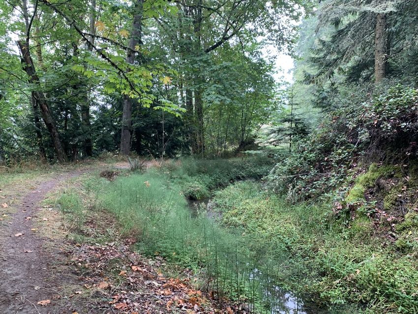
TABLES
Table 1             Summary of Records Reviewed by Anchor QEA
Table 2             Summary of Property History

FIGURES
Figure 1            Property Vicinity Map
Figure 2            Property Features
Figure 3            Observation from Property Inspection
Figure 4            Photographs from Site Reconnaissance – Eastern Portion of Property
Figure 5            Photographs from Site Reconnaissance – Northern Portion of Property
Figure 6            Photographs from Site Reconnaissance – BPA Right-of-Way
Figure 7            Photographs from Site Reconnaissance – Southern Portion of Property
Figure 8            Photographs from Site Reconnaissance – Old Sequim Dump Site
Figure 9            Photographs from Site Reconnaissance – River Front Areas (Western Portion of
                    Property)

APPENDICES
Appendix A          Anchor QEA Scope of Work
Appendix B          Site Maps
Appendix C          Aerial Photographs
Appendix D          Title Search
Appendix E          Well Logs and Geologic Information
Appendix F-1        DNR Property Records – Deeds and Property Use Information
Appendix F-2        DNR Property Records – Timber Sales and Associated Information
Appendix F-3        DNR Property Records – Water Rights
Appendix G          Database Search Findings
Appendix H          Qualifications of Preparer

Phase 1 Environmental Site Assessment              ii                                     January 2021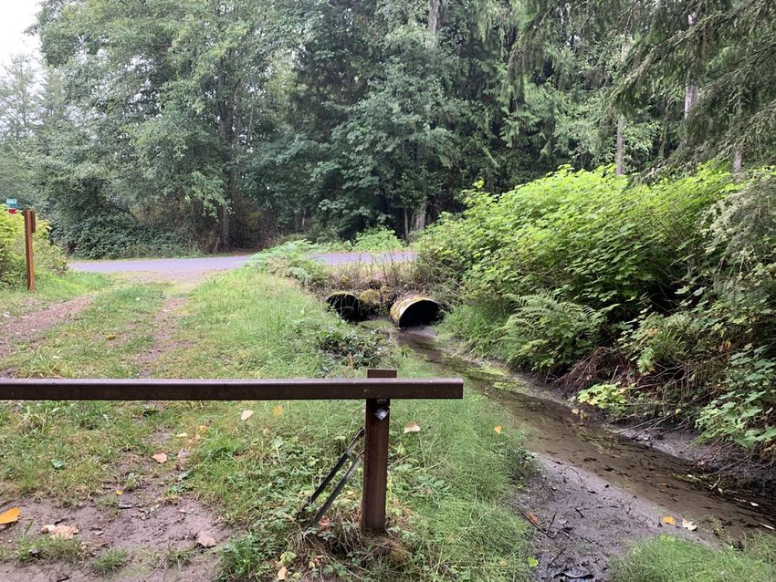
1         Project and Report Information
This document describes the methods and findings of a Phase 1 Environmental Site Assessment
(Phase 1) conducted by Anchor QEA, LLC (Anchor QEA) on behalf of Clallam County. The subject
property (Property) consists of two vacant tax parcels located along River Road just southeast of the
Sequim City Boundary. The Property is shown in Figure 1 and Figure 2 and is described further in
Section 2 of this Phase 1.

1.1        Client Information
Anchor QEA conducted this Phase 1 under contract with Clallam County. The County is considered
the User, as defined by ASTM International Standards E1527-13 and E2247-16. The Department of
Natural Resources (DNR), the agency currently managing the Property on behalf of the State of
Washington, is also considered by Anchor QEA to be an authorized User of this Phase 1.

1.2        Report Purpose
This Phase I was prepared to support proposed acquisition of the Property from the State of
Washington. The intended use of the Property is for development of a new irrigation water reservoir
and a public park.

The purpose of the Phase I is to review the Property history and available information to identify
recognized environmental conditions; that is, to assess the likelihood that contamination from
hazardous substances or petroleum products may exist on the subject property either from past or
present use of the subject property or nearby properties. This study is one step in the environmental
due diligence process for the Property acquisition.

1.3        Scope of Work
The Phase 1 complies with the Environmental Protection Agency All Appropriate Inquiry Rules and
the ASTM Standard Practice for Phase I Environmental Site Assessments: Phase I Environmental Site
Assessment Process (Designations E1527-13 and E2247-16). The scope of work for the project
included the items listed below:

      •    Site reconnaissance, including visual on-site inspection of the property
      •    Interviews of persons knowledgeable about the property, including (as available) current and
           past managers of the property
      •    A review of historical property records and historical aerial photographs
      •    A review of federal, state, and tribal environmental records concerning waste management
           practices, underground storage tank records, and/or documentation of historical releases at
           the property

Phase 1 Environmental Site Assessment                 1                                     January 2021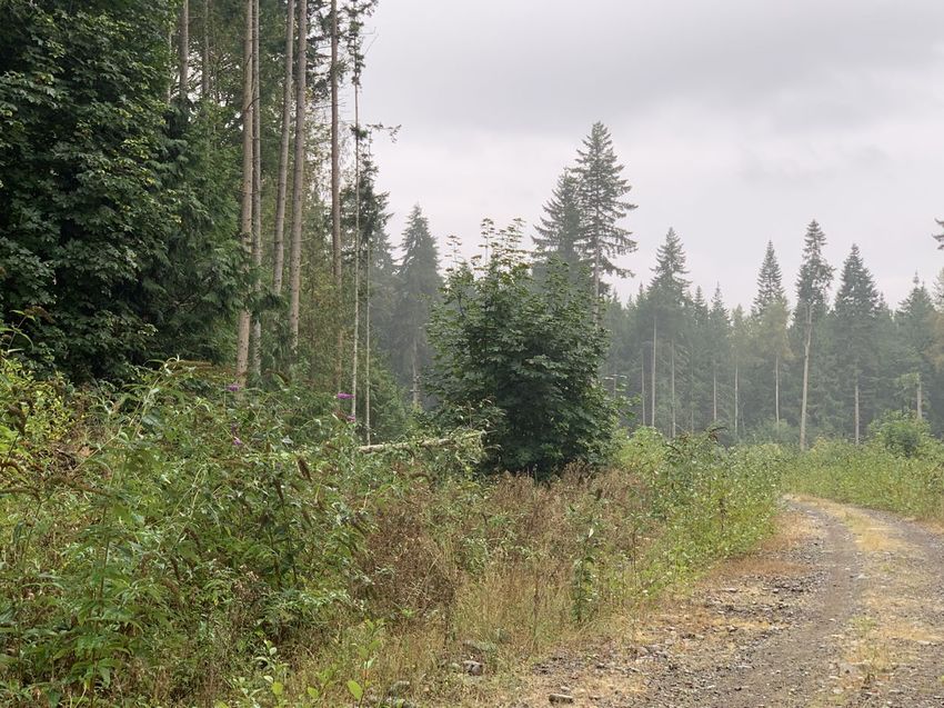
•   Identification of other commonly known or reasonably ascertainable information about the
          property
      •   An evaluation of the Recognized Environmental Conditions and development of a final report
          identifying the findings, opinions, and conclusions of the assessment
      •   If applicable, an identification of site-specific data gaps and a description of appropriate field
          investigation methods that can be used to resolve these data gaps

Anchor QEA’s work plan is attached as Appendix A. Anchor QEA has prepared this report using
information that is reasonably ascertainable; that is, information that is practically reviewable,
publicly-available, and obtainable from its source within reasonable time and cost constraints. This
report conforms to the requirements of ASTM E1527-13 and ASTM E2247-16. No Phase 2
Environmental Site Assessment activities were conducted as part of this Phase 1. Other business
environmental risk issues (non-ASTM method issues such as asbestos, lead paint, wetlands, indoor air
quality) were addressed during this study.

1.4       User-Imposed Limitations
Neither the County nor the DNR imposed limitations on Anchor QEA that affected our ability to
complete this Phase 1.

Phase 1 Environmental Site Assessment                 2                                         January 2021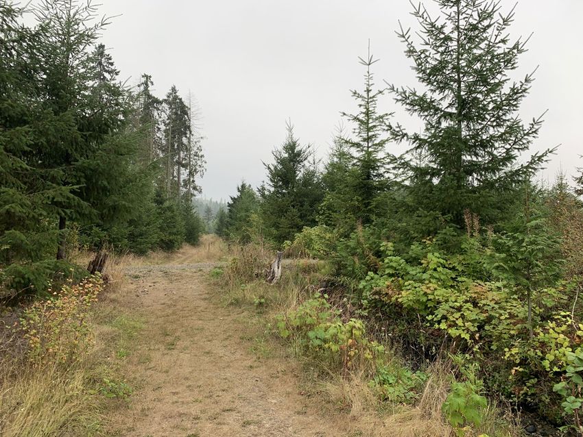
2       Property Information and Physical Setting
This section describes the Property and its physical setting, and available information about
groundwater and local soils.

2.1      Property Description
Tax lot information was obtained from the Clallam County tax assessor’s office. That information was
obtained at https://websrv22.clallam.net/propertyaccess/?cid=0. This information was accessed in
October, 2020.

         Property Address:              No formal street address at this time

         Tax Lots and Size:             Clallam County Parcel Numbers: 04303621000 (318.9 acres)
                                        and 043036130000 (76.6 acres)

         Township, Range, and Section: Township 36, Range 04 West, Section 36, Western half and
                                        the southern portion of northeast quarter section

         Current Use:                   Timber Harvest and Recreation

A site vicinity map and a site plan are included as Figures 1 and 2, respectively. A copy of the county
assessor’s tax parcel map is included in Appendix B, along with a prior survey plat map dated from
1986.

2.2      Owner and Site Use
The current owner of the Property is the State of Washington. The property is managed by the
Washington Department of Natural Resources.

Until recently the Property was managed exclusively for timber harvest. The most recent timber sale
was completed in 2015.

During the past 2 years the property has been developed for public access with the development of
mountain biking trails. The approximate trail locations are shown on Figure 2.

2.3      Topography and Site Features
A copy of a current U.S. Geological Survey 7.5-minute topographic map (East Sequim Quadrangle,
2014) is included in Appendix B.

The main portion of the Property is located along the eastern side of the Dungeness River between
350 and 450 feet above sea level. The main portion of the property is relatively flat, sloping

Phase 1 Environmental Site Assessment              3                                         January 2021
downward to the north. The portions of the Property located east of River Road include sloping areas
of higher elevation. The southeastern-most portion of the property has an elevation of about 850
feet.
There are no buildings or enclosed structures on the property. The property is undeveloped except
for the following features:
• Road Access: The Property can be accessed via gated entries either from River Road, Happy
Valley Road, or Sporsen Road.
• Utility Right-of-Way: The Property is bisected east/west by a power line easement with the
Bonneville Power Administration (BPA). Additional easements for power lines are in place with
the Clallam County Public Utility District (PUD) #1. The BPA easement location is shown in
Figures 2 and 3. The easement is vacant except for the overhead power lines, a small
rock/gravel pit (Figure 3) and gravel access roads.
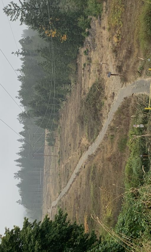
• Existing and Former Irrigation Ditches: There are a number of active and inactive irrigation
ditches and related structures on the Property:
o The upper ditch is operated by Highland Irrigation District and carries water along the
eastern side of the property toward the north. It includes a gate valve and pipeline
that directs water down to a separate irrigation ditch located in the middle portion of
the Property.
o The central irrigation ditch noted above is also operated by the Highland Irrigation
District.
o There is a third ditch, operated by the Sequim Prairie Tri-Irrigation Association
(formerly Eureka Irrigating Company), located along the western side of the Property
near the Dungeness River. The river intake is located near where the BPA right-of-way
crossing of the Dungeness River. This ditch carries water to the north. An irrigation
service road, spillway and flow control structure are located on the western portion of
the Property.
o There is also an older abandoned irrigation ditch located along the western portion of
the Property, near the Dungeness River. Some metal debris (an old fish screen) is
present (see Figure 3).
• Mountain Biking Trail System: The mountain biking trail system includes a trail map, and
multiple trail markers. The trails are unpaved and extend throughout most of the Property.
The approximate trail locations are shown on Figures 2 and 3.
Phase 1 Environmental Site Assessment 4 January 2021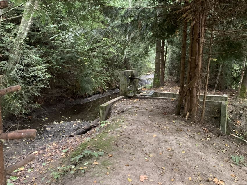
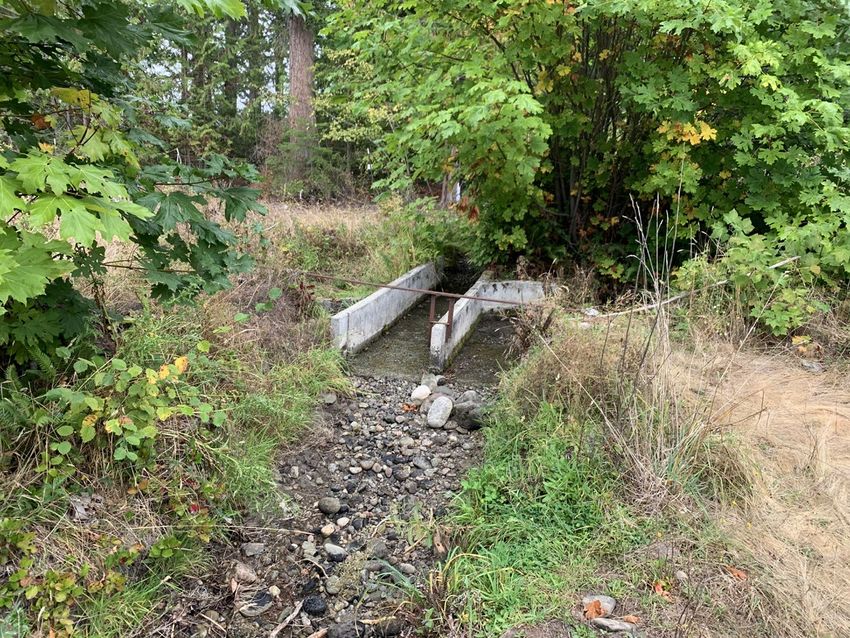
•   Interior Roadways: A number of interior roadways are located within the Property. These are
        unpaved gravel roads and are visible in Figure 2.

    •   Gravel Pit: A gravel pit is located in the southern portion of the Property just north of the
        old Sequim dump site (Figure 3).

    •   Old Sequim Dump Site: The Property includes an old unmanaged dump site known as the
        “Old Sequim Dump”. The location of the dump is shown in Figure 3. The dump site is
        discussed further in Sections 3, 4, 5 and 6 of this Phase 1.

2.4     Groundwater Well/Borehole Records
The Washington Department of Ecology’s (Ecology’s) well-query online log database
(https://fortress.wa.gov/ecy/waterresources/map/WCLSWebMap/default.aspx) provides logs for
water wells, monitoring wells, and geotechnical borings, along with decommissioned well reports
and other records. This database was reviewed by Anchor QEA in October, 2020.

No wells were identified on the Property. However, seven water supply wells were located along
River Road near the Property. These well logs are attached in Appendix E. The boring logs generally
indicate a soil sequence as follows:

    •   Surface topsoil

    •   Shallow gravels or sand and gravel in the upper 5-50 feet of soil (typically shallower than 50
        feet)

    •   Sequences of clay or hardpan, mixed with gravel or boulders, between depths of 5 and over
        100 feet

    •   Intermittent sequences of sand, silt, gravel and clay, with occasional water bearing zones

    •   Deeper shale units typically below 150-200 feet

Based on topography, the direction of groundwater flow is expected to be toward the north and
west.

2.5     Soils and Geology
The DNR records for the property included a soil map for the Property and surrounding areas and a
detailed discussion of area geology (included in Appendix E). The following description of area
geology is contained within the DNR geologic summary:

Phase 1 Environmental Site Assessment               5                                        January 2021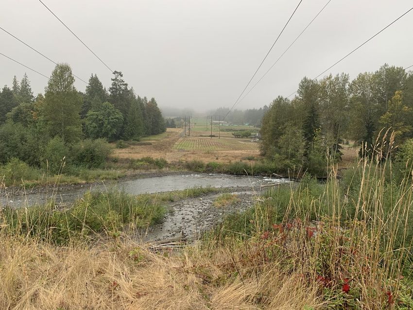
“According to geologic mapping by Schasse and Logan (1998) and Schasse and Wegmann
        (2000), the western margin of the property along the Dungeness River is underlain by alluvial
        deposits (unit “Qa”), river-deposited sand, gravel, pebbles, and cobbles with fines (silt and
        clay), as well as peat. Through the middle, relatively flat portion of the property, published
        mapping indicates the presence of older alluvial deposits (unit “Qoa”), described as “crudely
        stratified cobbly, pebbly, bouldery gravel in a matrix of sand, silt, and clay”. The upland areas
        are likely underlain by rocks of the Eocene Crescent Formation (unit “Ev(c”), capped by a
        mantle of Vashon glacial till (unit “Qgt” of Schasse and Wegmann (2000) and “Qgt(v)” of
        Schasse and Logan (1998)).

        Unit Ev(c), basalt, basalt breccia, and diabase, is described by Schasse and Wegmann (2000)
        as “mostly porphyritic to aphyric, sparsely jointed, and pillow basalt and lesser basaltic
        breccia. Glacial till is described by Schasse and Wegmann (2000) as a poorly sorted mix of
        “pebbly, clayey, sandy silt with scattered cobbles and sparse boulders”.

        Schasse and Wegmann (2000) map one landslide in the property. This mapping was
        published prior to LiDAR becoming available. My review of the LiDAR DEMs suggests the
        mapped landslide, unit Qls on Figure 1, is nonexistent, as their does not appear to be visible
        landslide morphology, such as a headscarp, body, and toe. However, there does appear to be
        a likely deep-seated landslide within the southern portion of the property above River Road,
        along a roughly east-west-trending fault. This would need to be confirmed on the ground. “
        (See DNR soils discussion in Appendix E)

A soil survey was conducted on the Property by Anchor QEA under contract to Pacific Groundwater
Group and the Washington Water Trust. That report is provided in Appendix E. The work included
excavation of seven test pits in the central, western portion of the Property in the area proposed for
the reservoir. The test pits were excavated from ground surface to depths of between 8 and 10 feet.
Soils encountered consisted of a shallow sequence of silty topsoil (2 to 3 feet thick), followed by a
layer of alluvium containing gravel, cobbles, boulders and sand.

There has been recent (last 1-2 years) landslide activity in the eastern portion of the Property. The
mountain bike trails in this area utilize the ditch service road operated by the Highland Irrigation
Ditch Company (Highland). These trails have been closed to the public since that time based on
safety concerns expressed by Highland.

Phase 1 Environmental Site Assessment               6                                         January 2021
3 Regulatory Records Review
This section summarizes available records for the Property and vicinity.
3.1 Governmental Record Sources
Governmental records for the Property were obtained through public sources as described below:
• Ecology Online Records: Available on-line records from the Washington Department of
Ecology were searched, including the following:
o What’s in My Neighborhood: Ecology maintains an on-line, searchable database of
Properties with recognized environmental contamination concerns or environmental
compliance obligations. The database is accessible at the following internet address:
https://apps.ecology.wa.gov/neighborhood/. The database did not list any records
for the Property or the properties in the vicinity.
o Groundwater Well Database: As described in Section 2.4, groundwater well records
in the vicinity were reviewed using Ecology’s on-line database. Refer to that section
of this report. for additional information.
• DNR-Provided Property Records: DNR provided an extensive list of records for the
Property. These were obtained both through Clallam County, and directly from DNR by
Anchor QEA. The majority of these records are contained in Appendix F. Copies of DNR-
provided site maps are contained in Appendix B, and the DNR geologic analysis for the
Property is contained in Appendix E. DNR records included the following:
o Deed Information: DNR deed and land tile information included the following:
Patent deed for the Property, documenting transfer of the Property to the
State of Washington from the federal government.
Copies of easements issued to the BPA, the Clallam County PUD #1, and
Clallam County.
A “Transaction Hold Records Search” documenting land title records for the
Property.
Scanned copies of the “Tract Book” listings for the property, listing
applications, leases, timber sales, rights-of-way and easements relating to the
Property.
Phase 1 Environmental Site Assessment 7 January 2021o Water Rights Records: DNR provided documents relating to water rights and canal
shares associated with the Property.
o Timber Sale Records: Older timber sales were listed in the Tract Book entries.
Documentation related to the recent “Happy Cat” timber sale in 2015 were provided.
These documents included a SEPA environmental review, permitting documentation,
and a copy of the 2014 Site Management Plan. That document described the
presence of the “Old Sequim Dump” and the “Happy Cat Debris Scatter” (Figure 3) as
follows:
Old Sequim Dump: “The old dump for the City of Sequim is found along the
sides and base of a railroad grade. The dump is 250 meters long and 30
meters wide and is located off a cliff embankment. It contains many rusty old
cars and trucks from the 1930s to 1950s. Deposits are mainly from the 1920s
through the 1950s although some earlier (back to the 1870s) and some later
materials are also present. There is modern dumping as well.”
Happy Cat Debris Scatter: “This site consists of approximately 4-5 pickup
truck loads of garbage predominately dating to the 1930s-1940s. These are
probably separate dumping episodes as the assemblage varies from pile to
pile. The dumping episodes cover an area of 80 X 60 meters. One load of
more modern material dates to the mid -1960s. There is evidence that these
piles were then bulldozed as there are pushed up piles of rock and soil .2 -.5
meters in height. There are two fragments of manganese glass 1, but these are
from a pitcher and a candy dish, forms that have a long life-span. There are
no manganese glass bottles.”
o Geologic Conditions Memorandum: A 2019 summary of Property geology was
included in the DNR records. This document is summarized in Section 2.5 of this
Phase 1 and is attached as part of Appendix E.
• Clallam County Records: Clallam County records were accessed to document the Property
location and land use as described in Section 2.1.
1 Manganese was used as a decolorizing additive to clear glass prior to about 1915. The reference in the DNR description was part of dating
the debris scatter. Though two fragments of the pre-1915 glass were present, the debris scatter was reasonably assumed by DNR to have
been placed at a later time period, as characterized by the other materials representative of later periods. Manganese glass is does not
constitute a hazardous substance.
Phase 1 Environmental Site Assessment 8 January 20213.2 Environmental Database Search
A search of EPA, state, and tribal environmental database listings was performed by a commercial
database search provider (EDR; a copy of the database search report is included in Appendix G). The
purpose of that search was to identify potential, suspected, or known sources of contamination on or
in the vicinity of the Property. Various agency listings were searched for different approximate
minimum search distances from the subject property as established in the ASTM method. Listings
included publicly available databases of environmental liens, activity and use limitations, and
easements and equitable servitudes, if recorded or filed.
No references to the Property were listed in the database search results.
References to nearby properties identified in the regulatory database report are summarized below.
None of these properties appear likely to have affected environmental conditions at the Property:
• 425 Dungeness Meadows Lane: This property is located less than 1/8-mile from the
Property, downhill and to the northwest. The property was listed in the CDL and SPILLS
databases in 2007 for a spill of an unknown type and quantity of chemical.
• 393 Dungeness Meadows Kitchen: This property is located less than 1/8-mile from the
Property, downhill and to the northwest. The property was listed in the Asbestos database for
asbestos abatement activities conducted there in 2016.
• Robinson, 21, 81, 121 & 131 Serenity Lane and 2762 River Road: These properties
included 9 parcels and 4 rental homes. They were located approximately 1/8 mile to the
southwest of the Property, along the Dungeness River. The properties were listed in the
Brownfields database due to environmental assessment activities performed between 2015
and 2017 by the Jamestown S Klallam Tribe under an EPA Brownfields grant. The work
included completion of Phase 1 and Phase 2 environmental assessments. The tribe purchased
the properties, removed the homes and cleaned up a localized area of petroleum
contamination. The area was then used for floodplain and habitat restoration work in
coordination with the Washington State Salmon Recovery Fund board and the Puget Sound
Acquisition and Restoration Fund.
• Delhur Industries Haller Quarry, 2657 River Road: This quarry is located approximately ¼
mile to the southeast of the Property. The quarry was listed in the FSIS, ECHO, All Sites and
NPDES databases because the quarry maintains an NPDES water quality permit. It was also
listed in the US Mines database because of its use as a commercial quarry.
Phase 1 Environmental Site Assessment 9 January 2021• Scarsella Brothers, 2822 River Road: This location is approximately ¼ mile to the southeast
of the Property. The location was listed quarry was listed in the SPILLS database due to a
release of 60 gallons of diesel fuel in 2013.
Phase 1 Environmental Site Assessment 10 January 20214 Historical Records Review
This section provides a listing of historical records reviewed for the Property and includes a concise
summary of the Property history.
4.1 Historical Sources Reviewed
Table 1 provides a concise summary of the historical records reviewed as part of this Phase 1. These
include standard historical records sources (historical maps and aerial photographs), results of a title
search (Appendix D), copies of records provided by the DNR (Appendices E and F), and information
developed through interviews (see Section 6).
No data failures were encountered. The historical objectives in ASTM E1527-13 and ASTM E2247-16
were achieved.
4.2 Previous Environmental Assessments
No previous Phase 1 or Phase 2 environmental assessments were identified for the Property.
DNR records for the 2015 “Happy Cat” timber sale included an environmental protection plan. That
document discussed two environmental concerns (the Happy Cat Debris Scatter and the Old Sequim
Dump) as summarized in Section 3.1. Both deposits remain in leave-tree areas at the Property
(Figure 3).
4.3 Summary of Property History
The history of the Property is summarized in Table 2, based on Anchor QEA’s review of the records
listed above, and the results of site interviews as summarized in Section 6.
In general, the Property has been used predominantly for timber growth and harvesting since the
late 1800s when Washington was granted statehood. A concise summary of property history includes
the following:
• The property title was transferred to the State in 1889. A patent deed was later issued in
1972.
• Timber sales occurred between the early 1900s and 2015 as documented in DNR deed and
timber sale records.
• Irrigation ditches were developed in the early 1900s on the Property. These irrigation features
were later documented in DNR surveys and land use records. These irrigation features are
described in Section 2.3 of this Phase 1.
Phase 1 Environmental Site Assessment 11 January 2021• Numerous easements exist within the Property for power line easements with the BPA and
Clallam County PUD #1, and with Clallam County for roadways. These easements were
granted between 1920 and the late 1980s.
• Several truckloads of debris dating from the 1930s, 1940s and 1960s were disposed in the
northeastern portion of the Property (Figure 3). This debris was later identified in DNR timber
sales documentation as the “Happy Cat Debris Scatter”.
• The Old Sequim Dump was placed on the Property some time prior to the mid-1970s (mostly
between the 1920s and 1950s). Based on available information and the results of interviews,
the dump was not a contracted or municipally-sponsored activity, but rather was the result of
uncontrolled dumping activity by local residents. The dump contains cars and trucks dating
primarily from the 1930s through the 1950s. Some older and newer debris is also present
according to DNR records (Section 3.1) and observations from the Property inspection
(Section 5.2).
• Some grazing activity was conducted prior to the 1970s in the northern portion of the
Property.
• Off-site residential areas to the northwest, north and east of the Property were developed
over time between the 1950s and the present.
• Several homes located to the southwest of the Property were removed between 2015 and
2017 to support floodplain restoration efforts. This work included environmental testing and
cleanup activities funded by grants from the EPA Brownfields program to the Jamestown
S’Klallam tribe.
• In 2016 a proposal for development of a reservoir on the Property was developed by Anchor
QEA in coordination with the Washington Water Trust, Clallam County, the City of Sequim,
the Dungeness Water Users Association, and the Clallam Conservation District.
• In approximately 2018, mountain biking trails were developed on the Property.
• Between 2019 and 2020 Clallam County and DNR have been in negotiations for potential
land transfer to support the proposed reservoir project. The current Phase 1 was developed
to support the land transfer process.
Phase 1 Environmental Site Assessment 12 January 20215 Property Reconnaissance
Anchor QEA conducted a reconnaissance or site visit at the Property. This section describes the
methods and observations from that site visit.
5.1 Property Reconnaissance Methods
The property reconnaissance was conducted by Mark Larsen and David Rice of Anchor QEA on
September 18, 2020. Figure 3 summarizes the areas visited during the site inspection.
Photographs taken during the site visit are included in Figures 4 through 9 of this Phase 1.
5.2 Observed Property Conditions
Conditions observed on the Property are summarized below. Given the large size of the Property, the
observations are summarized by area:
• Upper Property (east of River Road): This portion of the Property is located on a hillside. It
includes the Highland Irrigation Ditch. An access road runs along the ditch between River Road
and Happy Valley Road. A recent landslide occurred where the access road crosses under the
BPA power lines. Timber in this area of the Property was most recently harvested circa 1994.
Some road and train construction were occurring along Happy Valley Road at the time of the site
visit.
• Northern Property (north of BPA right-of-way): The northern end of the Property is located
west of River Road and north of the BPA right-of-way. The area is currently vacant except for
several stands of leave-trees and standing timber along the western edge of the Property sloping
downward to the Dungeness River. Timber in this area was harvested in phases between 1994
and 2015. Several areas of debris (4-5 pick-up truck loads) were noted in DNR records as
described in Section 3.1, but these were not directly observed during the site visit. Based on
interviews with the current DNR land manager (see Section 6), this debris remains on-site.
Numerous mountain biking trails are located in this area of the Property. An irrigation ditch runs
northward through the center portion of the Property.
• BPA Right-of-Way: The BPA right-of-way crosses the Property from the east to west. A small
gravel pit is located within the right-of-way just west of River Road. No evidence of waste
disposal or debris backfill was noted in this area. The right-of-way is vacant other than the power
line towers, the gravel pit and the access roadways. Wooden fencing is located along the western
edge of the right-of-way, on the bluff over-looking the Dungeness River.
• Southern Property (south of utility right-of-way): The southern portion of the Property
located to the west of River Road is vacant and covered in intermittent stands of timber. This
area includes the rock pit and Old Sequim Dump site as described below. Other than these
Phase 1 Environmental Site Assessment 13 January 2021features, the gravel access roads and the network of mountain biking trails, this portion of the
Property is vacant.
• Southern Rock/gravel Pit: A small gravel pit is located at the junction of two on-site gravel
roadways, just north of the Old Sequim Dump site. No evidence of waste disposal or debris
backfill was noted in this area.
• Old Sequim Dump site: The waste disposal area known as the Old Sequim Dump is located on
and at the base of a steep embankment just to the west of River Road as shown in Figure 3. DNR
records estimate the area to be 250 meters long and 30 meters wide. The debris contains a
mixture of old car bodies, appliances and other debris. The automotive debris includes some fuel
tanks, and both painted and rusted (i.e., no paint remaining) car parts. The debris is located on a
steep slope and at the base of an embankment. Some of the car bodies have become suspended
in the trees by trees growing through them. In most cases, native soil was visible beneath the
layer of debris, suggesting that the dump site was mostly surficial in nature.
• River-front Areas (Western Portion of Property): The western portion of the Property is
located at lower elevation along the Dungeness River. It includes one active irrigation canal and a
former irrigation ditch. The active irrigation canal is operated by the Sequim Prairie Tri-Irrigation
Association (formerly Eureka Irrigating Company). An access road and a flow control structure are
located in this area of the Property.
5.3 Conditions at Adjoining Properties
The Property is surrounded to the northwest, north and northeast by residential properties. No areas
of concern were identified during the site reconnaissance.
Properties to the southwest have been the subject of floodplain restoration activities. Homes
formerly located in these areas have been removed, and riparian vegetation has been planted along
the river. Some of the mountain biking trails on the Property extend into this area.
The properties to the south east include the Delhur quarry and other timberlands. The quarry is
separated from the property by areas of standing timber.
Phase 1 Environmental Site Assessment 14 January 20216 Interviews
Interviews were conducted by Anchor QEA with three individuals that have been involved managing
the property on behalf of DNR, including the following:
• Robert Winslow - DNR Trust Land Transfer Project Manager (Olympia, Washington):
Anchor QEA conducted a telephone interview with Robert Winslow, the DNR Trust Land Project
Manager on October 28th, 2020. Robert has been a DNR employee since 1986 and has been
involved in preparing the Property for potential acquisition by Clallam County since late 2018 or
early 2019. He provided access to Property ownership and use records, including those in
Appendix F. He confirmed that there is no evidence of historical use of the Property for oil and
gas exploration, gravel mining (other than use of the two on-site rock/gravel pits for on-site road
construction/maintenance), construction of occupied structures or for any uses other than those
documented in Section 4.3 of this Phase 1. He was not personally aware of any spills of
hazardous substances or solid wastes other than the presence of the Old Sequim Dump and the
Happy Cat Debris Scatter as discussed in Sections 3.1 and 4.3.
• Mark Benner - Current DNR Property Manager (Forks, Washington): Anchor QEA conducted
a telephone interview with Mark Benner on November 3rd, 2020. Mark is the current DNR
manager for the Property. Mark has held that role since about 2004 when Mike Cronin assumed
a different job. Mark was familiar with the recent timber sales at the Property, including the
Happy Cat sale in 2015. He confirmed that the Happy Cat debris scatter materials and the Old
Sequim Dump materials discussed in Section 3.1 and 4.3 remain present on the Property in leave
tree areas (Figure 3). The Happy Cat debris scatter is located in the northeastern portion of the
Property. He was aware that the Old Sequim Dump has been picked over by collectors for car
parts (hood ornaments, etc.), but was not aware of any concentrated salvage activities with
respect to the car bodies or other materials. He understood that the historical dumping was not
part of a contracted or organized municipal activity, but rather was the result of uncontrolled
dumping by area residents primarily between the 1930s and the 1950s (based on the dates of
the car bodies present). Mark was not aware of other deposits of solid wastes on the Property, or
of any spills or other releases of hazardous substances between 2004 and the present, other than
occasional disposal of furniture or household wastes/debris. These materials are managed by
DNR on an ongoing basis at its various properties. He confirmed that the on-site rock/gravel pits
have not been used for commercial mining activities, but rather are only used for on-site road
construction and maintenance. He described the recent development of the mountain bike trail
agreements and recreational use of the Property during the past two years. He said that the
Property has been heavily used by bikers and trail users since that time, and that this has helped
to discourage illicit disposal of household wastes at the Property.
Phase 1 Environmental Site Assessment 15 January 2021• Mike Cronin – Former DNR Property Manager (Retired): Anchor QEA conducted a telephone
interview with Mike Cronin. Mike was the former DNR land manager for the Property. He held
that position between the mid-1970s and 2004 when he assumed the district manager position
for DNR. He retired from DNR in 2006. Mike recalled managing the Property for timber
production. He recalled some early grazing activity in the northern portion of the Property up
into the 1970s. That grazing was conducted in among the timber. He said that the Old Sequim
Dump was present on the Property by the time he started managing it. He was not aware of any
historical contracts or other formal approvals for the dumping activity. During his period of
management there was occasionally some household trash dumping on the Property, particularly
in the BPA right-of-way, since that area was historically more accessible. He explained that DNR
had a process for removing garbage from its properties periodically, but that the funds were
always limited and there was never funding to remove the wastes from the Old Sequim Dump
site. He described the two on-site rock/gravel pits (Figure 3) as having been used for only on-site
road maintenance, never commercial mining activity. He was not aware of any import of waste
materials or other off-site materials associated with the rock/gravel excavation. He described the
on-site irrigation ditches and structures and their periodic maintenance by the irrigation
companies. He was not aware of any historical oil and gas exploration or drilling on the Property.
He was not aware of cultural or archaeological resources at the Property but noted that there
have been some culturally modified trees (i.e., cedar trees that had been harvested of their bark
by local tribal members) in the area. Mike was not aware of any fuel spills or other releases of
hazardous substances at the Property other than the Old Sequim Dump site. He was aware that a
railroad had been present on the Property in the 1920s or 1930s for early timber harvesting, but
had never seen any remains of tracks or ties from that. He said it was typical that the rails would
be removed from logging railroads when they were no longer needed.
Phase 1 Environmental Site Assessment 16 January 20217 Findings and Recommendations
This section summaries Anchor QEA’s findings and recommendations regarding apparent
environmental conditions at the Property based on the information reviewed and documented in this
Phase 1.
7.1 Findings
Based on the information reviewed by Anchor QEA and summarized in this Phase 1, there are two
Recognized Environmental Conditions at the Property.
• Old Sequim Dump Site: The Old Sequim Dump site (Figure 3) was placed on the property
since primarily between the 1930s and 1950s, with dumping activity ceasing prior to the mid-
1970s. It contains car bodies and car parts, household appliances and other debris and solid
wastes. The debris includes a mix of painted and rusted (free of paint) materials, and some
former automotive fuel tanks. The quantity of wastes and debris is significant, estimated by
DNR records to cover an area of 250 meters by 30 meters. The wastes appear superficial,
laying on the top of the native soils rather than constituting a thick fill deposit. Some of the
materials have decayed and are mixed in with the surficial soil. Some of the car bodies
remain on the steep hillside, and some have been raised into the air by the growth of trees
through the materials. No environmental testing of the debris, soils or groundwater has been
performed to date. Though the materials have been known to be present for several decades,
DNR has not allocated funding to remove the materials. During the prior timber sales that
dump site has been retained within a leave tree area. Given the presence of painted car
bodies from the early to mid-1900s, there is a potential for paint-related metals to have
become incorporated into soils at the Property in the dump site area. The presence of
automotive debris including former fuel tanks indicates some potential for releases of oil or
gasoline to soils, though no obvious signs of such contamination were noted during the site
reconnaissance.
• Happy Cat Debris Scatter: Smaller areas of apparent household debris are known to be
present in the northeastern portion of the Property (Figure 3). This is a much smaller quantity
of materials, described by DNR records as 4 to 5 pick-up truck loads. The materials are
believed to be from the 1930s or 1940s, with one truck load from the 1960s. During recent
timber sales, the debris scatter materials were not removed. They are present within an
existing leave tree area on the Property. The materials are present within the proposed
reservoir area and will be encountered during reservoir construction activities. They will need
to be removed and appropriately disposed at that time. Given the history of household waste
dumping at the Property, some other materials may also be encountered during reservoir
Phase 1 Environmental Site Assessment 17 January 2021construction. The quantity of such materials is not likely to be significant within the context
of the proposed project.
7.2 Recommendations
As part of the proposed property acquisition and development of the reservoir project, Anchor QEA
recommends that further work be performed to quantify the nature and extent of the Old Sequim
Dump materials and develop a cost estimate for appropriate removal and disposal of the materials
and any associated contaminated soils. Removal and appropriate disposal of the materials is
recommended, because the materials represent an uncontrolled solid waste deposit, they are likely
to contain or to have previously contained hazardous substances, they may continue to release
hazardous substances to soils (e.g., through corrosion of painted surfaces), and in some cases they
represent physical hazards to current and future Property users. Some of the car bodies in particular
are located on a steep hillside, and some have been raised into the air by trees growing through the
materials. Based on visual observations, the waste materials appear to be superficial, rather than
constituting a thick landfill deposit. Limited Phase 2 Environmental Site Assessment activities (i.e.,
limited soil and groundwater testing) should be performed prior to acquisition of the Property.
However, the Old Sequim Dump site is not expected by Anchor QEA to be a source of groundwater
contamination. Environmental impacts associated with the Old Sequim Dump site are most likely to
be limited to contamination of shallow soils within and beneath the waste deposits.
Smaller deposits of household debris are also likely to be encountered sporadically during future
development of the reservoir project. This may include the debris at the Happy Cat Debris Scatter as
well as potential household debris that may be encountered in other areas of the Property. To date,
available information indicates that these scattered waste deposits are small in quantity and contain
non-hazardous materials (e.g., bottles, cans, glass). Further environmental testing does not appear
warranted at this time for these areas. However, provisions for debris management should be
considered as part of future reservoir development activities in the event that deposits of household
debris are encountered during site grading activities.
Phase 1 Environmental Site Assessment 18 January 20218 Signatures
I declare that, to the best of my professional knowledge and belief, I meet the definition of
Environmental Professional as defined in §312.10 of 40 CFR 312. I have the specific qualifications
based on education, training, and experience to assess a property of the nature, history, and setting
of the subject property. I have developed and performed the All Appropriate Inquiries in
conformance with the standards and practices set forth in 40 CFR Part 312.
January 14, 2021
Mark Larsen Date
Anchor QEA Principal Scientist
Phase 1 Environmental Site Assessment 19 January 20219 Assumptions and Limitations Anchor QEA has prepared the Phase I ESA on behalf of Clallam County consistent with the methods defined in ASTME1527-13. No significant limitations were imposed on our work, and no significant data gaps limited our ability to complete this Phase 1. The work was performed in a manner that is commensurate with accepted procedures and practices in the environmental industry. The qualifications of the individual that prepared this report are listed in Appendix H. The Anchor QEA investigator reviewed sources that are publicly available, available within a reasonable time and cost, and reasonably ascertainable and considered practically reviewable, as defined under the ASTM standards. The conclusions and recommendations presented in this report represent Anchor QEA’s best professional judgment regarding environmental conditions at the subject property. These conclusions and recommendations are based on Anchor QEA’s review of the information presented in this report. Further, our conclusions and recommendations are based on state and federal regulations and policies as they exist at the time that this report was prepared. The findings and conclusions of this report are not scientific certainties but are based on professional judgment concerning the significance of the data gathered during the course of the Phase I. The conclusions in this report are not to be considered a legal opinion or advice as to the Client’s duty concerning due diligence and All Appropriate Inquiry relating to potential liabilities in leasing, owning, or purchasing real estate. It should be recognized that no effort can precisely define all environmental problems or eliminate all risks, and a certain degree of risk exists with any level of effort. Phase 1 Environmental Site Assessment 20 January 2021
10 References
American Society for Testing and Materials (ASTM). Standard Practice for Environmental Site
        Assessments: Phase I Environmental Site Assessment Process (ASTM 1527-13), Updated in
        2013.

American Society for Testing and Materials (ASTM). Standard Practice for Environmental Site
        Assessments: Phase I Environmental Site Assessment Process for Forestland or Rural Property
        (ASTM 2247-16), Updated in 2016.

Huntting, Marshall T., 1956, Inventory of Washington minerals; Part II--Metallic minerals: Washington
        Division of Mines and Geology Bulletin 37, Part II, 2 v.

Schasse, Henry W.; Logan, Robert L., 1998, Geologic map of the Sequim 7.5-minute quadrangle,
        Clallam County, Washington: Washington Division of Geology and Earth Resources Open File
        Report 98-7, 22 p., 2 plates.

Schasse, Henry W.; Wegmann, Karl W., 2000, Geologic map of the Carlsborg 7.5-minute quadrangle,
        Clallam County, Washington: Washington Division of Geology and Earth Resources Open File
        Report 2000-7, 27 p., 2 plates, scale 1:24,000.

Valentine, Grant M.; Huntting, Marshall T., reviser, 1960, Inventory of Washington minerals; Part I--
        Nonmetallic minerals; 2nd edition: Washington Division of Mines and Geology Bulletin 37,
        Part I, 2nd ed., 2 v.

Phase 1 Environmental Site Assessment              21                                       January 2021
Tables
Table 1
Summary of Records Reviewed by Anchor QEA
   Type           Information Source                 Description              Date                     Prepared By                             Subject                                                    Notes

Interviews (Section 6 of Phase 1)
         Anchor QEA                     Interview with Mike Cronin of DNR              9/2/2020 Anchor QEA           Interview of former DNR manager for the Property.           Interview covers the period mid-1970s to 2004.

            Anchor QEA                  Interview with Robert Winslow of             10/28/2020 Anchor QEA           Interview of DNR transaction specialist working with the    Interview covers the period 2018 to present.
                                        DNR                                                                          property transfer.
            Anchor QEA                  Interview with Mark Benner of DNR                       Anchor QEA           Interview of current DNR manager for the Property.          Interview covers the period 2004 to present.

Historic Maps (Appendix B)
          EDR / USGS                    Historic USGS Map - 2014                           2014 USGS/EDR             USGS data for map information for Property and vicinity     Historic USGS map data as obtained from EDR.

            EDR / USGS                  Historic USGS Map - 1985                           1985 USGS/EDR             USGS data for map information for Property and vicinity     Historic USGS map data as obtained from EDR.

            EDR / USGS                  Historic USGS Map - 1978 and 1979            1978, 1979 USGS/EDR             USGS data for map information for Property and vicinity     Historic USGS map data as obtained from EDR.

            EDR / USGS                  Historic USGS Map - 1956                           1956 USGS/EDR             USGS data for map information for Property and vicinity     Historic USGS map data as obtained from EDR.

            EDR / USGS                  Historic USGS Map - 1939                           1939 USGS/EDR             USGS data for map information for Property and vicinity     Historic USGS map data as obtained from EDR.

            EDR / USGS                  Historic USGS Map - 1938                           1938 USGS/EDR             USGS data for map information for Property and vicinity     Historic USGS map data as obtained from EDR.

            EDR / USGS                  Historic USGS Map - 1937                           1937 USGS/EDR             USGS data for map information for Property and vicinity     Historic USGS map data as obtained from EDR.

            Kroll Map Company           Historic Kroll Map                             8/1/1928 Kroll Maps           Clallam County township survey atlas from 1928.             Survey map from 1928 showing T30N R04W.
            EDR / Sanborn               Sanborn Search (No maps identified)                   -- EDR                 USGS data for map information for Property and vicinity     No Sanborn maps identified for Property or vinity.

            DNR                         SurveyPlat_1968                               12/2/1968 DNR                  Survey plat showing Sporsen Road right of way and private   Survey plat showing Sporsen Road right of way and
                                                                                                                     properties in S36 T30N R04W.                                private properties in S36 T30N R04W.
            DNR                         Ortho_RiverRoadTransfer                       3/25/2019 DNR                  River Road Transfer Ortho map.                              Aerial map of River Road Parcel.
            DNR                         RiverRoadVicinitySmall                        3/25/2019 DNR                  Small vicinity map.                                         Small vicinity map for the "Happy Valley Proposed Land
                                                                                                                                                                                 Exchange."
            DNR                         Site Class_RiverRoadTransfer                  3/25/2019 DNR                  River Road Transfer Site Class map.                         Site class map of River Road Parcel.
            DNR                         Transportation_RiverRoadTransfer              3/25/2019 DNR                  River Road Transfer transportation map.                     Transportation map (roads and road status) of River
                                                                                                                                                                                 Road Parcel.
            DNR                         USGS_RiverRoadTransfer                        3/25/2019 DNR                  River Road Transfer USGS map.                               USGS topographic map of River Road Parcel.
            DNR                         Water Bodies &                                3/25/2019 DNR                  River Road Transfer Water Bodies & Streams map.             Watercourse map of River Road Parcel.
                                        Streams_RiverRoadTransfer
            DNR                         Water Types_RiverRoadTransfer                 3/25/2019 DNR                  River Road Transfer Water Types map.                        DNR water-type map of River Road Parcel.
            DNR                         WDFW Habitat_RiverRoadTransfer                3/25/2019 DNR                  River Road Transfer PHS map.                                WDFW priority habitats and species map of River Road
                                                                                                                                                                                 Parcel.
Historical Aerial Photographs (Appendix C and Figures 2 and 3)
          Google Earth              2019 Google Earth Image                                2019 Google Earth         Google Earth Image - included in Figures 2 and 3.

          Google Earth                  2014 Google Earth Image                            2014 Google Earth         Google Earth image for Property and vicinity.
          Google Earth                  1994 Google Earth Image                            1994 Quantum Spatial      Google Earth image for Property and vicinity.
          Quantum Spatial               1985 Historic Aerial                          3/16/1985 Quantum Spatial      Aerial photo for Property and vicinity.
          Quantum Spatial               1974 Historic Aerial                           4/8/1975                      Aerial photo for Property and vicinity.
Title Search (Appendix D)

Phase 1 Environmental Site Assessment                                                                                                                                                                                                     January 2021
River Road Properties                                                                                                                                                                                                                      Page 1 of 3
Table 1
Summary of Records Reviewed by Anchor QEA
Type Information Source Description Date Prepared By Subject Notes
Clallam Title Company Dungeness_RiverRd_134177 9/22/2020 Clallam Title Co. Results of title search for Property as obtained from Clallam Complete title search for the DNR Dungeness River
Well Logs and Geologic Information (Appendix E)
Ecology Well Logs from Water Wupply Wells Nov 2020 Ecology Well logs obtained from Search of Ecology database for No well logs were identified for the Property. Seven
DNR River Road Transfer - Geology Review 6/29/2019 Ana Shafer, DNR Geological review summary for the "River Road Transfer" A review of the potential for surface and subsurface
DNR Soils_RiverRoadTransfer 3/25/2019 DNR River Road Transfer Soils map. Soils map of River Road Parcel.
Anchor QEA Dungeness Flow Enhancement: River 5/24/2014 Anchor QEA Limited geotechnical analysis for the Property; performed Test pit survey and limited geotechnical analysis was
Road Storage Project; Preliminary on behalf of Pacific Groundwater Group and the performed by Anchor QEA in support of planning
Geotechnical Engineering Washington Water Trust. activities for the Dungeness reservoir project.
Recommendations
DNR Records - Title and Property History Information (Appendix F-1)
DNR TransactionHold_RecordSearch_02- 3/28/2019 DNR Record search for River Road Transfer parcel. Record search #02-098949 for the River Road Parcel
098949 with encumbrances listed.
DNR Deed_Patent_46-72-0049 3/27/1972 Bureau of Land Patent for the support of common schools. Patent granted by the State of Washington on March
Management 27, 1972. Patent number 46-72-0049.
DNR DNR_Clallam_easement_50-CR3201 9/24/1985 DNR/Clallam County Easements between Clallam County Public Works and DNR. DNR easements and maps. Section 36 (River Road
parcels) on page 15 of the PDF. Grant from 12/15/1983
for forest land to Indemnity School/Cap Bldg/School.
CR3201 covers CO-CM-HAPPY-VALLEY-RD and CO-CM-
SPORSEEN-RD.
DNR DNR_Clallam_easement_50-CR03228 4/21/1986 DNR/Clallam County Easement between Clallam County and DNR for a road right Easement for a road within the NE corner of S36 of
of way in the River Road parcel. T30N and R04W. CR3328 covers CO-CM-RIVER-RD.
DNR DNR Tract Book Excerpts 1889 to 2004 DNR DNR Tract Book Excerpts Summary of deeds, use applications, use agreements,
easements and other information relating to the
Property as entered into the DNR tract book.
DNR Records - Timber Sales and Related Documents (Appendix F-2)
DNR Happy Cats Units 1-3 FMPT Special 8/8/2012 DNR TRAX FMPT Special Concerns Report for T30N R4W S36. DNR database report for T30N R04W S36 documenting
Concerns Report regional special concerns (DNR Region Office, DAHP,
Ecology, WDFW)
DNR HAPPY CAT_01_Final Notice of Sale 1/28/2015 DNR Timber notice of sale. DNR certificate for the sale of logging area containing
440 MBF of high quality Douglas fir. Agreement number
30-090791 under "Happy Cat."
DNR HAPPY CAT_02_Happy Cat Timber 9/8/2014 DNR Driving map to the timber area for sale under agreement Driving map to the lands for sale to harvest under 30-
Sale Maps Bundle number 30-090791. 090791 Units 1-4.
DNR HAPPY 6/23/2014 DNR SEPA Checklist for Happy Cat Timber Sale Agreement #30- Complete SEPA Checklist for the Happy Cat timber sale,
CAT_Happy_Cat_SEPA_Checklist_201 090791. which is a variable retention harvest (VRH) with
4 associated right of way composed of 4 units located in
the Dungeness Valley and Discovery Bay WAUs.
Phase 1 Environmental Site Assessment January 2021
River Road Properties Page 2 of 3You can also read