PIHA WETLAND Service Outcomes Plan - DRAFT - MARCH 2020 - Auckland Council

Page created by Terrence Franklin
 
CONTINUE READING
PIHA WETLAND Service Outcomes Plan - DRAFT - MARCH 2020 - Auckland Council
PIHA WETLAND
Service Outcomes Plan
      DRAFT - MARCH 2020

                  | LOCAL Auckland
                          PARKS DESIGN        | DRAFT
                                   Council GUID
                                           EDRAFT        O
                                                         FR Service
                                                  Piha Wetland CONSULTATI ONPlan|| 11
                                                                    Outcomes
PIHA WETLAND Service Outcomes Plan - DRAFT - MARCH 2020 - Auckland Council
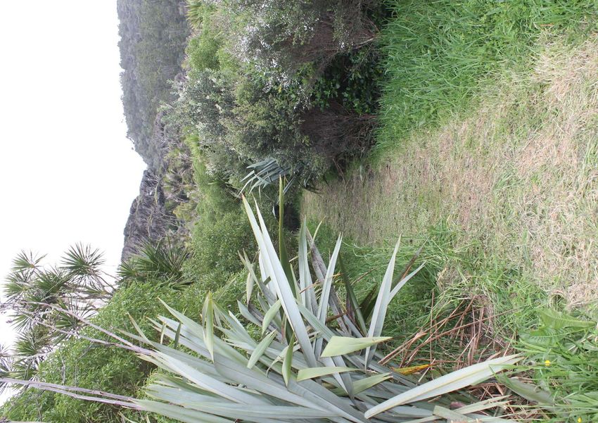
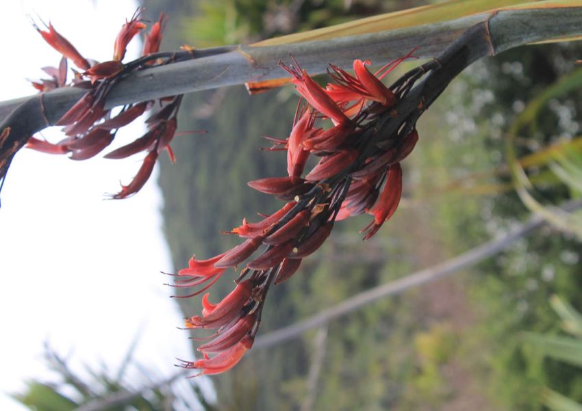
Figure 1. Harakeke flower (2019), Liz Oldfield
2
PIHA WETLAND Service Outcomes Plan - DRAFT - MARCH 2020 - Auckland Council
ACKNOWLEDGMENTS
The Piha Wetland Outcomes Plan has been prepared by Auckland Council using the skills,
experience and inspiration of many people, including, but not limited to:

      Waitākere Ranges Local Board
      Auckland Council Parks Sport and Recreation Team
      Auckland Council Healthy Waters Team
      Auckland Council Biodiversity Team
      Auckland Council Community Facilities Team
      Piha Residents and Ratepayers Association
      Piha Coastcare Trust
      Piha Wetlands Trust
      Pest Free Piha
      Protect Piha Heritage
      West Coast Community Art Trust
      Piha Kids Charitable Trust
      Mana Whenua - Te Kawerau a Maki
      Piha Community
      Field and Flora Ltd - Landscape Architect

Document Details:

Issue date:          March 2020
Status: 		           Third Draft
Prepared by:         Liz Oldfield - Field and Flora Ltd

Cover photo: Piha Wetland (2019), Liz Oldfield                       Auckland Council DRAFT Piha Wetland Service Outcomes Plan | 3
PIHA WETLAND Service Outcomes Plan - DRAFT - MARCH 2020 - Auckland Council
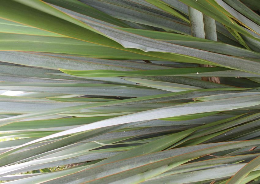
Figure 2. Piha Wetland bund path (2019), Liz Oldfield
4
PIHA WETLAND Service Outcomes Plan - DRAFT - MARCH 2020 - Auckland Council
CONTENTS

SECTION 1. OVERVIEW                                 SECTION 4. SERVICE OUTCOMES PLAN

1.1    Purpose                                      4.1   Park Environments
1.2    Aerial photography                           4.2   Design Principles
1.3    Waitākere Ranges Context                     4.3   Service Outcomes
1.4    Waitākere Ranges Context Map                 4.4   Service Outcomes Plan
1.5    Piha Wetland Existing Site Features          4.5   Service Outcome Priority Table
1.6    Piha Wetland Existing Site Features Plan     4.6   Aspirational Imagery
1.7    Piha Village Node Existing Context           4.7   Indicative costings
1.8    Piha Village Node Existing Context Plan
1.9    Strategic Context

                                                    REFERENCES AND USEFUL RESOURCES
SECTION 2. METHODOLOGY

2.1    Review of relevant documents
2.2    Project Working Group (PWG) workshops
2.3    Draft Outcomes Plan
2.4    Local Board Workshop
2.5    Public Consultation
2.6    Final Outcomes Plan

SECTION 3. SITE CONTEXT

3.1    Auckland Unitary Plan Context
3.2    Auckland Unitary Plan Context Map
3.3    Connectivity Context
3.4    Connectivity Context Map
3.5    Recreational Context
3.6    Recreational Context Map
3.7    Natural Heritage and Resources Context
3.8    Natural Heritage and Resources Context Map
3.9    Ecological Context
3.10   Hydrological Context
3.11   Hydrological Context Map
3.12   Cultural Heritage - Iwi Values
3.13   Cultural Heritage - Iwi Values Map
3.14   Heritage Sites
3.15   Heritage Sites Map

                                                            Auckland Council DRAFT Piha Wetland Service Outcomes Plan | 5
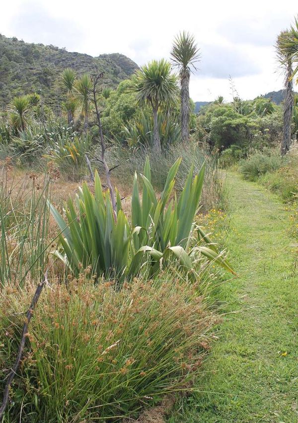
PIHA WETLAND Service Outcomes Plan - DRAFT - MARCH 2020 - Auckland Council
SECTION 1. OVERVIEW
    1.1        PURPOSE

    The purpose of this plan is to provide an outcomes plan for the Piha wetland area that is located on Seaview Road
    (Piha) on the west coast of the Waitākere Ranges. The property was acquired by Auckland Council from the Minis-
    try of Education in September 2017. Prior to the acquisition the site had been leased to the Piha Education Trust for
    environmental education activities with schools and wetland restoration planting. In 2014 the Piha Edication Trust
    relinquished the lease and the Ministry of Education sold the property as ‘surplus to requirement’. Several local Piha
    community groups have expressed an interest in working collectively with Auckland Council to enhance the wetland
    area and utilise the land more effectively for environmental, recreational and community outcomes.

    The Waitākere Ranges Local Board has prepared a Service Outcomes Plan that seeks to protect and enhance the
    special ecological, cultural and recreational values of the reserve while also identifying appropriate recreational
    activities, facilities, access routes and connections for future development.

    The Service Outcomes Plan will:
    • establish design principles to guide existing and future investment;
    • meet the needs and aspirations of the community and Mana Whenua,
    • recommend and prioritise projects,
    • provide indicative costings for prioritised projects

    Delivery of the plan will be a collaborative effort involving the Piha Wetland Trust, Mana Whenua and key delivery
    partners including the Waitākere Ranges Local Board and Auckland Council Officers.

    Figure 3. Piha, showing part of the wetland on the far right (in valley) (2020), Liz Oldfield.

6
PIHA WETLAND Service Outcomes Plan - DRAFT - MARCH 2020 - Auckland Council
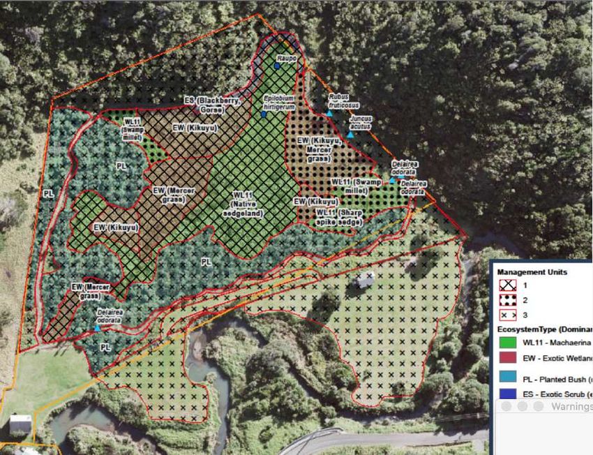
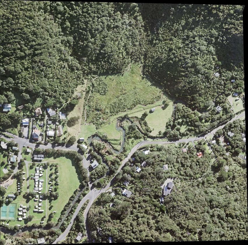
1.2        AERIAL PHOTOGRAPHY

                                                                    PIHA WETLAND
                                       Seav
                                        iew

                                                                                             ad
                                                                                             Ro
                                         Road

                                                                                         esk
                                                                                        en

                                                                                                  Map
                                                                                        Gl

           Figure 4. Aerial photography (2017), Auckland Council Geomaps.
                                                                                                   ´

                                                                                                                                                                        Sca
                                                             Aerial 2017                                                                                                 =
                                                                                                                                                                        Date
                                                                                                                                                                         4/1

           Figure 5. Aerial photography prior to bund path    Figure 6. Whites Aviation aerial photography (site extent approximate only) (1957), Reference
           (2000), Auckland Council Geomaps.                  Number: 754537, National Library of New Zealand.
                                                                     0   10   20   30
uld be
                                                                         Meters

rmation
                                                                   Scale @ A4
 has
 e
                         Aerial 2008                                = 1:2,500
this
n or use                                                          Date Printed:
                                                                   4/11/2019

                                                                                                        Auckland Council DRAFT Piha Wetland Service Outcomes Plan | 7
PIHA WETLAND Service Outcomes Plan - DRAFT - MARCH 2020 - Auckland Council
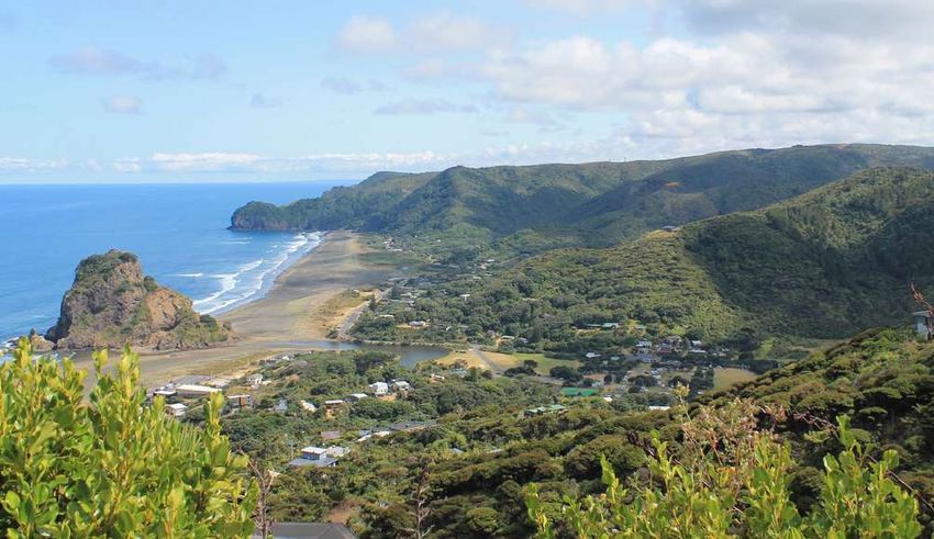
1.3     Waitākere RANGES CONTEXT

    Piha Wetland is located in the coastal settlement of Piha within the Waitākere Ranges Local Board area. The native,
    bush covered terrain of the Ranges provide for many breathtaking walking and tramping tracks while the beaches are
    a popular destination for surfers. The Piha Stream runs adjacent to the wetland site and subsequently flows through
    several regional and local reserves. In effect this creates both an ecological and recreational corridor between the
    native bush and beach areas. The Waitākere Ranges Heritage Area encompasses the site and provides an additional
    layer of protection and recognition to the Waitākere Ranges (refer to section 1.7).

                                Figure 7. Surfer at Piha Beach, Auckland Council Stock Photo
      7       8      9          Figure 8. Piha Beach with Whakaari (Lion Rock) in background, Auckland Council Stock Photo
                                Figure 9. Piha Beach as taken from Tasman lookout (2017), Liz Oldfield
                                Figure 10. Vegetated hills of the Waitākere Ranges taken from Piha Mill Camp (2017), Liz Oldfield
      10     11     12          Figure 11. Piha Stream taken from near the Art Gallery (2019), Liz Oldfield
                                Figure 12. Bush track at Piha taken from Glen Esk (2017), Liz Oldfield

8
PIHA WETLAND Service Outcomes Plan - DRAFT - MARCH 2020 - Auckland Council
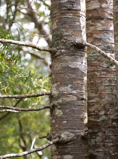
1.4        Waitākere RANGES CONTEXT MAP

                                                                                                                                                                                                         Te Atatu
                                                                                                                                                                                                         Peninsula

                                                                               Waitakere Township

                                                                                                                     Swanson                         Ranui
                                               ls R o ad
                                                                                                                                                                                                   Te Atatu
                                   B et h el
                                                                                                                                                                                                   South

                                                                                                         ve
                                                                                                   Dri
                                                                                             nic                                                                         Henderson

                                                                                                                           Cand
                                                                                       Sce

                                                                                                                               ia R o
                                                                                                                                      ad
              Te Henga (Bethells Beach)                                                                                                                                                                 Glendene

                                                                                                                           Henderson
                                                                                                                            Valley                                                                                 Kelston

                                                                                                                                                                ad
                                                                                                                                                           l Ro                             Glen Eden
                                                                                                                                                     Hil
                                                                                                                                            est
                                                                                                                                      For                                d
                                                                                       Sce                                                                         Roa       Oratia
                                                                                             nic                                                          o    ast
                        Anawhata                                                                   Dri                                               st C
                                                                                                         ve                                  We

                                                                                                         Waiatarua

                                                                                                                                                                                          Waima
                                                                              Road                                                           Scen                                                    Titirangi
                                                                     P ih a                                                                               ic D
                                                                                                                                                               r iv e

                                                                                                                                                                        Woodlands                   South
                       Piha                                                                                                                                               Park                     Titirangi

         PIHA
        WETLAND
                                                                                                                                                               Parau
                                                                                                                                                                                      Laingholm

                       Karekare
                                                                                                                                                          ad
                                                                                                                                                     Ro
                                                                                                                                                ia
                                                                                                              Huia                         Hu

 T E TA I - O - R E H UA
    TAS M A N S E A                                                                   Little Huia                                                              Cornwallis

                                                                                                                                                                                                         M A N U KAU
                                                                                                                                                                                                         HARBOUR

                                                           Whatipu

                                                                                                                                                                                                                     SCALE @ A4
                                                                                         Manukau Heads
                                                                                                                                                                                                               0         1        2km

LEGEND

      Piha Wetland
      Waitākere Ranges Local Board Boundary
      Waitākere Ranges Heritage Area
      Local and Sports Parks
      Regional Parks
PIHA WETLAND Service Outcomes Plan - DRAFT - MARCH 2020 - Auckland Council
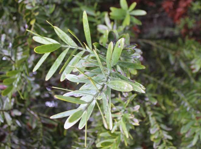
1.5     PIHA WETLAND EXISTING SITE FEATURES

     The site consists of nearly 2 hectares of predominately regenerating wetland that has high ecological values. It
     provides important contiguous connections to adjacent facilities and open spaces including the historic Nigel Hanlon
     Hut, Sir Algernon Thomas Green and Waitākere Ranges Regional Park land. An old school house, originally the
     Taurangaruru School (Waiuku) building sits on the south western corner of the site adjacent to Seaview Road (Figure
     13). It was moved to the site at Piha in 1958 and used until 1961 when the school closed.

     The grassed open space on the southern edge of the site provides the only foot or maintenance vehicle access to the
     the adjacent regional park land, however access is weather dependent across an overland flow path (Figure 17).
     The majority of the site sits within the 10 year Average Recurrance Interval (ARI) flood area which leaves the site
     inundated on occasions when the Piha Stream floods and bursts it’s banks (Figure 18). Given the proximity of the flat
     grass areas and the Nigel Hanlon Hut (on Regional Park land), these areas should be considered within the outcomes
     plan in liaison with the Regional Parks team (Refer to orange dashed areas on plan - Section 1.6).

     An informal raised bund path/track provides a walking loop around the wetland (Figure 15). This track was likely built
     some time between 2010 and 2012 by the Piha Education Trust as part of their restoration project. Native bush areas
     on the northern and eastern boundaries surround the wetland. There is good diversity of habitat conditions and
     species given the history of degradation and restoration of the wetland.

                                 Figure 13. Entrance to the Piha Wetland site and the old school house from Seaview Road (2019), Liz Oldfield
       13     14      15         Figure 14. Grassed open space between the wetland and old school house (2019), Auckland Council Stock Photo
                                 Figure 15. Bund path through established native vegetation within the wetland (2019), Liz Oldfield
                                 Figure 16. Facing South across Piha Wetland (2019), Liz Oldfield
       16     17      18         Figure 17. Access to regional park land from Piha Wetland site across overland flow path (2019), Liz Oldfield
                                 Figure 18. Piha Stream (2019), Liz Oldfield

10
34
           33
            31.5

                                                                                                                                             16

                                                                                                                                                    14
                30

                29
      1.6             PIHA WETLAND EXISTING SITE FEATURES PLAN
                                                                                                                                             13
                                                                                                                                                                                                                                                                   43

                                                                                                                                      12.5
                                   SCALE 1:1300 @ A4

                                                                                                                                                                                                                                                            42
                                                                                                                                  12
                              0          10         20      30m

                                                                                                                                                                                                                                                            41
                                                                                                                             11

                                                                                                                                                                                                                                                            38
                                                                                                                                                                                                                                                            .5
                                                                                                                                                                                                                                                      34
                                                                                                                10.5
                                                                                                                                                                                                                                                 32
                                                                                9.5                             168
                                                                                                                                                    R                                                                                       29
                                                                                    7.5

                                                                                                                                                                 7

                                                                                                                             6

                                                          5.5
                                                                                                                         5

                                                                                                          AREA 1

                                                                                                                                                                                                                   AREA 2
6.5

                                                                                                                                                                                                                                                      AREA 3

                                   15

                                                                                                                                                                                                                                           3.5
                                                                                                                                                                                                                               AREA 4
                                   3.5

                                                                                                                                      3
                                                                                                                                                                     AREA 4
                                                                                            R
                                                                                                                     3

                                                                                                                                                                                                                                         SIR ALGERNON
                                               17                                           AREA 4                                                                                                                                       THOMAS GREEN
                                                                                                                       3.5

                     14                                                                                                                                                                                  3.5
                                                                                                                                                                              4.5

                                                                                                                                                5
                                         18
                                                                                                                                                                                               4

                                                                              3.5
                                                                                                AREA 5

                                                           AREA 6                                                                                                                                        12.5                              10
      13                                                                                          3                               6
                                                                                                                                          6.5                                                       13                       14.5
                                               4

                                                                                                                                                        7.5

                                                                                                                                                                     NAME AND LEGAL.5DESCRIPTION:
                                                                                                                                                        8                                   15                                                                         10.5
                                                                                                                                       7
                                                                                                                                                                     AREA 1: LOCAL PARK - PIHA WETLAND
                                                                       3

                                                                                                                                                                     PT LOT61.5 DP 25709, PT LOT 247 DP 24231
                                           AREA 7                                                                                                                         1
                                                                                                          5.5
                                                                                                                                                                     AREA 2: REGIONAL PARK
                            4.5
                                                                                                                                                                             20

                                                                                                                                                                     SEC 3 BLK III, SO 41845
                                                                       AREA 6
                                                                                                                                                                                 23

                                                                                                                                                                     AREA 3: REGIONAL PARK - GLENESK ROAD PLANTATION
                                                                                                                                                                                24
                                                                                      3.5

                                                                                                                                                                     RESERVE 1 LOT 72 DP 25709
                                                                                                                        D

                                                                        5.5
                                                                                                                     OA

                                                                                                                                                                                      26
                                    SEAV

                                                                                                                 KR

                                                                                                                                                                     AREA 4: REGIONAL PARK
                                                                                                                                                                                             .5
                                                                                                                                                                                           28
                                                                                                4.5

                                                                                                            ES

                                                                                                                                                                     PT LOT 1 DP 25709, PT LOT 247 DP 24231
                                         IEW R

                                                                                                          EN
                                                                                                      GL

                                                                                                                                                                                               32

                                                                                                                                                                     AREA 5: REGIONAL PARK
                                          OAD

                                                                                                                                                                     LOT 2 DP 25709
                                                                                                                                                                                                    36
                                                            5

                                                                                                                .5
                                                                                                           11

                                                                                                                                                                                                               5
                                                          3.5                                                                                                        AREA 6: LOCAL PARK - PIHA41.DOMAIN (PART OF)
                                                   4

                                           4                                                                                                                         DEDICATED T256654
                          4
                                                                                                                                                                                                             5

                                                                                                                                                                     AREA 7: 50 SEAVIEW RD - PIHA FIRE STATION (INCLUDING
                                                                                                                                                                                                         44.
                                           3.5

                                                                                                                                                                     CAR PARK) LOT 1 DP 123107
                                                                                                   13.5

                                                                                                                                                                                                                    50
                                                                                                                                                                                                           47

                                                                                                                                                                                                                         53

                                                                                                                                                                                                                                    .5          58
                                                                                                                                                                                                                                55
                                                                                                                                                                                                    45

      LEGEND - PIHA WETLAND EXISTING SITE PLAN                                                                                                                                                                                                         60
                                                                                                                                                                                                                                                             62
                                                                                       11                                                                                                                                                                         64
              Site extent                                                     0.5m Contours                                                                 Toilet                                                       R          Rain gauge
                                     AD

                                                                               12                                                                                                                                                   (approximate
                                   RO

              Outcomes plan to consider use of                                Main access route to site                                                     Site photo reference (refer to figures in                                                                    66
                                                     AD
                                  EY

              grassed area (Regional Park land)                                                                                                             section 1.5)                                                            location only)                            67
                                                   RO
                            LL

                                                                  .5          Old school house building
                          VA

                                                                10
                                                 W

              Park land                                                                                                                                     Sign/sculpture
                          H

                                             VIE

                                                                              West Coast Gallery
                       AC

                                                                                                                                                                                                                                                                              69
                                          SEA
                     BE

              Piha Stream                                                                                                                                   Piha Stream steps/crossing to                                                                                          .5
                                                                              Piha Volunteer Fire Brigade buildings
                                                                                                                                                            Sir Algernon Thomas Green
              Grass track                                                     Nigel Hanlon Hut
                                                                                                                                                            Walking route to Nigel Hanlon Hut
                                         10
1.7     PIHA VILLAGE NODE EXISTING CONTEXT

     The Piha Wetland site sits in close proximity to the village heart of Piha. The West Coast Gallery, Piha Volunteer Fire
     Brigade, Piha Library, Piha Post Office, Piha Store, Piha Cafe, Piha Domain (with various informal and formal
     recreational activities), Piha Domain Motor Camp and Piha Beach are all within a short walking distance from the site.
     This provides an ideal location of interest for both the local community and day visitors/tourists to use as an
     alternative to the Piha Domain for walking and other informal recreation.

     The location of the West Coast Gallery directly adjacent to the entrance to the site provides an ideal opportunity to
     showcase locally designed art and sculpture around the wetland track or adjacent to the old school house. There is
     also an exciting opportunity for Māori art and Māori values and traditions to be integrated on the site.

     EXISTING ART INTEGRATION WITHIN PIHA VILLAGE NODE:

                                  The Piha eel bridge                                                          Timber trail marker/
                                  designed by local artist                                                     sculptures by local artist
                                  Mandy Patmore celebrates                                                     Andy Mardell on Regional
                                  that Piha Stream is home                                                     Park land adjacent to Piha
                                  to short and long finned                                                     Wetland.
                                  eels. Historically, eels were
                                  of great significance to
                                  Maori, featuring in many
                                  myths.

                                 Figure 19. Oldfield, Liz (2020) West Coast Gallery
       19      20     21         Figure 20. Google Maps Streetview (2020) Piha Cafe (left) and Piha Store (right)
                                 Figure 21. Google Maps Streetview (2020) Piha Volunteer Fire Brigade
                                 Figure 22. Oldfield, Liz (2020) Piha Domain Playground
       22      23     24         Figure 23. Oldfield, Liz (2020) Piha Tennis Club
                                 Figure 24. Oldfield, Liz (2020) Piha Eel Bridge connecting Piha Domain to Piha Beach

12
1.8              PIHA VILLAGE NODE EXISTING CONTEXT PLAN                                                                                                                          ´
                          SCALE 1:2500 @ A4

                           0      15       30m

                                                                                                                                                                WAITAKERE RANGES
                                                                                                                                                                 REGIONAL PARK

                                                                                                                     PIHA WETLAND

                                                                                                                                                       9

                                                  4
                 GA                                                                                                                                                          SIR ALGERNON
                     RD
                        EN                                                                                                                                                  THOMAS GREEN
                        RO
                 SEA
                    VIEW D
                          A                                   5
                         ROA
                             D                                                                  6
                            1
                                                                                                    7
                                                      3                                                                                                                           TO GLENESK/
                                       2
                                                                                                                                                                                  WAI O KAHU/
                                                                                                                                  D
                                                                                                                               OA
                                                                                                    SEAV

                                                                                                                                                                          KITEKITE FALLS TRACK
                                                                                                                           KR

        TO PIHA BEACH/                                                                                           8
                                                                                                     IEW R

                                                                                                                          ES

        LION ROCK
                                                                                                                        EN
                                                                                                                      GL
                                                                                                        OAD

                                            PIHA DOMAIN
                                                                                               AD
                                                                                             RO
                                                                                           LEY
                                                                                            L
                                                                                         VA

                                                                                                           D
                                                                                        CH

                                                                                                     W ROA
                                                                                     BEA

                                                                                                        SEAVIE

     LEGEND

            Site extent                                           1   Piha Library                                    Toilet                                          Parking
            Outcomes plan to consider use of                      2   Piha Domain Motor Camp Office                   Changing rooms                                  Walking/ track
            grassed area (Regional Park land)                     3   Piha Post Office                                Piha Domain Motor Camp                          Lookout
            Park land                                             4   Piha Cafe                                       Playground                                      Bird watching
DISCLAIMER:                                                                                                                                        0   10   20   30
This map/planPiha    Stream only and all information
                is illustrative                                   5   Piha Store                                      Barbecue                         Meters
                                                                                                                                                                      Surfing
should be independently verified on site before taking
             Grass     track on site
any action. Copyright Auckland Council. Land Parcel               6   Old school house building                       Picnic area                                     Swimming
Boundary information from LINZ (Crown Copyright                                                                                                    Scale @ A4
             Main access route to site
Reserved). Whilst due care has been taken, Auckland               7   West Coast Gallery                              Piha Tennis Club             = 1:2,500
Council givesPiha
              no warranty
                     Streamas steps/crossing
                                to the accuracy andtoplan
completeness of any information on this map/plan and              8   Piha Volunteer Fire Brigade buildings           Piha Bowling Club        Date Printed:
             Sir Algernon
accepts no liability            Thomas
                      for any error,        Green
                                     omission or use of the
information. Height datum: Auckland 1946.                         9   Nigel Hanlon Hut                                Basketball half-court     11/02/2020
            Walking route to Nigel Hanlon Hut
                                                                                                                      Events area/Playing Fields
            Walking routes around Piha Village
                                                                                                                      Dogs on leash
1.9       STRATEGIC CONTEXT

     The following diagram provides a summary of how this document sits within the wider policy context:

           RESOURCE MANAGEMENT ACT 1991                                 LOCAL GOVERNMENT ACT 2002

           The purpose of the Resource Management Act                   The purpose of the Act is to:
           is to:                                                       ‘enable democratic decision-making and action
           ’promote the sustainable management of                       by, and on behalf of, communities; and (b) to
           natural and physical resources.’                             promote the social, economic, environmental,
                                                                        and cultural wellbeing of communities, in the
                                                                        present and in the future.’

           AUCKLAND UNITARY PLAN (AUP) 2012

           ’The Auckland Unitary Plan is a 30 year plan for Auckland. It is a comprehensive long-term strategy for
           Auckland’s growth and development, and includes social, economic, environmental and cultural goals.’
            Section 1.5 outlines specific policies for Open Space Zones. The Piha Wetland site currently sits within the
           Rural - Waitākere Ranges Zone, however an appeal for a zone change will take place following the public
           Consultation of this document. Public Open Space - Conservation and Public Open Space - Informal
           Recreation are proposed.

           Waitākere RANGES LOCAL BOARD PLAN 2017

           The Local Board Plan identifies 6 outcomes towards achieving a better community for all:

           Outcome 1: People actively protect the Waitākere Ranges Heritage Area
           Outcome 2: Our unique natural habitats are protected and enhanced
           Outcome 3: Local communities feel good about where they live
           Outcome 4: People experience local arts and culture, and recognise our heritage
           Outcome 5: Our urban centres are enjoyable places to be
           Outcome 6: Our community spaces, parks, sports and recreation facilities meet local needs and are easy
           to get to

           Proposed development at Piha Wetland should consider these outcomes to ensure local board budgets
           are applied accordingly.

           Waitākere RANGES HERITAGE AREA ACT 2008 and
           Waitākere RANGES HERITAGE AREA LOCAL PARKS DESIGN GUIDE 2018

           Passed into law in April 2008, the Waitākere Ranges Heritage Area Act provides an additional layer of
           recognition of protection to the Waitākere Ranges and the eastern foothills. The purpose of the Act is:
           “To recognise the national, regional and local importance of the Waitākere Ranges Heritage Area and to
           promote the protection and enhancement of its heritage features for present and future generations.”

           The Waitākere Ranges Heritage Area Local Parks Design Guide encourages best practice outcomes that
           respect and enhance the heritage features identified in the Act. It provides guidance to those involved in the

14
design, development and future direction of local parks within the heritage area.
Piha Wetland sits within this Heritage area. Three of the seven park environments that are identified in the
Design Guide apply to the Piha Wetland site:
1. Riparian Park Environment: Riparian parks are defining landscape features that contribute to the
    character of the heritage area and provide structure to the natural environment. Primary waterways are
    typically contained by ridges and spurs that feed into the hill country from the upper ranges. Streams are
    generally clear running with stony bottoms in the upper reaches, becoming muddy in the lower reaches.
    Streams have intrinsic value and provide important ecological benefits, their vegetated margins prevent
    contaminants from entering streams, help alleviate flooding and contribute to the amenity of urban areas.
    Riparian park environments are characterised by a lack of built structures. Structures are often restricted
    to signage at reserve entrances. Where access is provided through these reserves it typically consists of
    unformed tracks and paths. Water is a resource that is sensitive to the impacts of land
    development so any development within riparian areas needs to carefully undertaken as potential
    impacts on the streams includes loss of ecological linkages and biodiversity, an increase in pollution and
    plant pests, and deterioration to the amenity of the areas around streams.
2. Native Forest Park Environment (small part of site): The majority of these local parks are bush or scenic
    reserves. Clad in native regenerating and indigenous bush they contribute to the wider green network
    of the Waitākere Ranges. They provide relatively untouched landscapes where the built environment is
    subservient to the natural environment and where a sense of wilderness, quiet and solitude prevails. They
    have a natural landscape character with vegetation and land form as their dominant features.
3. Open Grassed Park Environment (small part of site): These local parks have more of a traditional park-
    land character and are characterised by larger open green spaces used for informal recreation, play and
    picnicking.

This document has been developed with reference to the above park environments and has used the natural
and cultural heritage design principles from the guide to establish outcomes for the Piha Wetland (Refer to
Section 5).

 PIHA AREA DESIGN GUIDELINES 2010

 The purpose of the Piha Area Design Guidelines is to provide information to assist decision makers,
 adjacent property owners, developers and contractors during project development. The Piha Area Design
 Guidelines provides visual examples to encourage appropriate design proposals and offers ideas for
 positive design solutions. These guidelines also provide a description of the essence of Piha and a short history
 of the area. Additionally, when the service outcomes for Piha Wetland are funded, these guidelines will prove
 an invaluable tool to check the more detailed designs against.

OTHER RELEVANT DOCUMENTS

•    Piha Reserves Management Plan 1999
•    The West Coast Plan 2001
•    Piha Area Design Guidelines 2010
•    Morphum - Piha Wetland Options Assessment 2019
•    Auckland Council Cultural Heritage Inventory
•    Biodiversity values of the Piha Education land and wetland 2015 (Auckland Council Biodiversity Team)
•    Memo (Chris Ferkins Auckland Council) - Management for the enhancement of Biodiversity values of the
     Piha Education wetland 2018

                                                                    Auckland Council DRAFT Piha Wetland Service Outcomes Plan | 15
Figure 25. Harakeke, Flax (2019), Liz Oldfield
SECTION 2. METHODOLOGY
2.1     REVIEW OF RELEVANT DOCUMENTS
A review of the documents relevant to this Service Outcomes Plan was undertaken before commencing on the project.
These documents are listed in the previous section (Section 1.7: Strategic Context).

This review also included a memo of the internal Auckland Council workshop that was held prior to the procurement
of this Outcomes Plan.

Ministry of Education Land (Piha Wetland) Workshop with key internal staff
Date: 5 September 2019

Attendees:
- Parks and Places Specialist - Waitākere: Dawn Bardsley
- Waitākere Ranges Local Board
- Waitākere Ranges Local Board Strategic Broker: Claire Liousse
- Waitākere Ranges Local Board Advisor: Brett Lane
- Auckland Council - Parks, Sport and Recreation Portfolio Manager: Linda Smith
- Waitākere Ranges Local Board Democracy Advisor: Brenda Railey
- Auckland Council - Healthy Waters Team: Richard Smedley (at end of meeting)

Summary of Workshop:
Morphum Wetland Hydrology Report:
• The board are supportive of the highest environmental outcomes (for the wetland) and prefer the more expensive
   option over the cheaper alternative. Would also prefer the works be undertaken at once rather than over time to
   minimise any detrimental impacts on the wetland.
• Healthy Waters may be able to take and implement both the erosion project and the wetland restoration project.
   This needs to be clarified and confirmed. Works funded from the targeted rate are not able to be used for the
   creation of walkways and boardwalks.

Items to consider as part of the Outcomes Plan include:
• Cascading pools with riffles
• Raise area north of building to form dry picnic area
• Weed control
• Planting
• Sculpture trail
• Viewing platform/areas potentially northern end at highest point
• Upgrade access for maintenance purposes
• Educational opportunities/school holiday programmes
• Ability to cycle on tracks but not as a pump track just for recreational purposes aimed primarily at young children
• Local children involved in the restoration
• Caution over any paths going into the centre of the wetland
• Flat grass area on Regional Park land and Boys Brigade building (Sir Nigel Hanlon Hut) could be considered within
    the outcomes plan in liaison with Regional Parks.
• Interpretation opportunities
• Walking track a priority and consider connections with nearby regional park land

Other items:
A suggestion would be to commence work on the weed control of the wetland in accordance with the weed
management plan put together by Chris Ferkins. Ideally this work should be undertaken over the dryer summer
months and it will not detrimentally affect any of the proposed development works (Currently in progress December
2019).

                                                                      Auckland Council DRAFT Piha Wetland Service Outcomes Plan | 17
2.2      PROJECT WORKING GROUP (PWG) WORKSHOPS

     Piha Community Group Stakeholder Workshop
     Date: 28 October 2019
     Key Stakeholders met on site in the old school house to discuss challenges for development and desired outcomes.
     Prior to the meeting a group of the stakeholders met to do a walk-over on the site.

     Attendees:
     Piha Community:
     - Piha Residents and Ratepayers Assn.: Ken Cowan
     - West Coast Community Art Trust: Glenys Scott
     - Proposed Wetlands Trust: Hanneke Bouchier
     - Piha Kids Charitable Trust: Stuart Leighton and John Stokes
     - Coast Care: Pat LaRoche
     - Protect Piha Heritage Society: Peter Hosking
      Andy Mardell

     - Field and Flora Ltd: Liz Oldfield Landscape Architect

     Auckland Council:
     - Waitākere Ranges Local Board: Sandra Coney
     - Community Park Ranger: Sinead Brimacombe
     - Parks Portfolio Holder: Linda Smith (Apologies)
     - Parks and Places Specialist - Waitākere: Dawn Bardsley
     - Biodiversity Team: Chris Ferkins
     - Healthy Waters Team: Gabi Ezeta

     Other stakeholders that were consulted separately:
     - Heritage Unit: Peri Buckley
     - Regional Parks: Stephen Bell
     - Biodiversity Kauri Dieback Advisor: Yue Chin Chew

     Summary of Workshop:
     The following is a list of opportunities to consider in the development of the outcomes plan. It is a collated list of both
     the on-site working group feedback, and separate feedback from other stakeholders who didn’t attend the on-site
     workshop.

     Arrival and access:
     • Visual connectivity between entrance to site at old school house and wetland is required. Suggest blank wall on
          school house for signage/interpretation.
     • Propose formed access track around side of school building to encourage use of wetland. No track through open
          grassed area required. Visual access the key here.
     • Emphasize wildness
     • Connections with boys brigade land (Regional Park land adjacent to site) very important. Maintain and potentially
          improve grassed open space connection.
     • Bridge or crossing at north eastern end to connect with Sir Algernon Thomas Green. Originally was a small
          accessway and stepping stones across stream however flooding swept this away. Adventurous bridge? Access is
          the important factor here.
     • Connection to Nikau Track Route (Check status of track with relation to Kauri dieback info)
     Vegetation management and restoration:
     • Auckland Council Biodiversity Memo (Options Report) provides recommendations for wetland area
     • Budget earmarked for weed control
     • Educational opportunities/school visits
     • Current maintenance contract does not include weed control
     • Rabbit and rat predator control required
     Stream and flood management:
     • Initial Morphum report being revised through Auckland Council Healthy waters team. Recommendations to come.
     • Educational opportunities

18
•    Consideration should be given to allowing access to site when required battering of the Piha Stream is
     undertaken. Current limited access to site.
Recreation:
• Opportunity for viewing platforms around the wetland
• Pump track/cycling opportunity. Retain ability to mountain bike/cycle and walk (particularly for young children).
     Identify the track as a walking route that can also be used for cycling.
• Priority to improve the loop walking track around the wetland (incorporate several boardwalk sections)
• Community garden opportunity
• Removal of long grass between the local and regional park areas
Signage and interpretation:
• Interpretation of history of site including timber mill tramway, historic buildings and Kauri/Kauri dieback
• Interpretation of wetland/Piha Stream history and current restoration activities
• Signage to show toilet on Regional Park land
• Identify where on-leash dog walking areas are on signage
• Potential for Po at entrance to site near school house to be discussed with Te Kawerau
• Emphasize walkability
Art and events:
• Potential for sculpture trail
• School house ideal for workshops and educational activities for small groups.
• Use open grass space beside school house for community picnics. Suggestion of picnic tables
• Integration of activities in school house and grass open space
• Camping on the adjacent Regional Park land is unsafe due to flooding. Potential change of use of this site/Boys
     Brigade building/Sir Nigel Hanlon Hut in future. Limted use? Sir Algernon Thomas gifted this land and the deed
     included using the site for group camping.

Mana whenua project working group, Glen Eden
Date: 18 November 2019
Hui with Scott Lomas - Notes of hui between Te Kawerau Iwi Tribal Authority and Auckland Council

Attendees:
TKITA : Scott Lomas

Auckland Council:
- Community Facilities: Helen Biffin, Stephanie Barker, Donna Cooper
- Parks and Places Specialist - Waitākere: Dawn Bardsley
- Community Empowerment: Claire Liousse
- Local Board Services: Brett Lane, Shreya Rao, Raewyn Curran

Apologies:
Robin Taua-Gordon, Eryn Shield, Glenn Boyd, Linda Smith

Summary of Workshop:
Scott advised that the priority for Te Kawerau was restoration of the wetland to fully functioning wetland.

2.3     DRAFT OUTCOMES PLAN

The Piha Wetland Service Outcome Plan was drafted using the invaluable knowledge of the Project Working Groups,
Key Internal staff and the relevant documents listed in section 1.9. The draft document was distributed in February
2020 for an initial review by internal Auckland Council staff and Waitākere Ranges Local Board members.

                                                                       Auckland Council DRAFT Piha Wetland Service Outcomes Plan | 19
2.4      LOCAL BOARD WORKSHOP

     Local Board Workshop
     Date: 20th February 2020

     Attendees:
     Auckland Council:
     - Parks and Places Specialist - Waitākere: Dawn Bardsley
     - Waitākere Ranges Local Board: Ken Turner, Sandra Coney, Greg Presland, Mark Allen, Michelle Clayton
     - Waitākere Ranges Local Board Relationship Manager West: Glen Boyd
     - Auckland Council - Parks, Sport and Recreation Portfolio Manager: Linda Smith
     - Auckland Council - Elizabeth Stewart

     - Field and Flora Ltd - Liz Oldfield (Landscape Architect)

     Summary of Workshop:
     Agreed on consultation plan including an open day in Piha on a weekend day. Happy with draft plan. Draft will then be
     finalised for consultation.

     2.5    PUBLIC CONSULTATION
     Text TBC

     2.6    FINAL OUTCOMES PLAN
     Text TBC

20
Auckland Council DRAFT Piha Wetland Service Outcomes Plan | 21
SECTION 3. SITE CONTEXT
     3.1     AUCKLAND UNITARY PLAN CONTEXT

     The Piha Wetland is currently zoned Residential Rural and Coastal Settlement, however this Service Outcomes Plan
     recommends to re-zone the Piha Wetland ‘Open Space Conservation’ and ‘Open Space Informal Recreation’. This is
     because the Residential Rural and Coastal Settlement Zone is inappropriate for a local park that would be used for
     recreational purposes. The adjacent land zoning also needs to be considered as part of this Outcomes Plan to ensure
     any activities or development on the site are sensitive to the surrounding land use.

     Auckland Unitary Plan description of current Piha Wetland site zone:
     Residential – Rural and Coastal Settlement
     The Residential – Rural and Coastal Settlement Zone applies to rural and coastal settlements in a variety of
     environments including high-quality landscape areas and coastal areas. Due to factors including servicing,
     infrastructure and accessibility constraints and, in some cases their sensitive character, growth needs to be managed
     accordingly.

     Auckland Unitary Plan description of zones that the Service Outcome proposes for the Piha wetland site:
     Open Space – Conservation Zone applies to open spaces with natural, ecological, landscape, and cultural and historic
     heritage values. These areas include volcanic cones, bush reserves, headlands, natural wetlands and coastline and play
     an important role in protecting and increasing the populations of threatened and endangered species.
     To protect the values of the zone, recreation activities and development are limited in scale and intensity. Buildings
     and activities provided for relate to conservation, land management, recreation, education, park management and
     visitor information.
     H7.4.2. Objectives
     (1) The natural, ecological, landscape, Mana Whenua and historic heritage values of the zone are enhanced and
     protected from adverse effects of use and development.
     (2) Use and development complements and protects the conservation values and natural qualities of the zone. The

     Open Space – Informal Recreation Zone applies to open spaces that range in size from small local parks to large
     regional parks. These areas are used for a variety of outdoor informal recreation activities and community uses, such
     as walking, running, cycling, relaxing and socialising, picnics, playing and enjoying the environment. These open spaces
     are generally characterised by few buildings and structures. Limiting development in these areas
     maintains the open space character and amenity values, and enables opportunities for a range of informal recreation
     activities to occur.
     H7.5.2. Objectives
     (1) The open and spacious character, amenity values and any historic, Mana Whenua, and natural values of the zone
     are maintained.
     (2) Informal recreation activities are the predominant use of the zone.
     (3) Buildings and exclusive-use activities are limited to maintain public use and open space for informal recreation.
     (4) Small-scale, informal land-based water-related recreational facilities are provided for while maintaining and
     enhancing public access to and along the coast.

             Piha - Residential Rural
             and Coastal Settlement                         Piha - Public Open                                Piha - Public Open
             Zone                                           Space Conservation                                Space Informal Recreation

                            Figure 26. Overlooking the Residential - Rural and Coastal Settlement Zone from Piha Wetland site (2019), Liz Oldfield
       26     27      28    Figure 27. Public Open Space - Conservation from Piha Wetland site (2019), Liz Oldfield
                            Figure 28. Public Open Space - Informal Recreation, Piha Domain (2017), Liz Oldfield

22
3.2        AUCKLAND UNITARY PLAN ZONING MAP

                                                                                                                                        SCALE @ A4

                                                                                                                                    0    75   150 225m

                North Piha
                  Beach

                                            Les Waygood Park

                                                               Wekatahi Reserve

                                                                     Claude Able
                                                                       Reserve

                                                                                                                  Piha Mill
                                                                                                                    Camp

                                         Whakaari                                                  Sir Algernon
                                         Lion Rock                                                 Thomas Green        Wai o kahu
                                                                        Piha                                           (Glen Esk)
                                                                       Domain

                                              Piha
                                              Beach

                Taitomo Island

                                                                                                                                        Kitekite Falls
           The Gap

LEGEND

      Site extent
      Waitākere Ranges Local Board boundary (not shown as whole map sits within board boundary)
      Waitākere Ranges Heritage Area boundary (not shown as whole map sits within Heritage Area)
      Streams
      Waitākere Ranges Regional Park
      Public Open Space - Conservation Zone
      Public Open Space - Informal Recreation Zone
      Coastal Transition Zone
      Rural - Waitākere Ranges Zone
      Residential - Rural and Coastal Settlement Zone
      Business - Neighbourhood Centre Zone
      Rural Coastal Zone
3.3       CONNECTIVITY CONTEXT

     The wetland site sits within the valley at the mid-point between the beach and the Waitākere Ranges. It is a one
     minute walk to the local Cafe, Store and Domain at Piha form the site. As it sits within such close proximity to the
     main village centre it has the potential to be utilised more than what it currently is.
     Access to Piha is by car or private tour bus only as there are no public transport routes into the area. Walking or
     cycling are the preferred methods of movement within the village area (within the valley), and this should be
     considered within the Service Outcomes Plan.

     The temporary closure of many tracks surrounding the site due to Kauri dieback disease has put pressure on the
     remaining routes (e.g. Kitekite Falls), however many are identified for upgrade in the upcoming work program. The
     Hillary Trail is currently inaccessible in its entirety at this stage, but will re-open following upgrades to the tracks.

     Walking/cycling distances from Piha Wetland Site:

     •     to Piha Store/Piha Cafe/Piha Domain         1min walk
     •     to Kitekite Falls 			                       13min walk/ 4min cycle (to Glenesk) + 60min walk (to Kitekite Falls
     •     to Lion Rock				                            10min walk
     •     to Piha Beach (Surf Life Saving Club)       10min walk/ 4min cycle
     •     to Les Waygood Reserve		                    22min walk/ 5min cycle
     •     to North Piha Beach carpark		               29min walk/ 7min cycle

                                   Figure 29. Looking from the entrance of the site across Seaview Road to Piha Domain/Campground (2020), Liz
         29     30     31          Oldfield
                                   Figure 30. Piha Store and Cafe from opposite the site (2020), Liz Oldfield
                                   Figure 31. Kauri dieback cleaning station at Glen Esk Valley/Start of track to Kitekite Falls (2020), Liz Oldfield

24
3.4          CONNECTIVITY CONTEXT MAP

                                                                                                                                                                                                       SCALE @ A4

                                                                                                                                                                                                   0    260 520 780m

                                         Anawhata
                             Anawhata Beach Track                                                Anawhata Farm
                                                                                                 Loop Track

                                                                                                                                                                                              5k
                                  New Track

                                                                                                                                                                                                m
                       Fishermans Rock Track

                                                                                                                                                                                                  ref
                                                                                                                                                                                                     ere
                                                                                                                                                                                                        nce
                                            Rose Track
                                                                                           Anawhata Road

                                                                                                                                                                                                         fro
                                                                                                                                                                                                            ms
                                   Laird ThomsonTrack

                                                                                                                                                                                                              ite
                                                              White Track
                                                                                               Marawhara Walk

                                                                                                                   Maungaroa
                                               North Piha Road                                                     Lookout Track

                                                         North Piha Beach                     Piha Store
                                                                            Piha                & Cafe

                                                     Lion Rock Track                                                          Byers Walk
                                                                                                   Glen Esk
                                                                       Piha Beach                    Road                     Kitekite Track

                                                                                                                                     Connect Track
                                           Tasman Lookout Track                                                                      Kitekite Falls
                                                                                                                                              Kauri Grove Track
                                                                New                                                  Knutzen Track
                                                                Taitomo
                                                                Track
                                                                           Te Āhuahu Road                                                     Winstone Track
                                                                       Log Race Road
                                                                                                                                          Piha Road
                                                                 Mercer Bay                                                          Ussher Track
                                                                 Loop Track
                                                                                                        d
                                                                                                    Karekare Roa

                                                                      Comans Track

                                                                                                                                                                           ad
                                                                       Ahu Ahu Track
                                                                                                                                                                     i   Ro
                                                                                                                                                                  ur
                                                                                                                                                            e   Ka
                                                                                                                                                        Lon
                                                                                   Karekare
                                                                              Pōhutukawa                                  Taraire Track
                                                                              Glade Walk

                                                                                                                            Zion Hill Track

LEGEND

     Site extent
 DISCLAIM  ER:                                                                                                                                                            0     260   520   780
 This map/plan is illustrative only and all information
     Waitākere       Ranges
 should be independently        Regional
                             verified         Park taking
                                      on site before                                                                                                                             Meters
 any action. Copyright Auckland Council. Land Parcel
     Localinformation
 Boundary    and Sports   fromParks
                               LINZ (Crown Copyright                                                                                                                          Scale @ A4
 Reserved). W hilst due care has been taken, Auckland
     Major    or  Local    Roads
                                                                                                                                                                              = 1:50,000
 Council gives no warranty as to the accuracy and plan
 completeness of any information on this map/plan and
     Regional     park    tracks                                                                                                                                              Date Printed:
 accepts no liability for any error,(open)
                                     omission or use of the
 information. Height datum: Auckland 1946.                                                                                                                                     17/11/2019
      Hilary Trail (open)
      Other tracks (open)
      Track not currently open - in upcomming work programme
      Track not currently open - not included in upcoming work programme
3.5      RECREATIONAL CONTEXT

     There are a wide range of activities provided for in Piha, with many visitors attracted to the area to surf or swim at the
     west coast beaches or to experience the walking and tramping tracks within the bush clad ranges. The Piha
     Domain opposite the site provides for more active recreational uses such as tennis, lawn bowls, basketball and
     includes a playground and open grassed area for soccer or rugby. Current cycling opportunities are limited in the area
     to on-road cycling or short intermittent gravel paths alongside the road or along the bridge between the Piha Domain
     and Piha Beach carparks. Piha Wetland sits in a unique position as a quiet recreational space within very close
     proximity to the village area and the domain. As such, it has the opportunity to provide informal recreation such as a
     level off-road cycling/walking track particularly for children, areas for on-leash dog walking onto the adjacent regional
     park land, a quiet picnic space and educational opportunities with relation to wetland restoration.

       1    Kitekite Falls Track

                                                                                                     3   Regional Council Parkland
                                                    2    Sir Algernon Thomas Green                       adjacent to site

                                                                                                     6   Piha Beach

                                                         Footbridge access to beach
       4    Piha Domain Playground                  5
                                                         from Piha Domain

                                                         Les Waygood Reserve,
                                                    8
        7   Temporary pump track at Les                  Barnett Hall and access to
            Waygood Reserve                              North Piha Beach                            9   Claude Abel Reserve

                                   Figure 32. Kitekite Falls Track (2019), Auckland Council stock photo
       32       33      34         Figure 33. Sir Algernon Thomas Green (2020), Liz Oldfield
                                   Figure 34. Regional Council parkland (2020), Liz Oldfield
                                   Figure 35. Piha Domain Playground (2020), Liz Oldfield
       35      36      37          Figure 36. Piha Domain footbridge (2020), Liz Oldfield
                                   Figure 37. Piha Beach and surf life saving flags (2020), Liz Oldfield
                                   Figure 38. Temporary pump track at Les Waygood Reserve (2020), Liz Oldfield
       38      39      40          Figure 39. Les Waygood Reserve (2020), Liz Oldfield
                                   Figure 40. Claude Abel Reserve (2020), Liz Oldfield

26
3.6          RECREATIONAL CONTEXT MAP

                                                                                                                                                                                   SCALE @ A4

                                                                                                                                                                               0    260 520 780m

                       Anawhata Beach                                Anawhata

                                  Keyhole Rock                                                                                   Road
                                                                                                                          wata
                                                                                                                    Anah

                                                                                                                                                                       5k
                                                                                                                                                                         m
                                                                                                                                                                           ref
                 Fishermans Rock Point

                                                                                                                                                                              ere
                                                                                                                                                                                 nce
                               Whites Beach

                                                                                                                                                                                     fro
                                   Te Waha Point

                                                                                                                                                                                        ms
                                               Kohunui Bay

                                                                                                                                                                                          ite
                                                                                                                4

                                                        8                       7

                                                       North Piha Beach

                                                                                       9
                                                                                                    2               1
                                                 Whakaari Lion Rock                     5                               Glen Esk
                                                       Piha Beach                            3
               6

                                              Taitomo Island and
                                                The Gap Strait                                                              Kitekite Falls

                                                                                                                                   Piha Road

                                                              Te Āhua Point
                                                                                                     d
                                                                                                 Karekare Roa

                                                                        Mercer Bay

                                                                             Farley
                                                                              Point

                                                                                                         Karekare
                                                               Karekare Beach

                                                                            Karekare Point

LEGEND

 DISCLAIM  ER:
     Site extent                                                                                                    Dogs prohibited                              Event
                                                                                                                                                                    780 site
                                                                  Parking                                                                            0    260   520
 This map/plan is illustrative only and all information
 should be independently     verified  on site before                                                                                                      Meters
     Waitākere       Ranges      Regional      Park taking        Toilets                                           Playground                                   Tramping
 any action. Copyright Auckland Council. Land Parcel
 Boundary   information   from
     Local and Sports Parks     LINZ  (Crown   Copyright          Changing rooms                                    Tennis Courts                        Scale @Lookout
                                                                                                                                                                  A4
 Reserved). W hilst due care has been taken, Auckland                                                                                                    = 1:50,000
 Council givesor
     Major      noLocal
                   warranty   as to the accuracy and plan
                           Roads                                  Showers                                           Basketball 1/2 Court                         Surfing
 completeness of any information on this map/plan and                                                                                                Date Printed:
     Regional
 accepts          park
         no liability     tracks
                      for any error,(open)
                                     omission or use of the       Picnic area                                       Barbecue                                Swimming
 information. Height datum: Auckland 1946.                                                                                                            17/11/2019
      Hilary Trail (open)                                         Walking track                                     Lawn Bowls (Piha Bowling Club)               Library
      Other tracks (open)                                         Dog walking with restrictions on                  Campervans                                   Bird colony/nesting birds
      Track not currently open - in                               park land                                         Camping
      upcoming work programme                                     Dog off leash area between
      Track not currently open - not                              sunrise and sunset on North Piha
      included in upcoming work                                   Beach from just north of the
      programme                                                   Wekataki Stream to Lion Rock.
                                                                  On-leash between sunset and
                                                                  sunrise
3.7        NATURAL HERITAGE AND RESOURCES CONTEXT

     Piha Wetland sits within the Waitākere Ranges Heritage Area. The area is outstanding in northern New Zealand for
     ‘it’s terrestrial and aquatic ecosystems, which include a large continuous areas of primary and regenerating lowland
     and coastal rain forest, wetland and dune systems with intact ecological sequences”1
     Of particular importance to the Ranges is the Kauri forests which border the site. Kauri are one of the longest-living
     and largest tree species in the world (reaching ages of 1000 years+). These are under threat of extinction from Kauri
     dieback disease. The disease is caused by a ‘microscopic fungus-like organism called Phytophthora agathidicida (PA). It
     lives in the soil and infects kauri roots, damaging the tissues that carry nutrients and water within the tree, effectively
     starving it to death. The disease is easily spread through soil movements e.g. when soil is carried on dirty footwear,
     animals and vehicles, A pinhead size of soil is enough to spread the disease’2 . Education should be provided at Piha
     Wetland of the importance of staying on tracks and cleaning gear before and after nearby forest visits.

     Additionally, the Unitary Plan identifies an outstanding Natural Landscape Overlay on the bush-clad area along the
     northern edge of the site; a Natural Stream Management Area Overlay along the Ingram Stream and Piha Streams
     on the north-eastern edge of the site; and a Significant Ecological Area Overlay (Terrestrial) along the winding Piha
     Stream on the adjacent Regional Park site. Any development within or adjacent to these overlays should be checked
     against the relevant policies identified in the Unitary Plan. Given the high values of these Natural and Heritage
     Resources, consideration should be given to providing an opportunity for people to experience these resources by
     maintaining view shafts.

                                       Figure 41. Kauri leaves (2019), Liz Oldfield
                                       Figure 42. Kauri tree (2019), Jay Farnworth
           41          42

     1          New Zealand Legislation (2008) Waitākere Ranges Heritage Area Act - Preamble
     2          kauridieback.co.nz (2020) What is Kauri Dieback Disease?

28
Les Waygood Park

3.8        NATURAL HERITAGE AND RESOURCES CONTEXT MAP

                                                                                                                                              SCALE @ A4

                                                                                                                                        0     70     140   210m

                                      Wekatahi
                                       Reserve

                                                                                                                      50
                                                                                                                        0
                                                  Claude Able

                                                                                                                        m
                                                                                                                            re
                                                    Reserve
                        Marine

                                                                                                                              fer
                                                                                                                                 en
                                                                                                                                 efc
                            Parade

                                                                                                                                   rom
                                                                                                                                       site
                                                                                    Refer to inset bottom
                              North

    North Piha
      Beach
                                                                                                                                                       Piha Mill
                                                                                                                    Piha                                 Camp
                                                                                                                   Stream
                                                                                                    Sir Algernon
                                                                                                    Thomas
                                                                                                    Green
                                                                   Seaview Rd
                                                                                             Glenesk Rd
                                                       Piha
                                                      Domain

                                                                                                                                                                   50

                    Piha
                    Beach

                                                                                                                                   Natural Resource Overlays

                                                                                 Piha
                                                                                        Rd

LEGEND

      Site extent                                Natural Ridge line Protection
      Waitākere Ranges Regional Park             Overlay

      Local and Sports Parks                     Whole site: Waitākere Ranges
                                                 Heritage Area Overlay
      Local Roads
Natural Heritage Overlays:                  Natural Resource Overlays:
      Outstanding Natural Features               Natural Stream Management
      Overlay                                    Areas Overlay
      Outstanding Natural Landscapes             Significant Ecological Area
      Overlay                                    Overlay - Terrestrial
      Outstanding Natural Character
      Overlay
      High Natural Character Overlay
3.9       ECOLOGICAL CONTEXT

     The wetland sits within a largely continuous corridor of vegetation along the length of the Piha Stream from the top
     of the Waitākere Ranges to the sea. This situation presents significant opportunities to maintain and enhance the
     ecological integrity of this ecosystem.
     The wetland is a ‘mosaic of Machaerina sedgeland, exotic wetland, areas of slightly higher and drier flaxland and
     regenerating (mostly planted) bush, and a small strip of exotic scrub’.1 There is good diversity of habitat conditions
     and species given the history of degradation and restoration of the wetland. Metrosideros excelsa (Pohutukawa) are
     scattered on the edges of the open grassed areas on the site and adjacent regional park land.
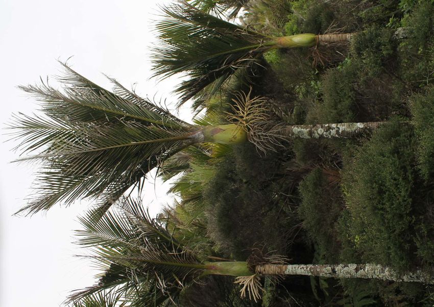
     Regional Park bush areas surround the site to the north and north-east. The bushland includes brilliant stands of
     Rhopalostylis sapida (Nikau), Cordyline australis (Cabbage tree) and Kunzea ericoides/Leptospermum scoparium
     (Kanuka/Manuka). Agathis australis (Kauri) is visible towards the upper extents of the ridge line. Weed management is
     currently being undertaken within the wetland to reduce the dominance of exotic invasive species including Delairea
     odorata (German ivy), Juncus acutus (sharp rush), Cenchrus clandestinus (Kikuyu grass), Paspalum distichum (Mercer
     grass), Rubus fruticosus (Blackberry) and Ulex europaeus (Gorse). Native convolvulus should be protected from weed
     management regimes (Calystegia septium Subsp. roseata)

     Ecological recommendations for the wetland are outlined in the report ‘Biodiversity values of the Piha Education land
     and wetland’ (Auckland Council Biodiversity Team 2015) as well as the 2018 report mentioned below. These should be
     balanced with the management of the Piha Stream/flood alleviation as well as recreational, artistic and educational
     opportunities. The report prioritises weed control in all areas, and then allows for natural seed dispersal and
     revegetation in ecosystem types WL11, EW and ES (refer to below plan and full report). ‘Contiguous vegetation
     between the neighbouring bush and both the wetland and planted (PL) areas would be a good outcome. There is
     plenty of seed rain of appropriate species so this will be achieved over time as long as management of track and bush
     edges is sympathetic to regenerating native seedlings. If active planting is desired then standard pioneer species that
     facilitate succession are all that is required. Core species would be ecosourced...’

     Piha Education Land Wetland - Ecological Recommendations Plan - Chris Ferkins 2018
     Note: For further information on Ecosystem Types and Management Units identified in key refer to original report.

     1   Ferkins, Chris (2018) Memo: Management for the enhancement of Biodiversity values of the Piha Education wetland, Auckland Council

30
NATIVE FLORA WITHIN THE PIHA WETLAND:

Refer to the report ‘Biodiversity values of the Piha Education land and wetland 2015’ for further species information.

 43                            44                            45                           46                        47

 48                            49                            50                           51                        52

 53                            54                            55                           56                        57

 58                            59                            60                           61                         62

Figure 43. Isachne globosa, Eleocharis acuta and   Figure 49. Calystegia septium Subsp. roseata    Figure 56. Cordyline australis
Carex lessoniana                                   Figure 50. Blechnum novae-zealandiae            Figure 57. Metrosideros excelsa
Figure 44. Carex secta                             Figure 51. Typha orientalis                     Figure 58. Alectryon excelsus
Figure 45. Coprosma repens                         Figure 52. Carpodetus serratus                  Figure 59. Myoporum laetum
Figure 46. Juncus sarophorus                       Figure 53. Phormium tenax                       Figure 60. Rhopalostylis sapida
Figure 47. Schoenoplectus tabernaemontani          Figure 54. Macropiper excelsum                  Figure 61. Hebe stricta
Figure 48. Carex lessoniana                        Figure 55. Coprosma robusta                     Figure 62. Leptospermum scoparium
Other species in the wetland not listed above:
Hypolepis dicksonioides

NATIVE FAUNA WITHIN AND SURROUNDING THE PIHA WETLAND:

The nationally threatened frog, Hochstetters frog (Leiopelma hochstetteri) has
the potential to colonise part of the wetland due to its presence in the regional
park land surrounding the site. If the wetland was restored, there is also potential
                                                                                                         Hochstetters frog
for Banded Kokopu (Galaxias fasciatus) that are present in the streams above the
wetland to effectively move through the site and into the Piha Stream.
Additonally, the New Zealand longfin eel (Anguilla dieffenbachii), Lamprey
(Geotria australis), shortjaw kōkopu (Galaxias postvectis), kōaro (Galaxias
brevipinnis) and torrentfish (Cheimarrichthys fosteri) are currently present in the
Piha Stream. The juvenille longfin eels are good climbers and prefer shallow water
(under 0.5m deep) so they have the potential to enter the lower reaches of the                           Branded Kokopu at Piha
wetland.

                                                                                       Auckland Council DRAFT Piha Wetland Service Outcomes Plan | 31
3.10      HYDROLOGICAL CONTEXT

     The majority of the site sits within the 10 year Average Recurrence Interval (ARI) flood area which leaves the site
     inundated on occasions when the Piha Stream floods and bursts it’s banks (refer to 3.11 Hydrological Context Map
     and figures below). Following the latest 2018 flood event the Auckland Council Healthy Waters and Parks Teams
     commissioned an option report for the Piha Wetland. This report is currently ongoing and will provide valuable
     information to guide this Service Outcomes Plan.

     A network of small streams from the wetlands own catchment to the north are the primary source of water that
     maintains both the running (channelised) water and the ground water within the wetland. Piha Stream is unlikely to
     sustain the wetland hydrology in any way as it sits lower than the wetland. The catchment into the wetland consists
     of ‘one large gulley (catchment area 16.4 Ha) and two smaller gulleys (3.6 Ha and 2.6 ha). Inflow is dominated by
     the Ingram Stream which exits a gulley into the sloped wetland. A 4m boardwalk crosses the stream where it enters
     the wetland. There is also a smaller gulley stream feeding the wetland to the west. This stream enters the wetland
     through two culverts (300 mm Ø) under the bund/path that surrounds the wetland. There are six boardwalk sections
     into the wetland and the two aforementioned culverts [where surface flows enter the wetland]. Visual assessment and
     anecdotal evidence also suggests that during large rainfall events, flow from Piha Stream overtops its banks and spills
     into the wetland.’2

     There are also shallow ditches on the uphill side of the bund pathway constructed by The Piha Education Trust prior
     to Auckland Council acquiring the property. The wetland habitat is dependent on dispersed and continuous surface
     and or ground water movement and therefore these ditches and the raised bund pathway (at least along the northern
     edge of the site) interfere with this as they divert the water away from the wetland and lower the groundwater level
     slightly (refer to figure 65 below). The ditches could be backfilled and the uphill pathway bund (or parts of) removed
     to allow continuous water movement.

                                  Figure 63. Looking North across Piha Wetland during flash flood event (2018), Piha Residents and Ratepayers
                   64        65   Figure 64. Ditches on the uphill side of the bund path (2015) Biodiversity values of the Piha Education land and
                                  wetland
         63
                                  Figure 65. Picnic area beside West Coast Gallery during flash flood (2018), Piha Residents and Ratepayers
                        66        Figure 66. Erosion of the Piha Stream banks (with debris) (2019), Liz Oldfield

     2   Morphum Environmental Ltd (2018) Piha Wetland Options Report, Auckland

32
3.11      HYDROLOGICAL CONTEXT MAP

                       SCALE 1:1300 @ A4                                                                 Ingram
                                                                                                         Stream
                  0       10       20      30m

                                                                                                     66

                                                                                            R

                                                               PIHA WETLAND

                                                                    67

                                                         R

                                                                                                                                          S I R A LG E R N O N
                                                                                                                                          T H O M AS G R E E N
                                                                                                                       Piha
                                                                                                                      Stream

                                    65

                                                                                                                                                              64
                       SEAV

                                                                            D
                                                                         OA
                         IEW R

                                                                         KR
                                                                      ES
                                                                    EN
                          OAD

                                                                  GL

LEGEND
                           AD

    Site extent                                  Site photo reference (refer to figures         Toilet                          Approximate alluvial fan - assessed
                         RO

                                                 in section 3.12)                                                               visually only (refer to Morphum
                                     AD

    Outcomes plan to consider use of
                         Y

                                                                                          10 Year ARI flood depth
                      LE

                                                                                                                                Report)
                                   RO

    grassed area (Regional Park land)            Old school house building
                     L
                  VA

                                                                                                2-4m
                                  W

                                                                                                                                Culvert
               H

    Park land                                    West Coast Gallery
                                  VIE
            AC

                                                                                                1-2m
          BE

                               SEA

    Piha Stream                                  Piha Volunteer Fire Brigade buildings                                          Low point
                                                                                                0-1m                            Boardwalk
    Grass track                                  Nigel Hanlon Hut
                                                                                                approximate location of ditch   Overland Flow Paths
R   Rain gauge
3.12     CULTURAL HERITAGE - IWI VALUES

     TBC through consultation with Mana Whenua

     MAORI PLACE NAMES:
     (NB. as identified on Piha.co.nz)

     •   Arerorua – the headlands at each end of the bay - likened to two tongues, White’s Beach
     •   Hikurangi – the high hill to the south of Piha – a common name throughout the Pacific – means “the mount
         touched by the last rays of the sun”
     •   Kitekite – properly Ketekete, the name relates to a revenge attack by Te Kawerau a Maki on visitors from South
         Kaipara. Ketekete was the clicking sound that Te Kawerau made to communicate in the lead-up to the attack.
     •   Kohunui Bay – far northern end of North Piha – the bay is often filled with a thick sea-mist or “kohunui”
     •   Omakinui – Monkey or Cub Rock - associated with the Te Kawerau a Maki eponymous tupuna Makinui
     •   Marowhara/Te Maro whara a Kupe – Kupe threw his cloak in the sea and it floated onto the shore at North Piha
     •   Maungaroa - the long mountain ridge, an old name from the Pacific
     •   Nga Wai Whakatu a Kupe – the rough sea of Kupe, the sea off the coast. Kupe came down from the Pacific and
         was being pursued along the Coast. He made the sea rough so people couldn’t catch him.
     •   Pakirikiri – the place where you catch rock cod
     •   Te Piha – Te Piha, the divided ripple at the prow of a canoe, denoting the waves breaking on the front of Lion Rock
     •   Puaotetai Bay – “foam of the sea” – area between Taitomo Island and the mainland where large drifts of foam
         often gather. Pua means foam
     •   Rangitunoa – the “profane”, common,or non-sacred hill at the south end of the beach
     •   Taitomo – the island with the cave through it – “the passageway of the sea”
     •   Takatu – cliffs to south of Piha, mean “the big drop”
     •   Te Ahua o Hinerangi – “the sacred mound”
     •   Te Kamaka – pohutukawa on the rock, the gateway and spiritual essence of Piha
     •   Te Pona a Ngawhetu – little hill at back of North Piha. Maki’s son, Ngawhetu, hurt his hand in a fight at North
         Piha and his knuckle stuck up.
     •   Te Rua o Kaiwhare – “ The Blowhole“ the lair of the taniwha Kaiwhare
     •   Te Rakau angiangi – lichen covered tree at the head of Waiokahu. The angiangi or lichen were used for a wide
         range of medicinal purposes.
     •   Te Unuhanga o Rangitoto – “ Mercer Bay“ the chasm from which Rangitoto was drawn by the tohunga, Tiriwa
     •   Te Waha or Te Wahangu – “dumb mouth”, headland at the north end of North Piha – the pa where people were
         speechless and subdued – this name came about when children on the pa above the beach sent a toetoe dart over
         the cliff edge which grazed the head of a tohunga on the beach below, who because of the indignity to which he
         had been subjected, cursed them and said that henceforth the people of the pa would not be able to speak
     •   Wai o Kahu – Piha Stream and Valley the water of Kahukeke, wife of Raukataura, the senior tohunga of the Tainui
         canoe
     •   Waitetura – North Piha – the wide and expansive bay
     •   Wai whaka tai – the stream overwhelmed by the sea, today called Marawhara Stream, by North Piha Campers’
         Club
     •   Wekatahi – the single or solitary weka, the weka found on his own. Weka were an important food source.
         Wekatahi was the site of the last main kainga lived in my Te Kawerau a Maki
     •   Whakaari – the landmark, it sticks out, Lion Rock

34
3.13            CULTURAL HERITAGE - IWI VALUES MAP

         TBC through consultation with Mana Whenua                                                                                                                                             SCALE @ A4

                                                                                                                                                                                           0    260 520 780m

                                                                                                            Anawhata Road
                                  Arerorua

              Te Waha/Te Wahangu
                          Kohunui Bay                                                                         ai
                                                                                                   k        at
                                                                                              w ha                                   Te Pona a Ngawhetu
                                                                                         ai
                                                 Omakinui                               W

                                                                                                                           oa
             Ngā Wai                                     Otokitoki Pā                                                  ngar
                                                                                                                   Mau
            Whakatu a                                Marowhara
              Kupe                                      Maungaroa Pā
                                                                                  Wekatahi                                                          Te Rakau angiangi
                                                                      Waitetura                                                  ahu
                                   Te Piha                                                                               Wai o K
                                                                                              Wai o Kahu
                                                   Whakaari Pā
                                                                                                                   Ketekete/Kitekite
                                                  Pakirikiri
                                               Taitomo                                                                 Te Kamaka
                                              Rangitunoa
                                         Puaotetai Bay

                                                             Takatu
                                                                                                                                       Piha Road

                                                                Hikurangi

                                   Te Ahua o Hinerangi Pā
                                                                                                  ad
                                                                                              Karekare Ro

                                     Te Unuhanga o Rangitoto

                                                                                                                                                                    d
                                                                                                                                                                  oa
                                                                                                                                                              riR
                                                                                                                                                          Kau
                                                                                                                                                     ne
                                                                                                                                                   Lo

LEGEND

        Site extent
DISCLAIMWaitākere
          ER:            Ranges Regional Park                                                                                                                       0    260   520   780
This map/plan is illustrative only and all information
        Local
should be       and Sports
           independently         Parks
                           verified  on site before taking                                                                                                                Meters
any action. Copyright Auckland Council. Land Parcel
        Major     or  Local   Roads
Boundary information from LINZ (Crown Copyright                                                                                                                         Scale @ A4
Reserved). W hilst due care has been taken, Auckland
        Pā                                                                                                                                                              = 1:50,000
Council gives no warranty as to the accuracy and plan
completeness of any information on this map/plan and
        Rocky outcrop                                                                                                                                                  Date Printed:
accepts no liability for any error, omission or use of the
information.
        Ridge Height  datum: Auckland 1946.
                 or cliff
                                                                                                                                                                        17/11/2019

                                                                                                                                Auckland Council DRAFT Piha Wetland Service Outcomes Plan | 35
You can also read