Rendlesham and Tunstall Forest plan Sandlings Forest 2021- 2031
←
→
Page content transcription
If your browser does not render page correctly, please read the page content below

Rendlesham and Tunstall Forest plan

Sandlings Forest

2021– 2031
Page 2

Contents
                                                                                            Who is Forestry England?
•   What are Forest Plans? .......................................................... 3
                                                                                            For over 100 years, we have been growing, shaping and caring for over 1,500 of our
•   Standard Practices and Guidance ............................................. 4         nation’s forests for the benefit and enjoyment of all, for this generation and the
•   Introduction and plan area map ................................................ 5       next.
•   Design Brief and concept maps ................................................. 7       Our task is to realise the potential of each of the forests in our care for sustainable
•   Environment…………………………………………………………………………………………….10                                       business opportunities, wildlife and nature conservation, and the enjoyment and
                                                                                            well-being of local people and visitors. Each of our forests supports the economy
•   Community ................................................................... .. 13     through local jobs, sustainable timber production and the provision of recreation and
•   Forest resilience ................................................................ 15   tourism opportunities.
•   Finance…………………………………………………………………………………………………...16                                       Our purpose is to secure and grow the social, economic and natural capital value of
•   Plan Maps & Appraisal .......................................................... 17     the nation’s forests is at the heart of everything we do.
•   Monitoring………………………………………………………………. ....................... 22                          •   We are the biggest landholder in England, managing more than 1,500 woods and
•   UKWAS compliance table…………………………………………………………………….. 24                                       forests
•   Forest Plan application ........................................................ 25     •   As well as health benefits, our woodlands make significant contributions to local
•   Glossary of Terms ............................................................... 26        economies around the country. The 226 million visits we get per year support
                                                                                                over 80 private businesses across England
•   Management Prescriptions……………………………………….. .................... 28
•   Tolerance Table……………………………………………………….. ...................... 29                        •   We are the largest supplier of sustainably produced timber in England, selling
                                                                                                around 1.4 million tonnes per year.
•   Appendices……………………………………………………………… ....................... 30
                                                                                            •   The benefits our forests provide has been estimated at £24.4 billion.
                                                                                            Our vision: The nation’s forests provide the most valuable places for wildlife to
                                                                                            thrive and expand in England
Page 3

What are Forest Plans?
 orest Plans are produced by us, Forestry England (FE), as a means of communicating our
management intentions to a range of stakeholders. They aim to fulfil a number of objectives:

•    To provide descriptions of the woodlands we manage.
•    To explain the process we go through in deciding what is best for the woodlands’ long term
     future.
•    To show what we intend the woodlands to look like in the future.
•    To outline our management proposals, in detail, for the first ten years so we can seek
     approval from the statutory regulators.

Our aim is to produce a plan that meets your needs for the woodland; meets the needs of the
plants and animals that live there and meets our needs as managers.
We have produced this draft plan to illustrate our management proposals thereby creating an
opportunity for you to comment on the plan, whether you are a user, a neighbour or a member of
one of the many stakeholder groups that have an interest in the woodlands. Information on how to
get your comments to us is on the webpage.
This plan does not set out the detailed yearly management operations for each small piece of a
wood, known as a coupe*. It is not possible to say which year a particular operation will take
place, but we can say in which five-year period it should happen.
All tree felling in the UK is regulated and a licence is required before trees can be felled; the scale
of tree felling across England’s public forest estate is such that the Forest Plan is the best
mechanism for applying for this licence.
Responsibility for checking that the plan meets all the relevant standards and statutes lies with
Forest Services. If all the criteria are met, full approval is given for the management operations in
the first ten years (2021 - 2031) and outline approval for the medium term vision (2032-2091). The
plan will be reviewed after the first five years (2026) to assess if the objectives are being achieved.
Natural England will approve management proposals for any Sites of Special Scientific Interest
(SSSIs) which lie within our woods. Historic England will approve management proposals for
Scheduled Monuments (SM).
We use some technical words and phrases in the text because they best describe what we are
doing. There is a glossary at the back of the plan with some commonly used technical forestry
terms and abbreviations these technical words are identified with an *.
Page 4

Standard Practices and Guidance                                                                          Other Designations
                                                                                                         The FC landholding in England has a wide range of European and national designations placed upon
Underpinning the management proposals in Forest Plans is a suite of standard practices and               it in various locations across the country, such as;
guidance described briefly below. Some of these practices are strategic national policy, whilst
others are local expressions of national policy to reflect the particular conditions found in East       •    National Park
England - the policy level is indicated in brackets.
                                                                                                         •    Area of Outstanding Natural Beauty (AONB)
The UK Forestry Standard* (national)
                                                                                                         •    Special Area of Conservation (SAC)
The UKFS sets out standards for the sustainable management of all forests and woodlands in the UK
and describes, in outline, good forest practice.                                                         •    Scheduled Monuments (SM’s)

The UK Woodland Assurance Standard* (national)                                                           •    County Wildlife Sites*
The UKWAS certification standard sets out the requirements which woodland owners, managers and           Along with the standard guidance documents, we have individual plans for our designated sites;
forest certification bodies can use to certify their woodland and forests as sustainably managed. It     these describe work required to maintain and enhance the protected features. We will gradually
is the document which guides all of our management, and against which the FC is certified by             integrate these into our Forest Plans where appropriate.
outside consultants to ensure our compliance. The most current edition at this time is the third
edition.                                                                                                 In addition, Forestry England has a number of practice guides and specialist bulletins which further
                                                                                                         inform our management.
Priority Habitats and species (national)
The Natural Environment and Rural Communities Act 2006 places a biodiversity duty on Forestry
England to conserve “Species and Habitats of Principle Importance for the conservation of
Biodiversity”. These priority species and habitats can be found in section 41 of the Act.
Sites of Special Scientific Interest* (national)
Within the UK sites that are nationally important for plants, animals or geological or physiographical
features are protected by law as Sites of Special Scientific Interest (SSSIs).
Special Protection Area* (national)
Site designated under the European Commission’s birds directive. They are classified for rare and
vunerable birds and for regularly occurring migratory species.
Deadwood (national and local)
Deadwood is important in the forest as a habitat for birds, invertebrates and some primitive plants.
Guidance is given on how to provide deadwood in the forest of different sorts and sizes and how
this will be distributed.
Natural reserves (national and local)
Natural reserves are areas of the forest where little or no active management takes place thereby
creating a very different and special habitat in our otherwise actively managed forests. They are
predominantly wooded and in areas of high conservation value.
Page 5
Introduction
This Forest Plan covers 2,514 hectares of Forestry England land which is part of Sandlings Forest, in Forestry England Priorities
the county of Suffolk. We are guided and directed by the policies and strategies detailed below:
At the national level the Growing the future:2021-26 five year plan, sets out where we will focus
The Governments Priorities our work so that we can achieve our objectives and purpose. Our compass (opposite page) shows
how our purpose, objectives and Growing the future: 2021-26 work together to achieve this.
The 25 year Environment Plan was published in January 2018 to set out the governments approach
to maintaining and enhancing the natural environment, within a generation. The plan is broad in At a district level the East England Forest District Strategy 2018-2022 sets our objectives around
scope but covers cleaner air and water, public forests and woodland, marine protected areas, five goals:
species protection, administrative and governance issues.
Staff — A skilled, motivated and professional workforce.
The England Trees Action plan 2021-2024 was developed to support the 25 year environment plan
for green recovery. It aims to boost tree planting and establishment, improve woodland manage- Finance — Generating a financial surplus.
ment and support a thriving green economy across England, delivering more for society, nature,
the climate and the economy.
Forest resilience — A healthy, resilient and productive forest.
Community — improved public involvement and engagement
Environment — A recognised global leader in environmental stewardship.
These strategic documents along with local knowledge are used to prepare a design brief for the
forest plan (see page 7). The plan is then subject to a consultation where subsequent changes may
be applied before being finalised. Forest plan objectives are based around goals 2-5 as the goal
relating to staff cannot be addressed within a plan.
General Description of Plan Area
The plan area is situated near the east coast of Suffolk in the heart of the Sandlings and includes
both Rendlesham and Tunstall forest.
Rendlesham accounts for 1425ha of the plan area. It is bordered by Staverton Park SSSI/SAC to the
east and Sutton and Hollesley heath SSSI to the south west. Woodbridge airfield lies in the centre of
the forest dividing the north and south of the woodland. Tunstall accounts for 1089ha of the plan
area. It is bordered by Blaxhall heath SSSI and Iken wood SSSI in the north, Tunstall common SSSI in
the west and Alde-ore Estuary SSSI/SAC in the north and south. The rest of the plan area is
surrounded by intensively managed arable and animal production units.
The whole plan area lies in the county of Suffolk, and is within the administrative boundary of
Suffolk Coastal District Council. Rendlesham falls within the six parishes of Bromeswell, Eyke,
Rendlesham, Wantisden, Capel St Andrew and Boyton. Tunstall falls within the five parishes of
Blaxhall, Tunstall, Iken, Chillesford and Sudbourne.
The whole plan area is held under freehold, the majority of which was acquired by Forestry England
in the 1920’s and 30’s, this land is open access with 2,450ha dedicated under the Countryside
Rights of Way Act (see plan area and landholding status map on page 6).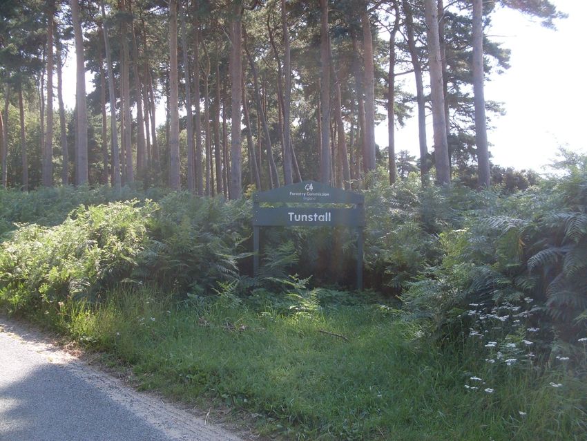

Page 7

Design Brief

Environment

•    To protect and maintain designated sites.

•    To protect and maintain priority habitats.

•    To protect and maintain priority species.

•    Maintain and improve cultural and heritage value of the land by protecting sensitive heritage
     features highlighted through the operational site assessment (OSA)* process.

•    Agree management plans for 8 scheduled monuments (SM) across Rendlesham and Tunstall,
     with Historic England (appendix 1).

Community

•    Create a pleasant natural environment for the public to enjoy outdoor recreation in a rural
     woodland setting.

•    Where appropriate, manage areas around campsites and recreational infrastructure through
     lower impact silvicultural systems* for amenity value.

•    Maintain recreational facilities to a high standard through inspection processes and
     partnership working with volunteer groups and other stakeholders.

Forest resilience

•    Maintain the land within our stewardship under FSC®/PEFC certification by meeting standards
     detailed in UKWAS fourth edition.

•    Improve economic resilience of our forests by increasing species diversity through restock
     programmes and mixed silvicultural practices, to protect future timber supplies and biomass.

Finance

•    The felling plan should aim to smooth production from crops in cyclic clearfell but also meet
     market commitments.
                                                                                                     The above diagram shows the five areas identified in the East England Forest District Strategy.
                                                                                                     The forest plan design brief identifies objectives related to four of these goals, demonstrating how
                                                                                                     this plan will contribute to the district strategy.


Page 10

Environment
Site Characteristics                                                                                     Designated sites
Rendlesham forest lies on relatively flat land with a gently rolling and sloping landscape and few       Sandlings Forest SSSI* designated in 2000 totals 2,484ha across Rendlesham and Tunstall forest
distinct features. There are two plateaux; one to the north, edged by the Butley River valley and        (www.sssi.naturalengland.org.uk/citation/citation_photo/2000443.pdf). Almost the whole plan
one to the south, edged on it’s western side by the River Tang valley. The forest only rises to a        area is designated under the Sandlings Forest SSSI (see design & concept map pages 8&9). The site
maximum of 25m above sea level and average rainfall is 620mm per annum. The forest is centred            is notified for it’s coniferous woodland which supports internationally important populations of
on the Sandlings belt and there is little variation in the sandy heathland soils although there is a     Woodlark (Lullula arborea) and Nightjar (Caprimulgus europaeus). These birds nest on open ground
tendency towards neutral pH soil at the western end.                                                     such as heathland and the areas left after tree felling.
Tunstall forest lies on relatively flat land with a narrow shallow valley running north east—south       Sandlings Forest SSSI forms part of the Sandlings SPA* designated under the European Birds
west from Tunstall common towards Orford. The forest only rises to a maximum of 20m above sea            Directive. The SPA designation supports populations of Woodlark and Nightjar, by protecting their
level with the outlying blocks of Chillesford wood and Sudbourne wood all of a similar height and        breeding habitat (restocked forest areas) and therefore impacts on the clearfell programme across
aspect. Average annual rainfall is 620mm per annum. Although the woods are centred in the                Rendlesham and Tunstall Forest. The revision of the forest plan will try to smooth the ‘supply’ of
Sandlings belt there is a marked variation from north to south. In the north the soil is pure sandy      breeding habitat over time by amending the felling dates of the clearfell coupes to produce an
heath whilst to the south the Chillesford clays come close to the surface resulting in more ponds        annual area of clearfell close to the sustainable mean for the forest. However, in the short term
and water loving vegetation.                                                                             the majority of habitat will be provided through heathland areas. Due to the 1987 storm described
                                                                                                         in the landscape section on page 14, much of the woodland was planted around the same time
Wooded Habitats                                                                                          resulting in a shortage of economically mature timber in the medium term. This is illustrated in the
                                                                                                         age distribution bar graph shown on page 15. As a result the condition of the SSSI/SPA is
Coniferous Forest                                                                                        unfavourable recovering.
Most of the wooded area of the plan is conifer forest, with Pine being the predominant species. The
mature forest areas are used for breeding habitat by several different species of raptor including       There are four SSSI’s which border Tunstall including Blaxhall heath, Tunstall Common, Iken woods
Hobby and Buzzard and other birds such as Firecrest. Many areas are managed through low impact           and the Alde-Ore Estuary (also a SAC). In Rendlesham there are two SSSI’s including Sutton and
silvicultural systems* (LISS) in the plan to provide habitat for these species (see management map       Hollesley heath and Staverton Park (also a SAC). The design concept maps on pages 8&9 show the
on page 18).                                                                                             location of these sites. The plan aims to improve links between adjacent heathlands, through
                                                                                                         improving open space connections in appropriate areas.
Ancient woodlands                                                                                        The maintenance and enhancement of biodiversity is a key consideration in the plan. The existence
Ancient woodlands have a long history of woodland cover, existing since before 1600. There is no         of various species of rare birds, flora, lepidoptera and mammals associated with designated sites
ancient woodland in the plan area but a few lie adjacent to the woodlands. Iken woods, an ancient        adjoining the plan area, is considered in the management of the woodland.
semi natural woodland borders the north east of Tunstall forest, and Watling/Oakyard woods, an
ancient replanted woodland borders the south, separated by the B1084.
Staverton Park, an ancient semi natural woodland with a well documented medieval history,
borders the east of Rendlesham.
                                                                                                                            Woodlark
These boundaries will be managed as LISS using a shelterwood system to encourage natural
regeneration of broadleaf species, extending further into the forest where possible. This is
particularly appropriate on the Watling/Oakyard wood and Staverton park boundaries where a
mixture of broadleaf species are already present, along with a number of veteran trees including
Oak and Sweet chestnut. Management through LISS will help protect veteran trees and create
dappled shade to encourage ground flora, increasing biodiversity (see management map on page
18).

Deadwood
The OSA* process is used to consider opportunities to provide deadwood habitat. A lot of fallen
trees are left to rot down where they fall, it is important not to ‘tidy up’ these fallen trees from a
biodiversity point of view as shaded rotting wood is important habitat for invertebrates.

The largest amounts of deadwood can be found in areas managed through LISS and natural reserves
where ecological processes such as vegetation succession, natural regeneration and windthrow
increase biodiversity and conservational value of the area.
                                                                                                                                                                                  ©Chris Knights
Page 11
Environment...continued managed through a mixture of grazing and annual mowing programmes, with some soil disturbance
to create bare ground.
Priority habitats
As part of the revision process open space across the plan area has been reviewed and reallocated
The UK Forestry Standard requires a minimum of 10% open ground or ground managed for the where appropriate. This has been done by assessing the current locations of open space and using
conservation and enhancement of biodiversity as the primary objective. UKWAS requires a minimum bird survey data records to evaluate their level of use. As a result some designated heathland areas
of 10% of the district forest management area to be managed as open space. This is for biodiversity, will expand whilst other previously designated areas will be planted or left to natural regeneration.
cultural and recreational purposes. The existing open space within the plan area is made up of This can be seen on the management maps and the habitat & restock map on pages 17-19.
recreation areas, Lowland heathland and the network of forest rides. This accounts for 9% of the
plan area (see pie chart on page 15) which includes both permanent open space and temporary Areas of temporary open space are present in both woodlands as a result of rotational clear fell
open space created through felling operations. operations and current restock sites. The plan proposes restocking of these areas through planting
predominantly conifer.
Open space within the woodland, particularly wide rides, not only provide high conservational value
but also timber extraction routes, easy access for public use such as walking and fire breaks helping Priority species
to prevent fires spreading and providing good access for the emergency services. They are also
important for wildlife management providing good feeding areas for deer. Where possible and European Protected Species include Bats. Bats are found throughout the plan area and will be
appropriate, rides will be widened during routine operations to improve access and conservation managed through maintaining woodland area and connectivity, maintaining and increasing
potential. deadwood and open rides and corridors for feeding.
Priority open habitats within the design plan area include freshwater habitats such as wet woodland Other Priority species found within the plan area such as Adders are associated with the lowland
along the two river valleys and ponds. Terrestrial lowland heathland and acid grassland are also heathland. All priority habitats and priority species will be taken into account as part of the OSA*
priority habitats in the plan area. process before work commences to ensure species protection and to identify additional
opportunities for enhancement.
Freshwater
There are two areas of wet woodland in Rendlesham forest including the Butley river valley in the
north, and the Tang river valley in the south. Tree species including Alder, Birch and Willow
dominant these areas, with other broadleaf and conifer species present in slightly drier locations,
particularly in Butley. However, these wet woodlands are not just dense tree cover but also include
open areas and other dry/wet habitats such as scrub and ponds. The highest proportions of standing
and fallen deadwood also exist here. In Butley river valley a large number of veteran Oak trees are
present. These will be retained and protected, linking well with the adjacent Staverton Park.
The diverse range of habitats present in these areas are important for biodiversity with an
abundance of lichens, mosses, sedges, rushes and ferns, and large numbers of invertebrates which
support amphibians, mammals and birds. These ecological niches are not found in drier woodland
areas making them a unique feature in the woodland.
Butley river valley will be managed through LISS using a shelterwood system to remove the majority Adder Lowland heathland
of remaining conifer and encourage further natural regeneration of broadleaf species. Thinning
operations will take place approximately every 10-13 years. The Tang river valley will be managed
as a natural reserve with no systematic felling, and operations only carried out where necessary for
safety reasons.
There are a number of ponds present along both river valleys and others at various locations within Brown long eared
Tunstall forest. These support a range of species including amphibians and dragonflies and are an
important water source for birds and other animals in dry weather.
Lowland heathland and acid grassland
The largest areas of permanent open space are found in the designated heathland sites distributed
across both woodlands. As part of the SSSI management plan agreed between Forestry England and
Natural England an area of 127ha of heathland will be managed to provide suitable habitat for
Woodlark and Nightjar. These areas can be seen on the design concept maps on pages 8 & 9.
Designating specific areas to provide habitat for Woodlark and Nightjar is required as a result of the
even age structure of the forest following the 1987 storm, which has reduced the amount of clear
fell area available, and therefore suitable nesting habitat over the next 15 years. These areas are TangPage 12
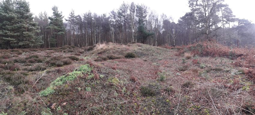
Cultural Environment
Safeguarding our Heritage Bowl barrow 250m SW of Tangham Cottages, in
Rendlesham forest.
Forestry England acquired the majority of the plan area in the 1920’s and 1930’s with some of
Tunstall acquired at a later point in the 1980’s.
The plan area has good survival of features associated with previous land use history including earth
banks, burnt flints, medieval and Roman pottery and quarry pits. There is also a strong World War
Two history across both woodlands. Surviving features include a military training area, dug pits used
for shooting, pill boxes and bomb craters.
Site specific heritage features are considered as part of an OSA process before work commences. A
handbook guide to protecting heritage assets has also been produced for forest workers and is
referred to during operations to increase understanding and protection of heritage features.
There are 8 scheduled monuments across the plan area of which all are Bowl barrows. There are 4
located in Rendlesham forest and 4 in Tunstall forest; examples of which can be seen in the photos
opposite. They have specific individual management plans shown in appendix 1 which were agreed
with Historic England in August 2019 and do not form part of the consultation.
Bowl barrows, the most numerous form of round barrow, are funerary monuments dating from the
Late Neolithic period to the Late Bronze Age, with most examples belonging to the period 2400-
1500 BC. They were constructed as earthen or rubble mounds, sometimes ditched, which covered
single or multiple burials. They occur either in isolation or grouped as cemeteries and often acted
as a focus for burials in later periods. Often superficially similar, although differing widely in size, © David Robertson
they exhibit regional variations in form and a diversity of burial practices. There are over 10,000
surviving bowl barrows recorded nationally (many more have already been destroyed), occurring
across most of lowland Britain. Often occupying prominent locations, they are a major historic
element in the modern landscape and their considerable variation of form and longevity as a
monument type provide important information on the diversity of beliefs and social organisations
amongst early prehistoric communities. They are particularly representative of their period and a
substantial proportion of surviving examples are considered worthy of protection (text taken from
the National Heritage list entries on Historic England website WWII Military training area in Rendlesham
https://historicengland.org.uk/listing/the-list).
Bowl barrow, 1300m south of Heath Cottages, in Tunstall forest.
© David Robertson © David RobertsonPage 13 Community Access and Recreation Public access is permitted on foot across the whole plan area (see plan area map on page 6). The main users across the plan area include walkers, cyclists, sled dogs and horse riders. Rendlesham forest is the main recreation site for the plan area and a popular destination, attracting around 100,000 visitors per year. Many are visitors from the Forest Camping Tangham site near the main forest office. There are 3 pay and display car parks including the main visitor car park, overflow and a small car park along the entrance drive, often used as a viewing area by plane spotters. The site provides a variety of formal recreation facilities including 2 walking trails (phoenix and UFO trail), 2 cycle trails (F.I.D.O and Tang trail), an orienteering course and an active play area. An information hub is also present on site along with seasonal catering, cycle hire and limited toilet facilities. There is a large picnic area close to the main car park, which has a successful ‘no bins’ policy thereby encouraging visitors to take their waste back home with them. A further car park Butley corner, is located along the B1084, approximately half a mile west of the entrance drive to Rendlesham forest. There are limited recreation facilities in Tunstall forest including the Sandgalls car park and a waymarked cycle trail (Viking trail). Tunstall and Rendlesham Off-Road Group (TROG), a local volunteer group developed the Viking trail and often hold trail building sessions to carry out maintenance. Recreation facilities in both forests are inspected by the Forestry England recreation ranger. There are several gateways around the forest boundaries which although not encouraged are often used for parking. There are a number of public rights of way across the plan area, one of which includes the Sandlings walk, a long distance path stretching 55 miles from the outskirts of Ipswich to Southwold, passing through Rendlesham forest. Signposts for this can be seen in the woodland. The main forest office located in Rendlesham manages permissions for events across the plan area. These include Oakwood Bowmen archery, sled dog training, MOD training and guided walks such as fungal forays and night walks. The Suffolk Wildlife Trust also run both led and self led educational activities. A Europe wide study has shown that people who visit forests prefer to see stands of large mature trees, both of broadleaves and conifers. This study confirms our own management policy of retaining some over-mature trees and managing them under LISS, thereby contributing to providing a more aesthetic environment. Forestry England manages recreation webpages for both forests providing information to visitors. To find out more about Rendlesham forest visit www.forestryengland.uk/rendlesham-forest and for Tunstall visit www.forestryengland.uk/tunstall-forest. Both forests also have a facebook page. Community There are private houses within the plan area and others on the forest boundaries. Farming units border the plan area along with Woodbridge airfield located in the centre of Rendlesham forest. Considering the population of surrounding towns and villages it is not a surprise the woodland is well used. Ipswich which lies to the south west has a population of 210,000 and Woodbridge which lies to the west, population of 11,000. The population of surrounding villages Tunstall, Sudbourne, Sutton, Broomeswell, Rendlesham and Butley total a combined population of 6,711. Forest plans are revised every 10 years and plans for the East England Forest District are accessible from the Forestry England website www.forestryengland.uk.
Page 14

Community continued ...
Landscape
The landscape of the plan area has changed significantly overtime. The majority of the plan area
was planted between 1922 the late 1930s, before which it was extensive heath and farmland. The
great storm of 1987 saw winds gust up to 100mph, flattening much of Rendlesham and Tunstall
forest with well over a million trees blown down (see photo of Sudbourne block in Tunstall below
and Rendlesham view from forwarder photo opposite). Fallen trees were cleared and preserved at
Lynford water in Thetford forest using a water pump that kept the timber wet to avoid degradation
and maintain their monetary value (see photo opposite). This helped to avoid swamping the market
with degrading timber.
Populations of Woodlark and Nightjar soared across the plan area during this time, which although a
positive consequence for nature is an unsustainable provision of habitat. Following the clear up
after the storm, the forests were successfully replanted over a period of 6 years which led to the              Rendlesham view from forwarder
young, even aged stands visible today. This can be seen in the photo opposite showing Rendlesham
forest 20 years after the storm and in the age class distribution graph shown on page 15.
Opportunities were taken to redesign the area, giving greater consideration to conservation,
recreation and timber production to create more balanced, sustainable forests. Consequently, the
plan area has much greater diversity with conifer and broadleaved woodland, open space, wet
woodland and heathland.
Harvesting operations greatly reduced following the years after the storm, retaining the trees
which survived and allowing the forest to re-establish. Thinning operations now take place but clear
fell coupes are still minimal for the next 15 years as much of the plan area is not yet economically
mature enough to fell. This can be seen on the revised felling area graph on page 20. As a result
heathland areas within the plan are the main habitat provision for the priority species Woodlark
and Nightjar, for which the plan area has been designated a SSSI and SPA. Overtime, as the clear
fell coupes are felled as proposed on the management map on page 17, the forest will become a
mosaic of organic shapes composed of trees of different ages and species.
The forest landscape provides a backdrop to the villages of Tunstall, Sudbourne, Sutton,
Broomeswell, Rendlesham and Butley. The majority of the plan area also lies within the Suffolk
Coast and Heaths Area of Outstanding Natural Beauty. As a generally flat landscape the view from
surrounding settlements will be mostly unaffected by internal clear fell coupes, especially as the                                             The log store at Lynford Water, 1987
majority of forest boundaries within the plan area will be managed through LISS.

                   Sudbourne block in Tunstall, 1987

                                                                                                       Rendlesham Forest, 20 years after the storm
Page 15
Forest Resilience
Tree Species
The whole plan area is predominantly a pine forest; this genus was chosen as both Scots and
Corsican pine are particularly well suited to the soils and climate in the Sandlings; growing fast and
producing good quality timber. The heavy reliance on pine, particularly Corsican pine, has had its
downside as Dothistroma Needle Blight (DNB) is now present across the whole forest; Corsican pine
is particularly susceptible to this disease; Scots pine is also affected but to a lesser extent. The
effect of DNB is to reduce the number of needles held on the tree and also to reduce the efficiency
with which the remaining needles photosynthesize, leading to poor growth and in the worst cases
killing the tree. This is a concerning issue with 63% of the plan area currently containing Corsican
pine. As a result this species is no longer planted and alternatives are used for restocking such as
Scots pine and Douglas fir. There are only a few pioneer species (Pine, Birch & Larch) which grow
well in the open conditions created after clearfelling, although as the area is less susceptible to
frost some areas are replanted with Douglas fir. This is positive as planting Larch is also restricted
due to a fungus-like pathogen, Phytophthora ramorum, which can infect and kill a range of tree
species widely grown in England including Larch, Sweet chestnut and Beech. Ongoing research is
guiding our future silvicultural decisions. Across the plan area there are 11 research plots carrying
out thinning experiments and forest condition assessments.
Restocked coupes are often fenced in order to protect from mammal damage giving the trees the
best possible chance of survival. Fencing across the plan area is minimal due to the current low
number of clear fell coupes as a result of the even aged forest.
Broadleaves make up 18% of the plan area, with the majority located in belts along the forest
boundaries, river valleys, small blocks across the woodlands and Natural reserve. Open space
including both permanent and temporary (e.g. recently felled areas) accounts for 9% of the plan
area.
Age Classes
The bar chart above illustrates how the storm of 1987 has perpetuated the condensed initial
establishment phase—resulting in the current limited spread of tree ages. Some of the original pine
plantings and broadleaf belts remain.
The design brief is to ‘smooth’ the felling of the second rotation so that the age class distribution
becomes more evenly spread over a period of 60 to 70 years. This equates, approximately, to a
rotation* of trees and will move the forest forward on a more sustainable basis.Page 16
Forest Resilience continued ... Finance
Future resilience
The plan revision should not effect short term sales contracts and medium term forecast
The threat posed to timber production from climate change and more directly from pests and commitments, coupes can be changed but appropriate substitution of coupes must ensure that
diseases is having a significant impact in forests, with Corsican pine being the worst affected. To future sales can be met. The even aged nature of the forest, post 1987 storm, means there is little
ensure long term sustainable timber production the present tree species will require age/species scope to fell more timber as much of the forest is still immature in economic and biological terms.
diversification in future rotations selecting species more resistant to the current and increased
incidence of pests and diseases.
The plan area is an established woodland
with an even age structure and ride
network throughout. Felling coupes will be
designed to vary the age structure across
the forest to improve future resilience, a
key objective for the plan. Silvicultural
systems currently used include thinning on a
5-7 year cycle in conifer plantations and a
10-13 year cycle for LISS areas to encourage
natural re-generation. Future plans will
likely see strip felling and underplanting
considered as an additional way of
introducing a wider variety of species into
the forest. As part of the forest resilience
programme, this is currently being trialled
in some coupes within Thetford Forest,
which has very similar woodlands to
Rendlesham and Tunstall.
The plan shows some areas will be planted
with Sweet chestnut that can be used for
fencing in future. This will see future coupes
become coppice again adding further
diversity to the woodland whilst still
providing habitat for the Nightjar.
The planting of small proportions of Corsican
pine in mixtures may be considered for use
in areas of high airflow and where
establishment is difficult.
To improve forest sustainability tree species and tree protection is considered as part of the re-
stock programme taking into account soil type, diversification, climate resilient species, disease
and pests. As a result of changing priorities restock species are decided closer to the time of felling
and it may be necessary to fence the replanted areas to prevent browsing by mammals. The split
between conifer, broadleaf and open space are shown on the habitat and restock species map on
page 19.Page 20
Plan Appraisal
- Design brief objective: To protect, maintain and enhance priority species.
The appraisal of the revised plan is measured against the design brief on page 7, this has three separate
sections and the appraisal relates to these sections: Priority species will be maintained and enhanced through the planned programme of management
identified for their supporting habitats. Opportunities will be identified at the operational level and
incorporated into work programmes via the Operational Site Assessment (OSA) process.
Environment
- Design brief objective: Maintain and improve cultural and heritage value of the land by
protecting sensitive heritage features highlighted through the OSA* process.
Site specific heritage features are considered as part of an OSA process before work commences. A
‘cab card’ guide to protecting heritage assets has also been produced for forest workers and
contractors to refer to during operations to increase understanding and protection of heritage
features.
- Design brief objective: Agree management plans for 8 scheduled monuments (SM) across
Rendlesham and Tunstall, with Historic England (appendix 1).
Appendix 1 shows the scheduled monument plans for Rendlesham and Tunstall. These have been
agreed with Historic England.
Community
- Design brief objective: Create a pleasant natural environment for the public to enjoy outdoor
recreation in a rural woodland setting.
It is difficult to assess how pleasant a woodland environment is as this is subjective but managing
the woodland through a variety of silvicultural systems including clear fell and LISS, and retaining
• Design brief objective: To protect, maintain and enhance designated sites patches of mature trees such as those present in wet woodland areas and natural reserves should
create a pleasing environment for forest users and passers by. Maintaining areas of open space also
helps create internal views within what is a relatively flat landscape.
The chart above compares the felling area per period of the previous forest plan alongside the new
revised plan, together with an indication of the mean level of felling across the plan area. The new
plan has reduced some of the peaks in the previous plan to a more sustainable level. This will - Design brief objective: Where appropriate, manage areas around campsites and recreational
provide more long term provision of SPA habitat. infrastructure through lower impact silvicultural systems* for amenity value.
The level of felling shown for the period 2017-2021 has not dropped as indicated here. It simply As shown on the management map on page 17-18, the majority of the plan area is managed through
shows the area left to fell for 2021. The rest of the area has already been felled and restocked so clear fell rotation due to it’s SSSI & SPA designation for Woodlark and Nightjar. However, areas
has now been given a much later fell date in the revised plan. around campsites and recreational infrastructure including car parks, buildings and play areas are
managed through LISS. Although some waymarked trails do run through areas managed as LISS it
- Design brief objective: To protect, maintain and enhance priority habitats. would be difficult to retain them all under this management as they cover such a wide area.
Leaving small strips of wooded areas along trails would increase the risk of windblow and greatly
The provision of permanent open space will see an increase of 1% following implementation of the reduce clear fell area.
revised plan. This gives a combined total (permanent plus temporary open space) of 10% as
required in the UKFS (see chart on page 21). - Design brief objective: Maintain recreational facilities to a high standard through inspection
processes and partnership working with volunteer groups and other stakeholders.
As agreed with Natural England an area of 127ha will be maintained as lowland heathland to
provide important habitat for Woodlark and Nightjar. This is required due to the limited amount of
clear fell coupes over the next 15 years, following the great storm of 1987. As part of the revision The whole plan area is open access and provides a wide variety of recreational facilities and
process open space across the plan area has been reviewed by using bird survey data to evaluate activities for all abilities and ages. The main recreation site is located in Rendlesham Forest
the level of use in previously committed locations. This has resulted in some formerly designated offering car parks, waymarked trails, orienteering course and play area. Seasonal facilities
heathland areas expanding whilst others are replanted or left to naturally regenerate, improving including catering and bike hire are also available here. Tunstall offers limited facilities but these
habitat provision for Woodlark & Nightjar. include a cycle trail and bike park (gate 23). The Forestry England recreation ranger is responsible
for inspecting and maintaining the facilities provided in both forests. However, some trails such as
There are two areas of wet woodland identified within the plan including Butley and the Tang river the Viking trail are maintained in partnership with the volunteer group TROG.
valleys. These will be managed through LISS to increase biodiversity across the plan area.Page 21
Plan Appraisal continued ... There are no plans to plant Corsican pine as such but a small proportion may be considered in areas
The permissions system is used to provide permits for Archery, Sled dog training, MOD training, of high airflow and where establishment is particularly difficult. Corsican pine will also remain in
guided walks and educational visits (provided by the SWT). some of the small patches of mature trees within LISS and long term retention areas. The future
diversity of conifer species is expected to increase across both forests as new species and
silvicultural systems are introduced.
Forest resilience
The percentage of broadleaf has decreased slightly to 16% but this figure will increase over time as
- Design brief objective: Maintain the land within our stewardship under FSC® /PEFC certification the temporary open space areas become stocked with naturally regenerated Birch and some clear
by meeting standards detailed in UKWAS fourth edition. fell coupes planted with sweet chestnut for future coppice.
UKWAS audits are carried out nationally in Forestry England woods and forests on an annual basis to The stocking density of areas managed through regeneration felling in the LISS areas is difficult to
retain our certified status. An approved forest plan is a key part of the evidence given to the define as this is dependant on the silvicultural practice used e.g. group felling or single tree
auditors to prove that the forest is managed sustainably. selection to encourage natural regeneration. This is dependant on the species present and
therefore natural regeneration will have a variable stocking density with the success of stands
- Design brief objective: Improve economic resilience of our forests by increasing species diversity measured by variation in age structure.
through restock programmes and mixed silvicultural practices, to protect future timber supplies
and biomass. Finance
- Design brief objective: The felling plan should aim to smooth production from crops in cyclic
The pie chart shows projected habitat proportions by the end of the plan period. Restock species clear fell but also meet market commitments.
will be confirmed by a site assessment after felling— soil pits and vegetation surveys will be used to
ascertain the optimum species for the coupe taking into account prevailing knowledge of species
performance and pathology concerns. The species choice in the chart is shown only as Mixed The objective to smooth timber production while continuing to meet market commitments is very
Conifers, this phrase should be taken to mean a mixture of conifers across the forest as a whole not similar to a prior objective to protect, maintain and enhance designated sites and the same
necessarily a mixture in every compartment*. restriction of age class on clearfell area applies. Most of the stands in the plan are programmed for
felling at their current optimum marketable age—between 50 and 70 years old. In the interim, the
The increase in restock species diversity should increase the resilience of the forests to climate productive stands in Rendlesham and Tunstall are expected to yield good quality thinning material,
change and the threat from pests and diseases. The habitat and restock map on page 19 gives an and the average coupe size is large enough to allow efficient timber harvesting.
indication of the split between conifer, broadleaf and open space.
The chart on page 20 shows that the area of felling in the next ten years remains relatively
unchanged with an increase in the period 2022-2026 and decrease in the period 2027-2031. As
previously stated the period 2017-2021 looks to show a large reduction in clear fell area but this is
not the case. As we are currently in this period it simply is showing the area left to fell. This area
was already approved as part of the previous plan so felling approval for it is not required as part of
this plan revision.
This shows the market commitments will be met and the work to smooth production in subsequent
years has improved the flow of timber towards the end of the century.Page 22 Monitoring FEE National vision and overall goal: “To secure and grow the economic, social and natural capital value of the Public Forest Estate for the people of England.” District Strategic Forest Plan Objective Monitoring Objectives Environment: • To protect, maintain and enhance designated sites A Habitats Regulation Assessment has been carried out and agreed with Natural A recognised global leader in England. There are 7% of coupes
Page 23

District Strategic         Forest Plan Objective                                                         Monitoring
Goals

Forest resilience:         •   Maintain the land within our stewardship under FSC®/PEFC certification    UKWAS audits and certification.
                               by meeting standards detailed in UKWAS fourth edition.
A healthy, resilient and
productive forest.                                                                                       The sub-compartment* database is updated after restocking to show the newly
                           •   Improve economic resilience of our forests by increasing species
                               diversity through restock programmes and mixed silvicultural practices,   planted species and their proportions. As part of this updating process the
                               to protect future timber supplies and biomass.                            restocking information is compared with the habitat and restock plan to confirm
                                                                                                         compliance. The restocking area can vary slightly from the plan as physical
                                                                                                         features come to light only after felling. Most of these minor changes are within
                                                                                                         the tolerances agreed between Forestry England and Forest Services – see
                                                                                                         Tolerance table on page 29. A felled coupe is usually restocked two years later,
                                                                                                         when all the ground preparation and weed control has been completed. To
                                                                                                         monitor timber sustainability, a stocking assessment is carried out to measure
                                                                                                         establishment success after five years. The sub-compartment* database will be
                                                                                                         used to monitor species diversity and assessed as part of the full forest plan
                                                                                                         revision.

Finance:                   •   The felling plan should aim to smooth production from crops in cyclic     A comparison between the production forecast of the previous plan (2007-2017)
                               clearfell but also meet market commitments.                               and the revised plan (2021-2031) was carried out to ensure no negative effect
                                                                                                         on market plan commitments. This has been agreed with the programme
Generating a financial                                                                                   manager.
surplus.
                                                                                                         To monitor compliance with the felling plan, after a coupe is felled the shape is
                                                                                                         captured on the ground using a GPS* receiver and the data is uploaded into GIS*.
                                                                                                         The resulting point data is then compared to the original coupe shape to
                                                                                                         confirm that the felling coupe has been accurately laid out on the ground.
Page 24
UKWAS Compliance table [1]
Forest Plan Area Forest Plan % Forest District Area Forest District %
(Ha) (Ha)
Total area 2,514 100 34,528 100
Total wooded area 2,282 91 30,129 87
Natural reserve - Plantation 18 0.7 317 1
(1%) [2]
Natural reserves - Semi-natural 0 0 255 5
(5%) [2]
Long-term retentions and low 531 21 14,606 42
impact silvicultural systems
Area of conservation value 2,460 97 28,431 82
(>15%) including designations:
PAWS, ASNW, NR, SSSI, SAC,
SPA & Conservation zones
[1]
Figures calculated 19th August 2021 and correct at time of publication.
[2]
Forest District area totals for natural reserves are calculated using allocated natural reserve area against semi-
natural score figures.Page 25
10. Application for Forest Design Plan
Forest Enterprise — Property
Signed …………………………………….. Signed …………………………………...
Forest District: East England
.Forest Management Director Area Director
Woodland or property name: Rendlesham and Tunstall Forest
East England FD East & East Midlands Area
Nearest town, village or locality: Woodbridge
Date………………………………………... Date of approval…………………………..
OS Grid reference: TM 377 523
Local Authority district/unitary Au- Suffolk coastal district Date approval ends………………………..
thority: *delete as appropriate
Areas for approval
Conifer Broadleaf
Clear fell coupes 148ha I seek approval to clear fell 148ha of the Public Forest Estate (this is the area in green and
orange stripe fell periods—i.e. 2022-2031). Restock will be through planting mixed conifer
Clear fell regeneration on open space areas (including 2ha 22ha species at a stocking density of 2,500 stems per ha.
heathland, ride network & archaeological sites)
In addition to the above felling 526ha will be managed using lower impact silvicultural
Regeneration felling 68ha 143ha systems (LISS) including regeneration and selective felling. This will be done through the
removal of single and small groups of trees, removing no more than 40% of the stems
within any single management unit/compartment over the approved plan period. This
New planting (complete appendix 4) N/A N/A operation is aimed at encouraging initial seeding, provision of sufficient light to boost
growth of understorey, allowing adequate space for the development of crowns and stem
form for quality timber and accelerate individual tree growth. Restock will be through
natural regeneration, with supplementary planting carried out if required.
1. I apply for Forest Design Plan approval*/amendment approval* for the property described above
and in the enclosed Forest Design Plan.
2. I apply for an opinion under the terms of the Environmental Impact Assessment (Forestry)
(England & Wales) Regulations 1999 for afforestation*/deforestation*/roads*/quarries* as detailed Date of commencement of the plan:
in my application.
3. I confirm that the pre consultation, carried out and documented in the Consultation Record at-
tached, incorporated those stakeholders which the FC agreed must be included. Where it has Expiry Date:
not been possible to resolve specific issues associated with the plan to the satisfaction of consult-
ees, this is highlighted in the Consultation Record. Mid-Term Review Date:
4. I confirm that the proposals contained in this plan comply with the UK Forestry Standard.
5. I undertake to obtain any permissions necessary for the implementation of the approved Plan.Glossary of Terms Historic Environment
These are the physical remains of every period of human development from 1 million years ago and
Biological Diversity include artefacts, earthworks, buried remains, structures and buildings.
The richness and variety of wildlife and habitats. Historic Environment Action Plan (HEAP)
Canopy Sets out the requirements for the sustainable management of all historic environment sites.
The mass of foliage and branches formed collectively by the crowns of trees.
Historic Environment Record (HER)
Compartments The definitive database of all known Historic Environment remains which is managed by the County
Permanent management units of land within a forest, further divided into sub-compartments. The Archaeology Service.
compartment boundary usually coincides with a road or ride.
LiDAR
County Wildlife Sites (also SINC and LNR)
Light detection and ranging is a method of surveying landscapes. Flights over the landscape send
A non-statutory designation, recognising a site’s local importance for nature conservation. These down laser pulses to the ground and the time taken to reflect back builds a picture of the relative
sites are identified by the Local Authority and should be taken account of in planning. height of the land and vegetation. For more information visit www.breakingnewground.org.uk.
Coupes
National vegetation Classification
Areas of forest that have been or will be managed together.
The key common standard developed for country nature conservation agencies to produce a
Cubic metre comprehensive classification and description of the plant communities of Britain. Each are
A standard forestry unit of timber volume. A cubic metre is roughly equivalent to a tonne of systematically named and arranged and with standardised descriptions for each.
timber.
Native woodland
England Forestry Strategy (now The England Trees Action Plan)
Woodland containing tree and shrub species which colonised Britain unaided by the influence of
Describes how the Government will deliver its forestry policies in England and sets out the man after the last Ice Age.
Government’s priorities for the next five years.
Natural regeneration
Favourable condition
The growth of trees from seed found in the soil or cast from adjacent trees and shrubs.
English Nature’s definition for a SSSI in its intended state.
Non-native species
Forestry Commission Guidelines
Outline the principles and standards of good management practices in forests and woodlands to Trees and shrubs that have been introduced to the UK by the activities of man. Also used to
enable landowners, land managers and their advisors to satisfy Forestry Commission policy. describe species not native to the site and locality.
GIS Operational Site Assessment (OSA)
Geographic Information System - computer program that enables the FC to hold and display all the Detailed site plans that are prepared in advance of all major forest operations and identify site
district’s inventory, landholding and crop information. All the maps in this document have been constraints, opportunities and areas requiring special treatment or protection.
produced using GIS.
Red Data Book species
GPS Species that are included on Red Data lists published by the Joint Nature Conservation Committee
(JNCC). The lists are based on a global system developed by the International Union for
Global Positioning System, which uses information from satellites to accurately locate a position on Conservation of Nature and Natural resources (IUCN) for classifying species according to their
the Earth. extinction risk.
Habitat Action Plans Restocking
UK wide plans for priority habitats defined under the UK Biodiversity Action Plan. They contain The re-establishment of trees where felling has taken place. Restocking may be achieved through
quantitative targets for conserving, restoring and expanding the habitats. natural regeneration but as a term, it is more usually associated with replanting.
Ride
Forestry term for unsurfaced roads, paths and tracks within a woodland.You can also read