Research for the Development of Best Management Practices to Minimize Horse Trail Impacts on the Hoosier National Forest - U.S. Forest Service
←
→
Page content transcription
If your browser does not render page correctly, please read the page content below
U.S. Forest Service
Final Research Report

     Research for the Development of
      Best Management Practices to
    Minimize Horse Trail Impacts on the
         Hoosier National Forest

                                                        Virginia Tech

                 College of Natural Resources, Department of Forestry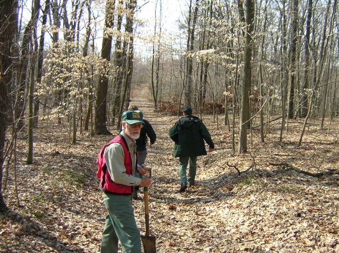
Research for the Development of
                     Best Management Practices to
                   Minimize Horse Trail Impacts on the
                        Hoosier National Forest

                                                by:

                                        Michael W. Aust
                                        Jeffrey L. Marion
                                           Kevin Kyle

                            Virginia Tech, Dept. of Forestry (0324)
                                    Blacksburg, VA 24061

                                           March 2005

                                           Abstract
This research investigates horse trail impacts to gain an improved understanding of the
relationship between various levels of horse use, horse trail management alternatives, and
subsequent horse trail degradation. A survey of existing horse trails on the Hoosier National
Forest was used to collect data on use-related, environmental and management factors to model
horse trail impacts. Results are analyzed to identify which factors are most easily manipulated
by managers to effectively avoid and minimize horse trail impacts. A specific focus includes
evaluating the relative effect of trail use level, surfacing, grade, and water control on indices of
erosion and trafficability such as trail cross sectional area, estimated erosion, muddiness, and
incision. Overall, the Hoosier National Forest horse trails could be significantly improved by
relocating or closing inherited trails that directly ascend slope or are excessively steep, reducing
the distance between water control structures, and by applying gravel to harden trail surfaces and
reduce soil erosion. A set of Best Management Practices for trails are included as a product of
this work, with recommendations based on this research.

                                                 ii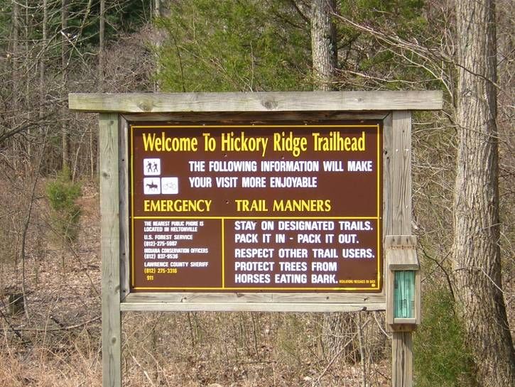
TABLE OF CONTENTS

TABLE OF CONTENTS ............................................................................................................. 1
TABLES......................................................................................................................................... 3
FIGURES....................................................................................................................................... 4
FIGURES....................................................................................................................................... 4
INTRODUCTION......................................................................................................................... 5
OBJECTIVES ............................................................................................................................... 6
LITERATURE REVIEW ............................................................................................................ 7
   POTENTIAL IMPACTS OF TRAILS................................................................................................... 7
   POTENTIAL IMPACTS OF HORSE TRAILS ....................................................................................... 9
   POTENTIAL IMPACTS OF ROADS ................................................................................................. 11
   FACTORS AFFECTING TRAIL RESOURCE IMPACTS ...................................................................... 12
     Use-Related Factors ............................................................................................................. 12
     Environmental Factors ......................................................................................................... 12
       Vegetation Type................................................................................................................ 13
       Topography ....................................................................................................................... 13
       Soil and Surface Characteristics ....................................................................................... 14
   TRAIL MANAGEMENT ................................................................................................................ 15
     Trail Construction................................................................................................................. 15
       Trail Standards .................................................................................................................. 15
       Location ............................................................................................................................ 16
       Road Costs ........................................................................................................................ 18
       Trail Grade ........................................................................................................................ 18
       Trail Slope Length ............................................................................................................ 20
       Sidehill Trails.................................................................................................................... 20
       Stream Crossings .............................................................................................................. 21
       Techniques for Wet Soils.................................................................................................. 22
       Tread Hardening ............................................................................................................... 23
       Geosynthetics.................................................................................................................... 24
       Reinforcing/Augmenting Soil Structure ........................................................................... 25
     Trail Maintenance................................................................................................................. 25
       Tread Shaping ................................................................................................................... 25
       Surface Water Control ...................................................................................................... 26
       Vegetation Management ................................................................................................... 27
     Visitor Management.............................................................................................................. 28
METHODS .................................................................................................................................. 29
   STUDY SITES .............................................................................................................................. 29
   TRAIL SELECTION ...................................................................................................................... 29
   FIELD PROCEDURES ................................................................................................................... 29
   DATA ANALYSIS ........................................................................................................................ 32

                                                                -1-
RESULTS AND DISCUSSION ................................................................................................. 33
   TRAIL INVENTORY INDICATORS ................................................................................................. 33
   TRAIL IMPACT INDICATORS ....................................................................................................... 35
   RELATIONAL ANALYSES ............................................................................................................ 36
     Drainage Features ................................................................................................................ 43
     Modeling Trail Degradation................................................................................................. 43
     Individual Trail Summaries .................................................................................................. 46
SUMMARY AND MANAGEMENT RECOMMENDATIONS ............................................ 48
   REVIEW AND SUMMARY OF FINDINGS ....................................................................................... 48
   STUDY RECOMMENDATIONS ...................................................................................................... 52
     Trail Planning and Decision Making ................................................................................... 52
     Managing Visitor Use ........................................................................................................... 53
     Evaluate, Relocate, and Reconstruct Trails.......................................................................... 54
     Best Management Practices.................................................................................................. 55
LITERATURE CITED .............................................................................................................. 59
APPENDIX 1. TRAIL SURVEY MANUAL........................................................................... 65
   INTRODUCTION .......................................................................................................................... 65
   MATERIALS ................................................................................................................................ 65
   POINT SAMPLING PROCEDURES ................................................................................................. 65
   PROBLEM ASSESSMENT PROCEDURES ........................................................................................ 70
   POINT SAMPLING FORM ............................................................................................................. 71
   PROBLEM ASSESSMENT FORM ................................................................................................... 72
APPENDIX 2. UNIVERSAL SOIL LOSS EQUATION DATA SHEET ............................. 75
APPENDIX 3. BEST MANAGEMENT PRACTICES GUIDE FOR TRAILS................... 76
APPENDIX 4. WORKSHEET FOR ESTIMATING ROAD/TRAIL COSTS .................... 80

                                                               -2-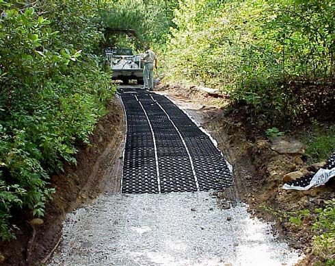
TABLES

TABLE 1. DIFFERENT FORMS OF TRAIL RESOURCE IMPACT AND THEIR ECOLOGICAL AND SOCIAL EFFECTS.
    .............................................................................................................................................................. 8
TABLE 2. EXAMPLES OF HIGH AND LOW TRAIL STANDARDS. ADDITIONAL EXAMPLES ARE AVAILABLE IN
    HESSELBARTH AND VACHOWSKI (2000)............................................................................................ 16
TABLE 3. COSTS FOR LOCATION AND CONSTRUCTION OF A TYPICAL MINIMUM STANDARD FOREST ROAD
    IN THE APPALACHIAN MOUNTAINS. COST ARE BASED ON 2001 DOLLARS. ...................................... 19
TABLE 4. SOIL TEXTURE PERCENTAGES FOUND ON HNF HORSE TRAILS.................................................... 33
TABLE 5. TOPOGRAPHIC POSITIONS FOR HNF TRAILS. .............................................................................. 33
TABLE 6. SLOPE ALIGNMENT VALUES HNF HORSE TRAILS. HIGHER ALIGNMENT VALUES ARE MORE
    PARALLEL WITH THE NATURAL CONTOUR WHILE VALUES NEAR ZERO ARE PERPENDICULAR TO THE
    CONTOUR. ........................................................................................................................................... 34
TABLE 7. TRAIL GRADE CATEGORIES FOR HNF HORSE TRAILS. ................................................................ 34
TABLE 8. CROSS SECTIONAL AREA (SOIL EROSION) CATEGORIES FOR HNF HORSE TRAILS. ...................... 35
TABLE 9. MUDDY SOIL AND STANDING WATER PERCENTAGES FOR HNF HORSE TRAILS........................... 35
TABLE 10. TRAIL WIDTH CATEGORIES FOR HNF HORSE TRAILS................................................................ 35
TABLE 11. DISTANCE TO NEAREST UPHILL TREAD DRAINAGE FEATURE FOR HNF HORSE TRAILS............ 36
TABLE 12. USE LEVEL AND SURFACE CONDITION EFFECTS ON MEAN VALUES FOR CROSS SECTIONAL
    AREA, ESTIMATED SOIL LOSS, MUDDINESS, TRAIL WIDTH, AND TRAIL INCISION FOR HNF HORSE
    TRAILS. ............................................................................................................................................... 37
TABLE 13. EFFECT OF TRAIL GRADE CLASS AND GRAVEL DEPTH ON CSA AND USLE. ............................ 39
TABLE 14. COMPARISON OF TRAIL SLOPE CATEGORY AND MEAN DISTANCE TO DRAINAGE FEATURE WITH
    RECOMMENDED DRAINAGE FEATURE INTERVALS. ............................................................................. 43
TABLE 15. CORRELATIONS BETWEEN CROSS SECTIONAL AREA LOSS OF SOIL (CSA) AND VARIOUS
    PREDICTIVE INDICATORS. ................................................................................................................... 44
TABLE 16. RESULTS FROM REGRESSION ANALYSES (BACKWARDS ELIMINATION) STARTING WITH THE
    FACTORS FROM TABLE 15. ................................................................................................................. 44
TABLE 17. MEAN CROSS SECTIONAL AREA SOIL LOSS ON TRAILS WITH AND WITHOUT GRAVEL BY TREAD
    DRAINAGE FEATURE DISTANCE AND TRAIL SLOPE ALIGNMENT ANGLE. ............................................ 45
TABLE 18. MEAN VALUES FOR POINT SAMPLING IMPACT INDICATOR DATA BY TRAIL.............................. 46
TABLE 19. TRAIL PROBLEM ASSESSMENT IMPACT INDICATOR DATA BY TRAIL. ........................................ 47
TABLE 20. SUMMARY OF PRINCIPAL RESEARCH FINDINGS AND LOCATION WHERE FINDING IS PRESENTED.
    ............................................................................................................................................................ 51
TABLE 21. SUMMARY OF RECOMMENDATIONS FOR GRAVEL USE ON HNF HORSE TRAILS........................ 56
TABLE 22. GUIDANCE FOR THE FREQUENCY OF WATER CROSS DRAINS AT VARIOUS TRAIL GRADES........ 57

                                                                        -3-
FIGURES
FIGURE 1. TRAILHEAD SIGN ON THE HOOSIER NATIONAL FOREST.............................................................. 5
FIGURE 2. HORSE TRAIL DEVELOPED ALONG A FORMER SKID TRAIL ON THE HOOSIER NF....................... 11
FIGURE 3. TRAIL EROSION POTENTIAL AND PROBABLE PROFILE FOR TRAILS WITH DIFFERENT SLOPE
ALIGNMENT ANGLES (LANDFORM SLOPE IS DOTTED LINE, TRAIL IS SOLID LINE)............................... 13
FIGURE 4. VIEW OF ONE ROAD EVALUATED BY SWIFT (1984) AFTER THE ROAD HAS BEEN STABILIZED
WITH GRAVEL AND VEGETATION........................................................................................................ 17
FIGURE 5. FROM TOP TO BOTTOM: TYPICAL EXAMPLES OF TRAIL CLEARING, ESTABLISHMENT OF ROAD
SURFACE, STABILIZING THE SURFACE, INSTALLATION OF WATER CONTROL/STREAM CROSSING
STRUCTURES, AND SURFACING........................................................................................................... 18
FIGURE 6. EFFECT OF TRAIL SLOPE PERCENT ON ESTIMATED EROSION IF RAINFALL AND RUNOFF FACTOR
(R = 175), SOIL EROSIVITY (K = 0.3), SLOPE LENGTH (L=100) AND COVER AND SUPPORT PRACTICES
(CP = 0.04864) ARE HELD CONSTANT FOR THE USLE (DISSMEYER & FOSTER 1984). NOTE THAT
THE EFFECT OF SLOPE BECOMES MORE PRONOUNCES AFTER 10-12 % SLOPE. (DASHED LINES ARE
FOR VISUAL EMPHASIS) ...................................................................................................................... 19
FIGURE 7. APPLYING GEOSYNTHETICS TO A HORSE TRAIL IN THE DANIEL BOONE NF. ............................ 24
FIGURE 8. TYPICAL TOPOGRAPHY AND CENTRAL HARDWOODS OF THE HOOSIER NATIONAL FOREST. .... 29
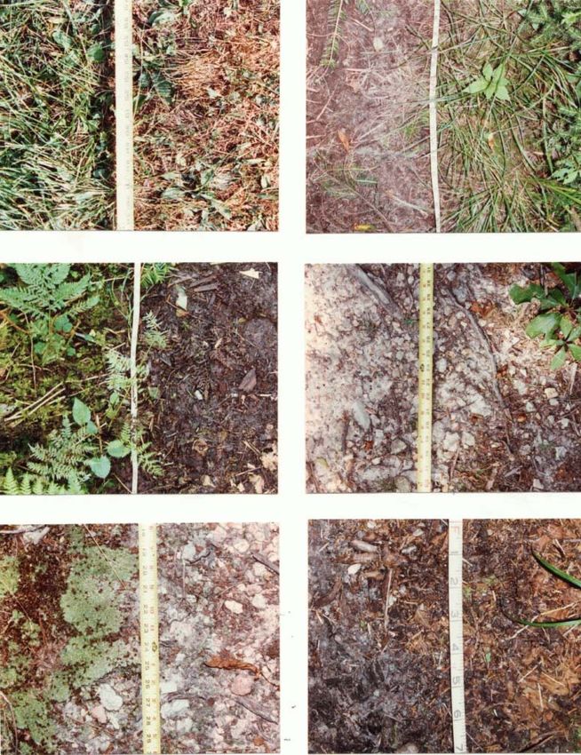
FIGURE 9. ILLUSTRATION OF THE VARIABLE INTERVAL CROSS SECTIONAL AREA METHOD FOR ASSESSING
SOIL EROSION ON TRAILS. TABLE OF VALUES SHOWS HOW DATA AREA RECORDED AND USED IN THE
COMPUTATIONAL FORMULA: AREA = (TRANSECT 1 + TRANSECT 2) X INTERVAL X .5 FOR EACH ROW
AND SUMMED FOR THE TOTAL AREA OF SOIL LOSS. ........................................................................... 30
FIGURE 10. EFFECT OF AMOUNT OF HORSE USE AND PRESENCE/ABSENCE OF GRAVEL ON USLE............. 37
FIGURE 11. EFFECT OF AMOUNT OF HORSE USE AND PRESENCE/ABSENCE OF GRAVEL ON CSA. .............. 38
FIGURE 12. EFFECT OF AMOUNT OF HORSE USE AND PRESENCE/ABSENCE OF GRAVEL ON MAXIMUM
INCISION. ............................................................................................................................................ 38
FIGURE 13. EFFECT OF AMOUNT OF HORSE USE AND PRESENCE/ABSENCE OF GRAVEL ON TRAIL WIDTH. 38
FIGURE 14. EFFECT OF TRAIL GRADE AND GRAVEL DEPTH ON USLE, CSA, AND MAXIMUM INCISION. ... 40
FIGURE 15. EFFECT OF TRAIL GRADE AND TRAIL ALIGNMENT ANGLE ON CSA......................................... 41
FIGURE 16. EFFECT OF USE LEVEL AND GRAVEL DEPTH ON CSA AND MAXIMUM INCISION. .................... 42
FIGURE 17. ELEMENTS OF A TRAIL PLAN. .................................................................................................. 52
FIGURE 18. COMMON TOOLS FOR OFFICE RECONNAISSANCE OF FOREST TRAILS INCLUDE TOPOGRAPHIC
MAPS, SOIL SURVEYS, AERIAL PHOTOGRAPHS, DIVIDERS, SCALE, AND CALCULATOR. ...................... 55
FIGURE 19. THE THICK DASHED LINE PROVIDES AN EXAMPLE OF A RELOCATED SECTION OF TRAIL THAT
REPLACED THE STEEPER VALLEY BOTTOM TRAIL ALIGNMENT. ......................................................... 55
-4-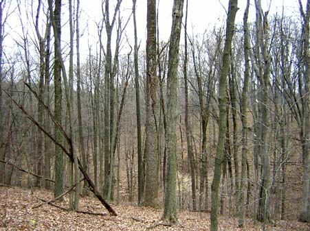
INTRODUCTION
The Hoosier National Forest (HNF) is managed for multiple uses, including forest products,
recreation, wildlife, and water resources. Watershed protection is a very important aspect of the
forest; indeed HNF provides watershed protection for 20+ municipalities and water companies
including Bloomington. Recreation is another predominant use and the HNF has approximately
258 miles of trail, 219 of which are open to some combination of use by hikers, mountain bikers
and horse riders (motorized ORVs and ATVs are prohibited) (Figure 1)(Forest Service 2002).
Horse riders and mountain bikers are required to purchase annual permits and must stay on
designated trails. Visitation estimates from permit data for the last three years indicate that
annual trail use was approximately 18,000 for horse riders and 5,000 for bikers. In particular,
horseback riding is an increasingly popular activity and the HNF attracts numerous riders from
commercial horse camps located on adjacent lands (Wadzinski 2000). Although these trails are
widely used and appreciated by horseback riders, they also have the potential to cause a variety
of negative impacts. Presently, the HNF has limited information on trail system conditions or
programs in place to monitor impacts associated with its varied and growing visitation.

Research has documented greater
potential for trail degradation from
horse use in comparison to other
trail uses. For example, horse
traffic can eliminate vegetation
cover more quickly than foot or
bike traffic and their greater
ground pressures compact soils to
greater densities and depths (Nagy
& Scotter 1974, Liddle 1997,
Widner & Marion 1993). The
resulting hoof prints and rutting
retain     water      and     promote
muddiness and erosion following
rains. Horse trails are also often
two to three times the width of
hiker trails, resulting in greater soil   Figure 1. Trailhead sign on the Hoosier National
exposure and erosion potential            Forest.
(Weaver & Dale 1978).

Trail impacts include a wide variety of problems. Even low levels of trampling disturbance
reduce ground vegetation height, cover, and biomass, and may alter species composition by
eliminating fragile species (Cole 1991, Cole 1995a, Sun & Liddle 1993a). Higher levels of
trampling cause more complete ground vegetation loss and compositional change (Cole 1995b,
Marion & Cole 1996). Concentrated traffic also pulverizes soil leaf litter and humus layers,
which are either lost through erosional processes or intermixed with underlying mineral soils.
These soils then become exposed and vulnerable to wind or water erosion and compaction (Cole
1982, Cole 1991, Marion & Merriam 1985, Marion & Leung 2001, Monti & Mackintosh 1979).
The compaction of soils decreases soil pore space and water infiltration, which in turn increases
water runoff and soil erosion.

                                             -5-
Trampling and vehicle traffic can also fragment and directly degrade wildlife habitats, and the
presence of trail users may disrupt essential wildlife activities such as feeding, sleeping, or
reproduction and the raising of young (Knight & Cole 1995). Although certain degrees of trail
impacts are unavoidable, excessive trail impacts threaten natural resource values, visitor safety,
and the quality of recreational experiences.

In addition to the trampling effects previously described, trail impacts include excessive tread
widening, muddiness, erosion, proliferation of visitor-created paths, and the results of various
depreciative behaviors such as littering and cutting of trail switchbacks (Cole 1983, Leung &
Marion 1996, Marion et al. 1993).

The HNF’s trail system incorporates many former roads and trails that were improperly located
or constructed or that were not maintained. Road and trail impacts are further aggravated by: 1)
highly erodible soils, 2) improper construction and maintenance, 3) inappropriate stream
crossings, 4) high use by horseback riders, and 5) improper location (e.g., steep grades or
floodplain settings).

Without proper trail management efforts these problems can alter natural patterns of water
runoff, resulting in irreversible soil loss and subsequent turbidity and deposition in streams and
other water bodies (Leung & Marion 2000). Again, while some impacts are inevitable, excessive
trail impacts should be avoided. The forest plan has six major goals that are all intimately linked
to the trail management effort: protection and management of ecosystems, protection of cultural
heritage, providing a visually pleasing landscape, providing recreational uses in harmony with
natural communities, providing a useable land base, and providing for human and community
development.

                                     OBJECTIVES
The following sections outline the four major objectives of this research project.

Objective 1: Develop, pilot test, and refine trail assessment procedures designed to inform
development of a horse trail degradation model.

Elements of two trail survey methodologies were integrated in developing survey procedures
(Leung et al. 1997, Marion & Leung 2001). A point measurement method with a systematic
sampling scheme at 500 ft intervals provides the most objective and reliable data for assessing
trail conditions. This method also provides an objective, accurate, and efficient approach to
monitoring changes over time should the HNF choose to reapply these procedures (Farrell &
Marion 2002, Leung & Marion 1999a). At each sample point survey staff measured selected
indicators such as trail width, maximum incision, and tread composition (e.g., vegetation cover,
exposed soil, wet soil, rock). Elements of a problem assessment method were integrated into the
survey procedures to provide census information on two specific trail impact problems:
excessive erosion and excessive muddiness (Leung & Marion 1999b). This approach provided
data on the frequency, lineal extent of occurrence, and location of these specific pre-defined
problems. A trail measuring wheel was pushed along each trail to record total distance, distance
to each sampling point and beginning/ending distances of each trail problem.

                                            -6-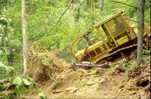
Meetings and close cooperation with forest administrative, resource management, and
maintenance staff ensured that forest management needs were met during the development of
these procedures (included in Appendix 1). Preliminary procedures were field tested and
refined, with appropriate review and approval by forest staff prior to application.

Objective 2: Apply trail condition assessment procedures to a sample of HNF horse trails.

Survey procedures were applied to a sample of horse trails identified in consultation with HNF
managers. A sample of approximately 36 miles was found to be sufficient. Only trails that are
predominantly used by horses were sampled and selection criteria included amount of use (low,
moderate, and heavy) and application of gravel (yes, no). The sample was not intended to be
representative and extrapolation of findings to the entire Forest’s trail system is inappropriate.

Objective 3: Evaluate data to understand the process of horse trail degradation and the role of
contributing factors. Develop a horse trail degradation model.

The purpose of the sampling and subsequent analyses was to identify and understand the role and
function of various causal and non-causal yet influential factors contributing to horse trail
degradation. Influential factors were investigated through statistical analyses. Causative factors
included type and amount of trail use. Non-causative factors included topographic alignment,
trail grade, gravel use, and proximity of tread drainage features. Regression analyses were
applied to model horse trail degradation and understand the relative influence of alternative
factors. These results are presented on pages 43-45.

Objective 4: Based on the field research at HNF, literature reviews, and consultations with HNF
managers and horse trail managers in other places, develop Best Management Practice guidance
for improving the sustainability of horse trails.

Literature reviews and analyses of data were conducted to address the development of Best
Management Practice guidance. Recommendations are presented in the Summary and
Management Recommendations section and Appendix 3.

                            LITERATURE REVIEW
Potential Impacts of Trails
Trails are generally regarded as an essential facility in recreation areas, providing access to non-
roaded areas, offering recreational opportunities, and protecting resources by concentrating
visitor use impacts on resistant tread surfaces. Much ecological change assessed on trails is
associated with their construction and is considered unavoidable (Birchard & Proudman 2000).
The principal challenge for trail providers is therefore to prevent post-construction degradation
from both recreational use and natural processes such as rainfall and water runoff.

Unsurfaced trail treads are susceptible to a variety of trail impacts. Common impacts include
vegetation loss and compositional changes, soil compaction, erosion, and muddiness, exposure

                                            -7-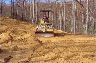
of plant roots, trail widening, and the proliferation of visitor-created side trails (Table 1)
(Hammitt & Cole 1998, Leung & Marion 1996, Tyser & Worley 1992). Soil erosion exposes
rocks and plant roots, creating a rutted and uneven tread surface. Erosion can also be self-
perpetuating when treads erode below the surrounding soil level, preventing the diversion of
water from the tread. Eroded soils may find their way into water bodies, increasing water
turbidity and sedimentation impacts to aquatic organisms (Fritz 1993). Similarly, excessive
muddiness renders trails less usable and aggravates tread widening and associated vegetation loss
as visitors seek to circumvent mud-holes and wet soils (Marion 1994). Trail widening and the
creation of parallel treads and side-trails unnecessarily increase the area of land disturbed by
trails (Liddle & Greig-Smith 1975).

Table 1. Different forms of trail resource impact and their ecological and social effects.

 Form of Impact               Ecological Effects                            Social Effects
 Soil Erosion     Soil and nutrient loss, water turbidity and   Increased travel difficulty, degraded
                     sedimentation, alteration of water            aesthetics, safety
                     runoff, most permanent impact
 Exposed Roots    Root damage, reduced tree health,             Degraded aesthetics, safety
                     intolerance to drought
 Secondary Treads Vegetation loss, exposed soil                 Degraded aesthetics
 Wet Soil         Prone to soil puddling, increased water       Increased travel difficulty, degraded
                     runoff                                        aesthetics
 Running Water    Accelerated erosion rates                     Increased travel difficulty
 Widening         Vegetation loss, soil exposure                Degraded aesthetics
 Visitor-Created  Vegetation loss, wildlife habitat             Evidence of human, disturbance,
 Trails              fragmentation                                 degraded aesthetics

Trails, and the presence of visitors, can also impact wildlife, fragment wildlife habitat and cause
avoidance behavior in some animals and attraction behavior in others seeking to obtain human
food (Hellmund 1998, Knight & Cole 1991). While most impacts are limited to a linear
disturbance corridor, some impacts, such as alterations in surface water flow, introduction of
invasive plants, and disturbance of wildlife, can extend considerably further into natural
landscapes (Kasworm & Monley 1990, Tyser & Worley 1992). Even localized disturbance can
harm rare or endangered species or damage sensitive resources, particularly in environments
with slow recovery rates.

Impacts such as severe soil erosion and exposed roots are visually offensive and can degrade the
aesthetics and functional value of recreational settings. Recent studies have found that resource
impacts are noticed by visitors and that they can degrade the quality of recreation experiences
(Roggenbuck et al. 1993, Vaske et al. 1993). Impacts such as deep ruts and excessive muddiness
increase the difficulty of travel and threaten visitor safety. From a managerial perspective,
excessive trail-related impacts to vegetation, soil, wildlife or water quality can represent an
unacceptable departure from natural conditions and processes. Impacts also result in substantial
costs for the maintenance and rehabilitation of trails and operation of visitor management
programs.

                                             -8-
Potential Impacts of Horse Trails
Impacts from horse use can be ecological: impacts to the resource, or social: impacts to the
experiences of other visitors. Both types of impact serve to bring horse use concerns to the
attention of managers. For example, many studies have revealed conflicts between hikers and
horseback riders. Watson et al. (1993) found that 36% of wilderness hikers did not like
encounters with horses on trails but only 4% of horse riders disapproved of meeting hikers. In
another wilderness study, 75% of managers reported they received complaints about horses,
including excessive trail impacts, manure on trails, and damage to meadows and riparian areas
(Shew et al. 1986). There is not space for a complete review of the social impacts of horse use
here; additional pertinent references include Hammitt and Cole (1998), Jacob and Schreyer
(1980), McClaran (1989), and Newsome et al. (2002).
The severity of resource impacts depends on the characteristics and behavior of the user,
environmental attributes, and how visitors and trails are managed. In order to understand horse
impacts and to arrive at viable solutions regarding their management, it is important to examine
and understand the impacts and factors that influence them.
The major ecological impacts to trails from horse use are vegetation loss, trail widening, erosion,
muddiness, and informal trail development. Erosion is considered to be the most severe form of
impact because its effects are long lasting, if not permanent (Hammitt & Cole 1998). Trampling
and erosional impacts caused by horses have been found to be significantly higher than hikers,
llamas, mountain bikes and even off-road motorcycles (Cole & Spildie 1998, DeLuca et al. 1998,
Wilson & Seney 1994). Many studies demonstrate that trampling by a horse is more destructive
to vegetation than trampling by foot (Nagy & Scotter 1974, Weaver & Dale 1978, Whittaker &
Bratton 1978). Whittaker and Bratton (1978) found vegetation on horse trails to be churned up
and often cut off at the roots, instead of flattened, as on hiking trails. An experimental trampling
study by Nagy and Scotter (1974) found vegetation loss to be four to eight times greater from
horse trampling than hiker trampling. The greater vegetation loss from horse use tends to widen
horse trails, which are often two to three times the width of hiker trails (Weaver & Dale 1978).
The greater width of exposed soil and inherent characteristics of horses also contribute to the
greater erosion potential of horse trails.
Erosion occurs after vegetation is lost; vegetation loss exposes soil that can then be eroded by
disturbances such as hooves, wind and water. Horse use can be a significant precursor for
increased erosion potential (Hammitt & Cole 1998). Soil erosion resulting from horse use is a
product of the trampling and eventual loss of vegetative cover, subsurface soil compaction
leading to lowered water infiltration rates, and the increased roughness and detachment of
surface soil particles. A horse carries a heavy weight on a small, usually shod, hoof. This
weight exerts approximately 18 lbs/in2 ground pressure for unshod horses to 62 lbs/in2 for shod
horses, compared to 2.9 lbs/in2 for a hiker in boots (Liddle 1997). Thus, horse traffic causes
significant compaction to the underlying soil layers, reducing water infiltration and increasing
surface runoff. In addition, the action of a horse hoof tends to puncture and dig up the soil
surface (McQuaid-Cook 1978). Loose, unconsolidated soil is more prone to erosion than
compacted soil and as a result, the potential for erosion increases on horse trails as compared to
hiker trails. An evaluation by Deluca et al. (1998) of the mechanisms by which trail traffic leads
to accelerated erosion suggested that soil loosening and detachment of soil particles by horses
-9-contributed to the higher erosional rates. Soil compaction and decreased infiltration were not
considered as important, a finding supported by the work of Wilson and Seney (1994).
Heavy horse traffic in areas with wet soils can result in the formation of muddy quagmires and
excessive trail widening. Whittaker and Bratton (1978) found loosening of the soil to be a
precursor to muddy trail sections. Loose soil is more apt to form mud than compacted soil and
the highly compacted subsurface soils prohibit water infiltration. The resulting impermeable
basins retain water and mud long after rainfall. Marion (1994) noted that deep hoof prints collect
and retain water, providing greater surface contact between water and soil and accelerating the
formation of mud. Trail muddiness can be a temporary or seasonal problem, making travel
difficult and often resulting in significant trail widening when trail users seek to circumvent
muddy sections.
Other trail problems attributed to horse use include the proliferation of informal trails, manure on
trails, tree damage, and the introduction and spread of exotic vegetation. Trail braiding is
especially troublesome in meadows, where stock users tend to spread out rather than ride in
single file (Hammitt & Cole 1998). The creation of side trails to access water, features of
interest, or short cuts to other trails are also considered a significant form of trail impact. User-
created trails are often poorly routed and not maintained, resulting in an increased potential for
degradation. Manure on trails is both an ecological and social problem. Manure can contain the
seeds of exotic plants, although seeds may also be introduced from horse feed, equipment, and
mud stuck to horse hooves. Large numbers of weed seeds can pass through the gut of horses and
germinate in their manure (St John-Sweeting & Morris 1991). However, Whinam et al. (1994)
found that weed seeds were limited to the manure, and Whinam and Comfort (1996) revealed no
indication of introduced weeds from monitoring. Large amounts of manure may also pose a
threat to water quality (Hammitt & Cole 1998).
Finally, horses tied to trees can result in damage to bark and roots. Ropes or chewing can
damage tree bark and may completely girdle and kill trees (Cole 1983). Bark damage weakens
trees and opens their inner wood to invasion by insects and diseases. Pawing and digging by
confined horses erodes soils and exposes tree roots. In the Bob Marshall Wilderness of
Montana, campsites used by horse groups had eleven times as many damaged trees and twenty-
five times more trees with exposed roots than backpacker sites (Cole 1983).
It is important to note that while horse use is often a more impacting type of use, other factors
may be more influential determinants of resource degradation. For example, McQuaid-Cook
(1978) found trail impact to be more a function of slope and trail location than a result of user
type. Nagy and Scotter (1974) concluded that although horse use generally causes more damage
than hikers, the degree of difference depends on the soil, vegetation, topographic and climate
characteristics. Summer (1980) identified the most influential landscape factors governing trail
deterioration as parent material, grade of trail and side-slope, soil texture and organic content,
rockiness, vegetation, and drainage. Measurements of physical changes along trails receiving a
constant amount of horse use resulted in a wide spectrum of erosional impacts as influenced by
one or more of the landscape factors listed above. Summer (1980, 1986) concluded that horse
traffic was not the most important agent contributing to trail degradation.
Deluca et al. (1998) experimentally compared the effects of hikers, llamas, and horses on
established recreational trails in western Montana. They concluded that horses consistently
- 10 -created more trail sediment than the other two user groups regardless of trail weather conditions
or traffic levels. Similarly, Wilson and Seney (1994) found horse trails to produce more
sediment than bikes or hikers. These types of studies, and trail inspections have caused
management personnel on the HNF to desire additional information regarding the best
management of horse trails. Van Lear et al. (1998) evaluated forest management, pasture,
urban, row crop, and recreational activities as sediment sources within the Chattooga River
watershed. They concluded that over 80% of the sediment supply was due to unpaved roads that
were primarily used for recreational activities. Thus, there appears to be ample research
evidence that recreational roads and trails used for horseback riding have the potential to cause
environmental problems. The overall goals of this project are to document the impacts
associated with different standards of horse trails and to develop best management plan
recommendations in order to minimize the impacts of horse trails while still providing the
recreational opportunities.
Potential Impacts of Roads
Many of the horse trails of the HNF are not traditional primitive hiking trails. Many are located
on old woods roads and/or skid trails and are considerably wider than typical hiking trails
(Figure 2). The wider width results from the original use of the trail, the habit of riding horses
abreast, and the construction and maintenance requirements of the trail. Realistically, these
horse trails are more similar to low to medium standard forest roads and skid trails. Therefore,
we have included considerable forest road literature within this review.
Elliott et al. (1999) reviewed actual and
predicted erosion rates on roads for
numerous U.S. Forest Service paired
watershed studies across the United States.
They found that erosion rates ranged from
as low as 5.0 tons/acre/year for graveled
roads to as great as 68 tons/acre/year for
unsurfaced roads.
Forman (2000) and Forman and Alexander
(1998) concluded that roads have both
positive and negative impacts. Positive
ecological impacts include minimization of
disturbance due to creation of more
convoluted routes that disturb additional
Figure 2. Horse trail developed along a former
areas and minimization of random searches
skid trail on the Hoosier NF.
for routes through less disturbed areas.
Foreman (2000) also found that road
corridors could provide some green space in more highly developed landscapes. Overall,
Foreman and Alexander (1998) concluded that roads have the potential for a variety of negative
ecological impacts relating to native plants and animals, site productivity, and water quality and
estimated that approximately 15-20% of the area in the U.S. is negatively influenced by road-
effects.
- 11 -Gucinski et al. (2001) published an extensive review of the potential effects of forest roads that
categorized the potential negative effects of forest roads into the broad categories of direct
physical and ecological effects and indirect landscape level effects. Direct physical and
ecological effects of forest roads include geomorphic alteration of sediment supply and
landslides, hydrologic alterations, decreased site productivity, habitat fragmentation, and
introduction of exotic species. Indirect landscape level effects included alteration of aquatic
habitat, alteration of terrestrial habitat, road kills, introduction of pathogens, changes in
predation, altered biodiversity, and decreased water and air quality.
Factors Affecting Trail Resource Impacts
The type and extent of trail impacts are influenced by use-related and environmental factors,
both of which may be modified through management actions. Use-related factors include type of
use, amount of use, and user behavior; environmental factors include attributes such as
vegetation and soil type, topography and climate. Recent comprehensive reviews of the role of
these factors are provided by Leung and Marion (1996), Hammitt and Cole (1998), and Marion
(1998).
Use-Related Factors
For well-designed and constructed trails, post-construction trail impacts would be minimal in the
absence of use. Rainfall might erode some soil following construction but in most environments
organic litter and vegetative colonization would increasingly minimize such impacts on unused
trails. Numerous studies have documented a curvilinear relationship between amount of use and
most forms of trail impact (Cole 1983, Sun & Liddle 1993a,b, Weaver et al. 1979). Initial or low
levels of use generate the majority of use-related impact, with per-capita impacts diminishing as
use increases. For example, vegetation and organic litter are either removed during trail
construction or are quickly lost from trails receiving even light traffic. Further traffic causes
relatively little additional impact, particularly on trails with adequate maintenance to control
water runoff and tread widening. An important implication is that substantial use reductions
must occur on highly visited trails to achieve any significant reduction in impact.
Some specific impacts, such as trail widening and creation of parallel treads (trail braiding) or
side trails, are strongly influenced by user behavior (Hammitt & Cole 1998). Visitors seeking to
avoid severe rutting or rockiness caused by soil erosion or muddiness often cause trail widening.
Visitors traveling side-by-side rather than single file also contribute to this problem. Type of use
has also been shown to be a significant determinant of the type and extent of trail impacts. For
example, Wilson and Seney (1994) evaluated tread erosion from horses, hikers, mountain bikes,
and motorcycles and found that horses made significantly more sediment available for erosion
than the others uses, which did not significantly vary from the control. Thurstan and Reader
(2001) found no significant differences between the vegetation and soil impacts from hiking and
mountain biking, though they speculated that behavioral differences between the two groups
could contribute to the belief that mountain biking has led to trail degradation problems.
Environmental Factors
Many trail impact problems are the result of poor location rather than higher impacting types or
amounts of use (Cole, 1987; Leung and Marion, 1996, 2000). Many trails have sections ranging
- 12 -from good to poor condition, yet each trail likely receives the same types and amounts of use.
Thus, problems like muddy soils or eroded treads are primarily a function of trail routings
through wet soils or up steep slopes. Applying tread reconstruction and maintenance solutions to
such problems can be expensive, effective for only a short time, and give the trail a more
“developed” appearance that can alter the nature of recreational experiences. Short trail reroutes
or larger relocations are a more effective long-term solution for sustaining traffic while
minimizing resource impacts and maintenance. The following topics highlight some important
trail location and design considerations to promote sustainable trail development. These include
vegetation type, topography, and soil and surface characteristics.
Vegetation Type
In general, dense understory vegetation that is resistant to trampling will inhibit trail widening,
though these attributes are less important in reducing soil loss. Dense trailside vegetation
confines the lateral spread of trail users while segments crossing open meadows often widen or
split to form multiple treads. At low use levels, vegetation types with high trampling resistance
and/or resilience (ability to recover) can sustain use with little degradation. The influence of
these attributes diminishes with increasing use and is relatively unimportant at high use levels
(Cole 1988).
Topography
Characteristics of topography have been the most intensively investigated influences on trail
degradation. Numerous studies have documented strong positive relationship between trail
slopes and soil loss (Weaver and Dale 1978; Bratton et al. 1979, Teschner et al. 1979). The
greater velocity and erosivity of surface runoff on steep slopes is the predominant cause but other
influences, such as the slippage of feet and hooves, are also likely contributors.
The orientation of the trail to the prevailing
slope, termed the trail angle by Bratton et al. Slope Alignment
Angle
Degradation Potential Trail Profile
(1979), and slope alignment angle by Very High – erosion from
Marion and Leung (2001), is an important 0-22o
water draining along
factor often overlooked by trail designers tread and muddiness from
water trapped on treads
and researchers. Trails that more directly
ascend the fall line of a slope, irrespective of High – draining water
23-45o will be difficult in most
its steepness, have a low slope alignment places
angle. Side-slopes, the terrain adjacent to
either side of the trail, are relatively flat with Low – easy to drain water
low slope alignment angles, relative to the 46-67o while still changing
elevation
plane of the trail tread (Figure 3). Trails
with a low slope alignment angle are Very Low - easy to drain
susceptible to degradation because their 68-90o water but trail can’t
flatter side-slopes offer little resistance to change elevation very fast
trail widening, and hinder or block the Figure 3. Trail erosion potential and probable
drainage of water from incised trail treads. profile for trails with different slope alignment
The slope alignment angle is important angles (landform slope is dotted line, trail is
regardless of topographic position (valley solid line).
bottom, mid-slope, ridge- or mountaintop),
- 13 -though the greater rainfall at higher elevations can increase erosion rates. The importance of
slope alignment angle increases in significance as trail slope increases. Water trapped within
low slope alignment trails with lower grades creates muddiness and are highly susceptible to
widening. This can occur in both valley bottom and ridge-top settings.
Trails that more closely follow the contour have a high slope alignment angle: they are more
perpendicular to the slope (Figure 3). Known as “side-hill” trails, their steeper side-slopes
confine use to the constructed tread and facilitate tread drainage. Though side-hill trails often
develop a berm of soil along their lower edge, these can be cut through during water bar or
drainage dip construction to allow water to drain off trail treads (Birchard & Proudman 2000,
Hesselbarth & Vachowski 2000). The easy removal of water from side-hill trails and the ease of
angling them to avoid steep trail grades make high slope alignment angle trails far more
sustainable and less expensive to maintain over time.
Proximity to groundwater discharge areas or streams can also increase the susceptibility of trails
due to excessive wetness and periodic flooding of trail treads (Root & Knapik 1972). Such
problems are most prevalent in valley bottom settings adjacent to streams and rivers. Unless
adequate drainage and hardening features are provided in these areas, trails with eroded and
muddy tread surfaces are unavoidable. In summary, degradation can be minimized by mid-slope
topographic positions with low trail grades, and higher slope alignment angles with moderate
side-slopes.
Soil and Surface Characteristics
Soil properties, including soil wetness, texture, structure and depth, influence the ability of soil to
withstand a given type and amount of traffic (Demrow & Salisbury 1998, Scottish Natural
Heritage 2000). Trails that traverse poorly drained soils are susceptible to excessive trail
widening as users seek to avoid muddy areas. Wet muddy soils are also more susceptible to
erosion, especially when trail grades are steeper. Highly organic soils retain water long after
rains and with traffic become mucky (Bryan 1977). Wet soils often present seasonal limitations,
as during times of the year when rainfall or snowmelt are particularly high. However, these
problems are exacerbated if trails are located near streams and groundwater discharge areas. If
soils that are seasonally wet and poorly drained cannot be avoided, be prepared to employ trail
construction techniques such as boardwalks, turnpikes, causeways, puncheon or geosynthetics to
sustain traffic and avoid muddiness (Hesselbarth & Vachowski 2000).
Trails on soils with fine and homogeneous textures are more erodible and often have greater
tread incision (Bryan 1977, Welch & Churchill 1986). Loam and sandy-loam soils, because of
their even mixture of silt, clay and sand, provide the fewest limitations for trails (Demrow &
Salisbury 1998, Hammitt & Cole 1998). Removal of organic litter and soils during trail
construction to expose underlying mineral soil creates a more durable tread less prone to
muddiness. Rock and gravel in the mineral soil further strengthens them to support heavy traffic
while resisting erosion and muddiness. Where possible, avoid soils high in silt and clay, which
become muddy when wet, or cracked and dusty when dry.
Soil depth to bedrock of greater than one meter is preferred – shallower soils may become
saturated and subject to muddiness. Extremely thin soils in alpine terrain are easily eroded so
contain traffic on clearly marked treads (Demrow & Salisbury 1998). Repeated traffic will alter
- 14 -soil structure, compressing the arrangement of soil aggregates and decreasing air and water
infiltration (Pritchett 1979). However, compacted treads provide a more stable and resistant
surface that sheds water to resist muddiness and minimizes the potential for soil erosion.
Surface characteristics generally refer to the roughness of trail treads, such as stoniness and the
presence of exposed tree roots. Trails on soils with a high rock or gravel content are less
susceptible to soil erosion (Bryan 1977, Weaver & Dale 1978). Rocks and gravels are less easily
eroded by water or wind, and these materials can act as filters, retaining and binding finer soil
particles. In general, small rocks and stones should not be removed from trail treads as their
presence tends to slow the velocity of water runoff and protect underlying soils (Summer 1980,
1986).
Trail Management
Few studies have directly examined the influence of managerial actions, though they have
considerable potential for modifying the roles of use-related and environmental factors (Leung &
Marion 1996). Knowledge of relationships between environmental factors and trail impacts can
be applied to route trails in the most resistant and sustainable locations. Muddiness can be
limited by avoiding wet organic soils and flatter terrain, erosion can be limited by avoiding steep
trail grades and low trail alignment angles, and parallel treads and tread widening can be limited
by locating trails in sloping terrain where steeper side-slopes direct visitors to stay on the
provided tread (Birchard & Proudman 2000). Through educational and regulatory actions,
managers can influence or control all use-related factors. For example, the impacts of horses or
vehicles may be limited by restricting their use to resistant trails, prohibiting their use on non-
graveled trails during wet seasons, or limiting their numbers. Trail construction and maintenance
actions, including installation and upkeep of tread drainage features, rock steps, and bridging, are
also vital to limiting soil erosion and tread muddiness, which in turn, influence user behavior and
the extent of impacts such as tread widening and secondary tread development (Birchard &
Proudman 2000). Unfortunately, trail management functions, because of their expense, are often
neglected and may be traded for use-related restrictions and regulations.
Grace (2002a) reviewed the forest road best management practices for the 13 southeastern states
and concluded that almost all of the states address the same basic issues of location-planning,
construction, stabilization, drainage, maintenance, and stream crossings. Swift (1985)
summarized almost 50 years of forest road related research from the USFS Forest Hydrology
Laboratory at Coweeta, NC and the Timber and Watershed Laboratory at Parsons, WV. Swift
(1985) concluded that application of existing technology would provide low cost, low
maintenance road designs that would provide lower levels of sediment to streams. The main
features needed were road planning and location, proper road template selection, adequate water
control, road stabilization, and surfacing. These basic features will be covered in additional
detail below.
Trail Construction
Trail Standards
Trail standards refer to the trail characteristics that act in concert to provide different qualities of
traffic, ease and timing of access, maintenance requirements, and costs (Walbridge 1997,
Walbridge et al. 1984). In general a higher standard trail will provide enhanced travel, lower
- 15 -maintenance, but will have a greater construction cost (Table 2). Issues that should be considered prior to selection of the final trail standards are: trail grade, maximum trail grade for short distances, trail surface width, trail template, drainage structures, surfacing, stream crossings to be used, seasonality, intended traffic volume and type, and intended maintenance regime. If vehicular traffic is intended, then turning radii should be considered for design of curves and switchback radii. Table 2. Examples of high and low trail standards. Additional examples are available in Hesselbarth and Vachowski (2000). Trail Parameters High Standard Trail Low Standard Trails Users Bike, horse, hiker Hikers only Season of major use All year Summer, Fall Grade (%)
gradient, and cutslope height and cover were the five most important considerations for control
of sediment from forest roads. Four of the five issues are directly addressed by the process of
road location.

McCashion and Rice (1983) evaluated almost 350 miles of logging roads in northwestern
California. As they encountered erosion problems they characterized the cause of the problem
and estimated how the problem might have been avoided. They concluded that approximately
76% of the problems were due to problems with site characteristics and slope alignment, clearly
indicating the importance of road location.

It is tempting to use a poorly located trail as opposed to developing a new trail. New trails are
costly and time consuming and the older trails are sometimes difficult to close. However,
location costs are minimal compared to the construction costs. Aust and Shaffer (2001) found
that location costs represented less than 3% of the total road costs for almost a mile of forest
road.

New trail construction has the potential to cause significant erosion because the construction
phase exposes previously covered soil and breaks downs large soil aggregates into less stable
structures. New trail construction should always be conducted on flagged or otherwise marked
gradelines (Walbridge 1997). Simply showing the equipment operator or trail crew starting and
ending points is probably not sufficient for ensuring proper location and design. Unfortunately,
even experienced equipment operators will construct a better trail if a gradeline is well marked.

                                                  New trail construction typically follows the
                                                  following stages (Figure 4). The clearing and
                                                  grubbing phase removes vegetation, litter, and
                                                  roots. For some trails, subsequent traffic may
                                                  actually serve as the agent for root and litter
                                                  removal. After clearing and grubbing, the
                                                  cross section of the trail is constructed. Fill
                                                  slopes and cut slopes may require some
                                                  stabilization at this phase. Water control
                                                  structures are installed and surfacing is applied
                                                  and spread. The construction phase of trails is
                                                  a highly erodible time and generally requires
Figure 4. View of one road evaluated by Swift
                                                  the use of multiple erosion control measures to
(1984) after the road has been stabilized with
                                                  protect water quality (Grace 2002a, Jubenville
gravel and vegetation.
                                                  & O'Sullivan 1987).         This is a rapidly
improving technology, but seeding, mulching, hydroseeding, sediment fencing, stacked hay
bales, sediment traps and armoring all have applications.

Swift (1984) evaluated soil losses from two newly reconstructed forest roads located on the
Coweeta hydrology laboratory (Figure 5). The roads were 22 feet wide, insloped and had
approximately 1:1 cut and fill slopes. Swift monitored the watersheds for approximately two
years for sediment losses. During the first year following construction the roads lost between 61
and 79 tons/acre/year. After the roads had stabilized they were found to have erosion rates of 32-
39 tons/acre/year. Swift also evaluated the impact of season, grass establishment, and gravel
additions to the roads. He found that freezing and thawing during winter months caused erosion
                                           - 17 -
You can also read