Research in the Land Entry Files of the General Land Office - INFORMAT ION
←
→
Page content transcription
If your browser does not render page correctly, please read the page content below
Research in the Land Entry Files
       of the General Land Office

R E F E R E N C E   I N F O R M A T I O N   P A P E R   1 1 4
Above: Since 1785 Federal land surveyors used the township as the major subdivision of the public domain under the rectangular sys tem of surveys. Townships are approximately 6 miles on each side and contain 36 sections of 640 acres apiece, numbered in the sequence above. Sections are further subdivided into half, quarter, and lesser sections, called aliquot parts. A township is identified by its relation to a base line and principal meridian, e.g., township 7 south, range 26 west, Sixth Principal Meridian (6th PM). Front cover: “A ‘closeup’ of a homesteader’s house of the better type, showing one of the ‘sure crops.’” Record Group 49, Records of the Bureau of Land Management, General Land Office, Field Service Division, Santa Fe, New Mexico. Back cover: The engraving that appeared on patent documents for land entries under the Homestead Act of 1862.
Research in the Land Entry Files
     of the General Land Office
                      RECORD GROUP 49
            C O M P I L E D B Y K E N N E T H H AW K I N S

R E F E R E N C E    I N F O R M A T I O N          P A P E R   1 1 4

 National Archives and Records Administration, Washington, DC
                           Revised 2009
INTRODUCTION
The National Archives and Records Administration (NARA) is the offi
cial repository for records of the U.S. General Land Office, a predecessor of
the Bureau of Land Management, that document the transfer of public
lands from the United States to private ownership.1 The case files generat
ed by over 10 million such individual land transactions, known as land
entries, and the tract books and various name indexes used to access them
are located in the National Archives Building, Washington, DC.
NARA has custody of the land entry case files for the 30 Federal public land
states. There are case files for all states in the United States except the origi
nal 13 states, Vermont, Kentucky, Tennessee, Maine, West Virginia, Texas, and
Hawaii. These states were never part of the original public domain.2
INFORMATION FOUND IN LAND ENTRY CASE FILES
These files can contain a wealth of genealogical and legal information.
Depending upon the type and time period of land entry, the case file may
yield only a few facts already known to the researcher, or it may present new
insights about ancestors, family history, title, and land use issues. Case files
for land entries made before the 1840s may contain only schematic infor
mation such as the name of the entryman; the land’s location, acreage, and
price; and the date and place of the land entry. Or they may, in cases of mil
itary bounty land warrants and private land claims, establish a record of
U.S. military service or reveal that the claimant settled a location before it
was annexed by the United States. Case files for land entries made after
about 1840 under the Cash Act (1820), Preemption acts (1830s–1840s),
Donation Act (1850), Homestead Act (1862), Mineral acts (1860s–1870s),
Timber Culture Act (1873), Desert Land Act (1877), and several military
bounty land warrant acts (1840s–1850s) generally include more informa
tion. The records can attest to the entryman’s age, place of birth, citizen
ship, military service, literacy, and economic status, among other vital
1 Pleasenote: Federal land records document only the FIRST transfer of title to land from the United States
to another party. Records of later transfers may be found in county or state records. Contact the appropriate
county recorder of deeds, state archives, or historical society.
2 Some of the original colonies and eastern states also sold land and awarded military bounty land warrants on their
own. Researchers interested in such records should contact the appropriate state archives or historical society.
1information, and sometimes include similar information about family
members. They also provide evidence of first title and occasionally of land
use, rightsofways, survey lines, crops and improvements, archeological
imprints, and conflicting claims.
Such information is not guaranteed to be in every land entry case file.
Over 40 separate legislative acts were used by Americans to make a land
entry on the public lands, and each act required different information from
the entryman. Thus the documentation available in the land entry case file
depends largely upon the legal requirements of the act under which the
land entry was made. Used imaginatively, however, even the smallest case
files can establish locations of land ownership or settlement and dates
essential to exploit other resources at NARA, such as census, court, and mil
itary service and pension records.
This publication is intended to provide an overview of the land entry files
held at the National Archives Building and an introduction to research in
them. It cannot begin to detail the many additional records of the General
Land Office (GLO) that relate to land entries and land use available to
researchers at the National Archives Building and NARA’s regional records
services facilities. For more detailed information on land records, please see
Robert Kvasnicka’s The TransMississippi West, 1804–1912, Part IV, Section
3, Records of the General Land Office (Washington, DC: National Archives
Trust Fund, to be published in 2007).
ARRANGEMENT AND ACCESS 3
Land entry case files comprise the paperwork accumulated by a local U.S.
land office in administering a land entry application. Once the legal require
ments governing a land entry were met, whether by a cash payment, surren
der of a bounty land warrant, or proof of residency and improvements, offi
cials at the local land office forwarded the case file to the headquarters of the
GLO in Washington, DC, along with a final certificate that declared it eligi
ble for a patent. There the case file was examined, and if found valid, a patent
or deed of title for the land was sent back to the local land office for delivery
to the entryman. The GLO also recorded each land entry in tract books
3 Researchers may wish to consult the tabular searchpaths printed at the end of this pamphlet.
2arranged by state and legal description of the land in terms of numbered
section, township, and range. The case files were retained and kept in sepa
rate filing systems for military bounty land warrants, pre1908 general land
entry files, and post1908 general land entry files.
The United States issued bounty land warrants to attract enlistments dur
ing the Revolutionary War, the War of 1812, and the Mexican War and to
reward service in these conflicts and in a variety of Indian wars, Indian
removal, and other military actions during the 1850s. The GLO filed most of
the military bounty land warrant case files by the year of the congressional
act that authorized them, the number of acres granted, and the warrant
number. These three elements of information are required to identify and
retrieve these files. Name indices and other means to access these files are
discussed below in the section on military bounty land warrants.
Before July 1908, the GLO kept the case files for all general land entries
according to state, land office, type of entry (such as credit, cash, home
stead, timber, and mineral), and final certificate number (sometimes called
the file or document number). Large portions of the preJuly 1908 land
entry case files are not indexed by name. Selected name indices and other
methods to obtain the information required to identify and retrieve the
case files are discussed below.
After July 1908, the GLO filed all general land entries regardless of state
or type in one large series by serial patent number. Name indices that pro
vide the patent number of all postJuly 1908 land entries are available in the
National Archives Building through the mid 1950s when NARA holdings
taper off. For serial land patents after the mid 1950s, it may be necessary to
contact the relevant contemporary Bureau of Land Management (BLM)
district office for the state in question.
A name index to the preJuly 1908 general land entry case files, main
tained on file cards, is available for Alabama, Alaska, Arizona, Florida,
Louisiana, Nevada, and Utah. Called the “Seven States Index,” 4 it shows
the entryman’s name, state in which the land was located, land office where
the entry was made, type of entry, and final certificate or file number. It
thus supplies all four of the information elements needed to have a land
entry case file retrieved or “pulled” for examination. It also shows the legal
4 Seven States Index, RG 49, Master Location Register number (MLR #) UD168.
3description of the land in terms of numbered section, township, and range.
The Seven States Index includes both successful land entries that received
patents and unsuccessful land entries, also called canceled or relinquished
land entries, which did not receive patents. NARA has case files for both
patented and unpatented land entries before 1908.
The four information elements noted above are also required to retrieve
preJuly 1908 general land entry files for the remaining 23 public land
states. Some researchers may already have possession of this information
because they have a copy of the U.S. patent issued for the land. Those who
do not have this information must obtain it from the General Land Office
tract books or other sources. The present location of these tract books
depends on whether the GLO’s successor agency, the Bureau of Land
Management, categorized the public land states as “eastern” or “western”:
Eastern Western
Alabama Alaska
Arkansas Arizona
Florida California
Illinois Colorado
Indiana Idaho
Iowa Kansas
Louisiana Montana
Michigan Nebraska
Minnesota Nevada
Mississippi New Mexico
Missouri North Dakota
Ohio Oklahoma
Wisconsin Oregon
South Dakota
Utah
Washington
Wyoming
GLO tract books for the 17 western public land states listed above are held
at the National Archives Building in Washington, DC. A map index to each
state’s tract books allows researchers to identify the tract book number that
covers the area in which they are interested. Some GLO tract books are held
4by NARA’s regional records services facilities and occasionally by other
repositories in western public land states. See “Using the Tract Books” below.
The Eastern State Office of the Bureau of Land Management (BLM
ESO), 7450 Boston Boulevard, Springfield, VA 22153, has retained custody
of the GLO tract books for the 13 eastern public land states. The BLMESO
also has a computerized index of patented land entries for all public land
states post1820, excluding land patents prior to 1908 located in Montana,
Nebraska, and Oklahoma. This index is on the BLM web site at www.glo
records.blm.gov. Complete entries from this index give the information
needed to locate given case files at NARA. Land offices and types of land
entries are given for some states in the system as code numbers, and the
final certificate number is designated the “document number.”
Since GLOARS covers only patented entries, it does not serve as an index
to pre1820 entries (with some sporadic exceptions regarding land war
rants) and the many thousands of canceled or relinquished land case files
generated in the course of the Federal public land business. Such case files
often have as much information useful to the researcher as those of patent
ed entries. To obtain file information on cancelled entries in the eastern
states, researchers much consult the headquarters tract books of the GLO
tract books in the custody of the Bureau of Land Management’s Eastern
States Office. Tract books used by branch offices of the GLO may be held by
state repositories in public land states, but these are not as authoritative as
the central office tract books held respectively by the BLM and NARA.
USING THE TRACT B O OKS AT THE
NATIONAL ARCHIVES BUILDING
These large bound volumes document all general and bounty land war
rant land entries before and after 1908 and provide the information ele
ments needed to identify and retrieve land entry case files for examination.
The information recorded includes the type of land entry; its legal descrip
tion in terms of numbered section, township, and range; its acreage and
price; the name of the entryman; date of application and/or patenting; and
the final certificate, serial patent, or warrant number. The tract books also
contain additional information affecting all land entries in a given area,
such as the local land office handling entries, rights of way, forest reserves,
5Indian reservations, and state lands.
The tract books are arranged by numbered section, township, and range
in what is termed a “legal description” of the land. In order to use the tract
books effectively, the researcher must know the legal description of the
land parcel in which they are interested. Civil divisions such as counties
and named townships were not used by the GLO and therefore are of lim
ited use to the researcher using its records. Legal description of land can
usually be obtained from the county recorder of deeds and is shown also
on some commercial atlases. For more information on the legal description
of land, see “A Note on Cadastral Surveys” below.
To identify the number of the tract book covering any given piece of land
in a western public land state, the researcher should consult the tract book
index map for that state.5 Each map shows the principal meridian and base
line governing land surveys in the state, as well as the numbered townships
and ranges that appear as a grid covering the entire state. The researcher
will locate the appropriate numbered township and range for their area and
find that it is included with a group of others in a block designated by a
tract book volume number. The researcher should request that tract book
by state and volume number.
Once the tract book is in hand, the researcher can locate the record of the
land entry under the appropriate numbered section, township, and range
listed on the left side of each page in the volume. Each land entry was
recorded in the tract book across two pages. Once the record of the land
entry is located, the researcher must extract the information needed to
retrieve and examine the land entry case file.
REQUESTING THE LAND ENTRY CASE FILE
Each request for a land entry case file must include the following informa
tion elements: PreJuly 1908 general land entries require the state, land
office, type of land entry, and final certificate number. PostJuly 1908 general
land entries require name of entryman and serial patent number. Bounty
land warrants require the year of the congressional act authorizing the war
5 Indexto Tract Books, RG 49, MLR# UD2321, maps arranged by state. Copies of these maps are available
for consultation in room G28 of the National Archives Building, Washington, DC.
6Tract book illustration 1
Tract book illustration 2
7rant, acreage, and warrant number. The location of each of these within the
tract book entry is illustrated on page 7.6
1. The type of land entry was usually abbreviated in the far left column:
Homestead entries were abbreviated as “Hd,” “H.E.,” or “Home.” Cash
entries were “P.a.” or “Pre. 41,” for the preemption act of 1841, or “cash.”
Timber Culture entries were “T.C.” Desert entries were “D.E.” Military boun
ty land warrant entries were routinely cited on either the left or right tract
book page and varied in format but always included the year of the act
authorizing the warrant, the acreage, and the warrant number. (Also shown:
the legal description of the land entries, the acreage, price or fees paid, and
the name of the entryman.) Enter the type of entry on your request form.
2. The final certificate or patent number is located in different parts of
the right tract book page, depending on the type of land entry and its dispo
sition. If it was a cash or preemption entry, the file number was usually
recorded under the column headed “Number of receipt and certificate of
purchase.” If it was a Homestead Act, Timber Culture Act, or Desert Land Act
entry, this column was used for the application number.7 The file number for
these types of entries was usually entered under the “By Whom Patented” or
“Date of Patent” columns as the final certificate,“F.C.,” or patent,“Pat.,” num
ber. Enter the appropriate number on your request form.
3. Because the preJuly 1908 general land entry case files are arranged by
type and number under the name of the land office, it is essential that the
correct land office be cited in any request for these files. Each state had up
to a dozen different land offices for various areas and time periods. The
land office that administered the land entry was sometimes listed on the
right tract book page, near the final certificate or patent number. In cases
where the land office was not cited in the tract book, researchers can con
sult an index prepared by the GLO that is arranged by state, meridian,
township, and range and chronicles the time periods during which various
land offices administered the public lands in any given area.8 Enter the
appropriate land office on your request form.
6 Kansas, tract book vol. 75, p. 35, for sections 31 and 32, township 7 south, range 26 west.
7 For Homestead Act, Timber Culture, and Desert Land land entries, the application number became the final
filing number only if the land entry was canceled, relinquished, or commuted to a cash entry by purchase.
Such dispositions were recorded on the righthand page of the tract book. Land entry case files so noted
should be requested as such.
8 Index to Land Offices, 4 vols., MLR# UD2320.
8When these information elements are obtained, correct requests for pre
1908 land entry case files from the Oberlin, Kansas, land office would read
like this:
Kansas, Oberlin land office, Homestead final certificate #4758
[Gottlieb Sandmeier]
Kansas, Oberlin land office, cash entry #4111 [Charles W. Little]
Kansas, Oberlin land office, canceled Homestead #17115 [John W.
Gordon]
Kansas, Oberlin land office, Timber Culture final certificate #1274
[William Flesher]
Land entries patented after 1908 do not require citation of the land office
to retrieve the case file; they require only the patent number. A post1908
serial land patent entry from the same land office might read:
Serial Land Patent No. 64998 [Henry A. Russell]
Learning what information elements are required to retrieve a land entry
case file and entering them correctly on the request form, without extrane
ous or incomplete information, will enhance the accuracy and efficiency of
the retrieval and research process.
A NOTE ON CADASTRAL SURVEYS
The cadastral elements of principal meridian, numbered section,
township, and range governed the survey and disposition of the public
lands in the United States. As each territory or state came within the public
domain, the GLO established a base line running east and west and a prin
cipal meridian north and south to guide land surveys. Numbered town
ships were laid out in tiers north and south of the base line while numbered
ranges were laid out east and west of the meridians. The intersecting lines
of townships and ranges formed a checkerboard or grid of townships, each
containing 36 sections. Each section of a township contains 640 acres and
is 1 square mile in area. Typical land entries consisted of parcels between 40
acres and 320 or more acres, usually in increments of 20 acres. NARA has
original GLO survey notes for Illinois, Indiana, Iowa, Kansas, Missouri,
and Ohio and original GLO township plats for Alabama, Illinois,
Indiana, Iowa, Kansas, Mississippi, Missouri, Oklahoma, Wisconsin, and
9parts of Ohio. They are reproduced in NARA microfilm publications T1240
and T1234, described in the microfilm section. Survey notes and plats for
other public land states generally are held by the Bureau of Land
Management, (BLM) Eastern States Office, and various BLM state offices.
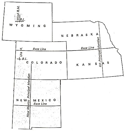
Often the public lands of one or more states are governed by a single
principal meridian. For example, all of Kansas and Nebraska and most of
Wyoming and Colorado base their land surveys on the Sixth Principal
Meridian (6th PM).
The base line of the 6th PM forms the state boundary between Kansas and
Nebraska so townships north of the baseline are in Nebraska, and those
south of it are in Kansas. The 6th PM divides Kansas and Nebraska into east
ern and western segments. Thus one location in northeast Nebraska is
described as township 27 north, range 5 east, 6th PM. One in east Kansas is
township 27 south, range 5 east, 6th PM. Similarly, two locations in the west
ern parts of each state are, respectively, township 27 north, range 5 west
(Nebraska), and township 27 south, range 5 west (Kansas). Except for parts
of Wyoming controlled by the Wind River Meridian and parts of Colorado
10governed by the New Mexico Meridian, all townships in Wyoming are also
north of the baseline of the 6th PM; most townships in Colorado are south
of its baseline; and all ranges in both Wyoming and Colorado are west of the
6th PM. Most good commercial atlases show meridians, baselines, town
ships, and ranges.
MILITARY B OUNTY LAND WARRANTS
From 1788 to 1855 the United States granted military bounty land war
rants for military service. At the time of the Revolutionary War, the United
States and several of the original states used land bounties to attract enlist
ments; the United States used the same incentive during the War of 1812.
Most of these early U.S. warrants could only be used in military districts, for
lands now principally in Ohio and several other eastern and central public
land states. Most of the Revolutionary War bounty land warrants were sold
or assigned by the soldiers or warrantees to others. Between 1847 and 1855
the Government granted a series of increasingly generous land bounties,
first to attract enlistments in the Mexican War, then to reward surviving vet
erans of all wars since 1790 (including Indian wars), and finally to include
those who served in the Revolutionary War. Under the acts of the 1850s, eli
gibility was gradually extended to include the regular army, navy, militia, and
Indians mustered into the service of the United States. The majority of those
who received warrants under the acts of 1847–55, did not use them to make
land entries themselves but sold them to others who did. These warrants
could be used to obtain land anywhere in the public domain. Most bounty
land warrant acts allowed, in the event of the death of those eligible, for the
warrants to be issued to their immediate heirs. No land bounties were
offered to Civil War veterans, but Union soldiers could deduct the time they
served from the residency requirements of the Homestead Act of 1862.
At the National Archives Building, NARA has custody of those military
bounty land warrants that were used or surrendered to the Federal
Government in exchange for land. They are arranged by the year of the act
of Congress that authorized them, the certificate or warrant number, and,
for warrants under the acts of 1847–55, by the number of acres granted.
There are name indexes for the Revolutionary War, most of the War of 1812
warrants, and some of the warrants under the acts of 1847–55.
11REVOLUTIONARY WAR B OUNTY LAND WARRANTS
Although many of the earliest warrants were lost in fires at the War
Department, surviving warrants issued for service in the Revolutionary
War are reproduced and indexed in NARA microfilm publications M829
and M804, described below in the microfilm section. There is also a card
index to them in the National Archives Building,9 and they are indexed in
the following publications, which are available at most large public, univer
sity or genealogical libraries:
Clifford Neal Smith, Federal BountyLand Warrants of the American
Revolution, 1799–1835 (Chicago: American Library Association, 1973).
National Genealogical Society, Index of Revolutionary War Pension [and
BountyLand Warrant] Applications in the National Archives (Washington,
DC: National Genealogical Society, 1976).
Surviving veterans of the Revolutionary War also qualified for bounty
land warrants under the act of 1855. These are partially indexed in NARA
microfilm publication M804, described below in the microfilm section, and
the second publication cited above.
WAR OF 1812 B OUNTY LAND WARRANTS
The earliest bounty land warrants for service in the War of 1812, issued
at the time of the war, are partially reproduced and indexed in NARA
microfilm publications M848 and M313, described below in the microfilm
section.
Surviving veterans of the War of 1812 also qualified for bounty land war
rants under the acts of 1842, 1850, 1852, and 1855. These warrants are
indexed in NARA microfilm publications M848 and M313, described
below in the microfilm section. They are also partially indexed in the fol
lowing publication:
Virgil D. White, Index to War of 1812 Pension [and BountyLand Warrant]
Files, 3 vols. (Waynesboro, TN: National Historical Publishing Company,
1989).
9 Alphabetical Index to U.S. Revolutionary War Bounty Land Warrants, Act of July 9, 1788, MLR# UD2139.
12OLD INDIAN WARS B OUNTY LAND WARRANTS
Surviving veterans of the various Indian wars since 1790 qualified for
bounty land warrants under the acts of 1850–55. These are partially
indexed (for military actions against Indians during the War of 1812 only)
in NARA microfilm publication M313, described in the microfilm section.
Warrants issued for other military actions against Indians are indexed by
the warrant applications under these acts, discussed below.
MEXICAN WAR B OUNTY LAND WARRANTS
The United States under an act of 1847 issued bounty land warrants to
encourage enlistments in the Mexican War. Warrants under this act were
the first that could be used to enter land anywhere in the public domain
(rather than limiting entry to military districts) and were assignable. They
are indexed in the NARA microfilm publication T317, described below in
the microfilm section.
B OUNTY LAND WARRANTS UNDER THE ACTS OF
1850, 1852, AND 1855
Under the acts of 1850, 1852, and 1855, Congress gradually extended the
eligibility for bounty land warrants to retroactively compensate surviving
veterans or the immediate heirs of all who had served since the Revolutionary
War, as noted above. Those who obtained warrants under an earlier act usu
ally were eligible under later acts as well, provided the total acreage they
obtained did not exceed 160 acres. The card, microfilm, and published index
es cited above, while valuable, do not include references to each of the hun
dreds of thousands of veterans, widows, and survivors who obtained bounty
land warrants under the acts of 1850–55. The most comprehensive “index” to
determine information about the filing of these warrants is the bounty land
warrant application files among the military pension records held by NARA,
most of which have not been microfilmed.10 Researchers who are unable to
locate bounty land warrant filing information using the indexes noted above
10 Note:bounty land warrant application files usually contain more information useful to the researcher
than do the surrendered warrants.
13should use NATF Form 85, Order for Copies of Federal Pension or Bounty
Land Warrant Applications, to request a copy of the land warrant application.
Each approved application will note the filing information of the surrendered
warrant, given as a threepart number containing the warrant number, the
acreage granted, and the year of the act granting the warrant. For example,
warrant number 12345 for 160 acres, granted under the act of 1855, would
read: “123451601855,” “12345160’55,” or some variation thereof. This fil
ing information should then be cited when requesting the surrendered boun
ty land warrant file. Since there are thousands of surrendered warrants under
each acreage group of these acts, it is important to include all three parts of
the filing information in a request.
MILITARY B OUNTY LAND WARRANTS, LAND ENTRY
CASE FILES, AND GENERAL LAND OFFICE ADMINISTRATIVE
RECORDS AVAILABLE ON MICROFILM
Because NARA holds approximately 10 million preJuly 1908 case files for
land entries and military bounty land warrants, it is not feasible to micro
film or scan them all. Limited series of these files have been microfilmed
and are available across the country at the regional facilities of NARA and
other repositories. Several of these microfilm publications have useful and
informative guides that describe the records and how to access them.
Several also contain the filing information needed to request copies of the
surrendered bounty land warrant and preJuly 1908 general land entry
case files. Inquiries about these and other landrelated microfilm publica
tions may be directed to the Old Military and Civil Records (NWCTB),
National Archives and Records Administration, Washington, DC 20408.
Please note that the paper originals of microfilmed records are no longer
available for copying; reproductions are made from the microfilm.
1. U.S. Revolutionary War Bounty Land Warrants Used in the U.S.
Military District of Ohio and Related Papers (Acts of 1788, 1803, and
1806). M829. 16 rolls. This publication indexes and reproduces all the
warrants under these acts that survived fires in the War Department
buildings in 1800 and 1814.
2. Revolutionary War Pension and BountyLand Warrant Application
Files. M804. 2,670 rolls. This publication indexes bounty land warrants
14for Revolutionary War service under the early acts noted above and
under the act of 1855. It reproduces the complete applications for
approved bounty land warrants under the act of 1855 only.
3. War of 1812 Military Bounty Land Warrants, 1815–1858. M848. 14
rolls. This publication partially indexes bounty land warrants under
the acts of 1812, 1814, and 1842 only, not later acts. It reproduces the
stubs retained by the Federal Government for issued warrants; the
warrants that were used, or surrendered, have not been filmed. They
are filed by the warrant number given in this microfilm publication
and are described under entries 13 and 14 in National Archives
Preliminary Inventory 22, LandEntry Papers of the General Land
Office.
4. Index to War of 1812 Pension Application Files. M313. 102 rolls.
This gives, in the upper righthand corner of each entry, the filing
information for bounty land warrants granted under the acts of 1812,
1850, and 1855. Warrants under the act of 1850 include those for serv
ice in various Indian wars since 1790.
5. Index to Mexican War Pension Files, 1887–1926. T317. 14 rolls. This
index gives filing information for bounty land warrants granted under
the act of 1847.
6. List of North Carolina Land Grants in Tennessee, 1778–1791. M68.
1 roll. The volume reproduced on the single roll of this microfilm pub
lication was prepared in the Office of the Secretary of State of North
Carolina in 1791 and submitted the same year to Thomas Jefferson,
Secretary of State of the United States. It is not indexed. Lands in North
Carolina and Tennessee were never part of the Federal public domain;
therefore, the General Land Office had no jurisdiction over land trans
actions in those states. Inquiries should be addressed to the respective
state archives.
7. Oregon and Washington Donation Land Files, 1851–1903. M815.
108 rolls. These land claims, like most general land entries before 1908,
are arranged by state, land office, and final certificate number. This
microfilm publication reproduces the case files for each approved
claim under the Donation Land Act of 1850. Name indexes are avail
able in the NARA microfilm publications, Abstracts of Oregon
Donation Land Claims, 1852–1903, M145, 6 rolls, and Abstracts of
15Washington Donation Land Claims, 1855–1902, M203, 1 roll. A pub
lished name index and abstract is available.
8. Bound Records of the General Land Office Relating to Private Land
Claims in Louisiana, 1767–1892. M1382. 8 rolls. Roll 2 includes “Old
Index of Private Land Claims in Louisiana, 1800–1880.” Individual case
files of these claims are not included in this microfilm publication.
9. Unbound Records of the General Land Office Relating to Private
Land Claims in Louisiana, 1805–1896. M1385. 2 rolls.
10. Land Claims Case Files of the U.S. District Court for the Eastern
District of Louisiana, 1844–1880. M1115. 16 rolls.
11. Records Relating to California Private Land Claims Dockets. T910.
118 rolls. An alphabetical index by grant title is found on roll 118. Lists
by name of grantee are found at the start of each roll. Indexes by both
grant name and grantee name are available.
12. Index to Private Land Grant Cases, U.S. District Court, Northern
District of California, 1853–1903. T1214. 1 roll. The records in this and
the following three microfilm publications document court cases relat
ing to private land claims in California. They may include information
from General Land Office docketed case files as well as records relating
to the proceedings of cases in the U.S. district courts.
13. Index to Private Land Grant Cases, U.S. District Court, Southern
District of California. T1215. 1 roll.
14. Index by County to Private Land Grant Cases, U.S. District Court,
Northern and Southern Districts of California. T1216. 1 roll.
15. Private Land Grant Case Files in the Circuit Court of the Northern
District of California, 1852–1910. T1207. 28 rolls.
16. Federal Land Records for Idaho, 1860–1934. M1620. 23 rolls.
Includes registers of land entries kept by local land offices; original
tract books.
17. Federal Land Records for Oregon, 1854–1908. M1621. 92 rolls.
Includes registers, abstracts of land entries kept by local land offices
and tract books.
18. Federal Land Records for Washington, 1860–1910. M1622. 72 rolls.
Includes registers, abstracts of land entries kept by local land offices
and tract books.
19. Records of the Bureau of Land Management, Surveyor General of
16Arizona, 18911950. M1627. 2 rolls. Includes records relating to survey
requests and surveyor personnel records.
20. Records of the Bureau of Land Management, Phoenix General Land
Office, 1873–1942. M1628. 15 rolls. Selected registers of land entries
kept by local land offices.
21. Records of the Bureau of Land Management, Prescott General Land
Office, 1871–1908. M1629. 16 rolls. Selected registers of land entries
kept by local land offices and land entry decisions.
22. Records of the Bureau of Land Management, Los Angeles District
Land Office, 1859–1936. M1630. 60 rolls. Selected registers of land
entries; declarations of intention to make land entries kept by local
land offices and selected land entry case files arranged alphabetically.
23. Miscellaneous Letters Sent by the General Land Office, 1796–1889.
M25. 228 rolls.
24. Letters Sent by the General Land Office to the Surveyor General,
1796–1901. M27. 31 rolls.
25. Letters Sent by the Surveyor General of the Territory Northwest of
the Ohio River, 1797–1854. M477. 10 rolls.
26. Letters Received by the Secretary of the Treasury and the
Commissioner of the General Land Office From the Surveyor General of
the Territory Northwest of the River Ohio, 1797–1849. M478. 10 rolls.
27. Letters Received by the Surveyor General of the Territory Northwest
of the River Ohio, 1797–1856. M479. 43 rolls.
28. Township Plats of Selected States. T1234. 62 rolls. Original GLO
manuscript plats of townships in Alabama, Illinois, Indiana, Iowa,
Kansas, Mississippi, Missouri, Oklahoma, Wisconsin, and parts of
Ohio. Arranged by state and thereunder by principal meridian and
numbered township and range. A roll list is available.
29. Field Notes From Selected General Land Office Township Surveys.
T1240. 280 rolls. Survey field notes from the original GLO surveys of
Illinois, Indiana, Iowa, Kansas, Missouri, and Ohio. Arranged by state
and thereunder by volume number. Index maps for each state are
reproduced at the front of each reel and provide the volume number in
which survey notes for any given township and range are reproduced.
The notes within each volume are arranged by numbered township
and range. A roll list is available.
1730. Correspondence of the Surveyors General of Utah, 1874–1916.
M1110. 86 rolls.
31. Correspondence Received by the Surveyors General of New Mexico,
1854–1907. M1288. 11 rolls.
32. Letters and Surveying Contracts Received by the General Land
Office from the Surveyor General for Illinois, Missouri, and Arkansas,
1813–1832. M1323. 2 rolls.
33. Letters and Surveying Contracts Received by the General Land
Office from the Surveyor General for Alabama, 1817–1832. M1325. 1 roll.
34. Letters Received by the Secretary of the Treasury and the General
Land Office from the Surveyor General of Mississippi, 1803–1831.
M1329. 4 rolls.
35. Letters Received by the Secretary of the Treasury Relating to Public
Lands (“N” Series) 1831–1849. M726. 23 rolls
36. Letters Sent by the Secretary of the Treasury Relating to Public
Lands (“N” Series), 1801–1878. M733. 4 rolls.
ADDITIONAL READING
Thomas Donaldson, The Public Domain. Its history, with statistics . . .
(Washington, DC: 1881, reprinted 1971).
Paul W. Gates, History of Public Land Law Development (Washington,
DC: Government Printing Office, 1968).
W. Wade Hone, Land and Property Research in the United States (Salt
Lake City: Ancestry, Inc., 1997).
Roy M. Robbins, Our Landed Heritage: The Public Domain, 1776–1936
(Lincoln: University of Nebraska Press, 1962).
Malcom J. Rohrbough, The Land Office Business; the Settlement and
Administration of American Public Lands, 1789–1837 (New York: Oxford
University Press, 1968).
18GENERAL LAND ENTRY FILES
Searchpaths for Requests by Mail
To obtain copies of case file of a: Use one NATF Form 84 per file Where to send completed forms
Land entry after July 1908 Use NATF Form 84, fill in state Send to Textual Reference
and name of entryman (NWCT1R), National Archives,
700 Pennsylvania Ave NW,
Washington, DC 204080001
Land entry before July 1908 and Use NATF Form 84, fill in state, Send to Textual Reference
in western1 state name of entryman, and legal (NWCT1R), National Archives,
description of land 700 Pennsylvania Ave NW,
Washington, DC 204080001
Land entry before July 1908 and Write to BLMESO3 and get Use NATF Form 84, fill in state,
in eastern2 state a copy of patent or record that land office, type of entry, and file
shows state, land office, type number. Send to address given
of entry, and file number. above
Or consult BLMESO web site
at www.glorecords.blm.gov
Land entry before July 1908, and Use NATF Form 84, fill in state, Send to Textual Reference
you have patent from BLMESO, land office, type of land entry, (NWCT1R), National Archives,
or you know state, land office, and file number. Complete rest 700 Pennsylvania Ave NW,
type of entry, and file number of form as needed Washington, DC 204080001
1 Alaska, Arizona,
California, Colorado, Idaho, Kansas, Montana, Nebraska, Nevada, New Mexico, North
Dakota, Oklahoma, Oregon, South Dakota, Utah, Washington, and Wyoming.
2 Alabama, Arkansas, Florida, Illinois, Indiana, Iowa, Louisiana, Michigan, Minnesota, Mississippi, Missouri,
Ohio, and Wisconsin.
3 Bureau of Land Management, Eastern States Office, 7450 Boston Boulevard, Springfield, VA 22153.
19MILITARY B OUNTY LAND WARRANTS
Searchpaths for Requests by Mail
To obtain copies of war Sources below index Use one NATF Form 84 Where to send
rant under Act of case files per file completed forms
July 9, 1788 Entire series on NARA Use NATF Form 84, fill Send to Textual
March 3, 1803 & microfilm M829, in name of warrantee, Reference (NWCT1R),
April 15, 1806 arranged alphabetically. year of warrant act, National Archives,
Revolutionary War See also published acreage, warrant number 700 Pennsylvania Ave
service indices1 NW, Washington, DC
204080001
Dec. 24, 1811 Indexed and partially Use NATF Form 84, fill Send to Textual
Jan. 11, 1812 reproduced on NARA in name of warrantee, Reference (NWCT1R),
May 6, 1812 & microfilm M848. See year of warrant act, National Archives,
July 27, 1842 also published indices2 acreage, warrant number 700 Pennsylvania Ave
War of 1812 NW, Washington, DC
service 204080001
February 11, 1847 Indexed by NARA Use NATF Form 84, fill Send to Textual
Mexican War microfilm T317 and by in name of warrantee, Reference (NWCT1R),
service warrant applications year of warrant act, National Archives,
ordered with NATF acreage, warrant number. 700 Pennsylvania Ave
Form 85 NW, Washington, DC
204080001
Sept. 28, 1850 Warrants for 1812 serv Use NATF Form 84, fill Send to Textual
March 22, 1852 ice indexed by NARA in name of warrantee, Reference (NWCT1R),
Service in all wars since microfilm M313. Others year of warrant act, National Archives,
1790, including Indian by warrant applications acreage, warrant number. 700 Pennsylvania Ave
Wars ordered with NATF NW, Washington, DC
Form 85. Published 204080001
indices may be available
March 3, 1855 Warrants for Rev. War Use NATF Form 84, fill Send to Textual
Service in all wars service indexed by in name of warrantee, Reference (NWCT1R),
including NARA microfilm M804. year of warrant act, National Archives,
Revolutionary War Others same as previous acreage, warrant number 700 Pennsylvania Ave
category NW, Washington, DC
204080001
Note: You can request a copy of a military bounty land application file by using the
Form NATF 85, Order for Copies of Federal Pension or Bounty Land Warrant
Applications. You can request a copy of an individual compiled service record by
using Form NATF 86, Order for Copies of Military Service Records. You can place an
order online by visiting our web site at www.archives.gov. If you place your order
through OrderOnline!, we will receive it the next work day. You will receive your
copies as soon as they are produced. If you prefer to pay by check, please use the “con
tact us” information to request the paper copies of the forms.
1 Clifford Neal Smith, Federal BountyLand Warrants of the American Revolution, 1799–1835 (Chicago:
American Library Association, 1973).
National Genealogical Society, Index of Revolutionary War Pension [and BountyLand Warrant]
Applications in the National Archives (Washington, DC: National Genealogical Society, 1976).
2 Virgil D. White, Index to War of 1812 Pension [and BountyLand Warrant] Files, 3 vols. (Waynesboro, TN:
National Historical Publishing Company, 1989).
20GENERAL LAND ENTRY FILES
Searchpaths for Requests in Person
PreJuly 1908 files require name, state, land office, type of land entry, and final cer
tificate number to locate file.
PostJuly 1908 files require name and patent number to locate file.
To examine the Sources below Use indexing Use one request Submit request slip
case file of a: index case files source(s) to: slip per land file: in Room G28
Land Entry after Twopart index: 1st Find patent num Fill in name of The land file will
July 1908 part, by name, ber in second part entryman and be delivered to the
gives application of index,2 using patent number Central Research
number and land appl. no. and land Room, Room 203
office...1 office obtained
from first part
Land entry before Name index for all Find name of land Fill in state, land The land file will
July 1908 and in land entries in office, type of land office, type of land be delivered to the
AL, AK, AZ, FL, these states only, entry, and final entry, and final Central Research
LA, NV, UT patented and certificate number certificate number Room, Room 203
unpatented3
Land entry before All land entries Examine tract Fill in state, land The land file will
July 1908 and in indexed in tract book5 and find office, type of land be delivered to the
western state (see books arranged by land office,6 type of entry, and final Central Research
list of states below) state and legal land entry, and certificate number Room, Room 203
description of final certificate
land4 number
Land entry before All land entries ind Contact BLMESO7 Fill in state, land The land file will
July 1908 and in exed by BLMESO in and get copy of office, type of land be delivered to the
eastern state (see tract books per above patent or record entry, and final Central Research
list of states below) and for AL, AR, FL, that shows land certificate number Room, Room 203
IA, IL, IN, LA, MI, office, type of land
MN, MO, MS, OH, entry, and final
WI, by computer certificate number
Land entry before Then you have ....go to next box.... Fill in state, land The land file will
July 1908, and you enough info to office, type of land be delivered to the
have patent from request pre1908 entry, and final Central Research
BLMESO, or you land entries in certificate number Room, Room 203
know state, land eastern and
office, type of entry, western states...
and file number
Western public land states: Alaska, Arizona, California, Colorado, Idaho, Kansas,
Montana, Nebraska, Nevada, New Mexico, North Dakota, Oklahoma, Oregon,
South Dakota, Utah, Washington, and Wyoming.
Eastern public land states: Alabama, Arkansas, Florida, Illinois, Indiana, Iowa,
Louisiana, Michigan, Minnesota, Mississippi, Missouri, Ohio, and Wisconsin.
1 RG 49, MLR# UD2137, Alphabetical Index to Case Files. Gives land office and application number.
2 RG 49, MLR# UD2136, Numerical Index to Case Files. Arr. by land office and appl. no. Gives patent number.
3 RG 49, MLR# UD168, Seven States Index. Gives all information needed to locate file.
4 RG 49, MLR# UD2321, Index to Tract Books, 17 maps, available in G28.
5 RG 49, MLR# UD21002117, tract book vols. arr. by state and legal description.
6 RG 49, MLR# UD2320, Index to Land Office, 4 vols. Available in G28. Land office usually not given in tract book.
7 Bureau of Land Management, Eastern States Office, 7450 Boston Boulevard, Springfield, VA 22153.
21MILITARY B OUNTY LAND WARRANTS
Searchpaths for Requests in Person
To examine a war Sources below Use indexing Use one reference Submit request slip
rant under Act of: index case files: source(s) to: request slip per in Room G28
warrant case file:
July 9, 1788 Entire series on Examine warrant Not applicable. Not applicable.
March 3, 1803 & NARA microfilm case file on NARA Original records Original records
April 15, 1806 M829, arranged microfilm M829. not served. Use not served. Use
Revolutionary alphabetically. See Original records M829 M829
War service also published not served.
indices1
Dec. 24, 1811 Indexed and par Determine year of Fill in year of The case file will
Jan. 11, 1812 tially reproduced warrant act, warrant act, be delivered to the
May 6, 1812 & on NARA micro acreage, warrant acreage, and Central Research
July 27, 1842 film M848. See number warrant number Room, Room 203
War of 1812 also published
service indices2
February 11, 1847 Indexed by NARA Determine year of Fill in year of The case file will
Mexican War microfilm T317 warrant act, warrant act, be delivered to the
service and by warrant acreage, warrant acreage, and Central Research
applications number warrant number Room, Room 203
ordered with
NATF Form 85
Sept. 28, 1850 Warrants for 1812 Determine year of Fill in year of The case file will
March 22, 1852 service indexed by warrant act, warrant act, be delivered to the
Service in all wars NARA microfilm acreage, warrant acreage, and Central Research
since 1790, includ M313. Others by number warrant number Room, Room 203
ing Indian Wars warrant applica
tions ordered with
NATF Form 85.
See also published
indices.
March 3, 1855 Warrants for Rev. Determine year of Fill in year of The case file will
Service in all wars War service warrant act, warrant act, be delivered to the
including indexed by NARA acreage, warrant acreage, and Central Research
Revolutionary War microfilm M804. number warrant number Room, Room 203
Others same as
previous category
1 Clifford Neal Smith, Federal BountyLand Warrants of the American Revolution, 1799–1835 (Chicago:
American Library Association, 1973).
National Genealogical Society, Index of Revolutionary War Pension [and BountyLand Warrant]
Applications in the National Archives (Washington, DC: National Genealogical Society, 1976).
2 Virgil D. White, Index to War of 1812 Pension [and BountyLand Warrant] Files, 3 vols. (Waynesboro, TN:
National Historical Publishing Company, 1989), 3 vols.
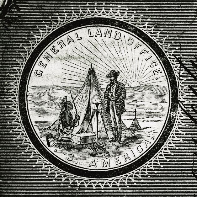
22Above: The seal of the U.S. General Land Office, ca. 1861.
National Archives and Records Administration | Washington, DC | 2009
You can also read