Rockingham Lakes Regional Park - Management Plan 2010 - Management Plan No. 67 Conservation Commission of Western Australia
←
→
Page content transcription
If your browser does not render page correctly, please read the page content below
Rockingham Lakes
    Regional Park
           Management Plan
                     2010

     Management Plan No. 67

              Conservation Commission
                   of Western Australia

              Department of Environment
                      and Conservation

                     City of Rockingham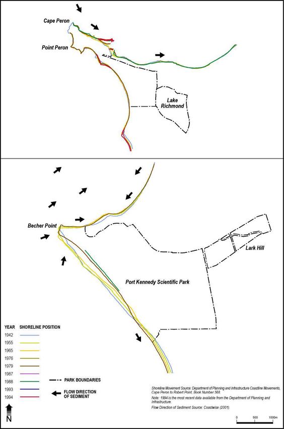
Rockingham Lakes Regional Park
                                   Management Plan
                                                2010

PLANNING TEAM

The Planning Team, representing the managers of Rockingham Lakes Regional Park, coordinated the
development of this plan on behalf of the Conservation Commission of Western Australia. The Planning Team
was assisted by a consultancy team led by Environmental Resources Management Australia Pty Ltd.

Jacinta Overman                  Department of Environment and Conservation
Brendan Dooley                   Department of Environment and Conservation
Tim Bowra                        Department of Environment and Conservation
Paddy Strano                     City of Rockingham

                                                    i
How to Use This Plan

This Plan is divided into chapters and sections as set out in the table of contents. Guiding principles are stated
at the beginning of each chapter. An objective is given at the beginning of each section, followed by a
discussion of the main issues and then strategies, which list responsible agencies and a priority rating. Priority
ratings provide an indication of the relative importance of a strategy. Key Performance Indicators are listed in
the Plan and outline performance measures, targets and reporting requirements.

A number of issues raised in this Plan are interrelated and are dealt with under more than one section. Where
this is the case, the discussion refers the reader to other related sections.

ACKNOWLEDGEMENTS

Numerous individuals and groups have contributed valuable ideas and information in the preparation of this
draft management plan and their efforts are gratefully acknowledged. In particular, the contribution of the
Rockingham Lakes Regional Park Community Advisory Committee is appreciated. The assistance of the
Environmental Resources Management Australia Pty Ltd consultancy team is also appreciated.

NOMENCLATURE

Inclusion of a name in this publication does not imply its approval by the relevant nomenclature authority.

THE CONSERVATION COMMISSION OF WESTERN AUSTRALIA AND THE DEPARTMENT OF
ENVIRONMENT AND CONSERVATION

All national parks, conservation parks, nature reserves, and other similar reserves are vested in the
Conservation Commission of Western Australia (Conservation Commission). These reserves are managed on
behalf of the Conservation Commission by the Department of Environment and Conservation.

As the controlling body, the Conservation Commission is responsible for having management plans prepared
for all lands that are vested in it. This plan has been prepared by the Department of Environment and
Conservation on behalf of the Conservation Commission.

                                                        ii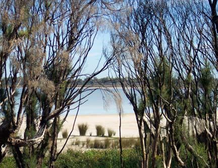
Preface

Regional parks consist of areas of land that have been identified as having outstanding conservation,
landscape and recreation values. Regional parks may consist of land areas managed by a range of different
management agencies, and private landowners. Regional parks therefore provide the opportunity for a
consortium of land managers and landowners to work together to develop a coordinated management
approach.

Set in a rapidly growing urban area, Rockingham Lakes Regional Park is a network of environmentally
significant lands containing coastal, wetland and upland ecosystems. The park occupies a significant proportion
of the City of Rockingham, and is not only important for conservation in this urban context, but also for the
range of recreational opportunities it provides.

The park crosses the unique Rockingham-Becher Plain, from the coastal promontories of Cape Peron and Port
Kennedy, to the wetlands of Lakes Cooloongup and Walyungup. This area is significant for its geomorphic
landforms because the distinct parallel sand ridges indicate the positions of former shorelines, providing a
record of sea level changes over the past 7,000 years. Wetlands have formed in between the sand ridges, and
these are also significant because they form part of an evolutionary time sequence and support unique
vegetation communities. The Becher Point Wetlands are listed as wetlands of international significance under
the Ramsar Convention. Thus the area is of considerable interest and importance for research on coastal
history, the evolution of wetlands and biological succession.

The park also contains significant flora and fauna, including two ‘threatened ecological communities’:
sedgelands in Holocene dune swales and thrombolites at Lake Richmond. In addition, the woodlands and
wetlands around Lake Cooloongup, Lake Walyungup, Tamworth Hill, Tamworth Hill Swamp, Anstey and
Paganoni Swamps are important remnants of ecosystems that were once widespread on the Swan Coastal
Plain.

While the park has undoubtedly high nature conservation values and contains some popular recreation areas, it
is at the same time beset by a number of critical management problems, such as vegetation degradation and
loss, widespread weed invasion and feral animal impacts. This management plan, which is based on previously
prepared ecological, recreational and historical surveys, as well as information collected during the study
period, seeks to establish clear objectives on how best to manage and protect Rockingham Lakes Regional
Park.

The Rockingham Lakes Regional Park Community Advisory Committee was established early in the planning
process to provide input during the preparation of the plan. The plan has been developed through consultation
with a range of stakeholder groups and it reflects their contributions. The draft plan was released for public
comment on 27 October 2003 until 27 February 2004. This final plan reflects the outcomes of the investigative
and consultative periods and provides a way forward for the sustainable and cooperative management of the
Rockingham Lakes Regional Park.

It is recognised that a considerable period of time has elapsed since the draft management plan was released
for public comment in 2003. The delay in preparing the final management plan in no way diminishes the value
of the contributions made by any organisation or individual. These contributions are important, and remain
critical to the integrity of the management plan and ultimately, to the management of the park.

Some issues that were identified in the draft management plan in 2003 may no longer be current or may have
changed. New issues have arisen. In finalising the management plan, DEC has attempted to capture the
changes that have occurred since 2003 with individual stakeholders and managing agencies without
compromising the integrity of the original process of developing the draft plan.

                                                      iii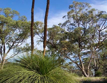
Table of Contents
A.           INTRODUCTION                                                                                                                                            1
1.    Purpose and Status of the Management Plan ............................................................................................. 1
2.    Regional Parks ............................................................................................................................................ 1
3.    Rockingham Lakes Regional Park .............................................................................................................. 2
4.    The Management Planning Process and Community Involvement ............................................................. 5
B. PRINCIPAL MANAGEMENT DIRECTIONS                                                                                                                                   6
5.    The Vision for the Park ................................................................................................................................ 6
6.    Legislation and Management Policies ......................................................................................................... 6
7.    Park Boundary ............................................................................................................................................ 6
8.    Land Tenure ................................................................................................................................................ 8
9.    Interim Management Arrangements .......................................................................................................... 10
10.       Park Management Zones.................................................................................................................... 10
11.       Integrated Management and Planning of the Park and Adjacent Areas. ............................................ 15
12.       Key Performance Indicators, Monitoring and Reporting...................................................................... 16
13.       Research ............................................................................................................................................ 16
C. CONSERVING THE NATURAL ENVIRONMENT                                                                                                                              18
14.        Guiding Principles for Conserving the Natural Environment ............................................................... 18
15.        Geomorphology, Geology and Soils ................................................................................................... 18
16.        The Coast and Foreshore ................................................................................................................... 19
17.        Hydrology and Wetlands ..................................................................................................................... 22
18.        Flora and Vegetation........................................................................................................................... 25
19.        Threatened Ecological Communities .................................................................................................. 30
20.        Fauna.................................................................................................................................................. 31
21.        Weeds................................................................................................................................................. 33
22.        Fire...................................................................................................................................................... 35
23.        Pets and Problem Animals.................................................................................................................. 36
24.        Rehabilitation ...................................................................................................................................... 38
25.        Park Aesthetics and Landscape Amenity............................................................................................ 39
26.        Regional Ecological Linkages and Greenways ................................................................................... 40
D. MANAGING CULTURAL HERITAGE                                                                                                                                      43
27.        Guiding Principles for Managing Cultural Heritage ............................................................................. 43
28.        Aboriginal Cultural Heritage ................................................................................................................ 43
29.        Non-Aboriginal Heritage...................................................................................................................... 44
E. MANAGING RECREATION                                                                                                                                             46
30.        Guiding Principles for Managing Recreation ....................................................................................... 46
31.        Visitor Use .......................................................................................................................................... 46
32.        Recreation Masterplan ........................................................................................................................ 47
33.        Recreation Sites and Facilities ............................................................................................................ 48
34.        Recreation Activities at Lake Walyungup ............................................................................................ 50
35.        Park Access and Circulation ............................................................................................................... 51
36.        Signs ................................................................................................................................................... 53
37.        Visitor Safety....................................................................................................................................... 54
F. MANAGING SUSTAINABLE RESOURCE USE                                                                                                                               55
38.        Guiding Principles for Managing Sustainable Resource Use .............................................................. 55
39.        Commercial Concessions – Leases and Licences .............................................................................. 55
40.        Mining and the Extraction of Basic Raw Materials .............................................................................. 58
41.        Park Utilities and Services .................................................................................................................. 59
42.        Development Proposals Affecting the Park......................................................................................... 60
G. WORKING WITH THE COMMUNITY                                                                                                                                      61
43.        Guiding Principles for Working with the Community ........................................................................... 61
44.        Community Involvement ..................................................................................................................... 61
45.        Information, Interpretation and Education ........................................................................................... 62
H. IMPLEMENTING AND EVALUATING THE PLAN                                                                                                                            64
46.        Priorities, Funding and Staff................................................................................................................ 64
47.        Term of the Plan ................................................................................................................................. 64
48.        Performance Assessment ................................................................................................................... 64

                                                                                 iv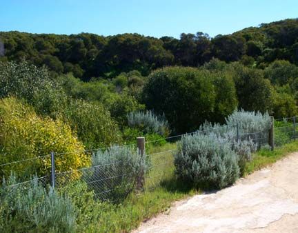
REFERENCES AND BIBLIOGRAPHY                                                                                                                                  68
Appendix A - Recreation Masterplan................................................................................................................. 73
Appendix B - DEC policies referred to in this Plan ............................................................................................ 77
Appendix C - Acronyms used in the Plan .......................................................................................................... 78
Appendix D - Glossary ...................................................................................................................................... 79
Appendix E - Contacts ...................................................................................................................................... 81

Figures

Figure 1 - Regional Park Planning Hierarchy ........................................................................................................ 2
Figure 2 - Park Location ........................................................................................................................................ 3
Figure 3 - Land Tenure and Park Boundary ........................................................................................................ 11
Figure 4 - Management Zones and Areas ........................................................................................................... 12
Figure 5 - Conceptual view of shoreline movement ............................................................................................ 21
Figure 6 - Indicative Vegetation Distribution ........................................................................................................ 29
Figure 7 - Greenway Corridors and Links ........................................................................................................... 42

Tables

Table 1 - Management Zones and Future Tenure Arrangements ....................................................................... 13
Table 2 - Floristic Community Types at Rockingham Lakes Regional Park ........................................................ 26
Table 3 - Performance Assessment .................................................................................................................... 66

                                                                                v
Part A Introduction

                                     A.         INTRODUCTION

 1.   Purpose and Status of the Management                    approach by a number of management agencies and
      Plan                                                    private landowners.

PURPOSE OF THE PLAN                                           Regional parks may comprise Crown lands vested in
                                                              State government agencies and local governments,
The purpose of this management plan (‘the Plan’) is           as well as private lands where the agreement of the
to provide the overarching approach for the                   landowner is obtained.
protection and enhancement of the conservation,
recreation and landscape values of Rockingham                 As such regional parks may comprise lands with a
Lakes Regional Park (‘the Park’). The Plan includes           variety of tenures and reserve purposes, drawn
strategies aimed at conserving the special features           together for integrated management which is
of the Park and providing for future community                coordinated by DEC. Rockingham Lakes Regional
requirements. The Plan will also help to sustainably          Park consists of land comprising Crown reserves
manage significant nature conservation and cultural           vested in the City of Rockingham, the Conservation
values while allowing for an appropriate level of use         Commission and the Minister for Community
by the community.                                             Services, as well as freehold land owned by the
                                                              WAPC and the Water Corporation, and privately-
Given the strategic nature of the Plan, more detailed         owned land.
planning (referred to as subsidiary plans) is required
prior to significant works taking place within the Park       Those lands that have been acquired by the WAPC
(these are listed in Section 46).                             for inclusion in the Park are to be transferred to the
                                                              Conservation Commission or the City of
STATUS OF THE PLAN                                            Rockingham, for management as part of the regional
                                                              park.
The Plan has been prepared in accordance with the
Conservation and Land Management Act 1984                     THE REGIONAL PARK CONCEPT
(CALM Act). It provides the statutory framework for
the management of lands within the Park vested in             The concept of regional open space was first
the Conservation Commission and managed by DEC                introduced to Western Australia in 1955 by the
on the Commission's behalf. The Plan also guides              Stephenson-Hepburn Report, which recommended
DEC in coordinating the involvement of other                  that a statutory region plan be prepared for Perth
managing agencies.                                            which reserved private land required for future public
                                                              purposes. In I963, the Perth Metropolitan Region
The Conservation Commission and DEC will seek to              Scheme (MRS) was established and under the
ensure that planning undertaken by other                      scheme, land was reserved for ‘Parks and
management agencies for areas within the Park is              Recreation’. This land (subject to amendments of the
consistent with the overall direction and principles of       MRS) has been gradually acquired by State planning
this Plan.                                                    authorities with the intention of protecting open
                                                              space of regional significance for conservation and
In consultation with DEC, the Western Australian              recreation.
Planning Commission (WAPC) will use the Plan to
assist with the assessment of development                     Areas with regionally significant conservation,
proposals on lands within and adjoining Rockingham            landscape and recreation value were identified by
Lakes Regional Park to ensure that proposed land              the Environmental Protection Authority (EPA) in
use is compatible, and to limit impacts upon the              Conservation Reserves for Western Australia, The
nature conservation and social values of the Park.            Darling System – System 6 (Department of
                                                              Conservation and Environment, 1983). This report
The strategies contained in the Plan have been                recommended areas of land be managed as regional
endorsed by Rockingham City Council. The City of              parks. A system of regional parks was envisaged
Rockingham will refer to the Plan to manage the               which included Rockingham Lakes, namely Lake
areas of the Park vested in it, in consultation with          Richmond; Lakes Cooloongup and Walyungup;
DEC.                                                          Tamworth Hill Swamp; and Port Kennedy (Localities
                                                              M102; M103; M104; M106 in the System 6 Report).
 2.   Regional Parks
                                                              In 1989, the State government decided that the
WHAT IS A REGIONAL PARK?                                      responsibility for managing regional parks would be
                                                              established with the then Department of
Regional parks are areas identified as having                 Conservation and Land Management, now DEC, and
regionally significant conservation, landscape and            that the responsibility for planning and acquisition of
recreation values.     Regional parks are a land              lands for regional open space be retained by the
management system that provides the opportunity               then Department of Planning and Urban
for a coordinated planning and management                     Development (now Department of Planning [DoP])
                                                              on behalf of the WAPC.
                                                          1
Part A Introduction
In 1990, a task-force report outlined proposed The Park covers an area of 4,270 hectares, which
administration, planning and management of consists of coastal areas, wetlands and remnant
regional open space (Regional Parks Taskforce, bushland areas. The main areas or estates of the
1990). Park (as indicated in Figure 3) are:
The EPA’s Red Book Status Report (Environmental Cape Peron;
Protection Authority, 1993a) describes the Lake Richmond;
transformation of regional parks from concept to Lake Cooloongup;
reality as being difficult because of the range of land Lake Walyungup;
tenure involved and the funding requirements for Port Kennedy Scientific Park;
continual management of the parks. Lark Hill;
Tamworth Hill;
REGIONAL PARK PLANNING Tamworth Hill Swamp;
Anstey Swamp; and
Planning for regional parks occurs at a number of Paganoni Swamp.
levels. Regional park management plans are a part
of a broad suite of planning undertaken by the General Overview
relevant managing agencies. Figure 1 illustrates the The Park is located in the City of Rockingham, which
planning levels typically undertaken for regional is experiencing rapid urban development. In 2006,
parks. the City had an approximate population of 88,900
people, and it is estimated that the population will be
130,100 in 2021 (Western Australian Planning
Commission, 2005). Nearby urban development and
increasing visitor numbers will place added pressure
on the natural environment and recreation sites in
the Park.
The Park is a significant feature of the Rockingham
area, occupying around 16% of the area of the City
Legislation
of Rockingham. The Park is surrounded mainly by
Government policies, residential and commercial land uses, with some
and rural areas around Anstey and Paganoni Swamps, to
corporate/business plans the south-east of the Park.
Regional park management The Park consists of a network of environmentally
plans significant lands, comprising coastal, wetland and
woodland ecosystems. There are areas of remnant
Local area management plans
vegetation in the Park that are considered in good
condition. There are also highly disturbed areas of
Subsidiary plans e.g. fire response plans, vegetation in the Park, which require rehabilitation.
weed management plans, site development plans
Parts of the Park are used for recreation, with
walking and nature observation being popular
Operational/action plans, annual works programmes activities. The Park also provides access to the
coast for swimming, snorkelling and boating. Land
yachting and model aircraft flying occurs at Lake
Walyungup, and the Rockingham Golf Course is
located within the Park. Other parts of the Park have
Source: ANZECC 2000. limited access and no recreational facilities, and
receive few visitors.
Figure 1 - Regional Park Planning Hierarchy
Regional Context
Rockingham Lakes Regional Park is an important
Implementation of local area management plans, link in a series of reserves and regionally significant
subsidiary plans, operational/action plans and annual bushland in the region. Nearby, there are wetlands
works programmes will be consistent with the overall and bushland in Beeliar Regional Park, Leda Nature
direction of this Plan. Reserve, Stakehill and Lakelands. The Shoalwater
Islands Marine Park adjoins the Rockingham Lakes
3. Rockingham Lakes Regional Park Regional Park to the west at Cape Peron, and
extends from the Garden Island Causeway to Becher
Rockingham Lakes Regional Park is located Point, including Shoalwater Bay and Warnbro
approximately 39 kilometres south of the Perth Sound. The conservation, recreation and scientific
central business district (see Figure 2). values of the Park are enhanced by this regional
context (Tingay and Associates, 1997).
Rural land uses occur to the east of Lake
Walyungup, and provide a relatively undeveloped
buffer to the wetland.
2
Part A Introduction

ESTABLISHMENT         OF    ROCKINGHAM         LAKES          In 1997, the State government announced that
REGIONAL PARK                                                 Rockingham Lakes would be established as a
                                                              regional park.
In 1997, the WAPC, Port Kennedy Board of
Management, DEC and the City of Rockingham                    The Rockingham Lakes Community Advisory
collaborated to prepare the Proposed Port Kennedy             Committee was established by DEC in 1999 as a
and Rockingham Parks Management Framework                     regular forum for public opinion and the exchange of
(Tingay and Associates, 1997). The aim of the                 advice on management issues affecting the Park.
framework was to protect the environmental values
of the Park, whilst allowing for a range of appropriate       PARK VALUES
public uses. The resulting report collated information
on the biological, environmental and geomorphic               The Park has a number of characteristics that are
values of the Park, as well as the opportunities for          valued by the community. The foremost values of
recreation and ecotourism (Tingay and Associates,             the Park are discussed below. The Plan seeks to
1997). The Port Kennedy Scientific Park is now                protect and enhance these values.
managed as part of the Rockingham Lakes Regional
Park. The proposed boundary and management                    Nature Conservation Value
areas outlined in Tingay and Associates (1997)                Rockingham Lakes Regional Park has significant
provide a basis for this Plan.                                conservation value owing to its geomorphic features,
                                                              the presence of diverse wetland types, habitat, flora
Public submissions were invited on the Proposed               and fauna. The Park’s location in relation to other
Port Kennedy and Rockingham Parks Management                  conservation reserves also enhances its value in a
Framework (Tingay and Associates, 1997). These                regional context. The Park is considered by the
submissions have been reviewed during the                     community to be an important natural remnant in its
preparation of this Plan, and the issues raised in the        urban context.
submissions have been addressed in this Plan
where appropriate.                                            The      Park    includes    geomorphic      features
                                                              representative of an evolving coastal environment,
                                                              which offer a unique opportunity for research into the
                                                              history of sea level change and the process of
                                                              coastal wetland development. The landforms and
                                                              vegetation assemblages of the Rockingham-Becher
                                                              Plain is unique in a global sense and is therefore of
                                                              international importance (Semeniuk Research
                                                              Group, 1991). The Park preserves an important
                                                              remnant of this plain.

                                                              The vegetation communities in the Park represent a
                                                              sequence from west to east; from coastal shrubland,
                                                              permanent and ephemeral wetlands, to Quindalup
                                                              woodlands including stands of tuart, jarrah and marri.
                                                              This diversity of vegetation has high conservation
                                                              value.

                                                              Of particular importance is the occurrence of two
                                                              ‘threatened ecological communities’ (see Glossary):
                                                              sedgelands in Holocene dune swales; and
                                                              thrombolites in Lake Richmond. Both of these
                                                              communities are listed as ‘critically endangered’ in
                                                              Western Australia. The two threatened ecological
                                                              communities are also listed as ‘endangered’ under
                                                              the Commonwealth Environment Protection and
                                                              Biodiversity Conservation Act 1999 (EPBC Act
                                                              1999), and so receive additional recognition and
                                                              protection.

                                                              The wetland ecosystems of the Park serve as a
                                                              refuge for a diverse bird population, including trans-
                                                              equatorial migratory birds that are protected under
                                                              international agreements and the EPBC Act 1999.
                                                              Carnaby’s black cockatoo have been sighted in the
                                                              Park and are also listed as threatened under the
                                                              EPBC Act 1999. The Park is also highly valued as a
                                                              refuge for other wildlife including quenda (Isoodon
                                                              obesulus fusciventer) and western grey kangaroo
                                                              (Macropus fuliginosus) (Tingay and Associates,
                                                              1996).
Figure 2 - Park Location
                                                          3
Part A Introduction

                                                               1997). Cooloongup means place of children and
The Park contains natural sites and features                   Walyungup means place where Nyoongars talk
recognised and in some instances, specially-                   (Walley, pers. comm., 2002). Paganoni Swamp is
protected at the national and international levels.            also culturally significant as it has an Aboriginal
The Australian Heritage Council recognises                     burial site nearby. There are seven listed Aboriginal
Tamworth Hill Swamp and Anstey Swamp as having                 sites in the Park.
heritage values that should be conserved. Lake
Richmond, Port Kennedy Scientific Park, Paganoni               The first European exploration of the Rockingham
Swamp and Adjacent Areas, and Lakes Cooloongup                 area occurred between 1801 and 1804 by a French
and Walyungup and Adjacent Areas are permanent                 expedition under Commodore Nicolas Baudin (Fall,
entries on the Register of the National Estate.                1979). Baudin named a number of features along
                                                               the coast, including Cape Peron.       The name
The Becher Point Wetlands at Port Kennedy are                  Rockingham however, commemorates a ship that
listed as wetlands of international importance under           ran aground in stormy conditions opposite the
the Ramsar Convention (see Glossary). These                    present location of Governor Road in 1830 (Fall,
wetlands are also specially protected under the                1972).
Commonwealth EPBC Act 1999 and listed on the
Directory of Important Wetlands in Australia                   Farmers settled the eastern parts of Rockingham
(Government of Western Australia, 2000).                       during the 1830s, when many moved south to the
                                                               area to find more arable soils than those near the
Recreation Value                                               failed settlement of Clarence, near to Woodman
The diversity of recreation settings in the Park               Point (Fall, 1972). Market gardening was previously
provides for a range of active and passive recreation          undertaken on the east side of Lake Walyungup and
pursuits. The Park is a resource for the Rockingham            dairy farming also occurred in the area. Rural
community, as well as the broader community.                   pursuits are still undertaken to the east of Lakes
Urban growth and tourism development in the region             Cooloongup and Walyungup.
will inevitably lead to greater visitor use of the Park.
                                                               The early fate of the town of Rockingham was tied to
Most visitors to the eastern areas of the Park are             its port.     The town grew as a result of the
local residents, whereas Cape Peron has a greater              establishment of the port in Mangles Bay, which was
profile and attracts visitors from across the Perth            important for the shipment of timber from local
metropolitan area (Colmar Brunton, 2005).                      suppliers as well as those in the Jarrahdale area.
                                                               Rockingham, however, declined to a small seaside
The coastal areas of the Park - Cape Peron and Port            settlement in the early twentieth century, once major
Kennedy, provide access for recreational activities            ports were constructed at Bunbury and Fremantle
such as swimming, snorkelling and fishing. Wetland             (Fall, 1972).
and bushland areas provide opportunities for walking
and nature appreciation. Lake Walyungup is a                   During the Second World War, the HMAS Stirling
unique setting within the metropolitan area for land           Naval Base was established at Garden Island as a
yacht sailing and model aircraft flying.         The           prominent centre of military and naval operations.
Rockingham Golf Course is also located within the              The Cape Peron gun emplacements were
Park.                                                          established as an integral part of the coastal defence
                                                               system, along with emplacements at Garden Island,
The Park provides opportunities to promote                     Rottnest Island and Buckland Hill. The Cape Peron
programmes like DEC’s ’Healthy Parks, Healthy                  Battery Complex is listed on the Rockingham
People’, which encourages people to visit and enjoy            Municipal Heritage Inventory and is a permanent
themselves in parks by raising the awareness of the            entry on the Register of the National Estate.
physical, mental and social health benefits of
spending time in nature.                                       Improvement to transport and infrastructure systems
                                                               lead to an increase of visitors and residents to the
Proposed recreation facilities in the Park are                 Rockingham area.       Significant industrial growth
described in Section 33 and illustrated in the                 occurred in the region in the early 1950s.
Recreation Masterplan, Appendix A.                             Rockingham has since continued to experience
                                                               growth in commercial, light industry and residential
Cultural Heritage Value                                        sectors. Despite the development that has occurred,
The Rockingham area has significance to both                   numerous historic buildings and sites relating to early
Aboriginal and non-Aboriginal people.                          European settlement have been retained in
                                                               Rockingham and in the Park (Government of
Traditionally, Aboriginal family groups travelled this         Western Australia, 1979).
area throughout the seasons. The wetlands and
woodlands of the Park are likely to have cultural              Landscape Value
significance for Aborigines due to their importance            The Park has many areas of high landscape quality,
for food and water and their spiritual significance            including mature woodlands and vegetated wetland
(Hayden and Hayden, 2002). Lake Richmond was                   areas. The tuart forests near Lake Cooloongup and
an important area for gathering food and camping.              the woodlands of Anstey and Paganoni Swamps
Lakes Cooloongup and Walyungup also hold special               provide natural landscapes in an urban area.
Dreaming significance as places where the Sea                  Elevated views across the Rockingham-Becher Plain
Waugal laid her eggs (Walley, pers. comm., 2002).              can be gained from Tamworth Hill. Water is a major
Both of these names are Nyoongar in origin (Draper,            visual element in the Park that adds to the landscape

                                                           4
Part A Introduction
amenity of the wetlands and coastal areas. The salt- 4. The Management Planning Process and
encrusted expanses of Lakes Cooloongup and Community Involvement
Walyungup create a stark but interesting landscape.
The rugged Cape Peron promontory provides for This Plan has been prepared in five phases.
vistas across Cockburn Sound to the north and
Shoalwater Bay and islands to the south. 1. The first phase was aimed at identifying the
Park’s values and relevant planning and
The diverse and distinctive landscape character management issues. This was achieved by
types represented in the Park are integral to its undertaking a literature review, analysing the
scenic value. existing condition of the Park and organising a
community workshop. Public involvement in
Research and Education Value this phase was encouraged through newspaper
The Park has some unique environmental features articles and canvassing key stakeholders for
which also provide valuable research and education the community workshop. Native Title
opportunities. claimants were notified of the Plan’s
preparation at the commencement of the
The proximity of Shoalwater Islands Marine Park and process.
Rockingham Lakes Regional Park provides
opportunities for researching and understanding 2. The second phase was the preparation of the
coastal processes and ecosystems. draft Management Plan. This involved
preparing planning strategies to protect values
Remnant bushland areas and local wetlands hold and address issues identified in the first phase.
significant conservation, scientific and aesthetic Within this phase, specialists within DEC, the
values. Research on the flora and fauna of these City of Rockingham and the Rockingham Lakes
areas will provide further information to guide Regional Park Community Advisory Committee
management decisions. provided advice on the development of the Plan.
The Port Kennedy Scientific Park protects an 3. The third phase involved presenting the draft
important remnant of the Rockingham-Becher Plain, Plan for public comment. The draft was open
a geomorphic feature of international significance for for public comment for a period of four months
scientific research. This area is one of the youngest and its availability for review was widely
formations on the Swan Coastal Plain and provides advertised.
an example of Holocene sedimentation and
stratigraphic evolution. The Rockingham-Becher 4. Phase four included the acknowledgement and
Plain is globally unique as arguably the best example analysis of public submissions.
of a consistently-developed beach ridge complex in
the world (Semeniuk Research Group, 1991). The 5. The fifth phase comprised the preparation of
Becher Point Wetlands, which occur in the swales of this final Plan incorporating issues or comments
the ridges, are the only place in Australia that shows raised within the public submissions and
the progression of old to young wetlands, and they comments State government agencies and the
are recognised as a Ramsar Wetland of International City of Rockingham. The revised Plan has been
Importance. These wetlands provide a record of the endorsed by the Rockingham City Council and
evolution of coastal wetlands and associated floral the Conservation Commission, and has been
assemblages (Semeniuk Research Group, 1991). approved for release by the Minister for
The wetlands also support ‘critically endangered’ Environment.
sedgelands in Holocene dune swales. Research on
these communities will assist in their protection and
enhancement.
A ‘critically endangered’ community of thrombolites
occurs at Lake Richmond. Thrombolites are
microbial structures, which represent one of the
oldest living organisms on earth. They have a
scientific value, as well as a very high conservation
value, because they may provide an insight into past
environments. Lake Richmond is one of the few
places in the world where thrombolites are found.
The Naragebup Rockingham Regional Environment
Centre is located next to Lake Richmond. The
centre is actively involved in environmental
education, particularly with issues that affect the
Park environment. Community members from the
education centre are actively involved in helping to
protect, conserve and enhance the Park’s
biodiversity.
5Part B Principal Management Directions
B. PRINCIPAL MANAGEMENT DIRECTIONS
5. The Vision for the Park
The long-term vision for the Park is: Strategy
1. Apply DEC policies in managing the Park.
‘The Rockingham Lakes Regional Park will be (DEC) [Ongoing]
a well managed park supporting species and
habitat diversity in a sustainable manner. The 7. Park Boundary
Park will provide for the conservation and
preservation of ecological and cultural heritage The objective is to clearly define the Park boundary
values, research and education, as well as for the implementation of this Plan.
providing for the recreational needs of the
community in a visually harmonious way.’ The Rockingham Lakes Regional Park boundary is
based on the recommendations of the Proposed
Strategy Port Kennedy and Rockingham Lakes Management
1. Manage the Park for nature conservation, Framework (Tingay and Associates, 1997). The
and allow recreation and other uses to boundary of the Park reflects the MRS, under which
occur to the extent that they do not the majority of the Park is reserved as ‘Parks and
adversely impact on the other Park values. Recreation’.
(DEC, CoR) [High]
Areas at Cape Peron, Lark Hill and Tamworth Hill
6. Legislation and Management Policies that are reserved for ‘Public Purposes’ in the MRS,
are controlled by the Water Corporation. While
The objective is for DEC to manage the Park in these areas are located within the boundary of the
accordance with the CALM Act and to integrate the Park, they are not considered part of the Park for
policies of the other managing agencies to support management purposes. The potential for the MRS
the vision for the Park. to be amended so these areas are reserved for
‘Parks and Recreation’ has been the subject of
LEGISLATION discussions with the Water Corporation during the
preparation of this Plan and discussions will
This Plan has been prepared in accordance with the continue.
CALM Act. In managing the Park, DEC will utilise
the provisions of the CALM Act and the Wildlife A number of transport corridors traverse or adjoin
Conservation Act 1950, and associated regulations, the Park and these reservations are outside the
as well as the provisions of any other legislation Park.
under which DEC may have responsibilities for
implementation. Some small areas of the Park as proposed in the
Proposed Port Kennedy and Rockingham Lakes
The CALM Act will be amended to specifically Management Framework (Tingay and Associates,
include the management of regional parks. 1997) have been fragmented by transport
infrastructure and isolated from the main estates of
MANAGEMENT POLICIES the Park. These areas are small and have difficult
management boundaries. Their fragmentation and
Department of Environment and Conservation isolation have reduced their conservation value to
This Plan is consistent with DEC policies. These the extent that they no longer constitute effective
policies provide direction and guidance for the areas of the conservation estate. Four such areas
application of the CALM Act, the Wildlife have been removed from the Park in the north-west
Conservation Act 1950 and associated regulations. corners of Lake Cooloongup, Anstey Swamp,
Paganoni Swamp and the southern point of Lake
The policies specifically mentioned in this Plan are Walyungup. The southern boundary of Lake
listed in Appendix B and are available to the public. Richmond has also been amended to reflect the
A number of these policies were under review at the Parks and Recreation reservation in the MRS.
time of writing. Should there be any inconsistencies
between this Plan and any revised policy, future The Park boundary is shown in Figure 3.
management will be in accordance with the new
policy. Coastal boundary and interface with Shoalwater
Islands Marine Park
City of Rockingham The coastal boundary of Rockingham Lakes
The policies and management actions of the City of Regional Park at Cape Peron and Port Kennedy is
Rockingham in relation to the management of the as follows.
Park will be consistent with this Plan.
6Part B Principal Management Directions
The WAPC is guided by Bush Forever in
At Cape Peron, terrestrial Reserve 48968 extends determining areas to be acquired for conservation
to the low water mark. However, the Shoalwater purposes (Government of Western Australia, 2000).
Islands Marine Park extends landward to the high Bush Forever is a strategic plan that aims to identify
water mark (see Glossary), creating a slight and conserve regionally significant bushland on the
overlap. To enable and clarify an effective and Swan Coastal Plain portion of the Perth
practical management regime, the operational Metropolitan Region. Bush Forever proposes that
boundary between the two is considered to be the certain areas of regionally significant bushland be
high water mark. Both the Shoalwater Islands reserved for Parks and Recreation in the MRS
Marine Park and Reserve 48968 are managed by and/or acquired by the WAPC for inclusion in the
DEC. The Shoalwater Islands Marine Park is conservation estate.
shown in Figure 3.
The criteria for determining additions to a regional
At Port Kennedy, terrestrial Reserves 44076 and park such as Rockingham Lakes are:
44077 (managed by the City of Rockingham and
DEC respectively) extend to the high water mark. 1. that the area is reserved for ‘Parks and
The City of Rockingham is responsible for Recreation’ in the MRS;
managing the beach adjoining these reserves 2. that the area has an appropriate tenure (such
between the high water mark and low water mark. as an existing Crown reserve or freehold land
It is therefore important that there is close acquired by the WAPC for inclusion in the
interaction between the City of Rockingham and Park);
DEC for the effective management of the Park. 3. that the area is identified by Bush Forever as
being regionally significant; and
Boundary of the Park at Lark Hill 4. that the area provides a physical link to another
The Proposed Port Kennedy and Rockingham area of the Park.
Lakes Management Framework (Tingay and
Associates, 1997) recommended an east-west Once potential additions to the Park have been
corridor between Port Kennedy Scientific Park and identified against the above criteria, the following
the southern end of Lake Walyungup. The intent of considerations are taken into account to ensure that
the corridor was to maintain public access to open the Park boundary is manageable: condition of the
space of regional significance, as recommended in land; future recreational demand; the enhancement
Conservation Reserves for Western Australia, The of views; fire management; and provision of future
Darling System - System 6 Report (Department of services and roads.
Conservation and Environment, 1983). The
corridor also has a role in maintaining a relatively In addition to the above factors, management
undeveloped link that traverses the geomorphic resources need to be carefully considered when
features from the coast to Lake Walyungup. additional lands are being proposed for inclusion to
the Park.
The corridor proposed in the Proposed Port
Kennedy and Rockingham Lakes Management Based on the above criteria, and taking into account
Framework (Tingay and Associates, 1997) includes the above considerations, the Park boundary may
areas reserved for ‘Public Purposes’ in the MRS be amended to include the following areas. These
which are owned by the Water Corporation. areas are shown in Figure 4.
Should development be planned for Water
Corporation land in this area, there may be an 1. An amendment to the MRS is in progress to
opportunity to design such development to reserve the portion of Reserve 27008 north of
minimise any impact on the corridor and maximise Safety Bay Road for ‘Parks and Recreation’.
the value of the link. Discussion will continue The unvested reserve is located on the corner
between the Water Corporation, DoP, the City of of Safety Bay and Mandurah Roads adjoining
Rockingham and DEC regarding the future land Tamworth Hill estate (Figure 4). The reserve
tenure arrangements and MRS reservations for this constitutes part of Bush Forever site 356 and
area. has conservation and landscape amenity value
and is generally in good condition. Once the
The City of Rockingham, in conjunction with the MRS is amended, the land will be included in
WAPC, is developing the Lark Hill Regional the Park.
Sporting and Equestrian Complex to the south of
the corridor. The boundary of the complex in 2. It is proposed to extend the Park to include an
relation to the corridor is yet to be determined. area of land south of Paganoni Swamp in the
City of Mandurah, including part of Lot 105 and
Inclusion of other lands into Rockingham Lakes Lot 53 Lakelands. This area is reserved as
Regional Park ‘Regional Open Space’ in the Peel Region
The WAPC has jurisdiction for overall planning and Scheme and has conservation and landscape
acquisition of lands for regional parks. The values. It is therefore considered an
inclusion of additional areas into the Park is appropriate addition to the Park. This proposal
therefore the responsibility of the WAPC, in is subject to acquisition of some of the land by
consultation with DEC, the Conservation the WAPC and further discussions between
Commission and the City of Rockingham. DoP, DEC and the City of Mandurah (hence
the boundary of the proposed addition
represented on Figure 4 is indicative only).
7Part B Principal Management Directions
3. The draft of this Plan proposed the inclusion of Strategy
part Lot 4 (now part Lot 807) Mandurah Road 1. Adopt the Park boundary as shown on
in the Park, in exchange for Lot 1 (now Lot 805) Figure 3. The boundary will be modified
Mandurah Road. Part Lot 807 was identified should additional lands be included in the
as regionally significant as part of Bush Forever Park, or should land be excised.
site 395, whereas Lot 805 contains a disused (Conservation Commission, DEC, WAPC,
quarry and was not considered regionally DoP, CoR) [High]
significant. Part Lot 807 has been acquired by
the WAPC, and an amendment of the MRS to 8. Land Tenure
reserve it for ‘Parks and Recreation’ is in
progress. Once the MRS is amended, the land The objective is to ensure that the values of the
will be included in the Park. Park are protected by security of tenure and reserve
purpose.
Additionally, a portion of Port Kennedy Town Lot
199 may be considered for inclusion in the Park. Land within the Park consists of reserves
Port Kennedy Town Lot 199 is east of the Kennedy administered under the Land Administration Act
Bay Golf Course, north of Port Kennedy Drive, and 1997 and vested in a number of State government
west of Bayside Boulevard. Lot 199 is subject to a agencies and the City of Rockingham, as well as
Crown lease, and is reserved for ‘Public Purposes freehold land owned by government agencies and
(Special Uses)’ in the MRS. There may be scope to private organisations and individuals. Existing land
consider the inclusion of part of this area in the Park tenure is shown on Figure 3.
should land tenure and zoning issues be resolved.
Stakehill Swamp will be considered for inclusion in The Plan seeks to reserve land and vest it in either
the Park when land comprising the area has been the Conservation Commission, or the City of
acquired and consolidated by the WAPC to enable Rockingham (as outlined in Table 1).
practical on-ground management.
Crown Reserves will be created using the
Reserve 44004 adjacent to the Warnbro Sound management areas outlined in Table 1 and Figure 4
foreshore, which is vested in the Conservation as a guide.
Commission and reserved for ‘Parks and
Recreation’ in the MRS, has been added to the The tenure arrangements for some areas of the
Park. Park will not change, for instance, the Port Kennedy
Scientific Park is to remain vested in the
Possible excision from the Park – proposed Conservation Commission as a nature reserve. It
Mangles Bay Marina Tourist Precinct will continue to be managed for the maintenance
Proposals and studies for a boat harbour at and restoration of the natural environment, and to
Mangles Bay date back to the 1970s protect, care for and promote the study of
(Environmental Protection Authority, 1993b; indigenous flora and fauna and to preserve any
Mangles Bay Boat Harbour Steering Committee, feature of archaeological, historic or scientific
1998) and pre-date the establishment of interest. At Cape Peron (Reserve C48968) has
Rockingham Lakes Regional Park. More recently, already been transferred to the Conservation
the State government has proposed the Mangles Commission and vested as a 5(1)(h) reserve for the
Bay Marina Tourist Precinct (formerly known as the purpose of Recreation. These tenure arrangements
Cape Peron Tourist Precinct) for the eastern end of are an interim step until the status of the Mangles
Cape Peron. Should the proposed development Bay Marina Tourist Precinct has been resolved. At
proceed, it would require land to be excised from that time the reserve will be converted to Class A
the Park and given a new zoning in the MRS. and vested for the purpose of Conservation Park.
Given that a development application for the The City of Rockingham has advised that its
Mangles Bay Marina Tourist Precinct is yet to be acceptance of the vesting of Area 9 (Dixon Road
lodged, an indicative area of the Park that may be Precinct) and Area 17 (Tamworth Hill Swamp) is
affected by the project has been identified as an conditional upon the City receiving suitable
‘Area Subject to Further Planning’ (Table 1 and assistance to progress management plans and
Figure 4). This area is based on the Strategic resultant capital works from the WAPC.
Environmental Review prepared by the proponent
in 2006. Should the proposed Mangles Bay Marina Should additional land be included within the
Tourist Precinct not proceed, the land tenure and boundary of the Park during the term of this Plan, its
management zoning of the area will be reviewed. tenure arrangements will be consistent with the
protection and enhancement of the Park’s values.
The proposed project boundary for the Mangles
Bay Marina Tourist Precinct extends outside of the
Rockingham Lakes Regional Park boundary north
of Point Peron Road generally covering the area
reserved for Port Installations in the MRS as well
as a section of Mangles Bay itself. The final
boundary will be determined through structure
planning for the project.
8Part B Principal Management Directions
Memorial Drive between Lease Road and Safety
Transfer of Western Australian Planning Bay Road.
Commission-owned freehold land
Freehold land owned by the WAPC will be Private property
converted to reserves under the Land Private property within the Park that is reserved
Administration Act 1997 and vested with the ‘Parks and Recreation’ in the MRS is earmarked for
Conservation Commission or the City of acquisition by the WAPC. Until acquired by the
Rockingham. The land will be managed in WAPC, this land will remain protected under the
accordance with this Plan. MRS by the ‘Parks and Recreation’ reservation.
Reserves created from WAPC freehold land and There are two parcels of private land in the Park.
vested in the Conservation Commission will be Lot 66 Safety Bay Road, on the north end of Lake
afforded the purpose of ‘Conservation Park’ and will Walyungup and Lot 14 Fifty Road which contains
be classified as Class ‘A’ under the Land the Lakeside Youth Camp owned and managed by
Administration Act 1997 (Table 1). the Salvation Army, in the north-west corner of
Tamworth Hill.
As agreed by the City of Rockingham, reserves
created from WAPC freehold land and vested in the The Plan does not propose any changes to the
City of Rockingham will be afforded an appropriate management of the camp while it is in private
purpose and given similar tenure arrangements as ownership. However, when the land is acquired by
the reserves vested in the Conservation the WAPC, management will be in accordance with
Commission (Table 1). the Plan's park management zones (Table 1 and
Figure 4).
Crown reserves and unallocated Crown land
It is proposed to negotiate a lease with the Access by Park visitors to private property in the
Department of Education (DoE) for a portion of Park is not available unless and until the property is
Reserve 48968, to provide security of tenure for the acquired by the WAPC.
education camp.
Strategies
Crown reserves now vested in the City of 1. Liaise with the WAPC, DRDL and the City of
Rockingham which are proposed to be vested in the Rockingham to create or transfer reserves
Conservation Commission will be converted to class to be vested in the relevant managing
‘A’ Reserves under the Land Administration Act agency using Table 1 and Figure 4 as a
1997 and afforded an appropriate purpose (Table guide. (DEC) [High]
1).
2. Liaise with DRDL to create road reserves for
Unallocated Crown Land is to be created as the western portion of Point Peron Road,
reserves and transferred to the Conservation Memorial Drive and Lease Road, and
Commission. These reserves will be afforded an transfer them to the City of Rockingham.
appropriate reserve purpose and tenure (DEC, CoR) [High]
arrangements under the Land Administration Act
1997, consistent with the protection and 3. Liaise with the DRDL and WAPC to close
enhancement of Park values (Table 1). road reserves in the Park that are
considered unnecessary. (DEC, CoR)
Land vested in the Minister for Community Services [Medium]
at Port Kennedy is to retain its reserve vesting and
purpose. The area is managed by the Department 4. Continue to liaise with DoP and the Water
for Communities and operated as a youth camp Corporation regarding potential MRS
(Table 1). amendments for lands reserved for ‘Public
Purposes’ in the Park to be changed to
Road reserves ‘Parks and Recreation’. (DEC) [Ongoing]
Liaison will occur between the City of Rockingham,
WAPC, Department of Regional Development Key performance indicators for land tenure
and Land (DRDL) and DEC to close road reserves The success of the strategies will be measured
adjacent to the Park that are considered by:
unnecessary. Should road reserves be closed they 1. Tenure actions for which DEC and the
will be amalgamated into adjoining reserves, which Conservation Commission are responsible.
will be afforded an appropriate reserve purpose and
tenure arrangement consistent with the protection Target:
and enhancement of Park values. 1. Complete all tenure actions for which DEC and
the Conservation Commission are responsible.
Roads at Cape Peron within Reserve 48968 vested
in the Conservation Commission will be excised and Reporting:
transferred to the City of Rockingham for 1. Every 5 years.
management as part of the local road network. The
roads are: the western end of Point Peron Road,
Memorial Drive and Lease Road. The City of
Rockingham is investigating the potential to close
9You can also read