RBT Roero Bike Tour Langhe Roero - Ente Turismo Alba Bra Langhe Roero
←
→
Page content transcription
If your browser does not render page correctly, please read the page content below
Langhe Roero

RBT
Roero Bike Tour

Cycling itinerary
in Langhe Roero

                    RBT
                    Roero Bike Tour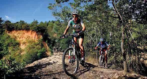
1
Welcome to Langhe Roero!
Langhe Roero, a well-kept secret
The network of hills that rises up from the Po river towards the Apennine
mountain range to the south east, in a sort of musical crescendo, is known
by three historical names that now encompass an area divided into multiple
provinces. Those three names are Monferrato, Roero and, finally, Langhe. The
Langhe region is the last bastion of an ancient world, separated from the rest
of the Piedmont region by the Tanaro river and protected by the wall of the
Apennines that rises above 1,000 metres (3,280 ft) throughout its length.
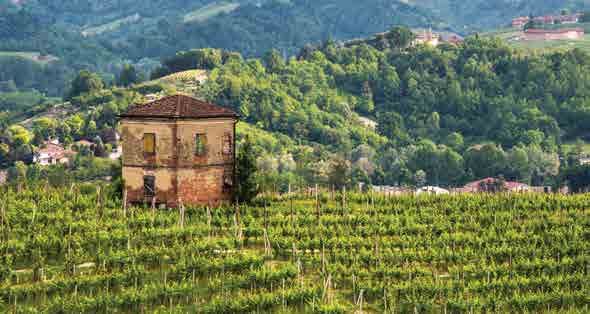
This cradle nestled between the mountains and the river has its own special
microclimate and unique soil (with marine sediment carved away by rivers giving
each hillside its own special strata) to produce some of the most desirable
delicacies of Italian cuisine. This special corner of the country features products
of unmatched excellence, some of which are closely kept secrets known only by
gourmets around the world.
This is the realm of the Nebbiolo grape and its noble offspring, Barolo,
Barbaresco and Roero wines, protected by castles, towers and walled villages
that harken back to the battles and the splendor of the Middle Ages. Pilgrims,
salt merchants, soldiers in the crusades and Benedictine monks have all walked
these lands and left their mark on local culture and heritage. But it was
1
Introduction                                                                                       2

               the lowly farmer, after centuries of hard work, who shaped these hills into the
               breathtaking landscape we see today.
               And beneath these special hills lies the most secret of the region’s treasures, the
               Alba White Truffle (Tuber Magnatum Pico), that “gray diamond” so loved by the
               likes of Cavour and Vittorio Emanuele II and made famous around the world by
               the youngest son of a family of poor sharecroppers, Giacomo Morra, inventor of
               the Alba White Truffle Fair and a sort of deus ex machina for the Langhe region.
               But the Langhe Roero area is not just about food. It is a true haven for hikers,
               cyclists, and all lovers of the great outdoors. A maze of trails crisscrosses the hills
               providing a range of options for beginners and experts alike. You can go from
               strolling along the false flat of row after row of Barolo and Barbaresco vineyards
               on a quest to visit all of the most famous crus to following in the footsteps of
               “Johnny the Partisan” along the rugged trails described by Beppe Fenoglio; from
               the rolling hills of “The Moon and the Bonfires” steeped in the poetry of Cesare
               Pavese to the Grande Traversata delle Langhe (the Great Langhe Trail, or “GTL”),
               a three-day itinerary that will take you from Alba to the Ligurian sea along the
               same mule tracks travelled for centuries by merchants and smugglers alike. The
               bandits have long disappeared, but the spectacular landscapes and amazing
               flora made of rare orchids and age-old beech remain.
               Another unexpectedly fascinating itinerary is that of the Rocche del Roero
               (literally: Roero rock formations), tour made of outdoor adventure and the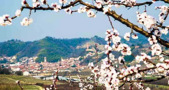
discovery of local flora, fauna and geology, interspersed with sudden streaks of sand
bursting with marine fossils that tell the tale of millions of years ago, when this all
was beneath the sea, only the tallest of the hills poking up through the surface of the
water as islands in the Adriatic.
Explore on foot or by bike the ancient cart tracks, steep mule tracks, trails through
the ravines or along the crests of the hills, all the other roadways that have taken
people from the hills to the sea for thousands of years and experience the history
here in your own unique way, as you stop in silence to focus on details or enjoy the
landscapes and interact with the locals and with the local wildlife. Take in all the
history, folklore, cuisine, geography and, of course, the heart and soul of these hills
as you go.
Although some of these ancient roads have since become modern-day paved streets,
others have been swallowed up by the woods and are referred to, collectively, as the
“Salt Roads”. They often still run through ancient toll stations that once helped fill the
pockets of the local squire with monies that he may have then used to pay an artist
to paint a beautiful fresco on a local church and create a little corner of paradise.
Here in the Langhe, frescos can be found in some unexpected places, far from major
cities, in secluded valleys and on remote hilltops, almost all of which belong to the
renowned Mondovì school and late Gothic style.
Castles and towers will take you back to the days of King Arthur and the Knights
of the Roundtable (as there are few places that have better preserved medieval
architecture than the Piedmont region). Because the enemy here was most frequently
the Moors (in addition to the lord from the hilltop fiefdom across the way), pirates
RBT - Roero Bike Tour • Introduction                                                         3
Introduction                                                                                      4

               who pillaged lands near the sea, a system of watchtowers was built alongside the
               fortresses in order to sound the alarm from the sea on up to Asti, spreading word
               of an attack in just about an hour. Over the centuries, many of the medieval manors
               have been embellished and transformed into luxurious Baroque residences as a
               new power arose throughout the Piedmont region in the form of the House of Savoy,
               ruling over the region from the sumptuous Royal Palace of Turin beginning in 1631.
               It is here in the Langhe Roero region made of woodlands and ravines — the oak
               trees, hazelnuts and pasture lands making stone villages and rural churches uniquely
               fragrant — that the Piedmont of the House of Savoy preserves its more feral soul.
               It is a soul of age-old beauty that is reflected in the snowy, protective mountaintops
               of the Alps as the hills here are brushed by the wind from the sea, creating a
               microclimate that is just what it takes to produce the area’s inimitable wines. But
               it is also a rugged soul made of hard work and sacrifice, poverty and emigration,
               resistance and resignation, as described in the works of Cesare Pavese and Beppe
               Fenoglio, two of Italy’s greatest authors of the 20th century, both of whom grew up
               here in these hills.
               So it was not by chance that all of this was named a World Heritage site by UNESCO
               in 2014, this vineyard landscape becoming the 50th Italian site to be so protected. Of
               course, we locals have always known we lived in particularly magical place.
               Knock, say you’re a friend, and all will be opened to you.
               Welcome!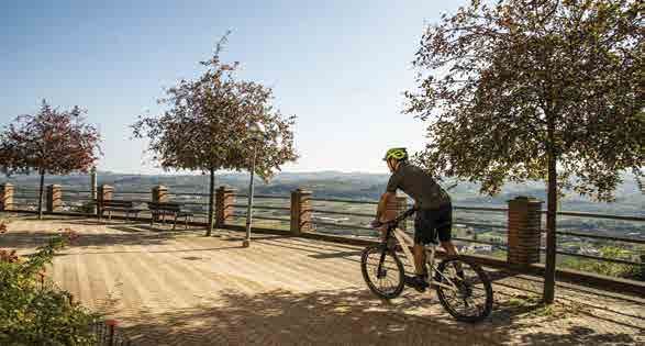
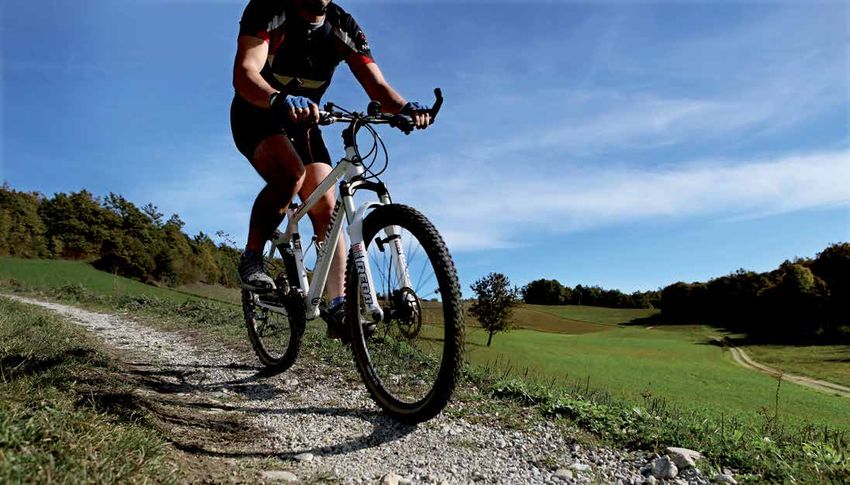
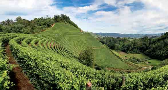
RBT - Roero Bike Tour
The Roero Bike Tour (RBT) is set in a section of hills known as the Roero
region laying along the left bank of the Tanaro river, which separates it from
the Langhe, on the confines with the provinces of Turin and Asti. Here,
historical villages, cultivated fields and other signs of humanity are immersed
in nature that remains largely untamed, featuring dense vegetation and
harsh hillsides. It was the Roero Family from Asti that possessed most of
the land and castles here and so gave the territory its name. It is a land of
passage and maintains its age-old vocation to trade and to hospitality.
As you cycle along the Roero Bike Tour, you will move from village to
village along nature trails or low-traffic roads on a journey through the one-
of-a-kind landscapes and vistas, such as the Rocche (singular: rocca, a
term that refers to local rock formations that are an unusual geological
phenomenon and which protect a wealth of biodiversity), vineyards, truffle
forests, cultivated groves, hilltop villages and castles.
The itinerary makes for a thrilling ride on a mountain bike or e-bike! It is a
total of about 140 km (87 mi) long and is to be done in one specific direction.
Its 7 sections are complemented by a number of variations, including both
alternate and connecting routes, and encompasses the three major existing
trails: the “Grande Sentiero del Roero”- S1 (Great Roero Trail); the “Sentiero
del Roero Centrale”- S4 (Central Roero Trail); and the “Sentiero dell’Acino,
Mulini e Castelli – Roero Orientale” - S3 (West Roero Trail of the Grape, Mills
and Castles).
RBT - Roero Bike Tour • Presentation                                              5
6
Contents
Leg 1 Borbore (Vezza d’Alba) - Montà p. 11 Leg 4 Pocapaglia - Monticello d’Alba p. 57
Variant 1A Canale - Rocca Tagliata (Canale) p. 19 Leg 5 Monticello d’Alba –
Borbore (Vezza d’Alba) p. 65
Leg 2 Montà - Monteu Roero p. 25
Leg 6 Borbore (Vezza d’Alba) – Govone p. 73
Variant 2A Monteu Roero - Battagli (Vezza d’Alba) p. 33
Variant 6A Castagnito - Guarene p. 81
Leg 3 Monteu Roero - Pocapaglia p. 41
Leg 7 Govone – Castagnito p. 87
Variant 7A Sotteri (Guarene) - Guarene p. 94
Variant 3A Saliceto (Pocapaglia) -
San Sebastiano (Pocapaglia) p. 49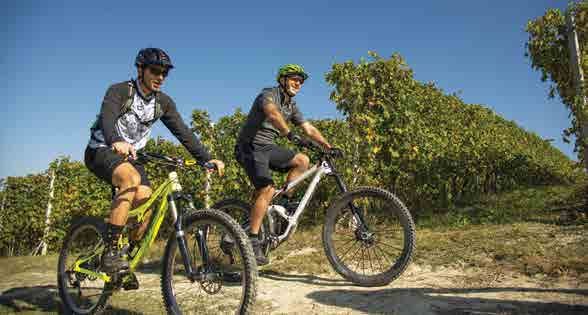
Langhe Roero

                                        The RBT
                                        Roero Bike Tour
                                        itinerary

RBT - Roero Bike Tour • Where we are                      7
RBT - Roero Bike Tour • How to get here 8
Torino Cocconato
How to get here: Castelnuovo
Don Bosco
Moncalvo
Frassinello
Monferrato
Chieri
Moncalieri
By car, motorways: Villanova
Castell’Alfero
d’Asti
A6 – Torino Savona, Marene or Carmagnola exit None Villafranca
Poirino d’Asti
A21 – Torino Piacenza, Asti Est exit cenza
rino Pia
A21 - To
A33 – Asti Cuneo, Alba exit Carmagnola Pralormo Rocchetta
Tanaro
San Damiano
d’Asti
Montà
By plane:
A6
Govone Nizza
-T
Canale Agliano
eo
Monferrato
or
Milano Malpensa and Linate – www.sea-aeroportimilano.it
un
Racconigi
ino
iC
st
Torino Caselle – www.aeroportoditorino.it
Sa
-A
vo
Canelli
3
Cavallermaggiore
na
A3
Cuneo Levaldigi – www.aeroporto.cuneo.it
Alba
Savigliano Cherasco Acqui Terme
By train: La Morra
Ferrovie dello Stato: www.trenitalia.com Genola
Barolo
Monforte Cortemilia
d’Alba
Fossano Bergolo
Dogliani
BossolascoLoc. Rocca
Tagliata Cisterna
Itinerary
d’Asti
for
esigned
Montà
o w n s ignage d long the Govone
its s a
Tour has nd-shaped sign y of Ceresole d’Alba Canale
h e R o e ro Bike e d ia m o o u t th e difficult Santo
T rc h th ti o n a b cu lt . Stefano
Priocca
Sea a
cyclists. you inform medium, red - diffi
Roero Castellinaldo
e ra ry , th at gives y e ll o w - e re are also
Monteu Roero d’Alba
itin - easy , often th
Sommariva Bosco Montaldo Magliano
e n ry inting
Roero
g re t v e
: rocks po far
Fraz.
the path times, b u Vezza Alfieri
o w n a t e e s a n d d’Alba Borbore
y fall d s on tr ods and Sanfrè Baldissero
Signs ma d white) marking ecially in the wo GPS map
d’Alba Loc. Castagnito
Sommariva Battagli
an ction, es
p
nsult the
Perno
the (red right dire r any doubts, co w.langheroero.i
t Guarene
u in th e o w
Corneliano
yo a d s . F s it e s w d’Alba Piobesi C. Sotteri
ed ro the
from pav downloaded from he.it.
Saliceto d’Alba
ys
t c a n b e
useod e ll e ro c c can alwa
tha ut these
Monticello d’Alba
w .e c o m la c e s , b e , o r by
and ww s in p ur bik Pocapaglia
te c h n ic al section g or pushing yo . Along the
There are e on foot, carryin between villages es and for
be overc
om lic transit rging e-b .
ik Santa Vittoria d’Alba
Alba
in g u s e of pub d stations for cha th e w ay Bra
ma k marke ry along
e re a re e c e s s a
route, th may be n RBT -
airs that
minor rep Roero Bike Tour
itinerary
Variant
RBT - Roero Bike Tour • Itinerary 9RBT - Roero Bike Tour • Itinerary 10
Notes
1A
e
apting th
e in c ircuits, ad s .
may be
don rence
ific prefe
The RBT uit your own spec
to s 1
itinerary 2
n).
nal sectio
Ring 1 le g s 1 , 2, 2A, 5 (fi RING 1
ed of
Compos 1 mi)
34 km (2
6
Len g th :
with
junction RING 4
(u p to the
Ring 2
2A
3 , 4 , 5
d of legs 3A 3
compose
6A
A .
the 2A), 2 m (30 mi) RING 3 RING 2 7 7A
8k
Length: 4 5
Ring 3 leg 3A.
ed of the
Compos .5 mi)
5.5 km (9
Length: 1
mi)
m (26.75
gth: 43 k
4
Ring 4 d 7. Len
o s e d o f legs 6 an
CompLeg 1
Borbore (Vezza d’
Alba) - Montà
11RBT - Roero Bike Tour • Leg 1 Borbore (Vezza d’Alba) - Montà 12
Leg 1
Borbore (Vezza d’Alba) -
Montà
A route connecting the two hearts of the Roero region – one that looks
out over the Langhe and the other that runs along the crest of the Rocche
rock formations – this section will take you from Vezza to Montà by way
of Canale, to encounter a number of theme-based trails.
DISTANCE/PROFILE ELEVATION DIFFICULTY
START FINISH
11,5 km 205 m 315 m MCItinerary profile
315 m
205 m
188 m
0 Km 6 Km 11,5 Km
Borbore (Vezza d'Alba) Canale Montà
RBT - Roero Bike Tour • Leg 1 Borbore (Vezza d’Alba) - Montà 13RBT - Roero Bike Tour • Leg 1 Borbore (Vezza d’Alba) - Montà 16 The starting point is the parking lot of Banca d’Alba in Borbore, a hamlet of Vezza d’Alba. From here, follow the markers for “Sentiero del Torion”, a ring trail dedicated to the eclectic ciabòt that can be seen atop the “del Castellero” hill. The feature of small building (of the sort typically found in the middle of a field, once used by farmers as a tool shed or other shelter) is its unique tower shape, from which it gets its name torion. There is also a large hole in the side of the building, which was created by a bombing in 1944 during one of the battles between the resistance fighters and members of the Repubblica Sociale Italiana. From the parking lot, head up in the direction of Castagnito. After just a few metres, take Strada Varasca to your left. When you reach the buildings of a winemaker, turn right onto a flat road that soon turns to gravel. Continue along the flat, parallel to highway SP 29, through cultivated fields and hazelnut groves. You will then find orderly rows of poplar trees, which, in springtime, create a spectacular “snowfall” effect when the pappi fall from the trees and float through the air. At a crossroads, you will find a small wayside shrine, one of the many that are found along the country roads of the Roero region. Continue straight here until you reach Patarrone. Here, before “Sentiero del Torion” takes a right and starts to ascend, continue straight along a flat road towards Canale. After about 450 metres, turn sharply to the right onto the gravel and head up the hillside. Just before the top,
at a wide switchback to the left that passes the drive to a private home,
                                                               continue along the crest in the direction of Canale, the tall bell tower of
                                                               which can now be seen in the distance. Pass a raised ciabòt followed by
                                                               the church of S. Michele nestled in a natural amphitheater of vineyards.
                                                               Keeping to the left, you will begin heading down towards the new
                                                               industrial zone of Canale, as the trail runs alongside the main highway.
                                                               When you get to a large roundabout, continue along the service road
                                                               of several industrial buildings. Pass the cemetery and continue in the
                                                               direction of the centre of town. Continue along Corso Asti until you reach
                                                               Canale’s historic wine cellar Cantine Enrico Serafino, where Corso Asti
                                                               meets Via Roma.
                                                               Here, a long series of shop windows run down both sides of the town’s
                                                               main street. The centre of town, with its orderly streets and porticoes
                                                               along each side of the main street, maintains the typical villanova structure
                                                               that the city of Asti established in 1260 for its neighboring settlements
                                                               (including Anterisio, Loreto di Canale, Castelletto d’Astisio, the “old”
                                                               Canale, and other minor settlements) after the defeat of the Biandrate
                                                               Family. In 1379, dominion over Canale passed to the Roero Family and
                                                               then gradually, beginning in 1512, shifted hands to the Malabaila Family,
                                                               who inhabit the castle, with its park of old-growth trees, to this day.
                                                               Once you’ve reached Piazza della Vittoria, you’ll not want to miss a trip to
                                                               Enoteca Regionale del Roero, the institutional wine centre that provides
                                                               information for tourists about the winemakers in the Roero region.
RBT - Roero Bike Tour • Leg 1 Borbore (Vezza d’Alba) - Montà                                                                             17
RBT - Roero Bike Tour • Leg 1 Borbore (Vezza d’Alba) - Montà 18 Here, you will find a lovely garden in the building’s inner courtyard, as well section between the high walls of the Rocche, steep vineyards and areas as a famous Michelin-starred chef on the upper floor. The 13th century in the shade of the surrounding vegetation. Civic Tower, which you will pass along this route, is all that is left of this When you reach the summit, continue on until you reach the Centro village’s outer wall. Outdoor Valle delle Rocche in San Grato di Montà. This mountain bike The square of the Church of San Bernardino has remained essentially park is situated at the junction of four trails and features a MTB/XC circuit, unchanged since the early 1900s, when it was entirely occupied by a daily a lighted pump track and a dual-slalom run with loads of kickers and peach market. In those days, due to a number of diseases that affected berms. Here, you will also find a range of services for cyclists, including a the vineyards, peaches became the dominant agricultural product and self-serve workshop, bike wash, locker rooms and restrooms. Canale became known internationally as a producer of quality peaches. Leaving the bike park behind you, continue along Via Morra, a dirt road Today, there are far fewer peach groves than there once were, but a that runs along the crest of the hill in the direction of the hilltop village of peach trade fair is still held here every July and a handful of art nouveau Montà, with a panoramic vista over the area’s rock formations. Continue buildings with intriguing floral decor point to a period of economic boom alongside the tranquil park of the 16th century Morra Lavriano Castle. for the entire town. One such building can be found at the start of Via When you reach Piazza di Sant’Antonio Abate with the village’s main Torino in the direction of Montà. church behind you, head down into the historical centre along Via Roma. From here, turn right when you come to signs for “Agriturismo Le Querce You will pass the Civic Tower (circa 1754) on your left, which marks the del Vareglio” and continue along a narrow road, which starts out paved start of the trail “Strada delle Masche” (Street of the Masche), a brief, and then turns to gravel, until you cross a small stream. Turn left here panoramic stroll to a natural balcony overlooking the surrounding hills. into the fields, then soon head up to the right to gradually climb the San Bartolomeo hillside (which gets its name from the shrine at its summit) through a myriad of hazelnut groves, vineyards, woods and cultivated fields. You will come across the trail S1, that here correspond to the “Sentiero del Castagno” (literally: “Trail of the Chestnut”, which you will follow in the opposite direction from what the signage indicates) in a
Variant 1A
Canale - Rocca Ta
                 gliata   (Canale)

                                     19
RBT - Roero Bike Tour • Variant 1A Canale - Rocca Tagliata (Canale) 20
Variant 1A
Canale -
Rocca Tagliata (Canale)
A variation of the previous section, this route takes you to the isolated
hamlet of Rocca Tagliata along a section of the S1 trail and then a section
of “Sentiero del Castagno”, while also extending into the territory of
Cisterna d’Asti and with the option of going to Montà.
DISTANCE/PROFILE ELEVATION DIFFICULTY
START FINISH
2,7 km 205 m 335 m MCItinerary profile
335 m
205 m
0 Km 2,7 Km
Canale Rocca Tagliata (Canale)
RBT - Roero Bike Tour • Variant 1A Canale - Rocca Tagliata (Canale) 21From Canale, head along Via Torino (intersection with leg 1) past the last
homes in the village. Turn right when you come to signs for “Agriturismo
Le Querce del Vareglio” and continue along a narrow road, which starts
out paved and then turns to gravel, until you cross a small stream. Here,
instead of turning left as described for the previous section, continue
straight until you reach the hamlet of Pecetto and a section of vineyards
along the S1 trail. At this point, the route begins to ascend, gradually at
first and then in a steep zigzag through hillside vineyards along a dusty
road in the direction of Casa Natura, which you will reach after passing
through a small wooded area. Home of Associazione Canale Ecologia, the
building is situated on a plateau and was once the site of a skeet shooting
range. It is now equipped with a small kitchen, restrooms, a classroom
and is often used by associations and other groups as a meeting point for
camping or other outings. There is also a self-serve workshop for cyclists.
Beyond Casa Natura, turn sharply to the left and follow along the S1
trail for a long section along the crest of the hill, through vineyards and
woodlands, in the direction of Montà and Cisterna d’Asti. This is the
San Nicolao Nature Park, a protected oasis now owned by the non-
profit Associazione Canale Ecologia, which works to maintain the area’s
biodiversity for future generations. Continue along the crest until Rocca
Tagliata, where you will meet up with “Sentiero del Castagno”. This trail
can be followed for a section through town in the direction of Valle del
Saretto.
RBT - Roero Bike Tour • Variant 1A Canale - Rocca Tagliata (Canale) 23RBT - Roero Bike Tour • Variant 1A Canale - Rocca Tagliata (Canale) 24 Rocca Tagliata, a pleasant hill far from residential areas, was selected as a base camp for the partisans’ 23rd Canale Brigade, an aggregation of the groups from Canale, Magliano Alfieri, Santo Stefano Roero and Vezza d’Alba formed in August of 1944. This area served as the base for incursions against Fascist soldiers crossing through this area and through Cisterna d’Asti and it was here that the precious cargo of one of the Allied Forces’ parachute supply runs was hidden. From Rocca Tagliata, you can follow the signs for Il Grande Sentiero del Roero (Trail S1) to Cisterna d’Asti, the hilltop village at the end of the Rocche ridge. This is the only municipality of the province of Asti that is a part of the Roero region both geographically and geologically, and it is in a prevalently hilly area featuring woods and vineyards. The village has ancient roots and was once enclosed within walls atop a natural escarpment. It features two main landmarks: its castle, which houses the storage tank (cisterna in Italian) which gave the village its name; and the main church. The oldest section of the castle dates back to the 12th century and features a medieval tower. The castle as it appears today is the result of a work that was done in the late 1500s and in the following century. Today, the castle is home to the Museo Arti e Mestieri di un Tempo (Museum of Ancient Arts and Trades), which houses over 5,000 artifacts from the 17th to the 20th centuries that embody the culture of the Piedmont region arranged in 20 shops that offer a detailed reconstruction of life as it once was.
Leg 2
Montà - Monteu R
                oero

                       25
RBT - Roero Bike Tour • Leg 2 Montà - Monteu Roero 26
Leg 2
Montà - Monteu Roero
A route along the central crest of the Rocche rock formations to admire
the “miracle” of how the Tanaro river was captured and what that event
created.
DISTANCE/PROFILE ELEVATION DIFFICULTY
START FINISH
8,5 km 312 m 373 m MCItinerary profile
373 m
312 m
0 Km 8,5 Km
Montà Monteu Roero
RBT - Roero Bike Tour • Leg 2 Montà - Monteu Roero 27RBT - Roero Bike Tour • Leg 2 Montà - Monteu Roero 30 The starting point for this leg is Montà, which is famous for the Alba White Truffles that enjoy an ideal habitat in the Rio Canneto and Mornaldo areas. In the village, you can experience a simulated truffle hunt with local experts or purchase truffles in the local shops. There are also a great many wine cellars in which to sample and purchase the local Roero and Roero Arneis DOCG wines, as well as apiaries that produce acacia, chestnut and wildflower honey. The centre of the village also features a great many quality shops and two open-air markets each week, on Thursday and Sunday mornings, for shopping fun. Start from Vecchia Segheria, home to the Ecomuseo delle Rocche del Roero, which is open for information on trails and outings in the area. Here, the itinerary coincides with the “Grande Sentiero del Roero” (Trail S1), the signposts of which may be followed as a guide. Follow along Via Cavour, the main street of town, past Piazza San Michele, where you will find the Town Hall. Continue along the first section of Via Roma, then turn onto Via Maccallè, which heads slightly downhill. At the end of this street, on a building at the edge of the roadway, you will see a large fresco of Benito Mussolini, which was executed in 1936 and is one of the most significant surviving examples of Fascist art in the Piedmont region. Continue downhill along Via Genova to the last few homes in the village, then follow a dirt trail through the vineyards, which runs parallel to highway SP 29. An abrupt crossing will take you to another valley and in another direction as you descend beneath dense vegetation in the
direction of Val Diana (Vallis Dianae), an area of woods and gorges they
                                                     say was blessed by a pagan goddess of the hunt.
                                                     The itinerary continues winding along the base of this damp valley as
                                                     it follows the Rio Canneto through lush habitats for truffles and the
                                                     occasional muddy stretch where rain water tends to gather. The trail then
                                                     heads back up through hillside vineyards with a final steep section of
                                                     climb to the last few hexagonal chapels of the Stations of the Cross of
                                                     Santuario dei Piloni, which was a place of pagan worship during the pre-
                                                     Roman era before being converted to use by Christians. It is an evocative
                                                     setting with a 360° view of the surrounding hills and is certainly worth a
                                                     leisurely visit. The chapels, records of which date back to 1774 and which
                                                     were rebuilt in their current hexagonal shape in 1897, contain groups of
                                                     statues depicting scenes from the Passion of Christ. By taking a brief
                                                     detour along the “Sentiero Religioso” (Religious Trail), you will reach the
                                                     Church of SS. Giacomo e Filippo Minore, which features two marble
                                                     heads from the late-Roman era and the remains of brickwork from the
                                                     13th century.
                                                     Returning to the main itinerary, stay along the crest of the hill in the
                                                     direction of Santo Stefano Roero as you enjoy, to your left, a panorama
                                                     of untamed, natural amphitheaters of cliffs and other rock formations.
                                                     You will also note the typical flora found on Roero hilltops, including
                                                     chestnut trees, Scots pine, and steep hillside vineyards. The Rocche
                                                     rock formations are a constant feature of this section of the itinerary
RBT - Roero Bike Tour • Leg 2 Montà - Monteu Roero                                                                           31
RBT - Roero Bike Tour • Leg 2 Montà - Monteu Roero 32 and throughout the “Grande Sentiero del Roero”, a trail that crosses the highway SP 110. Continue alongside the town cemetery, then turn left sandy landscapes of this geological phenomenon that extends for over in the direction of Carretta. On March 8, 1945, this tiny hamlet was the 40 kilometres (25 miles). The origin of these rock formations dates back site of a victorious battle of the resistance fighters, who had a base here, some 250,000 years ago and certain geological changes to the area against Fascist troops returning to Turin after several days of violent due to erosion caused by a phenomenon known as the “Capture of the skirmishes in Cisterna d’Asti. It is said that so many shots were fired on Tanaro”. The Tanaro river originally flowed from south to north, reaching that day that the trunks of the large chestnut trees alongside the road the Po river near Carmagnola. As a result of erosion caused by another here are still riddled with bullets. river, the Tanaro changed course and began flowing towards Alba, hence After climbing past the homes in Carretta, the trail winds down through the the “capture” of the Tanaro river, which caused great changes to the cool of old-growth chestnut trees, crosses the “Sentiero della Castagna soil in the valleys affected. The streams and rivers of the Roero area Granda”, (Big Chestnut Trail) and reaches the hamlet of Lambi, where began shifting towards the new Tanaro Valley, carving deep gorges and you will find a breathtaking view of the medieval Monteu Roero Castle picturesque ravines into the sandy soil. The tributaries inherited by the overlooking the valley of pristine woodlands. It is an image from another former watershed adapted to this new situation and the result of all this time, one that evokes stories of the robbers and bandits who, in the 19th was truly unique; cliffs and spires, fossils and pyramids of yellow sand century, sought escape routes along these isolated trails, such as the can still be seen amid the rolling Roero hills, which are so fragile that infamously ferocious Delpero, who once terrorized this area. landslides and mudslides continue to alter the landscape from one year Once back on the asphalt, continue in the direction of Monteu Roero. to the next. When you reach highway SP 29 at the entrance to the village, turn Once at Bricco Bissoca, at an altitude of 405 metres (1,330 ft) where immediately right towards the cemetery. you will find an impressive, cylindrical aqueduct, the trail begins to fall steeply back down the hill with a stunning view of the village of Santo Stefano Roero. When you reach Piazza Santa Maria del Podio, with its characteristic ridge of rock decorating the square, you can take a break here or in the local trattoria, or you can continue the itinerary along
Variant 2A
Monteu Roero - B
                attagli   (Vezza d’Alba)

                                           33
RBT - Roero Bike Tour • Variant 2A Monteu Roero - Battagli (Vezza d’Alba) 34
Variant 2A
Monteu Roero -
Battagli (Vezza d’Alba)
A variation of the RBT itinerary, this section connects the two central
crests of the Roero region as you ride alongside the crest of the Rocche
rock formations, descend into the valley, then head back up towards
Vezza d’Alba.
DISTANCE/PROFILE ELEVATION DIFFICULTY
START FINISH
7 km 373 m 340 m MCItinerary profile
373 m
340 m
0 Km 7 Km
Monteu Roero Battagli (Vezza d’Alba)
RBT - Roero Bike Tour • Variant 2A Monteu Roero - Battagli (Vezza d’Alba) 35RBT - Roero Bike Tour • Variant 2A Monteu Roero - Battagli (Vezza d’Alba) 38 Start in Monteu Roero’s Piazza Roma, where you can enjoy one of the most spectacular views of the area’s Rocche in a stunning, natural amphitheater just outside the village. The town actually rests on a strip of friable rock, so the homes closest to the ledges require regular work on their foundations to ensure that they are safe. Follow along Via Umberto I in the direction of Canale, leaving the Church of San Nicolao behind you, and continue along the wall of the medieval Monteu Roero Castle, which rises up from atop Mons Acutus, the tallest of the hills here, and for which the village was named. This privately-owned castle is opened for tours during “Castelli Aperti” (Open Castles) and other local events when the village opens its doors to visits of its network of underground wine cellars. A visit to the castle is a great opportunity to get a feel for what life must have been like in the Middle Ages, especially in the manor’s inner courtyard, and to admire the wonderful frescoes on the main floor. As the road narrows, you will come to the Church of San Bernardino, facing the climb up to the castle. Continue along the road, then turn right after a few steps at a downhill switchback, where you will see a frescoed shrine on your right surrounded by a hedge, whereas to your left there is an impressive rock wall. Here, you will begin following “Sentiero dei Fossili” (Fossil Trail) in the opposite direction along highway SP 29 in the direction of Tre Rivi. Before a sharp switchback, take a narrow, paved road to the right, which soon turns to dirt and takes you
through vineyards, cultivated fields and strawberry farms to the base
                                                                            of the valley at Tre Rivi. A large ciabòt clinging to a hill, surrounded by
                                                                            vineyards, guards this section of the trail. The structure was built over the
                                                                            remains of the Pulciano Castle, which was lost nearly a millennium ago
                                                                            and was replaced by the current medieval manor, and is one of the most
                                                                            photographed scenes in the entire area.
                                                                            Once back at highway SP 29, near an information panel, leave the
                                                                            “Sentiero dei Fossili” to the right in the direction of Montaldo Roero. After
                                                                            about 50 metres, leave the paved road again to follow a dirt road to the
                                                                            left, which briefly runs parallel to the main highway through the fields,
                                                                            before heading up gradually through the vineyards as it zigzags through
                                                                            small hamlets and past lovely farmhouses to the top of the hill and the
                                                                            houses of S. Vincenzo and Occhetti. When you reach highway SP 257,
                                                                            turn right onto the paved road and continue on until you reach “Sentiero
                                                                            del Tasso” (Badger Trail) near the hamlet of Cà Violi.
                                                                            Continue along the main highway, then in a few hundred metres, at a
                                                                            sharp curve to the left, turn right onto a flat dirt road, where there is a
                                                                            wayside shrine that is now half buried by the raised surface of the road.
                                                                            From here, you can follow the markers for “Sentiero del Tasso”, dedicated
                                                                            to the badgers that enjoy an ideal habitat in these woods and numerous
                                                                            dens of which have been sighted along this trail. Continue through the
                                                                            cool of this trail for about 300 metres, then turn left up a lovely climb
                                                                            through shady woods and vineyards. This area, known as Vadolmo, is
RBT - Roero Bike Tour • Variant 2A Monteu Roero - Battagli (Vezza d’Alba)                                                                             39
RBT - Roero Bike Tour • Variant 2A Monteu Roero - Battagli (Vezza d’Alba) 40 important for the fossil of a mastodon’s leg bone that was found here and which dates back to the Pleistocene era. This fossil is now kept at the Roero Nature Museum in Vezza d’Alba. The trail then passes through characteristically dry woods of downy oak and Scots pine to reach the crest of the hill. This section ends near Cascina Battagli, where “Sentiero del Tasso” meets “Sentiero del Roero Centrale” (S4) on the Monticello– Vezza d’Alba leg of the Roero Bike Tour (Leg 5).
Leg 3
Monteu Roero - Po
                 capaglia

                            41
RBT - Roero Bike Tour • Leg 3 Monteu Roero - Pocapaglia 42
Leg 3
Monteu Roero - Pocapaglia
This leg of the itinerary takes you along the historic “Grande Sentiero
del Roero”, which winds along the crest of the Rocche rock formations
through the Silva Popularis, old-growth woods of the Po Valley. From
Pocapaglia, you can also reach the centre of Bra by following the signage
for Trail S1.
DISTANCE/PROFILE ELEVATION DIFFICULTY
START FINISH
14 km 373 m 365 m MCItinerary profile
378 m
373 m 365 m
365 m 365 m
0 Km 3 Km 5 Km 8 Km 14 Km
Monteu Roero Montaldo Roero Baldissero d'Alba Sommariva Perno Pocapaglia
RBT - Roero Bike Tour • Leg 3 Monteu Roero - Pocapaglia 43RBT - Roero Bike Tour • Leg 3 Monteu Roero - Pocapaglia 46 From Piazza Roma in Monteu Roero, follow the signs for the “Grande Sentiero del Roero” (S1). Cross the bridge over the gorge, then turn left in the direction of the town cemetery. Past the cemetery, the paved road continues along the flat past cultivated fields, greenhouses and hazelnut groves to Serramuana. After an abrupt deviation to the left, you will be immersed in the woods as you descend back down towards Cascina Sacargena, just outside Montaldo Roero, the smallest of the hilltop villages in this area, but you will not actually enter the village unless you choose to make a slight detour. The trail runs along the edges of this municipality and its woods, vineyards, groves (of apricots in particular, so there is an apricot festival held here every year in June), its cylindrical, medieval tower rising up above it all. A symbol of the village, this tower rises up an impressive thirty metres (98 ft) and has a diameter of more than 8.5 metres (27 ft). It was commissioned by the Roero Family circa 1374 alongside the older castle, which previously belonged to the De Montaldo Family and was lost in the 1700s. From Cascina Sacargena, the itinerary continues along highway SP 253 in the direction of Montaldo Roero. Near a wide crossroads, turn right onto highway SP 119 in the direction of Baldissero d’Alba. You will follow this highway for about two kilometres, so it will be best to keep to the right-hand edge of the road. The highway doesn’t see a lot of traffic, but better safe than sorry! It is also possible to cut
the length of this highway section in half by following the S1 trail, which   Continue slightly uphill to the right along highway SP 119, then turn right
heads into the woods past the Rocche and joins up with highway SP 119         after a few hundred metres near an information panel. From here, the
after about a kilometre. This flat highway will first pass by wheat fields    route follows the S1 trail along a dirt road through cultivated fields and
and hazelnut groves and then run alongside old-growth chestnut groves,        back into the woods. The views along this section are breathtaking as you
its majestic trees creating welcome shade for your journey.                   pass numerous natural balconies overlooking gorges protected by wood
Brought to the area by the ancient Romans, the chestnut tree was once         fencing. The elevation gain here is significant and the edge of the trail—
quite common throughout Roero, but is now only found in significant           held together by the strong roots of oak trees and Scots pine clinging to
numbers here on the Rocche. The peculiarity of these distinctive trees        the sand—overlooks the ravines in places.
here is that they grow at an altitude of 300 metres (985 ft), which is much   Once you have left the woods, fields of isolated farmhouses will accompany
lower than in other areas dedicated to the cultivation of chestnuts. The      you to an outlying residential area of the village of Sommariva Perno.
local variety is known as the “castagna della Madonna” (chestnut of the       Continue alongside a hotel complex, then turn left near Centro Sportivo
Virgin Mary) because its harvest begins around the time of the Nativity of    del Roero onto highway SP 10, which will take you into town. At the
Mary (September 8th) and such an early harvest enables these chestnuts        intersection with Strada Sappelletto, leave the main road that would take
to be sold as the “first fruits” of the season. As the farmers here have      you into the hilltop centre of the village (with its majestic castle, which
always said, “It was the only crop that didn’t cost anything. All you had     was once the residence of Rosa Vercellana, the first Countess of Mirafiori
to do was go out and collect it, like manna from heaven.” Today, chestnut     and Fontanafredda and wife of Victor Emmanuel II, King of Italy), then
cultivation is being threatened by disease, but there are still vast areas    turn right along a straight road, past homes with well-groomed yards.
of old-growth chestnut trees whose trunks can reach circumferences of         This narrow, paved road continues through the countryside then turns
greater than 5-6 metres (15-20 ft).                                           to dirt and gravel after a few kilometres. Head back up the hillside and
Returning to the itinerary, once you have reached Baldissero d’Alba,          back into woods that stretch for many miles along the base of this damp
turn left at the first houses and continue to the roundabout at the           valley alongside the Roero cliffs. These woods are a part of what locals
intersection with Via Roma. Looking up, you can see the silhouette of         refer to as the “fini superiori”, an important, protected forest that the
the neo-Gothic castle of the Colonna Family and its crenellated towers.       ancient Romans referred to as silva popularis (from populus, poplar)
RBT - Roero Bike Tour • Leg 3 Monteu Roero - Pocapaglia                                                                                               47
RBT - Roero Bike Tour • Leg 3 Monteu Roero - Pocapaglia                 48

and which features oak, poplar, Scots pine, and a rich undergrowth
of periwinkle and asphodel.
As the trail leaves the woods, it becomes paved again and takes
you to Saliceto/Cravioli in the village of Pocapaglia. At the
roundabout, turn left in the direction of Pocapaglia, which you will
reach after a long, straight stretch of road that runs along the rest
area Asfodelo and descends gradually into the village. Past the
small picnic area of San Sebastiano with its view over spectacular
gorges on both sides, the road begins to climb up towards the
Pocapaglia Castle, its walls draped in caper plants. Pass the
castle’s magnificent outer gate with its warlike high-relief details,
which are said to be the work of Jacopo Sansovino, and continue
on into the central Piazza Principessa Maria Pia.
Variant 3A
Saliceto (Pocapag
                 lia) - San Sebastia
                                    no (Pocapaglia)

                                                      49
RBT - Roero Bike Tour • Variant 3A Saliceto (Pocapaglia) - San Sebastiano (Pocapaglia) 50
Variant 3A
Saliceto (Pocapaglia) -
San Sebastiano (Pocapaglia)
A variation of the main RBT itinerary, this is a flat ring loop through the
woods that reaches out to the village of Sanfrè and its impressive castle,
with possibility to reach, with a brief detour, the centre of Bra.
DISTANCE/PROFILE ELEVATION DIFFICULTY
START FINISH
15,5 km 373 m 390 m TCItinerary profile
390 m
373 m
280 m
0 Km 7,5 Km 15,5 Km
Saliceto (Pocapaglia) Sanfrè San Sebastiano (Pocapaglia)
RBT - Roero Bike Tour • Variant 3A Saliceto (Pocapaglia) - San Sebastiano (Pocapaglia) 51RBT - Roero Bike Tour • Variant 3A Saliceto (Pocapaglia) - San Sebastiano (Pocapaglia) 54 The loop starts at the Saliceto/Cravioli roundabout in Pocapaglia. From here, turn right onto Strada Boschi, a leisurely road that passes a few homes and then fields and woods. When you reach the crossroads for “Sentiero Botanico della Verna” (Verna’s Botanical Trail), follow the signs inviting you to continue straight in the direction of Sanfrè. Past some homes in Borgata Martini and then Cascina Gioiosa, the road becomes the paved Via delle Chiese, one of the village’s oldest roads, which takes you to the historic centre of Sanfrè. Continue through a peaceful residential area until you reach the main entrance to the Isnardi Castle. This manor dates back to the early 1200s, but nothing remains of the original building, which was burned by the Spanish in the mid-16th century. It was rebuilt as an impressive aristocratic residence, complete with ramparts and a protected passageway that connects it to the village’s main church. In 1630, Christine Marie of France, Duchess of Savoy and wife of Victor Amadeus I, stayed here for a few months when she had fled Turin to escape the plague. At the end of the Isnardi dynasty, the castle was the home to a group of missionary nuns before it was purchased by its current owners, who open the residence to the public for guided tours and public or private events. Continue along past the walls of the castle beneath the watchtower, then head down towards the centre of the village. As you descend down Via delle Chiese, you will see important monuments such as the Church of SS. Pietro and Paolo, designed in Baroque style by Francesco Gallo
(who also designed the impressive elliptical cupola of the Santuario
                                                                                         di Vicoforte), the Sant’Agostino Confraternity, and the 18th century
                                                                                         Villa Rambaudi. When you reach Piazza De Zardo across from the
                                                                                         Town Hall, turn left onto Via Oscar Milano, which runs along the flat
                                                                                         to the intersection with Via della Valle. Follow this street for its entire
                                                                                         length as it leaves the centre and heads out to the residential area at
                                                                                         the edge of town.
                                                                                         Once you have passed the final homes, the road turns to dirt and
                                                                                         continues through an ample valley of cultivated fields and tranquil
                                                                                         woods. Cross a stream and continue along the trail to America dei
                                                                                         Boschi, where you will again find the S1 trail (“Grande Sentiero del
                                                                                         Roero”). This area features a vast forest of flora that enjoys these drier
                                                                                         conditions, such as the European oak (Quercus robur), the European
                                                                                         hornbeam (Carpinus betulus), the small-leaved lime (Tilia cordata), the
                                                                                         European aspen (Populus tremula), the field maple (Acer campestre),
                                                                                         the sweet chestnut (Castanea sativa), as well as the invasive “false
                                                                                         acacia” (Robinia pseudoacacia) and, in the driest and sunniest areas,
                                                                                         the Scots pine, downy oak, juniper, hawthorn, and viburnum.
                                                                                         When you reach Strada Salimau, which becomes paved at the edge
                                                                                         of the first of the area’s homes, continue on to a church of recent
                                                                                         construction. Turn left here onto highway SP 340, then keep to the
                                                                                         right after a few hundred metres to follow along a gravel road that
                                                                                         passes through woods and hazelnut groves before joining back
RBT - Roero Bike Tour • Variant 3A Saliceto (Pocapaglia) - San Sebastiano (Pocapaglia)                                                                           55
RBT - Roero Bike Tour • Variant 3A Saliceto (Pocapaglia) - San Sebastiano (Pocapaglia) 56 up again with highway SP 340. Continue along this highway to Saliceto/ Cravioli and on to the village of Pocapaglia near the San Sebastiano picnic area, where there is a grassy field overlooking a vast natural amphitheater of rock formations that is considered one of the most beautiful views of the entire area. From here, you can take a brief detour to Bra, at the head of Il Grande Sentiero del Roero (Trail S1), by following the signs for Trail S1. This town is at the crossroads of history, culture and cuisine. Its ancient origins are rooted in the Neolithic age and reach back to both the Roman Empire and the Savoy dynasty. As you stroll through its streets and squares, you will see important examples of Piedmont Baroque architecture and the hilltop villa La Zizzola, a symbol of the city. Bra is the town where the international Slow Food movement got its start and is also known for its own culinary delicacies, including: the Bra veal sausage, which is to be enjoyed raw and Bra cheese (PDO), which is celebrated together with cheeses from around the world as part of the international event “Cheese: Le Forme del Latte”. Add some fresh local produce to Bra sausage and cheese and enclose it all between two slices of artisanal bread for a slow-food sandwich that encapsulates all the flavors of this region.
Leg 4
Pocapaglia - Mon
                ticello d’Alba

                                 57
RBT - Roero Bike Tour • Leg 4 Pocapaglia - Monticello d’Alba 58
Leg 4
Pocapaglia -
Monticello d’Alba
Leg 4 of the Roero Bike Tour connects the area of the Rocche rock
formations to the central series of Roero villages, winding along paved,
low-traffic country roads for about the first half of the route.
DISTANCE/PROFILE ELEVATION DIFFICULTY
START FINISH
16 km 360 m 310 m MCItinerary profile
360 m
310 m
250 m
0 Km 6,5 Km 16 Km
Pocapaglia Santa Vittoria d'Alba Monticello d'Alba
RBT - Roero Bike Tour • Leg 4 Pocapaglia - Monticello d’Alba 59RBT - Roero Bike Tour • Leg 4 Pocapaglia - Monticello d’Alba 62
This section starts in Pocapaglia, set in one of wildest, least accessible
parts of this area. Landslides and mudslides over the years, caused
by snowfall and bad weather, have transformed this area into a series
of impassable gorges, giving the landscape a harshness that inspired
the many legends of the masche (singular: masca), mythical witches
who would lie in wait to cast their spells and curses on the unfortunate
passers-by. The most famous masca is Micilina, who legend has it was
burned at the stake right outside the castle here.
The route starts in Piazza Principessa Maria Pia, outside the Church of
SS. Giorgio and Donato. Head down in the direction of the Pocapaglia
Castle past the Ecomuseo Rocche e Masche and the S. Agostino
Confraternity. The castle, the first mentions of which date back to 1197
as the fortress of the “domini de Paucapalea”, is located on Via Cavour.
Head down from Via Cavour to highway SP 134, then turn left in the
direction of Sommariva Perno. After about 400 metres, turn right onto
Strada Sant’Ignazio, a paved country road that sees very little vehicle
traffic and which winds gradually downhill through vineyards, hazelnut
and other groves in the direction of Macellai. To your right, you can enjoy
the view of Orti di Bra and the Pollenzo plain (Pollentia to the ancient
Romans), where once were held the markets of the terracotta vases and
amphoras produced in the nearby area of Anforiano, the name of which
hearkens back to that glorious past.
Pass through Valentino and continue in the direction of Santa Vittoriad’Alba until you reach highway SP 153. After about 200 metres, at a tight switchback, turn right onto Via Cagna, which winds past the homes of the centre of the village to the top of the hill, where you will find the impressive bell tower. From here, take “Sentiero del Roero Centrale” (trail S4), which will take you to Vezza d’Alba. Pass the castle (which is now a hotel), with its impressive ramparts and characteristic square tower (12th to 15th century), and head back down into the valley along the panoramic Via Castello overlooking the city of Alba, the valley of the winding Tanaro river and the Langhe hills in the distance. Along the way, we recommend a visit to the San Francesco Confraternity, particularly for its series of frescoes, which are the oldest and best preserved of the entire Roero region dating back to around the mid-16th century, which depict scenes from the Passion of Christ. When you reach Piazza Bertero, continue along highway SP 171 in the direction of Monticello d’Alba. After about 500 metres, turn left onto a gravel road that heads up towards Ciabot Nogaris. At the top of the hill, go around the hotel and turn to the west along the hill-crest road through sunny vineyards and woodlands and past a few fruit trees. Head down to Case Nuove, then turn right in the direction of Pautassi and continue on to the intersection with highway SP 261. Follow the highway for about 100 metres, then turn right in the direction of Gramaglia-Pautassi to descend gradually past farmhouses, vineyards and farmland. At the crossroads with Strada San Grato, turn to the right again in the RBT - Roero Bike Tour • Leg 4 Pocapaglia - Monticello d’Alba 63
RBT - Roero Bike Tour • Leg 4 Pocapaglia - Monticello d’Alba                                                                          64

                                                               direction of Sant’Antonio di Monticello and enter the shade of the Lunero
                                                               woods. Continue along the paved road through the inhabited part of the
                                                               village. When you reach a wide roundabout, turn onto highway SP 241
                                                               and follow this road for about 500 metres, then turn right and head back
                                                               up the other side of the valley past the houses of Valdozza and the chapel
                                                               of Santa Maria Ausiliatrice. Dense woodlands run along both sides of the
                                                               road here, and through the trees you can catch glimpses of the towers of
                                                               the medieval Monticello castle or the surrounding rolling hills.
                                                               This leg ends in the hamlet of Villa of Monticello d’Alba, near the Church
                                                               of San Bernardino, but we definitely recommend a brief detour to visit the
                                                               castle and its park. It is one of the area’s best-preserved castles and,
                                                               despite various works done to it over the centuries, maintains the
                                                               impressive shape it was given circa 1376, the year in which it passed to
                                                               the Roero Family, who run it to this day for tours and events.
Leg 5
Monticello d’Alba
– Borbore (Vezza d’Alba)
65RBT - Roero Bike Tour • Leg 5 Monticello d’Alba – Borbore (Vezza d’Alba) 66
Leg 5
Monticello d’Alba –
Borbore (Vezza d’Alba)
A route that follows “Sentiero del Roero Centrale” (trail S4) through hilltop
villages as you admire castles, towers and groves.
DISTANCE/PROFILE ELEVATION DIFFICULTY
START FINISH
18,5 km 295 m 200 m MCItinerary profile
295 m
200 m 200 m
195 m
0 Km 7,5 km 9 Km 18,5 Km
Monticello d'Alba Corneliano Piobesi Borbore (Vezza d'Alba)
d'Alba d'Alba
RBT - Roero Bike Tour • Leg 5 Monticello d’Alba – Borbore (Vezza d’Alba) 67RBT - Roero Bike Tour • Leg 5 Monticello d’Alba – Borbore (Vezza d’Alba) 70 This leg starts in Villa (Monticello d’Alba), where you will retrace a portion of the previous leg along highway SP 241 and then, turning right before the first homes of Valdozza, along a slightly uphill country road that branches off just after a wayside shrine to San Giacomo Maggiore. The road soon turns to gravel and continues along the crest of the hill through sunny vineyards with a view, to the right, of Monticello Castle. Continue through vineyards and a few sections of shade, created by the invasive false acacia, on to a crossroads. Turn right here and follow the signs for the S4 trail and for “Rifugio dell’Anima”, which you will come to after about 500 metres. From here, you will continue along a long up-and-down section through hilltop woods known as “Bosco di Corneliano”, featuring oak and chestnut trees. Once you have passed a modern chapel dedicated to Madonna della Guardia, head toward the hills Bric della Croce (altitude: 392 m / 1286 ft) and Bric Valtassera (altitude: 339 m / 1112 ft) until you exit the woods. Turn left out of the woods onto a country road that runs along the hillside parallel to highway SP 171 through the hamlet of Soria. The trail continues through ample vineyards to Corneliano d’Alba and its Santuario del Castellero, a solitary structure that houses over 200 restored ex votos. From here, turn left along highway SP 171. After about 600 metres, turn left again onto highway SP 275, which runs along the base of the valley through an area of strategic importance that once belonged to the gens Cornelia during the Roman Empire. This will take you to Corneliano d’Alba, a historical trading village for local produce, including peaches and Corneliano’s Favorita grape, which, in
turn, supported a longstanding tradition of basket makers who remained
                                                                           widely famous clear into the 1930s. The central Piazza Cottolengo features
                                                                           the Town Hall, the 18th century Church of SS. Gallo and Nicolao, a curious
                                                                           archway with the Savoy coat of arms, which was erected in 1814 in honor
                                                                           of the return of the House of Savoy and provides access to the climb up to
                                                                           the historic centre of Corneliano, and its 22-metre-tall (72 ft), 15th century
                                                                           decagonal tower.
                                                                           From the centre of the village, take highway SP 10 in the direction of
                                                                           Alba until you reach Piobesi d’Alba after a virtually uninterrupted series
                                                                           of homes, shops and other buildings. Once you reach the village, turn
                                                                           left at the weigh station and continue on past the Church of San Pietro in
                                                                           Vincoli. Turn left here onto Via Marconi, and in few metres you will begin
                                                                           the climb up Via Mezza Montà, along a series of switchbacks past houses
                                                                           and hazelnut groves. At one of the final switchbacks, before you reach the
                                                                           hilltop Church of Santa Maria al Bricco, turn off onto a secondary road
                                                                           following the signage for the S4 trail, which heads up a different side of
                                                                           the hill in the direction of Cascina Battagli. You will come across “Sentiero
                                                                           del Tasso”, which coincides with the RBT until you reach your destination
                                                                           of Borbore (Vezza d’Alba). Follow the entire crest of the hill in the direction
                                                                           of Valmaggiore through a breathtaking valley that has been known for its
                                                                           wine production for centuries. Indeed, it was 1473 when a visiting bishop
                                                                           noted: “The place is sandy and infertile and struggles to produce wheat,
                                                                           but when it comes to wine, it provides a respectable income.” It was in
RBT - Roero Bike Tour • Leg 5 Monticello d’Alba – Borbore (Vezza d’Alba)                                                                               71
RBT - Roero Bike Tour • Leg 5 Monticello d’Alba – Borbore (Vezza d’Alba) 72 Vezza, too, that the Favorita grape got its name, as it was cited here for the first time in the wine cellar books of the Roero Family in 1676. After crossing through the residential part of Valmaggiore, head down along a paved road for about 400 metres, then turn left onto a dirt road that will take you along a false flat to Santuario di Madonna dei Boschi. To get there, you will need to take a brief, uphill detour of about 300 metres, but the sheer beauty of the landscapes here will make the extra effort worth it. The church, with its Romanesque nave, was erected in the 12th century and features Gothic fresco of the Annunciation executed towards the end of the 15th century. Here, there are also the tombs of the Roero Family, buried here from 1608 to the end of the 19th century. Past the sanctuary and its picnic area, descend again and take the “Sentiero del Tasso”, which gets its name from the many badger dens that are found here. When you reach Piazzale San Carlo in Borbore, take highway SP 152 until you reach the parking area at the roundabout with SP 29, where you will also cross “Sentiero della Pera Madernassa” (Trail of the Madernassa Pear).
Leg 6
Borbore (Vezza d’
                 Alba) –   Govone

                                    73
You can also read