ROSEBUD &MCCRAE LOCAL FLOOD GUIDE - FOR FLOOD EMERGENCY ASSISTANCE CALL VICSES ON 132 500 - VICTORIA STATE EMERGENCY SERVICE
←
→
Page content transcription
If your browser does not render page correctly, please read the page content below
Rosebud &McCrae
Local Flood Guide
Flood information for Rosebud & McCrae
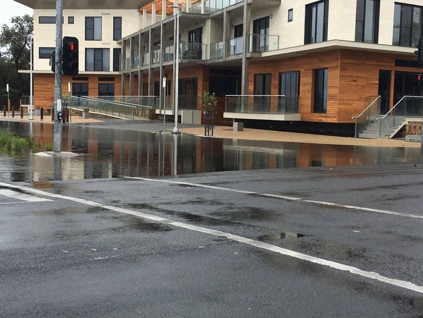
Rosebud
For flood emergency assistance call
VICSES on 132 500
Reviewed: February 2020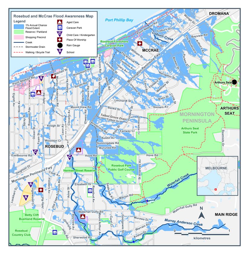
Local Flood Guide                    Rosebud and McCrae

Rosebud and McCrae Local Area

The suburbs of Rosebud and McCrae are located in the Mornington Peninsula Shire approximately 85 kilometres
south of Melbourne’s Central Business District. Both suburbs are in a primarily rural area with established
residential zones toward the coast.

The town of Rosebud is wedged between the lower slopes of Arthur Seat, the shores of Port Phillip Bay and the
plains of Boneo. Rosebud is the second largest town on the Mornington Peninsula, and a very popular tourist
resort with families who appreciate its sand beaches. Rosebud began as a little fishing village in the 1850’s and
has been a popular holiday destination since the 1950’s

McCrae is nestled between Rosebud and Dromana on Port Phillip Bay. The city boasts its own coastal frontage,
meaning that the beach here is secluded, safe and quiet, which is a welcome respite from the hubbub of nearby
Melbourne.

The map below shows the impact of a 1% flood in the McCrae and Rosebud area. A 1% flood means there is a
1% chance a flood this size happening in any given year. This map is provided as a guide to possible flooding in
the area.

Disclaimer
This map publication is presented by Victoria State Emergency Service for the purpose of disseminating emergency management
information. The contents of the information have not been independently verified by Victoria State Emergency Service. No liability is
accepted for any damage, loss or injury caused by errors or omissions in this information or for any action taken by any person in reliance
upon it. Flood risk information is provided by Melbourne Water.

                                                                                                                                              2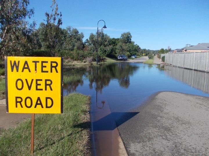
Local Flood Guide             Rosebud and McCrae

Are you at risk of flood?

Chinamans Creek and Murray Anderson Creek are the predominant watercourses in the area,
flowing from the inland hills around Arthurs Seat. High intensity, short duration rainfall events can
cause flash flooding in and around Rosebud, Rosebud West, McCrae and Boneo, while prolonged
rainfall may see Chinamans Creek and Murray Anderson Creek flood.

The area sees a mixture of moderate and slow water movement as water moves from the foothills of Arthurs Seat
to the flatlands around Boneo and Rosebud West. As a result, flooding on the foothills will rise and fall fairly
quickly while ponding may occur where terrain is flat and last for days.

   Chinamans Creek

While significant floods have occurred within Rosebud and McCrae, flooding typically occurs in the low-lying
areas of McCrae as shown on the map on page 2; however flash flooding can occur in other areas as a result of
short bursts of heavy rain fall that cannot drain away quickly. In addition, there is also a risk of flooding and
isolation caused by drains overflowing.

The following roads are subject to closure during flooding around Rosebud and McCrae:

   ▪     Mornington Peninsula Freeway between Beverley Road Pedestrian Bridge and Jetty Road

   ▪     Point Nepean Road, Rosebud and McCrae between Jetty Road and Bartel Street

Parkedge Circuit, Rosebud

                                                                                                                    3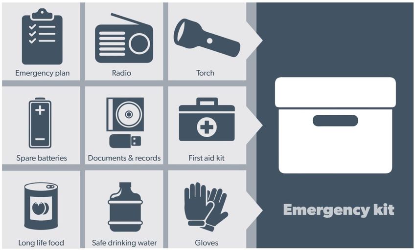
Local Flood Guide              Rosebud and McCrae

Did you know?

Rosebud and McCrae have a long history of flooding with floods recorded as early 1954. Most of these have
resulted from heavy rainfall falling in a short period of time, resulting in flash flooding of the area.

Significant flooding occurred during the following dates:

▪   October 2010

▪   February 2011
                                                                         No two floods are the same, floods
▪   November 2011                                                        like this or worse could occur again.

▪   February 2017                                           If you live in a low-lying area you may be at risk of
                                                            flooding or need to detour around flooded areas.
▪   November 2017

▪   December 2017
                                                            Knowing what to do can save your life and help
                                                            protect your property
▪   December 2018

Staying Informed and Further Information
▪   Current warnings (VicEmergency)              emergency.vic.gov.au                 1800 226 226
▪   Bureau of Meteorology (BoM)                  bom.gov.au/vic/warnings              1300 659 217
▪   VicRoads Traffic                             traffic.vicroads.vic.gov.au
▪   Emergency Broadcasters                       ABC Melbourne 774 AM
                                                 SKY NEWS Television                      Life-threatening
                                                 MyMP 1377 AM
                                                                                             Emergency
                                                 3RPP 98.7 FM
                                                                                                 000
▪   VICSES Social Media                          facebook.com/vicses
                                                 twitter.com/vicsesnews
▪   Preparing for Flood Emergencies              ses.vic.gov.au/get-ready
▪   Creating an Emergency Plan                   redcross.org.au/prepare
▪   Melbourne Water                              melbournewater.com.au                131 722
▪   Mornington Peninsula Shire                   mornpen.vic.gov.au                   1300 850 600 or 5950 1000

▪   National Relay Service (NRS)                 relayservice.gov.au

                                                                                                                    4
Flood warnings and
                        emergency checklist

Bureau of Meteorology Warnings
Warnings are issued by the Bureau of Meteorology (BoM) to tell people about possible flooding.

A Flood Watch means there is a developing weather pattern that might cause floods in one or two days. This
service covers the whole state.

A Flood Warning means flooding is about to happen or is already happening. There are minor, moderate and
major flood warnings. This service is only available where flood warning systems are in place.

        A Minor Flood Warning means                 A Moderate Flood Warning                A Major Flood Warning means
        floodwater can:                             means floodwater can:                   floodwater can:

 Spill over river banks and cover nearby   Spill over river banks and cover larger   Cause widespread flooding.
 low lying areas.                          areas of land.

 Come up through drains in nearby          Reach above floor levels in some          Many houses and businesses are
 streets.                                  houses and buildings.                     inundated above floor level.

 Require the removal of stock in some      Require evacuation in some areas.         Cause properties and whole areas to be
 cases.                                                                              isolated by water.

 Cover riverside camping areas and         Affect traffic routes.                    Closes major roads and rail routes.
 affect some low-lying caravan parks.

 Cover minor roads paths, tracks and       Require the removal of stock in rural     Require many evacuations.
 low level bridges.                        areas.

 Affect backyards and buildings below                                                Affect utility services (power, water,
                                                                                     sewage etc).
 floor level.

Severe Thunderstorm Warnings

Thunderstorms are classified as severe when there is potential to cause significant localised damage through
wind gusts, large hail, tornadoes or flash flooding. Severe Thunderstorm Warnings are issued to the community
by BoM.

Severe Weather Warnings

These warnings are issued to the community by BoM when severe weather is expected that is not directly related
to severe thunderstorms or bushfires. Examples of severe weather include damaging winds and flash flooding.

Flash Flooding

▪ Flash Flooding can occur quickly due to heavy rainfall. You may not receive an official warning.

▪ Stay informed- monitor weather warnings, forecasts and river levels at the BoM website and warnings through
  VicEmergency.

   Reviewed: February 2020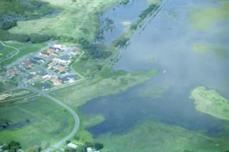
Local Flood Guide           Rosebud and McCrae

VICSES Warnings
VICSES utilises the VicEmergency app, website and hotline to distribute flood warnings and emergency
information in Victoria. You can also access this information through our social media channels and emergency
broadcasters.

VICSES warnings aim to provide you with information to help you make good decisions to protect yourself and
your family.

The warning level is based on severity, conditions and the likelihood of community impact.

 WARNING LEVELS
                   EMERGENCY WARNING
                   You are in imminent danger and need to take action immediately. You will be
                   impacted. A Major flood warning usually fits into this category.
                   WARNING (WATCH AND ACT)
                   An emergency is developing nearby. You need to take action now to protect yourself
                   and others. A Moderate flood warning usually fits into this category.
                   ADVICE
                   An incident is occurring or has occurred in the area. Access information and monitor
                   conditions. Can also be used as a notification that activity in the area has subsided
                   and is no longer a danger to you. A Minor flood warning or Flood Watch usually fits
                   into this category.

 ADDITIONAL MESSAGES
                   PREPARE TO EVACUATE/ EVACUATE NOW
                   An evacuation is recommended or procedures are in place to evacuate.

                   COMMUNITY INFORMATION
                   Updates for communities affected by an emergency.
                   Can also be used as a notification that an incident has occurred but there is no threat
                   to community.
                   EMERGENCY ALERT
                   During some emergencies, communities may be alerted by the sounding of a local
                   siren, or by sending an SMS to mobile phones or a voice message to landlines.

Your emergency plan
Emergencies can happen at any time, with little warning. People who plan and prepare for emergencies reduce
the impact and recover faster.

Taking the time to think about emergencies and make your own plan helps you think clearly and have more
control to make better decisions when an emergency occurs.

Visit redcross.org.au/prepare start creating your plan.

  ▪    Remember, you may not receive any official warning.
  ▪    Emergency assistance may not be immediately available. Be aware of what is happening
       around you to stay safe.
  ▪    Never wait for a warning to act.

                                                                                                                6
Local Flood Guide Rosebud and McCrae
Emergency Kit
Visit Emergency Toolkit for more information
Every home and business should have a basic emergency kit with a supply of 3 days:
Check your kit often. Make sure things work. Replace out of date items.
When a warning is issued, have ready for use or pack into your kit:
I need to add:
Write your list here. Tick items as you pack them into your kit
Special needs (eg, babies,
Elderly)
Photos
Family keepsakes
Valuables
Other
7Local Flood Guide Rosebud and McCrae
Emergency Checklist
Check if your insurance policy covers flooding.
Keep this list of emergency numbers in your mobile phone
Download the Vic Emergency app on your mobile phone.
Put together an emergency kit and prepare a home or business emergency plan, see
redcross.org.au/prepare
Before Flooding
Leaving early before flooding occurs is always the safest option. Evacuating through
floodwater is very dangerous and you may be swept away.
Stay informed- monitor weather warnings, forecasts and river levels at bom.vic.gov.au and warnings
through emergency.vic.gov.au.
Secure objects likely to float and cause damage.
Listen to the radio and check the VICSES website for information and advice.
Go over your emergency plan. Pack clothing and other extra items into your emergency kit and take
this with you if you evacuate.
If you are staying in a caravan, move to higher ground before flooding begins.
During Flooding
Make sure your family members and neighbours are aware of what is happening.
Conditions change rapidly; roads and escape routes can be covered or blocked.
Put household valuables and electrical items as high as possible.
Turn off water, gas and electricity at the mains.
Seek shelter indoors, away from floodwater.
If floodwater comes inside, move to a higher point such as a kitchen bench or second storey.
Stay away from trees, drains, low-lying areas, creeks, canals, culverts and floodwater.
Evacuating in Flooding
Flood water is dangerous. Stay safe by never entering flood water. It can take just 15cm of
water to float a car.
Find alternative travel routes if roads or underpasses are flooded.
Be aware of driving hazards, such as mud, debris, damaged roads and fallen trees. If driving
conditions are dangerous, safely pull over away from trees, drains and floodwater.
After Flooding
For recovery information, contact your local council, go to the VicEmergency Relief and Recovery-
emergency.vic.gov.au/Relief page or call the VicEmergency Hotline (1800 226 226).
Have all electrical and gas equipment professionally tested before use.
Stay away from damaged and flooded buildings, fallen trees and powerlines, and damaged roads.
Drive slowly, obey all road signs and never drive through floodwater.
When cleaning, protect your health and safety. Wear strong boots, gloves and protective clothing.
For VICSES emergency assistance, call 132 500, or Triple Zero
(000) in life threatening emergencies.
8You can also read