SAFER FRAMEWORK - Project Af8
←
→
Page content transcription
If your browser does not render page correctly, please read the page content below
SAFER
                                      SECTION 01. INTRODUCTION   a.

  SOUTH ISLAND/TE WAIPOUNAMU
  ALPINE FAULT EARTHQUAKE RESPONSE

  FRAMEWORK

MANA TANGATA: POWER OF LEADERSHIP THROUGH THE PEOPLE
This document has been published by:
  Emergency Management Southland
  August 2018
  www.projectaf8.co.nz

SHARED
SITUATIONAL
AWARENESS AND
OPERATIONAL
COORDINATION
IN THE EVENT
OF A MAJOR
ALPINE FAULT
EARTHQUAKE.

Cover image:
NASA Earth Observatory via Wikimedia Commons, the free media
repository.
Internal images:
GNS Science Visual Media Library; Dr. Caroline Orchiston; Unsplash:
Tyler Lastovich, Jeff Finley and Adam Edgerton; and, Wikimedia
Commons, the free media repository.
ABOUT THE SAFER FRAMEWORK AND PROJECT AF8
The SAFER Framework is one of the outputs of the Ministry of Civil
Defence & Emergency Management funded Project AF8, led by Emergency
Management Southland.

GOVERNANCE
Governance for Project AF8 and the SAFER Framework is provided by the
Project AF8 Steering Group, comprising management representatives
of each South Island CDEM Group emergency management office,
the Ministry of Civil Defence & Emergency Management, and science
representatives co-opted by the CDEM Group members.
Emergency Management Southland are the administrating authority for
the SAFER Framework, on behalf of the South Island CDEM Groups as
owners of the Framework. Administering authority status for SAFER
Framework can be transferred to another entity on agreement of a
majority of members of the Steering Group.

REVIEW
It is intended that the SAFER Framework will be reviewed collectively
by partner CDEM Groups and agencies within five years of it first being
adopted, or following any significant exercise, actual response, or change
to the organisational, statutory or regulatory environment within which
the Framework is located.
The SAFER Framework may also be reviewed after any significant
emergency response or higher level response review that has relevant or
applicable findings.
CONTENTS
SAFER FRAMEWORK

00/
      SUMMARY                                        I

01/
      INTRODUCTION                                  V

      1.1 Purpose and Scope                         v
      1.2 Out of Scope                              v
      1.3 Audience                                  v
      1.4 Intended Use                            vii
      1.5 Activation Triggers                     vii
      1.6 Operational Period                      vii
      1.7 Context of the SAFER Framework          viii
      1.8 Background                               ix

02/
      SCENARIO                                      1

      2.1 Overview                                  1
      2.2 Maximum Credible Event (MCE)              2
      2.3 Context of an Alpine Fault Earthquake     3
      2.4 Anticipated Impacts                       6
      2.5 Response Assumptions                      7
      2.6 Secondary and Compounding Risks         10
03/
      CONSOLIDATED
      RESPONSE FRAMEWORK                                     13

      3.1 Mission Statement                                  13
      3.2 Initial Response Objectives                        13
      3.3 South Island Alpine Fault Earthquake Response
          Coordination Concept                               14
          3.3.1 CDEM Group-to-CDEM Group support             15
      3.4 Concept for Command and Control                    16
          3.4.1 At the CDEM Group and Local Level            16
          3.4.2 National Coordination                        16
      3.5 Response Priorities                                18
      3.6 Response Actions                                    20
          3.6.1 Telecommunications Component                  24
          3.6.2 Reconnaissance Component                      27
          3.6.3 Evacuation Component                          36
          3.6.4 Logistics Component                           38
          3.6.5 Public Information Management (PIM) Component 41
          3.6.6 Welfare Services Component                    44

04/
      APPENDICES                                             49

      Appendix A Project AF8 Transition                      50
      Appendix B Detailed Impact Estimates                   53
      Appendix C Timeline of Response Activities             61
      Appendix D Roles and Responsibilities by Agency        63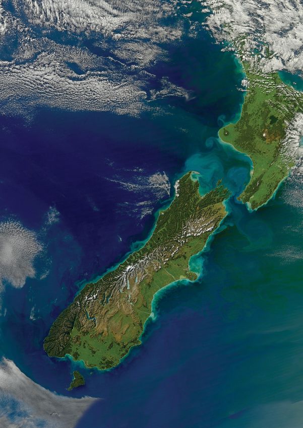
f.          PROJECT AF8 SAFER Framework

© GNS Science, Lloyd Homer
SUMMARY        i.

      SUMMARY
      MANA TANGATA: POWER OF
      LEADERSHIP THROUGH THE PEOPLE

01/    SECTION 1: INTRODUCTION
       The South Island Alpine Fault Earthquake
       Response (SAFER) Framework is a key output
                                                           Scientific knowledge of New Zealand’s highly
                                                           active seismic context has improved appreciably
       of the first two years of Project AF8, a Ministry   from an already solid base since the 2010
       of Civil Defence & Emergency Management             Darfield and 2011 Christchurch earthquake,
       (MCDEM) funded project to improve knowledge         as more resources have been directed to
       of, readiness for, and resilience to a              research national and regional programmes.
       magnitude 8 earthquake on the Alpine Fault.         Project AF8 has been established by South
                                                           Island CDEM Groups in partnership with their
       The SAFER Framework provides a concept of
                                                           seismic science partners, in particular GNS
       coordination of response and priority setting
                                                           Science (Resilience to Nature’s Challenges),
       across all six South Island Civil Defence
                                                           University of Canterbury (QuakeCoRE and Rural
       Emergency Management (CDEM) Groups and
                                                           Priority Laboratory), University of Otago, and
       their partner organisations in the first seven
                                                           Massey University, to make the most of the
       days of response. It is not intended to replace
                                                           resources available in building readiness for
       existing plans within agencies but to provide
                                                           and resilience to earthquake risk in the South
       a coordinated picture of response across the
                                                           Island.
       South Island.

02/    SECTION 2: SCENARIO
       The SAFER Framework employs the best
       current estimation of impacts to inform
                                                           Alpine Fault rupture must use a flexible
                                                           approach to ensure it encompasses a wide
       planning for quake response, with the               range of possible outcomes, including worst
       knowledge that there is a high degree of            case scenarios. Project AF8 has developed a
       uncertainty of what will actually happen.           Maximum Credible Event (MCE) scenario based
       Current estimates suggest that the Alpine           on a magnitude 8 earthquake rupturing along
       Fault experiences a significant rupture             the Alpine Fault from South to North. 2 Credible
       approximately every 300 years, with the most        impacts resulting from the significant Alpine
       recent rupture known to have occurred in 1717.      Fault earthquake scenario included in the
       The impact of a major rupture of between 400        SAFER Framework are:
       to 800 kms of the Alpine Fault would result in      • Landslides, rockfalls, liquefaction
       severe building, infrastructure, and geological
       damage within approximately 100 kms of the          • Damage to buildings, electricity,
       fault. 1 Communities in the affected areas            telecommunications, water, roads, etc.
       will be isolated, with highly compromised           • 1,000s of minor to moderate injuries
       living conditions from days to months, with
                                                           • 100s to 1,000s of serious injuries
       less severe affects further from the greatest
       shaking intensities.                                • 100s of deaths
       Landslides, liquefaction, infrastructure            • 10s to 100s entrapped
       damage, deaths and injuries vary considerably       • 10,000s displaced or isolated
       in all models of Alpine Fault rupture. Weather
                                                           • Food and fuel supplies disrupted
       conditions at the time of the quake and during
       the response cannot be known in advance.            • Agricultural, tourism and industry disrupted
       Therefore, the response Framework for an

                                                              1. See Appendix B for more detail.
                                                              2. Based on modelling from similar events elsewhere
                                                                 and RiskScape modelling not yet released.
ii.   PROJECT AF8 SAFER Framework

      03/            SECTION 3: CONSOLIDATED RESPONSE FRAMEWORK
                     Reviews of responses to earthquakes and other
                     significant emergencies in New Zealand and
                                                                         Included in the response section are six
                                                                         functional response components, providing
                     elsewhere in the past decade have identified        guidance for aspects of response identified in
                     that the most effective responses are those         multi-agency SAFER workshops carried in 2017
                     where robust science is used to inform              as requiring more cross-boundary specificity,
                     planning and risk management. This includes         clarity or urgency than provided in existing
                     knowledge of specific hazards communities           guidance and plans. These components are:
                     are exposed to and the consequences they            • Telecommunications
                     generate. Responders can use this information
                     to pre-empt the response capabilities,              • Reconnaissance
                     resources and coordination processes that           • Evacuation
                     will be required to meet the immediate and
                                                                         • Logistics
                     ongoing needs of communities affected by
                     an emergency. This focus on consequence-            • Public Information Management
                     informed capability development results in less     • Welfare Services
                     time being required to assess the impacts of an
                     emergency on communities, infrastructure and        As access to and from severely affected areas
                     the environment, and can therefore improve          will be very limited in this event, effective
                     responsiveness. It also helps to build resilience   across-boundary, multi-agency coordination
                     prior to the event, initiate and maintain           of evacuation, logistics, and the provision of
                     effective responses, and transition seamlessly      welfare services (in affected areas, in transit,
                     to recovery.                                        and in safe areas) will be pivotal aspects of any
                                                                         resultant response.
                     The SAFER Framework employs the current
                     best scientific knowledge of the Alpine Fault   Planning workshops for SAFER have identified
                     and its consequences and puts in place a set    key vulnerabilities and shared resources across
                     of proactive response targets, guidance and     New Zealand. We recognise that the Framework
                     supporting processes to assist CDEM Groups,     document is the start of the planning discussion
                     local authorities, iwi, emergency services,     and there will be an accompanying gap
                     social agencies, health and disability services,analysis to identify further work programmes
                     infrastructure providers, tourism stakeholders, over the coming years. Examples of this
                     business, and communities in developing more    include: management of air assets, fuel plans,
                     detailed plans to build and deliver effective,  Fast Moving Consumer Goods (FMCGs) and
                     proactive responses when disaster strikes. This telecommunication resilience and redundancy.
                     knowledge is outlined in impact assumptions     An extensive list of earthquake response
                     that inform the rest of the document.           focused roles and responsibilities is attached
                                                                     as appendices to the Framework, to provide
                     The response component of the Framework         Alpine Fault earthquake response expectations
                     outlines the collaborative approach intended    of emergency response partners. The roles
                     to be taken across the South Island, that will  and responsibilities section adds SAFER
                     be supported by central government agency       context value and clarity to the more generic
                     coordination led by MCDEM. Effective responses equivalents provided in the National CDEM Plan
                     under this Framework rely on leadership         and Guide 2015 and other emergency response
                     provided by CDEM Group Controllers, bringing    management documents.
                     together partner organisations in a seamless
                     inter-CDEM Group response.                      The SAFER Framework provides not only
                                                                     guidance for more effective responses but an
                     A set of response objectives and an “estimated impetus for improved resilience to earthquakes.
                     response timeline” are included to provide an   Risk reduction opportunities, needs and targets
                     indication of changing priorities and realistic are identified and delivered alongside readiness
                     timeframes for planning and activities in the   developments, outlined in Appendix A and in
                     immediate response to the needs generated       the accompanying SAFER Implementation Plan.
                     by an Alpine Fault earthquake. The response     A diagram representing the SAFER concept of
                     objectives and accompanying function specific   multi-agency coordination is at Figure 5.
                     “situation and likely event development”
                     analysis provide focus to the response guides
                     and suggested tasks included in each of the
                     action plans.
SUMMARY        iii.

A LIVING FRAMEWORK
Responsibility for the SAFER Framework will be held by Emergency Management
Southland, the sponsors of this project, with the intention that it will be reviewed following
the national Alpine Fault exercise in the 2020/2021 financial year. The Framework will
be fully reviewed five years after it is adopted or after any events or changes in policy,
responsibilities or organisational arrangements with a bearing on the Framework.
Appendix A provides an outline of how the response planning stages of Project AF8 are
intended to transition into the ongoing programme of risk coordination, communication,
and resilience work that will follow under the AF8 banner.
iv.   PROJECT AF8 SAFER Framework

            CONSISTENCY ACROSS
            ALL CDEM GROUPS WILL
            BE BENEFICIAL TO AN
            EFFECTIVE RESPONSE.
SECTION 01. INTRODUCTION v.
INTRODUCTION
MANA TANGATA: POWER OF
LEADERSHIP THROUGH THE PEOPLE
1.1 PURPOSE AND SCOPE
The purpose of the SAFER Framework is
to provide a concept of shared situational
The SAFER Framework sits between and
connects CDEM Group and partner organisation
awareness and operational coordination and plans at the regional level with the National
cooperation across all South Island CDEM CDEM Plan and Guide and national level partner
Groups and partner agencies in the event organisations plans.
of a major Alpine Fault earthquake, or any
While this Framework does not detail the
earthquake that causes widespread damage in
national response approach to an Alpine Fault
the South Island.
event, it recognises that an event of this nature
The scope of the SAFER Framework includes would likely lead to a declaration of a state of
the key concepts, principles and actions that national emergency. The Framework therefore
would underpin a proactive, effective and reflects that the National Crisis Management
coordinated response across the South Island Centre (NCMC) would be activated to direct the
to a major Alpine Fault earthquake. response
Emphasis in the Framework is on issues where
consistency across all CDEM Groups will be
beneficial to an effective response, particularly
on cross-CDEM Group boundary issues.
1.2 OUT OF SCOPE
This Framework does not contain detailed
action planning for CDEM Groups, MCDEM,
these organisations have their own plans and
procedures how they will respond to a major
or partner agencies at local, regional and Alpine Fault earthquake and other emergencies
national levels. It is therefore essential that of similar scale and complexity.
1.3 AUDIENCE
This Framework is intended for the following users:
• South Island CDEM Groups, their member • Lifeline utilities: road, rail, ports/airports,
local authorities (as shown in Figure air transport providers, electricity, fuel,
1) and their local and regional partner telecommunications, water, waste water,
organisations (particularly national service providers
• All other CDEM Groups and partner serving more than one CDEM Group area)
organisations and the FMCG sector
• South Island Te Waipounamu iwi • Private sector organisations involved in
response and recovery
• MCDEM and the National Crisis Management
Centre (NCMC) • Non-government organisations (NGOs)
involved in the response and recovery
• Central Government agencies (including
all emergency services, the New Zealand • All science research entities (including
Defence Force (NZDF), health and disability Crown Research Institutes (CRIs) and
services, welfare service agencies, and universities with interests and intention to
transport, energy and telecommunications be involved in, support or study community
regulating agencies involved in the response and managed responses to significant South
in the South Island) Island earthquakes)
• Crown owned entities • South Island and national media
organisationsvi. PROJECT AF8 SAFER Framework
FIGURE 1. SAFER FRAMEWORK CDEM GROUPS AND MEMBER LOCAL AUTHORITIES
NELSON-TASMAN MARLBOROUGH
Nelson City Council Marlborough District Council
Tasman District Council
WEST COAST
West Coast Regional Council
Buller District Council
Grey District Council
Westland District Council
SOUTHLAND
Environment Southland
Invercargill City Council
CANTERBURY
Gore District Council
Southland Distirct Council
Environment Canterbury
Christchurch City Council
Ashburton District Council
Hurunui District Council
Kaikōura District Council
Mckenzie District Council
Selwyn District Council
Timaru District Council
Waimakariri District Council
Waimate District Council
OTAGO
Otago Regional Council
Dunedin City Council
Waitaki District Council
Central Otago District Council
Queenstown Lakes District Council
Clutha District Council
SOURCE: MINISTRY OF CIVIL DEFENCE
& EMERGENCY MANAGEMENTSECTION 01. INTRODUCTION vii.
1.4 INTENDED USE
The SAFER Framework is intended to be used by CDEM Groups and partner agencies as follows:
Before an Alpine Fault earthquake: During an Alpine Fault (or other significant)
• To further develop relationships that will earthquake:
enable consistent and mutually supporting • As a guide for determining impacts, needs,
action across all aspects of response in the future risks, consequences and necessary
South Island response actions
• As a basis to build on existing plans and
capabilities and to establish more detailed
operational planning
It is anticipated that CDEM Groups, member local authorities, partner agencies and stakeholder
organisations will update their plans and procedures to align with the SAFER Framework. 3
1.5 ACTIVATION TRIGGERS
The SAFER Framework will be activated by
all South Island CDEM groups, their member
These triggers have been defined to ensure that
the unknown factors of the event do not prevent
local authorities, regional and national partner immediate, coordinated response actions
organisations immediately when any of the being carried out. Initially unknown factors will
following triggers occur: include:
1. A strongly felt earthquake with shaking • The source of the earthquake
continuing for longer than two minutes. • The scale and consequences of the event
2. Confirmation from GeoNet/GNS Science, • The extent of damage to communications,
MCDEM, or other sources that a severe electricity and other networks
Alpine Fault earthquake has occurred.
3. Community-wide electricity or
telecommunications failure following a
severe earthquake.
4. Reports of significant damage following a
severe, long duration earthquake.
1.6 OPERATIONAL PERIOD
The SAFER Framework covers the first seven
days of response after a major earthquake. An
However, actions initiated and action plans
developed in the first seven days will continue
estimated response timeline for an Alpine Fault into or inform subsequent operations periods.
event is included in Appendix C.
3. An implementation plan will accompany the SAFER
Framework to provide objectives, targets, and measures
for the development or update of respective response plans
and capabilities.viii. PROJECT AF8 SAFER Framework
1.7 CONTEXT OF THE SAFER FRAMEWORK
The SAFER Framework is designed to
operate under the auspices of the CDEM Act
The Framework sits between and connects this
national level doctrine with the statutory and
2002 and within the structures, roles and operational plans developed by CDEM Groups,
responsibilities of: and the operational plans and arrangements
• The current National CDEM Plan and Guide of all partner agencies at regional and local
levels, as illustrated in Figure 2 below.
• The current version of the New Zealand
Coordinated Incident Management System The SAFER Framework includes a wider range
(CIMS) manual. of partner agencies while this Framework
does not provide detailed action planning
for each agency, those that have roles and
responsibilities under this plan are expected to
have their own response plans and capabilities
that are consistent with the SAFER Framework.
FIGURE 2. SAFER FRAMEWORK CDEM GROUPS AND MEMBER LOCAL AUTHORITIES
CDEM ACT 2002
National
Guide to the National CDEM Plan 2015 framework for
responses to
PLANS OF PARTNER AGENCIES
emergencies
NATIONAL CDEM PLAN 2015
Wellington Plans and frameworks
Earthquake that address the
consequences of a
SAFER FRAMEWORK National Initial major earthquake
Response affecting Wellington
Plan (WENIRP) and/or the South island
Detailed operational
Wellington
Nelson- plans and
Marlborough West Coast Canterbury Southland Regional
Tasman Otago CDEM arrangements of CDEM
CDEM CDEM CDEM CDEM Earthquake
CDEM Group Groups and partner
Group Group Group Group Response Plan
Group agencies for an Alpine
(WREP) Fault event
The SAFER Framework is designed to work alongside (and has been developed in conjunction with) the Wellington
Earthquake National Initial Response Plan (WENIRP) 4, as a significant Alpine Fault earthquake may cause damage
and disruption in Wellington as well as in the South Island. It is therefore possible that the SAFER Framework,
WENIRP, and the Wellington Regional Earthquake Response Plan (WREP) 5 will need to be activated in response to
the same event.
4. Developed by MCDEM.
5. Developed by the Wellington Region Emergency
Management Office (WREMO).SECTION 01. INTRODUCTION ix.
1.8 BACKGROUND
The following recent events have highlighted the The scientific research that informed the
need for a systematic, proactive, and consistent scenarios used in this Framework and other
approach to inter-organisational coordination in AF8 outputs was put together by a broad range
major emergencies: of multi-disciplinary experts from a consortium
• 2010-2012 Canterbury earthquake sequence of New Zealand universities and CRIs.
• 2010 Pike River Coal Mine Tragedy Appendix A “Project AF8 Transition” provides an
overview of the goals and associated tasks that
• 2011 MV Rena grounding need to be carried out over the next 5 years,
• 2016 Kaikōura earthquake sequence at which point the SAFER Framework will be
reviewed.
• 2017 Port Hills fires.
The SAFER Framework was developed in
response to the lessons learned from these
and other emergencies, and to provide the
groundwork for the close cooperation between
South Island response agencies that an Alpine
Fault event would require.
© GNS Science/EQC, Julian Thomsonx. PROJECT AF8 SAFER Framework
A SIGNIFICANT ALPINE FAULT
EARTHQUAKE WILL CAUSE
WIDESPREAD DAMAGE
THROUGHOUT THE SOUTH
ISLAND, WITH MOST SEVERE
DAMAGE OCCURRING WITHIN
100 KM OF THE ALPINE
FAULT AND ASSOCIATED
FAULT RUPTURES.SECTION 02. SCENARIO 1.
SCENARIO
MANA TANGATA: POWER OF
LEADERSHIP THROUGH THE PEOPLE
2.1 OVERVIEW
The scenario on which this Framework is based
is informed by a range of Alpine Fault rupture
Although the SAFER Framework has been
written to consider any and all potential Alpine
scenarios and other potential earthquake Fault earthquake scenarios, the scenario used
sources. The four most likely rupture scenarios in the SAFER planning workshops was a South
for the Alpine Fault are depicted in Figure 3 to North rupture of the 400km section of the
below. Alpine Fault depicted in Figure 3.b.
FIGURE 3. THE ALPINE FAULT IN THE SOUTH ISLAND OF NEW ZEALAND,
HIGHLIGHTING EARTHQUAKE SOURCE SEGMENTS 6
A. The Alpine Fault (red), including the Wairau Fault B. The Alpine F2K (Fiordland to Kaniere) source
(black) in the northeast, is a semi-continuous plate (red) is defined from offshore of Charles Sound,
boundary structure from offshore of SW Fiordland to Fiordland to the intersection with the Hope-Kelly
Cook Strait. faults (blue). The AF8 Source Panel considered SW-
to-NE-directed, bilateral, and NE-to-SW directed
ruptures of AlpineF2K as viable Mw 8 earthquake
scenarios.
0 100 200
C. Offshore AlpineR (Resolution) seismic source segment. D. The AlpineK2T (Kaniere to Tophouse) source
(red) strikes from the vicinity of the Hope-Kelly fault
intersections to the southwestern end of the Wairau
6. National Seismic Hazard model of Stirling et al. (2012).
Fault.2. PROJECT AF8 SAFER Framework
2.2 MAXIMUM CREDIBLE EVENT [MCE]
The specific scenario used in developing the
SAFER Framework is scenario B from Figure 3
The energy released by this earthquake is
depicted in Figure 4 below, representing peak
on the previous page, involving an earthquake ground acceleration at two and three minute
initiation (epicentre) in Fiordland, with the intervals after the initiation of the rupture
seismic energy propagating North-Eastwards at a epicentre near to Milford Sound. Energy
for 400km along the Alpine Fault, to Kelly, from the quake will predominantly follow the
inland from Greymouth. direction of the rupture, in this case from
South to North. As well as the energy release
The South to North rupture is the accepted
nearer to fault rupture, this modelling also
maximum credible event (MCE) 7 used for the
demonstrates the accentuation of ground
SAFER Framework, as this scenario represents
acceleration in the softer unconsolidated soil in
the most widespread and severe damage
coast central Canterbury.
credibly possible from an Alpine Fault rupture.
More severe scenarios are also possible, but Alternative scenarios include a more northern
the chosen scenario was deemed challenging epicentre, which will generate a north to south
enough to provide a sound basis for planning rupture propagation, likely to cause more
purposes. damage in Central Otago, Dunedin, Clutha and
South-Eastern parts of the Southland region.
These alternative scenarios would not change
the activation or implementation of the SAFER
Framework.
FIGURE 4. ILLUSTRATION OF THE PARTICLE VELOCITY (VECTOR MAXIMUM IN
THE HORIZONTAL PLANE) AT THREE TIME INSTANTS DURING GROUND
MOTION SIMULATION OF THE SOUTHERN HYPOCENTRE ALPINEF2K
RUPTURE SCENARIO 8
A. B. C.
A. t = 50s, illustrating significant rupture directivity in the wavefield;
B. t = 130s, directivity-basin coupling as the wavefield enters the Canterbury basin;
C. t = 180s, directivity leading to relatively large amplitudes North of the rupture and critical reflections resulting in
a long duration of significant ground motion in the Canterbury sedimentary basin.
7. International best practice hazard based planning uses
MCE scenarios to inform the planning.
8. Ground motion simulations of great earthquakes on the
Alpine Fault of Bradley BA et al. (2017).SECTION 02. SCENARIO 3.
2.3 CONTEXT OF AN ALPINE FAULT EARTHQUAKE
The area covered by this Framework is
the entire South Island, including Stewart
steeper terrain of the Southern Alps near the
Alpine Fault and communities with vulnerable
Island, all of which will be impacted directly infrastructure being the most exposed.
or indirectly by a significant Alpine Fault Communities and visitors to these areas are
earthquake. also vulnerable due to their exposure to ground
shaking during the quake and the resultant
Exposure to an Alpine Fault earthquake is
damage to infrastructure and critical services
strongly influenced by location and local
(for more detail, see section 2.3.3 Vulnerable
ground conditions and topography, with the
Communities).
2.3.1 POPULATION
The estimated population of the South Island at the time this Framework was written and at the
intended time of its review are provided in Table 1 below.
TABLE 1. SOUTH ISLAND REGIONAL POPULATIONS
CDEM GROUP AREA ESTIMATED 2018 ESTIMATED 2023
Southland 98,400 99,000
Otago 219,750 225,550
Canterbury 610,090 619,970
West Coast 33,760 34,030
Nelson-Tasman 102,200 105,100
Marlborough 45,700 46,400
Total 1,109,900 1,130,050
SOURCE: STATISTICS NEW ZEALAND
Seasonal populations may differ substantially Day and night populations also differ
in all regions from the estimates of population significantly, resulting in different injury and
contained in Table 1, which are based on isolation outcomes in different parts of the
census night in March 2013. Summer and South Island. The most marked of these day
winter tourists 9 and seasonal horticulture and night differences are in areas such as
seasonal workers swell the population of Queenstown Lakes to Fiordland during the
Queenstown Lakes, Central Otago, the West summer, as visitors take day trips to Milford
Coast, Marlborough and Tasman districts Sound and other parts of the conservation
considerably, by between 25% and more than estate, and during the winter when visitors and
100%. local travel to the region’s ski areas and central
and service-based urban areas during working
hours.
9. Current tourism data is collected predominantly by Statistics New Zealand (Stats NZ) and the Ministry of
Business, Innovation and Employment (MBIE); however, it is mostly aggregated within regions and does not
provide real-time estimation of visitor numbers across the South Island. Regional tourism organisations
(RTOs) maintain up-to-date intelligence on visitor numbers that will be extremely useful in an earthquake
response.4. PROJECT AF8 SAFER Framework
2.3.2 VULNERABILITY
Vulnerability to the impacts of a large Alpine a primary language, a lack of local knowledge
Fault earthquake may be determined by including hazards and/or less well established
characteristics such as age, English not being community connections or support networks.
2.3.3 VULNERABLE COMMUNITIES
Vulnerable communities are most strongly • Visitors (domestic and international) to
determined by local, cultural or economic remote locations during the summer months
characteristics, including individuals and will be particularly prone to isolation with
groups without strong, well established support even less access to telecommunications
in the area or knowledge of the local hazard- • Children whose normal routines are severely
scape. The most vulnerable include: interrupted
• Anyone living or working in, passing through, • Owners and staff of businesses likely to be
or visiting buildings or places likely to be severely impacted, particularly if their homes
severely quake damaged are damaged
• Individuals with chronic medical conditions • Communities likely to be physically isolated
that depend on continuous electricity supply following significant local quake effects
or access to medications, with disabilities i.e.
visual and hearing impaired, mobility issues • Older unreinforced masonry and concrete
in wheelchairs health and/or those who rely slab buildings are most vulnerable to
on health care professionals or carers damage
• Members of culturally and linguistically • Companion and production animals
diverse communities, including seasonal dependent of human support or
workers, refugees and newer migrants infrastructure vulnerable to earthquakes
and/or individuals or groups who are
• People aged 65+, particularly older members responsible for at-risk animals
of this cohort vulnerable prior to the quake
• Visitors generally, but most importantly in
areas near to the Alpine Fault that are prone
to damage and isolation
• Seasonal workers and newer migrants in
urban, tourist and agricultural areas for
whom English is not a first language and/
or who lack local knowledge and community
connectionsSECTION 02. SCENARIO 5.
2.3.4 CRITICAL SUPPLIES AND LIFELINE UTILITIES
The South Island’s road network, fuel, water, consumption, with most supplies being trucked
air transport, electricity, telecommunications into communities daily to maintain retail
and marine transport infrastructure are supplies after being imported from offshore,
vulnerable to disruption from earthquakes and often through North Island centres. South
lack redundancy. Telecommunications services Island food distribution centres are generally
are increasingly hubbed in major centres, centralised in the greater Christchurch area
are not locally or regionally autonomous, and and to a lesser extent in Dunedin, adding some
therefore vulnerable to failure caused by link resiliency, but communities nearer the Alpine
disruption. Key electricity generation and Fault will be isolated from the bulk supplies
distribution components are concentrated that they depend on daily.
near to the Alpine Fault and widely distributed,
As well as lifeline utilities, most residential and
making them similarly vulnerable.
commercial built structures are susceptible
Communities close to the Alpine Fault, and to significant damage from earthquakes
throughout the South Island, rely on this and aftershocks. However, most newer
infrastructure for the delivery and distribution infrastructure have been designed and
of all essential goods and services and to travel constructed with quake resilience in mind.
between and within communities. Very little
food is produced in the South Island for local
2.3.5 HEALTH SERVICES
Tertiary and secondary health services are services closer to the Alpine Fault, in Te Anau,
concentrated in the larger communities on Queenstown Lakes, Central Otago, Mackenzie
the east coast of the South Island, primarily in Country and the West Coast are vulnerable to
Christchurch, Dunedin, Invercargill, Timaru, quake impact and disruption to land transport
and Nelson-Marlborough, distant from the routes.
Alpine Fault. Smaller hospitals and health
2.3.6 ONGOING PSYCHOSOCIAL IMPACTS FROM PREVIOUS EARTHQUAKES
South Island communities, particularly including responders, susceptible to
Canterbury and Marlborough, have experienced psychosocial impacts of further severe quakes.
numerous damaging earthquakes since Psychosocial support will be a significant
September 2010 that have left residents, aspect of all response and recovery activities.
THE SOUTH ISLAND’S ROAD NETWORK, FUEL, AIR TRANSPORT,
ELECTRICITY, TELECOMMUNICATIONS AND MARINE TRANSPORT
INFRASTRUCTURE ARE VULNERABLE TO DISRUPTION FROM
EARTHQUAKES AND LACK REDUNDANCY.6. PROJECT AF8 SAFER Framework
2.4 ANTICIPATED IMPACTS
A significant Alpine Fault earthquake will
cause widespread damage throughout the
Coast where communities, roads and other
infrastructure intersect with, or are very close
South Island, with most severe damage to, the Alpine Fault.
occurring within 100 km of the Alpine Fault and
Table 2 shows an overview of the anticipated
associated fault ruptures. Injuries and deaths
impacts from an Alpine Fault event. Detailed
are anticipated in communities in inland Otago,
regional-scale information about various
Fiordland, inland Canterbury, Southern portions
anticipated impacts is included in Appendix B
of Nelson-Tasman and Marlborough closest
Detailed impact estimates.
to the Alpine Fault. Proportionately the most
severe impacts will be experienced on the West
TABLE 2. OVERVIEW OF ANTICIPATED IMPACTS FROM A MAJOR
ALPINE FAULT EARTHQUAKE
ANTICIPATED IMPACTS
Immediate human There are likely to be thousands of minor and moderate injuries, at least
impacts hundreds of serious injuries, hundreds of entrapped individuals, and hundreds
of fatalities due to building failures, landslides/rockfalls, road/bridge damage
nearer to the Alpine Fault and in vulnerable building and terrain further distant
from the fault.
Health and disability Health and disability services will struggle to meet the demands generated by
services the earthquake due to structural damage to health facilities near to the fault and
due to disruption to road transport within and to and from impacted areas.
Areas of structural Areas of most structural damage are likely to be western Southland/Fiordland,
damage Queenstown Lakes, Central Otago, West Coast, inland Canterbury, and the
southern parts of Tasman and Marlborough districts. Reported numbers of
trapped, injured and isolated are likely to rise rapidly over the first 24 to 48 hours
of response.
Isolated communities Tens of thousands of visitors and residents are likely to be isolated in
Queenstown Lakes, parts of Central Otago, the West Coast and Fiordland as
roads are damaged and air transport is, at least initially, suspended.
Tsunami Tsunami are likely to have occurred in lakes and fiords near to the Alpine Fault
potentially causing significant damage or loss of life. Despite coastal tsunami
being unlikely, significant portions of communities in marine tsunami inundation
zones are likely to have evacuated as local populations feel a long, strong
earthquake and carry out self evacuations.
Electricity Electricity supplies throughout the South Island will be affected with likely
blackouts within at least 150 km of the Alpine Fault and intermittent supply in
areas considerably distant from the fault. The supply to the North Island may be
also be affected.
Telecommunications Standard telecommunications networks will be damaged with remaining
networks overwhelmed by increased communications traffic. In ground
infrastructure is likely to be severely damage.
Roads, railway lines, Roads, rail and bridges are likely to be damaged and seriously obstructed
bridges, embankments throughout areas of most severe shaking, including lower lying areas
susceptible to liquefaction, lateral spreading towards waterways, landslide and
rockfall. Access to and from communities has been impeded to varying degrees,
depending on distance from the fault rupture and local geological conditions.
Water (potable, waste Potable, waste and storm water systems are likely to be damaged around the
and storm) South Island particularly in areas that have been impacted by the most severe
shaking.SECTION 02. SCENARIO 7.
2.5 RESPONSE ASSUMPTIONS
The assumptions in Table 3 below have been
made in the development of this Framework,
at the outset of and during responses to an
actual Alpine Fault earthquake. If any of these
based on Project AF8 impact scenarios and on assumptions are found not to be valid in an
outputs from the planning workshops carried actual response the SAFER Framework and
out in preparation for this Framework. associated national, group, agency, and local
actions plans will be adjusted accordingly.
These assumptions are estimates only and
will likely need to be verified and modified
TABLE 3. RESPONSE ASSUMPTIONS FOR THE SAFER FRAMEWORK
ASSUMPTION
A CDEM Groups will be able to coordinate local responses
Each CDEM Group will have identified and equipped a primary and alternate post-quake
operational Emergency Coordination Centres (ECCs) and Emergency Operations Centres (EOCs)
from which regional and local and multi-agency responses will be able to very quickly lead and
coordinate multi-agency and community responses, communicate and coordinate with other CDEM
Group ECCs and NCMC.
B CDEM Groups will be rapidly declare states of local emergency
Due to the immediate impact of a significant Alpine Fault earthquake, local authorities and CDEM
Groups affected will immediately activate processes to declare states of local emergency to
ensure significant coordinated responses are empowered and achieved locally and regionally.
C South Island local authorities will continue operate, if with reduced capability
South Island local government authorities, with regulatory oversight responsibility, will continue in
their same role and responsibilities during the Alpine Fault earthquake response, potentially at a
reduced capacity, providing emergency assistance, including resources, through the South Island
CDEM Group system.
D Communities will respond proactively
Communities will work together receiving limited guidance from local government initially.
This includes neighbour helping neighbour, individuals volunteering within communities and
communities assisting other communities in need.
E North Island CDEM Groups may be able to assist the South Island
North Island CDEM Groups may be available to assist South Island CDEM Groups as requested,
acknowledging that in a major earthquake event their focus may be on their own emergency
response. Wellington and its response capability may well be compromised by the earthquake.
F A state of national emergency will be declared within 24/48 hours
If the criteria for declaring are met, a state of national emergency will be declared early in
a response. Once a state of national emergency is declared the NCMC will direct the overall
response. Group and local CDEM Controllers will continue to direct and coordinate responses
within a state of national emergency, working to the priorities of the National Controller. The
NCMC will continue to support, de-conflict and prioritise national response activities.
The National Crisis Management Centre (NCMC) will be operational and national coordination will be
G
active
The NCMC will be operational and able to coordinate the national response, although it is possible
that it will be from an alternate location other than its primary Wellington location.
H Responding agencies are functional
Responding local and regional agencies will be able to rapidly activate in communities directly
impacted by the quake where those agencies have a presence. They will also be prepared to
respond and assist in/from less affected areas.8. PROJECT AF8 SAFER Framework
ASSUMPTION
I Standard telecommunications are highly compromised across the South Island
Responding agencies will be able to communicate, though it is likely to be in a much reduced
capacity, using satellite communications, local UHF and VHF radio telephone, longer distance HF
radio, and couriers using various means of transport. Many communities are likely to have very
little access to telecommunications outside their immediate area, although some will have local
UHF/VHF radio and fewer still will have satellite telecommunications.
J Areas further from the fault rupture are likely to be isolated
Marlborough, Kaikōura and Nelson-Tasman are also likely be isolated, with access in parts of
these areas potentially compromised as well.
K Landslides, rockfalls and landslide dams will be widespread and numerous
Research supporting this Framework clearly indicates that there will be hundreds of thousands of
landslides and rockfalls in steeper terrain near the Alpine Fault throughout the South Island. These
geological changes will pose immediate and ongoing risk to life and damage to infrastructure.
The risk of landslide dam failure will be a high priority consideration in immediate and ongoing
reconnaissance and evacuation planning and delivery.
L The West Coast and communities close to the Southern Alps will be isolated
Large parts of the South Island normally accessed through alpine passes or steep sided valleys
nearer to the Alpine Fault will be inaccessible by road, potentially for weeks to months, and
should be the focus of initial and ongoing reconnaissance, response and relief. This may include
Queenstown Lakes, Eastern Southland, Central Otago, Mackenzie Basin, Canterbury foothills to
Hurunui District, Nelson Lakes to Murchison.
M Ports will be impacted
The small, primarily fishing ports of Jacksons Bay, Westport and Greymouth are likely to be
severely compromised by the quake and will be inaccessible due to road damage and liquefaction.
The ports of Nelson, Marlborough, PrimePort Timaru, Otago and Lyttelton may be affected
directly or indirectly by the initial quake or more local aftershocks and will need to be assessed
for serviceability. South Port Bluff is unlikely to be significantly impacted other than due to local
liquefaction unless there is significant local co-seismic activity.
N West Coast airports will be impacted
Hokitika and Westport airports and smaller airstrips will need to be assessed for damage after the
initial and significant subsequent quakes prior to use.
O Other South Island airport impacts will be variable
Airports closer to the Alpine Fault are likely to be damaged and will need to be assessed and,
where necessary, repaired prior to use, including Manapōuri, Milford, Queenstown, Wānaka,
Glentanner, Mt Cook, Twizel and Tekapo. Airports further from the Alpine Fault are less likely to
be impacted but may also require assessment depending on local seismic activity, and ground and
groundwater conditions, including: Invercargill, Dunedin, Alexandra, Timaru, Oamaru, Omarama,
Christchurch International, Nelson, Motueka, Tākaka, Blenheim/Woodbourne and Picton.
P The South Island electricity generation and distribution network will be severely compromised
The impact of the initial quake and wider aftershocks will cause most South Island hydro-
electric generation plants to shut down. Damage will occur to some transformer sites. National
and local distribution networks will be damaged, particularly where pylons or poles are located
in steeper, less stable terrain. Dams and canals may be compromised directly by shaking and
ground deformation and indirectly by landslide into or below structures. Some local generation
and distribution is anticipated to be achieved in less severely affected later in the first week of
response.
Q South Island Assembly and Staging Areas (Air) will be established at larger operational airfields
Air assembly areas are most likely to be established at Christchurch, Blenheim/Woodbourne,
Queenstown and Invercargill airports. If available, Hokitika and Queenstown Airport will also be
designated as South Island Assembly Areas. Dunedin, Wānaka, Alexandra and other airports may
be available as staging areas for evacuation and resupply. These facilities will be assessed in the
first six hours after the initial and subsequent quakes and their status shared with all responding
South Island CDEM Group ECCs and NCMC to enable planning for regional and local response and
recovery efforts.SECTION 02. SCENARIO 9.
ASSUMPTION
R South Island Assembly and Staging Areas (Sea) are likely to be operational at less damaged ports
Marine assembly, embarkation/disembarkation areas will be established where possible, likely
to be ports most distant from the Alpine Fault, including South Port Bluff, Lyttelton, PrimePort
Timaru and Port Marlborough in Picton. These facilities will be assessed in the first 24 hours
after the initial and subsequent quakes and their status shared with all responding South Island
CDEM Group ECCs and the NCMC to enable planning for regional and local response and recovery
efforts.
S Autonomous and managed mass evacuation from impacted area will take place
Some residents and most visitors are likely to attempt to remove themselves from areas of
damage and the most intense aftershocks as soon as they can. Critical casualties, essential
government personnel and visitors will be evacuated by air, sea, lakes and roads as soon as
possible in the circumstances, as part of the initial response.
T Nationally directed reconnaissance will be activated immediately
Pre-planned reconnaissance provided by NZDF, GNS Science, international remote sensing
satellites and others will be initiated and plans modified, to provide situational awareness to
national, South Island-wide and regional responses. The emphasis of these efforts and their
outputs will be on informing immediate and ongoing response activities, with outputs being
prioritised for regional and local life safety and response planning.
U Rail will be inoperable within the affected areas
The rail network in the affected area, particularly the West Coast Mainland Line and in the vicinity
of Kaikōura will be unusable due to direct damage to tracks, ballast and bridges, as well as
landslides and rockfall beyond the 7 day period covered by this initial response plan. Rail may
remain operational on the east coast at least in places between South Port Bluff and Christchurch.10. PROJECT AF8 SAFER Framework
2.6 SECONDARY AND COMPOUNDING RISKS
High priority secondary and compounding risks for inclusion in planning and
management include:
2.6.1 AFTERSHOCKS
Aftershocks will cause further landslides on and communities will need to be repeated after
unstable slopes, effect clearance and repair each significant aftershock. Aftershocks also
operations and pose a hazard to unstable have a debilitating effect on the psychosocial
buildings, and infrastructure previously wellbeing
damaged – although perhaps not perceptibly.
In addition, there is a continued risk of tsunami
Bridges, for example, that are passable prior
caused by aftershocks leading to rockfall/
an aftershock might not be after further
landslides into lakes and fiords, and/or
aftershocks. Inspections of structures, slopes,
submarine landslides.
2.6.2 ONGOING STRUCTURAL FAILURE
Buildings and infrastructure will continue Severe weather (see 2.6.5 Severe Weather) will
to be at risk of failure during aftershocks, pose a further compounding risk to already
particularly unreinforced masonry, tilt slab vulnerable structures. Hospital and health
concrete features, bridges, flood protection services, critical in response and recovery, are
structures, and embankments. vulnerable to direct and indirect earthquake
impacts.
2.6.3 CASCADING LANDSCAPE EFFECTS
A high priority for inclusion in planning to fill rapidly, depending on rainfall, stream
and management is addressing cascading flows and the nature of the dam material.
hazards, secondary impacts and a heightened Dams such as this are prone to failure and/or
risk environment that may follow the main overtopping as water builds up or aftershocks
earthquake. These hazards and risks may occur. Communities and infrastructure
arise from aftershocks and landscape hazards downstream of landslide dams will be
created by the quake, and their interactions vulnerable to sudden inundation in the event of
with coexisting yet unrelated hazards, notably dam failure.
severe weather.
As well as dam break floods from landslide
Landslides and rockfalls will be extensive dams, river allusion (river bed change) and
in steep terrain effected by the quake and debris flow (potentially caused by aftershocks)
aftershocks. Many of these slides will create will pose ongoing risks.
dams in streams and riverbeds which will begin
2.6.4 TSUNAMI
There will be a heightened risk of tsunami caused by rockfall/landslides into lakes and fiords
and/or submarine landslides, mostly likely during an aftershock.SECTION 02. SCENARIO 11.
2.6.5 SEVERE WEATHER
It is likely that wind, rain, snow, drought, There is the possibility of a severe storm that
extreme heat/cold or storm surge will affect causes its own impacts irrespective of the
at least some parts of the island at the time of current emergency. Furthermore, an extreme
the initial quake and during the first week of rainfall event may cause unexpected impacts
response, depending on the time of year. Severe in that historical flooding patterns may have
weather will may also require modification of changed due to altered topography, channel
response priorities in order to provide weather blockages and damage to storm water systems.
protection to impacted populations.
2.6.6 COMMUNICABLE HUMAN DISEASES
Disruptions to hospital and health services, concentration of displaced people in emergency
water and waste water services, food supplies, accommodation with limited hygiene raise the
places of accommodation and shelter, and the risk of communicable and waterborne diseases.
2.6.7 IMPACTS ON RESPONSE OPERATIONS
Aftershocks raise risks for operations in or near However, rainfall may be beneficial in areas
damaged buildings and infrastructure, while with damaged water distribution networks,
new landslips may block land transport routes. where rain may be collected for consumption.
Public information should include advice on
Severe weather may hamper search and rescue,
storing and treating of rainfall to lessen the
debris clearance, sea, land and air transport
burden on potable water provision.
movements and beach landing operations.
Heavy rain, along with aftershocks, pose
additional risks to response activities from
landslides and flash flooding or debris flows.
© GNS Science/EQC, Dougal Townsend12. PROJECT AF8 SAFER Framework
PLANS DEVELOPED AND
ACTIONS TAKEN IN THE
FIRST SEVEN DAYS OF
RESPONSE WILL INFORM
ONGOING PLANNING.SECTION 03. SECTION 3 CONSOLIDATED RESPONSE FRAMEWORK 13.
CONSOLIDATED
RESPONSE FRAMEWORK
MANA TANGATA: POWER OF
LEADERSHIP THROUGH THE PEOPLE
3.1 MISSION STATEMENT
The mission of the SAFER Framework is to:
Immediately mobilise a coordinated, mutually supportive, sustainable South Island-wide response to a
major Alpine Fault earthquake, to minimise loss of life and the health risks to communities and individuals,
mitigate risks, retain public confidence and to provide for the immediate to short term needs of affected
communities.
3.2 INITIAL RESPONSE OBJECTIVES
The immediate mission focus will be on
supporting and coordinating search and rescue
6. Coordinate immediate and ongoing inter-
CDEM Group responses to areas of most
operations and delivery of services for trapped, need
injured and dependent individuals and groups, 7. Establish telecommunication with all
whilst gaining a rapid appreciation of ongoing affected communities within 72 hours of
and potential future needs – predominantly the initial quake
in relation to inter-CDEM Group multi-agency
cooperation. 8. Coordinate multi-agency responses across
the South Island throughout the response
Plans developed and actions taken in the first
seven days of response will inform ongoing 9. Provide response access to and egress
planning, much of which will influence or from affected areas within 72 hours of
continue into subsequent operational periods. initial earthquake
10. Ensure communities are provided with
The initial response objectives 10 for the first
essentials: shelter, water, food, clothing,
seven days of response are to:
security and healthcare
1. Preserve life, rescue entrapped, mitigate
11. Maintain law and order throughout the
risks, and care for injured, isolated and
response
dependent people
12. Minimise further casualties from all
2. Initiate prioritised reconnaissance,
significant hazards throughout the
impact assessment and shared situational
response
awareness
13. Provide public information services to
3. Control movement into affected areas to
communities and the media using all
reduce exposure to hazards and impact on
means available
response
14. Support the reinstatement of critical
4. Immediately identify and secure local
infrastructure and provision of temporary
water, food, fuel and emergency
alternatives
accommodation
15. Initiate recovery planning within 72
5. Proactively establish and maintain shared
hours for later transition to recovery
situational awareness throughout the
management
response
10. The SAFER Framework response objectives have been
informed by the response objectives in the National CDEM
Plan and Guide.14. PROJECT AF8 SAFER Framework
3.3 SOUTH ISLAND ALPINE FAULT EARTHQUAKE RESPONSE
COORDINATION CONCEPT
Coordinating themes under the SAFER Framework are:
• Multi-agency coordination will primarily • In an emergency of the geographic and
be provided by the standard statutory consequence spread and complexity as an
arrangements delivered by each CDEM Group Alpine Fault earthquake, inter-regional
and their local partner organisations. coordination between CDEM Groups will
• CDEM will act as lead agency in this event, be required to supplement the usual
normal command and control arrangements local, intra-regional and national levels of
will apply within regions. coordination.
• Central Government agencies are generally A concept for inter-CDEM Group and inter-
only represented in major centres of agency coordination is illustrated in Figure 5
population and administration, necessitating below.
close coordination between CDEM Groups.
FIGURE 5. CONCEPT OF INTER-CDEM GROUP AND INTER-AGENCY
SAFER COORDINATION
NATIONAL COORDINATION: NCMC, All agency NCCs, Sector Coordinating entities
SOUTH ISLAND COLLABORATIVE COORDINATION
Canterbury West Coast
Southland CDEM Otago CDEM Nelson-Tasman Marlborough
CDEM CDEM
Group Group CDEM Group CDEM Group
Group Group
SOUTH ISLAND TE WAIPOUNAMU IWI
MINISTRY OF HEALTH SOUTH ISLAND REGION
CANTERBURY, SOUTH CANTERBURY
SOUTHERN DHB NESLON MALRBOROUGH DHB
AND WEST COAST DHBs
ST JOHN AMBULANCE SOUTH ISLAND REGION
SOUTHERN POLICE DISTRICT CANTERBURY POLICE DISTRICT TASMAN POLICE DISTRICT
FIRE AND EMERGENCY REGION 5 FIRE AND EMERGENCY REGION 4
WORK AND INCOME WORK AND INCOME
WORK AND INCOME NELSON REGION
SOUTHERN REGION CANTERBURY
WELFARE SERVICE AGENCIES AND ORGANISATIONS
DEPARTMENT OF CONSERVATION
DEPARTMENT OF CORRECTIONS, MINISTRY FOR PRIMARY INDUSTRIES, MINISTRY OF JUSTICE, ETCSECTION 03. SECTION 3 CONSOLIDATED RESPONSE FRAMEWORK 15.
All South Island CDEM Controllers and partner 3. Inclusion of all relevant agencies/
organisations will ensure that coordination organisations and response functions in
centres, personnel, and processes are CDEM Group intelligence gathering and
supported to ensure a coordinated response action plans.
across the South Island – particularly across 4. Deployment of organisation/agency liaison
CDEM Group boundaries. These coordination officers/representatives to relevant CDEM
processes will include: Group ECCs.
1. Participation in developing and maintaining 5. Avoidance of duplication of multi-agency
shared situational awareness operating coordination in agency ECC/EOCs.
pictures.
2. Active participation in joint planning and
execution of reconnaissance, response and
resource coordination activities.
3.3.1 CDEM GROUP-TO-CDEM GROUP SUPPORT
The scale of an Alpine Fault earthquake and This approach also aligns with District Health
resultant response, with its focus on the Boards (DHBs), most emergency service
western third of the South Island and lesser boundaries and other partner organisations,
impact to the South East and East, lends itself boundaries (particularly considering where
to sets of paired CDEM Group-based responses their regional headquarters are located),
(outlined in Figure 6 below). This support is allowing them to easily integrate into CDEM
likely to be in the form of reconnaissance and structures.
emergency logistics support from ‘supporting’
See Response Components 3.6.1 to 3.6.6 for
to ‘recipient’ CDEM Groups, and evacuees/
detail on the nature of inter-CDEM Group
displaced people moving from supported to
support anticipated.
recipient CDEM Groups.
FIGURE 6. CDEM GROUP-TO-CDEM GROUP SUPPORT PAIRINGS
SUPPORT CDEM GROUP RECIPIENT CDEM GROUP
CANTERBURY WEST COAST (Grey and Westland Districts)
NELSON-TASMAN WEST COAST (Buller Districts)
OTAGO WEST COAST (Haast and South)
MARLBOROUGH CANTERBURY (Northern Kaikōura)
SOUTHLAND OTAGO (Queenstown Lakes)
SOUTHLAND OTAGO (Dunedin - if severely damaged)
NELSON-TASMAN MALRBOROUGHYou can also read