Small Low-Cost Air Quality PM Sensor Pilot Project Collaborator Information
←
→
Page content transcription
If your browser does not render page correctly, please read the page content below
Version 3 Collaborative Information Sheet Updated Jan 2021
Small Low-Cost Air Quality PM Sensor Pilot Project
Collaborator Information
Overview:
The low-cost air quality sensor pilot project is being under-taken by the Meteorological Services
of Canada (MSC), a branch within Environment and Climate Change Canada (ECCC), to investigate the
benefit of using emerging low-cost sensor technologies to measure Particulate Matter (PM) to partner
with governments, institutions and interested stakeholders to augment current air quality (AQ)
monitoring networks. The aim is NOT to replace existing networks but to expand and increase spatial
coverage of air quality measurements in areas that the current networks do not cover. The project
started in Western and Atlantic Canada and will expand to Central Canada in the coming year.
Why do we need to augment the existing AQ network?
The National Air Pollution Surveillance (NAPS)
network, a collaborative effort between ECCC, the provinces,
territories and some municipalities, has a long history of
providing high quality air quality monitoring data in urban
communities across Canada. This data is used to inform
compliance with Air Quality Objectives and Standards and to
track trends in ambient data. NAPS sites provide the
observations that are used to generate the Air Quality Health
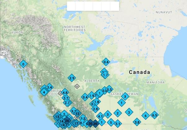
Index (AQHI) and forecasting products. The AQHI is a Location of Traditional Monitoring Network in Western Canada
communication tool that informs Canadians about the acute
health effects of current air pollutants using a 1 to 10+ scale. While the spatial coverage of the NAPS
network is representative of the larger population centers and reaches approximately ~80% of the
Canadian population, it does not extend into many rural and remote areas. As a result, its
measurements do not reflect the high spatial variability of PM2.5 observed during high impact pollution
events, such as smoke from forest fires. This leaves ~20% of Canadians, who occupy the remaining
~70% of land area, with no air quality monitoring or AQHI forecast during high impact air pollution
events, such as when smoke from forest fires inundates communities. By using low-cost sensors to
provide real-time AQ data in these areas, communities will be better able to make informed decisions to
protect their health during air pollution events.
What are the benefits for ECCC with the augmented network?
The MSC is responsible for forecasting the Air Quality Health Index (AQHI) within Canada and
provides current and 2-day AQHI forecasts and health messaging for Canadians to make informed
decisions. The AQHI calculation is based on the concentrations of Ozone, Nitrogen Dioxide and PM 2.5.
The PM2.5 measurements made possible by low-cost sensors in the augmented network will be used by
the MSC in the following way:
- Real-time PM AQ data will be made available to remote, northern or Indigenous areas.
These data will supplement information provided by our air quality forecast models and will
be used by MSC forecasters to provide the best possible synopsis of current and future air
1 of 6Version 3 Collaborative Information Sheet Updated Jan 2021
quality conditions to Canadians and partners. This is particularly important during high
impact AQ events, such as wildfire smoke events, when PM concentrations can be highly
variable in scale, both spatially and temporally.
- Data will be used to improve air quality dissemination products (such as web map
applications) as well as air quality and smoke forecast models and nowcasting tools,.
- .
What benefit does the hosting community/agency get from the augmented network?
Hosting a sensor within a community as part of this augmented network can benefit the
community in the following ways:
- Real-time PM2.5 data would be available to the community via a map product:
(https://cyclone.unbc.ca/aqmap).
o The map product includes sensor and agency concentrations of PM2.5 as well as the
health messaging that is associated with that concentration based on the AQHI+
PM2.5 calculation.
o Time series graphs per location by clicking on the map show the current PM
concentration and how it relates to that of previous days. This can provide answers
to inquiries, such as, “Is the concentration higher or lower than yesterday?”
o The data can be used by the community to make informed decisions about their
health, such as whether to participate in outdoor activities
o The product can be used in real-time for public outreach and social media to
educate Canadians on the use of AQHI during extreme events, such as acute wildfire
smoke impacts.
- The PM sensor technology can be used as an educational tool in schools and the community
to increase awareness of activities that cause air pollution events and to discuss actions to
reduce these impacts. Students and Canadians can track data using the tools available on
the UNBC sensor network web site.
What role does ECCC play in this augmented network?
During this pilot project, the Air Quality Science units within the MSC are coordinating this
augmented network and will be responsible for the following:
- Testing low-cost sensors to understand their capabilities and limits
- Providing the low-cost sensors to collaborators
- Providing instructions on the siting and installation of the low-cost sensors
- Providing expertise for questions regarding sensor technology, the map product, sensor
installation, etc.
- Providing a mapping tool in collaboration with the University of Northern British Columbia
(UNBC), which can be accessed by the public https://cyclone.unbc.ca/aqmap
- Providing automated corrections to the data following the determination of regionally
specific correction factors, if applicable. This correction factor is currently being updated by
collocating low-cost PM sensors with the higher quality monitoring instrumentation
traditionally used in the NAPS network.
- Providing automated basic quality control (QC) of the data that is reported to the mapping
tool, e.g. ensuring that the sensor is reading values typical of outdoor air vs. indoor air and
ensuring that the two sensors within each sensor package match.
2 of 6Version 3 Collaborative Information Sheet Updated Jan 2021
- Providing any repairs or replacements of sensors during the pilot project
What role does the sensor host play in this augmented network?
The sensor host has the following responsibilities in this augmented network.
- Receiving and installing the sensor according to the instructions provided by ECCC. The
installation is simple and should take less than 30 minutes.
- Providing the power for the low-cost sensor.
- Providing the WIFI for the low-cost sensor.
- Performing occasional simple trouble-shooting such as power cycling the sensor (turn off
and on)
- Shipping sensors back to ECCC if they fail.
Which communities or regions is ECCC looking to collaborate with during this pilot project?
The focus areas for this pilot project are as follows:
1. Communities that do not have or are not near a traditional NAPS or Provincial/Territorial AQ
monitoring site.
2. Communities that have in the past been impacted by smoke from wild fires or local
residential wood smoke.
3. Communities that are interested in installing Air Quality PM sensors at a school to examine
the feasibility of incorporating air quality education into a school curriculum.
4. Indigenous communities that are interested in air quality monitoring in their communities.
Frequently Asked Questions:
How much power does the PurpleAir sensor use?
The power usage is small. The power supply is a 5V at a max of 1.5 A, or 7.5 W.
How much data does the PurpleAir use?
Sent messages will be less than 180 bytes per message, with 4 messages every 2 minutes for a
total upload of around 518 KB/day (~15 MB/month).
Why can they not just expand the current network into my community?
Obtaining the high quality data associated with traditional networks is expensive. Initial setup of
a monitoring site can cost hundreds of thousands of dollars or more, when land acquisition, a
shelter and instrumentation are included. Operating costs are also substantial, as it takes trained
technicians to maintain a monitoring site. Therefore, it is not feasible or possible to expand the
existing network to every community. However, using low-cost sensors in under-served areas can
help to provide additional information about local air quality conditions and help inform air
3 of 6Version 3 Collaborative Information Sheet Updated Jan 2021
quality network managers about whether enhancing the monitoring capabilities in certain areas
may be warranted.
Will they remove existing monitoring in my community if we use these low-cost sensors?
No. The goal is not to replace the existing network but to expand into areas that do not have
existing monitoring or sufficient spatial coverage with existing monitoring.
If I look on the map and see a difference between our low-cost monitor and the traditional monitoring
network which one should I believe?
They both could be correct, however, the traditional monitoring network has higher quality
measuring equipment and will likely be more accurate. This may not necessarily mean that the
low-cost sensor is incorrect, as in some cases it may be picking up local effects such as traffic, a
smoke plume or a car idling nearby.
Is the password for the network encrypted?
According to PurpleAir, the WiFi details on the microchip within the sensor (ESP8266) are not
stored encrypted. You would need physical access to the device and the know how to flash it
with your own firmware to extract the password. For more information regarding the
PurpleAir security features please visit their website:
https://docs.google.com/document/d/1mUPywHk59i3kTP_8h0w--
vMQejEl1we47PPUilXJG1M/edit
There are many low-cost sensors on the market. Why is ECCC only using the Purple Air sensor?
ECCC has assessed numerous low-cost PM sensors. The PurpleAir sensor was chosen for this
stage of the pilot project for the following reasons:
- Cost – of the sensors assessed by ECCC; the PurpleAir is one of the least expensive
sensors that had reasonable correlation with the higher quality monitors in the
traditional network.
- Ease of Data retrieval – the data are easily incorporated into the UNBC mapping
tool
o Availability of Citizen based monitors – numerous Purple air sensors have
been purchased by the public and can add to this collaborative network
ECCC is continually assessing other low-cost sensors, and although PurpleAir are currently the
only low cost sensor data displayed on the mapping tool, other low-cost sensor data may be
added in the future.
Note: Low-cost sensor data on the mapping tool are provided by PurpleAir and are subject to
the capabilities and limitations of these instruments. Use of any data provider or system does
not constitute endorsement or recommendation of that system. Mention of trade names or
commercial products does not constitute ECCC endorsement or recommendation for use.
4 of 6Version 3 Collaborative Information Sheet Updated Jan 2021
How accurate and reliable is the data from low-cost sensors such as the Purple Air compared to
traditional monitoring technology?
While low-cost sensor data are useful for providing information about air quality, the sensor
data are not as accurate as that produced by the traditional monitoring network. The PurpleAir
sensors may overestimate or underestimate the actual concentrations but do tend to follow the
trend of the particulate matter concentrations. ECCC does not use the data from the low-cost
sensors for regulatory purposes.
The PurpleAir sensor data displayed on the UNBC map (https://cyclone.unbc.ca/aqmap)
includes a correction factor to improve the data accuracy. The correction factor was developed
using available data from collocated Purple Air and traditional regulatory monitors across North
America. Collocation studies have found that when corrected data from the PurpleAir monitors
is compared to traditional monitors, the AQHI was found to be within 1 AQHI unit,
approximately 95 percent of the time. Work by ECCC scientists is on-going to further investigate
the correction factor using the most recent data from across Canada and North America, and
the mapping tool will be updated to include a new correction factor, if necessary, as this work
progresses.
Traditional monitors are located at long-term sites that had to meet rigorous siting conditions,
while low-cost sensors do not follow such procedures. This may result in low-cost PM sensors
being place near local sources, such as BBQs or idling cars, which could affect their
measurements. Therefore, comparing sensor data with other nearby sensors or regulatory
monitors, if possible, may be helpful in determining if a particular sensor is picking up
contamination by a local source.
The data from the sensors is also available on the Purple Air website. How is that different from the
UNBC map product?
The PurpleAir map (https://www.purpleair.com/ ) and the UNBC map
(https://cyclone.unbc.ca/aqmap/ ) both display data from the host sensors and both can provide
information.
The PurpleAir map:
- covers the entire world
- displays only low-cost sensor data
- data can be displayed using a variety of correction factors determined throughout the USA.
- The default for color coding is in line with that of the US AQI index
-
The UNBC map:
- utilizes a correction factor that was developed using Canadian PM2.5 collocation data.
- currently only displays data in western Canada and bordering regions, such as Alaska and
Washington
- displays data from both the regulatory grade monitors and the PurpleAir sensors
5 of 6Version 3 Collaborative Information Sheet Updated Jan 2021
- displays additional information, such as the ECCC Firework PM2.5 forecast, NRCan active fire
locations and fire danger ratings, satellite data, as well as other meteorological parameters
of interest.
- displays messaging and colour coding in line with the Canadian AQHI
- includes preliminary quality control of the data
The AQHI is calculated from concentrations of PM 2.5, NO2 and O3. Why is ECCC only measuring PM2.5
in this low-cost sensor network?
The low-cost sensor pilot project is currently focused on PM2.5 alone for the following reasons:
- The current technology for the low-cost PM2.5 sensors show good correlation with traditional
monitoring methods.
- The current technology employed in low cost sensors does not yield NO2 and O3 data that
are well correlated with traditional measurements. As small sensor technology is rapidly
changing, ECCC plans to continue evaluating new sensors, as they become available, and
incorporate them into this network.
- PM2.5 is the major contributor to poor air quality in communities impacted by smoke from
forest fires.
What will happen at the end of the pilot project? Will this augmented sensor network continue to be
supported by ECCC in the long term?
The purpose of this pilot project is to assess the benefit of using low-cost sensor technologies to
provide additional air quality information in areas that lack traditional monitoring. Findings from
this pilot will help to determine the next steps for the project.
Whom should I contact if I have any other questions?
You can contact the following for any further information.
Corinne Schiller – Senior Air Quality Scientist – MSC/ECCC Corinne.Schiller@Canada.ca
Matt Parsons – Senior Air Quality Scientist – MSC/ECCC Matthew.Parsons@Canada.ca
6 of 6You can also read