The Keadby 3 Low Carbon Gas Power Station Project - SSE Thermal
←
→
Page content transcription
If your browser does not render page correctly, please read the page content below
The Keadby 3 Low Carbon Gas Power
Station Project

                                                  Document Ref: 6.3
                               Planning Inspectorate Ref: EN010114

The Keadby 3 (Carbon Capture Equipped Gas Fired Generating
Station) Order

Land at and in the vicinity of the Keadby Power Station site,
Trentside, Keadby, North Lincolnshire

Environmental Statement Volume II -
Appendix 11F: Riparian Mammal Survey
Report

The Planning Act 2008
The Infrastructure Planning (Environmental Impact Assessment)
Regulations 2017

                              Applicant: Keadby Generation Limited
                                                     Date: May 2021
Document Ref 6.3
                                             Environmental Statement - Volume II
                                   Appendix 11F: Riparian Mammal Survey Report

DOCUMENT HISTORY

Document Ref     6.3.17/APPENDIX 11F
Revision         VP1.0
Document Owner   AECOM

GLOSSARY

Abbreviation     Description
CIEEM            Chartered Institute of Ecology and Environmental Management
Defra            Department for Environment, Food and Rural Affairs
EcIA             Ecological Impact Assessment
EPS              European Protected Species
EPSML            European Protected Species Mitigation Licence
PEA              Preliminary Ecological Appraisal

May 2021                          Page i
Document Ref 6.3
                                                                    Environmental Statement - Volume II
                                                          Appendix 11F: Riparian Mammal Survey Report

CONTENTS
1.0 Introduction....................................................................................................... 1
    1.1    Background ........................................................................................... 1
    1.2    Survey Scope ........................................................................................ 1
2.0 Methods............................................................................................................ 3
    2.1    Desk Study ............................................................................................ 3
    2.2    Riparian Mammal Survey ...................................................................... 3
    2.3    Nature Conservation Evaluation ............................................................ 4
    2.4    Limitations ............................................................................................. 5
3.0 Legislation, Planning Policy and Related Guidance ......................................... 7
    3.2    Water Vole............................................................................................. 7
    3.3    Otter ...................................................................................................... 8
4.0 Results ........................................................................................................... 10
    4.1    Desk Study .......................................................................................... 10
    4.2    Water Vole Survey Results.................................................................. 10
    4.3    Otter Survey Results ........................................................................... 16
5.0 Conclusions and Nature Conservation Evaluation ......................................... 19
    5.1    Overview ............................................................................................. 19
    5.2    Water Vole........................................................................................... 19
    5.3    Otter .................................................................................................... 19
6.0 References ..................................................................................................... 21
ANNEX A Riparian Mammal Survey Forms ......................................................... 23
ANNEX B Photographs ........................................................................................ 43

TABLES
Table 1: Water vole field signs recorded within each waterbody .............................. 15

May 2021                                                 Page ii
Document Ref 6.3
                                                    Environmental Statement - Volume II
                                          Appendix 11F: Riparian Mammal Survey Report

1.0   INTRODUCTION
1.1   Background

1.1.1 This report accompanies Chapter 11: Biodiversity and Nature Conservation (ES
      Volume I - Application Document Ref. 6.2) and describes the approach and
      findings of the riparian mammal surveys undertaken in support of the Ecological
      Impact Assessment (EcIA) of the Proposed Development. For the purposes of
      this report, riparian mammals are defined as water vole (Arvicola amphibius)
      and otter (Lutra lutra).
1.1.2 The terms of reference used to describe the Proposed Development in this
      report are broadly consistent with those defined within the main chapters of the
      Environmental Statement (ES) (ES Volume I – Application Document Ref.
      6.2).
1.1.3 The Proposed Development Site encompasses an area of approximately 69.4
      hectares (ha) which includes circa 20.7ha of land for construction laydown.
1.1.4 The Proposed PCC Site comprises an area of approximately 18.7ha of the
      Proposed Development Site within the wider Keadby Power Station site that is
      located within Keadby Common. Overhead electricity transmission lines
      associated with the existing National Grid 400kV Substation bisect the
      Proposed PCC Site. Land to the south of these overhead lines within the
      Proposed PCC Site is proposed for administration/ control room/ warehouse
      buildings and car parking areas and an above ground installation (AGI) for the
      gas connection. The area of the Proposed PCC Site on which the power
      generation (CCGT), carbon capture and compression (CCP) and associated
      stacks will be developed is referred to as the ‘Main Site’ herein.

1.2   Survey Scope

1.2.1 An initial Preliminary Ecological Appraisal (PEA) of the ecological constraints
      and opportunities associated with the Proposed Development Site was made
      by AECOM in March 2020, including identification of the requirements for further
      protected species survey. The findings of the habitat and scoping survey were
      compiled as a Preliminary Ecological Appraisal (PEA) report (submitted as
      Appendix 11C (ES Volume II - Application Document Ref. 6.3)), which should
      be referred to for a more detailed overview of the site conditions and habitats
      present.
1.2.2 This habitat information was used to identify locations within the potential zone
      of influence of the Proposed Development that supported conditions potentially
      suitable for riparian mammals. Accordingly, the PEA report identified 16
      waterbodies (locations shown on Figure 11F.1 (ES Volume II - Application
      Document Ref. 6.3)) requiring further survey and/ or assessment due to the
      potential for these waterbodies to experience impacts and effects from

May 2021                                Page 1
Document Ref 6.3
Environmental Statement - Volume II
Appendix 11F: Riparian Mammal Survey Report
construction, operation and/or decommissioning of the Proposed Development.
The waterbodies of potential relevance are:
five field drains (Drains 1 (Glew Drain), 2, 3, 4 and 5) in association with the
Main Site, where construction works for the Proposed Development would
be focused;
the Stainforth and Keadby Canal due to it being considered as the preferred
Canal Water Abstraction Option;
the River Trent in the vicinity of the River Water Abstraction Option and
Water Discharge Corridor;
the North Soak Drain as it is located within the Proposed Development Site.
While this waterbody would not be directly affected, it is located adjacent to
a potential construction access route to the Potential Water Abstraction
Option on the Stainforth and Keadby Canal;
Hatfield Waste Drain as it is proposed that the existing Mabey Bridge would
be replaced at the proposed access point off the A18;
Keadby Common Drain adjacent to Chapel Lane, where a potential
connection to the 132kV Northern Powergrid substation may involve an
electrical cable being installed across the drain using open cut methods; and
six field drains (Drains 7a-7c and 8-10) dividing arable fields at Pilfrey Farm
that will be used for temporary construction.
1.2.3 The other waterbodies associated with the Proposed Development Site, all of
which are minor ditches and drains, were scoped out as they will not be affected
and are located at distance from proposed construction works. These other
waterbodies are not considered further in this report.
1.2.4 The purpose of the riparian mammal surveys and this report is to:
provide data on the level, nature and location of water vole and otter activity
associated with the relevant waterbodies and adjacent land;
present the above data in a manner that allows the results to be used to
support an assessment of relative nature conservation value, including
review against relevant criteria (see Section 2 of this report); and
inform the options for impact avoidance, mitigation and/or compensation to
be considered during design of the Proposed Development.
1.2.5 The purpose of this report is to provide baseline technical information only. It
does not seek to include recommendations, specify mitigation, or make an
ecological impact assessment (EcIA) of the Proposed Development. The formal
EcIA is provided as Chapter 11: Biodiversity and Nature Conservation (ES
Volume I – Application Document Ref. 6.2), and this riparian mammal report
comprises an appendix to that chapter.
May 2021 Page 2
Document Ref 6.3
Environmental Statement - Volume II
Appendix 11F: Riparian Mammal Survey Report
2.0 METHODS
2.1 Desk Study
2.1.1 A desk study was undertaken as part of the PEA (included as Appendix 11C
(ES Volume II – Application Document Ref. 6.3)) that was completed in
advance of the riparian mammal surveys and informed the scoping of
requirements for further survey.
2.1.2 Desk study results of relevance to the assessment have been carried forward
into this report, and where appropriate this data is presented in more detail or
re-interrogated for the needs of the current assessment.
2.2 Riparian Mammal Survey
2.2.1 The water vole and otter survey of the identified relevant waterbodies (see
Section 1) was undertaken with reference to guidance given in Strachan et al.
(2011) for water vole, and Chanin (2003a) and Crawford (2010) for otter.
2.2.2 To meet current good practice requirements for water vole survey, two survey
visits were completed (Strachan et al., 2011). These surveys were completed
on 19th May and 12th August 2020.
2.2.3 Some waterbodies (Hatfield Waste Drain, Keadby Common Drain at Chapel
Lane) were not identified as relevant until September 2020, so only one survey
visit was possible, and this was completed on 20th October 2020.
2.2.4 The relevant waterbodies were surveyed from within the channel where
possible, or on the bank face or bank top (as access and safety considerations
permitted) if not, and searched for the following signs that would indicate the
presence of water vole or otter:
Water Vole
direct sightings;
burrows and nests;
faeces and latrines;
feeding remains;
lawns – around burrows there is often an area of grazed vegetation;
footprints;
runways – low tunnels within the vegetation; and
auditory noises – characteristic ‘plop’ sound as animals enter a waterbody.
May 2021 Page 3
Document Ref 6.3
Environmental Statement - Volume II
Appendix 11F: Riparian Mammal Survey Report
Otter
direct sightings;
suitable habitat for holts (breeding sites);
feeding remains;
footprints;
slides;
spraints (faeces); and
evidence of couches (resting or laying-up sites).
2.2.5 In most cases the presence of faeces/ latrines and footprints are the most
reliable field evidence for riparian mammals, in the absence of direct sightings.
Not all the other field signs are necessarily definitive to species level, or other
factors may prevent a conclusive identification. Where the latter evidence was
detected, in the absence of these more reliable field signs, then this evidence
has been used with caution to infer the presence of riparian mammals.
2.2.6 The presence/ absence of mink (Neovison vison) and brown rat (Rattus
norvegicus) was also recorded through their field signs, where present. These
species may influence habitat suitability for water vole in particular and may help
to explain an absence of field signs in habitats that otherwise appear to be highly
suitable.
2.3 Nature Conservation Evaluation
2.3.1 Evaluation of the relative nature conservation value of the identified ecological
features within a site (encompassing nature conservation designations,
ecosystems, habitat and species) is required to inform EcIA. This report
presents the evaluation for riparian mammals and the impact assessment is
presented in Chapter 11: Biodiversity and Nature Conservation (ES Volume I -
Application Document Ref. 6.2).
2.3.2 The method of evaluation that has been utilised has been developed with
reference to the Chartered Institute of Ecology and Environmental Management
(CIEEM) Guidelines for Ecological Impact Assessment in the UK and Ireland –
Terrestrial, Freshwater and Coastal and Marine – Second Edition (CIEEM,
2019). These guidelines give advice on scoping and carrying out environmental
assessments and place appraisal in the context of relevant policies. Data
received through consultation, desk-based studies and field-based surveys are
used to allow ecological features of nature conservation value or potential value
to be identified, and the main factors contributing to their value described and
related to available guidance. This data can also be used to identify other
relevant values e.g. socio-economic or ecosystem services values, but this is
beyond the remit of this report and requires the involvement of other relevant
specialists.
May 2021 Page 4
Document Ref 6.3
                                                     Environmental Statement - Volume II
                                           Appendix 11F: Riparian Mammal Survey Report

2.3.3 The value of a faunal species, such as riparian mammals, may relate, for
      example, to its geographic location (species may be rare and more valued
      towards the edge of their geographic range), the extent to which the component
      species are threatened throughout their range, or their rate of decline. The value
      of the riparian mammal species populations associated with the Proposed
      Development Site has been defined with reference to the geographical level at
      which it is considered to matter. This assessment has been made with reference
      to published guidance and criteria where available e.g. criteria to assess relative
      value within the context of Lincolnshire are given in Greater Lincolnshire Nature
      Partnership (2013).

2.4    Limitations

2.4.1 All of the surveys were undertaken at an appropriate time of year and during
      suitable weather conditions. There was no substantive rainfall prior to the
      surveys that might have washed field signs away.
2.4.2 The bankside vegetation along the northern bank of Drain 1 had recently been
      cut prior to the second survey visit. Although this did aid the search for water
      vole burrows along this bank, other evidence for both otter and water vole such
      as feeding remains, lawns, runs, paths and couches may have been lost as a
      consequence. However, this is unlikely to have impacted the search for reliable
      in-channel features to identify presence such as latrines/ spraints and footprints.
      Similarly, if water vole had been present, it would still have been possible to find
      field signs on the immediately opposite unaffected bank. As such, the cutting of
      one bank is not considered a significant limitation.
2.4.3 North Soak Drain was not surveyed during the first visit as access was not
      available. On the second visit, access was obtained but due to safety
      constraints, could only be surveyed from the top of the bank as the water depth
      was greater than 1m deep and much of the bank face was covered by bramble
      scrub. This may have meant that field signs were missed, however as the
      Proposed Development will not directly impact on this drain, this is not
      considered a limitation. Habitat quality was considered poor as described in
      Section 4 and shown in the photographs provided in Annex B. This drain will
      not be affected by the Proposed Development.
2.4.4 There was also no access to survey the eastern section of Drain 2 during the
      first survey. This is not a limitation, given that access was possible during the
      second visit. If water vole was present in this drain, then the second visit would
      have coincided with the peak in water vole activity (which tends to be towards
      the end of the survey season, after breeding).
2.4.5 Hatfield Waste Drain, Keadby Common Drain at Chapel Lane, and field drains
      in the proposed construction laydown area south of the Stainforth and Keadby
      Canal and north of the A18 were surveyed only once and relatively late in the
      year (20th October 2020). While the timing of the survey was not optimal, it was
      not possible to survey earlier in 2020 and water voles would still have been

May 2021                                  Page 5
Document Ref 6.3
                                                     Environmental Statement - Volume II
                                           Appendix 11F: Riparian Mammal Survey Report

       active (if present) when the survey took place. Access to the banks of Hatfield
       Waste Drain was also poor, due to the steepness of the banks and the depth of
       the water within the drain. These are not considered limitations either at Chapel
       Lane or Mabey Bridge given the limited construction works proposed in these
       areas (installation of electrical connections and replacement of Mabey Bridge).
2.4.6 The drains associated with proposed temporary Construction Laydown Areas
      south of the Stainforth and Keadby Canal and north of the A18 will be subject
      to appropriate stand-offs and it is anticipated that access can be achieved
      without new crossing of these drains. A precautionary approach has been taken
      in the subsequent ecological impact assessment, including a commitment to re-
      survey all relevant drains prior to construction (regardless of prior survey effort
      applied to re-confirm the baseline).

May 2021                                 Page 6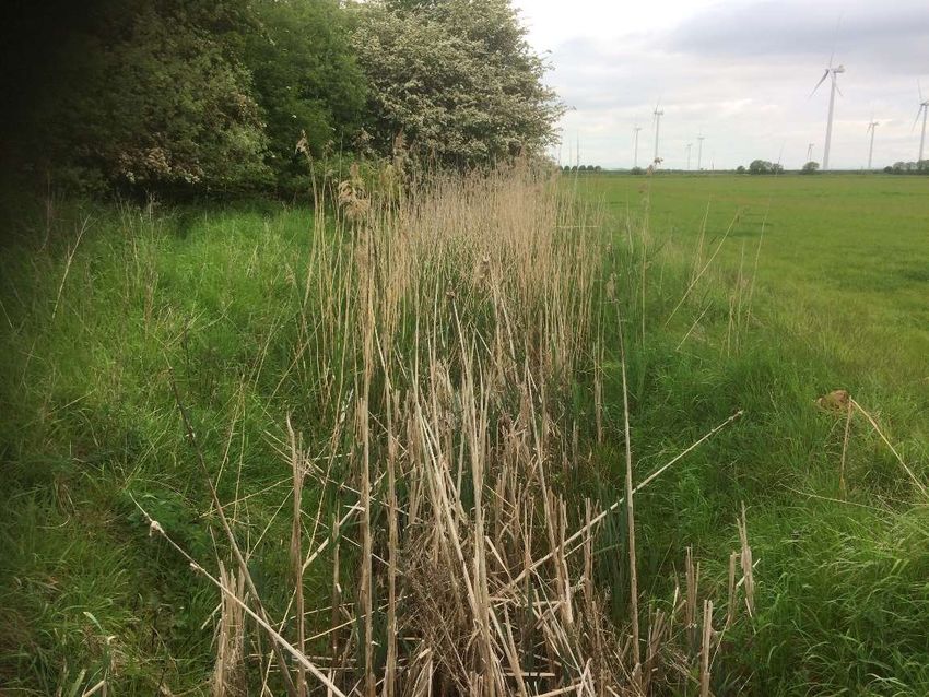
Document Ref 6.3
Environmental Statement - Volume II
Appendix 11F: Riparian Mammal Survey Report
3.0 LEGISLATION, PLANNING POLICY AND RELATED GUIDANCE
3.1.1 The following wildlife legislation, planning policy and guidance is specifically
relevant to the identification and assessment of potential constraints posed by
the presence of riparian mammals. At this stage of assessment, this legislation,
policy and guidance is primarily listed to demonstrate that an appropriate level
of survey and assessment has been undertaken to meet likely data
requirements for future decision-making regarding these material
considerations.
3.1.2 Wider relevant biodiversity legislation, policy and guidance is detailed in
Appendix 11A: Biodiversity and Nature Conservation Legislation and Planning
Policy (ES Volume II - Application Document Ref. 6.3).
3.2 Water Vole
3.2.1 The water vole is protected under Schedule 5 of the Wildlife and Countryside
Act 1981 (as amended) (the Act). This makes it an offence to:
intentionally capture, kill or injure water voles;
damage, destroy or block access to their places of shelter or protection (on
purpose or by not taking enough care);
disturb them in a place of shelter or protection (on purpose or by not taking
enough care); and
possess, sell, control or transport live or dead water voles or parts of them
(excluding water voles bred in captivity).
3.2.2 The Act provides a defence against the offences outlined above. However, the
defence is only sustained if it can be argued that the potential offence was ‘the
incidental result of a lawful operation’ and ‘could not reasonably have been
avoided’ as set out in the Act. In order to demonstrate these two elements of
the defence, as far as is reasonable, appropriate action would need to be taken
to safeguard water vole and their shelters to ensure there is as little risk as
possible of interfering with them. Short-term low-level disturbance which ‘allows
water vole to flee and then later return’ is not considered likely to trigger an
offence under the Act. Where development cannot avoid potential offences then
a licence may be required.
3.2.3 The Government has published standing advice (Natural England and
Department for Environment, Food and Rural Affairs (Defra), 2015) to guide
decision-makers on the determination of proposals with potential to affect
protected species such as water vole. The guidance sets out responsibilities
and minimum requirements for survey and mitigation.
3.2.4 The water vole is also considered a ‘Species of Principal Importance for Nature
Conservation in England’ pursuant to Section 41 of the Natural Environment
and Rural Communities (NERC) Act 2006. Section 40 of the NERC Act requires
May 2021 Page 7Document Ref 6.3
Environmental Statement - Volume II
Appendix 11F: Riparian Mammal Survey Report
that local planning authorities have regard to the conservation of biodiversity in
England, when carrying out their normal functions. The water vole is also
included as a priority species for nature conservation within the Lincolnshire
Local Biodiversity Action Plan (LBAP) (Lincolnshire Biodiversity Partnership,
2011).
3.3 Otter
3.3.1 The otter is fully protected as a European Protected Species (EPS) under the
provisions of Schedule 2 of the Conservation of Habitats and Species
Regulations 2017 (as amended). It is also protected under Sections 9 and 11 of
the Wildlife and Countryside Act 1981 (as amended). Taken together this
legislation makes it an offence to:
capture, kill, disturb or injure otters (on purpose or by not taking enough
care);
damage or destroy a breeding or resting place (deliberately or by not taking
enough care);
obstruct access to their resting or sheltering places (deliberately or by not
taking enough care); and
possess, sell, control or transport live or dead otters, or parts of otters.
3.3.2 The otter is also a ‘Species of Principal Importance for Nature Conservation in
England’ pursuant to Section 41 of the NERC Act 2006.
3.3.3 The Government has published standing advice (Natural England and Defra,
2019) to guide decision-makers on the determination of proposals with potential
to affect protected species such as otter. The guidance sets out responsibilities
and minimum requirements for survey and mitigation.
3.3.4 Where development cannot avoid potential offences, then it is possible to apply
for a European Protected Species Mitigation Licence (EPSML). A licence is only
likely to be granted for developments that can demonstrate compliance with the
relevant standing advice.
3.3.5 The disturbance offence within the relevant legislation is not concerned with
‘trivial’ levels of disturbance which would be unlikely to adversely affect otter.
There would only be a conflict with the above legislation where disturbance is
of sufficient extent or magnitude to:
impair the ability of otter to survive, to breed or reproduce, or to rear or
nurture their young; or
affect significantly the local distribution or abundance of the species.
3.3.6 It should be noted that there is no evidence that otters are particularly vulnerable
to disturbance, except where this closely coincides with habitat features used
by otters for breeding or resting. Otters will select resting sites where there is
May 2021 Page 8Document Ref 6.3
Environmental Statement - Volume II
Appendix 11F: Riparian Mammal Survey Report
limited risk of direct physical disturbance, but otherwise are tolerant of and do
not necessarily avoid areas subject to human activity (Chanin, 2003b).
May 2021 Page 9Document Ref 6.3
Environmental Statement - Volume II
Appendix 11F: Riparian Mammal Survey Report
4.0 RESULTS
4.1 Desk Study
4.1.1 The desk study returned 25 individual water vole records made in the vicinity of
the Proposed Development Site the period 2010-2020. Most of the records
returned relate to drains within Keadby Wind Farm to the north and east of the
Proposed Development Site. Two records were made from a drain next to the
existing 400kV National Grid Substation off Chapel Lane, Keadby in the
approximate vicinity of the route of the proposed Emergency Vehicle Access
Road.
4.1.2 Previous water vole surveys of field drains bordering the former Keadby Ash Tip
by AECOM in 2017 also found limited evidence of water vole in the vicinity of
the Proposed Development Site. Two latrines and one water vole burrow, and
associated feeding remains, were found on a short section of the minor field
drain on the western boundary of the former Keadby Ash Tip.
4.1.3 These recent records indicate that water vole is widely distributed within the
network of drains and other freshwater waterbodies in the vicinity of the
Proposed Development Site.
4.1.4 In comparison, just four records of otter were returned and all date back to 2000.
These records relate to just two locations. These are the Stainforth and Keadby
Canal (in the vicinity of Vazon Bridge, off Chapel Lane, Keadby) 100m to the
south of the Proposed Development Site, and the Warping Drain 420m north-
east of the Proposed Development Site. Given these records, it should be
assumed that otters may explore other minor waterbodies or make use of
terrestrial habitats within the vicinity of the canal and Proposed Development
Site.
4.1.5 No evidence of otter was found by AECOM in 2017 when surveying waterbodies
associated with the former Keadby Ash Tip.
4.2 Water Vole Survey Results
4.2.1 Figure 11F.1 (ES Volume II - Application Document Ref. 6.3) contained within
this report shows the locations of the waterbodies surveyed and the associated
locations of water vole field signs. A summary of results within each of the
waterbodies surveyed for water vole is provided below and summarised in Table
1. Further information (including details on individual field signs, rather than
peak counts) is provided on the survey forms within Annex A. Representative
photographs of each waterbody are provided in Annex B.
4.2.2 Where present, an estimate on the number of water vole territories within each
waterbody is provided to allow inference of the likely population size present.
May 2021 Page 10Document Ref 6.3
Environmental Statement - Volume II
Appendix 11F: Riparian Mammal Survey Report
Main Site - Drain 1 (Glew Drain)
4.2.3 This drain, located on the northern boundary of the Main Site, has a channel
width of between 1 and 2m and variable water depths that are less than 0.6m
throughout. The banks are of earth, so are suitable for water vole burrowing.
The drain and its banks support extensive stands of suitable foodplants,
including emergent grasses and sedges (Annex B, Photograph 1). Bankside
trees are absent and there is no shading of the channel.
4.2.4 Drain 1 is connected at both its eastern and western extent to a network of
drains in the wider landscape, such that it provides a potential movement
corridor for water vole between other areas of suitable habitat. The other
drainage ditches associated with Keadby Common (Drains 2 to 5) are
connected to Drain 1.
4.2.5 Evidence of water vole was found within Drain 1 at three discrete sections along
the length of the drain (refer to Figure 11F.1 (ES Volume II - Application
Document Ref. 6.3)). These locations are:
between SE 81847 12227 to SE 81944 12212 (approximately 100m total
drain length) two latrines and three burrows were found;
between SE 82006 12202 to SE 82057 12199 (approximately 50m length of
drain), two latrines and one burrow were found; and
at SE 82152 12185 where a single latrine was present.
4.2.6 Given the limited number of burrows and latrines found, and the concentration
of these in relatively discrete areas of the drain, it is considered that this drain
supports a maximum of four water vole territories.
Main Site - Drain 2
4.2.7 This drain, located on the southern boundary of the Main Site, is separated into
two discrete sections by a temporary construction haul road crossing for Keadby
2 Power Station.
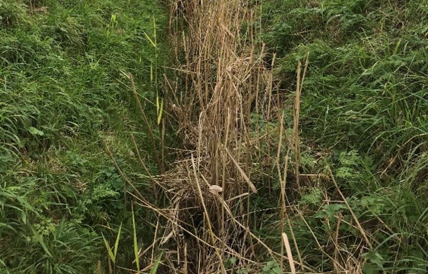
4.2.8 The western section of the drain is approximately 2-3m wide with water depths
of between 0.2 and 0.5m (Annex B, Photograph 2). This section of drain has
earth banks. The southern bank is dominated by dense willow scrub, which
overhangs the drain and casts heavy shade over approximately 70% of the
channel, reducing the cover of wetland plant species and by so doing, making
the habitat sub-optimal for water vole. The northern bank supports unmanaged
rank, semi-improved grassland. In-channel and bank vegetation suitable to
sustain water voles is restricted to the 30% of the channel where shading is
reduced.
4.2.9 The eastern section of the drain is narrower (approximately 1-2m wide) and is
dominated by reeds (Annex B, Photograph 3), so contains extensive suitable
food plants for water vole. The earth banks support rank semi-improved
May 2021 Page 11Document Ref 6.3
Environmental Statement - Volume II
Appendix 11F: Riparian Mammal Survey Report
grassland. This whole section is dry and is judged to only support water during
the wetter months of the year.
4.2.10 Evidence of water vole was present within a 60m section of the drain (between
SE 81933 11872 and SE 81993 11873). A total of four latrines and three
burrows were recorded within this area. Additional evidence of water vole
presence and activity was present in the form of 30 feeding stations.
4.2.11 Given the limited number of burrows and latrines found, and the concentration
of these in one short section of drain, it is considered that this drain supports a
maximum of two water vole territories (and potentially just one).
Main Site - Drain 3
4.2.12 This drain, located on western boundary of the Main Site, has a channel width
of 1-2m. During the first survey, the water depth was between 0.2 and 0.5m but
the whole length was dry during the return survey. The drain is dominated by
reeds along its entire length (Annex B, Photograph 4), so contains suitable food
plants for water vole.
4.2.13 The drain has earth banks approximately 0.5 - 1m in height, one of which
supports dense scrub, shading approximately 20% of the channel. The other
supports unmanaged, rank semi-improved grassland.
4.2.14 There was no evidence of water vole associated with this drain. Given that the
drain is regularly subject to drying, it is considered sub-optimal for water vole.
Main Site - Drain 4
4.2.15 This drain bisects the Main Site. The channel width is approximately 0.5m - 1m;
the drain, has earth banks, and during the initial survey the water depth was
very shallow (0.1m) and the channel was locally dry. By the second survey, the
whole drain was dry. The drain is dominated by reeds along its entire length
(Annex B, Photograph 5) so contains suitable food resources for water vole.
Bankside trees are absent and there is no shading of the channel.
4.2.16 Very limited evidence of water vole was found, which was restricted to a single
burrow with some associated feeding remains. This limited field evidence
indicates the presence of only a single water vole territory. Given that the drain
is subject to regular and prolonged drying, it is considered sub-optimal for water
vole.
Main Site - Drain 5
4.2.17 This drain, on the eastern boundary of the Main Site has earth banks, a channel
width of approximately 1-2m, and was dry during both surveys (a maximum
depth of 10cm was recorded at the time of the preceding PEA, Appendix 11C
(ES Volume II - Application Document Ref. 6.3)). The drain is dominated by
May 2021 Page 12Document Ref 6.3
Environmental Statement - Volume II
Appendix 11F: Riparian Mammal Survey Report
reeds along its entire length (Annex B, Photograph 6). Bankside trees are
absent and there is no shading of the channel.
4.2.18 There was no evidence of water vole associated with this drain. Given that the
drain is regularly subject to drying, it is considered sub-optimal for water vole.
North Soak Drain
4.2.19 The section of the drain associated with the Proposed Development Site is
approximately 10m wide and is greater than 1m in depth. The drain supports
occasional small stands of reeds with the open water areas but is otherwise
devoid of vegetation suitable to sustain water vole (Annex B, Photograph 7).
4.2.20 The drain has steep earth banks approximately 1-2m in height. The southern
bank between North Soak Drain and the Stainforth and Keadby Canal supports
dense bramble scrub, while the other bank supports rank, unmanaged semi-
improved grassland with tall ruderals. Bankside trees are absent and there is
no shading of the channel.
4.2.21 There was no evidence of water vole associated with this drain. There is minimal
food resource for water vole and as such the drain is considered to be sub-
optimal for this species. Previous surveys for Keadby 2 Power Station also did
not find water vole in this drain.
Stainforth and Keadby Canal
4.2.22 At the location of the Proposed Development Site, the canal is approximately
40m wide and greater than 1m in depth. The water column is dominated by
submerged aquatic plants, with isolated stands of reeds present in the margins
(Annex B, Photograph 8).
4.2.23 The banks of the canal are vertical and where visible were concrete. Bankside
trees and scrub are present on the northern bank of the canal, however given
its width, shading to the channel is negligible.
4.2.24 Given the prevailing habitat conditions, a water vole survey was not conducted.
The banks are unsuitable for water vole and there is minimal food resource. The
canal was therefore deemed unsuitable for water vole and was scoped out.
River Trent
4.2.25 At the location of the existing Keadby 1 Power Station cooling water intake and
outfall structures, the River Trent is a large (approximately 150m wide) tidal river
(Annex B, Photograph 9) and is therefore unsuitable for water vole. Water vole
is therefore scoped out in relation to the River Trent.
May 2021 Page 13Document Ref 6.3
Environmental Statement - Volume II
Appendix 11F: Riparian Mammal Survey Report
Hatfield Waste Drain
4.2.26 At the location of the existing Mabey Bridge crossing, the drain is approximately
10m wide and greater than 1m deep. The only aquatic vegetation apparent at
the time of survey was a narrow marginal fringe of reed sweet-grass (Glyceria
maxima) (Annex B, Photograph 10).
4.2.27 The drain has steep earth banks approximately 1-2m in height. The banks are
dominated by rank grasses, tall ruderal herbs and in places scrub. Bankside
trees are absent and there is no shading of the channel.
4.2.28 There was no evidence of water vole associated with this drain, but survey
access was poor due to the steep banks. Water vole is unlikely to be relevant
given the proposed works are restricted to the replacement of the existing
Mabey Bridge, but if the construction approach changes then a re-survey by
boat prior to construction may be required to inform the planning of construction
works.
Keadby Common Drain Adjacent to Chapel Lane
4.2.29 At the location of the potential 132kV connection to the Northern Powergrid
Substation, the drain is over-deepened. It has a channel width of between 1 and
2m and variable water depths that are less than 0.5m throughout. The banks
are of earth, so are suitable for water vole burrowing. The drain and its banks
support extensive stands of suitable foodplants, including emergent grasses
and sedges (Annex B, Photograph 11). Bankside trees are absent and there is
no shading of the channel.
4.2.30 The banks of the drain are very steep and eroded/ slumping in places with
exposed bare earth. Where vegetation is present, this is dominated by rank
grasses and herbs.
4.2.31 Evidence of water vole was found in scattered locations along a 75m stretch of
this drain within the Proposed Development Site (Figure 11F.1 (ES Volume II -
Application Document Ref. 6.3)). The distribution of field signs was:
between SE 82761 11971 to SE 82797 11967 (approximately 35m total
drain length) three latrines and three burrows were found;
at SE 82815 11959 one latrine was found; and
at SE 82834 11959 one latrine and one burrow were present.
4.2.32 Given the limited number of burrows and latrines found, and the concentration
of these in relatively discrete areas of the drain, it is considered that this section
of drain supports a maximum of four water vole territories.
May 2021 Page 14Document Ref 6.3
Environmental Statement - Volume II
Appendix 11F: Riparian Mammal Survey Report
Construction Laydown Area – Drains 7a-7c and 8-10
4.2.33 These drains comprise a cohesive network of field drains within land at Pilfrey
Farm (Annex B, Photograph 12 to 17). They are all approximately 2m wide and
steep earth banks dominated by rank grasses and ruderal herbs. Water levels
are variable, with Drains 7b and 8 completely dry and only likely to hold water
during the winter, and the remaining drains with water depths of less than 0.5m
(generally much less than this, except in localised areas). None of the drains
are shaded by trees.
4.2.34 Given the shallow water depths, all of these drains were easily accessed for
survey. There was no evidence of water vole associated with any of these
drains.
Table 1: Water vole field signs recorded within each waterbody
Waterbody Evidence Water Vole Field Signs (Peak Count)
Reference* of Water
Vole Burrows Latrines Other Field Estimate of
Found? Signs Water Vole
Territories
1 (Glew Yes 4 5 2 feeding 4
Drain) remains
1 feeding
remains
None
2 Yes 3 4 30 feeding 2
remains
3 No 0 0 None 0
4 Yes 1 0 1 feeding 1
remains
5 No 0 0 None 0
North Soak No 0 0 None 0
Drain
Hatfield No 0 0 None 0
Waste
Drain
Keadby Yes 4 5 None 4
Common
Drain
7a No 0 0 None 0
7b No 0 0 None 0
May 2021 Page 15Document Ref 6.3
Environmental Statement - Volume II
Appendix 11F: Riparian Mammal Survey Report
7c No 0 0 None 0
8 No 0 0 None 0
9 No 0 0 None 0
10 No 0 0 None 0
* refer to Figure 11F.1 and Figure 11C.3 presented in Appendix 11C – ES Volume II –
Application Document Ref. 6.3)
4.3 Otter Survey Results
Main Site (Drains 1, 2, 3, 4 and 5)
4.3.1 No evidence of otter was found in association with the minor waterbodies on the
Main Site, or in adjacent terrestrial habitats.
4.3.2 While otters will explore small waterbodies in their territories, such use would
be transitory only, unless there were suitable habitat features to encourage
more regular use. In this case, the habitat conditions present are sub-optimal
for otter given most of the drains dry up during the summer and only hold
shallow water during the wetter months of the year. Most of the drains are
therefore not suitable to sustain a regular presence of fish, and therefore do not
provide represent attractive foraging habitat for otter. Drain 1 (Glew Drain) holds
permanent water but is still a very minor waterbody and is only likely to support
minor fish species.
4.3.3 Cover was also poor along most drains, making it unlikely that otter would use
the waterbodies of Keadby Common for lying-up or for holts. Only Drains 2 and
3 had any substantive bankside cover, and this was dense scrub with little cover
at ground level. No evidence of otter, or habitat features suitable for use by otter,
was found in association with this scrub.
4.3.4 Given the above habitat conditions, it is considered that otter will not make any
substantive use of the drains associated with Keadby Common.
North Soak Drain and Keadby Canal
4.3.5 No evidence of otter was recorded in association with these two waterbodies
and their adjacent terrestrial habitats. The areas of mature woodland and scrub
next to the Proposed Development Site did not have sufficient cover or other
habitat features at ground level suitable for use by otters as couches or holts.
4.3.6 Currently the land required for the Proposed Development is subject to ongoing
construction works for Keadby 2 Power Station (Annex B, Photograph 18 and
19). Otter has not been identified as a constraint to these construction works,
and while construction works are ongoing, this area is unlikely to be attractive
to otter.
May 2021 Page 16Document Ref 6.3
Environmental Statement - Volume II
Appendix 11F: Riparian Mammal Survey Report
4.3.7 Otter is not considered a constraint in relation to potential works associated with
the Proposed Development in the vicinity of the North Soak Drain and the
Stainforth and Keadby Canal.
River Trent
4.3.8 The survey for otter was restricted to inspections of suitable terrestrial habitat
associated with the Proposed Development Site. The River Trent is only
relevant to the Proposed Development because of the option to use its existing
water intake and outfall structures. As such, although otter will likely forage
along the Trent, the Proposed Development has limited potential to affect the
species when it is using this large waterbody.
4.3.9 The banks of the Trent in association with the Proposed Development are
immediately adjacent to a road and are used for recreation by residents of the
village. The banks are predominantly under mown improved grassland, with
small and narrow stands of scrub and common reed at the edge of the channel.
The latter provides limited cover for otter, making it unlikely that otter would
preferentially use these areas for lying-up or for holts given the wider resource
of less disturbed habitat along the River Trent.
4.3.10 No evidence of otter was recorded in association with the River Trent. Otter is
not considered to be a constraint in relation to potential works associated with
the Proposed Development on the banks of the River Trent.
Hatfield Waste Drain
4.3.11 No evidence of otter was found in association with this drain. The drain runs
parallel to a busy road and there is no vegetation in association with the steep
banks that otters could use for shelter. Given this, otter may forage along the
drain at night, but is unlikely to be present during daylight hours.
4.3.12 Given the limited extent and construction requirements for the proposed Mabey
Bridge replacement works, otter is not considered a relevant constraint.
Keadby Common Drain Adjacent to Chapel Lane
4.3.13 No evidence of otter was found in association with this small drain. The drain
runs parallel to a road and is close to residential areas and routes used for public
amenity. There is no vegetation in association with the steep banks that otters
could use for shelter. Given these conditions, otter is very unlikely to use this
drain.
4.3.14 Given the limited extent and construction requirements for the proposed
connection to the 132kV substation, should this option be selected, otter is not
considered a relevant constraint.
May 2021 Page 17Document Ref 6.3
Environmental Statement - Volume II
Appendix 11F: Riparian Mammal Survey Report
Potential Laydown Area – Drains 7a-7c and 8-10
4.3.15 No evidence of otter was found in association with the minor waterbodies and
adjacent terrestrial habitats are not suitable to be utilised by otter for refuge.
4.3.16 Given the habitat conditions present, which are comparable to or less suitable
than Drains 1 to 5 as described above, it is considered that otter will not make
any more than rare exploratory use of these drains, or as an opportunistic
occasional route to move between Hatfield Waste Drain to the south and the
Sheffield and South Yorkshire Navigation habitat corridor to the north.
May 2021 Page 18Document Ref 6.3
Environmental Statement - Volume II
Appendix 11F: Riparian Mammal Survey Report
5.0 CONCLUSIONS AND NATURE CONSERVATION EVALUATION
5.1 Overview
5.1.1 This section provides an assessment of the riparian mammals recorded in
association with the Proposed Development Site to determine their relative
nature conservation value.
5.2 Water Vole
Main Site (Drains 1, 2, 3, 4 and 5) and the connected Keadby Common Drain
5.2.1 Given that all these surveyed waterbodies are located in close proximity to each
other and are connected, they have been evaluated together.
5.2.2 Fields signs were found in a number of discrete locations, indicating that there
is only a small and perhaps (at least in the case of the Main Site) transitory
population of water voles associated with the drains within the Proposed
Development Site (likely to be less than 14 territories and individuals). It is
possible that the sub-optimal drains of the Main Site in particular support
animals displaced from more optimal waterbodies elsewhere, and that there is
a high turnover of water voles within the Main Site drains year to year.
5.2.3 Lincolnshire is a stronghold for water vole, supporting a successful and
widespread population, and sightings or their associated field signs can be
expected in most suitable waterbodies throughout the county (Lincolnshire
Biodiversity Partnership, 2011). The desk study undertaken for the PEA
identified a large number of similar drains in the local area, which when
considered with the number of desk study records, suggests that this species is
relatively common in the wider landscape surrounding the Proposed
Development Site. The small numbers of water voles recorded indicates the
relevant sections of drain are of less than county value for the species. The
small numbers of water vole recorded are likely to make a minor contribution to
the wider population, especially given the habitat conditions present indicate
that the territories on the Main Site may not be sustainable over the long-term.
5.2.4 Given the above it is considered that these drains within the Proposed
Development Site support a water vole population of local value.
5.3 Otter
5.3.1 The surveys found no evidence of otter associated with the Proposed
Development Site.
5.3.2 As highlighted within the Section 4, it is assumed that otters are moving and
foraging along the River Trent and the Stainforth and Keadby Canal habitat
corridor, and potentially the other waterbodies associated with the Proposed
Development Site. However, there is no evidence that habitats within the
Proposed Development Site are of specific importance for otter and there is no
May 2021 Page 19Document Ref 6.3
Environmental Statement - Volume II
Appendix 11F: Riparian Mammal Survey Report
evidence that otter currently uses the habitats associated the Proposed
Development Site for breeding or resting.
5.3.3 Otter is not considered to be a constraint to the Proposed Development, so
further assessment is not required. However, top-up surveys are likely to be
required in future years to reconfirm the status of the species and the suitability
of the habitats present.
May 2021 Page 20Document Ref 6.3
Environmental Statement - Volume II
Appendix 11F: Riparian Mammal Survey Report
6.0 REFERENCES
Chanin, P. (2003a). Monitoring the Otter Lutra lutra. Conserving Natura 2000
Rivers Monitoring Series No. 10. English Nature, Peterborough.
Chanin, P. (2003b). Ecology of the European Otter. Conserving Natura 2000
Rivers Ecology Series No. 10. English Nature, Peterborough.
CIEEM (2019) Guidelines for Ecological Impact Assessment in the UK and
Ireland. Available online:
https://cieem.net/wp-content/uploads/2018/08/ECIA-Guidelines-2018-
Terrestrial-Freshwater-Coastal-and-Marine-V1.1Update.pdf.
Crawford, A. (2010). Fifth Otter Survey of England 2009 – 2010. Environment
Agency.
Greater Lincolnshire Nature Partnership (2013) Local Wildlife Site Guidelines
for Lincolnshire, 3rd Edition. Greater Lincolnshire Nature Partnership. Available
online:
https://glnp.org.uk/images/uploads/services/5e84eae57f8a5_LWS%20guidelin
es%203rd%20ed.pdf
Lincolnshire Biodiversity Partnership (2011) Lincolnshire Biodiversity Action
Plan 2011–2020 (3rd edition). Available online: https://www.nelincs.gov.uk/wp-
content/uploads/2016/02/201110-LincolnshireBAP-3rd-edition.pdf.
Natural England and Defra (2015) Water voles: surveys and mitigation for
development projects. Available online: https://www.gov.uk/guidance/water-
voles-protection-surveys-and-licences.
Natural England and Defra (2019) Otters: Surveys and Mitigation for
Development Projects. Available online: https://www.gov.uk/guidance/otters-
protection-surveys-and-licences.
Strachan, R., Moorhouse, T. & Gelling, M. (2011). Water Vole Conservation
Handbook, 3rd edition. WildCRU, Oxford.
May 2021 Page 21Document Ref 6.3
Environmental Statement - Volume II
Appendix 11F: Riparian Mammal Survey Report
FIGURE 11F.1 RIPARIAN SIGNS
May 2021 Page 22±
Drawn: TD Checked: JW Approved: CW Date: 13/05/2021
This drawing has been prepared for the use of AECOM's client. It may not be used, modified, reproduced or relied upon by third parties, except as agreed by AECOM or as required by law. AECOM accepts no responsibility, and denies any liability whatsoever, to any party that uses or relies on this drawing without AECOM's express written consent. Do not scale this document. All measurements must be obtained from the stated dimensions.
PROJECT
Drain
Wa
rp in g
Dra
The Keadby 3 (Carbon
Capture Equipped Gas Fired
in
Generating Station) Order
Peak Count -
Tra
c k
CLIENT
2 Water Vole Latrines Peak Count -
nt
2 Water Vole Latrines Keadby Generation Limited
r Tre
and 3 Burrows
and 1 Burrow
Rive
Wind Turbine
CONSULTANT
AECOM Limited
Peak Count -
2 City Walk
Leeds
Track Wind Turbine
1 Water Vole LS11 9AR
T: 0113 391 6800
Latrine Keadby Common www.aecom.com
LEGEND
The Order Limits
Glew Drain
1:12,000 @ A3 Running Water
Drain 1
Drain
Revision: 01
Track
0 100 200
Water Vole Field Signs
Glew
m
Drain
Drain 5
Drain
Peak Count -
Drain
1 Water Vole
Burrow Gantry
Drain 3 Gantry
Keadby Common
Filename: K:\07 CAD & GIS\02_Maps\PEA Preliminary Environmental Assessment\ES Version\K_ES_PEA_Fig_11F.1_Riparian_Signs_A3_20210507_R01.mxd
Drain 4 Drain
Drain
Drain
Drain
Electricity Distribution Site
K ead
by C
om m
on D
Drain rain
CHAP
Drain EL LA
NE
Red Ho
us e
Drain
Drain
Track
Gantry Gantry
Gantry Gantry
Mast
Drain 2
Gantry
Drain
Drain
Drain
Drain
Peak Count
- 5 Water Vole Latrines
Peak Count - and 4 Burrows
4 Water Vole Latrines, Keadby Common
and 3 burrows Track
Drain
Drain
Bank
Tanks Chy
Drain
FB
NORTH ROAD
WB
WB
WEST ROAD
2.2m
El Gen Sta
EAST ROAD
1.9m
2.3m
Tanks
EA LA ND
NOTES
RO AD
MP 18.0
North So Tanks
ak Drai Tank
n
Reproduced from Ordnance Survey digital
SP
Stone
GVC map data © Crown copyright 2021. All rights
North Soak Drain
reserved. Licence number 0100031673.
SOUTH ROAD
MP 0.75
ISSUE PURPOSE
Tank
RIPARIAN MAMMAL SURVEY
Tank
Roe Farm Tank
Level Tank Tank
REPORT
Crossing
SP 4.6m
Vazon Bridge
PROJECT NUMBER
Drain
House
Track
Track SP Ppg
Vazon Bridge
60625943
Sta
(Swing-Bridge)
Drawbridge
Stainforth & Kead
Track
Shef field and Sout
SHEET TITLE
MP 0.25
FB h Yorkshire Navigatio
by Canal
Drain SB n
Sout h Soak Drain Stain forth and Kead
Track by Canal
Riparian Mammal Field
Drain
Drain
Signs
Drain
1:4,000 @ A3
FB Sluice
Drain
50 25 0 50 100 150 200
SHEET NUMBER
m Figure 11F.1Document Ref 6.3
Environmental Statement - Volume II
Appendix 11F: Riparian Mammal Survey Report
ANNEX A RIPARIAN MAMMAL SURVEY FORMS
May 2021 Page 23Document 6.3
Environmental Statement - Volume II
Appendix 11F: Riparian Mammal Survey Report
May 2021 Page 24Document 6.3
Environmental Statement - Volume II
Appendix 11F: Riparian Mammal Survey Report
May 2021 Page 25Document 6.3
Environmental Statement - Volume II
Appendix 11F: Riparian Mammal Survey Report
May 2021 Page 26Document 6.3
Environmental Statement - Volume II
Appendix 11F: Riparian Mammal Survey Report
May 2021 Page 27Document 6.3
Environmental Statement - Volume II
Appendix 11F: Riparian Mammal Survey Report
May 2021 Page 28Document 6.3
Environmental Statement - Volume II
Appendix 11F: Riparian Mammal Survey Report
May 2021 Page 29Document 6.3
Environmental Statement - Volume II
Appendix 11F: Riparian Mammal Survey Report
May 2021 Page 30Document 6.3
Environmental Statement - Volume II
Appendix 11F: Riparian Mammal Survey Report
May 2021 Page 31Document 6.3
Environmental Statement - Volume II
Appendix 11F: Riparian Mammal Survey Report
May 2021 Page 32Document 6.3
Environmental Statement - Volume II
Appendix 11F: Riparian Mammal Survey Report
May 2021 Page 33Document 6.3
Environmental Statement - Volume II
Appendix 11F: Riparian Mammal Survey Report
May 2021 Page 34Document 6.3
Environmental Statement - Volume II
Appendix 11F: Riparian Mammal Survey Report
May 2021 Page 35Document 6.3
Environmental Statement - Volume II
Appendix 11F: Riparian Mammal Survey Report
May 2021 Page 36Document 6.3
Environmental Statement - Volume II
Appendix 11F: Riparian Mammal Survey Report
May 2021 Page 37Document 6.3
Environmental Statement - Volume II
Appendix 11F: Riparian Mammal Survey Report
May 2021 Page 38Document 6.3
Environmental Statement - Volume II
Appendix 11F: Riparian Mammal Survey Report
May 2021 Page 39Document 6.3
Environmental Statement - Volume II
Appendix 11F: Riparian Mammal Survey Report
May 2021 Page 40Document 6.3
Environmental Statement - Volume II
Appendix 11F: Riparian Mammal Survey Report
May 2021 Page 41Document 6.3
Environmental Statement - Volume II
Appendix 11F: Riparian Mammal Survey Report
May 2021 Page 42Document Ref 6.3
Environmental Statement - Volume II
Appendix 11F: Riparian Mammal Survey Report
ANNEX B PHOTOGRAPHS
Photograph 1 - Drain 1 (Glew Drain)
Photograph 2 - Drain 2, western section
May 2021 Page 43Document Ref 6.3
Environmental Statement - Volume II
Appendix 11F: Riparian Mammal Survey Report
Photograph 3 - Drain 2, eastern section
Photograph 4 – Drain 3
May 2021 Page 44Document Ref 6.3
Environmental Statement - Volume II
Appendix 11F: Riparian Mammal Survey Report
Photograph 5 – Drain 4
Photograph 6 – Drain 5
May 2021 Page 45Document Ref 6.3
Environmental Statement - Volume II
Appendix 11F: Riparian Mammal Survey Report
Photograph 7 – North Soak Drain
Photograph 8 – Stainforth and Keadby Canal
May 2021 Page 46Document Ref 6.3
Environmental Statement - Volume II
Appendix 11F: Riparian Mammal Survey Report
Photograph 9 – River Trent
Photograph 10 – Hatfield Waste Drain
May 2021 Page 47Document Ref 6.3
Environmental Statement - Volume II
Appendix 11F: Riparian Mammal Survey Report
Photograph 11 – Keadby Common Drain adjacent to Chapel Lane, Keadby
May 2021 Page 48Document Ref 6.3
Environmental Statement - Volume II
Appendix 11F: Riparian Mammal Survey Report
Photograph 12 – Drain 7a
May 2021 Page 49Document Ref 6.3
Environmental Statement - Volume II
Appendix 11F: Riparian Mammal Survey Report
Photograph 13 – Drain 7b
May 2021 Page 50Document Ref 6.3
Environmental Statement - Volume II
Appendix 11F: Riparian Mammal Survey Report
Photograph 14 – Drain 7c
May 2021 Page 51Document Ref 6.3
Environmental Statement - Volume II
Appendix 11F: Riparian Mammal Survey Report
Photograph 15 – Drain 8
May 2021 Page 52Document Ref 6.3
Environmental Statement - Volume II
Appendix 11F: Riparian Mammal Survey Report
Photograph 16 – Drain 9
May 2021 Page 53Document Ref 6.3
Environmental Statement - Volume II
Appendix 11F: Riparian Mammal Survey Report
Photograph 17 – Drain 10
Photograph 18 – Area of woodland cleared for construction of the Keadby 2
Power Station water intake on the Stainforth and Keadby Canal
May 2021 Page 54Document Ref 6.3
Environmental Statement - Volume II
Appendix 11F: Riparian Mammal Survey Report
Photograph 19 – Aerial view of the construction area for the Keadby 2 Power
Station water intake on the Stainforth and Keadby Canal, drone footage taken
November 2020
May 2021 Page 55You can also read