The Shiawassee River Canoe/Kayak Guide June, 2020
←
→
Page content transcription
If your browser does not render page correctly, please read the page content below
The Shiawassee River Canoe/Kayak Guide
                                June, 2020
                              Author: Phil Hathaway, Member
                              Friends of the Shiawassee River
          For Its Course Principally through Shiawassee County, Michigan

General Information. The Shiawassee River corridor has been called a “country scenic”
valley with farm fields and forested flood plains and embankments forming the landscape.
With a few exceptions, the Shiawassee River’s course in Shiawassee County is great for
beginners with some interesting riffles and obstructions in the way of rocks and tree falls that
provide a challenge for some. Frequent changes in the river height from storms or spring melt
raise the navigation conditions to intermediate and advanced status and these high water
periods are not recommended for beginners. There are six obstructions along the way: From
downstream to upstream they include the rock arch structure in Chesaning, Parshallburg’s
partially dismantled dam, the three low head dams in Owosso, the brick plan causeway east of
Corunna and the Byron Mill Pond Dam. The Owosso and Parshallburg impoundments are
navigable and are routinely used for paddlers with some experience. All of these obstructions
may be portaged.
        Except for flood stage or high water, the boating season is year-round for the hardiest.
The ‘ordinary person’ season extends from mid-April to late October with a pre-trip check
advised on low flow conditions that can occur anytime. Low flow in many Augusts
especially from Corunna to Parshallburg may be accompanied by a weed problem that
hampers paddles and lessens the quality of the recreational experience. Deer flies may show-
up in early July, but are rarely overwhelming; some get by well enough with head nets and
long-sleeved shirts. The Shiawassee County Environmental Health Department cautions that
the river is for partial body contact and care should be taken to not ingest water or swim
below the neck line. Washing of hands prior to snacks and meals taken along the way is
advised.
                                               1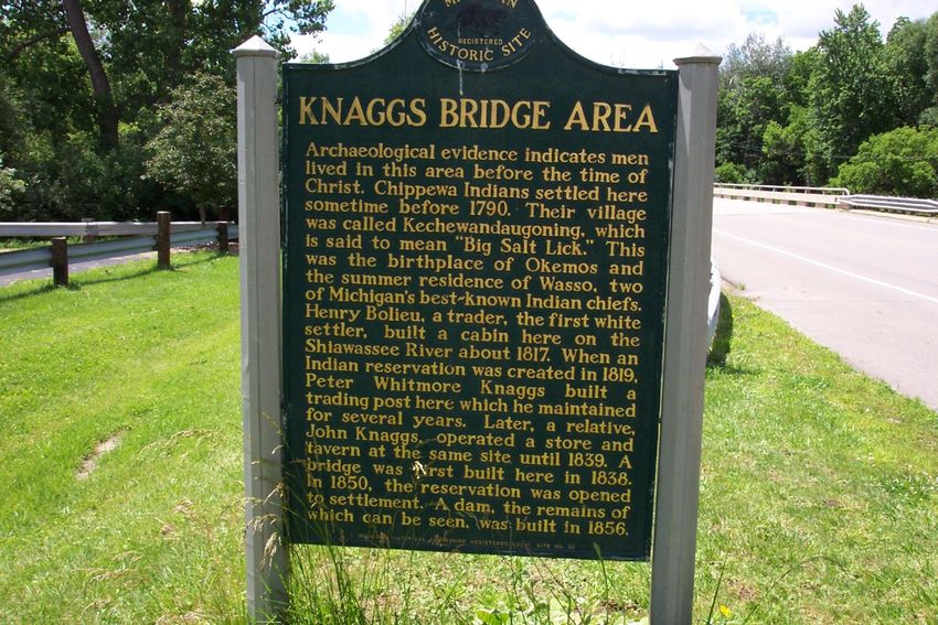
The passage from Byron to Chesaning is picturesque with plenty of wildlife together
with a fair share of mature forest stands. The river is noted on a Midwest scale for its small
mouth bass fishing. The most commonly-sited birds that leave an impression include the blue
heron, cedar waxwing, bald eagles and kingfisher. The herons tend to lead one downstream
landing and flying away until they eventually circle back to their territory and nests. The land
cover includes the pre-settlement forest types of oak-hickory and beech-maple. The willows,
oaks, sycamores and cottonwoods are everywhere, and a few escaped the lumber era to
provide glimpses of virgin timber specimens. The flowering weeds include joe-pye weed and
others that are excellent bank stabilization species that provide natural beauty. Invasive plants
are visible, especially stands of purple loosestrife.
         Although this guide shows sections averaging a little over two hours, any trip length
can be planned with the convenient number of drop off/landing locations. The descriptions
that follow provide detail on their condition and ease of entrance and exiting. A more
convenient tri-fold publication with a map is available on-line at the Friends of the
Shiawassee River website or at outlets such as the Owosso-Corunna Chamber of Commerce.
         Because nearly all of the launches are at public parks, rest areas with porta-johns and
picnic sites are of great benefit. Walnut Hills Campground northwest of Byron identified as a
launch in this guide has a swimming lake and many amenities for a modest visitor pass fee.
         Historical sites abound in this river valley. These areas are reflected in the Section
descriptions that follow the introduction. The guide strives for compatibility with the
initiative from Headwaters Trails, Inc and the Fenton-Linden River Keepers to establish a
Shiawassee River Heritage Water Trial. There are website guides for this upstream section.
         All-in-all the Shiawassee River is a superb natural, cultural and recreational resource.
So much enjoyment gained from Mother Nature’s free energy, meaning the current of the
river—as one glides downstream in an impressive flora and fauna corridor. Take a moment to
stand in the river at hip depth to feel this force and appreciate its unyielding influence.

Section 1 – Byron High School Ball Fields to Walnut Hills Camp & Canoe.
       Length: 5 river miles      Time: 2 Hours         Grade: 1.7 ft/mi
       a) Starting Point: This section of the river begins at the Byron High School ball
diamonds on Bath Road—south side—just west of the bridge in the Village.

        Upon entering the driveway to the ball diamonds a two track veers to the left about 50
yards into the grounds. There is a wide gravel pathway and new concrete ramp into the River.
These grounds are open to the public but users should be aware that the schools’ ball diamond
                                               2
park entrance gate could lock-in a vehicle if they are closed at night. There is no charge for
the use of this facility. It is a frequent starting point for Cheff’s Canoe Rental (phone--989-
288-7067; also see www.cheffscanoerental.com).
        There are services in this quaint Village—post office, ATM, snacks, pizza, and fuel.
Other upstream bridge crossings exist (Meier Road, and Duffield Road on the Main Branch
and Lillie Road Bridge on the South Branch) but are not evaluated in this Guide. Those who
have tried these stretches described numerous tree falls, and the Byron Mill Pond requires an
awkward portage on the main branch.
        b) End Point: The end point of this section is a gravel shoreline at a private
campground (Walnut Hills) immediately past the Lehring Road Bridge on the right. There is
a camp store there for convenience items and restrooms. It costs $1.00 for a visitor pass to
park a vehicle—well-worth the conveniences. Pay this before leaving the site on an excursion
because a visitor pass must hang on the visor of the vehicle window while parked. To learn
more about the Walnut Hills facilities and arrangements call 989-634-9782. The only private
canoe/kayak livery from Byron to Chesaning is based at this campground (Cheff’s Rental).
        c) River Description: Except for the Village of Byron in the first ½ mile of the trip,
there is very little development along the course. The woods are deep and the second growth
forest is quite mature. It is possible to paddle in the shade for nearly the entire trip. This is an
easily managed ride on this slow moving stream section with no riffles or rapids.

                1920’s Post Card of autumn river view near Byron

Although the current is slow, many tree falls make the maneuvering interesting, and these
provide regularly used perches for birds, harmless water snakes and turtles. There will be
common sitings of kingfisher and blue herons.
        Geologically this section of river north to Bancroft was part of the present-day
Looking Glass River in glacial times when the glacial advance of the Saginaw ice lobe
stagnated and forced that westerly course. Historically Byron Village had a hotel, lumber
mill, flour mill, furniture factory and all the trappings of a late 19th century urban place that
eventually condensed to a variety of service and convenience businesses and nicely
maintained homes.
                                                 3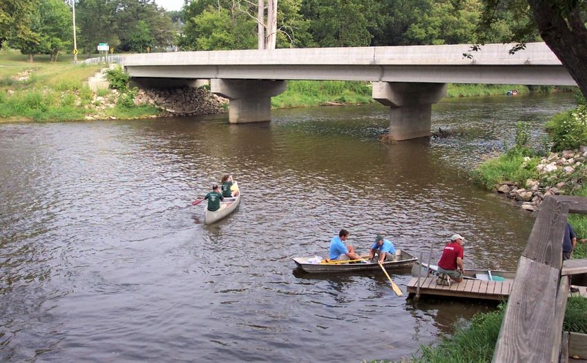
The spillway at the old Byron dam

       With respect to multi-day excursions, Walnut Hills is the only riverside campground
in the County. There are city and county parks along the way and except for the lack of
support services for campers (other than well pumps and porta-johns), there is no known
prohibition for setting up a tent for the night at various places with porta-johns. Long
distance/multi-day paddlers are advised to call in advance for permission at a public park.
Chesaning Village’s Showboat Park far to the north has a canoe landing and campground.

Section 2 – Walnut Hills Campground to Geeck Road County Park.
        Length: 7 river miles    Time: 2,5 Hours   Grade: 2.3 ft/mi

       a) Starting Point: See the End Point description in Section 1 above. This is a nice
gravelly launch with a short walk from your parked vehicle.

            Walnut Hills Canoe & Camp Launch Site at Lehring Road.

                                              4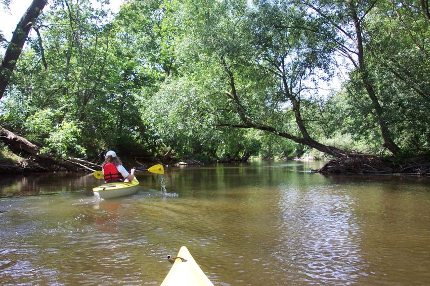
b) End Point: A scenic six-acre riverside park, Geeck Road County Park, has a
parking area, a newly installed launch with picnic grounds, pavilions and porta-john. The
park is at the intersection of Geeck Road (pronounced Geck) and Exchange Road. The
landing is north of the parking lot and is indicated with a new landing sign.
c) River Description: This section of river runs a little faster but is still deemed a
beginner’s stream. The curving course of the river, islands, swifter current and tree falls after
the Cole Road Bridge offer some interest and are easily managed. This section is more
developed agriculturally, but there are very few homes during this stretch. The river widens
in three or four places where an August trip may require a canoeist to “take an in-river hike”
for a short spell. As with Section 1, the course is well-shaded for most of its length.
River view en route to Geeck Road County Park
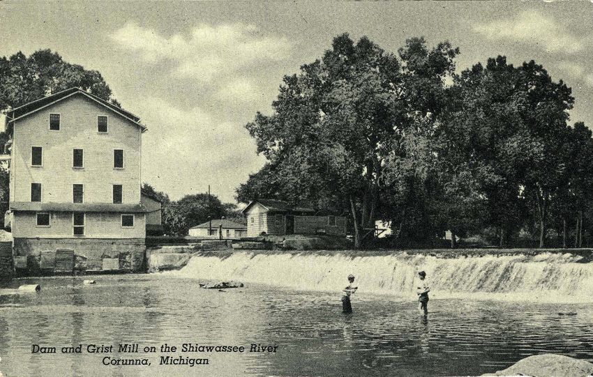
The Cole Road Bridge marks the first white settlement in Shiawassee County, circa 1817.
The area commonly referred to as Knaggs Bridge included an Indian reservation, a trading
post, dam and the bridge. Henry Bolieu traveled here from Saginaw Bay in 1816 when local
Indians gave him directions to this area through the “river that runs straight” with their name
for that translated as the “Shiawassee” [River] (the Flint River, the Bad River the Cass River
and the Tittabawassee River all enter the Shiawassee River from an approximate east-west
angle). The Williams Brothers met Chief Wasso of the Chippewa Tribe here and hiked the
Indian trail to present-day Owosso where Williams and a guide viewed the rapids in Owosso
for a future mill site and a town that he and his brother mapped in 1836.
Across the river to the south from Geeck was the former Exchange trading post on the north
edge of the Chippewa Reservation.
5
Knaggs Bridge Historic Marker

                 Knagg’s Bridge—1856 structure with earthen impoundment

The Indian trails leading to Owosso from Oakland County and onward also to Grand Rapids
intersected here (Grand River Road overlays sections of the west bound trail). The Chippewa
Indians were newcomers to this area and settled here in the early 1700’s to take advantage of
the trading goods available to the southeast. At the trading post (“the Exchange”), furs,
                                               6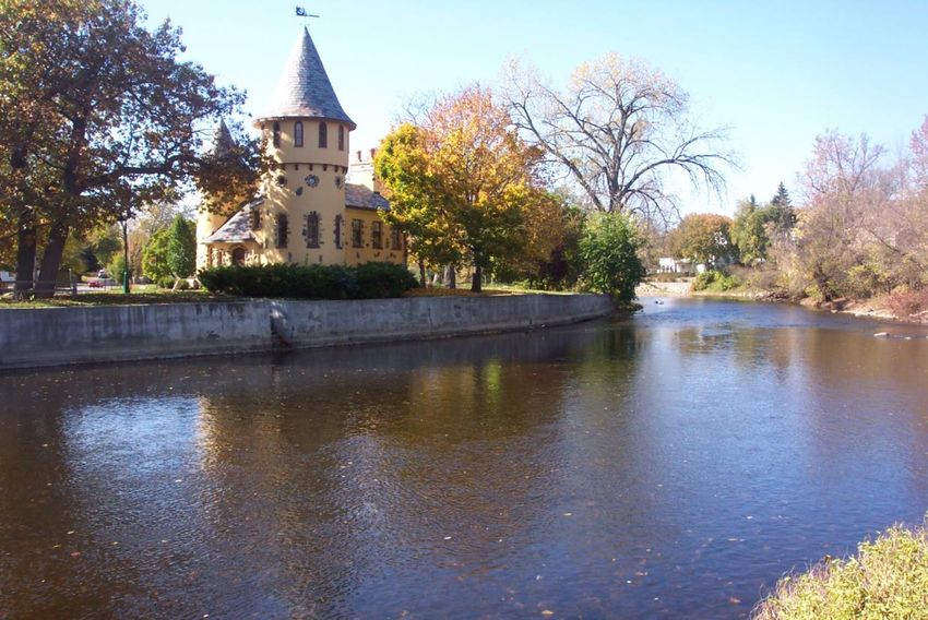
lumber and furniture (from Bancroft) were sold; Indians traded nuts, deer hides, and even
maple syrup. The Exchange was a meeting ground of frontier settlers and Native Americans.

                 The Old Exchange – Across from Geeck Road County Park

Section 3 – Geeck Road County Park to Shiatown Dam County Park.
       Length: 6 river miles     Time: 1 hr 45 min        Grade: 2.5 ft/mi
       a) Starting Point:    See the end point description in Section 2 above.

                        Launch and Sign at Geeck Road Park
                                           7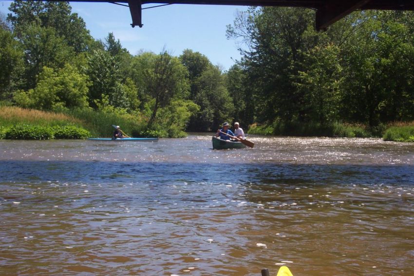
b) End Point: The Shiatown landing is newly available since the 2019 dam removal.
It is a sharp right in a fast current but manageable. A parking lot is conveniently adjacent to
this improved landing. A pit toilet is at the top of the hill a ways away from the landing.

             Riffle zone arrival conditions just above the Shiatown landing

c) River Description: For the first three miles the river is much like the predecessor
sections—curving, moderate flow, forested, shady and sparsely settled. The YMCA property
is here and except for a mowed trail access for canoe outings and river use, their property is
maintained in a natural state—it’s a beautiful run through here. A high embankment on the
river is at the end of the YMCA property along Exchange Road. After this point, some farm
fields and meadow are seen. Three bridges and a few islands are encountered. None of the
bridges are take out points at this time, nor do they need to be unless paddlers need to
disembark for some reason. The last ½ mile or so is the section where the reservoir was
drawn down in 2012. Evidence exists of a five-foot high siltation history since 1904 when the
dam was built. The river has found its original course and the site is wholly revegetated and
stabilized.
         There is a noticeable increase in kingfishers upstream from the old reservoir that
cackle away while sweeping the shoreline, then perching, and then sweeping again. Schools
of suckers pass under watercraft on gravel river beds. All in all this is a very pleasurable
paddling section and a fast run for the distance involved.
         The Geeck Road Park to Shiatown Park stretch is a shorter two hour run that may be
extended with another section of river to lengthen the outing. Shiatown was a bustling village
in the late 1830’s with only a few remnant homes. There is a new landing in the Village of
Vernon and the assets of the Village Park and Village Center command an advantage to this
extra 45 minute run from Shiatown. The river runs nicely through here with many bends and
riffles and signs of beaver activity. Between Shiatown and Vernon on the right side was the

                                              8
largest Chippewa corn field on the River. The Williams brothers, fouinders of Owosso
encamped here with Chippewas in 1831.

Section 4 – Shiatown County Park to Lytle Road County Park.
       Length: 7.8 river miles   Time: 3 hours       Grade: 4.6 ft/mi

        a) Starting Point: The starting point is a picturesque gravel base entrance that is a
lively river section launch—a great start to an excursion. The first section flanks an island
that was artificially created when a mill race was constructed for the saw mill and grist mill.
The mill race now appears as a natural waterway flowing briskly to the Bennington Road
Bridge for a great start to Lytle Road.

                   Shiatown County Park Access Facility

b) End Point: There is a County roadside park at Lytle Road and Kerby Road just east of the
Lytle Road Bridge. An arrival stream bank sign after the Martin Road Bridges indicates a
3,200’ distance to the landing. There are no facilities here except for a parking area, trash
container, barbecue spit, picnic table and nice shading. The facility is primarily there to
provide river access and a nice roadside rest area. The landing is relatively new and well-
signed.

                                              9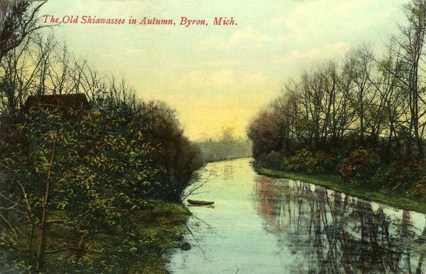
Lytle Road Park Landing

See below for a shorter distance take-out or rest at the Village of Vernon. Many have stated
the run to Lytle from Shiatown is too long and causes the river to be rated as intermediate
paddler experience. Vernon’s new intermediate facility resolves that issue.

        c) River and Vicinity Description: The Shiawassee Town area is one of the most
historic areas of Shiawassee County. In the 1840’s a future city was platted here at an
advantageous drop in the river where even a hydroelectric dam prospered from 1908 to 1955.
Shiawassee Town was the capital of the State of Michigan for one day. There are side streets
that are remnants of the intended city on a landscape that is rolling and scenic. One can
imagine the possibilities of a fine urban place as the early settlers did. Why there was even a
40 person capacity hotel and tavern at the top of the hill on the west side. Today there is a
variety of park installations for picnicking and play. Porta-johns and a potable water pump
well are on-site across the river to the west side park area for a short walk.
        After Shiatown, the river trip is entertaining with several riffles while navigating about
the rocks, river bends, and occasional tree falls. The grade of the river between Shiatown and
the Vernon Village is 7.5 ft per mile that reflects itself in a lively current among many river
bends. The river narrows in places, splits around islands that can be passed on either side, and
widens in a few sections where it is shallow with frequent boosts over boulders, aka “glacial
erratics”. The landscapes vary from tree-lined farm fields and deep forest in floodplain with
the option to stay in the shade for most of the trip. Cedar waxwings (seasonally), blue heron
and flycatchers are the most commonly seen birds. Perching turtles (painted and snappers)—
bumps on a log—are frequently seen.

                                               10
East facing view of the Vernon Village Access Facility
A geologic phenomenon creates a most interesting aspect of the Shiawassee
River course and that is the Maple River Drain that enters about 5 minutes downstream from
the Shiatown Dam. This Drain is in the glacial outwash plain where the glacial Lake Maumee
Maple Drain Entry to Shiawassee River-see text on a geological phenomenon
(predecessor name of Lake Erie) melt waters drained westerly in a mile-wide valley (leaving
the boulders and gravel deposits) to the Wabash River in Indiana and onto the Mississippi
11River. Today this Drain, an under-fit stream for this scoured valley, is said to be reverse
course in very high waters and actually create a flow westerly over the Lake Huron drainage
divide into the Lake Michigan drainage basin via the Maple River and Grand River. At most
times this Maple Drain (not the river) enters the Shiawassee. A hike up the drain for a ways
(private property--not recommended) ultimately leads to an imperceptible drainage divide
where the Maple River begins.
Finally the other point of interest is the former Martin Road Bridge site just before
Lytle Road. The riffles here are the most vigorous in the County (aside from the navigable
dam sluiceways) and offer alternate routes for paddling fun. The riffles are part natural fall of
the river and part rock remnants of a dam that served a grist mill with water power.
Former Martin Road Bridge Site Riffle
To sum, the Shiatown Dam to Lytle Road section is a great place to enjoy the Shiawassee
River and competes admirably with most excursions elsewhere in the State with its unique
mix of recreational paddling, history, deeply forested stretches, great fishing, and nature
enjoyment.
Section 5: Lytle Road Park to the Brady Street Landing in Corunna.
Length: 3.2 river miles Time: 50-60 min Grade: 2 ft/mi
a) Starting Point: See the End Point description in Section 4 above.
b) End Point: Brady Street Landing is one of the better landings in the County with a
barrier free landing/launch device set for installation in late 2020.
12Brady Street Landing in Corunna
c) River Section Description: The length of the Lytle Rd. to Corunna section does not
offer a sufficient outing on its own for most except when part of another recreational purpose,
principally fishing. It could be connected to the Vernon Village starting point or continued
downstream to Owosso as many do. At Lytle Road, the trip starts well with nicely moving
water in wooded spaces. There is an interesting island encounter with a narrow passage to the
right. At the halfway point a causeway obstruction at the Brick Plant requires a left bank
approach to a narrow bridge opening that is easily navigated but not visible on the approach.
Most miss this narrow bridge option and awkwardly portage the causeway. In low water the
bridge opening is not an option and one must portage over the causeway.
Corunna Brick Plant Causeway Bridge opening-south bank
13There are shoreline viewings of the mine tailings from the brick plant and a decent
variety of birds. At mine area, Michigan’s first coal mine operated. Some of the coal was
shipped by rail to upstream Lake Ponemah (an in-river lake) for two cement factories. Native
Americans found muddy shale deposits near the land surface for their pottery. The area is
another peak location for Shiawassee River history.
There is very little shade in the second half of the trip. The area about the former
Corunna Dam has a nice vest-pocket park—“Heritage Park”—for an alternate rest area There
are no facilities here but downtown Corunna, a full service county seat and commercial
district, is a few blocks south.
The Brady Street Landing is the most accommodating take-out along the entire stretch
of the river’s passage through Shiawassee County. If a paddle outing wishes to continue
downstream from Lytle Road, an option would be to reestablish a starting point/end point trip
at McCurdy Park in Corunna. This is the historic and routinely used Corunna access area yet
without an improved take out or put-in.
The former dam provided a head of water power for a grist mill that operated through
the 1950’s with water power. An historic village at McCurdy Park includes many restored
historic buildings relocated from several places in the County to create a step-back-in-time.
This restoration exhibit area is well worth a stop along the way.
Corunna is in the later stages of restoration of the dam removal. At the former dam
one finds the offices of the Friends of the Shiawassee River where paddlers may obtain useful
information about the river and nearby services. In construction is the boardwalk that will
flank the river on its west bank. The function of the boardwalk is to provide casual walks
with river viewing and fishing platforms. Native vegetation plantings will demonstrate
beneficial treatments of the riverside environment.
Post Card of Corunna Grist Mill and Dam
14Section 6: Corunna’s Brady Street Access to Owosso’s Harmon Patridge Park
Length: 6.2 river miles Time: 1 hr 45 min Grade: 3.4 ft/mi
a) Starting Point: There are two options for starting points in Corunna, both on
public land and both unimproved. One at Brady Street has already been detailed.
Base of Corunna Dam Launch Site—fishing excursion underway
The other launch is at McCurdy Park just upstream from the footbridge—a little muddy and
too sloped but this is the most commonly used launch. McCurdy Park is on State Highway
M-71 east of Downtown Corunna and at the end of Norton Street. This exceptional park has
the full slate of services for park users, a historic village and many recreational diversions.
Downtown Corunna has an ample supply of restaurants and services useful to river voyagers.
b) End Point(s): It is important to note that there are a two other intermediate or end
points in the Owosso area. The bias of this recommended section’s end point is just south of
Harmon Patridge Park (aka “Green Meadows”) near the regional wastewater treatment plant.
The accommodating launch is specifically built for canoe landings and starts. It can be found
north of VG’s Grocery Store/Citizen’s Bank at Chippewa Trail off State Highway M-52. One
can take Chippewa Trail past the Wastewater Treatment Plant where a small parking area is
located on the right with the launch on the left. This launch is well-signed. There are no
services here but several are in the vcinity.
An alternative intermediate take-out is at the Voight Family Loop Park just past the
wrought iron bridge in Owosso. This is a City Park, and the new landing avoids the first dam
in Owosso (that is navigable for some). The landing is fully developed and signed 200 feet
past the Oakwood Bridge. It is often called the Oakwood Avenue Landing. A second
intermediate alternative—unimproved—is at the Middle School (east side) below the first (of
three) Owosso Low-Head Dams (“weirs”) where a former stairway (three or four steps) leads
to the river from a parking lot behind the Middle School. This guide will change in 2021 to
denote the arrangements with a new owner of the Middle School that will convert to
residential housing.
15Middle School Landing-Downtown Owosso on Amphitheater Grounds
This is a popular landing for special events on the river but it needs some maintenance work
and it is not easily identified from the rest of the embankment. Curwood Castle, across from
the Middle School, has an interesting leisure boat stairway usable in the 1930’s and 40’s when
the downstream weir had seasonal boards to create a reservoir here. There is no recollection
of any use of this stairway since the Chipman Street low head dam doesn’t pond water any
longer. An unofficial third take-out is at the former Baker College administrative site (now
Retriever Solutions) on the M-52 Bridge—users are a guest of the landowner. All these
alternative take outs avoid the two low-head dams downstream at the Chipman Street bend
and Memorial Health Care respectively. In low water paddle boats nearly always scrape
concrete over these two weirs. Both the Middle School and Retriever Solutions access points
await engineering of structural access facilities projected to become available in the next two
years.
c) River Description: This section is urban with some natural areas along the airport
and James Miner Bikeway. It is an interesting paddle to see how riparians treat their
shorelines—with too many discouraging examples of mowed lawns to the water’s edge.
Private footbridge to an island in Owosso past M-52 Bridge
16Educational and promotional programs are underway to increase shading of the shoreline and
natural vegetation buffers between lawns and the river’s edge. Avoidance of phosphates in
lawn and garden fertilizers is also encouraged.
Streambank Erosion Conditions: Grass-to-Shore Example
In lower flows later in the season (starting in early July), the invasive river vegetation
dominates and is, in part, a reflection of over-fertilization from non-point source runoff—
lawns and farms. Additionally the river is very wide in many sections making it shallower
August weed growth east of M-52 Bridge near Henderson
and supportive of sun seeking aquatic vegetation. It is recommended to check the river gauge
this time of the season to determine if navigation will be enjoyable or not. That phone
number is 989-725-6800 and the recorded message is available around the clock. The internet
source with up-to-day gauge readings is very informative:
17www.waterdata.usgs.gov/usa/nwis/uv?site_no=04144500.
We found a tolerable river level in low flow late summer conditions to be 2 to 2.5 feet,
but below that level the weeds and keel-rubbing gravel beds take over. At other times of the
year and for some upstream locations without much weed growth, flow levels at 2 feet are
mostly navigable. Others like to refer to the cubic flow per second measure on the USGS web
page noted above and state that conditions aren’t good at least in River Sections 6, 7 and 8
when the flow is below 100 cubic feet per second. This recommendation does not always
apply to some upstream sections where there are narrower channels.
There are three impoundments in this route, all in Owosso, with awkward options for
portage (unimproved) or paddle-thrus. Navigating these is possible for via sluiceways in the
weirs but less passable in low flow, especially at Chipman Street and the Hospital. Expect a
thump for your watercraft even some keel scars at low flows. Everyone, at all times, is in for
a soaking at Chipman Street, but usually remain afloat.
Weir at Owosso Memorial Hospital
Ordinary caution is advised in high waters (5’ an higher) but that is true for the entire stretch
of the river. The sluiceways for the dams are not easily identified, especially in a low-lying
kayak, so paddlers are advised to approach the openings slowly to assure a straight-on
approach. Keeping the craft oriented parallel with the stream flow and we find applying
‘power’ oaring strokes while staying aligned are helpful practices through the sluiceways of
the dams.
The portage options for the first dam in downtown Owosso at Main Street is to take
out at the walkway at the south side of the Main Street Bridge—a little awkward but doable—
and then a short walk downstream from the dam to the put-in point behind the Middle School.
There is no practical portage options for the downstream weir at Chipman Street. Expect a
good soaking through this sluiceway. The final weir after the Oliver Street Bridge has a
manageable rocky shoreline to the left (the west bank). This is private property so the
18portage—permissible--should be brief, close to the shoreline, and only for the purpose of
take-out and launch.
Points of interest abound in this section and there are adequate bird sitings despite
urbanization. There is not much shade here with many long straight courses. Some of the hi-
lights along the way include:
Downtown Corunna and Corunna’s McCurdy Park with an historic village
McCurdy Park Launch/Footbridge & eastern terminus of J. Miner Bikeway
The Oakwood Avenue wrought iron bridge in Owosso—an 1876 bridge fully
restored in 2009.
Willman Field—Owosso’s CCC/WPA-built classic football and soccer
stadium in a traditional neighborhood environment.
The James Miner Bikeway from Corunna to Owosso—plenty of friendly
recreational outings and greetings ashore.
Oakwood Avenue 1876 Iron Bridge, at Voight Loop Trail Park in Owosso
19 The new Voight Family Loop Park/trail in Owosso from Oakwood Bridge to
Washington Street Bridge with more friendly encounters as above.
Downtown Owosso with a full slate of urban services and recreational outlets
with landings anywhere deemed desirable on the north shores from the city
limits to the Middle School--all public property. An ice cream stand near the
Middle School and Armory/Chamber (with indoor bathroom) can be a
welcome layover. There are pubs too.
The Steam Railroading Institute and the 1225 Steam Locomotive all along the
Loop Trail and riverside—a tourist destination of national interest.
Owosso’s Curwood Castle Park with the Castle, Art Center/Gallery,
Amphitheater, and park grounds at a significant geologic point of the River.
Curwood Castle in downtown Owosso
Here the Shiawassee was “pirated” about ten thousand years ago after the
last glacial period from its course to the Grand River to its new course to
the Saginaw River. The course takes a sweeping 90 degree turn (Chippewas
called this radical trun “Big Bend”)
A brewery had an advantageous spot here. In the photo on the next page note
the swift current hence Owosso’s translated name, “Big Rapids.”
The stately homes past the M-52 bridge where many of Owosso’s early
industrial families built grand residences. The towering home seen at the
island west of M-52 was built by Congressman/Industrialist Alvin Bentley and
20has a footbridge to an island. Take the course of the river to the right of the
island to see this.
Mueller’s Brewery Post Card on the Big Rapids
Other homes in Owosso from Curwood Castle to Harmon Patridge Park show
examples of the elaborate rear-yard viewing decks where Owosso residents
enjoy the view of their river and the moving water with its seasonally changing
character.
Walking tours of Owosso’s historic neighborhoods adjoining the river begin at
the Chamber of Commerce (in front of the Armory/Middle School landing
area) where a helpful tri-fold walking guide can be obtained for another
interesting break from the paddle excursion. For newcomers to the area, a
stop at the Castle Park area in downtown Owosso is strongly advised for an
outstanding cultural enrichment experience to the recreational outing.
This is an opportunity to comment on the presence of impoundments in the river. While
historically important to those who wished to preserve a consistent shoreline and flush raw
sewage from their shorelines, the evolution of wastewater treatment ended that need. The
dams, because they are not gated or festooned with top boards all across their length, no
longer pond much water. River ecology, especially sport fishing, benefits much more from
free flow of the stream. The Owosso low head dam at Main Street (constructed for pre-sewer
interceptor sewage management) would be a good first example of conversion to riffle flow
where a fast running river section existed prior to its construction—the area’s Native
Americans called Owosso “Big Rapids”. The other two low-head dams were also constructed
for sewage management. They are now obstructions for walleye fish passage and represent a
water quality degradation influence from many perspectives. An unimpeded river would be
21very active and more scenic at these impoundment sites without the lifeless, artificially
warmed pond water immediately behind each weir.
To understand pre-dam conditions, consider this earliest known description of the rapids in
Byron (there is no dam removal contemplated here-it is structurally sound with a 160 acre
pond in an urban setting):
“When a traveler, not familiar to this wilderness,
asked for directions when leaving Detroit or Toledo,
he was told, “You must go through the woods to the
north or northwest till you come to the seventh
river.” “How will I know when I come to the river?”
“Why, the Shiawassee makes more noise than all
the rivers in that country.”
--From A History of Byron, Michigan--
Owosso Dam at Main Street showing a whitewater alternative with walleye migration
passage.
22Section 7: Harmon Patridge Park Landing to Henderson Road County Park.
Length: 7.8 river miles Time: 2 hrs 30 min Grade: 6-8 ft/mi
a) Starting Point: See the End Point description of the Wastewater Treatment Plant
access site south of Harmon Patridge Park for Section 6 above. This is an outstanding launch
facility and offers a design standard for difficult embankments.
Harmon Patridge Park Launch (at very low flow)
Harmon Park Launch Sign
23b) End Point at Henderson Park: Henderson County Park is a fine stopping point
with supportive park services (porta-johns, barbecues, picnic facilities, and well-
water pump). The park location is on Henderson Road 1 miles west of the State
Highway M-52 intersection. There is a relatively new launch in Henderson
Park. An unofficial launch exists on the west side at the big bend river terrace that
is mowed and gently graded to the river’s edge. This formerly popular landing
spot is no longer encouraged with the access driveway recently moved 100 yards
to the south.
Henderson Park Unimproved Launch – West Side River Terrace
This is a gravelly surface and easily managed, but it is a multi-use area that is often congested
with non-paddler uses. The second and official take out is 2000 feet downstream at the east
end of the park that is very convenient. The site is signed and accessed from Henderson
Park’s first driveway—then straight back to the launch and parking area and visible from the
road. It is year-round access while the west side unimproved landing is closed in off-season.
Henderson Park Launch – New (2012) East Side Launch (shown in construction)
at low flow—this is the best take-out/launch area for this park.
24c) River and Vicinity Description: The River heads north from Owosso with a number
of turns and plenty of riffles. It is entertaining to look upstream after many of these riffles and
see the slight fall in the river elevation. There is shade in the early morning and later
afternoons on this stretch but plenty of sun otherwise. Despite urbanization, the river trip in
this section leaves the impression of being mostly forested or at least tree-lined.
Owosso to Henderson River View
The steep embankments are everywhere and provide another indication of the geologic-age
river piracy (described later in this section) when the course of the “new” river cut a more
dramatic valley on its way to the glacial Lake Huron lacustrine plain that starts in the
Chesaning area.
Many of the embankments have housing with varying degrees of sensitivity to
preservation of the river’s edge and top-of-bank areas. Accountability is not the point here;
these dwellings precede contemporary views of river corridor preservation. The effort today
is to encourage plantings at least 25 to 50 feet deep from the shoreline with benefit to:
prevention of shoreline erosion/soil slumping; fish habitats in the cooling shade of trees and
shrubs; stormwater filtering, and natural beauty for both riparian river owners and paddlers.
With its accessibility to a larger population along with the riffles, turns, fishing
“holes”, faster current, sufficient length, large islands with alternate routes, and steep
embankments, the Owosso-to-Henderson run constitutes the favorite river section for most
paddlers. It is not as active as the Byron to Shiawassee Park Sections owing to that section’s
availability of a private livery service.
Some points of interest include:
the Owosso Country Club—private property and no trespassing but golf balls
can be spotted (and available) on the river bottom;
Harmon Patridge City Park with a mink siting possible; the park offers a path
with interpretive signs for trees, playground, picnic areas and porta-johns;
Sitings of bald eagles in this section and the next section; osprey are viewed
with some frequency;
25 The Shiawassee Conservation Club where James Oliver Curwood and others
founded the Michigan United Conservation Club (“MUCC”). The clay pigeon
shotgun fire is frequent on the weekends (directed away from the river!);
The DeVries Nature Center, with a new dock landing, is an interesting visit for
paddlers. There is particular attention paid to maintaining native vegetation
along the extensive littoral (river’s edge) of this parcel. The site includes
examples of soil conserving farming practices, a horse-drawn carriage and
sleigh museum and environmental programs. Check their web page at:
www.DeVriesNature.org.
The Goss Bridge remnant abutment represents a small settlement/schoolhouse
at the Juddville Road Bridge area
Goss Bridge Post Card Image (Juddville Road area)
The geologic stories continue in this stretch with nature’s act of river piracy. To add to the
prior mention on the phenomenon, the river’s two prior courses through today’s Looking
Glass River in the south of the County and the Maple River in the center of the county were
sequentially re-routed to the lower outlet of the glacial lake Arkona (Saginaw Bay/Lake
Huron). The historical river—the northerly section of the Shiawassee River—cutting a head
wall from Saginaw to Owosso, eventually cut into the Maple River course of the Shiawassee
and ‘pirated’ the stream. Comparable to the Shiatown to Vernon Village run, this is the
steepest fall of the river in the County. A large enclosed storm drain on the former river bed
in SW Owosso, and many steep embankments in this section are indicators of that event. The
Owosso rapids (now the Main Street weir) and site of the flour and lumber mills—the
foundation industries of the City—acknowledge this geological past. This is a recent
phenomenon; the latest glacial epoch and glacial retreat makes this river section less than
20,000 years old. In contrast the Delaware River course is 160 million years old!
26Section 8: Henderson Road County Park to Parshallburg-Ditch Rd.
Length: 8.8 river miles Time: 2 hrs 50 min Grade: 1 ft/mi
a) Starting Point: See the Henderson End Point description in Section 7 above.
Group canoe outing starting point at Henderson Park Launch
b) End Point: Unless one disembarks at the Six Mile Creek Road a short way from
Henderson Park, the End Point at the unincorporated place called Parshallburg (aka
“Havanna”) is another “thump” for paddlers at the partially dismantled dam.
Parshallburg’s failed, but not dismantled, “Dam”
27Immediately after running the old dam and fast waters that follow, a dock at the right provides
a very good landing. There is a stairway to the parking lot. A canoe ramp is available for
raising or lowering a canoe to and from the elevated parking lot. A porta-john is provided. A
viewing deck perches over this historic settlement area and exactly where the grist mill was
located.
Parshallburg Landing and Viewing Deck
This end point can be reached from State Hwy M-52 in Oakley at Sharon Road. Take Sharon
Road east to Ditch Road that leads a mile or so to the landing where Niver Road intersects.
c) River and Vicinity Description: This longest section in the Byron-to-Parshallburg
extent of this guide provides the user broad expanses of riverscapes. There is a slower current
for the most part in its very wide courses, but imposing views of steep embankments before
the Shiawassee River enters the lake plains of the Chesaning area. Man-made erosion scars
are indicators of past and impending property damage, even a threat to adjoining roadways.
Erosion Scar north of 6 Mile Creek Bridge
28There are many long straight runs (sunny-little shade). With the river level gauge on July 14,
2008, showing 2.8 feet, and with the influence of weeds, most paddlers would not like to
venture out at levels much lower than that. There were places where a patch of river (versus a
patch of vegetation) was welcome relief from paddling through the “sedges”. It was still
manageable for a kayak to enjoy an outing in those conditions as navigating courses is part of
the entertainment gained from gliding over these conditions.
The Six Mile Creek area (30 minutes from Henderson Park) includes an 1886 wrought
iron bridge, several fishing holes, a railroad dock and a very historic place where coal mining
and furniture manufacturing was active in the nineteenth century.
6 Mile Creek Road Iron Bridge
Some paddlers exit here on the east side of the river just past the bridge, but this is not a
public launch site with limited roadside parking. After Six Mile Creek an interesting land
holding includes a grass river walk for the length of the farm river frontage (at least ½ mile).
Spike Farm’s River Walk Trail
29This trail raises images of the walking path for horse teams to drag 1840-1860 river barges to
and from Owosso from a Saginaw area landing to transport flour and goods. An 1856 railway
to Owosso ended that practice.
Pine Grove County Park at the Shiawassee County line is a little over an hour from
Henderson Park but cannot be accessed because there is no landing area at this time, nor is
there a convenient place to develop one. A forested glen, private campground south of the
Johnstone Road Bridge should not be mistaken as a public park.
The guide crosses into Saginaw County in order to reach the landing site at
Parshallburg. Intrepid boaters can paddle onto Chesaning Village’s Showboat Park and the
Shiawassee National Wildlife Preserve from there.
Section 9: Parshallburg to Chesaning’s Showboat Park.
Length: 4.4 miles Time: 1 hr 30 min Grade: 1’/mile
Start point. Parshallburg is a very popular launch site for the north river water paddlers.
Many events out of Chesaning raise the user rates. An ample parking area and unique launch
watercraft ramp to descend the embankment offer an interesting beginning to a trip.
Parshallburg’s accommodating launch
End Point. Chesaning’s generously outfitted Showboat Park is a concrete ramp landing that is
easily maneuvered. A pavilion, grassy surroundings and a large parking area greet paddlers.
This park is open year-round to visitors.
30Showboat Park Landing in high early spring waters
River and Vicinity Description. The Chesaning run is the end of the Shiawassee River Water
Trail that begins in Holly and terminates in this nicely appointed Village 88 miles later.
Showboat Park was the site of a showboat that features a massive performance facility
downstream from the landing and the location of 75 years of concerts over a week’s time
every summer. The boat including a chorus floating from upstream area of the Park to the
theater for a dramatic start of an evening of comedy and nationally known performing artists.
Tour buses filled the Village nightly. The nature of audience preferences, the decline in the
availability of the retiring performers of greatest interest to retirees, a dilapidated vessel and a
deficit budget ended this era.
The Chesaning Showboat in its glory years.
31The river is placid for its entire stretch from Parshallburg. The photo below during a river
clean up shows the confidence of a paddler in these mild waters.
A comfortable ride to Chesaning and a proficient tire spotter.
There is an alternative at Chesaning but most avoid it. The downtown is too far away from
Showboat Park to access its many services, dining options and products. At fifteen minutes
downstream from Showboat Park, the Chesaning dam was removed in 2009 and a rock ramp
took its place (still ponding water for a Showboat that closed the same year of the dam
removal). That ramp is not recommended for beginner paddlers and most intermediate
paddlers. There is a nice downtown park at the base of the rock ramp. Water trail planners
are encouraging the Village to develop a landing at the former Showboat lagoon at the Main
Street Bridge and above the rock ramp. The benefits to downtown businesses would be a
boost to sales and a fine service to tourist paddlers.
Downtown Chesaning’s Arch Rock Ramp at 4.85 river gauge height
32From Chesaning north a river guide could be written but the area is off the official Shiawassee
River Water Trail. Nevertheless, voyagers have options for some very interesting paddles
into two wildlife refuges (State and Federal), an interesting side trip up the Bad River to St.
Charles, and a Saginaw City access landing—another 25 miles of river to explore on a very
slow current but incomparable waterfowl viewing opportunities.
The guide leaves the narrative with an image of a 1900’s user’s message on a post card and a
map of the north river area confirming the Chippewa meaning of Shiawassee—the straight
ahead river.
33You can also read