THE STRAITS TIMES S'pore using 'virtual twins' of land and sea to monitor activities and plan projects
←
→
Page content transcription
If your browser does not render page correctly, please read the page content below
9/10/21, 2:29 PM S'pore using 'virtual twins' of land and sea to monitor activities and plan projects, Environment News & Top Stories - The Stra…
THE STRAITS TIMES
S'pore using 'virtual twins' of land and sea to
monitor activities and plan projects
The information includes details about the seabed, the status of desalination plants, and marine water
quality. PHOTO: ST FILE
Shabana
Begum
PUBLISHED SEP 9, 2021, 6:36 PM SGT
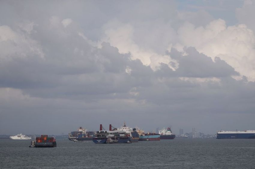
SINGAPORE - Dotted with ships and fish farms, and teeming with marine life, the
seas surrounding Singapore contain a treasure trove of information, some of it
invisible to the naked eye.
The information includes details about the seabed, the status of desalination
plants and marine water quality.
https://www.straitstimes.com/singapore/environment/spore-uses-virtual-twins-and-geographic-tech-to-monitor-activities-and-plan 1/8
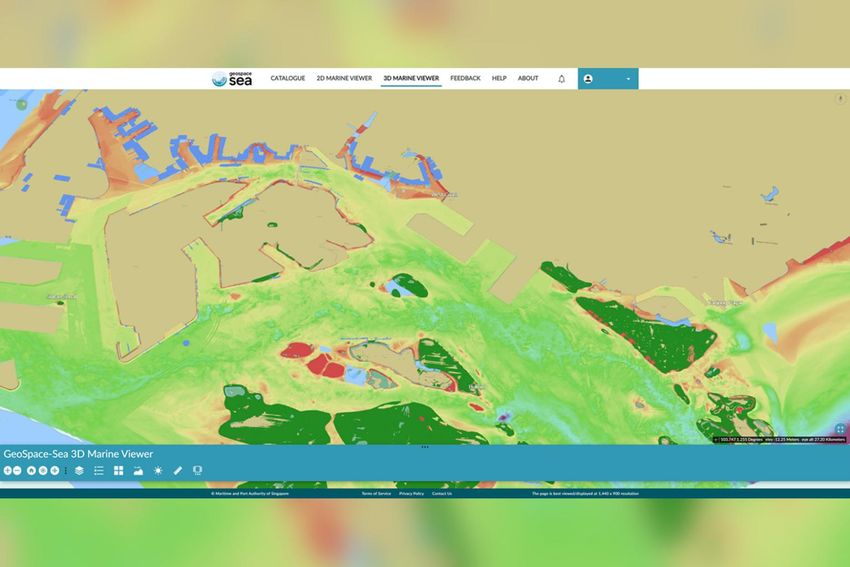
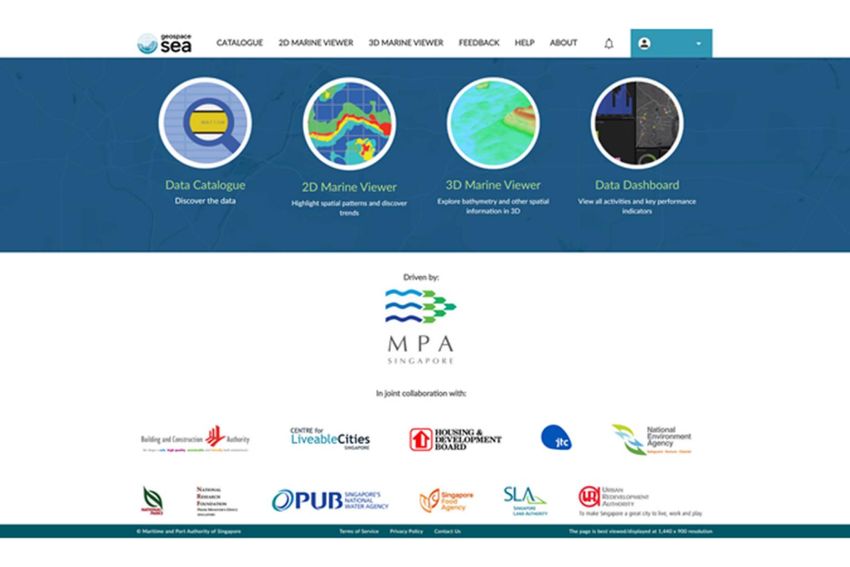
9/10/21, 2:29 PM         S'pore using 'virtual twins' of land and sea to monitor activities and plan projects, Environment News & Top Stories - The Stra…

  To make such data available to government agencies here, the Maritime and Port
  Authority of Singapore (MPA) started developing a repository of land, marine and
  coastal data in 2019.

  This virtual twin of Singapore's land and coastal waters - called GeoSpace-Sea - can
  map out and present data in 2D and 3D forms for the authorities to monitor coastal
  and sea activities in real-time, or plan building projects.

  GeoSpace-Sea stores and presents data from 11 government agencies, including
  national water agency PUB and the Housing Board.

  For example, if the National Parks Board (NParks) wants to study marine
  biodiversity, it can use the virtual twin to access marine life data, or the distribution
  of corals and sea grass. GeoSpace-Sea allows users to view and analyse the seabed
  with three-dimensional images as well.

  In July, MPA won the the Special Achievement in GIS (geographic information
  system) award for the GeoSpace-Sea project. The award was given by Esri, an
  international company that specialises in geographic information system software.

  The MPA project was discussed on Thursday (Sept 9), at a geo-innovation forum
  organised by Esri Singapore.

  Giving a talk on GeoSpace-Sea at the virtual forum, Dr Parry Oei, former chief
  hydrographer of Singapore, outlined future plans for the project and explained how
  the database can be used for climate change mitigation. He is now MPA's adviser on
  hydrography.

https://www.straitstimes.com/singapore/environment/spore-uses-virtual-twins-and-geographic-tech-to-monitor-activities-and-plan                        2/8
9/10/21, 2:29 PM         S'pore using 'virtual twins' of land and sea to monitor activities and plan projects, Environment News & Top Stories - The Stra…

  To meet climate challenges and build on the database, Dr Oei said high-quality data
  sets, shown in high resolution, are crucial.

  "Government agencies that do coastal engineering need real-time information. We
  give them access to sea-level monitoring," he said.

  MPA is working to make the platform accessible to the institutes of higher learning
  soon, and eventually to the public.

https://www.straitstimes.com/singapore/environment/spore-uses-virtual-twins-and-geographic-tech-to-monitor-activities-and-plan                        3/8

9/10/21, 2:29 PM         S'pore using 'virtual twins' of land and sea to monitor activities and plan projects, Environment News & Top Stories - The Stra…

  GeoSpace-Sea stores and presents data from 11 government agencies. PHOTO: MARITIME AND PORT AUTHORITY OF
  SINGAPORE

  "We are hoping to introduce augmented reality. (With that), it's not looking at data
  and models any more. It's diving into the data itself, to see (it in) three-
  dimensional, or even four-dimensional (form)," Dr Oei added.

  Another virtual twin that was discussed at Thursday's forum is NParks' Safe
  Distance @ Parks website, which was rolled out last year to monitor crowd levels in
  green spaces.

  NParks uses CCTV cameras equipped with analytics, as well as drones, robots and
  staff on the ground to record the footfall in parks and beaches, and monitor if
  visitors are following safe distancing.

  GeoSpace-Sea can map out and present data in 2D and 3D forms for the authorities to monitor coastal and sea
  activities in real-time. PHOTO: MARITIME AND PORT AUTHORITY OF SINGAPORE

  With the help of Esri Singapore's technologies, NParks has also been tracking birds
  and monitoring forest fires and the fall risk of trees for years.

https://www.straitstimes.com/singapore/environment/spore-uses-virtual-twins-and-geographic-tech-to-monitor-activities-and-plan                        4/8

9/10/21, 2:29 PM         S'pore using 'virtual twins' of land and sea to monitor activities and plan projects, Environment News & Top Stories - The Stra…

  Esri South Asia's managing director, Mr Leslie Wong, noted at the forum: "There are
  over two million street trees in Singapore. NParks keeps track of them in its GIS,
  and monitors information such as height, age, and tree incidents.

  "In 2001, there were over 3,000 tree (fall) incidents, but by 2019, there were 450
  incidents... We will see more greenery in Singapore in the years to come… but the
  risks will not spike because the users who lean heavily on GIS have been measuring
  things constantly."

  MORE ON THIS TOPIC

  New road maps to help marine and offshore engineering SMEs and staff go digital

  Firms in marine fuel sector to each get $30,000 a year to help in push to go digital

    Join ST's Telegram channel here and get the latest breaking news delivered to
  you.

                                         FROM AROUND THE WEB
    Ad                                   Ad                                    Ad                                     Ad

  Five things every                     Claim your wine offer                 [Photos] The                          If You Need To Kill
  employer needs to                                                           purpose behind the                    Time On Your
  know about                                                                  little pocket on                      Computer, This
  mandatory                                                                   underwear                             Vintage Game Is A
  vaccinations                                                                                                      Must-Have. No…
                                                                                                                    Install.
    Read more

  Inside Small Business                                                       World Lifestyle                       Forge Of Empires

                                         Learn More
    Ad                                   Ad                                    Ad                                     Ad

                                        Naked Wines

  This Japanese                         Sydney - Unsold                       Photos Show How                       Arthritis or Joint
https://www.straitstimes.com/singapore/environment/spore-uses-virtual-twins-and-geographic-tech-to-monitor-activities-and-plan                        5/8

You can also read