A modern open webservice-based GIS infrastructure - Adam Soroka the University of Virginia Library Digital Scholarship and Research Services R & D
←
→
Page content transcription
If your browser does not render page correctly, please read the page content below
A modern open webservice-based
       GIS infrastructure
              Adam Soroka
     the University of Virginia Library
         Digital Scholarship and
        Research Services R & D
Why a specialized geospatial data
          repository?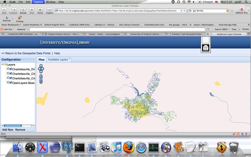
GIS data is weird.
It's
huge.
It's shaped
 all funny-
     like.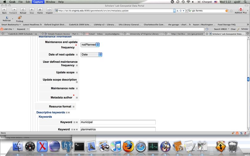
It lives in odd formats.
                             ●   Shapefiles
● ESRI grid
● IMG
                             ●   TIGER
● DXF                        ●   MrSID
● National Transfer Format

● GeoMedia
                             ●   ECW
● Vector Product Format      ●   ADRG
● Personal Geodatabase
                             ●   CIB
● File Geodatabase

● MapInfo TAB format
                             ●   many, many, many
                                 more…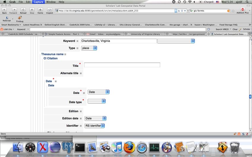
It requires special tools for use.
It deserves specialized description.

●   It's yet another kind of object for which MARC is
    not appropriate.
●   Good (international) standards exist for
    cataloging geospatial data, but your ILS doesn't
    know that.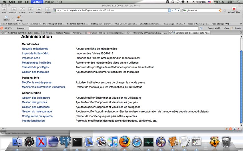
Standards
Sources of standards

●   Open Geospatial Consortium
●   ISO TC 211
●   Eruptions of GIS into other technical
    communities (e.g. GeoRSS, GeoJSON)
OGC
● The “W3C” of GIS, in that it
● produces standards, not tools,
● has members from industry, academia, and
government,
● and concerns itself mostly with interoperability.ISO TC 211
Geographic information/Geomatics
● Produces sophisticated and enterprise-y
standards for GIS based on UML models, and
● usually blesses OGC standards after extensive
review.
● If you love entity diagrams as much as I do…
So whose standards are standard?OGC and ISO TC211 are friends.
Specific standards

●   Simple Feature Access / SQL
●   GML
●   ISO 19115 / ISO 19139
●   WMS
●   WFS
Specific Standards:
     Simple Feature Access / SQL
●   “a well-defined and common way for
    applications to store and access feature
    data in relational or object-relational
    databases”
●   SQL API for constructing and manipulating
    geographical objects
●   Standard document exists for SQL
●   Many other languages and environments
    have community-supported versions.
Specific Standards:
Simple Feature Access / SQL
SQL Example:
SELECT ST_Intersection(r.the_geom,
m.the_geom) AS intersection_geom,
ST_Length(r.the_geom) AS rd_orig_length, r.*
FROM bc_roads AS r, bc_municipality AS m
WHERE ST_Intersects(r.the_geom, m.the_geom
AND m.name = 'PRINCE GEORGE';Specific Standards:
Simple Feature Interface / SQL
WKT Example:
MULTIPOLYGON(((0 0,4 0,4 4,0 4,0 0),(1 1,2 1,2
2,1 2,1 1)), ((-1 -1,-1 -2,-2 -2,-2 -1,-1 -1)))Specific Standards:
Geography Markup Language
● An XML language for defining geographical
objects which is
● enormously sophisticated and expressive
● and therefore verbose,
● but provides a solid baseline for interchange.Specific Standards:
Geography Markup Language
Sears Tower
52
100,200
100,200
2005-08-11T10:43:00Specific Standards:
ISO 19115 / ISO 19139
● 19115 is the abstract model for metadata about
geospatial… things.
● 19139 is the standard for serializing 19115 in
XML.
● A rich, expressive, specialized language for
describing anything that has place.Specific Standards:
ISO 19115 / ISO 19139
See example…Specific Standards:
Web Map Service
● A service that accepts queries and produces
imagery.
● Defined in ISO 19128.
● Used to publish both raster and vector data in
rendered form.
● Can be consumed by anything that can load an
URL and display an image.Specific Standards:
Web Map Service
Example:
Query:
http://blah/geoserver/wms?request=GetMap&lay
ers=benford:1850&bbox=334996.21452146204,2
55850.78955473876,365695.43672146206,28469
5.4647547388&styles=&Format=image/png&ver
sion=1.1.1&width=800&height=705&srs=EPSG:
3438Specific Standards:
Web Map Service
Example:
Response:Specific Standards:
Web Map Service
Example:
Query:
http://blah/geoserver/wms?request=GetMap&lay
ers=benford:1850&bbox=334996.21452146204,2
55850.78955473876,365695.43672146206,28469
5.4647547388&styles=&Format=image/pdf&ver
sion=1.1.1&width=800&height=705&srs=EPSG:
3438Specific Standards:
Web Map Service
Example:
Response:Specific Standards:
Web Map Service
Example:
Query:
http://blah/geoserver/wms?request=GetMap&lay
ers=benford:1850&bbox=334996.21452146204,2
55850.78955473876,365695.43672146206,28469
5.4647547388&styles=&Format=application/vn
d.google-
earth.kml+XML&version=1.1.1&width=800&hei
ght=705&srs=EPSG:3438Specific Standards:
Web Map Service
layer_0
benford:1850
Example:
benford:1850
0
Response: http://localhost:8080/geoserver/wms?height=705&bbox=334996.214521462
04%2C255850.78955473876%2C365695.43672146206%2C284695.4647547388&
;width=800&layers=benford%3A1850&request=GetMap&service=wms&a
mp;styles=Raster+Style&srs=EPSG%3A3438&format=application%2Fvnd.goo
gle-earth.kml+XML&transparent=false&version=1.1.1
never
0.75
41.864648381762365
41.78541164893516
-71.36190468629343
-71.47463768373167Specific Standards:
Web Map Service
Example:
Query:
http://blah/geoserver/wms?request=GetMap&lay
ers=benford:1850&bbox=334996.21452146204,2
55850.78955473876,365695.43672146206,28469
5.4647547388&styles=&Format=rss&version=1.
1.1&width=800&height=705&srs=EPSG:3438Specific Standards:
Web Map Service
Example:
Response:Specific Standards:
Web Feature Service
● A service that accepts queries and produces
feature data.
● Defined in ISO 19142.
● Used to publish vector data in non-rendered
form.
● Can be consumed by clients that understand
geographic information.Specific Standards:
Web Feature Service
Example:
Query:
http://blah/geoserver/wfs?request=GetFeature&ty
peName=lovecraft:placesSpecific Standards:
Web Feature Service
Example:
Response: See example…Specific Standards:
Web Feature Service
Example:
Query:
http://blah/geoserver/wfs?request=GetFeature&ty
peName=lovecraft:places&outputformat=jsonSpecific Standards:
Web Feature Service
Example:
Response: See example…Specific Standards:
Web Feature Service
Example:
Query:
http://blah/geoserver/wfs?request=GetFeature&ty
peName=lovecraft:places&filter=lovecraft
%3Amentionedin.*CD
W.*trueSpecific Standards:
Web Feature Service
Example:
Response: See example…Specific Standards:
Web Feature Service
lovecraft:mentionedin
.*CDW.*
trueTools
PostgreSQL / PostGIS

●   A well-supported open-source RDMBS with
    extension code for spatial data types and
    functionality.
PostGIS
An extension library for PostgreSQL supplying
spatial data types and functionality by
leveraging
– GEOS, a C++ library
implementing OGC
Simple Features, and
– PROJ.4, a library
implementing support
for geographical
projections.Other datastores can be used under
our web-tier
– Oracle
– ESRI ArcSDE
– Microsoft products
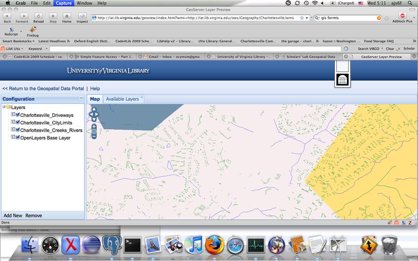
– MySQLGeoServer ● A Spring-based server that supplies WMS / WFS and more, by leveraging a powerful Java library called GeoTools. ● Connects to data stores and raster imagery and publishes services from them.
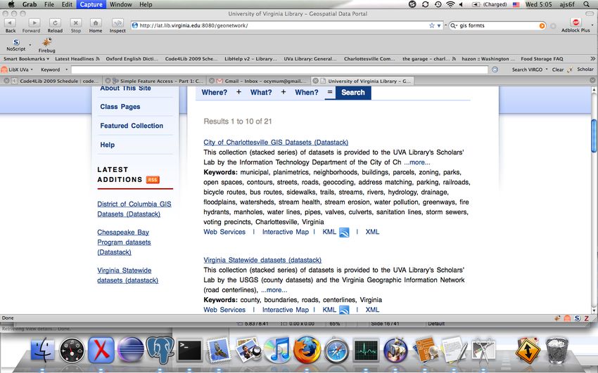
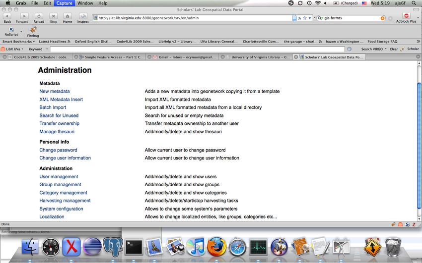
GeoNetwork

A UN-sponsored metadata repository backed by
          an RDBMS and Lucene.
GeoNetwork ● GN is made of a servlet-based webapp over ● a Lucene index over ● an RDBMS that actually stores the metadata.
GeoNetwork
● Features:
● metadata editors
● user-group management with various roles
● query by various means, including by extent
● a wide variety of connectivity (Z39.50, OAI-
PMH, CSW)
● easy extensibility
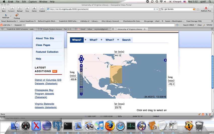
● strong internationalizationScreenshots
You can also read