Toongabbie Structure Plan - July 2020 DRAFT - Latrobe City Council
←
→
Page content transcription
If your browser does not render page correctly, please read the page content below

DRAFT

Toongabbie Structure
Plan
July 2020

                       Toongabbie
                            Structure Plan
Name                                       No.       PM Approved         PD Approved      Date
Draft Toongabbie Structure Plan            1         TM                  LD              03.06.20

                                  This report was written by Latrobe City Council.

                                  © Latrobe City Council 2020.

                                  This publication is copyright. No part may be reproduced by any process
                                  except in accordance with the provisions of the Copyright Act 1968.

                                  ACKNOWLEDGEMENTS

                                  The Study Team recognises that the State of Victoria has an ancient and
                                  proud Aboriginal history and complex ownership and land stewardship
                                  systems stretching back many thousands of years. We would like to
                                  acknowledge the Traditional Owners of this land, and offer our respect
                                  to the past and present Elders, and through them to all Aboriginal and
                                  Torres Strait Islander People.

                                  Front cover image source: Google Earth, 2020.
                                                                                                            2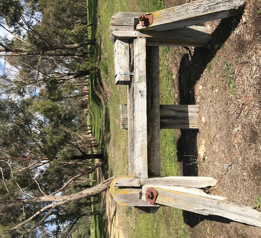
Contents
    Executive Summary               6     5.2 Movement and Access            55
                                           5.3 Public Realm and Environment   57
1.0 Introduction                    8     5.4 Built Form and Design          59
    1.1 Purpose                     9
    1.2 Report Structure            9 6.0 Implementation                     61
    1.3 Context                     9     6.1 Planning Controls              62
    1.4 History                     9     6.2 Other Actions                  68
    1.5 Background                 11     6.3 Monitoring and review          71
    1.6 Approach                   11
    1.7 Consultation               11 7.0 Appendices                         72
                                           Appendix A: Background Reports     73
2.0 Vision                         13
    2.1 Vision                     14
    2.2 Strategic Directions       15

3.0 Strategic Context              16
    3.1 Study Area                 17
    3.2 Study Precincts            17
    3.3 Demographics               19
    3.4 Policy Context             22

4.0 Land Use and Constraints       26
    4.1 Zones and Land Uses        27
    4.2 Constraints and Overlays   29
    4.4 Other Considerations       42
    4.2 Land Supply and Demand     45

5.0 Planning and Design            52
    5.1 Land Use and Activity      53

                                                                                    3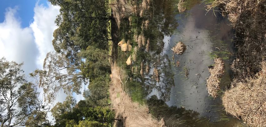
List of Tables
                                                                          List of Figures
Table 1: Study precincts                                            17   Figure 1: Toongabbie Structure Plan                                   7
Table 2: Policy context                                             22   Figure 2: Context                                                    10
Table 9: Bushfire risk mitigation measures                          31   Figure 3: Study area and study precincts                             18
Table 10: Flooding actions                                          34   Figure 4: Demographics - part 1                                      20
Table 11: Built and cultural heritage actions                       36   Figure 5: Demographics - part 2                                      21
Table 12: Landscape and environment actions                         39   Figure 6: Current zones                                              28
Table 13: Infrastructure actions                                    41   Figure 10: Current overlays                                          30
Table 3: Population growth scenarios for broader Toongabbie area    45   Figure 11: Bushfire risk                                             33
Table 4: Lot yield by zone                                          45   Figure 12: Flooding risk                                             35
Table 5: Dwelling forecast demand by zone                           46   Figure 13: Cultural and built form heritage                          37
Table 6: Adequacy of land supply                                    46   Figure 14: Provision of public open space                            44
Table 7: Summary of land supply and demand                          47   Figure 7: Vacant and developable land within study area              49
Table 8: Change in land supply and demand with proposed rezonings   48   Figure 8: Vacant and developable land within Toongabbie RLZ precinct 50
Table 14: Zoning actions                                            64   Figure 9: Vacant and developable land within Cowwarr RLZ precinct 51
Table 15: Overlay actions                                           67   Figure 15: Land use and activity                                     54
Table 16: Implementation                                            69   Figure 16: Access and movement                                       56
                                                                          Figure 17: Landscape and environment                                 58
                                                                          Figure 18: Toongabbie Housing Framework Plan60

                                                                                                                                                 4
Glossary of Terms

Term                                           Definition
Minimal Housing Change Area                    Housing areas that possess significant environmental, heritage and neighbourhood character
                                               development constraints. In response marginal future housing growth and change is supported.
Limited Housing Change Area                    Housing areas that provide for a limited degree of housing growth and change in established
                                               residential areas. These locations are generally beyond reasonable walking distances of public
                                               transport and services.
Incremental Housing Change Area                Housing areas that encourage moderate housing growth and change in a manner which responds
                                               to the surrounding character.
Bushfire Prone Area                            Areas of forest, woodlands, scrub, shrublands, mallee, rainforest and unmanaged grasslands where
                                               there is potential for bushfire behaviour such as crown fire, grassfire and ember attack.
1% Annual Exceedance Probability Flood Event   The probability of a flood event occurring in any year. The probability is expressed as a percentage.
                                               For example, a large flood which may be calculated to have a 1% chance to occur in any one year,
                                               is described as 1%AEP.
Community Infrastructure                       Public and private, State, Council and non-Council facilities (e.g., cultural buildings, recreation
                                               buildings, passive and active open space) which accommodate community support services,
                                               programs and activities (e.g. preschool service, child care, youth services, aged services, community
                                               meetings, sporting competition, informal recreation, cultural activities, education activities,
                                               emergency services, community support, etc.) (ASR Research, 2008)
Local significance (Heritage)                  Places of local significance that are of value to the local community and contribute to
                                               understanding the history of a local community which may be protected by listing on a schedule to
                                               the Heritage Overlay. Local government manages the identification and protection of places under
                                               the planning scheme and is responsible for the issuing of planning permits under the Heritage
                                               Overlay.
State significance (Heritage)                  If a place or object is important to understanding the history of Victoria we say it is of state level
                                               cultural heritage significance. Heritage places and objects of state level significance that also meet
                                               the Heritage Council’s assessment criteria are listed on the Victorian Heritage Register.

                                                                                                                                                        5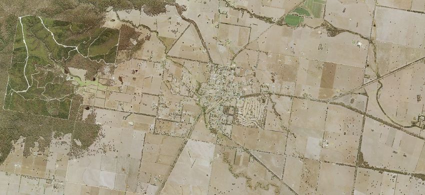
Term                             Definition
Reticulated services             Electricity, water, drainage, gas, communications or similar services the provision of which allows
                                 for direct access to and use of the services by the occupiers of individual parcels of land.
Statistical Area Level 1 (SA1)   Most SA1s have a population of between 200 to 800 persons with an average population of
                                 approximately 400 persons. This is to optimise the balance between spatial detail and the ability
                                 to cross classify Census variables without the resulting counts becoming too small for use. SA1s
                                 aim to separate out areas with different geographic characteristics within Suburb and Locality
                                 boundaries. In rural areas they often combine related Locality boundaries.
Vacant property                  Vacant land that is one ownership but may have a number of individual allotments.
Vacant title                     An allotment that makes up part of the larger property and is currently vacant.
Visual cohesion                  How development and the public realm retain a balance between the heritage and character
                                 elements of an area and modern development while still appearing to relate to each other and
                                 contribute to the character and sense of the place.
Scale                            The apparent size of a building, window or other element as perceived in relation to the size of a
                                 human being.
Massing                          The perception of the general shape and form as well as size of a building.
Built form                       The height, volume and overall shape of a building as well as its surface appearance
Articulation                     Changes in the depth of the surface of a building face or façade such as attached columns,
                                 recessed windows or window bays, horizontal banding or decorative cornices. Articulation gives
                                 texture to the building surface. Vertical articulation can be used to divide a façade into pieces that
                                 appear to be separate buildings or can simply be ornamental.
Visual interest                  Applying architectural techniques, including contrast, colour, texture and variation of materials to
                                 detail buildings.
Standard residential density     Latrobe City defines this as 11 lots per hectare or approximately 720 square metres per lot.
Low density residential          Under the zone this is a lot between 2000 and 4000 square metres.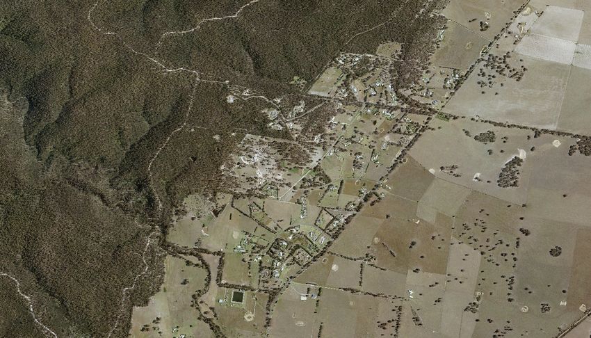
Executive Summary
Small towns in Latrobe City offer a unique
lifestyle choice, and have a number of different    The Plan builds on previous work undertaken
advantages, including access to major services      through the Live Work Latrobe Housing
such as hospitals within a short drive while        Strategy 2019 and the Rural Land Use Strategy
offering a rural atmosphere, that will underpin     2019 which were implemented through
and facilitate their future growth, prosperity      Amendment C105.
and liveability.
                                                    The Plan was undertaken in phases, with
Each structure plan is as unique as the             background information on existing conditions
communities they cover and although there           and plans sourced and analysed before
are guiding principles, they need to consider       technical assessments were prepared.
and represent the characteristics of individual
communities including community aspirations         These reports include:
and values.
                                                    •   Context Report that reviews and analyses
The Toongabbie Structure Plan is summarised             the planning context, land supply and
by the strategic directions:                            demand, the economic context, and social
                                                        infrastructure and recreation needs;
•   Maintain the historic, cultural, and            •   Bushfire Risk Assessment;
    environmental values of Toongabbie;             •   Infrastructure and Servicing Assessment;
•   Retain the quiet, rural atmosphere while        •   Flora and Fauna Assessment; and
    offering a diversity in lifestyle choices;      •   Consultation Report.
•   Improve infrastructure within the town;
•   Maintain key views and vistas;                  This information, along with feedback from the
•   Support the provision of open space and         community formed the basis of the ‘vision’ and
    community infrastructure; and                   the strategic directions.
•   Enhance Toongabbie’s ‘town centre’ core
    including the Village Green, V/line bus stop,
    General Store and the Avenue of Honour.

The Structure Plan was prepared through a
collaborative process involving stakeholders,
landowners and agencies.
                                                                                                     7
DRAWING KEY
                                                                               TO
                                                                            COWWARR                                 Figure 1: Toongabbie Structure Plan
     TOONGABBIE TOWNSHIP BOUNDARY
                                                                              WEIR
     TOWNSHIP GATEWAY
 #   TOONGABBIE TOWN STRUCTURE
     PLAN AREA

LAND USE                                                                                                                         WELLINGTON
     RESIDENTIAL                        TOONGABBIE                                                                                 SHIRE
                                                                                                                                  COUNCIL
     TOWNSHIP AREA
                                                          TOONGABBIE
     RESIDENTIAL                                        PRIMARY SCHOOL

     FIRST STAGE LOW DENSITY
     RESIDENTIAL
                                                                                                                                                  TO
     SECOND STAGE LOW DENSITY                                                                                                                  MAFFRA,
                                                   10
     RESIDENTIAL
                                                                                                                                               HEYFIELD
     PREFERRED DIRECTION FOR
     FUTURE GROWTH                                                                                         13

     AGRICULTURE / RURAL                                 6                                                                        14
     FARMING                                                                                   1
     PRODUCTIVE AGRICULTURAL LAND        11
     FIRST STAGE FUTURE RURAL LIVING
                                                               8
     SECOND STAGE FUTURE RURAL LIVING
                                                                       7
     COMMERCIAL                               12                                   9
                                                                                                                                                       TO
                                                                                              TOONGABBIE
     LOCAL ACTIVITY CENTRE                                                                    RECREATION
                                                                                                RESERVE

     COMMUNITY INFRASTRUCTURE /
                                                                                                                                                    KILMANY,
     OPEN SPACE                                                                                                                                     ROSEDALE
     PUBLIC OPEN SPACE
                                                                               5                                                  4
     CONSERVATION                                                                         TOONGABBIE
                                                                                             WATER
                                                                                            RESERVE
                                                                   2                                            3
     SERVICE / COMMUNITY / CIVIC USE
     PUBLIC / UTILITY LAND

MOVEMENT                                                TOONGABBIE
                                                         CEMETERY
                                                                            LONG TERM
                                                                              FUTURE
                                                                           LOW DENSITY
     MAJOR ROADS                                                            RESIDENTIAL

     SHARED PATHWAYS
     GIPPSLAND PLAINS RAIL TRAIL

OVERLAYS / CONSTRAINTS                                                                     WELLINGTON
     BUSHFIRE MANAGEMENT OVERLAY                                                             SHIRE
                                                                                            COUNCIL
     LAND SUBJECT TO INUNDATION
     OVERLAY
     FLOODWAY OVERLAY                       TO                                                                                         0      0.5       81.0km
                                        TRARALGON                                                                               N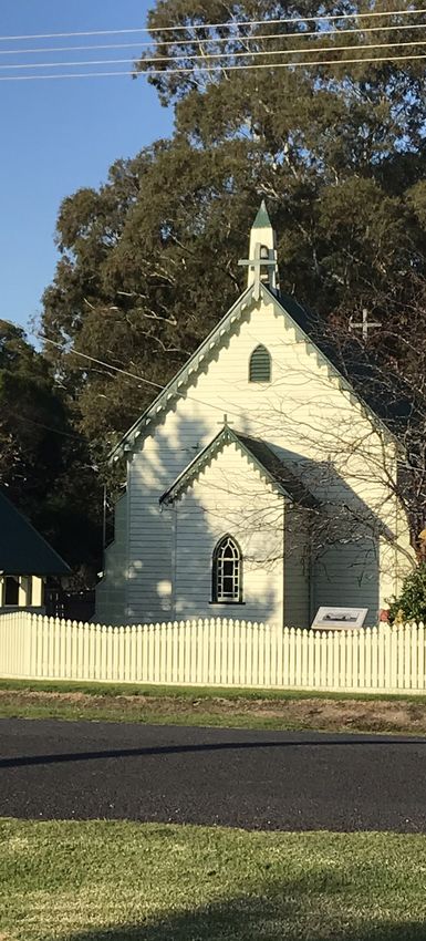
1

    Introduction
1.1 Purpose                                        1.3 Context                                            1.4 History
The purpose of this report is provide a            Latrobe City is centrally located in eastern           The traditional custodians of the Latrobe Valley
framework to guide future land use and             Victoria, approximately a two hour drive east of       are the Gunaikurnai people. The Brayakaulung
development within the township and the            Melbourne. It sits within the heart of Gippsland       clan settled over an area that includes the
surrounding area of Toongabbie.                    within easy access to the Gippsland coastline,         township of Toongabbie.
                                                   Mount Baw Baw snowfields and the Gippsland             Toongabbie Township originated in 1862 after
The Toongabbie Structure Plan project has          Lakes.                                                 the discovery of gold at Stringer’s Creek in
been undertaken in response to a number of         It is the fourth largest regional city municipality    Walhalla by Ned Stringer.
submissions that were received from residents      in Victoria. The municipality has a population
during the Exhibition period for Amendment                                                                The township was laid out and surveyed by
                                                   of over 74,000. Latrobe City sits within the
C105.                                                                                                     George Hastings in 1864. A further survey was
                                                   boundaries of the Brayakaulung Clan of the             made the next year by Henry Davidson.
                                                   Gunaikurnai people of Gippsland.
1.2 Report Structure                               The municipality includes four main towns
                                                                                                          It once formed part of the stock route between
                                                                                                          Sale to Walhalla, and Walhalla to Port Albert.
                                                   of Moe-Newborough, Morwell, Traralgon                  Miners, who rushed to the isolated gold field
The plan summarises the findings of the            and Churchill and seven smaller townships of           deep in the Great Dividing Ranges, came via
Toongabbie Structure Plan Background Reports       Yallourn North, Tyers, Glengarry, Toongabbie,          Port Albert and Sale, across the red gum plains.
through the Strategic Context, Vision and Land     Yinnar, Traralgon South and Boolarra.                  Toongabbie was the last supply post before
Use and Constraints sections. This plan then
                                                   Toongabbie is the northern most settlement             people attempted the difficult mountainous
sets out objectives, strategies and actions that
                                                   within the municipality. It is located 17              route to Walhalla. However, the size of the
apply to the town in the Planning and Design,
                                                   kilometres north of Traralgon and sits within          population started to decline when the train
and Implementation sections.
                                                   close proximity to the Wellington Shire Council        line was built between Moe and Walhalla. Now,
                                                   border. It is approximately 177 kilometres             it offers a valuable lifestyle choice within the
                                                   from Melbourne (see Figure 2). The township            municipality within close proximity to the Great
                                                   is unique in that it offers a relatively compact       Dividing Ranges and the Cowwarr Weir, while
                                                   ‘village’ with shops, services and community all       still being in a short driving distance to shops
                                                   with a five minute walk of the residential areas.      and services in Traralgon.
                                                   Over the years, it has largely retained its original
                                                   layout with larger allotments a feature of the
                                                   town. Like the other small towns in Latrobe
                                                   it is also within a short distance to shops, the
                                                   hospital and other services not available within
                                                   town.
                                                                                                                                                             10
1:1,700,000
Figure 2: Context 0 10 20 30 40 50km
G R E AT D I V I D I N G
RANGE
MELBOURNE
TOONGABBIE
WARRAGUL
MOE
SALE
DROUIN
ROSEDALE
TRARALGON
MORWELL
STRZELECKI
RANGES CHURCHILL
L AT RO B E
WONTHAGGI
INVERLOCH
WILSONS
PROMONTORY
111.5 Background 1.6 Approach 1.7 Consultation
Structure plans for all small townships in The Toongabbie Structure Plan project was A range of stakeholders have been consulted
Latrobe City were initially prepared by Enviro undertaken in two stages with a third stage to with for the Toongabbie Structure Plan project.
Plan and Michael Smith and Associates in be completed through the planning scheme The input from these groups has informed
2002. In 2003, Council resolved to ‘prepare amendment process. the development and refinement of this plan.
and exhibit Amendment C24 to the Latrobe Consultation was undertaken in two distinct,
Planning Scheme to implement the findings Stage one included community, and servicing yet complementary stages. Further consultation
and recommendations of the Small Town and referral agencies engagement, along will occur during the exhibition period of the
Structure Plans for Toongabbie, Yallourn North, with a desktop assessment and site visits. It associated Planning Scheme Amendment.
and Yinnar.’ However, Council never progressed produced five background reports - Context
with this version of Amendment C24 due to Report, Bushfire Risk Assessment, Infrastructure 1.7.1 STAGE 1 CONSULTATION
concerns voiced by a number of members of and Servicing Assessment, Flora and Fauna
the community. Assessment, and a Consultation Report. Stage 1 including consultation with referral and
servicing authorities, and government agencies
A review of these documents in 2006 by Stage two focused on the development of this which began in February 2018 and remains
Latrobe City Council found these plans to be report and the policy directions to achieve what ongoing; this included the following agencies
inappropriate for inclusion into the Latrobe the community has envisioned. and organisations:
Planning Scheme as they could not be
effectively implemented through the planning Stage 1 • Country Fire Authority (CFA);
scheme. As such, a new project for small town • West Gippsland Catchment Management
structure plans was undertaken for Boolarra, Policy Directions Authority (WGCMA);
Consultation
Glengarry and Tyers in 2010 and implemented Technical Reports • Gippsland Water;
into the Latrobe Planning Scheme through • Department of Transport (Regional Roads
Amendment C24. Yinnar, Traralgon South, Stage 2 Victoria (VicRoads));
Yallourn North and Toongabbie are yet to have • SP Ausnet;
structure plans completed. Toongabbie Structure Plan Report • Telstra;
• APA Group;
Parts of the Toongabbie study area were
Stage 3 • Department of Environment, Land, Water
proposed to be rezoned to Rural Living Zone and Planning (DELWP); and
in Amendment C7 in 2002, and again in
Planning Scheme Amendment • Latrobe City Council:
Amendment C105 in 2018. However, due to
a lack of demand in 2002 and further work
required around bushfire risk in 2018, this
rezoning has not proceeded.• Environment; Refer to the Toongabbie Structure Plan
• City Assets; Background Report - Consultation Report 2020
• Recreation; (See Appendix A) for a full summary of the
• Community Development; and approach and consultation findings.
• Economic Development.
The purpose of this consultation was to provide
technical advice and direction to shape and
test the structure plan. The Background reports
were also reviewed by these agencies and
organisations.
1.7.2 STAGE 2 CONSULTATION
Stage 2 consultation was completed between
March 2019 and October 2019; it included an
engagement strategy aimed at encouraging
public discourse and capturing aspirations for
the future around vision, preferred character,
infrastructure, and bushfire risk mitigation.
Stage 2 consultation had two phases to it.
Phase 1 included a survey to capture the
thoughts of a wide range of people.
Phase 2 consisted of two workshops to dive
deeper into the overarching themes that
emerged from the surveys and develop some
strategic directions around them.
67 people participated in the first phase of the
stage 2 engagement process, while 34 people
participated in second phase of the process.
132
Vision2.1 Vision
Toongabbie is a small, historic, country town in a
bush setting that maintains a safe, friendly, rural
atmosphere for all ages. It seeks to protect and
respect the environmental and cultural assets of the
town and the surrounding area while diversifying its
economic assets.
152.2 Strategic Directions
Maintain the historic, cultural, and Retain the quiet, rural atmosphere while Improve infrastructure within the town.
environmental values of Toongabbie. offering a diversity in lifestyle choices. Toongabbie is in a relatively flat area and
Toongabbie has a rich history stretching Toongabbie has a low density allotment sits on poor draining soil, as such it suffers
from the inhabitation of the area by the pattern within town, this gives a sense of from drainage issues. As a small town, the
Gunaikurnai nations to the founding of the space within the township. The low scale infrastructure requirements have not kept
current township during the gold rush period and massing of the built form contributes to up with the growth that Toongabbie has
in the 1800s. This plan seeks to maintain the rural character of the township. Through experienced over the past ten years. This
those historic and cultural links such as the the application of zones and overlays, plan seeks improvements to the drainage
Toongabbie Mechanics’ Institute and the the larger lot sizes and the smaller scale and roads within the township. Issues have
historic township precinct that contribute to of housing can be maintained, ensuring been highlighted with the availability of
the character of the township while planning that Toongabbie does not lose its sense of water and sewer infrastructure, this plan
for sustainable growth. The environmental character over time even with the availability seeks to manage growth sustainable within
values add to the rural character and are of a diversity of lot sizes. these restrictions.
endangered remnants of native vegetation.
Maintain Key Views and Vistas. Support the provision of open space and Enhance Toongabbie’s ‘town centre’ core
One of the assets that Toongabbie has is its community infrastructure. including the Village Green, V/line bus stop,
proximity to the Great Dividing Ranges with Toongabbie has a very active community General Store and the Avenue of Honour.
views to the foothills visible from the edges that attracts new residents. It is important Toongabbie serves as a stopping point
of the township along the northern and to support these facilities and community along the Gippsland Plains Rail Trail and
south western boundaries. groups as well as building upon those assets. as a gateway to the old historic route to
These views are an important part of the This plan seeks to connect the facilities and Walhalla and to Cowwarr Weir. There is an
existing character of Toongabbie adding to open space through additional linkages. opportunity to build upon the features of
the rural character. This plan seeks to ensure the township including the General Store,
that this character trait is retained. This Village Green and Recreation Reserve both
plan seeks to ensure that agricultural land through rural tourism and through additional
outside of the identified areas is retained for retail provision.
agricultural purposes.
163
Strategic Context
173.1 Study Area
Table 1: Study precincts
The study area is bordered by Harris Lane to the Precinct Description Number Number Number
west, Guyatts Road to the south, Antons Lane Name of of Lots of People
and Traralgon-Maffra Road to the east, and Dwellings
Afflecks and Old Walhalla Road to the north. A Lots to the north of Toongabbie between the Gippsland 25 25 68
Plains Rail Trail, Afflecks Road, Hill Street and the lot at 30
Major roads include Traralgon - Maffra Road, Walhalla Road.
running south-east to north-west through the B All lots generally bounded by the Gippsland Plains Rail 84 84 227
centre of town, Toongabbie-Cowwarr Road Trail, Afflecks Road, Packett Road, the creek, Main Street,
(Victoria Street) running north-south and Campbell Street, and Sparks Lane. Precinct B overlaps with
Stringer Road as other main thoroughfares. Precinct C as they considered different zones.
C Lots to the east of Sparks Lane not including a residential 23 22 62
3.2 Study Precincts zoned lot up to the 5 lots east of Packett Road.
D Lots to the east of Toongabbie, including two lots to 27 27 73
To determine the best areas for growth within the west of Nippe Lane and all lots east of Nippe Lane
between Traralgon-Maffra Road and Afflecks Road.
Toongabbie, nine different study precincts have
been looked at as potential growth areas in E Lots South of Traralgon – Maffra Road east of Nippe Lane 26 26 70
the preparation of the Toongabbie Structure and Anton Lane Including the title west of Nippe Lane until
Plan. Three of these were from the proposed the creek.
rural living precincts in Amendment C105, the F Lots South of the Toongabbie golf course, between 34 33 92
other precincts were identified if they were Heywood Street, Hendersons Road, Guyatts Road and
adjoining those proposed precincts and/or had Nippe Lane.
submissions that related to a zone change from G Lots south of Toongabbie between the Gippsland Plains 10 10 27
previous strategic planning projects. Rail Trail, Henderson Road and Guyatts Road.
H All lots to the west of Toongabbie, bound by Hill Street, 26 11 70
The precincts and possible zones (Rural Living
Harris Lane, Guyatts Road, Main Street and King Street
Zone (RLZ) or Low Density Residential Zone excluding residential lots.
(LDRZ)) are listed in Table 1 and shown in
J Lots south of Toongabbie between the Gippsland Plains 63 63 170
Figure 3. A tenth area includes infill within
Rail Trail, Henderson Road and Guyatts Road.
the township boundary. These study precincts
are not an indication that the precinct will be
rezoned, more so, it is a tool to determine
approximate lot yield and to guide further
discussion. 18Figure 3: Study area and study precincts
LEGEND
Study area
Precincts considered for Rural Living
Precincts considered for Low Density
Residential
A To Maffra
B+C
D
I
H
E
G+J
F
To Traralgon
193.3 Demographics
The population of Latrobe in 2016 (ABS, 2016)
was 73,257 people with Toongabbie (992
people) making up approximately 1.35% of
the population.
Toongabbie has proportionally grown
significantly between 2011 and 2016 at a rate
of 15.4 persons per annum or 1.63% which
is higher than the Latrobe average annual
growth rate of 0.24% over the same period.
Toongabbie has the second smallest urban
area by population among the small
towns in Latrobe, however, if State Suburb
Classifications are used, then it is the third
largest small town, in terms of population size,
behind Yallourn North and Glengarry.
Of importance to note for Toongabbie, it
has a higher number of people per dwelling
(2.7) when compared to Latrobe (2.3). The
median age is younger than Latrobe by 6
years. Children under 15 (24.2%) make up a
larger cohort of the population in Toongabbie
than the cohort for Latrobe overall (18.1%).
Accordingly there is a higher number of
families with children (48.4%) than Latrobe
overall (38.3%).
20••••• TOONGABBIE DEMOGRAPHICS •••••
Figure 4: Demographics - part 1 Other T R A V EL T O W O R K
13.1% 80.1% USED CAR
1.2% USED PUBLIC
TRANSPORT
992 PEOPLE Australian
Scottish
37.1% 3 8 7 P R IV A TE
7.5%
ANCESTRIES D WELLIN G S
Female Male $1609/W MEDIAN
Irish
50.2% 49.8% 9.3%
HOUSEHOLD INCOME
$1419/M MEDIAN MORTGAGE
REPAYMENTS
24.2% 65.9% 9.9%
Unoccupied private dweliing
0-15 16-64 65+ English
28.8%
4.9%
years old years old years old
29.4% OF PEOPLE ARE ATTENDING AN
Percentage of residents in age range
EDUCATIONAL INSTITUTION
MEDIAN AGE=35 P R IM A R Y
30.8%
Occupied private dwelling
S EC O N D A R Y
N U M B ER O F F A M IL IES 95.1%
21.1%
277 T ER T IA R Y 2.7
7.7% P E OP L E P E R HOUS E HOL D
HIGHEST LEVEL OF EDUCATION (15+ Y.O) 3.3
48.4% 37.6% 14.0% BEDROOOMS
Completed Year 12
12.1%
2.4
88.0% BORN IN Certificate III or IV
MOTOR VEHICLES
PER DWELLING
Not completed
AUSTRALIA 25.9%
1.9
53.5%
94.3% SPEAK ONLY
Advanced Diploma or Diploma CHILDREN PER FAMILIES
ENGLISH AT HOME 8.5% WITH CHILDREN
21Figure 5: Demographics - part 2
LABOUR FORCE Part-time
=
Full-time
504 PEOPLE
Unemployed
Away from work
0% 20% 40% 60%
PROFESSION
Machinery Operators and Drivers
18.7% Technicians and Trade Workers
28.7%
Labourers
19.1%
Professionals
21.4%
INDUSTRY
AGRICULTURE, FORESTRY AND FISHING
ACCOMMODATION AND FOOD SERVICES
MINING
TRANSPORT, POSTAL AND WAREHOUSING Note 1: German ancestry (3.8%) is not
MANUFACTURING shown of ancestries pie chart in Figure 4.
ADMINISTRATION AND SUPPORT SERVICES
ELECTRICITY, GAS, WATER AND WASTE SERVICES
PUBLIC ADMINISTRATION AND SAFETY Note 2: Clerical and administrative workers
CONSTRUCTION (7.7%) is not shown in profession pie chart
RETAILTRADE
WHOLESALE TRADE
in Figure 5.
HEALTHCARE AND SOCIAL ASSISTANCE
EDUCATION AND TRAINING Note 3: Five people shown in white in the
OTHER SERVICES Industry infographic in Figure 5 have not
INADEQUATELY DESCRIBED
stated an industry of employment.
223.4 Policy Context Table 2: Policy context
A range of state, regional and local policy Settlement Environmental and Landscape Values
documents have informed the preparation of
this structure plan report as summarised to the
Clause 11.01-1S Settlement Clause 12.01-1S - Protection of Biodiversity
Planning Policy Framework
right. Clause 11.01R Settlement - Gippsland Clause 12.01-2S Native Vegetation Management
Clause 11.02-1S Supply of Urban Land Clause 12.03-1S River Corridors, Waterways, Lakes
A detailed analysis of the background policy Clause 11.02-2 Structure Planning and Wetlands
is included in the Toongabbie Structure Plan Clause 11.03-1S Activity Centres Clause 12.05-2S Landscapes
Background Reports - Context Report 2020. Clause 11.07-1S Regional and Local Places Clause 21.03 Environment and Landscape Values
Clause 21.02 Municipal Profile
It is noted that some of the clauses and Clause 21.02 Housing and Settlement
strategies repeat where they had relevant Clause 21.09 Local Areas
sections under any given topic.
Plan Melbourne 2017-2050 Protecting Victoria’s Environment - Biodiversity
Strategic Policy Documents Ready for Tomorrow – A Blueprint for Regional 2037
and Rural Victoria 2010 Latrobe City Natural Environment Sustainability
Gippsland Regional Plan 2015-2020 Strategy 2014-2019
Gippsland Regional Growth Plan 2014 Latrobe City Biodiversity and Native Vegetation
Live Work Latrobe Housing Strategy 2019 Policy 2011
Structure Plans for Toongabbie, Yallourn North
and Yinnar 2002
Toongabbie is a ‘small town’ within the Latrobe Toongabbie has patches of significant native
Settlement Hierarchy where growth is supported, vegetation throughout the study area, it also has
as such this plan aims to ensure that there two waterways that flow through the study area.
Implications
is enough land supply over the next 15-20 As such, there is an opportunity to protect the
years and that it responds to the needs of the remnant vegetation and improve the landscape
community through the provision of housing, qualities through open space linkages and re-
recreation, open space, commercial land, and vegetation.
community infrastructure.
23Environmental Risks and Amenity Agriculture Built Environment and Heritage
Clause 13.01-1S Natural Hazards and Climate Clause 14.01-1S Protection of Agricultural Land Clause 15.01-1S Urban Design
Planning Policy Framework
Change Clause 14.01-1R Protection of Agricultural Land - Clause 15.01-1S Building Design
Clause 13.02-1S Bushfire Gippsland Clause 15.01-4S Healthy Neighbourhoods
Clause 13.03-1S Floodplain Management Clause 14.01-2S Sustainable Agricultural Land Use Clause 15.01-5S Neighbourhood Character
Clause 13.04-1S Contaminated and Potentially Clause 14.01-3S Forestry and Timber Production Clause 15.01-6S Design for Rural Areas
Contaminated Land Clause 14.02-2S Water Quality Clause 15.02-1S Energy and Resource Efficiency
Clause 21.04 Environmental Risks Clause 21.05 Natural Resource Management Clause 15.03-1S Heritage Conservation
Clause 22.02 Rural Subdivision and Dwellings Clause 15.03-2S Aboriginal Cultural Heritage
Clause 21.06 Built Environment and Heritage
Victorian Floodplain Management Strategy 2016 Gippsland Regional Plan 2015-2020 Live Work Latrobe Housing Strategy 2019
Strategic Policy Documents
WGCMA Floodplain Management Strategy 2018- Macalister Irrigation District (MID) 2030 – Live Work Latrobe Rural Land Use Strategy 2019
2027 Southern Rural Water 2007 Latrobe City Heritage Study 2010 (Vol. 1-3)
Safer Together 2018 Regional Forest Management Plans for Gippsland Healthy by Design Guidelines 2004
Strategic Bushfire Management Plan – East Central 2004
2014 Live Work Latrobe Rural Land Use Strategy 2019
Regional Bushfire Planning Assessment -
Gippsland Region 2012
Profile of Bushfire Risk within Latrobe District 2015
Latrobe Municipal Fire Management Plan 2017
Bushfire Risk Rating Assessment Toongabbie
Proposed Rural Living Precincts 2018
Toongabbie has both a bushfire risk and a Toongabbie has identified productive Toongabbie has identified a preferred rural
flood-prone risk that should be mitigated. agricultural land to the south west of the character for the township’s identity. Low
Implications
Planning scheme tools such as appropriate study area and sits on the edge of the scale housing and a sense of space between
overlays can help mitigate the risk for both Macalister Irrigation District to the east, dwellings will help retain this sense of
bushfire and flooding. A hotter, drier climate as such, any further growth should limit character. Toongabbie has an identified
has seen more intense and more frequent the impact on the ability of these areas to heritage precinct including the Village Green
bushfires in recent years. continue commercial farming operations. and Toongabbie Mechanic’s Institute.
24Housing Economic Development Transport
Clause 16.01-1S Integrated Housing Clause 17.01-1S Diversified Economy Clause 18.02-1S Sustainable Personal Transport
Planning Policy Framework
Clause 16.01-2S Location of Residential Clause 17.02-1S Business Clause 18.02-2S Public Transport
Development Clause 17.04-1S Facilitating Tourism Clause 18.02-3S Road System
Clause 16.01-3S Housing Diversity Clause 17.04-1R Tourism - Gippsland Clause 21.08 Transport and Infrastructure
Clause 16.01-4S Housing Affordability Clause 21.07 Economic Development
Clause 16.01-5S Rural Residential Development Clause 22.03 Rural Tourism
Clause 16.01-7S Residential Aged Care Facilities
Clause 21.02 Settlement and Housing
Homes for Victorians 2017 Victoria’s 2020 Tourism Strategy 2013 Tracks, Trails & Paths Strategy – Latrobe. Be in it.
Residential Zones State of Play Report 2016 Victorian Visitor Economy Strategy 2016 2016
Strategic Policy Documents
Live Work Latrobe Housing Strategy 2019 Gippsland Regional Plan 2015-2020 Latrobe City Bicycle Plan 2007-2010
Gippsland Regional Growth Plan 2014
Gippsland Tourism Strategic Direction 2013 –
2018
Regional Forest Management Plan for Gippsland
2004
Latrobe Economic Development Strategy 2016 -
2020
A Strength Led Transition 2016
Toongabbie has identified ‘limited’ and Toongabbie has an opportunity to leverage There is an opportunity to advocate for
‘minimal’ housing change areas in the its closeness to natural assets and build greater provision of public transport within
Implications
residential area. These change areas upon the Gippsland Plains Rail Trail that runs Toongabbie and build upon existing links
encourage single dwellings or dual occupancy through the middle of the town whether this within town to create a core movement
housing typologies only except within be through rural tourism opportunities or the network for pedestrians and cyclists. The
200m of an activity centre where units and provision of more shops. Gippsland Plains Rail Trail is a key inter-
townhouses are encouraged. regional cycling and pedestrian route.
25Infrastructure Implementation
Clause 19.02-2S Education Facilities Clause 71.02-3 Integrated Decision Making
Planning Policy Framework
Clause 19.02-4S Social and Cultural Infrastructure Clause 21.01 Municipal Profile
Clause 19.02-5S Emergency Services Clause 21.10 Implementation
Clause 19.02-6S Open Space
Clause 19.03-4S Telecommunications
Clause 19.03-2S Infrastructure Design and
Provision
Clause 19.03-3S Integrated Water Management
Clause 21.02 Housing and Settlement
Clause 21.08 Transport and Infrastructure
Gippsland Region Sustainable Water Strategy Latrobe City Council Plan 2017 – 2021
Strategic Policy Documents
2011 Latrobe 2026
Infrastructure Design Manual and Addendum
Latrobe City Municipal Public Health and
Wellbeing Plan 2018-2022
Municipal Domestic Wastewater Management
Plan (DWMP) 2019
Latrobe City Public Open Space Strategy 2013
Northern Towns Recreation Plan 2010
Toongabbie has significant infrastructure For Toongabbie, a combination of zones,
constraints including the provision of sewer overlays and policy have been considered
Implications
and water infrastructure, and a lack of nearby to address the preferred rural character and
telecommunications towers. There is also land use, identification of additional land
a need for further childcare and day care requirements, and appropriate mitigation
facilities. These will need to be addressed in responses to the identified constraints in order
order to develop in a sustainable manner. to have a sustainable, liveable community
while prioritising human life above all else.
264
Land Use and Constraints4.1 Zones and Land Uses
Figure 6 shows the zones that currently apply to Agriculture Civic uses
the study area and the surrounding catchment The area outside the township boundary There are four civic uses in Toongabbie, these
within Latrobe. Zones that apply within the (Precinct I) is zoned Farming Zone - Schedule 1 include Toongabbie Primary School, the CFA
study area include: (FZ1). building, St. David’s Church of England and
Toongabbie Cemetery.
• Farming Zone - Schedule 1 (FZ1) The main purpose of the FZ1 is to provide for
• Neighbourhood Residential Zone - Schedule the use and ensure the retention of land for The primary school is split zoned Public Use
4 (NRZ4) agriculture. Zone - Schedule 2 (PUZ2) and NRZ4. The
• Township Zone (TZ) Cemetery is zoned Public Use Zone - Schedule
• Public Use Zone - Schedule 2 Education Land within the study area is identified in 5 (PUZ5). While the CFA building sits within
(PUZ2) the Rural Land Use Strategy as being Class the Gippsland Plains Rail Trail reserve which is
• Public Use Zone - Schedule 5 Cemeteries 3 which is defined as ‘fair’ and “can sustain zoned PPRZ. St David’s Church of England is
and Crematoriums (PUZ5) agricultural uses with low to moderate zoned NRZ4.
• Public Park and Recreation Zone (PPRZ) levels of land disturbance such as broad acre Rural Residential
• Public Conservation and Resource Zone cultivation in rotation with improved pastures. Areas in Precinct B and H are zoned FZ1 but
(PCRZ) Moderate to high levels of production possible the land is heavily fragmented and used
• Road Zone Category 1 (RDZ1) with specialist management practices such primarily for rural residential purposes.
as minimum tillage”(Latrobe City Soil and
Agricultural Land Use Report, 2018). Activity Centre
A detailed description of the zones can be The Toongabbie General Store is the sole shop
found in Toongabbie Structure Plan Background Residential in Toongabbie, it is zoned Township Zone (TZ).
Reports - Context report 2020. Uses that occur Land with precinct I is primarily zoned
in the area include: Neighbourhood Residential Zone - Schedule One of the purposes of the TZ is to provide
Recreation and Community Facilities 4 (NRZ4). This is a ‘limited’ housing change for residential development and a range of
There is a range of recreation uses and area except where the Heritage Overlay applies commercial, industrial and other uses in small
facilities within the study area including the which is a ‘minimal’ housing change area. towns.
Gippsland Plains Rail Trail, Village Green,
playground at 9 Victoria Street and Toongabbie The purpose of the zone is to recognise areas There are three vacant parcels next to the
Recreation Reserve. These are zoned Public of predominantly single and double storey General Store which allow for more commercial
Park and Recreation Zone (PPRZ) except for residential development and to manage development to occur.
the Toongabbie Water Reserve which is zoned and ensure that development respects the
Public Conservation and Resource Zone (PCRZ). identified neighbourhood character, heritage,
environmental or landscape characteristics.
28Figure 6: Current zones
LEGEND
Public Conservation and Resource Zone (PCRZ)
Farming Zone - Schedule 1 (FZ1)
Rural Living Zone - Schedule 2 (RLZ2)
Public Use Zone (PUZ)
Neighbourhood Residential Zone - Schedule 4 (NRZ4)
Public Park and Recreation Zone (PPRZ)
Township Zone (TZ)
Main Roads
Municipal Boundary
Study Area
NB: Road Zone Category 1 (RDZ1) not shown along Traralgon-Maffra Road
294.2 Constraints and Overlays
A number of land use constraints have been 2020 and summarised in 4.4.1. the provisions of relevant State Environment
taken into account when developing this Protection Policies, particularly in accordance
structure plan, particularly: The purpose of the HO is to: with Clauses 33 and 35 of the State
Environment Protection Policy (Waters of
• Bushfire risk as the entire study area sits • Conserve and enhance heritage places of Victoria); and
within a bushfire prone area; natural or cultural significance; • Ensure that development maintains or
• Flood risk across all precincts, particularly • Conserve and enhance those elements improves river and wetland health, waterway
precincts H and I; which contribute to the significance of protection and flood plain health.
• Native vegetation and potential habitat for heritage places;
threatened species, particularly in Precinct H; • Ensure that development does not adversely West Gippsland Catchment Management
• Built and cultural heritage; affect the significance of heritage places; Authority (WGCMA) is the referral authority for
and planning permits triggered under the LSIO and
• Water and sewer infrastructure provision;
and • Conserve specifically identified heritage Floodway Overlay (FO).
• Potentially contaminated land. places by allowing a use that would
otherwise be prohibited if this will WGCMA proposes to update the flood data
demonstrably assist with the conservation of across the municipality and apply the FO and
An overlay applies to the land where there is the significance of the heritage place. LSIO accordingly through the amendment
an identified constraint or a preferred design process in the 2020/2021 financial year in
outcome. Figure 8 shows the existing overlays The purpose of the LSIO is to: accordance with the West Gippsland Catchment
within the Toongabbie study area which Management Strategy. As the updated data
includes: • Identify land in a flood storage or flood directly affects the Toongabbie Structure Plan,
fringe area affected by the 1 in 100 year those overlays are proposed to be updated
• Land Subject to Inundation Overlay (LSIO) flood or any other area determined by the through the Toongabbie Structure Plan
• Heritage Overlay (HO) floodplain management authority; amendment process. This is discussed in further
• Ensure that development maintains the detail in 4.4.2.
The Bushfire Management Overlay (BMO) free passage and temporary storage of
sits outside the study area, so it does not flood waters, minimises flood damage, is
A detailed description of the overlays can be
directly impact on the study area, however, compatible with the flood hazard and local
drainage conditions and will not cause any found in Toongabbie Structure Plan Background
the bushfire risk does impact on possible Reports - Context report 2020 found in
significant rise in flood level or flow velocity;
rezonings in accordance with Clause 13.02-1S Appendix A.
• Reflect any declaration under Division 4 of
of the Latrobe Planning Scheme, this is further
Part 10 of the Water Act, 1989 where a
discussed in the Toongabbie Structure Plan declaration has been made;
Background Reports - Bushfire Risk Assessment
• Protect water quality in accordance with
30Figure 10: Current overlays
LEGEND
Bushfire Management Overlay
Land Subject to Inundation Overlay
Heritage Overlay
Study Area
31Table 9: Bushfire risk mitigation measures
4.2.1 BUSHFIRE Precinct Mitigation Measure
The Toongabbie Structure Plan Background A1 The bushfire risk is considered to be too high for this precinct, rezoning to a Rural
Report - Bushfire Risk Assessment 2020 was Living Zone (RLZ) is not recommended. Any further risk mitigation measures will be
undertaken during stage 1 of this project. undertaken through the Bushfire Assessments and Rural Rezonings (BARR) project.
The report considered the bushfire risk and is
A2 The bushfire risk is considered to be too high for this precinct, rezoning to a Rural
consistent with the Latrobe Planning Scheme,
Living Zone (RLZ) is not recommended. Any further risk mitigation measures will be
particularly Clause 13.02-1S as well as guidance
undertaken through the Bushfire Assessments and Rural Rezonings (BARR) project.
provided in:
B1 B1 (Properties at 29 Hill Street and 36 Packett Road included in the Low Density
Residential Zone (LDRZ) considerations) is not being further considered as a part of this
• Planning Advisory Note 68: Bushfire State Structure Plan. These properties now form part of C1 RLZ1 opportunities.
Planning Policy Amendment VC140
B2 At the point of rezoning apply a Design and Development Overlay (DDO) to ensure
• Planning Practice Note 64: Local Planning subdivision layout, suitable siting of the dwellings, adequate defendable space, ensure
for Bushfire Protection
dwellings are built to a suitable BAL standard and that there are adequate buffer areas
from Rosedale Creek.
The Toongabbie Structure Plan has an
C1 Rezone this area in conjunction with D1 and D2. Apply the Development Plan
opportunity to prioritise the protection of
Overlay (DPO) to ensure suitable siting of the dwellings, adequate defendable space,
human life, as it is likely to enhance settlement
ensure good access and egress, ensure dwellings are built to a suitable BAL rating, as
safety.
determined during the development plan process and applies adequate buffer areas
from Rosedale Creek.
The development of the Toongabbie Structure
Plan requires some mitigation measures, C2 C2 (Properties between Hill Street, Traralgon-Maffra Road, Sparks Lane and Rosedale
particularly for precinct H, along King Street Creek included in the RLZ1considerations) is not being further considered as a part of
in precinct I where the risk interfaces with this Structure Plan as they are being considered for LDRZ opportunities.
development. This can be managed through D1 Rezone this area in conjunction with C1 and D2. Apply the DPO to ensure suitable
planning permits or controls placed on the land siting of the dwellings, adequate defendable space, ensure good access and egress,
at the time the land is rezoned. ensure dwellings are built to a suitable BAL rating, as determined during the
development plan process and applies adequate buffer areas from Rosedale Creek.
Figure 11 shows the assessment in relation D2 Rezone this precinct along with C1 and D1.Apply a DPO to ensure suitable siting of
to bushfire risk. Table 9 shows the individual the dwellings, adequate defendable space, ensure good access and egress, ensure
bushfire risk mitigation measures for each dwellings are built to a suitable BAL rating, as determined during the development plan
precinct as recommended by the draft process.
Toongabbie Structure Plan Background Reports
32Precinct Mitigation Measure
- Bushfire Risk Assessment 2020 which can be E At the time of rezoning (with precinct F), apply a DPO to ensure suitable siting of
found in Appendix A. the dwellings, adequate defendable space, ensure good access and egress, ensure
dwellings are built to a suitable BAL rating, as determined during the development plan
process and applies adequate buffer areas from Rosedale Creek.
F At the time of rezoning (with precinct E), Apply a DPO to ensure suitable siting of
the dwellings, adequate defendable space, ensure good access and egress, ensure
dwellings are built to a suitable BAL rating as determined during the development plan
process and applies adequate buffer areas from Rosedale Creek.
G G (Properties at 12 and 21 River Road, and 265 Guyatts Road included in the
RLZ1considerations) is not being further considered as a part of this Structure Plan as
the properties are considered as a part of Precinct J for LDRZ opportunities.
H1 and H1 and H6 are not considered appropriate for rural living as both are too close to the
H6 bushfire risk. H1 also has inadequate access, would require the removal of significant
native vegetation and sits adjacent to a timber haulage route.
H2 Apply a DDO to H2 requiring a BAL-29 design standard. There is no further subdivision
opportunity in this sub-precinct.
H3 H3 is not considered supported for rural living from a strategic land use perspective as
it cannot support septic tanks due to the flooding extent. As such, there are no further
development opportunities.
H4 and Apply a DDO to H4 and H5 requiring a BAL-29 design standard, and to ensure siting
H5 meets the BAL-12-5 separation distance..
I Apply a DDO to I requiring a BAL-29 design standard to lots along King Street between
Hill Street and Traralgon-Maffra Road.
J At the point of rezoning, apply a DPO to ensure subdivision layout, suitable siting of
the dwellings, adequate defendable space, ensure dwellings are built to a suitable BAL
rating as determined during the development plan process and that there are adequate
buffer areas from Toongabbie Creek.
33Figure 11: Bushfire risk LEGEND
Study area
Precincts
Fire threat edge
Bushfire Management Overlay (BMO)
Landscape fire run
Grass fire run
A1
A2
H1 C1
H2
D1
H3 ID B2 D2
IB
IA
H4
H5 IC
E
H6 IE
J
F
344.2.2 FLOODING
The draft Toongabbie Structure Plan In areas outside the urban sewer district such the township. However, WGCMA are yet to
Background Report - Infrastructure and as the possible rural living precincts, a lot complete a Floodplain Management Strategy
Servicing Assessment 2020 was undertaken must have a suitable area outside of the flood for Toongabbie and as such, the application of
during stage 1 of this project. The report overlays that can contain a septic system and the proposed overlays is seen as appropriate
considered the flooding risk and is consistent the effluent disposal area. If this is not possible, until such time that any flood mitigation works
with the Latrobe Planning Scheme, particularly then development on that lot is not possible. can be completed.
Clause 13.03-1S as well as guidance provided
by West Gippsland Catchment Management The Toongabbie Structure Plan has an Figure 12 shows the assessment in relation to
Authority (WGCMA). opportunity to assist the protection of life, flooding risk.
property and community infrastructure from
There are a number of waterways throughout flood hazard; the natural flood carrying capacity
the area, including Toongabbie Creek and of rivers, streams and floodways; and the flood
Rosedale Creek, and there is likely to be storage function of floodplains and waterways.
significant flooding around these waterways
during a 1% Annual Exceedance Probability The development of the Toongabbie Structure
(AEP) flood event. This flooding is likely to limit Plan requires some mitigation measures,
the area suitable for development. particularly for precinct H and the western
portion of Precinct I. The application of the FO
The WGCMA ‘Flood Guidelines - Guidelines for and the amendment of the LSIO will mitigate
development in flood prone areas’ (2013) state the risk through limitations on subdivision in
that where flood depth during a 1% AEP flood the FO and appropriate development controls in
event is likely to exceed 0.3 metres over the the LSIO and FO.
development site or 0.3 metres over the vehicle
route from the property, a proposal that seeks The affects of the proposed flood overlays on Table 10: Flooding actions
to intensify development through the creation development potential is discussed in the draft No. Action
of additional lots or dwellings is not supported Toongabbie Structure Plan Background Report - 1 Apply to Floodway Overlay and Land
as it would increase the amount of people and Context Report 2020. Subject to Inundation Overlays to 1%
property exposed to the flood hazard. AEP flood event extent.
If a 1% AEP flood event is likely to exceed It is noted that WGCMA have discussed flood
1.2 metres development is not supported by mitigation works such as a levee which would
WGCMA. mitigate the extent of the flooding throughout
35Figure 12: Flooding risk LEGEND
Floodway Overlay
Land Subject to Inundation Overlay
Area where development is prohibited
Municipal Border
Study Area
364.2.3 BUILT AND CULTURAL HERITAGE Table 11: Built and cultural heritage actions
Latrobe City Heritage Study identified as a ‘registered place of cultural No. Action
The Latrobe City Heritage Study 2010 details significance’ identifies where known existing
the settlement history of Toongabbie, first as artefacts and heritage areas are. There are 1 Facilitate a discussion with landowners
a supply post for people travelling to Walhalla registered places along Rosedale Creek which in relation to a Cultural Heritage
and then as a ‘railway town’ and lists places implies that the likelihood of more artefacts Management Plan (CHMP) for the
with notable heritage significance. being found in the area is high. Details on what Toongabbie study area.
is registered are not available to the public. 2 Undertake further consultation
Sites of local significance include the Edward with Gunaikurnai Land and Waters
Stringer Memorial (H02), Mingarra at 175 Old Activities, including development, buildings Aboriginal Corporation (GLaWAC)
Walhalla Road (HO80) and St David’s Church and works, ground disturbances and 3 Update the Urban Design Guidelines to
of England (HO81). The Toongabbie township subdivision of three or more lots, may require reflect proposed zone changes
also has a heritage precinct (HO79) that a cultural heritage management plan to be
includes 2-4 Cowen Street, 1, 15, 17, 21 and prepared. Proposals for subdivision and new
4 and 8 King Street, 33-43 and 46-48 Main developments should have regard to the
Street and 40-46 and 45 Stringer Road, the Aboriginal Heritage Act 2006 and Aboriginal
remains of the railway station, the avenue of Heritage Regulations 2018.
honour trees along Cowen Street, as well as
the Village Green and associated grandstand. The areas identified as having built heritage and
The Toongabbie Mechanic’s Institute (HO1) is of cultural heritage are shown in Figure 13.
state significance.
It is noted that every study precinct for
These areas are covered by a Heritage Overlay the proposed rural living and low density
and as such have a form of statutory protection. residential areas will require a cultural heritage
management plan for further subdivision to
occur. However, this only affects properties
Aboriginal Cultural Significance
where subdivision of three lots or more can
A portion of the study area along the
occur. Furthermore, a CHMP will be triggered
waterways of Toongabbie Creek and Rosedale
if there are pathways that are proposed that
Creek are identified as ‘culturally sensitive’.
are 500 metres or longer within the cultural
These areas, which are defined by Aboriginal
sensitivity areas.
Victoria (AV), identify areas that are likely to
have cultural heritage significance. The areas
37Figure 13: Cultural and built form heritage
LEGEND
Cultural Sensitivity
Registered Cultural Heritage Place
Heritage Overlay
Study Area
384.2.4 LANDSCAPE AND ENVIRONMENT
The Toongabbie Structure Plan Background Road, Toongabbie. If formally identified, these
Report - Flora and Fauna Assessment 2020 was patches would fall under the Environment
undertaken during stage 1 of this project. The Protection and Biodiversity Conservation Act
report considered the environmental values 1999 and could be identified in the Latrobe
within the study area and the impacts further Planning Scheme through the application of
development would have on these values. It is Vegetation Protection Overlays.
consistent with the Latrobe Planning Scheme,
particularly Clause 12.01-1S and 12.03-1S as It is acknowledged that a detailed study of
well as guidance provided in: the waterways in Toongabbie has not been
undertaken according to WGCMA. As such, it
• Environment Protection and Biodiversity Act is not possible to comment on the quality of
1999 the waterways. Furthermore, the waterways
• Environment Effects Act 1978 throughout Toongabbie are largely either on
private land or have been incorporated into
• Flora and Fauna Guarantee Act 1988 and
the Flora and Fauna Guarantee Amendment farmland and as such the riparian corridors
Act 2019 have been allowed to be degraded through
• Catchment Land Protection Act 1994 grazing activity, and pest and weed control. This
was witnessed through site visits conducted
• Wildlife Act 1975
as a part of the draft Toongabbie Structure
Plan Background Reports - Flora and Fauna
The Toongabbie Structure Plan has an assessment 2020.
opportunity to prioritise the protection of
significant native vegetation and enhance the Figure 17 on page 57 shows the landscape and
environment making it more sustainable and environment. Table 12 indicates the actions
have a higher degree of liveability. that should be undertaken in relation to the
landscape and environment as recommended
There are two potential patches of a federally- by the draft Toongabbie Structure Plan
listed, critically endangered ecological Background Reports - Flora and Fauna
vegetation class (EVC) called the Gippsland Assessment 2020 which can be found in
Red Gum Grassy Woodland and Associated Appendix A.
Grassland. One is at the Toongabbie Cemetery
and the other is at the rear of 53-57 Humphrey
39Table 12: Landscape and environment actions
No. Action
1 Complete further site assessments in different seasons to further assess the type and
quality of vegetation that is in Toongabbie.
2 Work with representatives from the Federal Department of Environment and Energy and
state representatives from the Department of Environment, Land, Water and Planning to
assess the possible Gippsland Red Gum Grassy Woodland and Associated Native Grasslands
EVC areas.
4 Work with West Gippsland Catchment Management Authority to create a management
plan for the Toongabbie and Rosedale Creeks to investigate the potential for green
corridors and integrated pathways along the waterways.
5 Identify significant roadside vegetation and include on Council’s significant tree register.
6 Investigate the future application of vegetation protection overlays to Gippsland Red Gum
Grassy Woodland and Associated Native Grasslands EVC communities and other significant
identified areas such as roadside verges.
7 Work with landowners to establish agreements to rehabilitate the waterways on their
properties.
40You can also read