Water Quality in the Mississippi Embayment - Mississippi, Louisiana, Arkansas, Missouri, Tennessee, and Kentucky 1995-98
←
→
Page content transcription
If your browser does not render page correctly, please read the page content below
Water Quality in the
Mississippi Embayment
Mississippi, Louisiana, Arkansas, Missouri, Tennessee, and Kentucky
1995–98

U.S. Department of the Interior                                Circular 1208
U.S. Geological Survey
POINTS OF CONTACT AND ADDITIONAL INFORMATION

The companion Web site for NAWQA summary reports:
http://water.usgs.gov/nawqa/

MISE contact and Web site:                                                     National NAWQA Program:
USGS State Representative                                                      Chief, NAWQA Program
U.S. Geological Survey                                                         U.S. Geological Survey
Water Resources Division                                                       Water Resources Division
308 South Airport Road                                                         12201 Sunrise Valley Drive, M.S. 413
Pearl, MS 39208–6649                                                           Reston, VA 20192
e-mail: dc ms@usgs.gov                                                         http://water.usgs.gov/nawqa/
http://ms.water.usgs.gov/misenawqa/

Other NAWQA summary reports
River Basin Assessments
Albemarle–Pamlico Drainage Basin (Circular 1157)                   Rio Grande Valley (Circular 1162)
Allegheny and Monongahela River Basins (Circular 1202)             Sacramento River Basin (Circular 1215)
Apalachicola–Chattahoochee–Flint River Basin (Circular 1164)       San Joaquin–Tulare Basins (Circular 1159)
Central Arizona Basins (Circular 1213)                             Santee River Basin and Coastal Drainages (Circular 1206)
Central Columbia Plateau (Circular 1144)                           South-Central Texas (Circular 1212)
Central Nebraska Basins (Circular 1163)                            South Platte River Basin (Circular 1167)
Connecticut, Housatonic, and Thames River Basins (Circular 1155)   Southern Florida (Circular 1207)
Eastern Iowa Basins (Circular 1210)                                Trinity River Basin (Circular 1171)
Georgia-Florida Coastal Plain (Circular 1151)                      Upper Colorado River Basin (Circular 1214)
Hudson River Basin (Circular 1165)                                 Upper Mississippi River Basin (Circular 1211)
Kanawha–New River Basins (Circular 1204)                           Upper Snake River Basin (Circular 1160)
Lake Erie–Lake Saint Clair Drainages (Circular 1203)               Upper Tennessee River Basin (Circular 1205)
Las Vegas Valley Area and the Carson and Truckee River Basins      Western Lake Michigan Drainages (Circular 1156)
    (Circular 1170)                                                White River Basin (Circular 1150)
Lower Illinois River Basin (Circular 1209)                         Willamette Basin (Circular 1161)
Long Island–New Jersey Coastal Drainages (Circular 1201)
Lower Susquehanna River Basin (Circular 1168)                      National Assessments
Ozark Plateaus (Circular 1158)                                     The Quality of Our Nation‘s Waters—Nutrients and Pesticides (Circular 1225)
Potomac River Basin (Circular 1166)
Puget Sound Basin (Circular 1216)
Red River of the North Basin (Circular 1169)

Front cover: Photograph of the Black Swamp, Cache River Basin, near Gregory, Arkansas.
Back cover: Left, cotton grows on the banks of bayous in the Yazoo Basin; center, many of the rivers in the
bootheel of Missouri have been channelized; right, soybeans are a major crop in the Mississippi Embayment Study
Unit.
Photographs in this report were all taken by members of the MISE NAWQA Study Unit, U.S. Geological Survey.
Water Quality in the Mississippi Embayment,
Mississippi, Louisiana, Arkansas, Missouri,
Tennessee, and Kentucky,1995–98

By Barbara A. Kleiss, Richard H. Coupe, Gerard J. Gonthier, and Billy G. Justus

U.S. GEOLOGICAL SURVEY CIRCULAR      1208

U.S. DEPARTMENT OF THE INTERIOR
BRUCE BABBITT, Secretary

U.S. GEOLOGICAL SURVEY
Charles G. Groat, Director

The use of firm, trade, and brand names in this report is for identification purposes only and
does not constitute endorsement by the U.S. Government.

2000

Free on application to the
U.S. Geological Survey
Information Services
Box 25286 Federal Center
Denver, CO 80225

Or call: 1-888-ASK-USGS

Library of Congress Cataloging-in-Publications Data

Water quality in the Mississippi Embayment, Mississippi, Louisiana, Arkansas, Missouri, Tennessee, and Ken-
tucky, 1995–98 / by Barbara A. Kleiss…[et al.].
        p. cm. -- (U.S. Geological Survey Circular ; 1208)
     Includes bibliographical references.
     ISBN 0-607-95414-0 (alk. paper)
     1. Water quality--Mississippi Embayment. I. Kleiss, Barbara A., 1958- II. Geological Survey (U.S.)
III. Series.

TD225.M64 W375 2000
363.739’42’09633--dc21
                                                                                                  00-049462
CONTENTS

NATIONAL WATER-QUALITY ASSESSMENT PROGRAM ............................................................... IV
SUMMARY OF MAJOR FINDINGS.................................................................................................... 1
INTRODUCTION TO THE MISSISSIPPI EMBAYMENT .................................................................... 3
MAJOR FINDINGS ............................................................................................................................. 7
     Nutrient Contributions to the Mississippi River System ................................................................ 7

     NATIONAL PERSPECTIVE—National Comparison of Total Nitrogen in Streams........................ 8

     Pesticides Commonly Found in Mississippi Embayment Surface Water ...................................... 10

     NATIONAL PERSPECTIVE—Pesticides in Streams Across the United States............................ 11

     Tertiary Aquifers Have High-Quality Drinking Water ..................................................................... 12

     Few Pesticides Detected in Memphis Shallow Aquifers................................................................ 12

     Water-Quality Differences in Geological Subunits of the Alluvial Aquifer...................................... 13
     NATIONAL PERSPECTIVE—Radon Levels in Ground Water Low in Mississippi Embayment
      Study Unit .................................................................................................................................. 14

      Aquatic Communities Show Environmental Stress ...................................................................... 15

     NATIONAL PERSPECTIVE—Comparison of Mississippi Embayment Aquatic Communities to
      National Results......................................................................................................................... 17

     Organochlorine Pesticides Persist in Fish Tissue ......................................................................... 18

     Pesticides in Air and Rain Samples from Agricultural and Urban Sites ........................................ 20

     Integration of Biological, Geological, and Chemical Data Improves Understanding of Aquatic
       Systems ..................................................................................................................................... 22

STUDY UNIT DESIGN........................................................................................................................ 24
GLOSSARY ........................................................................................................................................ 26
REFERENCES ................................................................................................................................... 28
APPENDIX —WATER-QUALITY DATA FROM THE MISSISSIPPI EMBAYMENT
     IN A NATIONAL CONTEXT .......................................................................................................... 30

                                                                                                                                    Contents              III
NATIONAL WATER-QUALITY ASSESSMENT PROGRAM

THIS REPORT summarizes major findings about water quality in the Mississippi Embayment that emerged from
an assessment conducted between 1995 and 1998 by the U.S. Geological Survey (USGS) National Water-Quality
Assessment (NAWQA) Program. Water quality is discussed in terms of local and regional issues and compared to
conditions found in all 36 NAWQA study areas, called Study Units, assessed to date. Findings are also explained in
the context of selected national benchmarks, such as those for drinking-water quality and the protection of aquatic
organisms. The NAWQA Program was not intended to assess the quality of the Nation’s drinking water, such as by
monitoring water from household taps. Rather, the assessments focus on the quality of the resource itself, thereby
complementing many ongoing Federal, State, and local drinking-water monitoring programs. The comparisons
made in this report to drinking-water standards and guidelines are only in the context of the available untreated
resource. Finally, this report includes information about the status of aquatic communities and the condition of in-
stream habitats as elements of a complete water-quality assessment.
   Many topics covered in this report reflect the concerns of officials of State and Federal agencies, water-resource
managers, and members of stakeholder groups who provided advice and input during the Mississippi Embayment
assessment. Basin residents who wish to know more about water quality in the areas where they live will find this
report informative as well.

                                                                                  NAWQA Study Units
                                                                                  Assessment schedule
                                                                                      1991 95

                                                                                      1994 98

                                                                                      1997 2001

                                                                                      Not yet scheduled

                                                                                      High Plains Regional
                                                           Mississippi                Ground Water Study,
                                                           Embayment                  1999-2004

THE NAWQA PROGRAM seeks to improve scientific and public understanding of water quality in the Nation’s
major river basins and ground-water systems. Better understanding facilitates effective resource managment,
accurate identification of water-quality priorities, and successful development of strategies that protect and restore
water quality. Guided by a nationally consistent study design and shaped by ongoing communication with local,
State, and Federal agencies, NAWQA assessments support the investigation of local issues and trends while
providing a firm foundation for understanding water quality at regional and national scales. The ability to integrate
local and national scales of data collection and analysis is a unique feature of the USGS NAWQA Program.
  The Mississippi Embayment is one of 51 water-quality assessments initiated since 1991, when the U.S. Congress
appropriated funds for the USGS to begin the NAWQA Program. As indicated on the map, 36 assessments have
been completed, and 15 more assessments will conclude in 2001. Collectively, these assessments cover about one-
half of the land area of the United States and include water resources that are available to more than 60 percent of
the U.S. population.

IV    National Water-Quality Assessment Program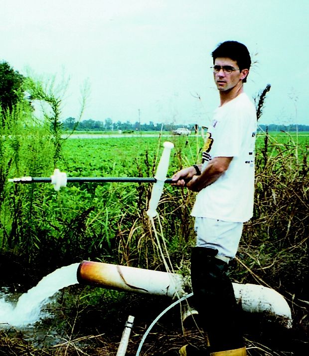
SUMMARY OF MAJOR FINDINGS

Stream and River Highlights                                                                     IL
                                                                           MO                        KY
   The climate, rainfall, soil type, and surficial geology
of the Mississippi Embayment (MISE) Study Unit                                                       TN

                                                                                           r
                                                                                               Memphis
strongly influence land use in the basin and subse-

                                                                                        ive
                                                                                   pi R
quently influence water quality. About 62 percent of                 AR

                                                                                  sip
                                                                                 ssis
                                                                             Mi
the Study Unit is used for agriculture. In areas of
                                                                                                     AL
intensive row-crop production, as much as 90 percent
of the land is used for agriculture. This influence from                                   MS
agricultural land use, with additional contributions                   LA
from urban areas, has resulted in streams that often
have high turbidities, mixtures of pesticides, and
degraded riparian habitat. Biological communities in
the streams commonly are stressed. However, human
activities on the Earth’s surface seem to have a limited
effect on the ground-water resources, which supply the
vast majority of the region’s drinking water.
• Herbicides frequently were detected in streams draining
  agricultural or mixed land-use basins; insecticides were
                                                                      0          30      60 MILES
  detected less often. Pesticides in over 60 percent of sam-
                                                                      0     30     60 KILOMETERS
  ples collected from these streams exceeded aquatic-life
                                                                                                                       EXPLANATION
  guidelines. Insecticides frequently were detected in sam-                                                               Land use
  ples from the urban stream; diazinon and chlorpyrifos                                                                     Surface water
  were detected in every sample, usually in concentrations                                                                  Urban
  above aquatic-life guidelines.                                                                                            Forest
                                                                                                                            Agricultural
• Nitrogen concentrations in the MISE generally were in                                                                    MISE boundary
  the middle range of the national data, whereas total phos-
  phorus concentrations were in the 67th to 93d percentile.
                                                                   The Mississippi Embayment (MISE) Study Unit is an
  The phosphorus concentrations in the Study Unit probably
                                                                   approximately 49,800-square-mile area in the six States of
  were related to many factors, such as rainfall amounts,
                                                                   Arkansas, Kentucky, Louisiana, Mississippi, Missouri, and
  soils, and artificial drainage of agricultural fields. No sam-   Tennessee. Land use in the MISE is principally agricultural.
  ple exceeded the guidelines and standards for nitrate or         Approximately 62 percent of the study area is agricultural, 33
  ammonia, but most exceeded the U.S. Environmental Pro-           percent is forested, and 5 percent represents other land uses. The
  tection Agency’s (USEPA) goal of 0.1 mg/L (milligram             land use in some of the smaller drainage basins sampled is
  per liter) of phosphorus for the prevention of plant nui-        greater than 90 percent agricultural.
  sances in streams.
                                                                          communities in most of the streams were dominated by
• Although the sale of the organochlorine insecticide DDT                 fish tolerant of poor water quality conditions. The aquatic
  was discontinued in 1972, DDT and metabolites (chemi-                   insects and algal communities generally were tolerant of
  cals resulting from the breakdown of DDT) were wide-                    turbid, silty conditions.
  spread within the MISE. DDT, or one of its metabolites,             • Methyl parathion, a metabolite of DDT, and several other
  was found in every fish tissue sample collected and was
                                                                       pesticides were detected in air and rain samples collected
  found in 67 percent of the streambed-sediment samples.
                                                                       in an agricultural area and in the urban area of Jackson,
  Detectable levels of a metabolite of DDT were measured
                                                                       Mississippi.
  in 14 percent of surface-water samples.
• Although volatile and semivolatile organic compounds               Major Influences on Streams and Rivers
  often were detected in urban stream water and in bed sedi-         • Runoff from agricultural and urban areas
  ment, they were rarely at levels of concern.
                                                                     • Drainage modifications and channelization of
• Aquatic organisms present in the MISE streams were typi-             streams
  cal of those found in impacted or degraded streams. Fish           • Modification or elimination of riparian habitat

                                                                                                          Summary of Major Findings         1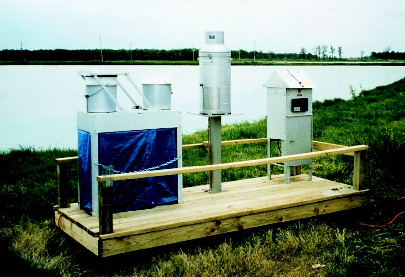
Selected Stream-Quality Indicators                           Bentazon, molinate, and fluometuron were the pesticides
                                      Small Streams                       Major Rivers      most frequently detected in the alluvial aquifer. Atrazine
                                         Agricul-                          Mixed            and dieldrin were detected one time each in shallow
                          Urban           tural       Undeveloped        Land Uses          urban wells at levels above the drinking-water standards
                                                                                            and guidelines.
                      1
        Pesticides
                                                                                          • Nutrient concentrations in the ground water in the MISE
        Total                                                                               generally were low. All nitrate concentrations were
                   2
        phosphorus                                                                          below the USEPA drinking-water standard of 10 mg/L.
        Nitrate3                                                                          • Radon is naturally occurring and was detected in almost
                                                                                            every well sampled. Concentrations above the USEPA-
        Trace
                4
                                                                                            proposed drinking water standard of 300 picocuries per
        elements
                                                                                            liter were found in water from only 16 of 109 wells.
        Organo-
                  5
                                                                                            These levels are low, relative to levels detected in other
        chlorines
                                                                                            NAWQA Study Units.
        Volatile
        organics
                 6                                                                        • Volatile organic compounds (VOCs) were detected in
                                                                                            ground water throughout the Study Unit; however, con-
        Semivolatile
        organics
                 7                                                                          centrations were well within drinking-water standards.
                                                                                            The most frequently detected VOCs were 1,2,4-tri-
                                                                                            methylbenzene and carbon disulfide.
                Percentage of samples with concentrations equal to or
                greater than a health-related national guideline for drinking
                water, aquatic life, or water-contact recreation; or above a              Major Influences on Ground Water
                national goal for preventing excess algal growth
                                                                                          • Ground water is commonly protected from surface
                Percentage of samples with concentrations less than a
                health-related national guideline for drinking water, aquatic               activities by thick, regional clay layers.
                life or water-contact recreation; or below a national goal
                for preventing excess algal growth                                                           Selected Ground-Water Quality Indicators
                Not assessed
                                                                                                             Shallow Ground Water                         Supply Wells
    1
      Insecticides, herbicides, and pesticide metabolites, sampled in water.
    2
      Total phosphorus, sampled in water.                                                                    Urban          Agricultural           Domestic            Public
    3
      Nitrate (as nitrogen), sampled in water.
    4
      Arsenic, mercury, and metals sampled in sediment.
    5
      DDT and PCBs sampled in fish tissue.
                                                                                                        1
    6
      Solvents, refrigerants, fumigants, and gasoline compounds sampled in water.          Pesticides
    7
     By-products of fossil-fuel combustion; components of coal and crude oil sampled in
     sediment.

                                                                                           Nitrate2
Ground-Water Highlights
   Ground-water quality in the Mississippi Embayment                                       Radon
Study Unit generally is very good. Ground water in the
deep Tertiary aquifers, which supply most of the                                           Volatile
region’s drinking water, generally is isolated from sur-                                   organics3

face activities by thick “confining layers” of clays. Sur-
face activities influence ground water where shallow
                                                                                                   Percentage of samples with concentrations equal to or greater
deposits cover the hills in the eastern part of the Study                                          than a health-related national guideline for drinking water,
Unit and in the Memphis shallow aquifers more than in                                              aquatic life, or water-contact recreation; or above a national
                                                                                                   goal for preventing excess algal growth
the deeper aquifers. The abundant ground water in the
                                                                                                   Percentage of samples with concentrations less than a
alluvial aquifer of the Mississippi River valley is near                                           health-related national guideline for drinking water, aquatic
the land surface but is covered by dense clays.                                                    life or water-contact recreation; or above a national goal
                                                                                                   for preventing excess algal growth
                                                                                                   Percentage of samples with no detection
• Pesticides, such as atrazine, simazine, and metolachlor,
  were detected most frequently in the ground water in the                                         Not assessed
  shallow deposits that cover the hills in the eastern part of                            1
                                                                                          2
                                                                                            Insecticides, herbicides, and pesticide metabolites,   sampled in water.
                                                                                            Nitrate (as nitrogen), sampled in water.
  the Study Unit and in ground water underlying urban areas.                              3
                                                                                           Solvents, refrigerants, fumigants, and gasoline compounds sampled in water.

2         Water Quality in the Mississippi Embayment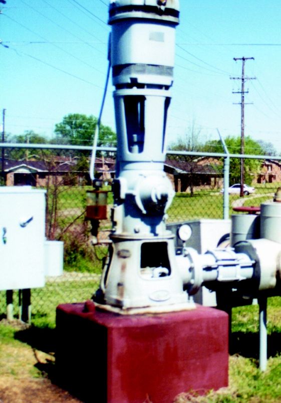
INTRODUCTION TO THE MISSISSIPPI EMBAYMENT

   In 1821, while painting a pere-
grine falcon, John James Audubon
described the Yazoo River, the
largest river wholly contained
within the Mississippi Embayment
Study Unit, as “a beautiful stream
of transparent water, covered by
thousands of geese and ducks and
filled with fish” (Smith, 1954).
Since that time, the bottomland
hardwood forests that covered the
Mississippi River Alluvial Plain
have been cleared for agricultural
use of the rich alluvial soils for the           John James Audubon’s painting of the peregrine falcon that he
production of cotton, soybeans,                  worked on while visiting the Yazoo River area in 1821.
rice, and corn. This clearing of the             (Reprinted courtesy of the National Audubon Society.)
land has exposed the fine alluvial
soils to erosion. Over time, the          the related ecoregions defined by              the Gulf Coastal Plains physio-
clays, along with nutrients and           Omernik in 1987 (fig. 1).                      graphic province, which includes
agricultural chemicals sorbed to the          About 57 percent of the MISE               the area identified as the Missis-
clay surfaces, were washed into the       Study Unit lies within the Missis-             sippi Valley Loess Plains and
rivers and streams, thus greatly          sippi Alluvial Plain physiographic             Southeastern Plains ecoregions
changing the water quality of the         province and ecoregion. This area              (fig. 1). The Gulf Coastal Plains are
area.                                     has been dominated by the flow                 separated from the eastern edge of
                                          and flooding of the Mississippi                the Mississippi Alluvial Plain by
Physiography and                          River during the past 2 million                the Loess Hills, which extend most
Ecoregions                                years or more. The Mississippi                 of the length of the Study Unit.
   Within the Mississippi Embay-          Alluvial Plain is an area of little            These hills are made of wind-
ment (MISE) Study Unit, the surfi-        topographic relief with an average             blown silts, rise a few hundred feet
cial geology is the underlying            slope of about 0.5 foot per mile               above the Mississippi Alluvial
controlling factor for the physio-        toward the Gulf of Mexico. One of              Plain, and average about 15 miles
graphy, land use, biological com-         the distinct features of the alluvial          in width. The remaining part of the
munities, and water quality of the        plain is the formation of natural              Gulf Coastal Plains uplands and
area. Therefore, the areas defined        levees along the banks of the riv-             Southeastern Plains ecoregion gen-
as physiographic regions (Fenne-          ers, and the associated backswamp              erally is rolling to hilly with low to
man, 1938) strongly correspond to         deposits that are dominated by                 moderate topographic relief. The
                                          dense alluvial clays and historically          soils are composed, in part, of silts
                                          have supported extensive wetland               and are more permeable than the
                                          areas. These clays have created low            alluvial clays; there are indications
                                          permeability soils, which limit the            that this allows for the downward
                                          ability of rainwater to infiltrate the         infiltration of precipitation. This
                                          ground surface and may cause run-              may partly protect the streams and
                                          off from agricultural fields to rap-           rivers from compounds carried in
                                          idly enter rivers and streams. These           runoff but may make the ground
                                          clays also seem to limit the suscep-           water slightly more susceptible to
                                          tibility of the ground water to sur-           surface contamination. These
                                          face activities in intense agricul-            coarser soils on steeper slopes are
Much of the Mississippi Embayment
Study Unit was bottomland hardwood        tural areas.                                   more erodible than alluvial soils,
forests and wetlands well into the 20th      Thirty-five percent of the                  and large amounts of soil from the
century.                                  remainder of the Study Unit lies in            Gulf Coastal Plains uplands have

                                                                        Introduction to the Mississippi Embayment            3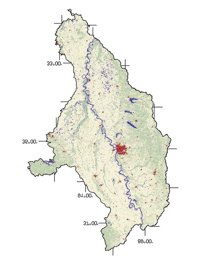
eroded into the Mississippi Allu-            sippi Embayment, a geologic struc-                                                    ier (1994) suggested that the Prairie
vial Plain.                                  tural trough in which the under-                                                      Complex was deposited between
   In the west, the Study Unit abuts         lying crust of the Earth forms a                                                      about 120,000 years ago and the
small areas of the Ozark High-               deep valley. Large rivers, such as                                                    time of the greatest extent of the
lands. Limited sampling was done             the Mississippi, Arkansas, and                                                        last glacier, about 18,000 years
in these areas during this project.          Ohio Rivers, have flowed through                                                      ago. The Pleistocene valley trains
   The land surface generally                this region, carved the surface, and                                                  were mostly deposited during two
slopes toward the Mississippi River          deposited clay, silt, sand, and                                                       time periods, between about 60,000
from both the eastern and western            gravel, collectively called allu-                                                     and 25,000 years ago and during
sides of the Study Unit and to the           vium. During the past 2 million                                                       the waning phase of the latest gla-
south toward the Gulf of Mexico.             years, up to 300 feet of alluvium                                                     cial period between 18,000 and
Thus, nearly all of the activities in        has filled this valley. The alluvium                                                  10,000 years ago. Glacial outwash
this Study Unit that influence water         can be grouped into three major                                                       (melting) flowing from north to
quality ultimately influence the             units: the Pleistocene Prairie Com-                                                   south provided enough energy to
water quality of the Mississippi             plex, Pleistocene valley trains, and                                                  cause a braided stream depositional
River and the Gulf of Mexico.                the Holocene alluvium (see fig. 7                                                     environment to form in the Lower
                                             for map; Autin and others, 1991;                                                      Mississippi River Valley during
Geology                                      Saucier, 1994).                                                                       this time. By about 9,000 years
   The Mississippi Alluvial Plain is            The Prairie Complex is older                                                       ago, the rate of glacial outwash in
in the northern part of the Missis-          than the Pleistocene valley trains                                                    the Lower Mississippi River Valley
                                             and the Holocene alluvium. Sauc-                                                      declined, and valley train deposi-

                                                     Ozark
                                                   Highlands
                                                   Ecoregion                                                                    Mississippi Valley
                                                                                                                                  Loess Plains
                                                                                                                                   Ecoregion
                                                                                                                                                             Gulf
                                                                                       R                                                                 Coastal Plains
                                                                                                                                                         Physiographic
                                                                                                     is
                                                                                            St. Franc

                                                                                                                                                           Province
                                                                                               r
                                                                                           i ve

                                                                                                                                  Southeastern
                                                                                       pi R

                                                                                                                                 Plains Ecoregion
                                                                                 issip

During much of the growing season,                                                                        Memphis
                                                                            Miss

rice crops are flooded with water
                                                             W hite R

withdrawn from the alluvial aquifer.
                                                                  ive
                                                                        r
                                                    Arka
                                                           nsa
                                                                 sR
                                                                               Yaz
                                                                                  ooRiver

                                                      Vicksburg

                                                                                                       Mississippi Alluvial
                                                                                                                                              Ground water is used to maintain
Cotton is still “king” in many areas of                                                          Plain Physiographic Province                 more than 100,000 acres of catfish
                                                                                                        and Ecoregion
the Mississippi Embayment. Cotton                                                                                                             ponds in the MISE Study Unit.
requires extensive use of agricultural
chemicals for successful cultivation.

Figure 1. Boundaries for Fenneman’s (1938) physiographic regions are very similar to Omernik’s Level III ecoregions (1987), at
least in part because the surficial geology is a controlling factor in the MISE Study Unit. The only major metropolitan area in the
Study Unit is Memphis, Tennessee. The area has many rivers, as well as several large river systems, including the Yazoo and
St. Francis Rivers and parts of the White and Arkansas Rivers. Major crops include soybeans, cotton, rice, and corn. Catfish
farms are a major component of the landscape as well as a principal user of ground water.

4       Water Quality in the Mississippi Embayment
tion ceased. The braided stream
depositional process of the Pleis-
tocene epoch was replaced by the
lower energy meander stream de-
positional process of the Holocene
epoch near major rivers, such as
the Mississippi and Arkansas Riv-
ers. (See fig. 2 for more explana-
tion.) Autin and others (1991)
reported that the depositional tran-
sition from Pleistocene valley Figure 2. Although the photograph on the left was recently taken of a stream in the
trains (braided streams) to Western United States, its braided condition is representative of what streams in the
Holocene alluvium (meander Mississippi Valley may have looked like during the Pleistocene geologic period.
streams) started near Baton Rouge, These high-energy systems allow sand and gravel carried by the stream to be depos-
Louisiana, around 12,000 years ago ited in the flood plain. The photograph on the right depicts a classic meandering
stream. Streams like this are low-energy systems and primarily deposit clay, silt, and
and migrated northward to near fine sand in the flood plains adjacent to the streams. This depositional pattern is
Cairo, Illinois, by 9,000 years ago. present today and has been the dominant form of deposition in the Lower Mississippi
The Pleistocene valley train River Valley during the last 9,000 to 12,000 years. These differences in depositional
deposits generally have a coarser environments appear to influence the chemistry of the ground water, the bioaccumu-
grain size than the Holocene allu- lation of pesticides, and biological communities.
vium. Also, water well drillers’
The natural regional flow of in the deep Tertiary aquifers has
logs indicate that the clay and silt
ground water in the Mississippi caused recharge rates to increase in
layer near the surface is thicker in
Embayment in the Tertiary aquifers the outcrop and production areas of
the Holocene alluvium, whereas
the underlying sand and gravel is from the outcrop areas in the the aquifer (Williamson and others,
layer (alluvial aquifer) is thicker in upper Gulf Coastal Plain, laterally 1990).
the Pleistocene valley train depos- along the aquifers toward the
its. embayment axis, and then upward Alluvial Aquifers
through overlying confining units
Hydrogeology and aquifers to the surface of the The Mississippi River confining
Mississippi Alluvial Plain (Grubb, unit is composed of the upper silt
Two principal aquifer systems
provide drinking-water supplies in 1986; Ackerman, 1989). Pumping and clay of the Quaternary allu-
the Mississippi Embayment—the
Tertiary and the alluvial aquifers
(fig. 3).
Tertiary Aquifers
The geologic groups associated
with the deep Tertiary aquifers are
the Midway, Wilcox, Claiborne,
and the Jackson groups. The deep
Tertiary aquifers sampled in this
study are thick sand deposits within
the Wilcox and Claiborne groups.
The names of the aquifers, from
youngest to oldest, include the
Cockfield, Sparta, Winona-
Tallahatta, Memphis, Meridian- Figure 3. Generalized geohydrologic section of the Mississippi River alluvial aquifer
upper Wilcox, and Wilcox. and underlying Tertiary aquifers (from Arthur, 1994).
Introduction to the Mississippi Embayment 525
summer, when the evapotranspira-
tion rate is higher than the precipi-
tation rate. These conditions also
20
result in streams which flood rap-
idly, remain at high levels for long
STAGE, IN FEET
15
periods of time, and have low
flows in the fall (fig. 4).
10
Water Use
5 In general, about three times as
much ground water is used com-
0 pared to surface water in the MISE
O N D J F M A M J J A S O N D J F M A M J J A S O N D J F M A M J J A S
1996 1997 1998
Study Unit (fig. 5). During the
1995
summer months, both ground and
Figure 4. This hydrograph is representative of streams in the Mississippi Alluvial surface water are used for irrigating
Plain. Often streams in this Study Unit flood rapidly, remain at high levels for long crops. Most (in excess of 7 billion
periods, and have very low streamflows in the fall. During the years of this project,
1996 was drier than usual, and 1997 and 1998 were wetter than usual. gallons per day) of the irrigation
water is withdrawn from the allu-
vium, whereas the Mississippi frosts, which influences the types vial aquifer. This aquifer is also
River alluvial aquifer is composed of crops that can be grown and the used for domestic drinking water,
of the lower sand and gravel of the amount of pesticides that generally aquaculture (primarily for catfish
Quaternary alluvium (Boswell and are applied. Mean annual precipita- ponds), power production, and
others, 1968; Ackerman, 1989). tion ranges from about 48 inches other commercial and industrial
Overlying silt and clay of the con- per year in the northern part of the needs. Ground water, primarily
fining unit impedes recharge into Study Unit to 56 inches per year in from the Tertiary aquifers, is used
the alluvial aquifer. Confining unit the southern part. Precipitation for public supply. The principal use
thickness generally ranges from 10 generally is greatest in April and of surface water is for power pro-
to 50 feet and generally increases least in October but is distributed duction where it is used for cooling
from north to south within the fairly evenly throughout the year. water for electric power genera-
MISE Study Unit. The thickness of This causes minor drought condi- tion. The second largest use of sur-
the alluvial aquifer ranges from 60 tions to occur frequently during the face water is for irrigation.
to 140 feet. Wells screened in the
alluvial aquifer typically yield
EXPLANATION
between 1,000 and 2,000 gallons Aquaculture
per minute (Whitfield, 1975). Prior Publicsupply/Domestic
to development, ground-water flow Irrigation
6,593.14 Power production*
is believed to have been generally Commercial/Industrial
from the older adjacent and under-
lying aquifers toward the alluvial 1,400.78
aquifer (Williamson and others,
5.86*
1990). 157.32
445.42 596.51 60.7
926.2 27.25 85.56
Climate
Climate in the MISE Study Unit Ground-water use in the Surface-water use in the
varies from humid, temperate in MISE Study Unit in 1995 MISE Study Unit in 1995
(Values given in millions of gallons per day)
the northern part to humid, sub- (Values given in millions of gallons per day)
tropical in the southern part. This Figure 5. Ground-water use in the Mississippi Embayment (MISE) Study Unit is
warm climate results in a long dominated by irrigation usage. Surface water is also used for irrigation, but more is
growing season and few killing used for cooling water for electrical power production.
6 Water Quality in the Mississippi EmbaymentMAJOR FINDINGS
Nutrient Contributions to the
Mississippi River System
Although nitrogen and phospho-
rus, as well as silica and other
nutrients, are natural and impor-
tant parts of a healthy ecosystem,
severe water-quality problems can
arise if an ecosystem becomes
enriched, or overloaded, with nutri-
ents. In recent years, scientists have
become aware of a large area of
low dissolved oxygen that develops
off the coast of Louisiana and
Texas each summer. The extent and
duration of this area of low dis-
solved oxygen has been related to The Yazoo River, the river with the largest drainage area wholly contained in the
the amount of nutrients, especially Mississippi Embayment Study Unit, enters the Mississippi River just north of these
bridges at Vicksburg, Mississippi.
nitrogen, and freshwater flowing
from the Mississippi River into the
Gulf of Mexico (Goolsby and oth- stream-sampling sites in the MISE streams located in the Gulf Plains
ers, 1999). The proximity of the Study Unit. Nitrate concentrations exceeded the recommended goal of
MISE Study Unit to the Gulf and never exceeded the drinking-water 0.1 mg/L or less total phosphorus
the use of nitrogen fertilizer in the standard of 10 mg/L in any sample, in less than 50 percent of the sam-
agricultural areas of the Study and ammonia concentrations did ples.
Unit, especially the Yazoo River not exceed aquatic-life guidelines.
Comparison of Nitrogen and
Basin, have led to speculation that However, the USEPA goal of 0.1
Phosphorus in Streams in the
the surface waters of the Study mg/L or less total phosphorus for
Mississippi River Basin
Unit may be contributing a dispro- streams not entering reservoirs was
portionate amount of nitrogen and exceeded in every sample from the The yield of nitrogen (mass per
phosphorus to the Mississippi urban stream and in more than 50 unit area), from streams in the
River and ultimately to the Gulf of percent of the samples from five MISE Study Unit during 1995–96
Mexico. streams located in the Mississippi was compared to the average yield
In the MISE Study Unit investi- Alluvial Plain. Samples from the during 1980–96 from streams in
gations have shown that concentra-
Table 1. Concentrations of nutrients near the mouth of the Yazoo River compared to
tions of nutrients (except total the Mississippi River at Vicksburg, Mississippi.
phosphorus) are higher in the Mis-
[Concentrations are in milligrams per liter]
sissippi River at Vicksburg, Missis-
sippi than near the mouth of the Constituent Site Year Maximum Minimum Mean
Yazoo River (table 1). The annual
load of nitrogen and phosphorus Total nitrogen Yazoo River 1996–97 3.3 0.57 1.3
from the Yazoo River for the 1996– Mississippi River 1984–93 3.8 1.1 2.3
97 calendar years, while signifi-
Nitrate as N Yazoo River 1996–97 1.2 0.16 0.45
cant, was only a small percentage
of the load carried by the Missis- Mississippi River 1984–93 2.7 0.70 1.5
sippi River (Coupe, 1998). Total phosphorus Yazoo River 1996–97 0.89 0.12 0.26
Water-Quality Standards Mississippi River 1984–93 0.38 0.04 0.16
Concentrations of nitrogen and Orthophosphate as P Yazoo River 1996–97 0.10 0.01 0.043
phosphorus were measured from
Mississippi River 1984–93 0.13 0.02 0.058
weekly to at least monthly at nine
Major Findings 7National Comparison of Total Nitrogen in Streams
Urban Areas
Nitrogen is a natural and important component of a
healthy stream; however, too much nitrogen can lead to
degraded stream-water quality, affecting both the aqua-
tic ecosystem and its use as a recreational or drinking-
water source for humans. The sources of nitrogen in
surface water are many and include atmospheric depo-
sition, municipal and industrial wastewater, and fixation
of nitrogen from the atmosphere by plants and some
species of algae.
By far, the biggest source of nitrogen in an agricultural
setting, such as the Mississippi Embayment (MISE)
Study Unit, is from the application of fertilizer to crops.
Mississippi For most of the Study Unit, the average annual total ni-
Embayment trogen input from fertilizer, manure, and the atmosphere
combined is greater than 25 pounds per acre. Most of
the agriculturally productive Midwest receives the same
Mixed Land-Use Areas amount.
The average annual concentration of total nitrogen from
agricultural and mixed land-use streams in the MISE
Study Unit is in the medium range, whereas nationally,
most streams that drain areas with greater than 25
pounds per acre of nitrogen input are in the high range.
The lower concentrations of total nitrogen in the MISE
Study Unit may be due to the milder climate that in-
creases microbial activity in the winter and to the in-
creased uptake of nitrogen by vegetation during the
longer growing season.
Nationally, the average annual total nitrogen concentra-
tions in urban streams, including the one urban site in
the Mississippi Embayment Study Unit, tend to fall into
the “medium” classification.
Agricultural Areas
EXPLANATION
8 Water Quality in the Mississippi Embaymentthe Mississippi River Basin. These the flow-weighted mean total phos- Unit is composed of fine, clay-
data indicate that the yield of nitro- phorus concentration generally was sized particles to which phosphorus
gen from the MISE Study Unit was quite high (67th to 93d). Again, the can sorb. Heavy rainfalls in the
less than the average yield from exception was the smallest mixed Study Unit increase the potential
streams in intensive agricultural land-use site, where the mean total for erosion and the movement of
areas of the Midwest, but more phosphorus concentration was near these fine clay-sized particles from
than from streams in the drier West the 40th percentile. These high agricultural fields into the streams.
or in the less agricultural Upper phosphorus yields were somewhat Additionally, because of the large
Mississippi River Basin. The flow- unexpected, as the soils in the amount of rain, the tight clays that
weighted mean total nitrogen con- MISE Study Unit, while fertile, do decrease infiltration of water, and
centrations for streams in the MISE not contain excessive amounts of the relatively flat terrain, much of
Study Unit were generally in the phosphorus. Also, phosphorus is the Study Unit has artificial drain-
50th to 60th percentile for all data used less as a fertilizer in the MISE age to expedite the movement of
collected in the national NAWQA Study Unit than in many parts of water. Most of this artificial drain-
Program (372 steam sites). The the Midwest (Battaglin and age is surface drainage, which has
exception was the mean nitrogen Goolsby, 1995), and due to the been shown to decrease nitrate con-
concentration at the smallest mixed rural nature of the MISE, there are centrations but to increase total
land-use site which was near the few significant point sources. One phosphorus concentrations.
20th percentile, nationally. hypothesis for the high yields and
The Effects of Land Use and
The yields of total phosphorus concentrations of phosphorus in the
Geology on Nutrient
generally were higher in the MISE MISE involves a combination of
Concen3rations and Yields
Study Unit than from most other factors, such as soils, rainfall, and
areas in the Mississippi River agricultural drainage. The sediment Generally, total nitrogen and
Basin, and the percentile ranking of in the rivers of the MISE Study phosphorus concentrations and
yields were higher in streams with
predominantly agricultural land use
Nutrient Yields from MISE Watersheds in the Mississippi Alluvial Plain,
1.0 but the highest nutrient concentra-
tions and yields were from the
0.9
urban stream. However, one stream
IN TONS PER SQUARE MILE
0.8 located in the Gulf Plains in an area
TOTAL PHOSPHORUS,
0.7
with no urban land use and only a
moderate amount of agricultural
0.6
land use had comparatively high
0.5 total nitrogen and phosphorus
Basins yields. The high yields in this
0.4
Mississippi Embayment stream are reflective of the steep
0.3 Upper Mississippi topography of the area and chan-
Mid Mississippi
0.2 Lower Mississippi
nelization of the stream for flood-
Missouri control purposes.
0.1 Ohio
More details on nutrients in the Yazoo
0
River can be found in the report:
WATERSHEDS WITHIN MISSISSIPPI RIVER VALLEY BASINS
Coupe, R.H., 1998, Concentrations and
Phosphorus yields from watersheds within the MISE Study Unit were the highest in
loads of nitrogen and phosphorus in the
the Mississippi River Basin (represented by the dark green bars). These high Yazoo River, northwestern Mississippi,
phosphorus yields probably are related to several factors such as soils, amounts of 1996–97: U.S. Geological Survey Water-
rainfall, and artificial drainage of agricultural fields. In contrast, total nitrogen yields Resources Investigations Report 98–4219,
in streams in the Mississippi Embayment were less than those from the 17 p.
agriculturally productive Midwest, but more than those in the drier western part of
the basin or the cooler Upper Mississippi River Basin, and about the same as The report also can be downloaded at:
http://ms.water.usgs.gov/misenawqa//
streams in the Ohio River Basin. (Data from Goolsby and others, 1999.)
Major Findings 9Pesticides Commonly Found
in Mississippi Embayment
Surface Water
The occurrence and temporal
distribution of more than 80 pesti-
cides and pesticide metabolites
were determined at five stream-
sampling sites from 1996 to 1998
in the MISE Study Unit. More than
230 stream samples were collected
and analyzed. The five rivers sam-
pled included three rivers with
small, primarily agricultural water-
sheds; one river with a small, urban
watershed; and one large river (the
Yazoo River) with mixed land use
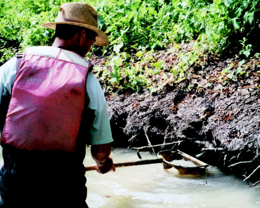
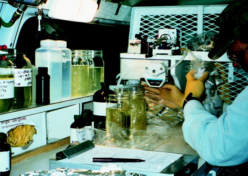
Water samples are filtered and processed in a mobile laboratory
(row-crop agriculture, forest, pas-
immediately after sample collection.
ture, and a small amount of urban).
Pesticides, usually herbicides, fre- showed distinct seasonal patterns rice) with later planting dates, or
quently were detected in water that corresponded to the type of herbicides that are used after the
samples from all five rivers sam- crops grown in the basin and the crop has emerged from the ground,
pled. Aquatic-life guidelines were use of pesticides on those crops. such as fluometuron and molinate,
frequently exceeded in the urban For instance, the highest concentra-
stream and occasionally exceeded were detected later in the growing
tion of the pre-emergent herbicide
in all of the rivers sampled in the season (June–July). The concentra-
atrazine frequently was found early
MISE Study Unit. tions of most of these herbicides
in the growing season (April-May)
corresponding to its application were well below any acute toxicity;
Agricultural Streams prior to the planting of corn and however, the long-term effects of
The pesticides detected in the grain sorghum (fig. 6). The highest chronic exposure to low levels of
rivers that drain the agricultural concentrations of herbicides that multiple herbicides are not well
watersheds in the MISE Study Unit are used on other crops (cotton and known.
60 60
Agricultural Stream Urban Stream
EXPLANATION
50 50
MEAN MONTHLY CONCENTRATION,
Pesticide
IN MICROGRAMS PER LITER
Other
FEB. 1996 - JAN. 1998
40 40
Simazine
Norflurazon
30
Molinate
30
Metolachlor
Fluometuron
20 20 Cyanazine
Atrazine
2,4-D
10 10
0 0
J F M A M J J A S O N D J F M A M J J A S O N D
MONTH MONTH
Figure 6. Herbicides in agricultural streams in the Mississippi Embayment Study Unit had higher concentrations, showed clear
seasonal patterns, and contained different compounds than herbicides in urban streams. The urban stream samples were dom-
inated by simazine, a turf grass herbicide. Concentrations of herbicides in the urban stream remained fairly constant throughout
the year, whereas agricultural sites had concentrations that peaked in the spring shortly after application. Agricultural sites also
were dominated by different herbicides (in this case atrazine).
10 Water Quality in the Mississippi EmbaymentUrban Stream
Pesticides in Streams Across the United States The type, amounts, and timing of
the occurrence of pesticides in the
stream draining an urban watershed
100
Agricultural Land Use
are much different from those in
National Data the agricultural streams (fig. 6).
80 MISE Data The herbicides most frequently
60 occurring in the urban stream such
as atrazine, 2,4–D, simazine, and
40
prometon, are those used in lawn
20 care and in the maintenance of
FREQUENCY OF DETECTION
0
rights-of-way. The urban stream
was also the only stream with fre-
quent occurrences of insecticides:
100
Urban Land Use
chlorpyrifos and diazinon were
detected in every urban stream
80
sample collected and exceeded the
60 aquatic-life guidelines in 12 of 25
40
and 24 of 25 samples, respectively.
20
0
100
Mixed Land Use
80
60
40
Many pesticides are applied by aircraft
20 in the Study Unit.
0
DDT Metabolites in Surface Water
Atrazine
Metolachlor
Cyanazine
Fluometuron
Deethylatrazine
Alachlor
Molinate
EPTC
Simazine
Prometon
2, 4-D
Diuron
Tebuthiuron
Chlorpyrifos
Diazinon
Malathion
Carbaryl
Methyl Parathion
Although DDT strongly sorbs to
sediments rather than readily dis-
AGRICULTURAL URBAN
solving in water, detectable levels
HERBICIDES HERBICIDES INSECTICIDES of DDE, a metabolite of DDT, were
found in 14 percent of the filtered
This diagram shows the top 15 pesticides most frequently detected in surface stream-water samples analyzed.
water at NAWQA Study Units throughout the United States and detections in
surface water of the Mississippi Embayment (MISE Study Unit). Three pesti- More details on pesticides in streams
cides used heavily in the Study Unit—fluometuron, methyl parathion, and mo-
in the MISE can be found in the report:
linate—but not used extensively throughout the United States, also are
included for comparison. Few areas of the United States are as suited to ag- Coupe, R.H., 2000, Occurrence of
riculture as the Mississippi River Alluvial Plain in the MISE Study Unit. The pesticides in five rivers of the Mississippi
combination of rich alluvial soils; a long, hot, growing season; flat terrain; and Embayment Study Unit, 1996–98: U.S.
plentiful rainfall make agriculture the dominant economic force in the Study Geological Survey Water-Resources
Unit. These same conditions also increase the weed and insect pressure and Investigations Report 99–4159, 69 p.
subsequently lead to an intensive use of pesticides to encourage profitable
farming. In general, the frequency of detection of pesticides in surface waters The report also can be downloaded at:
of the MISE Study Unit exceed the national average. http://ms.water.usgs.gov/misenawqa/
Major Findings 11Tertiary Aquifers Have High- range in depth from 208 to 1,460
Quality Drinking Water feet below the ground surface.
During the spring of 1996, water
Sample Results
samples were collected from 30
public-supply wells in the deep Water from wells in the deep
Tertiary aquifers in the MISE Tertiary aquifers had low nutrient
Study Unit. The most significant concentrations. The highest nutri-
finding from this part of the study ent concentration measured in a
is that all of the samples analyzed sample was 3.8 mg/L of nitrite plus
from these public-supply wells met nitrate nitrogen, which is less than
all existing drinking-water stan- half the drinking-water guideline of
dards and guidelines. Concentra- 10 mg/L. Pesticides were detected
tions of most of the constituents in water from only one of the wells.
measured that could adversely Water from the shallowest well
affect water quality, including sampled had a 0.16-µg/L (micro- Ground-water sample preparation
occurred inside plastic enclosures in
nutrients, pesticides, radon, and gram per liter) concentration of the order to minimize sample
volatile organic compounds, were herbicide bromacil and a 0.004- contamination from chemicals in the
below drinking-water standards µg/L concentration of deethylatra- atmosphere.
and guidelines. zine, a metabolite of the herbicide
atrazine. Volatile organic com- Few Pesticides Detected in
The Deep Tertiary Aquifers pounds (VOCs) are compounds
Memphis Shallow Aquifers
The deep Tertiary aquifers that have a high vapor pressure rel- In addition to the Tertiary aqui-
underlie about 80 percent of the ative to their water solubility and fers, 32 shallow monitoring wells
MISE Study Unit. Much of the include such things as components (not public-supply, drinking-water
population in this part of the coun- of gasoline and organic solvents. wells) were sampled in the shallow
try depends on these aquifers for VOCs were detected frequently in aquifers near Memphis, Tennes-
drinking water. Wells sampled the MISE, but concentrations were see. Results were similar to those
far below drinking-water guide- from the deep Tertiary aquifer
lines. Samples from 26 of the 30 study except that pesticides were
public-supply wells had at least one more frequently detected and radon
VOC detection. The VOCs most concentrations were higher. An
commonly detected were methyl- atrazine concentration of 3.14 µg/L
ethylketone and 1,2,4-trimethyl- was measured in one well, which
benzene, detected in 23 and 7 narrowly exceeded the drinking-
percent of the wells, respectively. water guideline of 3.0 µg/L, and
Nutrients, pesticides, and VOCs dieldrin was measured above the
generally enter the ground water drinking-water guideline of 0.02
from surface contamination; how- µg/L in another well.
ever, public-supply wells were gen-
erally deep enough to avoid More details on ground-water quality
elevated levels of these com- in the deep Tertiary aquifers can be
pounds. found in the report:
Radon in water from the public- Gonthier, G.J., 2000, Water quality in the
supply wells ranged from 54 to 270 deep Tertiary aquifers of the Mississippi
picocuries per liter; none exceeded Embayment, 1996: U.S. Geological Survey
Water-Resources Investigations Report
guidelines. Radon levels found in 99–4131, 91 p.
Ground-water samples commonly were
collected from municipal drinking-water
the ground water in the MISE were
facilities, such as the one pictured the second lowest of the 16 Study The report also can be downloaded at:
above. Units sampled during 1996–98. http://ms.water.usgs.gov/misenawqa/
12 Water Quality in the Mississippi EmbaymentWater-Quality Differences in ground water in the alluvial aqui-
Geological Subunits of the fer.
Alluvial Aquifer
The Alluvial Aquifer
Previous researchers have stud-
ied the alluvial aquifer as a single The alluvial aquifer is a large,
Quaternary feature (Grubb, 1986; underground, water-bearing layer
Ackerman, 1989). However, during of sand and gravel in the Lower
this NAWQA investigation, the Mississippi River Valley (fig. 7).
results of the water-chemistry stud- Water use from the alluvial aquifer
ies were examined by dividing the is enormous; pumpage from the
area into different major geologic aquifer is about 7 billion gallons
units, two of which are the Pleis- per day (Mesko and others, 1990).
tocene valley trains and the Most of the water pumped from the
Holocene alluvium (Saucier, 1994). alluvial aquifer is used to irrigate Many of the water samples collected
The data collected suggest that the crops or to maintain aquaculture, from the alluvial aquifer were taken from
differences in the geology influ- but the ground water also is used irrigation wells in agricultural areas.
ence the chemical makeup of the for public supply and industry.
Water-Chemistry Analysis Results
Twenty-nine wells in the Pleis-
tocene valley trains and 25 wells in
MISSOURI
the Holocene alluvium were sam-
pled during the summer of 1998.
KENTUCKY At least one pesticide was detected
in water from 19 of the 54 wells,
but none of the concentrations were
above drinking-water standards or
guidelines. The most frequently
TENNESSEE detected pesticide was bentazon, an
EXPLANATION
Prairie complex
herbicide used to control weeds in
Pleistocene valley trains soybean fields. Other pesticides
Holocene alluvium detected in the alluvial aquifer in
ARKANSAS Mississippi Embayment very low concentrations were moli-
er
Riv Study Unit Boundary
Wells
nate, fluometuron, 2,4–D, fenuron,
pi
ssip
MISSISSIPPI
Missi
atrazine, deethylatrazine, meto-
lachlor, propanil, and p,p´ DDE. At
least one VOC was detected in
Base modified from U.S. Geological Survey digital data 1:2,000,000
Albers Equal-Area projection
water from 25 of 46 wells; 1,2,4-
Standard parallels 29 30´ and 45 30´; central meridian 96 trimethylbenzene was detected
most frequently. However, all of
the VOC concentrations were well
LOUISIANA
below drinking-water standards or
guidelines.
Pleistocene Valley Trains and the
Figure 7. The colored part of this map depicts the areal extent of the three main Holocene Alluvium
geologic subunits of the alluvial aquifer and the location of the 54 wells that were
sampled as part of this study. Statistically significant differences exist in the nutrient,
The two subunits of the alluvial
carbon, and metal chemistry of the water sampled in wells located in the aquifer, the Pleistocene valley
Pleistocene valley trains as compared to the Holocene alluvium, demonstrating the trains and the Holocene alluvium,
effect of geology on other components of the environment. have different lithological charac-
Major Findings 13teristics. The Pleistocene valley vium. Examples of some of these enough to justify additional testing
trains generally have coarser grain differences are shown in figure 8. if proposals to lower the standards
sizes than the Holocene alluvium, Water in the Holocene alluvium are promulgated.
whereas the Holocene alluvium has tends to be older than water in the
a thicker clay and silt surficial unit. Pleistocene valley trains; that is, it 10
MEDIAN CONCENTRATION,
IN MILLIGRAMS PER LITER
These characteristics indicate that has been underground longer. This 8 Pleistocene valley trains
ground-water flow may be more Holocene alluvium
increases possible contact with bur- 6
active in the Pleistocene valley ied organics, resulting in less dis-
4
trains. solved oxygen, which could
Results of the ground-water influence concentrations of other 2
chemistry showed that sulfate, pH, chemical constituents. 0
tritium, chloride, and radon-222 Ammonia Dissolved Iron
organic carbon
were present in higher concentra- Arsenic Concentrations
tions in water from wells in the Figure 8. This graph shows some of
Arsenic, a compound that has the differences in chemistry in water
Pleistocene valley trains, whereas been implicated in causing several from the Pleistocene valley trains and
dissolved organic carbon, iron, cancers, was found at concentra- from the Holocene alluvium for a few
ammonia, fluoride, potassium, tions that exceeded current drink- selected constituents. Water from the
bicarbonate, magnesium, radium- ing-water guidelines in water from wells in the Holocene deposits tended
226, barium, calcium, chromium, to be older and had lower oxygen lev-
only one irrigation well that els. Low dissolved-oxygen concentra-
and dissolved solids were present pumped water from the alluvial tions in ground water may be
in higher concentrations in water aquifer. However, concentrations at associated with the presence of ammo-
from wells in the Holocene allu- several other wells were high nia, dissolved organic carbon, and iron.
Radon Levels in Ground Water Low in Mississippi
Embayment Study Unit
Radon is a colorless, odorless,
radioactive gas that forms naturally in
rocks and soils as an intermediate
product in the radioactive decay of
uranium-238. According to the U.S.
Environmental Protection Agency,
breathing radon in indoor air is the
second leading cause of lung cancer in
the United States. Radon can enter
homes from soil or bedrock through
cracks in basements or foundations, or
it can be released from water during
bathing, cooking, or showering.
Radon is highest in areas where there
are uranium-rich metamorphic and
igneous rocks. Because the MISE Radon-222 in ground water Mississippi
Study Unit is located in an area of thick Embayment
alluvial soils that have few rocks, the NAWQA Study Units with radon concentrations exceeding:
radon levels in the ground water are
some of the lowest reported by the
NAWQA Program.
14 Water Quality in the Mississippi EmbaymentAquatic Communities Show Algae and avoid being buried under large
Environmental Stress As a result of the dominant agri- amounts of sediment, as an indica-
cultural land use, fine alluvial soils, tion of stream-water quality. Levels
A combination of natural and of this index are high in agricul-
and limited vegetation in stream-
anthropogenic (human-related) fac- side or riparian areas, most of the tural areas of the MISE and moder-
tors results in stream conditions streams in the MISE Study Unit are ate in mixed land-use areas.
that stress aquatic communities in very turbid. Turbidity refers to the
the Mississippi Embayment Study reduced clarity of surface water
Aquatic Invertebrates
Unit. The streams have naturally due to particles (usually sediment) Aquatic invertebrates in the
low gradients that result in sluggish suspended in the water. Many of MISE are influenced by habitat
flows and slow rates of reaeration the streams within the MISE also quantity and quality as well as by
(the ability of oxygen to enter the have moderately high phosphorus water chemistry. Often, the loss of
water). Also, the streams, in their levels, which encourage algal stream and riparian habitat in the
natural conditions, have an abun- growth. However, the algal growth MISE is associated with stream
dance of streamside vegetation and in the streams is often more limited channelization, where streams have
swamps, resulting in an abundance by the inability of light to penetrate been cleared, ditched, and straight-
of organic material in the water. the turbid waters, than by lack of ened to facilitate the movement of
This organic material is a good nutrients. One indication of this floodwaters. These activities also
source of food for invertebrates can be seen in the Algal Siltation result in the loss of microhabitats
(aquatic insects, crayfish, and Index on page 17. This index uses that are essential to aquatic inverte-
freshwater shrimp) that inhabit the the relative abundance of diatom brates for food sources and refuge.
streams, but decay of the organic species, which are able to move Lower numbers of invertebrate
material and seasonally high water taxa were found at sites that had
temperatures contribute to low dis-
solved-oxygen concentrations. The
combination of low flow, high
organic concentrations, and high
temperatures results in a natural
environment in which the organ-
isms are often stressed by low dis-
solved-oxygen concentrations.
These natural conditions are
coupled with many anthropogenic Streams in the
Mississippi Embayment
conditions in the area. These
Study Unit have small
include stream channelization, changes in elevation
which can eliminate riparian vege- from their headwaters to
tation and degrade stream habitat; the mouth of the stream.
agricultural runoff into streams, This makes them very
which adds sediments, pesticides, slow moving and
generally contributes to
and fertilizers to the aquatic envi- low oxygen concen-
ronment; and the decline in the trations in the streams.
base flow of the streams due to The natural streams
ground-water withdrawal, which commonly have swamps
reduces the quantity of water avail- adjacent to them,
resulting in water
able for organisms. This combina-
stained with organics, ample habitat, and difficult sampling conditions, as shown
tion of natural and anthropogenic above. The many channelized streams in the area (see upper left photograph) have
conditions affects each of the major commonly lost all of their riparian vegetation, and the streams have little habitat for
biotic communities differently. aquatic organisms.
Major Findings 15You can also read