BEAR CREEK WATERSHED TMDL
←
→
Page content transcription
If your browser does not render page correctly, please read the page content below
BEAR CREEK WATERSHED TMDL
                                Chapter I
                   Section 1: Introduction
                   Section 2: Temperature
                              HUC # 1710030801

 Bear Creek River Mile 0.75                   Bear Creek River Mile 10
   Kirtland Road Bridge                      Under Interstate 5 Viaduct

 Bear Creek River Mile 9.5
Former Jackson St Dam Site                  Outlet of Emigrant Lake Dam

                               July 2007
                              Prepared by
                Oregon Department of Environmental Quality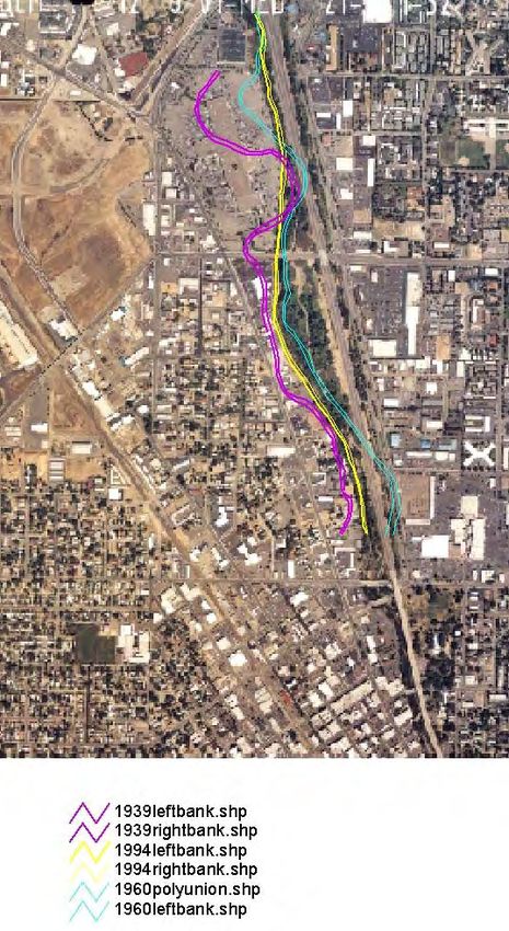
Bear Creek Watershed TMDL                               July 2007

For more information contact:

Bill Meyers
Oregon Department of Environmental Quality
221 Stewart Ave, Suite 201
Medford, OR 97501
meyers.bill@deq.state.or.us

Eugene Foster, Manager of Watershed Management Section
Department of Environmental Quality
811 Southwest 6th Avenue
Portland, Oregon 97204
foster.eugene.p@deq.state.or.us

John Blanchard, Western Region Watersheds Manager
Department of Environmental Quality
221 Stewart Ave., Suite 201
Medford, Oregon 97501
blanchard.john@deq.state.or.us

 Bear Creek Watershed TMDL - ODEQ                                i
Bear Creek Watershed TMDL                                          July 2007

                            Statement of Purpose
This Total Daily Maximum Load (TMDL) document has been prepared to meet
   the requirements of Section 303(d) of the 1972 Federal Clean Water Act.

Bear Creek Watershed TMDL - ODEQ                                             ii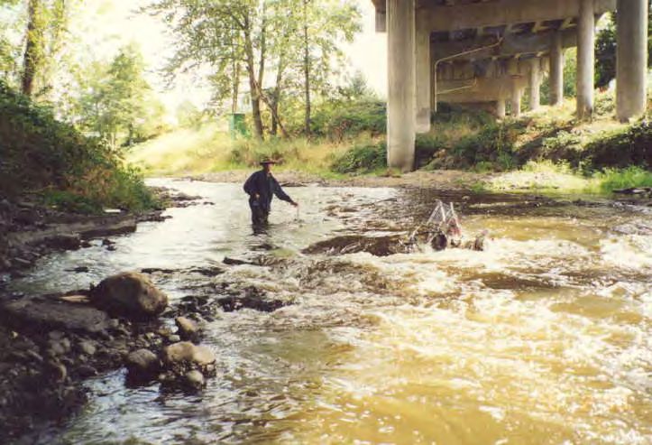
Bear Creek Watershed TMDL                                                                                                                                  July 2007

                                                                Table of Contents
EXECUTIVE SUMMARY .........................................................................................................................................1
    WATER QUALITY SUMMARY .....................................................................................................................................1
      Listed Parameters ................................................................................................................................................1
    TMDL SUMMARIES ...................................................................................................................................................2
      TMDL Load Capacity and Allocations: ...............................................................................................................2
      Temperature TMDL .............................................................................................................................................2
      Sedimentation.......................................................................................................................................................4
      Bacteria................................................................................................................................................................4
    WATER QUALITY MANAGEMENT PLAN .....................................................................................................................4
SECTION 1. TMDL BACKGROUND ......................................................................................................................6
    INTRODUCTION ..........................................................................................................................................................6
    DOCUMENT ORGANIZATION ......................................................................................................................................6
    WATERSHED CHARACTERIZATION ............................................................................................................................7
    WATER QUALITY IMPAIRMENTS ..............................................................................................................................17
    BENEFICIAL USES ....................................................................................................................................................20
    APPLICABLE WATER QUALITY STANDARDS ............................................................................................................20
SECTION 2. TEMPERATURE TMDL .................................................................................................................22
    INTRODUCTION:.......................................................................................................................................................24
    BENEFICIAL USES SENSITIVE TO TEMPERATURE. ....................................................................................................24
    DEVIATION FROM WATER QUALITY STANDARDS; 303(D) LISTINGS........................................................................25
    POLLUTANT IDENTIFICATION OAR 340-042-0040(4)(B).........................................................................................25
    SALMONID STREAM TEMPERATURE REQUIREMENTS ...............................................................................................27
    TEMPERATURE TARGET IDENTIFICATION: CWA 303(D) (1) ....................................................................................27
    EXISTING POLLUTION SOURCES ..............................................................................................................................29
    TMDL - LOADING CAPACITIES 40 CFR 130.2(F)...................................................................................................43
    WATER QUALITY STANDARD ATTAINMENT ANALYSIS – CWA §303(D)(1)............................................................44
    TMDL - LOAD ALLOCATIONS AND WASTE LOAD ALLOCATIONS 40 CFR 130.2(G) AND 40 CFR 130.2(H) ..........46
    PERMITTED POINT SOURCES OAR 340-042-0040(4)(G), 40 CFR 130.2(G) ............................................................46
    NONPOINT SOURCES: LOAD ALLOCATIONS OAR 340-042-0040(4)(H), 40 CFR 130.2(H)......................................50
    BEAR CREEK RESERVE CAPACITY OAR 340-042-0040(4)(K) ................................................................................54
    MAINSTEM BEAR SEASONAL VARIATION AND CRITICAL CONDITIONS....................................................................54
    MAINSTEM BEAR MARGIN OF SAFETY OAR 340-042-0040(4)(I), CWA §303(D)(1) .............................................55
       Explicit Margins of Safety..................................................................................................................................55
       Implicit Margins of Safety..................................................................................................................................55
REFERENCES..........................................................................................................................................................56

                                                                              Tables
Table 1. Stored Water for Use in the Bear Creek Watershed. .....................................................................................11
Table 2. 2004/2006 303(d) Listings Addressed in the Bear Creek Watershed TMDL...............................................17
Table 3. Beneficial Uses in the Bear Creek Watershed (OAR 340-041-0271, Table 271A)......................................20
Table 4. Water Quality Standards for Bacteria in the Rogue Basin............................................................................21
Table 5. Temperature TMDL Component Summary..................................................................................................23
Table 6. Temperature Sensitive Beneficial Uses (OAR 340-041-0271, Table 271A)................................................24
Table 7. 2004/2006 303(d) Listings Addressed in the Bear Creek Watershed TMDL...............................................25
Table 8. Modes of Thermally Induced Cold Water Fish Mortality ............................................................................27
Table 9. Biologically Based Numeric Temperature Criteria Applicable to Salmonid Uses .......................................28
Table 10. Biologically-based Numeric Criteria for the Bear Creek Watershed...........................................................29
Table 11. NPDES Permits in the Bear Creek Watershed with a potential to impact temperature. .............................30
Table 12. Average Current Percent Effective Shade Targets ......................................................................................35

  Bear Creek Watershed TMDL - ODEQ                                                                                                                                         iii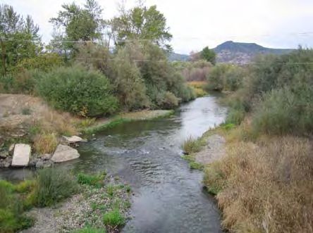
Bear Creek Watershed TMDL July 2007
Table 13. ODFW Instream Water Rights on Bear Creek ............................................................................................42
Table 14. Instream water rights in the Bear Creek watershed Managed by Oregon Water Trust:..............................42
Table 15. Allocations and Distribution of HUA.........................................................................................................46
Table 16. Ashland Creek Temperatures above WWTF (7 day maximum)1 ...............................................................48
Table 18. TMDL Shade Targets for Bear Creek and Selected Tributaries ..................................................................51
Table 19. Thermal Load Allocations for Urban DMAs : Bear Creek Only ................................................................51
Table 20. Approaches for Incorporating a Margin of Safety into a TMDL................................................................55
Figures
Figure 1. Generalized Discharge in Bear Creek .........................................................................................................11
Figure 2. Bear Creek Water Storage, Canals, and Irrigation Districts ........................................................................13
Figure 3. Anadromous Salmonid Lifecycle in the Bear Creek Watershed .................................................................16
Figure 4. Secondary Effluent Temperatures for Ashland WWTF ..............................................................................32
Figure 5: Daily High Temperatures in Ashland Creek Above and Below the WWTF................................................33
Figure 6. Current and Site Potential Percent-Effective Shade along the Bear Creek Mainstem................................35
Figure 7: Air Photo Composite of Bear Creek: 1939, 1960, 1994..............................................................................37
Figure 8. Average Daily Emigrant Dam Discharge – water year 2000-2001. ............................................................39
Figure 9: Bear Creek Current Flows (White Line) and Estimated Natural Flows (Blue Line)....................................39
Figure 10. Longitudinal Thermal Load in Bear Creek................................................................................................43
Maps
Map 1. Rogue River Basin ……………………………………………………………………………………………7
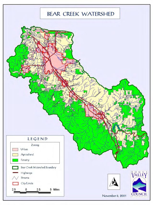
Map 2. Bear Creek Watershed Zoning Map. ................................................................................................................9
Map 3: 2004/2006 303(d) Temperature Listed Stream Reaches in the Bear Creek Watershed..................................26
Map 4: Water Diversion Points ...................................................................................................................................41
Bear Creek Watershed TMDL - ODEQ iv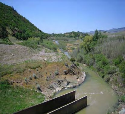
Bear Creek Watershed TMDL                                   July 2007

                       This Page Intentionally Left Blank

Bear Creek Watershed TMDL - ODEQ                                   v
Executive Summary July 2007
EXECUTIVE SUMMARY
Rogue Basin and
Bear Creek watershed
Water Quality Summary
Introduction
The following document contains the required components for a Total Maximum
Daily Load (TMDL) as described by the US Environmental Protection Agency (EPA)
for compliance with the Federal Clean Water Act. The document and its appendices
provide a thorough analysis of pollutant sources and accumulation processes in the
Bear Creek watershed.
Scope
The Bear Creek watershed encompasses an area of approximately 361 square miles located in southern Oregon in
Jackson County. This TMDL provides an analysis for all lands in the watershed.
Legal Requirements
Under Section 303(d) of the Clean Water Act, the EPA or its state delegates are required to develop a list of the
surface waters in each state that do not meet water quality criteria. These criteria are developed by each of the states
to protect “beneficial uses” and must be approved by EPA. The resulting “303(d) list” is based on the best available
data and, in most cases, must be revised every two years. Water bodies that are listed as impaired must have
TMDLs developed for each pollutant.
Listed Parameters
The current TMDL addresses all listings on the 2004/2006 303(d) list for the Bear Creek Watershed. According to
current EPA guidance on counting TMDLs, the Bear Creek TMDL addresses 31 TMDLs, covering 311.7 stream
miles (Table 1).
Table 1. Bear Creek TMDL Listings: EPA Method
Temperature: Total 138.7 miles 19 TMDL
Bacteria: Fecal Coliform: 10 listings. Total 120.4 miles, E. coli: 1 listing. Total 52.6
11 TMDL
miles
Sedimentation: 1 year-round listing 1 TMDL
Although the introduction and text of the Bear Creek TMDL uses the EPA method for calculating the total number
of TMDLs, ODEQ uses a different method. ODEQ tracks completed TMDLs using the method established for the
Consent Decree between the US Environmental Protection Agency (EPA) and Northwest Environmental Defense
Center (NEDC), John R. Churchill, and Northwest Environmental Advocates (NWEA) (October 17, 2000). The
Consent Decree lists the cumulative number of TMDLs to be established through 2010. As per the Consent Decree,
the Bear Creek TMDL represents the completion of 40 TMDLs (Table 2).
Table 2. Bear Creek TMDL Listings: Consent Decree Method
Temperature: 18 rearing (May 16-Oct. 14), 3 spawning (Oct. 15-May 15). Total 138.7
21 TMDL
miles
Bacteria: Fecal Coliform: 5 summer, 6 fall/winter/spring, 5 year-round. Total 120.4 miles 16 TMDL
Bacteria: E. coli: 1 summer listing, 1 fall/winter/spring. Total 52.6 miles 2 TMDL
Sedimentation: 1 year-round listing 1 TMDL
Bear Creek Watershed TMDL – ODEQ 1Executive Summary July 2007
Bear Creek currently has a TMDL in place. Approved by USEPA on December 12, 1992 it was among the first
TMDLs in the State of Oregon. The TMDL addresses the non-attainment of pH, aquatic weeds and algae, and
dissolved oxygen (DO) standards in the Bear Creek watershed. It has established instream concentration criteria,
load and wasteload allocations for total phosphorus, ammonia nitrogen and biochemical oxygen demand that are
currently used to set the targets that determine point and nonpoint source compliance. The 1992 TMDL is
considered adequate and is reviewed in Section 5 of this document.
TMDL SUMMARIES
TMDL Load Capacity and Allocations:
EPA’s current regulation defines loading capacity as “the greatest amount of loading that a waterbody can receive
without violating water quality standards.” (40 CFR § 130.2(f)). A loading capacity provides the reference for
calculating the amount of pollutant reduction needed to bring waters into compliance with standards. The loading
capacity can be divided into the sum of pollution coming from point sources plus the sum of pollution from nonpoint
sources [40 CFR 130.2(i)]. Point sources in the Bear Creek watershed include National Pollutant Discharge
Elimination System (NPDES) permitted facilities. Nonpoint sources include forestry, agriculture, roads, highways,
bridges, rural residential and urban development. Emigrant Dam, and the three irrigation districts in the Bear Creek
Valley also receive Load Allocations.
Temperature TMDL
The biologically based numeric criteria for cold water salmonids in the Bear Creek watershed is a seven (7) day
moving average of daily maximum temperature not to exceed 64.4oF (18.0oC) during times when salmonid rearing
is a beneficial use (May 16-October 14) and 55.4oF (13oC) during times and in waters that support salmon spawning,
egg incubation and fry emergence from the egg and in gravels (October 15-May 15). Heat Source 6.0 was used to
determine the thermal loading capacity for the Bear Creek mainstem based on the simulation of a watershed
condition termed natural thermal potential. Natural thermal potential is defined as “the determination of the thermal
profile of a water body using best available methods of analysis and the best available information on the site
potential riparian vegetation, stream geomorphology, stream flows and other measures to reflect natural conditions
(OAR 341-041-0002 (35)). The current total thermal load on Bear Creek is approximately 8680 MW-hr/m2. The
loading capacity under natural thermal potential conditions has been calculated as 3059 MW-hr/m2. The difference
between current load and the loading capacity is 6059 MW-hr/m2, a load reduction of 64%.
The simulation of natural thermal potential temperatures exceeded the biologically based numeric criterion,
indicating that there is no assimilative capacity available in Bear Creek. This indicates that in addition to the human
use allowance, there is no additional load available to give to point or nonpoint sources above natural thermal
potential. Current Rules define a human use allowance as a cumulative increase of no greater than 0.30C above the
applicable criteria after complete mixing in the waterbody and at the point of maximum impact (OAR 340-041-0028
12(b)(B)). Portions of the HUA were distributed to point and nonpoint sources and reserve capacity, which when
achieved will meet the temperature TMDL (Table 1).
Table 1. Allocations and Distribution of HUA.
Point Sources: Waste Load Allocations (WLA)1
Ashland WWTF No greater than 0.10C increase above the applicable criteria
(180C May 16-Oct 14, 130C Oct. 15-May 15) in Ashland Creek
at point of maximum impact.
Individual and General NPDES Permittees No significant cumulative increase above the applicable
criteria (Significant is defined as 0.005C).
Nonpoint sources; Load Allocations (LA)1
Nonpoint Sources: (DMA authority: Ashland, Talent, Cumulative impact no greater than 0.050C above the applicable
Phoenix, Medford, Central Point, Jacksonville, Jackson criteria at the point of maximum impact.
County, ODA, ODF, USFS, BLM, ODOT).
Emigrant Dam: (DMA authority: USBOR and TID) No increase in natural thermal potential temperatures when the
Bear Creek Watershed TMDL - ODEQ 2Executive Summary July 2007
biologically-based numeric criteria are exceeded.
Irrigation Districts: (DMA authority: TID, MID, RRVID) No greater than 0.050C increase above the applicable criteria
due to management of waters by TID, MID, RRVID in Bear
Creek at the point of maximum impact.
Reserve Capacity
No greater than 0.10C increase above the applicable criteria in
Bear Creek at the point of maximum impact.
1
Note: Current Rules define the loading capacity as being met if a cumulative increase of no greater than 0.30C
above the applicable criteria after complete mixing in the waterbody and at the point of maximum impact OAR 340-
041-0028 12(b)(B). This 0.30C increase is distributed between point and nonpoint sources and reserve capacity.
The nonpoint source load allocation for the Urban DMAs, as well as Agriculture, Forestry and Transportation is
defined as the amount of solar radiation that reaches a stream surface when riparian vegetation and stream channels
have achieved site potential. This applies to all perennial and intermittent fish bearing streams in the watershed.
Site potential shade targets are the TMDL implementation targets for urban, transportation, agriculture and forestry
(ODF, BLM, USFS). The TMDL targets for selected tributaries are provided in Table 2. Targets for additional
surface waters in the watershed are provided in Appendix D.
Note that in Table 17, current shade and site potential shade refer to percent-effective shade defined as the percent
reduction of solar radiation load delivered to the water surface. The role of effective shade in this TMDL is to
prevent or reduce heating by solar radiation and serve as a linear translator to the solar loading capacities in MW-
hr/m2. From an implementation standpoint it is important to note that any increase in shade over 80% effective
shade is considered a margin of safety. At 80% further reduction in stream temperature as a function of vegetation
may not be measurable for all stream flows (Boyd, 1996). At values of >80% effective shade, the stream is
considered recovered and should not be a candidate for active restoration. Additional shade should come from
passive management of the riparian area.
Table 2. TMDL Shade Targets for Bear Creek and Tributaries
TMDL Shade
Current Percent Effective
Creek Target. 1 % Change
Shade
(Percent Effective)
Bear Creek Mainstem 15 54 39
Jackson Creek 46 88 42
Griffin Creek 47 85 38
Lazy Creek 26 82 56
Coleman Creek 67 89 21
Wagner Creek 70 91 21
Myer Creek 40 83 42
Butler Creek 21 84 63
Ashland Creek2 66 82 16
Neil Creek 71 88 17
Walker Creek 41 86 37
Emigrant Creek 54 85 31
1: TMDL shade target is the calculated percent effective shade provided when riparian vegetation
reaches site potential.
2: Ashland Creek as shown represents the average shade from the base of Hosler Dam to the mouth
(mouth to river mile 4.9). If all of Ashland Creek is included in the average (both East and West Forks),
average percent effective shade from the mouth to the head waters currently is 91%, site potential shade
is 94%.
Bear Creek Watershed TMDL - ODEQ 3Executive Summary July 2007 Sedimentation Reeder Reservoir is listed for sedimentation on the 2004/2006 303(d) list. The listing is due to a USFS Watershed Assessment (USFS, 1995) that stated “excessive sedimentation requires periodic sluicing of Reeder Reservoir to provide storage for drinking water supply.” The sedimentation TMDL applies to all lands within the Ashland Creek Analytical Watershed (HUC-6) which drain into Reeder Reservoir including East and West Forks of Ashland Creek and several small unnamed creeks. All land uses and ownerships were included in the TMDL including the U.S. Forest Service (USFS), and the City of Ashland. The Ashland Creek watershed is composed of granitic soil types subject to debris landslides and surface erosion. Surface erosion, erosion from roads, debris flows/slide, and stream channel erosion are possible sources of sediment into streams and Reeder Reservoir. East and West Forks of Ashland Creek are the primary tributaries into the reservoir as well as the primary route for the conveyance of upslope sediments into the reservoir. Macroinvertebrate data has indicated that East and West Forks of Ashland Creek provides habitat in excellent condition. The survey recommended that the sites serve as reference sites for the region, and more specifically for granitic watersheds in the area. “What this site, and a handful of others in SW Oregon demonstrates, is that a granitic watershed, where stream channels are naturally storing and transporting high amounts of coarse, granitic sand, can display and maintain very high biotic integrity” (Wisseman 1997). The sedimentation TMDL sets the loading capacity at natural background or a soil erosion rate of 3.62 cubic yards per day total for the watershed. No significant delivery of sediment to Reeder Reservoir above that which would occur naturally is permitted. Long-term monitoring and the adaptive management nature of this TMDL will be used to evaluate this goal over time. It was recommended that in addition to monitoring sedimentation in East and West Forks of Ashland Creek, Reeder reservoir be monitored to determine trends in sediment delivery and to determine potential sediment sources. Monitoring of stream cobble embeddedness or percent fines (through Wolman pebble count method) and monitoring that continues to incorporate macroinvertebrates as trend indicators for sedimentation in the East and West Forks of Ashland Creek is requested. Bacteria In the Bear Creek watershed, fecal bacteria loading is dominated by nonpoint sources (98.4% of loading). As in other bacterial TMDLs (Willamette, DEQ 2006; North Coast Basins, DEQ 2003; Umpqua, DEQ 2006) load duration curves were used make flow-based source assessments. However the assumptions made in these models, that high fecal counts during low flow periods (60-90% flow, called “dry weather” ) indicate that point sources are the primary impact to the systems and that high fecal counts during high flow periods (10-40% flow, called “wet weather”) are indicative of nonpoint source inputs do not hold in the Bear Creek watershed. In Bear Creek the primary determinant of flow in the creeks is irrigation water delivery, operational spill and return flows, especially during the summer months. Some of the highest creek flows occur during the summer dry period when irrigation demands are the highest. A stream flow based loading capacity was developed for Bear Creek and percent reduction targets were determined for each of 5 stream flow ranges. Percent reduction targets were also developed for primary Bear Creek tributaries. Point source waste load allocations were developed based on the percent reduction needed on the affected waterways to meet the applicable water quality standard (126 or 406 E. coli organisms per 100 ml for water contact recreation). An explicit margin of safety was applied to all percent reduction targets. DMAs for the bacteria TMDL include: NPDES permit holders including the City of Ashland and stormwater permit holders, Jackson County onsite program, Urban DMAs including the Cities of Ashland, Talent, Phoenix, Jacksonville, Central Point, Medford and Jackson County, ODA for confined animal feeding operations (CAFO) program, Federal land managers, irrigation districts, and ODA for agricultural lands. WATER QUALITY MANAGEMENT PLAN A Water Quality Management Plan (WQMP) is included as a companion document to this TMDL and is included in Chapter II. This document explains the roles of various land management agencies, federal, state, and local Bear Creek Watershed TMDL - ODEQ 4
Executive Summary                                                                                      July 2007

governments, as well as private landowners in implementing the actions necessary to meet the allocations set forth
in the TMDLs and is intended to fulfill the requirements for implementing a TMDL as described in OAR 340-042-
0080. According to the schedule set forth in the WQMP the DMAs identified have 18 months from when this
TMDL becomes an executive order to develop and submit to DEQ an implementation plan.

The Bear Creek watershed DMAs and associated plans include:
   • Urban DMAs – Ashland, Talent, Phoenix, Medford, Jacksonville, Central Point, Jackson County;
   • Irrigation Districts - Medford, Talent, and Rogue River Valley;
   • US Bureau of Reclamation; Emigrant dam;
   • Oregon Department of Forestry: -State Forest Lands regulated through the Forest Practices Act;
   • USFS and BLM: Federal Forest Lands - Northwest Forest Plan;
   • Oregon Department of Agriculture: Private Agricultural Lands regulated through the Bear Creek
       Agricultural Water Quality Management Area Plan;
   • Oregon Department of Transportation: routine road maintenance to protect water quality and fish habitat.

 Bear Creek Watershed TMDL - ODEQ                                                                                    5
Sec II: Temperature TMDL July 2007
CHAPTER I. BEAR CREEK TMDL
SECTION 1. TMDL BACKGROUND
INTRODUCTION
This document seeks to clearly address the elements required by EPA for a Total Maximum Daily Load (TMDL).
The TMDL and its associated Water Quality Management Plan (WQMP) were prepared by the Oregon Department
of Environmental Quality (DEQ) with assistance from state, federal, and local partners.
Oregon’s TMDL Program (Generally Defined)
The quality of Oregon’s streams, lakes, estuaries, and groundwater is monitored by DEQ and a variety of partners.
This information is used to determine whether water quality criteria are being violated and whether the beneficial
uses of the waters are being threatened. Specific State and Federal plans and regulations are used to determine if
violations have occurred: these regulations include the Federal Clean Water Act of 1972 and its amendments (40
Codified Federal Regulations 131), Oregon’s Administrative Rules (OAR Chapter 340) and Oregon’s Revised
Statutes (ORS Chapter 468).
The term water quality limited is applied to streams and lakes where required treatment processes are being used,
but violations of state water quality criteria still occur. With a few exceptions, such as in cases where violations are
due to natural causes, the State must establish a TMDL for any waterbody designated as water quality limited. A
TMDL is the maximum amount of a pollutant (from all sources) that can enter a specific waterbody without causing
a violation of water quality criteria.
The total permissible pollutant load is allocated to point, nonpoint, background, future sources of pollution and a
margin of safety. Wasteload Allocations are portions of the total pollutant load that are allotted to point sources of
pollution, such as sewage treatment plants or industries and are used to establish effluent limits in discharge permits.
Load Allocations are portions of the TMDL that are attributed to either natural background sources, such as natural
runoff or background solar loading, or from nonpoint sources, such as roads, agriculture or forestry activities.
Allocations can also be set aside in reserve for future uses.
The Clean Water Act requires that each TMDL be established with a margin of safety. This requirement is intended
to account for uncertainties in the available data or in the effectiveness of control actions. The margin of safety may
be implicit, as in conservative assumptions used in calculating the loading capacity, wasteload allocations, and
loading allocations. The margin of safety may also be explicitly stated as an added separate allocation in the TMDL
calculation. The margin of safety is not meant to compensate for a failure to consider known sources. Implicit
margins of safety were developed for temperature, bacteria, and sediment in this TMDL and will be discussed
further in the body of the document.
DOCUMENT ORGANIZATION
As defined in OAR 340-042-0040 a Total Maximum Daily Load will contain the following elements:
• Name and Location
• Pollutant Identification
• Water Quality Standards and Beneficial Uses
• Loading Capacity
• Excess Load
• Sources and Source Catagories
Bear Creek Watershed TMDL - ODEQ 6Sec II: Temperature TMDL July 2007
• Wasteload Allocations
• Load Allocations
• Margin of Safety
• Seasonal Variation
• Reserve Capacity
• Water Quality Management Plan
WATERSHED CHARACTERIZATION
February 10th, 1827: We started at 8 AM and proceeded on until 2 PM when we encamped on a large Fork form’d
by a number of small Streams which we crossed in our travels this day…this is certainly a fine Country and
probably no Climate in any Country equal to it…a country well adapted from its Soil and timber (Oaks and Pine)
for cultivation. From the Journal of Peter Skene Ogden, camped on the bluffs above Bear Creek a mile or two
below the mouth of Ashland Creek. Ogden and his small party of Hudson’s Bay Company trappers became the first
white men to enter the upper drainage of the Rogue River (LaLande, 1987).
Geographic Setting Map 1. Rogue Basin with Bear
Creek watershed shown in Black
The Bear Creek watershed is an important part of the diverse 3,300,000 acre
(5,156 square miles) Rogue River Basin (Map 1). The approximately 231,276
acre (361 square mile) Bear Creek watershed includes lands in Jackson County.
Elevations in the watershed range from 1,160 feet above sea level at its
confluence with the Rogue River to 7,533 feet at the summit of Mt Ashland.
Within the valley floor area the gradient of the creek is low and averages only
about a 30 foot drop per mile. In the upper portions of the watershed, the
gradient are radically different and some tributaries reach an average drop of
over 400 feet per mile.
The watershed contains approximately 290 miles of streams, 83 named tributaries (13 of which are identified as fish
bearing) and numerous unnamed tributaries (Bear Creek Watershed Council, 1995). Bear Creek empties into the
Rogue River at river mile 127.
Ownership
The Bear Creek watershed is located entirely within Jackson County,
Oregon. Jackson County has a population of 181,269 most of whom reside Approximately 21% of the
within the Bear Creek valley in the population centers of Ashland (19,522), Bear Creek watershed is
Talent (5,589), Phoenix (4,060), Medford (63,154), Central Point (12,493),
Federally managed.
and Jacksonville (2235) (US Census Bureau, Census 2000). These
urban/non-resource zoned areas cluster predominantly along the valley
bottoms along Bear Creek itself and up the valleys created by tributary streams (Map 2).
Approximately 21 percent (49,020 acres) of the watershed is publicly owned and managed by the US Forest Service,
Bureau of Land Management, and US Bureau of Reclamation (BLM data, March 2007). These public lands are
located primarily along the headwaters of streams in timbered mountainous terrain. These lands are managed for
multiple use including water quality, timber production, livestock management, wildlife and recreation.
Zoning in the Bear Creek Watershed
Zoning designations for the Bear Creek watershed are shown below. Zoning designations are important because
TMDL implementation plans are usually applied to specific land uses, i.e. agriculture, forestry, urban, rural
Bear Creek Watershed TMDL - ODEQ 7Sec II: Temperature TMDL July 2007 residential etc. The TMDL implementation plan that applies is based on the specific land use that is occurring on the property. Urban/non-resource zoned lands • Industrial (1.1%) outside of city limits (primarily White City) • Commercial (0.3%) outside of city limits • Rural (6.51%) inside or outside of UGB • Suburban(2.1%) inside or outside of UGB (Gibbon/Forest acres) • Urban (0.1%) within UGB or UCB (White City and Hwy 99 UCBs) • City (8.8%) all lands within city limits Resource Zoned lands • Aggregate Mining resource zone (0.7%) • Farmland (34.8%) exclusive farm use (EFU) • Forest (45.6%) open space reserve (OSR), woodland resource (WR), forest resource (FR). Bear Creek Watershed TMDL - ODEQ 8
Sec II: Temperature TMDL                                             July 2007

                           Map 2. Bear Creek Watershed Zoning Map.

 Bear Creek Watershed TMDL - ODEQ                                            9
Sec II: Temperature TMDL July 2007 Geology The Bear Creek watershed is the result of tectonic plates causing regional uplift. As elsewhere in the Rogue Basin this uplift is responsible for the steep incised canyons and narrow tributaries formed as water downcuts through a rising landscape composed of soft geologic strata and usnstable formations. The variable soils produced by the erosion of volcanic deposits most certainly have always produced high sediment yields during high flow events from the Bear Creek drainage. The upland Takelma Indian tribe who historically occupied the lower Bear Creek Valley referred to Bear Creek as “Si’kuptpat” meaning “dirty water” (La Land 1987). Geologically Bear Creek is the point of transition between the Cascades and the Siskiyou mountains, which produces contrasting soil types and structures and natural geologic features. Bear Creek is the line of demarcation between the granitic and volcanic soils. . Climate and Weather The Bear Creek watershed lies on the Pacific Northwest coast of the North American continent at approximately 42.5-north latitude and 123-west longitude. As a part of interior southwestern Oregon, the Bear Creek watershed is located in a transitional area between four very different climate zones: Pacific Maritime to the west, Oregon High Desert to the east, California Mediterranean to the south, and Northern Temperate to the north. The fluctuating boundary between these four zones results in the basin's weather being highly unpredictable, experiencing large annual fluctuations in precipitation and temperatures within longer climatic cycles. Rainfall ranges from 20 inches in the valley areas to over 60 inches at higher elevations. Significant snowfall occurs at higher elevations resulting in a major source for spring river flows, ground water re-charge and surface water for irrigation. Hydrology The total discharge from Bear Creek varies considerably from year to year, ranging from a low of about 20000 AF/year in 1931 to 230,000 AF/year in 1965 (RVCOG, 1999) with an annual mean flow of 112 CFS (12 St. gage, USGS data). Historically, the annual stream flows (measured in Medford) have shown more variability that annual precipitation rates because of the effects of storage and irrigation diversion activities. It has been estimated that there are approximated 290 miles of natural creeks in the Bear Creek watershed and greater than 250 miles of irrigation canals (main canals only) RVCOG 1999. Under the current scenario natural stream flows within the Bear Creek watershed are greatly diminished by the end in June and replaced by irrigation conveyance flows which result in artificially high flow conditions for the upper reaches of Bear Creek (above the TID diversion in Ashland) and unnaturally low flows in the system below the MID diversion in Medford (Figure 1). Bear Creek Watershed TMDL - ODEQ 10
Sec II: Temperature TMDL                                                                                    July 2007

                                     Figure 1. Generalized Discharge in Bear Creek

      90
      80
      70
    C 60                                                                                 Non-irrigation Season
    F 50
    S 40                                                                                  Irrigation Season
      30
      20
      10
       0
            0        5          10      15      20       25       30 Miles from Mouth of Bear Ck
                                                                     to Base of Emigrant Dam

                                 Note: adapted from Bear Creek Watershed Council 1995

Overview of Irrigation and Water Storage
Irrigated agriculture began in the Bear Creek watershed over 150 years ago with the first water right in the state of
Oregon being granted to Joseph Wagner in 1851. The development of irrigation delivery and storage systems in the
Bear Creek valley has significantly altered the landscape of the valley from natural conditions. Irrigation water is
conveyed to the farms by some 250 miles of high and low canals which run parallel to Bear Creek on the uplands
above the valley floor. Most canals are unlined ditches with significant leakage (in some areas up to 20% of water
diverted is lost through canal leakage). In addition to the natural water yield of the Bear Creek watershed, water is
imported from both the Applegate Subbasin and the Klamath Basin to meet irrigation needs. Water rights for over
143,00 acre/ft is available for import into the watershed. Imported water in addition to natural flows is stored in
Emigrant lake, Fourmile lake, Howard Prairie lake, Fish lake, Hyatt lake, and Agate Reservoirs (Figure 2 and Table
1).

The long term average annual flow yield for Bear Creek, measured at the Medford gauging station, is 82,590 acre
feet per year (112 cfs average, Source: USGS Medford gage, Bear Creek River Mile 11.0). This yield represents
natural flows plus the contribution of imported waters. Imported waters are brought into the Bear Creek basin at
several points. It is estimated that approximately 33,000 AF are imported from the Klamath Basin, plus a junior
water right on imported water from the Applegate Subbasin (0.26-6.15 CFS April-Sept, Cohen et. al, 1999). These
inter-basin transfers play a large role on the availability, quantity, and quality of water during certain times of the
year. This stored water is used primarily for agriculture and insures that during most years water is available for all
those who have rights in the Bear Creek basin. The future of these inter-basin transfers are currently under
discussion between water users in the Klamath River Basin and the Bureau of Reclamation.

                              Table 1. Stored Water for Use in the Bear Creek Watershed.
                  Reservoir                          Date completed       Approximate Storage capacity in
                                                                          Acre Feet (AF)
                  Fourmile Lake                      1922                 15600
                  Fish Lake                          1908                 7900

 Bear Creek Watershed TMDL - ODEQ                                                                                    11
Sec II: Temperature TMDL July 2007
Agate Reservoir 1966 4700
Emigrant Reservoir Addition 1960 39000
Howard Prairie Reservoir 1959 59800
Hyatt Lake 1922 16200
Keene Creek Reservoir 1956 260
CURRENT TOTAL STORAGE 144,480 AF
NOTE: Due to limitations in water delivery, not all water in storage is available for irrigation
usage in any given year. Source: Talent Irrigation District Website: www.talentid.org
Bear Creek Watershed TMDL - ODEQ 12Sec II: Temperature TMDL July 2007
Figure 2. Bear Creek Water Storage, Canals, and Irrigation Districts.
Bear Creek Watershed TMDL - ODEQ 13Sec II: Temperature TMDL July 2007 Irrigation Districts Irrigation Season in the Bear Creek Valley is legally defined as April 1 through October 31 when Bear Creek and many major tributaries become conveyance systems for the 3 large districts in the valley: Talent Irrigation District (TID), Medford Irrigation District (MID), and Rogue River Valley Irrigation District (RRVID). In addition approximately 30 cfs of streamflow is allocated to the districts for frost control between February 15 and April 1. Talent Irrigation District (TID) manages Howard Prairie Lake, Hyatt Lake, Keen Creek reservoir and Emigrant reservoir. TID uses these sources of stored water in addition to natural stream flow water rights and irrigation water recovered from return flows to supply irrigation water to the southern end of the Bear Creek valley. TID supplies water to 3300 users on 16,400 acres (BCLAC, 2004). Medford Irrigation District (MID) uses Rogue River Basin Project – Talent Division water (7.5117%) for irrigation in the central portion of the Bear Creek watershed. In addition to stored water, MID picks up TID return flows from the mainstem of Bear Creek. MID supplies approximately 12,800 acres (BCLAC, 2004). Rogue River Valley Irrigation District (RRVID) uses Rogue River Basin Project – Talent Division water (3.7559%), live stream flow water rights, in addition to a 1/3 share of Fourmile and Fish lake waters and Agate Reservoir for irrigation in the northern portion of the Bear Creek watershed. In addition to stored water, RRVID picks up TID and MID return flows from the mainstem of Bear Creek. RRVID supplies 8,400 acres (BCLAC, 2004). In addition to the irrigation districts, there are private irrigation rights and ditch associations operating on Bear Creek and some of its major tributaries which cumulatively may take up to 15-20 CFS from the system (RVCOG, 1999). In sum total there are approximately 6000 irrigation accounts within the 3 irrigation districts (Jim Pendleton, Pers. Communication). According to the Bear Creek Local Agricultural Committee report 2004 “Small acreage landowners (those with five acres or less) make up 80 percent of the irrigation district accounts in the Bear Creek watershed. Many of these small operations may have livestock and/or flood irrigation systems, and without careful management in place, water quality problems can be significant. Given current population growth, there is every indication that this segment of the community will continue to grow and affect traditionally “rural” areas of the watershed”. Emigrant Dam Emigrant Dam is owned by the USBOR and operated by TID. It is a part of the USBOR Rogue River Basin Talent Division project which includes Fourmile Lake, Fish Lake, Howard Prairie Lake, Hyatt Lake, and Agate lake. It is located 7.5 miles southeast of Ashland, on Emigrant Creek. The reservoir was originally constructed by TID in 1924. The original 110-foot- high thin-arch concrete dam was incorporated into a 204-foot- high earthfill structure with enlargement by the Bureau of Reclamation in 1961. The dam is 204 feet high and has a crest elevation of 2254 feet. The reservoir´s total capacity is 40,500 acre-feet (active 39,000 acre-feet). The enlarged reservoir re- regulates Green Springs Powerplant discharges and provides additional storage for irrigation. The dam releases water from the bottom of the reservoir, there is currently no way to regulate the temperature of Emigrant Dam discharge. A preliminary proposal was submitted to the Federal Energy Commission in 2001 to develop a 935kW hydroelectric project at Emigrant dam. The proposal was withdrawn in 2003. Bear Creek Watershed TMDL - ODEQ 14
Sec II: Temperature TMDL                                                                                 July 2007

Hosler Dam
Hosler Dam is located just below the confluence of the east and west forks of Ashland Creek, above the City of
Ashland. It is owned and operated by the City of Ashland. The dam was constructed in 1928 creating Reeder
Reservoir. It is 25 feet thick at its base and 7 feet thick at the top, rising 110 feet. The concrete dam holds back a
maximum of 850 acre feet (277 million gallons) of water reserves. There is a small hydroelectric generating plant
located at the base of the dam with an installed capacity of 810 kW. The project is currently operated under FERC,
Reeder Gulch, project number #1107-005. This project is exempt from the requirements of Part I of the Federal
Power Act and does not require a FERC license. This exemption is made in perpetuity and is subject to mandatory
terms and conditions set by federal and state fish and wildlife agencies and by the Commission, and does not convey
the right of eminent domain. Access roads and to a lesser extent the Forest Service Roads within the Reeder
Reservoir watershed have contributed surface erosion to the reservoir and to Ashland Creek below the reservoir.
Roads are not surfaced and therefore can contribute large volumes of silt and coarse sediment to the reservoir
(USFS, 1995).

Bear Creek Watershed Fisheries
Bear Creek has a small population of coho, fall chinook, winter and summer steelhead, and resident trout (rainbow
and cutthroat). Winter steelhead and fall chinook are the primary anadromous species using the Bear Creek system.
In addition, pacific anadromous lamprey, western brook lamprey, reticulate sculpin, and Klamath smallscale sculpin
have been found in the system. Nonnative species also exist in the watershed: redside shiner, speckeled dace, large
and small mouth bass, black crappie, bluegill, catfish, brown bullhead, yellow perch, carp, goldfish and others
(USFS, 1995).

Coho salmon in the Rogue Basin belong to the Southern Oregon-Northern California Coast Evolutionary Significant
Unit (ESU) which occurs between Cape Blanco, Oregon and Punta Gorda, California. This ESU is listed under the
Federal Register (2002) as threatened by NOAA Fisheries. Steelhead in the Rogue including the Bear Creek
watershed belong to the Klamath Mountain Province ESU, which is inclusive of the Klamath River in California
north to the Elk River in Oregon. A recent status review concluded that the listing of Steelhead in this ESU was not
warranted (Federal Register, 2001).

All salmonids require a cold freshwater environment for spawning. Each species, however, differs in the extent to
which they rear in fresh water. All salmonid species dig a nest (redd) in the gravel bottom of streams where the eggs
are deposited by the female and fertilized by the male. Incubation of the egg depends upon the species and is water
temperature dependent. After incubation, an alevin (a small fry with an attached egg yolk sac) emerges from the egg
into the gravel. Once the egg sac has been completely absorbed, the alevins emerge from the gravel as developed
fry (Figure 3).

The salmonid life cycle involves a complex web of instream habitats, ocean conditions and harvest pressure that all
combine to impact salmonid populations. Listed below is a brief description of specific habitat needs by species as
found in the Bear Creek watershed.

 Bear Creek Watershed TMDL - ODEQ                                                                                  15
Sec II: Temperature TMDL                                                                                 July 2007

                    Figure 3. Anadromous Salmonid Lifecycle in the Bear Creek Watershed

Coho Salmon (Oncorhynchus kisutch)
Coho are most linked to the complex riverine habitats that were once prevalent in the Bear Creek. Spawning of wild
coho in the Bear Creek was linked to the mainstem and tributaries. Coho prefer pools, glides, or slow velocity areas
with overhead cover for rearing. Juveniles are territorial and prefer plunge pools, lateral scour pools, and glides
during the summer months. They spend the winter months in low gradient braided channel areas where side
channels, sloughs, and beaver ponds, are present before migrating to the ocean. They depend on smaller streams
that have wide riparian areas with marshes and side channels and pools in off-channel areas, alcoves along the edges
of streams and rivers and beaver dams for summer and winter freshwater habitat. These fish must remain in
freshwater habitat, generally tributary streams for one year. Urbanization, agriculture, water withdrawals and loss of
stream/floodplain connectivity in the greater Bear Creek watershed inhibit the recovery of coho salmon (USFS,
1995).

Chinook Salmon (Oncorhynchus tshawytscha)
Most spawning and rearing occurs in the lower segments of larger tributaries and the mainstem of the Bear Creek.
Mainstem river edge habitat is used for refuge by fry in the early spring prior to their migration downstream to the
estuary.

 Bear Creek Watershed TMDL - ODEQ                                                                                  16
Sec II: Temperature TMDL July 2007
Steehhead (Oncorhynchus mykiss)
Steelhead are rainbow trout which migrate to the ocean. Of the three anadromous species present in the Bear Creek,
steelhead are the most adaptive. The Bear Creek is home to two distinct runs of steelhead: summer run and winter
run. In the absence of barriers, steelhead will spawn and rear throughout the watershed, but prefer headwater
streams or upper segments of streams. Juvenile steelhead reside in small streams and in the mainstem of Bear Creek
if temperatures are cool. Unlike the salmon which prefer pools and glides, steelhead are able to rear in fast-moving
water. This trait and their variable stay in fresh water from one to four years make them very adaptive to changing
habitat conditions, but also most susceptible to high water temperatures. They can compensate somewhat for
elevated stream temperatures by seeking turbulent water with more oxygen. Many of the streams preferred by
steelhead for spawning dry up in the summer. In addition, irrigation diversions, water withdrawals and low flows
limit adult access to spawning tributaries, forcing steelhead to spawn in the mainstem Bear Creek, resulting in lower
juvenile survival rates.
Resident Trout (Oncorhynchus species)
Bear Creek and Rogue Rivers’ resident rainbow population is somewhat unusual for coastal basins. Resident
cutthroat and rainbow populations are generally located in headwater streams. In the simplified aquatic and riparian
habitat of lower elevation streams, cutthroat and rainbow are out competed by juvenile steelhead and non-native fish
(USFS, 1995).
WATER QUALITY IMPAIRMENTS
The existence of water quality problems in the Bear Creek watershed has been acknowledged and documented for
many years. Studies supported by the Clean Water Act Section 208 planning grants in the 1970s identified problems
related to fecal bacteria, low flows, sediment, turbidity, nutrients, and temperature. In 1992 Bear Creek was among
the first watersheds in the state to have an established TMDL. The Bear Creek TMDLs were approved by USEPA
on December 12, 1992. In order to address the non-attainment of pH, aquatic weeds and algae, and dissolved
oxygen (DO) standards in the Bear Creek watershed, TMDLs were developed establishing instream concentration
criteria, load and wasteload allocations for total phosphorus, ammonia nitrogen and biochemical oxygen demand.
These existing TMDLs are still in place and used to determine point and nonpoint source compliance. The 1992
TMDL is reviewed in Section 5 of this document.
The 2004/2006 303(d) list indicates that the Bear Creek watershed does not meet water quality standards for
temperature, bacteria, and sedimentation at certain times of the year (Table 2). This TMDL will address the
following:
• Temperature: Total 138.7 miles, 19 TMDLs.
• Bacteria: Fecal Coliform, 5 summer listings, 6 fall/winter/spring, 5 year-round. Total 120.4 miles; E. coli:
1 summer listing, 1 fall/winter/spring. Total 52.6 miles, 11 TMDLs
• Sedimentation: 1 year-round listing. 1 TMDL.
Note: A total of 31 TMDLs, covering 311.7 stream miles are addressed in this TMDL (Table 2). Note also that on
the DEQ website (www.oregon.gov/DEQ) the Bear Creek watershed 303(d) listings are included in the Middle
Rogue section. The remainder of the Middle Rogue 303(d) listings including: Battle Creek, Birdseye Creek, Cold
Creek, East Fork Evans, Evans Creek, Galls Creek, Pleasant Creek, Ramsey Canyon, Rock Creek, Salt Creek,
Savage Creek, and West Fork Evans Creek will be addressed in the Rogue TMDL scheduled for completion in
2007.
Table 2. 2004/2006 303(d) Listings Addressed in the Bear Creek Watershed TMDL
TEMPERATURE
Record ID Waterbody Name River Mile Parameter Season List Date
3940 Bear Creek 0 to 26.3 Temperature Summer 1998
Bear Creek Watershed TMDL - ODEQ 17Sec II: Temperature TMDL July 2007
3942 Butler Creek 0 to 5.2 Temperature Summer 1998
4423 Carter Creek 0 to 4.8 Temperature Summer 1998
3944 Coleman Creek 0 to 6.9 Temperature Summer 1998
3946 Emigrant Creek 0 to 3.6 Temperature Summer 1998
4422 Emigrant Creek 5.6 to 15.4 Temperature Summer 1998
8149 Gaerky Creek 0 to 4.6 Temperature Summer 2002
4425 Hobart Creek 0 to 1 Temperature Summer 1998
3953 Jackson Creek 0 to 12.6 Temperature Summer 1998
8016 Jackson Creek 0 to 12.6 Temperature October 1 - May 31 2002
3954 Larson Creek 0 to 6.7 Temperature Summer 1998
8022 Lazy Creek 0 to 4.5 Temperature Summer 2002
3955 Lone Pine Creek 0 to 5 Temperature Summer 1998
3957 Meyer Creek 0 to 5.3 Temperature Summer 1998
8026 Neil Creek 0 to 4.8 Temperature October 1 - May 31 2002
3958 Neil Creek 0 to 4.8 Temperature Summer 1998
8031 Payne Creek 0 to 2.1 Temperature Summer 2002
4424 Tyler Creek 0 to 4 Temperature Summer 1998
4326 Wagner Creek 6 to 7.4 Temperature Summer 1998
3967 Wagner Creek 0 to 6 Temperature Summer 2002
8036 Walker Creek 0 to 6.7 Temperature October 1 - May 31 2002
Total number of miles listed for rearing temperature 114.6
Total number of miles listed for spawning temperature 24.1
BACTERIA
Record
Waterbody Name River Mile Parameter Season List Date
ID
4085 Ashland Creek 0 to 2.8 Fecal Coliform Fall/Winter/Spring 1998
4357 Ashland Creek 0 to 2.8 Fecal Coliform Summer 1998
4360 Bear Creek 0 to 26.3 Fecal Coliform Summer 1998
4086 Bear Creek 0 to 26.3 Fecal Coliform Fall/Winter/Spring 1998
16882 Bear Creek 0 to 26.3 E. coli Fall/Winter/Spring 2004
16883 Bear Creek 0 to 26.3 E. coli Summer 2004
4088 Butler Creek 0 to 5.2 Fecal Coliform Fall/Winter/Spring 1998
4089 Coleman Creek 0 to 6.9 Fecal Coliform Year Around 1998
4090 Crooked Creek 0 to 4.3 Fecal Coliform Summer 1998
4404 Crooked Creek 0 to 4.3 Fecal Coliform Fall/Winter/Spring 1998
4093 Griffin Creek 0 to 14.4 Fecal Coliform Summer 1998
4405 Griffin Creek 0 to 14.4 Fecal Coliform Fall/Winter/Spring 1998
4095 Jackson Creek 0 to 12.6 Fecal Coliform Year Around 1998
Bear Creek Watershed TMDL - ODEQ 18Sec II: Temperature TMDL July 2007
4096 Larson Creek 0 to 6.7 Fecal Coliform Year Around 1998
4097 Lazy Creek 0 to 4.5 Fecal Coliform Year Around 1998
4098 Meyer Creek 0 to 5.3 Fecal Coliform Summer 1998
4406 Meyer Creek 0 to 5.3 Fecal Coliform Fall/Winter/Spring 1998
4100 Payne Creek 0 to 2.1 Fecal Coliform Year Around 1998
Total number of miles listed Summer fecal coliform 29.6
Total number of miles listed Fall/Winter/Spring fecal coliform 58.3
Total number of miles listed for year-round fecal coliform 32.8
Total number of miles listed Summer E. coli 26.3
Total number of miles listed Fall/Winter/Spring E. coli 26.3
SEDIMENTATION
Record
Waterbody Name River Mile Parameter Season List Date
ID
Reeder
4280 Reservoir/Ashland 4.9 to 5.4 Sedimentation Year-round 1998
Creek
Total number of miles listed Sedimentation Reservoir
1
Once a TMDL is developed, effected parameters are removed from the 303(d) list. i.e. parameters covered under
the 1992 Bear Creek TMDL are not shown on the 2004/2006 303(d) list shown above.
Bear Creek Oregon Water Quality Index (OWQI)
The DEQ has conducted water quality monitoring in the Rogue Basin since the mid 1980s and has used this water
quality data to calculate Oregon Water Quality Index (OWQI) scores. OWQI is a single number which expresses
water quality by integrating measurements of eight carefully selected water quality parameters; temperature,
dissolved oxygen, biochemical oxygen demand, pH, ammonia+nitrate nitrogen, total phosphates, total solids, fecal
coliform. The index was developed for the purpose of providing a simple, and concise method for expressing the
significance of regularly generated laboratory data, and was designed to aid in the assessment of water quality for
general recreational uses.
DEQ submits the results of the OWQI on an annual basis. The reports address trends over the previous 10 years, for
example the 2004 report addressed the water years 1994-2003, the 2005 report addressed the water years 1995-2004,
and the 2006 report addressed the water years 1996-2005. These 3 most recent reports indicate that although Bear
Creeks water quality is below standards, the creek is showing significant improvements. In the 2004 report Bear
Creek was the most improved waterway in the state (+16.7 OWQI units,@ 99% significance). In 2005 it was the
second most improved waterway (+12.2 OWQI units,@ 99% significance) and in 2006 it was again the second most
improved waterway (+7.5 OWQI units,@ 99% significance) in the state of those tested. In addition in 2006 the
status of the Bear Creek based on its OWQI scores was upgraded from very poor to poor. See the DEQ website at
http://www.deq.state.or.us/lab/wqm/wqimain.htm for more information.
Bear Creek Watershed TMDL - ODEQ 19You can also read