Severn and Avon Vales - National Character Area profile: Natural England publications
←
→
Page content transcription
If your browser does not render page correctly, please read the page content below
National Character      106. Severn and Avon Vales
      Area profile:                                                                        Supporting documents

                                                                               Key facts       Landscape          Analysis
                        Introduction & Summary   Description   Opportunities
                                                                               and data        change

  www.gov.uk/natural-england

                                                                                                     1
National Character                106. Severn and Avon Vales
      Area profile:                                                                                                                                    Supporting documents

                                                                                                                                      Key facts             Landscape              Analysis
                                  Introduction & Summary         Description                     Opportunities
                                                                                                                                      and data              change

   Introduction                                                                          National Character Areas map
   As part of Natural England’s responsibilities as set out in the Natural
   Environment White Paper,1 Biodiversity 20202 and the European Landscape
   Convention,3 we are revising profiles for England’s 159 National Character Areas                                                               North
   (NCAs). These are areas that share similar landscape characteristics, and which                                                                 East
   follow natural lines in the landscape rather than administrative boundaries,
   making them a good decision-making framework for the natural environment.                                                                           Yorkshire
                                                                                                                                                         & The
                                                                                                                                            North       Humber
   NCA profiles are guidance documents which can help communities to inform
                                                                                                                                            West
   their decision-making about the places that they live in and care for. The
   information they contain will support the planning of conservation initiatives at a                                                                       East
   landscape scale, inform the delivery of Nature Improvement Areas and encourage                                                                          Midlands
   broader partnership working through Local Nature Partnerships. The profiles will                                                           West
   also help to inform choices about how land is managed and can change.                                                                     Midlands
                                                                                                                                                                         East of
   Each profile includes a description of the natural and cultural features                                                                                             England
   that shape our landscapes, how the landscape has changed over time,
   the current key drivers for ongoing change, and a broad analysis of each                                                                                        London
   area’s characteristics and ecosystem services. Statements of Environmental
                                                                                                                                                             South East
   Opportunity (SEOs) are suggested, which draw on this integrated information.                                                    South West
   The SEOs offer guidance on the critical issues, which could help to achieve
   sustainable growth and a more secure environmental future.

   NCA profiles are working documents which draw on current evidence and
   knowledge. We will aim to refresh and update them periodically as new                 1
                                                                                           The Natural Choice: Securing the Value of Nature, Defra
   information becomes available to us.                                                    (2011; URL: www.official-documents.gov.uk/document/cm80/8082/8082.pdf)
                                                                                         2
                                                                                           Biodiversity 2020: A Strategy for England’s Wildlife and Ecosystem Services, Defra
                                                                                           (2011; URL: www.defra.gov.uk/publications/files/pb13583-biodiversity-strategy-2020-111111.pdf)
   We would like to hear how useful the NCA profiles are to you. You can contact the     3
                                                                                           European Landscape Convention, Council of Europe
   NCA team by emailingncaprofiles@naturalengland.org.uk.                                  (2000; URL: http://conventions.coe.int/Treaty/en/Treaties/Html/176.htm)

                                                                                                                                                                    2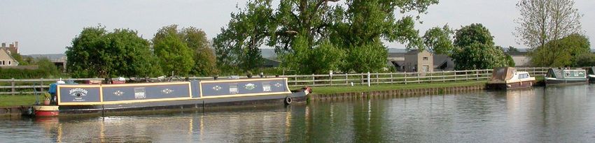
National Character 106. Severn and Avon Vales
Area profile: Supporting documents
Key facts Landscape Analysis
Introduction & Summary Description Opportunities
and data change
Summary
The lower valleys of the rivers Severn and Avon dominate this low-lying violet click beetle. There are important staircases of fossil-bearing river
open agricultural vale landscape made up of distinct and contrasting terrace gravels containing evidence of Palaeolithic and Mesolithic human
vales, including Evesham, Berkeley, Gloucester, Leadon, and Avon, with settlement, and rare inland salt deposits at Droitwich. Key ecosystem
Cotswold outliers like Bredon Hill punctuating the otherwise flat vale services within this NCA include flood regulation, food production due
landscape. The M5 motorway runs through the centre and the eastern to extensive agriculture and sense of history which is internationally
edge of the area. A small proportion of the National Character Area (NCA) important due to its links with Shakespeare. Future challenges and
is urban and includes towns such as Worcester, Cheltenham, Gloucester opportunities include pressure from development around urban and
and Stratford-upon-Avon, with its world famous Shakespearian industrial areas, pressure to increase food production and large scale
connections. Industrial development is still important at Avonmouth wetland habitat restoration to aid flood management.
and the archaeology/heritage of former industry is prominent around
Sharpness Docks, Pill, Gloucester-Sharpness Canal and Stroudwater
Canal. The majority of the area is used as agricultural land. NCA 106 boundary
Other NCA boundary 102
66
Mid Severn Sandstone
Area outside NCA 106 Teme Plateau
Area of Outstanding Valley 97
Natural Beauty
Arden
Woodland is sparse and it is a generally open landscape. Traditional
0 10km
101
Herefordshire
orchards are widespread across the area and with surrounding 100
Herefordshire
Plateau 96
Dunsmore
& Feldon
95
Northants
NCAs support the main UK population of the noble chafer beetle Lowlands
Malvern
Hills
Uplands
and provide an important genetic resource of local fruit varieties. 104
South
Herefordshire 103
Malvern
Important concentrations of lowland meadow and floodplain grazing
& Over Severn
Hills Cotswolds
107
Cotswolds
marsh support a range of priority species from green winged orchid 105
Forest of
Dean &
and brown hairstreak butterfly to true fox sedge and a wide range Wye Lower Wye
Valley 108
Upper Thames
Clay Vales
of waterfowl. The Walmore Common Special Protection Area (SPA)
and adjacent Severn Estuary SPA are of international importance for 118 North Wessex
Bristol, Avon Downs
wintering wildfowl, such as Bewick’s swan and shelduck. Valleys &
Ridges
117
Avon Vales
National Character Area 106
Severn & Avon Vales
Mapping © copyright Lovell Johns Limited. Note: In most instances, the NCA boundary is not
Contains Ordnance Survey data precisely mapped and should be considered as a
© Crown copyright and database right 2010. zone of transition between NCAs.
The oolitic limestone outliers of the Cotswolds AONB overlie this area
Natural England OS licence number 100022021
and the Bredon Hill SAC is particularly important as a site for the rare Click map to enlarge; click again to reduce.
3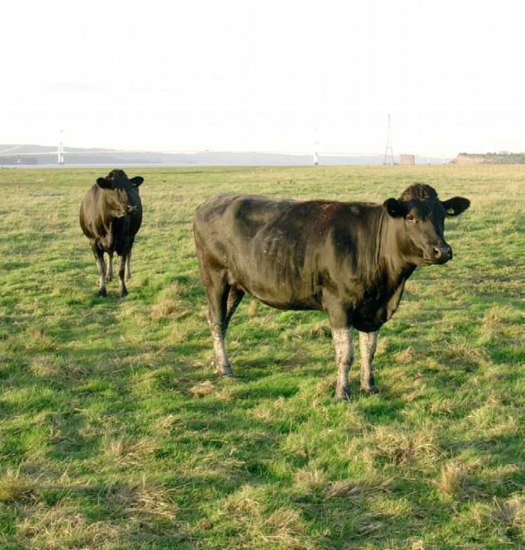
National Character               106. Severn and Avon Vales
      Area profile:                                                                                                                        Supporting documents

                                                                                                                            Key facts           Landscape         Analysis
                                 Introduction & Summary        Description                Opportunities
                                                                                                                            and data            change

   Statements of Environmental Opportunity
   ■■ SEO 1: Protect and manage the landscape, heritage and biodiversity
      associated with the Severn Estuary, the river valleys and other hydrological
      features, planning for a landscape scale expansion of wetlands, inter-
      tidal habitats and unimproved grasslands along river floodplains through,
      restoration, expansion and re-linkage of existing remnant areas of semi-
      natural habitat.

   ■■ SEO 2: Seek to safeguard and enhance this area’s distinctive patterns of
      field boundaries, ancient hedgerows, settlements, orchards, parkland, small
      woodlands, chases, commons and floodplain management with their strong
      links to past land use and settlement history, and for the benefits this will
      bring to soil erosion, soil quality and biodiversity.

   ■■ SEO 3: Reinforce the existing landscape structure as part of any identified
      growth of urban areas, hard infrastructure and other settlements ensuring
      quality green infrastructure is incorporated enhancing health, access,
      recreation, landscape, biodiversity and geodiversity.

   ■■ SEO 4: Protect geological exposures and maintain, restore and expand
      semi natural habitats throughout the agricultural landscape, linking them
      together to create a coherent and resilient habitat network enabling
      ecosystems to adapt to climate change.

                                                                                      Cattle grazed saltmarsh Northwick Warth, Severn Estuary, Avon.

                                                                                                                                                       4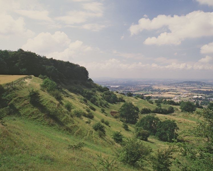
National Character 106. Severn and Avon Vales
Area profile: Supporting documents
Key facts Landscape Analysis
Introduction & Summary Description Opportunities
and data change
Description
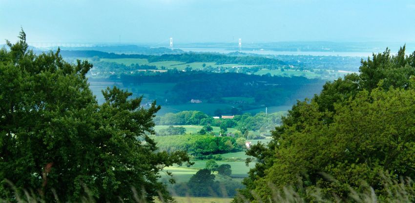
Physical and functional links to other National Distinct areas
Character Areas
■■ Cotswold outliers: Bredon, Dumbleton, Churchdown and Robinswood Hills.
To the western edge of the NCA the Malvern Hills form an abrupt feature,
rising steeply out of the Severn Vale. On the eastern boundary the area
flows more subtly into the Arden and Dunsmore and Feldon NCAs. There is
a similarly subtle boundary with the Teme Valley and Herefordshire Plateau
NCAs to the north and north-western edges of the area. From the Forest of
Dean, Malvern Hills and the Cotswolds there are impressive views over the
contrasting low lying and level landscape of the area and respectively there are
expansive views outwards to the surrounding hills. The M5 motorway running
right through the area, used by thousands of people each day, also provides
widespread views of this landscape and those of neighbouring NCAs.
The River Severn flows from the Mid Severn Sandstone Plateau into the area
and the Warwickshire Avon flows into the area from the Arden and Dunsmore
and Feldon NCAs. The Teme, rising from the Welsh border, flows across the
Clun and North West Herefordshire Hills, Herefordshire Lowland and Teme
Valley NCAs entering the Severn and Avon Vales from the north of the Malvern
Hills, while the Leadon, rising in the Herefordshire Plateaux flows across the
Herefordshire Lowlands and South Herefordshire and Over Severn NCAs,
entering the area from the south end of the Malvern Hills.
The Severn Vale from Crickley Hill and Barrow Wake Site of Special Scientific Interest.
5
National Character               106. Severn and Avon Vales
      Area profile:                                                                                                                                Supporting documents

                                                                                                                                   Key facts            Landscape               Analysis
                                 Introduction & Summary         Description                    Opportunities
                                                                                                                                   and data             change

     Key characteristics
     ■■ A diverse range of flat and gently undulating landscapes strongly influenced       north to south, while the Warwickshire River Avon meanders over a wide
        and united by the Severn and Avon rivers which meet at Tewkesbury.                 flood plain between Stratford, Evesham and Tewkesbury. The main rivers
     ■■ Prominent oolitic limestone outliers of the Cotswold Hills break up                regularly flood at times of peak rainfall.
        the low-lying landscape in the south-east of the area at Bredon Hill,           ■■ A strong historic time line is visible in the landscape, from the Roman
        Robinswood Hill, Churchdown Hill and Dumbleton Hill.                               influences centred at Gloucester, earthwork remains of medieval
     ■■ West of the Severn the Mercia Mudstones predominate, producing                     settlements and associated field systems through to the strong
        poorer silty clay soils. Lias clays in the Avon Valley and east of the Severn      Shakespearian heritage at Stratford-upon-Avon.
        create heavy but productive soils. River terrace gravels flank the edges of     ■■ Highly varied use of traditional buildings materials, with black and white
        watercourses.                                                                      timber frame are intermixed with deep-red brick buildings, grey Lias and
     ■■ Woodland is sparsely distributed across this landscape but a well                  also Cotswolds stone.
        wooded impression is provided by frequent hedgerow trees, parkland              ■■ Many ancient market towns and large villages are located along the
        and surviving traditional orchards. Remnants of formerly extensive                 rivers, their cathedrals and churches standing as prominent features in
        Chases and Royal Forests, centred around Malvern, Feckenham and                    the relatively flat landscape.
        Ombersley still survive.
     ■■ Small pasture fields and commons are prevalent in the west with a
        regular pattern of parliamentary enclosure in the east. Fields on the
        floodplains are divided by ditches (called rhines south of Gloucester)
        fringed by willow pollards and alders.
     ■■ Pasture and stock rearing predominate on the floodplain and on steeper
        slopes, with a mixture of livestock rearing, arable, market gardening and
        hop growing elsewhere.
     ■■ Unimproved neutral grassland (lowland meadow priority habitat)
        survives around Feckenham Forest and Malvern Chase. Along the main
        rivers, floodplain grazing marsh is prevalent. Fragments of unimproved             The view from Stanway Hill across the Severn Vale showing Cotswold outlier
        calcareous grassland and acidic grasslands are also found.                         hills standing out from the surrounding flat vale; Dumbleton Hill near the centre,
                                                                                           Bredon Hill far centre, Malverns left horizon.
     ■■ The River Severn flows broadly and deeply between fairly high banks,

                                                                                                                                                                6
National Character                  106. Severn and Avon Vales
      Area profile:                                                                                                                           Supporting documents

                                                                                                                               Key facts          Landscape           Analysis
                                    Introduction & Summary       Description                 Opportunities
                                                                                                                               and data           change

   Severn and Avon Vales today                                                        rise to inland salt marsh. Narrow riverside levels in the south widen out to the
                                                                                      north of Gloucester. The northern section of the area divides into two distinct
   The Severn and Avon Vales is a low-lying open agricultural vale landscape          landscapes characterised by their historic patterns of settlement and field
   with the Severn and Avon rivers, threading through this large and complex          boundaries. In the west, on poor, wet soils of the Mercia Mudstones, there is
   area, providing a unifying feature. The Cotswolds to the south-east, the Forest    an ancient landscape of dispersed settlements with numerous open commons
   of Dean to the south-west, and the Malvern Hills to the west, form abrupt          (survivors of the historic droving trade which crossed the area) and small
   boundaries providing prominent viewpoints across the vales. To the north, the      pasture fields. To the east, fertile soils on Lias clays give rise to rich agricultural
   Avon Vale rises more gently.                                                       land, particularly around the Vale of Evesham where market gardening
                                                                                      predominates. Here settlements are more nucleated, often around a church
   The Severn and Avon Vales are underlain by soft rocks, mostly consisting of        that stand prominently in this low lying landscape, and fields are medium
   the Mercia mudstone group and Liassic clays, which form heavy loam or clay         to large sized, with many following the narrow rectangular fields derived
   soils. River terrace deposits of sands and gravels are found in the Severn Vale,   from parliamentary enclosure of medieval strip farming. Many villages are
   some of which are worked commercially. An unusual feature is the localised salt    characterised by red brick, stone and black and white timber framed buildings.
   deposit around Droitwich, which has been worked since Roman times and gives
                                                                                      The River Severn flows north to south through the NCA and the River Avon
                                                                                      meanders east to west between Stratford and Tewkesbury where it joins
                                                                                      the Severn. The floodplains of the two rivers, plus a small length of the River
                                                                                      Teme north of Worcester, are a major unifying feature through this large and
                                                                                      complex NCA. To the south and east the NCA is dominated by nucleated towns
                                                                                      and villages; larger town and cities are mostly located on riversides, including
                                                                                      the cathedral cities of Worcester and Gloucester, and the Abbey Towns of
                                                                                      Tewkesbury and Pershore, which form prominent features in the landscape.
                                                                                      To the west of the Severn, settlements are more dispersed in nature, linked by
                                                                                      a network of lanes leading to the River Severn and to the higher ground to the
                                                                                      west. Alongside the rivers the major land cover is pasture, or further south,
                                                                                      estuarine levels. Many of the levels and grasslands have historically been
      Local rhubarb displayed at Tewkesbury      Green winged orchids at Foster's     managed as flood meadows, Hams or Lammas meadows. The nationally scarce
      Food and Drink Festival.                   Green Meadows SSSI, an example of    narrow leaved water dropwort is particularly associated with the Hams and
                                                 species-rich lowland meadow.
                                                                                      they are locally important for breeding waders.

                                                                                                                                                          7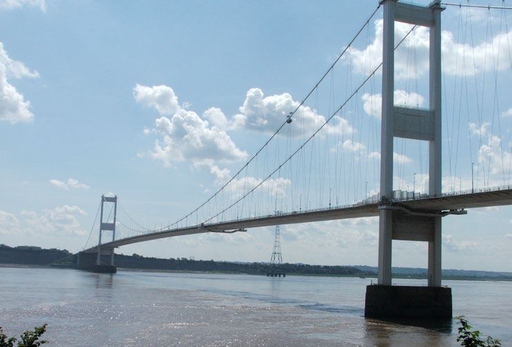
National Character                106. Severn and Avon Vales
      Area profile:                                                                                                                          Supporting documents

                                                                                                                               Key facts          Landscape         Analysis
                                  Introduction & Summary         Description                   Opportunities
                                                                                                                               and data           change

   Flood embankments, integral to past and current management of the                    sites, including rot holes, for birds and bats. This and surrounding NCAs are a key
   floodplain grasslands, line much of the length of the rivers, allowing               area for mistletoe, which particularly thrives on old fruit trees, lime and poplar.
   agricultural activity in former floodplain criss-crossed by tree lined ditches,      Mistletoe along with annual orchard blossom and fruit displays, provide striking
   called rhines south of Gloucester, and where veteran pollard willows are             seasonal features that have strong cultural associations within the area.
   frequent. South of Gloucester the Severn floodplain takes on an estuarine
   character, ever widening and with a gently undulating topography. Here               In the north-east of the NCA pasture is more frequent. Many species-rich
   wetlands and saltmarshes are internationally important for wildlife such as          hedges (some of which date back to Saxon times), nationally significant
   wading birds. Rare plants such as sea barley, ribbon-leaved water-plantain and       areas of lowland meadow, traditional orchards, wood pasture, parkland and
   true fox-sedge utilise the ponds and rivers of the floodplain.                       scattered ancient woodlands support many priority species. A high level of
                                                                                        public access in enjoyed across the area, including 11 km of the Cotswold
   Oolitic limestone outliers of the Cotswolds stand out prominently in the             Way National Trail and long distance routes such as the Severn Way, Wysis
   landscape around Gloucester and to the north-east of Tewkesbury. These well          Way and Gloucestershire Way, enabling the public to access and enjoy the
   wooded hills are part of the Cotswold Hills, standing as an isolated microcosm       natural environment. There are nationally recognised attractions such as
   of the Cotswolds stranded in the vale. Bredon Hill is an internationally             sites associated with Shakespeare, Berkeley Castle, the Severn Bore and the
   important site (designated Special Area for Conservation) for wildlife, with         Slimbridge wetland reserve which are popular with visitors.
   calcareous grassland and historic parkland containing many veteran trees,
   which host key invertebrate species such as the violet click beetle and red-         The Roman influence on the landscape is particularly strong around
   horned cardinal click beetle. Across the Vales woodland is generally sparse,         Gloucester. Earthworks of medieval townships and extensive ridge and
   localised and broadleaf in nature. However, a well wooded feel is provided           furrow survive, particularly in Honeybourne parish. There is also a nationally
   in many places by frequent hedgerow trees, traditional or bush orchards              important ridge and furrow fieldscape at Weston Subedge on the eastern
   and poplar shelter belts, or remnants of Royal Forests and Chases such as            fringe of the area. Substantial estates and parklands survive across the area,
   Feckenham. One of the largest concentrations of the declining native black           such as Croome, Sudeley Castle, Overbury (Bredon Hill) and Berkeley.
   poplar is found at Castlemorton.
                                                                                        The M5 runs through the length of the area while at the southern end, and along
   Across the NCA, many traditional orchards survive, retaining an important            the tidal Severn, the M4, M48, M49 and M5 motorways together with the two
   genetic resource in a wide range of local fruit varieties. Though commercially       Severn Bridges, riverside power stations, the canals and associated industrial
   superseded by more recently planted bush orchards, the traditional orchards are      heritage of mills and docks and the current industrial and commercial activity at
   rich in wildlife, providing the UK stronghold for the noble chafer beetle and nest   Avonmouth and Sharpness docks create prominent features.

                                                                                                                                                         8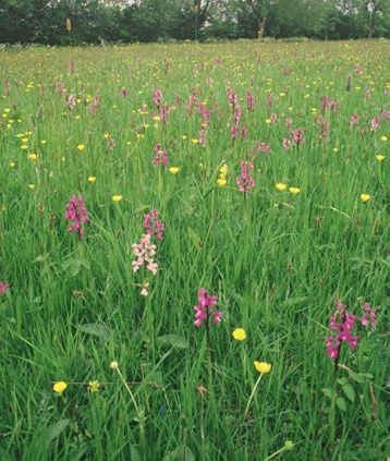
National Character               106. Severn and Avon Vales
      Area profile:                                                                                                                                Supporting documents

                                                                                                                                 Key facts             Landscape          Analysis
                                 Introduction & Summary         Description                   Opportunities
                                                                                                                                 and data              change

   The landscape through time                                                          once stood. Bredon Hill was a focus of early activity, reflected in its surviving
                                                                                       standing stones and hill forts. By the Iron Age, settlement had spread beyond
   The whole of the NCA is underlain by soft rocks of Triassic and Jurassic age        the gravels and Droitwich salt was being exploited. This was expanded by the
   resulting in the fertile soil that has influenced the land use throughout the       Romans and further evidence of their activity is seen in the legacy of Roman
   human settlement of the Vales. West of the Severn the Mercia Mudstones              roads crossing the area and in the Roman centre at Gloucester.
   predominate, producing poorer silty clay soils. Lias clays in the Avon Valley
   and east of the Severn create heavy but productive soils surmounted in places       The River Severn divides two sharply contrasting areas of historic significance
   by outliers of the Cotswold oolitic limestone forming Bredon, Dumbleton,            that strongly influence the present character of the NCA. To the west, there
   Churchdown, Robinswood and Alderton Hills. The oldest Triassic sandstones           is a predominant pattern of highly dispersed settlements, which was well
   of the Bromsgrove Formation give rise to hills and ridges fringing the northern     established by the 11th century. The present pattern of small-medium scale
   part of the area.                                                                   fields and an intermingling of assorted fields and open commons, derives from
                                                                                       medieval piecemeal enclosures of the once much more extensive heaths that
   Staircases of fossil-bearing river terrace gravels, formed in response to changes   developed through the grazing in common, of the poorer soils.
   in global climate and sea levels, flank the edges of the Severn and Avon and
   are significant for interpreting environmental change during the Pleistocene.
   In places these deposits are worked commercially for gravel. Unusual localised
   salt deposits (from the Triassic Mercia mudstone group) feature around
   Droitwich, producing rare inland saltmarsh. Peat deposits occur in the Gordano
   Valley at the southern tip of the area and at Walmore Common, where they give
   rise to distinctive wetlands.

   Along the lower reaches of the Severn, the youngest of the Triassic rocks
   (Rhaetic) crop out to produce a series of cliffs, for example Hock, Aust and
   Sedbury Cliffs, revealing further fossil exposures.

   Extensive evidence of human settlement as far back as the Palaeolithic and
   Mesolithic has been found on the gravel terraces, Oldbury provides evidence
   of Neolithic tools. The second half of the 1st Millennium BC saw major                 Flooding from the Severn in Gheluvelt Park, Worcester.
   woodland clearance, crop marks still showing where farmstead roundhouses

                                                                                                                                                             9
National Character                106. Severn and Avon Vales
      Area profile:                                                                                                                           Supporting documents

                                                                                                                                Key facts          Landscape         Analysis
                                  Introduction & Summary        Description                   Opportunities
                                                                                                                                and data           change

   To the east the predominant pattern is of stronger nucleation, with fewer           The use of traditional building materials across the area has been highly varied;
   isolated farmsteads. The latter formed as part of the enclosure of open fields      local stone (red sandstone, grey Lias or Cotswold stone) intermixed with timber
   that extended across most of the land, between the 16th and 19th centuries.         frame buildings sometimes retaining their thatch, and deep-red brick and
   The surviving field boundary patterns give a real impression of the former          pantile roofs. The grander houses at the base of the Cotswolds benefitted from
   nature and extent of the medieval townships, with their extensive common            the availability of local Cotswold stone. Modern developments tend to be in
   arable fields, most notably at the relict ridge and furrow fieldscapes of Weston    modern red brick or render with a mixture of slate, tile or pantile being used.
   Subedge. There is a high survival of 17th century and earlier houses across the
   area, from small wayside houses to the farmhouses of a prosperous class of          Broadcloth production (a major feature of Stroud valleys in the Cotswolds
   farmer that developed from the 15th century. There are also some barns of           NCA) developed in the south of the area from the late 14th century. Stocking
   medieval (mostly ecclesiastical) estates with notable concentrations along the      knitting developed at Tewkesbury, which also became a major corn milling
   Cotswolds Fringe where these estates were active in the clearance of woodland       centre from the medieval period. The building of the canal network during
   in the 12th and 13th centuries.                                                     the 18th and 19th centuries, to transfer and export the goods produced in
                                                                                       the area, simulated the growth of the Worcester porcelain pottery. The one
   The heavy and fertile soils of the east have supported a concentration of arable    time important dairy industry around Gloucester gave us double and single
   farming, while the Vale of Berkeley and Gloucester provided rich pastures           Gloucester cheeses. The Severn has long been a major salmon fishery and
   for cattle and for over-wintering sheep brought down from the Cotswolds.            historically, sturgeon and lamprey were supplied to the Crown.
   Fruit orchards for cider and perry developed from at least the 17th century.
   Horticulture developed on gravel terraces in the 19th century as railways
   brought urban markets closer.

   The 9th-century Anglo-Saxon church at Deerhurst is an internationally
   significant survival of early Christian architecture, and early Christian centres
   have developed as important cities and towns across the area, for example,
   Worcester, Gloucester and Tewkesbury. Later, towns at Evesham and Stratford-
   upon-Avon developed from the 12th century while Cheltenham developed
   as a spa town from the 1830s. Shakespeare’s Stratford, its theatre and historic
   buildings and Regency Cheltenham and associated festivals are internationally
   important visitor destinations.                                                        A traditional Worcestershire plum orchard showing standing dead wood, an
                                                                                          important resource for orchard biodiversity.

                                                                                                                                                          10
National Character 106. Severn and Avon Vales
Area profile: Supporting documents
Key facts Landscape Analysis
Introduction & Summary Description Opportunities
and data change
During the 20th century there has been rapid urban expansion, particularly of Ecosystem services
the larger cities and towns. This has been mirrored by many villages becoming
commuter settlements with new residential areas. Elm was once a highly The following section seeks to identify the services offered by the landscape.
characteristic hedgerow tree of the area and the loss of mature elm trees during A more expansive list of ecosystem services associated with this NCA are
the Dutch elm disease outbreak of the 1970s, has dramatically changed the included in the Analysis section.
landscape making it feel far more open.
The Severn and Avon Vales NCA provides a wide range of benefits to society. Each
Research showed that in the period 1990 to 1998, the landscape of the Severn is derived from the attributes and processes (both natural and cultural features)
and Avon Vales experienced a slight increase in small woodland planting, within the area. These benefits are known collectively as ‘ecosystem services’. The
consistent with the character of the NCA, but there were changes in agriculture predominant services are summarised below (under the constituent headings).
and development that were inconsistent with character. In the second Further information on ecosystem services provided in the Severn and Avon
assessment period from 1998 to 2003, it was noted that the woodland resource Vales NCA is contained in the ‘Analysis’ section of this document.
appeared to have strengthened, but changes in agriculture and the pressure of
development continued to transform the area. Riverine, boundary and historic Provisioning services (food, fibre and water supply)
elements also showed signs of neglect. ■■ Food provision: The Severn and Avon Vales NCA supports a mixture of
farming from predominantly grazing in the west, to intensive agriculture and
The development of the motorways that cross the area and the two Severn market gardening on the heavy but fertile soils of the Lias clay landscape to
bridges have increased access to this NCA and neighbouring Wales. The old the east. It is renowned for its orchards, soft fruit and asparagus production.
Severn Bridge, now a grade 1 listed building, was a pioneering design of its time
using aerofoil technology, which produces its characteristic slim profile. The ■■ Water availability: This NCA is characterised by two of the major rivers of
flat landscape and access to the water of the Severn has provided opportunities lowland England; the Avon and the Severn. The River Severn provides public
for industrialisation particularly at Avonmouth. Riverside power stations and water supplies to six million people. There is ‘no water available’ for abstraction
industrial and commercial activity at Avonmouth and along the tidal Severn to along the length of the River Severn and its tributaries, including the River Teme
Gloucester and beyond, all create prominent landscape features. and the River Avon within this NCA. There are no major reservoirs in this NCA.
■■ Genetic diversity: This and the surrounding NCAs of the major fruit producing
counties of Gloucestershire, Herefordshire and Worcestershire hold a wide
range of local varieties of orchard fruit, cultivated over hundreds of years.
11National Character 106. Severn and Avon Vales
Area profile: Supporting documents
Key facts Landscape Analysis
Introduction & Summary Description Opportunities
and data change
Regulating services (water purification, air quality maintenance and Cultural services (inspiration, education and wellbeing)
climate regulation) ■■ Sense of place/Inspiration: Sense of place is provided by the rivers Severn
■■ Regulating soil erosion: Soil erosion is recognised as a concern particularly and Avon and their floodplains, with ancient market towns and villages
along the River Teme catchment with its steeper slopes. located on them, such as Worcester, Stratford, with its strong associations
with Shakespeare, Tewkesbury and Gloucester with their characteristic
■■ Regulating water quality: The majority of surface water in this NCA is black and white timber framed buildings. The Vale of Evesham and its
of moderate or poor ecological quality. The Severn and Avon rivers are association with horticulture including soft fruits and the wider coverage
considered ‘heavily modified’. and strong cultural associations of traditional orchards are also an
essential part of the character of the area.
■■ Regulating water flow (flooding): Flooding is a significant problem in this
NCA with two major rivers, which confluence at Tewkesbury. The catchment ■■ Sense of history: The area contains a wealth of visible built and natural
management plan proposes ways to increase the regulation of river flooding. historic and prehistoric features including some which are internationally
renowned such as those associated with Shakespeare.
■■ Pollination: Pollination services are particularly important in this NCA due
to the pollination requirements of orchards and the horticultural nature of ■■ Recreation: Recreation is supported by waterways, over 5,000 km of rights
farming in parts of the area. of way at a density of 2.41 km per km2, including the 11 km of the Cotswold
Way and 1 km of Offa’s Dyke National Trails, plus just under 2,000 ha of
■■ Regulating coastal flooding and erosion: The Severn estuary has the second open access land.
largest tidal range in the world, at 10-12 m, and is tidal as far upstream as
Gloucester. In Avonmouth and surrounds there are approximately 1,043 ■■ Biodiversity: There are nine internationally designated sites in the NCA.
properties at risk from all sources of flooding, including fluvial, tidal and The area is particularly important in terms of the floodplain wetland and
coastal. Most of the flooding here results from tide-locking. associated bird assemblages, lowland meadow and traditional orchards.
Most of the woodland is semi-natural ancient woodland, and important
invertebrate assemblages are supported by the veteran trees of parkland such
as that in the Bredon Hill SAC.
■■ Geodiversity: There are rare inland salt deposits at Droitwich, as well as
staircases of fossil bearing river terrace gravels and other fossil bearing
exposures along the rivers and the limestones of the Cotswold outliers.
12National Character 106. Severn and Avon Vales
Area profile: Supporting documents
Key facts Landscape Analysis
Introduction & Summary Description Opportunities
and data change
Statements of Environmental Opportunity
SEO 1: Protect and manage the landscape, heritage and biodiversity associated with the Severn Estuary, the river valleys and other hydrological features,
planning for a landscape scale expansion of wetlands, inter-tidal habitats and unimproved grasslands along river floodplains through, restoration,
expansion and re-linkage of existing remnant areas of semi-natural habitat.
For example, by:
■■ Restoring the natural floodplain function, landscape and habitat ■■ Maintaining restoring and creating areas of wetland habitat, including
diversity associated with the rivers Severn and Avon and their tributaries estuary saltmarshes, mudflats and grazing marsh for nationally
through the opportunities provided by managed realignment, and the important assemblages of breeding waders; flood meadows, “hams”
management of agricultural drainage/land use, increasing flood water pastures and fen and the contribution salt marsh provides to carbon
storage capacity and reducing surface water run-off and soil erosion. sequestration.
■■ Ensuring that managed realignment sites on the Severn Estuary are ■■ Managing peat soils so that they remain wet or are re-wetted to
managed to create new intertidal and saline habitats that will contribute maintain important wetland biodiversity and sequestrate carbon.
to, maintain and enhance biodiversity, contribute to climate regulation ■■ Managing standing water features dispersed across the NCA to
and enhance local landscape character, improve sustainability of current maintain their significant biodiversity interest.
management practices and reduce flooding of built-up areas. ■■ Protecting the exceptionally rare surviving example of inland saltmarsh
■■ Appropriately managing, restoring and creating fen, freshwater and inter- near Droitwich by managing this habitat to ensure its continuity.
tidal grazing marsh, reedbed and ditch features to create an extensive ■■ Maintaining and extending low-input permanent pasture, hedgerows
and interconnected habitat network of wetlands, benefiting BAP species and woodland across slopes near the River Teme to reduce soil erosion
such as true fox sedge and supporting the large numbers of wildfowl that and impact on water quality.
utilise both the estuary and surrounding wetlands, while ensuring that ■■ Reverting arable to permanent unimproved grassland, particularly
heritage assets, such as ridge and furrow, are not damaged or destroyed adjoining or close to existing remnant areas of semi-natural habitat.
during the restoration or creation of wetland habitats. ■■ Promoting and expanding, multi-functional quality green spaces and
■■ Protecting river terraces, important for their archaeological and linear routes, integrated with wetland habitats for recreation, health
geological record, retaining the outstanding evidence base for historic and educational benefits.
and prehistoric settlement, glacial and fossil record.
13National Character 106. Severn and Avon Vales
Area profile: Supporting documents
Key facts Landscape Analysis
Introduction & Summary Description Opportunities
and data change
SEO 2: Seek to safeguard and enhance this area’s distinctive patterns of field boundaries, ancient hedgerows, settlements, orchards, parkland, small
woodlands, chases, commons and floodplain management with their strong links to past land use and settlement history, and for the benefits this will
bring to soil erosion, soil quality and biodiversity.
For example, by:
■■ Retaining, restoring, and managing appropriately, all hedges and especially ■■ Protecting the integrity of floodplain grasslands together with
those that defines enclosure of medieval strip farming where this is a strong embankments that are fundamental to their historic management and
landscape feature. This will enhance the landscape, retain historic field are important for present day flood management.
patterns and provide an important biodiversity resource and connectivity ■■ Protecting ridge and furrow and other buried archaeology from damage
of particular importance across the arable areas. Good hedgerow by cultivation and enhance biodiversity by restoring permanent
management will also assist reduce soil erosion and protect soil quality. grassland.
■■ Protecting and restoring the dry stone walls characteristic of the ■■ Protecting varied heritage assets including archaeological features
Cotswolds particularly seen on the Cotswold outliers in this NCA. such as iron-age hill forts, earthwork remains, ridge and furrow, Roman
■■ Managing open commons to retain and enhance their open character estate boundaries for example on Bredon Hill, and patterns of former
and biodiversity value. medieval strip farming, and ensure access to and interpretation of
■■ Managing ditches and rhines together with veteran willow pollards that these important historical features.
line their boundaries. ■■ Promoting, managing, restoring and enhancing designed parklands,
■■ Within ‘ancient woodland restoration areas’ (identified by Forestry deer parks, wood pasture, commons and traditional orchards with their
Commission woodland opportunity mapping) where ancient woodland associated biodiversity, local genetic varieties and, historic buildings, for
comprises 3 per cent or more of the landscape, linking the smaller example cider houses and associated cultural heritage, through local and
woodland fragments to secure and enhance them. For example Bredon community events creating new recreation and education resources.
Hill, Malvern Hills and the Forest of Feckenham. ■■ Retaining genetic diversity of orchard trees to allow adaptability to the
effects of a changing climate.
14National Character 106. Severn and Avon Vales
Area profile: Supporting documents
Key facts Landscape Analysis
Introduction & Summary Description Opportunities
and data change
SEO 3: Reinforce the existing landscape structure as part of any identified growth of urban areas, hard infrastructure and other settlements ensuring
quality green infrastructure is incorporated enhancing health, access, recreation, landscape, biodiversity and geodiversity.
For example, by:
■■ Ensuring that extensions to settlements, such as residential ■■ Ensuring that new developments provide biodiversity enhancement
developments considered around Worcester, Redditch, Gloucester, rather than just mitigation.
Cheltenham and Tewkesbury, and further industrial expansion ■■ Encouraging the creation of sustainable urban drainage systems, and
at Avonmouth, are designed to ensure their visual and functional surface water management plans that can create new wetland features
integration with the surrounding landscape and the existing urban close to urban areas and new development, tying in as part of a green
edge. Key views to and from settlements should be retained. infrastructure network.
■■ Providing access to quality greenspace through well designed green ■■ Conserving the area’s richly varied traditional architecture and farmsteads,
infrastructure which will benefit health and wellbeing and provide habitat vernacular and historic buildings in Cotswold stone, timber framing
increasing the permeability of the urban landscape to biodiversity. and deep-red brick, encouraging the use of appropriate styles and use
■■ Ensuring any new hard infrastructure, such as new power stations or of locally distinctive materials. Ensuring that the repair, restoration or
other industrial plants along the Severn, are designed to ensure visual conversion of vernacular buildings is carried out with due regard to this
and functional integration with the surrounding landscape. historic interest using local and appropriate materials, styles and detailing.
SEO 4: Protect geological exposures and maintain, restore and expand semi-natural habitats throughout the agricultural landscape, linking them together
to create a coherent and resilient habitat network enabling ecosystems to adapt to climate change.
For example, by:
■■ Carrying out geo-conservation work at important geological sites aspects of conservation practices in the National Character Area.
improving accessibility so that they are available for research and ■■ Protecting river terrace gravel sites which, due to their unconsolidated
education and all the geodiversity features are visible. nature, are particularly vulnerable to erosion, commercial extraction
■■ Working with landowners to ensure geological sites are appropriately and development.
managed and their condition is monitored. ■■ Protecting and restoring calcareous grassland habitat on the Cotswold
■■ Ensuring that the management of geological sites is integrated into all outliers.
15National Character 106. Severn and Avon Vales
Area profile: Supporting documents
Key facts Landscape Analysis
Introduction & Summary Description Opportunities
and data change
■■ Protecting veteran trees in parklands, particularly in the Bredon Hill SAC orchard and possibly short rotation coppice. Ensuring that extant
and Dixton Wood SAC, and ensure plans for continuity of old trees and historic woodland boundaries are not masked by buffering or woodland
dead-wood resources are made. extensions. Protecting existing populations of green hound’s tongue.
■■ Conserving violet click beetle populations associated with veteran ■■ Retaining and managing wood pasture and parkland in former chase
trees, particularly at Bredon Hill SAC and Dixton Wood SAC, and which and royal forest areas, particularly focussing on continuity of veteran
also support other important invertebrates, bats, birds and fungi. tree and dead-wood resources.
■■ Promoting sustainable farming practices to create a farmed landscape, ■■ Managing peat soils in the Gordano Valley and Walmore Common so
which is more permeable to the movement and supporting of species. their biodiversity value associated with wet meadow, reed bed and carr
■■ Protecting and enhancing ancient woodland across the area. communities and carbon sequestration potential is fully realised.
■■ Targeted planting of new woodland, informed by strategies such as the ■■ Protecting all heritage assets, in particular ridge and furrow and other
Forestry Commission ancient woodland opportunity mapping, paying earthwork features in permanent grasslands.
due regard to the ancient open character of the landscape in places ■■ Maintaining and improving the quality and expanding a network of
such as the Vale of Evesham. integrated public green spaces and rights of way for biodiversity,
■■ Improving the management of traditional orchards and developing geodiversity, recreation and health benefits.
age structure to ensure continuity of habitat resource and reverse the
dramatic loss of this habitat for species associated with traditional
orchard trees. Connecting orchards with other wood habitat to create
functional habitat networks.
■■ Protecting species-rich grasslands, manage, restore and create
unimproved grassland and traditional orchard habitat to provide an
interconnected grassland habitat network.
■■ Protecting and managing hedgerows, particularly those with
substantial blackthorn presence and extending the network of hedges
suitable for brown hairstreak butterflies.
■■ Protecting ancient woodlands scattered across the former chase and royal
forest areas and aiming to incorporate them into interconnected habitat Pershore Abbey, a prominent ecclesiastical feature standing out in the flat vale
landscape.
networks by buffering woodlands with unimproved grassland, traditional
16National Character 106. Severn and Avon Vales
Area profile: Supporting documents
Key facts Landscape Analysis
Introduction & Summary Description Opportunities
and data change
Additional opportunity
1. Enhance and manage the relationship between access to the natural environment and conservation of the landscape, biodiversity, geodiversity and
historic qualities of this popular area.
For example, by:
■■ Maintaining and enhancing the high level of public access through the ■■ Managing sensitively and promoting the Cotswolds Way to national
dense network of rights of way and long distance routes, woodland standards and also other long distance routes such as the Severn Way,
and open access land with clear signposting and better interpretation to protect sensitive habitats, enhance tourism and ensure a high quality
to improve the quality of understanding and enjoyment of the experience for all users.
distinctive landscape and natural environment. ■■ Providing interpretation of the many biodiversity and geodiversity
■■ Developing multi-purpose routes that prevent undue erosion, features of the area to improve understanding and enjoyment of the
characterised by good quality surfacing, gradients and signage that distinctive landscape and natural environment.
enable more people to enjoy the natural environment together. ■■ Ensuring interpretation of historic buildings and artefacts brings out
■■ Providing more green infrastructure and route connectivity in areas their role in the development of landscape over time and continues to
close to where people live to improve access for all, sustainable provide inspiration through sense of place and literary associations that
transport options, and improve health and understanding of the the area provides.
natural environment. ■■ Enhancing the many recreational opportunities offered whilst
■■ Improving access and facilities in selected areas, in particular to the rivers minimising the pressures for tourism by ensuring sufficient
Severn and Avon for non-motorised recreational use that enables more infrastructure is in place, and managing visitor demand.
people to engage in healthy activities in inspirational water environments.
17National Character 106. Severn and Avon Vales
Area profile: Supporting documents
Key facts Landscape Analysis
Introduction & Summary Description Opportunities
and data change
Supporting document 1: Key facts and data
Please note: (i) Designated areas may overlap (ii) all figures are cut to Mean High Water Line,
Total area: 210,326 ha. designations that span coastal areas/views below this line will not be included.
1. Landscape and nature conservation designations
There are 538 Local sites in the Severn & Avon Vales NCA covering 6,941 ha
The Severn and Avon Vale includes 11,980 ha of the Cotswolds Area of which is 5 per cent of the NCA.
Outstanding Natural Beauty (AONB) and 2,199 ha of the Malvern Hills AONB. In Source: Natural England (2011)
total AONBs cover 7 per cent of the total area of the NCA.
■■ Details of individual Sites of Special Scientific Interest can be searched at:
http://www.sssi.naturalengland.org.uk/Special/sssi/search.cfm
Management plans for the protected landscape(s) can be found at:
■■ www.wyevalleyaonb.co.uk/ ■■ Details of Local Nature Reserves (LNR) can be searched http://www.lnr.
naturalengland.org.uk/Special/lnr/lnr_search.asp
■■ www.cotswoldsaonb.org.uk/
■■ Maps showing locations of Statutory sites can be found at http://magic.
Source: Natural England (2011)
defra.gov.uk - select ‘Designations/Land-Based Designations/Statutory’
1.1 Designated nature conservation sites
The NCA includes the following statutory nature conservation designations: 1.1.1 Condition of designated sites
Tier Designation Name Area % of A breakdown of SSSI conditions as of March 2011 is as follows:
(ha) NCA
Percentage of SSSI in
International Ramsar Severn estuary; Walmore Common 774National Character 106. Severn and Avon Vales
Area profile: Supporting documents
Key facts Landscape Analysis
Introduction & Summary Description Opportunities
and data change
2. Landform, geology and soils 2.4 Superficial deposits
Thick deposits of Quaternary sediments were deposited across the NCA
2.1 Elevation during the ‘ice ages’ by rivers and ice sheets. The Severn and Avon Rivers both
The NCA is on average 41 m above sea level with a maximum elevation of 295 m. have important ‘staircases’ of river terraces formed in response to changes
Source: Natural England (2010) in global climate and sea and land levels. Many of these river gravels are
fossil bearing and contain vertebrate remains. Some deposits of sands and
2.2 Landform and process gravels here are worked commercially. Flooded former gravel workings form
The Severn and Avon Vales NCA has a diverse range of flat and gently undulating significant wildlife sites in several parts of the National Character Area. An
landscapes largely consisting of silty clays thought to be deposited in an arid unusual feature is the localised salt deposit around Droitwich, which has
environment in ephemeral lakes, inland seas or saline lakes, punctuated in places been worked since Roman times and gives rise to inland salt marsh.
by Cotswold outliers. The area is now drained by the rivers Severn and Avon, Source: Severn & Avon Vales Countryside Character area description, Severn & Avon
both of which have important ‘staircases’ of river terraces formed in response to Vales Natural Area profile, British Geological Survey maps
changes in global climate and sea and land levels.
Source: Severn & Avon Vales Countryside Character Area description 2.5 Designated geological sites
Tier Designation Number
2.3 Bedrock geology National Geological Site of Special Scientific Interest (SSSI) 13
The Severn and Avon Vales are underlain by Triassic and Jurassic soft rocks, National Mixed Interest SSSIs 1
Local Local Geological Sites 42
mostly consisting of Mercia Mudstones (formerly known as Keuper Marls)
and Liassic Clays, which form heavy loam or clay soils. Several outliers of Source: Natural England (2011)
Cotswold Jurassic Limestone occur at Bredon Hill and near Gloucester, for
example, Churchdown and Robinswood Hills. They are the source of many
important fossil faunas including fish, reptiles and insects. Along the lower ■■ Details of individual Sites of Special Scientific Interest can be searched at
reaches of the Severn are a series of cliffs where bands of hard Rhaetic http://www.sssi.naturalengland.org.uk/Special/sssi/search.cfm
Limestone are interspersed with layers of softer rocks. Thin bands of Rhaetic
Limestone also underlie some of the low hills north of Gloucester through to
the Natural Area boundary just south of Bromsgrove.
Source: Severn & Avon Vales Countryside Character area description, Severn & Avon Vales
Natural Area profile, British Geological Survey maps
19National Character 106. Severn and Avon Vales
Area profile: Supporting documents
Key facts Landscape Analysis
Introduction & Summary Description Opportunities
and data change
2.6 Soils and Agricultural Land Classification 3. Key waterbodies and catchments
The 8 main soilscapes in the NCA are: Slightly acid loamy and clayey soils with
impeded drainage, covering 29 per cent of the NCA; Lime-rich loamy and clayey 3.1 Major rivers/canals
soils with impeded drainage (25 per cent); Slowly permeable seasonally wet The following major rivers/canals (by length) have been identified in this NCA.
slightly acid but base-rich loamy and clayey soils (16 per cent); Freely draining Name Length in NCA (km)
slightly acid loamy soils (9 per cent); Loamy and clayey floodplain soils with River Arrow 4
naturally high groundwater (7 per cent); Loamy and clayey soils of coastal flats River Avon 86
with naturally high groundwater (6 per cent); Freely draining lime-rich loamy River Isbourne 17
soils (5 per cent); and Freely draining floodplain soils (1 per cent). River Leadon 15
River Severn 77
Maps showing locations of Statutory sites can be found at: River Stour 1
http://magic.defra.gov.uk – select ‘Landscape’ (shows ALC and 27 types of soils). River Teme 14
Source: National Soil Research Institute Gloucester & Sharpness Canal 25
Stratford upon Avon Canal 6
The main grades of agricultural land in the NCA are broken down as follows (as Worcester and Birmingham Canal 24
a proportion of total land area):
Source: Natural England (2010)
Grade Area in (ha) Percentage of NCA
Please note: other significant rivers (by volume) may also occur. These are not listed where
Grade 1 4,215 2
the length within the NCA is short.
Grade 2 25,503 12
Grade 3 14,610 69 3.2 Water quality
Grade 4 18,986 9 The total area of Nitrate Vulnerable Zone is 145,454 ha, 69 per cent of the NCA.
Source: Natural England (2010)
Grade 5 252National Character 106. Severn and Avon Vales
Area profile: Supporting documents
Key facts Landscape Analysis
Introduction & Summary Description Opportunities
and data change
4. Trees and woodlands Area and proportion of ancient woodland and planted ancient woodland sites
(PAWS) within the NCA:
4.1 Total woodland cover Woodland type Area (ha) Percentage of NCA
The NCA contains 11,148 ha of woodland (5 per cent of the total area), of which Ancient semi-natural woodland 875 2
3,080 ha is ancient woodland The Forest of Avon Community Forest, one of Ancient re-planted woodland (PAWS) 1National Character 106. Severn and Avon Vales
Area profile: Supporting documents
Key facts Landscape Analysis
Introduction & Summary Description Opportunities
and data change
6. Agriculture 6.4 Land use
There has been an 11 per cent drop in the land area used for cereal farming
The following data has been taken from the Agricultural Census linked to this NCA. but a 28 per cent increase in the area of land used for oilseeds, and a 25 per
cent increase in land used for “other arable crops”.
6.1 Farm type Source: Agricultural Census, Defra (2010)
The predominant farm types are Livestock Grazing and Cereal. Horticulture
is also prominent, particularly around the fertile vale of Evesham: Cereal 466 6.5 Livestock numbers
farms (17 per cent); General Cropping 124 (4 per cent); Horticulture 281 (10 per There was a 39 per cent drop in the number of pigs farmed here between
cent); Specialist Pigs 23 () holdings in 2009 than there were in 2000.
the NCA belonging to holdings whose centre point is within the NCA listed.
Conversely, there were fewer holdings of all other sizes in 2009 than there
had been at the start of the millennium.
Source: Agricultural Census, Defra (2010)
6.3 Farm ownership
2009: Total farm area = 155,338 ha; owned land = 101,786 ha
2000: Total farm area = 155,359 ha; owned land = 105,134 ha
Source: Agricultural Census, Defra (2010)
22National Character 106. Severn and Avon Vales
Area profile: Supporting documents
Key facts Landscape Analysis
Introduction & Summary Description Opportunities
and data change
7. Key habitats and species 7.2 Priority habitats
The Government's new strategy for biodiversity in England, Biodiversity 2020,
7.1 Habitat distribution/coverage replaces the previous Biodiversity Action Plan (BAP) led approach. Priority
Important concentrations of unimproved neutral grassland (lowland meadow) habitats and species are identified in Biodiversity 2020, but references to
resource survives around Feckenham Forest and Malvern Chase and along BAP priority habitats and species, and previous national targets have been
the main rivers. Coastal and floodplain grazing marsh is also prevalent, with removed. Biodiversity Action Plans remain a useful source of guidance
fragments of calcareous grassland on higher ground, particularly on Bredon and information. More information about Biodiversity 2020 can be found
Hill. Below the Malvern Hills at Castlemorton and Hollybed commons there are at; wwwnaturalengland.org.uk/ourwork/conservation/biodiversity/
localised areas of unimproved, acidic grasslands. Below Frampton, Gloucester, protectandmanage/englandsbiodiversitystrategy2011.aspx.
there are areas of regularly inundated saltmarsh.
The NCA contains the following areas of mapped priority habitats (as mapped
Past industrial activity has created areas of open water habitat at places like by National Inventories). Footnotes denote local/expert interpretation. This will
Upton Warren Pools, Grimley Brick Pits (Worcestershire) and Frampton Pools be used to inform future national inventory updates.
(Gloucestershire). Habitat Area (ha) Percentage of NCA
Coastal and floodplain grazing marsh 13,923 7
Woodland is sparsely distributed across this landscape but a well wooded Broadleaved mixed & yew woodland 3,484 2
impression provided by frequent hedgerow trees and surviving traditional orchards Traditional orchard 2,280 1
which are particularly common around Evesham and Westbury on Severn. Lowland meadows 383National Character 106. Severn and Avon Vales
Area profile: Supporting documents
Key facts Landscape Analysis
Introduction & Summary Description Opportunities
and data change
Maps showing locations of priority habitats are available at: 8.3 Local vernacular and building materials
■■ http://magic.defra.gov.uk - Select 'Habitats and Species/Habitats' The vernacular here is an abundance of red brick, timber framing and pantile
roofs. At the edge of the Cotswolds, the availability of high quality building
7.3 Key species and assemblages of species stone has produced some grander houses.
■■ Maps showing locations of some key species are available at: Source: Severn & Avon Vales Countryside Character Area description; Countryside Quality
http://magic.defra.gov.uk - Select 'Habitats and Species/Habitats' Counts (2003)
■■ Maps showing locations of S41 species are available at http://data.nbn.org.uk/ 9. Key historic sites and features
9.1 Origin of historic features
8. Settlement and development patterns There is extensive evidence for Palaeolithic and Mesolithic activity on gravel
terraces. There was major woodland clearance in 1st millennium BC. Early
8.1 Settlement pattern Christian centre at Worcester becomes bishopric in 679, and other evidence
Although the area is mainly one of towns and nucleated villages, towards the of early Christian activity at Gloucester, Pershore, Evesham and in minster
west and particularly on the poorer land there are hamlets and common-edge churches founded by local Hwiccan aristocracy: 9th-century Deerhurst
settlements in a rather dispersed pattern. survives as internationally significant example of early Christian architecture.
Source: Severn & Avon Vales Countryside Character Area description; Countryside Quality
Counts (2003) Major abbeys built after Norman Conquest at Tewskesbury (1087) and
8.2 Main settlements Gloucester (1089), and Berkeley Castle became important in south of area as
The main towns/cities within the NCA: are Cheltenham, Gloucester and Worcester; administrative centre of the Berkeley estates that continue to present.
smaller settlements include Droitwich Spa, Great Malvern and Evesham. The total
estimated population for this NCA (derived from ONS 2001 census data) is: 699,655. To the west of the Severn, the predominant settlement pattern of high to very
Source: Severn & Avon Vales Countryside Character Area description; Countryside Quality high levels of dispersal was clearly evident by the late 11th century, nucleated
Counts (2003), Natural England (2012) villages and being rare. Moated sites are common.
To the east, the predominant settlement pattern is of strong nucleation. Very
low to extremely low levels of dispersed settlement, with some moated sites
24You can also read