Water-spreading weirs for the development of degraded dry river valleys - Experience from the Sahel
←
→
Page content transcription
If your browser does not render page correctly, please read the page content below
Water-spreading weirs for the development
of degraded dry river valleys
Experience from the Sahel

Published by:
2

Table of Content

Foreword                                                                            4

Summary                                                                            5

1   Introduction                                                                   8

2   Water-spreading weirs for the rehabilitation of dry valleys                    10
    2.1 Development of water-spreading weirs – a timeline                          10
    2.2 Ecological processes in dry valleys                                        10
    2.3 Action mechanism and technical characteristics of water-spreading weirs    12
    2.4 Use and management of rehabilitated valley floors                          19
    2.5 Legal-institutional aspects in the construction of water-spreading weirs   21

3   Organisational aspects of water-spreading weirs                                24

4   Water-spreading weirs affect ecology, yields and living conditions             28
    4.1 Impacts of water-spreading weirs on groundwater and surface water          30
    4.2 Increases in usable land area and users                                    32
    4.3 Increases in yield and production                                          34
    4.4 Impacts on livestock husbandry                                             38
    4.5 Water-spreading weirs as a measure for adapting to climate change          38
    4.6 Income and profitability                                                   39
    4.7 Social impacts                                                             41

5   Sustainability of water-spreading weirs                                        44

6   Success factors and challenges                                                 46

7   Appendices                                                                     48
    Appendix 1: Construction of water-spreading weirs – key steps                  48
    Appendix 2: References                                                         51
    Appendix 3: Technical drawings of water-spreading weirs                        52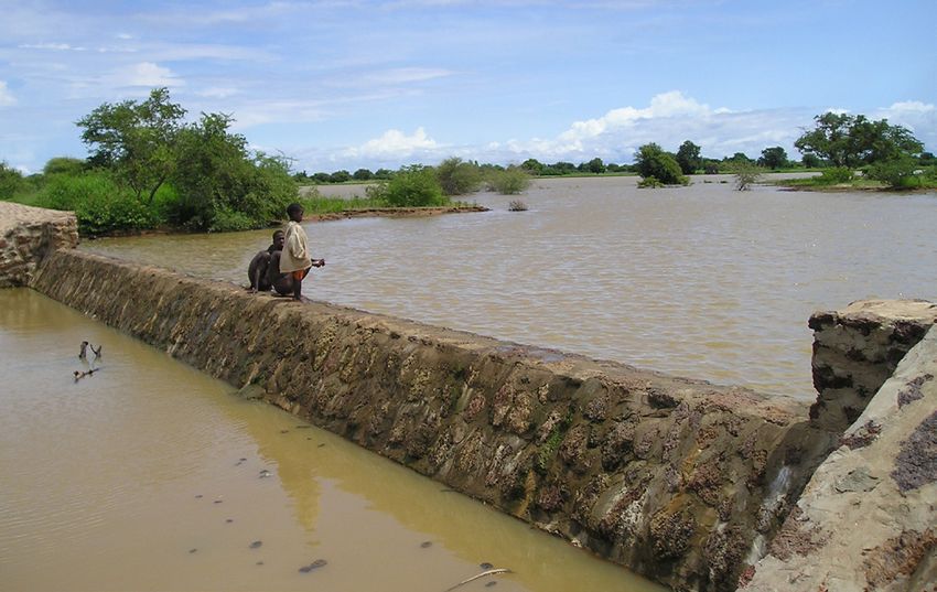
TABLE OF CONTENT                                                                           3

Boxes
Box 1:   Water-spreading weirs are adapted to various priorities                      12
Box 2:   Water-spreading weirs alone do not stop erosion completely                   15
Box 3:   Land-use planning for drainage basins (SMEV) in Niger                        20
Box 4:   Impacts of water-spreading weirs on groundwater in Chad                      31
Box 5:   Impacts of water-spreading weirs on poor households                          42

Tables
Table 1: Yield increases in rainy season crops with water-spreading weirs             35
Table 2: Yield increases in dry season crops in Niger with water-spreading weirs      36
Table 3: Changes in arable land, yield and production in 11 rehabilitated valleys
         in Niger                                                                     37
Table 4: Estimated income from vegetable crops in Niger                               40

Acronyms
DETA       Development-oriented Emergency and Transitional Aid Project (ENÜH by its German
           initials)
FICOD      Fonds d‘Investissement pour les Collectivités Décentralisées
GIEC       Groupe d’experts Intergouvernemental sur l’Évolution du Climat
HIMO       Haute Intensité de la Main d’Œuvre (intensive use of manual labour)
LUCOP      Programme de Lutte contre la Pauvreté (Niger)
PADL/UE    Programme d’Appui au Développement Local de l’Union Européenne (Chad)
PDRD       Programme de Développement Rural Décentralisé (Chad)
PDRT       Projet de Développement Rural de Tahoua (Niger)
PMAE       Projet de Mesures Anti-Erosives
PNSA       Programme Nationale de Sécurité Alimentaire (Chad)
PROADEL/BM Programme d’Appui au Développement Local (Chad)
PRODABO    Programme de développement rural décentralisé d’Assoungha, Biltine et Ouara
           (Chad)
SMEV       Schéma de Mise en Valeur des Vallées
4                                                                                          FOREWORD

Foreword

The present study is an outcome of a joint KfW
and GIZ initiative that has been implemented           The approaches of the following
on behalf of the German Federal Ministry for           programmes were studied:
Economic Cooperation and Development /                 • Niger: LUCOP/GIZ and FICOD/KfW
(BMZ). Its purpose is to describe the new              • Burkina Faso: FICOD/KfW
approach involving the construction of water-          • Chad: PDRD/GIZ and the DETA project
spreading weirs that was developed in recent             Sécurité alimentaire et gestion paisible
years in the Sahel region, and thus to make it an        des ressources naturelles dans les zones
attractive option for other semi-arid regions as         des réfugiés á l’Est du Tchad/GIZ
well.
                                                       This study is based on the following
The joint initiative was supported by KfW’s            substudies:
Agricultural and Natural Resources Division            • Bender, Heinz: Flussschwellen zur
and sub-Saharan Africa governance team.                  Überflutung von Talsohlen. Technisch-
The following GIZ sector projects contributed            ökologischer Teil. Mai 2011. [River weirs
to the initiative: ‘Sustainable Management of            for flooding valley bottoms. Technical-
Resources in Agriculture’, ‘Rural Territorial            ecological section]. May 2011.
development’, the ‘Convention project to               • Kambou, Fiacre: Etude sur le concept de
combat desertification’ and the development-             réalisation des seuils d’épandage en ses
oriented emergency and transitional aid (DETA)           aspects organisationnels (soft) au
project Sécurité alimentaire et gestion paisible des     Burkina Faso. April 2011.
ressources naturelles dans les zones des réfugiés á    • Lütjen, Heiko: Inwertsetzung von
l’Est du Tchad.                                          Flusstälern im Sahel durch die Errichtung
                                                         von Flussschwellen
The present study also provides the basis for a          als neuer Ansatz zur landwirtschaft-
capacity development programme which is to               lichen Produktionssteigerung und
be developed jointly by the participating na-            Ernährungssicherung im ländlichen
tional and international engineering firms. This         Raum. April 2011. [Rehabilitation of river
programme shall focus on engineers and con-              valleys in the Sahel by the construction of
sulting firms in the countries in question.              river weirs: A new approach to increasing
                                                         agricultural production and food
                                                         security]. April 2011.
                                                       • Bureau Consult International:
                                                         Expérience des seuils d’épandage au
                                                         Tchad. June 2011.
SUMMARY                                                                                                 5

Summary

Over the last 12 years water-spreading weirs         rapid runoff of the water, there is also less infil-
have been introduced and improved as a new           tration in the valley and the water table there
rehabilitation technique for degraded dry            drops. This in turn harms the natural vegetation
valleys in Burkina Faso, Niger and Chad. They        and limits agricultural use. Within a few years
complement the previously available, proven          fertile valleys turn into desert-like landscapes.
rehabilitation measures for drainage basins. As
a result, a set of measures is now available for     These dynamics can be reversed with water-
the future stabilisation of such basins – from the   spreading weirs and stabilisation measures
plateaus to the slopes to the valley floor. Water-   in the drainage basin. Water-spreading weirs
spreading weirs are an additional, economical        are structures that span the entire width of the
and effective water management option for val-       valley. They consist of a spillway in the actual
leys, where they supplement retention basins,        riverbed and lateral abutments and wings.
small impoundment dams and microweirs as             Floodwaters are spread over the adjacent land
means of intensifying agricultural production        area above the structure, where they eventu-
in the valleys. In contrast to other techniques,     ally overflow the lateral wings and then slowly
water-spreading weirs are especially well-suited     flow back towards the riverbed below the struc-
for the large-scale rehabilitation of wide and       ture. As a result the land area below the water-
shallow dry valleys that have been seriously         spreading weir is flooded. The lateral spreading
degraded and in which severe gully erosion pre-      of the water causes the land area above and
vents the regular flooding that would normally       below the structure to be flooded and supplies
be typical there.                                    it with sediment. Water infiltrates, gullies in
                                                     the valley are filled and the riverbed is raised.
Substantial degradation of drainage basins in        Thanks to the infiltration, the water table also
the Sahel due to population growth and intense       rises in a few years.
land-use pressure has been observed since the
1960s. Climate change has further amplified          Water-spreading weirs alter the basic runoff
this trend. The expansion of agriculture and         and sedimentation processes in the valley.
intensification of grazing and logging have          Specific adaptation to the various alterations
caused the natural vegetation cover to decline.      of natural processes and agricultural optimisa-
This process has been accelerated by severe          tion of the water-spreading weirs are frequently
droughts and has led to the degradation of the       beyond the scope of a single construction cam-
soils. Sparse vegetation cover and structurally      paign, and subsequent adaptations may be re-
damaged soils reduce rainfall infiltration into      quired. In constructing water-spreading weirs,
the soil, resulting in more runoff and soil ero-     the first step is to identify basically suitable
sion on plateaus and slopes. Runoff is concen-       valleys in a region and inform the respective
trated in the valleys, in which heavy floodwaters    villages, communities and technical services
wash away fertile soils and lead to deep erosion     about the possibilities and prerequisites for re-
of the riverbed. The annual, recurrent small and     habilitation. Interested communities then sub-
medium-size floods that normally cause tem-          mit a written request to the project in charge,
porary inundation of the valleys and deposition      which is examined by an approval committee.
of fertile sediments no longer occur. Due to the     The socioeconomic conditions and structures in
6                                                                                             SUMMARY

the valley and the willingness of the local peo-     are less susceptible to damage. In combination
ple to cooperate are assessed in the subsequent      with the water-spreading weirs, areas in the
feasibility study. Then the basic construction       drainage basin that are especially susceptible
parameters are defined and the anticipated           to erosion and the areas between the weirs are
costs are estimated in a preliminary technical       stabilised in order to regulate runoff more ef-
study. The information delivered by these stud-      fectively and minimising silting. Users who do
ies provides the basis for the final approval of     not own any land in the valley benefit from the
the construction.                                    additional stabilisation measures outside the
                                                     actual valley.
After approval a detailed technical study is con-
ducted, on which the invitation to tender and        The construction of water-spreading weirs en-
ultimately the selection of a construction com-      sures that soils are regularly flooded and sup-
pany is based. One of the principles of imple-       plied with water and sediment. The arable land
mentation is intensive participation by the com-     area and the yields of the rainy season crops
munities and villages so that the responsibility     serving as staple foods increase. For example,
may be transferred to the local level as soon as     4,731 farms in a valley system in Niger (which
possible. The community is the client, issues the    were direct beneficiaries of such rehabilitation
invitation to tender and accepts the work in the     measures) each had approx. 0.6 ha of arable val-
end. It also assumes a portion of the construc-      ley land prior to the rehabilitation. Thanks to
tion costs. A management committee made up           the water-retaining weirs, this was increased to
of representatives from the local villages and       2.2 ha. Millet and sorghum yields increased on
communities is set up in the chosen valley. It       average by 85–90% and 25–30%, respectively.
acts as the contact for all external stakehold-
ers and helps in the organisation of the work.       The more frequent flooding of the soils results
Under the leadership of the management com-          in increased infiltration, and the groundwater
mittee, future rules of use are agreed and docu-     level rises substantially in most of the valleys.
mented. This can be in the form of a local use       In 15 rehabilitated valleys in Niger, for example,
agreement, or may take place in the scope of a       the average depth of the water table level from
more comprehensive land-use planning proc-           the surface was 12.5 metres prior to the rehabili-
ess for the entire drainage basin system.            tation. A few years after the stabilisation meas-
                                                     ures, the average depth of the water table in the
The construction work is performed with in-          valleys was 3.5 metres below the surface.
tensive manual labour (HIMO by its French ac-
ronym) by workers from the local villages, thus      In most of the valleys, prior to the rehabilitation
generating local income-earning opportuni-           it was only possible to grow a rainfed crop and
ties during the construction phase. During the       perhaps an irrigated crop on some small areas
construction phase, local craftsmen are trained      of land. After the rehabilitation, in addition to
for the future maintenance of the structures.        the rainfed crop grown on larger areas of land,
Water-spreading weirs are usually built in series    it became possible to grow a post-rainy season
in order to rehabilitate as much land area in the    crop (culture de décrue) and, once the water
valley as possible; moreover, structures in series   table had risen, an irrigated crop (culture de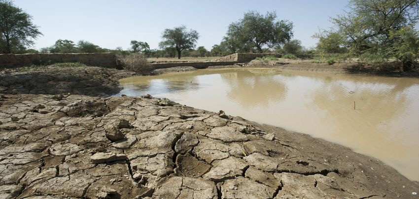
SUMMARY                                                                                              7

contresaison) in most cases as well. Hence, prior    change in regions experiencing increasing
to the rehabilitation, it was not possible to grow   variability in rainfall.
a crop during the dry season in 8 out of 15 val-
leys in Burkina Faso, whereas in others it was       The challenges lie in ensuring that the manage-
only possible to grow an irrigated crop to a lim-    ment committee is still able to function after
ited extent on small fields in direct proximity to   the end of the project and that the local struc-
the river. Since the rehabilitation, at least one    tures (e.g. the communities) are able to main-
additional crop cycle is now possible on larger      tain the water-spreading weirs, particularly in
fields during the dry season in 13 out of the 15     the event of severe damage. At the present time
valleys. The experiences in Niger and Chad are       the organisational and technical know-how for
similar.                                             the construction and use of water-spreading
                                                     weirs exists in only three countries (Burkina
Post-rainy season crops and irrigated crops di-      Faso, Niger, Chad) and is limited to a few stake-
versify agricultural production. They are used       holders. This study aims to introduce the
primarily for marketing and thus as a means of       approach and describe it in detail so that it can
earning of cash incomes. The growing of staple       be spread to other semi-arid regions. The idea
crops during the rainy season is mainly done by      is for the approach to be more widely adopted
the landowners themselves. However, they are         through intensive exchange of experience and
only able to use a portion of the land area for      by capacity development of companies and
intensive post-rainy season and irrigated crops      engineers.
with the available labour, and they therefore
pass this land on to other farmers to use.

Water-spreading weirs thus increase and diver-
sify agricultural production by making more
arable land area available, increasing yields and
making 1 to 2 additional crop cycles per year
possible. This contributes substantially to food
security and higher incomes for the beneficiar-
ies. Thanks to the rising water tables, the natu-
ral vegetation of the valleys and the availability
of fodder for livestock improve. Water for drink-
ing and for watering livestock is more readily
available, which in turn eases the workload of
women. The more intensive production stimu-
lates other business activities and generates
income, helping to reduce poverty and stabilise
the local population. With their capacity to           Stagnant water in water-spreading weir
regulate annual floodwaters and harness them           © GIZ / Klaus Wohlmann
to stabilise production, water-spreading weirs
are an effective measure for adapting to climate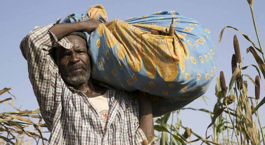
8                                                                                               INTRODUC TION

1 INTRODUCTION

Valleys often constitute favourable environ-               types of irrigation dams, small impoundment
ments for agriculture and settlement. The depo-            dams, water retention basins and microweirs
sition of nutrient-rich sediments from the sur-            were constructed in the valleys to store water,
rounding plateaus and slopes of the drainage               raise the water table or control runoff and thus
basin and the inflow of surface and slope water            improve irrigation, water availability and flood
form fertile alluvial soils. The availability of wa-       protection.
ter for people, livestock and crops is improved.
The alluvial plains in arid regions like the Sahel,        To supplement the existing set of measures,
where it only rains a few months a year, are pro-          water-spreading weirs1 were introduced dur-
duction sites with an outstanding potential for            ing the last 12 years as a new measure for the
intensive farming. Multiple harvests are even              rehabilitation and sustainable use of degraded
possible.                                                  dry valleys, and have been improved based on
                                                           experience gained in Niger, Burkina Faso and
Increasing population pressure, inappropriate              Chad. With the option of effectively rehabilitat-
land uses and climatic fluctuations have result-           ing wide and degraded dry valleys, they com-
ed in the increasing degradation of the Sahel              plement the existing measures and thus present
region drainage basins and their valley floors             an opportunity for holistic rehabilitation of
over the last 40 years. Clear-cutting, over-exploi-        degraded drainage basins throughout such val-
tation and recurring droughts have brought                 leys – plateaus, slopes and valley floors.
about a decline in the vegetation, which in
turn has led to increased surface runoff and soil          Water-spreading weirs are low retention walls
erosion, and, in the valleys, to highly variable           designed to reduce runoff and erosion. They are
drainage conditions, gully erosion, silting and            made of natural stones and cement, and consist
a drop in the groundwater. The ultimate result             of a spillway in the dry riverbed itself, lateral
was a drastic reduction of the production poten-           abutments for stabilisation and wing walls that
tial of the valleys.                                       span the width of the valley (Figure 1). In dry val-
                                                           leys in which water flows in the rivers for only a
In order to deal with the degradation, biological          few days a year, they serve to distribute the in-
and physical soil and water conservation meas-             coming runoff over the valley floor and allow as
ures for restoring and maintaining production              much water as possible to infiltrate the soil. The
potential, especially on the plateaus and slopes           groundwater is thus replenished and is then
of drainage basins, have been implemented                  available for agricultural use. In contrast to the
since the 1980s. Reforestation, hedgerows and              various types of dams, the goal of water-spread-
grass strips, rows of stones, filter dams and sta-         ing weirs is not to create reservoirs for later use.
bilisation of gullies serve to reduce runoff and           What water-spreading weirs do is cause a tem-
the erosion that it causes. Previously, various            porary flooding of the adjacent land area above
                                                           and below the weir.

1 In German there is presently no standard term for water-spreading weirs, and the structures are known as
Talschwellen, Sohlschwellen or Flussschwellen. Talschwelle is used in the German version of this text, as the
structures span the entire valley (Ger: Tal). Water-spreading weirs are known as seuils d’épandage in French.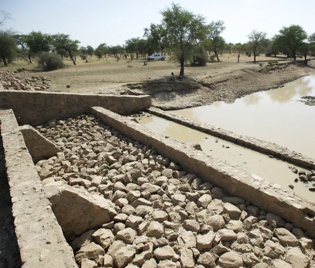
INTRODUC TION                                                                                                                        9

The aim of this study is to introduce the new ap-                     ly on the work of four preliminary studies that
proach of water-spreading weirs to the interest-                      were conducted in Burkina Faso, Niger, Chad
ed professional audience consisting of develop-                       and transnationally,2 as well as on comments
ment experts, consultants and planners, and to                        and suggestions from numerous stakeholders.
summarise the experience acquired with them                           At this point we would like to thank all of them
since the late 1990s. The results are based main-                     for their contributions and input.

  Figure 1: Components of water-spreading weirs. A) schematic with spillway, abutments and wing walls. B) spillway in the riverbed
  with lateral abutments. C) water-spreading weir with spillway, lateral abutments and wing walls. Source: after Bender (2011)

                              Abument                                                                                    Abutment

          Wing walls                                                                                                 B

    A                                                Spillway

                                                                                                                     C

                Water spreading weir

2 Burkina Faso: Kambou (2011), Niger: Lütjen (2011), Chad: BCI (2011), transnational: Bender (2011)
10                                 WATER-SPRE ADING WEIRS FOR THE REHABILITATION OF DRY VALLEYS

2 Water-spreading weirs for the
  rehabilitation of dry valleys
2.1 Development of water-                           In 2003 the KfW-funded project ‘HIMO’ (later
    spreading weirs – a timeline                    FICOD) adopted the already improved method
                                                    in Burkina Faso and constructed a total of 65
Water-spreading weirs have been used and            water-spreading weirs in 23 valleys between
improved in Chad, Niger and Burkina Faso            2003 and 2010.
since the 1990s.
                                                    German development cooperation incorporat-
The first water-spreading weirs were intro-         ed water-spreading weirs into its programme
duced during the 1990s in Chad through              in Chad in 2004. By 2010, 104 water-spreading
Swiss cooperation.3 In Niger, the use of water-     weirs had been constructed in the scope of the
spreading weirs began in the Tahoua region in       two development projects DETA and PDRD.
1997. In that region, the first water-spreading
weirs were constructed in an area in which the      Water-spreading weirs have since been widely
slopes and plateaus of various drainage basins      adopted and are now used as an approach by
had already been stabilised through measures        German, Swiss and French cooperation as well
for conserving soil and water implemented           as the World Bank and other donors in the three
as part of the Projet de Développement Rural de     African countries.5
Tahoua (PDRT). Thanks to the weirs, the fertile
but heavily damaged valleys were also reha-
bilitated in addition to the plateaus and slopes,   2.2 Ecological processes in dry
thus stabilising the drainage basins in their           valleys
entirety.
                                                    Land-use pressure and climate change have
The first generation of water-spreading weirs       led to the degradation of drainage basins in
were built with stone-filled wire baskets known     the Sahel in just 40 years.
as gabions and were prone to damage. From
2000 on the weirs underwent continuous im-          The successful use of water-spreading weirs
provements in terms of both efficacy and dura-      demands a holistic understanding of the eco-
bility. The gabions were replaced with cement-      logical and hydrological processes of a drainage
reinforced natural stone walls, the planning        basin. Water flows in the dry valleys of the Sa-
process was refined, engineering and construc-      hel for only a few weeks a year. After the heavy
tion firms were trained, and the local people       isolated downpours typical of the region, the
were taught how to maintain the structures. By      runoff collects in the valley and there it drains
2010 more than 200 water-spreading weirs had        away as concentrated floodwater. In ecologi-
been constructed in the Tahoua region, with ap-     cally intact valleys, the valley plains are repeat-
proximately 10,000 ha of arable land area and       edly inundated during the three to four-month
nearly 5,000 users.4                                rainy season. The valley soils are infiltrated and
                                                    thus store additional water; excess water seeps

3 Picard (no date), p. 1
4 Lütjen (2011), p. 37
5 LUCOP (2010a), p. 77f
WATER-SPRE ADING WEIRS FOR THE REHABILITATION OF DRY VALLEYS 11
deeper and replenishes the groundwater. Fine In valleys these heavy floodwaters erode the
soil and organic matter are deposited and im- riverbed, thus concentrating the runoff even
prove the fertility of the soils every year. Salts more. Because of the sunken riverbed, the
that would otherwise accumulate near the sur- smaller and medium-sized floodings of the val-
face in certain regions are leached out. ley floor with their fertile sediment deposits no
longer occur. The rapid runoff rate aggravates
Valleys with a largely intact ecology develop a gully and bank erosion. Fertile alluvial plains
dense vegetation cover that uses the available are destroyed. Because of the lack of periodic
soil moisture or is able to access the groundwa- flooding, the low rate of infiltration and the rap-
ter via deep-penetrating roots. The vegetation id runoff, the groundwater level drops. Former-
enriches the soil with additional organic matter ly fertile valleys are transformed into desert-like
and nutrients and stabilises the soil structure, landscapes within a few years (Figure 2).
thereby improving water absorption capacity
and resistance to erosion. Figure 2: A) (before) gully erosion in damaged valley floor;
B) bottom: rehabilitated valley floor with dense vegetation
(Fulachi, Niger). Source: Lütjen
Traditionally, agriculture used to utilise only a
A
small portion of the drainage basins and thus
the soils were able to recover during the long
fallow periods. Most of the land area was used
as forest and pasture land. The basins, including
the valleys, thus remained ecologically stable
for long periods.
Aggravated by the first severe droughts in the
years 1968–1973, rapidly progressing degrada-
tion due to a growing population and increas-
B
ing land-use pressure has been noted in the
Sahel region ever since. In the Tahoua region in
Niger, for example, the practice of leaving fields
fallow was abandoned over 15 years ago and
agricultural land area has been expanded to the
detriment of pasture and woodland. Declining
vegetation cover and more intensive use caused
a rapid deterioration of the soils. Water perme-
ability is declining, causing surface runoff and
increasingly more intense floodwaters. Due
to the heavy runoff and the sparse vegetation
cover, soil erosion is on the rise and gullies are The degradation of fertile valley floors is thus
forming. directly correlated with the degree of the deg-
radation of the entire drainage basin. Degraded
valleys therefore require, depending on the12 WATER-SPRE ADING WEIRS FOR THE REHABILITATION OF DRY VALLEYS
extent of the erosion risk, various soil and wa- Box 1: Water-spreading weirs are adapted
ter conservation measures in the basin itself to various use priorities
in order to increase infiltration then and there
and reduce the runoff and silting in the valley. Depending on the climate zone and farming system,
Without such supplementary measures, water- farmers use natural resources for various purposes:
spreading weirs in degraded basins are subject - Rice growing is the main goal of the farmers
to rapid damage from gully erosion, undermin- in north-eastern Burkina Faso. Hence they
ing and silting. prefer weirs as high as possible that retain
water on the flooded land for several days or
weeks.
2.3 Action mechanism and - In Tahoua, Niger, sorghum is grown in years
technical characteristics of in which water is plentiful, and millet in other
water-spreading weirs years. If the water retained by the weirs
remains on the land for too long, it is no
Water-spreading weirs are designed to stop longer possible to grow sorghum. Because
gully erosion in valley floors and to establish a the design of the first water-spreading weirs
drainage pattern corresponding to that of in- was not sufficiently adapted to the priorities
tact valley floors; in other words, they promote of the users, they were initially dissatisfied.
the inundation of the valley floor and the depo- Scepticism faded, however, once the users
sition of fine soil and organic matter. In order to found that they could grow an additional
do so, the structures must span the entire width crop on the flooded area without having to
of the valley floor. Depending on user prefer- irrigate once the water receded. They then
ences, the primary goal may be: i) agricultural adapted their farming systems to the new
use, ii) sylvo-pastoral use, or iii) the replenish- conditions.
ment and raising of the water table (Box 1). - In Aïr, Niger, onions are planted in the rainy
season because early onions command a
The flooded land area, the volume of impound- high sales price. The main production, how-
ed water and hence sedimentation and infil- ever, takes place during the dry season with
tration can be influenced by the height of the irrigation. The farmers in Aïr thus wanted
weirs and the distances between the structures. most of all to raise the level of the water
In contrast to various types of dams, however, table so that they could irrigate as easily
no further regulation of the water is possible as possible from shallow wells. Hence the
after the weirs are constructed, and longer-term water-spreading weirs were designed so that
surface detention of water for irrigation use at a a large volume of water would infiltrate but
later date is not the goal. The achievable yields also so that only minor flooding of a portion
are therefore less than those that are possible of the valley floor would occur in order to
with controlled irrigation. However, water- enable the production of early onions during
spreading weirs are easier to manage and main- the rainy season.
tain than dams. They are also more economical Source: Bender (2010), p.15
to construct.WATER-SPRE ADING WEIRS FOR THE REHABILITATION OF DRY VALLEYS 13
In villages that are otherwise cut off during The water-spreading weir diverts the water to
the rainy season, water-spreading weirs can the sides in order to inundate as much surface
also be designed as fords so that the valley can area as possible above and below the weir.
be crossed during the rainy season as well Water infiltrates, and fertile sediments are
(Figure 3). deposited on the flooded land area.
Figure 3: A water-spreading weir designed as a ford for Because the water flows back to the lower river-
crossing the valley. Source: Bender (2011), S. 16
bed after it overflows the wings, the soil in the
zone of return flow below the weir is especially
susceptible to erosion. To prevent this from hap-
pening, water-spreading weirs are preferably
constructed in series, thus reducing the flow
gradient. The areas between the weirs are also
stabilised (Box 2).
The specific adaptation of the structures to the
individual site conditions and use requirements
is often beyond the scope of a single construc-
tion project, as the structures cause alterations
to the valley floor and the drainage pattern. The
experiences of the users continue to change
Water-spreading weirs consist of a spillway, and evolve as well. As a result of these altera-
which is located in the riverbed, lateral abut- tions, subsequent adaptations such as elevation
ments and wing walls, which gradually de- or reinforcement of the structures may be justi-
crease in size with increasing distance from the fied in order to optimise use and sustainability.
main structure (Figure 4). As the floodwater This leads to a multi-year process wherein the
rises, the various structural elements overflow structures and their use need to be monitored
one after another: (i) with little runoff all of the and possible adaptations considered.
water is conducted over the spillway and re-
mains in the riverbed; (ii) with increasing runoff
first the lower, outer wing walls overflow, and
(iii) finally the higher wing walls as well as run-
off increases even further.
The abutments at the sides of the spillway are
designed to protect both it and the riverbanks
below from erosion. The abutments are only
flooded in exceptional cases with extremely
high floodwaters.14 WATER-SPRE ADING WEIRS FOR THE REHABILITATION OF DRY VALLEYS
Technical aspects in the construction of water- After a valley is selected, the next step is the
spreading weirs detailed technical study, which is necessary
for preparing the tender documents. In this
Water-spreading weirs require detailed tech- study the type of weirs and the dimensions of
nical planning and experienced engineering the structures are established and the exact
and construction firms. The bulk of the work sites of the individual water-spreading weirs
is performed using local materials and by are marked on the landscape. The cross-section
village craftsmen and helpers. of the valley at the height of each weir is meas-
ured. The individual plans of the water-spread-
A series of preparatory steps6 nis necessary ing weirs are drawn (Appendix 2) and the work
before construction of the weirs can start. The is described in the tender documents. The draft-
technical planning starts with a preliminary ing of the study requires considerable practical
technical study once the people of a valley on an experience, which must be taken into account
extensive area of the valley floor have agreed to in the selection of the engineering firm. New
the rehabilitation work. In the scope of the pre- project engineering teams must therefore be
liminary technical study, the approximate sites supervised and given practical training by an
of the weirs, the weir type and the rough dimen- experienced engineer. Local experts should be
sions are determined, wherein it is necessary included in the studies. Because the studies will
to gauge how the individual weirs will interact. be conducted prior to the rainy season and the
This ultimately leads to the overall design of the construction will not take place until after the
planned series of water-spreading weirs. The rainy season, the fact that several years of such
inundation area to serve as potential produc- supervision will be necessary must be taken
tion area is determined, and the cost of the en- into account. The structure will not be tested in
tire system is estimated using per hectare cost actual practice until the following rainy season.
values derived from experience. The soil quality Furthermore, water-spreading weirs alter the
and the depth of the water table are assessed drainage pattern of the water, soil erosion and
and the anticipated impact of the weirs on the silting, and land uses in the valley. Hence it is
groundwater level is estimated. Groundwater necessary to commit to several years of observa-
levels that can be raised rapidly and clayey soils tion and subsequent adjustments to the struc-
are indicative of valleys with a high production tures may also be required.
potential of up to three possible harvests.
6 Appendix 1 gives a schematic timetable for the implementation of water-spreading weirs, which can also
ser ve as an aid for interested projects and par tners.WATER-SPRE ADING WEIRS FOR THE REHABILITATION OF DRY VALLEYS 15
Figure 4: A) with moderate runoff, the spillway in the actual riverbed and the lower wing walls located on the outsides of the weir
overflow. B) as runoff increases, the higher wings overflow as well. Source: Bender (2011), p. 13
Flood area at risk of erosion
A B
Box 2: Water-spreading weirs alone do not stop erosion completely
Gully erosion and sedimentation pose a danger to individual water-spreading weirs in degraded valleys. Hence water-
spreading weirs are constructed in series (Figure 5) in which neighbouring weirs protect each other by reducing the
gradient between the weirs and thus slowing the runoff velocity.
Even in series, however, erosion processes still occur between individual weirs. The areas directly above and below
the water-spreading weirs are well protected (green area in Figure 6). The retained water stagnates above the weir;
the water immediately below the weir has very little flow velocity and erosion force. With increasing distance from
the weir, however, the velocity picks up again and the water concentrates more and more, and thus the risk of erosion
increases in direct proportion to the distance from the weir. The river banks below the weir are also in danger of being
eroded by the return flow of the water.
In order to prevent erosion from starting anew, small stone walls are built between the weirs and also below the last
weir, and deep gullies between the weirs are stabilised with filter dams. Stabilisation measures are required outside
the immediate area of the valley as well (not shown in the figure), in areas at high risk for erosion and gully erosion in
order to reduce runoff and silting in the valley.
Figure 5: Water-spreading weirs constructed in series – an Figure 6: Areas above and below the weirs are well protected
example from two dry valleys in Chad (Wadi Chock and Wadi (1, 2); the risk increases in direct proportion to the distance from
Chaou – yellow lines). the upper weir (3) and gullies may form (4)
Source: PRODABO in BCI, 2011, p. 7 Source: Bender, 2005, p. 2416 WATER-SPRE ADING WEIRS FOR THE REHABILITATION OF DRY VALLEYS
The invitation to bid on the construction work ployees, receive instruction and practical train-
is issued on a national level in order to build up ing from technical specialists with experience
the expertise of local firms. As the client, the in water-spreading weir construction. Local
municipal authority issues the invitation to bid. masons are also included in this training so that
In Niger, for example, a representative from they are able to perform repair work later on.
each of the following takes part in the bid evalu-
ation process in order to ensure transparency: The use of local materials and the inclusion of
the community, the state specialist authorities, the local population are key implementation
the supervising engineering firm,7 the project principles for easing future maintenance. Be-
and the office in charge of the planning. The cause water-spreading weirs alter both the nat-
contract with the construction company is con- ural processes and the uses in the valley, it is es-
cluded between the latter and the project, on sential to assess the impacts of these changes on
behalf of the client. It is important that the invi- the structure after one or more rainy seasons.
tation to bid and the awarding of the contract This takes place in the scope of a technical eval-
phases be completed by the end of the rainy uation, in which weak places are investigated
season so that the actual construction of the and adaptation measures are established to en-
water-spreading weirs can begin early in the sure optimum utility. For instance, if high weirs
dry season and be completed by the next rainy are planned, it may emerge that the structures
season. Adaptations can then be made in subse- cannot be built to the final height right away for
quent years. safety reasons. Instead it may be necessary to
build lower weirs first. Following the construc-
The contracted local construction companies tion the height differences will be lessened as
are contractually obligated to use manual soil builds up, and then additional height can
labour as much as possible for the work and be added on to the structures.
to hire and train mainly local workers (HIMO
approach).8 This provides a temporary sup- Figure 7: Training site for local craftsmen. Source: Lütjen
plemental income for local households, whose
members also acquire the necessary craftsman-
ship skills for the future maintenance of the
structures. The contracted engineering firms,
municipal authority representatives, members
of the newly formed management committee
and the project supervise the construction. Final
acceptance is by the client (community), with
the assistance of the project/engineering firm.
When the work starts, setting up a training site
has proven invaluable. Here local helpers and
experts, as well as construction company em-
7 Because the communities as clients in Niger do not have the necessar y exper tise to super vise the construction,
this task is delegated to an engineering firm (‘delegated client ship’).
8 HIMO – Haute Intensité de la Main d’OEuvre (intensive use of manual labour)WATER-SPRE ADING WEIRS FOR THE REHABILITATION OF DRY VALLEYS 17
Where are water-spreading weirs especially There are various approaches and techniques
useful? for rehabilitating valleys that can be used in
combination with one another. Water-spread-
Water-spreading weirs are especially well- ing weirs are one of the possible, proven options
suited for the large-scale rehabilitation of that should be considered.
severely degraded, wide valley floors.
Complementary rehabilitation measures in the
Compared to small impoundment dams, reten- drainage basin
tion basins and microweirs, water-spreading
weirs are especially well-suited for shallow, Complementary stabilisation measures in
wide valleys that, due to severe gully erosion, critical areas of the drainage basin are
are no longer inundated by small and medium required to protect water-spreading weirs.
volume floodwaters. The flooding no longer
takes place because the actual riverbed has An important reason why rehabilitation meas-
been deeply eroded and enlarged. However, ures in drainage basins must include valley
water-spreading weirs are also suitable for im- floors is the high production potential of such
proving agricultural productivity in more or areas and the potential contribution to food
less intact valley floors. security that this represents. The per hectare
production potential of valley floors is higher
Water-spreading weirs are successful in re- than that of the other areas in the basin, as
gions where precipitation during the growing valleys have the most fertile soils and the best
season is erratic and where the weirs ensure a water supply. By the same token the valley
more evenly distributed water supply for crops, area is small compared to the rest of the basin,
as well as in zones in which water enrichment thus limiting the scope of necessary measures.
makes one or two additional growing seasons Hence there is much to be said for securing this
possible. At the present time they are in use in a important production potential. Nevertheless,
broad area where annual rainfall ranges from measures outside the valleys are still critical
50 to 1,200 mm/year. because the condition of the rest of the basin ex-
erts a considerable effect on the valley floors.
The difficulty in the construction of water-
spreading weirs lies chiefly in the extent of the A degraded drainage basin increases the risk of
degradation and gully erosion. The slope of the damage to measures implemented in the val-
valley, runoff volume and soil properties are leys. Heavy surface runoff from the slopes leads
secondary factors. For example, the slope in the to intense flooding and silting in the valleys,
valleys that have been rehabilitated to date lies and in turn to more stress on and damage to
between 1 and 8%. It merely influences the dis- the water-spreading weirs. In contrast, basins
tance between two weirs and thus the cost per in which stabilising soil and water conservation
hectare. measures have been implemented reinforce
the positive effects of water-spreading weirs
on the hydrological regime. A portion of the
water infiltrating the drainage basin flows un-18 WATER-SPRE ADING WEIRS FOR THE REHABILITATION OF DRY VALLEYS
Water-spreading weir facilitates water supply and soil fertility © GIZ / Klaus Wohlmann
derground as slope water to the valley floor and challenge can only be mastered through long-
thus continuously replenishes the valley floor’s term commitment on the part of the local peo-
groundwater supply. ple as well as the government, and it requires
long-term functioning funding mechanisms.
In order to protect the valley floors from excess In the scope of water-spreading weir ‘projects’
runoff and sedimentation, rehabilitation meas- with their generally short runtimes, all that can
ures must be implemented at least in those ar- usually be accomplished is to start stabilising
eas of the rest of the drainage basin that are par- plateaus and slopes in critical areas, and to use
ticularly susceptible to erosion. Such measures this work as a basis for introducing necessary
are essential for protecting the water-spreading technology and for training the local people.
weirs. Furthermore, they also serve to improve
agricultural production for households that do In special cases, water-spreading weirs can be
not own any valley land. incorporated as a supplementary element in
already rehabilitated drainage basins. This was
When planning rehabilitation measures in a possible to some extent in Niger, where the first
drainage basin, the dimensions of the land area water-spreading weirs were built in regions
in the valley and the rest of the basin need to where the PDRT (Projet de Développement Rural
be taken into account. The relatively small val- de Tahoua) had already stabilised a large por-
ley floor compared to the rest of the basin can tion of the basins. This project demonstrated
be rehabilitated in the course of a few years that water-spreading weirs can be used as an el-
and is hence feasible in the scope of ‘develop- ement in a holistic approach to drainage basin
ment projects’. In contrast the large-scale reha- management and also as a specific measure (in
bilitation of entire drainage basins frequently combination with the stabilisation of areas par-
requires decades, which should be taken into ticularly at risk of erosion) for rapidly restoring
account when planning new projects. Such a the productivity and ecology of valley floors.WATER-SPRE ADING WEIRS FOR THE REHABILITATION OF DRY VALLEYS 19
2.4 Use and management of Production during the rainy season primarily
rehabilitated valley floors serves as a means of self-provision with staple
foods. Excess production can be marketed in
Prior to rehabilitation, the degraded valleys good years. The yield of the post-rainy season
were generally only used for the production of and irrigated crops also serves as a supplement
a rainfed crop consisting predominantly of mil- to self-provision, but is mainly intended for
let, sorghum and cowpea (black-eyed pea). Such marketing.
crops were grown on the remaining land areas
of the valley (areas not yet lost to degradation). The use of the flooded land areas is adapted to
In valleys in which the groundwater table was the prevailing exploitation system of the us-
still relatively shallow, some vegetable produc- ers. Whereas villages oriented to agronomic
tion was still possible in the vicinity of the river, production use all of the land for growing field
with irrigation from wells in the riverbed. crops, villages that are predominantly geared
to agropastoral production only use a portion of
After the rehabilitation, as many as three crops the land area for field crops, and other portions
a year could be grown in most of the valleys: a are reserved for pasture and for growing forage
rainy season (rainfed) crop,9 a post-rainy season crops.
crop and a third (irrigated) crop10 that can be
watered from shallow wells thanks to the re- During the rainy season the land area is prima-
plenished water table. Post-rainy season crops rily cultivated by the field owners themselves.
and irrigated crops are usually grown only on a Only in Burkina Faso are plots also provided
portion of the land area, whereas the majority to others for intensive rice production, simply
of the land area inundated by the water-spread- because insufficient labour is available on the
ing weirs is used for the rainfed crop. farms for cultivating all of the land area. The
owners are likewise unable to use all of their
In Niger and in Chad, the rainy season crops land area for post-rainy season and irrigated
are still millet, sorghum and cowpea, whereas crops, and plots are rented or lent to other users
the rehabilitated valleys in Burkina Faso are in this case as well.
predominantly used for rice production. Maize,
sweet potato, pumpkin, hibiscus varieties and An intensification of agricultural production
other vegetables are planted as post-rainy sea- is generally seen after the rehabilitation due
son crops. Tomatoes, onions, chillies, eggplant, to the increased production potential. Organic
cabbage, lettuce and beans are the principal ir- and inorganic fertilisers as well as animal trac-
rigated crops. tion are being used to a greater extent. A few
farms have purchased motor-driven pumps for
irrigation.
9 Post-rainy season crops (culture de décrue) are grown on the borders of rivers and lakes. They use the land area
that becomes available as the floodwaters recede and which still has adequate soil moisture or a sufficiently
shallow water table for growing a crop.
10 The main crops grown as irrigated crops (culture de contre-saison) are vegetables and herbs. They are wate-
red from hand-dug or cemented wells, either by hand or with motordriven pumps.20 WATER-SPRE ADING WEIRS FOR THE REHABILITATION OF DRY VALLEYS
Box 3: Land-use planning for drainage basins (SMEV) in Niger
An SMEV (Schéma de Mise en Valeur des Vallées) is a planning document that integrates aspects of drainage basin
development in an overall strategy. This includes types of land use, ownership aspects, infrastructure, and rules of
access to resources. It contains a medium-term action plan with measures for improving the area.
To develop an SMEV, the starting situation is analysed in collaboration with all of the stakeholders in order to formu-
late a common vision and the necessary actions to carry it out in the second phase. Representatives of the newly-
formed land law boards, local councils, representatives of the villages and all other user groups in the valley, as well
as specialised government authorities, participate in the process.
The advantages of an SMEV are the characteristic ownership and high level of acceptance of the plan that come from
the participatory development, the intensive capacity building, and the inclusion of all stakeholders. The role of the
land law boards, of which only a few have been established thus far, was strengthened. The disadvantages are that
the development of SMEVs is cost intensive and that the strategies are not recognised as an official land-use planning
method in Niger (thus far there is no official communal land-use planning method in that country) and are therefore
exclusively project-driven.
Figure 8: Land-use scheme for the Guidoma drainage basin in the community of Affala (Niger)
Upland plains Arable
Slopes Pasture
Valley plains Arable
Dunes Arable
Relict mountains Pasture
Scree PastureWATER-SPRE ADING WEIRS FOR THE REHABILITATION OF DRY VALLEYS 21
2.5 Legal-institutional aspects in A special effort was made in Niger to develop a
the construction of water- land-use planning methodology for drainage
spreading weirs basins in which water-spreading weirs were
constructed that takes account of both physi-
Water-spreading weirs must comply with ographic and social conditions. Representa-
the national statutory framework. The tives of communities, the target villages and all
allocation of use rights by the users stakeholders in the basin area took a survey of
themselves has worked thus far. the situation and then produced a rehabilita-
tion scheme (Schéma de Mise en Valeur des Val-
The construction and use of water-spreading lées – SMEV). SMEVs are a type of land-use plan-
weirs are subject to different legal regulations ning on drainage basin level that can be used as
in every country. In all three countries studied, a subunit of communal planning or as a cross-
the rehabilitation of valley floors supports the municipality planning instrument (Box 3). Ini-
goals of various national policies such as pov- tially developed and implemented on a project
erty reduction, environmental protection, and basis, the methodology is now being aligned
combating desertification or climate change. with similar approaches in order to comple-
ment the national set of planning tools.
National land legislation or laws governing Problematic is the fact that including a greater
access to and exploitation of natural resources number of stakeholders entails greater effort
such as environmental law, forest law, water for coordination, which in turn leads to addi-
law, etc. must (as with dams and similar struc- tional costs and delays in decision-making proc-
tures) also be considered in the use and exploi- esses.
tation of water-spreading weirs. Regulations
that set forth the duties and rights of rural enti- Land law aspects
ties such as communities, village administrative
bodies, cooperatives, or farmers’ associations In the impact zone of water-spreading weirs,
likewise play an influential role. land ownership rights can range from tradi-
tional rights of tenure, registered deeds, gov-
Institutions and bodies with jurisdiction over ernment-owned land and common/municipal
the construction and the use of water-spreading land.11 In actual practice the majority of the val-
weirs should therefore be included in the plan- ley land is in the traditional ownership of differ-
ning and implementation phases. The water- ent families. Some areas may be common land
spreading weirs should be integrated in the (now municipal land) or government-owned
respective development schemes and action land. The ownership of private land is handed
plans. This applies especially to municipal de- down from generation to generation and can
velopment plans, but also to the work plans of be farmed by the owners themselves, leased, or
specialist authorities. lent either free of charge or in return for money
and shares in the harvest.
11 Municipal (communit y) land did not exist prior to the introduction of communities (communes), which have
only been in existence for a few years in most of the countries. Previously it was common land.22 WATER-SPRE ADING WEIRS FOR THE REHABILITATION OF DRY VALLEYS
The rules in Chad differ somewhat from this Other users from the village or even from out-
general framework. Only the rainfed fields are side can apply for plots, and the use thereof
in private family ownership and inheritable. Re- can either be free or in exchange for payment
claimed irrigated fields and vegetable produc- in kind or cash. All users of rehabilitated valley
tion fields go back to the community and can be land pay a fee, which is administered by the
redistributed. management committee and used for repairs.
The projects do not get directly involved in Rice is grown in the valleys of Burkina Faso
ownership issues of the rehabilitated land in during the rainy season. Because rice is a more
any of the three countries studied. The alloca- labour-intensive crop than either millet or
tion of use rights within the villages has thus sorghum, the owners are unable to use all of
far offered all interested parties access to the their land even during the rainy season. They
land, at least during the dry season. The only therefore allow other farmers to use it during
known case of tension was in Chad. In the first the rainy season as well. Because additional us-
year after the construction of the weirs, all that ers must first be found, the number of users in-
formed initially were isolated ‘oases’ with good creases during the first years. As Figure 9 shows,
growing conditions, and there were disputes as the number of users in three sites in Burkina
to how these were to be allocated. Faso increased from less than 50 farmers to
more than 100 farmers during the rainy season,
In Burkina Faso, the intention at the outset of and from around 10 to as many as 30 or 50 dur-
the project was to redefine the ownership con- ing the dry season.
ditions on the rehabilitated land area. It later
emerged, however, that the committees in
charge only regulated the use of the land area,
and the actual ownership conditions remained
unchanged.
In Niger and in Chad, it is mainly the owners Water-spreading weir in Kalfou (Tahoua region, Niger)
themselves, or in some cases other users des- © Heinz Bender
ignated by the owners, who use all of the land
area during the rainy season. During the post-
rainy season and irrigation season, the owners
are only able to farm a small portion of their
land themselves due to limited manpower.WATER-SPRE ADING WEIRS FOR THE REHABILITATION OF DRY VALLEYS 23
Ownership and maintenance Figure 9: A) Trends in user numbers in rehabilitated valleys
in Burkina Faso during the rainy season. B) and the dry sea-
son. Source: Bender (2010)
There is still no clear answer to the question of
who owns the initial structures. During the first A
300
years, water-spreading weirs were constructed Koulfo
in the valleys upon request by the village com- Siedougou
250
Loagre
munities. The villages were the owners of these
200
utzer
weirs and were thus obligated to maintain
er
NUsers
them, but they were only able to take care of mi- 150
Anzahl
dNo.
nor repairs. The property owners on whose land
100
the structures were built had to give their con-
sent and the land for the construction. Whether 50
they received any compensation from the vil-
lages for doing so is not known. 0
2004
2006
2008
2010
Year
Jahr
Over the course of time and in the scope of
increasing decentralisation, communities 60
B
emerged as new players. In Burkina Faso, for Koulfo
Siedougou
example, all villages have been members of 50
Loagre
communities since 2006. The communities
40
utzer
have been in charge of the construction ever
er
NUsers
since, and have taken on the responsibility of 30
Anzahl
dNo.
performing more extensive maintenance work.
20
But because the budgets of the communities are
hardly sufficient to cover their numerous tasks, 10
funds for more extensive repairs are seldom
0
assured.
2004
2006
2008
2010
Year
Jahr
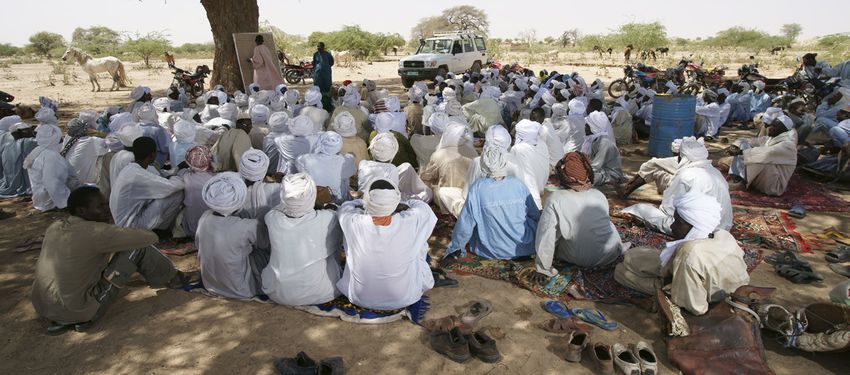
24                                                         ORGANISATIONAL ASPEC TS OF WATER-SPRE ADING WEIRS

3 Organisational aspects of
  water-spreading weirs
The village community and the weir                                 examples are merely schematic illustrations
committee participate intensively in the                           of the most essential processes, and they need
planning and implementation phases in                              to be adapted on a case-by-case basis. Active
order to generate a sense of ownership and                         participation by the stakeholders in all phases,
to build capacity.                                                 however, is recognised as a universal principle.

The successful use of water-spreading weirs                        The preparatory phase
requires high quality planning and technical
implementation of the structures as well as                        From the project standpoint, the work starts
active participation by the local people and                       with a rough inventory of suitable valleys
the competent communal and government                              and with informing government services, the
stakeholders in the planning, realisation, use                     responsible communities and/or potential vil-
and maintenance aspects. While sufficiently                        lages about the possibilities and terms of the
qualified engineering and construction firms                       cooperation. Villages that are interested in the
with practical experience in weir construction                     rehabilitation of their valleys submit a writ-
are able to take care of the technical part, the                   ten request for valley rehabilitation through
more complex task is the organisation of the us-                   their village committee. In the past this request
ers and incorporation in the local institutional                   went directly from the village to the project,
environment, with the aim of handing over                          but now it is sent to the municipal authority for
the structures and the long-term operation                         approval, which then officially submits it to the
and maintenance thereof. How the details of                        project as a request from the municipal author-
this task are worked out depends on the legal,                     ity. How water-spreading weirs are handled
socio-economic and cultural conditions and the                     in communal development plans (which are
institutional environment. Hence the following                     valid for 3 to 5 years) is different in each coun-

Participatory planning process with local population © GIZ / Klaus Wohlmann
You can also read