BLACKWATER CREEK NATURE PRESERVE LAND MANAGEMENT AND LAND USE PLAN - Hillsborough County
←
→
Page content transcription
If your browser does not render page correctly, please read the page content below
BLACKWATER CREEK NATURE PRESERVE
                                                  LAND MANAGEMENT AND LAND USE PLAN

            BLACKWATER CREEK NATURE PRESERVE
            LAND MANAGEMENT AND LAND USE PLAN
                              FCT Award #93-018-P3A

1.0   GENERAL INFORMATION

1.1   Location of the Blackwater Creek Nature Preserve

The Blackwater Creek Nature Preserve (Preserve) is located in northeastern
Hillsborough County, (County), Florida in Sections 12, 13, and 14 of Township 27 South,
Range 21 East and Sections 7, 18, and 19, of Township 27 South, Range 22 East. The
Preserve lies west of State Road 39, near the Pasco/Hillsborough County line. The
2,014-acre Preserve encompasses a portion of the Blackwater Creek floodplain in the
northern part of the County. Surrounding land use includes low density residential areas,
and agriculture. The Cone Ranch well field lies east of SR 39. Figure 1 provides a
location map of the Blackwater Creek Nature Preserve, as well as other public lands in
the vicinity. Appendix A provides the legal description, easements, and other legal
documents for the Preserve. The future land use (FLU) designation of the Preserve is
“Natural Preservation.”

1.2   History of the Preserve

The majority of the Blackwater Creek Nature Preserve was purchased between 1997 and
2003, by the Environmental Lands Acquisition and Protection Program (ELAPP) of
Hillsborough County, in cooperation with the Florida Communities Trust (FCT Award #
93-018-P3A), for approximately $4,000,000 (Hillsborough County, 2007). Grant funding
from FCT was used to acquire the Preserve and this Management Plan is a revision of
the 1996 Management Plan which was developed to ensure that the Preserve will
continue to function in accordance with the Grant Award Agreement and in furtherance of
the purpose of the grant application. Additional property (approximately 200 acres) was
purchased at that time by the County as an Acquisition of Convenience (shown in Figure
1), because it was part of the parcel but did not meet the requirements for the FCT grant.
This additional property is managed separately as part of the Preserve.

Five additional subsequent acquisitions (including the Robison/Kovacs property along SR
39) have increased the initial 1,900 acre purchase to the current Preserve size of 2,014
acres. The majority of the land that encompasses the Blackwater Creek Nature Preserve
was historically used for low intensity cattle grazing and silviculture, and was purchased
by the Weiss family in the 1940’s. The Weiss family continued the logging and cattle
grazing until the land was purchased by Hillsborough County (Hillsborough County,
1997). Figure 2 provides an aerial photograph of the site taken in 1938.

                                            1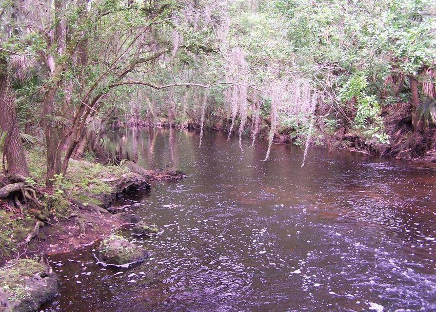
BLACKWATER CREEK NATURE PRESERVE
               LAND MANAGEMENT AND LAND USE PLAN

FIGURE 1

           2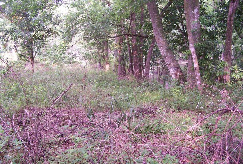
BLACKWATER CREEK NATURE PRESERVE
               LAND MANAGEMENT AND LAND USE PLAN

Figure 2

           3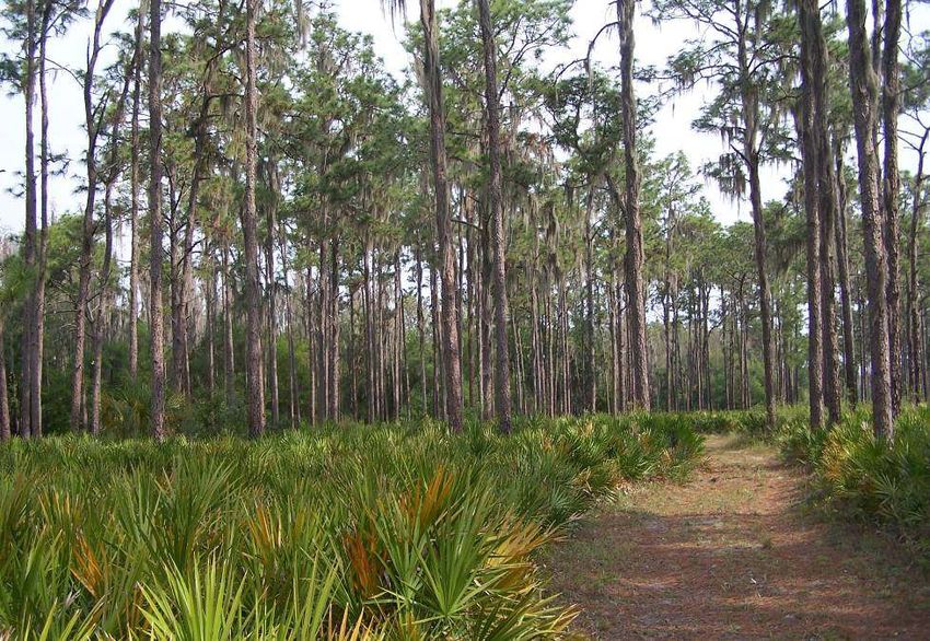
BLACKWATER CREEK NATURE PRESERVE
                                                     LAND MANAGEMENT AND LAND USE PLAN

The Hillsborough County Parks, Recreation and Conservation Department has been
responsible for stewardship of the Preserve from 1997 to present, and since that time
with the help of the cattle lessees Lance and Gayle Ham has maintained the ongoing
prescribed burn program, including summer burns; maintained an ongoing invasive plant
and animal program; installed, repaired, and posted boundary fencing; applied for grant
assistance and removed derelict buildings with assistance from the AmeriCorps program
and Youth Environmental Services (YES) of Wimauma, Florida (both programs benefit
and educate youth); initiated a Stream-Water watch station and monitored and reported
water quality in Blackwater Creek since 2000; installed a parking lot, kiosk, picnic tables,
entrance walkover, marked hiking trail, and a Florida Communities Trust
acknowledgement sign. The County also developed a brochure which is currently
publicized through their web site. The Preserve also survived large wildfires in 2000 and
2001 and major flooding after the hurricanes of 2004.

Environmental site assessments were conducted on the Weiss and Robison/Kovacs
Properties prior to their purchase. Neither site presented any existing or potential
environmental hazards (GLE and Associates, Inc., 1998 and HAS Environmental, 1997).

1.3      The Purpose of the Blackwater Creek Nature Preserve

The primary purpose of acquiring the Blackwater Creek Nature Preserve was to provide
protection for natural plant communities, the Blackwater Creek floodplain, and wildlife in
Hillsborough County. A secondary purpose was to provide resource based recreation.
Blackwater Creek Nature Preserve will continue to be managed only for the conservation,
protection and enhancement of natural resources, and for public outdoor recreation that
is compatible with the conservation, protection and enhancement of the site. The existing
recreational uses are restricted to passive activities, such as hiking and nature study,
compatible with management of the Preserve’s natural resources. The Preserve
provides hiking trails through different wooded habitat areas with mature trees and a
varied understory, as well as through palmetto prairie and riverine swamp. The trails are
marked and signage clearly states that the Preserve is open during daylight hours.

1.4      The Management Objectives for the Preserve

Management objectives for the Preserve include the following:

      1. Continue active habitat management activities such as prescribed burns and
         invasive species control.
      2. Develop specific management plans for listed species present in order to protect
         and perpetuate the species populations.
      3. The County will continue to work with neighbors and volunteers for cleanup and
         security and encourage a sense of shared responsibility for the benefit of the
         Preserve.
      4. The integrity of the natural habitat will be conserved and protected to the greatest
         extent possible.

                                               4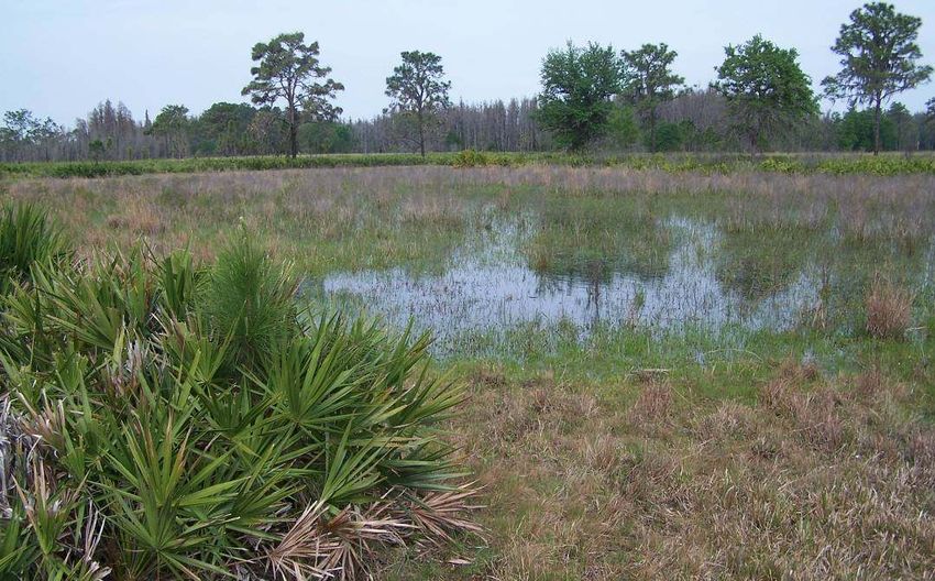
BLACKWATER CREEK NATURE PRESERVE
                                                  LAND MANAGEMENT AND LAND USE PLAN

   5. Water quality monitoring in Blackwater Creek will continue as long as the Stream
      Water Watch Program is active.
   6. Staff will continue to map invasive species locations, and inventory and monitor
      listed species.
   7. Funding or assistance will be sought to conduct a cultural resources survey in the
      Preserve.
   8. Conservation Services staff will continue to pursue alternative sources of funding
      for management programs.
   9. Continue cattle agreement to ensure additional on-site security and management
      assistance by lessee.

The Blackwater Creek Nature Preserve assists Hillsborough County in implementing the
goals, objectives and policies of the Recreation and Open Space (ROSE), Future Land
Use (FLUE), and Conservation and Aquifer Recharge (CARE) elements of the County’s
Plan (http://www.theplanningcommission.org/hillsborough/comprehensiveplan).

The preservation of wildlife habitats and the development of public recreation and
environmental conservation activities on the Preserve will help to accomplish or further
enhance the following plan goals and objectives:

   •   Preserve, conserve, restore, and appropriately manage the natural resources of
       Hillsborough County to maintain or enhance environmental quality for present and
       future generations (CARE Goal).
   •   Maintain or improve the ecological integrity of natural lakes, ponds, and streams,
       and provide for multiple uses such that existing water quality, fisheries habitat,
       scenic and recreational opportunities, and other natural and community benefits
       can be maintained, improved and where feasible, restored (CARE Objective 6).
   •   Maintain populations of threatened and endangered species and species of
       special concern occurring in Hillsborough County; and where feasible and
       appropriate, increase the abundance and distribution of such species (CARE
       Objective 14).
   •   Correct existing deficiencies and prevent future inadequacies to an efficient
       system of open space, park, and recreational facilities proportionately distributed
       to meet the needs of the populations.
   •   Improve public access to parks and recreational facilities and waterfront lands,
       including beaches and shores (ROSE Objective 2, Policies 2.2, 2.8).
   •   Increase the provision, protection, and enhancement of open spaces by public
       agencies and private enterprises (ROSE Objective 3, Policy 3.8).
   •   Implement an aquatic plan to utilize water resources for active and passive
       recreational activities (ROSE Objective 10, Policy 10.1).
   •   Continue to implement a program to allow appropriate utilization and protection of
       natural resources (ROSE Objective 11, Policy 11.2).
   •   Consider the needs of existing urban and suburban areas and newly developing
       urban areas when providing and programming needed public facilities (FLUE
       Policy D-6.3).

                                            5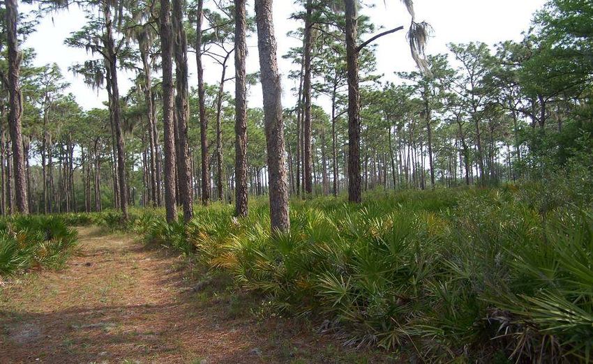
BLACKWATER CREEK NATURE PRESERVE
                                                     LAND MANAGEMENT AND LAND USE PLAN

      •   Meet the standards for county parks and recreational facilities as specified in the
          Capital Improvements Element (CIE Policy 1.C.1.f).

The Blackwater Creek Nature Preserve will be identified in all literature and advertising
as acquired with funds from the “Florida Communities Trust” and operated as a natural
conservation and outdoor passive recreation area.

Any proposed modifications of the Blackwater Creek Nature Preserve Land Management
Plan or any site alterations or physical improvements that are not addressed in the FCT-
approved Land Management Plan requires prior FCT review and approval.

1.5       Adjacent Land Uses and Potential Conflicts

Adjacent land uses include pending residential development, agriculture, and publically
owned lands. The pending residential development includes the former Thomas Ranch,
now known as Hickory Hill Development Corporation. This land is located north and west
of the Preserve. Hillsborough County has attempted to purchase this property but as yet
has not been successful (see Figure 1 for approved lands). Publically owned lands
include the Cone Ranch wellfield (Figure 1), which is owned and operated by the
Hillsborough County Utilities Department and presently leased for agriculture. Over the
past 20 years, staff from the Parks, Recreation and Conservation Department has
coordinated with the lessees as well as Hillsborough County’s Real Estate Department to
ensure that activities at the Cone Ranch do not negatively impact the Preserve.

The Florida Department of Transportation (FDOT) owns rights-of-way through the
Preserve. The only pending road project in the area, the proposed widening of SR 39, is
currently on hold. There are two FDOT borrow pits, one near Tollar Road and one further
south which were likely used for fill during the construction of the nearby bridge on SR
39. These borrow pits have revegetated and are now viable freshwater marshes. FDOT
may require additional fill for the roadway base when construction is initiated. It is not
known at this time whether additional fill will be required from these borrow pits when the
road is widened. Information regarding the rights-of-way is provided in Appendix A.

1.6       Public Involvement

No public meetings are planned at this time, but would be conducted in the event that
there is any major land use change proposed for the Preserve. Staff from the
Hillsborough River State Park will be given a copy of the Blackwater Creek Nature
Preserve Land Management Plan because of their proximity to and location downstream
of the Preserve, and staff continues to participate in the land management plan updates
for the State Park. The Hillsborough County City-County Planning Commission will
review the Blackwater Creek Nature Preserve Land Management Plan for compliance
with the County’s comprehensive plan.

                                               6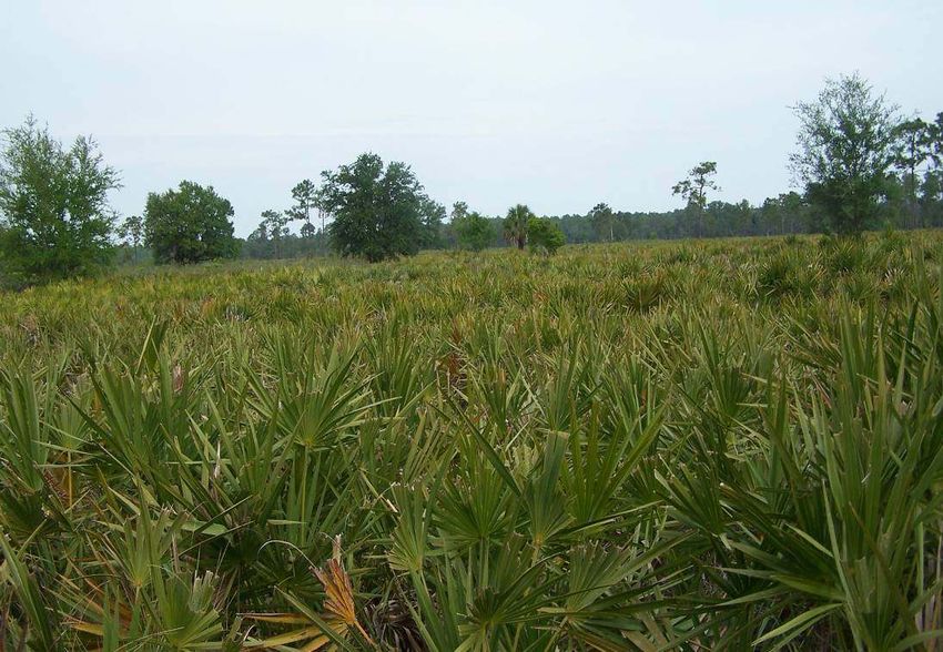
BLACKWATER CREEK NATURE PRESERVE
                                                     LAND MANAGEMENT AND LAND USE PLAN

If there are any proposed modifications of the Management Plan and/or undertaking any
site alterations or physical improvements that are not addressed in the approved
Management Plan, the County will submit the changes to FCT for review and approval.

2.0     NATURAL RESOURCES
2.1     Soil Resources

2.1.1 Soils Distribution

According to the United States Department of Agriculture/Natural Resource Conservation
Service (formerly Soil Conservation Service) Soil Survey of Hillsborough County (USDA
1989), there are fourteen different classifications of soils found in the Blackwater Creek
Nature Preserve. Table 1 lists the soils and the surface area they cover within the
Preserve. Figure 3 highlights the fourteen soil types and shows their distribution
throughout the Preserve.

                                       Table 1
                           Blackwater Creek Nature Preserve
                                  Soils Distribution

      Map Number                             Soil Type                       Acreage
          5          Basinger, Holopaw, and Samsula soils                    224.44
          10         Chobee loamy fine sand                                     0.19
          12         Chobee sandy loam, frequently flooded                   158.60
          13         Eaton fine sand                                           44.32
          14         Eaton mucky sand, depressional                             6.38
          15         Felda fine sand                                           42.43
          17         Floridana fine sand                                       10.99
          21         Immokalee fine sand                                       72.86
          27         Malabar fine sand                                       211.94
          29         Myakka fine sand                                        924.54
          57         Wabasso fine sand                                       263.73
          59         Winder fine sand                                          43.70
          60         Winder fine sand, frequently flooded                       7.16
          61         Zolfo fine sand                                            2.75
                                                             Total Acreage  2014.03
  USDA Natural Resource Conservation Service, Soil Survey Graphic (SSURGO) Database for
  Hillsborough County, Florida, 2004.

                                              7
BLACKWATER CREEK NATURE PRESERVE
                     LAND MANAGEMENT AND LAND USE PLAN

FIGURE 3 SOILS

                 8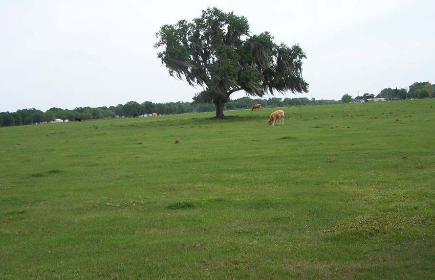
BLACKWATER CREEK NATURE PRESERVE
                                                   LAND MANAGEMENT AND LAND USE PLAN

2.1.2 Soils Description

Basinger, Holopaw, Samsula soils (5). This soil type makes up 11.14% of the total
surface soil cover and is found in forty-four locations scattered throughout the Preserve.
This soil complex supports small cypress domes, freshwater marshes, and wet prairie
communities. Native vegetation on undisturbed sites includes cypress in the canopy, with
saw grass, panicum, bluestem, and maidencane in the understory.

Chobee loamy fine sand (10). The Chobee fine sand makes up only 0.01% of the
surface soil in the Preserve, and is found in only one location on the southeastern
boundary. Undisturbed soils of this type would support cypress, cabbage palms, slash
pine, and Carolina willow. Understory species include buttonbush, maidencane, and
Jamaica saw grass.

Chobee sandy loam, frequently flooded (12). This soil makes up 7.87% of the surface
soils and is found along the main stem of Blackwater Creek. The natural vegetation
found on undisturbed areas of this soil includes bald cypress, sweet gum, willow, red
maple, and cabbage palm. Understory species include buttonbush, smartweed, sedges,
buttonbush, maidencane, and Jamaica saw grass.

Eaton fine sand (13). Only 2.20% of the surface soils are characterized as Eaton fine
sand and it is found in only seven locations scattered in the eastern half of the Preserve.
This soil occurs in sloughs within flatwoods and would normally support longleaf and
slash pine, sweet gum, and cabbage palm, with gallberry and panicum in the understory.

Eaton mucky sand, depressional (14). This nearly level, poorly drained soil is found in
depressions in flatwoods. On the Preserve, this soil type comprises only 0.32% of the
surface soils, and it is found in only one location near the eastern boundary. Under
normal conditions, the soil supports cypress and sweet gum, with sand cordgrass,
maidencane, bluestem, and wax myrtle as an understory.

Felda fine sand (15). Felda fine sand is nearly level and poorly drained, and makes up
only 2.11% of the surface soils of the Preserve. This soil is found in seven small areas
throughout the Preserve. The natural vegetation on this soil includes canopy species
such as cabbage palm and slash pine, and understory species such as saw palmetto and
wax myrtle.

Floridana fine sand (17). This soil is nearly level and poorly drained and is commonly
found in sloughs and swales in pine flatwoods. The natural vegetation in these areas
consists of cabbage palms and slash pine, with bluestem and maidencane in the
understory. This soil makes up only 0.55% of the total surface soils and it is located in
one small area in the southeastern corner of the Preserve.

Immokalee fine sand (21). This soil is nearly level and poorly drained and is typically
found in the flatwoods. The soil normally supports typical flatwoods vegetation such as

                                            9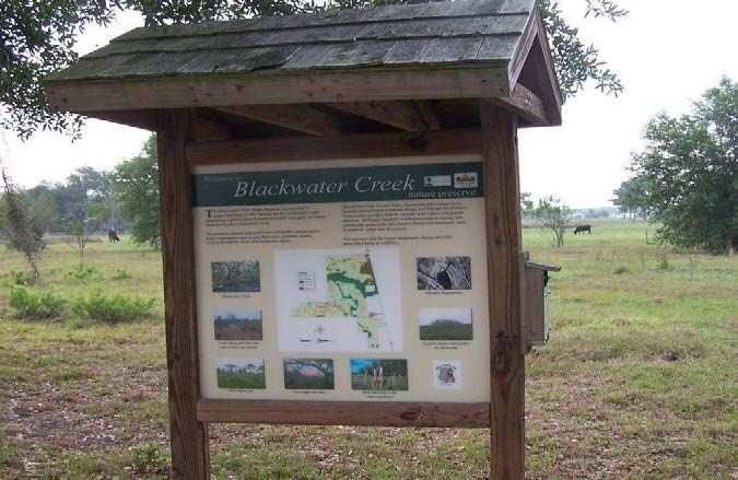
BLACKWATER CREEK NATURE PRESERVE
                                                  LAND MANAGEMENT AND LAND USE PLAN

longleaf and slash pine in the canopy, with lopsided Indian grass, gallberry, saw
palmetto, pineland three-awn and wax myrtle in the understory. This soil type is located
in four small areas scattered throughout the Preserve. Immokalee fine sand comprises
3.62% of the total surface soils.

Malabar fine sand (27). The Malabar fine sand soils are usually found in depressions
within pine flatwoods. The native vegetation on this soil type includes cabbage palm,
longleaf pine, slash pine, saw palmetto, and wax myrtle. Malabar fine sands comprise
10.52% of the total surface soils in the Preserve, found in twenty-three very small areas
scattered throughout.

Myakka fine sand (29). This soil type comprises the majority of the Preserve with
approximately 45.91% of the surface soils. This soil is found in fourteen areas scattered
throughout the Preserve. This soil type is nearly level and poorly drained, and supports
pine flatwoods with longleaf and slash pine in the canopy and saw palmetto, gallberry,
running oak, and wax myrtle in the understory.

Wabasso fine sand (57). This soil type comprises 13.09% of the Preserve and is
located in ten small sites, scattered throughout. This nearly level, poorly drained soil
supports flatwoods vegetation such as longleaf, slash pine, and cabbage palm with an
understory of palmetto.

Winder fine sand (59). This is another nearly level, poorly drained soil found in sloughs
in the flatwoods. Natural vegetation on these soils consists of live oak, slash pine, and
cabbage palm. The understory consists of saw palmetto, wax myrtle, and pineland three-
awn. This soil comprises 2.17% of the Preserve, and it is located in six small areas
scattered throughout.

Winder fine sand, frequently flooded (60). This soil type comprises only 0.36% of the
total surface soils in the Preserve and is located in one small area in the northeastern
quarter of the property. This soil type typically supports Carolina willow, red maple,
cabbage palm and sweet gum, as well as buttonbush, saw grass, smartweed, and
sedges in the understory.

Zolfo fine sand (61). This soil classification comprises only 0.14% of the surface soils
within the Preserve and is found in one small area within the northeastern quarter of the
site. Under natural conditions, this soil type supports xeric oak, pine, saw palmetto, and
other species found in oak scrub vegetative associations.

2.1.3 Soils Management Measures

Management measures for the Preserve include protecting the natural vegetation to
prevent soil erosion, preventing off-road vehicles from accessing the Preserve, and
maintaining the trail system and fire breaks. The goals and objectives of the
management plan will preserve the integrity of the native soils by preserving the native

                                           10
BLACKWATER CREEK NATURE PRESERVE
LAND MANAGEMENT AND LAND USE PLAN
vegetation communities on the Preserve and by taking action to prevent erosion. There
are no facilities or actions proposed in this ten-year plan that would require impacts to
soils with the exception of the maintenance of the existing fire breaks. Any future
management measures not included in this plan that require earthwork will implement
Best Management Practices prior to construction to preserve the character of the
ecosystems (http://www.na.fs.fed.us/spfo/pubs/n_resource/wetlands/index.htm). There
are no known oil, gas, phosphate or other mineral resources on the Preserve.
2.2 Natural Communities
2.2.1 Mapping Process
The discussion of ecological communities describes the seven distinct vegetation
associations on the Blackwater Creek Nature Preserve. The vegetation community areas
were provided by the Hillsborough County Parks, Recreation, and Conservation
Department, Conservation Services staff. The system employed in this plan of
classifying the natural communities was developed by the Florida Natural Areas Inventory
(FNAI). The premise of this system is that physical factors such as geology, climate,
soils, hydrology, and fire determine the species composition of an area and that areas
which are similar with respect to these factors will tend to have natural communities with
similar species compositions.
Appendix B provides a list of the plant species found to date on the Blackwater Creek
Nature Preserve. The seven vegetation communities identified are listed in Table 2 with
the total area that each community occupies within the Preserve.
Table 2
Blackwater Creek Nature Preserve
Natural Vegetation Communities
Vegetation Community Acres %
Palmetto prairie 568.84 28.2
Riverine swamp 259.31 12.9
Pine flatwoods 555.03 27.6
Cypress swamp 209.98 10.4
Improved pasture 180.45 9.0
Oak hammock 189.22 9.4
Wet prairie/freshwater marsh 51.20 2.5
Total acres 2014.03 100.0
2.2.2 Vegetation Community Descriptions
The following paragraphs describe the seven distinct communities and Figure 4 shows
their estimated extent and location within the Preserve. As stated previously, the
11BLACKWATER CREEK NATURE PRESERVE
LAND MANAGEMENT AND LAND USE PLAN
mapping was completed with limited ground truthing and the locations of the plant
communities and descriptions of the vegetative cover are approximations. As part of the
10-year management process, the Conservation Services Section will continue ground-
truthing and refining the delineation of plant community types, as well as continue to
update the flora and fauna species lists.
Saw palmetto prairie. The palmetto prairie community provides the majority of the land
cover on the Preserve, with 28.2% of the total area. The majority of the pines were
logged out, and others have been lost to wildfires and lightning strikes, but some long leaf
pines are regenerating in a few areas.
This photo
shows the
large expanse
of saw
palmetto
prairie on the
site. The
prairie is
maintained by
frequent fires.
Management measures for saw palmetto prairie. Research scientists and land
managers recommend that the pine/palmetto and the palmetto/gallberry/hardwood areas
be treated with mechanical means and possibly chemical application, as well as frequent
prescribed burns and protection of the hydrology of the community
(http://www.ces.fau.edu/fdpc/proceedings.php). Other management measures include
the continuation of site security to limit illegal off-road vehicles, and other forms of
vandalism.
Pine flatwoods. The nearly level pine flatwoods areas are burned on a 2 to 3 year cycle
which maintains an open canopy of longleaf and slash pine. The understory varies in
composition depending on the timing and intensity of the last fire. Some areas support a
dense understory of saw palmetto, gallberry, wax myrtle, wiregrass, and broomsedge.
More xeric areas contain sand live oak, paw paw, shiny blueberry, while more mesic
flatwoods are characterized by hat pins, gallberry, and St. Johns wort. Saplings of pines
are recruiting along with dense stands of palmetto, broomsedge, and winged sumac.
The pine flatwoods are found throughout the Preserve, and encompass 27.6% of the total
land cover.
12BLACKWATER CREEK NATURE PRESERVE
LAND MANAGEMENT AND LAND USE PLAN
Figure 4 Natural communities
13BLACKWATER CREEK NATURE PRESERVE
LAND MANAGEMENT AND LAND USE PLAN
The area shown
in the photo to the
left depicts the
pine flatwoods on
the Preserve.
Staff has
suggested that
this area could be
investigated as a
potential red-
cockaded
woodpecker
introduction site.
Very specific
management
efforts would be
required for this
option.
Management measures for pine flatwoods. The proper management of pine flatwoods
includes such measures as conducting prescribed burns every two to four years (Myers
et al., 1990), controlling exotic vegetation, and preventing impacts to the soil and native
vegetation. Minor changes in the flat topography can have significant impacts to the
character of the habitat by changing drainage patterns. Other management measures
include roller chopping, prescribed burns to reduce wildfires, preventing off-road vehicle
impacts, and other forms of vandalism.
Oak hammock. There are two oak hammock areas located in the northeastern corner
and one small area in the southeastern corner of the Preserve, and these three areas
combine to comprise 9.4 % of the total land cover. These areas are characterized by a
dense canopy of live oak draped in Spanish moss, and a thick carpet of leaf litter in the
understory. Lower species diversity is present in the deep shade.
Management measures for oak hammock. These areas may have occurred as a
result of historic fire suppression. Current management in effect include the maintenance
of exotic vegetation, prevention of off-road vehicles and other forms of vandalism.
Wet prairie/freshwater marsh. There are over thirty wet prairie/freshwater marsh areas
scattered throughout the Preserve, providing about 2.5% of the total land cover. The
wetlands range from one so small it is barely visible on aerial photography to large
systems several acres in size. The vegetation in these wetlands varies as well. Those
wetlands with a shorter hydroperiod and a shallow water depth support pipe wort, marsh
penny wort, smart weed, broomsedge, and soft rush. Deeper wetlands support
pickerelweed, duck potato, soft rush, and spike rush. Both wetland types are often
surrounded by a shrub perimeter, with species such as wax myrtle, button bush, and
Carolina willow.
14BLACKWATER CREEK NATURE PRESERVE
LAND MANAGEMENT AND LAND USE PLAN
Two borrow pits excavated a long time ago by the FDOT are present in the northeastern
corner of the Preserve and are shown on Figure 3. These areas have developed a
dense cover of soft rush and other native species to the extent that they are difficult to
identify as man-made. For this reason, these areas have been included in this category.
There are
many small
marsh/wet
prairie areas
in the
Preserve.
These provide
important
habitat for
wading birds
and other
wildlife.
Management measures for wet prairie/freshwater marsh. These wetland areas
usually burn every 2 to 4 years (FNAI, 1990); without occasional fires these wetlands
would become shrub swamps with Carolina willow and buttonbush becoming established
in the central portions. Other management measures include the maintenance of exotic
vegetation, maintaining hydrology, and the prevention of off road vehicle impacts.
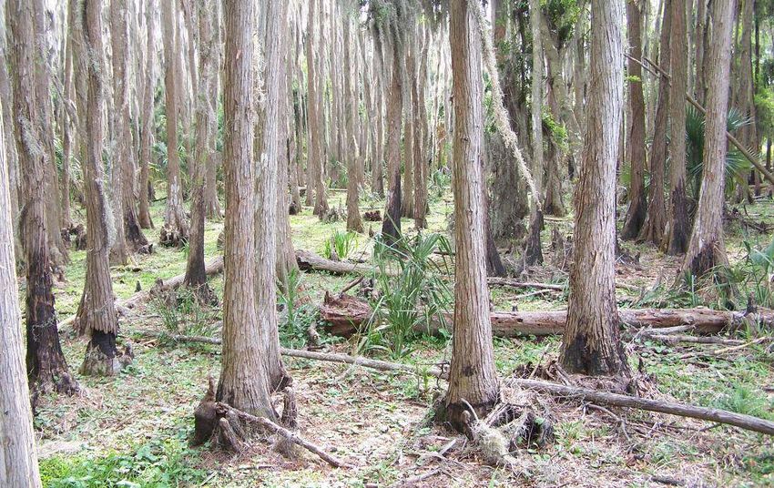
This cypress
swamp is
located in a
depression
within pine
flatwoods.
Other cypress
forests on the
Preserve
appear as
“domes”
within the
palmetto
prairie.
15BLACKWATER CREEK NATURE PRESERVE
LAND MANAGEMENT AND LAND USE PLAN
Cypress swamp. The cypress swamp communities include strands, sloughs and domes,
and are found throughout the Preserve, comprising approximately 10.4% of the total land
cover. These communities are characterized by a canopy dominated by bald cypress
with occasional cabbage palms or laurel oak. The composition and density of ground
cover species is dependent upon the canopy closure, and species present include soft
rush, water penny wort, lizard’s tail, water hyssop, hornwort, blue flag iris, day flower, and
a variety of ferns. Some of the more mesic cypress swamp areas also support laurel
oak, button bush, and wax myrtle.
Management measures for cypress swamp. The management of the cypress swamps
includes preventing the infestation of exotic vegetation and maintaining the hydrology.
Exotic species of special concern to cypress swamps are old world climbing fern, air
potato, and skunk vine. Maintaining the hydrology is important not only to support the
chemical and physical processes of the ecosystem, but to support the physical properties
of the soil that sustains the ecosystem.
Riverine swamp hammock. The Blackwater Creek swamp hammock bisects the east-
central portion of the Preserve. This community comprises 12.9% of the total land cover
and is the most diverse in the Preserve. Canopy species include bald cypress, cabbage
palm, American elm, pop ash, black gum, water oak, laurel oak, water hickory, red maple,
and hackberry. A shrub layer includes saplings of canopy trees as well as button bush,
bumelia, swamp dogwood, shiny lyonia, wax myrtle, and wild coffee. Ground cover
species includes a variety of ferns, spoon flower, lizard’s tail, day flower, star rush, wild
petunia, and water grass.
This photo shows
Blackwater Creek
within the riverine
swamp hammock
community. The
creek is
channelized within
the first 1600 feet
west of SR 39, but
the natural
streambed is
preserved for the
remainder of the
creek within the
Preserve.
Management measures for riverine swamp hammock. This type of community is
prone to infestations of air potato, old world climbing fern, and other noxious vines, so
maintenance of exotics is an important issue. Feral hogs are especially damaging in
16BLACKWATER CREEK NATURE PRESERVE
LAND MANAGEMENT AND LAND USE PLAN
these wetland communities because they create soil disturbances that easily erode
during strong flows and high water events, so control of these species is important.
Wildfire in these areas during times of drought can be devastating and create such
extensive damage from which it may take decades to recover.
The improved
pasture areas (in
the Acquisition of
Convenience
area) are fenced
so that the lessee
can prevent
overgrazing in the
FCT natural areas
and more easily
attend to the
needs of his
cattle. The
natural areas are
accessible by the
cattle, but their
access is limited.
Improved pasture. There are two areas of improved pasture totaling 9.0% of the total
land cover on the Preserve. One large pasture area is located in the southeastern
portion of the Preserve and is not part of the FCT portion of the property. This large
pasture area has been used to graze cattle for over twenty years. The pastures support
bahia grass and native herbaceous species and is managed for cattle and wildlife
species that require open areas.
Management measures for improved pasture. The cattle lessee manages the pasture
according to provisions in the cattle management plan prepared by the Natural Resource
Conservation Service. The current plan is available as Appendix C.
Management measures for all vegetation communities. In order to properly manage
the vegetation communities, it is necessary to conduct periodic surveys to determine the
content and health of these communities. The Conservation Services staff conducts
surveys and photo-monitoring of the vegetation annually at minimum, to determine what
listed plant species are present, and if the current management efforts are adequate for
the preservation, restoration, or protection of the listed species or plant community. In
order to comply with the conditions of the FCT Grant Award Agreement, the long-term
monitoring, protection and long term viability of the individual communities is essential.
The Conservation Services staff is committed to continuing the monitoring, including
photo-monitoring, of natural communities into the future.
17BLACKWATER CREEK NATURE PRESERVE
LAND MANAGEMENT AND LAND USE PLAN
2.3 Water Resources
2.3.1 Aquatic Preserves and Outstanding Florida Waters
There are no Aquatic Preserves within or in the vicinity of the Blackwater Creek Nature
Preserve. Blackwater Creek is a major tributary to the Hillsborough River, which was
designated as an Outstanding Florida Water (OFW) in 1995 from Fletcher Avenue to the
river’s origin in the Green Swamp, including Blackwater Creek.
(http://www.dep.state.fl.us/water/wqssp/ofwqa.htm) The OFW designation ensures that
no water quality degradation will be allowed, and all stormwater discharges must meet
certain water quality standards. Blackwater Creek joins the Hillsborough River north of
Lake Thonotosassa.
2.3.2 Water Quality
The recorded Grant Award Agreement (Appendix A) states in V.6, that “The water quality
in Blackwater Creek shall be protected and the natural hydrology shall be preserved, and
where applicable, restored to a natural hydrological regime.” The Blackwater Creek
Nature Preserve lies within the Upper Hillsborough River Watershed, and has a 17 mile
reach within the County. This watershed spans approximately 153 square miles in
Hillsborough County, and contains 1 named lake and 15 named rivers, streams and
canals. The average daily flow in Blackwater Creek is 54 million gallons per day
(Hillsborough County, 1997).
The map to the left
shows the majority
of the Hillsborough
River Watershed.
Blackwater Creek
is located in the
Upper Hillsborough
River Watershed.
BLACKWATER CREEK
NATURE PRESERVE
The map was taken
from the
Hillsborough
County Water Atlas
located on line.
(http://maps.watera
tlas.usf.edu/hillsbor
ough/index.asp?wa
terbodyid=12)
Blackwater Creek is described as an impaired water body by the Florida Department of
Environmental Protection. Because of concern for water quality in the creek
Conservation Services staff established a water monitoring station on the west boundary
of the preserve in 1998 and monitors the creek monthly through the Hillsborough County
Stream-Waterwatch Program. Water quality results are compared to an Environmental
18BLACKWATER CREEK NATURE PRESERVE
LAND MANAGEMENT AND LAND USE PLAN
Protection Commission sampling station at the creek and SR 39 to determine whether on
site activities such as cattle grazing are degrading water quality in the creek. Water
quality parameters being measured by staff include air temperature, water temperature,
dissolved oxygen, pH, water clarity, total nitrogen, phosphorus, fecal coliform and
enterococci. Results of the monitoring have been made available in annual stewardship
reports and are also available for perusal as data or in graphic form online at
http://www.hillsborough.wateratlas.usf.edu/ DataDownload/GraphData.aspx.
Hillsborough County remains committed to hydrological improvements in the watershed,
particularly when there is potential to improve conditions in Blackwater Creek. In 1999
the Hillsborough County Public Works Section partnered with the Southwest Florida
Water Management District to create a 400-acre wetland restoration project in the Cone
Ranch southeast of the Blackwater Creek Preserve (Turbiville, Personal Communication,
2009). A ditch block was installed within the project area, and water was re-routed
through a number of created herbaceous wetlands (see blue shading in the Cone Ranch
in Figure 1, located just south of Blackwater Creek, for location). The project enabled
large scale wetland rehydration and habitat improvement of cypress domes and
freshwater marshes, and provides water treatment to Tiger, Itchepakesassa, and
Blackwater Creeks. District staff observed or documented a great deal of wildlife
utilization of the area as a result of the project, including bald eagle, Sherman’s fox
squirrel, sandhill crane, American alligator, several hundred white and glossy ibis, great
blue heron, great egret, cattle egret, snowy egret, osprey, hawks, white-tailed deer, and
fox. Much of the Cone Ranch, as shown in Figure 1, has been nominated to the ELAP
program and three of the perimeter areas are now protected.
In addition, a 2004 coliform study done by the Department of Environmental Protection
on Blackwater Creek established the maximum allowable loadings to Blackwater Creek
that would “restore the waterbody so it meets the applicable water quality criteria for fecal
and total coliform bacteria (Tyler and Petrus, 2004).” The study recommends an
implementation plan for all affected parties, and the recommendation has been
incorporated into this plan (see recommendation below as well as Section 8).
An abandoned cattle dipping vat is located in the eastern section of the Preserve near SR
39, as stated in the environmental audit for the Weiss parcel (HAS, 1997). The presence
of the dipping vat indicates the potential for groundwater contamination with arsenic,
DDT, and/or Toxaphene. This area is isolated from the general public, and the
remediation of the vat will eventually need to be addressed by the Department of
Transportation when Highway 39 is widened.
2.3.3 Water Resource Management Measures
As stated in the original management plan, the County remains committed to protecting
the water quality of Blackwater Creek and preserving the natural hydrology on site. The
County continues to keep FCT updated on the status of water-related issues that could
directly impact the hydrology of the creek.
19BLACKWATER CREEK NATURE PRESERVE
LAND MANAGEMENT AND LAND USE PLAN
Management measures required with respect to maintaining or improving the water
quality in the vicinity of the Preserve would be to:
• control exotic vegetation with an approved herbicide used according to the label, or
use biocontrol agents if available,
• avoid soil disturbances to prevent erosion and subsequent turbidity and
sedimentation in surface waters,
• prevent cattle from getting into the creek,
• prevent overgrazing of vegetation,
• remove trash from the creek
• always implement best management practices during any construction or other
disturbance of the soils or vegetation,
• remediation of cattle dipping vat,
• Continue agreement with the Southwest Florida Water Management District to
monitor on site wells and partner with the District’s SWIM program should
opportunities arise to improve hydrological conditions in Blackwater Creek.
• Participate with other landowners or stakeholders if any plans to implement water
quality standards in the creek are implemented.
2.4 Fish and Wildlife Resources
2.4.1 Existing Conditions
The Blackwater Creek Nature Preserve provides a broad expanse of contiguous habitat,
including forested wetlands, marshes, prairies, and pine flatwoods within northern
Hillsborough County. According to the previous land management plan (Hillsborough
County, 1997), there are likely 23 amphibian species, 52 reptile species, 159 bird
species, and 42 mammal species potentially present within the Preserve, based on
literature research and on the known character and extent of the available habitat and
other factors (Hillsborough County, 1997). A list of the flora and fauna known to occur on
the Blackwater Creek Nature Preserve is provided as Appendix B.
2.4.2 Management Measures for Fish and Wildlife
Formal surveys which include trapping and tagging are recommended to identify the
wildlife resources on the site. These surveys should be conducted seasonally to include
the use of the site by migrant species and those species only active on a seasonal basis
to provide a truly comprehensive list of the species present. Surveys should include
herpetofaunal drift fencing or pitfall arrays, small mammal trapping, and conducting
pedestrian transects throughout the Preserve, sampling all habitat types. GPS should be
used to mark the locations of important populations. Hillsborough County coordinates
extensively with the Florida Fish and Wildlife Conservation Commission regarding the
management of specific listed species.
20BLACKWATER CREEK NATURE PRESERVE
LAND MANAGEMENT AND LAND USE PLAN
Informal plant and animal surveys have been conducted on the Preserve by staff and
volunteers since its purchase over ten years ago. The surveys were combined to
produce a preliminary species survey which is provided in Appendix B. The informal
surveys will continue in perpetuity and as new species are observed, the list will be
updated.
The main management measures for the protection and conservation of wildlife on the
Preserve are the prescribed burn program to enhance and manage the habitat, and the
control of nuisance exotic vegetation and animals. These management measures are
conducted in the Preserve on an as-needed basis, and as prioritized by the Conservation
Services staff. Other measures include maintaining site security to prevent trespassing,
poaching, dumping, arson, and other illegal activities.
Additional management measures for fish and wildlife include maintaining or improving
wildlife corridors inside and outside the Preserve. The Hillsborough Greenways
Committee studied the status of wildlife corridors with respect to gaps and barriers and
prepared list of gaps and barrier sites to improve. State Road 39 was determined to be
one of the top ten man-made barriers within the County, affecting wildlife movement on
the Blackwater Creek Nature Preserve. The study results are provided in Appendix B
(Hillsborough County, 2006).
2.5 Special Status Species
Information regarding the special status species on Blackwater Creek Nature Preserve
was obtained from the Conservation Services staff, local experts, and relevant literature.
State and/or federally listed plant and animal species observed on the Preserve include
those listed in Table 3 (Florida Fish and Wildlife Conservation Commission, 2008).
The individual habitat needs for each species are discussed in the following paragraphs.
The faunal species were noted during casual observations and not from formal surveys.
Formal surveys for fauna have not been initiated yet in this Preserve, but will be
implemented in the future. Future surveys should determine the locations of foraging,
roosting, and nesting areas of the protected species.
The knowledge gained in the surveys will allow the planning for future facilities in areas
that won’t disturb the protected species. ELAPP policies regarding the management of
special status species are provided in Appendix D.
21BLACKWATER CREEK NATURE PRESERVE
LAND MANAGEMENT AND LAND USE PLAN
Table 3
Special Status Species Observed in the
Blackwater Creek Nature Preserve
Species Ranking
FED STATE
Common Name Scientific Name
(3) (1,2)
Birds
Snowy Egret Egretta thula SSC
Little Blue Heron Egretta caerulea SSC
Tricolored Heron Egretta tricolor SSC
White Ibis Eudocimus albus SSC
SE American Kestrel Falco sparverius paulus T
Florida Sandhill Crane Grus canadensis pratensis T
Wood Stork Mycteria americana E E
Mammals
Sherman’s fox squirrel Sciurus niger shermani SSC
Reptiles and Amphibians
American alligator Alligator mississippiensis SAT SSC
Eastern indigo snake Drymarchon corais couperi T T
Gopher tortoise Gopherus polyphemus T
Plants
Catesby’s lily Lilium catesbaei T
Angular fruit milk vine Matelea gonocarpos T
Giant air plant Tillandsia utriculata E
Treat’s zephyrlily Zephyranthes atamasco var. treatiae T
Notes:
1) http://fac.dos.state.fl.us/
2) http://www.fl-dof.com/forest_management/plant_conserve_list.html
3) http://www.fws.gov/endangered/wildlife.html
2.5.1 Descriptions of Special Status Species
Snowy Egret. The Snowy Egret nests in both inland and
coastal wetlands, often in mangroves or willows, but also in
cypress, buttonbush and Brazilian pepper. Nesting occurs
over shallow water or on islands separated from the
mainland by broad expanses of open water. They forage
almost anywhere the water is shallow and calm, and their
diet consists of small fish, frogs, small rodents, prawns,
crayfish, grasshoppers, worms, and a variety of other
aquatic invertebrates. The Snowy Egret is declining due
predominantly to the loss of nesting and foraging habitats
(Rodgers et al., 1996).
22BLACKWATER CREEK NATURE PRESERVE
LAND MANAGEMENT AND LAND USE PLAN
Management measures for the Snowy Egret. The Blackwater Creek Nature Preserve
provides foraging habitat for the Snowy Egret but it is not known if this species nests on
site. This species prefers to nest on islands over a broad expanse of open water to
reduce nest predation (Rodgers et al., 1996), but nesting within floodplains is not
uncommon. Management of the habitat includes the preservation of existing wetlands on
site, control of exotic species, especially in wetlands, and limiting human interference. All
of these management measures are currently being addressed and will continue in
perpetuity.
Little Blue Heron. Little Blue Herons require shallow
freshwater, brackish or saltwater habitats for foraging. Their
diet consists of fish, amphibians, and invertebrates, but
nesting herons need freshwater fish for their young. Their
numbers have been steadily declining due to the loss of
foraging habitat as more and more wetlands are drained or
altered. Also contributing to their decline is exposure to
pesticides and heavy metal contamination, and the
alteration of wetland hydrocycles (Rodgers et al., 1996).
Management measures for the Little Blue Heron. The Blackwater Creek Nature
Preserve provides foraging, and roosting habitat for the Little Blue Heron, but it is not
known if this species is nesting on the site. This species, as well as the other wading bird
species listed below prefer to nest on islands surrounded by a broad expanse of open
water to reduce nest predation. Management of foraging habitat includes the
preservation of wetlands on site, control of exotic species, and limiting human
interference. All of these management measures are currently being addressed and will
continue in perpetuity.
Tricolored Heron. The Tricolored Heron prefers mangrove islands for their nesting
colonies, but can also be found nesting in Carolina willow in freshwater wetlands. Other
less frequent nesting trees include Australian pine, cypress, Brazilian pepper, and
saltbush. Almost all nesting areas are over standing water or on islands. The tricolored
herons forage in almost any shallow wetland and on the edges of ponds and lakes. Their
diet is similar to that of the snowy egret, but small fish are their most preferred food.
These birds are declining due to the loss of nesting and feeding habitat, and due to
disturbance during breeding (Rodgers et al., 1996).
Management measures for the Tricolored Heron. As with the birds listed previously,
the Preserve provides foraging and roosting habitat for the Tricolored Heron, but no
known nesting habitat. The management measures listed for the previous species also
apply to the Tricolored Heron.
White Ibis. The White Ibis has been observed on numerous occasions foraging on the
Preserve for insects, crayfish, and small amphibian and reptiles. Ibis will also eat fish
when abundant. There are no known nesting colonies of white ibis on the Preserve.
23BLACKWATER CREEK NATURE PRESERVE
LAND MANAGEMENT AND LAND USE PLAN
Nesting Ibis require freshwater foraging areas because their fledglings cannot tolerate
salt and will decline and die if salt is ingested (Rodgers et al., 1996). White Ibis are very
vulnerable to disturbance and one episode of human impact on a nesting colony can
result in massive mortality of young birds (Rodgers et al., 1996).
Management measures for White Ibis. The shallow wetland areas in the Preserve are
essential foraging areas for the white ibis, especially during the breeding season. These
wetlands support fish populations which are concentrated during the dry season when
the water recedes. The White Ibis and other wading birds forage on the fish and expend
less energy for the effort. A benefit of the cattle grazing on the Preserve is that pasture
areas are kept open thereby preserving additional foraging areas for these birds.
Management measures for this species should include keeping feral dogs and cats out of
the Preserve, maintaining water quality to support fish populations, controlling exotic
vegetation, and preserving the natural vegetation on the site. All these measures are
currently in place and will be provided in perpetuity.
Southeastern American Kestrel. The kestrel is an inhabitant of open spaces where
they feed on insects, small rodents, and reptiles. While the northern races are abundant
and are frequently observed in central Florida as migrants and winter residents, the
locally breeding sub-species has undergone recent statewide population declines and is
currently listed as threatened, and considered to be very rare in Florida (Rodgers et al.,
1996).
Management measures for Southeastern American Kestrel. The primary reason for
the decline of this bird is the loss of nesting habitat. They prefer to nest in longleaf pine
snags in open areas with low herbaceous cover. Prescribed burns are also
recommended to keep habitat open.
Florida Sandhill Crane. Sandhill cranes require freshwater
marshes for nesting, specifically herbaceous wetlands of a
minimum of 0.5 acre. The numerous depression wetlands on
the Preserve support vegetation suitable for nesting, and
nesting Florida sandhill cranes have been documented on
the site. The flatwoods and other open, low-lying uplands
provide excellent foraging habitat for the cranes. These
cranes feed mainly on seeds and berries but have also been
known to eat insects, invertebrates and small vertebrates.
Florida Sandhill Cranes begin nesting in late winter or early
spring and fledge in the late summer (http://www.myfwc.com/WILDLIFEHABITATS/
BirdSpecies_SandhillCrane.htm).
Management measures for the Florida Sandhill Crane. The greatest threats to
sandhill cranes are loss or degradation of habitat and human interference. The habitat in
the Preserve is conserved in perpetuity but this does not prevent the potential for human
24BLACKWATER CREEK NATURE PRESERVE
LAND MANAGEMENT AND LAND USE PLAN
interference. The Sandhill Crane is becoming more accustomed to human activity in the
vicinity of active nests, but management activities such as prescribed burns and nuisance
vegetation control should be timed to avoid disturbance around active nests during
nesting season.
Wood Stork. Wood storks are birds of freshwater and brackish wetlands, primarily
nesting in cypress or mangrove swamps. They feed in freshwater marshes, narrow tidal
creeks, or flooded tidal pools. Wood Storks use a specialized feeding behavior called
tactolocation, or grope feeding. A foraging Wood Stork wades through the water with its
beak immersed and partially open. When it touches a prey item, a wood stork snaps its
mandibles shut, raises its head, and swallows what it has caught. Storks will often stir
the water with their feet, a behavior which appears to startle hiding prey. Tactolocation
allows storks to feed at night and use water that is turbid or densely vegetated. However,
the prey must be concentrated in relatively high densities for Wood Storks to forage
effectively (http://www.fws.gov/verobeach/images/pdflibrary/wost.pdf). Particularly
attracttive feeding sites are depressions in marshes or swamps where fish become
concentrated during periods of falling water levels. The Wood Stork has been observed
foraging in the shallow wetlands on the Preserve.
Management measures for the Wood Stork. The Blackwater Creek Nature Preserve
provides foraging and roosting habitat for the Wood Stork, but no known nesting habitat.
Management of foraging habitat includes the preservation of existing natural wetlands on
site, control of exotic species, especially in wetlands, and limiting human interference. All
of these management measures are currently being addressed and will continue in
perpetuity.
American alligator. Alligators have been reported as present in the Preserve by hikers
and other visitors over the years. It is not known how many alligators are present at this
time. The American alligator is the largest reptile in North America. The alligator can be
distinguished from the endangered American crocodile by its short, rounded snout and
darker color. Adult alligators can reach 18 feet in length, but the average length and
weight is 13 feet and 450 to 600 pounds. An alligator’s tail accounts for half the length.
Male alligators are generally larger than females. Alligators can be found in rivers,
swamps, marshes, bogs, lakes, ponds, creeks, canals, and bayous. They can tolerate
some salt water (Moler, 1992).
Alligators eat just about anything, including lizards, fish, snakes, turtles, small mammals,
birds, crustaceans, and even small alligators. They hunt for prey underwater and often
swallow their meal whole. Alligators that have been fed by humans lose their fear and
become a potential hazard, which usually results in the destruction of the “nuisance”
alligator.
Management measures for the American alligator. Protecting the alligators on the
Preserve will require protection from poaching, avoiding impacts to water quality,
preventing significant fluctuations in water elevation, protecting nest sites and young, and
25BLACKWATER CREEK NATURE PRESERVE
LAND MANAGEMENT AND LAND USE PLAN
preventing human interference. Alligators which have lost their fear of humans and are
considered a nuisance will be removed by the Florida Fish and Wildlife Conservation
Commission.
Gopher tortoise. The gopher tortoise lives in
extensive subterranean burrows in dry upland
habitats such as longleaf pine sandhill, xeric oak
hammocks, scrub, pine flatwoods, dry prairies, and
coastal dunes. Tortoises can also live in man-made
environments, such as pastures, old fields, and
grassy roadsides. To be suitable for gopher
tortoises, the habitat must have well-drained sandy
soils for digging burrows, herbaceous food plants,
and open sunny areas for nesting and basking.
Periodic natural fires play an important role in
maintaining tortoise habitat by opening up the canopy and promoting growth of
herbaceous food plants (Moler, 1992).
Gopher tortoise burrows remain at a fairly constant temperature and humidity level year-
round, thus providing shelter for the tortoise during periods of extreme temperatures,
drought, and fire. Tortoise burrows also afford refuge to other animals including listed
species such as the eastern indigo snake, Florida pine snake, gopher frog, Florida
mouse, and gopher cricket (Moler, 1992).
In 2007, the Florida Fish and Wildlife Conservation Commission (FWC) took action to
upgrade the status of gopher tortoise from “species of special concern (SSC)” to
“threatened”. The species has been under siege due to the rampant development
throughout the state and currently, little habitat remains for the tortoise. In addition, the
SSC status allowed developers to apply for a permit to conduct an “incidental take”. This
permit allowed developers to entomb or bury the tortoises alive on the site in return for
making a payment to a mitigation fund. The FWC estimates that approximately 200,000
tortoises were entombed in this manner. The reclassification will provide some protection
for the tortoise in that an “incidental take” will no longer be permitted.
Management measures for gopher tortoise. Management measures for the gopher
tortoise include surveying and collecting GPS coordinates for all burrows. Areas where
the burrows occur should be restricted against all vehicular traffic to prevent the crushing
of active burrows. Prescribed burns should continue in these areas to keep the
herbaceous layer fresh and low. Egg and hatchling predation should be reduced as
much as possible, and if possible, should include controlling raccoon and fire ant
populations on the Preserve. If suitable habitat is available, gopher tortoise relocations
should be considered. The Conservation Services staff has prepared gopher tortoise
relocation policies that use the guidelines established by the FWC. These policies are
provided in Appendix D. The revised state management plan for gopher tortoises is
available at http://www.myfwc.com/imperiledspecies/plans.htm.
26BLACKWATER CREEK NATURE PRESERVE
LAND MANAGEMENT AND LAND USE PLAN
Eastern indigo snake. The eastern indigo snake is a large, docile, non-venomous
snake that has declined in numbers over the last 100 years due to the loss of habitat,
pesticide use, and collection for pet trade. The snake is a commensal species with a
number of burrowing animals, using their burrows for egg-laying and denning. The
preferred diet of these snakes is frogs, other snakes, toads, salamanders, small
mammals, and birds. The eastern indigo snake can be found in many habitat types from
wetlands to xeric pinelands and scrub. (Moler, 1992)
Management measures for the Eastern indigo snake. Protection and management of
the eastern indigo snake’s habitat is all that is required to ensure the success of this
species. Conducting the prescribed burns, controlling the exotic vegetation, maintaining
the hydrology of areas in which significant populations are present, and preventing or
controlling the influx of exotic animals such as feral pigs are measures that would protect
the eastern indigo snake and its habitat. These are measures that the Preserve staff is
currently undertaking. The USFWS recovery plan for this species is located at
http://www.fws.gov/verobeach/Programs/Recovery/vbms4.html.
Sherman’s fox squirrel. Sherman’s fox squirrel is one of three subspecies of fox
squirrels that occur in Florida. The Sherman’s fox squirrel is found in the Florida
panhandle from northern counties to the Tampa Bay area over to Lake Okeechobee.
Fox squirrels south of this region are Big Cypress fox squirrels. These squirrels are
larger than the common gray squirrel and are declining due to the loss of their specific
habitat areas to development. These squirrels require mature, fire maintained long-leaf
pine-turkey oak sandhill and flatwoods community types. Acorns from turkey oak and live
oak, as well as long-leaf pine seeds are the major components of the fox squirrel diets,
but they also eat fungi, other nuts, bulbs, vegetative buds, and insects. They build leaf
nests in large oaks, and typically have two breeding periods per year, with only 2 to 3
young per season (Humphrey, 1992).
Management measures for the Sherman’s fox squirrel. The Sherman’s fox squirrel
requires at least 6000 acres of heterogeneous, natural sandhill habitat to preserve a
viable population (Humphrey, 1992). The habitat should be burned every two to three
years to regulate the turkey oak and maintain the long- leaf pines. The population of
Sherman’s fox squirrel on the Preserve should be surveyed and monitored, and the area
in which the squirrels are located should be protected in perpetuity.
Catesby’s lily. This beautiful lily is found throughout the
southeastern United States in wet pine flatwoods,
savannahs and pitcher plant bogs. The large flowers appear
from June to October and are red or pinkish red with maroon
or magenta spots. It is adapted to frequent fires and is
pollinated by the palamedes and spicebush butterflies.
(http://www.efloras.org/florataxon.aspx?flora_id=1&taxon_id
=242101729)
27You can also read