TO IMPROVE AND INCREASE WALKING AND CYCLING IN THE SHIRE 2010-2020
←
→
Page content transcription
If your browser does not render page correctly, please read the page content below
To Improve and Increase Walking and Cycling in the Shire
                      2010–2020
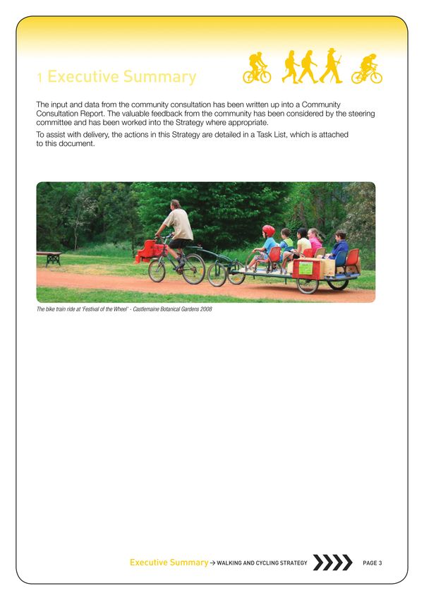
1   Executive Summary
This Strategy sets out a strategic approach for Mount Alexander Shire Council to improve and
increase walking1 and cycling in the Shire over the next decade. In the 2007-08 budget $20,000
was allocated to consult with the community and develop a walking and cycling Strategy. A steering
committee comprising Council and community members with interests in walking and cycling for
transport and recreation has guided the development of this Strategy.
The following concepts have been developed to assist with clarifying and prioritising work around
walking and cycling. They are:
Three zones around key population centres across the Shire.
• A Town Centre Zone – focused on the key shopping/activity centre of a township
• A Walking Zone – A 2.5 km radius around a town centre based on an approximate manageable2 30
  minute walk
• A Cycling Zone – A 5 km radius around a town centre based on an approximate manageable 30
  minute ride
Three independent and interconnected networks for walkers and cyclists.
• The Footpath Network – Beside road, primarily for walkers
• The Bike Lane Network – On road for cyclists
• The Trail Network – Off-road for walkers and cyclists
Primary and Secondary routes for each Network.
The most important routes on each network are identified as “Primary Routes”. These routes will
carry the most walking or cycling traffic and will be of the highest standard. “Secondary Routes”
are those that still play a connection role for walkers or cyclists but do not carry as high a volume
of traffic as Primary Routes. The design guidelines for Secondary Routes will therefore not be as
stringent as for Primary Routes.
Maps of the Primary and Secondary routes for the three networks were developed as a part of this
Strategy. These maps were displayed as a part of the community consultation process, and have
been amended in response to community feedback.
Each network has been analysed for its ability to:
• Be connected to the places that people want to get to and from,
• Be of sufficient quality with appropriate facilities
• Provide safety when crossing roads and interacting with other traffic
• Be inviting, attractive and convivial
• Be clear and easy to understand
And detailed approaches to improving these conditions are laid out under these headings.
An extensive community consultation was conducted in October 2009. This consultation:
• Checked the strategic approach of the Strategy against community expectations
• Identified priority issues for the community and added any issues not dealt with in the draft Strategy
  (Sept 2009)
• Identified priority routes for each network that were amended into the associated maps
• Identified specific areas of concern (i.e. tripping risk on Main St)
• Gathered baseline data on walking and cycling in the community to be included in the final Strategy

Executive Summary > Walking and Cycling Strategy Page 
1.0  Executive summary                        Page 02
            2.0  Introduction		                                05
            2.1  Our Shire		                                   05
            2.2  Defining Walking and Cycling		                05
            2.3  Why Walking and Cycling are Important		       05
            2.4  Policy Context		                              06
            2.5  Walking and Cycling Policy		                  06
            2.6  Vision for 2020		                             07
            2.7  The Walking and Cycling Zones Explained		     08
            2.8  The Walking and Cycling Zones		               09
            2.9  Networks and Routes		                         09
           	3.0	The Footpath Network                      Page 10
Contents
            3.1  Connection		                                  10
            3.2  Quality		                                     11
            3.3  Crossings		                                   15
            3.4  Inviting		                                    20
            3.5  Clear		                                       23
           	4.0	The Bike Lane Network                     Page 24
            4.1  Connection		                                  24
            4.2  Quality		                                     26
            4.3  Crossings		                                   27
            4.4  Inviting		                                    28
            4.5  Clear		                                       29
            5.0  The Trail Network                        Page 	30
            5.1  Connection		                                  30
            5.2  Quality		                                     32
            5.3  Crossing		                                    33
            5.4  Inviting		                                    33
            5.5  Clear		                                       33
            6.0	Town Centre Zones                         Page	34
            6.1  Streets for Walking		                         34
            6.2  Cyclists in town		                            34
            7.0  Wayfinding                               Page 35
            7.1  Map Boards		                                  35
            7.2  Directional Signage		                         36
            7.3  Maps and brochures		                          36
            7.4  Heritage		                                    36
            8.0	Lighting                                  Page	37
            8.1  Lighting Footpaths and Bike Lanes		           37
            8.2  Lighting Trails		                             37
            8.3  Lighting Options		                            37
            9.0	Integrating with Public Transport         Page	38
            9.1  Railway Stations		                            38
            9.2  Bus/Coach Routes		                            39
           10.0  Planning for Walking and Cycling         Page 40
           11.0  Community Engagement                        Page	41
           11.1  Promoting Walking and Cycling		                  41
           11.2  Driver Behaviour		                               43
           11.3  Council as a Model		                             43
           11.4  Business Opportunities		                         44
           11.5  Working to Encouraging Walking and Cycling		     44
           12.0  Measurement and Assessment                  Page 45
           12.1  Greenhouse implications		                        45
           13.0	Implementation                               Page 46
           14.0  Appendices                                  Page 46
           15.0	Attachments                                  Page 47
           16.0	Reference Documents                          Page 47
           17.0  Acknowledgements                            Page 48
           18.0	Glossary of Terms                            Page 49

Contents > Walking and Cycling Strategy Page 
2 Introduction
2.1 Our Shire
Mount Alexander Shire is located in the goldfields region of central Victoria, Australia, and covers an
area of 1,439 sq km. We are a diverse Shire with a range of transport and recreation habits across
our urban and rural communities. Walking and cycling are important transport options and popular
recreational activities in our Shire.
Our towns and surrounding areas are of national historic and environmental significance, making the
Shire an attractive location for residents as well as tourists from all over the country to walk and cycle
around.
2.2 Defining Walking and Cycling
Throughout this document the word ‘walking’ will be used to define the basic form of mobility
available to each individual. This therefore includes those who ‘walk’ with the aid of a stick or frame, a
wheelchair or a motorised mobility aid.
Cycling will take in all non-motorised wheeled transport (bikes, trikes, scooters etc.) not defined as
‘wheeled recreational devices3’ in the road rules. Bicycles with an auxiliary source of power (petrol or
electric) under 200 watts are also included in the category of ‘bicycle’ under the road rules.
2.3 Why Walking and Cycling are Important
Walking is the foundation of our transport system, it is accessible to all, it is free and it is good for
our health. Our first steps as children are significant as they represent the beginning of independent
mobility and our ability to move around our community. Walking is so fundamental that sometimes we
overlook it, but every trip no matter how long begins and ends with walking.
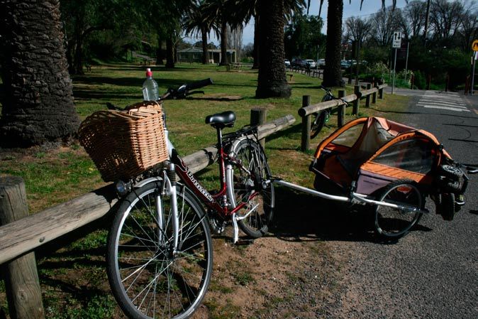
Cycling, like walking is good for our health and costs little. Cycling is a quiet, clean way to get around
that has the benefit of increased speed and range. Despite being more than 130 years old the bicycle
is still the most efficient form of transport ever invented.4
When walking and cycling replace car trips they minimise our environmental impact, reduce our
dependence on fossil fuels and make our community more financially independent while supporting
our local economy.5 Walking and cycling are also good for our social health. People who live in places
that are good to walk around have stronger social connections.6 Walking and cycling for mobility and
exercise are of increasing importance as our population ages.
Walking and cycling are popular forms of transport and recreation in the Shire. The community’s desire
for more and better facilities for walking and cycling has been noted in the 2009 Customer Satisfaction
Survey and in the Community Consultation and Survey associated with this Strategy in October 2009.
Walking and cycling are also popular recreational activities that improve individual health and fitness
and generally have positive benefits for the community. Tourism experiences based around walking and
cycling are already important in the region and present a fantastic area for growth and development.
We are all walkers at some point in every journey, and the majority of us ride at some time in our lives.
We all benefit when the place we live in is good to walk and ride around.
This Strategy is for the benefit of residents and visitors alike in Mount Alexander Shire.
Executive Summary > Walking and Cycling Strategy Page 
2   Introduction
2.4 Policy Context
The community of Mount Alexander identified walking and cycling as important areas for improvement
through the ‘Map 2020’ Community Plan process. The plan calls for:
• Footpaths that are developed, accessible and safe
• Improvements in pedestrian and cycle infrastructure that will create continuous routes
• The development of green travel plans for workplaces, schools and communities
The Council Plan 2009-2013, Greenhouse Action Plan 2007 – 2010 and Road Safety Strategy 2004 all
identify the need to develop a Walking and Cycling Strategy that will improve our transport system.
The Victorian Transport Plan 2008 makes “building a more sustainable transport system” a priority by
“using less polluting forms of transport more often”. It notes that, “the key is shifting behaviour towards
greener travel options”.
The Victorian Cycling Strategy 2009 has a vision for cycling as a “safe, readily available, convenient and
preferred transport option for Victorians”, and also recognises “the importance of cycling for recreation,
health and leisure”.

2.5 Walking and Cycling Policy
Council recognises walking and cycling as healthy, equitable and sustainable forms of transport and
recreation that benefit our Shire.
We will consider the needs and desires of walkers and cyclists in all areas of our influence. All new
developments, re-developments and initiatives of Council that have some bearing on walking and
cycling will seek to improve conditions for these activities.
We will ensure adequate facilities, appropriate design and engaging programs to encourage the
community’s preferred options to be walking in the ‘walking zones’, and cycling in the ‘cycling zones’
of our townships.

Introduction > Walking and Cycling Strategy Page 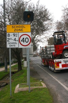
2   Introduction

    2.6 Vision for 2020
    By 2020 walking and cycling will have dramatically improved and increased in Mount
    Alexander Shire.
    Council’s positive position on walking and cycling will have played a major part in
    transforming the infrastructure, the attitudes and the behaviour in Mount Alexander
    towards these activities.
    We will have built a more extensive footpath network that will connect townships in the
    Shire to all the main attractions in their surrounding ‘walking zones’. Footpaths will be
    generous, well maintained and uncluttered. The very young and the very old will not feel
    threatened walking down the street.
    The environment in the town centres of our ‘walking zones’ will be particularly focussed
    on walking with very slow traffic conditions and easy movement for pedestrians through
    these spaces. Through community engagement programs and infrastructure it will be clear
    that walking is the preferred mode of transport for trips close to and around our townships.
    All these improvements will be reflected in a much greater level of walking.
    We will have worked with VicRoads to ensure that wide, well-connected on-road bike
    lanes are provided on all main roads though towns. We will have joined these main bike
    lanes with lanes on local streets that connect efficiently with the houses, shops and public
    places people want to move between.
    Cycling will represent a large share of the transport mode split with riding in the ‘cycling
    zones’ being convenient, safe and popular. Recreational cyclists will also find it easy to
    access the mountain trails and country roads that they enjoy. The Shire will have built on its
    reputation as a ‘cycling centre’ to be considered one of the best places in Australia for all
    forms of cycling.
    We will have continued to build, improve and connect up a network of off-road tracks for
    walkers and cyclists that will give people access from townships to their community and
    their local environment in a car-free environment. These tracks will also be a major attractor
    to the area for recreational walkers and cyclists. The Shire’s natural and cultural beauty and
    significance will be easily accessible on these tracks with clear signage, quality maps and
    good facilities along the way.
    We will have worked closely with the community to encourage and increase walking
    and cycling in the Shire. Schools, community groups and drivers will all be engaged with
    the message that walking and cycling are healthy, clean and positive activities that are
    supported at all levels of Council and the community.
    Driving in Mount Alexander Shire will also be better with lower traffic volumes, safer speeds
    and less parking stress in our townships. Through community engagement programs
    drivers will drive in a more cautious and respectful way, recognising walkers and cyclists
    as important road users. Any pedestrian might be our neighbour, our daughter or our
    granddad, any cyclist might be our workmate, our mother or our grandson.
    By 2020 there will still be work to do to improve and increase walking and cycling, but
    Mount Alexander Shire will be a fantastic place to walk and cycle in.

Introduction > Walking and Cycling Strategy Page 
2   Introduction

                                    Maldon                                                              Harcourt

                                                                                               Barrke
                                                                                               Ba  kerrs Creekk

                                               Gower

                                                                  Muc
                                                                   uckkleford
                                                                   uc                                   Moonlight Flat        Faaraday
                                                                                 Castlemaine
                                                                                                                         Goldenn Poinnt
                            Welsshmans Ree
                                        eeff
                                                                                                        Chewton
                                                                                Campbells
                                                                                  Creek                                              Elphinstone
             Joyces
                 es Creek
                                Newstead
                                                                    Yapeen
                                                                    Yapee

                                                                                                                                          Taradale
                                                                                                              Fryerstown
                                                  Strrangway
                                                          ays
                                                          ay      Guildford                      Irishhtown

                                                                                            Vaugghann

                                                                                  Tarilta

Fig 1. Walking and Cycling Zones Map

2.7 The Walking and Cycling Zones Explained
Conceptual Walking and Cycling Zones have been devised around the key population centres across
the Shire to provide a framework for the Strategy.
An average person walks at about 5km per hour, so in 30 minutes covers 2.5 kilometres. If we draw a
circle with a 2.5 kilometre radius around a town this gives us an idea of a manageable walking zone for
that town.
A casual cyclist rides at about 10–15 kilometres per hour. A 5 kilometre radius gives us a manageable
cycling zone for that town.
The terrain, directness of route, time taken at crossings and pace of the individual all affect the actual
time taken for any journey. The walking and cycling zones provide an indicative guide for manageable
journey times.
The map above shows these walking and cycling zones for the most populous towns in Mount
Alexander Shire.

                                                                Introduction > Walking and Cycling Strategy                                          Page
2 Introduction
2.8 The Walking and Cycling Zones
There is currently little useful data on walking and cycling in Mount Alexander Shire. One of the most
comprehensive profiles of walking and cycling came out of the Community Consultation process
associated with this Strategy. A report of the approach and findings of this consultation process is
provided as an attachment to this Strategy.
2.9 Networks and Routes
For walking and cycling to become preferred options in our community, the needs and desires of
different types of walkers and cyclists need to be understood and catered for. To do this it is helpful
to identify three separate walking and cycling networks each of which services particular groups of
walkers or cyclists and have their own list of requirements.
These three networks are:
• The Footpath Network (beside road, primarily for walkers)
• The Bike Lane Network (on-road bike lanes on existing roads)
• The Trail Network (off-road Walking and Cycling trails)
The most important routes on each network are
identified as “Primary Routes”. These routes will
carry the most walking or cycling traffic and will
be built to the highest standards. “Secondary Footpath Network
Routes” are those that still play a connection role Primary Routes Secondary Routes
for walkers or cyclists but do not carry as high a
volume of traffic as Primary Routes. The design
guidelines for Secondary Routes will therefore not
be as stringent as for Primary Routes.
Bike Lane Network
Primary Routes Secondary Routes
Each of the networks and their Primary and
Secondary Routes are addressed in detail in the
following sections (see 3, 4 and 5)
This Strategy also identifies the central shopping
Trail Network
Primary Routes Secondary Routes
and activity centres of our townships as areas
of special pedestrian importance. These Town
Centre Zones need to have the very highest level
of pedestrian friendly development to ensure our
towns are vibrant, attractive and utilised. Where
Town Centre Zone
not already identified in the other networks the
infrastructure requirements of these zones are
detailed in section 6 Town Centre Zones.
Introduction > Walking and Cycling Strategy Page 3 The Footpath Network
The footpath network is primarily for walkers, though is also legitimately used by children
under 12 who are cycling and adults that may be accompanying them on bike. To be effective
and to be used, the footpath network needs to:
• Be connected to the places that people want to get to and from
• Be of sufficient quality with appropriate facilities
• Provide safety when crossing roads and interacting with other traffic
• Be inviting, attractive and convivial
• Be clear and easy to understand
The most important routes on the footpath network will be identified as “Primary Walking Routes”
which will connect to “Secondary Walking Routes”. Footpaths on the Primary Walking Routes will
carry the most pedestrian traffic and will need to be of the highest standard.
(see ‘Maps’ for identified Primary and Secondary routes)
3.1 Connection
The footpath network, like the road network, needs to connect the places people are, to the
places they want to get to. A well-connected footpath network will provide unbroken walking
access to the following:
• Shops and shopping precincts
• Play/open spaces
• Community facilities
• Schools
• Public Transport stops
• Areas of residential concentration
• The Trail Network
If a road suddenly comes to a dead-end a car driver is forced to stop. This is the same with footpaths
for many walkers. Walkers such as the elderly, disabled, the very young and those pushing prams
depend on footpaths being connected and of sufficient quality to get to their destination.
We will work towards building a connected footpath network that creates an unbroken
link between all the locations in the above list within the ‘walking zone’ of each township.
3.1.1 Opening Lanes, Dead-End Streets
and Other Blockages
Walkers have the ability to move through spaces
that cars cannot. There are many opportunities for
pedestrian accessibility in our towns and ‘walking
zones’ through the opening or unblocking of
laneways, signing dead-end streets that are not
dead-ends to walkers and creating new ways through
existing blockages to pedestrian movement.
The addition of new ‘pedestrian access’ signs where
‘no through road’ signs do not apply to walkers,
and/or replacement of ‘no through road’ signs with
signage that notes walking and cycling access will
improve pedestrian accessibility of our townships.
Footpath Network > Walking and Cycling Strategy Page 103 The Footpath Network
There are many things that block or break up the footpath network.
Every street crossing can be an impediment, and crossing major
roads at places that don’t have signals can be very difficult
especially for the young and very old. Rivers and train tracks also
create barriers that can break up the footpath network.
We will develop appropriate local planning policies to protect
important pedestrian (and cycling) access ways, and ensure
compliance at a statutory and enforcement level.
We will use the annual footpath audit process to
assess pedestrian accessibility in the Walking Zones,
to identify and improve:
• Blocked pedestrian access ways
• Potential new pedestrian access ways
• Blockages at intersections or crossing points
(See 3.3.2 Intersections and 3.3.3 Mid-Block Crossings for
more detail of solutions)
• Signage to increase awareness of pedestrian accessibility Above unsealed footpath,
• Parallel cycling improvements for all of the above Below asphalted footpath
(see 4.1.3 Bicycles Excepted)
3.2 Quality
Many pedestrians, particularly the elderly, disabled or those
pushing prams require a high level of quality in the footpath
network for it to be useable and safe; other pedestrians prefer
informal footpaths as a part of the ‘country feel’ of the Shire.
3.2.1 Gravel or Sealed?
Gravel footpaths are less than ideal for many vulnerable road users
yet provide a cost effective way to deliver a greater length of path
and therefore better connection in the footpath network compared
to the sealed options of concrete and asphalt. Work on gravel
footpaths can become the foundation for future sealed surfaces,
making investment in gravel paths sound even if the intention is to
move towards sealed surfaces in the future.
The balance between quality and connectivity will be addressed
by making footpaths on the Primary Walking Routes sealed, and
preferencing sealed surfaces for Secondary Walking Routes, while
leaving the option open for the use of gravel as an interim stage to
sealing, to achieve greater footpath distance and connectivity in
the short term.
Footpath Network > Walking and Cycling Strategy Page 113 The Footpath Network
3.2.2 Footpath Guidelines
We will use the following design guidelines for establishing, upgrading and maintaining footpaths:
• Footpath surfaces need to be sufficiently smooth and free from tripping risks so that a person
using a walking frame can move comfortably. (See 11.3.1.1 Staff using mobility aids and bicycles)
• Footpaths on the Primary Walking Routes need to be at least 1.5 metres wide, enough to allow
groups of pedestrians, children on bikes or people pushing prams to pass comfortably.
• Footpaths on the Primary Walking Routes will be made of asphalt or concrete depending on
appropriateness for the streetscape or matching of existing infrastructure.
• Footpaths on the Secondary Walking Routes need to be no narrower than 1.2 metres
• Footpaths on the Secondary Walking Routes will ideally be made of asphalt or concrete
(depending on appropriateness for the streetscape or matching of existing infrastructure) though
gravel may be used as an interim stage to sealing to provide greater footpath network length
• Every intersection or crossing point will have a Pram-ramp of a grade no greater than 1.8
(12.5%) and no narrower than 1.2 metres on the Primary Walking Routes and no narrower than
1 metre on the Secondary Walking Routes to ensure universal access at these points (see 3.3
Crossings for further design guidelines)
3.2.3 Streets Outside the Primary and Secondary Walking Routes
Everyone in the Shire should be able to walk safely and comfortably from their houses along any road
to wherever they want to get to in the Shire. Yet many of the the residential streets in our Shire have no
formal footpath or sometimes lack the space needed to walk separately from vehicles.
This Strategy focuses attention on Primary and Secondary Walking Routes as footpaths of greatest
importance for improvement, but all residential streets that connect directly or indirectly to these
identified ‘routes’ are still important parts of the walking infrastructure of the Shire.
Access along informal ‘footpaths’ on road verges can and should be protected from parked vehicles,
overhanging vegetation, tripping risks left by adjacent homeowners and speeding vehicles. Any specific
safety risk along these streets needs to be addressed appropriately.
3.2.4 Grade as a deterrent to use
Very steep footpaths (extreme grade) are also an issue for many walkers and a deterrent to many
potential users. Grade at Pram-ramps is addressed under ‘crossings’
We will avoid grades that exceed 1:14 (4º) on footpaths on footpaths on the Primary
and Secondary Walking Routes unless no reasonable alternative exists.
3.2.5 Maintaining Unimpeded Footpaths
Obstructions on the footpath can be in the form of bins out for collection, overhanging branches,
street-side café seats and tables, shop displays, parked cars, delivery vehicles, building or
maintenance works or anything that stops the free flow of walkers on the footpath.
Footpath Network > Walking and Cycling Strategy Page 123 The Footpath Network
Through local laws, maintenance and media we will:
• Promote proper placement of bins out for collection so that
they don’t block the footpath
• Continue and improve the work of ensuring obstructing
branches and vegetation from Council plantings or private
gardens are kept from impeding pedestrian movement
• Ensure that the flow of footpaths is not obstructed by footpath
trading, while still encouraging vibrant street trading that
builds attractive town centres through the development of
footpath trading guidelines
• Continue and improve the work of ensuring construction
works that cross over or spill onto the footpath have a minimal
impact on pedestrian access by requiring stronger conditions
and better enforcement for building permits that have the
potential to block or create impediments on the footpath
• Enforce the above footpath guidelines
• Continue and improve the work of enforcing parking controls
so that cars and delivery vehicles parked across the footpath
Blockers on the footpath network
are appropriately deterred.
• Develop media campaigns to promote the importance of the
road rules in relation to pedestrian access (see 11.2 Driver
Behaviour)
3.2.6 Driveways
Driveways and other footpath crossovers create risks and surface
impediments on the footpath network. Cars reversing out of
driveways across the footpath must give way to walkers (and riders)
on the footpath, but often this road rule is not followed due to
issues of poor visibility, lack of care looking out for footpath users or
ignorance of the road rules. This is a particular problem for children
whose height can be obstructed by fences, hedges or other objects
between the footpath and the view from the driveway.
Drivers using off-road parking need to be encouraged to reverse
into the driveway as this affords good views of the footpath when
entering and much better views when exiting. Fences, hedges and
other obstructions that block good sight-lines of the footpath will
ideally be removed; this is of particular importance on the Primary
Walking Routes. On-street parking offers a safer alternative to crossing the footpath.
We will strengthen existing controls and develop appropriate new local planning policies to
ensure better sight lines for vehicles crossing the footpath with particular consideration when
granting planning and building permits on Primary Walking Routes, and ensure compliance at a
statutory and enforcement level.
We will develop media campaigns to promote safe driving behaviour around
driveways and footpath crossings.
Footpath Network > Walking and Cycling Strategy Page 133 The Footpath Network
3.2.7 Road Related Areas
Particular attention needs to be paid to businesses that encourage or require vehicles to cross
footpaths into their ‘road related areas’ be they service stations, car-parks or drive-through
facilities. In all cases vehicles entering or exiting these areas are required to give-way to
pedestrians in both directions.
We will develop appropriate local planning policies to ensure that:
• Pedestrian right of way is better communicated to vehicles entering and exiting road
related areas in terms of signage, road/footpath treatments and the reduction of visual
impediments for clear sight-lines
• Vehicles entering and exiting a road related area are slowed by appropriate traffic calming
measures (e.g. speed humps), narrower turning circles, and shorter footpath crossing widths,
• Ensure compliance of the above at a statutory and enforcement level
3.2.8 Unsealed Roads and Road Related Areas
Changes also need to be made to unpaved roads and ‘road related areas’ that cause gravel and other
debris to be dragged across the footpath and onto road shoulders and bike-lanes creating tripping
risks and problems for walkers and cyclists.
We will develop appropriate local planning policies requiring businesses along Primary Walking
Routes and Primary Cycling Routes to reduce gravel from road related areas being pulled across
footpaths, road shoulders, bike-lanes and roads by one of the following:
• Paving their road related areas
• Taking responsibility for cleaning debris
• Contributing to the financial costs associated with cleaning
And ensure compliance at a statutory and enforcement level.
At intersections along Primary Walking Routes where gravel across footpaths is identified as
a concern we will work towards sealing unsurfaced streets back to the property line, or where
appropriate to minimise this risk.
We will use the annual footpath audit process to assess the safety and pedestrian amenity of
all existing commercial crossovers on the Primary and Secondary Walking Routes to address
the above two issues and work with the landholders of identified ‘problem’ sites to improve the
crossover for pedestrian safety and comfort.
3.2.9 Public Toilets, Seats,
Drinking Fountains
Quality facilities are also essential for making the walking
environment pleasant, accessible and safe. The provision of
public toilets, seats in shaded spots for resting during a journey,
drinking fountains for maintaining hydration while walking
(particularly in the hotter weather) are all important parts of the
footpath infrastructure.
These facilities will ideally be situated at the intersections of two
or three of the walking and cycling networks to allow sharing of
the facilities across the different user groups.
Footpath Network > Walking and Cycling Strategy Page 143 The Footpath Network
Where possible these facilities should be shared with other community facilities like sports grounds
or public/private facilities like retail outlets or shopping centres to reduce duplication and cleaning/
maintenance costs. Clear signage and markings will also be important.
We will work towards providing a Footpath Network that has access to public toilets, seats in
shaded summer locations and drinking fountains at acceptable intervals
We will work with interested community partners (Older people, parents with young children,
people with disabilities) to identify gaps and areas for improvement in the existing provision
of the above facilities as well as options for utilising existing public or private facilities for this
purpose. (see also Trail network 5.2.2)
3.3 Crossings
The greatest safety concern for walkers is where interactions with vehicles take place at crossing
points. Crossings can be grouped into two main categories, ‘Intersections’ and ‘Mid-Block Crossings’.
Some approaches for improving the safety of crossings work in all locations while others suit specific
types of crossings.
3.3.1 Speed
Slowing vehicle speed is the most effective way to improve the safety of pedestrian crossing points.
Vehicular interactions with pedestrians are best done at walking pace, as vehicle speeds over 30 km/h
are extremely dangerous to walkers7. The design of the road environment at crossing points as well as
along roads of high pedestrian and vehicle interaction need to send a clear message to “slow down”.
This “slow down” message is incorporated in the approaches addressed below under Intersections
and Mid-Block Crossings. More general approaches to calming traffic speed are addressed in Slow
Traffic Conditions.
3.3.2 Intersections
3.3.2.1 Wide Bell Mouths
Wide “bell mouths” at intersections do not adequately
reflect a pedestrian’s right of way at these points, with
turning vehicles given plenty of room for making turns
at speed while pedestrians are forced to make a longer
crossing. It is not unusual to have streets that average 6
metres in width along their length opening out to 20-30
metres at an intersection.
Above Wide bell mouth, 25 metre footpath
The bell mouths of intersections, where the footpath crossing, Below narrowed treatment,
6.5 metre footpath crossing
network and roads intersect, need to be narrowed where
possible to slow turning vehicles and allow a shorter
crossing for pedestrians, ideally no wider than the average
width of the street at the footpath.
Footpath crossings that can’t be reduced down to
6 metres require a pedestrian refuge/splitter island.
However, this is less advantageous for pedestrians if the
intersection’s wide mouth encourages vehicles to turn a
corner at anything faster than walking pace.
Footpath Network > Walking and Cycling Strategy Page 153 The Footpath Network
Pedestrian refuges need to be wide enough to accommodate a person pushing a pram and assisting
a toddler, or a person wheeling a bicycle. 1.8 metres is the minimum8 width that a refuge should be for
pedestrian safety as shorter refuges can leave pedestrians sticking-out and exposed. Lane crossings
on either side of a pedestrian refuge should be no greater than 3 metres.
We will work towards a maximum 6 metre crossing at the bell mouths of intersections on the
Primary and Secondary Walking Routes and in our Town Centre Zones. Where total crossings
cannot be reduced to 6 metres a pedestrian refuge ‘splitter island’ will be used to facilitate safer
pedestrian movements where that pedestrian refuge can be at least 1.8 metres wide and individual
lane crossings are no greater than 3 metres.
3.3.2.2 Footpath Direction
At many intersections the footpath veers away from its path
leading walkers away from the intersection. Apart from
making the footpath longer and less direct, these variances
send a confusing message to traffic. Although vehicles
turning off a primary route into a side street should give way
to walkers crossing the side street, the footpath leads walkers
away from the intersection making car drivers less likely to
see them or to give-way
We will work towards footpaths that do not change direction at intersections on the Primary
Walking Routes and in our Town Centre Zones, but reflect pedestrian right of way at these points.
3.3.2.3 Raised Pavement Crossings
Raised pavement crossings are like a speed-hump with a
footpath across the top. They send a clear message that the
footpath continues across the intersection and vehicles need
to slow at this point. This message can also be re-enforced
with coloured or textured surface treatments that contrast
with the road surface and colour.
We will utilise ‘raised pavement crossings’ on the
Primary Walking Routes and in our Town Centre Zones
as the preferred approach to slow traffic and make the Raised pavement crossing
footpath network safer and easier to use. Where drainage
issues make the cost of this treatment prohibitively high,
contrasting markings or surface treatments will be used to
support the footpath network
3.3.2.4 Zebra Crossings at Intersections
Zebra crossings at intersections can be effective ways of assisting walkers to make safe
crossings, while slowing traffic – assisting safety further. Zebra crossings at intersections can be
marked over raised pavements, and alternative road surface textures or colours.
Note: The use of Zebra crossings is under the jurisdiction of VicRoads.
Footpath Network > Walking and Cycling Strategy Page 163 The Footpath Network
We will work with VicRoads to utilise zebra crossings at
important intersections on the Primary Walking Routes
and in our Town Centre Zones where turning vehicles
reduce the safety or amenity to pedestrians. These Zebra
crossings can be in addition to raised pavement crossings
and/or contrasting markings or surface treatments
Zebra intersection
3.3.2.5 Signalised Crossings at Intersections
Improvements in the sequencing at signalised crossings
(traffic lights) can make conditions better for walkers. Early
‘green man’ sequencing allows pedestrians to enter an
intersection before turning traffic is given access, which
is in line with the road rules. Automatic call up allows
walkers who arrive at an intersection just after the lights
have changed to catch that sequence, and not leave them
standing by the side of a busy road for several minutes. It is
equivalent to what vehicular traffic enjoys. Longer crossing
times will also be programmed to allow more vulnerable road
users to have adequate time to cross the road. All of these
changes are a simple matter of re-programming, and are
being adopted in signalised crossings across the state. Early Green - Pedestrians go first
When re-sequencing is conducted, consideration needs to be given to the speed at which vehicles
travelling between two signalled intersections are encouraged to travel. Where sequencing at two
intersections can be linked, sequencing should not allow speeding traffic to ‘miss’ both lights while
traffic travelling at a safe and legal speed ‘catch’ both lights, which only encourages a culture of
speeding in our town centres.
Note: The control of signalised crossings is under the jurisdiction of VicRoads
We will work with VicRoads towards the following improvements for pedestrians
at signalised crossings:
• Early ‘green man’
• Automatic call up
• Longer crossing times
• Where sequencing at two intersections can be linked, sequencing should favour
at or below speed limit driver behaviour
3.3.2.6 Roundabouts
Unlike other intersections, pedestrians have
no priority at roundabouts in any direction.
Pedestrians have to give way to vehicular
traffic on all legs of a roundabout. This makes
roundabouts very difficult for vulnerable road
users (particularly younger and older walkers) to
negotiate, and can leave some walkers stranded
by the side of the road for a very long time. This
situation is extremely dangerous.
Footpath Network > Walking and Cycling Strategy Page 173 The Footpath Network
Vulnerable road users are often advised in official publications to “avoid crossing at Roundabouts”
as “you must give way to motor vehicles” in all directions9. It is unacceptable to build new traffic
treatments that exclude, or are dangerous for the people who need the footpath network the most.
As an example, the large roundabout on Forest and Wheeler/Hargraves Streets in Castlemaine
impedes important pedestrian movement from the South and the East into the town centre.
Modifications are required to allow better pedestrian access on these important walking routes.
We will, where possible avoid building new roundabouts in the Walking and Cycling Zones
and where a particular need is identified we will work towards the modification of existing
roundabouts to address any walking and cycling concerns.
3.3.3 Mid-Block Crossings
Walkers often favour mid-block crossings (a crossing not made at an intersection), as there
is only traffic on one street to negotiate, whereas crossings made at intersections involves
negotiating with traffic in several directions. Mid-block crossings can also be important for
walkers to get to where they want to go by the shortest route, especially in shopping areas.
Making mid-block crossings easy and safe is an important part of improving the ‘pedestrian
accessibility’ of an area or route.
Different streets and their particular characteristics determine the pedestrian accessibility of that
street. The less traffic there is, the slower its speed and the shorter the crossing, the easier it is
for walkers to negotiate. Often the Town Centre Zones in our Shire have grown up along what are
now major arterial routes carrying relatively high volumes of traffic at speeds not suited to town
centres, and in some cases on dual carriageways (2 lanes each way). These are poor conditions
for pedestrian accessibility.
Pedestrian accessibility can be assisted by the installation of Formal Pedestrian Crossings, but
a range of other measures can assist in creating ‘informal crossings’ that can be used to make
stretches of street more accessible for pedestrian movement.
3.3.3.1 Formal Pedestrian Crossings
Formal pedestrian crossings (zebra or signalised) can be effective ways of assisting walkers to
make safe mid-block crossings, but have some draw-backs for accessibility. A mid-block crossing
made 20 metres either side of a formal pedestrian crossing is technically jay-walking, is therefore
illegal and can result in a fine. One ‘formal’ crossing can make 40 metres of street less accessible
to walkers, while making crossing at one point better. There is a balance to be struck between
formal and informal crossings.
Mid-Block Zebra crossings are best suited to streets that are already reasonably slow and where
motorists are expecting pedestrian activity. In these cases the ‘pedestrian accessibility’ of the
street will already be high, so zebra crossings should be restricted to crossing points that best suit
vulnerable road users and connect to important locations or routes.
Signalised pedestrian crossings are better suited to low ‘pedestrian accessibility’ roads where
speeds and traffic volumes are relatively high. When signalised crossings are used on arterial
routes they should be placed where they provide the greatest benefit to all three networks.
Footpath Network > Walking and Cycling Strategy Page 183 The Footpath Network
3.3.3.2 Informal Mid Block Crossings
Mid-block crossings can be enhanced with the use of
pedestrian refuges (or median strip, or pedestrian storage),
creating a space between lanes of traffic for walkers to
make a crossing in two stages. Pedestrian refuges can be
created with painted boxes, but are clearer and safer with
raised sections of pavement, though not so raised that they
are difficult for vulnerable road users to mount. As noted
under intersections (3.3.2 Intersections) refuges should
ideally be a minimum of 1.8 metres wide (to accommodate
prams, scooters etc.), and lane crossings should be no
greater than 4 metres.
Narrower streets are easier and safer for pedestrians to
cross. Car lane width can be reduced by using or changing
the orientation of on-street parking, the introduction of bike
lanes, painted or solid pedestrian refuges and narrowed
lane markings.
Footpath extensions or chicanes can also be used to slow
traffic by reducing lane width at points while shortening
pedestrian crossing distance. Well placed mid-block
chicanes can improve pedestrian visibility and site lines,
making mid-block crossings safer.
Trees, parked cars and other roadside objects like footpath
trading displays or café furniture can hide walkers, especially children, from oncoming traffic and
reduce pedestrian sight-lines. Creating spaces amongst these barriers can improve sight-lines
and safety for road crossings. When combined with the above ‘shorter crossing points’ these
spaces can provide simple, safer crossing points along stretches of road that currently have poor
pedestrian accessibility.
(Approaches to calming traffic speed along roads are addressed in 3.4.3 Slow Traffic Conditions)
Note: The approval of major traffic control items such as signalised and zebra crossings along with
Arterial roads remain under the jurisdiction of VicRoads.
We will work (with VicRoads - where appropriate) towards maximising pedestrian safety and
accessibility at identified locations through the use of street narrowing treatments, shorter crossing
points, pedestrian refuges, improved sight lines or the installation of formal crossings as deemed
appropriate for the specific location and risks identified.
Footpath Network > Walking and Cycling Strategy Page 193 The Footpath Network
3.4 Inviting
Even the very best infrastructure can be under-utilised if it
does not attract people to it. Human beings have a very
strong desire to be in places that are comfortable, pleasing
and beautiful. It is essential that we consider how a place
makes people feel if we expect to attract them to it.
3.4.1 Shade and Beauty
Streets and footpaths are pleasant to walk on when they are
shady in the summer, sunny in the winter and are protected
from winds. Appropriate placement of shade trees, verandas
and shelter structures can make the difference between a
pleasant walk and a hot, windy or chilly one. Shade trees
that do not block sight-lines or obstruct footpaths contribute
greatly to the pleasure of walking.
Lower plantings can provide colour, beauty and attract birds
in and along our streets. Good planting and planning can
be the difference between a footpath that ‘gets you there’
to a place that is a pleasure to walk in. Council’s street tree
planting program and ongoing maintenance of existing
street trees will ensure a wealth of beautiful streets for the
Summer shade from deciduous trees
walking network.
We will develop appropriate local planning policies to ensure that shading and seasonal comfort
issues for pedestrian spaces are a core consideration when developing streetscape/landscape
policies and undertaking landscaping works.
We will develop appropriate local planning policies to encourage effective verandas over the
footpath in the design and construction of new retail and commercial development within the Town
Centre Zones and along Primary and Secondary Walking Routes, both in areas where heritage
concerns apply and where more modern styles are developed, and the redevelopment of verandas
on older buildings, whether C19 or C20, will also be encouraged. We will ensure compliance with
this policy at a statutory and enforcement level.
3.4.2 Good Orientation for Pedestrian Environments
Footpaths and shops on the South side of an East-West oriented street offer the best locations
for walking and sitting as they can be sunny in Winter and shady in Summer with the right trees or
structures. The South side of the street should be favoured for the Primary Walking Routes unless this
clashes with better connections.
The main street through Newstead and Chewton, as well as Forest, Mostyn, Lyttleton and Templeton
Streets in Castlemaine’s Town Centre Zone are all oriented approximately East-West and their South
side will present the best options for year-round comfort with appropriate plantings and structures.
Most other main streets in the Shire run North-South (approximately) offering fewer opportunities for the
improvements detailed above. Deciduous shade trees and North oriented structures can still make for
pleasant environments on these streets. Developments close to the intersection of East-West feeder
streets on these main North-South streets can also provide good opportunities for improvement.
Footpath Network > Walking and Cycling Strategy Page 203 The Footpath Network
3.4.3 Slow Traffic Conditions
Slower traffic conditions make the road safer for everyone. This is confirmed by many studies on
the effect of speed in crashes. A recent study has concluded that in relation to fatalities, “a strong
dependence on impact speed is found, with the fatality risk at 50 km/h being more than twice as high as
the risk at 40 km/h and more than five times higher than the risk at 30 km/h”10.
Another essential factor to consider in relation to traffic speed is the effect it has on the perceptions of
safety and comfort of pedestrians using that street. Pedestrians are less inclined to use a footpath and
feel less safe walking, if traffic on the road is busy and fast. Parents are less likely to allow their children to
walk independently if there is a perception of fast and threatening traffic conditions. This is supported by
the research of Donald Appleyard who showed an inverse link between the traffic volumes of streets and
the use of the street by pedestrians11.
Council recognises that the perception of speeding vehicles in the community and the resultant safety
concern is just as much of a deterrent to walking (and cycling) as actual speed is.
Recent work at Monash Accident Research Centre has shown that lowering traffic speeds through
key pedestrian areas actually has very little impact on travel times for drivers while having a substantial
improvement in the reduction of serious injury and fatality12.
Traffic can be slowed by a few methods:
• Lowering Speed limits
• Traffic Calming Measures Along Roads
• Traffic Calming Measures at Crossings (this is addressed in ‘Intersections’ and ‘Mid-Block Crossings’
under ‘Crossings’ above)
• Driver Behaviour Change
3.4.4 Reviewing the 85th Percentile
The ‘85th percentile’ is used by traffic engineers to assess traffic speed data from ‘tube-counts’.
It suggests that if 85% of vehicles are at, or below the speed limit in a particular street statistically
there is not reason for concern with speed in that street.
This methodology has several problems, they are:
• 15% of drivers are still speeding in the street
• Tube counts do not differentiate between vehicles that are at cruising speed when they cross the
counter and vehicles that are not yet at full speed. Vehicles that have pulled out from the curb or
driveway or turned into the street, or who have slowed because they are behind a slower vehicle are
all not yet at full speed. Although efforts are made to place tube counters away from intersections,
car parks etc. in some streets vehicles are potentially not at full speed. This may account for
ambiguity in the traffic count data. These factors may influence data on local residential roads more
than arterial roads.
• Tube counter strips are very noticeable and are a clear reminder of speed and are still
remembered by some as an early speed detection device used by police. Drivers who are
inadvertently speeding might well adjust their speed down when they see a tube-counter, this
would also skew the speed data down.
In light of these issues and in recognition of the profound effect speed has on safety and the
perception of safety, we will place particular emphasis on speed in areas of high walking and
cycling importance, even if they don’t meet the 85th percentile.
Footpath Network > Walking and Cycling Strategy Page 213 The Footpath Network
3.4.5 Lowering Speed limits
The introduction of the standard 50kph speed-zone in local streets was very successful in Victoria.
Research has shown a noticeable reduction in fatalities and serious injuries since the introduction of
this control13. There has also been great success with the introduction on 40km zones in the main
shopping streets of Melbourne. Speed limits alone will not slow all traffic. Public awareness raising,
general community support and enforcement are all needed to make speed limits effective, but lower
speed limits send a clear message about expected behaviour in and around our areas of highest
pedestrian activity.
Many drivers expect that they will be able to drive ‘at the speed limit’ rather than ‘at a safe and legal
speed’, which is what is actually required by the law. Lowering speed limits helps these drivers who
find it hard to respond to the conditions of the road and surrounds.
Note: Setting speed limits is under the jurisdiction of VicRoads, following an initial
assessment by Council.
We will continue to work with VicRoads towards lowering the speeds in our Walking Zones, on our
Primary Walking Routes and in our Town Centre Zones.
3.4.6 Traffic Calming Measures Along Roads
Road narrowing, speed humps, chicanes, one-way bottle-necks, different road textures, raised
pavements and curb extensions are all measures can be used to slow traffic speeds along the length
of roads. The best options to use will be ones that offer dual functions. For example chicanes can
be used as crossing points to allow pedestrians shorter crossing points, speed humps can become
raised zebra crossings, different road textures or colours can be used to reiterate pedestrian priority in
the road rules. These treatments will integrate with the treatments detailed in ‘Intersections’ and ‘Mid-
Block Crossings’ under ‘Crossings’.
We will use appropriate traffic calming measures to slow traffic and to assist pedestrians
where speeds are deemed too high for safety or the perception of safety.
We will use dual functions on all traffic calming measures to ensure the best outcomes
for each treatment.
3.4.7 Driver Behaviour/Culture Change
Even without speed limit reduction or traffic calming infrastructure drivers can make the roads much
safer by choosing to slow down and drive with care and courtesy. This kind of behaviour needs to be
encouraged at many levels to become a part of a different culture on the road.
Council has an established partnership with various road safety organisations.
We will work with road safety partners to deliver ongoing media campaigns and programs to raise
public awareness in the area of road safety.
(This area is addressed in more detail in section 5.6 ‘Driver Behaviour’)
Footpath Network > Walking and Cycling Strategy Page 223 The Footpath Network
3.4.8 Walking with Bicycles and Mobility Aids
Children under 12 and parents accompanying children under 12 are allowed to use the footpaths to
ride on. Cyclists who are allowed to use the footpaths are required to give way to walkers. Keeping
bicycle speeds low and making sure riders respect and give-way to walkers is important for keeping
footpaths comfortable for all walkers.
We will develop and install simple signage at key network connector points (where Trails and shared
footways connect to the Footpath network) to clearly state which cyclists can use the footpath and
what is expected of them.
The use of motorised mobility aids (electric scooters) can be vital for keeping those who have mobility
problems involved in and connected to their community. As our population ages the use of electric
scooters is increasing, and is at times creating conflict on the footpath. There are already guidelines
for the safe use of electric scooters and the introduction of legislative controls on registration, speed
and behaviour of these vehicles may well be introduced as it has been in other States. Any new State
controls on the use of electric scooters should ensure:
• A medically verified reason for use
• Speed limitations to ‘walking pace’
• Clearer road rules for ‘right of way’ conflicts between pedestrians and electric scooters
It is hoped the improvements in footpath quality and connectivity, bike lanes and off-road trails detailed
in this Strategy will assist in keeping our community more active and make walking and cycling options
for those with limited mobility much better, thus reducing the need for and prevalence of electric
scooters on our footpaths, while providing excellent footpaths for those who need mobility assistance.
3.5 Clear
The combination of signage, maps and markings for aiding pedestrian understanding of the walking
environment are important for people to know where they are and where they are going. Signage,
maps and markings are often referred to together as ‘Wayfinding’. Wayfinding is particularly important
to visitors and those just learning to use the walking and cycling networks.
Wayfinding for all three walking and cycling networks is addressed in section 7 of this report.
5 “Pedestrian fatality risk as a function of car impact speed” 2008. E Rosin, U Sanders. Autoliv Research, Sweden
6 Australian Standard AS1742 Part 10 and Austroads Part 13 Guide to Traffic Engineering Practice
7 “Pedestrian fatality risk as a function of car impact speed” 2008. E Rosin, U Sanders. Autoliv Research, Sweden
8 “Liveable Streets” 1981. D. Appleyard
9 “The impact of lowering speed limits in urban/metropolitan areas” 2008. Archer, Fotheringham, Symmons, Corban. MUARC
10 “An evaluation of the 50km/h speed limit in Victoria” 2006. Hoareau, Newstead, Cameron. MUARC
Footpath Network > Walking and Cycling Strategy Page 234 The Bike Lane Network
The Bike Lane Network is made up of on-road bike lanes that
connect through the centre of our townships to quieter streets and
country roads. This network is focused on directness, giving cyclists
a fast, efficient and safe way to move around. Cyclists who are
confident enough to ride in traffic will use the Bike Lane Network,
but the network must also cater for all cyclists over 12 who can
no longer use the footpath network, and novice adult cyclists who
are still gaining confidence. To provide for a broad range of skill
levels requires wide lanes with a good level of separation and good
provision through intersections.
To be effective and to be used the Bike Lane Network needs to:
• Be connected to the places that people want to get to and from
• Be of sufficient quality and provided with appropriate facilities
• Provide safety when crossing at intersections
• Be inviting, attractive and safe
• Be clear and easy to understand
The most important routes on the bike lane network will be
identified as “Primary Cycling Routes” which will have clear on-road
bicycle lanes, signage and crossing markings. These lanes will
connect to “Secondary Cycling Routes” which will include streets
with lower and slower traffic.
4.1 Connection
4.1.1 On-Road Bike Lanes
The Bike Lane Network will be concentrated on main routes inside
our Cycling Zones. The network needs to get cyclists of many
abilities safely from where they live to:
• Shops and shopping precincts
• Play/open spaces
• Community facilities
• Schools
• Public Transport stops
• Areas of residential concentration
• The Trail Network
The Bike Lane Network will get cyclists into town in the most direct fashion, as well as allowing
cyclists to move around the centres of our townships. Bike Lanes will also provide access to areas of
residential concentration. The main roads through our towns will be essential parts of the Bike Lane
Network as they are usually the most direct routes between the places people want to get to.
We will work towards building a connected bike-lane network that creates an unbroken link
between the above list of locations within the ‘cycling zone’.
Note: Main roads and the ‘Municipal Bicycle Network’ are under the jurisdiction of VicRoads.
We will continue to work with VicRoads towards making the Primary and Secondary Cycling
Routes on the main roads through the Shire’s townships part of the Bike Lane Network.
Bike Lane Network > Walking and Cycling Strategy Page 24You can also read