RIGHTS OF WAY IMPROVEMENT PLAN (ROWIP) 2020-30
←
→
Page content transcription
If your browser does not render page correctly, please read the page content below
CARDIFF COUNCIL
   RIGHTS OF WAY IMPROVEMENT
   PLAN (ROWIP) 2020 -30

Mae’r ddogfen hyn ar gael yn Gymraeg ar wefan Cyngor Caerdydd (Hawliau Tramwy Cyhoeddus)
This document is available in Welsh and is on Cardiff Council’s website (Public Rights of Way)

                                                                                                 Working for Cardiff, working together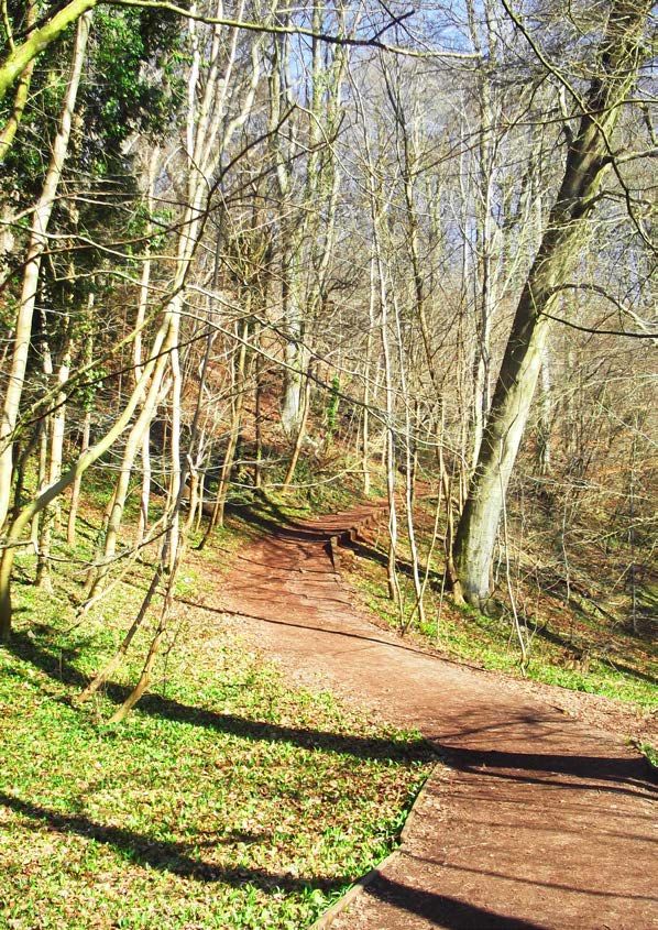
Cardiff Council Rights of Way Vision:
                                                                         Cardiff Council aims to manage, maintain, improve and
                                                                         develop the Rights of Way network and countryside
                                                                         access, to provide better opportunities for more people
                                                                         to enjoy the outdoors, help support their way of life and
                                                                         contribute to their well-being.
                                                                         We want to make the network more accessible for local
                                                                         communities and visitors to our city, also promote and
                                                                         encourage responsibility for our outdoor environment.

Written by Tricia Cottnam
Designed by Mark Goddard

Cardiff Council - Rights of Way Improvement Plan (ROWIP) 2020-30
Statutory duty, Countryside and Rights of Way Act 2000 Section 60 & 61

                                                                                                                                     Fforest Fawr, Whitchurch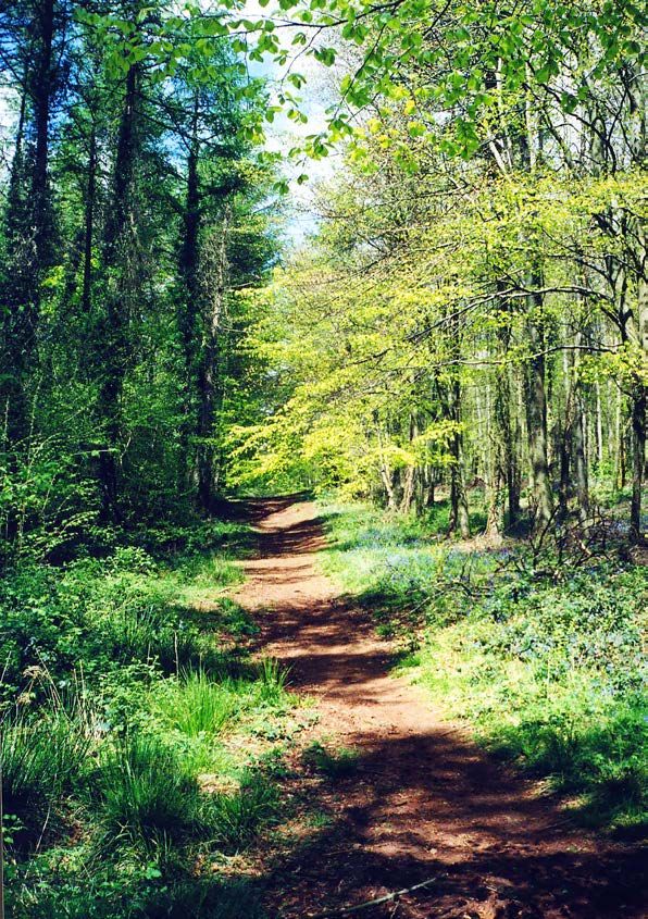
Cardiff Council - Rights of Way Improvement Plan 2020 -30                                                                                                                                                                         Cardiff Council - Rights of Way Improvement Plan 2020 -30

ABBREVIATIONS AND GLOSSARY:                                                                                TABLE OF CONTENTS:
DMS            Cardiff Council’s digital management system to record path issues, plan repairs or other    Cardiff Council Rights of Way Vision........................................................................................................................ 1
               work and run reports (currently AMX – Asset Management Expert)                              Abbreviations and Glossary......................................................................................................................................... 2
CROW           Countryside and Rights of Way Act 2000 – this includes the requirement to produce a         Foreword & endorsement from Leader & Councillor........................................................................................... 6
               10-year ROWIP (sections 60-61)                                                              Summary of our Rights of Way Improvement Plan (ROWIP).......................................................................... 9
                                                                                                           1. Introduction.............................................................................................................................................................13
DM             Definitive Map – see page 4 for definition
                                                                                                                 1.1           Cardiff, Capital City of Wales...........................................................................................................................................15
DMMO           Definitive Map Modification Order                                                                 1.2           Table to show legal path users.........................................................................................................................................16
km             Kilometre                                                                                         1.3           What are Public Rights of Way (PROWs)?...................................................................................................................17
m              Mile                                                                                              1.4           Definitive Map (DM)............................................................................................................................................................17
                                                                                                                 Map 1:        Cardiff Public Rights of Way Network (current at 2019)........................................................................... 18
LAF            Local Access Forum – a group whose interests are relevant to PROW
                                                                                                                 1.5           Who can use which path?..................................................................................................................................................22
LA             Local Authorities – Cardiff Council’s neighbouring LAs are: Vale of Glamorgan Council,            1.6           Who maintains our PROWs?.............................................................................................................................................23
               Rhondda Cynon Taf Council, Caerphilly County Borough Council and Newport City Council             1.7           Local Access Forum (LAF)...................................................................................................................................................23
LDP            Local Development Plan – a plan required by Welsh Government to increase housing to cope          1.8           Natural Resources Wales (NRW).....................................................................................................................................24
               with demand for homes; Cardiff Council adopted their plan in January 2016                   2. Why are we making a new ROWIP?.................................................................................................................25
                                                                                                                 2.1           Why are we making a new ROWIP?..............................................................................................................................27
NRW            Natural Resources Wales (formerly Countryside Council for Wales) – this looks after the
                                                                                                           3. New Assessment and public survey.................................................................................................................29
               environment for people and nature and operates within WG
                                                                                                                 3.1           Evaluation of the delivery of the 1st ROWIP 2008-18 (Stage 3).......................................................................30
OC             Outdoor Cardiff                                                                                   3.2           Evaluation of the current condition of the network and its legal record........................................................32
OS             Ordnance Survey                                                                                     3.2.1       The current condition of the network...........................................................................................................................32
PI             Planning Inspectorate – this approves legal orders including DMMOs                                  3.2.2       The legal record.....................................................................................................................................................................33
                                                                                                                 Map 2:        Cardiff Neighbourhood Area............................................................................................................................... 34
PROW           Public Rights of Way – see Cardiff Council PROW
                                                                                                                 3.3           Future needs and opportunities......................................................................................................................................35
RAMSAR         Wetland of International importance under the Ramsar Convention, an intergovernmental               3.3.1       Public survey............................................................................................................................................................................35
               environmental treaty established by UNESCO in 1971                                                  3.3.2       How we carried out the survey.........................................................................................................................................35
ROWIP          Rights of Way Improvement Plan – a 10-year plan to manage and improve the PROW                      3.3.3       ROWIP Survey – how responses have changed........................................................................................................36
               network in Cardiff – see Cardiff Council ROWIP                                                      3.3.4       Instagram competition.......................................................................................................................................................37
SAC            Special Area of Conservation                                                                        3.3.5       Survey results..........................................................................................................................................................................38
                                                                                                                   3.3.6       Evaluation – further points to note................................................................................................................................40
SMART          Objectives: Specific, Measurable, Achievable, Relevant, Time-bound
                                                                                                                   3.3.7       Supporting groups and influencing factors................................................................................................................40
SOA            Statement of Action – part of the new ROWIP, it sets out the 10-year aims for improvement         Map 3:        LDP Strategic Development Sites (red outline)............................................................................................. 42
               on the path network                                                                               3.4           Conclusion of the assessment..........................................................................................................................................45
SPA            Special Protection Area                                                                           3.5           Publish the Draft ROWIP 2020-30.................................................................................................................................45
SSSI           Site of Special Scientific Interest                                                         4. Statement of Action 2020 -30 – what we aim to achieve.......................................................................47
                                                                                                                 4.1           Key Strategies.........................................................................................................................................................................49
SWOT           Analysis: Strengths, Weaknesses, Opportunities, Threats
                                                                                                           5. Key Aims....................................................................................................................................................................51
WCP            Wales Coast Path – path linking around the whole coast of Wales                               5.1               About our Key Aims..............................................................................................................................................................52
WG             Welsh Government – within Environment and Countryside section, they develop policy and      		                  Key Aims 2020-30 – description and funding...........................................................................................................54
               guidance on access to the outdoors, including guidance to LAs on the new ROWIP. They          5.2               Managing future change in Key Policies and Legislation.....................................................................................62
               have also helped with some grant funding of certain path improvements.                      6. Delivery Plans...........................................................................................................................................................63
                                                                                                                 6.1     Welsh Government Delivery Plan guidance................................................................................................................64
                                                                                                                 6.2     Review of Delivery Plans – the Annual Programme.................................................................................................64
                                                                                                                   6.2.1 The 5-Step PROW decision-making and delivery plan...........................................................................................65
     For more information on Public Rights of Way (PROW) including mapping, reporting a problem,           Appendix 1 – Supporting documents and references.......................................................................................67
     leaflets, etc, go to the PROW webpages.                                                               Appendix 2 – Links to Trails and Circular Walks.................................................................................................69
                                                                                                           Appendix 3 – Considerations of 1st ROWIP Review..........................................................................................70
                                                                                                           Appendix 4 – SWOT analysis definition and Key Strategies..........................................................................75
                                                                                                           Appendix 5 – Strategic Environmental Assessment..........................................................................................81
                                                                                                           Appendix 6 – ROWIP Consultation List ................................................................................................................83

2                                                                                                                                                                                                                                                                                                                            3
FOREWORD & ENDORSEMENT
                FROM LEADER & COUNCILLOR

                “...encourage our citizens and visitors to
                use our path network to walk, ride a horse
                or cycle .... It is so important to help make
                our environment sustainable and above all
                enjoyable.”

Lisvane Steps                                   Horse Step Over - Fforest Fawr, Tongwynlais
Cardiff Council - Rights of Way Improvement Plan 2020 -30                                                                                                                Cardiff Council - Rights of Way Improvement Plan 2020 -30

FOREWORD                                                                                                   ENDORSEMENT STATEMENT
Councillor Huw Thomas,                                                                                     Councillor Caro Wild,
Leader of Cardiff Council                                                                                  Cabinet Member for Strategic Planning & Transport, Cardiff Council

The Rights of Way Improvement Plan (ROWIP) 2020-30 is our second 10-year plan and is compiled              I am delighted to endorse the Rights of Way Improvement Plan (ROWIP) 2020-30, as it clearly aims to
as part of our statutory duty under the Countryside and Rights of Way (CROW) Act 2000. It aims to          encourage our citizens and visitors to use our path network to walk, ride a horse or cycle, whether this is
enhance the city’s path network, which is a valuable resource for our residents and visitors to Cardiff.   as a sustainable transport choice, or simply for enjoyment. I believe that it will help improve the health
                                                                                                           and wellbeing of many users of our path network.
We have engaged with the public through our survey, which has been really useful in providing ideas and
focus for future improvements to our network. We have also worked with local communities and groups        Some of the city’s path network aligns with our Active Travel routes and also provides links to the new
including our Local Access Forum and Green Infrastructure group, as well as with our neighbouring local    communities that are being developed in the city, which we hope people will take advantage of. More
authorities to ensure that long distance routes between us are improved.                                   and more people are choosing to cycle or walk to work or school, so if we can make their route a pleasant
                                                                                                           one, then that will be a great start. It is so important to help make our environment sustainable and
The ROWIP 2020-30 mirrors many of our Capital Ambition commitments, such as investing in
                                                                                                           above all, enjoyable.
sustainable transport modes to offer better opportunities for walking, cycling, accessibility and public
transport use. It also reflects our wish to work with our communities and I am confident that the ROWIP    The ROWIP 2020-30 demonstrates that we have listened to our citizens through the ROWIP survey. We
2020-30 will be met with enthusiasm by current and future path users.                                      are putting feasible plans in place for the next 10 years and are committed to providing improvements
                                                                                                           to our path network, which is already a popular resource for people to use and enjoy.
I’m grateful to the Public Rights of Way (PROW) team, stakeholders and all those who contributed to
developing the plan. I’d particularly like to thank everyone who took time to respond to our survey. You
have played an important part in helping us to shape this plan and our priorities for the next 10 years.

                                                                                                                                                                                                  Councillor Caro Wild

                                                                                  Councillor Huw Thomas

6                                                                                                                                                                                                                               7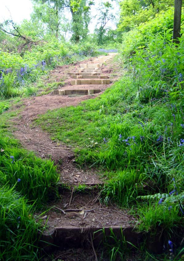
SUMMARY OF OUR RIGHTS
                                             OF WAY IMPROVEMENT PLAN
                                             (ROWIP)
                                             “Improve the PROW network to benefit all
                                             users; walkers, cyclists, horse riders, off-road
                                             users and people with sensory/mobility
                                             issues.”

Horses and riders enjoying the countryside                                              Hendre Lake, Wentloog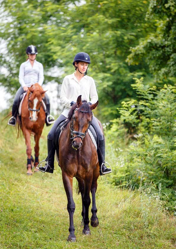
Cardiff Council - Rights of Way Improvement Plan 2020 -30                                                                                                                  Cardiff Council - Rights of Way Improvement Plan 2020 -30

Summary of our Rights of Way Improvement Plan (ROWIP)                                                         •    Section 5 The Key Aims provide a more detailed plan of the Council’s priorities over the next 10
                                                                                                                   years. These will inform the PROW team’s Delivery Plan (annual work programme), which will have
Cardiff Council has a Public Rights of Way (PROW) network of around 200 kilometres/124 miles,
                                                                                                                   specific tasks that may change during the course of the year depending on availability of funding
consisting of footpaths, bridleways and restricted byways. The city also has several other sites and routes
                                                                                                                   and staff resources. The 12 Key Aims are:
that provide access opportunities such as permissive paths, green lanes, cycle tracks, parks and common
land.                                                                                                             No.    Key Aims
Following national legislation, the Countryside and Rights of Way (CROW) Act 2000 placed a legal                   1     Improve management and ongoing maintenance of the PROW network
obligation on all Local Authorities (LAs) to produce a Rights of Way improvement Plan (ROWIP). This                2     Maintain an up-to-date Definitive Map and process Legal Orders
plan would outline how each LA would manage and improve its PROW network over the next 10 years.
                                                                                                                   3     Enhance Cardiff’s ecosystems along PROW routes
The duty also stated LAs should take steps to improve their PROW networks to benefit all users; walkers,
cyclists, horse riders, off-road users and people with sensory/mobility issues, which is important for             4     Install waymarking across the PROW network to help the public find their way
healthy exercise and mental well-being.                                                                            5     Support the Cardiff Local Access Forum and work in partnership with interest groups and
                                                                                                                         volunteers
In June 2008, Cardiff Council published its first ROWIP. Now, a decade after publishing Cardiff’s first
ROWIP, the CROW Act 2000 requires all Local Authorities to consider whether or not to amend it for the             6     Identify and improve strategic links and accessibility of the network
next 10-year period. In 2016, Welsh Government provided Guidance to Local Authorities to support their             7     Improve and increase the bridleway network
first decennial review of ROWIPs, with the expectation that it would help to plan a strategy to manage,            8     Protect and enhance paths within new developments and on private land
maintain, improve, develop, integrate and promote their local PROW network plans.
                                                                                                                   9     Publicise information online to help the public ‘Report a Problem’ on the path network
                                                                                                                  10     Maintain and improve the Wales Coast Path (WCP), liaise with NRW
Overview of each section in this document                                                                         11     Improve information about trails, places to visit, outdoor activities and events
 • Section 1 gives an Introduction and background to the ROWIP and the Cardiff Public Rights of Way               12     Promote Codes of Conduct for the public to respect the environment and other path users
   (PROW) network.
 • Section 2 gives the reasons for making a new ROWIP for 2020-30.
                                                                                                              Why is there a 2 year gap between ROWIP 2008-18 and ROWIP
 • Section 3 gives details of the New Assessment, which looks at 3 main points:
                                                                                                              2020-30?
   reviewing the ROWIP 2008-18, evaluating the current network and evaluating the public’s future
   needs and opportunities of the network. When looking at the future needs, an extensive public survey       Welsh Government issued guidance in summer 2016 to Local Authorities to advise them about whether
   was undertaken and the main results are included in this section.                                          (and how) to make a new ROWIP. Cardiff Council’s Public Rights of Way team took the view that the 1st
                                                                                                              ROWIP 2008-18 would need to be reviewed and a new ROWIP planned, however due to staffing, another
 • Section 4 outlines the Statement of Action for the ROWIP 2020-30, which has 5 key strategies for
                                                                                                              officer would be needed. Following recruitment procedure, an officer was appointed in autumn 2017.
   the long term aims over the 10-year period as listed below:
                                                                                                              The process of delivering the final ROWIP 2020-30 has progressed through several stages needed before
  No.        Key Strategy                                                                                     publication (Stages 1-6, page 26). Due to the public survey and public consultation periods required
     1       Develop a more efficient management system for statutory Rights of Way work                      during the process, publication of the ROWIP is relevant for the period 2020-30.
     2       Increase access for all through network improvements                                             However, it must be noted that between 2018 and 2020, work on the Public Rights of Way network
     3       Improve and promote the PROW network and outdoor activities for health and recreation            has continued with regular maintenance, cyclical work, seasonal cutbacks, legal work and responses to
                                                                                                              various issues raised by the public, groups and organisations. They have continued to work with related
     4       Preserve and enhance the PROW network and ecosystems
                                                                                                              PROW issues within new developments and Local Development Plan. These points link to Key Strategies 1
     5       Be responsive to new Legislation, revised local plans and strategies and land developments       & 5 and Key Aim 1 & 6.
                                                                                                              The PROW team have also worked with internal departments on a variety of issues including Planning,
                                                                                                              Green Infrastructure, Legal, Active Travel, etc. They have developed the Digital Management System
                                                                                                              (DMS) to record assets including furniture, waymarking, surfaces, etc, in order to make periodic condition
                                                                                                              surveys of the network, which helps to plan maintenance.

10                                                                                                                                                                                                                              11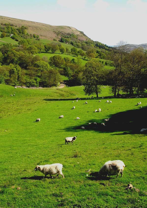
1. INTRODUCTION

                                       “Cardiff has about 200 km/124 miles of
                                       Public Rights of Way (PROW) footpaths
                                       and bridleways, with great links to the
                                       countryside, parks and coast.”

Pimple of Garth Mountain, Pentyrch                                    Cardiff Bay at Sunset by andrebelg
Cardiff Council - Rights of Way Improvement Plan 2020 -30                                                                                                   Cardiff Council - Rights of Way Improvement Plan 2020 -30

                                                                                              1.1 Cardiff, Capital City of Wales
                                                                                              Cardiff, in the south east of Wales, is the capital city and has a population of more than 345,000 people,
                                                                                              which has risen by 3,500 a year since 2001*.
                                                                                              Cardiff has about 200 km/124 miles of Public Rights of Way (PROW) footpaths and bridleways, with
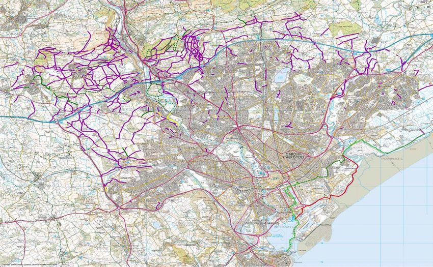
                                                                                              great links to the countryside, parks and coast; most are in the north and north-west of Cardiff (see map,
                                                                                              pages 18-19). Cardiff Council’s PROW team are responsible for making sure the Rights of Way network
                                                                                              is clearly mapped and the paths are maintained for safe use for the public to enjoy. In the built-up urban
                                                                                              areas of the city, most other paths are pavements adjacent to roads (adopted highway), including shared
                                                                                              use or segregated pavements for pedestrians and cyclists, which link around the city.
                                                                                              Though generally thought of as an urban city, about a third of the county is countryside, rich in natural
                                                                                              beauty. There are 4 protected river and stream valleys with trails for walking and cycling; the Rivers Ely
                                                                                              and Taff flowing into Cardiff Bay, the tidal Rhymney River and the Nant Fawr. Cardiff also has a mix
                                                                                              of nature to enjoy, with 27 Conservation Areas, 2 sites with special biodiversity features (Cardiff Beech
                                                                                              Woods SAC near Tongwynlais) and the Severn Estuary which has SSSI, SAC, SPA and Ramsar^ status).
                                                                                              There are a variety of places to visit with rich historical heritage, including Cardiff Castle, Castell Coch,
                                                                                              Iron Age hillforts, Roman remains, many religious sites and other historical monuments.
                                                                                              There have been many changes in Cardiff in the last 10 years and there are new opportunities and
                                                                                              challenges ahead, including new laws, new initiatives and importantly, expanding community areas
                                                                                              within the Cardiff Local Development Plan (LDP). This ROWIP includes consideration and links to any new
 Rhymney Trail                                                                                initiatives, new laws and other changes that may have developed since the first ROWIP.
                                                             Wenallt – Permissive Bridleway
                                                                                              Cardiff has 4 neighbouring Local Authorities – Vale of Glamorgan to the west, Rhondda Cynon Taf and
                                                                                              Caerphilly to the north and Newport to the east. We will work together to improve route links, co-ordinate
                                                                                              maintenance and help to promote long-distance routes for the future.

                                                                                                                                                                                         Graig viewpoint, Lisvane

                                                                                              * From the Cardiff Local Development Plan 2006-2026 Adopted Plan
                                                                                              ^ See ‘Abbreviations and Glossary’, page 2, also LDP (page 43) and link to NRW
Garth Mountain                                                Rhymney Trail - Cors Crychydd     - Protected area of land and sea, Appendix 1.

 14                                                                                                                                                                                                               15
Cardiff Council - Rights of Way Improvement Plan 2020 -30 Cardiff Council - Rights of Way Improvement Plan 2020 -30
1.3 What are Public Rights of Way (PROWs)?
17.7km/
0.15km/
16.2km/
Length
5.50km/
1.20km/
Length
172km/
0.09m
10.1m
3.40m
0.75m
107m
A ‘Public Right of Way’, is a highway over which the public has a right to pass and repass for all time.
11m
These paths have a legal status^ and Cardiff Council has a statutory obligation to record and maintain
them. See page 22 and 23 for path definitions, also Q & A on ‘general guidance’ on the PROW website
of paths
Number
Number
PROW
352
pages.
34
13
of
7
1
3
Example
S S
of sign
DU TH IG AY
DU TH IG AY
ED ED
YW
YW
A
A
These are paths where a landowner has given permission for the public to use under a
R CYHOED
R CYHOED
F O OTP
F O OTP
CYFYNG
CYFYNG
ED B
ED B
IC T
IC T
LI C
LI C
AY
AY
YB
YB
TR
TR
W W
S S
B
B
LLW PU LLW PU
BY BY
RE RE
Right of way for horse riders, pedestrians, horse
Right of way for horse riders, pedestrians and
Cyclists must give way to all other users.
Description
specific agreement, but they are not legal rights of way.
Right of way for pedestrians
Description
& carriage and cyclists.
It has legal status.
It has legal status.
It has legal status
Garth Mountain Ely Trail Pentyrch Kissing Gate
by Tricia Cottnam
cyclists.
See description on page 17.
1.4 Definitive Map (DM)
Legal type of user
The Definitive Map (DM) was established following the National Parks and Access to the Countryside
Act 1949 Chapter 97 and maps were produced for the Cardiff area on the relevant date of September
1954. The DM is a legal record and includes Statements for each path, with a series of maps displaying
the routes. Each path Statement explains the route alignment, usually the OS grid reference and the
1.2 Table to show legal path users
surface, path width and any gates/stiles.
on OS maps
(1:25,000)
Displayed
Some urban areas, such as Roath, Rhiwbina and Llanishen, were excluded from recording paths on the
n/a
Definitive Map in 1954, however, the Wildlife and Countryside Act 1981 Section 55(3) required LAs to
on OS maps
(1:25,000)
Displayed
map all excluded areas of the original DM 1954. These paths were recorded on the Excluded Area Map in
2008.
on Council
Displayed
mapping
(i-share)
Definitive Map Modification Orders (DMMO) are legal orders to allow the DM to be amended. When
Other types of paths
orders are confirmed, the DM will be updated (along with the excluded areas) and sent to Ordnance
on Council
Survey (OS); these are periodically re-printed. The scale required for DM is 1:25,000 (approx. 2 ½
Displayed
mapping
(i-share)
inches/6.4cm per mile or 4cm per km). See Cardiff DM on Council mapping system.
Permissive Bridleway
Permissive Footpath
Modification Order
Type of Path
Definitive Map
Restricted
Bridleway
Right of
Footpath
Public
Way:
^ Rights of Way – A Guide to Law and Practice (John Riddall and John Trevelyan); ‘Rights of Way Law is a mixture of Common
Byway
Law (law defined by judgments in court cases) and Statute Law, contained in Acts of Parliament and subordinate regulations.’
16 17Cardiff Council - Rights of Way Improvement Plan 2020 -30 Cardiff Council - Rights of Way Improvement Plan 2020 -30
Map 1: Cardiff Public Rights of Way Network (current at 2019)
KEY:
Public Rights of Way
Footpath
Cart
Bridleway
Byway
Permissive Path
Footpath
Bridleway
18 19Cardiff Council - Rights of Way Improvement Plan 2020 -30 Cardiff Council - Rights of Way Improvement Plan 2020 -30
North West Cardiff Map North East Cardiff Map Cambrian Way
Rhymney Valley Fforest Fawr
Ridgeway Walk Circular Walk
Garth Mountain Circular Walk
Penhrys Pilgrimage Trail
Tongwynlais - Wenallt
Pentyrch - Creigiau Circular Walk
Circular Walk Taff Trail
Rhymney Trail
St Fagan’s Circular Walk
St Fagans - St Georges
Circular Walk
Ely Trail
Wales Coast Path
South West Cardiff Map South East Cardiff Map
20 For more information about outdoor activities and trail leaflets: www.outdoorcardiff.com 21Cardiff Council - Rights of Way Improvement Plan 2020 -30 Cardiff Council - Rights of Way Improvement Plan 2020 -30
1.5 Who can use which path? Open Access land
Areas of open country, registered common land or dedicated land (under the Countryside and Rights
Footpaths of Way Act 2000) are open for people to walk, run, explore, climb, watch wildlife etc., without having to
A right of way for pedestrians. It has legal status. stay on paths. NRW manages 7% of land in Wales for public access, including 120,000ha of woodland,
42 National Nature Reserves and 5 Visitor Centres. In Cardiff, NRW manages woodlands including;
Bridleways Tyn-y-Coed, Fforest Fawr, Coed-y-Gedrys and Cefn Mably. See link in Appendix 2
A right of way for horse riders, pedestrians and cyclists. Cyclists must give way to pedestrians and horse
riders. It has legal status. NOTE: There are some highways owned and maintained by other organisations that are not adopted
Restricted Byways highway.
A right of way for horse riders, pedestrians, horse and carriage and cyclists. It has legal status.
Byways open to all traffic (BOAT)
1.6 Who maintains our PROWs?
A right of way open to all types of users, including horse-drawn and
motor vehicles. It has legal status. Currently there are no PROWs Statutory duties and discretionary work
categorised as BOAT in Cardiff.
Cardiff Council PROW team must carry out certain duties as statutory (such as waymarking, cutting
Permissive Paths surface vegetation along routes and updating the Definitive Map), while other work is discretionary
These are paths where a landowner has given permission for the public but helpful (such as creating circular trails and providing leaflets). See PROW web pages for further
to use under a specific agreement, but they are not legal rights of way. information.
Cycle Tracks Landowner responsibilities
These are paths created for cyclists and pedestrians. While they have Landowners must make sure paths crossing their land are not obstructed. This includes making sure
legal rights for path users, these paths are excluded from the DM and access furniture, such as stiles and gates, is maintained and safe for the public to use. See ‘general
recorded as Adopted Highway. guidance’ on the PROW website pages.
Adopted Highway (road)
This is a term for a publicly maintained highway which has a higher Photo: Cardiff Conservation Volunteers
maintenance and surface liability than a standard Public Right of Way. 1.7 Local Access Forum (LAF)
Footway The LAF is a statutory advisory body created under the CROW Act 2000 (s 94-95). This is a group of
appointed volunteers with a variety of interests in the PROW network, usually meeting quarterly. The
Pavement next to an Adopted Highway; this may be for pedestrians only, or signposted as shared use
Cardiff LAF was established in October 2003 and is reconstituted every 3 years, as required by law. The
or segregated for pedestrians/cyclists.
following groups are represented:
Green Lanes • Walkers
This term has no legal meaning, but has been used as a physical description of lanes that are • Equestrian
vegetated underfoot or enclosed by hedges, hence the term ‘green’. These may be sections of
• Cyclists
historically adopted highway (such as drovers’ roads), but the surface is not suitable for motorised
• Water Sports
vehicles.
• Landowners
Private access and land
• Supporting Officers who are not Forum Members but advise the LAF when requested, including
Some paths may have private access rights such as vehicle access to a property or a farm track, PROW Officers, a Cardiff Council Equalities Officer and members from the Cardiff Council Access
equestrian access to a livery yard, etc. Almost all PROW paths cross private land rather than land being Focus Group, Active Travel team and Sustrans
owned by Cardiff Council.
22 23Cardiff Council - Rights of Way Improvement Plan 2020 -30
The LAF considers important issues related to land management and more importantly, the need to
conserve the natural beauty of a specific area. This may include informing the PROW Officers about 2. WHY ARE WE MAKING A NEW
access issues (obstruction of paths by locked gates, poor surfaces on paths that would be useful for a
strategic link if resurfaced, etc) or being consulted on specific planning applications where paths cross
the site and will need to be realigned to be kept within green corridors.
ROWIP?
Overall, the LAF plays a key role in helping to ensure ROWIP Delivery Plans are still relevant and key
aims are being achieved in a timely manner, also offering their support/expertise on various projects.
“Cardiff’s ROWIP 2020-30 sets out how
1.8 Natural Resources Wales (NRW) the PROW team will identify, prioritise
NRW is the principal environmental advisor to Welsh Government and others, also it is Wales’ principal
environmental regulator, with a purpose to pursue Sustainable Management of Natural Resources
and plan improvements across the
(SMNR) across all its functions. This is a significant public asset and it is their priority to make this asset
available, attractive and welcoming to people.
network for the duration.”
Garth Hill by hikerchick_hayles
24
Enjoying the outdoorsCardiff Council - Rights of Way Improvement Plan 2020 -30 Cardiff Council - Rights of Way Improvement Plan 2020 -30
2.1 Why are we making a new ROWIP?
There was a legal obligation for all Local Authorities to make a 10-year ROWIP under Section 60 (1)
Outline and
ROWIP Key Stages
Planning for of the CROW Act 2000. Cardiff published its 1st ROWIP in June 2008, which helped the PROW team
timetable
the Review of Initial Based on Welsh Government prioritise and plan work on the network over a 10-year period.
(Stage 1) Consultation guidance, this diagram outlines
Under section 60 (3-4) of the CROW Act 2000, there is a legal obligation to review the 1st ROWIP, make
the various Stages of the
a new assessment and decide whether to republish a new ROWIP; this should be done every subsequent
process of delivering Cardiff’s
decade.
Initial
ROWIP 2020-30:
Initial ROWIP subgroup There have been many changes in the last 10 years, including legal, policy and initiatives, so Welsh
Consultation with
formed as Government (WG) issued guidance on what needed to be considered if a new ROWIP were made.
Consultation Local Members,
stakeholder
(Stage 2) the Public and
consultees Following due consideration of various legislative changes including Environment (Wales) Act 2016,
Organisations
Well Being of Future Generations Act 2015, Active Travel (Wales) Act 2013, Equality Act 2010) and an
appreciation of current economic challenges, Cardiff Council has decided to make a new ROWIP for
Look at 2020-30.
Review of achievements
1st ROWIP Cardiff’s ROWIP 2020-30 sets out how the PROW team will identify, prioritise and plan improvements
and consider
1st ROWIP incomplete tasks
review across the network for the duration. Proposals for managing Cardiff’s PROW network are detailed in the
(Stage 3) to be included in made public
Statement of Action Key Strategies and Key Aims in sections 4 and 5. These were identified as a result
ROWIP 2020-30
of the evaluation process and are important for the future management and improvement of Cardiff’s
PROW network. The Statement of Action sets out what we plan to achieve over the course of 10 years
Public Survey Survey and and will help to identify priorities in the Delivery Plan, which will be based on finance and staff resources.
Carry to gauge views assessment
Conclusions from Evaluating
out New on current findings to In order to gauge what the public think about our current PROW network and ideas for making
1st ROWIP inform future needs and
Assessment New Assessment
PROW network
opportunities
identify next improvements, we undertook a public survey – See details in New Assessment (3.3, page 35)
(Stage 4) and ideas for 10-year
improvements Key Strategies
2.2 Strategic Environmental Assessment (SEA)
Develop Public
Publish Draft Develop Revise where An SEA screening process was undertaken by the Council’s Sustainable Development Team, who
background, Consultation on
Statement of necessary based
ROWIP layout and
Action and
the draft plan
on results of
confirmed that an SEA was not required (See Appendix 6). The ROWIP document will inform annual
(Stage 5) ideas from New
Delivery Plans
(minimum 12
consultation Delivery Plans with site specific projects to enhance and protect the environment.
Assessment weeks)
The Delivery Plans will require an SEA screening process and this will be undertaken prior to agreeing
the programme. Specific projects may require licenses and/or permissions prior to carrying out work,
Publish document therefore officers will liaise with organisations and Council Officers as required (e.g Cadw, NRW, Cardiff
Publication and make
of ROWIP & available for the Publish initial Council Ecologist, Parks, etc.).
Delivery Plans public to view Delivery Plan
(Stage 6) online and in
community hubs
Delivery plans
Review of Ongoing
will be reviewed
monitoring of
Delivery annually, based
delivery plans
Plans should be done
on financial
(Stage 7) budgets and staff
periodically
provision
26 27Cardiff Council - Rights of Way Improvement Plan 2020 -30
Cardiff’s 1st
Rights of Way
3. NEW ASSESSMENT AND
Improvement Plan
– published in 2008
PUBLIC SURVEY
“The New Assessment for Cardiff’s ROWIP
2020-30... evaluation of 1st ROWIP 2008-
18, current condition of network and
future needs and opportunties.”
Public Survey and
Results – 2018
28
Jenn Griffiths enjoying the Sculpture Trail (Fforest Fawr), TongwynlaisCardiff Council - Rights of Way Improvement Plan 2020 -30 Cardiff Council - Rights of Way Improvement Plan 2020 -30
3. New Assessment and Public Survey Summary outcomes of aims, actions and tasks in ROWIP 2008-18
Based on the Welsh Government guidance, this stage went through the following steps: There were 16 Key Aims, 63 targeted actions and of these, there were 213 tasks. Of the 213 tasks:
• 69 were completed
• 37 were substantially completed
Public Survey Survey and
Carry • 20 were partially completed
to gauge views assessment
Conclusions from Evaluating
out New on current findings to • 13 were at planning stage
1st ROWIP inform future needs and
Assessment New Assessment
PROW network
opportunities
identify next • 27 tasks were initiated
(Stage 4) and ideas for 10-year
improvements Key Strategies • 47 were not started
The New Assessment for Cardiff’s ROWIP 2020-30 was drafted, published and circulated to consultees,
promoted through social media (Council website, Twitter, etc) and made available at a series of public
events in libraries and community hubs. Further details of this process can be seen in the ROWIP
supporting document Stage 4 – New Assessment on the ROWIP web page.
Briefly, the New Assessment was divided into 3 main sections:
• Evaluation of the delivery of the 1st ROWIP 2008-18 (Stage 3 – see 3.1) Example view of i-share mapping on Cardiff Council website
• Evaluating the current condition of the network and its legal record (see 3.2)
• Evaluating future need and opportunities (see 3.3)
The following pages highlight results from the 1st ROWIP review, the public surveys and evaluation of
the public’s future needs to inform the conclusions of the New Assessment. These conclusions were used
in the Statement of Action (section 4) to help develop the next 10-year Key Strategies as outlined and
development of the long term Key Aims (section 5), describing how they will be achieved.
3.1 Evaluation of the delivery of the 1st ROWIP 2008-18 (Stage 3)
The 1st ROWIP was originally written in 2006 and a draft ROWIP was published in 2007. It was then
finalised, approved and adopted; the final version was published in June 2008. The review of the 1st
ROWIP features the key aims, targeted actions and tasks and includes performance indicators. It should
be noted that statutory tasks are included in the ROWIP 2020-30 and any other tasks that may be
ongoing, not completed or not started may also be included.
In reviewing the 1st ROWIP, several factors which affected delivery of certain tasks were taken into
consideration, such as the high number of tasks to complete, lack of grant funding, staff changes, etc.
Because of these factors, not all tasks could be completed and/or reviewed:
• A summary of the 1st ROWIP Review with Key Highlights and achievements of ROWIP 2008-18 – 16
key aims are in Appendix 3
• Full review of ROWIP 2008-18 is available on the ROWIP web page
30 31Cardiff Council - Rights of Way Improvement Plan 2020 -30 Cardiff Council - Rights of Way Improvement Plan 2020 -30
3.2 Evaluation of the current condition of the network and its 3.2.2 The legal record
legal record The Summary Review of ROWIP 2008-18 (Stage 3) highlighted this within Key Aim 1 – ‘Definitive Map
This section was an evaluation of the current condition of the network, the completeness and accuracy (DM); Resolve current anomalies and produce an up-to-date DM for Cardiff’.
of the Definitive Map and Statement and the management of any changes to the PROW network. The The review states:
evaluation was undertaken by using information given by the PROW maintenance team and others
• All draft DM and statements completed by Definitive Map Modification Orders (DMMO). The revised
including LAF members and ROWIP Sub-Group. Issues were also raised by members of the public.
map can be viewed ‘live’ on Cardiff Council iShare
• Identifying unregistered paths and lost byways – there were 23 paths claimed and confirmed under
3.2.1 The current condition of the network Section 53 of the Wildlife and Countryside Act 1981.
Since the publication of ROWIP 2008-18, the Council Highways team has implemented a digital • The Supplementary Planning Guidance (SPG) was a useful tool for developers to advise them about
management system (DMS; currently AMX – Asset Management Expert), which is used to enable more statutory obligations to check a potential development area for PROWs and consult the PROW team.
efficient and informed management and maintenance of the highway network. This software is being The PROW Technical Guidance Notes (TGN) now supersede the PROW SPG and are supplied by the
further developed to manage and maintain the PROW network and will form an important and integral Planning team to a Developer at the application stage.
part of future PROW improvement. It is included in the ROWIP 2020-30 Key Strategy 1 and Key Aim 1.
The review of the ROWIP 2008-18 shows that the legal record was being effectively managed; the review
Details of these are in sections 4 and 5, also SWOT analysis in Key Strategy 1 is included in Appendix 4.
includes evaluation undertaken using information given by the PROW maintenance team and others
In future, the DMS will be used to store all network data, including: including LAF members and ROWIP sub-group.
• Condition data of routes and infrastructure (such as stiles, gates and bridges) The legal record remains a key element of the ROWIP 2020-30 and is featured in Key Strategies 4 and 5
• Location of infrastructure of Statement of Action and Key Aim 2, 6 and 8.
• Land ownership details
• Legal records relating to routes and issues
• Correspondence
The development of the DMS will over time enable the PROW team to be more informed to plan more
appropriate, specific and effective management of the network. This is a priority task in the ROWIP
2020-30 (Key Aim 1).
Llandaff Fields @onemorebiscuitplease
32 33Cardiff Council - Rights of Way Improvement Plan 2020 -30 Cardiff Council - Rights of Way Improvement Plan 2020 -30
Map 2: Cardiff Neighbourhood Area Map 3.3 Future needs and opportunities
As part of the New Assessment stage, consultations and surveys were made within each of the six We examined the extent to which Cardiff’s PROW network met the present and likely future needs of
neighbourhood areas. the public and the opportunities it has provided for exercise and other forms of outdoor recreation and
enjoyment both currently and for the future.
NEWPORT
3.3.1 Public survey
We conducted a public survey to raise awareness about Cardiff’s PROW network, to get feedback on
TROWBRIDGE
what people thought about the current network and give their ideas for future improvements.
6
PONTPENNAU / OLD ST MELLONS
3.3.2 How we carried out the survey
RUMNEY
LLANRUMNEY
Consultation on the Cardiff’s Public Rights of Way (PROW) was open from 10 April to 14 October 2018
2
3
SPLOTT
and centred on an electronic survey. The survey was sent to a list of 270 consultees (including those
CAERPHILLY
required and relevant in CROW Act 2000, section 61 (1)). The survey was also featured on the web pages
PENTWYN
of Cardiff Council’s PROW, ROWIP and Ask Cardiff, along with the Outdoor Cardiff website.
10
PENYLAN
5
BUTETOWN
N
OW
SD Cardiff Council’s Communication team conducted a campaign through social media on Cardiff Council’s
D
YD
AM
Twitter and Facebook accounts, with an audience of more than 45,000 followers on Twitter and 21,000
13
W AD
NE
CYNCOED
AS
PL on Facebook. People responding to the ROWIP campaign were primarily on Twitter, with more than 480
14
LISVANE
15
clicks, retweets or shares.
CATHAYS
LLANISHEN
GRANGETOWN
4
GABALFA
In addition, 1,500 hard copy surveys were also distributed across public buildings in the city including
RIVERSIDE
11
HEATH
libraries, hubs, leisure centres, community centres and core Cardiff Council buildings.
In order to reach across all communities in Cardiff, a programme of face-to-face engagement sessions
LLANDAFF
CANTON
NORTH
took place at Hubs and libraries in Cardiff to promote Rights of Way and to encourage people to take
RHIWBINA
12
LLANDAFF
part in the survey.
GLAMORGAN
VALE OF
8
9
In August and September 2018 these sessions took place at:
CAERAU
TONGWYNLAIS
WITCHURCH &
FAIRWATER
1) Ely & Caerau Hub 9) Whitchurch Library
7
MORGANSTOWN
2) Llanrumney Hub 10) Star Hub
1
ELY
RADYR &
3) Rumney Hub 11) Grangetown Hub
16
4) Llanishen Hub 12) Rhiwbina Library
CREIGIAU / ST FAGANS
5) Llanedeyrn Hub 13) Butetown Hub
6) St Mellons Hub 14) Rhydypennau Library
7) Fairwater Hub 15) Central Library Hub
PENTYRCH
8) Llandaff North & Gabalfa Hub 16) Radyr Library
CYNON TAFF
RHONDDA
City & Cardiff South
Cardiff South West
Cardiff South East
Cardiff North
Cardiff West
Cardiff East
M4
34 35Cardiff Council - Rights of Way Improvement Plan 2020 -30 Cardiff Council - Rights of Way Improvement Plan 2020 -30
3.3.3 ROWIP Survey – how responses have changed A significant number of comments related to Active Travel routes highlighted the need for more cycle
routes. There were also positive and negative comments about the Taff Trail (not a PROW) and general
The survey included multiple choice questions and open questions, so answers do not all sum to 100%.
on-road cycling:
‘Elsewhere’ was used to generally gauge levels of activity outside the county of Cardiff.
• Segregation – ‘separation needs to be enforced to differentiate between cyclists and pedestrians’,
• There were a total of 1,018 survey responses, compared to 673 in 2005*.
‘All new developments in Cardiff should have segregated paths and cycle routes’.
• 57.8% who responded use outdoor spaces in Cardiff every day (Q4), which is a significant increase of
• Safety/respect for other path users – ‘enjoyment and safety... adversely affected by cyclists going
16.8% from 2005*.
too fast’, ‘in Forest Fawr… mountain bikers… fly down these self-made paths at great speed…
• There was a general increased trend of people visiting outdoor spaces outside Cardiff (Q4), with
having near misses with people using the forest legitimately’.
27.8% visiting at least once a week (8.2% increase from 2005*) and 27.9% visiting on weekends
• Shared use paths – ‘hazardous and often results in an argument with a cyclist going too fast’,
(new category in 2018). Overall in Wales, there were 22% of frequent and 62% infrequent
‘pedestrians straggling across full width of path for joint use by cyclists’.
participants visiting outdoor spaces^.
• More cycle routes – ‘I want to cycle into work but lack of safe and pleasant provisions prevent me’,
• Walking was still the most popular activity (Q5), with 88.2% in Cardiff (an increase of 7.2% from
‘we need more off-road cycle paths for commuters and access for cycles to railway stations’.
2005*) and 60.2% Elsewhere.
• There was a significant increase in people using outdoor spaces for Relaxation/to feel better; 66.6% These issues and comments were passed to colleagues involved in Active Travel schemes in Cardiff. We
in Cardiff compared to 39.2% in 2005* (62.9 Elsewhere compared to 29.3% in 2005*), suggesting will also work together to address issues on bridleways and potential paths that could be upgraded from
that people are enjoying the outdoors more. footpaths to bridleways (see Delivery Plan, Key Aim 7).
• Socially (ref Q6), there was a marked increase of just over 26% of those using the paths Alone See full ROWIP Survey Results 2018 on the ROWIP web page; this also includes the full ROWIP Survey
in Cardiff at 58.4% (39% in Wales overall^) and a decrease of 7.5% using paths with a partner Spring/Summer 2018 consultation (in appendix).
compared with 2005*. 9.4% of respondents used paths in Cardiff as member of an organisation
compared with 8.8% in 2005*; in both surveys, the most popular group were Ramblers.
3.3.4 Instagram competition
• In Q8, we asked respondents what stops them from using paths. Just under 50% of respondents
gave 3 main reasons; overgrown paths, not enough information and routes not well signposted. In the lead-up to the end of the ROWIP survey, our Communications Team hosted an Instagram
Results were quite similar in 2005*. competition (using #CardiffROWIP) for the public to submit photos we might use in publicity material,
• We asked what else holds you back (Q9); 28.6% mentioned safety issues (with 29.1% specifying the winner to receive £100 in Mountain Warehouse vouchers. There were 185 submissions, 5 were
safety in Q8), significantly fewer compared to 46.3% in 2005*, which suggests people now feel safer shortlisted and, over a series of posts, viewers were asked to ‘like’ their favourite photo. The winning
on paths. image was of the Taff Trail at Blackweir by @welsh_poppy and is featured below along with the other 4
finalists.
Open questions were used to encourage people to specify potential maintenance issues (Q8a), find out
what stops people using paths in Cardiff (Q9) and to ask for comments (Q11). This led to some specific Photos – 5 finalists of the Instagram competition
points and ideas for consideration in the new ROWIP, for example:
• Maintenance issues (Q8a) – ‘Once crossing over the stiles, it’s unclear where the path is meant to
lead’ (Pentyrch 19) – this suggests we may need to improve our signage. There were also several
described paths that may need attention, such as ‘overgrown… south of Llantrisant Road’ near/on
Llanillterne 20.
• What stops use of paths (Q9) – ‘not enough information available’, ‘it would be nice to have a list
on the website that’s very easy to find and a pinned post on Facebook’ – this suggests we need to
improve access to maps and information about our PROW network.
3.
• Comments (Q11) – This question produced a variety of ideas, for example ‘more joint working with 1. 2.
other adjacent local authorities’, ‘Make more paths available to horse riders’, ‘brilliant if a directory
specifically for users of mobility vehicles was available’, ‘Why not encourage volunteering in the same
1. Taff Trail, Blackweir @welsh_poppy
way as the National Trust’, ‘more circular walking routes which are accessible from public transport’.
2. Castell Coch @Gale_Jolly_photos
3. Squirrel in Cefn Onn @snapshotwales
4. Llandaff Fields @onemorebiscuitplease
* Public Rights of Way Questionnaire 2005 (results)
5. Roath Park @andrebelg
^ NRW Welsh Outdoor Recreation Survey 2014/15 – Key Facts
36 5. 37
4.Cardiff Council - Rights of Way Improvement Plan 2020 -30 Cardiff Council - Rights of Way Improvement Plan 2020 -30
89.6%
used beach,
sea or coastline. 13.5% - (around
‘elsewhere’ one in eight) were
part of an
Gweithio dros Gaerdydd, gweithio gyda’n gilydd
Working for Cardiff, working together
interest group or
organisation
RIGHTS OF WAY Respondents were almost twice
IMPROVEMENT as likely to use private land
Elsewhere - 27.9% Footpaths were the
PLAN REPORT2018 than they would within most popular form
of public rights of
Cardiff - 14.8%
SURVEY RESULTS way used in
1,018 Cardiff - 89.1%
repondents shared as well as
their views in our Elsewhere - 60.2%
ROWIP survey.
Walking was the Around one third
most popular reason enjoyed paths for
to use these pths, in Birdwatching/Wildlife in
Cardiff - 88.2% and Cardiff - 30.6% and
57.8% Elsewhere - 33.0%;
were female At 44.4% Elsewhere - 82.0%
the age With similar results for
range 35-54 Dog Walking in
was highest Cardiff - 30.2% and
Elsewhere - 27.0%
Use of paths ‘Alone’
was highest within
Cardiff - 58.4% Of the barriers to using
paths the top three were:-
9.3% had a Overgrown paths (48.7%);
long standing
illness or health 91.1% used Not enough information
condition a local park about routes available
Over half used paths
or other local (48.2%) and;
with a ‘Partner’
space in Cardiff
Elsewhere - 53.1% Routes are not well signed
/hard to follow (47.0%)
38 39Cardiff Council - Rights of Way Improvement Plan 2020 -30 Cardiff Council - Rights of Way Improvement Plan 2020 -30
3.3.6 Evaluation – further points to note Active travel
Aside from the consultations, a number of factors are likely to affect future needs of the PROW network, Active travel, meaning walking and cycling for journeys with a purpose, rather than solely for recreation,
including: is now a government priority. The purpose of the Active Travel (Wales) Act 2013, ‘…aims to make active
• Opportunities for the future will need to reflect the steady increase in people living and working in travel the most attractive option for most shorter journeys. Its purpose is to enable more people to
Cardiff, mainly because of the increase of community housing areas and business growth, within the undertake active travel…’ (1.1 WG Guidance).
8 strategic sites of the LDP (see Map 3 for locations).
The definition of ‘active travel’ in WG guidance, means ‘walking and cycling as an alternative means to
• National research by Sustrans has shown that more people intend to walk/cycle in future.
motorised transport ….a journey made to or from a workplace or educational establishment or in order
• More provision of routes with facilities for disabled people.
to access health, leisure or other services or facilities.’ (WG Guidance, page 5). Active travel does not
• An increase in use of routes and the potential for newly recorded routes; this will lead to an increased
include Horse riding or recreational and general use of paths.
need for maintenance.
• While there is a small amount of annual internal budget that would cover statutory duties, there is no
guarantee of funding for discretionary work or projects. It is interesting to note that cycle use increased by 10% between 2001-11
and rail travel increased by 82% in the same period (LDP, p20).
3.3.7 Supporting groups and influencing factors
The Transport team in Cardiff Council, along with Sustrans and Exegesis SDM (under contract for Welsh
A number of groups will be supporting the ROWIP 2020-30 (Green Infrastructure, Local Access Forum
Government), produced an Integrated Network Map (INM) which sets out Cardiff Council’s 15-year
(LAF), Active Travel Team, etc). In addition, underpinning the promotion of all outdoor activities linked to
vision to improve cycling and walking routes across the city. PROW and Transport team will identify
PROW, is the website of ‘Outdoor Cardiff’. There are also a number of influencing factors (LDP, Capital
routes that are on PROW and potential improvements. Green spaces may also be incorporated in Active
Ambition, well-being objectives) to consider.
Travel routes as they bring many benefits, such as increasing mental well-being, minimizing air pollution,
etc. Also, to uphold the active travel aims and objectives, the LDP sets out to ensure that all new
Local Access Forum (LAF)
development areas (whether greenfield or brownfield) create sustainable communities with useful and
The Local Access Forum (LAF) is a statutory body formed as a requirement of the Countryside and Rights linked walking and cycling networks.
of Way Act 2000. The LAF has volunteers who include a range of people from across Cardiff including
Within the Capital Ambition initiative, Cllr Huw Thomas, Leader of Cardiff Council, states: ‘I am
landowners, access users such as walkers, cyclists and horse riders and those representing other interests
determined that we prioritise sustainable transport modes’ and that we will ‘adopt Smart City
such as health and conservation. See 1.7 for more information.
approaches to managing city infrastructures’.
Green Infrastructure Group
Outdoor Cardiff
The Green Infrastructure Group is an inter-departmental working group (Parks, Ecologist, Tree Officer,
The initiative to create the Outdoor Cardiff (OC) brand and website was a major achievement arising
PRoW, Transportation & Sustainable Drainage Officers) within Cardiff Council to make the best use of
out of the ROWIP 2008-18 process, through discussions with relevant Council teams (including Parks,
financial resources and avoid duplication of efforts by providing a central group for green infrastructure
Harbour Authority and Active Travel), who were consulted on the process and progress of the ROWIP.
development actions. This includes acting as consultee for planning applications, implementing
As there were many common aims and objectives within the teams and opportunities for potential joint
biodiversity projects and ROWIP Delivery Plans across the city to improve access to green spaces and
projects, Outdoor Cardiff became a central point for the teams to communicate to the public about
waterways.
outdoor activities in Cardiff. Between Oct 2016 and Oct 2017, there were 41,453 page views and 14,546
The group has created a Green Infrastructure Plan setting out Cardiff Council’s approach – multi- unique visits.
functional, connected green spaces that make the best use of land – at the same time showing the need
to provide and enhance green open space for all, helping wildlife to flourish and delivering a wide range
of economic, health and community benefits.
The benefits of a Green Infrastructure approach enables landscapes to deliver social, economic and
environmental benefits and flood risk management simultaneously and then looks at how those benefits
can be multiplied by being connected to a wider network of spaces. For example, the health and well-
being benefit will be enhanced by improved air quality and noise regulations, while more accessible areas
for exercise and amenities improve health and social conditions. Tourism and recreation is increased by
creating more attractive destinations and providing a range of recreational opportunities.
40 41You can also read


