Aquatic Resources Delineation - Pioneer Baptist Church Project - June 2, 2021
←
→
Page content transcription
If your browser does not render page correctly, please read the page content below
Attachment 13

Aquatic Resources Delineation

   Pioneer Baptist Church Project

              Citrus Heights, California

                         Prepared For:

                 City of Citrus Heights
          6360 Fountain Square Drive
             Citrus Heights, CA 95621

                        June 2, 2021
Aquatic Resources Delineation for Pioneer Baptist Church Project

CONTENTS

1.0           INTRODUCTION ................................................................................................................................................................... 1
2.0           REGULATORY SETTING ...................................................................................................................................................... 1
              2.1            Waters of the United States ............................................................................................................................ 1
                             2.1.1           Wetlands ................................................................................................................................................ 1
                             2.1.2           Other Waters ........................................................................................................................................ 1
              2.2            Clean Water Act ................................................................................................................................................... 3
              2.3            Jurisdictional Assessment ................................................................................................................................ 3
              2.4            Porter-Cologne Water Quality Act ............................................................................................................... 4
3.0           METHODS ............................................................................................................................................................................... 4
              3.1            Routine Determinations for Wetlands ........................................................................................................ 5
                             3.1.1           Vegetation ............................................................................................................................................. 5
                             3.1.2           Soils .......................................................................................................................................................... 6
                             3.1.3           Hydrology .............................................................................................................................................. 7
4.0           RESULTS ................................................................................................................................................................................... 7
              4.1            Existing Site Conditions .................................................................................................................................... 7
                             4.1.1           California Aquatic Resource Inventory ....................................................................................... 7
                             4.1.2           Soils .......................................................................................................................................................... 8
              4.2            Aquatic Resources .............................................................................................................................................. 8
                             4.2.1           Wetlands ................................................................................................................................................ 8
                             4.2.2           Other Waters ..................................................................................................................................... 12
5.0           JURISDICTIONAL ASSESSMENT .................................................................................................................................. 12
6.0           CONCLUSION ..................................................................................................................................................................... 12
7.0           REFERENCES........................................................................................................................................................................ 13

LIST OF TABLES

Table 1. Classification of Wetland-Associated Plant Species1 ............................................................................................ 6
Table 2. Aquatic Resources ............................................................................................................................................................... 8

LIST OF FIGURES

Figure 1. Study Area Location and Vicinity ................................................................................................................................ 2
Figure 2. California Aquatic Resource Inventory ...................................................................................................................... 9
Figure 3. Natural Resources Conservation Service Soil Types ......................................................................................... 10
Figure 4. Aquatic Resources Delineation ................................................................................................................................. 11

ECORP Consulting, Inc.                                                                                                                                                                     June 2, 2021
                                                                                                     i
Pioneer Baptist Church Project                                                                                                                                                             2018-062.02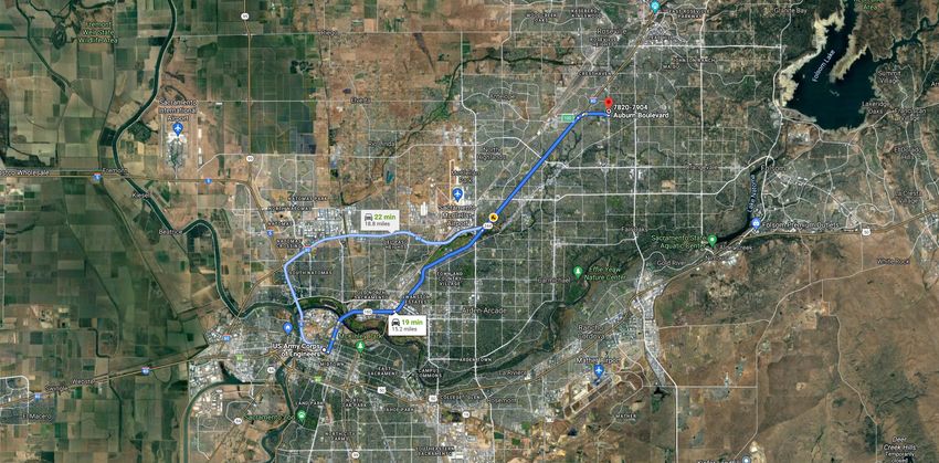
Aquatic Resources Delineation for Pioneer Baptist Church Project

LIST OF ATTACHMENTS

Attachment A – Driving Directions to Study Area
Attachment B – Wetland Determination Data Forms - Arid West
Attachment C – Representative Site Photographs
Attachment D – USACE Operations and Maintenance Business Information Link Regulatory Module
       Aquatic Resources Table
Attachment E – Wetland Delineation Shape File (to be included with USACE submittal only)

LIST OF ACRONYMS AND ABBREVIATIONS

CARI             California Aquatic Resource Inventory
CFR              Code of Federal Regulations
CWA              Clean Water Act
FR               Federal Register
GPS              Global Positioning System
NPDES            National Pollutant Discharge Elimination System
NRCS             Natural Resources Conservation Service
NWPR             Navigable Waters Protection Rule
OHWM             Ordinary high water mark
PJD              Preliminary Jurisdictional Determination
RWQCB            Regional Water Quality Control Board
SFEI             San Francisco Estuary Institute
Study Area       Pioneer Baptist Church Project
TNW              Traditional Navigable Waters
USACE            U.S. Army Corps of Engineers
USEPA            U.S. Environmental Protection Agency
USGS             U.S. Geological Survey

ECORP Consulting, Inc.                                                                              June 2, 2021
                                                                ii
Pioneer Baptist Church Project                                                                      2018-062.02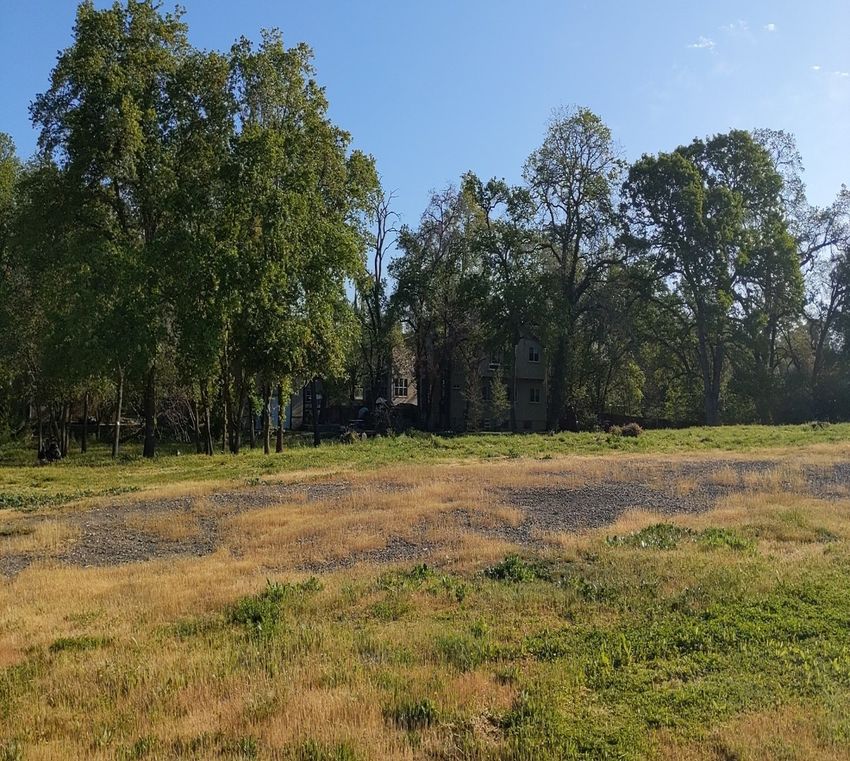
Aquatic Resources Delineation for Pioneer Baptist Church Project

1.0       INTRODUCTION
On behalf of Pioneer Baptist Church, ECORP Consulting, Inc. conducted an aquatic resources delineation
for the approximately 3.88-acre Pioneer Baptist Church Project (Study Area) located in Sacramento
County, California. The Study Area is located south of Cripple Creek Road, east of Auburn Boulevard, and
north of Watson Way (Figure 1. Study Area Location and Vicinity). The Study Area corresponds to a portion
of Section 23, Township 10 North, Range 6 East within the “Citrus Heights, California” 7.5-minute
quadrangle (U.S. Geological Survey [USGS] 1992). The approximate center of the Study Area is located at
38.708902° latitude and -121.289498° longitude within the Lower American Watershed (Natural Resources
Conservation Service [NRCS], USGS, and U.S. Environmental Protection Agency [USEPA] 2016). Driving
directions to the Study Area are included as Attachment A.

This report describes aquatic resources identified within the Study Area that may be regulated by the U.S.
Army Corps of Engineers (USACE) pursuant to Section 404 of the federal Clean Water Act (CWA). The
information presented in this report provides data required by the USACE Sacramento District’s Minimum
Standards for Acceptance of Aquatic Resources Delineation Reports (USACE 2016a). The aquatic resource
boundaries depicted in this report represent a calculated estimation of the jurisdictional area within the
Study Area and are subject to modification following the USACE verification process.

The purpose of this report is to provide adequate information to USACE for the issuance of a Preliminary
Jurisdictional Determination (PJD).

2.0       REGULATORY SETTING

2.1       Waters of the United States
This report describes aquatic resources, including wetlands, that may be regulated by USACE under
Section 404 and/or the Regional Water Quality Control Board (RWQCB) under Section 401 of the federal
CWA. The following sections define these regulations.

2.1.1     Wetlands

Wetlands are “those areas that are inundated or saturated by surface or groundwater at a frequency and
duration sufficient to support, and that under normal circumstances do support, a prevalence of vegetation
typically adapted for life in saturated soil conditions” (51 Federal Register [FR] 41250, Nov. 13, 1986, as
amended at 58 FR 45036, Aug. 25, 1993). Wetlands can be perennial or intermittent.

2.1.2     Other Waters

Other waters are nontidal, perennial, and intermittent watercourses and tributaries to such watercourses
(51 FR 41250, Nov. 13, 1986, as amended at 58 FR 45036, August 25, 1993). The limit of USACE jurisdiction
for nontidal watercourses (without adjacent wetlands) is defined in 33 Code of Federal Regulations (CFR)
328.4(c)(1) as the “ordinary high water mark” (OHWM). The OHWM is defined as the “line on the shore
established by the fluctuations of water and indicated by physical characteristics such as clear, natural line
impressed on the bank, shelving, changes in the character of soil, destruction of terrestrial vegetation, the

ECORP Consulting, Inc.                                                                                June 2, 2021
                                                                1
Pioneer Baptist Church Project                                                                        2018-062.02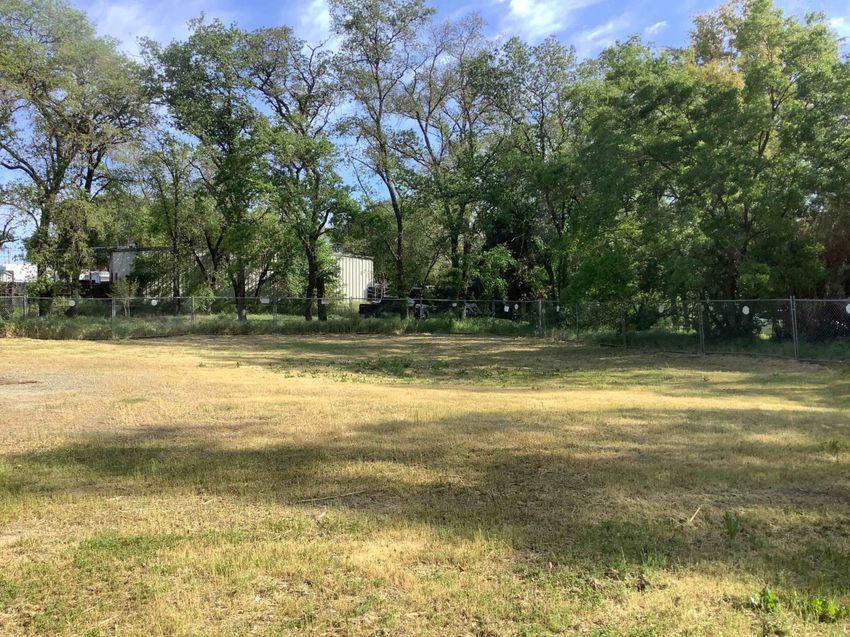
\PB_
CLn.a
V p u
rx([A o
th itia
rIn tu
ls])-k q
rnu /8
ist4 0
/221
M
apF
eatu
res
V ity
icin
P
roje
ctB
oun
dary-3
.88a
c.
o
\L ca n
tio_
Sacra m e
ntoC ounty,C aliforn
ia
\MP
AS
§
23 ,T .10N,R.06E,M DB M
rch
L
atitud e(NAD 8
3): 3 8.7089
02°
h
tistCu
L
on gitude(NA D83 ): -12 1.289498
°
p
Waters hed:L
o werA meric an(180201
11)
2P n
ioerB
e a
ScaleinFeet
I
6
-02.0
0 1
,00
0 2
,00
0
\21
08
Citru
sH eig
h ts(1992,NA D83)
018
C
A7.5-m in
uteT op og
ra p
hicQ uad
rang
le
:\2
:N
U SG eologicalSurv
e y
.
o
L ca n
tio
M
apD
ate
:4/8
/20
21
S
ourc
e s
:Es
ri,U
SGS
Figure 1. Study Area Location and Vicinity
2018-062.02 Pioneer Baptist Church
Aquatic Resources Delineation for Pioneer Baptist Church Project
presence of litter and debris, or other appropriate means that consider the characteristics of the
surrounding areas” approximation of the lateral limit of USACE jurisdiction. The upstream limits of other
waters are defined as the point where the OHWM is no longer perceptible.
2.2 Clean Water Act
The USACE regulates discharge of dredged or fill material into Waters of the U.S. under Section 404 of the
CWA. “Discharges of fill material” is defined as the addition of fill material into Waters of the U.S.,
including, but not limited to the following: placement of fill necessary for the construction of any
structure, or impoundment requiring rock, sand, dirt, or other material for its construction; site-
development fills for recreational, industrial, commercial, residential, and other uses; causeways or road
fills; and fill for intake and outfall pipes, and subaqueous utility lines [33 CFR § 328.2(f)]. In addition,
Section 401 of the CWA (33 U.S. Code 1341) requires any applicant for a federal license or permit to
conduct any activity that may result in a discharge of a pollutant into Waters of the U.S. to obtain a
certification that the discharge will comply with the applicable effluent limitations and water quality
standards.
Substantial impacts to wetlands, over 0.5 acre of impact, may require an individual permit. Projects that
only minimally affect wetlands, less than 0.5 acre of impact, may meet the conditions of one of the
existing Nationwide Permits. A Water Quality Certification or waiver pursuant to Section 401 of the CWA is
required for Section 404 permit actions; this certification or waiver is issued by the RWQCB.
2.3 Jurisdictional Assessment
On April 21, 2020, the USEPA and the USACE published the Navigable Waters Protection Rule (NWPR) to
define “Waters of the United States” in the FR (USACE and USEPA 2020). With the NWPR, the agencies
streamlined the definition of “Waters of the United States” so that it includes four categories of
jurisdictional waters, provides clear exclusions for many water features that traditionally have not been
regulated, and defines terms in the regulatory text that have never been defined before. The NWPR
regulates Traditional Navigable Waters (TNW) and the core tributary systems that provide perennial or
intermittent flow into them.
The four categories of federally regulated waters are:
the territorial seas and TNW,
perennial and intermittent tributaries to those waters,
certain lakes, ponds, and impoundments, and
wetlands adjacent to jurisdictional waters.
The final rule also details 12 categories of exclusions, features that are not “waters of the United States,”
such as features that only contain water in direct response to rainfall (e.g., ephemeral features),
groundwater, many ditches, prior converted cropland, and waste treatment systems.
ECORP Consulting, Inc. June 2, 2021
3
Pioneer Baptist Church Project 2018-062.02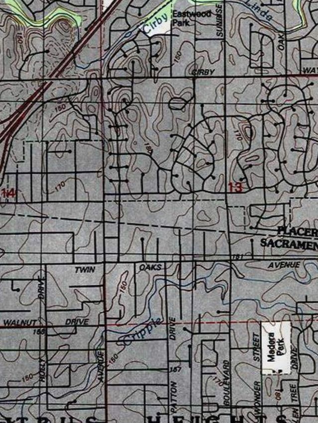
Aquatic Resources Delineation for Pioneer Baptist Church Project
The final rule clarifies key elements related to the scope of federal CWA jurisdiction, including the
following:
Providing clarity and consistency by removing the proposed separate categories for jurisdictional
ditches and impoundments.
Refining the proposed definition of “typical year,” which provides important regional and
temporal flexibility and ensures jurisdiction is being accurately determined in times that are not
too wet and not too dry.
Defining “adjacent wetlands” as wetlands that are meaningfully connected to other jurisdictional
waters, for example, by directly abutting or having regular surface water communication with
jurisdictional waters.
The NWPR is the second step in a two-step process to review and revise the definition of “waters of the
United States” consistent with the February 2017 Presidential Executive Order entitled “Restoring the Rule
of Law, Federalism, and Economic Growth by Reviewing the ‘Waters of the United States.’” This final rule
became effective on June 22, 2020 and has replaced the Step One Rule published in October 2019.
2.4 Porter-Cologne Water Quality Act
The RWQCB implements water quality regulations under the federal CWA and the Porter-Cologne Water
Quality Act. These regulations require compliance with the National Pollutant Discharge Elimination
System (NPDES), including compliance with the California Storm Water NPDES General Construction
Permit for discharges of storm water runoff associated with construction activities. General Construction
Permits for projects that disturb one or more acres of land require development and implementation of a
Storm Water Pollution Prevention Plan. Under the Porter-Cologne Water Quality Act, the RWQCB
regulates actions that would involve “discharging waste, or proposing to discharge waste, with any region
that could affect the water of the state” (Water Code 13260(a)). Waters of the State are defined as “any
surface water or groundwater, including saline waters, within the boundaries of the state” (Water Code
13050 (e)). The RWQCB regulates all such activities, as well as dredging, filling, or discharging materials
into Waters of the State, that are not regulated by the USACE due to a lack of connectivity with a
navigable water body. The RWQCB may require issuance of Waste Discharge Requirements for these
activities.
3.0 METHODS
This aquatic resources delineation was conducted in accordance with the Corps of Engineers Wetlands
Delineation Manual (Environmental Laboratory 1987) and the Regional Supplement to the Corps of
Engineers Wetland Delineation Manual: Arid West Region (Arid West Region Supplement) (USACE 2008a).
Non-wetland waters were identified in the field according to A Field Guide to the Identification of the
Ordinary High Water mark (OHWM) in the Arid West Region of the Western United States (USACE 2008b),
where applicable. The boundaries of aquatic resources were delineated through standard field methods
(e.g., paired sample set analyses) and aerial photograph interpretation. Field data were recorded on
Wetland Determination Data Forms – Arid West Region (Attachment B). A color aerial photograph
ECORP Consulting, Inc. June 2, 2021
4
Pioneer Baptist Church Project 2018-062.02
Aquatic Resources Delineation for Pioneer Baptist Church Project
(1”=100’ scale; National Agriculture Imagery Program 2020) was used to assist with mapping and ground-
truthing. Munsell Soil Color Charts (Munsell Color 2009) and the Web Soil Survey (NRCS 2021a) were used
to aid in identifying hydric soils in the field. The Jepson eFlora (Jepson eFlora Project [eds.] 2021) was used
for plant nomenclature and identification.
Field surveys were conducted on April 7, 2021 by ECORP biologists Daniel Wong and Hannah Kang. The
biologists walked the entire approximately 3.88-acre Study Area to determine the location and extent of
aquatic resources within the Study Area. Paired locations were sampled to evaluate whether the
vegetation, hydrology, and soils data supported an aquatic resource determination. At each paired
location, one point was located within the estimated aquatic resource area, and the other point was
situated outside the limits of the estimated aquatic resource area. Additional non-paired locations were
sampled to document marginal areas that were determined not to be aquatic resources because they
lacked hydrophytic vegetation, hydric soils, and/or wetland hydrology. Aquatic resources within the Study
Area were recorded in the field using a post-processing capable Global Positioning System (GPS) unit with
sub-meter accuracy (e.g., Apple iPad, Collector for ArcGIS application with Juniper System Geode
submeter GPS unit with real-time correction).
This aquatic resource delineation was conducted in the spring, within the blooming season for most plant
species, and was conducted at an acceptable time of the year to observe wetland hydrology. During the
2020-2021 water year prior to the field survey (October 1, 2020 to April 5, 2021) approximately 7.73 inches
of precipitation were recorded at the Sacramento 5 ESE reporting station (National Oceanic and
Atmospheric Administration [NOAA] 2021a), approximately 13 miles southwest of the Study Area. The
most recent measurable precipitation event prior to the 2021 survey occurred on March 19, 2021,
resulting in 0.01 inch of rainfall (NOAA 2021a).
3.1 Routine Determinations for Wetlands
To be determined a wetland, the following three criteria must be met:
A majority of dominant vegetation species are wetland-associated species;
Hydrologic conditions exist that result in periods of flooding, ponding, or saturation during the
growing season; and
Hydric soils are present.
3.1.1 Vegetation
Hydrophytic vegetation is defined as the sum total of macrophytic plant life that occurs in areas where the
frequency and duration of inundation or soil saturation produce permanent or periodically saturated soils
of sufficient duration to exert a controlling influence on the plant species present (Environmental
Laboratory 1987). The definition of wetlands includes the phrase "a prevalence of vegetation typically
adapted for life in saturated soil conditions." Prevalent vegetation is characterized by the dominant plant
species comprising the plant community (Environmental Laboratory 1987). The dominance test is the
basic hydrophytic vegetation indicator and was applied at each sampling point location. The "50/20 rule"
ECORP Consulting, Inc. June 2, 2021
5
Pioneer Baptist Church Project 2018-062.02
Aquatic Resources Delineation for Pioneer Baptist Church Project

was used to select the dominant plant species from each stratum of the community. The rule states that
for each stratum in the plant community, dominant species are the most abundant plant species (when
ranked in descending order of coverage and cumulatively totaled) that immediately exceed 50 percent of
the total coverage for the stratum, plus any additional species that individually comprise 20 percent or
more of the total cover in the stratum (USACE 1992, 2008a).

Dominant plant species observed at each sampling point were then classified according to their indicator
status (probability of occurrence in wetlands; Table 1), National Wetland Plant List (USACE 2018). If the
majority (more than 50 percent) of the dominant vegetation on a site are classified as obligate (OBL),
facultative wetland (FACW), or facultative (FAC), the site was considered to be dominated by hydrophytic
vegetation.

Table 1. Classification of Wetland-Associated Plant Species1
        Plant Species Classification                 Abbreviation               Probability of Occurring in Wetland
 Obligate                                                OBL           Almost always occur in wetlands
 Facultative Wetland                                    FACW           Usually occur in wetlands, but may occur in non-wetlands
 Facultative                                             FAC           Occur in wetlands and non-wetlands
 Facultative Upland                                     FACU           Usually occur in non-wetlands, but may occur in wetlands
 Upland                                                  UPL           Almost never occur in wetlands
 Plants That Are Not Listed                              N/L           Does not occur in wetlands in any region.
 (assumed upland species)
  1Source:   USACE 2018

In instances where indicators of hydric soil and wetland hydrology were present, but the plant community
failed the dominance test, the vegetation was re-evaluated using the Prevalence Index. The Prevalence
Index is a weighted-average wetland indicator status of all plant species in the sampling plot, where each
indicator status category is given a numeric code (OBL=1, FACW=2, FAC=3, FACU=4, and UPL=5) and
weighting is by abundance (percent cover). If the plant community failed the Prevalence Index, the
presence/absence of plant morphological adaptations to prolonged inundation or saturation in the root
zone was evaluated.

3.1.2        Soils

A hydric soil is defined as a soil that formed under conditions of saturation, flooding, or ponding long
enough during the growing season to develop anaerobic conditions in the upper part (NRCS 2003).
Indicators that a hydric soil is present include, but are not limited to, histosols, histic epipedon, hydrogen
sulfide, depleted below dark surface, sandy redox, loamy gleyed matrix, depleted matrix, redox dark
surface, redox depressions, and vernal pools.

At each sampling point a soil pit was excavated to the depth needed to document an indicator, to confirm
the absence of indicators, or until refusal at each sampling point. The soil was then examined for hydric
soil indicators. Soil colors were determined while the soil was moist using the Munsell Soil Color Charts
(Munsell Color 2009). Hydric soils are formed predominantly by the accumulation or loss of iron,
manganese, sulfur, or carbon compounds in a saturated and anaerobic environment. These processes
and the features in the soil that develop can be identified by looking at the color and texture of the soils.

ECORP Consulting, Inc.                                                                                               June 2, 2021
                                                                6
Pioneer Baptist Church Project                                                                                       2018-062.02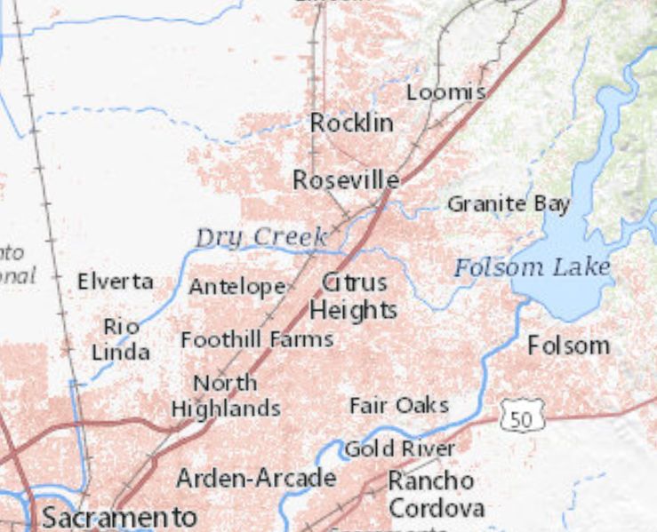
Aquatic Resources Delineation for Pioneer Baptist Church Project

3.1.3     Hydrology

Wetlands, by definition, are seasonally or perennially inundated or saturated at or near (within 12 inches
of) the soil surface. Primary indicators of wetland hydrology include, but are not limited to: visual
observation of saturated soils, visual observation of inundation, surface soil cracks, inundation visible on
aerial imagery, water-stained leaves, oxidized rhizospheres along living roots, aquatic invertebrates, water
marks (secondary indicator in riverine environments), drift lines (secondary indicator in riverine
environments), and sediment deposits (secondary indicator in riverine environments). The occurrence of
one primary indicator is sufficient to conclude that wetland hydrology is present. If no primary indicators
are observed, two or more secondary indicators are required to conclude wetland hydrology is present.
Secondary indicators include, but are not limited to drainage patterns, crayfish burrows, FAC-neutral test,
and shallow aquitard.

4.0       RESULTS

4.1       Existing Site Conditions
The Study Area is located within relatively flat terrain situated at an elevational range of approximately
133 to 145 feet above mean sea level in the Sacramento Valley Subregion of the Great Central Valley
floristic region of California (Baldwin et al. 2012). The average winter low temperature in the vicinity of the
Study Area is 41.5 degrees Fahrenheit (˚F) and the average summer high temperature is 91.2˚F. Average
annual precipitation is approximately 20.27 inches, which falls as rain (NOAA 2021b).

The Study Area is an urban parcel surrounded by a mix of residential and retail to the south and north,
and single-family residential to the east. Rusch Community Park is on the western side of Auburn
Boulevard, opposite the Project site. Cripple Creek bisects the Study Area from the east to the west.

Portions of the Study Area contain gravel lots located in the northern and southern section of the Study
Area. A storm drain is located in the northern gravel lot, which drains into Cripple Creek.

The majority of the Study Area is ruderal, a vegetation community dominated primarily by a mix of
nonnative forbs such as common dandelion (Taraxacum officinale), bur clover (Medicago polymorpha), and
red-stemmed filaree (Erodium cicutarium).

Riparian oak woodland also occurs in the Study Area along Cripple Creek. This vegetation community
consists of an intermittent to dense canopy of valley oak (Quercus lobata) and blue oak (Quercus
douglasii), with an understory of annual vegetation community dominated by slender wild oat (Avena
barbata) and foxtail barley (Hordeum murinum).

4.1.1     California Aquatic Resource Inventory

The California Aquatic Resource Inventory (CARI; San Francisco Estuary Institute [SFEI] 2017) is a statewide
map of surface waters and related habitats combining multiple national and regional datasets, including
the National Wetlands Inventory and the National Hydrography Dataset. CARI includes aquatic resource
features mapped using a variety of remote sensing and modeling techniques. As such, these aquatic

ECORP Consulting, Inc.                                                                                  June 2, 2021
                                                                7
Pioneer Baptist Church Project                                                                          2018-062.02
Aquatic Resources Delineation for Pioneer Baptist Church Project
features may or may not exist as represented. In addition, CARI data varies in detail, accuracy, and age,
and is meant to be used as a tool to assist with an aquatic resource delineation but not as the only source
of information (SFEI 2017).
According to CARI (SFEI 2017), there are several aquatic features mapped within the Study Area (Figure 2.
California Aquatic Resource Inventory Features). These include stream features mapped as fluvial natural,
which roughly correspond to Cripple Creek mapped onsite.
4.1.2 Soils
According to the Web Soil Survey (NRCS 2021a), two soil units, or types, have been mapped within the
Study Area (Figure 3. Natural Resources Conservation Service Soil Types):
148 – Fiddyment-Orangevale-Urban land complex, 2 to 8 percent slopes
227 –Urban land
These soil units do not contain any listed hydric components (NRCS 2021b).
4.2 Aquatic Resources
A total of 0.247 acre of aquatic resources has been mapped within the Study Area (Table 3). The wetland
determination data forms are included in Attachment B. A discussion of the aquatic resources is presented
below, and the aquatic resources delineation map is presented on Figure 4. Aquatic Resources Delineation.
Representative site photographs are included as Attachment C. The USACE Operations and Maintenance
Business Information Link Regulatory Module aquatic resources table of potential Waters of the U.S. is
included in Attachment D.
Table 2. Aquatic Resources
Type Acreage1
Other Waters
Creek 0.247
Total 0.247
1Acreages represent a calculated estimation and are subject to modification following the USACE
verification process.
4.2.1 Wetlands
No wetlands were mapped within the Study Area.
ECORP Consulting, Inc. June 2, 2021
8
Pioneer Baptist Church Project 2018-062.02M
apC
onte
n ts
P
roje
ctB
oun
dary-3
.88a
c.
C
ARIF
eatu
res
F
luv
ialN
atu
ral
na D
l_ e
lin
e a n
tio B
\PCC
_ R
A p
I.a tu
rx()-k q
rnu t4
is /2
/8 2
01
S
ource
s:N
AIP2
020
C
E R
OP:N 0
:\21\2
8 1
08 6
-02 2P
.0 n
ioerB
e p
a tC
tis u
h h
rc A
\MP\J
S u d
ris tio
ic
M
apD
ate
:4/8
/20
21
Figure 2. California Aquatic Resources Inventory
I
ScaleinFeet
0 3
00 2018-062.02 Pioneer Baptist ChurchFigure 3. Natural Resources
Conservation Service Soil Types
CRIPPLECREEKRD
M
apF
eatu
res
P
roje
ctB
oun
dary-3
.88a
c.
2
27 S
erie
sNu
m b
er-S
erie
sNa
m e
148-Fidd
yment-Ora
n g
evale
-Urb
anla
n d
co
m ple
x,2to8p e
rcentslope
s
2
27-U
rba
nla
n d
2
27
UNNAMEDRD
1
48
1
48
UNNAMEDRD
p
ils.a tu
rx()-k q
rnu /8
ist4 0
/221
RNBLVD
y B
\P _
CSo
BU
o g
lo
U
Ge
A
h
tistCu \M
rch P
AS o
\S a
ils_n_
d
AY
p
CKW
rBa
N
atura
lResou
rcesCon se
rva
tionServ
ice(NRCS)
nee
So
ilSurv
eyGeograph
ic(SSUR GO)Data
b a
sefo
r
ERLO
2Pio
SacramentoCounty
,CA
2.0
SH
o
L n
tio
ca :N 0
:\21\2
8 1
08 6
-0
P
hotoS
ource
:NA
IP2
020 M
apD
ate
:4/8
/20
21
I
ScaleinFeet
2
018
-06
2.0
2Pio
nee
rBa
p tistC
hurch
0 1
00Map Features
Project Boundary - 3.88 ac.
A
! Reference Coordinates
@ Culverts and Storm Drain
Sample Points
!
H Upland Point
H
! Waters Point
Aquatic Resources - 0.247 ac. 1 *
Creek - 0.247 ac.
38.709605/ 38.709611/
38.709605 38.709611
A
! A
!
@
Photo Source: NAIP 2020
Boundary Source: Millenium Planning and Engineering
Delineator(s): Daniel Wong and Hannah Kang
ECORP: N:\2018\2018-062.02 Pioneer Baptist Church\MAPS\Jurisdictional_Delineation\PBC_PreLim_ARD_20210408.mxd (KIT)-kturnquist 4/15/2021
@ Coordinate System: NAD 1983 StatePlane California II FIPS 0402 Feet
1
The information depicted on this graphic represents a preliminary wetland assessment. The
assessment was not conducted in accordance with the Corps of Engineers Wetland Delineation
Manual and Sacramento District Minimum Standards. The project boundaries, wetland boundaries,
@ H
!
H
! and acreage values are approximate.
* The acreage value for each feature has been rounded to the nearest 1/1000 decimal. Summation of these
values may not equal the total potential Waters of the U.S. acreage reported.
38.7084/
38.708388/ 38.7084
38.708388
A
! A
!
Figure 4. Aquatic Resources Delineation
Map Date: 4/15/2021
Sca le in Fe e t
0 100 I 2018-062.02 Pioneer Baptist ChurchAquatic Resources Delineation for Pioneer Baptist Church Project
4.2.2 Other Waters
Creek (Cripple Creek)
Creeks are linear features that exhibit a bed and bank, OHWM, and flow continuously throughout the
year. The perennial creek (Cripple Creek) mapped within the Study Area flows through the Study Area
from the east to west. Hydrophytic vegetation was present along the banks and channel of Cripple Creek
in areas of sediment accumulation that provide a substrate suitable for plant establishment and growth.
Dominant plant species observed within the OHWM of Cripple Creek include northern water plantain
(Alisma triviale) and tall flatsedge (Cyperus eragrostis). Sampling point 2 was collected within the OHWM
of Cripple Creek. The OHWM was delineated in the field based on the transition from hydrophytes to
upland species, presence of water marks, drift/debris deposits, drainage patterns, and sediment deposits.
5.0 JURISDICTIONAL ASSESSMENT
Per Regulatory Guidance Letter 16-01, an applicant may request a PJD “in order to move ahead
expeditiously to obtain a Corps permit authorization where the requestor determines that it is in his or her
best interest to do so ... even where initial indications are that the aquatic resources on a parcel may not be
jurisdictional” (USACE 2016b). The following information on connectivity of wetlands and other waters in
the Study Area to TNW is provided should an Approved Jurisdictional Determination be necessary.
Cripple Creek is a perennial tributary to the Sacramento River via Lower Steelhead Creek. The USACE
Sacramento District has identified the Sacramento River as a navigable water. Therefore, Cripple Creek is
jurisdictional according to the NWPR and subject to regulation under Section 404 of the CWA. In addition,
Cripple Creek would also fall under the RWQCB jurisdiction as Waters of the State.
6.0 CONCLUSION
A total of 0.247 acre of aquatic resources has been mapped within the Study Area. This acreage represents
a calculated estimation of the extent of aquatic resources within the Study Area, and is subject to
modification following USACE review and/or the verification process. The placement of dredged or fill
material into jurisdictional features would require a permit pursuant to Section 404 of the CWA and
certification or waiver in compliance with Section 401 of the CWA.
ECORP Consulting, Inc. June 2, 2021
12
Pioneer Baptist Church Project 2018-062.02Aquatic Resources Delineation for Pioneer Baptist Church Project
7.0 REFERENCES
Environmental Laboratory. 1987. Corps of Engineers Wetlands Delineation Manual. Technical Report Y-87-
1 (On-line edition). Vicksburg, Mississippi: U.S. Army Engineer Waterways Experiment Station. p.
143. January 1987.
Jepson eFlora Project (eds.) 2021. Jepson eFlora. Available online: https://ucjeps.berkeley.edu/eflora/.
Accessed April 2021.
Munsell Color. 2009. Munsell Soil Color Book. Munsell Color. Grand Rapids, Michigan.
National Agriculture Imagery Program. 2020. https://usdaonline.maps.arcgis.com/apps/MapJournal
NOAA. 2021a. Climate Data Online: Daily Precipitation Summaries for Sacramento 5 ESE, California.
Available Online: https://www.ncdc.noaa.gov/cdo-web/search. Accessed April 2021.
_______. 2021b. NCDC 1981-2010 Climate Normals for Sacramento 5 ESE, California.
https:/www.ncdc.noaa.gov/cdo-web/datatools/normals. Accessed April 2021.
NRCS. 2021a. Web Soil Survey. http://websoilsurvey.nrcs.usda.gov/. Accessed April 2021.
_______. 2021b. Soil Data Access Hydric Soils List.
https://www.nrcs.usda.gov/wps/portal/nrcs/mail/soils/use/hydric/. Accessed April 2021.
_______. 2003. National Soil Survey Handbook. http://soils.usda.gov/technical/handbook
NRCS, USGS, USEPA. 2016. Watershed Boundary Dataset for California. http://datagateway.nrcs.usda.gov.
SFEI. California Aquatic Resource Inventory (CARI) Version 0.3. 2017. http://www.sfei.org/data/california-
aquatic-resource-inventory-cari-version-03-gis-data#sthash.0SjnlwfO.dpbs.
USACE. 2018. National Wetland Plant List, version 3.4. U.S. Army Corps of Engineers, Engineer Research
and Development Center, Cold Regions Research and Engineering Laboratory. Hanover, NH.
Available online: https://wetland-plants.sec.usace.army.mil/nwpl_static/v34/home/home.html.
_______. 2016a. Minimum Standards for Acceptance of Aquatic Resources Delineation Reports. U.S. Army
Corps of Engineers. p. 20. January 2016.
_______. 2016b. Regulatory Guidance letter 16-01, Jurisdictional Determinations. October 2016.
______. 2008a. Regional Supplement to the Corps of Engineers Wetland Delineation Manual: Arid West
Region.
______. 2008b. A Field Guide to the Identification of the Ordinary High Water mark (OHWM) in the Arid
West Region of the Western United States.
______. 1992. Clarification and Interpretation of the 1987 Manual. Memorandum from Major General
Arthur E. Williams. Dated 6 March 1992.
ECORP Consulting, Inc. June 2, 2021
13
Pioneer Baptist Church Project 2018-062.02Aquatic Resources Delineation for Pioneer Baptist Church Project
USACE and USEPA. 2020. The Navigable Waters Protection Rule: Definition of “Waters of the United
States.” Federal Register Vol. 85 No. 77, 33 CFR Part 328 (USACE), 40 CFR Parts 110, 112, 116, et al.
(USEPA). 93 pages. April 21, 2020.
USGS. 1992. Citrus Heights, California" 7.5-minute Quadrangle. In: Survey. G, editor. Denver, Colorado.
ECORP Consulting, Inc. June 2, 2021
14
Pioneer Baptist Church Project 2018-062.02LIST OF ATTACHMENTS
Attachment A – Driving Directions to Study Area
Attachment B – Wetland Determination Data Forms - Arid West
Attachment C – Representative Site Photographs
Attachment D – USACE Operations and Maintenance Business Information Link Regulatory
Module Aquatic Resources Table
Attachment E – Wetland Delineation Shape File (to be included with USACE submittal only)ATTACHMENT A Driving Directions to Study Area
4/27/2021                                    US Army Corps of Engineers to 7820-7904 Auburn Blvd - Google Maps

                                US Army Corps of Engineers to 7820-7904 Auburn                            Drive 15.2 miles, 19 min
                                Blvd

                                                                    Imagery ©2021 TerraMetrics, Map data ©2021   2 mi

   US Army Corps of Engineers
   1325 J St, Sacramento, CA 95814

   Take 16th St to CA-160 N/N Sacramento Fwy
                                                            4 min (1.4 mi)
            1.   Head east on J St toward 14th St
                                                                   0.2 mi
            2.   Use the left 2 lanes to turn left onto 16th St
                                                                   1.2 mi

   Follow CA-160 N/N Sacramento Fwy, I-80BL E and I-80 E to
   Antelope Rd in Citrus Heights. Take exit 100 from I-80 E
                                                          12 min (12.7 mi)
            3.   Continue onto CA-160 N/N Sacramento Fwy
                                                                   2.2 mi
            4.   Use any lane to merge onto I-80BL E
                                                                   4.7 mi
            5.   Use the left 3 lanes to merge onto I-80 E toward
                 Reno
                                                                   5.5 mi
            6.   Take exit 100 for Antelope Road
                                                                   0.2 mi

https://www.google.com/maps/dir/US+Army+Corps+of+Engineers,+J+Street,+Sacramento,+CA/7820-7904+Auburn+Blvd,+Citrus+Heights,+CA+9561…   1/2
4/27/2021 US Army Corps of Engineers to 7820-7904 Auburn Blvd - Google Maps
7. Keep right at the fork, follow signs for Citrus
Heights and merge onto Antelope Rd
299 ft
Continue on Antelope Rd. Drive to Auburn Blvd
2 min (1.1 mi)
8. Merge onto Antelope Rd
0.9 mi
9. Use the 2nd from the left lane to turn left onto
Auburn Blvd
Destination will be on the right
0.2 mi
7820-7904 Auburn Blvd
Citrus Heights, CA 95610
These directions are for planning purposes only.
You may nd that construction projects, tra c,
weather, or other events may cause conditions to
differ from the map results, and you should plan
your route accordingly. You must obey all signs or
notices regarding your route.
https://www.google.com/maps/dir/US+Army+Corps+of+Engineers,+J+Street,+Sacramento,+CA/7820-7904+Auburn+Blvd,+Citrus+Heights,+CA+9561… 2/2ATTACHMENT B Wetland Determination Data Forms - Arid West Region
WETLAND DETERMINATION DATA FORM – Arid West Region
Project/Site:
PB Church City/County: Sacramento Sampling Date: 4/7/2021
Applicant/Owner: Pioneer Baptist Church State: CA Sampling Point: 01
Investigator(s): D. Wong & H. Kang Section, Township, Range: S.23 T.10N R.06E
Landform (hillslope, terrace, etc.): Terrace Local relief (concave, convex, none): Concave Slope (%): 0-1
Subregion (LRR): C Lat: 38.70902117 Long: -121.2899483 Datum: NAD83
Soil Map Unit Name: 148 - Fiddyment-Orangevale-Urban land complex, 2 to 8 percent slopes NWI classification: FrWtr FrstShrb Wtlnd
Are climatic / hydrologic conditions on the site typical for this time of year? Yes ✔ No (If no, explain in Remarks.)
Are Vegetation , Soil , or Hydrology significantly disturbed? Are “Normal Circumstances” present? Yes ✔ No
Are Vegetation , Soil , or Hydrology naturally problematic? (If needed, explain any answers in Remarks.)
SUMMARY OF FINDINGS – Attach site map showing sampling point locations, transects, important features, etc.
Hydrophytic Vegetation Present? Yes No ✔
Is the Sampled Area
Hydric Soil Present? Yes No ✔
within a Wetland? Yes No ✔
Wetland Hydrology Present? Yes No ✔
Remarks:
Above the OHWM of Cripple Creek in central Citrus Heights. Upland point to Sample Point 02.
VEGETATION – Use scientific names of plants.
Absolute Dominant Indicator Dominance Test worksheet:
Tree Stratum (Plot size: ) % Cover Species? Status
Number of Dominant Species
1. That Are OBL, FACW, or FAC: 0 (A)
2.
Total Number of Dominant
3. Species Across All Strata: 3 (B)
4.
Percent of Dominant Species
= Total Cover That Are OBL, FACW, or FAC: 0 (A/B)
Sapling/Shrub Stratum (Plot size: )
1. Prevalence Index worksheet:
2. Total % Cover of: Multiply by:
3. OBL species x1=
4. FACW species x2=
5. FAC species x3=
= Total Cover FACU species x4=
Herb Stratum (Plot size: 5x5' ) UPL species x5=
1. Bromus diandrus 40 Yes N/L Column Totals: (A) (B)
2. Vinca minor 20 Yes N/L
3. Raphanus sativus 10 No N/L Prevalence Index = B/A =
4. Hordeum murinum 20 Yes FACU Hydrophytic Vegetation Indicators:
5. Vicia sativa 5 No FACU Dominance Test is >50%
1
6. Prevalence Index is 3.0
1
7. Morphological Adaptations (Provide supporting
data in Remarks or on a separate sheet)
8. 1
Problematic Hydrophytic Vegetation (Explain)
95 = Total Cover
Woody Vine Stratum (Plot size: )
1
1. Indicators of hydric soil and wetland hydrology must
be present, unless disturbed or problematic.
2.
= Total Cover Hydrophytic
Vegetation
% Bare Ground in Herb Stratum 5 % Cover of Biotic Crust Present? Yes No ✔
Remarks:
US Army Corps of Engineers Arid West – Version 2.0SOIL Sampling Point: 01
Profile Description: (Describe to the depth needed to document the indicator or confirm the absence of indicators.)
Depth Matrix Redox Features
1 2
(inches) Color (moist) % Color (moist) % Type Loc Texture Remarks
0-12 7.5YR 3/2 100 Lmy Snd Dry
1 2
Type: C=Concentration, D=Depletion, RM=Reduced Matrix, CS=Covered or Coated Sand Grains. Location: PL=Pore Lining, M=Matrix.
3
Hydric Soil Indicators: (Applicable to all LRRs, unless otherwise noted.) Indicators for Problematic Hydric Soils :
Histosol (A1) Sandy Redox (S5) 1 cm Muck (A9) (LRR C)
Histic Epipedon (A2) Stripped Matrix (S6) 2 cm Muck (A10) (LRR B)
Black Histic (A3) Loamy Mucky Mineral (F1) Reduced Vertic (F18)
Hydrogen Sulfide (A4) Loamy Gleyed Matrix (F2) Red Parent Material (TF2)
Stratified Layers (A5) (LRR C) Depleted Matrix (F3) Other (Explain in Remarks)
1 cm Muck (A9) (LRR D) Redox Dark Surface (F6)
Depleted Below Dark Surface (A11) Depleted Dark Surface (F7)
3
Thick Dark Surface (A12) Redox Depressions (F8) Indicators of hydrophytic vegetation and
Sandy Mucky Mineral (S1) Vernal Pools (F9) wetland hydrology must be present,
Sandy Gleyed Matrix (S4) unless disturbed or problematic.
Restrictive Layer (if present):
Type:
Depth (inches): Hydric Soil Present? Yes No ✔
Remarks:
HYDROLOGY
Wetland Hydrology Indicators:
Primary Indicators (minimum of one required; check all that apply) Secondary Indicators (2 or more required)
Surface Water (A1) Salt Crust (B11) Water Marks (B1) (Riverine)
High Water Table (A2) Biotic Crust (B12) Sediment Deposits (B2) (Riverine)
Saturation (A3) Aquatic Invertebrates (B13) Drift Deposits (B3) (Riverine)
Water Marks (B1) (Nonriverine) Hydrogen Sulfide Odor (C1) Drainage Patterns (B10)
Sediment Deposits (B2) (Nonriverine) Oxidized Rhizospheres along Living Roots (C3) Dry-Season Water Table (C2)
Drift Deposits (B3) (Nonriverine) Presence of Reduced Iron (C4) Crayfish Burrows (C8)
Surface Soil Cracks (B6) Recent Iron Reduction in Tilled Soils (C6) Saturation Visible on Aerial Imagery (C9)
Inundation Visible on Aerial Imagery (B7) Thin Muck Surface (C7) Shallow Aquitard (D3)
Water-Stained Leaves (B9) Other (Explain in Remarks) FAC-Neutral Test (D5)
Field Observations:
Surface Water Present? Yes No ✔ Depth (inches):
Water Table Present? Yes No ✔ Depth (inches):
Saturation Present? Yes No ✔ Depth (inches): Wetland Hydrology Present? Yes No ✔
(includes capillary fringe)
Describe Recorded Data (stream gauge, monitoring well, aerial photos, previous inspections), if available:
Remarks:
US Army Corps of Engineers Arid West – Version 2.0WETLAND DETERMINATION DATA FORM – Arid West Region
Project/Site:
PB Church City/County: Sacramento Sampling Date: 4/7/2021
Applicant/Owner: Pioneer Baptist Church State: CA Sampling Point: 02
Investigator(s): D. Wong & H. Kanh Section, Township, Range: S.23 T.10N R.06E
Landform (hillslope, terrace, etc.): Channel Local relief (concave, convex, none): Concave Slope (%): 0-1
Subregion (LRR): C Lat: 38.7090547 Long: -121.2900018 Datum: NAD83
Soil Map Unit Name: 148 - Fiddyment-Orangevale-Urban land complex, 2 to 8 percent slopes NWI classification: N/A
Are climatic / hydrologic conditions on the site typical for this time of year? Yes ✔ No (If no, explain in Remarks.)
Are Vegetation , Soil , or Hydrology significantly disturbed? Are “Normal Circumstances” present? Yes ✔ No
Are Vegetation , Soil , or Hydrology naturally problematic? (If needed, explain any answers in Remarks.)
SUMMARY OF FINDINGS – Attach site map showing sampling point locations, transects, important features, etc.
Hydrophytic Vegetation Present? Yes No ✔
Is the Sampled Area
Hydric Soil Present? Yes No ✔
within a Wetland? Yes No ✔
Wetland Hydrology Present? Yes ✔ No
Remarks:
Below OHWM at toe of slope of bank of Cripple Creek in central Citrus Heights.
VEGETATION – Use scientific names of plants.
Absolute Dominant Indicator Dominance Test worksheet:
Tree Stratum (Plot size: 5x5' ) % Cover Species? Status
Number of Dominant Species
1. Quercus douglasii 35 Yes N/L That Are OBL, FACW, or FAC: 2 (A)
2. Robinia pseudoacacia 10 Yes FACU
Total Number of Dominant
3. Species Across All Strata: 4 (B)
4.
Percent of Dominant Species
45 = Total Cover That Are OBL, FACW, or FAC: 50 (A/B)
Sapling/Shrub Stratum (Plot size: )
1. Prevalence Index worksheet:
2. Total % Cover of: Multiply by:
3. OBL species x1=
4. FACW species x2=
5. FAC species x3=
= Total Cover FACU species x4=
Herb Stratum (Plot size: 5x5' ) UPL species x5=
1. Cyperus eragrostis 20 Yes FACW Column Totals: (A) (B)
2. Alisma trivale 10 Yes OBL
3. Galium aparine 5 No FACU Prevalence Index = B/A =
4. Vinca minor 5 No N/L Hydrophytic Vegetation Indicators:
5. Dominance Test is >50%
1
6. Prevalence Index is 3.0
1
7. Morphological Adaptations (Provide supporting
data in Remarks or on a separate sheet)
8. 1
Problematic Hydrophytic Vegetation (Explain)
38 = Total Cover
Woody Vine Stratum (Plot size: )
1
1. Indicators of hydric soil and wetland hydrology must
be present, unless disturbed or problematic.
2.
= Total Cover Hydrophytic
Vegetation
% Bare Ground in Herb Stratum 30 % Cover of Biotic Crust Present? Yes No ✔
Remarks:
Surface Water: 30%
US Army Corps of Engineers Arid West – Version 2.0SOIL Sampling Point: 02
Profile Description: (Describe to the depth needed to document the indicator or confirm the absence of indicators.)
Depth Matrix Redox Features
1 2
(inches) Color (moist) % Color (moist) % Type Loc Texture Remarks
0-7 10YR 4/3 100 Sand Contains organic matter; Wet
7-14 7.5YR 4/2 100 Sand Saturated
1 2
Type: C=Concentration, D=Depletion, RM=Reduced Matrix, CS=Covered or Coated Sand Grains. Location: PL=Pore Lining, M=Matrix.
3
Hydric Soil Indicators: (Applicable to all LRRs, unless otherwise noted.) Indicators for Problematic Hydric Soils :
Histosol (A1) Sandy Redox (S5) 1 cm Muck (A9) (LRR C)
Histic Epipedon (A2) Stripped Matrix (S6) 2 cm Muck (A10) (LRR B)
Black Histic (A3) Loamy Mucky Mineral (F1) Reduced Vertic (F18)
Hydrogen Sulfide (A4) Loamy Gleyed Matrix (F2) Red Parent Material (TF2)
Stratified Layers (A5) (LRR C) Depleted Matrix (F3) Other (Explain in Remarks)
1 cm Muck (A9) (LRR D) Redox Dark Surface (F6)
Depleted Below Dark Surface (A11) Depleted Dark Surface (F7)
3
Thick Dark Surface (A12) Redox Depressions (F8) Indicators of hydrophytic vegetation and
Sandy Mucky Mineral (S1) Vernal Pools (F9) wetland hydrology must be present,
Sandy Gleyed Matrix (S4) unless disturbed or problematic.
Restrictive Layer (if present):
Type:
Depth (inches): Hydric Soil Present? Yes No ✔
Remarks:
High water table at 7 inches from surface. Soil saturated.
HYDROLOGY
Wetland Hydrology Indicators:
Primary Indicators (minimum of one required; check all that apply) Secondary Indicators (2 or more required)
✔ Surface Water (A1) Salt Crust (B11) ✔ Water Marks (B1) (Riverine)
High Water Table (A2) Biotic Crust (B12) ✔ Sediment Deposits (B2) (Riverine)
✔ Saturation (A3) Aquatic Invertebrates (B13) ✔ Drift Deposits (B3) (Riverine)
Water Marks (B1) (Nonriverine) Hydrogen Sulfide Odor (C1) ✔ Drainage Patterns (B10)
Sediment Deposits (B2) (Nonriverine) Oxidized Rhizospheres along Living Roots (C3) Dry-Season Water Table (C2)
Drift Deposits (B3) (Nonriverine) Presence of Reduced Iron (C4) Crayfish Burrows (C8)
Surface Soil Cracks (B6) Recent Iron Reduction in Tilled Soils (C6) Saturation Visible on Aerial Imagery (C9)
✔ Inundation Visible on Aerial Imagery (B7) Thin Muck Surface (C7) Shallow Aquitard (D3)
✔ Water-Stained Leaves (B9) Other (Explain in Remarks) FAC-Neutral Test (D5)
Field Observations:
Surface Water Present? Yes ✔ No Depth (inches): 0
Water Table Present? Yes No ✔ Depth (inches):
Saturation Present? Yes ✔ No Depth (inches): 0 Wetland Hydrology Present? Yes ✔ No
(includes capillary fringe)
Describe Recorded Data (stream gauge, monitoring well, aerial photos, previous inspections), if available:
Remarks:
Surface water within 5x5' plot of sample point.
US Army Corps of Engineers Arid West – Version 2.0ATTACHMENT C Representative Site Photographs
Photo 1. Sample Point 1, above OHWM. Looking west. Photo   Photo 2. Overview of oak woodland and gravel lot. In central
taken April 7, 2021.                                       Study Area. Looking northeast. Photo taken April 7, 2021.

Photo 3. Overview of Cripple Creek, below OHWM. Looking    Photo 4. Overview of paved/developed lot in northern portion
northeast. Photo taken April 7, 2021.                      of Study Area. Looking southwest Photo taken April 7, 2021.

                                                                    Attachment C. Representative Site Photographs
                                                                                               2018-062.02 Pioneer Baptist Church Project
ATTACHMENT D
USACE Operations and Maintenance Business Information Link Regulatory Module
Aquatic Resources TableWaters_Name State Cowardin_Code HGM_Code Meas_Type Amount Units Waters_Type NWPR_Determine_Code Latitude Longitude Local_Waterway Creek-1 CALIFORNIA R2 Area 0.247138628 ACRE PJD10404 38.70895346 -121.28928740
ATTACHMENT E

Wetland Delineation Shape File (to be included with USACE submittal only)
You can also read