Atmospheric Radiation Measurement (ARM) User Facility - ARM MOBILE FACILITY WORKSHOP REPORT - Office of ...
←
→
Page content transcription
If your browser does not render page correctly, please read the page content below

Atmospheric Radiation
Measurement (ARM)
User Facility
ARM MOBILE FACILITY
WORKSHOP REPORT

Published April 2019
DOE/SC-0197
ARM Mobile Facility Workshop Report

               Recommended Citation:
               U.S. DOE. 2019. Atmospheric Radiation Measurement
               (ARM) User Facility ARM Mobile Facility Workshop Report,
               DOE/SC-0197 Office of Biological and Environmental
               Research, U.S. Department of Energy Office of Science,
               Germantown, Maryland, USA.
April 2019

Atmospheric Radiation Measurement (ARM)
User Facility
ARM Mobile Facility Workshop Report

Convened by
U.S. Department of Energy
Office of Science
Office of Biological and Environmental Research
Gaithersburg, Maryland

August 15 to 17, 2018

Organizers
Sally McFarlane, Atmospheric Radiation Measurement User Facility
Shaima Nasiri, Atmospheric System Research
Rick Petty, Atmospheric Radiation Measurement User Facility

Co-Chairs
Nicki Hickmon, Argonne National Laboratory
Rob Wood, University of Washington
Guang Zhang, University of California, San Diego

Writing Team
Mike Jensen, Brookhaven National Laboratory
Steve Klein, Lawrence Livermore National Laboratory
Ruby Leung, Pacific Northwest National Laboratory
David Mechem, University of Kansas
Paquita Zuidema, University of Miami

                                                      Published April 2019
                                                            DOE/SC-0197

                                                                                          i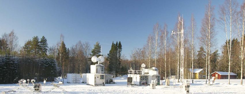
ARM Mobile Facility Workshop Report

     Acronyms and Abbreviations
     AAF                 ARM Aerial Facility
     ACE-ENA             Aerosol and Cloud Experiments in the Eastern North Atlantic
     AMF                 ARM Mobile Facility
     AOS                 aerosol observing system
     ARM                 Atmospheric Radiation Measurement
     ARMBE               ARM Best Estimate
     ARSCL               Active Remotely Sensed Cloud Layers
     ASR                 Atmospheric System Research
     AWARE               ARM West Antarctic Radiation Experiment
     BAECC               Biogenic Aerosols–Effects on Clouds and Climate
     BBOP                Biomass Burning Observation Project
     BER                 Office of Biological and Environmental Research
     CAPE                convective available potential energy
     CAP-MBL             Clouds, Aerosol, and Precipitation in the Marine Boundary Layer
     CAPT                Cloud-Associated Parameterizations Testbed
     CCN                 cloud condensation nuclei
     CESD                Climate and Environmental Sciences Division
     CHEESEHEAD          Chequamegon Heterogeneous Ecosystem Energy-balance Study Enabled
                         by a High-Density Extensive Array of Detectors
     CLAMPS              Collaborative Lower Atmospheric Mobile Profiling System
     CLIVAR              Climate Variability and Predictability
     CMDV                Climate Model Development and Validation
     COMBLE              Cold-Air Outbreaks in the Marine Boundary Layer Experiment
     CSAPR               C-Band Scanning ARM Precipitation Radar
     DHS                 Department of Homeland Security
     DIMOP               Diurnal Cycle Interactions with Madden-Julian Oscillation Propagation
     DOE                 U.S. Department of Energy
     DYNAMO              Dynamics of the Madden-Julian Oscillation
     E3SM                Energy Exascale Earth System Model
     ECMWF               European Centre for Medium-Range Weather Forecasts
     EDGAR               Emissions Database for Global Atmospheric Research
     EERE                Office of Energy Efficiency & Renewable Energy
     ENA                 Eastern North Atlantic

ii
April 2019

ENSO       El Niño-Southern Oscillation
EPA        Environmental Protection Agency
ESM        earth system model
FASMEE     Fire and Smoke Model Evaluation Experiment
FIREX      Fire Influence on Regional and Global Environments Experiment
GCM        global climate model
GCSS       GEWEX Cloud System Study
GEWEX      Global Energy and Water Exchanges
GoAmazon   Observations and Modeling of the Green Ocean Amazon 2014/15
GPCI       GCSS Pacific Cross-Section Intercomparison
GPM        Global Precipitation Measurement
GPS        Global Positioning System
HALO       High Altitude and Long Range Research Aircraft
IMPROVE    Inter-agency Monitoring of Protected Visual Environments
IN         ice nuclei
INP        ice nucleating particle
ISDAC      Indirect and Semi-Direct Aerosol Campaign
KORUS-AQ   Korea-United States Air Quality
ITCZ       intertropical convergence zone
LASSO      LES ARM Symbiotic Simulation and Observation
LES        large-eddy simulation
LTER       Long-Term Ecological Research
MAGIC      Marine ARM GPCI Investigations of Clouds
MARCUS     Measurements of Aerosols, Radiation, and Clouds over the Southern Ocean
MCS        mesoscale convective system
MICRE      Macquarie Island Cloud and Radiation Experiment
MJO        Madden-Julian Oscillation
ModEx      model-observation-experiment
MODIS      Moderate Resolution Imaging Spectroradiometer
MOSAIC     Multidisciplinary Drifting Observatory for the Study of Arctic Climate
MPACE      Mixed-Phase Arctic Clouds Experiment
NASA       National Aeronautics and Space Administration
NEON       National Ecological Observatory Networks

                                                                                                 iii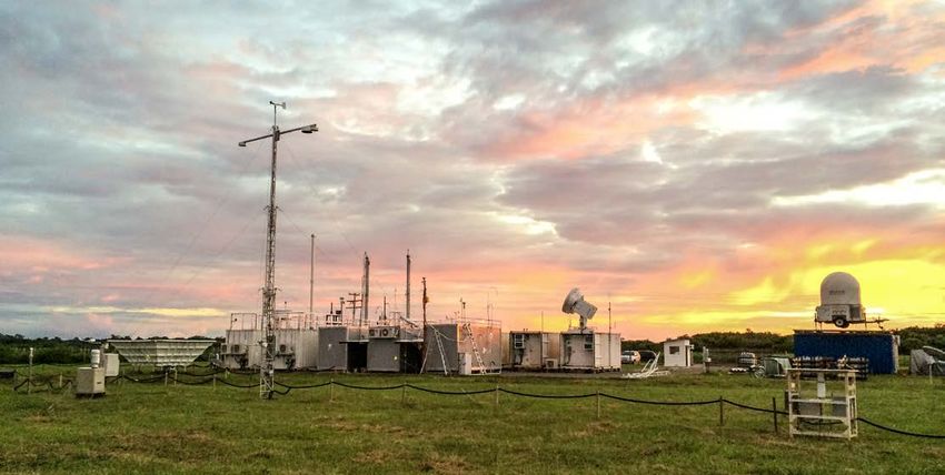
ARM Mobile Facility Workshop Report

     NOAA                National Oceanic and Atmospheric Administration
     NSA                 North Slope of Alaska
     NSF                 National Science Foundation
     NWS                 National Weather Service
     PBL                 planetary boundary layer
     PDF                 probability density function
     PI                  principal investigator
     RADAGAST            Radiative Divergence using AMF, GERB and AMMA Stations
     RHUBC               Radiative Heating in Underexplored Bands Campaign
     RRM                 regionally refined mesh
     R/V                 research vessel
     SBR                 Subsurface Biogeochemical Research
     Sc-Cu               stratocumulus-to-cumulus
     SGP                 Southern Great Plains
     SHEBA               Surface Heat Budget of the Arctic Ocean
     TES                 Terrestrial Ecosystem Science
     TOGA-CORE           Tropical Ocean Global Atmosphere-Coupled Ocean Atmosphere
                         Response Experiment
     TWP                 Tropical Western Pacific
     UAS                 unmanned aerial system
     USGS                U.S. Geological Survey
     VAP                 value-added product
     VARANAL             Large-Scale Forcing Data from Constrained Variational Analysis
     WCRP                World Climate Research Programme
     WE-CAN              Western Wildfire Experiment for Cloud Chemistry, Aerosol Absorption and Nitrogen
     WMO                 World Meteorological Organization
     WRF                 Weather Research and Forecasting (model)

     XSAPR               X-Band Scanning ARM Precipitation Radar

iv
April 2019

Executive Summary
The U.S. Department of Energy (DOE) held a workshop                     based on arctic observations might not necessarily apply
for the Atmospheric Radiation Measurement (ARM) user                    to the Antarctic. Southern Greenland, boreal forests in
facility ARM Mobile Facility (AMF) in August 2018 to                    high latitudes, Alaska, and inland Antarctica are critical
bring together representatives of the scientific community to           regions with quite different feedbacks between the surface
discuss critical climate challenges where ARM observations              energy budget, clouds and aerosols, and atmospheric
could impact and improve earth system models (ESM).                     moisture transport.
White papers were requested from attendees and the
broader scientific community and the workshop discussions           •   Mountainous and complex terrain regions have
were organized around the primary regions or regimes                    orographically forced convection, varied surface
identified in the white papers. The discussions for each                conditions (i.e., vegetation, glacier, snowpack),
region or regime focused on which scientific challenges                 and aerosols, with a large influence on clouds
could be addressed in each region, how these would impact               and precipitation. Mountainous regions contribute
models, and what deployment duration, spatial coverage,                 disproportionately to precipitation over land worldwide,
combination of ARM assets, and collaborations would be                  greatly affecting the hydrologic cycle and fresh water
critical to addressing these challenges. The workshop also              supply. Observations could support studies to improve
included sessions on how to increase the scientific impact              the significant understanding gaps in the areas of
of the AMFs and how to make better connections between                  convection, extreme precipitation and weather, and
ARM observations and the ESM community.                                 interactions between atmospheric circulation, radiation,
                                                                        and land-surface conditions.
Common scientific challenges were represented across many
sessions of the workshop discussion. Accurate representation        •   Clouds that develop in marine regions generate 80% of
of clouds, processes affecting transitions of cloud type,               the Earth’s precipitation. However, this regime is under-
interactions with aerosols and/or the land surface, and                 sampled due to its large size and the logistical difficulties
precipitation were themes of scientific interest across                 of marine deployments. ARM observations could
most regimes.                                                           improve the understanding of aerosol impact on cloud
                                                                        and precipitation and their long-range transport and
The following regions and processes were identified by the              removal. Observations in various marine regions could
workshop co-chairs as the highest priority for discussion               target specific types of cloud model representation biases,
and key elements of the discussion were highlighted in
                                                                        such as subtropical regions, tropics, and high latitudes.
each session:
                                                                    •   Poor representation of processes associated with organized
•   The southeast United States is a warm and humid region              convection is linked to biases in the amount, type, spatial
    with abundant locally forced, atmospheric convection                distribution, and diurnal timing of precipitation in ESMs.
    inland and enhanced convection along coasts. The strong             Precipitation produced by organized convection is
    coupling with the surface supports the study of the impacts         important in both continental and marine regions;
    of variations in land surface on cloud climatology and              however, organized convection has different
    transition between cloud regimes as well as their associated        characteristics in each region. Due to the large spatial
    precipitation. Large amounts of secondary organic aerosols          scales and long lifetimes, observations of organized
    and scattered urban populations allow for observations              convection will likely require extended facilities or multiple
    to support studies of aerosols’ radiative impacts and the           sites along the propagation path. Several regions where
    interaction between naturally produced and urban aerosols.          observations could capture organized convection and
•   High-latitude regions are important due to the changing             its evolution are the central United States between the
    cryosphere. Observations in the high latitudes are often            Rockies and the Great Plains, southeast United States,
    sparse due to logistical difficulties, and model improvements       Tropical Pacific, Maritime Continent, and the Amazon.

                                                                                                                                     v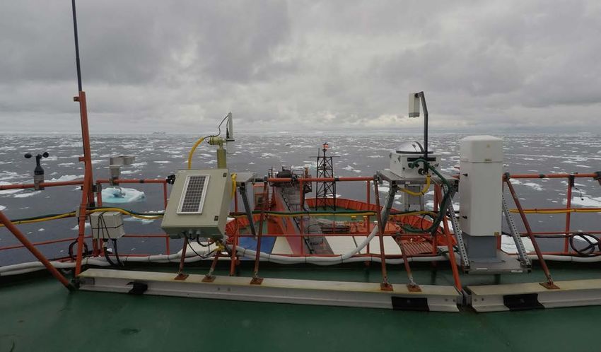
ARM Mobile Facility Workshop Report

The regions mentioned above were identified for discussion        high-quality data are of the utmost importance for process
because of their mention in multiple white papers. An             studies and model advancement; therefore, emphasis should
additional session was held for discussion of topics or regions   be placed on robust calibrations, maintaining inventory of
that attendees felt were important but that did not receive       critical spare parts and instrumentation, and preparing
as much emphasis in the white papers. These included the          observational data for model use, as funding allows. Past
Great Lakes region of the United States, Asian monsoon,           successful campaigns, with strong collaborations involving
Asian pollution, urban areas, wildfire-prone regions, and         experimentalists and modelers, should provide useful future
convection in semi-arid regions.                                  deployment design elements to balance the time needed
                                                                  for these needs and urgency to provide appropriate value-
Increasing the impacts of observations on ESMs can be             added-products (VAPs) and model input to the community.
done by improving parameterizations, testing and evaluating       Dedicated site-focused modeling activities, like Large-Eddy
model representation of the processes observed, providing         Simulation (LES) ARM Symbiotic Simulation and
large-scale forcing data sets, or as direct input in process-     Observation (LASSO), should be used to bridge
model simulations and model data assimilations. Ideas for         observations with efforts to improve larger-scale ESMs.
how ARM could improve the impact of AMF campaigns                 New technologies should continue to be explored, allowing
revolved around the earlier engagement of modelers with           the potential for increased flexibility, spatial coverage, and in
the observationally focused scientific community. Available,      situ and remotely sensed measurements.

vi
April 2019

Table of Contents
Acronyms and Abbreviations........................................................................................................... ii

Executive Summary........................................................................................................................... v

Introduction........................................................................................................................................ 1

Regime/Region Areas of Interest..................................................................................................... 3
    Marine Regions.............................................................................................................................. 4
    Southeastern United States.......................................................................................................... 9
    Mountainous and Complex Terrain Regions............................................................................ 13
    Organized Deep Convection.................................................................................................... 17
    High-Latitude Regions................................................................................................................. 21
    Other Regimes/Regions.............................................................................................................. 25
         Great Lakes............................................................................................................................. 25
         South and Southeast Asian Monsoon.................................................................................. 26
         Asian Pollution in South Korea.............................................................................................. 26
         Urban Areas............................................................................................................................ 27
         Wildfires.................................................................................................................................... 28
         Convection in Arid and Semi-Arid Environment................................................................. 29

Modeling Coupling/Integration..................................................................................................... 30
    Integration of AMF Science with Modeling............................................................................. 30
    Strategies to Better Engage Modeling with AMF Science..................................................... 30
    Opportunities for Specific Modeling Frameworks................................................................... 30
    AMF Data Products for Modeling.............................................................................................. 32

Increasing AMF Impact................................................................................................................... 33
    Promoting Communication with the Larger ARM/ASR Community to Foster
    Broader Collaboration for AMF Campaigns............................................................................ 33
    Developing In-Country Relationships........................................................................................ 33
    Performing Modeling and/or Observational Studies Early to Optimize
    Experimental Design of Prospective AMF Deployments........................................................ 33
    Developing Campaign Log/Field Guide for Intensive Operational Periods of
    AMF Deployments....................................................................................................................... 33
    Ensuring AMF Data Quality........................................................................................................ 34
    Identifying Optimum Time Scale for AMF Deployments......................................................... 34

                                                                                                                                                            vii
ARM Mobile Facility Workshop Report

           Assessing the Relative Merit of UAS, Tethered Balloon, and Distributed
           Observational Networks............................................................................................................. 34
           Recognizing Opportunities for Synergistic and
           Collaborative Field Activities..................................................................................................... 35
           Formalize Procedures for Deploying Subsets of the AMF Instruments................................... 35
           Additional Items.......................................................................................................................... 36

       Summary and Conclusions............................................................................................................. 37

       Appendix A: Workshop Charge..................................................................................................... 39

       Appendix B: ARM Mobile Facility Workshop Input Questions..................................................... 40

       Appendix C: Workshop Agenda.................................................................................................... 41

       Appendix D: AMF Instrumentation................................................................................................. 43

       Appendix E: Attendees................................................................................................................... 44

       Appendix F: White Paper Contributors.......................................................................................... 45

viii
April 2019
Introduction
The mission of the U.S. Department of Energy (DOE) capability of manned and unmanned aircraft providing in
Office of Biological and Environmental Research (BER) situ measurement capabilities that complement the ground-
Atmospheric Radiation Measurement (ARM) user facility, based remote-sensing observations.
as a DOE Office of Science user facility, is to provide the
climate research community with strategically located in Included in the earliest ARM program planning, the ARM
situ and remote-sensing observatories designed to improve Mobile Facility (AMF) concept was developed to address
the understanding and representation, in climate and earth particular areas of interest for shorter periods of time than
system models (ESMs), of clouds and aerosols as well as envisioned for the fixed sites. Deployments on the timescale
their interactions and coupling with the Earth’s surface. To of three months to two years were clearly an expectation
fulfill this mission, ARM began collecting observations in when initial locale recommendations were made in a 1991
1992 at the Southern Great Plains (SGP) site in Oklahoma. report. Revived discussion and design occurred from 2001
Additional observatories were added in strategic climate to 2003 during the ARM Science Team Meetings and a
locations of the North Slope of Alaska (NSA) in 1996, workshop, which resulted in deployment in 2004 of the
the Azores islands in the Eastern North Atlantic (ENA) in first AMF. With this new AMF capability, ARM targeted
2013, and the Tropical Western Pacific (TWP) sites from observing shorter-duration phenomena with a more flexible
1996 to 2013. The ARM Aerial Facility (AAF) has provided approach and design. An example for the design and
observations in various locations since 2007, with the deployment of the AMF was the earlier Surface Heat Budget
2007 Identified Area
ARM Observatory
AMF Deployment
Aerial Deployment
Ship Deployment
The 2007 expansion workshop identified areas for future deployments, indicated in red. Since then, ARM has collected mea-
surements in many of the high-priority locations identified from that workshop, as highlighted on ARM’s deployment map.
1ARM Mobile Facility Workshop Report
of the Arctic Ocean (SHEBA) collaboration between ARM The workshop organizers sought input from the community
and National Oceanic and Atmospheric Administration and participants prior to the workshop. Co-chairs developed
(NOAA), which demonstrated the scientific potential and a set of guiding questions, included in Appendix B, and
value of shorter-duration, interdisciplinary, collaborative encouraged attendees and the broader scientific community
efforts. Much of the 2018 AMF workshop discussion to submit white papers addressing the questions. Contributors
supported the original methodology of deployment, with are listed in Appendix F. Co-chairs organized the workshop
three phases: examination of existing data and models; agenda, included in Appendix C, around the major themes
deployment; and in-depth analysis of processes and their of the white paper submissions. Session leads facilitated
interactions from data. discussion among the participants and rapporteurs took notes
during the discussions. This report summarizes the feedback
In 2005, ARM began operating the first ARM Mobile provided and discussion held during the workshop.
Facility (AMF1). The second ARM Mobile Facility (AMF2)
was deployed in 2010 and the third (AMF3) in 2013. Each
mobile facility added unique capabilities to ARM, as the Additional Resources
AMF2 brought deployment capability aboard marine vessels, Learn more about the history of the ARM mobile
and the AMF3 brought extended-duration arctic support. facilities in these historical ARM documents and
Over the past 25 years, ARM has proven its capability to American Meteorological Society Monograph:
successfully observe on every continent.
From the beginning, ARM sought community feedback ARM Climate
Research Facility
to support continuous improvement and to identify Expansion Workshop
high-priority science locations and questions for ARM December 2007
observations. Feedback has been gathered through formal
workshops, Atmospheric System Research (ASR) working
groups, field campaign investigators, the ARM User
Executive Committee, the ARM Science Board, and
DOE reviews. The last formal workshop that specifically
focused discussion on high-priority scientific locations
was the 2007 ARM Expansion Report. The top five high- Identification,
priority locales from this report were: Azores, Greenland, Recommendation,
and Justification of
South Asia, Amazon Rainforest, and Middle- Latitude Potential Locales
Storm Tracks in the Southern Ocean. This document for ARM Sites
also provided the rationale for improvements to the April 1991
AMF design.
Over the past 10 years, ARM has conducted measurements
in many of the high-priority locations identified in the 2007
workshop. In addition, BER has developed and released a new
The Atmospheric
ESM, the Energy Exascale Earth System Model (E3SM), that Radiation Measurement
demands targeted field observations in order to improve, test, (ARM) Program:
and validate modeling capabilities. Therefore, it is timely to The First 20 Years
obtain new input from the community on current scientific April 2016
priorities for AMF deployments. In 2018, BER hosted a
workshop to facilitate input and discussion from the
scientific community on the highest-priority scientific For access to these documents and more,
objectives, research challenges, and opportunities for the visit the ARM Facility Documents web page at
AMF capabilities to best address the BER goal of improving https://www.arm.gov/about/facility-documents.
the predictability of ESMs.
2April 2019
Regime/Region Areas of Interest
Predicting earth system variability and change requires vegetation that changes the surface albedo. Land-sea contrast
understanding and modeling of multi-scale and plays an important role in cloud formation in coastal regions
interdependent processes that govern the radiative energy such as the southeastern United States and the Maritime
balance, water cycle, and biogeochemistry in terrestrial and Continent. At larger scales, contrast in energy inputs such
ocean systems. Solar radiation provides the primary source as that associated with land and ocean drives monsoon
of energy for Earth, but the net input of energy to Earth circulations that interact with clouds, aerosols, and
and its temporal and spatial distribution are determined by convection. In arid and semi-arid environments, land-
the complex and regionally varying interactions between atmosphere interactions influence convection differently,
radiation, water vapor, clouds, aerosols, atmospheric as compared to moist environments with larger convective
composition, atmosphere and ocean circulation, and the available potential energy (CAPE) and longer land-surface
surface. In particular, through storage of energy and water, memory associated with plentiful surface and subsurface
and exchange of energy, water, and biogeochemical fluxes moisture. At smaller scales, large surface water bodies such as
with the atmosphere, the ocean, land, and ice that cover
the Great Lakes, the urban built environment, and wildfires
the Earth’s surface have a dominant influence on radiation,
have important effects on radiation, clouds, aerosols, and
clouds, aerosols, and precipitation. The latter processes are
precipitation through perturbations of the surface fluxes
the primary focus of the ARM user facility for delivering
and mesoscale circulation.
improved understanding and modeling of Earth’s system
through in situ and remote-sensing observations of the Over both ocean and land, organized convection is a
atmosphere and its interactions with the surface. Hence, the major driver of large-scale atmospheric circulation as the
AMF workshop was organized by discussion groups focusing large stratiform precipitation regions produce a top-heavy
on radiation, clouds, aerosols, and precipitation in regions diabatic heating profile that perturbs the upper-tropospheric
or regimes of the ocean, land, and cryosphere systems that circulation. Organized convection is also a major contributor
interact with the atmosphere. to mean and extreme precipitation. Failure of global ESMs in
simulating organized convection has significant implications
The ocean covers 70% of the Earth’s surface and provides for the ability to model the global and regional circulation
more storage for energy and water compared to any other and water cycle.
of the earth system components. The flux of water from
the ocean to the atmosphere also contributes up to 80%
of the global precipitation. On average, over two-thirds
of the ocean is covered by clouds of various types, making
the marine atmospheric environment and marine clouds
and precipitation key elements for understanding and
modeling the Earth’s energy and water cycles. Through
its role in the global energy and water cycles, the ocean
also exerts significant remote influence over land and the
cryosphere systems through its impacts on the large-scale
atmospheric circulation.
Over land, radiation, clouds, aerosols, and precipitation
are modulated by complex topography, land cover/land
use characteristics, and coastlines that provide unique
environments interacting with the atmosphere to support
clouds with different diurnal and subseasonal-to-seasonal
variability. Mountains, for example, exert a major influence The AMF workshop was organized by discussion groups focusing
on radiation, clouds, aerosols, and precipitation in regions or
on convection and cloud formation through orographic regimes of the ocean, land, and cryosphere systems that interact
forcing of the atmosphere and seasonal snow cover and with the atmosphere.
3ARM Mobile Facility Workshop Report
Lastly, cryosphere processes over ocean and land play a key monsoon regions, Asian pollution, urban regions, wildfires,
role in radiation, clouds, aerosols, and precipitation, as the and convection in arid and semi-arid environments. Along
atmosphere, ocean, land, and ice components of the Earth with the science questions and modeling impacts that can be
system interact through complex processes modulated by addressed, the report discusses considerations for deployment
large surface heterogeneity. High-latitude processes are both strategies and opportunities for collaboration for each region.
influenced by transport of energy, moisture, and aerosols Altogether, the region/regime discussions present high-priority
from the lower latitudes, and in turn influence the lower scientific opportunities for advancing understanding and the
latitudes through their impacts on mid-latitude storm tracks ability to accurately simulate radiation, clouds, aerosols, and
and jet streams. precipitation in diverse environments.
The following sections summarize the science questions,
deployment strategies, modeling impacts, and potential Marine Regions
collaborations from breakout group discussions organized Approximately 80% of all low clouds on Earth occur
by regions or meteorological regimes beginning with the over the oceans, and uncertainty in how marine low
marine region, the southeast United States, mountainous clouds are expected to change with increasing greenhouse
regions, organized convection over both ocean and land, gases remains the largest source of uncertainty in cloud
and high-latitude (cryosphere) regions with complex surface feedback and climate sensitivity. In addition, although most
cover (ocean, land, and ice). Those regions received the most anthropogenic aerosols originate from emissions over land,
input from the community in the white paper contributions models show that a disproportionately large fraction of the
before the workshop, and so separate discussion sessions global aerosol indirect forcing is associated with aerosol-
were organized for each. These are then followed by shorter cloud interactions over remote marine regions. Earth system
discussions of regions that were also mentioned in the white models suffer from major biases in their representation
papers, but by fewer participants. These include the Great of clouds, precipitation, and aerosols in marine regions.
Lakes of the United States, the south and southeast Asian
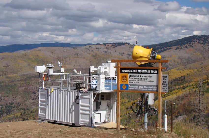
AMF Deployments Timeline
Since 2005, ARM’s mobile facilities have traveled to every continent in their 22 deployments. Consisting of several
portable shelters, a baseline suite of instruments, communications, and data systems, these facilities explore research
questions beyond those addressed by ARM’s fixed atmospheric observatories.
For more information, visit the AMF observatory web page at https://www.arm.gov/capabilities/observatories/amf.
PYE M1 HFE M1 PGH M1 MAO M1 COR M1
United States CHINA INDIA BRAZIL ARGENTINA
NIM M1 GRW M1 PVC M1 ASI M1 ANX M1
NIGER PORTUGAL United States ATLANTIC OCEAN NORWAY
FKB M1 IAH M1
GERMANY United States
SBS M2 MAG M2 ACX M2 MAR M2
United States PACIFIC OCEAN PACIFIC OCEAN SOUTHERN OCEAN
GAN M2 TMP M2 AWR M2 MOS M2
MALDIVES FINLAND ANTARCTICA ARCTIC OCEAN
OLI M3
United States
2005 2007 2009 2011 2012 2013 2014 2015 2016 2017 2018 2021 2022
2010 2020
4April 2019
addition, the fixed Eastern North Atlantic (ENA) site on
Graciosa Island in the Azores archipelago has, since 2015,
provided a continuous, comprehensive suite of cloud,
aerosol, and precipitation measurements in a remote marine
environment. These investments are providing key data sets
to improve large-scale weather and climate models, but a
number of marine regimes remain under-sampled. This is
unsurprising; despite compelling scientific motivations for
studying marine regions, the logistical hurdles are typically
larger than for land-based deployments.
Science Questions
Remaining scientific foci appropriate for marine regions/
regimes include the following:
• Processes that drive spatial and temporal transitions in
marine boundary-layer clouds are both poorly understood
and poorly represented in large-scale models. Numerous
questions remain regarding factors controlling the
stratocumulus-to-cumulus (Sc-Cu) transition in the
subtropics/tropics. How important is precipitation
in driving the Sc-Cu transition? Can the transition
be modulated by differences in aerosol loading? The
Sc-Cu transition over the northeast Pacific was sampled
During approximately 25 round trips between Los Angeles,
California, and Honolulu, Hawaii, AMF2 obtained continuous
with the Marine ARM GPCI Investigations of Clouds
on-board measurements of cloud and precipitation, aerosols, (MAGIC) AMF deployment on a cargo ship, but this
and atmospheric radiation; surface meteorological and ocean- transition differs somewhat from the other subtropical
ographic variables; and atmospheric profiles from weather
balloons launched every six hours. ocean regions. Similar transitions also occur at higher
latitudes as part of synoptic disturbances or moisture
In subtropical regions, climate models tend to produce intrusions (e.g., transitions from shallow, overcast
marine low clouds that are insufficient in coverage but are conditions to deeper open cell convection in cold
too optically thick (the “too few, too bright” problem).
air outbreaks).
In the tropics, climate models tend to produce too much
precipitation, do not adequately capture existing east-west • The tropical trade wind cumulus regime has been poorly
precipitation gradients, and distribute tropical precipitation sampled and remains a persistent source of disagreement
too evenly about the equator (the double ITCZ problem). across global climate models (GCMs). How does the
In high latitudes, models struggle to faithfully represent large-scale environment (profiles of temperature,
shallow cloud transitions. Model representation of the ice moisture, and vertical motion) determine cloud cover
versus liquid phase is also an issue in the high latitudes; and thickness? What is the role of precipitation?
this section only focuses on liquid-only clouds.
• Factors controlling aerosol budgets in remote marine
There is a great need for surface and in situ observations regions are not well understood, and observations
of clouds, aerosols, and precipitation in marine regions, show that the strength of aerosol-cloud interactions
but logistical and measurement challenges mean that varies with marine region. What are the relative roles
such observations are mostly restricted to relatively short of long-range transport of aerosol, local production
campaigns with research vessels and/or aircraft. In the past from ocean surface emissions, and cloud (coalescence)
decade, ARM has made important investments to provide processing in determining the local aerosol budget in
surface-based AMF observations in marine settings. In marine environments?
5ARM Mobile Facility Workshop Report
The Measurements of Aerosols, Radiation, and Clouds over the Southern Ocean (MARCUS) field campaign, which took place from October
2017 to April 2018, used AMF2 instruments to capture the variability in aerosol and cloud properties across the Southern Ocean between
Tasmania and Antarctica from spring to autumn.
• Most ESMs still do not represent realistic magnitudes and • Stratocumulus clouds are still a source of substantial
locations of tropical oceanic precipitation. The inflow radiation biases in large-scale models and uncertainties in
region into the intertropical convergence zones (ITCZs) the climate sensitivity associated with these clouds remain.
has not been systematically observed over the full seasonal While ARM has a long-time record from the ENA site, the
cycle, nor has the ITCZ itself. other large stratocumulus decks (northeast Pacific, southeast
Pacific and Atlantic, southeast Indian Ocean), along with
• How do the thermodynamic, radiative, and cloud
their unique aerosol environments, remain vastly under
and precipitation properties vary across the ITCZ
sampled. What are the fundamental differences in cloud
as it moves seasonally?
properties and aerosol-cloud-precipitation interactions
• Models continue to struggle with representing transitions across the different marine stratocumulus regions?
from shallow to deep convection at multiple scales (from
diurnal up to the deepening of clouds as part of the Deployment Strategies
45- to 60-day Madden-Julian Oscillation [MJO]),
Marine environments are particularly difficult to sample. A
as well as credible populations of low, congestus,
perennial question is whether AMFs deployed to island and
and deep clouds. Too few systematic observations
coastal sites accurately sample the remote marine environment
exist documenting transitions from shallow to deep
or whether there are data severely influenced by land artifacts?
convection. What is the relative importance of large-
The answer to this question likely depends upon the particular
scale external meteorology versus internal cloud-
observation. While it is known that surface fluxes from island
controlled processes (e.g., cold pools, self-aggregation) sites are not representative of the surrounding open ocean, it
in driving or suppressing transitions? is possible that clouds and precipitation may be less affected.
6April 2019
Measurements from ships or buoys upwind of island sites new data assimilation approaches can be applied to improve
can help provide surface fluxes that are representative of the subsidence estimates. Closer coordination with National
open ocean. Aeronautics and Space Administration (NASA) satellite
programs may also be useful.
An additional question is whether information from an AMF
deployment at a single location is sufficient. Again, the
Deployment Duration Considerations
answer is likely observation-dependent. The characterization
of precipitation over a larger range than is available to DOE Regions/regimes with more homogeneous clouds (e.g.,
scanning precipitation radars is helpful for understanding shallow near-coastal subtropical marine stratus/stratocumulus)
the corresponding cloud mesoscale organization. ARM’s can be sampled over shorter durations, but deployments
scanning X- and C-band precipitation radars (XSAPR/ targeting regimes with greater underlying synoptic variability,
CSAPR) can be used in conjunction with existing non-DOE or sampling phenomena characterized by a relatively small
precipitation radar networks to provide additional range for number of episodic “extreme” events (e.g., deep convection),
studying large mesoscale convective systems. Constraining will require longer time frames. Regimes with strong inter-
the large-scale vertical motion field is crucial for most annual variability (e.g., high latitudes; regions affected by the
modeling studies but remains a stubborn problem. A widely El Niño-Southern Oscillation [ENSO]) will require longer-
used approach is to employ sounding networks, but this term deployments to provide adequate statistical sampling.
requires three to five sites. Another approach is to construct
a circle of dropsondes around a particular ground-based site. Potential Deployment Locations
Coordination with interagency and international partners
Marine regions include a wide range of meteorological,
can increase the effectiveness of an AMF deployment by
cloud, and aerosol conditions, and there are numerous
supporting multi-site deployments, other research aircraft,
suggestions for locations where new AMF deployments can
unmanned aerial systems (UAS), tethered balloons, and
provide important data in previously under-sampled marine
research vessels. As atmospheric reanalyses improve, perhaps
environments. These include:
LEGEND
ARM Observatory
AMF Deployment
Ship Deployment
Aerial Deployment
Site Suggestion
Marine Regime
ARM observatories and mobile facilities have sampled, or will sample, many marine regimes, such as subtropical stratocumulus, trade
cumulus/shallow convection, summertime midlatitude low clouds, shallow-to-deep convection transition, and polar-north Atlantic con-
nectivity (referenced in the dashed circles). Workshop participants provided suggested locations for future deployments or observatories
indicated by the yellow dots.
7ARM Mobile Facility Workshop Report
• Trade wind cumulus regime – The trade wind cumulus • Western continental coasts – The shallow subtropical
regime could be effectively sampled at Barbados, southern stratocumulus regime off the western continental coasts
Florida, Kwajalein Atoll, or Reunion/Madagascar. could be sampled using measurements from an island site
Hawaii is situated in a good location, but the high terrain (e.g., San Felix west of Chile, San Nicholas in the U.S.
of the islands likely represents a significant challenge. Channel Islands, St. Helena in the southeast Atlantic, or
from a dedicated barge/ship).
• Shallow-to-deep convection transition – Kwajalein
Atoll is a good location to sample the shallow-to-deep
convection transition. Existing infrastructure includes a Modeling Impacts
National Weather Service (NWS) S-band precipitation Marine regimes continue to challenge ESMs. Shallow
radar. Other potential sites to sample deep convection stratocumulus-topped PBLs just off the west coasts of
and/or the transition between shallow and deep continents remain a major source of bias in the simulation
convection include Guam, and perhaps the Galapagos. of the radiative budget in ESMs. Additional observations
in these regions would be highly valuable. ESM biases stem
• Mid-latitude oceans – Summertime mid-latitude oceans
both from uncertainties in individual parameterizations
have the highest coverage of marine low clouds anywhere. (e.g., microphysics, turbulent mixing), and from the
This regime could be sampled at the Aleutian Islands interplay between the different parameterizations that must
(52 to 55°N), with the opportunity to sample downwind work together to produce a realistic representation of clouds
of major east Asian aerosol sources. In the Atlantic, open (e.g., cloud overlap assumptions used by the radiation
ocean extends further poleward, offering the potential for parameterizations).
sampling marine regimes straddling the mid-latitudes and
Arctic. The high-latitude Atlantic is particularly relevant A good representation of mixing between clouds and clear
given the secular trend toward less sea-ice coverage. Cold air (both at cloud top for stratocumulus and laterally for
air outbreaks, warm advection stratus, and poorly sampled cumulus) is critical for accurately representing the cloud
mixed-phase cloud regimes would complement/extend climatology and transitions between regimes. Turbulent
existing AMF deployments such as Measurements of entrainment is not explicitly represented in large-scale
Aerosols, Radiation, and Clouds over the Southern models, and boundary-layer parameterizations need to be
Ocean (MARCUS) and Cold-Air Outbreaks in the tuned using estimates of entrainment from a combination
of robust observations and high-resolution large-eddy
Marine Boundary Layer Experiment (COMBLE).
simulation (LES) model output. New remote-sensing
• Marine shipping effects – Shipping lanes present another measurements of turbulent processes (e.g., Doppler lidar and
deployment opportunity because marine shipping radar) will help constrain entrainment parameterizations and
currently uses sulfur-rich fuel whose combustion emits mass-flux closure assumptions necessary in parameterizations
high quantities of sulfur dioxide (SO2), an aerosol of shallow and deep convection. LES model domains can
precursor gas. Although individual ship tracks are readily be nested within regional models, allowing for explicit
detected under conditions of very shallow, stratocumulus- representation of turbulent mixing processes and resulting
topped planetary boundary layers (PBLs), evidence for cloud structure that can be compared directly with
time-aggregated signals of shipping lanes on marine low observations. This modeling hierarchy can then be used
cloud fields has not yet been clearly observed. Regular to develop improved physical parameterizations for use
ship traverses of a major shipping lane could be in large-scale models. There is an opportunity to adapt
conducted if a suitable cargo ship can be identified. systematic modeling approaches (e.g., LASSO) to marine
The International Maritime Organization low-sulfur regions, although large domains may be necessary to
regulation requires shipping companies to reduce their capture known scales of mesoscale variability and to better
sulfur emissions by 85% by the year 2020, making the understand island effects. Different modeling constructs can
also be considered (e.g., doubly periodic versus constructs
next few years one of significant shipping emissions
that allow for inhomogeneous surface forcings and spatially
changes with potential implications for aerosol-
asymmetric large-scale forcings).
cloud interactions.
8April 2019
symmetric about the equator (the double ITCZ problem).
In addition to constraining model forcings, extensive ARM
observations are obviously important for model-observational
comparisons. One important consideration is to involve the
modeling community as early as is feasible, perhaps through
advertising a dedicated webinar as soon as a deployment is
approved, and/or through developing preliminary VAPs that
can be readily compared to model quantities.
Potential Collaborations
Synergies with other agencies that focus upon making
Annual mean emissions are shown here of sulfur dioxide, a key
aerosol precursor gas, from commercial shipping. Commercial both intensive and longer-term atmospheric measurements
shipping is a key, but highly spatially heterogeneous and in the marine environment (e.g., NOAA, National Science
uncertain, contributor to the marine boundary-layer aerosol
Foundation [NSF], and NASA within the United States)
budget. Ship emissions lead to more numerous cloud droplet
concentrations, smaller droplet sizes, and brighter clouds. Image could be leveraged to augment the observational capabilities
credit: Michael Diamond (U. Washington) based on data from the of the mobile facilities. NASA satellite observations provide
Emissions Database for Global Atmospheric Research (EDGAR).
regional context for AMF deployments, but also benefit
from validation opportunities that can be provided by the
Aerosol-cloud interactions remain poorly represented
AMF observations. NOAA conducts many observations
in large-scale models (e.g., a consensus is emerging
focused on air-sea interactions using research ships and buoys
that the modeled aerosol indirect effect is too strong).
and is testing new autonomous marine research platforms
Model experiments suggest that accurately representing
that could be leveraged to design new marine measurement
the susceptibility of precipitation to increasing aerosol
configurations. Because most of the potential marine sites
may be a key target. AMF deployments are uniquely
would involve basing the AMF in a foreign country, it will
positioned to provide both the detailed and statistically
be important to engage the scientific organizations within
robust observations needed to quantify this sensitivity in
the host countries to ensure the most fruitful collaborations.
marine environments. Even in highly resolved models with
bin microphysics, there is major disagreement regarding
precipitation formation, sedimentation, and evaporation, Southeastern United States
and AMF observations can help provide constraints on
The southeast United States is a warm and humid region
these processes. Aerosol long-range transport and removal
with abundant atmospheric convection nearly year-round,
processes must now be represented accurately in global
but most prominently in the summer season. Two regimes
aerosol ESMs, but model experiments show major sensitivity
of convection are dominant, namely, a continental inland
of aerosol loadings to model resolution in long-range aerosol
regime and a coastal sea breeze regime. For both regimes, the
transport, and to precipitation formation processes.
convection is strongly influenced by the surface and is paced
Challenges for using observations to constrain models by the diurnal cycle of solar heating. Atmospheric convection
in marine regions include how to develop a forcing data over the southeast United States contrasts with that over the
set for shallow marine convection—in particular, how to ARM SGP atmospheric observatory in Oklahoma: the warm
constrain the large-scale advective tendencies and large- season in the southeast has significantly more moisture and
scale vertical motion. It is possible that UAS or tethered more frequent surface-forced shallow and deep convection.
balloon systems could be used to provide thermodynamic Although much of the deep convection is unorganized,
profiles around ship and island sites. Further emphasis on organized deep convection (e.g., mesoscale convective systems)
improved data assimilation of AMF observations, together occurs year-round under different forcings. Because of the
with Cloud-Associated Parameterizations Testbed (CAPT) strong coupling of convection with the surface, the southeast
experiments (climate models run in forecast mode), will United States is also a good location to study atmospheric
be useful to identify the model processes contributing to convection and the effects of variations in land-surface
model biases such as, e.g., tropical precipitation that is too properties or emissions of aerosols and their precursors.
9ARM Mobile Facility Workshop Report
• Southeast United States has a large amount of biogenic
emissions of organic compounds that form secondary
organic aerosols as well as the emissions from scattered
cities. How large are the radiative impacts of these natural
occurring aerosols in comparison to those produced by
the cities and what role might they have played in the
relative coolness of the southeast United States in recent
decades? How do the naturally produced aerosols interact
with the urban emissions? How do the properties of
shallow or deep convection and its precipitation vary with
changes in the aerosol population over the seasonal cycle
or between urban and rural regions?
Atmospheric convection over the southeast United States contrasts
with that over the ARM Southern Great Plains atmospheric observa-
tory in Oklahoma. As such, there is a need to study this region with
Deployment Strategies
potential comparisons to ARM’s largest fixed site.
The measurement of atmospheric convection and its
properties would be central to any deployment in the
Science Questions southeast United States. This requires vertical profiling
• For the continental inland regime, the typical cloud life measurements such as those given by sensitive cloud
cycle features morning shallow convection transitioning radars for cloud vertical extent and microphysics, and
to afternoon deep convection that produces precipitation wind profilers and Doppler lidars for vertical velocities
and cold pools with subsequent dissipation after sunset. within and beneath convective clouds. For the important
How do the properties of shallow and deep convection, vertical profiles of temperature and especially water vapor,
including vertical extent, amount, vertical velocities, and continuous high-quality remote-sensing measurements
water content, vary with ambient conditions? How does are needed to fill in the time intervals between radiosonde
deep convection form from shallow convection? How do launches. Characterization of aerosols at the surface and
the properties of downdrafts and cold pools relate to aloft should be done. An important goal would be the
measurement of the three-dimensional structure of deep
those of the deep convection?
convection through its life cycle, and such measurements
• For the coastal sea breeze regime, convection follows a may be possible from scanning cm-wavelength radars or
similar diurnal cycle but with the intensity of deep Doppler lidars. AMF scanning radars could provide extra
convection enhanced by the sea breeze circulation. How detail to the precipitation field beyond that available from
do the properties of deep convection vary with aspects of the operational radar networks.
the sea breeze circulation such as the circulation strength,
Spatially distributed measurements are required for several
and moisture content of the imported oceanic air, and
purposes including measuring the mesoscale circulation
sensible heat flux over land?
forming and produced by deep convection (e.g., initial
• Land surface over the southeast United States differs circulations and cold pools) and measuring variations in the
markedly from the SGP with a greater amount of characteristics of land surface and aerosols. Surface state and
woodland/forests and reduced amount of grasslands. flux measurements could be made over both the agricultural
How are the properties of the shallow and deep land and woodland/forests and it would be worthwhile to
convection affected by variations in the sensible and characterize variations in aerosols between urban and rural
latent heat flux with different land-surface types (e.g., regions. Occasional in situ measurements by aircraft or
woodland/forests versus agricultural land) or seasonally as tethered balloons in the boundary layer and in shallow
the vegetation grows and dies? Does deep convection convection could also provide valuable information about
preferentially develop over the agricultural regions with horizontal variations of clouds, aerosols, and atmospheric state,
its enhanced sensible heat flux relative to the surrounding particularly in environments surrounding deep convection.
woodland/forests?
10cold air deep
outbreak convection
t
ron
ic f
opt
se a
April 2019
syn
bre
eze
17 17
JanJan
2018: synoptic front, cold airair
outbreak 2 2July
July2018:
2018:deep
deepunorganized
unorganizedconvection,
convection, sea
sea breeze
breeze
2018: synoptic front, cold outbreak 10 Oct 2018: hurricane rainbands 28 Dec 2018: organized convection
cold airair deep
deep organized
cold
outbreak convection
convection convection
outbreak
ic f t
t
opt fron
hurricane
ron
rainbands
synoptic
sseea
ab
syn
brreee
ezzee
10 10
OctOct 2018:
2018: hurricane
hurricane rainbands
rainbands 2828Dec
Dec2018:
2018:organized
organizedconvection
convection
Examples of cloud and precipitation processes in the southeast United States from Moderate Resolution Imaging Spectroradiometer
(MODIS) satellite images. Cloud map images courtesy of National Aeronautics and Space Administration.
Site selection would need to be carefully tailored to the science
organized
which are strong in this region in the cold season but
organized
goals. A campaign in
hurricane
hurricane
the coastal environment would
convection
convection require would also be expected to have impacts on the condition
rainbands
careful consideration of the spatio-temporal evolution of
rainbands of summertime vegetation.
the sea breeze and its associated convection to decide where
to place an AMF site(s). A campaign interested in detecting Modeling Impacts
the effect of the land-surface type on convection may want
Observations collected in the southeast United States
to identify locales where the patch sizes of agricultural or
could be very helpful in addressing problems ESMs have
forests are large enough to significantly impact atmospheric
modeling the evolution of convection over land, including
convection. Unless it were part of a project’s science goals,
the competition between shallow and deep convection.
locales within significant orography (e.g., the Appalachian
ESMs typically produce precipitation near noon instead of
Mountains) should be avoided. Satellite studies may assist
nearer sunset as observed. This reflects that ESMs activate
in identifying preferred locations for observing convection
their deep convection too easily and do not simulate a long
in both the continental inland regime and coastal sea breeze
enough period of shallow convection. Observations of the
regime. If the science goal is to determine the impact of
life cycle of convective cloud populations over land could
aerosols on clouds and convection, a site should be selected
identify the necessary roles for mesoscale circulations in
downwind of a moderate size city (i.e., not as large as
forming deep convection and the resulting cold pools in
Atlanta or Houston) in order to have a well-identified
forming new convection or reducing shallow convection
aerosol source that is distinct from the surrounding region.
and provide insights necessary for their parameterization.
A deployment in the coastal sea breeze regime must have
The insights for modeling gathered from the continental
flexibility for rapid evacuation in the case of a hurricane.
inland regime are expected to have wide applicability to the
The frequent occurrence of shallow-to-deep convection simulation of convective processes over warm-season land
transitions during the warm season means developing good areas globally for the regimes where convection processes
statistics may be achievable with observations over a single are only parameterized. However, as the resolution of
extended warm season. This is particularly true for the ESMs increases, the sea breeze circulations will begin to be
coastal sea breeze regime, where the locations of deep resolved and observations of convection in this regime may
convection are more fixed. For the continental inland also provide important insights relevant to the modeling of
regime, while shallow convection would be amply observed coastal sea breeze regimes globally. Observations collected in
from any site, a longer period of observations (say two warm the southeast United States would also aid in the improved
seasons) would help in collecting a set of cases with deep modeling of land-atmosphere interactions, biogenic aerosols,
convection, due to the more scattered occurrence of deep and aerosol-convective cloud interactions. In particular,
convection in this regime. A longer period of observations the treatment of secondary organic aerosols and aerosol
would help to tease out more secondary effects such as the life cycle in general is highly suspect in ESMs. With its
influence of aerosols on convective cloud properties. A large amounts of biogenic emissions, the southeast United
multi-year campaign would lower the risk of observing States would be a great area for testing and developing new
inter-annual variability from El Niño teleconnections, parameterizations of secondary organic aerosols.
11You can also read