Burn SMART A planned burning guide for small landholders - DFES recommends managing your fuel loads to help protect your property from bushfire.
←
→
Page content transcription
If your browser does not render page correctly, please read the page content below
Burn SMART
A planned burning guide
for small landholders
DFES recommends managing your fuel loads to help protect
your property from bushfire.
Produced and published by:                           Disclaimer
Bushfire Centre of Excellence, Department of Fire    The information contained in this publication is
and Emergency Services.                              provided by the Bushfire Centre of Excellence,
                                                     Department of Fire and Emergency Services
Content provided by Bushfire Technical Services,
                                                     voluntarily as a public service. This document
Rural Fire Division, Department of Fire and
                                                     has been prepared in good faith and is derived
Emergency Services.
                                                     from sources believed to be reliable and accurate
April 2021                                           at the time of publication. Nevertheless, the
                                                     reliability and accuracy of the information
                                                     cannot be guaranteed and the Bushfire Centre
© Bushfire Centre of Excellence, Department
                                                     of Excellence expressly disclaims liability for
of Fire and Emergency Services 2021
                                                     any act or omission done or not done in reliance
                                                     on the information and for any consequences,
Other than permitted under the Copyright             whether direct or indirect, arising from such
Act 1968, no part of this publication may be         act or omission. This publication is intended to
reproduced by any means without written              be a guide only and readers should obtain their
permission of the Bushfire Centre of Excellence,     own independent advice and make their own
Department of Fire and Emergency Services of         necessary inquiries.
Western Australia.
                                                     Burn SMART – A planned burning guide for small
Enquiries should be addressed to:                    landholders replaces the Winter Burning Guide
Bushfire Centre of Excellence                        published in 2015.
Department of Fire and Emergency Services
PO Box P1174
Perth WA 6844
Web: dfes.wa.gov.au/plannedburning
Email: BushfireCoE@dfes.wa.gov.au
Wherever a third party holds copyright in material
presented in this publication, the copyright
remains with that party. Their permission may be
required to use the material.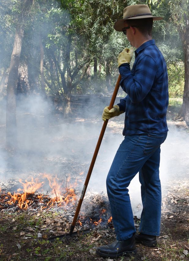
Contents

About this guide                              4
Legal requirements                            5
Planned burning explained                     5
Why planned burning is done                   5
Understanding fire behaviour                  6
Factor 1: Fuel                                 6
   — Fuel loads                                6
   — Fuel layers                               7
   — Fuel moisture                            8
Factor 2: Topography                          10
Factor 3: Weather                             11
Planning and conducting your burn             12
Stage 1: Develop a fuel management strategy   12
Stage 2: Prepare your burn patch              14
Stage 3: Before the burn                      15
Stage 4: Day of the burn                      16
Stage 5: During the burn                      17
Stage 6: After the burn                       18
Burn SMART checklist                          19
Recommended burn intervals                    22
Useful resources                              23
About this guide
                                           Jurien Bay
                                                                                       KEY
This guide is for you if:                                                                 Swan Coastal Plain
                                                               Moora                      Jarrah Forest
• You are a small landholder with a                                                       Warren
  property under 2 hectares in size              Lancelin
                                                                                          Darling Scarp
  (1 hectare = 10,000 m2)                                                                 CITY
                                                             Gingin
• You live in the Swan Coastal                          Yanchep       Toodyay
                                                                                          Town

  Plain, Jarrah Forest or Warren                              Bullsbrook

  Biogeographic regions                                            Mundaring
                                                             PERTH
• You want to conduct a planned
  burn of the surface fuels on                           MANDURAH
  your property in areas of forest,                          Pinjarra
  woodland or tall shrubland                                  Waroona
                                                                               Williams
                                                             Harvey
The principles outlined in this guide
                                                        BUNBURY
can also be applied in other areas of                              Collie
Western Australia. Be sure to research                      Donnybrook
recommended burn intervals relevant               BUSSELTON
to your local vegetation.                   Margaret River        Bridgetown

We strongly recommend you consult            Augusta              Manjimup
your local government for additional
                                                                                                 Mount Barker
information and advice.
                                                                             Walpole             ALBANY

                                         Image: The biogeographic regions of Western
                                         Australia covered within this planned burning guide.

                                         You may have heard of hazard or fuel
                                         reduction burns, burn offs, prescribed
                                         burns and controlled burns. These are
                                         all names for planned burns.

                                         Burn SMART: A planned burning guide for small landholders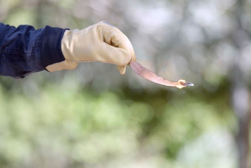
Legal requirements
Under the Bush Fires Act 1954, local governments may issue notices that require landholders or
occupiers of land to install and maintain firebreaks and reduce fuel areas around their boundaries and
assets. This is to help prevent the start or spread of a bushfire. The requirements of these firebreak or
hazard reduction notices vary depending on the size and location of the property. Landholders must
manage their fuels according to the notice issued by their local government.
Local governments administer the periods of restricted, prohibited and unrestricted burning for
specific times of the year. During the restricted period, a burn permit must be obtained prior to any
burning taking place. No burning should be conducted by private landholders during the prohibited
period unless permitted as per the provisions of the Bush Fires Act 1954. Local governments also
declare harvest and vehicle movement bans which will affect burning. Planned burning may also
be prohibited due to environmental health regulations. Local governments are the best source of
information about such conditions in the local area.
The Department of Fire and Emergency Services (DFES) may declare a Total Fire Ban (TFB) for various
local government areas, which prohibits the lighting of any fires in the open air and any other activities
that may start a fire. TFBs are announced the day before (usually in the afternoon), or on the morning of
the actual day. TFBs usually start at midnight and last for 24 hours. Fire Danger Ratings (FDR) can also
override permits and burning periods. Visit emergency.wa.gov.au for TFB declarations and FDRs.

Planned burning explained
Planned burning is the deliberate burning of a pre-determined area under the right environmental
conditions to reduce fuel loads. Planned burns are done under mild and stable weather conditions so
that the fire burns slowly and with low flame heights.
Planned burning is just one of several methods used to reduce fuel loads. Other methods include
raking, slashing, ploughing and weed control.
When combined, these methods can:
• Maximise the effectiveness of your fuel management
• Reduce the impact of bushfire
• Assist in protecting life and property

Why planned burning is done
Done properly, planned burning is an efficient way to remove the build-up of fuel over larger areas of
land where other methods are too labour intensive. Used appropriately, a planned burn not only helps
to safeguard lives and property in the event of a bushfire, but generally results in less environmental
disturbance than other methods, benefiting many native plants and animals.

                                                                                                            5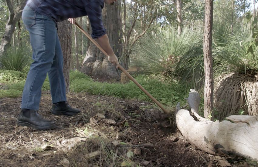
Understanding fire W E AT H E R
behaviour
Understanding how a fire behaves is vital when
preparing and executing a planned burn. Fire
behaviour refers to the intensity (heat), speed and
spread of a bushfire or planned burn.
HY
Fire behaviour is largely influenced by three factors:
AP
F
GR
U
• The fuel available to burn
E
PO
• The topography (or terrain) of the area
L
TO
• Prevailing weather conditions
The following pages explore how each of these
factors affects fire behaviour. Image: The fire behaviour triangle.
Factor 1: Fuel
Fuel is the vegetation and dead plant material that can burn in a fire. The type of fuel, the quantity of
fuel (total fuel loads), how the fuel is arranged (fuel layers), and its condition (fuel moisture) are the
most important characteristics of fuel to consider when planning a burn.
Fuel loads
Total fuel loads consist of two types of fuels, shown in the table below.
Types of fuels
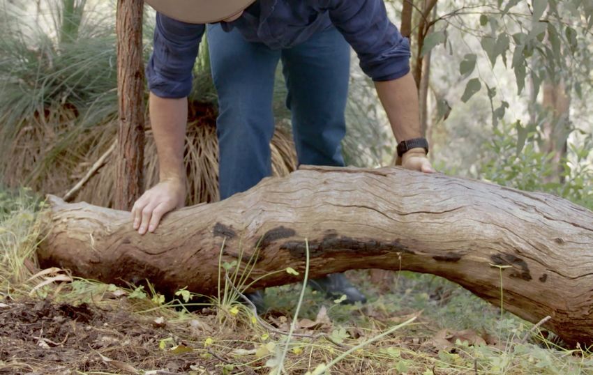
Coarse fuels Fine fuels
Describes fallen branches and logs Describes leaves, twigs and bark and are split into two
categories
Dead vegetation Live vegetation
Less than 6 mm in thickness Less than 3 mm in thickness
Of the two types of fuel loads, fine fuels have the greatest influence on fire behaviour.
Fine fuels ignite and burn more readily than coarse fuels.
Your planned burn will primarily target fine fuels at the surface and near surface layers.
Burn SMART A planned burning guide for small landholders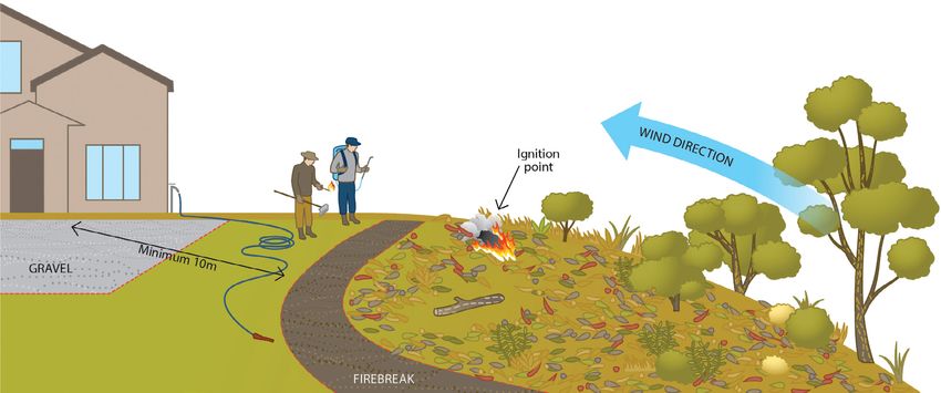
Fuel layers
Fuel accumulates in ‘layers’, depending on its height above the ground. The following are the important
fuel layers to consider when planning a burn.

  Fuel layers

                     Commonly called litter layer, these fuels are made up of leaves, twigs, bark and other
 Surface
                     fine fuel lying on the ground.

 Near                Consisting of live and dead fuel, these fuels include grass, low shrubs and suspended
 surface             leaves, twigs or bark. These effectively touch the ground, but don’t lie on it.

                     The bark on tree trunks and branches from ground to canopy. These can be a source of
 Bark                embers. Embers are burning leaves, twigs, bark and other debris carried in air heated
                     by the fire and the wind.

                     Fine fuels supported above the ground, including the foliage of taller shrubs, creepers
 Elevated            and lower branches up to 2 metres in height. As these fuels are well-aerated, they can
                     contribute to an increase in fire intensity and rate of spread.

                                                                                            Bark
 Elevated fuel

 Near surface fuel

 Surface fuel

Image: Fuel layers and bark.

Different vegetation types have different fuel characteristics.
Shrublands and woodlands with low tree cover usually have patchy surface fuels.
Forests usually have a deeper and more continuous surface layer of leaf litter.

                                                                                                               7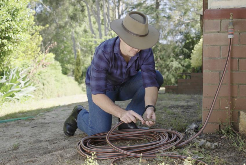
Fuel moisture
Fuel moisture affects how easily fuel will ignite and how much will burn. Fuel that is too moist won’t
burn. Fuel that is too dry will burn too easily and may escape to become a bushfire. It is vital you test
the moisture content of fuel within the burn area before starting a planned burn. The best way to do
this is to use the leaf moisture method.
Leaf moisture method
The aim is to discover the angle at which a small flame either goes out or flares up. Be sure to
test dead leaf samples from areas with different vegetation types and where fuel is in direct
light and shade.
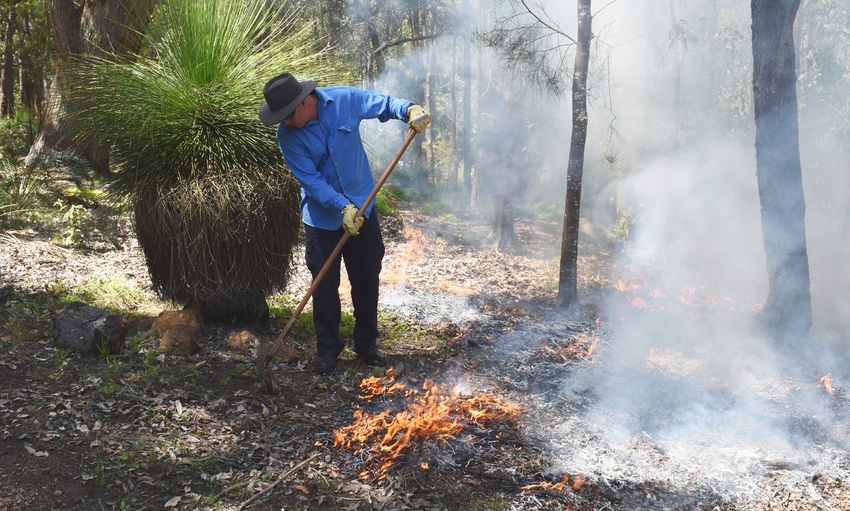
1. Select dead leaves 2. Find a safe place 3. Light the leaf 4. Test new locations
Take dead leaves from Move to a place that Light the end of the Check if moisture
the top and bottom of is sheltered from wind first dead leaf and levels vary across the
the litter layer. and away from fuels. watch how it burns. burn area by testing in
other locations.
Burn SMART A planned burning guide for small landholders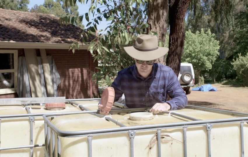
Understanding the results
How quickly and intensely a dead leaf sample burns offers a strong indication of its moisture level.
This is valuable to consider when judging the potential success of a planned burn. Use these markers
as a guide.

        Wet                Damp                  Moist                 Dry               Very dry

 Leaf burns only      Leaf burns when      Leaf burns when      Leaf burns when      Leaf burns when
 when pointed         angled down but      level but not        angled up, but       angled straight
 straight down        not when level       when angled up       not if vertical      up
 or does not burn
 at all
                      If the leaf          If the leaf          If the leaf          The fuel is too
 If in the area to    sample               sample               sample               dry to burn
 be burnt, the fuel   is from the:         is from the:         is from the:
 is too moist to
                      Top layer            Top layer            Top layer
 burn
                      The fire will burn   The fire will burn   The fire will burn
                      slowly               at the upper         at too high an
                                           level of intensity   intensity for a
                                           for a burn           burn

                      Bottom layer         Bottom layer         Bottom layer
                      The fuel             The fuel             The fuel is too
                      moisture             moisture             dry to perform a
                      is okay              is okay              burn

                      Fires with damp
                      fuels tend to
                      need the wind
                      and/or a slope to
                      spread

                                           Recommendations

 Postpone             Proceed with         Proceed with         Do not proceed       Do not proceed
 planned burn         planned burn         planned burn,        with planned         with planned
 until moisture                            but exercise         burn                 burn
 levels drop                               caution

                                                                                                       9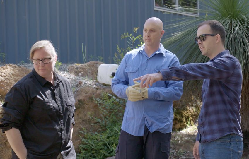
Factor 2: Topography
Topography describes the physical features of a landscape, including the slope and aspect. Both slope
and aspect can influence how a fire behaves.

Slopes
Fires burning on slopes will behave differently from those on level ground. It is important to consider
the slope in your burn area.

Upslope considerations
 • Fires burn more rapidly when moving up a slope
 • Winds may move more rapidly upslope, increasing the speed at which a fire can spread
 • For every 10 degree increase in uphill slope, a fire will double its speed and intensity

Downslope considerations
 • Fires tend to travel at slower speeds and be less intense as they move downhill

When undertaking a planned burn, fires should ideally be lit at the top of a slope to burn downwards
and against the wind.

Image: Graphic of a planned burn started at the top of a slope and burning downwards against the wind.

Aspect
Aspect is the direction the landscape faces.
In Western Australia, northern and western
aspects are exposed to more sun, making
fuels drier and more readily burnt than those
facing south or east.

                                                           Image: Graphic representation of a northern and
                                                           southern aspect in Western Australia.

Burn SMART A planned burning guide for small landholders
Factor 3: Weather
Wind speed, wind direction and humidity are the main weather factors that affect fire behaviour.
Knowing what the weather is likely to do in your region can help you predict the direction in which the
fire will burn, and where the smoke will blow on the day of your burn.
Before you conduct a planned burn, it is important you:
• Check your local weather forecast at bom.gov.au/places/wa
• Check wind speed and direction and relative humidity in the days before, during and after the burn
On the day of the burn, it is important you:
• Recheck local weather conditions at bom.gov.au/places/wa
• Visually assess wind speed using the Beaufort Scale (see below)
Planned burns are recommended when:
• Wind speeds are between 5 and 20 kilometres per hour
• The air is cool and moist (greater than or equal to 40% relative humidity)
Planned burns are not recommended if:
• The wind speed is greater than 20 kilometres per hour
• Too much wind may make it hard to control the burn, increasing the likelihood of the fire escaping
Exercise caution with planned burns if:
• There is too little wind and fuel is too moist to burn
• On still days fires may not spread, wind direction can be variable and smoke may linger
It is important to note:
• Surface wind speeds at the burn site will be affected by the density of tree canopy cover
• Surface wind speeds may be lower in a forest where there is dense tree canopy cover
• Areas of tall shrubland or woodland that have low tree canopy cover might experience variable winds
Beaufort Scale
Description Average wind Estimating speed over land
speed (km/h)
Calm Less than 1 Calm smoke rises vertically.
Direction of wind shown by smoke drift. Wind does not
Light air 1 -5
move wind vanes.
Wind felt on face, leaves rustle. Ordinary wind vane
Light breeze 6 -11
moved by wind.
Leaves and small twigs in constant motion. Wind
Gentle breeze 12 -19
extends light flag.
Moderate breeze 20 -28 Raises dust and loose paper. Small branches moved.
Adapted from: Simpson, G.C., 1926. The velocity equivalents of the Beaufort Scale. Air Ministry Professional Notes, No 44. London
11Planning and conducting your burn
Undertaking a planned burn is a big responsibility. It involves recognising and managing all
associated risks. In the wrong conditions, a planned burn can escape and become an uncontrollable
fire. It is strongly recommended you plan and conduct a burn using these six stages.
Stage 1: Develop a fuel management strategy
A fuel management strategy is a plan to
manage the fuel loads on your property each
year. Part of this strategy may involve a planned
burn in conjunction with other methods such as
raking, slashing, ploughing and weed control.
Developing a burn plan as part of your fuel
management strategy will identify areas
of vegetation that may be burned to ensure
fuel loads are kept low on your property.
The development of a burn plan involves
the following steps:
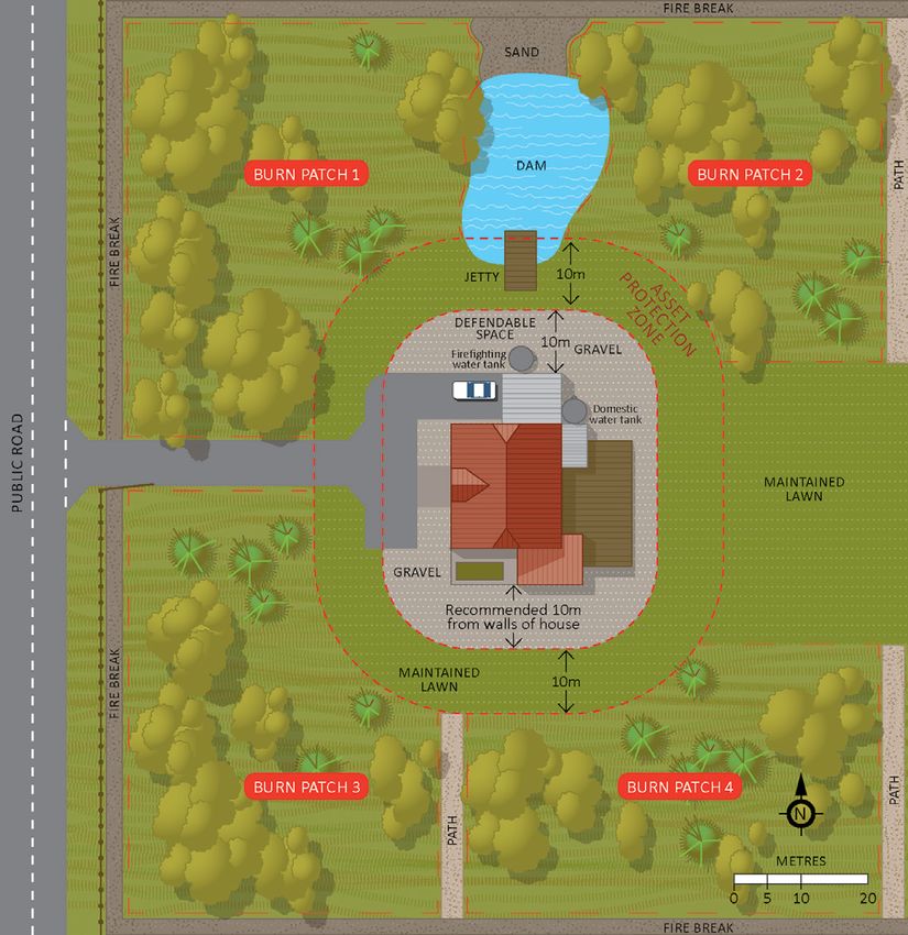
Sketch your property
In your sketch include buildings, driveways,
fences, large trees, water sources and important
things you want to protect from flames, radiant
heat or embers. Your sketch should also include
an Asset Protection Zone, which includes a
minimum 3 metre dependable space. Complete
Image: Example of a property sketch.
your sketch at the back of this guide.
More on Asset Protection Zones
An Asset Protection Zone (APZ) is an area surrounding a building that is managed to reduce
bushfire risk. Included in an APZ is a defendable space. A defendable space is an area adjoining
the asset in which firefighting operations can be undertaken to defend the structure. Vegetation
within this space should be kept at an absolute minimum and free from combustible items and
obstructions.
More information on APZs can be found in the Guidelines for Planning in Bushfire Prone
Areas version 1.3 - appendices on the Department of Planning, Lands and Heritage website
(dplh.wa.gov.au).
Identify burn patches
On your sketch, identify patches that can be burnt individually. Patches should be at least 10 metres
from buildings or other assets. Be sure to include a minimum 1 metre separation from adjoining burn
patches. Separations can include firebreaks, paths, roads, driveways, rock outcrops or any other
landscaping that won’t burn. Other methods, such as raking a pathway through leaf litter, may help
to break up larger patches of vegetation into manageable areas.
Burn SMART A planned burning guide for small landholdersFirebreaks explained
A firebreak is an area clear of inflammable material (e.g. a raked path, a road or driveway) that
separates a burn patch from buildings, sheds, fences and unburnt areas. To learn more about
firebreak requirements, talk to your local government.
Talk with your neighbours
Working with neighbours to coordinate a burn can make it smarter, safer and easier. For example, you
could work with neighbours to mow long grasses and/or construct firebreaks to reduce the risk of a fire
escaping. You may be able to help each other by burning together and sharing resources. Coordinating
a burn with neighbours can also be beneficial if native vegetation is present across several properties.
Stagger your burns
Plan to burn the patches separately over a number of years. Burning one area at a time will ensure that
the burns are of a manageable size. It also ensures that wildlife have refuges in unburnt areas while
burnt areas regenerate.
Consider plant life cycles
Different vegetation types respond differently to fire and may require different intervals
between burning. It may take a number of years for a plant to mature and produce enough seed
to ensure germination after a fire. Consider the life cycles of native plants when planning which
patches to burn.
Some fire-sensitive trees and shrubs should be excluded from burns to maintain their health.
Examples include wandoo, gimlet, mallet, mallee, some acacias and banksias. Page 22 details
the recommended minimum burn intervals for different vegetation types.
Did you know?
When native plants are removed from the environment, they may be replaced by weeds such as
introduced grasses. This may increase the flammability of the vegetation and consequently the
risk of bushfire.
Assess the fuels within each burn patch
Assess the fuels within each burn patch to determine which area you will burn in the first year. Your
property fuel management strategy should prioritise burning areas around the property boundary and
closest to buildings. Once you’ve identified these patches, prioritise those with the highest fuel loads.
Refer to page 22 for the recommended burn intervals for maintaining manageable fuel loads.
13Stage 2: Prepare your burn patch Now that you have identified a patch to burn, it’s time to prepare the area and ensure you have the appropriate permissions, notifications and resources. Check local restrictions Contact your local government for information on burning restrictions in your area. A permit to burn will be required during the restricted burning season. Organise support and nominate roles Organise at least two able-bodied persons to undertake the planned burn. Nominate a person to be responsible for monitoring burn patches in the days following the burn. Create or clear firebreaks Construct new firebreaks using an appropriate tool such as a rake. Remove any leaf litter and regrowth from existing firebreaks. Firebreaks are areas clear of inflammable material and at least 1 metre in width. Protect plants and trees Rake leaf litter away from logs, individual plants and trees to protect them. Test water sources Check that hoses are long enough to reach all points of the burn. If you use tank water, ensure the supply is adequate, remembering that if fire does take hold of heavy fuels, they can take hundreds of litres of water to extinguish. Burn SMART A planned burning guide for small landholders
Stage 3: Before the burn
In the days leading up to a planned burn, be sure
to:

Check when it last rained
It is ideal to burn two days after significant
rainfall (5 millimetres or greater), but no more
than 10 days.
The Bureau of Meteorology has recent historical
data at bom.gov.au/climate/data.

Check your local weather forecast
Visit bom.gov.au/places/wa and check for mild
weather conditions in the days ahead. Do not
conduct a burn if strong winds and dry conditions
are forecast.

Check your equipment
Ensure that all the equipment you’ll need —
metal rake, shovel, hose, water supply etc —
are available and in good working order.

Check your support
Confirm that the people helping you with the
burn are still available. Contact the neighbours
assisting with your burn, if applicable.

Check in with your neighbours
Notify all neighbours (including those separated
by a road, lane or waterway) no less than four
days prior to burning so they don’t mistake your
burn for a bushfire. Notifying them means they
can plan to avoid the smoke if necessary. Out of
courtesy, you may want to remind neighbours on
the day of the burn.

                                                    15
Stage 4: Day of the burn
On the day that you plan to conduct the burn, Register your burn with DFES
you must: Call the DFES Communications Centre on
(08) 9395 9209 to register your burn. This will
Check for fire bans prevent firefighters from being called out if
Visit emergency.wa.gov.au for up to date smoke is reported.
information on Total Fire Ban and Fire Danger
Ratings in your area. Conduct a pre-burn briefing
Gather everyone helping with your burn together
Check for severe weather warnings and cover the following:
Visit bom.gov.au/wa/warnings and check that • What you want to achieve
the Bureau of Meteorology has not issued severe
• How it will be done
weather or strong wind warnings in your area on
the day of or the day after your burn. • What each person’s role will be
For example, winds that proceed a cold front • Hazards to look out for
can produce strong gusts of dry air. • Ensuring escape routes and safety zones are
identified and accessible
Check the sky is clear and not hazy • What to do if something goes wrong, such as
In clear conditions, smoke will disperse more the burn escaping
quickly and is less likely to build up to hazardous
levels. Do not burn if the Bureau of Meteorology Consider what time of the day you
has issued a smoke haze alert for the day of the start your burn
burn (bom.gov.au/wa/warnings), or if there is
A good rule of thumb is to light the burn after the
already significant smoke in the local area.
mid-afternoon, so that the fire is burning during
the time when fuel moisture is rising, not falling.
Check wind and relative humidity
During the day, fuel moisture typically peaks at
Search your location and check local wind speed,
about dawn and is lowest in the mid-afternoon. If
wind direction and relative humidity under
fires are lit too early in the day, by mid-afternoon
Detailed 3-Hourly Forecast at bom.gov.au/places/
the fire may become too intense.
wa. The wind needs to be relatively light (less than
20 kilometres per hour), with relative humidity
greater than or equal to 40%.
Call your local government
Notify them of your intent to burn, if required. If
a permit has been issued, ensure burn conditions
comply with those outlined on the permit and any
additional notifications are completed.
Check fuel moisture
Use the leaf moisture method (shown on pages
8-9) to see if fuel moisture levels are appropriate. If the above steps have been
completed and the conditions are
suitable, progress with your burn.
Burn SMART A planned burning guide for small landholdersStage 5: During the burn
Wear appropriate equipment
Appropriate personal protective equipment
includes:
• Long-sleeved cotton shirt
• Trousers and socks
• Wide-brimmed hat
• Eye protection
• Leather gloves
• Boots
Light a test fire
Ensure the ignition point is within 3 metres
of a firebreak, and check the wind is blowing
towards the firebreak. Observe the test fire flame
heights and rate of spread for at least 20 minutes.
Proceed or postpone
If the height of the flames in your test area
consistently exceeds 1 metre, the test fire should
be immediately extinguished. Postpone your
planned burn until the fuel or weather conditions
are moister and/or milder.
If after 20 minutes the rate of spread is too slow Monitor the area
and the test fire does not look like it will burn the
Make sure the fire does not reignite. There should
entire area before evening, you may wish to ignite
be no smoke, smouldering vegetation or glowing
another point 15 to 20 metres away from the first
embers. Continue monitoring the area until it is
one (within 3 metres and upwind of a firebreak).
fully extinguished and safe to depart.
Additional ignition points are more likely to be
required where surface fuels are patchy, such
as in woodlands and shrublands.
If you lose control of your
Monitor the fire burn, call Triple Zero (000)
The fire should burn slowly and self-extinguish
by early evening when the weather becomes cooler immediately.
and it is more difficult for fuels to keep burning.
After the flames are out
When the area has burnt out, use a metal rake
to move smouldering vegetation, branches and
woody material towards the middle of the burn
area to minimise the risk of escape. Water can
also be used to fully extinguish the area.
17Stage 6: After the burn
Check the burn area the following day
Check to ensure the fire has not reignited. There should be no smoke, smouldering vegetation or
glowing embers.
Continue checking several times a day
Keep checking the burn patch for at least two days after the burn, or longer if weather conditions
escalate. Larger fuels may continue to smoulder and potentially reignite.
Keep monitoring the area
Until you are confident the burn is completely extinguished and safe, keep monitoring the area.
It is your responsibility to monitor the burn
area until the fire is fully extinguished.
Burn SMART A planned burning guide for small landholdersBurn SMART checklist
Stages 1 and 2: Planning the burn
Planning should be undertaken weeks or even months in advance of your planned burn.
Actions Completed
Develop a fuel management strategy for your property.
Sketch how you will divide your property into manageable burn patches.
Refer to full instructions on pages 12-13.
Contact your local government for information on burning restrictions in your
area.
A permit to burn will be required during restricted burning season.
Prepare your burn patch.
Refer to and complete the list of preparations on page 14.
Stage 3: Before the burn
Actions Completed
Confirm it has been two days but no more than 10 days since it last rained (5mm
or greater).
You can check at bom.gov.au/climate/data.
Check for mild weather conditions for the next several days at bom.gov.au/
places/wa.
Do not burn if strong winds and dry conditions are forecast.
Ensure all equipment is available and in good working order.
Include a metal rake, shovel, hose or another source of water.
Confirm that the people helping you with the burn are still available.
Notify all neighbours no less than four days prior to burning.
This includes neighbours separated by a road, lane or waterway.
19Stages 4 and 5: Day of the burn Actions Completed Visit emergency.wa.gov.au for current Total Fire Ban and Fire Danger Ratings in your area. Visit bom.gov.au/wa/warnings to check that the Bureau of Meteorology has not issued a severe weather, strong wind warning or haze alert for your area. Check your local weather forecast at bom.gov.au/places/wa. Wind speeds should be less than 20 kilometres per hour. Relative humidity should be greater than or equal to 40%. Notify your local government of your intent to burn, if required. If a permit has been issued, ensure burn conditions comply with those outlined on the permit and any additional notifications are completed. Complete the leaf moisture method on pages 8–9. Confirm fuel moisture levels are appropriate for a burn. Call your neighbours and remind them that you’re burning today. Register your burn with the DFES Communications Centre on (08) 9395 9209. Conduct a pre-burn briefing with everyone who will be helping with your burn. Know the steps you need to take in Stage 5: During the burn shown on page 17. If the above steps have been completed and conditions are suitable, progress with your burn. Burn SMART A planned burning guide for small landholders
Stage 6: After the burn
 Actions                                                                              Completed

 Check the burn area the following day to ensure the fire has not reignited.
 There should be no smoke, smouldering vegetation or glowing embers.

 Thoroughly check the burn patch several times a day for at least two days after
 the burn.
 Check for longer if the weather becomes hotter, drier or windier.
 Larger fuels may continue to smoulder for several days and potentially reignite.
 Monitor the area until you are confident that the burn is completely extinguished.

For more advice, consult your local government (walga.asn.au/About-Local-Government/Online-Local-
Government-Directory.aspx). Always check your local government requirements before conducting a
burn.

                                                                                                  21
Recommended burn intervals
The burn intervals listed below are based on accepted practice and research to sustain ecosystems
and maintain fuel loads within a manageable range. If the vegetation type on your property is not listed
below, contact your local government or email BushfireCoE@dfes.wa.gov.au.
Recommended
Vegetation Type burn interval Comments
(years)
Banksia woodlands 50% of the fine fuel presents as live vegetation
Ecological communities dominated and will accumulate rapidly in the first six years
8+
by banksia species ranging from tall after fire. Complementary mechanical fuel
open shrublands to low forests. reduction should be considered between burns.
These vegetation types cover a large
Jarrah-Marri woodland/forest
geographical range, a wide variety of climatic
A medium to tall forest (>30% 6
and geographic situations and are highly
canopy cover) or woodland (≤30%).
variable in structure.
This community produces fuel at approximately
twice the rate of Jarrah-Marri forest. Karri trees
Karri forest
4 have thin bark so are much less resilient to
A very tall forest dominated by Karri.
hotter burns and intense bushfires. Frequent low
intensity burns are preferred.
When in good condition these vegetation
Kwongan shrubland
types generally have a limited surface fuel
Low shrubland community, generally
load, although elevated fuel loads can be quiteUseful resources
Resource Information
Online Local Government Directory For all Western Australian local government
contact details.
walga.asn.au/About-Local-Government/
Online-Local-Government-Directory.aspx
Department of Fire and Emergency Services For planned burning information, tools
and resources.
dfes.wa.gov.au/plannedburning
Emergency WA For current Total Fire Ban and Fire Danger
Ratings in your area.
emergency.wa.gov.au
Bureau of Meteorology – Warnings For information on severe weather, strong wind
warnings and haze alerts in your area.
bom.gov.au/wa/warnings
Bureau of Meteorology – Forecasts For weather forecasts in your area.
bom.gov.au/places/wa
Bureau of Meteorology – Climate Data For historical records on climate measurements,
including recent rainfall.
bom.gov.au/climate/data
Department of Biodiversity, Conservation and For information about the Land for
Attractions - Parks and Wildlife Service Wildlife Program.
dpaw.wa.gov.au/management/off-reserve-
conservation/land-for-wildlife
23Sketch your property
Need more information?
Contact the Bushfire Centre of Excellence
BushfireCoE@dfes.wa.gov.auYou can also read