Conservation Area Appraisal Clachan of Campsie - East Dunbartonshire Council - East ...
←
→
Page content transcription
If your browser does not render page correctly, please read the page content below

East Dunbartonshire Council

Conservation Area
Appraisal
Clachan of Campsie
Final report
Prepared by LUC
January 2021
East Dunbartonshire Council

Conservation Area Appraisal
Clachan of Campsie
Project Number
11049

Version               Status                                                   Prepared       Checked      Approved   Date

 1.                   Draft                                                    R. Brady       R. Brady     S. Orr     28.10.2020

                                                                               R. Nicholson   R. Haworth

 2.                   Second Draft – addressing client comments                R. Nicholson   R. Brady     S. Orr     18.12.2020

 3.                   Third Draft – formatting amendments                      R. Nicholson   R. Brady     S. Orr     13.01.2021

Bristol          Land Use Consultants Ltd    Landscape Design
Edinburgh        Registered in England       Strategic Planning & Assessment
Glasgow          Registered number 2549296   Development Planning
London           Registered office:          Urban Design & Masterplanning
Manchester       250 Waterloo Road           Environmental Impact Assessment
                 London SE1 8RD              Landscape Planning & Assessment
landuse.co.uk                                Landscape Management
                 100% recycled paper         Ecology
                                             Historic Environment
                                             GIS & Visualisation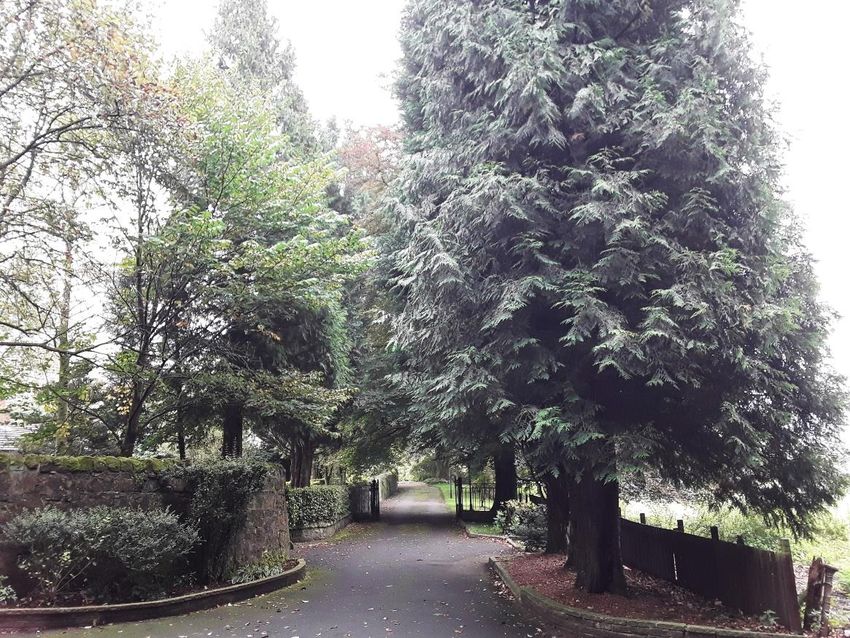
Contents

                                                                                      Conservation Area Appraisal
                                                                                      January 2021

Contents
                                             Country Estate                      10   Views                                        24    Figure 4.1: Building scale and
Chapter 1                                                                                Types of Views                            24    hierarchies                                   16
                                             A Rural Revolution                  11
Executive Summary                        1                                               Examples of views in Clachan of
                                               Industry                          11                                                      Figure 4.2: The influence of the built and
                                               Tourism                           12      Campsie Conservation Area                 24    natural environment on spatial qualities      17
Introduction                             1
                                                                                                                                         Figure 4.3: Private and public spaces         18
Location and context                     1
                                                                                      Appendix A                                         Figure 4.4: The setting of the Clachan        19
Historical development                   2   Chapter 4
                                                                                         Publications                              A-1   Figure 4.5: Architectural styles and
Summary of defining characteristics of       Conservation Area
                                                                                         Designation Records                       A-2   materials                                     20
Clachan of Campsie Conservation Area     2   Character Analysis                  15
                                                                                         Websites                                  A-2   Figure 4.6: Public realm and street
                                                                                         Maps                                      A-2   furniture                                     21
                                             Function and Form                   15
Chapter 2                                      Activity and Movement             15                                                      Figure 4.7: Trees within the conservation
Location and Context                     3     Scale                             16                                                      area                                          22
                                               Hierarchy                         16   Table of Figures                                   Figure 4.8: The shrine and surrounding
Location                                 3   Spatial Qualities                   16                                                      gardens at the Schoenstatt retreat            23
                                                                                      Figure 2.1: The Fells and surrounding
Geology & Topography                     4     Development Pattern, Layout and        low-lying countryside                         4    Figure 4.9: The glen                          23
                                               Density                           16                                                      Figure 4.10: Static view – Aldessan
The Conservation Area Boundary           5                                            Figure 2.2: Map of CA boundary                6
                                               Public and Private Space          17                                                      House                                         24
                                               Setting                           18   Figure 3.1: The remains of Clachan's
                                                                                      ecclesiastical origins                        8    Figure 4.11: Glimpsed view – private
Chapter 3                                    Architectural Detailing             20                                                      drive, entrance to Kirkland                   25
                                                Types, form, and materials       20   Figure 3.2: The Kincaid-Lennox family
The Historical Development                                                            vault                                         9    Figure 4.12: Dynamic view – Clachan of
                                                Styles and decoration            20
of Clachan of Campsie                    7                                                                                               Campsie road                                  26
                                                Boundary treatments              20   Figure 3.3: Aerial view of the village and
                                                Public realm and floorscape      21   surroundings                                 11    Figure 4.13: Panoramic view                  A-26
Ecclesiastical Origins                   7
  Parish Church                          7   Trees and Landscaping               22   Figure 3.4: The historical development of
  Churchyard                             8      Greenspace character             22   Clachan                                      14

                                                                                                                                                                                  LUC I i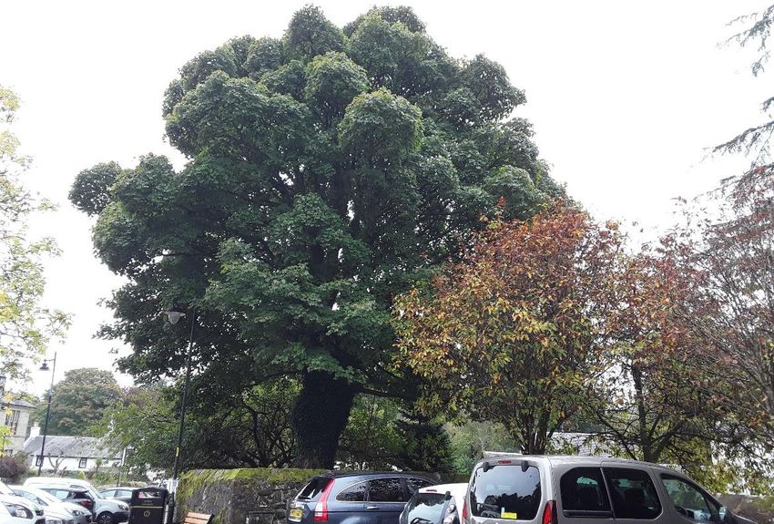
-Chapter 1
Executive Summary
Conservation Area Appraisal
January 2021
Chapter 1
Executive Summary
Introduction
The special interest of the Clachan of Campsie and the desire to celebrate and preserve
its historical importance was recognised by the former Stirling County Council in 1974 by its
designation as an area of special interest. This conservation area appraisal was produced in
October 2020 to review and update the previous appraisal and document the reasons for the
area's designation, considering the character and appearance of the area as it stands today.
This appraisal is one of a suite of appraisals and documents that consider the importance
of conservation areas in East Dunbartonshire and how their special interest should be
managed.
Each conservation area has its own appraisal that considers the historical development of
that specific area, along with an analysis of its character based on an assessment of its
function and form, spatial qualities, architectural detailing, trees and landscaping and
views.
Further information on why and how an area is designated as a conservation can be
found in the accompanying document 'An Introduction to Conservation Areas'.
For advice on how to retain, restore and reinforce the character of conservation areas,
along with specific management issues, opportunities and recommendations identified for
the Clachan of Campsie Conservation Area, please refer to the separate 'Conservation
Areas: Managing Change’ document.
Location and context
Clachan of Campsie lies in the edge of the Glazert Valley, south of the Campsie Fells at
the mouth of the Campsie Glen, located in the most northerly extent of East Dunbartonshire.
The nearest settlements are the village of Haughhead immediately to its south and
LUC I 1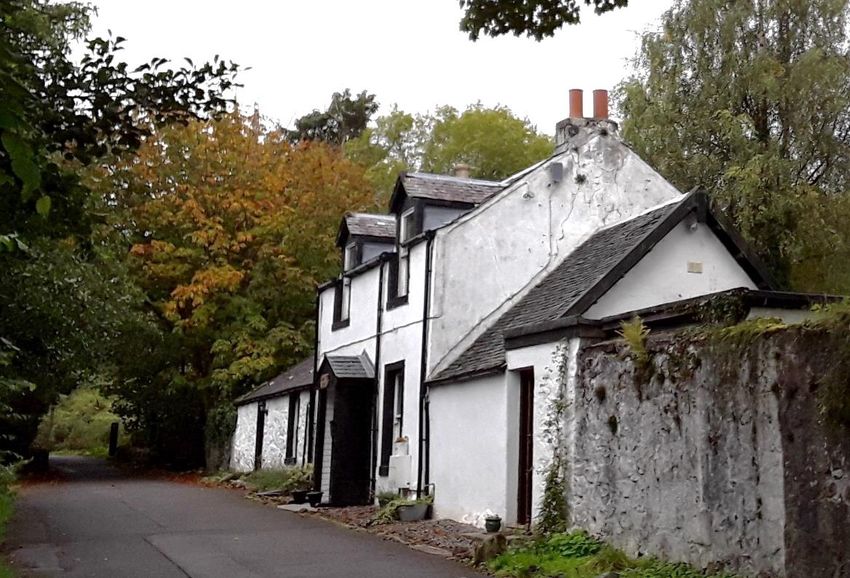
Chapter 1
                                                                                                        Executive Summary
                                                                                                        Conservation Area Appraisal
                                                                                                        January 2021

Lennoxtown, approximately 1.5km to the south-east, with the centre of Strathblane                       Clachan has returned to its quieter, more modest size and appears much as it did a century
approximately 4.5km to the west within the Stirling local authority area.                               before.

       The area has been described as one of the most beautiful places in East Dunbartonshire
due to the scenic beauty of the surrounding landscape. This is due in no small part to the
                                                                                                        Summary of defining characteristics of Clachan of Campsie
differing properties of the underlying geology of the area, which has resulted in the precipitous       Conservation Area
stepped escarpments of the Campsie fault contrasting with the low-lying pastoral flood plain of               The context and historical development of the Clachan are unique to the village and it is
the Pow Burn/Glazert Water. The special landscape qualities of these areas are recognised in            from this that it draws its individual character. This strong sense of place comes from many
the designation of the Campsie Fells and Glazert Valley Local Landscape Areas. Clachan of               facets and the way these elements combine to create a special place of architectural or historic
Campsie is located on the border between these two contrasting landscapes, giving it a                  interest – that is, the foremost criteria for conservation area designation. The following features
picturesque and unique position compared to other settlements in the region.                            are of particular importance to the character and appearance of the Clachan:
     Two areas closely related to the conservation area are designated as Local Gardens and                   –   The picturesque ruin of the original parish church, its churchyard setting and
Designed Landscapes in recognition of their historical and landscape value: the grounds of the                    additional features such as the Kincaid-Lennox family Vault, stone boundary wall and
former Ballencleroch House, now the retreat of the Schoenstatt Sisters of Mary, forming the                       ornate entrance gate and pillars. The somewhat sombre colours are offset by the
south-western part of the conservation area, and the romantic designed landscape of Campsie                       brighter whitewash of the adjoining Aldessan Gallery.
Glen, overlapping and extending to the north of the conservation area.
                                                                                                              –   The organic layout and low density of buildings, loosely concentrated around the
Historical development                                                                                            village square. Buildings in the area are predominantly small scale, harled and
                                                                                                                  whitewashed – with two notable exceptions – with slate roofs and stone boundary
       The story of Clachan of Campsie as the settlement we see today begins with the arrival                     walls. The buildings and their grounds incorporate numerous small scale architectural
of Saint Machan and the subsequent building of a church in the 12th century, supposedly over                      and streetscape detailing and ornamentation.
his grave. In the 15th century this was joined (to the south-west) by a large laird's house set in
generous and private grounds. The historic core of the village naturally grew up between the                  –   The incorporation of large amounts of mature planting and green space, both
two, focused on a village square, at the junction between drove roads and paths along the                         designed and unplanned, and the extremely close relationship and integration of the
Glazert Valley and the Campsie Glen. This remained relatively small and contained until the                       natural and built environment throughout the whole area. This includes the substantial
late-18th century. At this point, the natural resources of the Clachan led to the development of                  walled, wooded and private grounds of the Schoenstatt Retreat and the wilder,
local industry. This was part of massive changes that were afoot as a result of the industrial                    intimate and public space within the Glen and along the banks of the burns.
revolution, and the small-scale agricultural economy that had supported residents for centuries               –   Visitor activity associated with the Glen, Schoenstatt Retreat, Aldessan Gallery and
was overtaken by bleachworks and printworks, based here to take advantage of the plentiful                        shops, which adds a sense of vitality to the conservation area.
and powerful water sources.
                                                                                                              –   The beautiful, powerful, wild, contrasting and dramatic landscape setting of the
        By the turn of the 20th century this rush of activity had all but finished and today there is             Clachan at the edge of the Glazert Valley at the foot of the Campsie Glen and
little evidence it was ever there, the factories, mills and workers' cottages long since                          Campsie Fells is a defining feature that makes for a strong identity and sense of
demolished, although the higher-status residences from this period do survive. A small amount                     place.
of infill and additional housing has been added throughout the 20 th century, but on the whole the

                                                                                                                                                                                                   LUC I 2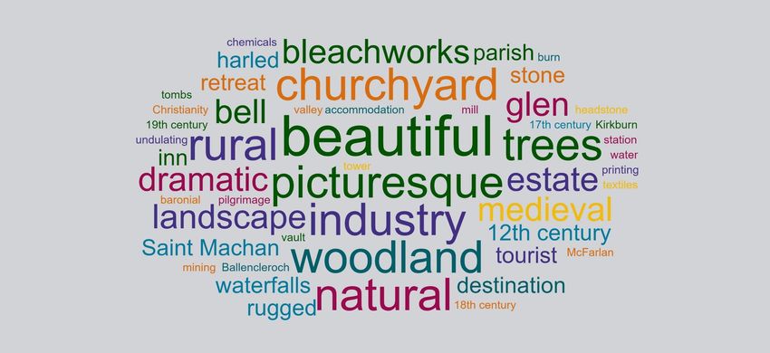
-Chapter 2
                                                                                            Location and Context
                                                                                            Conservation Area Appraisal
                                                                                            January 2021
                                                                                            Chapter 2
                                                                                            Location and Context

                                                                                            The character of an area starts to form long
                                                                                            before the human interventions of buildings,
                                                                                            streets, fields and towns are established: it starts
                                                                                            with the geology and topography of a place.
                                                                                            These literal foundations are what makes some
                                                                                            places suitable for human habitation and others
                                                                                            not, what makes some settlements flourish whilst
                                                                                            others fade. This section considers what it is
                                                                                            about the location and context of Clachan of
                                                                                            Campsie that made it ripe for successful
                                                                                            occupation.

                                                                                            Location
                                                                                                  East Dunbartonshire lies to the north of the city of Glasgow in central Scotland. Bordered
                                                                                            by Stirling to the north, West Dunbartonshire to the west and North Lanarkshire to the east, it
                                                                                            covers an area of approximately 175 square kilometres and incorporates parts of the historic
                                                                                            counties of Dunbartonshire, Stirlingshire and Lanarkshire.1

                                                                                                 Clachan of Campsie (herein known as the Clachan) lies at the side of the Glazert Valley
                                                                                            south of the Campsie Fells at the mouth of the Campsie Glen, and is described as one of the

___________________________________________________________________________________________________
1
    https://www.geni.com/projects/Dunbartonshire-Main-Page/16029 [accessed 7th July 2020]

                                                                                                                                                                                    LUC I 3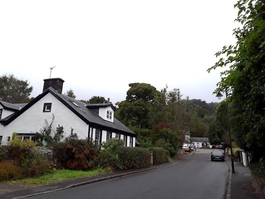
Chapter 2
                                                                                                        Location and Context
                                                                                                        Conservation Area Appraisal
                                                                                                        January 2021

most beautiful places in East Dunbartonshire due to the scenic beauty of the surrounding area.          and sense of place. Clachan of Campsie is located on the border between these two
Located within the north extent of the local authority area (originally within the county of            contrasting landscapes, giving it a picturesque and unique position compared to other
Stirlingshire), the parish was first established in the 12 th century when a parish church was          settlements in the region.
erected dedicated to St Machan. The boundaries of the parish remained consistent until 1649
                                                                                                              It is along this line that the tumultuous geology of the Campsies has been formed, with the
when the eastern portion to the Garrell burn was transferred to Kilsyth parish and western
                                                                                                        severe downthrow of the Campsie Fault giving rise to the precipitous stepped escarpments.
portion to Baldernock parish.
                                                                                                        More recent episodes of glaciation have created various depositional features on lower slopes
     The nearest settlements are the village of Haughhead immediately to its south and                  and progressive erosion by the Kirk Burn reveals many of the finer geological details of these
Lennoxtown, approximately 1.5km to the south-east, with the centre of Strathblane                       episodes. Owing to its relative accessibility and enlightened landlords opening it to the public
approximately 4.5km to the west within the Stirling local authority area.                               since the 18th century, the glen has brought generations of amateur and professional geologists
                                                                                                        to the Campsie Glen alongside visitors too.
Geology & Topography                                                                                    Figure 2.1: The Fells and surrounding low-lying countryside
       The landscape of the region varies in character, descending from the sparsely populated,
rugged uplands of the Campsie Fells in the north-west, through smooth, undulating foothills into
the broad, deep lowlands of the Glazert Valley and Kelvin Valley and on to the rolling, pastoral
farmland of the south-east of the region. Punctuating this landscape are small towns and
villages, with the largest settlements congregating along the corridor created by the valley
lowlands that extend on a gentle incline from south west to west, allowing easy passage across
the area. The further south and south-west you travel the more densely populated the area gets
as it transitions from its rural hinterlands to become the urban fringes and overspill of the City of
Glasgow.

      The change in landscape character can largely be attributed to the geology that underlies
this area. For the most part, this comprises sedimentary bedrock formed by a sequence of lava
flows between 350 and 300 million years ago in the Carboniferous Period. Known as the
Clackmannan Group, this layer of rock is made up of a sequence of sandstones, siltstone,
mudstones, ironstones and coals overlaid by seams of clays, silts, sand and gravel that were
deposited on top of them during the last Ice Age. Over millions of years this rock has eroded,
and it is this action that has formed the gentle hills and lowland of the majority of the area.

      This wide band of sedimentary rock that underlies most of the area sits alongside harder
volcanic rocks in the north, and it is the nature of these different types of rock formation that
directly accounts for the area's topography. Volcanic rock is more resistant to erosion and
wears away at a much slower rate than sandstone. The transition between the two – along a
line known as the Campsie Fault – has endowed East Dunbartonshire with a beautiful,                     The entrance to the conservation area
contrasting and at times dramatic landscape, a defining feature that makes for a strong identity

                                                                                                                                                                                                LUC I 4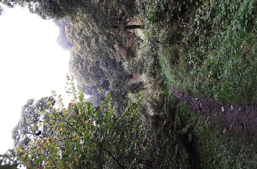
Chapter 2
                                                                                                    Location and Context
                                                                                                    Conservation Area Appraisal
                                                                                                    January 2021

The Conservation Area Boundary
      The conservation area measures approximately 16 hectares and encompasses a section
of Campsie Glen and the village adjacent known as Clachan of Campsie, largely following
historic field boundaries and routeways. Although containing one large area, there are two
distinct parts of the conservation area: the historic village with access to the glen, and the
former grounds of Ballencleroch (or Kirkton) House. Campsie Glen and the Lands of
Ballencleroch House are also identified as local Historic Gardens and Designed Landscapes in
the East Dunbartonshire Local Development Plan 2017 and previous Development Plans, with
background information provided in the council’s 2006 “Survey of Historic Gardens and
Designed Landscapes in East Dunbartonshire”.

     The historic village core is concentrated around a square with the Clachan of Campsie
Road leading into the centre, Knowehead Road to the west and Crosshouse Road to the east.
Immediately behind the square lies the historic burial ground which contains the ruins of the old
church of St Machan alongside the Kincaid-Lennox family vault.

      To its north, the boundary contains the site of the former bleachworks before rising into a
section of the Campsie Glen, stopping at the James Linn waterfall. The naturally steep-sided
valley forms the eastern extent of this section and the west bank of the Kirk Burn acts as the
western boundary. The village boundary previously contained a larger number of buildings
which were predominantly workers' cottages but these have long been demolished.

       The former grounds of Ballencleroch House are defined on its northern boundary by
Knowehead Road, east by Clachan of Campsie Road, Strathblane Road (A891) to its south and
field boundaries through woodland on its western edge. It contains the location of the former
Ballencleroch House and its lodge, Ballencleroch Cottage, Knowehead Cottage and Finglen
House. The extensive grounds now contain the purpose built Schoenstatt Retreat and
Conference Centre, run by the Schoenstatt Sisters of Mary.

                                                                                                                                  LUC I 5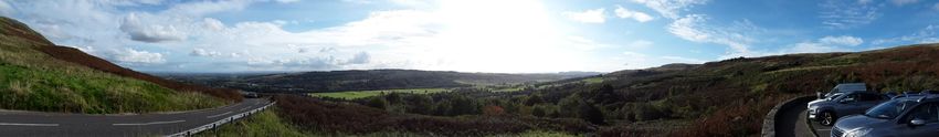
Chapter 2
                                 Location and Context
                                 Conservation Area Appraisal
                                 January 2021

Figure 2.2: Map of CA boundary

                                                               LUC I 6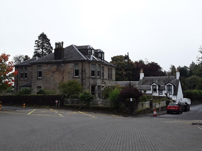
-Chapter 3
The Historical Development of Clachan of Campsie
Conservation Area Appraisal
January 2021
Chapter 3
The Historical Development of Clachan of
Campsie

Conservation areas did not develop in isolation,
and in order to understand what is included
within the boundary and why we must look
beyond to give the area context. This section
considers how Clachan of Campsie developed
from its earliest origins into the settlement we see
today.

Ecclesiastical Origins

Parish Church

     The Clachan’s first substantial building dates from around 1175, when a parish church
dedicated to Saint Machan was established over his reputed grave. Little is known about
Machan’s life; however, documentary evidence suggests that he was educated in Ireland and
became an ordained bishop in Rome. Probably attracted to the secluded environs of the
Campsie Glen, he built a small chapel at the base of the glen from which he carried out
missionary work in the area.

      An adjacent well 70m to the north of the chapel is reported to have been used by Machan
for baptisms, although unfortunately no structural remains survive. In the mid-19th century, it
was described as consisting of a four foot deep structure fed by a spring, partly covered by a
flagstone, with the water leading off through a (possible stone slab covered) tunnel to the
woods north of the church. This is a rare example of a well with a clear association with a saint
at an early-medieval ecclesiastical site, such wells were often attributed healing properties.

                                                                                         LUC I 7
Chapter 3
The Historical Development of Clachan of Campsie
Conservation Area Appraisal
January 2021
Not long after the church was founded in the late-12th century, the Earl of Huntingdon Figure 3.1: The remains of Clachan's ecclesiastical origins
granted control of the Campsie church to Kelso Abbey with the approval of King William I and
the bishop of Glasgow, along with the neighbouring, but now lost, Antermony church. However,
this was challenged by the Earl of Lennox who in turn granted the buildings to Glasgow
Cathedral sometime between 1208 and 1214; this is evident in a bull of 1216, which lists the
church of Campsie amongst the prebendal churches of Glasgow.
The church continued in active use and underwent many alterations in subsequent
centuries, including the last major renovation during the 1770’s. Through time, each
modification incorporated fabric from the existing structures whilst adding to it with new material
and decoration. This was confirmed by a standing building survey undertaken of the church in
2016, which identified different masonry and pointing techniques, alongside breaks in coursing,
that revealed different phases of building work, with the north wall likely to be the earliest
surviving element. Additionally, on the west gable, a simple cross-incised stone was built into
the wall core during its consolidation in the 17th century; the stone is likely to be of medieval
origin and is a rare example of an early Christian marked stone in the region.
The church at Clachan was abandoned in 1828 to make way for the new parish church
located in the more urban settlement of Lennoxtown to the south-east. The old church was
substantially demolished at this time in order to raise money for the fittings for the new church,
although during the 1850’s the bell tower at least was still in operation, it being used for funerals
and evening meetings on Sunday at the nearby parish school. The bell then went on a tour of
the area, first being relocated to Oswald School in Lennoxtown, then to Milton of Campsie
Church in 1888, before finally returning back to Clachan to be installed in the late-20th century The ruins of the parish church – the west gable is visible The late-20th century bellcote housing the old church bell,
but the walls are concealed by vegetation. although the bell itself is currently missing.
bellcote outside the former inn (now a café and gift shop) The bell has since been removed to
an unknown location, possibly housed in the new Milton of Campsie church building on
Campsie Road. Churchyard
Today, very little of the building remains apart from the west gable and reduced sections The old parish church stands within a wider churchyard (listed together as LB4351)
of the north and south walls, although these are largely covered with vegetation. The 2016 surrounded by a stone boundary wall, partly in rubble and partly in squared ashlar at its
building survey confirmed that, after its abandonment, exposed wall foundations on the south entrance. The current curved shape of the churchyard wall to the north-west suggests that it
and west walls were consolidated with recycled masonry, cement pointing and hard capping. may retain the partial footprint of an earlier curvilinear structure. Oval boundary walls are typical
of early medieval church and cemetery sites and could be associated with the chapel
established by St Machan.
The churchyard is scattered with headstones, table tombs and ground slabs of varying
sizes and decorative detailing, dating between the 17th and 18th centuries. There is also a single
LUC I 8Chapter 3
The Historical Development of Clachan of Campsie
Conservation Area Appraisal
January 2021
cast iron headstone, an obelisk and Celtic cross. The Gazetteers of Scotland describes many Figure 3.2: The Kincaid-Lennox family vault
important individuals to the local area who are buried in the churchyard including:
Two Covenanters
The Campsie minister John Collins, murdered in 1648 by the Laird of Belglass on his way
from a presbytery meeting
The martyr William Boick executed in Glasgow in 1683 for his loyalty to Scotland’s
Covenanted cause
The geographer James Bell who lived in Campsie in the final years of his life
Local poet William Muir who wrote a lament for the decline of Campsie in the early 1800s
Reverend Norman Macleod (1812-72), a clergyman whose father was minister of Clachan
parish church.
The most substantial structure in the churchyard is the Kincaid-Lennox family vault
(LB4358) in the south-east corner, a two-storey building with a domed roof. The keystone from
the entrance dates to 1715 with the upper storey added in 1819 by Miss Lennox, which acted
as a waiting room between church services and was accessed from an external stair on the
east gable. Initially, the coffins were laid on stone shelves within the vault; however, after the
funeral of Mrs Kincaid Lennox in 1876 (the last funeral to take place in Clachan) all the coffins
were buried beneath the vault. A lintel at the entrance marks the vault as being closed in 1884,
with the doorway blocked by two slabs from former table tombs. These indicate the churchyard The vault stands to the right-hand side of the entrance to The reused, early-17th century former table tomb slabs.
was in use by the family before the construction of the vault, with Latin inscriptions to James the churchyard. Behind it to the left the Campsie Fell rises
in a dramatic backdrop. "Clachan of Campsie, St. Machan's churchyard
Kincaid (who died on 13th February 1604) and another James Kincaid (who died 19 th January [3]" by Robert Murray is licensed under CC BY-SA 2.0
1604). "Clachan of Campsie, St. Machan's churchyard
[2]" by Robert Murray is licensed under CC BY-SA 2.0
LUC I 9Chapter 3
The Historical Development of Clachan of Campsie
Conservation Area Appraisal
January 2021
Country Estate were added and the external walls white harled; the internal staircase was repositioned, the
drawing room enlarged, and an entrance porch added bearing a heraldic panel above the
Located in the woodland to the south of the village, on the site of the current Schoenstatt doorway.
Retreat, was Ballencleroch or Kirkton House (referred to herein as Ballencleroch). The first
documentary evidence is in a charter dating to 1423 where the land, including that to the north With a newly positioned entrance came a new main driveway. This was formed adjacent
to incorporate an area of the glen and waterfalls, was granted to the Brisbane family of to the Kirkburn and connected the house to Haughhead to the south, with a smaller road
Bishopton. They constructed a fortified tower or mansion house that overlooked the land to the leading to the north to provide access into Clachan. In the south, entrance gates were added to
east that fell to the Kirk Burn. the surrounding boundary wall (still visible today) and a now demolished entrance lodge placed
to the west of the bridge over Kirkburn. Also within the grounds was Finglen Cottage, lying at
The Brisbane’s held the policies for just over 200 years when, in 1642, it was sold to the the end of a branch of the main driveway to the south west of the main house. Its origins are
McFarlans of Keithton or Kirkton. The McFarlans were a turbulent family based in the lands unknown, but the building appears on historical mapping in 1817, constructed between the two
between Loch Long and Loch Lomond (now forming the parish of Arrochar) with ancestral links main alterations to the house.
to the Earls of Lennox. Over their time at Ballencleroch, members of the family served in the
army, as lawyers, surgeons and as members of the clergy. In 1665, laird James McFarlan built Despite the considerable investment made in the mid-19th century, the house and estate
a new home for his aristocratic wife, Mary Keith, the daughter of the Earl of Marischal. The new was subsequently let to a range of tenants throughout the remainder of the McFarlans'
modest lairds house was a two-storey, T-plan house incorporating elements of the previous ownership before it passed from the family in the 1960s. Ballencleroch House was then
dwelling. converted into the Campsie Glen Hotel, a popular country retreat aimed at the upper class and
celebrities, before it was destroyed by arson in 1983 and laid vacant for five years until it
The grounds surrounding Ballencleroch House were planted and landscaped from the acquired new owners.
early-18th century by the then owner Hugh McFarlan, who purchased the property in a judicial
sale in 1703. The son of James and Mary McFarlan, he had hastily fled the family home over 20 In 1987 the 17-acre estate was acquired by the Schoenstatt Sisters of Mary, a German
years earlier after killing a son of Stirling of Glorat during a duel in the grounds of the house. religious order, bringing a new chapter in the history of the site. The order had historic
During this time, he became a soldier on the European mainland fighting under the Duke of connections to the area, with a private chapel in honour of Our Blessed Lady created in 1508 by
Marlborough where he brought back a large variety of tree species which he planted in the Sir John Strivelling of Gragbernand in his own neighbouring house. In 1989, the Marian Shrine
grounds and towards Campsie Glen. (modelled on the original in Germany) was opened in the grounds of the house as a place of
pilgrimage and prayer. Due to the fire damage and years of neglect, the house itself was
Ballencleroch was substantially enlarged between 1852-3 in the Scots Baronial style. A beyond repair and was demolished. It was replaced with a new building, also called
series of contemporary letters between the owner John McFarlan and architect Robert Logan Ballencleroch House, in 1995 which echoed the Scots Baronial character of the previous house,
discuss the alterations planned and their specifications. McFarlan died in 1852 (buried in the including crow stepped gables and tower. Since then, further accommodation has been
graveyard at the Clachan parish church) so his son continued his plans. It was a considerable constructed and the site has become a popular retreat and conference centre.
undertaking: the new extension, once completed, had cost £1,417, approximately £113,000 in
today’s money.
The new Ballencleroch House incorporated both new and altered elements from the old
house: the original main entrance of the 17th century building was closed up and the building
itself resigned to being the north wing; new three-floor extensions were added to the south and
west and a tower to the south-east with large, hood-moulded windows; crow stepped gables
LUC I 10Chapter 3
The Historical Development of Clachan of Campsie
Conservation Area Appraisal
January 2021
Figure 3.3: Aerial view of the village and surroundings A Rural Revolution
The Clachan is in the rural upland region which, along with much of the rest of the
country, had an economy largely based on peasant agriculture until the late-18th century. Both
the settlement and its surrounds testify to this in various buried and upstanding archaeological
remains. These highlight the historic pastoral use of the landscape associated with the
conservation area, both within its boundaries and in its immediate surroundings. Most of these
features date to the post-medieval period and lie on the land owned by the McFarlan’s, residing
in Ballencleroch House. Cultivation terraces have previously been recorded near the church
extending eastwards across the contours of the hillside with some over a meter high. Just
outside of the conservation area, possible sheiling huts and enclosures have also been
identified, probably related to sheep farming; later, the wool farmed from this trade would have
provided a natural resource for use in the factories on the banks of the Kirkburn.
Situated just off the village square and to the left of the main road leading into the
Clachan stands the building that once contained the old parish school. It has origins in the 17th
century when it opened under the patronage of John, Archbishop of Glasgow, with the deed of
creation stating that the schoolmaster should teach Latin. The school would have been in use
by the rural community, especially accommodating the children of the families working in the
various industries during the 18th and 19th centuries. The building held the school, used for
primary education, until 1978 when it closed and the building subsequently has held various
workshop and residential uses.
The picturesque and rural landscape surrounding Clachan of Campsie allowed it to
remain secluded and continue largely unchanged for much of its history; however, the 19th
century was a catalyst for economic and social change across the country and even Clachan
would not escape its reaches. The local topography, both beautiful and resource rich, would
A view of the village and its surroundings from the fells, looking SSW. The core of the village and centre of activity today is
the area around the old inn, the building centre-right in the foreground. Behind it is the considerable grounds of fuel the growth of the village in two ways: industry and tourism.
Ballencleroch House can be seen, with a heavily wooded shelterbelt marking its boundary. The conical roof of the retreat
can be seen along with the gable end of the shrine (in the centre of the photograph). Note also the pastural fields
surrounding the village, a key feature of the area and for a long time the principal economy. Industry
The demotion of Saint Machan's church at Clachan from parish church was a direct result
"Clachan of Campsie" by Bill Jarvie is licensed under CC BY-SA 2.0
of the establishment of a new town, Lennoxtown to accommodate the workers of the growing
industrial development at the end of the 18th century. The industries that prospered at this time
included mining, textile printing and chemical industries, all of which contrasted with the raw,
natural, picturesque qualities of the Campsie Glen to the north. Even the Glen itself did not
remain free of industry, with manufacturers taking advantage of the natural power of the
LUC I 11Chapter 3
The Historical Development of Clachan of Campsie
Conservation Area Appraisal
January 2021
Kirkburn and its waterfalls for generating power and as a water source. The surrounding Groome documented the waste material spilling into the burn, noting:
landscape was rich in raw materials, which spurred on the rapid growth of industry during the
19th century.
The largest industry was the Clachan Bleach Works which opened in 1819, converted “streams, which a mile away are clear as morning, are dyed black as ink before they
from an earlier mill at the foot of the Glen to the north of the churchyard. It employed 13 people have escaped from print work and bleaching-green…”.
which expanded to 50 by 1851, with workers bleaching cotton muslin. Of the 28 houses
recorded in Clachan in 1841, the majority housed workers at the bleachfield; unsurprisingly,
however, the work was dangerous. Bleaching usually involving harmful substances such as
sulphuric acid or chlorine to speed up the process and is likely to have caused long-term health In response to the industries, further development sprang up around the central square,
impacts on workers. Testament to the strength of the industry, a further bleach works – the with new residential properties for workers appearing throughout the 19th century. These were
Glenmill Bleach Works – opened in 1831 approximately 0.6km to the west-south-west of predominantly workers cottages with two late-Victorian villas appearing at the end of the 19th
Clachan, employing 90 people with a dedicated women’s lodging. century. The industry was prolific but short-lived, however, and by 1895 the bleachworks were
in decline, the last standing evidence of the industry demolished by the 1940s. As other forms
During the 19th century, other forms of industry grew up around the bleach works, taking of power became cheaper and more readily accessible, industry moved out of the rural glen
advantage of the convenient location and resources. This included a meal mill, a blacksmith, a and east to Lennoxtown.
textile workshop with over 50 looms, a kiln and a print field for printing cotton fabrics (likely
linked to the bleachfields). The clearest evidence of historical growth appears on 1 st Edition OS Tourism
mapping, which depicts a number of new structures. The industries were placed on the east
bank of the Kirk Burn to the left of the church, influenced by the topography; the force The land surrounding Clachan and into the Campsie Glen were part of the estate owned
generated by the upstream waterfalls provided power and a water source whilst the flat land by the McFarlans, the lairds of Ballencleroch. They kept the lands private until, in an unusual
before the steep glen provided space for factories and their associated features. A nursery and move for the time, John McFarlan opened part of the estate to visitors at the end of the 18th
large glass house were also mapped in the field north of the Crosshouse Road, and a century, marking the beginning of the area as a visitor attraction. To improve the romantic and
gasometer appears on the banks of the Kirkburn, probably used to provide gas lighting to the scenic appeal of the glen, a designed landscape was created with pathways up its steep sides
different industries to allow longer production days. to the waterfalls, along with new planting and bridges.
Aside from the factory buildings, the bleachworks also needed ponds for treating the The move paid off, gaining popularity from both the local population and visitors which
cloth with chemicals prior to spreading on large fields to be bleached in the sun. Field surveys continues to the present day. Other country estates with similar topography also began opening
north of the churchyard have discovered the remains of ponds and platforms associated with their glens for tourists during the 18th and 19th centuries, with other examples including the Falls
the mill and bleach fields. Although there are no physical remains of the factories themselves, of Bruar and the Falls of Clyde. The opening of the Campsie Glen Station in 1867 as part of the
buildings such as Almeel House and The Cottage (4 Clachan of Campsie), that would have Blane Valley Branch Line, half a mile from Clachan, provided improved access and the area
housed workers within the village, do survive as a testament to this once prominent local became more popular with day visitors from Glasgow.
industry. Prominently located at the head of the village, the two-storey Aldessan House and
The sound, smell and environmental impacts of the industry had noticeable and quite attached cottage range (LB4359) dates to the 1830’s and was initially a laird's house. By 1859,
dramatic effects on the Clachan, altering its quiet and picturesque character. Writing in 1892, historic mapping indicates it had become the Crown Inn, providing accommodation and
refreshment to increasing numbers of visitors, reflecting the popularity of the glen as a tourist
LUC I 12Chapter 3
The Historical Development of Clachan of Campsie
Conservation Area Appraisal
January 2021
destination. In 1922, after the inn had closed, the buildings became the Temperance Red Tub
Tearooms; the tearooms were run by a group of well-known local ladies on strict temperance
principles to remove the ill reputation which closed the inn in the first place. Behind the building
was a water garden for customers to dine and enjoy the views up to the Campsie Fells. A
further attraction came to the Clachan when world champion boxer Benny Lynch used the Red
Tub as a training centre between 1936 and 1938, with thousands of people visiting in an
attempt to see their idol. After the closure of the tearooms, the buildings saw a variety of uses
including a private dwelling and post office. Opening in 1988, it now houses the Aldessan
Gallery and Coffee Shop with different retail and workshop units in the lower range, which
remains popular with visitors today.
The 20th century saw the tourism industry continue to thrive and further residential
properties constructed, located on infill sites within the conservation area or on its outskirts.
Between the 50s and 70s a handful of additional houses were constructed including the
municipal semi-detached houses beyond the area's eastern boundary.
LUC I 13Chapter 3
The Historical Development of Clachan of Campsie
Conservation Area Appraisal
January 2021
Figure 3.4: The historical development of Clachan
A word cloud created using the above text to illustrate the key factors and defining influences on the development of Clachan of Campsie.
LUC I 14-Chapter 4
Conservation Area Character Analysis
Conservation Area Appraisal
January 2021
Chapter 4
Conservation Area Character Analysis
This section considers how the historical
development of the area, as outlined above, is
evidenced in the historic environment that is
included within the boundary of the conservation
area.
Function and Form
Activity and Movement
Today, the Clachan is a small village predominantly of residential houses. The industry
that once dictated people's comings and goings have long since disappeared and with it the
church, school and local amenities that, before the advent of the car, were necessary to keep
such a remote settlement functioning.
One industry that has remained strong, however, is tourism. The beauty and history of the
area continue to draw visitors in and the Clachan is perfectly placed in the Glazert Valley at the
foot of the Campsie Fells to act as a base. Within the Clachan, most of this activity centres
around Aldessan House, where there is car parking, a café, gift shop, bicycle shop and toilets,
and from where it is then easy to explore the churchyard or strike out into the glen to the north.
The popularity of the area for day trips and holiday makers means that at peak season the area
can be teeming with visitors; off-peak, however, when the weather starts to turn the village
returns to its core community, with fewer visitors during the winter months, enjoying the austere
beauty of the glean in that season.
Alongside those who come to explore what the natural and historic environment has to
offer are those who come to visit the shine and retreat set up by the Schoenstatt Sisters of
LUC I 15Chapter 4
Conservation Area Character Analysis
Conservation Area Appraisal
January 2021
Mary. Although it is open all year round, its location within the former grounds of Ballencleroch Figure 4.1: Building scale and hierarchies
House mean that activity in this part of the conservation area is largely contained behind the
heavily planted and walled boundary of the grounds.
Scale
The loss of the industrial buildings and the now predominantly residential use in the area
means that buildings in the Clachan are overwhelmingly domestic in scale. Buildings within the
historic core are largely single or 1½- storey up to a maximum of 2-storeys with attics. Nestled
in at the foot of the Campsie Fells their human scale is amplified by the comparatively
monumental landscape, which rises behind the village; it is a constant reminder that despite
man's intervention nature still dominates the area and is, after all, the very reason for the
settlement's existence.
Hierarchy
Buildings within the area are principally generously sized 19 th and 20th century detached
and semi-detached dwellings. They are positioned fairly organically along the main
thoroughfares through the village and, as such, there is no demonstrable hierarchy from
building to building. The exception to the rule would have been Ballencleroch House, which was
a much larger, high-status residence; even now, despite the demolition of the house, its walled
and densely tree lined boundary is suggestive of a substantial and private property, even if you
cannot see it.
Individual buildings, however, are slightly more nuanced and show a pattern of hierarchy The 1½ storey central range of the principal dwelling with smaller, lower offshoots – with less detail and fewer windows
typical of domestic properties of this date: it generally follows that the greatest financial (glass was expensive) – to either side.
investment went into the principal façade of the building – the part most people would see – to
convey the status and refinement of the occupants. The rear of the property, offshoots and
ancillary buildings are humbler in style and appearance, and will also tend to be smaller in
footprint and scale.
Spatial Qualities
Development Pattern, Layout and Density
The Gaelic term clachan generally refers to a small hamlet where the layout of dwellings
has no particular formal plan. The church and its associated manse (of unknown date but
appearing on historic mapping of the early 19th century) were deliberately placed at the opening
of Campsie Glen, sited on the borderland of mountain and plain. The conservation area follows
LUC I 16Chapter 4
Conservation Area Character Analysis
Conservation Area Appraisal
January 2021
a broadly organic, informal, loose-grain development pattern southward from this point, with Figure 4.2: The influence of the built and natural environment on spatial qualities
subsequent development concentrating around a central square and along the routes leading
toward it. The majority of houses are orientated on a roughly east-west line, with their principal
elevations facing south or north. The retreat and the grounds to Ballencleroch House form a
contrast with the development pattern of the village core, spreading out from the central square.
This accounts for nearly two thirds of the conservation area but contains only three buildings:
the new retreat building and shrine, Finglen Cottage (depicted on historic mapping from 1817)
and the lodge, which is depicted on OS 1st edition mapping.
Historic rights of way are still visible within the area, with the roads and pathways
providing evidence of past communities making their mark on the landscape as they travelled to
the parish church. Crosshouse Road leading south-east is depicted on mapping from the late-
18th century linking Clachan with Lennoxtown, with Strathblane Road (forming the southern
boundary of the area) also dating to this period. Clachan of Campsie Road follows the route of
a road that appeared at the turn of the 19th century, running parallel to the boundaries of
Ballencleroch and connecting to the important Strathblane Road. To the east of the
conservation area, Crow Road is a historic route leading over the Campsie Fells, possibly an
old drove route.
The evidence of industry so clear on the early edition OS maps is all but gone now,
leaving only the few dwellings that date from this period. The lack of large scale, dense
development, the extensive grounds of Ballencleroch House and the enhanced natural
landscape of the glen means that the natural environment dominates. From the ground, the
siting of buildings in the area have the appearance of having been dropped into the landscape
almost at random with the natural environment weaving between them, tying the composition
together into a coherent whole. The intimate and immediate relationship between built and
natural elements is an absolutely fundamental part of the character of the area, softening the The spaces between buildings allow nature in and the relatively informal layout gives the area an organic and informal
hard edges of man's intervention into the landscape and reinforcing its rural and secluded character.
character.
Public and Private Space
Despite the surrounding area's active tourism trade, the majority of space within the
conservation area boundary is private. The grounds owned by the Schoenstatt Sisters of Mary
are open all year round for visitors to the retreat and shrine, but it is enclosed by a stone
boundary wall and there is no formalised access to the grounds for the general public; however
LUC I 17Chapter 4
Conservation Area Character Analysis
Conservation Area Appraisal
January 2021
there is a well-designed, designated woodland walk beside the Kirk burn which is popular with Setting
locals and visitors. Most of the dwellings in the area also stand within generous, private
What sets the Clachan conservation area apart from all other conservation areas in the
grounds, demarcated by boundary walls, hedging and railings.
region is the drama and immediacy of its landscape setting. Situated on the border between low
The northern part of the conservation area – the glen and the space around the village lying, open countryside of the Glazert Valley to its south and the rising, imposing Campsie Fells
square – is more open and easier to access. During the 1990’s, the square underwent various to its north, the contrast between the two and their constant presence in views within, toward
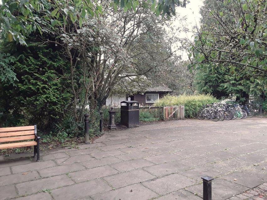
public sector improvement works to enhance the historic centre of the Clachan. This included and out from the area is a defining feature, and yet most of it is within the setting of the area,
resurfacing works; creation of 23 car parking bays on the edges of the square; installation of not within its boundary. Unlike some conservation areas, the intimacy of the area's relationship
black seating, street furniture and bespoke street lighting, and fingerposts and trees outside with its setting means that it is virtually impossible on the ground to tell where the boundary
Aldessan House. The works are commemorated by a plaque as you enter the square from the starts and ends, emphasising just how important the contribution of setting is to the character
south. As a result, the visiting public was brought into the heart of the village, bringing custom to and appearance of the conservation area.
the businesses and allowing better appreciation of the glen which forms its backdrop.
From the fells, there are contained, intimate, picturesque views within the glens as well
There are several private roads within the conservation area with dead ends (but which extensive views outwards across the settlement and beyond, with the accents of white buildings
continue into core paths): Knowehead Road leading to Knowehead House and farm; the path to standing out amongst the hedgerows, woodland and gardens. Campsie Glen appears behind
Fin Glen and Allanhead; Crosshouse Road leading to Crosshouse Cottage; and a path to key buildings and features, such as the churchyard and Aldessan House, adding to their visual
Lennoxtown, via Hole Farm. Finglen Cottage is also accessed via a private road leading of the appeal and significance. Kirkburn is the watercourse flowing through the glen, with its many
main driveway within the Schoenstatt grounds. waterfalls a key attraction to visitors historically and today.
Figure 4.3: Private and public spaces The setting of the conservation area extends beyond the purely visual connection and
provides historic context that helps us understand and appreciate the area's history. The village
of Clachan may be associated with the church and Ballencleroch House in the mouth of the
glen, but it is also linked to a variety of other key sites within the wider area, connected through
ownership with Lennox Castle and Woodhead. The Clachan is visible from parts of the
designed landscape surrounding Lennox Castle where it appears in the same view as
Craigbarnet to the west, thus also providing a visual connection between the sites.
In short, the setting of the conservation area has much to contribute to our appreciation
and understanding of the settlement's evolution and distinctive character, as well as enhancing
its aesthetic appeal. This setting adds to the sense of rurality and remoteness of the site whilst
also linking to the areas agricultural and industrial history. It imparts a powerful sense of
character and place and our experience of the conservation area is greatly enriched by the
The entrance to the private grounds of the Schoenstatt Public space at the foot of the glen around the village contribution it makes to its special interest.
retreat (the grounds of the former Ballencleroch House) square.
and Finglen cottage.
LUC I 18Chapter 4
Conservation Area Character Analysis
Conservation Area Appraisal
January 2021
Figure 4.4: The setting of the Clachan
A view from the fell looking south west. Starting from the left and moving right: new development within Lennox Castle (with the old grounds stretching behind and to the right); the pastoral, flat, lowland fields that surround the Clachan and separate it
from Lennoxtown; the small collection of houses Haughhead; the grounds to the Schoenstatt retreat; the collection of buildings are the core of the Clachan, gathered around the village square. "Lennoxtown" by Andy_Mitchell_UK is licensed under CC
BY-SA 2.0
LUC I 19Chapter 4
Conservation Area Character Analysis
Conservation Area Appraisal
January 2021
Figure 4.5: Architectural styles and materials
Architectural Detailing
Types, form, and materials
The buildings in the Clachan are principally domestic in use and overwhelmingly domestic
in character. Even those that were once in other uses – such as the schoolhouse – or have
been converted from domestic to commercial – such as Aldessan House – have the
appearance of accommodating domestic functions. Most are 1½ storeys in height with pitched
roofs incorporating gabled dormers (to gain extra room and height within the roof space) and
chimney stacks to the gable ends. Slates roofs predominate and external walls are harled (a
rough cast render) and whitewashed.
The exception to this is the large, late-Victorian villa that occupies the corner plot to the
south-east of the village square (6 Clachan of Campsie). At 2½ storeys – and built to tall,
Victorian proportions – it is taller than the established building height in the Clachan and is
finished in coursed ashlar rather than harled and whitewashed. Like its neighbours it has a slate
roof, but its hipped roof form is anomalous in the area; similarly, the double height canted bay
window is an unusual feature and, whilst dormers are common, the two here are canted
dormers with hipped roofs set into the roof pitch rather than gabled and extending up from the
wall head; consequently, although it is undoubtedly a handsome building, it is not
representative of the overriding architectural character of the area. To the east of this house,
down Crosshouse Road, stands a contemporary neighbour. Although finished in the same
exposed stonework, it has adopted a form more characteristic of the area, standing at 1½
storeys with a pitched roof, gabled dormers and end chimney stacks.
Styles and decoration
In the foreground, the large, late-Victorian villa on the corner of the village square. Behind it, a more characteristic form of
building.
There are no lavish architectural statements within the Clachan; Ballencleroch House with
its applied baronial style would once have filled this gap, and whilst the building that replaced it
references the site's past it is a fairly modest building in detailing, if not in scale. That said, the Boundary treatments
dwellings in the Clachan are no humble, vernacular cottages either. Their incorporation of
The gardens and boundaries to the properties in the Clachan are an extension of the
details such as sash windows, fan lights and moulded, often classically inspired, door surrounds
buildings and, as such, often display a similar level of thought and detailing. Boundary walls are
shows awareness and conscious adoption of architectural fashions in a desire to create
without exception stone built; most are random rubble and topped with coping stones to help
attractive, polite, contemporary residences. Of particular note are the fanlight and porch to the
shed water from the wall head. To the former schoolhouse and 6 Clachan of Campsie, these
old schoolhouse and the upper sashes of the house opposite, all of which have incorporated
walls are low level with railings set into them, those to the former schoolhouse (along with the
simple geometric patterns to pleasing visual effect.
LUC I 20Chapter 4
Conservation Area Character Analysis
Conservation Area Appraisal
January 2021
corresponding gate) are a particularly fine feature. These hard boundaries are often coupled Figure 4.6: Public realm and street furniture
with planting, used to reinforce the demarcation and to offer more privacy to the space within.
Public realm and floorscape
Due to the size and openness of the area around the village square, public realm within
the Clachan exerts a considerable influence on our experience of the village but, unfortunately,
little street furniture or floorscape of any historic interest survives, bar a lone water fountain just
south of Aldessan House. The public realm improvement works in the 1990s have served the
village and its tourists well, but they are starting to look worn and are in need of repair in places.
The abundant use of standard design benches, bollards, bins and the assortment of paving
types is not reflective of the individual, rural, village character of the Clachan and generally
clutters and detracts from its aesthetic qualities.
Priority has also been given to the car and parking – a common problem in remote but
popular villages. An understandable resolution has been found by concentrating parking spaces
around the village square, but as the gateway to the Glen, the heart of the village and the focus
of tourist activity it is regrettable that this area has lost most its historic significance and identity.
Standard design benches, bins and bollards and assorted paving around the village square are beginning to look tired and
do not reflect the individual character of the area. In the centre, sandwiched between a bollard and bin, is the water
fountain.
LUC I 21Chapter 4
Conservation Area Character Analysis
Conservation Area Appraisal
January 2021
Trees and Landscaping Greenspace character
A dominant feature within and surrounding the conservation area is the presence of Schoenstatt grounds
mature planting, veteran trees and green spaces – some designed, some fortuitous – many of
which have a history that predates the buildings in the area. Several impressive veteran trees, As a result of Ballencleroch owner Hugh McFarlan bringing new species of young trees
planted within private gardens but widely visible, contribute to the conservation area. Both from his time abroad at the start of the 18th century, and the subsequent planting and
Roy’s 1750 and Ross’s 1780 maps show that at the end of the 18 th century there was planting landscaping, the woodland in and around Clachan became beautiful and diverse. In particular,
surrounding the parish church and Ballencleroch House, features that continue to define the the woodlands surrounding the then house were designed and can be traced through historic
characteristics of the area today. As such, natural features – whether deliberately planned or mapping to the woodlands we see today.
not – are an integral part of the infrastructure and quality of the area. Between the Schoenstatt Centre and Clachan of Campsie Road, the Kirk burn is
Figure 4.7: Trees within the conservation area enhanced and made more attractive by a strip of woodland formed of a diverse range of
species. This includes large broadleaf trees (including lime, sweet chestnut, beech and ash)
and conifers (including Douglas fir, Norway spruce, cedar of Lebanon, larch and yew). In
particular, in the south of the woodland there is a specific conifer group that contains two large
Wellingtonias (giant redwoods).
Further woodland was planted in the grounds along the south boundary enclosing the
main driveway and evidence of some restocking. On the western boundary, there is a large
mixed block of conifers and broadleaves with rhododendrons.
1st and 2nd Edition OS mapping from the mid to end 19th century highlights this small scale
designed landscape of parklands within the grounds. The 1 st edition also appears to depict
planned pathways to the north of the house on either side of the Kirk burn, possible as part of a
walled garden. There is a similar feature to the west of the manse.
Trees are not just a feature of the designed landscapes or the surrounding countryside but form an integral part of the
infrastructure of the character of the area.
LUC I 22You can also read