Cover

                  City of Harrison
Recreation Master Plan 2017-2021
←
→
Page content transcription
If your browser does not render page correctly, please read the page content below
Cover
City of Harrison
Recreation Master Plan 2017-2021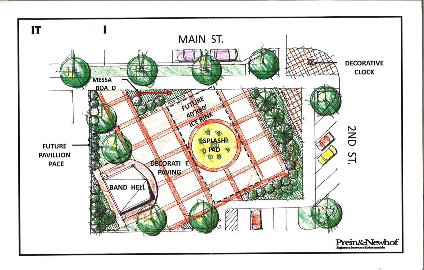
T H I S P A G E H A S B E E N L E F T B L A N K I N T E N T I O N A L LY
Acknowledgments
COUNCIL
Stacy Stocking D o n K o l a n d e r
Mayor City Councilor
D a n S u l l i v a n Joni Ashcroft
M a y o r P r o - Te m City Councilor
David Rowe
Angela Kellogg City Councilor
City Councilor
C o n n i e C a u c h i
City Councilor
PA R K S A N D R E C R E AT I O N C O M M I T T E E
Tr a c e y B e a d l e Mike Kirby
City of Harrison Manager/Clerk Planning Commissioner
Lori Ware Rick Foote
Clare County Community Harrison Community Schools
Development and Seniors Services Superintendent
Director
David Rowe
Carol Leary City Councilor
Clare County Fairgrounds Board-
member Joe Ashcroft
Harrison Community Schools AD
Don Kolander Director
Harrison Council & Clare County
Parks Director Kevin Smith
Budd Lake Area Association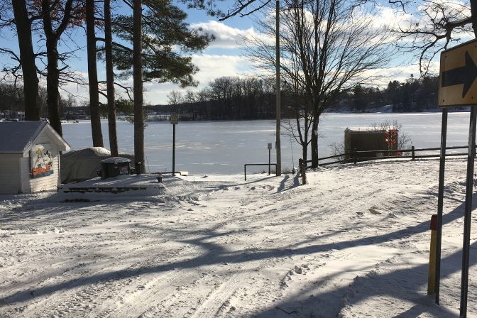
Maps & Tables

Maps
Regional Location Map							8
Resource Inventory Map						10
Existing Facilities Map							18
Public Park Service Area						24
Average Park Usage							28
Non-Motorized Trail Plan						33
Action Plan								35

Tables
Table 2.1 Percent Change in Population by Decade			        11
Table 2.2 Age Distribution by Percentage 				              11
Table 2.3 Disability of Non-Institutionalized Civilians			 12
Table 2.4 Households by Tenure and Type				                12
Table 2.5 Median Household Income by Community			          13
Table 2.6 Race by Community 						                         13
Table 2.7 Clare County Health Rankings				                 14
Table 2.8 City of Harrison Parks and Recreation Budget		   15
Table 3.1 Park Accessibility Rating System				             17
Table 3.2 Park Facilities Overview					                    19
Table 3.3 Other Parks in the Harrison Region				           19
Table 3.4 Accessibility Rating						19
Contents
CHAPTER 1: INTRODUCTION                                   6

CHAPTER 2: COMMUNITY DESCRIPTION                         9

C H A P T E R 3 : R E C R E AT I O N I N V E N T O R Y   16

CHAPTER 4: PLANNING PROCESS                              25

CHAPTER 5: GOALS AND OBJECTIVES                          30

CHAPTER 6: ACTION PLAN                                   32
6   CIT Y OF H A RRIS O N PAR K S AN D R E CR E AT I ON M A STER PL A N

                                         Introduction
The City of Harrison has a rich              The City of Harrison is committed      inventory of the parks and
history of leveraging natural                to providing a high-quality            recreation assets in the City of
resources to enhance economic                recreation experience that will        Harrison and the surrounding
prosperity and quality of life, as           attract visitors and make the City     region, an overview of the
evidenced by sawmills and lumber             a more desirable place to live,        administrative structure and
companies that once supported                work and play. At its core, Harrison   management of the parks and
the locally economy. Today, the              is a residential community with        recreation facilities in the City, a
City attracts thousands of visitors          recreational assets.                   description of the public input
who come to enjoy the City’s                 The goals, objectives, and action      and planning process, an outline
high-quality recreational facilities,        plan that follow seek to embrace       of the City’s recreation goals and
explore the surrounding natural              parks and recreation through           objectives, and an action plan with
resources, and enjoy access to               a holistic lens, looking at the        implementable steps to achieving
“twenty lakes within twenty                  entire community, beyond the           these goals.
minutes” of Harrison.                        traditional boundaries of public
Special events like the Clare County         park land. Non-motorized trails and    CONTEXT
Fair and Frostbite Open Golf                 connections within the community
                                                                                    This plan was drafted based on
Tournament on Budd Lake further              and with neighboring communities
                                                                                    the Michigan Department of
enhance recreational opportunities           are of utmost importance. To
                                                                                    Natural Resources’ “Guidelines for
for visitors and residents. However,         accomplish this, the City will
                                                                                    the Development of Community
social demographics, economic                continue to collaborate with
                                                                                    Park, Recreation, Open Space,
conditions, and community                    neighboring jurisdictions, schools,
                                                                                    and Greenway Plans” as well as
attitudes are constantly in flux;            the County, and NGOs to provide
                                                                                    best management practices for
this creates the need to regularly           the highest quality of recreation
                                                                                    placemaking in rural communities.
update a City’s plan for the future          services.
of its recreation system.                    This plan includes a detailed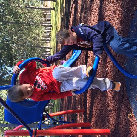
C H A PTER 1: I N TRO DUCTION   7

Financial Assistance for
Parks and Recreation
Plans
This five-year plan serves as the basis for
financial assistance through a number of
State and Federal programs. Assistance
is currently available from the Michigan
Natural Resources Trust Fund (MNRTF),
the Federal Land and Water Conservation
Fund (LWCF) and Recreation Passport
(RP). All three grant programs can be used
for the development of public outdoor
recreation facilities including support
facilities and nature centers. RP can be
used for indoor public recreation facilities.
MNRTF is the only program that can be                                  Downtown Harrison
used for the acquisition of land for public
recreation and for protection of land
for environmental importance or scenic
beauty.                                         Non-motorized trails
Placemaking
In addition to satisfying eligibility
                                                  and connections
criteria for financial assistance, the City
of Harrison is looking to leverage its
natural resources to enhance economic
                                                    within the
development. This plan incorporates
Placemaking strategies aimed at leveraging
Harrison’s unique small-town assets.
                                                  community and
These include:
•   Strengthen community image and
                                                 with neighboring
    sense of place
•   Support non-centralized economic
    growth throughout the entire
                                                communities are of
•
    community
    Promote health and wellness
                                                utmost importance.
•   Protect cultural and natural assets
•   Connect parks with non-motorized
    trails accessible to all residents
•   Provide recreational experiences
•   Foster high-quality educational
    opportunities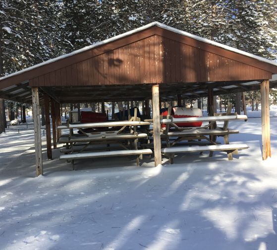
8 CIT Y OF H A RRIS O N PAR K S AN D R E CR E AT I ON M A STER PL A N
ANTRIM OTSEGO MONTMORENCY ALPENA
LEELANAU
Traverse City
KALKASKA CRAWFORD ALCONA
GRAND TRAVERSE (
/131
Grayling
OSCODA
'
%
(
&
75
WEXFORD MISSAUKEE ROSCOMMON OGEMAW IOSCO
West Branch
Cadillac
(
/127
%
'
(
&
75
Õ115 CITY OF
Æ
HARRISON ARENAC
LAKE OSCEOLA _
^
CLARE GLADWIN
Gladwin Standish
Evart
(0
/
ay
1
w B
ina
Clare
Sag
Big Rapids
(0
/1 BAY
MECOSTA ISABELLA MIDLAND
Õ20
Æ
Mt. Pleasant Midland
NEWAYGO Bay City
(
/131
(
/127 Saginaw TUSCOLA
SAGINAW
MONTCALM GRATIOT
Alma
%
'
(
&
75
CITY OF HARRISON RECREATION PLAN 0 15 30
Regional Location
Miles
Data Sources: State of Michigan Geographic Data Library, Michigan DNR Open Data Portal
State Roads DNR Lands / Parks
Railroads Cities
County Boundary Lakes / Ponds
Rivers / Streams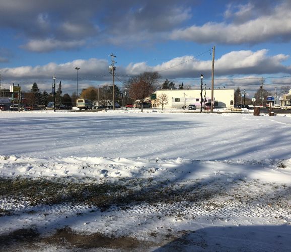
C H A PTER 2: C O M M U N I TY D ESCRIPTION   9

                  Community Description
T H E B U I LT                      rolling with isolated points of         Grant Avenue.
                                    high and low elevations scattered       The other lake in the city is Little
ENVIRONMENT                         throughout the city.                    Long Lake. This lake also provides
The City of Harrison is the         Clare County has a significant          swimming opportunities and has
county seat of Clare County.        number of lakes, rivers, and            a boat ramp. Although the major
The city measures approximately     streams. These water resources          portion of Little Long Lake is in
four square miles in area, two      provide a number of outdoor             Hayes Township, approximately 14
miles east-west by two miles        recreational opportunities to area      acres is located in the northeast
north-south. Harrison is located    residents. There are two large lakes    corner of the city.
approximately 12 miles north of     located within the city, Budd Lake      The “Resource Inventory” map
Clare and 25 miles north of Mt.     and Little Long Lake.                   on page 10 shows the location of
Pleasant in roughly the middle of
                                    Budd Lake is a spring fed lake          woodlands, wetlands, and steep
mid-Michigan. Please refer to the
                                    approximately 1 ½ miles long            slopes in the area and sources are
regional map on page 8.
                                    and averaging 1000 feet wide,           on the map.
A land use inventory was            totaling approximately 175 acres        As is illustrated in the map,
completed in 1984 and updated in    in area. The lake is a major tourist    Harrison has a wide variety of
1998. Approximately 290 acres or    attraction with numerous homes          forested ecosystems within its
11% of the total area of the city   and cabins along the shoreline.         boundary. There are also a few
was dedicated to park use.          The lake provides opportunities         acres of small wetlands within
                                    for swimming and for fishing,           the parkland in the City. Given
T H E N AT U R A L                  including bass, muskie, bluegill        the limited acres of preserved
                                    and perch fishing. The only major       wetlands, it will be important for
LANDSCAPE                           public access points on the lake are    the City to continue to protect
The topography of the city can      at Wilson State Park, Saxton Park,      these areas moving forward. As is
be described as level to slightly   and the Budd Lake Boat Launch off       also seen on the map, Budd Lake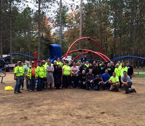
10 CIT Y OF H A RRIS O N PAR K S AN D R E CR E AT I ON M A STER PL A N
Thomas
Grant
Gir
Clare
l
Sc
ou
Oakgrove
Camino
Lapham
Helen
Niemi
Janette
t
Ca
mp
Melanie
Rosina
Townline Lake
Laura
Hammond
1st
Mary Jo
Hillcrest
Wilson
Matilda
Van Deus
en
Isabella
Little
Little Long Lake
Long Lake
Fairlane
Greenlawn
ple
Eastlawn
Tem
Oaklawn
Fairview Lone Pine
La
ke
Green
vie
w
Jill
y
err
John R Ch
Lansing
La
s
ns
Hughe
Saginaw
Lak
Maple
in
Bu
g
e
Westlawn
Owosso
Birch
dd
Broad
Mount Pleasant
4th
Grant
Norway
La
Ithaca
La
Bischoff
ke
Byfield
Beech
ke
Midland
Coleman Lee
Main
M 61 Farwell
Dale
Oak
6th
Sellinger
Pine Ireta
4th
Pine
Duggan
Sullivan
Spruce Clarence
Clarence
Short
Foote
Do
Elm
ug
Eaton
las
Park
Park
2nd
ard
Bond
Rich
5th
Stone
Mostetler
Vass Sandy
Burrington
Harrison
Old County Farm
Buttern
ut
Coraldale
on
e
Weld
mbin
Wi
Colu
nte
rgr
Hawthorn
ee
n
Dean
Lily Lake Lockwood
County Farm
Clare
CITY OF HARRISON RECREATION PLAN 0 0.5 1
Resource Inventory
Miles
Data Sources: State of Michigan Geographic Data Library, Michigan DNR Open Data Portal, City of Harrison, National Land Cover Database
City Boundary Parks Freshwater Emergent Wetlands
State Roads Deciduous Forests Freshwater Forested/Shrub Wetlands
All Roads Evergreen Forests Steep Slopes:
Railroads Mixed Forests 20 - 30% Slope
Rivers / Streams 30 - 40% Slope
Lakes / Ponds 40% Slope or GreaterC H A PTER 2: C O M M U N I TY D ESCRIPTION 11
abuts steep slopes surrounding much population began to decline (see Table
of its shoreline. These areas are at 2.1). This decline is due to either the
risk for erosion during extreme rain mortality rate exceeding the birth
and flooding events, and existing rate, or out-migration exceeding in-
vegetation should be protected as migration.
much as possible.
Gender
The population is evenly split between
THE PEOPLE males and females, 49.1% and 50.9%
respectively (please refer to Table 2.2).
Population
Harrison is a small city of 2,114 Age
residents (2010 U.S. Census), making The median age of Harrison residents
up about 7% of Clare County’s is 38.8 years old, which is in line with
population of 30,786. Like many the State of Michigan’s median age of
communities in Michigan, population 39.3. However, it’s considerably lower
growth in the area was substantial than the surrounding Hayes Township
until the year 2000, when the of 45.2, and Clare County at 46.2.
Ta b l e 2 . 1 P e r c e n t C h a n g e i n P o p u l a t i o n b y D e c a d e
COMMUNITY 1970-1980 1980-1990 1990-2000 2000-2010
Harrison 16.4 7.9 14.9 -.28
Hayes Twp. 85.5 7.7 20.9 -5.2
Clare County 47.2 4.3 25.2 -1.1
Michigan 4.2 .3 6.9 -.55
US Census
Ta b l e 2 . 2 A g e D i s t r i b u t i o n b y P e r c e n t a g e
COMMUNITY 0-17 18-24 25-44 45-64 65+
Harrison 18.7 13.2 27 25.4 15.7
Hayes Twp. 19.9 7.9 21.7 33.2 17.1
Clare County 20.4 7.8 20.4 30.7 20.8
Michigan 23 10.1 24.3 28.1 14.5
Source: 2010-2014 ACS 5-Year Estimates12 CIT Y OF H A RRIS O N PAR K S AN D R E CR E AT I ON M A STER PL A N
The U.S. Census defines Ta b l e 2 . 3 D i s a b i l i t y o f N o n -
Ambulatory Difficulty institutionalized Civilians
as having serious difficulty HARRISON HAYES CLARE CO
walking or climbing stairs. Persons age 16-64 1,189 802 22,455
Ambulatory difficulty 153 356 2,189
Self-care difficulty 24 140 822
The disabled population has grown Persons aged 65+ 333 302 6,229
from 220 in 2000 to 273 in 2014.
A growing disabled population Ambulatory difficulty 67 195 1,439
corresponds with a nationally aging
population. The highest proportion Self-care difficulty 29 32 378
of those who suffer from Total 273 723 4,828
ambulatory and self-care difficulty
are senior citizens. It is important to Source: 2010-2014 ACS 5-Year Estimates
track types of disabilities and how
they change over time in Harrison
because residents with mobility Ta b l e 2 . 4 H o u s e h o l d s b y Te n u r e a n d Ty p e
constraints require different
amenities to help them access HARRISON HAYES CLARE CO
recreational opportunities. The Owner Occupied 58.6% 81.7% 80.1%
federal Americans with Disabilities
Act requires that site development Married-couple families 49.4% 44.6% 54.3%
provide reasonable access for the
disabled. Table 2.3 compares the Male householder 6.0% 5.6% 4.9%
disabilities of various user groups
Female Householder 10.4% 10.9% 9.2%
in Harrison, Hayes Township, and
Clare County. Non-family household 34.2% 38.8% 31.6%
H o u s i n g Tr e n d s Renter Occupied 41.4% 18.3% 19.9%
Table 2.4 shows that Harrison Married-couple families 20.9% 38.5% 26.7%
households are primarily owner-
occupied, although less so when Male householder 6.1% 4.4% 5.4%
compared to larger geographies.
The data also reveals that in the Female Householder 16.6% 8.9% 20.1%
geographies examined, female
head of household is typically Non-family household 56.4% 48.2% 47.8%
about twice as likely as a male head
of household. Given that women Total Households 904 914 13,208
generally earn less than men, this Source: 2010-2014 ACS 5-Year Estimates
could be contributing to a low
median household income. Renter-C H A PTER 2: C O M M U N I TY D ESCRIPTION 13
occupied housing in Harrison is Ta b l e 2 . 5 M e d i a n H o u s e h o l d I n c o m e b y
double (41.4%) than that in Clare Community
County (19.9%), which falls in line
with the expectation that cities COMMUNITY INCOME
have a higher proportion of rental
units and non-family households. City of Harrison $28,083
This generally represents those who
Hayes Township $27,896
live alone and households with
non related roommates, usually Clare County $33,264
students or senior citizens.
Michigan $49,087
Median Income Source: 2010-2014 ACS 5-Year Estimates
The median household income of
Harrison continues to be a little Ta b l e 2 . 6 R a c e b y C o m m u n i t y
over half the amount compared
with the State of Michigan, and HARRISON HAYES CLARE CO
even about $5,000 less than Clare
County. Between 2000-2014, the Am.Indian, Eskimo or Aleut 58.6% 81.7% 80.1%
median household income has
Married-couple families 49.4% 44.6% 54.3%
risen by less than $2,000, meaning
that purchasing power has likely Male householder 6.0% 5.6% 4.9%
declined over this time too, leaving
Harrison residents financially worse Female Householder 10.4% 10.9% 9.2%
off. A lower median household
income could be due to a high Non-family household 34.2% 38.8% 31.6%
proportion of retirees, as suggested
in the 2009 Parks and Recreation Renter Occupied 41.4% 18.3% 19.9%
Plan; however, the 65+ age group
Married-couple families 20.9% 38.5% 26.7%
has shrunk over the last 5 years.
More plausibly, the median income Male householder 6.1% 4.4% 5.4%
is low because over 1 in 5 families
(22%) earn less than $10,000 Female Householder 16.6% 8.9% 20.1%
annually, representing the highest
proportion of earners in any Non-family household 56.4% 48.2% 47.8%
income bracket.
Total Households 904 914 13,208
In terms of employment, the
largest industry is education and Source: 2010-2014 ACS 5-Year Estimates
health care services (22.4%). This
employment trend aligns with the
state as well (24.1%). Whereas
in the state of Michigan the next
largest industry is manufacturing,
the second largest industry in
Harrison is Retail Trade at 16.8%.
Retail trade often employs people14 CIT Y OF H A RRIS O N PAR K S AN D R E CR E AT I ON M A STER PL A N
part-time, pays minimum wage,
and does not offer benefits. This
can also contribute to a low
median household income. The
unemployment rate at 18.3%
is also substantially higher than
the county (16.1%) and the state
(11.4%).
Race
Clare County continues to be Table 2.7 Clare County Health Rankings (out The County Health Rankings
primarily white (96.5%). Harrison of 82 Michigan Counties) & Roadmaps program is
is slightly more diverse with 117 a collaboration between
of the County’s 180 African- the Robert Wood Johnson
HEALTH VARIABLE RANKING Foundation and the University
Americans living in Harrison. The
numbers do not add up to 100% Health Outcomes 78 of Wisconsin Population
because these percentages are Health Institute. Health
based on estimates (see Table 2.6). Length of Life 75 outcomes represent how
healthy a county is, and are
Quality of Life 78
measured by how long people
Health Statistics
live and how healthy people
Although the City of Harrison and Health Factors 81
feel while alive. Health factors
Clare County have considerable represent what influences
Health Behaviors 74
natural resources for outdoor the health of a county, and
activity and exercise, Clare Clinical Care 73 are measured by health
County residents rank amongst behaviors, clinical care, social
the unhealthiest in the State of Social and Economic Factors 80 and economic, and physical
Michigan. Based on the Robert environment factors.
Wood Johnson County Health Physical Environmental 49
rankings compiled in 2016, Clare Source: 2016 County Health Rankings
County is ranked 78th of 82 in
Michigan for health outcomes,
which is based on length and Administrative and Federal grants, and community
quality of life of residents. These Structure donations. Sources of funding
rankings further support the which may be available to the
proactive approach to active Parks and recreation programs in City of Harrison include, but are
recreation being undertaken by the the City of Harrison are carried out not limited to, the following: the
City and its partners. Clare County by the City’s Department of Public Michigan DNR Recreation Division,
is ranked 81 out of 82 counties Works. The Parks and Recreation the Land and Water Conservation
for health factors, which is a score Committee advise the City Council Fund, the Michigan Economic
for health behaviors, clinical care, and Planning Commission on parks Development Corporation, USDA
social and economic factors, and and recreation-related matters. Rural Development, Safe Routes to
the physical environment (see Table Funding for the Parks and School, millages, bonding, various
2.7 for more detail). Recreation budget is provided grants and foundations, and user
through local tax revenue, State fees.C H A PTER 2: C O M M U N I TY D ESCRIPTION 15
City of Harrison Parks and Recreation Budget
CURRENT FISCAL YEAR PROJECTED FISCAL YEAR
ITEM
(JAN.-DEC. 2017) (JAN.-DEC. 2018)
Ball Diamonds $5,000.00 $5,000.00
EXPENDITURES SR2S $6,000,000.00 --
Town Square -- $475,000.00
General Fund $2,500.00 $2,500.00
FUNDING Little League Program $2,500.00 $2,500.00
Other State Funds and Grant Revenues $600,000.00 $475,000.00
A view of the tennis courts at City Volunteers pose after completion The site of the town square, set to
Park. of the City Park play area, which be constructed in phases
features Universal Design.
Previous Grant City Park Play Area To w n S q u a r e B a n d
Assistance Project No. RP14-0113 – Harrison Shell
The City of Harrison has received received a 2014 grant of $45,000 Project No. RP15-0098 – Harrison
a total of three grants from the by the Recreation Passport (RP) received a 2015 grant for $45,000
MDNR from 1977 to 2015. to construct a new play area and by the Recreation Passport (RP)
to provide a universally accessible to construct a Town Square Band
Te n n i s C o u r t s playground in City Park. The Shell. The grant funds will go
installation included new age- towards construction of a 30’ x
Project No. 26-00933 – The City appropriate and safe equipment, 30’ music/band shelter that will
received a grant in 1977 for which is ADA accessible; along serve multiple functions such as
$5,810.96 by the Land and Water with providing a cushioning bandstand for music in the park,
Conservation Fund (LWCF) for uniform safety surface that allows small family reunions, weddings,
Harrison Area Park (otherwise wheelchair users a more even and other outdoor activities.
known as City Park) to develop surface. Transfer access is included Another planned improvement is
tennis courts and install a LWCF as well as ground level “do it an ADA-compliant sidewalk leading
sign. spots” and a sensory play feature. to the Band Shelter.16 CIT Y OF H A RRIS O N PAR K S AN D R E CR E AT I ON M A STER PL A N
Recreation
Section Heading
Inventory
OVERVIEW supplement. In order to determine be appropriate for the park. The
the level of universal access to each table on page 18 summarizes the
A comprehensive inventory of park, an accessibility evaluation wide variety of recreation amenities
recreational assets is an important was completed in conjunction with available to City residents and
component of any parks and the parks inventory. Each park was visitors.
recreation planning effort because visually assessed for its level of
it allows a community to take At a regional level, the City of
accessibility, focusing on available Harrison is located within 15
stock of what it has as it plans and amenities and physical access
prioritizes what it needs. miles of a number of parks and
to those amenities. The general recreation facilities, including state,
In December of 2016, an accessibility standards can be found county, city, township, and private
inventory was performed of in Table 3.1 on page 17, and the facilities.
existing parks and recreation accessibility evaluation for each
facilities owned or operated by park can be found in Table 3.4 on Please refer to Table 3.2 on page
the City of Harrison. The inventory page 19. 19 for a summary of existing parks
was conducted to evaluate the and facilities within the city of
The City of Harrison has an Harrison and the map on page 18
overall quality and usage of the impressive amount of park land—
community’s parks and recreation for a summary of facility locations.
around 300 acres of parks and
facilities. Each park was visited to recreation land for a population
examine the available amenities of 2,114 (2010 U.S. Census), in
and their condition as well as addition to a non-motorized trail
photographically document the system. Though each park has
parks. Because snowy conditions unique characteristics, they can be
made it difficult to accurately divided into several categories that
document ground-level conditions, help clarify how each park is used,
satellite imagery, existing photos, by whom, and what facilities would
and local expertise were used toC H A PTER 3: REC REATI O N I N VENTORY 17
Courtesy of Harrison Chamber of Commerce
Table 3.1
Park Accessibility Rating System
Symbol Characteristics Elements
None of the There are no paths connecting elements. Restrooms are
facilities meet not accessible. Curb cuts are not present in the roads.
A1
accessibility Play elements are not accessible and the fall surface is not
guidelines. accessible or out of compliance.
The park may contain one or two accessible elements, but the
Some of the
park as a whole is not accessible. For example, the park may
facilities meet
A2 contain an accessible picnic table, but there is no access path
accessibility
connecting the picnic shelter to the accessible parking spaces
guidelines.
or sidewalk.
The majority of elements are accessible, such as paths
Most of the
connecting elements, accessible picnic tables, and designated
facilities meet
A3 accessible parking, but one or two elements do not meet
accessibility
guidelines. For example, the play structure may not meet
guidelines.
accessibility guidelines.
The entire park All of the elements meet accessibility guidelines as they have
meets been brought into compliance over time. For example, paths
A4
accessibility were added to connect elements, additional accessible play
guidelines. elements were added, and accessible restrooms were added.
The entire park
was
The entire park was designed and implemented with universal
developed/
A5 accessibility in mind. All elements fully comply with ADA, and
renovated using
may even go above and beyond requirements.
principles of
universal design.18 CIT Y OF H A RRIS O N PAR K S AN D R E CR E AT I ON M A STER PL A N
Thomas
Grant
Gir
Clare
l
Sc
ou
Oakgrove
Camino
Lapham
Helen
Niemi
Janette
t
Ca
mp
Melanie
Rosina
Townline Lake
Laura
Maple Grove Little Long
Hammond
Lake Access
1st
Cemetery
Mary Jo
Hillcrest
Wilson
Matilda
Wilson Van Deus
en
Isabella
Clare County Fairgrounds State Park
Little
Little Long Lake
Long Lake
Fairlane
Greenlawn
ple
Eastlawn
Tem
Oaklawn
Fairview Lone Pine
Budd Lake La
ke
Green
Island vie
w
Jill
y
err
John R Ch
Lansing
La
Westlawn
ns
Saginaw
Lak
Maple
in
Bu
g
Lakeside
e
Owosso
Birch
dd
Park
Broad
Mount Pleasant
4th
Grant
Norway
La
Ithaca
Hillside Saxton Park Bischoff
Byfield
ke
Midland
Elementary Veterans Park Coleman Lee
La
Main
ke
Farwell
M 61 Dog Oak Dale
Park
Sullivan
6th
Sellinger
Pine Ireta
Duggan
4th
Spruce Clarence
Clarence
Short
Robert
Foote
Do
M. Larson Elm
ug
Eaton
las
Elementary Park
Park Budd Lake
City 2nd
Boat Launch
ard
Park Bond
5th
Rich
Harrison Stone
Middle Harrison
School High
School
Mostetler
Vass Sandy
Burrington
Harrison
Old County Farm
Buttern
ut
Coraldale
on
e
Weld
mbin
Wi
Colu
nte
rgr
Hawthorn
ee
n
Dean
Lily Lake Lockwood
County Farm
Clare
CITY OF HARRISON RECREATION PLAN 0 0.5 1
Existing Facilities (Local)
Miles
Data Sources: State of Michigan Geographic Data Library, Michigan DNR Open Data Portal, City of Harrison
City Boundary Facility Ownership:
State Roads City of Harrison
All Roads County
Railroads School
Rivers / Streams Michigan Department of Natural Resources (MDNR)
Lakes / PondsTable 3.2
Park Facilities Overview
Garbage Receptacles
Walking/Biking Trail
Size
Performance Area
(Ac) or
Horseshoe Pits
Running Track
Park Name Owner
Play Structure
Baseball Field
Picnic Shelter
Softball Field
Tennis Court
Boat Launch
Picnic Tables
Distance
Parking Lot
Swimming
Memorials
Restrooms
Basketball
(mi)
Benches
Football
Signage
Swings
Teeball
Soccer
Other
Grills
Neighborhood Dog Park 0.4 City x x x
Parks Lakeside Park 0.3 City (99 yr. Lease) x x
Budd Lake Boat Launch 0.8 City x
Community
Parks
Budd Lake Island Park 1 City x x
Saxton Park 0.7 City x x x x x ice fishing
City Park 40 City x x x x x x x x x x x x x x x x x sledding
Wilson State Park 36 DNR x x x x x x x x x x x x camping
Regional Parks Hayes Township Outdoor Park 30 Hayes Township x x x x x x x x x x x x
Maple Grove Cemetery 22.2 City x
Clare County Fairgrounds 120 Clare County x x x x x x x x x event center
Linear Parks Trails/Sidewalks 9.09 Multiple x
Special Purpose
Parks
Veterans Freedom Park 1.23 City x x x x x
Robert M. Larsen Elementary 50 Harrison Public Schools x x x x x x
School District Hillside Elementary N/A Harrison Public Schools x x x x
Properties Harrison Middle School N/A Harrison Public Schools x x x
Harrison High School N/A Harrison Public Schools x x x x x x x
Table 3.3 Table 3.4
Other Parks in the Harrison Region Accessibility Rating
PARK NAME GENERAL PURPOSE ADA
Snow-Snake Ski Area Ski and golf resort OWNER PARK NAME RATING
Tamarack Golf Course 18 hole golf course Dog Park A1
Devil’s Knob Golf Course 19 hole golf course Lakeside Park A2
Brookwood Park sports, playground Budd Lake Public Access A2
Farewell Park boat launch, fishing, swimming Budd Lake Island Park A2
City of Harrison
Garfield Township Park picnic, swimming, sports Saxton Park A2
Stamina Stadium Sport Park sports stadium City Park A3
Lincoln Township Park camping, boat launch Veterans Freedom Park A2
Lloyds Park picnic, swimming Maple Grove Cemetery A1
Au Sable State Forest Nature preserves, hiking DNR Wilson State Park A3
Petit Park camping, picnic, fishing Clare County Clare County Fairgrounds A2
Shingle Lake Park boat launch, fishing, swimming Multiple Trails A3
Shamrock Park sports, playground20 CITY OF HARRISON PARKS AND RECREATION MASTER PLAN
The City of Harrison owns or The park contains two softball
operates seven parks, one fields, two baseball fields, and a
cemetery, and a recreational trail tee-ball field. Additionally, there
system within the City limits. The are 10 horseshoe pits, a basketball
following is a brief description of court, two tennis courts, and four
those resources and a summary covered picnic pavilions. There are
of comments from the on-site also numerous play structures for
inventory. children, including one that was
recently installed with barrier-free
Saxton Park access.
Saxton Park is a popular park on The City intends to continue
the west side of Budd Lake. The to improve the ballfield and
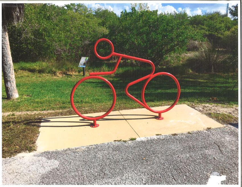
park provides fishing access and strengthen its role as a regional A bike rack at Saxton Park.
scenic views for residents. On ballfield facility. Water, sewer,
sunny days, there are many people and electrical services extend to
who walk down to the park to the ballfield area. There is also a
eat lunch. While the potential concession stand and restrooms.
for additional development is Providing these amenities make
limited because of the steep slope the site an appropriate venue for
and the lake, the City intends to organized league play and regional
develop additional picnic facilities tournaments.
in the park. The parking lot is The City intends to develop a non-
paved, and there is a barrier-free motorized trail system through the
wheelchair ramp which leads to park (see page 33 for a map of
the lake overlook area from the the planned routes). The Nature
parking lot. However, there are no Trail will extend into the adjacent
barrier-free parking spaces marked 20-acre capped landfill, which is
in the parking lot. All future also City-owned. In addition to A picnic pavilion at City Park
improvements to the park will be the Nature Trail, the City plans to
of barrier-free design. construct a BMX/skate track. Both
The City intends to investigate parcels would lend themselves
the potential of developing to the development of the trail
a barrier-free ramp system to system. With the exception of the
provide pedestrian access into the vehicular entry drive off Spruce
park. The ramp system would be Street, there are no barrier-free
developed on the steep slope along entrances into the park for non-
Lake Street, and would provide motorized users.
pedestrian access from Lake Street There is only one designated ADA
into the park. parking space within the park. With
the exception of one new feature,
City Park much of the play equipment in the
City Park is the largest public park park is older and not of barrier-free
in the City and provides the widest Children enjoying new play
range of recreational opportunities. equipment at City ParkC H A PTER 3: REC REATI O N I N VENTORY 21
design. All future improvements
to the park will be of barrier-free
design.
Budd Lake Boat
Launch
This park is in the southeast corner
of Budd Lake off Grant Avenue.
The park has approximately 15
parking spaces for two boat
launches and an overlook area.
There are no ADA parking spaces
designated in the parking lot.
The boat launches appear to be
of barrier-free design. The lake A new play structure at City Park that uses principles of universal design.
overlook is at the same grade as
the parking lot, so barrier-free improvements will incorporate nearby. Residents and employees
access to the lake is provided at this barrier-free elements into their from the offices eat lunch in the
park. The parking area should be design. park on sunny days. The park
re-striped to provide an appropriate provides a passive outdoor area for
number of ADA parking spaces. residents of the retirement home
Dog Park
and their guests.
Budd Lake Island This park sits on a relatively small
parcel (132’ x 132’) at the corner
Budd Lake Island is a relatively small of Fifth and Oak Streets. The lot Lakeside Park
island in the middle of Budd Lake. has many large trees and is an This parcel is extremely popular
There are no improvements on the attractive location for a small dog with neighborhood residents
island; it has been left in its natural park. during the summer months. The
state. Because it is unimproved, park is natural in character, and
barrier-free access onto or around The City intends to develop this
park into a dog park by adding is comprised of a beach area and
the island does not exist. Most of a picnic table. The site has steep
the water surrounding the island attractive fencing surrounding
the perimeter of the park, adding topography between the street
is extremely shallow, and therefore and the lake, so there is no room
inappropriate for a dock system. trash receptacles with plastic
‘doggie’ bags, dog trails and for off-street parking spaces. In
The only part of the island deep addition, there is not room for
enough to allow boats to get close dog entertainment features, and
benches and picnic tables to on-street parking along the narrow
to a dock is on the eastern side street. Because automobile traffic
of the island. However, the City provide a place for visitors to sit
and eat. A proposed brick walkway cannot be accommodated, the City
could explore installing a kayak or intends that the park should be
canoe launch using universal design will provide barrier-free access into
the park from the sidewalk along designed as a neighborhood park
principles. and a destination for trail users.
Oak and Fifth Streets.
If the City decides to make The City intends to develop some
improvements on this island, all There is a retirement home and
county administrative offices passive recreation improvements
in the park. A small pavilion or22 CIT Y OF H A RRIS O N PAR K S AN D R E CR E AT I ON M A STER PL A N
gazebo will provide a place to sit in 2015. The Park honors local Tr a i l S y s t e m
and rest, as well as shelter from veterans and provides public
The continued development of a
sun and rain. A small play structure education on the continued
non motorized trail system in the
would provide play opportunities sacrifices that service men and
community is a high recreational
for neighborhood children and women give for continued
priority. The City has completed a
a proposed bicycle rack will freedom. The park has a welcome
non-motorized trail surrounding
encourage riders to stop and use center with restrooms and
Budd Lake, which provides access
the park. military artifacts, as well as a
for swimming, boating, fishing,
As a long-term goal, the City walking trail that surrounds the
and scenic opportunities for area
intends to improve access to pentagon shaped park, with
residents. The lake is a significant
the beach area by developing a side areas dedicated for historic
natural resource and is the main
barrier-free trail to the beach. The war eras. Because this park was
focal point of the City. The lake
improvements will provide passive recently completed, it meets ADA
is also a major tourist attraction,
recreation opportunities, beautify requirements and is not in need of
drawing many campers into Wilson
the park, and improve access any upgrades.
State Park during summer months.
to the lake for neighborhood
Maple Grove As already discussed, the City plans
residents and trail users. If the
to develop the Nature Trail and
improvements result in significantly Cemetery BMX/skate track throughout the
more visitors to the park, the The Maple Grove Cemetery is 40-acre City Park and the 20-acre
City would consider purchasing located on Townline Lake Road landfill site. The Nature Trail could
property adjacent to the park for just north of the Clare County then extend to the southwest
its expansion, should property and fairgrounds in Harrison. The corner of the City on City-owned
parking become available. City maintains the grounds and property. The trail will also extend
keeps it open to the public. from City Park across city property
Veterans Freedom The City plans to replace the to the east, connecting to school
Park fence, archway, and gates in the property. The planned trail will loop
This park is located in downtown cemetery and add mausoleums in through school property, providing
Harrison, and was completed areas where the topography is too exercise opportunities and a place
steep for headstones. to get close to nature.
Signage should be placed at
appropriate locations to inform
users of the route, including
distances, rest areas, and places
of interest. The City also hopes
to add exercise stations along the
trail. Benches and trash receptacles
would also be located in
appropriate areas. In the future, the
trail could link to other trail systems
in the area, such as the Old-127
corridor route.
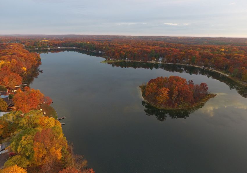
Budd Lake Boat LaunchC H A PTER 3: REC REATI O N I N VENTORY 23 PARKS SERVICE AREA In Table 3.2 on page 19, the The bottom photo below shows service area of each park owned Lakeside Park in the winter. The and operated by the City of top photo is a bird’s eye view of Harrison is indicated as either local, Veteran’s Freedom Park. community, or regional. Local parks serve the immediate area, drawing visitors from within a short walking distance or those who are passing by. The map on page 24 shows the portion of Harrison that is within a 1/4 mile walk of a park. As is illustrated, neighborhoods in the west and south portion of the City are not within an easy walk of a neighborhood park. Community parks serve all of Harrison, with recreational facilities that typically accommodate a wider audience, such as athletic fields or larger parks. Regional parks serve visitors from Harrison and surrounding communities because of their unique characteristics, such as access to Budd Lake or recreational opportunities.
24 CIT Y OF H A RRIS O N PAR K S AN D R E CR E AT I ON M A STER PL A N
Thomas
Grant
Gir
Clare
l
Sc
ou
Oakgrove
Camino
Lapham
Helen
Niemi
Janette
t
Ca
mp
Melanie
Rosina
Townline Lake
Laura
Hammond
1st
Mary Jo
Hillcrest
Wilson
Matilda
Van Deus
en
Isabella
Little
Little Long Lake
Long Lake
Fairlane
Greenlawn
ple
Eastlawn
Tem
Oaklawn
Fairview Lone Pine
La
ke
Green
vie
w
Jill
y
err
John R Ch
Lansing
La
s
ns
Hughe
Saginaw
Lak
Maple
in
Bu
g
e
Westlawn
Owosso
Birch
dd
Broad
Mount Pleasant
4th
Grant
Norway
La
Ithaca
La
Bischoff
ke
Byfield
Beech
ke
Midland
Coleman Lee
Main
M 61 Farwell
Dale
6th Oak
Sellinger
Pine Ireta
4th
Pine
Duggan
Sullivan
Spruce Clarence
Clarence
Short
Foote
Do
Elm
ug
Eaton
las
Park
Park
2nd
ard
Bond
Rich
5th
Stone
Mostetler
Vass Sandy
Burrington
Harrison
Old County Farm
Buttern
ut
Coraldale
on
e
Weld
mbin
Wi
Colu
nte
rgr
Hawthorn
ee
n
Dean
Lily Lake Lockwood
County Farm
Clare
CITY OF HARRISON RECREATION PLAN 0 0.5 1
Public Park Service Area
Miles
Data Sources: State of Michigan Geographic Data Library, Michigan DNR Open Data Portal
City Boundary 1/4 Mile Service Area
State Roads Public Parks
All Roads
Railroads
Rivers / Streams
Lakes / PondsC H A PTER 4: PL A N N I N G PROCESS 25
Planning Process
R E L AT E D According to a press release Plan, Zoning Ordinance, and
issued by Governor Snyder, receiving technical assistance in
PLANNING Rising Tide is sponsored by the marketing, community branding,
EFFORTS Michigan Department of Talent and communications.
A recreation plan is not a stand- and Economic Development and
is providing 10 communities in 2009 Parks and
alone effort; instead, it is one
planning effort among many in the Michigan with the tools they Recreation Master
area aimed specifically at outlining need to design and build a solid Plan
the parks and recreation goals planning, zoning, and economic The last Five-Year Parks and
and action plan for the next five development foundation to Recreation Plan for the City of
years. In this section, previous and Harrison was adopted in June
attract new businesses and help
concurrent planning efforts are of 2009. This plan follows the
existing employers to grow.
examined to develop a recreation Michigan Department of Natural
plan that supports and enhances Resources Guidelines and includes a
efforts already underway. comprehensive summary of existing
to work with local leaders to
The City of Harrison is a Rising develop new strategies for conditions, goals and objectives,
Tide community, which means that economic prosperity. Communities and a five-year action plan. The
the State of Michigan is putting were chosen based on a series plan includes conceptual drawings
considerable effort into helping of economic factors including for City Park, Lakeside Park, and
Harrison leverage its assets to unemployment rates, poverty Dog Park (formerly Senior Citizen’s
support economic development levels, and labor participation Park). A public input session and
and enhance quality of life for rates. As a part of the Rising Tide a public hearing were held. The
its residents. Harrison is one of project, the City of Harrison will be plan also summarizes a 1998 public
ten communities across Michigan updating its Community Master survey that was administered by
participating in this pilot program the City.26 CIT Y OF H A RRIS O N PAR K S AN D R E CR E AT I ON M A STER PL A N
Many of the actions identified 2001 Master Plan fabric and character, the 2001
in the 2009 plan have been Master Plan primarily focuses on
completed. The trail around Budd The most recent Master Plan improvements to public parks,
Lake is finished, connecting Wilson was adopted by the City in April as opposed to non-motorized
State Park and three city parks. 2001. The plan summarizes pathways connecting the parks.
City Park improvements have been existing conditions and goals Non-motorized infrastructure
completed and barrier-free access for residential and commercial will be a cornerstone of the new
to bathrooms and park amenities development. Since the plan Master Plan.
have been added. Saxton Park and was adopted, there have
Budd Lake Public Access received been considerable changes to
downtown, both from public and 2014 Bicycle and
upgrades to boating facilities, Pedestrian Master
and bike parking was added to private investments, and changes
to the surrounding parks and Plan
Saxton Park. Additionally, Veterans
Freedom Park was completed in neighborhoods. Demographic This plan was created for the
2015 on a formerly vacant school- trends have also shifted since the City of Harrison, but was done in
owned property. Veterans Freedom plan was updated, resulting in an collaboration with neighboring
Park amenities include bathrooms, unanticipated loss of population Hayes Township, which surrounds
memorials, a welcome center between 2000 and 2010 as the City of Harrison. The overall
honoring veterans in the five- well as a significant increase in goal was to create a bicycle and
County area, and seating for 200 the proportion of older adults. pedestrian-friendly environment
people in an entertainment-style While the Plan acknowledges for the City of Harrison by
arrangement. the pivotal role that recreational promoting safety and access
amenities play in community throughout the community. The
plan identifies and prioritizes
infrastructure improvements as
well as strategies for education and
community engagement (see the
map on page 33 for a summary
of planned routes). This plan was
especially helpful in identifying
and prioritizing non-motorized
improvements for inclusion in the
2017-2021 Parks and Recreation
Master Plan.
Downtown
Development
Authority 2007 Plan
The Harrison Downtown
Development Authority adopted
a downtown plan in order to
facilitate improvements in the
district. The current plan, adopted
in 2007, establishes a unified
vision supported by specific goalsC H A PTER 4: PL A N N I N G PROCESS 27
and projections. The projects are
financed through the authority’s
tax incremental financing (TIF)
mechanism. The DDA is committed
to helping enhance non-motorized
infrastructure and making the
downtown district a more inviting
place for all roadway users. They
are also implementing a series of
traffic calming measures with Safe
Routes to School funds. The seven
key goals outlined in the 2007 plan
are as follows:
1. “Set the table” for private
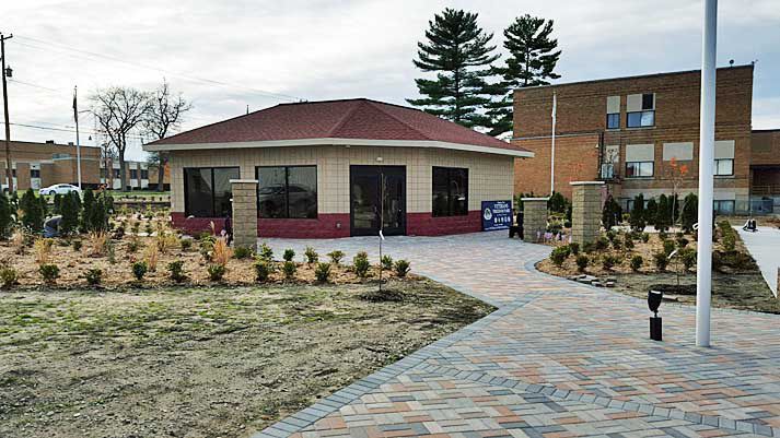
investment There has been significant investment in downtown Harrison in recent years.
2. Establish an identifiable Pictured above is the entrance to Veterans Freedom Park
character for the city of Harrison
3. Establish a town square style, officials worked hard to ensure a press release, Facebook, and
multi-use center in Harrison that the Plan met the needs of posted a direct link to the survey on
4. Establish and support a all residents of the community the City website. There was a total
“traditional,” and workable, and users of the city recreational of 67 respondents. The following
downtown retail district amenities. Public input on the summarizes feedback from the
present conditions and future survey.
5. Establish a physical and
needs of parks and recreation
perceived connection between
facilities was gathered by three Overall Park Usage
downtown Harrison and Budd Lake
primary means: a resident survey,
6. Improve pedestrian circulation The results from the survey showed
three visioning sessions with the
throughout the DDA district that 100% of respondents have
Parks and Recreation Committee,
visited a Harrison City Park within
7. Establish programs to foster and a public hearing.
the past five years. The most
economic activity and enhance widely used park according to
business development and Survey Results the survey was City Park, with
retention in Harrison’s downtown The community survey was Wilson State Park and Budd Lake
available to the public from Boat Launch coming in at a close
PLANNING December 27, 2016 through second and third respectively. See
January 15, 2017. The online the map on page 28 for a visual
PROCESS survey was administered through representation. Although the Clare
In the fall of 2016, the City of the platform Survey Monkey. Hard County Fairgrounds is used less
Harrison began engaging residents copies were also available at City frequently than other parks, 83%
and stakeholders in a meaningful Hall and the Public Library for of respondents visited the grounds
way to elicit public input to residents who wished to complete at least once that year. The least
inform goals, objectives, and the survey by paper. The City used parks were the former Senior
implementation strategies. City advertised the survey through Citizens Park and Lakeside Park.28 CIT Y OF H A RRIS O N PAR K S AN D R E CR E AT I ON M A STER PL A N
Thomas
Grant
Gir
Clare
l
Sc
ou
Oakgrove
Camino
Lapham
Helen
Niemi
Janette
t
Ca
mp
Melanie
Rosina
Townline Lake
Laura
Maple Grove
Little Long
1st
Cemetery
Mary Jo
Lake Access
Hillcrest
Wilson
Matilda
Wilson Isabella
Clare County Fairgrounds State Park Little
Little Long Lake
Long Lake
Fairlane
Greenlawn
ple
Eastlawn
Tem
Oaklawn
Fairview
Budd Lake Lone Pine
La
ke
Island
Green
vie
w
Jill
y
err
John R Ch
Lansing
La
Westlawn
ns
Saginaw
Lak
Maple
in
Bu
g
e
Lakeside Owosso
Broad
Birch
dd
Park Mount Pleasant
4th
Grant
La
Hillside Veterans Beech Ithaca Bischoff
Saxton
Byfield
ke
Elementary Park
Midland
Lee
Main Park Coleman
M 61 Dog Farwell
Dale
Oak
Park
Sullivan
6th
Sellinger
Pine Pine Ireta
Duggan
4th
Lake
Spruce Clarence
Clarence
Short
Robert
Foote
M. Larson
Do
Elm
ug
Eaton
las
Elementary Park
Park Budd Lake
City
Boat Launch
Park 2nd
ard
Bond
5th
Rich
Harrison Stone
Middle Harrison
School High
School
Mostetler
Vass Sandy
Burrington
Harrison
Old County Farm
Buttern
ut
Coraldale
on
e
Weld
mbin
Wi
Colu
nte
rgr
Hawthorn
ee
n
Dean
Lily Lake Lockwood
County Farm
Clare
CITY OF HARRISON RECREATION PLAN 0 0.5 1
Average Park Usage
Miles
Data Sources: State of Michigan Geographic Data Library, Michigan DNR Open Data Portal, City of Harrison
City Boundary Average Park Usage:
State Roads Less than once a year
All Roads Several times a year
Railroads Not included in question
Rivers / Streams
Lakes / PondsC H A PTER 4: PL A N N I N G PROCESS 29
Park Uses
Over 20% of respondents said
they use the parks at least once a
week for organized youth sports.
The majority of respondents
(over 60%) said that they use the
parks for boating, running/hiking/
walking, and other unorganized
outdoor activities at least several
times a year. When asked about
their reason for visiting parks,
respondents noted that the two Left, youth soccer players at
biggest reasons were recreation Hayes Township Park. Above,
and spending time with family and a sign highlighting 20 parks
friends. About 1/3 of respondents that can be accessed within a
said they use the parks for exercise 20-minute drive of Harrison.
and about 1/4 said they use the
parks to get closer to nature. park was recently constructed disabled, elderly, or have restricted
and has not required significant mobility to access the parks in
Opportunities for maintenance yet. In general, the Harrison. Additionally, over half
Improvement majority of respondents were of respondents said that it was
also satisfied with the overall difficult to get to neighborhood
When asked about opportunities condition of City Park, the Clare and community parks by walking
for improvement or future County Fairgrounds, and Wilson and biking.
development, the highest ranking State Park. Budd Island Park and
response was to develop more Lakeside Park (listed as Land
non motorized trails (44% said it Lease in the survey) recorded Parks and
was a high priority), while others the lowest level of satisfaction. Recreation
receiving high support were play About 95% of respondents were
equipment (41% said it was a Committee
in favor of taxpayer support for
high priority), cultural events and parks and recreation services, In addition to the survey, the City
public art (40%), outdoor picnic and over 80% supported the of Harrison held three visioning
and pavilion shelters (37%), town City expanding recreational meetings with the Parks and
square (34%), and ice skating rink facilities and services. Recreation Committee to refine the
(35%). Note that the ice rink is Additionally, 80% supported a goals and objectives and to develop
planned to be constructed at the partnership between the City a five-year action plan. On January
Town Square. and the County to increase use 9, 2017, the Committee met to
of the County Fairgrounds. review preliminary survey results
Park Maintenance and develop goals and objectives
for the Plan. The meetings on
The survey also asked respondents Park Accessibility
January 12 and February 6 were
about overall maintenance of The survey also asked an opportunity for the Parks and
the parks. The highest level of respondents about the general Recreation Committee to revisit the
satisfaction was the condition accessibility of parks. One draft plan and make final changes
of Veterans Freedom Park. This quarter of respondents said it to the document prior to the
is likely due to the fact that the was not easy for people who are February 20 Public Hearing.30 CIT Y OF H A RRIS O N PAR K S AN D R E CR E AT I ON M A STER PL A N
Goals
Section
andHeading
Objectives
Photo courtesy of Marty Johnson
The City of Harrison Parks and Goal #1 Objectives:
Recreation Master Plan goals and • Work to increase year-round
Protect natural resources, open
objectives are based on the parks use of the County Fairgrounds
space, and the small-town
inventory, community input, and for recreational related
character of Harrison; while
previous planning within the activities, events, and camping.
leveraging these assets for
community.
economic development and • Continue incremental steps to
The Parks and Recreation placemaking. complete the Town Square,
Committee reviewed all available including the clock, band shell,
information and established three sign/marquee, ice rink, and
overarching goals for the Parks Placemaking in Harrison means
leveraging its existing high-quality splash pad.
and Recreation Plan. Each goal
has a series of objectives that are natural and cultural assets to spur
supported by residents of the economic growth and enhance
community and implementable opportunities for all residents.
through a series of action steps Leaders envision a community
outlined in detail in the final with safe and accessible non-
chapter. motorized routes connecting all
parks, schools, and neighborhoods.
Harrison is working to be a
recreation destination for regional
residents and visitors alike with its
20 inland lakes within a 20-minute
drive of the City, including Budd
Lake and Little Long Lake.C H A PTER 5: G O A L S A N D O B J ECTIVES 31
Goal #2
Provide high-quality
recreational experiences
that serve a diversity of age
groups, income levels, and
socioeconomic backgrounds to
increase the quality of life for
Harrison residents.
To create an inclusive parks system
that serves residents and visitors
of varying abilities, all new and
renovated facilities must comply
with the Americans with Disabilities
Act regulations and guidelines. This
benefits every citizen by making it
easier to access the facilities and
recreational amenities provided
by the City of Harrison, while
Goal #3 Objectives:
maintaining a diverse array of Expand the trail network to • Complete the Nature Trail
physical recreation opportunities in provide barrier free access through the southwest portion
the outdoor environment. The City to nature and recreational of the City that connects
of Harrison will work to meet the amenities, active transportation City Park, the 20-acre landfill
needs of all ages, since 16% of the options, and enhance economic property, with adjacent schools
population is over age 65 and 19% development, providing and neighborhoods.
of the population is under age 18. transportation and recreation • Add signage, benches, trash
(2010 US Census). connections within the City and receptacles, and exercise stations
throughout the region. along the trails to enhance the
Objectives: user experience and to welcome
Harrison is committed to all trail users.
• Continue to collaborate with developing a safe, attractive, • Explore opportunities to partner
Hayes Township to offer and convenient trail network for with MDOT, Clare County, and
soccer youth leagues to the transportation and recreational neighboring communities to link
community at the soccer purposes. The recently completed to regional trails; connecting
complex owned and operated Bicycle and Pedestrian Master Plan with the US-127 corridor route
by Hayes Township. for the City provides a vision and to the south.
• Continue upkeep and implementable projects the City • Support investments and
improvements on the five city- plans to undertake to support partnerships that help position
owned ballfields. a more bicycle and pedestrian Harrison to be a recreational
• Continue to support non- friendly environment. The City destination for central Michigan.
profits and other groups who also hopes to welcome motorized
trail users like snowmobiles and • Welcome snowmobiles into
seek to offer recreational Harrison and encourage
programming such as tennis ORVs by improving signage and
amenities. them to use the shoulders of
lessons and football camp in neighborhood streets at slow
City-owned parks. speeds.32 CIT Y OF H A RRIS O N PAR K S AN D R E CR E AT I ON M A STER PL A N
Section
ActionHeading
Plan
Courtesy of JC Colville
A detailed road map is the first step 3. Install trash receptacles with
toward realizing Harrison’s parks plastic ‘doggie’ bags.
and recreation goals. The following 4. Add benches and picnic tables
action plan includes a general
strategy for each City-owned 5. Barrier Free Opportunities:
park as well as a list of action • Add barrier-free brick
plan items that support the plan’s walkway into the park
objectives. See the map on page • All additional improvements
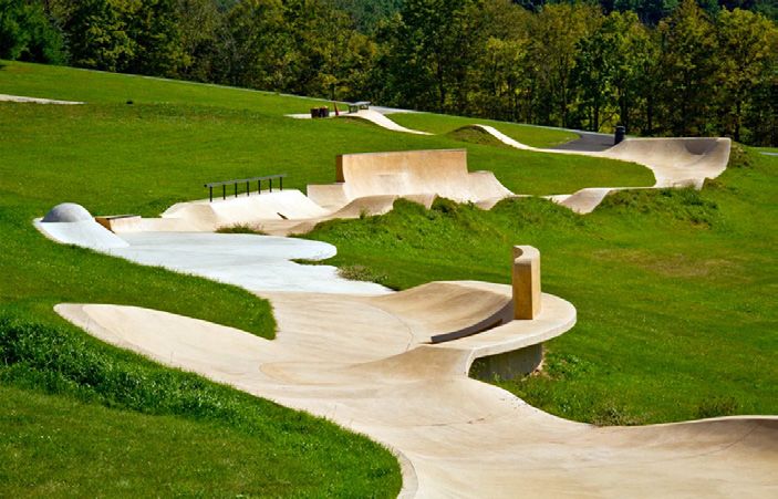
35 for locations of the action plan will be barrier free. An example of the BMX/skateboard track
items. Additionally, funding sources
the City plans to construct at City Park.
and implementation strategies are
explored in this chapter. Development of a BMX/
skateboard track
Development Development of the Public
The City of Harrison plans to
Strategies: Square
develop a BMX/skateboard track
Development of Dog Park at City Park. The design has not Develop the Public Square at the
been finalized, but the City plans corner of Main Street and 2nd
Create a dog park at the underused Street. The public square will be the
to locate the track on the old
park located at the corner of Oak center point of downtown Harrison
landfill site. The track will likely be
Street and 5th Street. and will include a bandshell, splash
constructed of concrete or asphalt.
1. Install visually appealing pad, ice rink, pavilion, decorative
fencing to keep dogs within clock, and message board.
the park boundary.
2. Create a dog trail and explore
opportunities to add dog-
friendly features.You can also read


