DRAFT 2020 Land Use Plan - Moore County, North Carolina
←
→
Page content transcription
If your browser does not render page correctly, please read the page content below
DRAFT
                                            2020 Land Use Plan
                                            Moore County, North Carolina

Photo Credits: Sandhills Photography Club, Carolina Forestry Inc.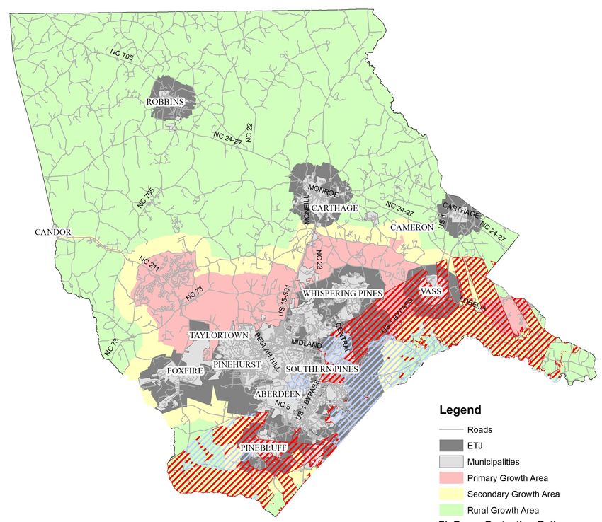
2020 Moore County Land Use Plan

         IN THIS PLAN
         OVERVIEW | BACKGROUND | TOWNS & COMMUNITIES |
         CULTURAL ACTIVITIES | POPULATION PROJECTIONS |
         GROWTH PATTERNS | RESIDENTIAL GROWTH |
         AFFORDABLE HOUSING | ECONOMIC DEVELOPMENT |
         TOURISM | MILITARY | EDUCATION | UTILITIES |
         AGRICULTURE | PRESERVING OUR LAND |
         CORRIDOR PROTECTION | CONSERVATION SUBDIVISIONS |
         GROWTH AREAS | GROWTH MANAGEMENT AREAS MAP |
         GROWTH MANAGEMENT POLICIES

OVERVIEW
The Moore County Land Use Plan serves as a comprehensive long-range guide for policy decisions concerning the overall
growth management of Moore County. Accordingly, this plan offers data and information about current and projected
conditions in Moore County and sets forth a series of policy guidelines and growth management area map to define areas
of the County where urbanization is not intended to expand within the 2030 year planning horizon. The 2020 update
builds on discussions and initiatives that have taken place previously with a focus on how to accommodate new growth
while also addressing quality of life issues such as the preservation of our heritage assets in an increasingly fragile rural
environment.
At the heart of the Land Use Plan are five goals, described in greater detail in the Growth Management Policies Chapter,
which were identified through civic engagement. These five goals are the Plan’s policies. All policies respond to and fulfill
one or more of the Plan’s goals. Policies provide general guidance for decision-makers and help direct the County towards
achieving the guiding goals.

         Land Use Plan Goals:
         1. Preserve and Protect the Ambiance and Heritage of the County of Moore
         (inclusive of areas around municipalities).
         2. Enhance the Union of the Built and Natural Environments to Improve Citizen
         Health through the Use of Open Space and Recreational Opportunities.
         3. Optimize the Uses of Land Within the County of Moore.
         4. Provide Information and Seek Citizen Participation.
         5. Accommodate a Variety of Housing Types.

                                                                                                                                2
Moore County is experiencing rapid growth in what were once rural areas. Major residential subdivision growth in the
traditionally rural areas of the County have spurred concerns among county residents about how this growth pattern, if
not addressed, will have lasting impacts on these rural areas of the County. As a response to these concerns, Moore
County, in 2019, required major residential subdivisions go through a public hearing process and limited where subdivi-
sions can be located. As a result, in 2020, Moore County created Growth Management Areas to provide guidance to
citizens, developers, elected officials, development boards, and staff, as decisions are made on rezonings and growth relat-
ed issues. The Moore County Land Use Plan includes broad policy statements that will, when combined with designated
Growth Management Areas (Primary, Secondary, and Rural Growth) form an overall growth management strategy for
Moore County.

          The Moore County Land Use Plan is not a detailed, lot by lot, site specific land use
          plan as reflected by zoning maps. Instead, the Plan prepares broad policy state-
          ments that will, when combined with designated Growth Management Areas,
          form an overall growth management philosophy for Moore County. The Plan pro-
          vides options to land owners and developers that will still accomplish growth
          management objectives.

Although adopted by the Board of Commissioners as an official public document, the Land Use Plan is not a development
ordinance and does not carry the force of law. However, the Land Use Plan serves as a long-range guide for public policy
decisions concerning the overall growth and development of the Moore County community. The Growth Management
Areas Map is incorporated as part of the document and provides a vision for the county’s future growth. Many policies
describe desired development outcomes, and consistency with these policies will be a factor in the review of discretionary
development applications, such as rezoning petitions. The Plan will bring more predictability to the zoning and develop-
ment review and approval process for developers, property owners, and concerned citizens alike.
The Land Use Plan is also a resource for those who seek general information on how Moore County may change over the
next ten to twenty years. The intent of this Plan is to make it easy to read and accessible to all. Key issues are described
with data to make the purpose of policies more apparent. Graphics, maps, photos, and charts have been used to illustrate
major points and improve the legibility of the text. Text boxes are used to present background information or highlight
issues.

                                                                                                                               3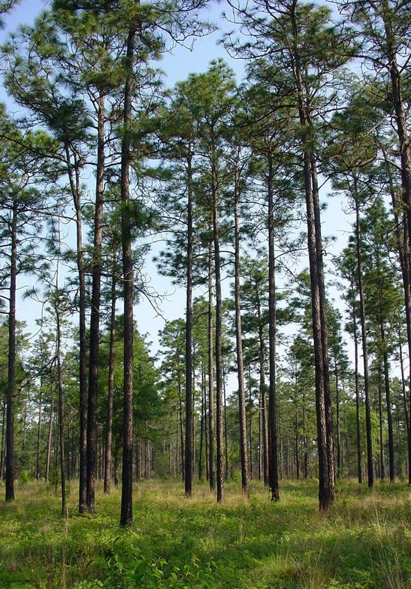
BACKGROUND
The first Moore County Land Use Plan was adopted on March 15, 1999 and included the following goals:
  1.   Preserve and protect the County’s rural agricultural nature.
  2.   Protect property rights.
  3.   Protect the environment, open space, and recreation.
  4.   Address development concerns with respect to economic development and transportation.
  5.   Encourage information and citizen participation.
  6.   Address housing.
  7.   Preserve the County’s heritage.
In 2013, a Land Use Steering Committee was formed to update the 1999 Land Use Plan. The Committee provided insight
on land use optimization and how it effects Moore County holistically and formed the following guiding principles:
  1.   Ensure the highest respect and consideration for public and private land ownership and property rights.
  2.   Ensure our County’s culture, health, economy, and natural resources are considered equally.
  3.   Recognize that all the County’s towns, villages, communities, and rural areas are unique and valued places.
  4.   Development policies should result in optimization of public services and infrastructure.
It was the committee’s intent to guide the development of policies that will lead to the growth, progress, and economic
well-being of Moore County based on the principles above. To that end, the committee identified five goals that should
guide the processes and development of policy for land use in Moore County. These five goals are:
  1. Preserve and Protect the Ambiance and Heritage of the County of Moore (inclusive of areas around municipalities).
  2. Enhance the Union of the Built and Natural Environments to Improve Citizen Health through the Use of Open Space
        and Recreational Opportunities.
  3. Optimize the Uses of Land Within the County of Moore.
  4. Provide Information and Seek Citizen Participation.
  5. Accommodate a Variety of Housing Types.
While the action steps may change, the guiding principles for the development of this plan should exhibit little change and
should be the foundation upon which future Planning Boards, County Commissioners, and other policy makers build. To
accomplish these goals, several recommendations for policy action were developed by the Committee.
We are indebted to the work of those involved in the 1999 and the 2013 updates. As Moore County has evolved over the
past several years, the necessity for a 2020 update has been recognized as a means to encourage quality and sustainable
growth, to accommodate new growth while preserving the heritage and natural resources of Moore County, to keep
providing a high level of public services while keeping taxes at a reasonable rate, and to maintain a healthy balance
between economic viability and livability by recognizing the direct connection between development and our county’s
quality of life.

           Evaluate / Update
           Periodically this Plan should be evaluated of the effectiveness in implementing
           the goals and policies. This plan is an evolving document. As new circumstances
           arise, as accomplishments are realized, and as objectives are achieved,
           amendments to the plan should be made.

                                                                                                                              4
TOWNS & COMMUNITIES
Moore County has 11 incorporated municipalities, as well other villages and communities throughout the County. These
areas have developed over the last 300 years, as Moore County has grown to what it is today. Below are brief historical
backgrounds and descriptions of cultural assets of each community.

Aberdeen. Aberdeen’s humble beginnings date back           Cameron. In 1857 the Raleigh & Augusta Railroad came to Cam-
as early as the 1700s when Highlanders fled Scot-          eron and was the end of the line for a while. The town was
land for the shores of North Carolina and migrated         incorporated in 1876 and named for Paul Cameron, a railroad
up the Cape Fear River. Originally called Bethesda, in     official. From 1880 to 1890, the Cameron-based, Muse Brothers
the mid-1850’s the name was changed to Blue’s              Store was known as the largest department store between
Crossing, in honor of Malcolm Blue. Soon after, the        Richmond and Augusta. The introduction of the Lucretia
Civil War brought turmoil and decimation to the            Dewberry (a mild blackberry) in 1892 made Cameron the
area as many of the local men fought and died in           “Dewberry Capital of the World.” Today, Cameron is well known
battle. The men that survived returned to the area         for its antique shops and on the first Saturday in May and
and started new businesses, laying the foundation          October, an antiques fair is held and attended by thousands of
for the era of prosperity to come.                         visitors. The quiet residential town offers lots of antiques and
                                                           treasures for every kind of collector.
With the completion of the Raleigh & Augusta Rail-
road after the Civil War, the improved transporta-
tion transformed Aberdeen into the commercial
center of Moore County, allowing the tar, pitch and
turpentine industry to blossom. Soon after, farming
became a staple of the area, followed by the birth of
the resort industry. Today, Aberdeen has embraced
the history found in the downtown district, but has
also progressed with the development of new busi-
nesses, charming shops, restaurants and hotels.

Carthage. Carthage is the oldest town in Moore
County, NC. It was incorporated in 1796 and serves
as the county seat. Activities in Carthage have
always revolved around the courthouse and still do
today with the fifth and current courthouse still in
use since 1922. The town itself was not laid out until     Foxfire. The Village of Foxfire is an area about seven miles
1803. The National Historic District of Carthage is
                                                           southwest of Pinehurst. The early English and Scottish settlers
proud of its more than 50 buildings and residences         called this area Piney Bottom in the early 18th century. Foxfire
of historical significance dating back to the pre- Civil   was said to have been the site of a small battle during the
War period . From 1850’s to 1920’s, the town’s             American Revolution around 1780. Due to the richness of the
growth was due to its successful buggy industry.
                                                           pine forest, settlers sold the timber for construction and
Alexander Kelly and Thomas Tyson founded the               turpentine production. Agriculture came to prominence in the
Tyson Jones Buggy Factory in 1855. This major in-          20th century featuring cotton, tobacco, corn and rye. Peach or-
dustry remained the largest factory in Moore County
                                                           chards and vineyards were also plentiful.
into the 20th century producing the “Cadillac” of
horse drawn carriages. At its peak in 1890, the            In 1977, Foxfire was incorporated and sits on one of Moore
factory turned out approximately 3000 vehicles per         County’s highest elevations. Being a relatively newer town in
year. The horse drawn buggy brought prosperity to          Moore County, Foxfire maintains its tradition of being a
Carthage, but the automobile spelled doom for the          pleasant, scenic and resort golf community. The golf course
buggy industry. However, the annual Buggy Festival         community was developed from an old 2,200 acre farm under
of Carthage honors the town’s heritage of carriage         the partnership of Roland McKenzie and Dan Tomlinson. It is a
makers and is a great family-friendly event.               growing community with the addition of residential tracts
                                                           suitable for horse farms.

                                                                                                                              5
Pinebluff The Scottish influence is reflected in the names of the early towns and residents. Members of the Peter Blue
family from Aberdeen were the original residents of Pinebluff. The Blues had great success in the agricultural industry with
tobacco and raising cattle. John Patrick had the idea to duplicate his Southern Pines and bought 772 acres in 1884. His plan
was to turn the area into a second resort. He named streets after fruits and nuts, and the avenues after northern cities.
Patrick worked for 20 years at attracting new residents to Pinebluff. Unfortunately disastrous fires stunted the develop-
ment of Pinebluff. Dr. John W. Achorn, stepped up to assume the responsibilities of leadership in Pinebluff. Achorn along
with his wife and her mother laid the foundation for Pinebluff to become a very pleasant residential area. Pinebluff has
become home to many retirees and military families from neighboring Ft. Bragg and Pope Air Force Base. Pinebluff has a
strong recreational program that centers around Pinebluff Lake. A “bedroom community,” has developed in recent years
for working class and young professional people who work in Fayetteville, Pinehurst, Southern Pines and surrounding
towns and cities.

Pinehurst. In 1895, James Walker
Tufts had a dream. As a philanthro-
pist and a shrewd businessman, he
felt there was a market for the
development of an affordable
health resort for the working class.
With the help of the esteemed
landscape designer, Frederick Law
Olmsted, the designer of New York
City’s Central Park, it took just
seven months to create the Village
of Pinehurst. When guests began
arriving with golf clubs and
invading nearby cow pastures to
practice, Tufts made the decision to
incorporate golf into the area’s
offerings. Shortly afterwards in 1900, Tufts hired Donald Ross to design courses for the new facility. After thoughtful
planning and the creation of a Ross design that infused Scottish links golf with the topography of the Sandhills, the legend-
ary Pinehurst No. 2 was born. Since that time, Pinehurst No. 2 has been designated as a National Landmark and hosted
numerous golf championships, including three US Open Golf Championships, with another set for 2024.

Southern Pines. In 1887, the idyllic town of        Robbins. The town of Robbins has roots that go back to the American
Southern Pines was developed on 675 acres           Revolution. Alexander Kennedy, a gunsmith from Philadelphia, built a
of land. Originally designed as a stopover for      gun factory on the falls of Bear Creek, near present day Robbins. The
weary northern travelers heading to and             business was very successful given the demand for rifles during the
from Florida, Southern Pines was built with         war. Due to the success of his business, many factories were
the railroad running right through the center       established and the town became known as Mechanics Hill. There was
of town. This thoughtful planning, in               a small gold strike that kept the town going until the Durham-Charlotte
conjunction with Patrick’s vision of turning        railroad came through in 1904. It was around this time that John
the area into a health resort, allowed South-       Lenning, a wealthy businessman and railroad builder, laid out the
ern Pines to become a successful and                streets to a new town nearby. In honor of his contribution the town
thriving community. Through the decades,            was named after his daughter, Elise.
James Boyd and his family contributed to
                                                    The community grew and once again the name was changed to Hemp
the growth and prosperity of Southern
                                                    as more textile manufacturing came to the area in the early 1900’s. In
Pines. In 1903, the Boyd family built
                                                    1930, a Russian immigrant, Karl Robbins purchased the Pinehurst Silk
Weymouth Heights and developed 500 acres
                                                    Mills in order to improve its operations and make it state-of-the-art.
into lots for future homes. But perhaps the
                                                    Many of the residents were employed by the mill which was a blessing
Boyd family’s most enduring legacy is their
                                                    during the Depression years. The citizens of Hemp honored Robbins in
vision of a thriving equestrian community in
                                                    1943 by renaming the town after him. It was recognition well deserved
Southern Pines. With over 4,000 acres of
                                                    for a many that had done so much for the town. Today Robbins is a
riding trails, Southern Pines now offers the
                                                    quaint town about halfway between Pinehurst and Seagrove. With the
Walthour-Moss Foundation, and hundreds
                                                    economic shifts in the last decades, the town is beginning to focus on
of nearby horse farms.
                                                    outdoor recreational activities for tourists and promotes hometown
                                                    businesses and potteries that reflect the small town hospitality that
                                                    has carried it through many changes and challenges.

                                                                                                                                6
Taylortown. Incorporated in 1987, the     Vass. Vass was settled by Scotsmen and has had many names over the years.
Town of Taylortown has played an          Originally known as Bynum, for Joseph Bynum, an early settler, it later became
important role in the well-being and      Winder after Major Winder, an officer with the Raleigh & Augusta Railroad. But
growth of the Village and resort. The     the name that remains today came from Major William Worrell Vass, another
town emerged as the resorts need to       railroad official. Major Vass was a longtime paymaster for the Seaboard Air
find ample housing for its growing        Line Railroad Company. Vass was a bustling town for commerce and agricul-
workforce. One of Taylortown’s            ture, a railroad center and even a publishing center. Today it is a town noted
famous residents was Robert “Hard         for its community involvement and wholesome leadership. As an example,
Rock” Robinson, a caddie to world         Vass residents Phil and Pasty Keith donated the building that houses the library
famous golf course architect Donald       (a Veterans Memorial). Books and funds were donated from the residents of
Ross, whose reputation as Pinehurst’s     Vass and the Bill and Belinda Gates Foundation donated state of the art
most knowledgeable caddie is              computers.
legendary.

Whispering Pines. Back in the late 1700s, Charles Hurd and Nicholas Smith received land grants from the king of England,
and the area we now call Whispering Pines was born. Many others bought and sold the area’s properties and lakes
throughout the 18th and 19th centuries, but it was A.B. Hardee who realized the land’s ultimate potential when he
purchased 400 acres in 1959. Hardee developed his tract into a private golf course and residential community, and in just
ten years, Whispering Pines became the first municipality in North Carolina to be designated as a village. Today,
Whispering Pines covers over 2,000 acres, features six lakes, sixteen miles of paved roads, two semiprivate golf courses
and an abundance of pristine stands of pines and hardwoods.

The following are other current and historical communities that have influenced the culture of Moore County:

Eagle Springs. The legend about the naming of Eagle Springs states        Jackson Springs. Jackson Springs is a rural
that the town was named for a pair of eagles that built their nest in a   crossroads community that has a very rich
huge pine tree at the mineral springs located west of the Eagle Springs   history dating back to the mid 1700’s. The
Methodist Church. A baby eagle supposedly fell out of the nest and        town came about because of the mineral
into the spring. Just south of the Methodist Church was a steam-          springs and the clear fresh water which has
powered sawmill and a shingle mill. North of the church was the           flowed without stopping for over two hundred
railroad running east and west. Beside these tracks were peach            years. In the early twentieth century, Jackson
packing sheds from which peaches were shipped to the north. Peach         Springs flourished as a highly esteemed
growers were the Page, the Bost and the Harrison families. Sand from      retreat, noted for its famous mineral water
the Bost Sand Pit was also shipped on rail cars. The railroad depot was   which could “cure any ailment”. Legend has it
on Academy Avenue (now Eagle Branch Road) and NC HWY 211.                 that a man named Jackson was hunting one
                                                                          day and shot a deer. He tracked the deer by
The Warner Hardware Store had rooms to rent upstairs. There was a
                                                                          the trail of blood in the snow to the spring
café and its second story was used for the Masonic Hall. Mrs. Hattie
                                                                          where he found the deer dead. There he dis-
Stutts was the telephone operator and the “Central Office” was in her
                                                                          covered a huge bed of brown rock with a
home. Other early stores were Wilbern Blake’s and, possibly the oldest
                                                                          natural bowl or basin in it and clean water
of the stores, N.J. Carter’s. The Eagle Springs High School was also on
                                                                          flowing from the rock. Mr. Jackson received a
Academy Avenue but it was not an accredited high school. Therefore,
                                                                          grant for the land and the place became
students, for at least their senior year, had to go either to Elise
                                                                          known as Jackson’s spring. Later the name was
Academy in Hemp (now Robbins) or to Jackson Springs High School,
                                                                          changed to Jackson Springs when someone
both of which were accredited\ high schools. The Eagle Springs
                                                                          discovered there are actually two different
Elementary School was closed about 1944 and students were bused to
                                                                          springs running from the huge brown rock,
West End Elementary. In 1946 Moore County built a new elementary
                                                                          both containing mineral water.
building at West End, at Vineland on NC 211, and a new building on NC
211 East in Eagle Springs. The elementary students again went to          Many years passed before a group of men
school in Eagle Springs until 1969 when they were sent to West End.       decided to build a health resort in the late
The Eagle Springs Methodist Church was established in 1874; the Eagle     1800’s and early 1900’s so more people could
Springs Baptist Church was established in 1901; the Eagle Springs         benefit from the water. Jackson Springs was a
Presbyterian Church was established in 1922 and was closed and            very fast growing and prosperous town for
joined with Bensalem Presbyterian Church in 1976. The Presbyterian        about thirty years. There was a school before
Church Cemetery was placed under the care of the Presbytery of            the Civil War and for several years after an
Coastal Carolina (formerly Fayetteville Presbytery). The Methodist and    accredited high school with two dormitories
Baptist churches of Eagle Springs are still active churches. When NC      for students, a depot and train which carried
HWY 211 was moved away from the old center of town, Eagle Springs,        passengers and cargo (such as lumber, turpen-
as it used to be, died.                                                   tine, mineral water, and peaches), bank, drug-
                                                                          store, doctor’s office, hotel, hardware store,
                                                                          two general stores, two service stations, post     7
office, three churches, grocery store, cotton gin, chicken hatchery, bowling alley, swimming pool, ninehole golf course and
tennis court, barber shop, dance pavilion where an orchestra played nearly every evening during the summer months, and
a large lake for swimming, boating and fishing existed. There were large homes where residents lived year round and
cottages used for summer retreats.
In 1904, members of the Page family attended the Louisiana Purchase Exposition, sometimes called the St. Louis Exposi-
tion or the World Fair at St. Louis. They took samples of the mineral water with them. It was judged the second best
medicinal water in America, winning a silver medal. Jackson Springs had a water bottling plant and the water was shipped
out by rail to various towns and cities. Many people traveled to Jackson Springs to stay at the hotel and drink the water.
With the advent of the automobile, others drove in to fill their jugs and bottles to take home – a practice that continues to
this day. In 1921, Jackson Springs became incorporated. The town encompassed the land within a one mile radius of the
mineral spring. In 1952, the incorporation of the town was re-activated and a slate of officers was elected. Edgar Graham
was elected mayor. The town received money from North Carolina to pave the streets and all the streets within a one mile
radius were paved. There has been no active municipal government in over fifty years. The hotel burned in the spring of
1932 and it was decided that it would not be profitable to rebuild. Gradually the other businesses closed as Pinehurst and
surrounding areas began to grow and thrive. Few people are still living who can remember Jackson Springs in its heyday,
but many of the people residing within Jackson Springs today have connections to the early settlers of the community and
their heritage, which is very important to them.

Seven Lakes. Seven Lakes is the largest, unincorpo-
rated village in Moore County. Planned thirty years
ago as a summer home and retirement community, it
now has a well-balanced mix of retirees and young
professionals with children. There are three separate
gated communities – Seven Lakes West, North, and
South, which is named after its seven spring-fed lakes.
Fred Lawrence, a Sanford businessman, developed
the original project in 1973. Lake Auman, an 820-acre
lake is found in the Seven Lakes West community.
Seven Lakes offers a wide range of activities such as
boating, fishing, swimming, tennis, picnic shelters,
play grounds, water sports and community centers.          West End. In 1890, between Aberdeen and Carthage, traveling
Seven Lakes offers its own public stables, providing       through the woodlands would bring you to Daniel McDonalds
horseback and equestrian sports for its residents.         turpentine distillery. To help with the transportation of timber
Both gated communities offer golfing opportunities,        and naval stores from the fields to the commercial areas,
including Beacon Ridge Golf Course and a members-          McDonald cleared a path for a railway from Southern Pines to
owned Seven Lakes Country Club, which are both             his turpentine distillery. Soon a nontraditional railway was
rated four-star. While remaining an affordable place       constructed. It had wooden rails on huge cross ties and mule
to live, Seven Lakes combines all the small town           drawn cars were pulled along these ways, fetching timber from
elements of a resort getaway with the comforts of a        both sides of the tracts. The Aberdeen and Asheboro Railroad
private gated community.                                   was completed along the McDonald right of way, in 1890. At
                                                           the most western end, a town sprung up called West End.
                                                           Sadly, the Great Fire of 1898 destroyed all thirteen buildings in
                                                           the downtown area of West End except for the railroad depot
                                                           and the drugstore. In later years, the Sandhills Furniture
                                                           Corporation mill was built and enjoyed many years of success.
                                                           In 1965, Sandhills Furniture Corporation was sold to Stanley
                                                           Furniture Company. Stanley Furniture Company was the largest
                                                           employer in Moore County before it closed its doors in early
                                                           2000. Many other communities within the County have played
                                                           valuable roles in shaping Moore County, including, but not
                                                           limited to Eastwood, Highfalls, Glendon, Westmoore, Haw
                                                           Branch, Lakeview, Parkwood, and Woodlake.

                                                                                                                                8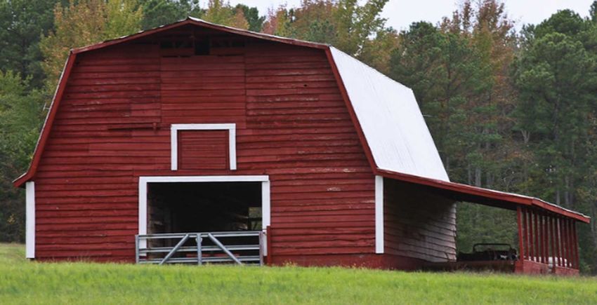
CULTURAL ACTIVITIES
Golf & Resorts. Moore County has historically enjoyed notoriety for its golfing community and culture, with Pinehurst
being considered the Home of American Golf. This attraction remains a substantial tourism draw to the area, with
developing golf course communities, restaurants, and hotels. Golf courses have changed the landscape of Moore County
over the past 100 years, since the first golf course was constructed at the Pinehurst Resort, completed by Donald Ross.
According to Moore County GIS, all the golf courses combined utilize 7,420 acres of land, equating to 11.59 square miles,
which makes up approximately 1.5 percent of the County’s land area.
Pinehurst No. 2 will be home to the U.S. Open for the fourth time in 25 years when the national championship returns to
Pinehurst Resort and Country Club in 2024. The area has attracted people, not only throughout the United States, but
from around the world.
Farming and Agriculture. Moore County’s agricultural lands are an essential element of the county’s rural landscape, mak-
ing up more than three quarters of the land base with croplands, pastures, and forests. The majority of the county’s 733
farms are small, family-run operations; similarly, most of the forest tracts are held by families, yet these small entities
combine to produce substantial quantities of agricultural and timber products. These 733 farms manage nearly 90,000
acres of farmland to produce an array of crop and livestock products for local, national and export markets. Farming in
Moore County is primarily done on a small scale, but over 150 poultry farms combine to make Moore County one of the
top twenty producers of broiler chickens in North Carolina. Farmers and other families manage 304,076 acres of timber-
land and has a total income of almost $49 million. The forest sector in Moore County, including forestry, logging, and
forest product industries, has a total economic contribution of approximately $178.9 million in industry output to the
county’s economy, supporting about 853 jobs with a payroll of about $33.1 million (NC State College of Natural
Resources). Moore County is one of North Carolina’s top ten producers of saw logs according to the USDA Forest Service
Southern Research Station. Moore County is also ranked eighth in North Carolina in income of timber harvested and
delivered to mills in 2017 (NC State College of Natural Resources).
Tobacco (both conventional and organic) continues to be a large part of the agricultural economy and agricultural
economy of Moore County. Tobacco produced in the Sandhills is in demand in the global market. Agriculture is important
because the pastures, crop fields, and forests that cover 85 percent of the county define the rural landscape, support hard
working families, and has continuously provided numerous economic, environmental and social benefits to Moore
County, contributing greatly to the identity and pride of the area.
In August of 2012 the Moore County Board of Commissioners adopted the Moore County Working Lands Protection Plan
which is a long-range plan developed to help perpetuate and even stimulate the agricultural economy of the County. The
Plan covers in detail the state of agriculture in the County, as well as its challenges and opportunities. Included in the Plan
are several proposed policies intended to help overcome industry challenges and to take advantage of opportunities that
are identified.

Forestry. Privately-owned for-
estland comprises 304,076 acres,
or 67 percent of the county’s land
area, most of which is owned by
individuals,       not      timber
companies.        The     greatest
concentrations of forests are
found in the northern half of the
county and along the western
edge of the southern half. Twenty
-five different forest types are
found throughout the county, the
figure displays the proportions of
the most common types.

                                                                                                                                  9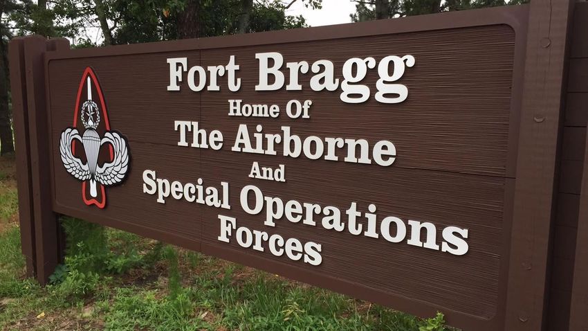
Loblolly is the primary tree grown for timber in the county because it has a relatively short rotation period of 30 to 40
years. However, while longleaf pines may have a slower start in life and require higher stand management costs up front,
the high value of the longleaf pine straw and their higher saw timber values can often offset their upfront costs when
considering the full life cycle benefits of the longleaf. Longleaf pines account for only five percent of total forestland. Hard-
woods grow much slower, taking 60 to 90 years to reach maturity. It is estimated that 74 percent of the private forests in
the county are being managed for commercial production. Non-industrial forest owners generally sell their timber to a
buyer who works for a wood processing mill, wood suppliers, loggers or timber brokers. In 2016, $12.6 million was paid to
private landowners in the county for timber that had a value of $22.9 million at wood processing mills.
Timber is a commodity that can be managed, harvested and possibly most important conserved for generations to come if
proper reforestation efforts are implemented as part of a land owner’s timber management plans. Moore County is the
leader in the state for reforestation efforts with an average of 1,500 to 2,500 acres of timberland reforested each year. In
2010, a little over 1,000 acres were reforested but this amount is lower than in previous years due to the downturn in the
economy. There are numerous cost share programs that can be used by landowners to offset the costs of reforestation.
The programs offer assistance for tree planting and other forest management activities such as prescribed burns. Along
with reforestation tax credits, there are many incentives for landowners to keep and maintain their woodland properties.
                                                       The longleaf pine, North Carolina’s state tree, once covered nearly 90
                                                       million acres of coastal plains in the southeastern United States.
                                                       Today the forests cover only about three million acres. The forests,
                                                       which burned frequently, were home to a wide variety of plant and
                                                       animal species such as bobwhite quail, fox, turkey, deer, wildflowers
                                                       and legumes. The longleaf pine tree is highly resistant to pine beetles,
                                                       ice, and fire, and historically provided construction lumber, tar, and
                                                       pitch for buildings and ships; and a resin used to refine turpentine.
                                                       The Sandhills region is one of the last remaining strongholds of long-
                                                       leaf pine in the country and several organizations, including Fort
                                                       Bragg, The Nature Conservancy, U.S. Fish and Wildlife Service,
                                                       Sandhills Area Land Trust, and Sandhills Ecological Institute, are
                                                       working to restore and protect this vanishing ecosystem.
                                                       An underlying goal of these organizations is to protect the red-
                                                       cockaded woodpecker, an endangered bird that lives predominantly
                                                       in longleaf pine forests. These two species are important issues for
                                                       Fort Bragg. In 1992, a U.S. Fish and Wildlife Service biological opinion
                                                       resulted in significant training restrictions on the Fort as part of the
                                                       requirements to recover the red-cockaded woodpecker. In order to
                                                       meet recovery requirements for the woodpecker, Fort Bragg has
                                                       been working with stakeholders to preserve and restore longleaf pine
                                                       forests and manage critical habitat on private lands outside Fort
                                                       Bragg. More than 12,000 acres of longleaf pine habitat have been
                                                       preserved in Cumberland, Hoke, and Moore counties through the
                                                       North Carolina Sandhills Conservation Partnership.

Equestrian. Horses have been a popular pastime for many citizens of Moore County. Each year, several events are focused
around the equestrian community, including the “Blessing of the Hounds” and “Stoneybrook Steeplechase.” The southeast
portion of Moore County mostly located along or off of Youngs Road is considered ‘Horse Country’ and is currently zoned
for rural equestrian. This area includes the Walthour-Moss Foundation, which occupies over 4000 acres dedicated to
horse trail riding and other equestrian activities. The foundation is also a wildlife refuge for the endangered red-cockaded
woodpecker, deer, raccoons, fox squirrels and red and grey fox. North Carolina State University Equine Research Facility is
located in this area, which is a branch of the NC State University’s Veterinary College. Though Horse Country is commonly
used to refer to this area of the county, it also extends to parts of Foxfire, Vass, Cameron, and The Harness Track in
Pinehurst. The Pinehurst Harness Track was constructed in 1915, with the Pinehurst Jockey Club being formed in 1916 by
Leonard Tufts, son of Pinehurst founder James Walker Tufts. Due the growing popularity of horse and equestrian activities,
many equestrian communities have sprung up across Moore County, especially on the fringes of Horse Country, such as
The Meadows, The Fields, Morganwood, McLendon Hills, Grande Pines and Pelham Farms.

                                                                                                                                    10
Pottery. The northwest area of Moore County is part of “Pottery Country,” a nationally recognized cluster of artisans and
handcrafted pottery. The Town of Seagrove, which is located in Randolph County, is the center of “Pottery Country”. This
area has been home to potters since the late 1700s. The pottery community is ran by nearly one hundred area pottery
shops by potters who grew up in pottery families, inspired locals who learned the trade in area community colleges , and
potters from other states attracted to the area. Several potteries are located along NC HWY 705 or its side roads,
prompting the state to designate NC HWY 705 as the official “NC Pottery Highway.” This area is unique in that the ceramic
history of the area began with the abundant and diverse natural clay deposits found in the vicinity. Native Americans were
first to discover this resource and used it for both functional and ceremonial objects. These ancient pieces are among the
most important remain-
ing artifacts of early
civilization. Since that
time, immigrant potters,
mostly English and
Germans, discovered the
area in the latter half of
the 18th century
recognizing the value of
the local clay. Over the
years, popularity of the
area has grown and is
currently home to over
100 local potters.
Military Training. Since approximately 1918 the area now known as Fort Bragg has been a training ground for the U.S.
military. Since then the base has been a highly recognized military training venue for the U.S. Army, home to the 18
Airborne Corps, 82nd Airborne Division, and U.S. Army Special Operations Command, U.S. Joint Special Operations
Command, (and previously the U.S. Air Force – Pope Air Force Base). Camp Mackall partially located in the southern
portion of Moore County also serves as a training ground for the U.S. military. Today, Fort Bragg is the largest U.S. military
installation in terms of population with approximately 53,700 military personnel and another 14,000 civilians who work on
post.
With the amount of special operations and training conducted at Fort Bragg, noise has become a land use planning issue.
This is due to the presence of artillery and small arms fire high-noise areas, aircraft accidental potential zones, and military
aircraft low-level training areas. Most of Fort Bragg’s high noise areas are contained within its boundaries. However,
relatively small areas, just outside the installation boundaries experience average noise levels, at times in excess of 62
decibels, which is mostly generated by artillery fire. These military live-fire exercises are often conducted late at night and
due to the startled effect caused by blast noise and vibrations; this can disrupt citizen’s sleep patterns and in the past have
led to the registration of numerous complaints.
In addition to artillery fire, military aircraft accident potential zones (APZ’s), which extend from Camp Mackall into Moore,
Richmond, and Scotland Counties and from Pope Army Airfield into Cumberland and Harnett Counties, have a much
higher noise level. APZ’s are statistically the
location where the highest number and
percentage of aircraft accidents occur, which
may lead to loss of life and property, thus
becomes a concern in land use planning.
In terms of effected area, a significantly larger
off-base impact than noise and accident
potential is the military aircraft training
routes and special use airspace. Moore
County, as well as Harnett and Hoke Counties,
contain military special use airspace, which
regularly experiences low-level flights from
military helicopters and C-130 cargo planes,
as pilots practice nap-of-the-earth radar
evasion tactics.
11POPULATION PROJECTIONS
The County’s total population, including the municipalities, has more than doubled over the last fifty years, from 36,733 to
88,247 (US Census Bureau). Moore County’s estimated population in July 2018 was 99,390 (NC Budget & Management).
1990-2000
Moore County’s population in
1990 was 59,000. The County
grew by 15,768 people (26.7%)
and had a total population of
74,768 in 2000. (US Census
Bureau)
2000-2010
Moore County grew by 13,479
people (18%) and had a total
population of 88,247 in 2010.
(US Census Bureau)
2010-2020 Estimates
Moore County is projected to
grow by 14,703 people (16.6%)
and have a total population of
102,950 by 2020. (NC Budget &
Management)
2020-2030 Estimates
Moore County is expected to
grow by 16,724 people (16.2%)
and have a total population of
119,674 by 2030. (NC Budget &
Management)
12GROWTH PATTERNS
As the County grows a projected 16.2% between 2020 and 2030, new development will be located predominately in the
south-central portions of the county. The highest concentration of people are located in the municipalities of Pinehurst,
Aberdeen, and Southern Pines. Of the total current population living in Moore County, approximately 39% of all residents
live within one of these three municipalities.
Moore County also has two unincorporated communities (Seven Lakes and Woodlake). Growth is anticipated to continue
in these areas, as well as areas just outside the boundaries of the incorporated municipalities. This growth outlook is
enabled by proximity to existing infrastructure such as major roads and utilities and potential annexations. Conversely,
limited availability of water and sewer, coupled with poor soils, are factors denoting the northern parts of Moore County
as low growth areas.
2018 Population Estimates
A predominant pattern of development in Moore County over the past 10 years can best be defined as rural sprawl. This
type of development is unchecked, residential growth occurring far from higher density areas and generally consuming
more land and resources needed to create a livable county. Dispersed development patterns create a higher tax burden
on the county than more compact patterns that can make more efficient use of existing infrastructure. In addition,
sprawling development patterns can increase conflicts with agricultural uses typically found in rural settings.
Economic development and related residential growth is essential to maintaining the quality of life enjoyed by Moore
County residents. In strict terms of land development, public costs of growth include schools (increasing student popula-
tions require additional classroom space and entire schools); public safety such as fire, police, and emergency medical
services; general administration such as tax collection, public records, planning and inspections; social services; health
services; solid waste, and many other services either voluntarily provided by local government, or mandated by the state
government as necessary for the local governments to provide.
Population growth brings both costs and benefits. Growth, if not well planned, can lead to overburdening the available
revenue sources, so that as unrestricted development occurs, existing funding is inadequate and may cause a reduction of
the level and quality of service over time. The County encourages new development to locate near existing communities
and near areas that are planned for services such as a water and sewer.
Moore County’s eleven municipalities make up only 9.4% of the land area in the tax district, but account for 66.99% of
the County’s total tax value at $9,267,332,024. The rest of Moore County (90.6% of the tax district) accounts for 33.01%
of the total tax value at $4,564,660,542 (Moore County Tax Department).
Moore County realizes that growth can have significant impacts on agriculture, community character, quality of life, and
the tax base and tax burden. This plan seeks to achieve well-planned growth patterns that are fiscally, socially, and
environmentally responsible.
13How Can Our Current Growth Trends Affect Moore County?
• Traffic congestion
• Service costs of new residential development can exceed tax revenue generated
• Loss of open space and farmland
• Loss of natural heritage assets
• Difficulty in anticipating schools, classroom space and utility infrastructure
The Moore County Land Use Plan outlines growth management policies that build sustainable development principles by
reshaping residential and rural development patterns with the intent to strengthen our local economy, create jobs, and
protect our environment and rural resources.
The Moore County Land Use Plan is a strategic approach to development planning as it does not end with a few specific
zoning ordinance revisions. The policies outlined in the Plan should provide the County Planning Board, Board of County
Commissioners, school boards, municipalities and other interested entities with some level of predictability in the growth
patterns that occur in Moore County. The Plan is also intended to provide landowners, homebuilders, land developers,
and other real estate interests with some level of confidence in determining where to pursue various development
opportunities.
Who Uses the Land Use Policies?
To aid in the effective use of this plan, the following examples explain how different
users can employ the policies in deciding upon a typical rezoning request:
Landowners. To determine development potential of lands owned and the possible
impact of surrounding property.
Developers. A developer or property owner can petition for a rezoning request that is
consistent with County policy, thereby increasing the chances of rezoning approval
and minimizing guess work and wasted time.
Planning Department Staff. The Moore County Planning Staff will review the rezoning
request considering the adopted Land Use Plan and advise which policies support the
rezoning or conflict with the rezoning.
Planning Board. Prior to a regular meeting of the Planning Board, members can make
their own determination as to the consistency of the rezoning request with the Land
Use Plan. At the meeting, the entire Board will review and decide upon the petition,
using the Plan as a foundation for recommending approval or denial. The Board may
choose to give different weight to different policies, and where policies appear to con-
flict, the Board will decide which policy should be followed.
Board of County Commissioners. In its legislative authority to rezone property, the
Board of County Commissioners has the final decision on whether a rezoning request
is consistent with the Land Use Plan. Over time, a record of policy interpretations will
form a foundation for consistent decision making throughout the land use planning
process.
14RESIDENTIAL GROWTH
Moore County is expected to grow by 16,724 people from 2020 to 2030 (NC Budget & Management). As the population of
Moore County continues to grow, the issue of residential development patterns has resulted in a closer examination of the
effects of intense development on our rural quality of life. The traditional concerns expressed have been about loss of
farmland, open space, and increased traffic congestion.
If the average Moore County household size of 2.33 persons per household (2010 US Census Bureau) remains unchanged,
an estimated 7,177 additional dwelling units will be needed to meet housing needs by 2030. If half of the new housing
units are developed within a municipality or extra-territorial jurisdiction (ETJ) that would leave 3,588 homes (and 8,360
people) to locate within unincorporated areas of the County.
If public sewer is not available, new dwelling units, on average, requires 1/2 an acre of land per unit which adds up to
approximately 1,800 acres. New roads and open space account to approximately 40% of a new subdivision for an
additional 720 acres totaling to approximately 2,500 acres (or 4 square miles). For comparison, the Town of Vass is 3
square miles.
The Moore County Land Use Plan seeks to outline growth management areas and policies that outline sustainable devel-
opment principles by reshaping residential growth patterns to strengthen our local economy, enhance our rural communi-
ties, and protect the environment. The Land Use Plan is intended to guide growth in an organized, efficient, and
sustainable manner by encouraging where growth should be supported and restraining rural sprawl.
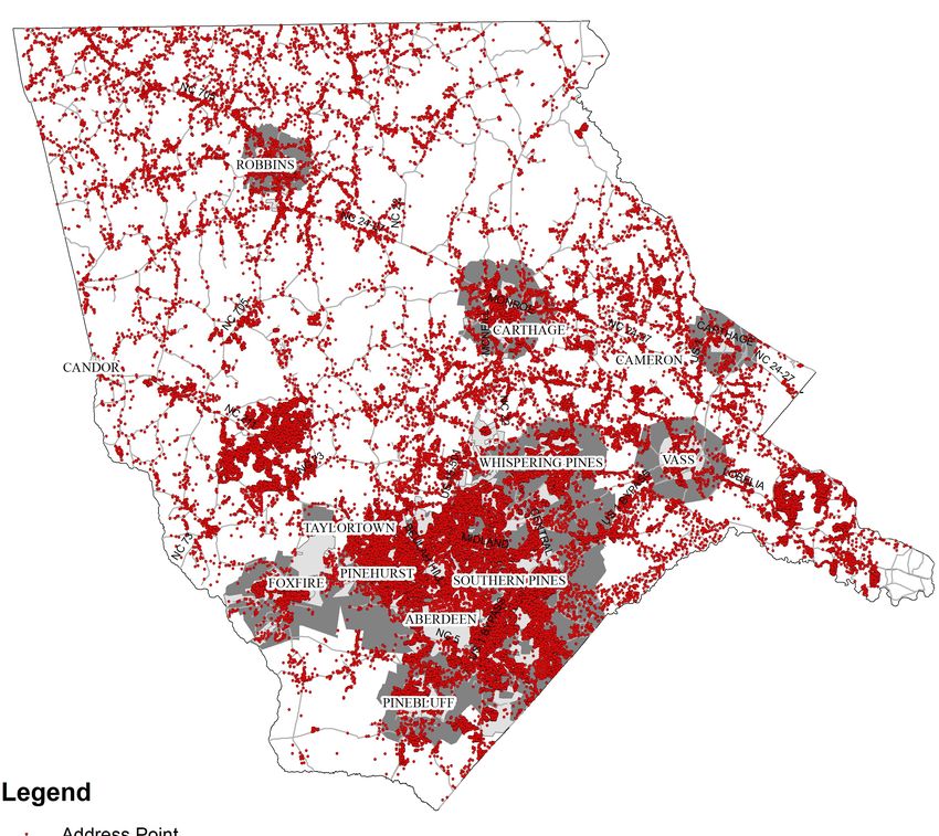
Address Point Map
15AFFORDABLE HOUSING
There were 46,613 housing units in Moore County as of 2018. The majority of housing is single family detached (70%).
Mobile homes are the second most prevalent housing type (15%) and serve as the primary type of affordable housing in
many parts of the County (US Census Bureau ACS Data). As land prices rise, especially in the southeast part of the County,
many mobile homes parks may be redeveloped, which will further exacerbate the affordable housing issue in that part of
the County.
Traditional measures of housing affordability ignore transportation costs. Typically a household’s second-largest expendi-
ture, transportation costs are largely a function of the characteristics of the household’s neighborhood. Factoring in both
housing and transportation costs provides a more comprehensive way of thinking about the cost of housing and true
affordability. Moore’s residents spend 24.4 minutes commuting each way compared to 21 minutes for Cumberland County
(US Census Bureau ACS Data).
32,604 2,011 5,033 6,965
SINGLE FAMILY UNITS TOWNHOMES APARTMENTS MOBILE HOMES
The median home value in Moore County is $227,000. For comparison, the median home value in Cumberland County is
$113,900 and Fayetteville is $111,400. Moore County home values have gone up 4.6% over the past year and Zillow
predicts they will rise 3.0% within the next year. The median price of homes currently listed in Moore County is $306,499
while the median price of homes that sold is $196,700. For comparison, the median price of homes currently listed in
Cumberland County is $160,900 while the median price of homes that sold is $123,400. The median rent price in Moore
County is $1,450, which is the same as the Pinehurst-Southern Pines median of $1,450. The median rent price in
Cumberland County is $950, which is lower than the Fayetteville Metro median of $975 (Zillow).
An income of approximately $63,000 is necessary for a mortgage of the average new home to be considered affordable
(30% of monthly income). Moore County’s median household income in 2017 was $54,468 (US Census Bureau). Police
officers, teachers, social workers and other professionals have incomes significantly below this threshold and need access
to more affordable for-sale and rental housing. Moore County ranks just behind Chatham County for percentage of
population below poverty level at 10.7% for surrounding counties. The average poverty level for all surrounding counties is
17.86%. North Carolina as a whole has 14% of its total population below the poverty line.
Assuring the option of affordable housing within a community creates opportunity for citizens to establish a safe and
stable living environment for the various age segments identified above. It is important as a community that affordable
housing options are available to people at different stages of their life cycle, people with different needs, and different
incomes. Additionally, economic developers find it necessary to have affordable housing options available to attract and
retain young professionals to our community. Stable and affordable housing that meets the needs of the identified
segments of the population from above creates the opportunity for a stronger community of engaged citizens. Second to
housing costs for these segments of the population described above is the cost of transportation. So, from a land use
planning perspective, it is important to consider that affordable housing options exist within neighborhoods that are in
close proximity to public services, schools, places of employment, as well as goods and services.
A more in-depth countywide analysis should be conducted to determine how new affordable housing options could be
incorporated into the community, as well as a comprehensive study of the County’s demographics to identify trends and
support assertions in regards to this need.
16ECONOMIC DEVELOPMENT
Moore County is uniquely located within the heart of North Carolina and is easily accessible from all parts of the state.
Healthcare, Tourism/Hospitality, and Retail are our three largest private industry sections currently employing 66.3% of
our workforce. Manufacturing is also a consistently solid industry sector, and our defense & military industry is growing.
Moore County is an attractive and convenient location for military contractors and suppliers, not only because the Fort
Bragg Army installation, Pope Army Airfield, and the Camp Mackall training facility are our neighbors, but also because our
workforce is enhanced by the large number of separated and retired military who have settled here to enjoy the
exceptional lifestyle.
Moore County currently has a
labor force of 40,623.
The health services industries
make up 34% of employment
within the county. The leisure
and hospitality industry
makes up the second most
employed industry at 19%,
which supports the strong
presence of golf in the area.
First Health of the Carolinas,
Inc. is the largest employer in
the county with over 3,000
total employees, which is
approximately 8% of the total labor force.
A key principle of policies outlined in the Land Use Plan is to encourage continued economic development in a way that is
compatible with the quality of life and environmental concerns of county residents. Sustainable economic growth,
environmental protection, and rural quality of life must be pursued together as mutually supporting growth management
goals. As our economy continues to change, the characteristics of rural industry and commerce are also evolving. With
proactive County Growth Management Policies, there could be opportunities for rural industry and commerce to be
located within Rural Growth Areas without causing unacceptable disturbance to the rural community.
The basic zoning standards currently utilized in Moore County emphasize the separation of land uses that are normally
deemed to be “incompatible.” However, in a large rural area such as Moore County, the unintended consequences of this
system have been the segregation of residential areas from convenient rural shopping and have increased the
dependence and travel distances required by automobile. The policies outlined by this Land Use Plan envision the mixing
of compatible land uses (such as rural neighborhood retail and service establishments within general residential areas)
with the goal of reducing automobile travel distances and promoting better livability in the rural communities.
The unique economic challenges faced by large counties in the 21st Century include the necessity to enhance rural eco-
nomic development; rural employment opportunities; and the County’s tax base, by accommodating industrial/
commercial activities that require proximity to rural resources. Individual rezoning decisions will depend on the scale of
the development and the nature of the site and its location. In Rural Growth Areas, rezoning requests necessary to sus-
tain a rural economy shall be weighed with the need to protect the area through the use of site specific and conditional
zoning.
Source: NC Department of Commerce, Labor and Economic Analysis Division
17TOURISM
Tourism is our 2nd largest private industry sector. According to Visit North Carolina, Moore County is ranked 11th out of
North Carolina’s 100 counties in total travel expenditures for 2018. Domestic tourism revenues for Moore County in 2018
totaled $520.69 million, up 6.0% from 2017. More than 6,000 jobs were directly attributable to travel and tourism.
According to the Convention and Visitors Bureau 2017 Strategic Plan, visitors spend $1.28 million per day in Moore Coun-
ty. This includes hotels/lodging, food, recreation, retail purchases, transportation, and other miscellaneous expenses.
Tourism also generates $38 million in taxes annually.
Though golf is the driving force behind tourism, there are several other attractions that draw people into Moore County.
Visitors from all over the country and the world visit Moore County yearly, not only to experience the charm found in the
historical areas of the community, but also to enjoy the agricultural and pastoral land uses, straddling the division of the
Sandhills and piedmont regions of the state. Festivals are held throughout the year that attracts thousands of visitors from
outside Moore County and the state. The northwest area of Moore County is part of “Pottery Country,” a nationally
recognized cluster of artisans and handcrafted pottery. Horses have been a popular pastime for many citizens of Moore
County. The southeast portion of Moore County mostly located along or off of Youngs Road is considered ‘Horse Country’
and is currently zoned for rural equestrian.
As Moore County continues to grow, it will also be critical to protect and enhance the quality of life that is found in the
area, which is highly recognized in the tourism industry. Moore County should ensure its destination is more appealing so
people will stay longer, receive value for the money they spend during each visit, and leave feeling they have experienced
a unique area that has preserved its unique character.
Tourism continues to play a vital role in the County’s economy, including job creation. Tourists that visit spend money that
helps our local businesses. The quality of life, through golf, horse country, and/or recreation, makes Moore County a very
desirable retirement location. The county benefits greatly from having such a high retirement population, with retirees
with various backgrounds and education, which contribute to organizations and provide mentorships to the younger
generation. It will be crucial for planners to respond and plan for this ever growing population. As people continue to age,
their ability to be mobile often diminishes, making it more difficult for the aged to access goods, services and social
opportunities.
18You can also read