Draft NOVEMBER 2017 - DPLH Consultation Hub
←
→
Page content transcription
If your browser does not render page correctly, please read the page content below

Department of Planning,
   Lands and Heritage

Draft
Guilderton to
 Kalbarri
 Sub-regional Planning
                    Strategy

                               NOVEMBER 2017
Draft Guilderton to Kalbarri Sub-regional Planning Strategy

This document has been published by the                       © State of Western Australia
Department of Planning, Lands and Heritage.
                                                              Published by the
Any representation, statement, opinion or advice
                                                              Department of Planning
expressed or implied in this publication is made in
                                                              Gordon Stephenson House
good faith and on the basis that the Government, its
                                                              140 William Street
employees and agents are not liable for any damage
                                                              Perth WA 6000
or loss whatsoever which may occur as a result of
action taken or not taken, as the case may be, in             Locked Bag 2506
respect of any representation, statement, opinion or          Perth WA 6001
advice referred to herein. Professional advice should
                                                              Published November 2017
be obtained before applying the information contained
in this document to particular circumstances.
                                                              website: www.dplh.wa.gov.au
                                                              email: info@dplh.wa.gov.au
                                                              tel: 08 655 18002
                                                              fax: 08 655 19001
                                                              National Relay Service: 13 36 77
                                                              infoline: 1800 626 477
                                                              Department of Planning owns all photography in this
                                                              document unless otherwise stated.
                                                              This document is available in alternative formats on
                                                              application to Communication Services.

                                                        II
Draft Guilderton to Kalbarri Sub-regional Planning Strategy

Executive Summary
The coastal area between Guilderton and                       • Indian Ocean Drive being compromised as
Kalbarri is the focus of the Guilderton to                      an important tourist route if it is used for
Kalbarri Sub-regional Planning Strategy.                        major freight
                                                              • the need for new recreational marine
Historically, the sub-region has been                           facilities in the sub-region, in particular at
characterised by small fishing and tourist towns                Ledge-Lancelin.
nestled along a coastline of sandy beaches and
fringe reefs, with the regional city of Geraldton
anchoring economic and social service                         The strategy sets 17 policy statements specific
provision.                                                    to the sub-region. These clarify the WAPC’s
                                                              position on matters such as: coastal hazard
The sub-regional strategy is an overarching                   risk, the future of Wedge and Grey, settlement
planning document that outlines the Western                   hierarchy definition, limitations on future rural
Australian Planning Commission’s approach to                  residential development, and avoiding native
future planning and development within the                    vegetation loss.
sub-region
                                                              Eleven future actions are set for the WAPC to
The Guilderton to Kalbarri sub-region is                      undertake, some of which are specific to the
administered by eight local governments and                   sub-region and others that may have broader
covered by the Mid West and Wheatbelt                         application. The future actions respond to data
Development Commissions.                                      gaps and proactive initiatives identified in the
                                                              preparation of the sub-regional strategy.
The strategy responds to a range of potential
planning issues that would impact the coast.                  Future actions include: land assembly for non-
These include:                                                residential public uses, preparation of a further
                                                              sub-regional strategy for the Mid West’s Batavia
• Perth’s outer suburbs sprawling up the                      Coast, investigating the need for a study to
  coast, threatening large tracts of pristine                 identify future demand for a Perth-Geraldton
  remnant vegetation and stretching                           passenger rail service, and assisting in the
  infrastructure servicing demands                            preparation of tourism strategies to guide local
• urban growth threatening areas with high                    planning strategies.
  biodiversity significance, known strategic
  mineral and petroleum resource value and
  other recognised natural assets
• changing coastal processes prompting the
  need for guidance on existing and proposed
  development to inform coastal hazard
  risk management and adaptation plans
  (CHRMAP)
• continued population and tourist growth
  prompting the need for strategic and
  sustainable potential tourism opportunities

                                                        III
Draft Guilderton to Kalbarri Sub-regional Planning Strategy

   Table of contents
   1 Introduction                                                           1
       1.1 The study area                                                   1
       1.2 Need for this strategy                                           1
       1.3 Purpose and scope                                                1
       1.4 Vision                                                           1
       1.5 Key issues                                                       2
       1.6 Process for developing this strategy                             2

   2 Governance and context                                                 4
       2.1 Planning                                                         4
             2.1.1 State planning policies                                  4
             2.1.2 Regional planning and infrastructure frameworks (2015)   4
             2.1.3 Indian Ocean Drive Planning Guideline (2014)             5
             2.1.4 Local planning strategies and schemes                    5
       2.2 Regional development                                             5
       2.3 Aboriginal heritage and native title                             6

   3 Population and settlement                                              8
       3.1 Population statistics                                            8
             3.1.1 Population statistics and projections                    8
       3.2 Settlement and growth                                            9
             3.2.1 Settlement hierarchy                                     9
             3.2.2 Settlement culture and tourism impacts                   10
             3.2.3 Health and education services                            11
             3.2.4 Land requirements for future public works                13
             3.2.5 Public health and adaptive technologies                  13

   4 Environmental significance                                             14
       4.1 Climate                                                          14
       4.2 Biodiversity                                                     14
             4.2.1 Conservation assets and protection                       15
       4.3 Water resources                                                  17
             4.3.1 Groundwater                                              18
             4.3.2 Surface water                                            18

                                                        IV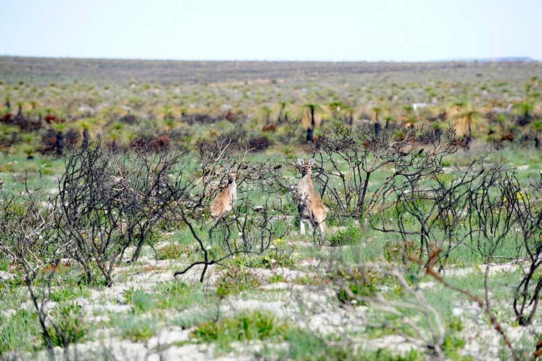
Draft Guilderton to Kalbarri Sub-regional Planning Strategy

       4.4 Landcapability and catchment management                          19
       4.5 Bushfire                                                         20
       4.6 Basic raw materials                                              21
       4.7 Mineral and petroleum resources                                  23
       4.8 Coastal planning                                                 25
             4.8.1 Responses to coastal erosion                             25

   5 Economic drivers                                                       27
       5.1 Tourism                                                          30
             5.1.1 Tourism assets and events                                32
             5.1.2 Wedge and Grey                                           34
             5.1.3 Trails and cultural tourism                              35
             5.1.4 Tourism land supply                                      36
             5.1.5 Caravan parks                                            37
             5.1.6 Peak tourism                                             38
             5.1.7 Recreational boating                                     39
             5.1.8 Tourism signage and promotion                            43

   6 Transport                                                              44
       6.1 Roads                                                            44
       6.2 Rail                                                             46
       6.3 Ports                                                            47
       6.4 Aviation                                                         47

   7 The Guilderton to Kalbarri sub-regional strategy                       48
       7.1 WAPC policy position for the Guilderton to Kalbarri sub-region   48
       7.2 WAPC future actions                                              49
       7.3 Monitoring and review                                            50
       7.4 Maps                                                             50

   References                                                               58

   Appendices

   Appendix 1       Regional settlement hierarchy                           61
   Appendix 2       Relevant State planning policies                        63

   Maps, figures and tables

                                                        V
Draft Guilderton to Kalbarri Sub-regional Planning Strategy

   Map 1         Settlement and transport                                                     51
   Map 2         Natural environment                                                          52
   Map 3         Sewage-sensitive policy areas                                                53
   Map 4         Basic raw materials and mineral resources                                    54
   Map 5         Mineral resources activity                                                   55
   Map 6         Coastal planning                                                             56
   Map 7         Tourism                                                                      57

   Figure 1      Western Australian planning framework                                        4
   Figure 2      Anticipated population growth of local governments in the study area         9
   Figure 3      Land affected by the draft Strategic Assessment for Perth and Peel Regions   17
   Figure 4      Basic raw material extraction on Crown land in Western Australia             21
   Figure 5      Sedimentary basins of Western Australia and
                 potential shale gas resource locations        24
   Figure 6      Risk management and adaptation hierarchy                                     25
   Figure 7      Employment by industry (Guilderton to Kalbarri sub-region)                   28
   Figure 8      Percentage of total visitors to Western Australia by Tourism WA region       31
   Figure 9      Number of recreational vessels in the sub-region                             40
   Figure 10     Percentage of recreational vessels per shire                                 40

   Table 1       Settlement hierarchy and population capacity                                 10
   Table 2       Health facilities                                                            11
   Table 3       Education facilities and enrolments                                          12
   Table 4       National parks in the study area                                             16
   Table 5       Land zoned for tourism purposes                                              36
   Table 6       Existing boating facilities                                                  42
   Table 7       Designated agricultural lime routes                                          46

                                                        VI
Draft Guilderton to Kalbarri Sub-regional Planning Strategy

1 Introduction
1.1 The study area                                            1.3 Purpose and scope
The study area for the Guilderton to Kalbarri                 The sub-regional strategy is an overarching
Sub-regional Planning Strategy can be broadly                 planning document that outlines the WAPC’s
described as the coastal strip between                        approach to future planning and development
Guilderton (Moore River) to the south, and                    within the Guilderton to Kalbarri sub-region.
Kalbarri (Murchison River) to the north, and
including the Abrolhos Islands.                               The purpose of the strategy is to integrate
                                                              local and regional landuse planning to provide
                                                              for population and economic growth in a
1.2 Need for this strategy                                    sustainable manner. The strategy also must
                                                              respond to environmental and coastal landform
The Western Australian Planning Commission                    change and address complex governance
(WAPC) has identified a range of issues that                  matters.
are consistently experienced throughout
the coastal area from Guilderton to Kalbarri,                 The sub-regional strategy provides a local
particularly in the coastal settlements. These                context and more detail for actions previously
include urban growth pressure, coastal erosion                detailed in the WAPC’s State Planning Strategy
and inundation, protection of biodiversity,                   (2014) and various local planning instruments.
tourism, agriculture and landscape values, and
bushfire planning.                                            It promotes a whole-of-government approach
                                                              for a wide range of social, economic and
The primary aim of this strategy is to manage                 environmental considerations in the sub-region.
and plan for growth along the Indian Ocean
coastal zone from the northern boundary of                    As a provision of the State Planning Framework,
the metropolitan region to Kalbarri.                          the sub-regional strategy forms the basis for
                                                              cooperative action by the State and local
The strategy is intended to help local                        governments on land use, development and
governments implement State strategic issues                  infrastructure. Local planning strategies are
in a sub-regional context by guiding decision-                expected to be consistent with this document.
making, and informing local planning documents
such as local planning strategies and schemes.
                                                              1.4 Vision
The WAPC established a steering group to
guide the preparation of the Guilderton to                    The vision for the Guilderton to Kalbarri Sub-
Kalbarri Sub-regional Planning Strategy. The                  regional Planning strategy is:
steering group has overseen the preparation of
the document and supports the purpose, vision                    Relaxed and healthy coastal
and implementation actions presented.                            communities connected to a
                                                                 diverse economy, valued natural
                                                                 environment and a celebrated
                                                                 culture

                                                        1
Draft Guilderton to Kalbarri Sub-regional Planning Strategy

1.5 Key issues                                                1.6 Process for developing
• There is the potential for Perth’s outer
                                                                  this strategy
  suburbs to sprawl up the coast, threatening                 The preparation of the Guilderton to Kalbarri
  large tracts of pristine remnant vegetation                 Sub-regional Planning Strategy was overseen
  and stretching infrastructure servicing                     by the Department of Planning, Lands and
  demands on the State.                                       Heritage on behalf of the WAPC. A steering
• Urban growth may threaten areas with high                   group was established to guide the preparation
  biodiversity significance, known strategic                  of the strategy.
  mineral and petroleum resource value and
  other recognised natural assets.                            The steering group included representatives
• Coastal processes are changing. Guidance                    from:
  around the State values of existing and                     • Western Australian Planning Commission
  proposed development is required to                           (WAPC)
  inform the preparation of coastal hazard                    • Department of Planning, Lands and
  risk management and adaptation plans                          Heritage
  (CHRMAP) by local governments and others.
                                                              • Mid West Development Commission
• Continued population and tourist growth
  is expected to put pressure on the sub-                     • Wheatbelt Development Commission
  region’s coastal areas. The strategic and                   • WA Local Government Association
  sustainable development of potential                          (WALGA)
  tourism opportunities is required.
                                                              • Shire of Chapman Valley
• Indian Ocean Drive is an important tourist
                                                              • Shire of Carnamah
  route that could be compromised if it is
  used for major freight.                                     • Shire of Coorow
• There is economic and recreational                          • Shire of Dandaragan
  pressure to develop new marine facilities                   • Shire of Gingin
  in the sub-region, in particular at Ledge-
  Lancelin.                                                   • City of Greater Geraldton
                                                              • Shire of Irwin
                                                              • Shire of Northampton.

                                                        2
Draft Guilderton to Kalbarri Sub-regional Planning Strategy

The steering group met in Jurien Bay, Geraldton               The steering group has overseen the
and Lancelin, and received presentations from:                preparation of this document and supports
• Department of Planning, Lands and Heritage                  the purpose, vision and implementation actions
                                                              presented.
• Department of Transport – Marine
• Main Roads WA                                               Infrastructure projects identified within the
• Tourism WA                                                  strategy are based on indicative information
                                                              from State government agencies and are
• the Office of the Environmental Protection                  subject to change. Unless otherwise stated, they
  Authority                                                   should not be taken as a funded Government
• Mid West Development Commission                             commitment.
• Wheatbelt Development Commission.

                                                        3
Draft Guilderton to Kalbarri Sub-regional Planning Strategy

2 Governance and
  context
2.1 Planning                                                  plans, subdivision, and development. This study
                                                              seeks to build on the policy direction of State
The planning context for the Guilderton to                    planning policies relevant to the Guilderton to
Kalbarri Sub-regional Planning Strategy is                    Kalbarri sub-region (Appendix 2).
shown in Figure 1. This strategy is intended
to be more detailed than a regional strategy,                 2.1.2 Regional planning and
but it does not address all matters that would                      infrastructure frameworks
typically form part of a local planning strategy.
                                                              Planning and infrastructure frameworks have
2.1.1 State planning policies                                 been prepared for each of Western Australia’s
                                                              10 planning regions. The frameworks provide
State planning policies provide the highest                   guidance to government agencies and local
level of planning policy control and guidance in              governments on land use, land supply, land
Western Australia. They are prepared under                    development, environmental protection,
Part 3 of the Planning and Development Act                    infrastructure, investment and for the delivery
2005 and are applied at all levels of planning                of physical and social infrastructure for each
decision-making including strategic planning,                 region. They also provide the framework
local planning strategies and schemes, structure

Figure 1: Western Australian Planning Framework

                             Strategic            Structure             Statutory             Policy
          Level                                     Plans

                                State                                       State
          State                Planning                                    Planning
                               Strategy                                     Policy
                                                                                            Strategic &
                                                                                            Operational
                                                                                              Policies
                               Regional                                   Regional
        Regional             Framework/                                  Mechanisms
                               Strategy                                including:
                                                  Sub-regional         - Region Scheme
                                                    & District         - Planning Control
                                                 Structure Plans         Area
                                 Sub-                                  - Improvement Plan
      Sub-regional             regional
                               Strategy

                                Local                                        Local             Local
          Local                Planning                                     Planning          Planning
                               Strategy               Local                 Scheme            Policies
                                                    Structure
                                                      Plan(s)

                                                        4
Draft Guilderton to Kalbarri Sub-regional Planning Strategy
for the preparation of sub-regional and local The local planning strategies and schemes may
planning strategies and inform the decisions of need review to ensure consistency with this
the WAPC and its Infrastructure Coordinating strategy.
Committee.
The Guilderton to Kalbarri study area is 2.2 Regional development
covered by the Mid West Regional Planning
and Infrastructure Framework (2015) and The Regional Development Commissions Act
the Wheatbelt Planning and Infrastructure 1993 defines the regions of the State in an
Framework (2015). These frameworks almost identical manner to the Planning Act.
establish a broad settlement hierarchy for
each region, outline major transport routes Regional investment blueprints have been
and infrastructure, identify conservation estate, prepared for each region in Western Australia
remnant vegetation, mineral prospectivity, and defined under the Regional Development
significant basic raw materials. Commissions Act 1993. They identify
priorities for economic, social and community
2.1.3 Indian Ocean Drive Planning development projects.
Guideline
By considering local issues and conditions,
The Indian Ocean Drive Guideline (2014) sets the blueprints seek to develop the economic
out broad guidelines for the location, siting and base of each region by highlighting advantages,
design of various land uses and development in workforce opportunities and community
the locality of Indian Ocean Drive. It provides development. They are intended to guide
an integrated approach to land use decision- investment and allocation of funding into
making across five shires with the purpose of infrastructure and services for regional
retaining the rural and natural landscape and communities
enhancing the provision of services and facilities
available to all users of the scenic coastal road. Mid West Regional Investment Blueprint
The Guideline is classified as an operational The Mid West Regional Investment Blueprint
policy under State Planning Policy 1: State (2015) represents a 2050 growth and
Planning Framework with the intention that development strategy for an intergenerational,
it be used in the context of local planning global, innovative and dynamic Mid West region
strategies and schemes (and amendments to) that attracts and retains talent and investment.
and development applications.
The Blueprint has five priority pillars that are
2.1.4 Local planning strategies and deemed as important to either drive or reduce
schemes barriers to growth and development. These are:
• physical infrastructure
There are eight local governments in the study
area, and all have local planning strategies • digital and communications
and schemes that govern land use and • economic development
development.
• highly desirable communities
This sub-regional strategy is intended to • knowledge and learning.
provide direction and support to local
governments to deal with issues of State and
regional significance.
5Draft Guilderton to Kalbarri Sub-regional Planning Strategy
The five pillars are further divided into 22 The recognised traditional owners for the land
associated elements (sub-pillars). north of Perth are the Yued people. See the
Noongar (Koorah, Nitja, Boordahwan) (Past,
The Mid West Development Commission has Present, Future) Recognition Act 2016.
been progressively implementing the Blueprint. The Yued region includes coastal areas between
Two Rocks and Leeman, and also includes
Wheatbelt Regional Investment Blueprint inland areas such as Moora and Dalwallinu.
Geraldton and its surrounds are considered to
The Wheatbelt Regional Investment Blueprint be the traditional lands of the Yamatji people.
(2015) outlines a future for a region that is
diverse in industry, liveability and capability. Since 2009, the State Government and South
Five distinct sub-regions are home to 75,000 West Aboriginal Land and Sea Council have
people, receive nearly 700,000 visitors annually been negotiating on the South West Native
and drive an annual economic value of $7.4 Title Settlement, a negotiated settlement for
billion. This economic activity occurs across six native title claims made by the Noongar
the key industries of agriculture (including people of the south west of Western Australia
horticulture and aquaculture), mining, transport (of which the Yued claim forms approximately
and logistics, manufacturing and construction 29,000 square kilometres). Under the
and lifestyle services (retail, tourism, health, Settlement, native title is proposed to be
education, aged care). exchanged for a negotiated package of benefits,
including formal recognition of the Noongar
To maximise growth across the region, the people as traditional owners, land, investments
Wheatbelt blueprint outlines a roadmap with and the establishment of Noongar Regional
six key pillars for growth. Corporations. A major component of the
Settlement is the establishment of the Noongar
Land Estate through the transfer of a maximum
2.3 Aboriginal heritage and of 320,000 hectares of Crown land for cultural
and economic development, comprising
native title 300,000 hectares as reserve land and 20,000
hectares as freehold title. The Noongar
The Native Title Act 1993 provides for the Boodja Trust will be a major landholder in the
recognition and protection of Aboriginal and Wheatbelt and South West regions.
Torres Strait Islander people’s native title rights
and interests. Certain government actions, In the Mid West, the Naaguja claim covers
such as grants of freehold, have been found to approximately 5,500 square kilometres
extinguish native title. including the City of Greater Geraldton
and the shires of Chapman Valley, Irwin and
When planning for urban growth and Northampton.
development, native title is an important
consideration as land in and around towns that The South West Native Title Settlement and
may be identified as appropriate for certain the Naaguja claim are not yet finalised. When
development options may be subject to a they are, traditional owners are expected to
native title claim or determination. Broadly, be more closely involved in land use planning
however, native title has been extinguished on in the district. This strategy acknowledges the
the majority of land in the study area by the traditional owners of the sub-region, past and
granting of freehold title. present.
6Draft Guilderton to Kalbarri Sub-regional Planning Strategy
The Shire of Gingin and the Yued people have
prepared a reconciliation action plan, which
identifies two significant areas for Yued people.
Until the South West Native Title Settlement
commences the Native Title Act 1993 (Cth)
still applies to all land users planning activities
in the Settlement Area. Within the native title
settlement area and across the sub-region the
Aboriginal Heritage Act 1972 (WA) applies at
all times, and will continue to do so after the
commencement of the native title settlement.
Land users must always consider Aboriginal
Heritage in their planning processes. These are
shown on Map 1.
7Draft Guilderton to Kalbarri Sub-regional Planning Strategy
3 Population and
settlement
The Guilderton to Kalbarri coast has two (if over a certain threshold), suburb,
distinct settlement areas: postcode and neighbourhood (known as a
• the regional city of Geraldton, including mesh-block).
settlements along the Brand and North- • Estimated resident population –
West Coastal highways, principally Dongara- the Estimated Resident Population
Port Denison and Kalbarri; and produced by the ABS is Australia’s
• settlements along Indian Ocean Drive, from official population and is used as a basis
Guilderton in the south to Leeman in the for Commonwealth grants and seats in
north. parliament. These figures are derived
by adding natural increase (births minus
These are shown on Map 1. deaths) and net overseas migration
(immigration minus emigration) to the
estimated population at the beginning of the
3.1 Population statistics period. Account is also taken of estimated
interstate movements involving a change of
usual residence (net interstate migration).
3.1.1 Population statistics and This data is updated every quarter, but its
projections finest detail is for local government area.
Population change comprises three elements: • WAPC forecasts – the WAPC is the
fertility (births), mortality (death) and migration. State demographer and is responsible for
It is generally the case that birth and death preparing population forecasts for use by
rates are similar, resulting in no net change in State agencies and other interested parties.
population. Migration, be it within Australia, Its WA Tomorrow suite of publications
or from overseas is the most critical factor includes a forecast range known as ‘bands’.
in effecting substantial change in population. Users can choose from five forecasts
In regional areas, the issue of population is (bands) which best suit their purposes.
sensitive, as there is no ‘absolute’ population Bands A and B contain less optimistic
figure that exists. This strategy seeks to explore forecasts, Band C is the ‘most probable’
the different types of population data that can forecast and bands D and E represent the
be used for different purposes. most optimistic forecasts. Where smaller
populations are involved, there is greater
In considering potential population change, variability between the bands.
there is a range of data that can be used to • Blueprint aspirations – the Mid West and
provide an indication. This includes: Wheatbelt Regional Investment blueprints
• Census data – the Census is conducted both set aspirations for population growth,
by the Australian Bureau of Statistics (ABS) based on average annual growth rates.
every five years and provides detailed
information on people counted in a location Figure 2 shows anticipated population
on census night, usual residence, movement growth in the sub-region, which combines
since last Census and visitors. This data is local government-wide population figures for
available at the finest level of detail of all Estimated Resident Population and the WA
data, including local government, settlement Tomorrow projections. An overall trend of
growth is anticipated in the study area.
8Draft Guilderton to Kalbarri Sub-regional Planning Strategy
ABS and WAPC forecasts are based on the 3.2 Settlement and growth
‘cohort component method’, in which base
population is projected by calculating the 3.2.1 Settlement hierarchy
effect of births, deaths and migration within
each age-sex group according to specified The settlement hierarchy shown in Map 1 is
fertility, mortality and migration assumptions. broadly similar to that shown in the regional
The component cohort method of forecasting planning and infrastructure frameworks, with
has been used globally since 1895. It is widely the exception that Wheatbelt settlements are
used by developed nations, as well as the now defined to a greater level of detail.
United Nations and the World Bank. While The hierarchy and status of the settlements is
the model is stable and reliable, it struggles to outlined in Table 1.
capture seasonal changes and to project for
‘opportunity’ or aspiration. Table 1 also illustrates the ability of the
settlements to respond to urban growth
The WAPC will be guided by the full range of demand by identifying the existing and
population figures in contemplating land use potential population of each settlement. In the
change. context of this sub-regional strategy, potential
population is the estimated design population
of the settlements if they were to be developed
to the full extent of the current level of zoned
Figure 2: Anticipated population growth of local governments in the study area
75,000
70,000
65,000
60,000
58,251 59,749
55,000 56,240
54,148
52,023
50,000
2011 2016 2021 2026
2005 2008 projection projection projection projection
Band A (least optimistic) Band D
Band B Band E (most optimistic)
Band C (most likely) Estimated Resident Population
(official population)
9Draft Guilderton to Kalbarri Sub-regional Planning Strategy
serviceable land. The planned populations of This strategy does not provide for Perth’s
the settlements that form part of this strategy outer suburbs to sprawl up the coast, and local
are significantly above the existing population. planning frameworks are in place to achieve
a nodal form of development, generally with
As shown in figure 2 and table 1, there large tracts of pristine remnant vegetation in-
is sufficient land supply to cater for future between.
population growth.
3.2.2 Settlement culture and tourism
The WAPC’s approach is for one of impacts
consolidation and growth around existing
settlements so they are able to realise their Aside from Geraldton, most of the settlements
potential. along the coast were established to provide
a holiday destination for farming communities
Urban growth should be in an orderly manner, from inland areas. As such, these communities
with a presumption against the development have strong connections to inland farming
of land for urban purposes that is beyond districts and a social capital that has developed
reasonable estimates of demand. over decades of shared endeavour and leisure.
Table 1: Settlement hierarchy
2011 2016 population and
Settlement category * Settlement
population potential population**
2 (regional city) Geraldton 35,749 38,111 (96,000)
3 (regional centre) NIL
4 (sub-regional centre) – Kalbarri 1,467 1,557 (6,500)
existing and proposed Dongara-Port Denison 2,766 2,790(14,500)
Jurien Bay (proposed) 1,507 1,761 (35,000)
Lancelin (proposed) 606 726 (12,000)
Guilderton South (proposed) Nil Nil (6,000)
5 (major town) NIL
6 (town/major local Cervantes 461 527 (2,500)
centre) Leeman 356 352 (2,000)
7 (local centre/village/ Green Head 256 297 (1,500)
settlement) Ledge Point 207 240 N/A
Guilderton 141 172 (1,000)
Seabird 80 78 (limited growth)
Port Gregory (Yallabatharra SSC) 213 86 (limited growth)
Horrocks 131 138 (1,500)
* Appendix 1 describes the characteristics of the assigned settlement categories.
** Existing and potential population capacity – 2016 population is based on the 2016 Census. Potential population
indicates the population that could be accommodated based on existing zoned land, noting that population is indica-
tive only, and may be affected by topography, vegetation, bushfire, servicing and land assembly.
10Draft Guilderton to Kalbarri Sub-regional Planning Strategy
The planning implications associated with a conundrum. In a sense, communities must
holiday towns are significant. Many houses are endure the limitations of modest servicing until
‘lock and leave’, with up to 30 per cent vacancy such time as populations increase.
during non-peak times. At peak times, towns
struggle to cope with the influx of visitors, The study area also has a significant aging
making demands on local facilities and services, population, and one that is proportionally
and also impacting on the sustainability of older than the State average. This presents
facilities in off-peak times. a complex range of health (and housing)
requirements for communities, with the
The impact of tourism on specific facilities is pending retirement of the ‘baby boomers’ and
discussed in Section 5 – Economic Drivers. continued trend of people wishing to ‘age in
place’.
3.2.3 Health and education services
As coastal communities grow, priorities will
Tables 2 and 3 outline the health and education be for hospitals with accident and emergency
facilities available to the study area. services, and for schools that cater for years
K-12. A particular challenge for this area is the
Due to the historical settlement pattern of issue of the demand on health services created
coastal communities in the study area, the by seasonal populations.
Indian Ocean drive settlements have limited
health and education facilities, reflective of The need for additional facilities and upgrades
permanent population figures. It should also is typically aligned with permanent population
be noted that some ‘inland’ towns such as growth based on planning thresholds within
Northampton and Moora provide health and agencies, meaning that seasonal populations do
education services that are accessed by the not form part of population considerations.
coastal settlements
In situations where permanent facilities are not
The relationship between population and in place, there should be a focus on establishing
services is well-established, such that education and maintaining effective access to services,
and health facilities are typically provided when particularly for emergency health services. This
populations hit a certain threshold. From a requires resourcing of infrastructure to support
community perspective, if the services were the Royal Flying Doctor Service, identifying
in place, then population may grow, which is strategic highway locations for helicopter
landing, supporting local volunteer brigades.
Table 2: Health facilities
Emergency RFDS
Health campus Type Beds
services airstrip
Dongara Eneabba Mingenew Health Service PublicDraft Guilderton to Kalbarri Sub-regional Planning Strategy
Table 3: Education facilities and enrolments
School Location Type/classification Enrolments
Cervantes Primary School Cervantes Primary schools (K-6) 46
Dongara District High School Dongara District high schools (K-12) 424
Allendale Primary School Geraldton Primary schools (K-6) 354
Beachlands Primary School Geraldton Primary schools (K-6) 143
Bluff Point Primary School Geraldton Primary schools (K-6) 317
Geraldton Flexible Learning Centre Geraldton Non-government schools (7-12) 83
Geraldton Grammar School Geraldton Non-government schools (K-12) 591
Geraldton Primary School Geraldton Primary schools (K-6) 348
Geraldton Senior College Geraldton Senior colleges (10-12) 845
Holland Street School Geraldton Education support schools (K-12) 47
John Willcock College Geraldton High schools (7-9) 791
Leaning Tree Community School Geraldton Non-government schools (K-6) 82
Mount Tarcoola Primary School Geraldton Primary schools (K-6) 438
Nagle Catholic College Geraldton Non-government schools (7-12) 1227
Rangeway Primary School Geraldton Primary schools (K-6) 451
St Francis Xavier Primary School Geraldton Non-government schools (K-6) 469
St John's School Geraldton Non-government schools (K-6) 210
St Lawrence's School Geraldton Non-government schools (K-6) 606
Strathalbyn Christian College Geraldton Non-government schools (K-12) 456
Waggrakine Primary School Geraldton Primary schools (K-6) 521
Wandina Primary School Geraldton Primary schools (K-5) 330
Gingin Senior High School Gingin District high schools (K-12)
Jurien Bay District High School Jurien Bay District high schools (K-12) 307
Kalbarri District High School Kalbarri District high schools (K-12) 220
Lancelin Primary School Lancelin Primary schools (K-6) 126
Leeman Primary School Leeman Primary schools (K-6) 36
Source: Department of Education student census Semester 2, 2016
12Draft Guilderton to Kalbarri Sub-regional Planning Strategy
In the study area, Geraldton Regional Hospital 3.2.5 Public health and adaptive
is expected to be substantially redeveloped, technologies
including upgrading the Emergency
Department and the provision of 18 new The Public Health Act 2016 has repealed
mental health beds. much of the previous Health Act of 1911. As
there is a significant amount of work required
to transition to the new regulatory framework,
3.2.4 Land requirements for future public
the Act will be progressively introduced over
works
the next three to five years. There is a timeline
The State government is a major investor in for implementation, which outlines five key
non-residential public projects throughout the stages to the implementation of the new Act,
Western Australia. The provision of health, with many of the functions carried out by local
education, emergency, justice, cultural and government environmental health officers.
general government services requires requisite
facilities. As populations change and grow The transitional arrangements involved with the
courts, hospitals, schools, correctional facilities, new Act are intended to provide a reasonable
cemeteries and so on are required in support. timeframe to adapt to changes for matters such
as asbestos, terminology, authorised officers,
Currently, there is no land assembly process reporting requirements, infectious diseases,
for the identification and reserving of land public health, the built environment, water and
for non-residential public projects, and land is enforcement.
sought by State agencies after development
has occurred. This frequently leads less than With many settlements in the study area not
optimal outcomes in terms of cost, location having deep sewerage, and with limited access
and, ultimately, service delivery. to affordable water and power supply, the use
of fit-for-purpose infrastructure and innovative
Identifying the location and land requirements technologies is broadly supported, provided it
for public infrastructure early in the planning can meet health and safety requirements.
process, as occurs with transport and energy
infrastructure, is recommended as this would
be an efficient and cost effective approach to
securing land projected to be required by the
State.
In the Guilderton to Kalbarri sub-region this
does not currently occur, as there is only
limited information available to inform local
planning strategy preparation. Although
beyond the limited scope of this document, it
is recommended that the Planning portfolio
develop and drive a land assembly process to
identify assemble land for non-residential public
projects in the sub-region.
13Draft Guilderton to Kalbarri Sub-regional Planning Strategy
4 Environmental
significance
The study area is rich in biodiversity and more hot, dry summers with mild winters.
natural assets, including flora, fauna and mineral While the southern section of the study area
resources (Map 2) however historical farming experiences warm summers with cold winters.
practices have resulted in extensive clearing.
Average annual rainfall within the study area
Planning processes are required to consider ranges from 600 millimetres in Lancelin to 346
the environmental values of the region and millimetres in Kalbarri (BOM, 2017).
incorporate measures to ensure that potential
impacts on the environment are avoided or The Bureau of Meteorology (2017) notes
minimised. There is an increased focus on that the observed mean annual temperature
enhancement of environmental assets where from 1970-2016 has been increasing. This is
feasible. Significant proposals which are likely, consistent with the observed trend in global
if implemented, to have a significant effect annual temperature over the same time period.
on the environment, may require referral
to the Environmental Protection Authority The implication of future temperature
(EPA) and/or Commonwealth Minister for increases, both locally and globally, needs to be
the Environment under the Environmental considered within future planning work. This
Protection Act 1986 (WA) and/or Environment includes consideration of the long-term effects
Protection and Biodiversity Conservation Act on the environmental systems and biodiversity.
1999 (Commonwealth), respectively. Further, there is an increased likelihood of
extreme events such as bushfire, storm events
With the region experiencing pressure for and coastal impacts within the study area.
growth, the WAPC will seek to address Proactive planning within this context can
natural resources early in planning processes, address otherwise irreversible impacts on
particularly as part of strategic regional and the environment and both public and private
sub-regional planning. This is because delaying infrastructure. Guidance for addressing several
the consideration of natural resources to of these issues is provided through State
structure planning and subdivision stages planning policies, such as SPP2, SPP2.5, SPP2.6
reduces the ability to achieve desired outcomes. and SPP3.7.
The WAPC will be guided by the principles
outlined in State Planning Policy 2: 4.2 Biodiversity
Environment and Natural Resources (SPP2)
and State Planning Policy 2.5: Rural Planning The study area is characterised by a diverse
(SPP2.5), as they relate to natural resources. range of terrestrial and marine ecosystems
supporting flora and fauna, exemplified by two
of the 15 biodiversity hotspots in Australia
4.1 Climate being located within its boundary (Map 2).
The study area covers two temperature/ The Geraldton to Shark Bay Sandplains
humidity zones as defined by the Bureau of biodiversity hotspot comprises extensive heaths
Meteorology (BOM) (2017). Moving north and scrub-heaths, perfect habitats for native
through the study area the climate experiences plants and animals. The sandplains are most
14Draft Guilderton to Kalbarri Sub-regional Planning Strategy
extensive in the north, where the area overlaps Coastal Plain), 103 listed threatened species
the edges of the Carnarvon Basin biodiversity and 51 listed migratory species within the study
hotspot. The sandplains are home to a diverse area.
range of endemic plants and many reptiles,
including a number of endemic small skinks and Land use planning can be an effective tool to
the Western Australian Carpet Python. improve biodiversity conservation outcomes
through the identification and protection
The Mount Lesueur-Eneabba hotspot is located of areas with significant biodiversity values,
in the southern extents of the study area. It including corridors, in reserves and via zoning,
supports a large number of distinct, species rich as well as through the appropriate location and
and endemic communities. There are more control of adjacent land uses.
than 250 indigenous plant species, many living
in the heaths and scrub heaths. The hotspot The study area’s biodiversity is one of its major
provides an ideal habitat for reptiles, especially assets, providing economic and social benefits
small lizards, and home to the threatened to the broader community. Opportunities
Dibbler, a small carnivorous marsupial. to enhance this resource both for use by the
community and for its tourism potential should
Other significant ecosystems found within the be investigated. Development should aim to
study area include rivers and their catchments protect vegetation, flora and fauna species and
such as the Moore, Hill, Murchison, Irwin, and communities which are identified as having
Chapman rivers and associated estuaries significant environmental values.
as well as wetlands of national significance.
Nationally important wetlands within the study 4.2.1 Conservation assets and
area include the Hutt Lagoon System, Karakin protection
Lakes, Indoon System, Lake Thetis, Lancelin
Defence Training Area and Murchison River The study area is largely cleared as a result of
(lower reaches). historical land uses, with a substantial amount of
cleared land available for development. As such
The study area also contains significant marine the remaining remnant vegetation is important
biodiversity, ecosystems and habitats, such as for the conservation and environmental
those found within the Jurien Marine Park and values it holds. Future development should
Abrolhos Marine Reserve. These areas support be avoided in areas with vegetation and flora
numerous marine communities and species, values to prevent additional impacts to remnant
further there are at least 15 whale species and vegetation.
other cetaceans likely to occur in the area.
The Department of Biodiversity Conservation
Within the study area there are several matters and Attractions (DBCA) plays an important
of national significant and other matters role in conservation and environmental
protected by the Environment Protection and management, whilst also providing advice to
Biodiversity Conservation Act (1999) (EPBC planning decision-makers on environmental
Act) in addition to the wetlands mentioned issues relating to nature conservation, as well as
above. The EPBC Act currently lists one DBCA-managed areas.
National Heritage Place (Lesueur National
Park), three listed threatened ecological
communities likely to occur in the area
(including Banksia Woodlands of the Swan
15Draft Guilderton to Kalbarri Sub-regional Planning Strategy
National Parks and associated approved species. Furthermore, as noted in section 4.2,
management plans within the study area are the study area contains a diversity of wetlands
outlined in Table 4. There is also a number of of which six are listed as nationally important
nature reserves and conservation areas that are under the EPBC Act. These include the Hutt
of high environmental value, which should also Lagoon System, Lake Logue-Indoon System,
be considered in land use planning. Additionally, Murchison River (lower reaches), Lake Guraga,
regional flora and vegetation surveys have been Karakin Lakes, Lake Thetis and Lancelin Defence
undertaken for some sections of the study area, Training Area. This means that activities
including the Geraldton Regional Flora and such as major new developments, works or
Vegetation Survey (2010). infrastructure that are likely to have a significant
impact on national matters of significance
As well as the above national parks, the study needs to be considered and approved at the
area also contains the Jurien Bay Marine Park, national level before proceeding.
the Abrolhos Commonwealth Marine Reserve
and numerous nature reserves. Although as noted above there are several
reserves for varying conservation purposes
In order to help protect and maintain Australia’s within the study area, significant biodiversity
biodiversity the Commonwealth administers assets remain in unprotected remnant
the Environment, Protection and Biodiversity vegetation on private land.
Conservation Act (1999). Within the study
area there are several matters of national To the south of the strategy area, work is
significant and other matters protected by the in progress on the Strategic Assessment of
EPBC Act, including one National Heritage the Perth and Peel Regions. The aim of the
Place (Lesueur National Park), three listed Strategic Assessment is to secure approval
threatened ecological communities likely to under Part 10 of the EPBC Act and deliver
occur in the area (including Banksia Woodlands a streamlined approvals process under the
of the Swan Coastal Plain), 103 listed Environmental Protection Act 1986 (WA) for
threatened species and 51 listed migratory development within the Perth and Peel regions
Table 4: National parks in the study area
Local government National park Management plans
Northampton Kalbarri National Park Kalbarri National Park 2015
Carnamah Tathra National Park
Alexander Morrison National Park
Lesueur National Park – Coomallo
Coorow Lesueur National Park (portion)
Nature Reserve 1995
Watheroo National Park (portion)
Lesueur National Park - Coomallo
Lesueur National Park (portion)
Nature Reserve 1995
Watheroo National Park (portion)
Nambung National Park 1998
Dandaragan Badgingarra National Park
(incl. Wangarren, Nilgen and Southern
Nambung National Park
Beekeepers Nature Reserves, and the
Drovers Cave National Park
Wedge and Grey Masterplan 2003)
Gingin Moore River National ParkDraft Guilderton to Kalbarri Sub-regional Planning Strategy
required to support a city of 3.5 million people. Figure 3: Land affected by the draft Strategic
Outcomes of the Strategic Assessment may Assessment of the Perth and Peel
need to be considered within the strategy area. Regions
A number of new conservation reserves over
Crown Land are proposed in the strategy area
as part of the Strategic Assessment. These are
known as Phase 1 reserves and are shown in
dark blue in Figure 3. The Strategic Assessment
also identified a number of other areas of
Crown Land shown in light blue in Figure 3.
Subject to a selection process outlined in the
Strategic Assessment, it is proposed some
of these land parcels would be selected for
Phase 2 conservation reserves over time.
The proposed conservation reserves present
opportunities for nature based tourism and
recreation provided conservation values are
protected. It should be noted that the Strategic
Assessment is in a draft form and the areas
of Crown Land identified for conservation Generally the WAPC will not support
reserves is subject to refinement. proposals that may have a significant impact on
matters of national or international significance
The clearing of native vegetation in Western and will require referral under the EPBC Act.
Australia is generally restricted and requires a
clearing permit under Part V, Division 2 of the This strategy seeks to preserve biodiversity
EP Act unless the clearing is for an exempt values by avoiding development in vegetated
purpose. areas. Aside from the biodiversity status of
the area, there is substantial zoned and/or
Future land uses and development will need cleared land available for development. Further,
to carefully consider the environmental values although there is relatively good information
of the study area and incorporate measures to about biodiversity assets, there is a need to
ensure that impacts from development on the consider wildlife and biodiversity corridors that
environment are avoided or minimised, and the may be able to link the areas of land held in
environmental values of the land are enhanced conservation reserve.
where feasible. Significant proposals which
are likely, if implemented, to have a significant
effect on the environment, may require referral 4.3 Water resources
to the Environmental Protection Authority
(EPA) and/or Commonwealth Minister for The study area contains significant ground and
the Environment under the Environmental surface water assets, with many of these water
Protection Act 1986 (WA) and/or Environment resources being adjacent to, or surrounded by
Protection and Biodiversity Conservation Act existing town sites.
1999 (Commonwealth), respectively.
Future land use change and development
must consider these resources and potential
impacts on the total water cycle. The aim
is to deliver an outcome that is consistent
17Draft Guilderton to Kalbarri Sub-regional Planning Strategy
with the principles of integrated water cycle Water resource availability is informed by
management and water sensitive design as allocation plans under the Rights in Water
outlined within State Planning Policy 2.9: and Irrigation Act 1914, and is subject to
Water Resources and Better Urban Water allocation limits. The Department of Water
Management. and Environmental Regulation’s support for
a land use change or development would be
The regulation of the take and use of water, influenced by whether or not water is available.
protection of waterways, managing drainage If abstraction of the required water would
and protection of public drinking water sources result in significant environmental effects (such
and supply is currently managed through six as impacts on native vegetation, wetlands or
Acts. It is proposed that the six existing Acts waterways), the Department of Water and
be consolidated into one Water Resources Environmental Regulation may need to refer
Management Act. In 2015 drafting of a bill the proposal to the Environmental Protection
commenced, and it is intended that the new Authority under s38 of the EP Act.
Act will substantially modernise the existing
legislation, some of which dates back to the The provision of water supply for residential,
early twentieth century. The new legislation is agricultural, mining and industrial uses, as well
intended to address the water management as water quality management of drinking
needs of the State in the context of climate water resources will be a key challenge for
change, water allocation and licensing and future planning. Key pressure areas will include
environmental management. Greater Geraldton, Dongara, Narngulu, and
Northampton/Kalbarri.
4.3.1 Groundwater
4.3.2 Surface water
Five groundwater management areas,
proclaimed under the Rights in Water and The study area contains numerous surface
Irrigation Act 1914 exist within the study area: water features including rivers, wetlands and
the Gascoyne, Arrowsmith, Gnangara, Jurien other water dependant ecosystems (Map 2).
and Gingin groundwater areas. Groundwater The surface water systems typically discharge
is the major, almost sole, source of water for into coastal lagoons or wetlands before
domestic, agricultural, industrial and commercial reaching the coast. The mouths of those that
developments within the study area. do not reach the coast typically have little or
no connection to the ocean, with river mouths
Water reserves, catchment areas and blocked by sand dunes or bars, sometimes
underground water pollution control areas permanently.
are collectively known as public drinking water
source areas (PDWSAs). Within the study area The study area’s river systems are considered
these are proclaimed under the Country Areas to have regionally significant values in terms
Water Supply Act 1947 (WA). The water of biodiversity, habitat provision, aesthetics,
quality protection note 75 (Department of recreation, and indigenous and European
Water, 2012) notes that there are 18 PDWSAs cultural heritage; however it is recognised that
within the study area, most being located within their condition varies along their length.
close proximity to existing settlements. Within
these areas land use and development is guided There are three main river basins within the
by the WAPC’s State Planning Policy 2.7: Public study area; namely the Greenough, Moore-Hill
Drinking Water Source, State Planning Policy and Murchison River Basins. The Murchison
2.2: Gnangara Groundwater Protection, and River is approximately 700 kilometres long
State Planning Policy 2.9: Water Resources. and rains the Yilgarn Plateau. The Greenough
18Draft Guilderton to Kalbarri Sub-regional Planning Strategy
River and Moore-Hill river basins are made utilised in the preparation of planning strategies,
up of a number of small rivers, which are not schemes and policy. Further, floodplain mapping
linked. These include the Irwin, Hutt, Bowes, of significant waterways and establishment
Greenough, and Arrowsmith rivers within the of natural and heritage corridors should be
Greenough River basin, and the Eneabba Creek, undertaken.
Hill and Moore rivers within the Moore-Hill
basin.
4.4 Land capability and
As noted in section 4.2.1, the study area
contains a number of significant wetlands. Many
catchment management
of the study area’s wetlands dry out completely
Many areas of highly productive soils are
during the summer, however there are some
found close to the coast in the study area.
which are continuously fed by groundwater that
This includes soils in Northampton and
are particularly important transitory habitats for
Chapman Valley areas, the front and back
migrating birds as well as supporting significant
flats at Greenough, the Irwin River Valley, and
permanent ecosystems.
Spearwood type sands which run in a belt up
the coast from south of Perth to the vicinity
The impacts of land use and climate change on
of Jurien Bay. These fertile and versatile soils
environmental water supply and biodiversity
are the foundation for high quality agricultural
management will also be a key challenge for
land and are important, finite assets for the
the sub-region. Pressure areas are likely to
agricultural industry.
include Irwin, Greenough, Murchison, Chapman,
Hill and Moore River systems, the agricultural
The Department of Primary Industries and
areas within the sub-region, native vegetation
Regional Development is aware that intensive
and national parks/reserves. It is imperative
agriculture including horticulture and animal
that investigations into these impacts on natural
production, such as piggeries and poultry, has
assets in the study area are undertaken, and
grown rapidly in the past decade in this area,
19Draft Guilderton to Kalbarri Sub-regional Planning Strategy
particularly in the Shire of Gingin. Research Further, one of the key issues addressed by the
undertaken earlier this century identified that review of the current sewerage policies is the
catchment management practices threaten the potential for impacts on the environment from
health of the lower Moore River. The growth the on-site disposal of sewage. The draft policy
in intensive agricultural activities in the past dictates sewage sensitive areas and associated
decade has increased nutrient runoff even requirements in these areas. Sewage sensitive
further. areas represent locations where there is a
high environmental risk associated with on-
The levels of nutrients in the estuary are site sewerage disposal. These areas are well-
significantly above accepted standards and defined, known to have high environmental
it is considered eutrophic. Because of the values and to be sensitive to the impacts of
naturally dark colour of the water (tannins) on-site sewage disposal. The following sewage
and the dynamic of the sand bar, the estuary at sensitive areas are recognised by the draft
Guilderton is not yet affected by algal blooms. policy and are shown in Map 3:
However, it has been stated that altering the • land that drains to and is within two
natural dynamics of the estuary and river kilometres of the estuarine areas of the
mouth through development may create Chapman, Greenough, Hill, Irwin and
serious problems with algal blooms in the future. Murchison rivers
State Planning Policy 2.5: Rural Planning • land within two kilometres of the coastal
notes that sub-regional and local planning embayment of Jurien Bay
strategies should provide soil and land • land within a boundary, which is one
capability information regarding the risk of kilometre up-groundwater-gradient and
nutrient export where land uses may generate 250 metres down-groundwater-gradient
increased nutrient loads in rivers estuaries of a significant wetland or where the
or their tributaries. It is further stated within groundwater gradient is unknown within
SPP2.5 that environmental and landscape one kilometre of the significant wetland
attributes will be managed and improved
• habitats of threatened and priority
by making planning decisions that support
ecological communities and specially
the protection of water resources and their
protected water depended fauna
dependent environments in order to maintain
or improve water quality. • wild river catchments.
Proposals that may affect the nutrient level of
a river, estuary or associated tributary need
to consider the nutrient load of that system.
4.5 Bushfire
WAPC consideration of such proposals, where
Bushfire protection is a land use and
the nutrient load is already above accepted
development issue in much of the Study
standards, would require a net reduction in
area particularly where settlements and
nutrient export to be demonstrated
development activities occur. The recently
released State Planning Policy 3.7: Planning
The draft Government Sewerage Policy 2016
in Bushfire Prone Areas (SPP3.7) and the
promotes reticulated sewerage as the best
accompanying Guidelines apply to every stage
disposal method for sewage. It requires all new
of the planning process and it is intended that
subdivision and development to be connected
bushfire planning and management measures
to reticulated sewerage where available or
be addressed as early as possible in the
considered necessary on health, environment
planning process, with the level of information
or planning grounds.
provided being progressively more detailed.
20You can also read