Valley Gardens Brighton Local Growth Fund Business Case Coast to Capital July 2014 - Local Growth Fund Business Case
←
→
Page content transcription
If your browser does not render page correctly, please read the page content below
Local Growth Fund Business Case								   July 2014

        Valley Gardens Brighton

 Local Growth Fund Business Case

             Coast to Capital

                 July 2014

                                                 1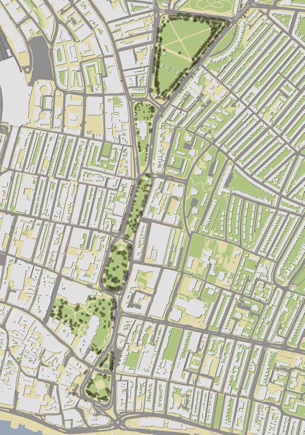
Brighton & Hove City Council		   						   Valley Gardens

2
Local Growth Fund Business Case								                                           July 2014

1. Promoting Organisation(s)
Lead Authority:		    Brighton & Hove City Council
Lead Officer:        Jim Mayor
				                 Senior Project Manager
				                 Brighton & Hove City Council
				                 Hove Town Hall, Norton Road
				                 Hove BN34AH

Email: 			           jim.mayor@brighton-hove.gov.uk
Tel:   			           01273 294164

Partner Support:		   The scheme has been developed with and is supported by local stake-
				                 holders representing a variety of interests. Statements of stakeholder
				                 support are included in Appendix 3. Messages of developer and busi-
				                 ness support are included in the main body of the document.

                                                                                              3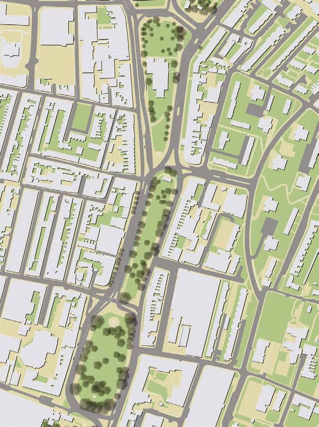
Brighton & Hove City Council		               						                                   Valley Gardens

Contents

Section                                                                                       Page
1         Promoting Organisation                                                              3
2         Project Location                                                                    6
          Project Area                                                                        6
          Project Scope                                                                       8
3         Project Description                                                                 10
4         Project Timescales                                                                  17
5         Project Costs                                                                       17
          Scalability                                                                         18
6         Why Local Growth Funding is Being Sought                                            19
          Complementary Bid / LSTF Funding                                                    19
7         Publication                                                                         19
8         Local Priority                                                                      19
9         The Scheme                                                                          20
          Description                                                                         23
          Quantifiable Enhancements                                                           28
          Expected Measurable Scheme Outcomes                                                 29
10        Alternatives                                                                        30
          Option Appraisal                                                                    31
          Design Options                                                                      32
11        Consultation                                                                        34
12        Overall Strategic Benefits                                                          36
          Strategic Benefit 1: Movement                                                       36
          Strategic Benefit 2: Economic Growth                                                36
          Strategic Benefit 3: Housing                                                        40
          Strategic Benefit 4: Use                                                            41
          Strategic Benefit 5: Environment & Resilience                                       42
          Strategic Benefit 6: Building on the City’s role as a KIBS hub                      43
          Strategic Benefit 7: Building on the City’s role as a Visitor Destination           45
13        Specific Benefits                                                                   46
          Benefit Area 1: Job Creation, Training & Protection                                 46
          Benefit Area 2: Development                                                         48
          Benefit Area 3: Housing                                                             48
          Benefit Area 4: Transport                                                           48
14        Contribution to Coast to Capital Strategic Aims                                     53
          Links to SEP Development Areas                                                      54
15        Contribution to Coast to Capital Transport Aims                                     56
          Links to Route 23                                                                   56

4
Local Growth Fund Business Case								                                                  July 2014

Section                                                                                    Page
16        Fit with Local Policies                                                          57
          City Plan                                                                        57
          Local Transport Plan                                                             57
          Conservation Area Study & Enhancement Plan                                       58
          Biosphere                                                                        58
          Air Quality Management Area                                                      59
          Seafront Strategy                                                                59
          One Planet Living                                                                60
17        The Financial Case                                                               61
18        Economic Case (Summary)                                                          63
19        The Commercial Case                                                              64
20        The Management Case                                                              67
          Consents Required                                                                67
          Governance Arrangements                                                          68
          Stakeholder Management / Engagement Processes                                    69
          Risk Management                                                                  71
21        Section 151 Officer Declaration                                                  74

          Appendices

1         Linked Developments
2         Linked Projects
3         Statements of Stakeholder Support
4         Project Plan
5         Vehicle Journey Times within the Project Area
6         Environmental Impact Assessment
7         Full Economic Case
8         Extract from City Plan showing predicted increase in City Core trips by 2030
9         Monitoring Arrangements for Scheme Aims and Key Performance Indicators
10        Noise Quality Assessment
11        Air Quality Assessment
12        Cultural and Events Strategy

                                                                                                  5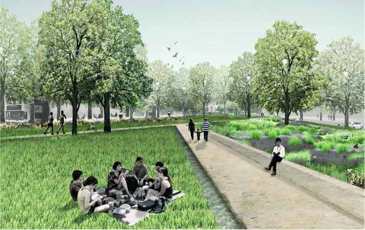
Brighton & Hove City Council		                						                                   Valley Gardens

2. Project Location
Grid Reference: TQ 31422 04618

Project Area

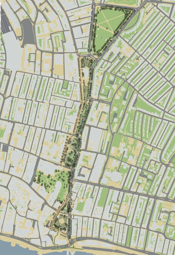
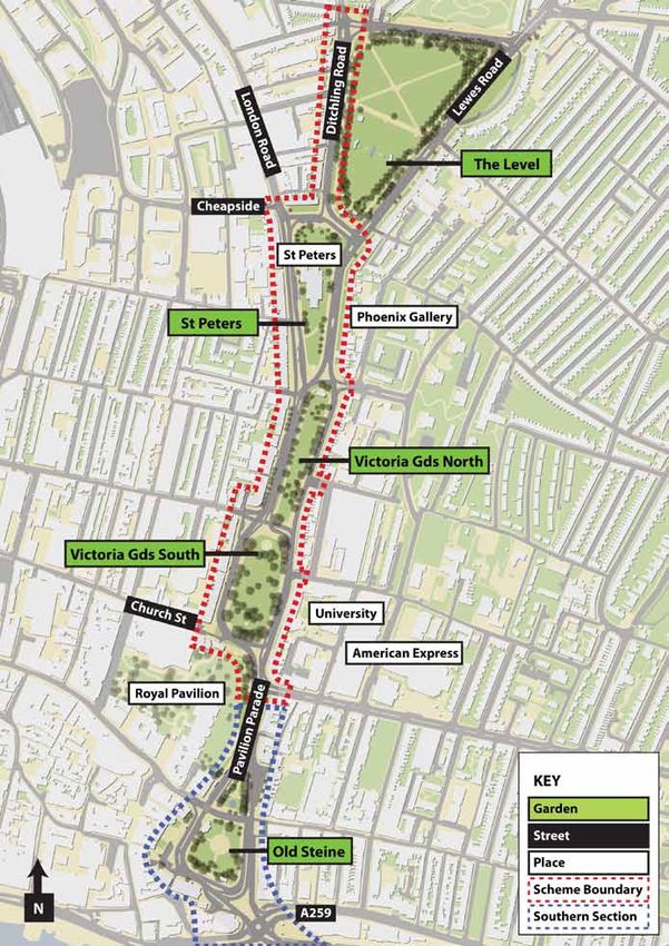
A conservation area of approximately 0.85 miles in length, Valley Gardens consists of a series of
green spaces running through central Brighton to the seafront. A number of key transport corridors
run through the area. The A23 (London Road) and A27 (Lewes Road) run north to south, and are
bisected by a number of east-west routes before terminating with the A259 at the seafront.

Due to the size and location of Valley Gardens, the area connects a number of communities and
destinations. Notably, the Lanes and North Laine lie to the west, the London Road shopping district
and New England Quarter to the north. The St James’s St shopping district and Kemptown (along
with residential areas of Queens Park, Elm Grove and Hanover) are to the east. The seafront is to
the immediate south of Valley Gardens. Brighton Station and Churchill Square Shopping Centre are
amongst the key destinations in close proximity to, and accessed from, Valley Gardens.

St Peters Church, sometimes referred to as the city’s unofficial cathedral, sits within Valley Gar-
dens. Other key buildings lining the study area include the Royal Pavilion, Phoenix Art Gallery,
University of Brighton and American Express, one of the city’s largest employers.

The vehicle routes intersecting Valley Gardens divide the green areas into a series of distinct sec-
tions. From north to south these are The Level, St Peters (North and South), Victoria Gardens
North, Victoria Gardens South and, after something of a gap (Pavilion Parade), the Old Steine.

6
Local Growth Fund Business Case								   July 2014

  Valley Gardens

                                                 7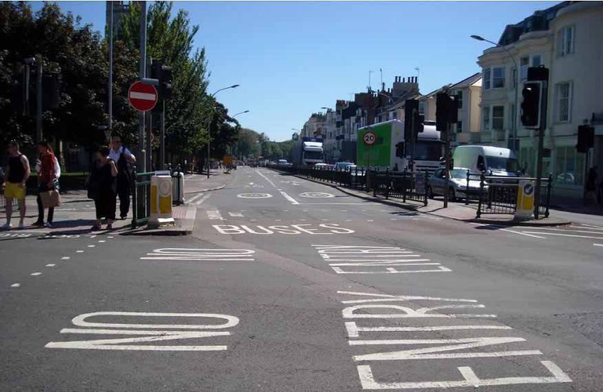
Brighton & Hove City Council		                						                                    Valley Gardens

Project Scope

Historically the northern section of Valley Gardens has been referred to in LEP documentation as
Stages 1 (St Peters) and 2 (Victoria Gardens). In this context, ‘stages’ relates to the order in which
areas of Valley Gardens would best be constructed from a practical perspective. Stage 3 (incorpo-
rating the Old Steine and Aquarium Roundabout) forms the southern half of Valley Gardens.

The proposal focuses on the northern half of Valley Gardens (between Church Street (north) and
Cheapside (south)). Within these boundaries, the project considers all spaces between building
lines, including footways, carriageways and soft and hardscaped public spaces.

To the south of Cheapside, the project also incorporates the length of Ditchling Road to the immedi-
ate west of the Level. The public space of the Level is excluded from the scheme as the park has
recently been the focus of a separate regeneration scheme.

To the immediate south of Church Street, building lines create a spatial constraint along Pavilion
Parade that limits scope for significant movement or public space improvement, providing a natural
division point for the Valley Gardens proposals.

A separate business case will be submitted to the LEP for funding that will enable work on Stage
3 to commence in 2017. The northern section of Valley Gardens has been prioritised for improve-
ment, partly because this is where the existing environment has greatest negative impact on the
city, and partly because there is greater immediate scope to achieve additional beneficial impact by
complementing wider developments in the vicinity (as set out in Appendices 1 and 2).

Extended Scope of Impact

Because of the study area’s size, location, profile and function, the project has potential for citywide
impact.

Unlocking the barrier effect can enable the perceived city centre (to the west) to spread east and
north. Enhancing the quality of arrival will impact positively on the first impression visitors have of
the city. (Valley Gardens provides the first sense of being in the ‘city proper’ for drivers travelling
down the A23 - before Valley Gardens the route remains relatively suburban in character). Creating
a great city centre place can boost the city’s international reputation and attraction, in the same way
as La Rambla has benefitted Barcelona’s international identity. Investing in place will not just en-
courage development and regeneration in the immediate vicinity of Valley Gardens, but also across
the wider city, including key development sites such as Black Rock (east) and Brighton Centre
(west). Enhancements to movement infrastructure, especially those making sustainable movement
more attractive, will enable the city core to accommodate future forecast growth within the con-
straints of finite space for vehicular infrastructure.

The diagram on the facing page shows developments beyond the immediate vicinity of Valley Gar-
dens that are expected to benefit from the scheme.

 Historically the northern section of Valley Gardens has been referred to in LEP documentation
 as Stages 1 and 2. (In this context, ‘stages’ relates to the order in which areas of Valley Gardens
 would best be constructed from a practical perspective). Stage 3 (incorporating the Old Steine
 and Aquarium Roundabout) forms the southern half of Valley Gardens.

8

SECONDARY DEVELOPMENT LINKS
    Development Links
                                                                 1: CHEAPSIDE                   2000m² Employment TBC
                                                                 1: GB LINERS BLACKMAN ST       3327m² B1 Office
                                                                 1: BLACKMAN ST / CHEAPSIDE     32 Dwellings
                                                                 2: NEW ENGLAND HOUSE           (New Strategic Site)
                                                                 2: LONGLEY INDUSTRIAL ESTATE   3000m² (New Strategic Site)
                                                                 3:RICHARDSON’S SCRAPYARD       3000m² (New Strategic Site)
                                                                                                36 Dwellings
                                                                 4: VANTAGE POINT               1333m² (New Strategic Site)
                                                                                                90 Dwellings
                                                                 5: BLOCK J BRIGHTON STATION    424m² Retail
                                                                                                734m² Leisure
                                                                                                147 Dwellings
                                                                 5: BLOCK K BRIGHTON STATION    3554m² B1 Office
                                                                 6: SPRING GDNS / CHURCH ST     34 Dwellings
                                                                 7: POST OFFICE NORTH STREET    50 Dwellings

                                                                 TERTIARY DEVELOPMENT LINKS

                                                                 8: BRIGHTON MARINA            5000m² Retail
                                                                                               3500m² Leisure
                                                                                               1400 Dwellings
                                                                 9: FRESHFIELD RD              9250m² B1 Office
                                                                                               9250m² B8 Warehouse
                                                                                               30 Dwellings
                                                                 9: BT SITE FRESHFIELD ROAD    45 Dwellings
                                                                 10: KING ALFRED KINGSWAY      New Strategic Leisure Site
                                    4                                                          400 Dwellings
                                   3                             11: GASWORKS SITE             2000m² B1 Office
                                  5 2
                                                                 12: B’TON CTR / CHURCHILL SQ. 25000m² Conference Centre
                                      1                                                        20000m² Retail
                                   6 7                           13: ST MARY’S HALL EASTERN RD 5168m² B1 Office
                        10
                                                                 14: ROYAL SUSSEX HOSPITAL     73000m²
                             12           9
                                              14
                                                   13
                                                        11
                                                                                                                              Local Growth Fund Business Case

                                                             8
                                                                                                                              July 2014

9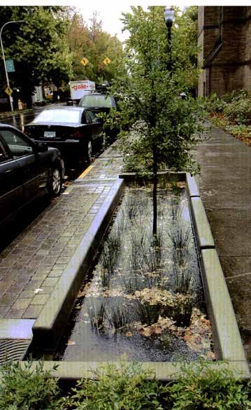
Brighton & Hove City Council		                 						                                    Valley Gardens

3. Project Description
Project Description

“Valley Gardens comprise the open spaces and surrounding roads that run in a linear manner from
Old Steine in the south to the Level in the north, excluding the Pavilion Gardens. This area is of
unique strategic and topographic significance to Brighton & Hove in the way in which a number
of major issues coexist and, in some cases, conflict. These include: the area’s role as an arrival/
departure point for visitors; its function as a major traffic route (the A23 sustainable transport corri-
dor); its cultural and heritage significance; its provision of public open space; its inclusion within the
academic corridor; its wide mix of land uses; and its role as a venue for major events. However, the
area is currently failing to fulfil its potential.” - Brighton & Hove City Plan

Geographically, Valley Gardens connects many of the city’s residential districts, key destinations
and development sites and has huge potential as a movement corridor and amenity space. How-
ever, poor design of traffic infrastructure in the area creates a host of problems which prevent that
potential being realised. The problems impact at a local, city and regional level.

The vehicular movement network within Valley Gardens needn’t be confusing and complicated. The
existing layout seeks to accommodate 4 lanes for regular vehicles (a northbound and southbound
lane for each for the A23 and A27) and 2 bus lanes between St Peters and the seafront. However
the current arrangement is a mixture of gyratories, contra-flows and dual carriageways. Vehicles
move from the east side of the space to the west as they journey north to south. In order to cope
with the different traffic movements created by the inconsistent road layout, junctions are also more
complex than they need to be.

The arrangement has negative implications for all individuals moving through the area. Bus lanes
result in relatively expedient and reliable journey times through Valley Gardens. However, the qual-
ity of bus stops is often poor. The unconventional nature of the segregated, two-way bus lanes at
Gloucester Place enables provision of a southbound, but no northbound bus stop, while the north-
bound St Peters stop delivers bus passengers onto a narrow, isolated traffic island.

Cycle provision is constrained by, and so reflects the complexity of, the wider traffic network. Some
areas have cycle provision, some don’t. Facilities that are provided switch from east to west, from
footway to road, and are of varying quality, encouraging conflict and discouraging cycling.

Complex junctions and constantly changing traffic arrangements make it more difficult (and danger-
ous) for pedestrians to cross the road. Over 40% of the time taken to walk north to south through
Valley Gardens is currently spent waiting at signalised crossings, and numerous collisions have
taken place in the area.

In a bid to mitigate against the danger created by the road arrangement, copious guard railing has
been added. Alongside large areas of ‘carriageway’ space that have little or no value for vehicles,
and a highway design style more appropriate to an urban freeway than a city centre environment,
guardrail contributes to traffic infrastructure dominating the area. These elements also signal to
drivers that Valley Gardens as a place to drive through as quickly as possible, rather than with the
care and awareness required in a city centre location. This exacerbates both perceptions of vehicu-
lar dominance and road safety issues.

10
Local Growth Fund Business Case								                      July 2014

Above left: Geographically, Valley Gardens connects a
number of key neighbourhoods and destinations. East-
west connectivity is especially important.

Above right: However the overly complex and heavily
engineered traffic network creates a host of problems.
One of these problems is the barrier created to east-west
movement.

Right: The photograph, looking towards Richmond Parade
from North Laine, illustrates the impact of the current
traffic infrastructure on perceived and physical east-west
connectivity.

                                                                   11
Brighton & Hove City Council Valley Gardens This page, anti-clockwise from top left: Photo 1: Whilst bus lanes result in relatively expedient and reliable journey times through Valley Gardens, the quality of bus stops is poor. The northbound St Peters stop delivers bus passengers onto a narrow, isolated traffic island, sand- wiched between two southbound lanes of private vehicles (west) and a north and southbound bus lane (east). Photo 2: Overly complex and inappropriately scaled transport infrastructure, such as the bus contraflow to the west of St Peters, divides the east and west of the city. Photo 3: The current Valley Gardens environment is a poor setting for existing attractions such as the Royal Pavilion. Diagram: Some areas have cycle provision, some don’t. Where cycle facilities are provided, they switch from east to west, from footway to road, and are of varying quality. The arrangement discourages cycling and encourages conflict. Opposite page Top: Collisions cluster around confusing areas of carriageway infrastructure. Bottom: The images, taken within five minutes of each other, show levels of usage of amenity space in Pavilion Gar- dens (left) and a few yards away in Victoria Gardens (right). Hardly anyone uses Valley Gardens as an amenity space due to the poor quality environment, whilst Pavilion Gardens suffers from over-use. 12
Local Growth Fund Business Case								   July 2014

                                                13
Brighton & Hove City Council Valley Gardens The transport dominated environment sees Valley Gardens create physical and perceived discon- nect between the ‘city centre’ and the east of the city, which contains a number of development sites and key destinations including the University of Brighton campus. This in turn constrains employment growth, particularly expansion of the regionally important Knowledge Based Intensive Services (KIBS) sector which favours a city centre location. Rather than adding to the city and region’s cultural and visitor offer (in the manner of Barcelona’s La Rambla or New York’s High Line) the current environment provides a poor first impression of the city, and a poor setting for established tourist attractions such as the Royal Pavilion. The current environment also prevents Valley Gardens fulfilling its potential as an amenity space for local people whilst demand for space in the adjacent Pavilion Gardens exceeds available ca- pacity. The limited numbers of people spending time in Valley Gardens also reduces the viability of businesses in the area and increases perceptions of crime and anti social behaviour, Pollutant levels have led to Valley Gardens being designated an Air Quality Management Area. The amenity spaces are also barren from an ecological perspective despite housing a National Elm Col- lection of international significance. Addressing these issues is set to become increasingly important in future as development creates additional demand for city centre trips within finite infrastructure capacity and the city looks to meet housing targets, encourage economic growth, build sustainable communities, maintain its status as a visitor destination / digital sector hub and deal with the impact of future climate change; particu- larly impacts of flash flooding. By simplifying and ensuring vehicular infrastructure is designed in a way that is appropriate for a city centre location, providing enhanced sustainable movement provision and increasing the attrac- tiveness and ecological offer of the area, the scheme set out in this business case has potential to deliver multiple benefits and outcomes. These benefits and outcomes, which are further explained in the main body of this business case, are: Transport Benefits Improve movement for all modes, particularly sustainable modes, to reduce numbers of KSIs and accommodate additional future demand for city centre trips within finite infrastructure capacity. Transport Outcomes 1. Encourage growth in Walking numbers, with a Health benefit valued at £3.27m over 20 years. 2. Encourage growth in Cycling numbers, with a Health benefit valued at £1.05m over 20 years. 3. Reduce likelihood of collisions, resulting in a KSI benefit valued at £1.72m over 20 years. 4. Improve journey times for drivers, with a financial benefit of £2.893m over 20 years. 5. Improve northbound peak hour journey times for buses by at least 30 seconds. 6. Improve journey times for pedestrians by 15%. 7. Improve journey times for cyclists by 31%. 8. Enhance proportion of population with access to high frequency bus stops by 8.6% 9. Improved journey experience for all modes 10. Improve perceived safety in the area 14
Local Growth Fund Business Case								                                                       July 2014

Training & Jobs Benefits

Support local jobs by:
• Supporting growth of the KIBS sector
• Supporting growth of the Visitor Economy
• Support development that can provide city centre office space for businesses to expand into
Create training opportunities by:
• Providing a setting for University events
• Establishing partner management and maintenance strategies for public spaces
• Supporting development which creates new jobs & training opportunities.

Training & Jobs Outcomes

1. Enable training of 295 people
2. Contribute towards growth of the KIBS sector, creating a minimum of at least 141 FTE jobs over
   ten years.
3. Contribute towards a minimum of 87 FTE (or 118 actual) additional jobs in Tourism Services.
4. Support Creation of 16.5 FTE wider Jobs

Building City / Regional Competitiveness Benefits

Support growth of the KIBS sector by
• Better connecting the city centre, Brighton University and creative hubs
• Encouraging the city centre development that can provide office space for businesses to
  grow into
• Supporting the city’s ability to continue to attract the “highly creative and innovative individuals
     (who) self-select to move to Brighton, (which) generates a growth dividend” (The Bright
  on Fuse report).
Enhance the tourism offer by
• Creating a new visitor destination
• Enhancing the setting of existing destinations such as the Royal Pavilion

Building City / Regional Competitiveness Outcomes

1. Attract an additional £3.9m p/a visitor income to the city
2. Contribute towards growth of the KIBS sector, to an estimated value of at least £10.1m over ten
   years.

Development & Housing Benefits

Support local development by:
• Redressing physical and perceived barriers between the ‘city centre’ and development sites
  within and to the east of Valley Gardens
• Enhancing the quality of the public realm (and so attractiveness of development within and
  in the immediate vicinity of Valley Gardens)
• Raising the profile of and investment confidence in Brighton
• Providing the vital recreational areas that will assist the city in delivering its housing targets.
• Enabling the city centre movement network to accommodate additional future demand for
  city centre trips within finite infrastructure capacity.

                                                                                                        15
Brighton & Hove City Council Valley Gardens
Development & Housing Outcomes
1. Directly support delivery of 66,822m² office space
2. Directly support delivery of 3,800m² new education space
3. Indirectly support delivery of 23,299m² office space
4. Indirectly support delivery of 25,424m² retail space
5. Indirectly support delivery of 7333m²+ new strategic sites
6. Indirectly support delivery of 4,234m² leisure space
7. Directly support delivery of 309 new dwellings
8. Indirectly support delivery of 2264 new dwellings
9. Increased value of existing local housing/business stock by £108.427m over 20 years.
Environment & Resilience Benefits
• Reduce Noise & Air pollution, encourage use of public spaces, better enable the area to cope
with impact of future climate change, particularly flash flooding and provide a fitting setting for
the National Elm Collection.
Environment & Resilience Outcomes
1. Provide Quality of Life benefits for Valley Gardens users valued at £4.917m over 20 years.
2. Improve NO2 and Particulate Air Quality to a value of £1.294m over 5 years.
3. Improve Noise Quality with a value of £0.143m over 20 years
4. Enable the city to manage water more sustainably
5. Plant 265 new trees
6. Reduce levels of real and perceived crime and anti-social behaviour.
7. Increase numbers of people spending time in Valley Gardens
8. Increase potential retail rateable value from adjacent frontagers by £0.97m over 20 years.
Benefit Cost Ratio
The range of benefits that the Valley Gardens scheme will deliver enables this business case to es-
timate that a BCR (benefit cost ratio) of 4.148:1 will be achieved over a 20 year period, even if very
conservative assumptions are made as to the extent of those benefits.
A full analysis of the Benefit Cost Ratio is provided in Appendix 7: Full Economic Case.
Whilst the scheme delivers a package of distinct benefits, all are interdependent and none can be
achieved without redressing the problems created by current transport infrastructure. Benefits de-
livered by theoretically distinct packages (such as enhanced planting or improved footways) are
complementary and together enable the scheme to deliver levels of benefits that exceed those
that could be achieved by delivering packages in isolation or in smaller groups.
16Local Growth Fund Business Case July 2014
4. Project Timescales
Assuming timely conditional and full approval decisions, the provisional project programme con-
tains the following headline milestones, which include the scheme’s primary dependency of obtain-
ing planning permission:
2014
• July Submit Draft Bid
• August Undertake final stage of Full Public Consultation
• October Obtain Planning Approval
• October Complete Detailed Design
• October LTB Approval
• November Full Approval
2015
• January Advertise Traffic Regulation Orders
• March Complete Technical Design
• June Start Physical Works
2017
• February Complete Physical Works
A project plan is attached as Appendix 4.
5. Project Costs
The Valley Gardens proposal constitutes a Major Scheme. Brighton & Hove City Council is applying
for a grant of £8m.
Headline Costs
Total Project Cost: £10.126m
Preparatory Cost: £0.775m
Physical Scheme Cost: £9.351m
Preparatory Contribution
Brighton & Hove City Council £0.775m
Physical Scheme Contribution
Brighton & Hove City Council £1.835m
S106/278 £0.291m
Local Growth Funding £8.000m
A cost profile is provided in Section 17. All contributions (aside from Local Growth Funding) are
guaranteed. Funding gaps will be managed and accommodated by Brighton & Hove City Council.
17Brighton & Hove City Council Valley Gardens Scalability A concept scheme has been developed for the whole Valley Gardens area. This business case seeks funding to deliver the northern section (Stages 1 and 2) of this scheme. This initial project area has been identified on the basis of it being large enough to bring real, sig- nificant and immediate benefit, but within an overall approach that enables phased delivery (with implementation of the southern section (Stage 3) commencing in 2017). Importantly the spatial constraints of Pavilion Parade provide a natural break between the northern and southern elements – naturally dividing the wider proposal into two distinct sections. In theory the proposal is scalable up or down. Scaling Down Scaling down could be achieved in two ways. Firstly the project could focus on a smaller section of Valley Gardens. However, without a natural break point equivalent to that provided by Pavilion Pa- rade, such an approach would result in a scheme that appeared and operated as something ‘half finished’. The anticipated benefits associated with reducing city severance, improving quality and consistency of movement routes and encouraging employment and development to spread into the east of the city would be significantly diluted. The other option is to deliver the ‘movement’ parts of the proposal, and not those areas that could be described as being primarily ‘public spaces’. The disadvantage of this approach, which would only lead to relatively small financial savings (given that enhanced movement connections across public spaces would still need to be included in the delivered scheme) is that enhancements to the public spaces provide the journey quality benefits that are particularly important in encouraging sustainable transport choice, and the enhanced envi- ronment that attracts residents, tourists, the KIBS (Knowledge Intensive Business Services) sector and development. Scaling Up It is anticipated that a Business Case for Stage 3 of the wider Valley Gardens scheme (the south- ern section) will be prepared for a future tranche of LEP funding. However, the current proposal could be scaled up to enable earlier delivery of these sections if opportunities arose. 18
Local Growth Fund Business Case								                                                     July 2014

6. Why local growth funding is being sought
Without local growth funding, the scheme could not be delivered in the foreseeable future. No alter-
native sources of funds have been identified that would enable improvement of significant enough
scale to unlock the potential of the city centre.

The Valley Gardens scheme has not been the subject of other bids and so has not been rejected in
the past.

Complementary Bid: LSTF Funding

In March 2014 a bid was submitted to the Department of Transport for LSTF (Local Sustainable
Transport Fund) funding.

This bid focuses on the area to the east of Valley Gardens and consists of tried and tested smarter
choices measures that will complement and enhance the planned infrastructure improvements
within the Valley Gardens area set out in this business case. BHCC have already delivered a simi-
lar successful smarter choices package of initiatives in the adjacent LSTF Lewes Road Corridor
Area. Within the first two years of the Lewes Road Corridor scheme, monitoring data showed a
14% increase in cycling numbers along the corridor and a 7% increase in bus patronage in the sur-
rounding residential areas. This bid looks to replicate and enhance this success by giving particular
focus on the health benefits of making a change to the way you travel as well as improving access
to job opportunities by promoting Door-to-Door sustainable travel throughout the area.

The smarter choices measures will include a sustained community led Personalised Travel Plan-
ning project with residents and employees in the area as well as travel planning and initiatives with
the Universities, local schools, businesses and key destinations such as the Job Centre.

As the LSTF bid focuses on soft measures, any funding awarded through that source would com-
plement, but could not replace LGF funding in delivering the physical improvements necessary to
deliver the benefits set out in this business case.

7. Publication
No element of this Business Case is considered confidential.

8. Local Priority
Following an initial sifting process the Valley Gardens proposal has been identified as Brighton &
Hove’s primary and only priority for the current tranche of Local Growth Funding.

                                                                                                     19
Brighton & Hove City Council Valley Gardens
9. The Scheme
Existing Carriageway
Arrangement
20Local Growth Fund Business Case July 2014
New Carriageway
Arrangement
21Brighton & Hove City Council Valley Gardens New Landscaping Arrangement (general with SUDs & planting - left) (cultural programming provision - right) 22
Local Growth Fund Business Case								                                                       July 2014

9. The Scheme
Description

Due to its size and location, many key strategic vehicular transport routes pass through Valley Gar-
dens. These include the north-south Lewes (A27) and London (A23) Roads, which intersect with a
series of east-west connections until they meet the A259 at the seafront.

The Valley Gardens transport corridors provide access to a number of key destinations, including
the majority of the city’s privately owned car parks, the Royal Sussex Hospital, American Express
and Churchill Square Shopping Centre. A high proportion of the city’s buses run through the area.

At a local level, Valley Gardens connects a host of city destinations and districts for drivers, public
transport users, walkers and cyclists.

Unfortunately what should be a relatively straightforward movement arrangement in Valley Gardens
has developed inconsistently over a number of years. At all stages vehicular infrastructure has
been prioritised with little evident thought for impact on or needs of other users of the space or the
wider city. The result is a confusing mixture of gyratories, contraflows and dual carriageways which
work poorly for vehicles and turn what should be a major public recreational asset into a barrier that
dissects the city. Resolving this barrier is key to unlocking the potential of Valley Gardens and the
surrounding city.

The proposal achieves this by effectively ‘disentangling’ vehicular routes through the area. A tree
lined ‘Avenue’ for private vehicles is created on the eastern side of the Gardens, comprising two
northbound and two southbound lanes, separated by a wide, planted median strip to enable easy
pedestrian crossing.

The Avenue provides a consistent, direct and legible route for private vehicles throughout the
length of the project area. The simplified layout removes the need for complex junctions (ten exist-
ing junctions are simplified under the proposals). Along with reductions in associated infrastructure
(guardrailing, signage, additional carriageway space) the new arrangement provides an enhanced
journey experience for drivers and a fitting welcome to the city.

The avenue effect and reduced traffic infrastructure - along with increased footways, tighter side
road corner radii and other measures that achieve a greater balance of spatial priority between
different modes and users - will ensure vehicular routes feel integrated with the wider city centre
environment, rather than appearing as urban freeways dissecting it. As a result, the physical and
perceptual barrier currently created by transport infrastructure will be significantly reduced. Pedes-
trians will now only need to cross two lanes of traffic at any point within the project area, and will
always know which direction that traffic is coming from - increasing both permeability and safety. 34
enhanced pedestrian crossing are provided by the proposal, whilst reduced complexity of crossings
on a north-south journey through the project area will reduce pedestrian journey times by at least
15%.

Simplified and consistent routing of private vehicle routes along the eastern side of the study area
enables a reduction in the scale and complexity of traffic infrastructure intersecting the study area
from east to west, enabling the perceptual and physical impact of traffic within central public spac-
es to be reduced.
                                                                                                      23
Brighton & Hove City Council Valley Gardens Above: By ‘disentangling’ the current vehicular transport network, movement through the area becomes more legible for all modes. Consistent bus lanes are provided to the west of Valley Gardens, serving new (north of Church St) and enhanced bus stops (under the new arrangements passengers can embark / disembark from the footway rather than traffic islands). A consistent cycle route can also be accommodated. Reducing the complexity of the traffic infrastruc- ture also reduces the danger and barrier effect created by the existing arrangement. Below: Roads are redesigned in a manner appropriate to a city centre location, helping calm traffic and reduce the per- ceived and physical barriers that the current infrastructure creates. Pedestrians will only ever need to cross two lanes of traffic and will always know where traffic is coming from. The image below shows how connections between the Gardens and University will be enhanced. (The image on the left shows the current arrangement, the artist impression on the right shows how the new “Avenue” will look). 24
Local Growth Fund Business Case								                                                        July 2014

The arrangement also lessens the volume of traffic routed in front of the Pavilion Gatehouse, ena-
bling improved connection between the Royal Pavilion Estate and Valley Gardens.

Long stretches of the western side of Valley Gardens currently see 4 lanes of traffic travelling in
opposing directions, enclosed by guard-railing. It is along this corridor that the current barrier effect
between the east and west of the city is strongest. The proposal replaces the existing arrange-
ment with a two lane ‘Park Road’ which provides a consistent north-south route for buses travelling
through the project area, along with local access.

The Park Road provides similar benefits to the Avenue in terms of reducing complexity and so vol-
ume of traffic infrastructure to positively impact on segregation, safety, permeability and allocation
of space amongst different modes and users. Integration of the Park Road within the wider environ-
ment is enhanced by the use of coloured surface materials to differentiate the carriageway area
from traditional, blacktop finishes that are associated with vehicle use. Although the Park Road will
not be a shared space, it is expected that low volumes of traffic will enable pedestrians to cross
informally as well as at enhanced crossings should they wish, further improving east west connec-
tivity. Bus passengers will also benefit from the simplified arrangement. Access from bus stops at
St Peters will be made from the footway rather than isolated traffic islands, and it will be possible to
provide a new southbound, adjacent to an upgraded northbound bus stop in the vicinity of Marlbor-
ough Place to serve the North Laine.

Cycle facilities are enhanced through provision of 26 cycle parking hubs and a consistent dedicated
700m cycle lane which runs north to south along the eastern side of the project area, connecting
existing sections of the cycle network to the north, east and west - including the Lewes Road Corri-
dor SEP Development Area. Along the western side of the project area, cyclists can share the Park
Road. Like pedestrians, cyclists will benefit from journey savings due to enhanced crossings at
simplified junctions - a north south journey is expected to be at least 31% quicker.

Most of the rearranged vehicular infrastructure is delivered within existing kerb lines. The excep-
tions are two new sections of two lane carriageway, built within existing green space in Victoria
Gardens. The new sections of carriageway enable the consistent alignment of vehicle routes along
the length of the project area without impacting on the Gardens’ National Elm Collection.

Despite creation of new carriageway sections, simplifying the vehicular arrangement allows for
overall space given over to carriageway infrastructure to be reduced by more than 30% whilst
maintaining current access and capacity. As a result footways along building lines can be increased
in area by over 70%, and central open spaces by just over 2%. The additional footway space, along
with increased legibility, a pleasanter environment, improved crossings and new footpaths across
the green spaces to connect key routes and destinations on each side of the city will significantly
improve pedestrian permeability.

The elements above improve movement through Valley Gardens for all modes, whilst tackling is-
sues around physical and perceived barriers created by the current vehicular infrastructure. The
remaining elements of the proposal encourage people to use the area by creating a vibrant public
space that can operate as a new destination, connecting the surrounding city.

Feedback from public consultation saw an almost unanimous desire for Valley Gardens to be
re-imagined as a peaceful, city centre park, complementing rather than replicating neighbouring at-
tractions of the beach and shopping districts.

                                                                                                       25
Brighton & Hove City Council Valley Gardens 26
Local Growth Fund Business Case								                                                                     July 2014

This is achieved through introduction of 265 new trees - in part performing the function of an ar-
boretum to help protect the city’s Elm heritage into the future - planting areas and water features
including 3507m² of Sustainable Urban Drainage System (SUDS). The SUDS system, featuring
street swales and water gardens, will bring aesthetic and environmental benefit (through perform-
ing a bioremedial function) and help the city accommodate the impact of future flash rainfall events
associated with climate change.

Landscaping also creates flexible hard and soft-scaped spaces that can be used for educational
and cultural programming. Enabling Valley Gardens to operate as an ‘urban lab’ for the University
of Brighton provides opportunities for on-site training in a variety of industries. Extending facilities
for Brighton & Hove’s already strong creative sector provides local job / economic benefits whilst
enhancing the city and region’s international renown as a cultural destination. (A Cultural & Events
Strategy is attached as Appendix 12).

The proposal also provides enhanced amenities such as seating, lighting and power supplies to en-
able and encourage a variety of uses, bringing benefits including reduced fear of crime.

As will be explained in following sections, improving the environmental quality of and removing the
physical / perceived barriers between the east and west of the city centre creates virtuous circles
benefitting the city’s wider economy. Enhanced environmental quality is key to attracting and retain-
ing the city’s KIBS sector, which also benefits from connectivity to the University.

Enabling the perceived city centre to spread increases the demand for and thereby the value / vi-
ability of adjacent development sites, especially those to the east of the city centre. In return, the
new developments provide the space for the KIBS, and related sectors, to grow into, overcoming
acknowledged spatial constraints on economic growth. It is also anticipated that the dramatic and
very visual environmental improvements realized by the Valley Gardens scheme will significantly
raise the profile of and investment confidence in central Brighton, acting as a catalyst for a number
of planned developments in the wider area. It is expected that this could benefit key strategic
projects such as Brighton Centre, the i360 observation tower and the Black Rock site.

Previous page top: Simplified vehicular infrastructure enables pedestrian permeability through and across the area to
be significantly improved, reconnecting the east and west of the city, encouraging walking, reducing danger and en-
couraging positive use of public spaces. The scheme is expected to reduce journey times through the area by 15%.

Previous page bottom: Increased planting helps deliver public aspirations for a peaceful, park like environment within
the Gardens. Along with SUDS (Sustainable Urban Drainage System) the planting will also bring ecological benefits.
Increased use of public spaces will bring social, safety, health and economic benefit.

                                                                                                                     27
Brighton & Hove City Council Valley Gardens
Quantifiable Enhancements
Pedestrian
Number of upgraded pedestrian / cycle crossings 34
Length of new / upgraded footway 3016m
Area of new footway 2586m²
Area of upgraded footway 15628m²
Length of new park footway 1333m
Area of new park footway 4700m²
Number of seating areas 13
Cycling
Length of new cycle lane 699m
Area of new cycle lane 1901m²
Number of new cycle parking hubs 26
Driving
Number of upgraded (simplified) junctions 10
Length of new carriageway 377m
Area of new carriageway (excluding SUDS features located on footway) 2212m²
Area of upgraded carriageway 10970m²
Area of reallocated redundant carriageway 10865m²
Change in private vehicle capacity -
Number of public parking / delivery / taxi bays TBC
Number of private (St Peters) parking spaces -12
Buses
Length of new bus / shared lane (shared with taxi, cycles, access) 703m
Area of new bus / shared lane 5289m²
Number of improved bus interchanges 4
Number of new bus interchanges 2
Environment
Area of enhanced public open space (space within carriageways) 28405m²
Area of new public open space 670m²
Area of SUDS features 3507m²
Number of character lighting schemes 1
Number of trees 265
Area of new civic square 3120m²
Number of new event spaces 13+ (see p.22)
• Pedestrian / Cycle Crossing facilities including a central reservation are counted as a single crossing. Precise detail
and location, and possibly number of crossings to be refined as design process progresses.
• Precise number of seating spaces to be determined, figure provided assumes minimum target of seating every
100m on both sides of gardens. Assumption excludes secondary seating opportunities such as low walls.
• Precise number of cycle parking spaces to be determined, figure provided assumes minimum requirement of a
cycle parking hub every 50m on both sides of gardens.
• Numbers and arrangement of loading, taxi and parking bays is to be determined as design progresses. As a gen-
eral principle, existing provision will be at least maintained and enhanced.
28Local Growth Fund Business Case July 2014
Expected Measurable Scheme Outcomes
Transport
Encourage growth in Walking numbers, with a Health benefit valued at £3.27m over 20 years.
Encourage growth in Cycling numbers, with a Health benefit valued at £1.05m over 20 years.
Reduce likelihood of collisions, resulting in a KSI benefit valued at £1.72m over 20 years.
Improve journey times for drivers, with a financial benefit of £2.893m over 20 years.
Improve northbound peak hour journey times for buses by at least 30 seconds.
Improve journey times for pedestrians by 15%.
Improve journey times for cyclists by 31%.
Enhance proportion of population with access to high frequency bus stops by 8.6%
Improved journey experience for all modes
Improve perceived safety in the area
Environment
Provide Quality of Life benefits for Valley Gardens users valued at £4.917m over 20 years.
Improve NO2 and Particulate Air Quality to a value of £1.294m over 5 years.
Improve Noise Quality with a value of £0.143m over 20 years
Enable the city to manage water more sustainably
Plant 265 new trees
Reduce levels of real and perceived crime and anti-social behaviour
Increase numbers of people spending time in Valley Gardens
Increase potential retail rateable value from adjacent frontagers by £0.97m over 20 years.
Training & Jobs
Enable training of 295 people
Contribute towards growth of the KIBS sector, creating a minimum of at least 141 FTE jobs over
ten years.
Contribute towards a minimum of 87 FTE (or 118 actual) additional jobs in Tourism Services.
Support Creation of 16.5 FTE wider Jobs
Development & Housing
Directly support delivery of 66,822m² office space
Directly support delivery of 3,800m² new education space
Indirectly support delivery of 23,299m² office space
Indirectly support delivery of 25,424m² retail space
Indirectly support delivery of 7333m²+ new strategic sites
Indirectly support delivery of 4,234m² leisure space
Directly support delivery of 309 new dwellings
Indirectly support delivery of 2264 new dwellings
Increased value of existing local housing/business stock by £108.427m over 20 years.
Building City / Regional Competitiveness
Attract an additional £3.9m p/a visitor income to the city
Contribute towards growth of the KIBS sector, to a value of at least £10.1m over ten years.
29Brighton & Hove City Council Valley Gardens
10. Alternatives
Doing Nothing
If nothing is done to improve Valley Gardens, the city and region will fail to benefit from:
• Increased attractiveness of sustainable movement (which will increase in importance as future
development in the city creates increased journey demand) and associated health benefits.
• Reduced KSIs.
• Protection and expansion of the local economy, particularly the regionally important KIBS, visitor
and creative sectors.
• Mutually beneficial momentum for local and citywide development.
• Reduced exposure to potential financial sanctions for failure to address poor air quality.
• Reduced exposure to future impacts of climate change
Doing Minimum
Because all of the problems in Valley Gardens stem from the inconsistently and inappropriately de-
signed vehicular carriageway arrangement that dominates the area and divides the city, redressing
this is key to realising the project’s varied objectives. This means that opportunities for improve-
ment through relatively small scale or ‘do minimum’ interventions are limited. Increasing the attrac-
tiveness of public spaces within Valley Gardens, for example, would have limited benefit if traffic
infrastructure remained a perceived and physical barrier between the city and those spaces. Nor
would such changes do anything to improve safety and poor quality cycle infrastructure (etc).
Resolving movement infrastructure without investing in improvements to the wider public realm
would fail to deliver ecological benefits, limit the attractiveness and vibrancy of the area (which in
turn influences sustainable transport choice), fail to completely resolve the perception of the area
as a barrier rather than connecting space and limit opportunities for cultural / educational / tourism
benefit in return for a relatively modest saving. Failure to enhance the public realm is also likely to
have a negative impact on efforts to support development and economic growth:
“The literature review indicates that there is a clear typology of economic benefits and impacts aris-
ing from improvements to the public realm:
• Attracting investment
• Increasing land and property values
• Attracting visitors
• Increasing tourism
• Improving productivity
• Enhancing image “
(Economic Impact of the Public Realm, ECOTEC)
Doing Something
The proposal developed on the basis that something needed to be done to enhance Valley Gar-
dens and that the proposal needed to incorporate movement and place improvements. Three op-
tions for reducing the impact of vehicular traffic were considered:
30Local Growth Fund Business Case July 2014
1. Reducing vehicle capacity in the Valley Gardens area,
2. Reducing the visible impact of traffic in the Valley Gardens area whilst maintaining localised traf-
fic capacity (effectively creating a tunnel), and
3. Simplifying the existing carriageway arrangement whilst maintaining vehicle capacity in the Val-
ley Gardens area.
Option Appraisal
Option 1: Reducing Vehicle Capacity in the Valley Gardens Area
Pragmatically, given Valley Gardens’ importance within the wider city transport network, meaning-
fully reducing traffic capacity in the area would be dependent on the success of a wider strategy/ies
to reduce vehicle numbers in the city centre. Given volumes of traffic in the area, reducing capacity
and expecting the existing wider network to be able to cope with displaced traffic is unrealistic.
The only measure likely to reduce city centre traffic sufficiently to enable existing vehicular capacity
to be reduced in Valley Gardens would be the provision of Park & Ride alongside significant reduc-
tions in city centre car parking. Given historic difficulties in identifying deliverable sites for a Park &
Ride facility (due in a large part to the city being spatially constrained between the sea and South
Downs National Park) and difficulties associated with achieving the necessary complementary
reductions in city centre parking (the majority of city centre car parks are privately owned and so
effectively beyond the council’s influence), this option is not realistic.
City Plan modelling forecasts that the number of trips within the city core is likely to rise significantly
by 2030. Increased investment in walking and cycling infrastructure and additional public transport
provision (etc) can go a long way to mitigating against the impact of this rise. However, despite the
cumulative impact of such measures, car person trips are still forecast to increase in the urban core
by between 2% and 8% over the 2010 base year, creating an additional constraint on any aspira-
tions to reduce carriageway capacity along the Valley Gardens corridor.
Option 2: Reducing the visible impact of traffic in the Valley Gardens area whilst maintain
-ing localised traffic capacity
At the earliest stages of project development, occasional calls were made for consideration of
road tunnels to enable vehicle capacity through Valley Gardens to be maintained whilst reducing
(the visible impact of) traffic infrastructure in the area. The need to maintain various east-west and
north-south connections in the area, alongside cost, are two reasons to quickly rule this option out
ahead of serious testing.
Option 3: Simplifying the existing carriageway arrangement whilst maintaining
vehicle capacity in the Valley Gardens area
Despite the current traffic arrangement in Valley Gardens comprising a confusing and heavily engi-
neered mixture of gyratories, contraflows and dual carriageways, the movement network within the
area needn’t be complicated. The existing layout seeks to accommodate 4 lanes for regular vehi-
cles (2 each for the A23 and A27) and 2 bus lanes between St Peters and the seafront, along with
a cycle route in each direction. There is scope, therefore, to achieve wider scheme objectives whilst
maintaining existing traffic flows through Valley Gardens by simplifying the existing carriageway ar-
rangement and introducing a design language appropriate to a city centre location.
31Brighton & Hove City Council Valley Gardens Design Options Four options for simplified carriageway arrangements were tested: Design Option 1 is a simplified clockwise gyratory system, with three southbound vehicular lanes (one for buses, two for private vehicles) on the eastern side of the corridor and three northbound lanes to the west. Aside from simplifying the movement arrangements in the area, the option offers the benefit of being build-able wholly within existing kerb lines. However, spatial constraints mean that a section of the eastern corridor (alongside Victoria Gardens north) cannot accommodate three lanes of traffic. This option would therefore require either a reduction in localized private vehicle capacity or loss of dedicated bus provision along this length. Traffic Modelling using PARAMICS suggested that reducing localized vehicle capacity would create a bottle-neck which caused further delays at upstream junctions. Loss of bus provision was also seen as being damaging to the pro- posal’s movement objectives. During discussions with stakeholders, this option was also considered to have limited impact on redressing perception of the green spaces within Valley Gardens as anything other than a series of glorified traffic islands. Design Option 2 (the preferred option) sees general traffic routed along an `Avenue’ on the east- ern side of Valley Gardens, with buses located to the west along a new `Park Road’. The extent of perceived and actual barrier created by the retained road layout is lower than with Option 1, as only two lanes of traffic need to be crossed at any one time. Vehicular routes are lined by trees and street swales, visually connecting them with the wider Gardens environment whilst bringing practi- cal ecological, water management and air quality benefits. The option requires two new lengths of two-lane carriageway for northbound general traffic to be constructed in Victoria Gardens North and South. The existing carriageway along the western side of the corridor (now only used by buses and local access) is reduced in size to two lanes. Aside from cost associated with building new sections of carriageway, issues associated with this option are potential loss of 16 trees, including 3 Elm trees and perceived impact on open public space due to new roads being built in current garden areas (although in reality the option enables an overall growth in both volume and biodiversity value of open space). Design Option 3 echoes Option 2, but with the ‘Park Road’ relocated to the eastern side of the Gardens, and the Avenue to the west. This option overcomes the need for a new, two-lane car- riageway to be built through Victoria Gardens North, although new carriageway is still required in Victoria Gardens South due to spatial restrictions between the western building line and mature Elms in the Gardens. As well as reducing the amount of new carriageway required, Option 3 avoids the Elm trees threatened by Option 2. However, due to spatial restrictions associated with building lines, the pedestrian median strip be- tween north and southbound private vehicle carriageways would remain very narrow to the west of St Peters. As a result, ability to reduce the perceived / actual barrier to east – west movement cre- ated by transport infrastructure already apparent in this location would be severely compromised. The spatial constraints would also provide minimal, if any room, for the additional tree planting and swales that would provide environmental and character benefits to the scheme and constrain pos- 32
Local Growth Fund Business Case								                                                                          July 2014

sible future development (and associated employment) plans which could see a new ‘front’ en-
trance on the western façade of St Peters.

From a townscape perspective, the traffic arrangement at Victoria Gardens South would offer re-
duced opportunity to better connect the Royal Pavilion Estate with the surrounding Valley Gardens.
The western edge of the corridor also offers fewer suitable opportunities for private vehicles to pull
off the main north – south route and turn round than the east.

Design Option 4 moves all traffic and buses to the eastern side of Valley Gardens. The main ben-
efits of this option are the creation of a single, unified traffic avenue between St Peters Church and
the seafront and enhanced connection between the public spaces of Valley Gardens with the city to
the west.

However, an avenue comprising six lanes of vehicular traffic would have a negative impact on east-
west connectivity across the city. Costs of new road building would be significant and the spatial
requirements for this arrangement would also require the loss of the majority of Elm trees along the
eastern side of the Gardens.

Conclusion

Design Option 2 is considered to have the greatest potential for transformative change in Valley
Gardens, whilst being realistic in terms of deliverability.

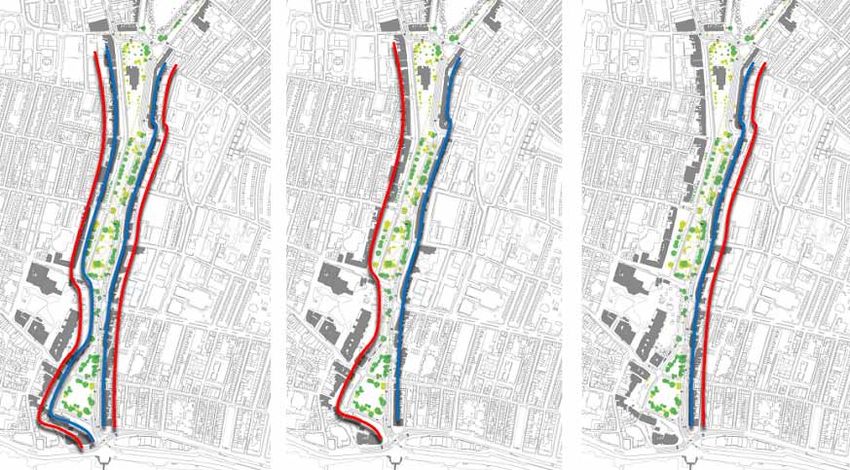
Above: Options tested included a simplified clockwise gyratory (Option 1, left), buses and access to the west and pri-
vate vehicles to the east (Option 2, centre) and all traffic to the east (Option 4, right). (Private vehicles are represented
by a blue line, buses and access by a red line).

Various practical considerations led the design team and stakeholders to identify Option 2 as the preferred arrange-
ment. (Option 3 was effectively a reversal of Option 2).

                                                                                                                           33
You can also read


