DRAFT REGIONAL LAND TRANSPORT PLAN
2015 - 2025

DECEMBER 2014
←
→
Page content transcription
If your browser does not render page correctly, please read the page content below
DRAFT REGIONAL LAND TRANSPORT PLAN 2015 - 2025 DECEMBER 2014
FOREWORD FROM REGIONAL TRANSPORT COMMITTEE CHAIRMAN
This document has been prepared by the Hawke’s Bay                    To work towards this we wish to see a number of major             The draft Plan is now out for public consultation and I would
Regional Transport Committee                                          roading improvements completed, while maintaining and             encourage you to tell us whether you agree with the Plan’s
This draft Regional Land Transport Plan describes Hawke’s             operating the existing road and public transport networks to a    strategic focus and whether our priorities are the right ones.
Bay’s strategic objectives for the transport system over the          high standard. Our top priorities for new construction include:   On behalf of the Regional Transport Committee, I’d like to
next ten years and sets out our funding request to the New            • The Whakatu Arterial Link ( Hastings District Council)          thank all those who have contributed to the preparation of
Zealand Transport Agency for the next three years.                    • The Hawke’s Bay Expressway, Pakowhai and Links Road             this document. I look forward to ensuring that Hawke’s Bay
The document has been developed in partnership with all                 Intersection improvement (NZTA Highway Network                  has a plan that delivers better transport options for Hawke’s
councils in Hawke’s Bay, the New Zealand Transport Agency               Operations)                                                     Bay.
and other key transport partners. It builds on the extensive          • SH2 Napier Road Intersection (NZTA Highway Network
transport studies undertaken between 2009 and 2012 and                  Operations)
the strategic direction set out in the Regional Land Transport
                                                                      • Improvements to State Highway 2 to the north and to the
Strategy 2012, which it now replaces.
                                                                        south and on local roads to enable the carriage of High
The plan’s main objectives are to achieve a resilient and efficient     Productivity Motor Vehicles
transport system that supports economic development and
                                                                      • Safety improvements to high risk intersections and routes
social wellbeing while reducing the risk of death or serious
                                                                        such as SH2- Watchman Road, Hawke’s Bay Airport –SH2,
injury on Hawke’s Bay roads
                                                                        The Expressway between Kennedy Road and Meeanee,                Councillor Alan Dick
                                                                                                                                        Chairman Regional Transport Committee
                                                                        and SH 2 PakiPaki To Waipukurau .
                                                                      • Cycling improvements in Napier, Hastings and Wairoa to
                                                                        build on the extensive work already undertaken to make
                                                                        Hawke’s Bay a top cycling centre.

                                                                                                                                                                                                    1

                                                                                                          DRAFT REGIONAL LAND TRANSPORT PLAN 2015 - 2025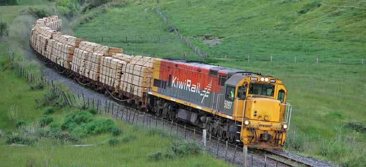
CONTENTS

1.0   Background..................................................5        4.10   Public transport...........................................10          6.2   A limited shared view of cross-boundary
                                                                           4.11   Freight........................................................10            transport issues increases the risk of
1.1   Introduction...................................................5
                                                                                                                                                               sub-optimal investment in and management
1.2   The regional transport committee...................5                 4.12   Air...............................................................10
                                                                                                                                                               of the network (20% weighting)...................14

2.0   National context for the RLTP........................6               5.0    Our future...................................................11        6.3   How people use the transport network is
                                                                                                                                                               leading to an unacceptable level of deaths
                                                                           5.1    Geography...................................................11
3.0   Regional context for the RLTP........................7                                                                                                   and serious injuries (20% weighting)...........14
                                                                           5.2    Production..................................................11
                                                                                                                                                         6.4   Summary....................................................14
                                                                           5.3    Employment................................................11
4.0   About us.......................................................8
                                                                           5.4    Vehicle ownership / travel patterns...............11                   7.0   Statement of transport priorities for the region
4.1   Geography.....................................................8                                                                                          for 2015 to 2025.........................................15
                                                                           5.5    Safety..........................................................11
4.2   Landscape....................................................8
                                                                           5.6    Public transport...........................................12
4.3   Climate..........................................................8                                                                                 8.0   Regional transport objectives and policies...16
                                                                           5.7    Freight........................................................12
4.4   Population.....................................................8                                                                                   8.1   A safe, resilient and efficient transport system
                                                                           5.8    Port of Napier..............................................12
4.5   Production....................................................8                                                                                          that supports the development of our economy
                                                                           5.9    Rail.............................................................12
4.6   Employment..................................................9                                                                                            and contributes to social wellbeing in our
                                                                           5.10   Air...............................................................12         community..................................................16
4.7   Transport network..........................................9
                                                                                                                                                         8.2   A reduction in the risk of death or serious
4.8   Travel patterns / vehicle ownership.................9                6.0    Issues and challenges.................................13
                                                                                                                                                               injuries on Hawke’s Bay roads.....................16
4.9   Safety..........................................................10   6.1    Parts of the transport system lack capability
                                                                                  affecting economic productivity, safety and
                                                                                  social development (60% weighting)............13

2
9.0    Proposed regional land                                          12.0   Assessment of the relationship of police                        APPENDIX A
       transport activities.......................................17          activities to the regional                                      Assessment of RLTP compliance
                                                                              land transport plan......................................33     with Sections 14 and 16 of the LTMA......................36
9.1    Prioritisation process...................................17
9.2    Prioritised activities for 2015-21...................17                                                                                APPENDIX B
                                                                       13.0   Activities approved under Section 20 of the
9.3    Full List of activities for 2015-21..................20                LTMA but not yet completed........................34            Significance Policy..................................................40
9.4    Ten year forecast by activity class.................26                                                                                 1   Purpose of the Policy.........................................40
9.5    Regionally significant expenditure on                           14.0   Activities to be varied, suspended or                           2   Application of the Policy....................................40
       land transport activities to be funded from                            abandoned..................................................34
                                                                                                                                              3   Determination of a significant activity for
       sources other than the national land                                                                                                       prioritisation......................................................40
       transport fund.............................................30   15.0   Monitoring of the plan..................................34
                                                                                                                                              4   Determination of inter-regional significance........40
10.0   Activities of inter-regional significance..........31           16.0   Summary of consultation carried out in the                      5   Determination of regionally significant
                                                                              preparation of this plan................................34          expenditure from other sources.........................41
11.0   Requested addition of activities to the regional                                                                                       5   Determination of significance of a variation........41
       land transport plan......................................32     17.0   Summary of the significance policy..............34

                                                                       18.0   Glossary of abbreviations and terms.............35

                                                                                                                                                                                                                           3

                                                                                                              DRAFT REGIONAL LAND TRANSPORT PLAN 2015 - 2025
4
1.0 BACKGROUND

» 1.1    INTRODUCTION                                                                                                                      » 1.2    THE REGIONAL TRANSPORT COMMITTEE

  This draft Regional Land Transport Plan (RLTP) for 2015-25         undertaken during the 2015-2021 period and provides a                    The RTC is responsible for the development of the Regional
  has been prepared by the Hawke’s Bay Regional Transport            10 year forecast of anticipated expenditure for all transport            Land Transport Plan with advice and assistance from a group
  Committee (RTC) (on behalf of Hawke’s Bay Regional                 activities.                                                              of technical officers from member organisations. The RTC has
  Council), for the purposes of seeking transport funding for                                                                                 the following membership.
                                                                     The full legislative requirements for a regional land transport
  the region from the National Land Transport Fund.
                                                                     plan are set out in Appendix A.
  Under the Land Transport Management Act 2003 (as
  amended in 2013), each regional council must ensure
  that its RTC prepares a regional land transport plan every
  six financial years. This plan must set out the region’s land       NAME                           POSITION                                                      ORGANISATION
  transport objectives, policies and measures for at least ten
  years in advance.                                                   Councillor Alan Dick           Member and Chairperson                                        Hawke’s Bay Regional Council

  The plan must contain all activities for which the organisations    Councillor Rick Barker         Member and Deputy Chairperson                                 Hawke’s Bay Regional Council
  in the region are seeking funding from the New Zealand              Councillor Mark Herbert        Member                                                        Napier City Council
  Transport Agency and provides a mechanism for applying              Councillor Tania Kerr          Member                                                        Hastings District Council
  regional priorities to our proposed transport activities. The       Mayor Craig Little             Member                                                        Wairoa District Council
  Agency can only allocate funds to activities listed in an RLTP.
                                                                      Councillor Terry Kingston      Member                                                        Central Hawke’s Bay District Council
  The list of activities in this plan has been jointly developed      Ms Raewyn Bleakley             Member                                                        New Zealand Transport Agency
  by key regional transport stakeholders, including Hawke’s           Mr David Murray                Advisory Representative: Private Motorists                    Automobile Association
  Bay Regional Council, Napier City Council, Hastings District
                                                                      Mr Kim Santer                  Advisory Representative: Rail                                 KiwiRail
  Council, Wairoa District Council, Central Hawke’s Bay District
                                                                      Mr Chris Bain                  Advisory Representative: Economic Development and Coastal     Port of Napier
  Council, The Department of Conservation, The New Zealand
                                                                                                     Shipping
  Transport Agency and other entities with transport interests.
                                                                      Mr John Emmerson               Advisory Representative: Road Transport Industry              Emmerson Transport
  The RLTP consists of proposed transport activities to be
                                                                      Inspector Matt Broderick       Advisory Representative: Safety                               New Zealand Police
                                                                      Mr Brian Gregory               Advisory Representative: Cultural Interests                   Maori Committee, Hawke’s Bay Regional
                                                                                                                                                                   Council

                                                                                                                                                                                                           5

                                                                                                          DRAFT REGIONAL LAND TRANSPORT PLAN 2015 - 2025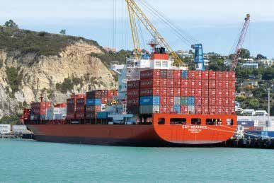
2.0 NATIONAL CONTEXT FOR THE RLTP

The Regional Land Transport Plan must be consistent with          The GPS cannot determine which projects will be funded, or
the Government Policy Statement (GPS) on Land Transport,          how much funding any particular project will receive. Rather,   GPS 2015-18 has three main priorities:
which is reviewed three yearly and sets the Government’s          the GPS sets ranges of funding which government will make
direction for land transport.                                     available for different types of activity. The New Zealand      •   A strong and continuing focus on economic growth and
                                                                  Transport Agency then determines which projects receive             productivity
The Government Policy Statement on Land Transport (the
                                                                  funding – and to what level – within those overall funding      •   Road safety
GPS) is the Government’s main instrument for setting priorities
                                                                  ranges.
and funding levels for land transport investment.                                                                                 •   Value for money
The draft GPS 2015-18 includes:                                                                                                   The draft GPS proposes five land transport objectives.
•   national objectives for land transport                                                                                        They are for a land transport system that:

•   the results the Crown wishes to achieve from the allocation                                                                   •   addresses current and future demand
    of funding from the National Land Transport Fund                                                                              •   provides appropriate transport choices
•   the Crown’s land transport investment strategy                                                                                •   is reliable and resilient
•   the Crown’s policy on borrowing for the purpose of                                                                            •   is a safe system, increasingly free of death and serious
    managing the National Land Transport Programme.                                                                                   injury
                                                                                                                                  •   appropriately mitigates the effects of land transport on the
                                                                                                                                      environment.

6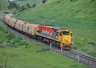
3.0 REGIONAL CONTEXT FOR THE RLTP

While the GPS sets national priorities for transport, the RLTP sets the strategic direction for transport in the region and brings
together the transport programmes of all the councils into one document.

City and district councils have responsibility for the upkeep      (LTP) at the same time as the RLTP is prepared. The LTP           and it is important that the final document reflects LTPs as
and improvement of local roads in their districts, while the       contains planning and financial information for the next ten      much as possible. No activity can be funded by NZTA unless
Highway Network Operations arm of the New Zealand                  years.                                                            it is contained in the RLTP.
Transport Agency manages the state highways in the region.         The RLTP has an impact on the LTP because the level of
Hawke’s Bay Regional Council has a role in transport planning      government subsidy received will affect the size of each
through the RTC, as well as contracting and managing the           transport programme and the amount of income required
provision of public transport services.                            from city, district or regional rates.
Each of the region’s councils must prepare a Long Term Plan        The RLTP is consulted on during a similar period as each LTP

                                                                                                                                                                                               7

                                                                                                       DRAFT REGIONAL LAND TRANSPORT PLAN 2015 - 2025
4.0 ABOUT US

  In order to understand the transport issues and priorities         » 4.2      LANDSCAPE                                                  » 4.4       POPULATION
  identified in this plan, we need a broad understanding of
                                                                       •     In the north of the region much of our land is unstable,        •     In 2013 our region had a population of 151,179.
  the physical, social and environmental factors which have
                                                                             highly erodible and deeply incised by rivers and streams.       •     130,000 people live on or immediately adjacent to
  influenced and shaped our transport needs.
                                                                       •     In the centre of the region and to the south more extensive           the Heretaunga Plains, beyond this area the population is
» 4.1      GEOGRAPHY                                                         plains have been formed.                                              dispersed and mostly situated in the small towns of Wairoa,
                                                                       •     To the west all these lands are bounded by high axial                 Waipawa and Waipukurau.
  •     The Hawke’s Bay region covers 1.42 million hectares, lies
        on the East Coast of the North island and includes Wairoa,           ranges and in the east south of Napier by lower limestone       •     The Napier / Hastings urban area is the fifth-largest
        Hastings and Central Hawke’s Bay District Councils,                  hills.                                                                population concentration in the country.
        Napier City and Hawke’s Bay Regional Councils.                 •     This landscape restricts movement north and south to one        •     The region has had moderate population growth over the
  •     We adjoin the Bay of Plenty, Waikato and Manawatu-                   or two main corridors, while access to other regions is               past three decades but our population is aging quite
        Wanganui regions and Gisborne District, with small                   difficult.                                                            quickly, exacerbated by young people moving to larger
        portions of Taupo and Rangitikei districts also within the                                                                                 urban centres for study or work .
                                                                     » 4.3      CLIMATE
        Hawke’s Bay region.                                                                                                                  •     Across the region, Maori form 23% of the population.
                                                                       •     Our weather is sunny and warmer overall than most
                                                                             regions with a cooler wetter winter and hot dry summer.       » 4.5       PRODUCTION

                                                                       •     Storm systems from the north and east affect the area           •     Our rural land is used for pastoral farming and forestry,
                                                                             seasonally and can cause significant heavy rainfall events            horticulture and viticulture.
                                                                             to occur.                                                       •     We produce 61% of New Zealand’s apple and pear crops
                                                                       •     The transport network can be affected by flooding, snow               (approx 10.4 million cartons), 70% of summerfruit, 25%
                                                                             and sleet on high land areas.                                         of grapes for wine and 50% of the squash crop.
                                                                                                                                             •     128,100 ha are planted in forests and timber products are
                                                                                                                                                   a major export.1
                                                                                                                                             •     There are around 3 million sheep, 520,000 cattle, 85,000
                                                                                                                                                   dairy and 63,000 deer stock units in the region.

                                                                                                                                             1
                                                                                                                                                 http://www.mpi.govt.nz/portals/0/documents forestry/statistics/forestry-stats/
                                                                                                                                                 facts-figures-11-12.pdf
  8
• The main processing centres for rural product are situated » 4.7 TRANSPORT NETWORK » 4.8 TRAVEL PATTERNS / VEHICLE OWNERSHIP
in and around Tomoana / Whakatu, Omahu Road and
• Our transport network has been shaped by the geography • The number of households with access to a private motor
Irongate areas in Hastings and the Awatoto and Onekawa
of the region. vehicle increased by 12% between 2001 and 2013.
areas in Napier.
• State Highway No 2 runs the length of the region from • The number of kilometres travelled by vehicles on Hawke’s
• Tourism is a growing industry within our region,
north to south. Bay roads has fluctuated between 812 and 829 million
contributing an estimated 10.2% of the region’s Gross
• State Highway No 5 connects the region to the central per year since 2009.
Domestic Product2 with many opportunities for tourists to,
for instance: North Island . • Generally the road network copes well with this private
• State Highway 38 connects Wairoa with Lake motor vehicle based demand, although some parts of the
• visit natural areas (e.g. Lake Waikaremoana,
Waikaremoana and the Urewera National Park but network experience peak hour level of service issues.
Cape Kidnappers)
remains unsealed. • Cycle numbers are increasing where network
• undertake recreational activities such a fishing and
• A single track rail line runs from the south of the region improvements have been made, with over 400,000 users
boating, sailing, hiking and cycling
north to Gisborne District (the Palmerston North to of the off road cycle paths annually and over 200 daily
• visit facilities such as the National Aquarium of NZ and users of the cycle path between Hastings and Havelock
Gisborne line) but the section between Napier and
Splash Planet North.
Gisborne has been closed since 2012 due to major
• undertake camping holidays and motel/hotel stays damage sustained during a weather event. » 4.9 SAFETY
• attend special events such as the Mission Concert and • The Port of Napier provides logistics services for the region • Our region has more crashes per vehicle km travelled
Art Deco Weekend and central New Zealand . on state highways and local roads than many other
• visit wineries. • The Hawke’s Bay Airport, situated at Napier, provides regions. Crash rates vary across the region, and are lower
» 4.6 EMPLOYMENT national passenger services for the region and caters for in Central Hawke’s Bay and higher in Hastings District and
irregular private jets. Wairoa.
• In our region there is a trend towards increasing
• Since 2002, Hawke’s Bay has created over 200 kilometres • In 2013 there were 321 injury crashes in the region and 6
employment in horticulture, agriculture, forestry and
of off road cycle trails and 100 kilometres of on road cycle of these involved at least one fatality.3
fishing. This was the largest occupational group recorded
facilities.
in the 2013 Census, with 14% of Hawke’s Bay workers
occupied in this area.
2
Tourism Industry Association of New Zealand website http://www.tianz.org.nz/main/news-detail/index.cfm/2014/08/new-statistics-highlight-tourism-value-to-hawkes-bay-region/
3
http://www.nzta.govt.nz/resources/crash-analysis-reports/briefing-notes.html?page=3&TopicID=0&ReportYear=2014&RegionID=0&LocalAreaID=0
9
DRAFT REGIONAL LAND TRANSPORT PLAN 2015 - 20254.0 ABOUT US (CONTINUED)
» 4.10 PUBLIC TRANSPORT
• Bus passenger services operate in and between Napier • The rail line south from Napier is commercially viable and
and Hastings. handles all the region’s rail freight. Use of this line for
• Significant growth in passenger numbers has occurred freight grew over 40% between 2007 and 2012 but
over the past 3 years, with around 800,000 trips now made tonnages remain low as a percentage of all freight carried
annually, covering approximately 8,470,000 kilometres. in the region.
• A taxi based Total Mobility Scheme is provided for those • There are no scheduled rail passenger services operated
people unable to use public transport services in the region.
and carries approximately 99,000 passengers a year. • The line from Napier to Gisborne experienced growth
» 4.11 FREIGHT in tonnage carried over its last year of operation, but this
trade was disrupted by storm damage and the line has
• The Port of Napier is the fourth largest port in New been mothballed. KiwiRail is exploring options to lease the
Zealand by overseas export volumes. It accounts for 10 line to another operator.
percent of New Zealand’s export tonnages and is therefore
a nationally significant asset.
» 4.12 AIR
• Our rural industries generate freight, shifting produce for • The Hawke’s Bay airport hosts regular scheduled domestic
processing and export. passenger flights, services run to Auckland, Wellington
• Road transport carries 95% of the region’s freight while
and Christchurch.
There have been significant
• Secondary services also run to Hamilton, Gisborne, and
rail accounts for almost all the remaining 5%.
Tauranga.
increases in the freight flow in
• There have been significant increases in the freight flow in
and out of the Port of Napier. In 2009, 2.893 million • Passenger numbers currently exceed 450,000 annually. and out of the Port of Napier.
tonnes of freight flowed through the Port, but by 2014 this • Hawke’s Bay airport is jet capable.
had increased to 4.1 million tonnes, an increase of
41.7%.
105.0 OUR FUTURE
In order to evaluate our future transport needs we need to » 5.2 PRODUCTION » 5.3 EMPLOYMENT
understand the physical, social and economic factors which
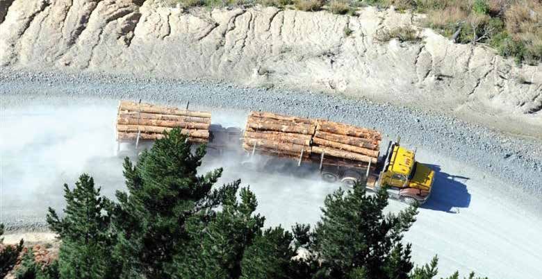
• Forest harvests will expand significantly over the next 5 • The total number of jobs on the Heretaunga Plains is
are likely to influence and shape our transport network.
years as current plantations come to maturity. expected to grow from the current 40,000 to over 55,000
» 5.1 GEOGRAPHY by 2045
• Forecasts indicate that annual forest harvests will grow
• Our region could change through local government from the current 1.7million cubic metres of timber to • The number of jobs within the rest of the region is likely
reorganisation both in terms of territory, the number of around 3.0million cubic metres by 2021 and most of this to grow and be based around forestry, processing
councils and the way transport services are delivered. product will originate from forests in the north of our industries, farm services and tourism services.
region. However there are also significant plantings in • Overall white collar or service sector job growth is
• Those parts of our network close to our coastline will be
Central Hawke’s Bay, with a predicted harvest of 750,000 expected to occur around the Heretaunga Plains.
affected by sea level rise through coastal erosion
tonnes over the next twelve years.
processes over time and sudden changes brought by » 5.4 VEHICLE OWNERSHIP / TRAVEL PATTERNS
more intense storms. • The Ruataniwha water storage project, if it proceeds,
will enable up to 30,000 ha of land to be developed for • Energy cost and supply volatility will affect affordability of
• Other parts of our network will be affected by the impact
more intensive agriculture such as cropping or dairy private motor vehicle transport for some people.
of climate change through more intense rainfall events
farming and may significantly affect transport demand in
and consequent erosion and flood damage. Resilience • The mobility afforded by the private motor vehicle
the area. This development will influence transport demand
issues in neighbouring regions, such as through the will continue to affect employment choices and access to
depending on which land uses establish; dairying will
Manawatu Gorge, will affect the transport of freight and education and recreational opportunities.
generate freight movements to the south, cropping to the
people between the lower North Island and Hawke’s Bay. • Level of service issues will arise at peak travel times and
north. A proposed Wairarapa water storage project
• We need to reduce our emissions from transport to help could also change land use and therefore affect transport need to be managed.
meet the national target of 5% below 1990 emission levels patterns through the Hawke’s Bay region. • Other than at peak times, congestion is minimal in terms
by 2020. of private motor vehicle use.
• Other new industries based around oil and gas could
develop in the region and influence transport needs and » 5.5 SAFETY
the location of new processing industries.
• Risk factors such as speed and alcohol/drugs will continue
• Tourism is expected to develop significantly within our
to be an issue on our roads.
region based around improved access to outdoor
recreational areas and the provision of new attractions. • Intersections and rural roads are likely to continue to be
sources of crashes on our network.
11
DRAFT REGIONAL LAND TRANSPORT PLAN 2015 - 20255.0 0UR FUTURE (CONTINUED)
» 5.6 PUBLIC TRANSPORT • High productivity motor vehicles (HPMV) will need to be shipping scenarios eventually emerge, it is highly likely that
more widely utilised to cope with the increased freight all existing cargo – on a higher base - will be retained and
• There will need to be further investment in public transport
demand due to the economic, safety and environmental shipped from Napier Port. No other mode (road or rail) is
services to offset likely loss of access to private motor
benefits they generate. deemed to have sufficient capacity to cope with current,
vehicles as costs rise for this mode and energy supplies
• A focus will be required on the State Highway 2 corridor let alone future, volumes or annual seasonal requirements,
become less reliable.
north of Napier in order to meet freight demand from especially temperature-sensitive refrigerated cargo.
• Our aging population will create further demand for public
forestry. » 5.9 RAIL
transport and specialised services such as Total Mobility.
» 5.8 PORT OF NAPIER • The Palmerston North-Gisborne rail line south of Napier
• Integration of buses with other transport modes such as
walking and cycling will become increasingly important. • Napier, as the largest international seaport in central is expected to carry increased volumes of freight, with
New Zealand, will continue to be the biggest generator of tonnages already up by 40% between 2008 and 2012.
5.7 FREIGHT
» freight movements throughout the wider region.The Port • The Palmerston-Gisborne rail line north of Napier is
• There will be a significant growth in freight movements of Napier predicts 50% cumulative growth in combined currently mothballed, but options to re-open the line are
across our region’s transport network, with freight into and imports and exports over the next ten years. Shipments of being investigated.
out of the region expected to increase from 20.21 million product in bulk or by container will increase significantly,
tonnes in 2012 to 30.72 million tonnes in 2045.
» 5.10 AIR
based around the growing rural sector production and
• Increased freight movements on our network will increase added- value processing , particularly forestry & food. • The airport at Napier has the capability to provide for
maintenance costs. Another large swing towards containers from conventional internal jet based passenger services and international
bulk shipping is anticipated in the next few years. flights, but this is dependent on attracting a suitable
• Key freight routes to and from processing industry sites
• Napier Port will continue to handle international container airline.
such as Whakatu / Tomoana / Onekawa and the Port at
Napier will need to function efficiently. services, providing direct links to overseas markets • Expansion of air services is seen as being essential for the
(vessels up to 6000-7000 TEU capacity). In the event that development of tourism.
• Freight routes from other regions will also need to function one or two international services possibly hub on several
effectively to cater for expected freight increases. Of NZ ports, Napier can expect to remain a key feeder
particular importance is the link between the freight port, coastally transhipping from Napier on mainline
distribution hub of Palmerston North and the Port of international container services (as is current practice)
Napier. or possibly on dedicated feeder vessels. Whatever future
126.0 ISSUES AND CHALLENGES
Analysing the above trends, it is clear that the region’s transport system faces some challenges over the next ten years. The RTC has evaluated these issues using a strategic business case
approach and condensed them into three key problem statements. These are outlined below.
» 6.1 Parts of the transport system lack capability affecting In order to function effectively for freight, routes must be Wairoa will result in withdrawal of further services from
economic productivity, safety and social development efficient from start to end. these areas and can reduce the viability of such transport
(60% weighting) There are also concerns about future safety, level of service services as do exist, as well as reducing the ratepayer
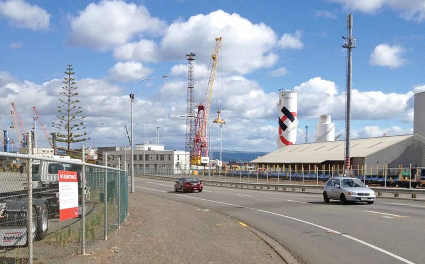
Freight in and out of the Hawke’s Bay region is projected and resilience issues on State Highway 2 between Napier base able to pay for road maintenance, improvements and
to grow by 50% by 20421 and the Port of Napier is and Gisborne, as heavy traffic on the route is predicted to services.
predicting 50% cumulative growth in both imports and increase due to forest harvests. This corridor is serviced The coverage and frequency of public transport in the
exports over the next ten years, with 41.7% growth only by road, as the rail line was mothballed eighteen main cities has significantly increased over the last five
already having occurred over the last five years. months ago. We need to ensure we have accurate years, resulting in good patronage growth, and there is no
There are a number of pinch points on the Heretaunga information on the scale of this increase in order to plan identified unmet demand at present. However, this level of
Plains which have been previously identified as constraints for it, so that resilience and travel time issues do not service should be monitored to ensure that it continues to
on network efficiency, particularly for the movement of adversely affect the Wairoa District, and constrain social meet needs effectively and efficiently. Continued provision
freight to and from the Port of Napier. Some of these have and economic development. Opportunities for growth in of efficient commuter services between the region’s two
already been programmed in the 2012-15 Regional Land tourism in the Urewera National Park may be limited by cities will promote transport mode change, contribute to
Transport Programme and are either underway or awaiting these issues and by the fact that State Highway 38 to Lake reducing congestion on key strategic routes at peak times
further investigation. A Government announcement Waikaremoana remains unsealed. and improve energy efficiency.
in July 2014 has provided funding to bring forward an Six of the 100 most dangerous intersections in New Tourism is increasingly important to the Hawke’s Bay
investigation into access to the Port of Napier. Zealand are located in Hawke’s Bay. While planning for regional economy and we need to manage freight traffic
However, the catchment area for the Port of Napier improvements is underway for most of these, only two to minimise conflicts with the region’s tourism industry.
extends well beyond the boundaries of the Hawke’s Bay have works already programmed. We need to ensure that Linked to this is Hawke’s Bay’s new-found status as a
region and it is vitally important that the region works with planning proceeds to implementation as soon as possible. centre for safe recreational cycling. The extensive network
its neighbouring regions to ensure that freight routes are We also need to monitor and plan for demographic change of safe cycling routes is changing the commuting habits
operating as efficiently as possible. While some of the in the region to ensure that transport access and services of local residents and drawing large numbers of tourists
State Highway links in and out of the region are HPMV are appropriate to changing needs and that our transport to Hawke’s Bay. To maximise this contribution to the local
and/or 50MAX capable, others have constraints which system facilitates social wellbeing. Our population is economy and the health and wellbeing of its residents,
prevent this capability. There are also a large number of aging and already has a higher median age and a higher the region is preparing a regional cycle plan and intends
local road connections which need to be upgraded to this proportion of people over 65 than for New Zealand as to further develop the cycle network, promote Hawke’s
standard to ensure that full use can be made of HPMV. a whole. Declining populations in rural towns such as Bay as the best region for cycling in New Zealand and
encourage more residents to cycle for transport.
1
National Freight Demand Study, Ministry of Transport, 2014 13
DRAFT REGIONAL LAND TRANSPORT PLAN 2015 - 20256.0 ISSUES AND CHALLENGES (CONTINUED)
» 6.2 A limited shared view of cross-boundary transport » 6.3 How people use the transport network is leading to » 6.4 SUMMARY
issues increases the risk of sub-optimal investment in an unacceptable level of deaths and serious injuries These issues are largely consistent with the principal
and management of the network (20% weighting) (20% weighting). strategic direction set in the Regional Land Transport
This issue is closely linked with the one above. The The region’s rate per kilometre travelled of deaths and Strategy in 2012, which was to “improve the economic
Hawke’s Bay transport system is part of a much wider serious injuries from road crashes remains unacceptably efficiency, effectiveness and safety of the routes servicing
social and economic catchment area, much of which high. While there are a number of blackspot crash the region’s economic production centres and in particular,
connects to the Port or other key transport or land use locations in the region, planning is underway to address transport routes to and from the Port of Napier”.
hubs. many of these. Crashes are in many cases caused by As the highest priority improvements identified at that time
The region needs to work closely with neighbouring driver behaviour. on the Heretaunga Plains are already largely underway,
regions to ensure that issues are jointly managed. For Principal causes are speed, loss of control in rural the region now needs to focus on ensuring maximum
example, the Manawatu Gorge was closed for 15 months areas, alcohol and young drivers. Using the Safe System efficiency and safety throughout the catchment area of
in 2011-12 by a major slip, requiring a substantial road approach, the region must collectively decide how best to the Port. Close cooperation with neighbouring regions is
reconstruction. While alternate routes were in place, address these issues. therefore vital.
the closure cost businesses and transport operators an
estimated $63,000 a day.3 Resilience issues such as this
in neighbouring regions can have a major effect on the
economy of Hawke’s Bay and vice versa, so the transport
system must be viewed in terms of end-to-end journeys,
not regions.
Large forests soon to be harvested in the Tararua district The Hawke’s Bay transport
will traverse Central Hawke’s Bay roads to access the Port. system is part of a much
The two regions need to jointly plan for this so that funding
can be allocated where needed and freight efficiency is wider social and economic
maximised. catchment area.
3
Vision Manawatu estimate 2011
147.0 STATEMENT OF TRANSPORT PRIORITIES
FOR THE REGION FOR 2015 TO 2025
The RTC has identified its transport priorities over the next Our priorities are :
ten years. These reflect the transport issues which have been 1. To complete capacity, efficiency and safety improvements
outlined in Section 6 and are in turn reflected in the objectives on the Hawke’s Bay Expressway leading to the Port of
and policies set out in Section 8, and in the proposed activities Napier
for which the region seeks funding over the next six years. The
RTC has not assigned a particular order to these priorities. 2. To improve connections from the Whakatu Industrial Area
to the Port of Napier by providing an efficient safe link to
the HB Expressway
3. To ensure High Productivity Motor Vehicle capability on the
region’s strategic routes and major local road connections
4. To work with neighbouring regions to maximise the
efficiency and resilience of transport routes throughout
the Port of Napier’s catchment area
4. To rectify safety issues at intersections in the region
which are listed amongst the top 100 most dangerous
intersections in New Zealand
5. To reduce the number and severity of crashes caused by
network user behaviour on Hawke’s Bay roads
6. To ensure Hawke’s Bay becomes a major centre for cycling,
for local residents and tourists
7. To provide public transport services which encourage
transport mode change and provide access to the region’s
economic, social and educational opportunities.
15
DRAFT REGIONAL LAND TRANSPORT PLAN 2015 - 20258.0 REGIONAL TRANSPORT OBJECTIVES
AND POLICIES
The Land Transport Management Act requires that the » 8.1 A safe, resilient and efficient transport system that » 8.2 A reduction in the risk of death or serious injuries on
Plan set out the region’s land transport objectives, policies supports the development of our economy and Hawke’s Bay roads
and measures for at least ten years. Activities which are put contributes to social wellbeing in our community We aim to achieve this by:
forward for funding must be assessed against the policy or We aim to achieve this by: i. targeting programmes aimed at changing network user
objective to which they contribute.
i. planning effectively for growth and economic productivity behaviour in regard to speed, rural loss of control, young
Proposed objectives and policies to address our issues and on the strategic network. drivers , alcohol and other major crash causes
reflect our priorities are set out below.
ii. cooperating closely with neighbouring regions to ensure ii. prioritising and remedying network deficiencies according
These have been kept as simple and concise as possible to that the transport network serving the Port of Napier’s to risk
reflect the key strategic direction described above. While catchment area is as safe, efficient and resilient as iii. avoiding conflict between transport modes wherever
there are other transport issues in the region which our possible. possible.
business as usual activities will address, these reflect our
iii. maintaining the capability of the local road network to iv. ensuring that road safety solutions provide the best
proposed major focus for the next ten years.
ensure effective end to end journeys, with a particular possible outcome relative to the investment
focus on High Productivity Motor Vehicle capability
iv. continuing to invest in cycling in Hawke’s Bay for tourism,
health and liveability
v. monitoring and responding to the changing demographics
of the region to ensure access to the region’s social,
economic and cultural opportunities.
vi. Ensuring that transport solutions provide the best possible
outcome relative to the investment and contribute to an
environmentally sustainable transport system
169.0 PROPOSED REGIONAL
LAND TRANSPORT ACTIVITIES
Each council in Hawke’s Bay and NZTA’s Highway Network » 9.1 PRIORITISATION PROCESS » 9.2 PRIORITISED ACTIVITIES FOR 2015-21
Operations Group has developed a programme of activities In order to determine which of the proposed projects are most Key to Organisations:
which will contribute to achieving the above objectives and, important to the region, the RTC has used a prioritisation
through this Plan, seeks implementation funding from NZTA process which has considered:
for the next six years. TERM / ACRONYM ORGANISATION
• Strategic fit - how each activity aligns with the Government’s
The RTC has developed a policy that determines which CHBD Central Hawke’s Bay District Council
investment direction (as contained in the Government
activities it considers to be significant and should therefore Policy Statement and NZTA’s Investment Assessment NCC Napier City Council
be assigned an order of priority. This significance policy is Framework)
contained in Appendix B. HDC Hastings District Council
• the effectiveness of the proposed activity in addressing
Business as usual activities such as maintenance, operations the issue or problem and delivering regional and national NZTA HNO New Zealand Transport Agency Highway
and renewals of roads, public transport programmes and strategic objectives. Network and Operations
minor improvements are included in the RLTP but not HBRC Hawke’s Bay Regional Council
• the economic efficiency of the proposed activity, indicating
prioritised by the RTC.
a measure of value for money based on a benefit and cost WDC Wairoa District Council
Section 9.2 sets out the region’s prioritised list of activities. appraisal.
These are improvement projects, usually of significant cost, DoC Department of Conservation
• how the project will benefit the regional objectives and
which the RTC considers make a strong contribution to
priorities set out in Sections 7 and 8
regional strategic objectives and priorities.
The first three criteria form the Assessment Profile (refer
Section 9.3 sets out all land transport activities for which our
lists of activities) and the fourth determines the Contribution
region seeks funding from the New Zealand Transport Agency
Rating to Regional Objectives.
between 2015 and 2021. As is required by the LTMA, the
objective or policy to which the activity contributes has been
identified and is shown in the column headed Main Objective
or Policy Contribution.
Only those activities which need to be prioritised have also
been assigned a Contribution Rating to Regional Objectives
and an RTC Priority. These activities are highlighted in yellow
in Section 9.3.
Section 9.4 sets out a ten year forecast of expenditure by
activity class between 2015 and 2025 and identifies funding
sources.
17
DRAFT REGIONAL LAND TRANSPORT PLAN 2015 - 20259.0 PROPOSED REGIONAL LAND TRANSPORT ACTIVITIES (CONTINUED)
» 9.2 PRIORITISED ACTIVITIES FOR 2015-21 (CONTINUED)
ASSESSMENT
ORGANISATION PROJECT NAME AND DESCRIPTION
PROFILE
1 HDC Whakatu Arterial Link - improved access for freight and enhanced supply chain efficiency from the growing industrial area at Whakatu, along the Expressway to the HMH
Port of Napier, while improving deaths and serious injury crask risks
2 NZTA HNO HB Expressway Pakowhai & Links Rd Intersection. Combine the two adjacent intersections (traffic signal and priority controlled) with a single 60 metres diameter at HMH
grade roundabout. Future proofed for a grade separated expressway (i.e. stage two) when affordable. Stage one and two will be future proofed to accommodate the
duplication of the Tutaekuri Bridge and four laning of the Expressway
3 NZTA HNO SH2 Napier Road Intersection safety and capacity improvement in conjunction with Whakatu Arterial Link HMH
4 NZTA HNO High Productivity Motor Vehicle Tranche 2 Napier Port to Gisborne Strengthening of bridges and structures along the corridor between Port of Napier and Gisborne HHM
to provide for HPMV access into/from the region TABLES TO COME
5 NZTA HNO High Productivity Motor Vehicle Tranche 2 HB Napier Port to South Boundary.Strengthening of bridges and structures along the corridor between Port of Napier HHM
and Manawatu to provide for HPMV access into/from the region safety and capacity improvement in conjunction with Whakatu Arterial Link
6 HDC High Productivity Motor Vehicle Bridge Improvements - investigation, design and strengthening works 2015/18 HHH
7 NZTA HNO HB Expressway Kennedy Rd to Meeanee Rd.Investigate improvements for both safety and efficiency on this section of the SH50a corridor. HMH
8 NZTA HNO SH2 Watchman Rd, HB Airport Intersection. Investigation and implementation of improvements for safety of SH2 and SH2B/Watchman Rd intersections located on HMM
a national strategic state highway and the strategic route to the port and Hawkes Bay airport.
9 NZTA HNO Pakipaki to Waipukurau Safety - Investigation and implementation of safety improvements to reduce the number of crashes on this section of highway. HLM
10 HDC Model Communities 2015-18 Walking and Cycling - monitoring and evaluation, planning and marketing, construction. Continuation of planned walking and cycling HMH
improvements and promotional programmes through the I Way walking and cycling programme
11 NCC Cycle Strategy Implementation HHM
Creation of over 16km of arterial off-road cycle pathways in urban area
Additional 13km on-road cycle lanes linking with new and existing routes
12 WDC Blacks Beach Lifeline Security - Reinstatement of Flood Damage and protection of roadside to secure this lifeline route in and out of the Mahia Peninsula (e.g. MMM
coastal protection works or similar).
13 WDC Walking and Cycling Implementation. Continued construction of walkways/cycleways as per implementation plan in the district walking/cycling strategy MML
18CONTRIBUTION
TOTAL COST
TO REGIONAL RTC PRIORITY COST 2015 COST 2016 COST 2017 COST 2018 COST 2019 COST 2020
6 YEARS
OBJECTIVES
H+ 1 $9,558,349 $8,140,000 $1,318,349
H+ 1 $5,800,900 $5,800,900
H+ 1 $4,129,433 $650,000 $1,364,930 $2,114,503
H 2 $4,341,592 $100,000 $2,089,359 $2,152,233
H 2 $2,349,350 $111,874 $2,237,476
H 2 $1,906,153 $610,000 $631,500 $664,653
H 2 $4,009,265 $56,000 $431,244 $3,522,021
H 2 $3,306,669 $108,463 $1,898,206 $1,300,000
M 3 $16,349,813 $80,000 $1,675,655 $1,467,600 $6,596,978 $6,529,580
M 3 $5,543,792 $1,303,607 $1,134,566 $1,124,872 $894,742 $484,191 $601,814
M 3 $5,996,331 $1,116,437 $946,183 $1,086,048 $1,039,984 $1,178,875 $628,804
M 3 $4,840,000 $2,000,000 $2,240,000 $600,000
M 3 $3,030,000 $480,000 $550,000 $600,000 $750,000 $500,000 $150,000
19
DRAFT REGIONAL LAND TRANSPORT PLAN 2015 - 20259.0 PROPOSED REGIONAL LAND TRANSPORT ACTIVITIES (CONTINUED)
» 9.3 FULL LIST OF ACTIVITIES FOR 2015-21
MAIN OBJECTIVE
ASSESSMENT CONTRIBUTION
ORGANISATION PROJECT NAME AND DESCRIPTION OR POLICY
PROFILE RATING
CONTRIBUTIONS
1 CHBDC Maintenance, Operations and Renewals Programme MMM 8.1, 8.1 iii
2 CHBDC Minor improvements 2015-21 MMM 8.1, 8.1 iii
3 DoC Maintenance Operations and Renewals Programme MMM 8.1, 8.1 iii
4 HDC Activity Management Plan HH- 8.1, 8.1iii
5 HDC Corridor Management Plans HM- 8.1, 8.1iii
6 HDC High Productivity Motor Vehicle Bridge Improvements - investigation, design and strengthening works 2015/18 HHH 8.1i, 8.1iii H
7 HDC Maintenance, Operations and Renewals Programme 8.1, 8.1iii
8 HDC Minor improvements 2015-21 8.1, 8.1iii
9 HDC Model Communities 2015-18 Walking and Cycling - monitoring and evaluation, planning and marketing, HMH 8.1 iv M
construction. Continuation of planned walking and cycling improvements and promotional programmes through
the I Way walking and cycling programme
10 HDC Streetlight LED implementation. 8.1iii, 8.1 vi
11 HDC Whakatu Arterial Link 2012/15 - improved access for freight and enhanced supply chain efficiency from the HMH 8.1i H+
growing industrial area at Whakatu, along the Expressway to the Port of Napier, while improving deaths and
serious injury crask risks
12 NZTA HNO Corkscrew Gully Northbound & Southbound Passing Lanes. Construction of a new northbound passing lane and 8.1i, 8.2ii
lengthening of an existing short southbound passing lane on Great North Road, State Highway 2.
13 NZTA HNO HB Expressway Kennedy Rd to Meeanee Rd.Investigate improvements for both safety and efficiency on this HMH 8.1i, 8.2ii, 8.1ii H
section of the SH50a corridor.
20TOTAL COST 6
RTC PRIORITY COST 2015 COST 2016 COST 2017 COST 2018 COST 2019 COST 2020
YEARS
$63,428,810 $10,266,656 $10,246,458 $10,246,458 $10,889,746 $10,889,746 $10,889,746
$896,874 $298,958 $298,958 $298,958 $306,432 $306,432 $306,432
$243,000 $35,000 $38,000 $41,000 $42,000 $43,000 $44,000
$1,205,600 $192,950 $291,650 $216,000 $155,000 $190,000 $160,000
$478,984 $174,720 $69,378 $44,302 $95,710 $46,810 $48,064
2 $1,906,153 $610,000 $631,500 $664,653
$138,768,555 $21,198,400 $21,210,208 $21,832,958 $23,598,189 $24,821,500 $26,107,300
$7,125,000 2,300,000 2,375,000 $2,450,000 $2,530,000 $2,615,000 $2,700,000
3 5,543,792 $1,303,607 $1,134,566 $1,124,872 $894,742 $484,191 $601,814
$2,053,451 $300,000 $315,750 $332,326 $349,774 $368,137 $387,464
1 $9,558,349 $8,140,000 $1,318,349
$1,466,500 $1,466,500
2 $4,009,265 $56,000 $431,244 $3,522,021
21
DRAFT REGIONAL LAND TRANSPORT PLAN 2015 - 20259.0 PROPOSED REGIONAL LAND TRANSPORT ACTIVITIES (CONTINUED)
» 9.3 FULL LIST OF ACTIVITIES FOR 2015-21 (CONTINUED)
MAIN OBJECTIVE
ASSESSMENT CONTRIBUTION
ORGANISATION PROJECT NAME AND DESCRIPTION OR POLICY
PROFILE RATING
CONTRIBUTIONS
14 NZTA HNO HB Expressway Pakowhai & Links Rd Intersection. Combine the two adjacent intersections (traffic signal and MMH 8.1 i, 8.1ii H+
priority controlled) with a single 60 metres diameter at grade roundabout. Future proofed for a grade separated
expressway (i.e. stage two) when affordable. Stage one and two will be future proofed to accommodate the
duplication of the Tutaekuri Bridge and four laning of the Expressway
15 NZTA HNO High Productivity Motor Vehicles Tranche 2 HB HNO Napier Port to Gisborne strengthening of bridges and HHM 8.1i, 8.1ii H
structures along the corridor between Port of Napier and Gisborne to provide for HPMV access into/from the
region
16 NZTA HNO High Productivity Motor Vehicles Tranche 2 HB HNO Napier Port to South Boundary. Strengthening of bridges HHM 8.1i, 8.1ii H
and structures along the corridor between Port of Napier and Manawatu to provide for HPMV access
17 NZTA HNO Maintenance, Operations and Renewals Programme HHH 8.1
18 NZTA HNO Mangahohi Bridge Replacement - Design of a temporary bridge replacement (Bailey bridge) of the existing MMH 8.1i
wooden Mangahoni Bridge. The current bridge structure does not support class one loading for logging vehicles.
19 NZTA HNO Minor improvements 2015-21 8.1
20 NZTA HNO Pakipaki to Waipukurau Safety - Investigation and implementation of safety improvements to reduce the number HLM 8.2ii M
of crashes on this section of highway.
21 NZTA HNO SH2 Napier Road Intersection - safety and capacity improvement in conjunction with Whakatu Arterial Link HMH 8.1i H+
22 NZTA HNO SH2 Watchman Rd, HB Airport Intersection. Investigation and implementation of improvements for safety of HMM 8.2ii H
SH2/ SH2B/ Watchman Rd intersections located on a national strategic state highway and the strategic route to
the port and Hawkes Bay airport.
23 NZTA HNO Wairoa SEDF (North of Napier SEDF)To provide a stock effluent facility between Napier and Wairoa MMH 8.1vi
24 NZTA HNO WeighRight - Hawkes BayInstallation of a weigh right facilities that will support the management and operation of HML 8.1
SH2 in the Hawkes bay area - four locations
25 HBRC Public Transport Programme , including bus services, Total Mobility, bus infrastructure, ticketing systems, MMM 8.1v
timetable information and service marketing
22TOTAL COST 6
RTC PRIORITY COST 2015 COST 2016 COST 2017 COST 2018 COST 2019 COST 2020
YEARS
1 $5,800,900 $5,800,900
2 $4,341,592 $100,000 $2,089,359 $2,152,233
2 $2,349,350 $111,874 $2,237,476
$116,284,270 $18,336,210 $18,828,390 $19,254,260 $19,543,410 $20,029,650 $20,292,350
$879,000 $99,000 $780,000
$5,006,469 $1,557,568 $1,668,823 $1,780,078 $1,780,000 $1,780,000 $1,780,000
3 $16,349,813 $80,000 $1,675,655 $1,467,600 $6,596,978 $6,529,580
1 $4,129,433 $650,000 $1,364,930 $2,114,503
2 $3,306,669 $108,463 $1,898,206 $1,300,000
$600,000 $100,000 $500,000
$3,750,000 $150,000 $1,650,000 $900,000 $1,050,000
$25,915,398 $3,966,504 $4,148,335 $4,240,365 $4,377,237 $4,517,144 $4,665,813
23
DRAFT REGIONAL LAND TRANSPORT PLAN 2015 - 20259.0 PROPOSED REGIONAL LAND TRANSPORT ACTIVITIES (CONTINUED)
» 9.3 FULL LIST OF ACTIVITIES FOR 2015-21 (CONTINUED)
MAIN OBJECTIVE
ASSESSMENT CONTRIBUTION
ORGANISATION PROJECT NAME AND DESCRIPTION OR POLICY
PROFILE RATING
CONTRIBUTIONS
26 HBRC Regional Land Transport Planning Management 2015-21 HH_ 8.1, 8.2
27 HBRC Road Safety Promotion 2015-18 - High Strategic Fit activities HM_ 8.2i
28 HBRC Road Safety Promotion 2015-18 Medium Strategic Fit activities MM_ 8.2i
29 NCC Cycle Strategy Implementation. Creation of over 16km of arterial off-road cycle pathways in urban area HHM 8.1iv M
Additional 13km on-road cycle lanes linking with new and existing routes
30 NCC Maadi / Wycliffe / Kennedy Traffic Signals HHM 8.1iii
31 NCC Maintenance, Operations and Renewals Programme 2015-21 MHH 8.1, 8.1iii
32 NCC Meeanee / Awatoto Intersection - safety upgrade to roundabout HHH 8.2ii
33 NCC Minor improvements 2015-21 MMM 8.1, 8.1iii
34 WDC Associated Improvements for Network Resilience - dust hazard reduction, provision of adequate road width and MMM 8.1iii
other associated improvements - various locations
35 WDC Blacks Beach Lifeline Security - Reinstatement of flood damage and protection of roadside to secure this lifeline MMM 8.1iii M
route in and out of the Mahia Peninsula (e.g. coastal protection works or similar).
36 WDC Maintenance, Operations and Renewals Programme 2015-21 8.1, 8.1iii
37 WDC Maintenance, Operations and Renewals Programme 2015-21- Special Purpose Roads 8.1, 8.1iii
38 WDC Minor improvements 2015-21 8.1, 8.1iii
39 WDC Minor improvements 2015-21 Special Purpose Roads 8.1, 8.1iii
40 WDC Te Urewera Rainforest Route Resilience Improvement - reinstatement of old washouts and geometric upgrades HHM 8.1, 8.1iii
41 WDC Walking and Cycling Plan Implementation. Continued construction of walkways/cycleways as per implementation MML 8.1iv M
plan in the district walking/cycling strategy.
42 WDC Transport Planning. 8.1, 8.2
24TOTAL COST 6
RTC PRIORITY COST 2015 COST 2016 COST 2017 COST 2018 COST 2019 COST 2020
YEARS
$1,070,700 $79,000 $81,400 $103,800 $86,300 $88,900 $111,500
$786,000 $262,000 $262,000 $262,000 $269,860 $269,860 $269,860
$350,000 $116,667 $116,667 $116,666 $120,140 $120,140 $120,140
3 $5,996,331 $1,116,437 $946,183 $1,086,048 $1,039,984 $1,178,875 $628,804
$350,000 $350,000
$42,978,154 $6,418,620 $6,719,450 $7,034,450 $7,256,204 $7,596,570 $7,952,860
$2,830,000 $2,830,000
$993,875 $316,231 $331,062 $346,582 $362,811 $379,829 $397,643
$1,550,000 $500,000 $450,000 $600,000
3 $4,840,000 $2,000,000 $2,240,000 $600,000
$49,540,000 $8,020,000 $8,185,000 $8,135,000 $8,300,000 $8,400,000 $8,500,000
$2,497,000 $789,000 $850,500 $857,500
$1,160,000 $380,000 $390,000 $390,000 $400,000 $410,000 $410,000
$2,275,000 $740,000 $765,000 $770,000
$750,000 $200,000 $200,000 $200,000 $150,000
3 $3,030,000 $480,000 $550,000 $600,000 $750,000 $500,000 $150,000
$140,000 $70,000 $70,000
25
DRAFT REGIONAL LAND TRANSPORT PLAN 2015 - 20259.0 PROPOSED REGIONAL LAND TRANSPORT ACTIVITIES (CONTINUED) » 9.4 TEN YEAR FORECAST BY ACTIVITY CLASS MAINTENANCE AND OPERATION OF LOCAL ROADS 2015-16 2016-17 2017-18 2018-19 2019-20 Central Hawkes Bay District Council $4,182,896 $4,162,698 $4,162,698 $4,346,390 $4,346,390 Department of Conservation $35,000 $38,000 $41,000 $42,000 $43,000 Hastings District Council $9,243,800 $9,515,790 $9,895,270 $10,516,100 $10,831,524 Napier City Council $3,432,120 $3,588,450 $3,751,750 $3,751,148 $3,921,757 Wairoa District Council (incl Special Purpose Roads) $6,029,000 $6,225,000 $6,352,500 $5,750,000 $5,800,000 MAINTENANCE AND OPERATION OF STATE HIGHWAYS 2015-16 2016-17 2017-18 2018-19 2019-20 Hawke’s Bay Highway Network Operations $13,933,400 $14,307,050 $14,628,720 $14,846,240 $15,216,410 RENEWAL OF LOCAL ROADS 2015-16 2016-17 2017-18 2018-19 2019-20 Central Hawkes Bay District Council $6,383,760 $6,383,760 $6,383,760 $6,543,356 $6,543,356 Hastings District Council $9,527,824 $9,807,449 $10,131,731 $11,834,527 $12,189,566 Napier City Council $2,986,500 $3,131,000 $3,282,700 $3,505,056 $3,674,813 Wairoa District Council ( incl Special Purpose Roads) $3,590,000 $3,630,000 $3,465,000 $2,950,000 $3,200,000 RENEWAL OF STATE HIGHWAYS 2015-16 2016-17 2017-18 2018-19 2019-20 Hawke’s Bay Highway Network Operations $4,402,810 $4,521,340 $4,625,540 $4,697,170 $4,813,240 New and Improved Infrastructure for Local Roads 2015-16 2016-17 2017-18 2018-19 2019-20 Central Hawkes Bay District Council $298,958 $298,958 $298,958 $306,432 $306,432 Hastings District Council $11,350,000 $4,640,599 $3,497,000 $2,880,000 $2,983,000 Napier City Council $316,231 $681,062 $3,176,582 $362,811 $379,829 Wairoa District Council $445,000 $2,500,000 $2,690,000 $1,100,000 $480,000 26
You can also read