DRUMHELLER FLOOD MITIGATION and CLIMATE ADAPTATION SYSTEM - Changing the Channel of Flood Readiness
←
→
Page content transcription
If your browser does not render page correctly, please read the page content below
DRUMHELLER FLOOD MITIGATION and CLIMATE ADAPTATION SYSTEM
           Changing the Channel of Flood Readiness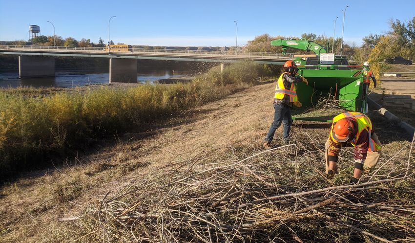
All rights reserved © 2020 The Town of Drumheller
Drumheller Flood Mitigation and Climate Adaptation System:
Changing the channel on flood readiness
                                                                              LEVERAGE.
WHO:                Town of Drumheller                                            INTEGRATE.
WHAT:               Flood Mitigation and Climate Adaptation System                       LEGACY.
WHERE:              100 kilometres of riverbank in the community of           We are committed to leveraging opportunities,
                    Drumheller                                                integrating approaches to flood mitigation and
                                                                              building a legacy in a proactive and sustainable
WHEN:               2019 - 2024                                               way. This will form the basis of a 3-word
                                                                              community ‘Pledge’ for the program.
HOW:                Drumheller Resiliency and Flood Mitigation Office

HOW MUCH:           Funding total: $55M

Overview
In March 2019, the Government of Canada committed funding in the
amount of $22M to Drumheller’s Flood Mitigation and Climate Adaptation
System through the Government of Canada’s Disaster Mitigation and
Adaptation Fund (DMAF). The Government of Alberta also committed
$28M in funding to this project through the Alberta Community
Resiliency Program (ACRP). With the additional municipal investment
of $5M, a total of $55M has been dedicated to the Drumheller Flood
Mitigation and Climate Adaptation System to change the channel on
flood readiness in the community.                                                Mayor Heather Colberg and Chief Resiliency and
                                                                                 Flood Mitigation Officer, Darwin Durnie, announce
                                                                                 confirmed federal grant funding for the Drumheller
                                                                                 Flood Mitigation and Climate Adaptation System.

               WE’RE CHANGING
               THE CHANNEL ON
               FLOOD READINESS!
                                                                         We’re changing the
                  DRUMHELLER.CA                @drumhellerALERT
                                                                                            channe
                                                                               Flood Readiness! l on

                                                                                                                                      1
Drumheller Resiliency and Flood Mitigation Office                   January – December 2020
    The purpose of this office is to protect the people and property    This report is intended to provide governing bodies and key
    in Drumheller from loss due to flooding through a sensible          stakeholders an overview of the current and planned objectives
    model for a small community to adapt to the perils of changing      for the Drumheller Resiliency and Flood Mitigation Office. While
    climate. The Resiliency and Flood Mitigation Office will manage     the COVID-19 global pandemic created unforeseen hurdles, the
    the Flood Mitigation and Climate Adaptation Plan through to its     project has been able to prevail and make excellent headway
    completion in 2024.                                                 throughout the year. We were able to secure all the funding
    Mission: Protect residents and property from loss or injury         required for the project, begin land acquisitions, complete
    related to the perils of flood and changes in climate.              geotechnical and terrestrial studies, complete necessary dike
    Goal: Preserve the value of property and ensure risk is reduced     inspections, complete indigenous consultation site visits,
    to levels which allows financial and insurance products to          modernize key municipal planning documents, make headway
    remain available.                                                   on the flood emergency response manual, and break ground on
    Aim: Implement a comprehensive mitigation program for               System 2100 starting with Clark Hill to Hoodoos.
    flooding and adaptation to changes in climate by 2025 with the
    following objectives:
       1.   Communication and public engagement
       2.   Regulatory/approvals
       3.   Conveyance capacity
       4.   Structural measures
       5.   Municipal Emergency Plan (MEP)
    Council took a bold step in hiring an expert team of seasoned
    practitioners that have been through flood, fires and major
    community disasters to help manage the project and address
    the concerns of the community. For the first time in our
    community, a Chief Resiliency and Flood Mitigation Officer was
    hired to lead this team and ensure that Drumheller is flood ready
    and that resident concerns are addressed pre-flood, during a
    flood and post-flood.
    The creation of the Resiliency and Flood Mitigation Office will
    follow the principles of the internationally recognized Incident
    Command System (ICS).

                                                                           Planning day, February 2020

2
Communications and Engagement
Creating and implementing a communication plan and an
inclusive public engagement and stakeholder strategy is
a critical part of this initiative. The need to work with the
community, businesses and residents, to take on ownership and
responsibility in helping change the channel on flood readiness
in Drumheller is very important. The following communications
activities and stakeholder engagement occurred from January –
December 2020:
• Indigenous consultation and engagement:
   » Stoney Nakoda Nation – correspondence with no return
     answer (January 30)
   » Siksika First Nation meeting to confirm project details
     and desire to meet in spring to conduct ceremony prior
     to traditional use study (February 3) – postponed due to        Mayor Colberg attends Siksika Nation Council meeting, March 2020
     COVID-19
   » Blood Tribe – meeting at Grey Eagles Resort to provide           » 2 band site visits requested and completed (Siksika and
     overview of program. Interest in historical resource and            Blood First Nations)
     archaeological findings in prescribed area. Will schedule        » Consultation Logs have been forwarded to the 7 bands
     site visit in mid spring (February 10) – postponed due to           for them to review
     COVID-19                                                         » We are hoping to receive an Adequacy decision from the
   » Tsuut’ina First Nation – meeting at tribal office. Provided         ACO early in 2021
     overview of program interested in ceremony in advance            » Consultation Office for adequacy in early January 2021
     of work commencing. Will schedule meeting in mid              • Crisis Communications training held for Town staff and council
     Spring (February 10) – postponed due to COVID-19              • Produced videos highlighting updates and educating citizens
   » Siksika Nation Council meeting with Mayor Colberg               of the Valley on the flood mitigation project and emergency
     – interest in joint council meeting and exploring               preparedness:
     opportunities to develop long term relationship (March 5)        » Urban Tree Strategy (June 26)
   » Received positive feedback from Infrastructure Canada            » Storm Detention Ponds (July 2)
     that they are satisfied and pleased with approach to             » Newcastle Recreation Area (July 28)
     consultation and engagement town has adopted in                  » Flood Wall History (July 30)
     regards to Indigenous Consultation process to date               » Grant Funding Announcement (Aug. 12) – DFAM sign
     (March 10)                                                          installation
   » Application sent to Alberta Consultation Office (ACO).           » Focus on the new MDP and LUB and how they help with
     Response received was a Level 1 streamlined consultation            flood mitigation (Aug. 13)
     with 7 First Nations                                             » Berm Design (Sept. 9)
                                                                      » Focus on the steps to become more adaptive, explaining

                                                                                                                                        3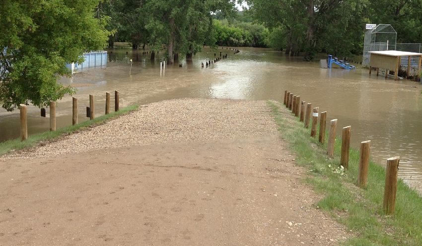
the new zones, strategies and why flood mitigation in the      COVID-19
           Drumheller Valley is so important (Sept. 17)                 • Held two mitigation system inspections/orientations
         » Dike Condition Inspection (Sept. 23)                         • Held meeting with local contractors to review flood
         » Clark Hill to Hoodoo Project Sign Unveiling (Oct. 2) –         mitigation project opportunities
           DFAM sign installation                                       • Held meeting with local Realtors to discuss land acquisition
         » Understanding Tree and Rodent Impact on Berms (Sept.           policy and process
           30)                                                          • Developed phone scripts for town staff to assist in answering
    •   Launched dedicated Flood Readiness Website (February 5)           frequently asked questions
    •   Implementing public education campaign based on themes:         • Five flood advisory committee meetings were held to provide
        Be Informed. Plan Ahead. Take Action – over 500 social            status updates
        media posts across Facebook, Instagram and Twitter              • Twenty-five weekly team meetings conducted to coordinate
         » Instagram page launched September 2020                         activities and consolidate communications
    •   Developed educational opportunities to be delivered to          • Meeting with Palliser Regional Municipal Services in Hanna
        Grade 4 students canceled due to COVID-19 school closures       • Five planning technical meetings with O2 Design as it relates
    •   Project updates highlighted on dedicated Flood Readiness          to Master Engineering Design and Assessment of Planning
        website:                                                          Impacts
         » Land Acquisition Policy (Jan. 20)                            • Coordination of communication strategies with O2 Design
         » Website Launch (Feb. 5)                                      • Communications discussing the 8-steps to changing the
         » Family Day Activities (Feb. 18)                                channel
         » Flood Mitigation Maintenance Updates (March 4)                  » Local
         » Flood Season Reminder (May 15)                                     Newspaper
         » River Updates (May 25, June 1)                                     (Drumheller
         » Flood Mitigation Surveying (June 9)                                Mail) two-page
         » Urban Forest Surveying (June 10)                                   spread (Sept. 16)
         » Land Acquisition Process (July 17)                              » Social media
         » Dike Condition Inspections (Sept. 17)                              campaign
         » Bore Hole Drilling (Oct. 5)                                        (September -
         » Land Use Webmap Launch with Palliser Regional                      December)
           Municipal Services (Nov. 10)                                 • Information
         » “What We Heard Report” now available (Nov. 27)                 brochures
         » MDP/LUB Passes at Town Council (Dec. 8)                        explaining the
    •   Adopting Land Acquisition Policy and Process                      DRFMO (Aug. 26)
    •   Engaging with affected homeowners impacted by Land              • Local farmers
        Acquisition                                                       market participating
    •   Flood Forum with other DMAF recipients and academia               with flood mascot
        planned for April 19-22 to show leadership and provide an         (Sept. 19)
        opportunity for municipalities and experts to share best        • Regular radio          Drumheller Farmer’s Market, September 2020
        practices in mitigating flooding disasters – postponed due to     and newspaper

4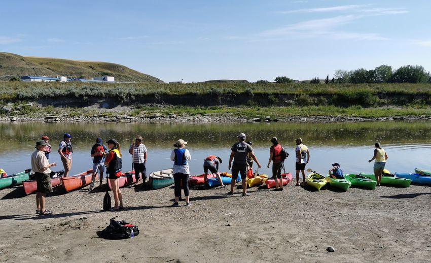
advertising as required                                        Regulatory/approvals
• Launched “On the Trail with Morris the Hike-Asaurus” in
  September                                                      Work continues on the complex regulatory and approval process
   » Frequent “blog” hosted on website and in the Drumheller     that is integral to this program. This includes:
      Mail from the perspective of the flood mascot, provides    • Meeting with Alberta Environment and Parks (AEP)
      updates in a friendly manner and addresses any                operations branch to identify transfer methods (moved to Q3
      misconceptions around the program                             as a result of COVID-19)
• Land Assembly information packages completed for Sept. 14      • Continuing discussions on transfer methods
• Internal technical meetings with staff to understand impacts   • Meetings with AEP and Public Lands to discuss the transfer
  of new policies (ongoing)                                         of lands and dikes
• Regular website updates                                        • AEP Flood Hazard Mapping
• Rotary Club briefing (Sept. 29)                                  › Released November 2020 - asking for public feedback by
• Neighbourhood Information Sessions - engaging public                January 15, 2021
  and encouraging feedback on proposed new Municipal               › Allows engineering firms to utilize this information as
  Development Plan (MDP) and Land Use Bylaw)                          design guidelines as they start detailed design work on
   » 8 neighbourhood sessions held across the Valley (Oct. 15         berms
      - 27)                                                      • Held routine meetings with Palliser Regional Municipal
   » Produced publicly available “What We Heard” report             Services, our regional planning provider
      consolidating feedback and changes made to drafts from     • Actively participating in monthly Municipal Planning
      feedback                                                      Commission Meetings to provide strategic advice relating to
• AEP Flood Hazard study release - Coordinated                      flood mitigation matters
  communication strategies and key messaging with AEP staff.     • Historical Resource application for review submitted
  Sharing content released by AEP. Encouraging homeowners        • Climate Lens: Greenhouse Gas Mitigation Assessment report
  to review inundation maps                                         completed
                                                                 • Risk assessments - framework completed to understand
                                                                    homes at risk
                                                                 • Property acquisitions
                                                                   › Offers made on 19 distinct properties
                                                                   › Offers accepted and closed on 16 properties
                                                                   › 100 Access agreements confirmed throughout Valley
                                                                 • Master Engineering Design and Planning Assessment
                                                                   › Council gave first reading to two new bylaws on September
                                                                      14 – Municipal Development Plan (MDP) and Land Use
                                                                      Bylaw (LUB)
                                                                     » As reported in the latest Intact Centre Report – Provincial
                                                                        and Territorial Flood Report – August 2020, “Alberta
  River inspection, March 2020
                                                                        reported that it falls below average in Land Use
                                                                        Planning.” DRFMO made land use planning a priority and

                                                                                                                                     5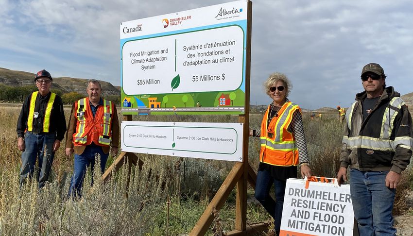
put the river at the heart of all future planning documents. • Completed a review of existing MDP and LUB, and identified
This could be recognized as a leading practice in Canada areas for improvement in both content and process to meet
» Second reading passed November 23 flood mitigation requirements
» Third and final reading successfully passed December 7 • Engaged in workshops and conversations with our steering
» New documents will go into effect March 1, 2021 and technical committees that have helped us understand
• Nature Based Insurance Solutions - we’ve been approached the new set of intents and priorities that will shape the next
by Swiss RE and IBC to discuss opportunities for nature decades of planning and development
based and parametric insurance solutions. Have agreed to • Used DRFM targets to review flood impacts, existing
be a pilot program in order to learn more. infrastructure, and mitigation as key variables that are giving
shape to planning strategy, both for implementing flood
Structural measures protection, connecting the valley, and for shaping future
In 2020, we continue to work on the structural foundation for growth
the Flood Mitigation and Climate Adaptation System: • Built a rich library of layered stories about the valley that will
guide the experience and curation of the valley as a world-
• Winter river inspection to address stability and erosion issues
class destination
• Sourced material for berm construction for both flood
• Prepared a preliminary land use framework that incorporates
mitigation project work scopes and emergency berm work
all the considerations above
• Legal surveying of existing berms that will allow for licensing
• Structural measures update and barrier alignment
and registration of the land as part of the existing flood
• Municipal Development Plan and Land Use Bylaw –
system
conceptual Planning framework, initial policy direction and
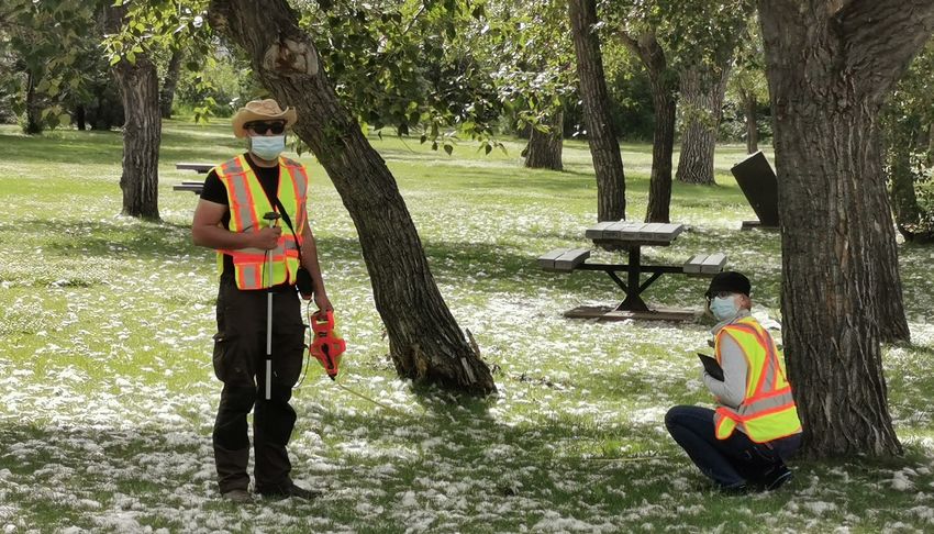
• Geography and Information Technology students from
proposed LUB approach
Southern Alberta Institute Technology (SAIT) commenced
inventory of trees throughout the valley. This will assist in
determining how much green house gas is being captured
and the cooling measures. This asset inventory will also
determine the life expectancy of the trees and how many
replacement trees need to be maintained at the tree farm at
the Drumheller Institution
• Met with the Drumheller Institution to discuss collaboration
with Drumheller’s inmate Work Release Program to include:
» Tactical emergency response planning
» Tree farm maintenance
» Manufacturing warning signs
» Work release programs
• Held Workshop and scoping exercise with land-use
landscape architecture focused on translating mandates,
story and vision for the Drumheller Valley into better defined
project scopes Flood mitigation work at Newcastle Recreation Area, July 2020
6
• Two meetings with the MDP/LUB impact study steering                       • Newcastle brush grubbing preparation for improvements
  committee to review work and align direction for committee                  with Drumheller Institution work release program
• Preparing land assembly packages including crossing                       • Excavated 6200 m3 of material from riverbank at Newcastle
  agreements and right-of-way agreements – moved to Q3 as                     to relieve impact on hospital dike erosion
  a result of COVID-19                                                      • Improvements to high water swift rescue boat access
• Engaged Palliser Regional Planning to ensure coordination                 • Wayfinding sign for passive warning system – delayed due to
  of the current and future development procedures and                        COVID-19
  protocols for the Town of Drumheller                                      • Over 5,000 trees inventoried in public lands
• System 2100 - embankment assessment Clark Hill to                            » 50 species classified and 50% of trees identified over 50
  Hoodoos geotechnical drilling preparations                                      years old
                                                                            • Brushing and inspection of 6.5 km of provincial dikes to
                                                                              determine if maintenance and repairs are required
                                                                               » Over 20,000m2 of brush/vegetation cleared
                                                                            • Geotechnical and terrestrial assessments completed
                                                                               » No remarkable situations acquired regarding aquatic and
                                                                                  terrestrial assessments
                                                                               » Geotech investigations have affirmed previous
                                                                                  understandings regarding seepage and associated
                                                                                  instability in some areas.

                                                                            Municipal Emergency Plan
                                                                            While the COVID-19 global pandemic has created
                                                                            unprecedented challenges to municipalities, one main benefit
                                                                            of the Town of Drumheller’s response has been increased staff
                                                                            training and awareness to Incident Command System processes.
                                                                            Additional improvements include:
                                                                            • Increased awareness ICS to all Town employees
   Dike C brush clearing: before (left) and after (right), September 2020   • Email availability to all Town employees
                                                                            • Council increased awareness to ICS processes and EOC
Conveyance capacity                                                           operations
                                                                            • Improved EOC technology
An important part of this initiative is making room for the river
which includes planning and outreach. The following was                     Collaborated with City of Calgary to receive a copy of their
achieved from January – December 2020:                                      FERM (flood emergency response manual), and will adapt their
                                                                            process for Drumheller
• Cross drain preparation and exploration for improvements                   • If there is a major flood event in the community CEMA will be
• Drainage ditch flow improvements

                                                                                                                                               7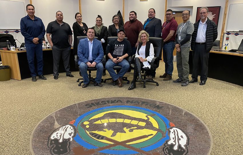
Nature Conservancy Canada
                                                                      Flood office worked in cooperation with Nature Conservation
                                                                      Canada for a 3 month volunteer secondment. A group of 6
                                                                      volunteers worked in three focus areas:
                                                                       • Birds survey team
                                                                       • Riparian rough camping opportunity assessment
                                                                       • Conservation through art

                                                                      The program concluded November 2020. The background
                                                                      information gathered will be used to enhance the flood program
                                                                      to the extent possible.

      Drumheller Emergency Management Agency activation, March 2020

      asked to support our response efforts
    • Utilizing a similar response manual will provide ease of
      transition for CEMA staff responding

    As we continue to update the MEP, we are also working on
    developing and expanding it beyond planned success and
    focusing on recovery by awfulizing potential event scenarios.

    Governance
    Steps have been undertaken to ensure a strong governance
    model is in place including the following:
    • Land Acquisition Policy adopted by Council – January 20
    • Council approved a Purchasing Policy for the DRFM Program         Patrick Crowchild depiction of the stratigraphy of the Drumheller
      which closely follows the existing Town Policy but broadens       badlands eroded vertically by rain.
      the circumstances in which sole source purchasing may be
      used – January 20                                               Finance
    • Council approved the DRFM Program Budget for 2020 -             Finance and Administration activities are a key contributing factor
      2021                                                            to the success of the Flood Mitigation and Climate Adaptation
                                                                      System. The following has been completed in 2020:
                                                                      • Alberta Community Resiliency Program (ACRP) contract terms
                                                                        were agreed to with amendments

8
• Negotiations are ongoing for the contribution agreement with » Inspect Flood Mitigation Berms and coordinate Flood
Government of Canada Zone Geotech – Sweet Tech Engineering
• Grant investment $20,000,000 with local Credit Union » Engaged services with Parkland Geotechnical Consulting,
• Completed Climate Lens GHG Mitigation Assessment Draft Wood Canada Ltd., SweetTech Engineering Consultants.
Report Klohn Crippen Berger Ltd, Kerr Wood Leidal Associates Ltd
• Set up office to function as DRFM program operations center » Sole sourced Northwest Hydraulics to continue
» Renovations of offices including: finish walls, ceiling, floors interpretation of provincial flood mapping that they
and electrical on operations room, framing, electrical, prepared for Province
drywall, painting operations and briefing Rooms, electrical, » South Drumheller Storm pond Design
sprinkler relocation in operations room, flooring in • Engaged over 22 local companies for goods and services
operations room and install electronic equipment including:
» Hired local business to run computer cables install » 1477834 Alberta Ltd » Hunter Survey Systems
backbone for technology set up » Ascend LLP Ltd.
» Installation of computer cables and monitors » Big Country Graphics » Hunter Wallace Surveys
• Developed and implemented record management system » Big Country Victim » James Martin
• Developed and implemented organizational systems and Services » Jon Sheppard Media
controls » Bright Valley Electrical » KC Hydrovac
• Reviewed and established purchasing policy that acts as » Critters » Outlawns Tree Service
checks and balances for purchases within the program » Drumheller Equipment » Palm Engineering
• Purchased notebooks and recycled computers from local Sales and Rentals » Reality Bytes
organization » Drumheller Mail » Reg Gallagher Trucking
• Set up accounting software and protocols » Gary’s Welding » Vector Surveys
• Established backbone for information systems and flow of » Grants Oilfield » Zucatto Landscaping
data and information for the DRFM Program » Kloot, Wilkins &
• Purchased and set up ARCview software for utilization Associates
• Developed and awarded following service contracts:
» Centennial Park Flood Barrier Site Concept Plan – O2
Planning and Design
» Master Engineering Design and Assessment of Planning
Impact – O2 Planning and Design
» Finance and Management Audit – Ascend Financial
» Hydraulic Analysis, Flood Mitigation Measures Overview,
Conceptual Design and Cost – Northwest Hydraulics
» Cathodic Protection – ASM Controls
» Geotechnical Services – ParklandGEO Geotechnical
Engineering
» Surveyor of Record – Hunter Surveys Wayfinding Sign manufacturing for passive water warnings.
» Surveying Services – Vector Surveying & Hunter Wallace Manufactured locally. Garry’s Welding.
9Climate Change Resilience Assessment Report
Future climate projections indicate that the increase in Red
“
Deer River flows, due to rapid snowmelt and/or higher intensity
Flood mitigation is more than the capital investment
rainfall events as projected by the climate models, are likely
required to build new infrastructure to minimize future
to produce great risks to the flood protection systems and the
risk. To maintain the resiliency of the assets you must also
assets in the protected areas. The 2001 Muzik report concluded:
make operations and maintenance budgets a priority. I
Small to moderate increases in rainfall intensity may
”
encourage communities to ensure adequate O&M budgets
have substantial impacts on flood flows, suggesting are available to maintain the life cycle of the asset.
that the existing man-made infrastructures may be
insufficient to deal with future floods. These results — Dr. Guy Felio, Doctor Infrastructure
suggested that a 25% increase in extreme rainfall could
lead to 40% increase in 100-year flood, 50% increase Based on the results presented in this climate risk assessment,
in 10-year flood, 60% increase in 3-year flood and 90% recommendations for risk mitigation measures should be
increase in 2-year flood. developed. Incorporating the use of standardized practices such
Flood events will also impact local and regional public services, as PIEVC and ENVISION will provide best practice guidance
due to the increased demand for emergency intervention and based on national comparisons.
the need to evacuate the town. • Complete a more detailed risk assessment for infrastructure
components designed according to specific criteria,
• Review the design of existing flood protection dikes against
projected climate change impacts.
• Consider options to increase drainage and storage capacity
• Increase availability of trained staff (including volunteer
staff) to intervene in emergency situations, and further
raise awareness in the community regarding flood risks and
emergency preparedness
• Improve existing weather and river monitoring
• Review and improve, as needed, operations and
maintenance procedures
• Review floodplain maps to reflect climate change impacts
and inform land use planning.
Crews clearing brush and vegetation for provincial dike condition
inspection at Dike C, September 2020
10Greenhouse Gas Mitigation Assessment Report
The objective of the GHG Mitigation Assessment is to estimate the expected GHG emissions associated with the Project and to predict
changes in GHGs associated with the Project compared to a functionally equivalent Baseline scenario. In this case, the Baseline
scenario considers the situation where the dike rehabilitation/construction does not take place.
Flood damages in the Town of Drumheller are expected to amount to $4,340,032.40 annually, on average. These average annual
damages sum to $130,200,972 in damages over a 30-year period and $325,502,430 over the estimated lifespan of the proposed
dike system (i.e. 75 years). The Project scenario involves the rehabilitation of existing dikes and the construction of new dikes over a
36-month period which will mitigate the estimated damages in the Baseline scenario and over a 75-year useful lifespan.
The Project over the span of the baseline scenario will result in an estimated net decreased of GHG emissions of 60,291 tCO2e over the
lifetime of the Project Furthermore, assuming annual damages occur in 2030 in the absence of flood mitigation, the Project will result in
an estimated net GHG reduction of 949 tCO2e in 2030.
Taking into account the amount of effort
2030 GHG Emissions Results (tCO2e) Lifetime GHG Emissions Results (tCO2e)
required to build dikes (such as tree hauling,
Baseline scenario emissions,
949
Baseline scenario emissions,
74,999
vegetation grubbing, and construction) this
in 2030 lifetime (cumulative) is a significant achievement for the project in
Estimated Project emissions, Estimated Project emissions reducing greenhouse gas emissions.
0 14,708
in 2030 * lifetime (cumulative) *
Net emissions (reduction) -949 Net emissions (reduction) -60,291
Dike B brush clearing: before (left), during (middle), and after (right), September 2020
11Alberta Environment and Parks Provincial Flood Studies
Flood maps identify where water will flow during a flood, and
what land could be flooded for different sized floods. Most flood
maps focus on floods caused by high river flows but some also
show areas at risk from ice jam floods.
This project by Alberta
With the release of this Environment and Parks (AEP) is
information, the engineering the largest undertaking of flood
teams can now review their mapping in Alberta’s history. It
plans and finalize the berm covers over 1,500 kilometres
design, a process that is of river and more than 60
expected to be complete in municipalities and First Nations
Spring 2020 across Alberta.
In November of this year, AEP
released the Drumheller Flood Study for engagement and
feedback. This release includes detailed engineering reports
and flood maps. The engineering reports are technical in
nature and document the data, assumptions, and results of the 1931 flooding in Wayne
hydrologic and hydraulic analyses needed to create flood maps.
When technical work on a flood study is completed, draft reports
and maps are provided to impacted local authorities, such as
towns, cities, counties, municipal districts, and First Nations.
Once a local authority completes its technical review and issues
are addressed, public engagement proceeds. Draft reports and
maps are then made available to the public, typically starting
with foundational study components like flood inundation
maps and followed by flood hazard maps at a later stage in the
process.
This first phase of engagement is focused on the flood
inundation maps that support local emergency response. AEP
is planning future engagement opportunities on other study
components for early next year, including the flood hazard maps
2013 flooding at Newcastle Recreation Area that define floodways.
12Local Hiring Impact
A key element of this project, beyond providing additional
protective measures to the residents of the Drumheller
Valley, is also providing community employment benefits for
locals to engage in meaningful work.
Over the last year this project has generated 7,500 hours of
local staffing including:
• Engaged over 22 small/medium-sized local businesses
• Two youth temporary positions generated
• Eight seasonal temporary employees generated
• One apprentice position generated (engineer in training)
• Two apprentices assigned to project (lawyer and
surveyor)
• Eight women are engaged in the project - resulting in (From left to right) Junior Jensen, Darwin Durnie, Mayor Heather
10% of total hours Colberg and Grant Adie unveiling the System 2100 Clark Hills to
Hoodoos project, September 2020
Two GIS contractors conducting a tree survey, June 2020 River inspection, March 2020 Team meeting March 2020
13Master Design and Integrating Land Use Planning with 8 distinct neighbourhoods and 3 stakeholder groups — with
an attendance of over 500 and significant implementation of
Throughout Canada, disaster mitigation is sought through
digital communication tactics in order to reach all stakeholders
ensuring the fundamentals of land use planning integrates
during COVID-19 restrictions.
resiliency adaptation and mitigation. We aggressively pursued a
review of first principles to create a flood ready community now The review was conducted based on the following conditions:
and through to 2100. This lead to a comprehensive discussion The Rivers — place the river at the heart of the Plan and
and plan that identified the 8 steps to encapsulate the first understand channel capacity
principles necessary to change the channel in Drumheller. The
The Badlands — ensure the views that make the Badlands
outcome created a natural opportunity to modernize the municipal
experience are protected
development plan (MDP), the driver of all planning and strategic
efforts and to modernize and modify the Land-Use Bylaw (LUB). Growth Areas — develop smart and attractive growth areas away
from the river
New modernized bylaws for the MDP and LUB were passed
December 7 following an intense communication and engagement Neighbourhoods — build on the unique neighbourhood identities
throughout the Valley.
1. DESIGN BASIS 3. KNOW YOUR FLOW
HOUSES IN
6m ADAPTATION CONFLICT WITH
1640 CMS FLOW
UNDERSTAND THE RISK
We start by establishing a design Using the conveyance map, we can
TRAIL & basis. Here, we identify the start to Know Your Flow. Knowing
HAUL ROUTE conditions that drive the design Your Flow means understanding
2100cms of our flood protection system. An what flow rate threatens your safety
1640-1850cms adaptable system needs to protect to and property. Floods like those
a range of flow-rates that will protect experienced in 1915 (2000 cms),
ADAPTIVE
PROTECTION
people and property in a variety of HOUSES
NOT IN
2005 (1450 cms), and 2013 (1310
SYSTEM R IVE R flood scenarios. We use berms that CONFLICT WITH cms) showed how vulnerable we can
are designed to help us raise the 1640 CMS FLOW be. Knowing Your Flow helps us all
barriers when the river rises. prepare for the next event.
2. CONVEYANCE CAPACITY 4. ALIGNMENT REVIEW
s
2100 cms
cm
s
s
cm
ROOM TO FLOW STRUCTURAL MEASURES
0 cm
40
16
00
164
21
We use our target flow rates to map A Once we know where existing
where the river wants to go. The development is threatened by the
conveyance map shows us where river, we review potential berm
the river needs this room to flow. alignments to understand where and
In Drumheller, there are two lines of what type of structural measures
TH
defense: (i) 1640-1850 cms, and are feasible. This analysis has two
E
RI
(ii) 2100 cms. These two lines both key goals: (i) make room for the river
VER
RIVER
CONVEYANCE play important and separate roles in POSSIBLE BERM ALIGNMENT
OPTIONS ARE EXPLORED ON B2 by keeping the channel as wide as
the multi-barrier protection system. BOTH SIDES OF THE RIVER. possible, and (ii) protect existing
B1 property and assets.
14What does it mean to have an adaptive system?
An adaptive system provides the best long-term
protection and short-term cost and intrusion. Making
berms adaptable means we can typically build them
to lower elevations. It also means that the berm tops
need to be wider, so that they can accept sufficient
material and be used as haul routes when the barrier
is being raised. In Drumheller, this means that adaptive
berm tops need to be at least 6m wide. Having flat,
wide berm tops enables the adaptive system, but
it also unlocks other potentials to leverage flood
measures for public trails and open space.
5. PROTECTED ZONE 7. CONVEYANCE ZONE
IMPACTED
PROPERTIES PROTECTION ZONES REC
SPACE
ROOM FOR THE RIVER
A Most properties can be protected The area left to the river is called the
by structural measures like berms, NATURAL
AREAS
conveyance zone. In a flood, this
but some are in conflict for reasons zone provides space for the river
of river capacity, berm height, to expand. The rest of the time, it is
geotechnical considerations, cost, home to natural spaces, recreational
or operational complication. In the NEW
amenities, and low-impact uses that
figure, one house is not feasibly PARKS invite the river back into everyday life.
BERMS CREATE
‘PROTECTED ZONES’
protected by a berm. Another house This zone also enhances Drumheller’s
is in the path of the berm alignment climate adaptation, helping store
B1 that protects the most properties. carbon and regulate micro-climates.
6. GROWTH AREAS 8. TRAILS AND OPEN SPACE NETWORK
00
NEW GROWTH
BEYOND 2100 EDUCATION
21
ABOVE 2100 CMS
EM
LO
ST
C As it is completed, flood protection
SY
In the coming decades, Drumheller AL
TR
needs to move out of the river’s path.
AIL PLAZA will be leveraged as an amenity. The
This means that new growth will 2100 line will become a regional trail
happen outside of the 2100 cms between the train bridges at Midland
SYST
line. Limited infill below the 2100 and East Coulee. This trail will tie-in
EM
cms line will be subject to additional
RIVER to local paths that will link residents
2100
ACCESS
conditions that make it more flood- to the river and the rest of the Valley’s
LIMITED DEVELOPMENT resilient while this gradual migration destinations. Educational pavilions
BELOW 2100 CMS
occurs. along the trail will teach visitors
about the history of our valley and its
changing climate.
15To avoid adding a whole series of specialized additional RIVER
ensure adequate space for the river to flow
districts, the LUB can make use of overlays. These overlays build adaptive flood protection systems
apply additional technical considerations and regulations. This adapt to the changing climate
develop an interconnected open space network
approach disentangles the river from the districts, making it develop a world-class trail and pathway network
both easier to use and to update. It also ensures that the robust harness the river as an amenity
technical thinking in the MDP carries through to the Bylaw. BADLANDS
protect critical viewsheds
maintain a sense of remoteness/solitude
protect ecological health and integrity
21 SIMPLIFY & CLARIFY 8 celebrate the badlands landscapes
curate the visitor arrival experience
foster a sense of discovery
Existing Land New Land provide an “escape” from city life
Use Districts Use Districts inspire locals to encourage friends & family to visit
NEIGHBOURHOODS
protect historic character and heritage assets
Badlands Neighbourhood Centre maintain unique neighbourhood identities
sustain a thriving downtown
enable a diversity of lifestyles and development
Rural Development Downtown ensure growth is supported by existing services
nurture local tourism and recreation industries
DEVELOPMENT OPPORTUNITY
Countryside Tourism Corridor catalyze growth and investment
focus growth in safe and suitable locations
provide a range of housing tenures and types
Neighbourhood Employment grow within the Valley
connect the Valley for all modes of transportation
POLICY DIRECTIONS
river leading the way forward and
DEVELOPMENT PROCESS INTENT connecting the Valley
building blocks for a locally distinct MDP
agile and adaptive to change long term vision for the future of
Drumheller Valley
simple to use and implement guiding principles to inform decision-
making
clearly articulated, not subject to broad interpretation
growing in safe and strategic locations
form-based rather than use-focused world-class destination and a strong local
business friendly economy
enhancing the unique qualities of the
flexible to allow for innovation and growth Valley
connected to the overall vision and priorities for the Valley a community of distinct neighbourhoods
16Digital communications impact Newsletter:
Prior to COVID-19 digital communications were already We utilize MailChimp to send Total Subscribers: 369
an effective and important tool for communicating to out monthly newsletters.
Q4 New Subscribers: 100
residents. This has become more important than ever Our subscriber base continues
Number of Emails: 10
now that face-to-face conversations are occuring less
Avg. Open Rate: 57.7%
frequently.
We are actively engaged on social media through
to steadily increase thanks to
Facebook, Twitter, YouTube, and most recently –
referrals from the Town, through
Instagram. We are also connecting to residents digitally
the website and through social
via our website and through a monthly newsletter update.
media advertising (both organic
By building diverse strategies to engage the unique
and paid).
audiences within Drumheller we are starting to pick up
more engagement and reach than ever before.
Sample newsletter,
November 2020
Website:
Our website is our main source of information for residents Sessions: 29,865
of Drumheller. We have been actively posting new Avg. Session Duration: 1 min 5 sec
information and updated FAQs on a regular basis. Since
% New Sessions 67.2%
Jan. 1 we have had 45,584 impressions on Google search,
Pages/Session: 1.93
with the term “drumheller flood mitigation” as our primary
search term.
AUDIENCE DEMOGRAPHICS
24%
20%
19%
17%
12% MEN
41%
8% WOMEN
59%
Sample website post - “On the
Trail with Morris the Hike-Asaurus”,
UNDER September 2020
25-34 35-44 45-54 55-64 65+
25
17Facebook:
Facebook is our most popular social networking site that we use. An interesting finding
about our followers shows that while the majority of our followers are under 55, the
majority of our engagers are over 55. After an increased push on social, our reach for users
under the age of 35 increased by 3%.
DEMOGRAPHIC SOURCE
FOLLOWERS REACH ENGAGEMENT
27%
17% 18%
16%
14%
13% 12% 13%
11% 10% 11% 11%
9%
8%
5% 5%
3% 3%
WOMEN
UNDER 25 25-34 35-44 45-54 55-64 65+
MEN
1% 1% 2%
3% 3% 4%
4%
5% 6% 6% 5% 6% 5% 6%
8% 7% 8%
9%
Sample Facebook post, September 2020
Facebook Live event with The Drumheller Mail,
Sample Facebook video, July 2020 Sample Facebook video, September 2020 August 2020
18Instagram: Twitter: YouTube:
Our Instagram account launched in late Twitter the least active platform for YouTube is one of our primary tools for
September. While our account is new, we hope residents of Drumheller, however for video hosting. We continue to focus on
to increase our presence particularly with those those residents we are reaching the video content overall across our social
under 45 who support the flood mitigation engagement is very high. media strategy.
program.
Sample YouTube post, September 2020
Sample Instagram post, September 2020
440k
Sample Twitter post, September 2020
1.8k
13.2k
71.2k
185
74 129 30 3.4k
24 7.4k
62 15 61
12 38 1.7k
9 2
3
Total Followers New Followers (Q4) Number of Posts (Q4) Total Engagements Total Reach*
FACEBOOK INSTAGRAM TWITTER YOUTUBE
*Twitter is showing impressions and YouTube is showing video views
19O2 Planning & Design River Tour, August 2020
MDP and LUB Neighbourhood Information Sessions, October 2020
(locations clockwise from top left — Last Chance Saloon (Wayne),
East Coulee School Museum, Newcastle Community Hall, Rosedale
Community Hall
River inspection, March 2020
Drumheller Farmer’s Market, September 2020
Morris at Family Day event,
February 2020
20Aerial footage of Drumheller, September 2020
MDP and LUB Neighbourhood Information Sessions, October 2020
(locations clockwise from top left — Nacmine Community Hall,
Midland Community Hall, Badlands Community Facility (BCF) –
morning session, BCF – evening session
Dike D brush clearing: before (left) and after (right), September 2020
What is Art – painting by
Patrick Crowchild
21Moving forward
Next year we look forward to finalizing the berm alignment and design, working with Alberta Environment and Parks on transferring
their dikes to the town, and confirm berm construction contracts. While 2020 was busy with planning, assessments and studies, we look
forward to the action phase so we can increase the protective measures in the Valley.
• Flood Emergency Response Manual Updates • Tender 2021 - 2023 works
Q2 (Apr - Jun)
Q1 (Jan - Mar)
• “Know Your Flow” campaign launch • 2021 Flood Season
• Complete berm alignment and design • AEP Dike Transfer
• Stakeholder engagement berm design • ROW crossing agreements
• ROW plans registered • ROW Assembly
• Urban Tree Strategy completed • Virtual Flood Forum
• Water Act, Navigable Waters, Fisheries/Oceans • Confirm suitability rail embankments
applications • Pursue active transportation funding
• Public Land Dispositions • “Know Your Flow” implementation with 2021 flood
• Riprap delivery season
• New MDP/LUB adopted • Orientation of Flood Emergency Response Manual
• Indigenous Consultation completed • Appendix to dike system operation manual
• Historical resource application confirmed
• Development process and modernization to • Commence armour (riprap) stockpiles and borrow
aggressively include flooding area development
• Inter-municipal development plans updated • Commence early works Centennial Park,
• Inter-municipal collaboration framework (ICF) Newcastle, Hoodoos
plans updated • Haul route establishment
• Stakeholder engagement with surrounding • Tentative start rail enbankment modifications for
municipalities dikings (system 2100)
• Staff training on new MDP/LUB
22• Berm construction contracts awarded • Commence construction activities
Q4 (Oct - Dec)
Q3 (Jul - Sep)
• ROW assembly • Municipal Elections
• Commence buyout program disposals • Commence Construction activities
• Finalize conveyance capacity preservation » Armouring and instream construction
• Know Your Flow Education Series walking lectures » Complete 2 km+ dike construction
• Coordination with Travel Drumheller tourist • Education plaza location confirmation
information education series - Know Your Flow • Drumheller Emergency Management Agency
• Coordination with Travel Drumheller restaurant Annual Exercise
education tray liners • Grade 4 and Grade 9 education series
• Review AEP updated flood hazard maps • Drumheller Resiliency and Flood Mitigation
• Launch social media campaign reflecting AEP orientation to new council members
updated flood hazard maps • ICF updates completed
• Continue haul route establishment • Grant claims
• 2022-2025 budget adopted by council
OUR COMMITMENT
As a community dedicated to a safe and prosperous future,
both on the housing, economic and cultural front, we are
writing the next chapter of our story and ensuring a resilient
and flood ready future. It takes a whole community approach,
and together with our partners in the provincial and federal
governments, we will preserve the Dinosaur Capital of
Canada and share our story of adapting to a changing climate
with the world.
23WE ARE A FLOOD Focus Areas
COMMUNITY Communications & Engagement
The story of Drumheller is one of 1. Promote Drumheller’s approach to adapting to the perils of changing climate
changing climate. It started under
PEOPLE 2. Continuing to unite the community behind a shared purpose to protect Drumheller’s
economic, environmental and cultural assets from flooding
a layer of ice which melted to 3. Consult and engage with impacted indigenous communities
reveal a treasure trove of fossils 4. Position Drumheller as an innovative leader in the area of flood mitigation and readiness
deposited by the mass extinction 5. Inform affected residents of a ‘fair and balanced’ approach to land acquisition process
of the dinosaurs. As the melting 6. Communicate and work with financial and insurance sectors on viable solutions for
water sliced deep through the displaced homeowners
Great Plains, it eroded 75 million
years of geological layers and Regulatory & Approvals
created the Canadian Badlands. 1. Obtain transfer of existing dikes from Alberta Environment and Parks (AEP) to Town of
Of a population of 8,000 there are PROPERTY Drumheller
2. Meet obligations of funding agreements
2,344 residents in 1,045 dwellings
3. Collaborate with AEP on revised Flood hazard maps
at risk of direct inundation in a 1% 4. Encourage economic development through updated MDP and LUB by ensuring future
return flood event. development proceed in areas not subject to flood risks
Drumheller is the 3rd largest tourist
destination in Alberta, but has Conveyance Capacity
seen its fair share of adversity from 1. Make room for the river – preserve channel capacity
mother nature in terms of flooding: 2. Ensure Drumheller is prepared for inevitable flooding events caused by either an ice jam,
high flow levels or intensive rainfall
June 27, 1915 (rain on snowmelt)
3. Preserve up to 1,200 acres of natural (riparian) area that is comparable to 3,200 family
April 2, 1967 (ice jam)
June 18 1931 (rain on snowmelt)
ENVIRONMENT cars of carbon capture per year
4. Develop a fair and balanced land acquisition policy for impacted homeowners
June 23, 2005 (rain on snowmelt)
April 21, 1948 (ice jam)
June 21, 2013 (rain on snowmelt)
Structural Measures
1. Build an adaptive system to protect the community into the 22nd century
August 26, 1954 (rainfall)
2. Protect the cultural, palaeontological and archaeological treasures of the Red Deer River
April 24, 2018 (ice jam)
Valley
The Drumheller Flood Mitigation 3. Develop recreational and educational interpretive centers as part of the improved flood
and Climate Adaptation System mitigation system
(DFMCAS) is a multi-hazard 4. Connect the Royal Tyrrell Museum to the Atlas Coal Mine via a 38 kilometre “2100 trail
solution covering 100 kilometers ECONOMY network” as part of the improved flood mitigation system
of riverbank, that has been
designed to reduce flooding and Municipal Emergency Plan (MEP) Enhancement
protect Drumheller into the 22nd 1. Develop detailed flood mitigation system operations manual to accompany MEP
Century. It began in April 2019 and 2. Divide river valley into manageable monitoring sectors that will allow regional partners to
will end March 2024. The total respond/assist appropriately to their assigned area of responsibility during emergencies
cost is shared by three orders of 3. Establish a Flood Mitigation and Climate Adaptation operations center to effectively
government: $22M Canada, $28M respond during a flood emergency
Alberta, $5M Drumheller. 4. Implement Incident Command System (ICS) protocols throughout flood mitigation and
climate adaptation office to educate staff on processes
5. Conduct annual exercises using ICS
24Achievements
• Residents were and continue to be engaged and
supportive of flood mitigation and climate adaptation Goal
system
• Town of Drumheller enhances relationship with The Town of Drumheller has protected
Indigenous communities as a result of consultation the residents and property from
process loss or injury related to the perils of
• Residents agree Town of Drumheller is a flood community floods and changes in climate. The
• Residents have increased knowledge about flooding in risk to property is reduced, thereby
Drumheller preserving economic viability of the
community.
• All existing provincial dikes are transferred to Town of
•
Drumheller
Revised provincial flood hazard maps are implemented in Drumheller
collaboration with Town of Drumheller
• Future flood plain development in Drumheller is improved
through changes to MDP and LUB Success
Flood Mitigation
and Climate
• Support from funding partners is maximized
• Confidence of residents
• Channel capacity in Red Deer River is improved/preserved
Adaptation
• Decreased vulnerability and
• Land Acquisition program is successfully completed to exposure areas
remove structures from floodway • Increased economic activity in 5
System
• Innovate environmental initiatives were implemented to years
preserve riparian areas and urban forests • Increased river capacity
• Projected green house gas reductions of 3200 cars per • Improved climate adaptation
• Increased staff capacity to respond
year equivalent is met
to future emergencies
• Enhanced diking system withstands future flooding by
being adaptive to future
• Diking network between Royal Tyrrell Museum and Atlas
Coal Mine serves as experiential education system for Risks Changing the Channel
•
500,000 annual visitors
Majority of projected 20,000 man hours to complete work • Increasing likelihood of natural on Flood Readiness
are hired locally disasters
• Changes to the provincial flood
hazard maps
• Project delays due to regulatory &
approvals process
• Town of Drumheller staff are trained to respond to future
• Loss of local human resource
flooding expertise
• Regional partners manage prescribed monitoring sectors of • Ineffective communication and December 2020
the river valley engagement
• MEP is updated and meets Bill 8 requirements
2526
You can also read