Emerald Project: Foreshore Licence Application for Site Investigation Work - JULY 6TH 2020
←
→
Page content transcription
If your browser does not render page correctly, please read the page content below
Emerald Project:
   Foreshore Licence
   Application for
   Site Investigation
   Work

JULY 6 TH 2020

SIMPLY BLUE ENERGY

                        1
Investigative Foreshore Licence Application (Offshore
                          Renewable Energy)

Please indicate project category as appropriate:
Wave:

Tidal:

Wind:
X

Other:
Please specify:

                                DATA PROTECTION
The Office of the Data Protection Commissioner states that the sending of marketing
material to individuals without consent may result in action by the Data Protection
Commissioner against the sender including prosecution. It is the responsibility of persons
or entities wishing to use any personal data on an application form for direct marking
purposes to be satisfied that that they may do so legitimately under the requirements of
the Data Protection Acts 1998 and 2003 and with regard to General Data Protection
Regulation (2016/679) requirements.

Applicant Name and Address:

Full Name of Applicant (not Agent):

Sampson Roch-Perks
Company/Organisation:

Simply Blue Energy (Kinsale) Limited

Address:

Woodbine Hill, Youghal, Co. Cork

Eircode:

P36 NW52
Applicant Contact Details:

Phone No:

+353-86-8825432

E-mail address:

sam@simplyblueenergy.com

Nominated Contact (Where different from above):

Name:

Address:

Phone No:

E-mail address:

Applicant’s Legal Advisor:

Name:

Elaine Traynor, Field Fisher Ireland

Address:

The Capel Building, Mary’s Abbey, Dublin, D07M4C6

Phone No:

01 828 0600

E-mail address:

info.ireland@fieldfisher.com

                                                    2
Part 1: Proposal Details (Attach additional documents as required)

 1.1    Provide background information on the project including reason and
        objectives of the site investigations, the site selection process and any
        proposals for future works at the site.

        Project Partners:
        The Emerald project partners consist of Simply Blue Energy (Kinsale) Limited
        (SBEK) and Principle Power (PPI). SBEK is a 100% subsidiary of Simply Blue
        Energy Ltd (SBE). SBE was established in 2011 to become a “blue economy”
        project developer, to work with marine resources to help deliver long-term
        projects that will be part of our societal transition towards sustainable
        development goals.

        SBE was founded on the basis that floating wind farm development is a game-
        changer for sustainable energy generation, given a timely process of
        commercialisation for foundation technology. SBE operates on the basis that
        there is a need for innovative, credible project developers to create
        opportunities that will enable this process.

        The benefits associated with the maturity and scale of the offshore wind sector
        present a compelling case to progress Floating Offshore Wind (FLOW) projects
        in the Celtic Sea.

        In 2016, SBE conducted a technology review to identify the most viable
        technology solution with greatest potential for near-term commercial
        deployment in the Celtic Sea and beyond. As a result, SBE has been working
        with PPI since late 2016 to develop a number of strategic projects which are
        integrated    into   PPI’s   WindFloat    development     pathway     towards
        commercialisation. With PPI as a technology partner, we are jointly committed
        to identifying complementary project locations in Irish waters and to the
        development of the supply chain that this will stimulate.

        These projects include two projects that SBE are actively progressing in UK
        waters, which are a c.100MW demonstration development, due for Final
        Investment Decision (FID) in 2024 and a c.300MW pre-commercial project, due
        for FID in 2026.

        SBE has recently partnered with Total for the development of its c.100MW
        demonstration project in the East Celtic Sea. The joint venture is called Blue
        Gem Wind. The pre-commercial scale project will be developed by Blue Gem
        Wind under the project name Erebus and will facilitate the parallel development
        of a local supply chain in advance of the roll-out of full commercial scale
        developments. It demonstrates the commitment of both JV Partners towards a
        low carbon economy and their confidence in the Principle Power floating wind
        technology.    Further     information    on      SBE      is    available   at
        www.simplyblueenergy.com.

        Principle Power is an innovative technology developer and services provider for
        the offshore deep-water wind energy market. PPI’s proven technology, the
        WindFloat - a floating wind turbine foundation – enables a change in paradigm
        for the industry in terms of reduced costs and risks for the installation and
        operation of offshore wind turbines.

                                                                                     3
Principle Power's mission is to make the WindFloat the most competitive, safe,
reliable and environmentally friendly technology for deep-water, offshore wind
projects while enabling global offshore wind markets to reach their full
potential.
Further information on Principle Power and its WindFloat technology is available
at www.principlepowerinc.com
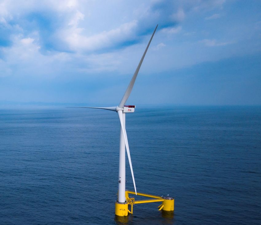
Technology Development:
WindFloat is a floating foundation for offshore wind turbines with a simple,
economic and patented design. The innovative features of the WindFloat
dampen wave and turbine induced motion, enabling wind turbines to be sited
in previously inaccessible locations where water depths exceed 3540m and wind
resources are superior. Furthermore, economic efficiency is maximised by
reducing the need for offshore heavy lift operations during final assembly,
deployment and commissioning.
In October 2011, Principle Power deployed a full-scale, 2MW WindFloat
prototype (WF1) 5km off the coast of Aguçadoura, Portugal. The structure was
assembled and commissioned onshore before being towed some 400km along
the Portuguese coast (from its assembly facility near Setubal, Portugal).
Certification (or Class) was also an area of focus in this prototype design as it
will be a future requirement for commercial projects. To date, the system has
produced in excess of 16GWh of electricity, delivered by sub-sea cable to the
local grid. Principle Power gained valuable operational data and experience for
use in future WindFloat systems world-wide.
A successful 5-year deployment in the open ocean of the Atlantic has proven
that the technology can meet its promise and is ready for commercialisation.
In July 2016, having completed all of its project objectives, Principle Power
initiated the WindFloat decommissioning process. The WindFloat foundation
was detached from its mooring lines and electrical cable, and then towed back
to Southern Portugal’s Port of Sines where the wind turbine was disassembled.
This was the first time an offshore wind turbine had been dismounted from a
floating structure and it demonstrated the procedures to be used in commercial
projects in the event of unanticipated major component failure. The turbine has
now been transferred to another project and the inspections reveal that the
WindFloat foundation itself remains in excellent condition.
The next generation WindFloat designs have taken the learnings from the
Windfloat-1 project to optimise the technology for today's offshore wind
turbines. The V164-8.4MW turbine for WindFloat Atlantic was installed onto the
WindFloat triangular platform at the quayside in Ferrol (northern Spain) before
making the 250km journey to the installation site off the Portuguese coast of
Viana do Castelo.
The current WindFloat Atlantic platforms host the largest and most powerful
wind turbine used by floating technologies. This unlocks significant cost savings
to the customer on a levelized cost of energy (LCOE) basis. Furthermore,
Principle Power anticipates reduced O&M (operations and maintenance)
downtime, decreased annual operational costs and significantly less risk in the
operation of its technology solution.
4Follow-on projects are under development for the installation of the next
generation of WindFloat units, including project Erebus mentioned above, as
well as the Emerald Portfolio, which is the subject of this application.
Site Selection:
SBE has identified the area south of the coast of Ireland in the vicinity of the
Kinsale Gas Field as being suitable for the deployment of PPI’s technology.
The main advantages of the study area include:
Suitable water depths (>70m), relatively close to shore;
Favourable wind resources;
Optimal wave resource;
Relatively low level of environmental constraints;
A maritime area with a history of energy production.
A number of studies have informed the development of this project.
Environmental Constraint Mapping & Site Selection (SBE, 2019): This study
utilised readily available marine data sets and site selection methodologies
developed for lease applications in the UK waters.
Development & Consenting Pathway (GDG, 2019): SBE engaged Gavin &
Doherty Geosolutions to identify existing and proposed consenting
pathways in Irish Jurisdictional waters and to plan a high-level roadmap for
the development of floating offshore wind farm projects off the South Coast
of Ireland.
Grid Constraints and Analysis (Mullan Grid, 2019): SBE engaged Mullan
Grid to complete a grid review for the site, which included a review of the
existing 220kv Network, existing connected and contracted generation in
the area, demand levels, potential connection methods, grid costs and
timelines.
Outputs from SBE’s participation in the Eirwind Project: Eirwind is the
MaREI Centre’s industry-led collaborative research project, co-designing
the opportunity around the sustainable development of Ireland’s marine
resources, using offshore wind as the catalyst for innovation and impact.
SBE have been in consultation with existing oil and gas lease holders in the
area. Preliminary discussions with fishing industry representatives have also
been initiated. The survey that forms the basis of this application, and a
stakeholder engagement process, will facilitate detailed project design and site
selection.
1.2 Possible MW output of final development:
This application for a foreshore licence is for permission to conduct surveys within
12 nautical miles of Cork Harbour to help inform the design and assessment of a
series of Floating Offshore Wind (FLOW) projects envisioned further offshore in
the vicinity of the Kinsale gas platform, c. 35-60km from the coast. The surveys
will support an overall project which is being designed to include:
1 No. 100MW (approx.) demonstration FLOW project, situated
approximately 35km to 60km from the south coast of Ireland, comprising
7-10 Windfloat platforms supporting a wind turbine of between 10-15MW in
size. The footprint of this area is estimated to be approximately 32km2.
1 No. 288MW (approx.) pre-commercial FLOW project, situated
approximately 35km to 60km from the south coast of Ireland comprising
5Windfloat platforms, each supporting a wind turbine between 10MW and
15MW in size, connecting to an offshore substation. The footprint of this
area is estimated to be approximately 93km2.
1 No. 600MW (approx.) commercial FLOW project situated approximately
35km to 60km from the south coast of Ireland comprising Windfloat
platforms, each supporting a wind turbine between 10MW and 15MW in size,
connecting to an offshore substation. The footprint of this area is estimated
to be approximately 198km2.
Associated infrastructure, including Anchoring system, Moorings, Electrical
Cabling.
1.3 Type of surveys proposed (e.g. geophysical, geotechnical,
archaeological or benthic.)
- Geophysical Survey (including Archaeology and Benthic) and Benthic
Sampling Programme;
- Preliminary Geotechnical Surveys (including Benthic) in association
with the Benthic Sampling Programme;
- Wind Resource Monitoring;
- Metocean Surveys;
- Nearshore and Intertidal Surveys;
- Environmental Surveys including Birds & Marine Mammals Surveys.
1.4 Survey methodologies and equipment to be used for each survey type
proposed:
The table below summarises the survey methods to be undertaken at the
proposed investigation area. For further details please see submission
document; Emerald Project Foreshore Licence Application for Site Investigation
Works – Schedule of Works.
Survey Methods Purpose
MBES is a system for collecting detailed
topographical data of the seabed. The R2Sonic
Multibeam 2024 may be taken as an indicative example of
echo a MBES system to be used in the completion of
sounder these works. The equipment will operate within
(MBES) a frequency range of 400-700kHz (400,000-
700,000Hz) with sound pressure levels in the
range of 200-228dB re1μPa at 1 metre range.
SSS surveys are used to determine sediment
characteristics and seabed features. The
Edgetech 4200 may be taken as an indicative
Geophysical
Side scan example of an SSS device and will have a
sonar (SSS) potential operating frequency range of
approximately 300 to 900 kHz (300,000 –
900,000 Hz) with sound pressure levels of
228dB re1μPa at 1 metre range.
This is used to identify magnetic anomalies and
hazard mapping for metal obstructions,
Magneto- shipwrecks and unexploded ordnance on the
meter surface and in the sub-surface. The Geometrics
G-882 can be taken as an indicative equipment
example.
6SBP is used to develop an image of the
subsurface, identifying different strata
encountered in the shallow sediments. The
Seatronics Edgetech 3300 is an indicative
example of a hull-mounted pinger system with
Sub-bottom an operating frequency range of approximately
Profiling 2-16 kHz with sound pressure levels of 200dB
(SBP) re1μPa at 1 metre range. The Applied Acoustics
is an indicative example of a boomer source
with an expected operating frequency of
approximately 2.5kHz with sound pressure
levels in the range of 208-211dB re1μPa at 1
metre range.
The penetration depth and density of a
borehole will be informed by the geophysical
survey results. It is currently speculated that
Boreholes approximately 20 boreholes will be required.
All drilling equipment used will follow the ISO
and API technical specifications for drilling
equipment.
CPTs are a method for testing the soils
strength parameters. CPT can be performed as
Geotechnic-
Cone either Seafloor CPTs or as Down Borehole
al
Penetration CPTs. The density of survey points will be
Tests (CPTs) informed by the Geophyisical Survey results. It
is anticipated that approximately 35 CPTs will
be required.
Vibrocore, gravity samples and grab samples
Vibrocore/ are three methods of collecting un-consolidated
gravity seabed samples. It is anticipated that
sampling approximately 65 sample locations will be
required.
A floating LiDAR buoy will be deployed to
Floating measure the wind resource at the application
LiDAR area. Deployment of this buoy will include
anchor points on the seafloor.
Metocean Acoustic Acoustic dopplers are used to examine wave
Doppler and current conditions in the survey area. This
Current equipment is installed on the seabed.
Profiler
(ADCP)
Estimate the distribution and abundance of
Marine
seabirds, marine mammals and fish species
Ecology
within the survey area.
Marine Marine mammal acoustic monitoring using up
Ecology Mammal to 2 CPODs deployed throughout the site for
Monitoring periods throughout the monitoring campaign.
Identify the expected benthic communities and
Benthic
habitats at the site. This will involve grab
Ecology
samples of soft sediment on the seafloor.
Archaeo- Identification and assessment of metallic and
Underwater
logical other targets recorded during the marine
Archaeology
Survey magnetometer survey.
71.5 Describe the nature and scale of any structure to be erected on the
foreshore for testing the suitability of the site. Is the structure
proposed to be temporary or permanent?
There will be no structures erected for the Geophysical Survey campaign. This
application is for survey activities only. No permanent structure shall be erected
as part of these works. As described in the Schedule of Works submission
document for the Metocean surveys, a wind LiDAR buoy (Seawatch or similar)
will be deployed accompanied by a marker buoy, ADCPs will be deployed on the
seafloor as part of the survey works and CPODs may be deployed for marine
mammal monitoring.
These activities represent the only temporary deployments associated with the
investigation application.
1.6 Provide information on proposed mooring, marking and lighting
arrangements for any proposed deployment of instrument arrays.
All equipment deployed under the lease shall be moored, marked and lit as
required under navigational safety requirements and in consultation with the
Commissioners for Irish Lights.
1.7 Has the applicant held or does the applicant hold any previous
Foreshore Licences, Leases or applications over the area sought or
over any other area? (Give details including Department’s file reference
number(s)).
No previous foreshore leases or licences have been or are held by the applicant.
1.8 Indicative timing of the investigation works: (i) Start date (ii) Duration
(iii) Any other information relevant to timing.
SBEK intends to adopt a phased survey approach in order to minimise the risk
associated with poor winter weather conditions. The intention is to begin
Geophysical Survey activities in spring/summer 2021 with a staged series of
investigations over the subsequent five years as the project reaches the
detailed design stage.
Geophysical Surveys will inform the Geotechnical Campaign. The Geotechnical
Campaign will be carried out on a phased basis and will likely have an initial,
interim and completion phase as the detailed project design progresses.
It will be necessary for SBEK to apply for a further site investigation licence post
enactment of the Marine Planning and Development Management Bill to allow
for surveys outside the current 12nm limit that is the extent of the marine area
currently regulated under the Foreshore Act.
Ecology (Bird and Mammal) Surveys may begin in 2020 and will be multi-year
(2-3) depending on weather and seasonality of survey parameters. Given the
current Covid-19 pandemic, it is impossible to state with reasonable accuracy
when these surveys will begin. However, it is planned to undertake aerial
surveys which will not interact with the marine environment.
1.9 Describe any likely interactions with activities of the public or other
foreshore users during the investigative works (e.g. fishing,
8aquaculture, sailing, and surfing). Describe any measures proposed to
minimise inconvenience to other users.
No negative impact or minimal impact is expected from the planned survey
work with most other foreshore users (fishing, sailing, surfing, etc). SBEK will
issue a marine notice to notify the public and other foreshore users in the area
about the works schedule.
The proposed survey site overlaps with an application for an aquaculture site
within Cork Harbour for bottom mussel cultivation. This survey site borders the
high-water mark near the Aghada Generating Station. As this is one of the
possible landing sites for the cable, site investigation works may be necessary
in a small area of the overlap. Any works carried out within this area of overlap
will be temporary and will be discussed with the holder of the aquaculture
licence should it be granted prior to survey works to ensure it does not impact
upon their aquaculture operations.
1.10 Describe any consultations undertaken to date with other foreshore
users.
The following consultations have been initiated with fisheries organisations:
1. Irish South and West Fish Producers Organisation (by telephone, email
and meeting);
2. National Inshore Fisheries Forum and South East Regional Inshore
Fisheries Forum (by telephone and email);
3. National Inshore Fisheries Association (NIFA) and National Inshore
Fisheries Organisation (NIFO) (by telephone and email);
4. Irish South East Fisheries Producers Organisations (by telephone and
email);
5. Bord Iascaigh Mhara (BIM) (by telephone and email);
6. South West Regional Inshore Fisheries Forum (SWRIFF) (by telephone
and email).
These preliminary discussions will be followed up with a fisheries engagement
strategy to ensure ongoing dialogue with the fisheries sector throughout the
development of the project.
SBEK has also consulted with other relevant stakeholders such as the operators
of the Kinsale Gas Field regarding potential interactions with their operations
within the foreshore area.
1.11 Describe any consultations undertaken to date with other consent
authorities e.g. planning authority, Commission for Energy Regulation
etc.
A pre-application meeting was held with officers of the Foreshore Unit within
the Marine Planning and Development Section of the Department of Housing,
Planning and Local Government on Wednesday, 29th January 2020.
The application has been submitted in line with guidelines issued by the Water
and Marine Advisory Unit and the Marine Planning and Development Section of
that Department.
1.12 Describe briefly any consultations undertaken with relevant
authorities (e.g. county council, port/harbour authority etc) or State
9Agencies e.g. National Parks & Wildlife Service (NPWS), National
Monuments Service (NMS) of Department of Arts, Heritage and the
Gaeltacht:
These consultations are pending.
1.13 Describe briefly any support received or under application with the
Sustainable Energy Authority of Ireland (SEAI) or other State Agency:
Options on a Pilot Project for Floating Offshore Wind (OPFLOW) is an SEAI
funded project, under the 2019 National Energy Research, Development &
Demonstration (RD&D) Funding Programme. The project is being led by MaREI,
University College Cork, in collaboration with Simply Blue Energy and Principle
Power. This research project is examining if there is merit in a pre-commercial
pilot project for floating offshore wind in Ireland, including the scale and
strategic location for such an initiative. University College Cork has been
allocated €69,800 in funding by the SEAI. The project commenced on 1st
January 2020 and is scheduled to complete on the 30th June 2020. The industry
partners are not paid; they are making a contribution in-kind to the project.
10Part 2: Proposed Site. (Attach additional documents as required)
2.1 Delineate the proposed site in red on a latest edition map at a scale of
1:10 000 or larger scale if more appropriate and available, indicating:
Please see “Foreshore Licence Map” accompanying this application.
2.2 Geographic coordinates of the area under application, where the area
can also be identified on the Ordnance Survey map, specify Ordnance
Survey coordinates also.
Irish Transverse Mercator WGS 84
ID
Easting Northing Latitude Longitude
1 579457 565257 51° 50' 20.97" -8° 17' 53.18"
2 584068 565278 51° 50' 22.19" -8° 13' 52.30"
3 584072 565081 51° 50' 12.55" -8° 14' 25.69"
4 583428 564982 51° 50' 15.82" -8° 13' 52.06"
5 583420 565077 51° 50' 15.62" -8° 14' 26.12"
6 582073 564472 51° 49' 55.89" -8° 15' 36.37"
7 582549 564151 51° 49' 45.56" -8° 15' 11.45"
8 588062 559170 51° 38' 37.75" -7° 50' 28.91"
9 610979 543497 51° 47' 4.89" -8° 10' 22.90"
10 568856 517740 51° 24' 41.49" -8° 26' 51.77"
11 568910 527559 51° 29' 59.27" -8° 26' 52.08"
12 573201 527529 51° 29' 59.09" -8° 23' 9.58"
13 577825 553550 51° 44' 1.90" -8° 19' 15.75"
14 579474 557312 51° 46' 3.87" -8° 17' 50.60"
15 579532 558553 51° 46' 44.03" -8° 17' 47.84"
16 579920 561593 51° 48' 22.46" -8° 17' 28.23"
17 579349 563832 51° 49' 34.84" -8° 17' 58.52"
18 579418 564811 51° 50' 6.53" -8° 17' 55.12"
2.3 Delineate proposed site on relevant Admiralty Chart.
See ”Foreshore Licence Map”
2.4 Relevant Local Authority:
Cork County Council
2.5 Location name and nearest townland name:
11As the proposed investigation area is bounded by the High-Water Mark along the
coast and parts of Cork Harbour, a considerable number of townlands are directly
adjacent to the site boundary. These are listed below (West – East)
1. Britfieldstown
2. Doonavanig
3. Ringabella
4. Kilmichael East
5. Myrteville
6. Ballinluska
7. Kilcolta
8. Crosshavenhill
9. Crosshaven
10. Curraghbinny
11. Ringaskiddy
12. Spike Island
13. Aghada
14. Ballincarroonig
15. Corkbeg
16. Carislefort
17. Glanagow
18. Trabolgan
19. Ballyknock (ED Corkbeg)
20. Finure
21. Ballintra West
22. Ballintra East
23. Inch
24. Lahard
The site investigations that are planned for the inner area are for the potential
cable route only. The eventual development excluding the cable route will be
much farther offshore (outside the 12nm limit).
2.6 Distance from nearest other developments, including any offshore
renewable energy developments on the foreshore:
The Lower Cork Harbour area is an industrial harbour with a number of major
installations including a tier one port (Port of Cork Company, [POCC]) located at
Ringaskiddy approximately 1km from the northern edge of the survey site. In
addition, an electricity generating station is located at the north eastern corner
of the proposed survey area (Aghada Electricity Generating Station). Other
activities/installations include the Irish Naval Base located on Haubowline Island,
a crematorium, a Gas Networks Ireland distribution plant to the east of the
survey area, Spike Island Visitors Centre and both the National Maritime College
of Ireland and the MAREI Centre for ocean energy research in Ringaskiddy. The
Kinsale Gas Field, due to be decommissioned, is located in the south west of the
survey area. Some of the gas field infrastructure (gas pipes) are located within
the survey area inside the 12nm limit.
There are no other renewable energy developments on the Foreshore, however
there is currently an application for site investigation works for a Floating
Windfarm to the east of the proposed site off the east Cork and west Waterford
coasts (FS006859). There may be some overlap for the cable route survey works.
2.7 Distance from shore:
12The application area has been drawn to include investigation of potential cable
landing points. To this end, the application site boundary follows the high-water
mark around a portion of Cork Harbour and therefore adjoins the shore in parts.
The site investigation area extends to the 12nm limit. Please see submission map
for further detail of the site outline.
2.8 Distance from nearest aquaculture operation:
The proposed site overlaps with an aquaculture site within Cork Harbour.
Aquaculture Licence Application number T05/522A for bottom mussel cultivation
within Cork Harbour has an overlap of 27.224ha. This overlap occurs along the
shoreline adjacent to the Aghada Generating Station. This area has been
identified as a potential future cable landing point for the proposed project.
Any works carried out within this area of overlap will be temporary and will be
discussed with the holder of the aquaculture licence should it be granted in
advance of works to ensure it does not impact upon their aquaculture operations.
The proposed investigation site also overlaps with Aquaculture Licence
Applications sites T05/546A, B & C. These much smaller sites, totalling 7.9ha
combined, and are licenced for Oyster trestle cultivation. The majority of this
licence area (546A/ 546C) is situated on the shores of Spike Island which is not
of interest as a cable landing location and therefore no works are planned for
these areas. The third site 546B is located on the shoreline of Corkbeg townland
along the crossing to Corkbeg Island. This area is not of interest as a potential
cable landing point and therefore survey works will not be required here.
2.9 Distance from any other sensitive location e.g. fish spawning ground,
designated Shellfish Growing Waters.
The closest Designated Shellfish Growing Waters are located within the Great
Island Channel SAC which is located 4.2km to the north of the proposed survey
area.
The closest nutrient sensitive locations are both north of Great Island and over
5km from the proposed survey area.
The table below shows the species for which nursery and spawning areas are
known to occur within the application area.
Species Nursery Area Spawning Area
Horse Mackerel ✓ ✓
Atlantic Cod ✓ ✓
WBA Monk ✓ X
Haddock ✓ ✓
Whiting ✓ ✓
Hake ✓ X
Megrim ✓ ✓
Mackerel ✓ ✓
Herring ✓ ✓
2.10 Any other site details considered relevant:
13As part of the preparation for this application an examination was undertaken of
various sources to identify both infrastructure and historical wrecks in the survey
area. Further information is available in Section 2 of the “Emerald Project
Foreshore Licence Application for Site Investigation Works – Supporting
Document” submitted with this application.
Specifically, the location of subsea cables is shown in Figure 2-13.
Shipwreck data available through both the National Monuments Database and
the INFOMAR project is shown in Figure 2-14.
The application area also overlaps with offshore gas pipeline infrastructure
associated with the Kinsale Gas Field. The decommissioning of the infrastructure
associated with the Kinsale Gas Field is due to commence in 2020/2021.
The area also includes a site that is used from time to time by the Department
of Defence as a firing site. The location of this site is available in Section 2 of the
“Emerald Project Foreshore Licence Application for Site Investigation Works –
Supporting Document” submitted with this application.
The area planned for surveying for a possible cable route crosses a busy shipping
area at the entrance to Cork Harbour.
The potential cable routes cross an area used as a dumping at sea site under
permit from the EPA by the Port of Cork for both capital dredging related to the
redevelopment of Ringaskiddy Port and maintenance dredging of the river up to
the Tivoli Quays. Dumping at sea for the capital dredging is complete and the
maintenance dredging will be completed in 2020.
14Part 3: Nature Conservation Considerations (Attach additional
documents as required)
3.1 Distance from nearest Natura 2000 sites (i.e. Special Protection Area
(SPA) or Special Area of Conservation (SAC):
As the proposed survey area includes a portion of Cork Harbour the survey area
directly bounds with the Cork Harbour SPA. Cork Harbour SPA is a multi-site SPA
and therefore the proposed investigation area bounds the SPA in two separate
locations.
The proposed investigation area bounds the Cork Harbour SPA site situated
between the townlands of Aghada and Corkbeg in the Eastern portion of Cork
Harbour. The study site again bounds Cork Harbour SPA at the townlands of
Curraghbinny and Ringaskiddy in the Western portion of Cork Harbour.
The inclusion of the investigation area in Cork Harbour is to allow for the review
of potential cable landing locations. Due to the presence of the SPA, the areas
referenced above will not be considered for cable landings and therefore no
investigation works will take place along these boundaries.
The nearest SAC to the proposed investigation area is the Great Island Channel
SAC which lies approximately 4.2km north of the site.
Details on the potential impact on protected sites are detailed in “Emerald Project
Foreshore Licence Application for Site Investigation Works – Natura Impact
Statement” submitted with this application.
3.2 Name and location of Natura 2000 sites in or around the project area:
The Table below summarises all Natura 2000 Sites in or around the project area.
Name Distance (km)
Cork Harbour SPA 0.0
Great Island Channel SAC 4.2
Sovereign Islands SPA 7.0
Ballycotton Bay SPA 10.0
Old Head of Kinsale SPA 10.0
Courtmacsherry SPA 21.0
Ballymacoda SPA 21.0
Ballymacoda (Clonpriest and Pilmore) SAC 21.0
Seven Heads SPA 22.0
Blackwater River (Cork/Waterford) SAC 30.0
Clonakilty SPA 33.0
Galley Head to Duneen Point SPA 34.0
3.3 Describe potential impacts of the site investigations on Natura 2000
sites.
An Appropriate Assessment was undertaken by Gavin and Doherty Geosolutions
in support of this application. The Appropriate Assessment found that the project
was not likely to have a significant effect on the SACs or SPAs within the zone of
influence of the proposed site and they were screened out. The screening report
15found that the survey works were not likely to have a significant effect on all but
one of the qualifying interests of the SACs and SPAs within the zone of influence
of the survey works. The Appropriate Assessment found that significant negative
effects could not be ruled out for the Twaite Shad which may be present in the
survey area for part of the year and the Appropriate Assessment proceeded to a
Stage 2 Natura Impact Statement for this species. For further information please
see the accompanying report “Emerald Project Foreshore Licence Application for
Site Investigation Works – Natura Impact Statement”, Chapters 5 and 6.
3.4 Describe any measures proposed to mitigate possible impacts on Natura
2000 sites and other key marine receptors.
Mitigation measures are proposed for the protection of the Twaite Shad which is
susceptible to the sudden introduction of Ultra High Resolution Seismics (UHRS).
The Twaite Shad may be present in the site at certain times of the year and the
soft start procedure will be used for all surveys to mitigate against any possible
impact to this species.
No other mitigation measures are considered necessary for any of the Natura
2000 sites considered under the Appropriate Assessment Screening Report
(Please see “Emerald Project Foreshore Licence Application for Site Investigation
Works – Natura Impact Statement”, Chapters 5 and 6.
Protective measures in relation to other key marine receptors (i.e. Non-
Qualifying Marine Mammals that may be found in the survey area) are included
in the “Emerald Project Foreshore Licence Application for Site Investigation
Works – Natura Impact Statement”, under Chapter 7.
3.5 Describe any other projects or plans for the area, anticipated or
developed, that in combination with this proposal, may have a
significant effect on a Natura 2000 site:
GDG examined other plans and projects as part of the Appropriate Assessment
Screening Report. GDG identified the following projects or proposed projects that
are close to the proposed site:
1. Foreshore Application file reference FS006859 – Site Investigation to assess
Windfarm off Inis Ealga, Cork; was submitted on the 21st of October 2019
and the documents have been recently made available on the Department’s
website. One of the potential cable route investigation areas for the Inis
Ealga site overlaps with the proposed cable route site investigation site for
the Emerald Site. Site investigations proposed by Inis Ealga for the area
include Geophysical (summer 2020 together with benthic sampling),
Geotechnical (summer 2022), Wind Resource Monitoring (summer 2020 for
12-36 months), Metocean Monitoring (summer 2020 for 3 months), Birds
and Mammals (spring 2020 - 2 years seasonal).
2. The Kinsale Gas Field is the subject of a decommissioning plan. The Gas
Field is approximately 30km to the South West of the proposed site
investigation works and is approximately 50km from the coast of Cork. The
decommissioning is expected to take place in stages commencing in
2020/2021. It is proposed to plug the decommissioned wells and to remove
the platforms, platform topside and the subsea infrastructure. The subsea
gas pipelines to shore which traverse the proposed site investigation area
16will not be removed at this time. It is planned to begin the decommissioning
in Q2 2020 by plugging the platform well before moving onto plugging the
subsea well and removing the subsea infrastructure and platform top over
Q2 and Q3 2021.
3. Celtic Interconnector: Eirgrid PLC holds a site investigation licence
(FS006811) for three areas to the east of the proposed site (Ballinwilling,
Claycastle and Redbarn Beaches). It was issued on 17 May to allow Eirgrid
to carry out site investigations to determine the most suitable landing point
for the “Celtic Interconnector”, a 500KW electricity cable connecting the
Irish and French electricity grids. The cable is a joint venture between
Eirgrid PLC and RTE, the French grid operator. The site investigations
permitted under the license are now complete and Claycastle Beach which
is the furthest from the proposed site has shown itself to be the most
suitable. Claycastle Beach is at the edge of Youghal Harbour. Claycastle
Beach is approximately 40km from eastern edge of the site.
4. Port of Cork Company have a number of Dumping at Sea Permits for Capital
and Maintenance Dredging as follows:
ii. S0013-02 for maintenance dredging campaigns in 2014, 2017 and
2020 from various locations within Cork Harbour to a dumping site
to the south of Roches Point;
iii. S0021-01 for dumping of capital dredging spoil from the
redevelopment of Ringaskiddy Port at a site 8km off Roches Point;
iv. S0021-02 for dumping of additional capital dredging spoil from the
redevelopment of Ringaskiddy Port to the same site licenced under
S0021-01.
All the material dredged under various campaigns by Port of Cork Company
is disposed of at the same dump site located approximately 8km south of
Roches Point within the proposed site boundary. While the dumping at sea
site is within the proposed site boundary, the dumping at sea site itself will
be avoided to ensure the accuracy of the results of surveys undertaken. In
addition, all of the capital dredging undertaken as part of the
redevelopment of Ringaskiddy Port due to be dumped at the site is
complete. The maintenance dredging campaign will be completed in 2020.
Having examined the possible likely effects of this project it is our conclusion
that due to the:
a) timing and phased nature of proposed works;
b) temporary nature of proposed works, and
c) very localised and imperceptible effects of proposed works,
in-combination effects of the proposed works with the projects described at 1.
2. and 3. above on any of the nearby Natura 2000 sites is considered not likely.
SBE will comply with any conditions of the licence in relation to the timing and
notification of site investigation works.
17Part 4: Navigational Safety Considerations.
4.1 Distance from shipping lanes at nearest point. Illustrate on the
appropriate marine charts accompanying the application.
Please see “Emerald Project Foreshore Licence Application for Site Investigation
Works – Supporting Document”, Section 2.3 which shows marine traffic for the
area in accordance with the Automatic Identification System AIS monitored by
the Irish Coast Guard. A shipping channel in and out of Port of Cork is within the
planned survey area to identify a cable route.
4.2 If a safety zone for passage of shipping (including fishing and leisure
boats) is sought, supply details and give reasons.
No specific safety zone will be sought. A notice will issue to mariners in advance
of works which will ask that other users of the foreshore maintain a safe distance
from survey vessels in line with accepted maritime safety. In addition, SBEK will
consult with the Port of Cork Company in relation to timing of activities.
4.3 If any temporal /spatial restrictions are sought on the use of any type
of fishing gear or leisure activity within the area, provide details and
justification for such restrictions and indicate location(s) on appropriate
marine charts.
No specific restrictions will be sought. As for Section 4.2 a notice to mariners will
issue in advance of any survey works. In addition, ongoing engagement with
users of the foreshore will be undertaken in advance of and throughout the period
of survey work.
1819
You can also read