For action Monitoring - Understanding Western Australia's changing marine and coastal environments - Western Australian Marine Science ...
←
→
Page content transcription
If your browser does not render page correctly, please read the page content below
Monitoring
                                 for action

                                                Symposium abstracts
                                                     24 November 2009

Understanding Western Australia’s changing marine and coastal environments

                                                                      ERNME
                                                                 OV           N
                                                             G
                                                                              T
                                                       THE

                                                                                  OF
                                                       WE

                                                                                  A
                                                                              LI

                                                             TE
                                                                              RA
                                                        S

                                                                  RN
                                                                       AUST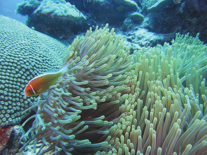
WAMSI and Goojarr Goonyool Aboriginal Corporation Whale Monitoring Team - Pender Bay, September 2009.

Sponsors
Murdoch University
Australian Institute of Marine Science
Department of Environment and Conservation
The University of Western Australia
Department of Fisheries
CSIRO National Wealth from Oceans Flagship
Western Australian Museum
Rottnest Island Authority
Edith Cowan University
UNESCO Intergovernmental Oceanographic Commission

The Western Australian Marine Science Institution (WAMSI) would like to thank the members of the Monitoring
for Action Organising Committee for putting the symposium together. They were Dr Steve Blake (WAMSI,
Chair), Ms Sue McKenna (WAMSI), Ms Lynne Stephensen (WAMSI), Ms Linda McGowan (WAMSI), Dr Kim
Friedman (Department of Environment and Conservation), Dr Chris Simpson (Department of Environment and
Conservation), Dr Jamie Oliver (Australian Institute of Marine Science), Dr Jane Fromont (Western Australian
Museum) and Dr Paul Lavery (Edith Cowan University).

Cover photo courtesy of DEC.

Contents
Introduction
   Monitoring for action: understanding Western Australia’s changing marine and coastal environments
      Dr Steve Blake Western Australian Marine Science Institution                                      1

Session 1: Scientific monitoring – the backbone of any change detection
           program
       Chair: Dr Peter Rogers, WAMSI Board Chairman
   Keynote address: What and why are we monitoring? An international and national perspective
      Dr Jamie Oliver AIMS                                                                              4
   Nationally, what should we be measuring?
       Dr Geoff Hosack CSIRO, Mathematical and Information Sciences                                     5
   Case study of a long-term monitoring initiative: The AIMS Great Barrier Reef monitoring program
      Dr Hugh Sweatman AIMS                                                                             6
   Compliance monitoring for industry
   Industry monitoring in the nearshore of North West Australia
       Dr Jim Stoddart MScience Pty Ltd                                                                 7
   Working with private industry in marine monitoring
   Recent experiences from monitoring programs in North West Australia
      Dr Russell Hanley and Dr Martin Heller Marine and Coastal Science Group                           8

Session 2: The seascape of monitoring in WA
       Chair: Dr Chris Simpson, WA Department of Environment and Conservation
   Ecological
   State Outlook for Marine Monitoring, Evaluation and Reporting: A Department of Environment and
   Conservation Perspective
       Dr Kim Friedman Department of Environment and Conservation                                      10
   Ports and coastal infrastructure
   WA Coastal Monitoring Programs and their interpretation for coastline change assessment
       Matt Eliot Damara WA Pty Ltd                                                                    12
   River and estuarine health
   Understanding our rivers and estuaries
       Dr Vanessa Forbes Department of Water, Water Science Branch                                     13
   Oceanography and climate
   Integrated Marine Observing System (IMOS) in Western Australia
        Professor Chari Pattiaratchi UWA                                                               14
   Physiochemical
   Ocean Outlet Monitoring in Western Australia: Targets, Triggers and Technical Challenges
      Dr Glenn Shiell Oceanica Consulting Pty Ltd                                                      16
   Social/Community
   Community based monitoring
      Kim Onton Department of Environment and Conservation                                             18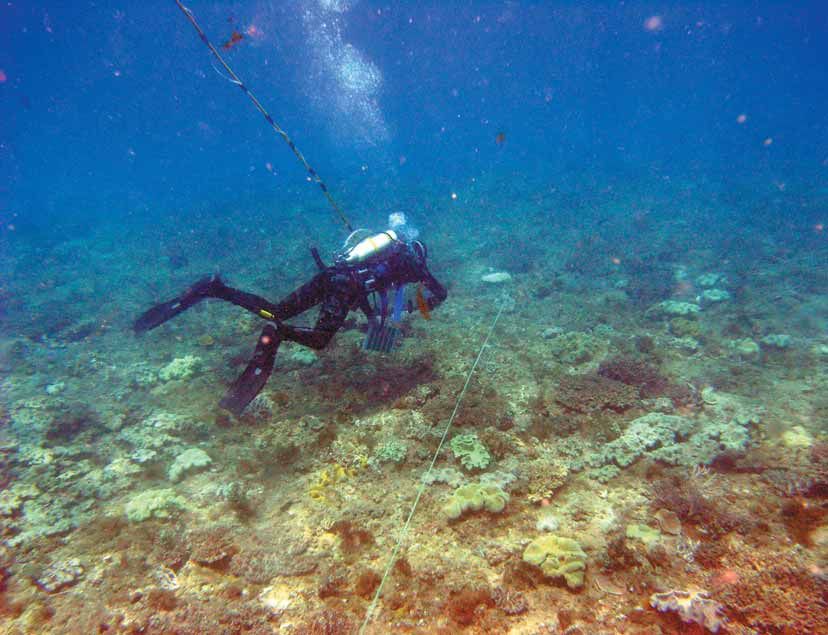
Session 3: Reaching for answers – practical experiences from monitoring
           programs
      Chair: Professor Neil Loneragan, Murdoch University
  Keynote address: Why you need monitoring to evaluate the natural environment.
  The ‘must haves’ in designing any monitoring project
  A Statistical Framework for Integrated Monitoring and Research in WA
      Dr Jeff Dambacher CSIRO, Mathematical and Information Sciences                             20
  Fisheries
  Development of appropriate management units, objectives and then indicators for use in the
  management of fisheries and other natural resources
      Dr Rick Fletcher WA Department of Fisheries                                                21
  Natural Resource Management
  What we learned from a state-wide approach to Resource Condition Monitoring in Natural Resource
  Management
     Ceidwen Pengelly Department of Agriculture and Food, NRM Science Branch                      22
  Marine monitoring: Indicators
  The when and the where of marine monitoring
      Professor Jessica Meeuwig UWA, Centre for Marine Futures                                   23
  Swan and Canning rivers
  The value of information capital in managing the Swan and Canning rivers
      Dr Kerry Trayler Swan River Trust                                                          24
  Rottnest Island
  Off the shores of Rottnest Island – maintaining a healthy marine environment
       Roland Mau Rottnest Island Authority                                                      25
  Cockburn Sound
  Practical experience with monitoring: The Cockburn Sound story – Monitoring for a purpose
      Dr Tom Rose Cockburn Sound Management Council                                              27

Session 4: Working smarter, not harder
      Chair: Dr Andrew Heyward, AIMS
  Current national initiatives in marine and coastal monitoring
      Ian Cresswell CSIRO, Wealth from Oceans Flagship                                           30
  Constructing historical timelines
  Constructing historical timelines – is it worth the trouble?
     Kevin Bancroft Department of Environment and Conservation WA                                31
  The power of historical datasets
  A demographic approach to monitoring the current and future health of coral communities
      Dr James Gilmour AIMS                                                                      32
  Consistency vs best practice
  Lessons learned from a long term monitoring scoping project
      Dr Brett Human Department of Fisheries WA                                                  33
  Practical constraints? Strategic monitoring and compliance monitoring
  Monitoring fish biodiversity: What can the fish tell us?
     Dr Tim Langlois UWA                                                                         34
  Managing long-term datasets – Ensuring data stays ‘alive’
     Luke Edwards WAMSI, iVEC, IMOS & WASTAC                                                     35

Session 5: Closing and wrap-up of day
  Packaging up the outputs of monitoring for decision makers
  Symposium summary, thanks and closure
     Dr Peter Rogers WAMSI Chairman
Introduction
Monitoring for action: understanding
Western Australia’s changing marine
and coastal environments
                                                                                                    Dr Steve Blake
  Dr Steve Blake
  Chief Executive Officer
  Western Australian Marine Science Institution

Western Australia’s marine and coastal environments are undergoing constant change. Plant and animal
communities come and go on various temporal and spatial scales.

One of the key challenges to all scientists lies in discerning the natural ambient variability associated with
natural change and for example, the additional contribution of man-induced or anthropogenic changes to the
system. Fundamentally, this requires an understanding of what is there, how it is influenced by the physical
environment and developing the necessary baselines for future comparison. For example:

As a monitoring program, the goal is to document change - i.e. where, how much, and what kind of changes
take place in the study areas at 52 different reefs. The ideal is to resolve change at scales which will allow
judgements to be made as to which changes are within normal, natural variability, and which are outside it
[Ref: AIMS web site: Long-term Monitoring Program on the GBR underway since 1992].

Many marine and coastal values are monitored and if they are under threat, action can be taken to manage
potential impacts and prevent or minimise further damage [Ref: DEC web site].

Eradication of introduced marine species is extremely difficult. Early detection and monitoring are vital tools in
eliminating and controlling the further spread of marine pests [Ref: WA Fisheries web site].

So clearly the link between monitoring and ‘management’ is a highly important and focussed one and marine
management agencies have an ongoing requirement for such activities to inform their decision making. The
questions we will pose in the future will also, to some degree, draw off the monitoring programs of today. We
monitor to inform our decision-making to allow us to take some type of management ‘actions’, the theme of
the symposium.

Photo courtesy of DEC.

                                                    1                                      Presenters’ abstract papers
Monitoring for action: understanding Western Australia’s changing marine and coastal environments

Some talk of habitat mapping, others of community and assemblage mapping, others of mapping the natural
values of the ecosystem. Monitoring programs commonly directly inform Pressure-State-Response models
which are used as a framework to themselves inform State of the Environment Reporting. The PSR model
has three main elements:
• Pressure: the human activities that affect the environment, habitat or taxonomic group;
• State: what is known about the status or health of the environment, habitat or taxonomic group; and
• Response: the actions taken by society to relieve or manage these pressures.

Add to this discussions on indicators (there are 19 nationally agreed indicators under the National NRM
Monitoring and Evaluation Framework), matters for target, resource condition indicators, community
monitoring and other issues, and the whole monitoring space becomes confusing.

Monitoring is therefore not as straightforward as we may like to think. Like all aspects of science it has its
‘best-practices’ and its ‘tricks for young players’. What scale do I monitor at? Will my data have sufficient
spatial resolution? Will my data have a sufficient statistical power to discern change? Can my monitoring
program link into other similar programs? I now have to reduce my sampling intensity by one third, what sites
do I drop off to maintain the 10 year study? These are the types of questions we all commonly confront.

The symposium: Monitoring for action: understanding Western Australia’s changing marine and coastal
environments has therefore been organised with this in mind. The aim of the symposium is not to look into
the detail of one particular monitoring technique or method per se, but instead to come at the whole marine
and coastal monitoring challenge to understand why we monitor in the first place, how best to go about it to
give the study every possible chance of succeeding, and having a long enough temporal duration to track
natural and anthropogenic process change. We look at the data management issues and the issues around
management uptake of monitoring outputs, both keystones in any successful monitoring program. Building
flexibility into your monitoring program, the spatial nesting of monitoring initiatives and making them scalable
for future expansion are also keys to success.

Five sessions have been developed to lead us through the considerations for establishing and sustaining a
marine and coastal monitoring program:
Session 1: The background to scientific monitoring and what are the current national and international
initiatives with examples of best-practice;
Session 2: The seascape of monitoring in WA – who is doing what locally and what are the State’s ongoing
requirements;
Session 3: Reaching for answers – practical experiences from monitoring programs;
Session 4: Working smarter, not harder – working together to maximise the ongoing effects of undertaking
such monitoring efforts; and
Session 5: Wrap up of the day and getting your monitoring outputs taken up in the management and policy
arenas.

WAMSI would like to thank the WA Museum for providing the venue, the agency sponsors for supporting the
symposium and the presenters who have brought to the event their vast experiences (the good, the bad and
the ugly!) over many decades of planning, undertaking and evaluating marine and coastal monitoring
initiatives. Enjoy the symposium.

Symposium, 24 November 2009                                2
Session 1
Scientific monitoring
The backbone of any change detection program
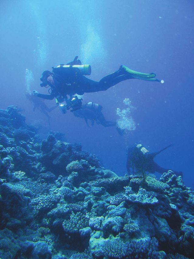
A researcher records a coral transect. Photo courtesy of Dr Jim Stoddart.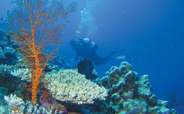
Monitoring for action: understanding Western Australia’s changing marine and coastal environments

Keynote address
What and why are we monitoring? An
international and national perspective
  Dr Jamie Oliver
  Science Leader, Western Australia                                                          Dr Jamie Oliver
  Australian Institute of Marine Science
  j.oliver@aims.gov.au

Monitoring is a standard component of many government and industry funded environmental programs. It is
a vital tool in determining the impacts of anthropogenic activities, the effectiveness of management
interventions and the underlying natural variability of the natural system. Because of the multiple issues
which monitoring programs can be targeted at, and because there is a tendency to implicitly target multiple
question over several spatial scales and time frames, many monitoring programs end up being unable to
provide the clear and conclusive results which are needed by managers and developers. This talk will review
the key components of a successful monitoring program and will highlight the importance of careful planning
and design. Some of the lessons learned from successful and less successful programs in Australia and
internationally will be reviewed.

Western Australian Museum's Dr Jane Fromont with samples destined for the WA Marine
Bioresources Library.

Kimberley marine region.

Symposium, 24 November 2009                             4
Nationally, what should we be measuring?
  Dr Geoff Hosack
  Research Scientist
  CSIRO Division of Mathematical and Information Sciences
  Tasmania
  geoff.hosack@csiro.au

Ecological indicators reduce the complexity of real-world systems to a small set of key characteristics that
are useful for management and communication purposes.

Reducing the complicated dynamics of natural ecosystems to a small number of indicators, however,
represents a significant scientific challenge. Many theoretical methods used for identifying indicators, such as
unstructured lists, objective-indicators matrices, cartoons and influence diagrams cannot realistically predict
the behaviour of ecological indicators in complex ecosystems subject to multiple simultaneous pressures.
Qualitative and quantitative models provide the most realistic solution to this problem.

This talk presents a national approach to identify indicators based on the following components: a) a set of
key ecological features or values that we wish to preserve, together with an analysis of the drivers and
pressures that threaten these values; b) mapping of values and pressures to identify trends and patterns of
co-occurrence; c) qualitative modelling to identify potential ecological indicators among the ecological
features that are exposed to threatening processes; and, d) indicator selection criteria to identify suitable
indicators from a list of potential indicators.

                                                   5                                      Presenters’ abstract papers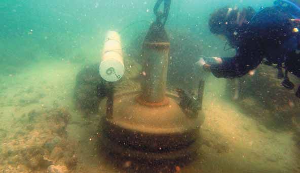
Monitoring for action: understanding Western Australia’s changing marine and coastal environments

Case study of a long-term monitoring
initiative: The Australian Institute of
Marine Science (AIMS) Great Barrier
Reef monitoring program
                                                                                                   Dr Hugh Sweatman

  Dr Hugh Sweatman
  Research Scientist
  AIMS, Queensland
  h.sweatman@aims.gov.au

The AIMS Great Barrier Reef (GBR) long-term monitoring program grew out of a program to survey the GBR
for crown-of-thorns starfish outbreaks in the 1980s. In 1992, the program added surveys of reef fishes and
benthic organisms on fixed transects in a standard habitat on about 50 reefs spread systematically across
the central and southern GBR, with the aim of providing situational awareness for much of the GBR marine
park.

Preliminary reports are made available by email and on the internet within two weeks of survey cruises. Web
pages on individual survey reefs are updated annually and status reports that include regional and overall
summaries. This program has been a major source of information for the GBR MPA State of the Reef Report
and the 2009 GBR Outlook Report, which provides the link back to policy and management.

In 2006 the program was revised so that the long-term survey sites were surveyed every other year,
alternating with similar surveys of a different set of pairs of similar reefs designed to monitor the effects of the
new zoning plan that was implemented in 2004 on reef fishes and benthic organisms. This program has
shown a rapid increase in target species in no-take zones, but there is little evidence for indirect effects on
non-target species.

There is considerable emphasis on data quality control, data management and rapid reporting.

Symposium, 24 November 2009                                  6
Compliance monitoring for industry
Industry monitoring in the nearshore
of North West Australia
Dr Jim Stoddart
Principal Scientist Dr Jim Stoddart
MScience Pty Ltd
239 Beaufort St
Perth Western Australia 6003
jim@mscience.net.au
The north-west Australian coast is a major interface for shipping
mineral resources offshore or bringing hydrocarbon resources
onshore. As well as hosting the shipping and shiploading
infrastructure, this area holds processing works and the
population servicing these industrial needs. All this comes with
a range of actual and potential impacts on the nearshore marine
environment. Typically, impacts derive from the activity of large
companies with large identifiable projects or facilities where
impacts are subject to assessment and regulation under the
WA or Commonwealth environment acts. This results in a wide
range of monitoring programs, including programs directed at:
• reactive management,
• compliance testing, and
• knowledge improvement.
Monitoring programs designed to meet the needs of the first
two frequently employ an impact-reference dielectic to imply
causation. However, with the location of impact sites and the
extent of the impact normally outside the control of the The Angel platform on the North West Shelf.
program designer, this may not be useful. Baselines are too Photo courtesy of Woodside Energy.
short and interannual variation too large to allow effective use of
baseline statistics to identify exceedences from the routine.
Some examples of monitoring programs from the Pilbara and Kimberley will be used to illustrate the problem.
The work team checks the instrument on a telemetered water quality logger.
7 Presenters’ abstract papersMonitoring for action: understanding Western Australia’s changing marine and coastal environments
Working with private industry in marine monitoring
Recent experiences from monitoring programs
in North West Australia
Dr Russell Hanley
Executive Marine Scientist
and Dr Martin Heller
Marine and Coastal Science Group
Sinclair Knight Merz
Perth, WA 6001
Dr Martin Heller Dr Russell Hanley
JHanley@skm.com.au
MHeller@skm.com.au
The Marine and Coastal Science Group of Sinclair
Knight Merz has been engaged in a variety of
environmental baseline and monitoring programs in
the Pilbara region since 2006, with a focus on the
development of ports infrastructure requiring large
scale capital dredging.
Many areas of the Pilbara region are information
poor and a major impediment has been the lack
of baseline data on water quality, habitat types
and distributions, community stability through
time, and critical thresholds for the assessment
of impact upon ‘sensitive’ communities.
The MCSG has been guided by previous dredging
programs and associated environmental approvals
in the Pilbara, but has also spent considerable
effort, with the support of clients, in the
investigation of new approaches to many of the
environmental issues that are common to most
infrastructure development in the region.
Several examples are presented of improvements
in mapping and delineating marine benthic habitat
types, including the identification of change through
time and the potential drivers of observed changes.
Photos courtesy of SKM.
Symposium, 24 November 2009 8Session 2
The seascape
of monitoring in WA
Photo courtesy of DEC.Monitoring for action: understanding Western Australia’s changing marine and coastal environments
Ecological
State outlook for marine monitoring,
evaluation and reporting: A Department
of Environment and Conservation
Dr Kim J. Friedman
perspective
Dr Kim J. Friedman
Principal Research Scientist, WAMMP
Marine Science Program
Department of Environment and Conservation
kim.friedman@dec.wa.gov.au
Australia is a marine nation. We have one of the
largest ocean territories in the world, and employ
numerous tools to sustainably manage coastal
systems for the benefit of present and future The Department of Environment and Conservation’s
generations. In this regard, Commonwealth Marine Science Program staff.
agencies are committed to strategic research to
gain a fundamental understanding of how oceans work and how they interact with the atmosphere, land,
biological cycles and people. For the States and Territories, industry, environmental and fisheries agencies,
industry regulation and planning authorities, local councils and community groups oversee and manage
resource interests, boating, extractive use, and safety and industrial development activity at scales
appropriate to human activity.
The Department of Environment and Conservation (DEC) is Western Australia’s primary biodiversity
conservation agency. Its key responsibilities include broad roles in conserving biodiversity and protecting,
managing, regulating and assessing many aspects of the use of the State’s natural resources. Specific to the
marine sector, DEC operates across the State in relation to managing human impacts on biodiversity and
threatened marine fauna and regulating resource use (generally non-extractive uses). A focus of DEC’s
marine biodiversity management is in the form of a statewide network of marine protected areas (MPAs).
DEC manages MPAs under a range of spatial and ‘activity’ controls, implementing an active adaptive
management process to conserve ecological and social assets and mitigate anthropogenic pressures.
Information on the condition of assets, pressures and management response within and across MPAs is
integral to the audit function of the Marine Parks and Reserves Authority (MPRA). The audit process to
oversee DEC’s management performance is legislated within Section 26B of the Conservation and Land
Management Act 1984 (CALM Act) and is a core element in the MPRA’s annual report to Parliament.
In late 2008, DEC established the Western Australian Marine Monitoring Program (WAMMP), which is
primarily a partnership between its Science Division (via Marine Science Program) and Regional Services
Division. WAMMP also has access to environmental data from the temperate and tropical research groups of
the Marine Science Program and information from DEC specialist branches (e.g. Marine Ecosystems Branch
and Environmental Management Branch in relation to industrial environmental impact assessments and
compliance monitoring).
The WAMMP will establish reference sites at representative and relatively undisturbed locations in all WA
IMCRA bioregions to measure a suite of ecosystem condition indicators, particularly indicators that are
reflective of human induced changes to ecosystem condition. These sites will be complemented with sites
indicative of anthropogenic and climate change pressures at appropriate spatial and temporal scales. In order
for WAMMP to deliver a world-class monitoring, evaluation and reporting system across the State we need to:
(i) Determine the status and trends in selected indicators of condition of recognized assets, the pressure/s
on the assets and the effectiveness of management responses;
(ii) Provide better understanding of the dynamic nature of undisturbed ecosystems and provide reference
points for comparisons with altered environments;
(iii) Provide warning of condition change to allow early development of effective mitigation measures; and
(iv) Provide information to meet community audit requirements and allow measurement of progress towards
ecological performance and community appreciation goals.
Symposium, 24 November 2009 10WAMMP is currently in its establishment mode for its Statewide program. A strategic plan for the program
has been finalised, as have draft knowledge reviews for priority biodiversity assets across the State. These
outline WAMMPs approach to monitoring under the Condition / Pressure / Response model adopted by
DEC. Implementation of fish community and key benthic community monitoring that is guided by knowledge
reviews and historical datasets is currently underway, and this will be followed by monitoring of the other
assets in the required suite as the program matures.
Under WAMMP the realisation of long-term fundamental datasets over an expansive spatial area and a broad
range of assets will require significant effort. These objectives and the working strategies that underpin
WAMMP would benefit from input by other agencies, and DEC will look to share information with other
statutory and non-statutory bodies in recognition of their roles. For example the Department of Fisheries
(DoF) is a key player in this regard, as they are required to fulfill their statutory obligations in commercial and
recreational fisheries, pearling and aquaculture and fish habitat protection. These obligations, and DoF’s
Ecosystem-Based Fisheries Model (EBFM) complement well the obligations and duties of DEC, offering a
wide range of targets for complementary monitoring. Similar overlaps in activity exist with Commonwealth
agencies, other state authorities like Water Corporation and Department of Water, private commerce and
industry (particularly the Oil & Gas industry) and local council and district groups (e.g. NRM, community
monitoring). Integration of activity within these monitoring programs and the sharing of results offers access
to a wide range of information over a range of spatial and temporal scales.
This presentation defines the plan
of action for WAMMP, and looks
at the potential for greater
integration between agencies
where there is areas of joint
interest or responsibility. Such
integration needs to occur along
the full chain of monitoring activity,
to ensure clear signals emerges
from public and privately funded
monitoring of our coastal
systems. The task ahead requires
not only the structured and
integrated implementation of
monitoring and collaborative
efforts to be made in data
distribution, but also follow-up to
ensure results flow back into
active adaptive management
cycles. This will only happen with
credible, comprehensive and
regular data flows on asset
condition and information on
stressors, and this will best be
realised through active
cooperation of the marine
community in Australia,
particularly Western Australia.
11 Presenters’ abstract papersMonitoring for action: understanding Western Australia’s changing marine and coastal environments Ports and coastal infrastructure WA coastal monitoring programs and their interpretation for coastline change assessment Mr Matt Eliot Damara WA, Perth, AUSTRALIA damarawaptyltd@bigpond.com Coastline change has been recognised as a likely future challenge to Australian coastal management, due to the combined pressures of climate change and increased coastal utilisation. After a hiatus of a number of years, the potential for adverse coastline change has achieved wider recognition with the Australian public and in the political sphere. Steps have been taken at all levels of government to improve the information base for coastline change assessment, allowing improved decision-making. Projects have included the ‘first-pass’ National Coastal Vulnerability Assessment; review and revision of historic databases; development of high- quality bathymetric data sets; and locally based climate change coastal impact assessment. Although this ‘newly acquired’ knowledge base provides a basis for future assessment, its collation over a short period of time limits its capacity to help detect and interpret coastal change. Consequently, historic coastal monitoring programs provide the foundation upon which change assessment must be undertaken. Prior to the 1990s, the majority of coastal instrumentation throughout WA was installed to assist with either port operations or the design and installation of coastal facilities. Consequently, the value of such observations as a tool for coastal change assessment is largely opportunistic, with a strategic framework of observations, including several offshore waverider buoys, tide gauges, weather stations and annual coastal aerial photography. Evidence-based studies for climate change coastal impact assessment have identified some of the strengths and weaknesses of the available historic records. The spatial and temporal coverage of recent and historic coastal monitoring programs is discussed, with respect to their potential for coastline change assessment across WA. Symposium, 24 November 2009 12
River and estuarine health
Understanding our rivers and estuaries
  Dr Vanessa Forbes
  Water Science Branch
  WA Department of Water
  Vanessa.Forbes@water.wa.gov.au

Waterways are one of the most significant forces shaping our
ecosystem and intrinsically linked with the overall health of the
environment. Understanding our rivers and estuaries with a view to
management and maintenance of both form and function, whilst
balancing economic and social values, is one of the most
important roles of the Department of Water.

The condition and stability of our waterways is dependent on a
complex and dynamic network of interactions between biotic
(bacteria, algae, plants and animals) and abiotic features
(sediments, rocks, climatic features, water flow, chemicals and
physical form), which often varies greatly between regions
(variations in rainfall, temperature, altitude, geology, depth, flow)
and over time (i.e. seasonal changes).

To better understand, assess and manage our waterways the
Department of Water is looking at multiple approaches, using both           Monitoring river health. Photo courtesy
                                                                            of the Department of Commerce.
monitored and modelled techniques. The Department has a
significant focus on water quality and quantity, although it is investing increasing time and effort investigating
sediment quality, algae and more recently plants and animals, including macroinvertebrates, fish and crayfish,
seagrass and fringing vegetation.

Holistic, multiple-parameter approaches for assessing waterway health are also being employed, where a
range of information is collected for each system to determine overall ecological health. This approach
examines not only the condition of particular aspects of the waterway (such as water quality and fish health),
but attempts to determine the ecological integrity of the system taking into account catchment inputs and
interactions between components of the system. This approach is being undertaken for both rivers and
estuaries.

Understanding of waterways enables the Department to better assess the health status of our systems,
especially in relation to common threats and risks to our waterways.

                                                      13                                    Presenters’ abstract papers
Monitoring for action: understanding Western Australia’s changing marine and coastal environments
Oceanography and climate
Integrated Marine Observing System
(IMOS) in Western Australia
Professor Charitha Pattiaratchi
Winthrop Professor of Coastal Oceanography Charitha Pattiaratchi
School of Environmental Systems Engineering,
The University of Western Australia, Nedlands, WA 6009
chari.pattiaratchi@uwa.edu.au
West Australian Integrated Marine Observation System (WAIMOS) is a node of the Integrated Marine
Observation System (IMOS) for Australia funded through the National Collaborative Infrastructure Scheme
(NCRIS).
The main area of interest for WAIMOS is the continental shelf and slope regions offshore from Fremantle
extending northwards to Jurien Bay. Within this region there are important topographic features such as the
Rottnest Island and Perth Canyon where circulation is dominated by the southward flowing Leeuwin Current
(LC) with the northward flowing Leeuwin Undercurrent (LU) beneath the LC, and the wind-driven Capes
Current (CC) located on the shelf, particularly during the summer months.
The IMOS infrastructure located in this region includes HF Radar (CODAR and WERA systems) for surface
current measurements at different scales – ocean gliders (Slocum and Seagliders) for subsurface water
properties, continental shelf moorings (ADCP, thermistor and water quality loggers), passive acoustic sensors
for whale monitoring, and remotely sensed data products (SST and ocean colour).
Example data collected from these instruments will be
presented in relation to the understanding of different processes
operating in the region. These include:
1. the interaction between the LC and CC. Here, the warmer,
lower salinity southward flowing Leeuwin Current interacts with
the cooler, higher saline northward flowing Capes Current
creates a region of high horizontal shear and thus intense
mixing; and
2. the winter cascade of dense water along the continental
shelf. The region experiences a Mediterranean climate with hot
summers and cold winters. During the summer months the
inner continental shelf waters increase in salinity due to
evaporation. In winter as the higher salinity waters cool, the
density is higher than offshore waters and a gravitational
circulation is set up where the inner shelf water are transported
as higher salinity plumes into deeper waters.
Professor Charitha Pattiaratchi and two
students with an ocean glider, which
beams ocean data by satellite.
Symposium, 24 November 2009 14Professor Charitha Pattiaratchi is the Winthrop Professor of coastal oceanography at the School of
Environmental Systems Engineering at the University of Western Australia.
He undertook his tertiary studies at the University of Wales, Swansea, where after completing a Bachelors
degree with honours in Oceanography and Applied Mathematics, he obtained a Masters and PhD in
oceanography from the same institution. In 1988, he accepted a position as a lecturer at the Centre for
Water Research at UWA.
He has been a Fellow of IMarEST and a chartered marine scientist since 2005.
His current roles include:
• Director of the Australian National Facility for Ocean Gliders;
• Node Leader, West Australian Integrated Marine Observation System (WAIMOS);
• Group leader, Coastal Oceanography, School of Environmental Systems Engineering;
• Graduate Research Coordinator, School of Environmental Systems Engineering;
• Chair, Numerical Modelling Group for the Indian Ocean Tsunami Warning System;and
• Chair, International Steering Committee of the Physics of Estuaries and Coastal Seas (PECS).
He also coordinated the marine science and engineering program for UWA and served as the head of the
university’s Department of Environmental Engineering.
He has supervised more than 30 PhD students and 100 honours students and was awarded an excellence
in postgraduate supervision award by UWA in 2003.
His research interests are in coastal physical oceanography and coastal sediment transport, with emphasis
on field experiments and numerical modelling, in particular, the circulation and mixing processes on the
continental shelf, coastal and estuarine regions of WA and Sri Lanka. Research interests also cover sea level
variability, the dynamics of island wakes and headland eddies, remote-sensing applications, effluent
dispersion from outfalls, estuarine circulation and dynamics, nearshore processes and sediment transport,
and the formation and maintenance of rhythmic features, such as linear sandbanks and beach cusps.
He has published more than 262 articles/reports on coastal oceanography, which include over 100 in peer-
reviewed, international journals and two as book editor. He also serves on the editorial boards of many
international scientific journals.
15 Presenters’ abstract papersMonitoring for action: understanding Western Australia’s changing marine and coastal environments Physiochemical Ocean outlet monitoring in Western Australia: targets, triggers and technical challenges Dr Glenn R Shiell Oceanica Consulting Pty Ltd PO Box 3172, Broadway Nedlands WA 6009 Tel: (08) 9389 9669 glenn.shiell@oceanica.com.au Oceanica presently oversees the management of two major ocean outlet monitoring programs in the Perth metropolitan area [Perth Long-Term Ocean Outlet Monitoring (PLOOM); Alkimos Ocean Outlet Monitoring] and one major ocean outlet monitoring programme in the State’s south-west [Bunbury Ocean Outlet Monitoring (BOOM)]. The extent and type of monitoring required for each of the program – conducted on behalf of the Water Corporation – is governed by State Government regulations, encompassing Ministerial and Licence Conditions. Monitoring has traditionally focussed on in situ measures of environmental quality [Conductivity- Temperature-Depth (CTD) profiles, nutrients and ecological indicators such as seagrass shoot density] with monitoring commencing following Wastewater Treatment Plant (WWTP) operation. However, more recent programmes have adopted a Multiple-Before-After-Control-Impact (MBACI) approach, by considering the state of the environment before and after commencement of treated wastewater ocean disposal. This presentation provides an overview of the PLOOM, BOOM and Alkimos monitoring programmes, and concludes with examples of the challenges faced by marine environmental managers. PLOOM Commencing in 1995, the PLOOM program was established following completion of the Perth Coastal Waters Study (PCWS). The PCWS consisted of a four year (1991-1995) multi-disciplinary study investigating the effects of Perth’s existing ocean outlets at Sepia Depression, Swanbourne and Ocean Reef. Although no adverse effects of the ocean outlets were detected at the time, the study advised that the ongoing disposal of treated wastewater had the potential to cause eutrophication in the future because of projected increases in nutrient loads if WWTPs were not upgraded. A major recommendation of the PCWS was that Water Corporation conduct a five-year ocean outlet performance monitoring program, including a time-series investigation of water column chemistry, sediment condition and plant and animal community structure. In the absence of pre-disturbance data (i.e. prior to the establishment of ocean outlets) these data provide a valuable data set against which present-day data are compared. Since this time, all of Perth’s WWTP have undergone major upgrades to significantly reduce the loads of nutrients reaching the environment. Indeed, recent PLOOM investigations conducted between 2000 and 2009 have found no significant change in characteristics of marine sediments and no significant increase in the concentration of chlorophyll a in the vicinity of the outlets. Monitoring in the vicinity of Perth’s outlets continues with the aim of ensuring the disposal of treated wastewater is sustainable, and that the Environmental Values (and Objectives), as established by the Environmental Protection Authority (2000), are maintained. BOOM Commencing in 2002, the BOOM program was designed to meet Ministerial and Licence conditions, including the requirement to conduct environmental monitoring three times per annum (encompassing spring, summer and autumn). Monitoring is focussed on several water quality (physical chemical, nutrients) and two benthic environmental indicators (sediments and seagrass shoot density). Two levels of environmental protection have been established and include Environmental Quality Guidelines (EQG) and Environmental Quality Standards (EQS). Exceedance of an EQG leads to more detailed assessment against the EQS; Symposium, 24 November 2009 16
exceedance of an EQS leads typically to an appropriate management response. Data collected between
2002 and 2009 have indicated numerous exceedances of the EQG, but no exceedances of the EQS,
indicating a measurable effect of the outlets, but no adverse environmental impacts with the potential to
compromise the Environmental Values.
Alkimos
The Alkimos WWTP is the fourth major ocean outlet to be established in the Perth metropolitan area.
Although not commencing ocean discharge until mid 2010, base-line algal community monitoring
commenced in February 2009 and will continue into early 2010. A clear understanding of the status of the
benthic environment prior to ocean disposal forms an important part of the Environmental Management Plan
and an integral component of the underlying MBACI experimental design. The MBACI programme is
designed around hypothesis based tests for changes in algal community structure. The resulting long term
multivariate data set will provide valuable insights into the level of natural spatial and temporal variation, and
the level of statistical rigour (with consideration of effect sizes) required to detect meaningful change. The
Alkimos Ocean Outlet Monitoring program is the most rigorous monitoring programme applied to any of the
ocean outlets presently operating in WA. In addition to the benthic indicators developed for the MBACI
program, the monitoring program also includes a number of in-water indicators and triggers. Several in-water
triggers (nutrients, micro-biological and physical-chemical) have been established as the EQG, whereas
benthic triggers have been established as the EQS.
Challenges
Despite the advent of increasingly rigorous environmental monitoring programs (i.e. MBACI), environmental
managers are faced with the same, age-old challenge—how to detect the beginnings of anthropogenic
change in the midst of considerable natural change? This is particularly worrying when the first detectable
change at an impact location may already indicate irreversible change, for example a shift toward complete
dominance of one algal species over a suite of algal species. To begin the process of developing acceptable
triggers, managers first require prerequisite knowledge of the extent of natural change on two scales:
temporal (inter seasonal and inter annual) and spatial. This is not traditionally the case, with most examples
(and those approved during the EIA process) focussing monitoring effort during and after the disturbance,
and not before-hand. Armed with this knowledge, the challenge for managers is to develop triggers that are
sufficiently sensitive to provide ‘warning’ but not over?sensitive such that the trigger lies within the upper
range of natural variation.
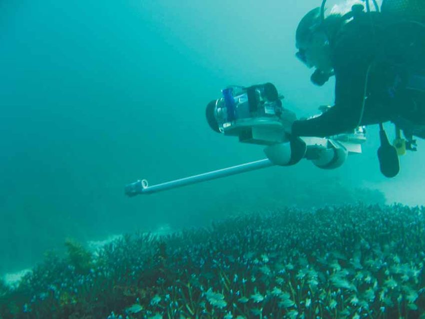
Algal community monitoring near Alkimos. Photos courtesy of Glenn Shiells.
17 Presenters’ abstract papersMonitoring for action: understanding Western Australia’s changing marine and coastal environments
Social/Community
Community based monitoring
Kimberly Onton
Research Scientist
Marine Science Program
Department of Environment and Conservation Kimberly Onton
kim.onton@dec.wa.gov.au
Community-based monitoring refers to the involvement of volunteers in scientific studies. Community-based
monitoring programs can involve a broad range of activities, from ecological observations to the
measurement of environmental parameters. Whilst the collection of data by community members is not new,
the number of studies, volunteers enlisted and the scope of data collected has increased with time. These
programs may be led by non-government organisations or community groups for either research purposes or
advocacy, or by government agencies for the purpose of public engagement or the need for assistance with
data collection.
Community-based monitoring is often questioned for its scientific merit. Limitations identified generally center
around the unqualified nature and high turnover of participants (observer bias) and potential inconsistencies
in methods over time that may limit the utility of the data collected. Whilst these challenges are
acknowledged, community-based monitoring has considerable strengths. The utilisation of volunteers allows
for the collection of data on a larger geographic scale and over longer time periods than is possible with
more traditional scientific research that is often limited in time and financial resources. For example, the Birds
Australia Shorebirds 2020 program has identified shorebird population trends from data collected by 1100
people over 30 years from 2000 sites. Community-based monitoring can complement scientific institutional
monitoring and may serve as an early warning system to trigger more detailed research. The community
engagement aspect itself is valuable in inspiring community members to connect with their environment and
advocate for its protection whilst becoming more aware of the complexities of natural resource management.
The Department of Environment and Conservation (DEC)
recognises the value of community-based monitoring and
aims to engage the community in the collection of scientific
data, particularly in the State’s marine protected areas as part
of the Western Australian Marine Monitoring Program
(WAMMP). The WAMMP will use the Marine Community
Monitoring Program, a ‘toolbox’ of simple but effective marine
monitoring methods to assist local interest, stakeholder,
industry and school groups to monitor ecological and social
parameters relevant to marine conservation and
environmental management.
This presentation will explore the strengths, weaknesses and
lessons learnt from example community-based monitoring
programs and their applicability to DEC in addressing marine
and coastal management in WA.
Symposium, 24 November 2009 18Session 3
Reaching for answers
practical experiences from monitoring programs
Monitoring in the Abrolhos. Photo courtesy of the Centre for marine futures.Monitoring for action: understanding Western Australia’s changing marine and coastal environments
Keynote address: Why you need monitoring to evaluate
the natural environment. The ‘must haves’ in designing
any monitoring project
A statistical framework for integrated
monitoring and research in WA
Dr Jeffrey Dambacher
Dr Jeffrey Dambacher
CSIRO Mathematical and Information Sciences
GPO Box 1538 Hobart, Tasmania 7001
Jeffrey.Dambacher@csiro.au
A major goal of an environmental monitoring program is to provide information that will be relevant to the
needs of decision makers in the future, but long-term monitoring program are especially challenged. Often
our understanding of the natural system changes, the system itself changes, or, perhaps more frequently,
institutional policies change. Moreover, the questions asked range from local to regional scales, and are
being asked by an array of research and regulatory organisations with objectives that are not necessarily
compatible. If not adequately addressed in an integrated manner, these challenges can lead to an inefficient,
ineffective, or aborted monitoring program.
Many of these challenges can be addressed through a statistical framework called the generalised random
tessellation stratified (GRTS) sampling design. Developed in North America, it is gaining popularity as a
rigorous and flexible approach to long-term monitoring programs. Here we provide a brief introduction of the
GRTS sampling design, with applications for the monitoring of stream habitat and fish populations, and
marine parks.
Dr Dambacher on a field trip.
Symposium, 24 November 2009 20Fisheries
Development of appropriate
management units, objectives and then
indicators for use in the management
of fisheries and other natural resources Dr Rick Fletcher
Dr Rick Fletcher
Director of Fisheries Research
WA Department of Fisheries
rick.fletcher@fish.wa.gov.au
There has been considerable level of activity and interest
over the past decade to develop indicators, resource
condition monitoring (RCM) targets and other similar terms,
supposedly for use in natural resource management. Such
activities are, however, largely pointless unless the indicator
or RCM that is generated is directly associated with
measuring something that clearly relates to a management
objective and there is some possibility that a management
action may arise if the indicator suggests poor performance.
Given the complexity of the marine systems, it can often be
difficult to choose what to measure that will describe what is
happening within the system. However, the more critical
problem has been in determining pragmatically, what are the
units of management and developing clear enough
objectives that would mean the monitoring of some indicator
will actually be a valuable use of resources.
This talk outlines how we are undertaking the process of
simplifying the complexity of the marine ecosystem and Above: The Department of Fisheries
fisheries resources down to a level such that indicators can coordinates the monitoring of WA waters for
be developed that can be monitored in a cost effective way sustainable fisheries.
and for which realistic management outcomes can be Below: Measuring a rock lobster.
Photos courtesy of the department.
defined.
The talk will provide an outline of the minimum requirements
for the development of the indicator, objective and
performance measure package. It will also provide
examples of how cost effective monitoring and management
systems can be developed even for complex circumstances.
It will also outline when such programs are not likely to be a
valuable use of resources.
21 Presenters’ abstract papersMonitoring for action: understanding Western Australia’s changing marine and coastal environments Natural Resource Management What we learned from developing a state-wide approach to Resource Condition Monitoring in Natural Resource Management in NAP and NHT2 Ceidwen Pengelly Manager, Monitoring and Evaluation Natural Resource Management Science Department of Agriculture and Food WA Monitoring and evaluation (M&E) is an integral part of the Natural Resource Management (NRM) program cycle. It is the key to understanding whether our NRM activities, products and services are effective at protecting and managing our natural resources for the future. The aim of investment in NRM is to improve or maintain the resource condition. Resource Condition Monitoring provides us with information about the state and trends in our natural resources. It is an important part of the NRM investment cycle. In WA the M&E for two programs – the National Action Plan for Salinity and Water Quality (NAP) and the Natural Heritage Trust 2 (NHT2) – was coordinated through the State NAP and NHT2 M&E Implementation Plan. The plan has been in place since 2003. In 2008/09 an internal review of this plan was undertaken by the State M&E team to measure progress and recommend improvements for future M&E plans. The review found that the plan had enabled the coordination and funding of monitoring and evaluation activities, which is a significant step forward in WA. The plan also enabled the funding of eight Resource Condition Monitoring projects worth $10 million to improve the state monitoring network and to develop monitoring protocols and install infrastructure. The review found that the eight RCM projects have made progress, state agency technical experts have been engaged and they have made a significant contribution to monitoring in WA. The projects have developed Standard Operating Procedures, developed and tested monitoring protocols, completed scoping studies, adjusted databases to receive information and installed infrastructure. They have made a significant contribution to the scientific knowledge of monitoring as relevant to WA. However, these projects have experienced delays to contracting and funding and thus their progress. RCM takes a long time to plan and implement. The time required to understand what is happening in the environment can be between five and 20 years. In each field technical scientists are required to measure, analyse and report data in a way that is easily understood by decision makers and the community. This means that it is important to provide ongoing funding to maintain the capacity to continue our long-term monitoring programs. Lastly, it was also recommended that a resource condition monitoring plan be developed to coordinate effort across state agencies and enable long-term funding. In summary, progress has been made in RCM in WA and the state-wide monitoring network has been improved, however the uncertainty in future funding could adversely affect the progress made to date. Symposium, 24 November 2009 22
Marine monitoring: Indicators
The when and the where of marine
monitoring
Professor Jessica Meeuwig
Director Jessica Meeuwig
The Centre for Marine Futures
The University of Western Australia
j.meeuwig@uwa.edu.au
Jessica Meeuwig1, Euan Harvey2, Tim Langlois2, Dianne Watson1, Mark Westera2
1 The Centre for Marine Futures, Oceans Institute, University of Western Australia, Perth, AUSTRALIA
2 School of Plant Biology, University of Western Australia, Perth, AUSTRALIA
Two key challenges in marine monitoring are a lack of historical data and a reluctance to invest in such
monitoring. The general lack of long term data sets means we are swimming blind and our baselines are
shifting. The reluctance to invest in marine monitoring means that, moving forward, we are constrained both
in terms of the frequency with which we monitor in time (the ‘when’) and the spatial coverage of our
monitoring programs (the ‘where’).
A number of strategies exist to address these challenges. ‘When’ can in part be answered by annual and
seasonal repeated sampling at focal locations that identifies scales of natural variability against which human
induced change can be assessed. This requires investment. ‘When’ also requires us to creatively use
available historical data sets, typically based on human use such as recreational catch records, commercial
catch and effort data, mariners’ logs and even art. We need to explore how these sources of information can
be converted into currencies relevant to today’s management. ‘Where’ means choosing sites that theory tells
us are likely to be the marine equivalent of canaries in the coal mine. ‘Where’ also means collecting spatially
extensive data, allowing ‘space for time’ modelling that provides insights into how baselines may have shifted
or may shift in the future.
We need to invest in highly protected (IUCN Level 1) marine parks that help us tease apart impacts of climate
change, fishing and other anthropogenic pressures and we need to invest in effective baseline surveys prior
to offshore development such that we can understand the implications of change.
Monitoring in the Abrolhos. Photos courtesy of the Centre for marine futures.
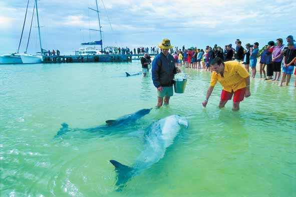
23 Presenters’ abstract papersMonitoring for action: understanding Western Australia’s changing marine and coastal environments Swan and Canning rivers The value of information capital in managing the Swan and Canning rivers Dr Kerry Trayler Principal Scientist Swan River Trust Kerry.Trayler@dec.wa.gov.au The Swan River Trust, through the Department of Water, undertakes routine estuarine and tributary water quality sampling on the Swan and Canning rivers for health assessment, phytoplankton hazard warnings, status and trends, and process understanding. The data set is one of the most extensive available and provides essential information for the evaluation of the impacts of change on the system. The value of this data set will be explored in context of recent dolphin deaths, a water quality improvement program and climate change. Dolphins at Monkey Mia. Photo courtesy of Tourism WA. Symposium, 24 November 2009 24
Rottnest Island
Off the shores of Rottnest Island – maintaining a
healthy marine environment
  Roland Mau
  Manager Marine and Terrestrial Reserve
  Rottnest Island Authority

Authors: Roland Mau, Shane Kearney
(Environmental Services Coordinator, Rottnest
Island Authority) Rian Caccianiga (Conservation
Officer, Rottnest Island Authority), Russell Stevens
(Conservation Officer, Rottnest Island Authority)

Rottnest Island is one of the most popular
recreation and holiday destinations in WA with
up to 600,000 people visiting the Island every
year. Rottnest Island is located 18 kilometres
west of Fremantle at latitude 32°00 S. The
island and its waters are an A-Class Reserve
for the purpose of public recreation and
protection of flora, fauna and heritage values.    Rottnest island.
The reserve encompasses 1900 hectares of
land, 38 kilometres of coastline and 3830 hectares of marine environment.

The Rottnest Island Authority (RIA) was established in 1987 as the statutory body to control and manage the
Island under the Rottnest Island Authority Act 1987 (the Act). The Act dictates that the RIA must sustainably
manage the natural and cultural assets of the island. To that end, the RIA has adopted a strategic ‘triple-
bottom line’ approach – moving towards becoming environmentally, socially and financially sustainable. The
Act requires the RIA to have a five-year management plan in place, providing a legally binding statement of
policies and guidelines and a summary of operations proposed for the five year period.

The 2009-2014 Rottnest Island Management Plan’s (RIMP) desired outcome is that Rottnest Island visitors
enjoy recreational and holiday experiences in healthy natural and cultural environments. The level of success
in achieving this outcome will be measured by a suite of relevant performance indicators. Although some
reporting on key performance indicators pertaining to the health of the natural environment has been
undertaken over recent years, the measures for the marine habitat were largely output based and are
currently under review to ensure their adequacy in meeting the RIA’s Outcome Based Management
Framework. The following section outlines the key values of the reserve, management strategies currently in
place and an overview of existing monitoring programs.

Ecological values

Rottnest Island’s marine environment is ecologically ‘special’ in many ways. Its geographic isolation from the
mainland and location near the Leeuwin Current have resulted in its waters being characterised by a unique
blend of tropical and temperate species, with a prominent component of WA endemic species. The island
also has the southernmost occurring assemblages of tropical corals in the State and possibly in Australia,
and has a diverse mix of habitats and communities, ranging from coral reef to seagrass habitats.

Social values

Rottnest Island’s proximity to the Perth metropolitan area has made it a highly valued place for recreational
activities. Many of the visitors coming to the island undertake marine-based recreational activities. These
activities include swimming, diving, fishing, surfing, kayaking and boating amongst others. The main social
features of the marine reserve include marine amenity, visual appreciation for land-based as well as vessel-
based visitors, commercial/private use, and experiences of the marine environment.

                                                       25                                Presenters’ abstract papers
You can also read