GREEN TRIANGLE FOREST MANAGEMENT PLAN - September 2016 - ForestrySA
←
→
Page content transcription
If your browser does not render page correctly, please read the page content below

GREEN TRIANGLE
FOREST MANAGEMENT PLAN
              September 2016
© ForestrySA 2016.

Published 2016 by ForestrySA, Mount Gambier, South Australia.

ISBN 978 0 7308 7437 9

This work is copyright. Apart from any use permitted under the Copyright Act 1968, no part of this
plan may be reproduced by any process without prior written permission from ForestrySA.
Requests and inquiries concerning reproduction and rights should be addressed to:

ForestrySA
PO Box 162
MOUNT GAMBIER SA 5290

Citation:
Horn, T, Thompson, R, & Haywood, B, 2016, ForestrySA Green Triangle Forest Management Plan
Cover photos: ForestrySA.

Authors:
Troy Horn, Conservation Planner, ForestrySA, Mt Gambier, SA.
Rose Thompson, Project Ecologist, Nature Glenelg Trust, Mt Gambier, SA.
Bryan Haywood, Senior Ecologist, Nature Glenelg Trust, Mt Gambier, SA.

Disclaimer: While this publication may be of assistance to you the Government of South Australia
and its officers do not guarantee that it is without flaw of any kind or is wholly appropriate for your
particular purpose. The Government therefore disclaims all liability for any error, loss or other
consequence that may arise from you relying on any information in this publication

                                                   2
Contents
Green Triangle Forest Management Plan ............................................................................................... 5
   1.      Introduction ................................................................................................................................ 7
        Native Forest Management Context............................................................................................... 7
        State and Regional Framework / Context ....................................................................................... 8
        Administrative and Legislative Context .......................................................................................... 9
   2.      History ....................................................................................................................................... 11
        Forest History ................................................................................................................................ 11
        Conservation Planning and Management..................................................................................... 11
   3.      Landscapes and Water .............................................................................................................. 13
   4.      Biodiversity Conservation ......................................................................................................... 15
        Flora .............................................................................................................................................. 15
        Fauna ............................................................................................................................................. 16
        Threatened Species ....................................................................................................................... 17
        Monitoring .................................................................................................................................... 19
        External Firebreaks ....................................................................................................................... 19
   5.      Weeds and Pests ....................................................................................................................... 21
        Weeds ........................................................................................................................................... 21
        Pests .............................................................................................................................................. 22
        Joint Management Areas .............................................................................................................. 22
   6.      Community Use and Infrastructure .......................................................................................... 23
        Community Environmental Programs........................................................................................... 25
        Infrastructure ................................................................................................................................ 26
        Access to ForestrySA Infrastructure for Third Party Use .............................................................. 26
   7.      Fire Management ...................................................................................................................... 27
        Prescribed Burning ........................................................................................................................ 27
        Wildfire History ............................................................................................................................. 27
        Fire Management and Suppression .............................................................................................. 27
   8.      Heritage..................................................................................................................................... 28
        Aboriginal Impacts and Heritage................................................................................................... 28
        European Impacts and Heritage ................................................................................................... 28
   9.      Corridors and Revegetation ...................................................................................................... 31
        Biodiversity Corridors.................................................................................................................... 31
        Revegetation ................................................................................................................................. 32
   10.         ForestrySA - OneFortyOne Plantations Joint Management .................................................. 34
References and Bibliography ................................................................................................................ 35

                                                                              3
Appendix 1: Threatened communities and habitats known to occur within Green Triangle NFRs . 37
Appendix 2: Management Action Summary ..................................................................................... 38
Appendix 3: Legislation ..................................................................................................................... 41

                                                                     4
Green Triangle Forest Management Plan
The Green Triangle Forest will be managed according to this Management Plan, under the
framework of ForestrySA’s policies, guidelines and Forest Management System. ForestrySA has
prepared this plan to set out the purpose and management objectives for the Green Triangle Forest.
These management objectives underpin the framework for sustainable forest management. The
administrative details contained in this document are current as at date of publication.
Implementation of the Plan will occur so that regulatory and other obligations are met and so that
programs are delivered in line with budgets and operational constraints.

The management of the Green Triangle Forest is mandated by the Charter of the South Australian
Forestry Corporation (SAFC), which details the responsibility for the management of significant
Government assets within the context of broader Government policies and strategies. These
responsibilities include issues relating to commercial plantations, biodiversity conservation and
heritage protection, community engagement and regional development.

                                                 5
Figure 1 – Native Forest Reserves of the Green Triangle

                                                 6
1. Introduction
ForestrySA manages just under 12700 hectares of land in the Green Triangle, nearly all of which is
contained within 51 Native Forest Reserves. These reserves are located in the lower south east of
South Australia (Figure 1). The majority of the reserves are located within close proximity to Penola,
Millicent, and Mount Gambier, with smaller outlying areas occurring near Robe. These reserves are
managed for conservation and provide passive recreational opportunities such as bushwalking and
cycling and contain a range of facilities. ForestrySA has responsibilities for providing fire protection
and maintains a series of smaller parcels of land containing fire towers, depots, and minor areas of
plantation. ForestrySA is also responsible for the provision of recreational sites and access permits
both within its estate and on crown land held under lease by OneFortyOne Plantations Pty Ltd.
The plan describes the management context and planning framework for the forest, and provides a
summary of the natural, built and heritage values, community use and issues that impact on the
management of the forest. It addresses the main land uses including conservation, recreation,
historical and heritage aspects of the forest. A summary of the values and issues in the forest is
included for external audiences. Additional strategic and operational plans provide more detailed
direction for specific aspects of management.
ForestrySA’s main objectives are to:
Conserve and enhance biodiversity and areas of conservation, cultural, historic and scientific
significance in native forest reserves.
Encourage cooperation with the community and other stakeholders and promote the
community use of the Forest for a range of recreational activities, community events and
educational values.
Management objectives stated in this plan underpin the framework for management of the forest,
while Management actions set priorities for the values identified.
Native Forest Management Context
ForestrySA manages some of the few remnant areas of native forest, woodland and wetland
predominantly in the higher rainfall areas of South Australia. These areas contribute significantly to
the natural assets of the State and are managed as Reserves under the Forestry Act 1950 by
ForestrySA (formerly the Woods and Forests Department) which was established in 1882.
ForestrySA’s primary management objective for areas of native vegetation under its control is to
conserve and enhance native flora and fauna, and preserve biodiversity for the long-term benefit of
the South Australian community.
In managing native vegetation, ForestrySA:
• recognises that the size and relative isolation of much native vegetation increases the risk of
species loss due to fire, drought or disease.
• recognises that Native Forest Reserves contribute to the conservation of valuable remnant
habitats for many species and provide, in part, a representation of the original vegetation.
• recognises that ecosystems are dynamic and will continue to change with time;
• will make decisions for the management of ecosystems, communities and processes based
on the information available;
7
• will use the least disturbed sites as benchmark areas to monitor changes due to natural
succession, and as reference sites for restoration of adjacent disturbed areas;
• will vary management programs between and within Native Forest Reserves as required to
maximise biodiversity; and
• may co-operate with neighbouring landowners (Other Government agencies, Local
Government, private individuals) to maximise the conservation value of an area.
Prior to the early 1950s, most areas were disturbed by activities such as timber cutting, grazing, fire
and invasion by introduced plants and animals. Since then, most of these areas have remained
relatively undisturbed. Compared with other remnant areas of native vegetation in South Australia,
those managed by ForestrySA are often the least disturbed due to their long history of consistent
land tenure.
Areas of native vegetation may require specific management prescriptions to achieve management
objectives depending upon their disturbance histories. ForestrySA is committed to the following
broad management objectives for the native vegetation under its control, for the benefit of the
people of South Australia:
• Conservation Management – the reserves will be managed for the long-term conservation of
native plant and animal communities, and will incorporate research and monitoring. Options
for species re-introduction programs will be evaluated. Natural processes will be maintained
by the use of approved prescribed burning and/or other activities when and where
appropriate.
• Community Use – community use will be managed consistent with the NFR’s primary
conservation purpose. Understanding and awareness of the NFR’s natural values will be
promoted in line with ForestrySA policies and guidelines.
• Protection – the NFRs will be managed to minimise impacts from human-induced or natural
disturbances and in recognition of the potential hazards and risks they present to adjacent
land use and the community.
• Rehabilitation – sites that have been extensively degraded by human-induced or natural
activity will be rehabilitated.
• Stakeholder Involvement – community groups and volunteers (Friends of the Forest) will be
encouraged to participate in the implementation of the management program.
State and Regional Framework / Context
The management goals for the Green Triangle complement existing South Australian State and
regional plans, including those relating to the management of native vegetation, bushfire mitigation,
natural resources, biodiversity, conservation, cultural heritage, recreation and tourism. These plans
include but are not limited to:
In a Great State, SA Strategic Plan (2011)
Our Place. Our Future, State Natural Resources Management Plan, South Australia (2012-
2017)
South Australian Tourism Plan 2020
No Species Loss – Nature Conservation Strategy for South Australia (2007-2017)
8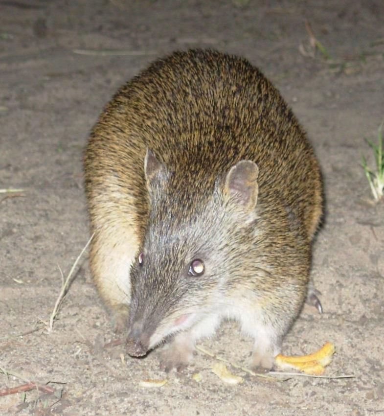
At a regional level, biodiversity conservation priorities are guided by:
South East Natural Resources Management Plan (2010)
Biodiversity Plan for the South-East of South Australia (Croft et al 1999)
Biological Survey of the South East South Australia (Foulkes and Heard 2003)
Regional Species Conservation Assessment Report (Gillam and Urban 2001)
Limestone Coast Regional Plan, August 2011
Lower Limestone Coast Water Allocation Plan
Administrative and Legislative Context
ForestrySA is governed through the Charter of the South Australian Forestry Corporation. The
Corporate Overview outlines the Corporation’s mission, roles and values. Further information about
the Corporate Overview and Charter can be found online at https://www.forestrysa.com.au/About-
Us/CorporateOverviewandCharter.
ForestrySA works within the objectives of the Strategic Plan (2015-20). The implementation of this
plan facilitates a number of strategies that have been identified. ForestrySA is committed to
achieving high standards of management through the Forest Management System (FMS), an
integrated system relating to quality, environment, and sustainable forestry practices. ForestrySA
also maintains certification to the Australian Forestry Standard (AS 4708).
On ground management and decisions are guided by both Commonwealth and State legislation,
including the Forestry Act 1950 and Forestry Regulations 2005, National Parks and Wildlife Act 1972,
Environment Protection and Biodiversity Conservation Act 1999 (AUS), Native Vegetation Act 1991,
Aboriginal Heritage Act 1988 and the Natural Resources Management Act 2004. Further legislation is
referenced in Appendix 3.
ForestrySA has obligations regarding recreational access and joint management areas on crown land
leased by OneFortyOne Plantations Pty Ltd (OneFortyOne Plantations / OFO) as detailed in the
Plantation Lease Agreement and Operations Deed. Further details are provided in Chapter 10 and
relevant sections.
ForestrySA manages land within the District Council of Grant, City of Mount Gambier, Naracoorte
Lucindale Council, Kingston District Council, District Council of Robe, and Wattle Range Council.
ForestrySA works within council planning guidelines when undertaking forest operations.
Planning and management of programs are undertaken by supervision of ForestrySA staff. A variety
of means are used to achieve outcomes including the use of both internal and external resources
and volunteers. Plans and strategies range from strategic long-term (5 – 25 years), medium term (1-5
years) and short term (annual).
Operational plans are developed for forest activities in line with longer term goals to provide good
biodiversity outcomes and ensure value for money. A variety of internal and external funding
sources are used to achieve these goals. The majority of funding comes from the South Australian
Government, through PIRSA Forestry for the provision of Community Service Obligations (CSO’s).
These include native forest management, community use of forest reserves, forest industry
development and community and fire protection. Other funding is sourced through Commonwealth
and State Government initiatives to enhance core programs.
9
ForestrySA coordinates a community engagement program that assists with the management of
native vegetation, community facilities and heritage sites. Larger teams are engaged through a
variety of youth development, community service and environmental training programs.

                                                10
2. History
The Green Triangle has a long history, with four main periods covered in this plan. They can be best
summarised as:
1. Aboriginal Australia – Where traditional life and occupation of the region occurred according
its own unique culture, government, and system of beliefs. Aboriginal people were largely
unaffected by colonisation in this region until the 1840s.
2. Early Pastoral – A period where large pastoral leases occupied the region. This occurred from
the 1840’s until a period of closer settlement from the 1870s to the early 1900s. Major
towns, ports and roads were established during this period and Aboriginal society
experience its greatest decline.
3. Closer Settlement – A period where closer settlement began from the 1870s through to the
1930s when the land was purchased for forestry purposes.
4. Woods and Forests Legacy – Purchase and management by the Woods and Forests
Department (Now ForestrySA).
Aboriginal groups traditionally occupying the plan area included the Boandik, or Bunganditj, the
Meintangk, and the Pinejunga. The early pastoral period commenced soon after the state was
founded in 1836 during the early 1940s, with pastoralists driving their stock overland and forming a
series of large stations. These were comprised of a head station and series of smaller outstations
scattered over their leases. Towns and infrastructure developed in line with the pastoral industry.
Closer settlement meant a greater density of people arriving on a larger number of sections. Some of
this land was poorer land, and tenants made efforts during this period to further improve the land
for agriculture and grazing by clearing and draining. The Woods and Forest Department later
purchased the land to utilise it for forestry purposes.
Forest History
Due to concerns about the state’s limited native forest and over-exploitation of the resource, the
South Australian Government began undertaking forestry in 1875. A forest board was established
and given responsibility for protecting and regenerating native vegetation and research into forestry.
It soon became evident that large areas needed to be planted to maintain the domestic timber
supply, so nurseries and trial plantings began in 1876 at Wirrabara and Mount Gambier. The Woods
and Forests Department was established in 1882, and by 1900, two species of Pine were chosen for
plantations, and large scale plantings began.
Some of the Native Forest Reserves, including Kay, Rock Shelter, Burr Slopes South, Native Wells and
Nangwarry have their tenure linked to these very early days of forestry; however the majority of the
reserves were acquired in the 1920s and 1930s during a period of larger scale expansion. Over
coming decades, further land acquisition coupled with a series of government employment and
other programs, new technology, plantation suitability surveys, and changes in forest policy, native
vegetation was both cleared and set aside into the reserved areas we manage today.
Conservation Planning and Management
In the early 1970s there was a major shift in the Department of Woods and Forests policy towards
the retention and more considered conservation management of native vegetation. Initial policies
relating to prescribed burning were developed during this time, and several studies on flora and
fauna were undertaken.
The development of the Native Vegetation Act in the early 1990s meant staff with skills in native
vegetation planning and management were needed and the first dedicated Scientific Officer in the
11Green Triangle was appointed at this time. The Community Forestry Section was established in the
mid 1990’s to further develop expertise in this area and this section was renamed Conservation and
Recreation in the mid 2000’s. With the support of management a number of conservation planning
officers and rangers have been employed since the mid – late 1990’s to plan and implement a range
of conservation, community engagement and recreation programs and projects including the
development of native forest reserve management plans, large scale revegetation programs, the
successful strategy to establish biodiversity corridors and the school education program. The
achievements by staff involved in conservation, community engagement and recreational planning
and management during this period are acknowledged and have been a significant factor in allowing
ForestrySA to meet its Community Service Obligations and objectives under the Australian Forestry
Standard.
Management Actions
Continue to staff and manage the region with appropriate resources to meet Community
Service Obligations and objectives under the Australian Forestry Standard.
123. Landscapes and Water
The region has a Mediterranean climate with warm dry summers and cool wet winters. Rainfall is
highest in the southern areas with average rainfall up to 850 millimetres around the Mount Burr
Range and Mount Lyon, and in parts of Caroline Forest. A steady decrease northward and inland
results in average rainfall as low as 600 millimetres in Comaum and Cave Range, and 650 millimetres
around Mount Benson.
The lower South East of South Australia is comprised of many landforms that have originated from a
unique geological history. The region is typified by a series of stranded dune ranges - the remains of
old shore lines which run parallel to the present day coast. Interdunal and lower lying areas contain
wetlands of various types. These systems are found above limestone or karst, which contains the
region’s water resource in the form of aquifers, and in which many caves and sinkholes have formed.
Very few significant surface streams exist within the region because of this karst system. A more
recent volcanic influence and wind-blown sand dunes add complexity to the geology.
Soils and unique habitats have developed, depending on the position in the landscape, availability of
water and nutrients, drainage, and history of the site. Because of the forestry history of the sites, the
majority of reserves are located on or alongside the more elevated and better drained soils of sand
dune or volcanic origin. In the lower lying areas, a mixture of both terrestrial and aquatic habitats
can be found scattered through the landscape, adding to the diversity of species found there.
Different karst systems are found throughout the region. The larger cave systems have had a strong
relationship with water in their formation. Caves and sinkholes are common throughout the Mount
Burr Range, Mount Gambier Forest and Caroline Forest and along the Naracoorte Range. These can
range from simple dolines and solution tubes, to more complex cave systems such as Snake Hill and
sinkholes such as Hells Hole. South of Mount Gambier and The Bluff, wet caves are common in the
more extensive Mount Gambier Limestone formation, and are used by cave divers. Caves are less
common in the lower lying areas around the Dismal Swamp and Penola Forest, as they are filled with
soil. This has led to the development of many wetlands; many over the top of underground sinkholes
(uvalas) with an adjacent “runaway hole” (funnel doline). A good example of one of these is at
Topperwein NFR, where the main wetland overflows into a runaway hole via a small creek.
ForestrySA are responsible for management of caves in NFRs, and manage recreational access to
sites in the broader forest via the forest permit system (see Section 6 Community Use)
The majority of wetlands with better hydrology found throughout the forest contain simple perched
aquifers. This means they have a confining ground layer of clay, organic hardpan, or peat holding the
water in the wetland. These types of wetlands are the least affected by large scale drainage,
intensive agriculture, and forestry due to their consistent hydrology. Variations of these wetlands
have developed on the volcanic hills around Mount McIntyre and Mount Lyon and the edges of the
Mount Burr Range. Larger scale wetland systems can be found at The Marshes, Honan, and
Kangaroo Flat NFRs over perched aquifers. Many wetlands including the aforementioned overflow
when full, and follow natural drainage lines to other wetlands or runaway holes further down the
gradient. Wetlands with altered hydrology generally have greater groundwater influences, and are
typically found on the edges of highly modified landscapes.
Most of these wetlands and are further described in the vegetation section and in the Wetland
Condition Field Guide (Horn & Haywood 2016) and Wetlands Great and Small (Herpich and Butcher
2010). Landscapes and Water are being compiled into a Green Triangle NFR Resource Document
(Horn in prep.)
13Management Actions
Continue to manage and protect caves and sinkholes for conservation purposes and ensure
adequate protection at each site.
Maintain public safety through restricted access to karst features
Uphold conservation values by altering access to karst features as necessary
Continue to allow scientific and research activities relating to Landscapes and Water.
144. Biodiversity Conservation
ForestrySA manages biodiversity across its estate through a number of formal and informal
mechanisms. At the highest level, biodiversity is formally protected in South Australia in Native
Forest Reserves (NFRs). Other more informally reserved areas are protected as conservation zones
and features and managed through the forest management system.
Flora
ForestrySA manages approximately 12 700 hectares of native forest, woodland, and wetland in the
lower South East, most of which is contained within Native Forest Reserves (NFR). The native
vegetation within the NFRs contribute significantly to biodiversity conservation within the lower
South East region, where less than 6% of the original native vegetation remains (Foulkes and Heard
2003). NFRs are gazetted under the Forestry Act 1950 and have a similar protection status as
National Parks.
The NFRs are some of the best examples of native vegetation in the region as they have remained
largely undisturbed by grazing and pasture establishment practices, although some areas have a
history of wood cutting and vegetable growing or other agricultural crops. The relative size of the
NFRs and their relatively undisturbed histories make them significant areas for biodiversity
conservation. NFRs add significant value to existing conservation parks of the area. The region’s
Native Forest Reserves contain a wealth of floral diversity, including a large number of regionally,
state, and nationally threatened species (refer to Threatened Species section).
Swamp Gum Woodland, Honan NFR.
There are well documented fire histories dating back to the 1950s for many NFRs, making them ideal
reference areas in biodiversity management. Monitoring is a key component of effectively managing
remnant vegetation. ForestrySA have set up programs to regularly capture flora and fauna
population and distribution data since the mid-1970s, with Nangwarry NFR targeted for flora and
15fauna response to prescribed burning. More recently, since the since late 1990s, specific habitats
which are least represented in the region (often because they are highly favoured for agriculture)
have been surveyed and documented along with the fauna which they support. Without this
information and monitoring system, reporting on significant populations and distribution of species
throughout the native forest reserve network would not be possible.
The majority of the Native Forest Reserves in the region consist of Brown Stringybark woodland and
forest, which occurs on the more elevated sites. This woodland is scattered across the landscape,
forming associations with a variety of different vegetation types ranging from wetlands and swampy
woodland types in the lower lying areas, to Messmate and Manna Gum on the more fertile soils of
the ranges. The understorey is variable, ranging from a typical heath or bracken rich woodland
through to areas that are rich in herbs and sedges. These key vegetation types provide habitat and
protection for numerous species that depend on them.
Throughout the Green Triangle region, a range of different habitats are protected within the NFRs.
The reserves to the south-east of Mount Gambier contain flora and fauna species on the edge of
their national distributions, abutting large remnants of native vegetation in Victoria. For example,
the largest protected population of Snow Gum (Eucalyptus pauciflora) in South Australia exists
within Snow Gum NFR, with the species also found at three other nearby NFRs.
Biological surveys have recorded more than 950 species of native plants, including eleven nationally
threatened species, and 210 species with State conservation significance. A number of species are
known to occur nowhere else, for example Honan Mint (Mentha atrolilacina) named after the NFR in
which it was first found. Another notable species is the Spiral Sun-orchid (Thelymitra matthewsii),
the largest known population of which occurs at Nangwarry NFR.
Honan NFR is in fact one of the most floristically diverse reserves in the state, containing the highest
number of threatened species of all South Australian reserves, with 140 of the 160 state significant
threatened species in the region found here.
Native grasslands and grassy woodland ecosystems are some of the most endangered ecosystems in
south-eastern Australia (Greening Australia 2006) and significant areas of both are present within
the NFRs. Some of the best examples of Swamp Gum grassy woodland in the region can be found in
Honan and Kangaroo Flat NFRs, while Dry Creek NFR contains a degraded native grassland.
A number of priority vegetation associations are found within Green Triangle NFRs (see Appendix 1).
Fauna
The high level of floral diversity supports a similarly high level of wildlife diversity within the NFRs.
The plantation mosaic, with inliers of native vegetation creates important linkages between habitats,
particularly for forest and woodland bird species. Over 100 bird species have been recorded,
including 21 species of high conservation significance in South Australia including the Powerful Owl
(Ninox strenua), Red-tailed Black Cockatoo (Calyptorrhyncus banksii ssp. graptogyne), Satin
Flycatcher (Myiagra cyanoleuca), Chestnut-rumped Heath-wren (Calamanthus pyrrhopygius) and
Southern Emu-wren (Stipiturus malchurus). The species detected occupy a diverse range of foraging
niches which reflects the habitat diversity of the NFRs.
More than 25 species of reptiles and amphibians have been recorded, including the Growling Grass
Frog (Litoria raniformis) which is rated Vulnerable at both state and national level. This frog species
requires semi-permanent waterbodies preferably with a good cover of Ribbon Weed (Triglochin
16procura) The Glossy Grass Skink (Pseudemoia rawlinsonii) and Swamp Skink (Egernia coventryi), both
Endangered in South Australia are found in Honan NFR, preferring dense wet heath sites.
The Southern Brown Bandicoot (Isoodon obesulus) is a mammal species of high conservation
significance, with 90% of the south east population occurring in native forest reserves. The dominant
habitat for this species is the Brown Stringybark (Eucalyptus baxteri/arenacea) woodlands where a
good cover of heath and/or Xanthorrhoea Grass-trees occur. Other significant species include Heath
Mouse, and Yellow-bellied Glider which would not occur in South Australia if it was not for NFRs.
Populations of Sugar Glider, Red-necked Wallaby, and Swamp Wallaby are also well represented in
NFRs.
Despite timber cutting in native forest areas, larger scattered trees remain, which are critical habitat
for hollow dependent fauna such as gliders and owls.
Threatened Species
Threatened species, communities, and habitats are managed in accordance with threatened species
legislation which provides protection measures for areas with threatened species, communities,
and/or habitats present (see Appendix 1 for full list of threatened species, communities, and
habitats known to occur within NFRs).
Safeguards are in place to ensure threatened species, communities, and habitats are identified,
assessed, monitored, and their status improved through the Forestry Management System.
Threatened flora and fauna species are discussed under the relevant sections above (see also
Appendix 1 for a full list of threatened species).
Specific examples of conservation action and survey include:
Revegetation to improve populations of Mentha atrolilacina, M. diemenica, Olearia
glandulosa, O. suffruticosa, Leptostigma reptans, Veronica subtilis, Pultenaea dentata,
Lomandra filiformis ssp. coriacea, Lagenophora gracilis, Eryngium vesiculosum, Cullen
microcephalum, Eucalyptus pauciflora, and Acacia stricta;
Surveys (documenting) of populations/sites for Cardamine gunnii, Dianella callicarpa,
Powerful Owl, Yellow-bellied Glider, Heath Mouse, Southern Brown Bandicoot, Eared Worm-
lizard, Growling Grass-frog, Smooth Frog, McCoys Skink, Brolga, Ancient Greenling damselfly,
and Sword-grass Brown, Splendid Ochre, and Orange Ochre butterflies.
The Heath Mouse (Pseudomus shortridgei) is listed as Vulnerable under the Environment Protection
and Biodiversity Conservation Act 1999, and Endangered in South Australia under the National Parks
and Wildlife Act 1972. There are two distinct populations in Australia, one in Western Australia, and
the one in south-eastern Australia in the Victoria/South Australia border region. The species inhabits
dry heathland habitat, and was discovered to be present in the NFRs of Caroline Forest in 2004.
Results from Heath Mouse surveys in recent years indicate that the species persists in the area,
including after prescribed burning.
17The Eared Worm Lizard (Aprasia aurita) is an Endangered legless lizard. The species was originally
thought to only occur in the Victorian mallee, but a new population was identified in Malone Heath
NFR in 2011. Annual surveys coordinated by Nature Glenelg Trust have taken place each spring using
grids of roofing tiles under which the reptiles can be found.
Powerful Owl, Comaum, T. Wynniat. Southern Brown Bandicoot, B Haywood.
Red-tailed Black Cockatoo is nationally and state listed as Endangered. The highly specialised feeder
relies solely on three species of tree to support its lifecycle: Brown Stringybark, Desert Stringybark,
and Buloke. Extensive areas of stringybark woodland are contained within the NFRs and Red-tailed
Black Cockatoo sightings are common. The Red-tailed Black Cockatoo Recovery Team have held an
annual population count in May every year since 1996; this is one of the major public events which
occur within the NFRs.
The distribution of the Southern Brown Bandicoot stretches across south-eastern Australia, with
95% of all records in the South East occurring within NFRs. Extensive population surveys involving
>300 sites have been carried out in the South East in 1998, 2007-08, and 2016, revealing that the
population in the Mt Burr Range has remained reasonably constant throughout this time however
smaller populations in Nangwarry and Caroline Forests are declining (Fullagar, 2016).
Powerful Owl (N. strenua) is a tall forest owl occurring throughout eastern Australia and was first
report in South Australia in the 1960s. At this time, the species was thought to only be a vagrant,
with no breeding pairs known. Powerful Owls require large hollows for nesting and have a
characteristic dusk mating call which is often used to accurately identify its presence in remnant
patches. In 2006-07, two breeding pairs were discovered in Dry Creek and Wombat Flat NFRs
(Haywood, 2010) where they still occur today.
A population of Yellow-bellied glider (Petaurus australis) were discovered in Caroline Forest around
the late 1970s. Characteristic markings were found on gum trees in Snow Gum NFR. Yellow-bellied
Gliders make a dusk territorial call which can be heard at several hundred metres allowing accurate
18identification of their presence. The small population was monitored by researchers from Adelaide
University in the 1990s however despite several attempts no gliders have been seen or heard since
2009.
The Smooth Frog (Geocrinia laevis) is a state listed amphibian only known from the SE region of
South Australia. Smooth Frogs inhabit damp forests and shallow wetlands and formed the focus of a
study in the 1960s, 1999-2000 and 2011-2013. The majority of the population occur in NFRs and
adjacent plantation wetlands (Haywood, 2013) throughout the Mt Burr Range and Mt Gambier
Forest where they are considered secure.
Monitoring
The network of NFRs, conservations areas, and other inliers, allow for a diversity of structural
elements and processes, as well as ensuring genetic, species, and structural diversity are all
maintained across the landscape. ForestrySA has a program of biodiversity monitoring across the
estate. Methods employed include vegetation plots, flora and fauna ramble surveys, photopoints,
targeted flora and fauna surveys, weed monitoring, native vegetation condition reports, and wetland
condition reports. This comprehensive program, including the development and maintenance of
databases, allows ForestrySA to assess the effectiveness of the biodiversity objectives, to assess
threat levels and forest health, and to develop alternate management options accordingly.
Vegetation Monitoring – Nangwarry NFR, Scientific Bird Monitoring – Woolwash to Bluff Corridor, White-
Expedition Group. eared Honeyeater.
External Firebreaks
A significant proportion of firebreaks surround ForestrySA’s Native Forest Reserves that are either
owned, leased or managed by external organisations with the surveyed boundary often ending at
the tree-line. Many of these firebreaks make a significant biodiversity contribution to the native
vegetation as they contain threatened and less common orchid and other plant species. Although
managed by external parties, ForestrySA has an interest in working with these organisations to
ensure the long-term survival of species growing on these firebreaks.
A variety of operations occur adjacent to these firebreaks depending on the business of the land
manager, but may include roading, harvesting, transportation, site preparation, maintenance, weed
and pest control, and fire. The significant risks associated with many of these activities can be
minimised if they are undertaken with best practice, ensuring operations are compatible with high
biodiversity firebreaks and other native vegetation. In some cases, the conservation significance of a
19firebreak may necessitate the installation of extensive site signage, and/or the establishment of
exclusion zones during a potentially high impact operation.
Management Actions
Work with other agencies as necessary towards improving the status of threatened species,
communities, and habitats.
Continue existing monitoring programs and/or establish new monitoring as necessary.
Maintain biodiversity databases (weeds, flora, and fauna).
Maintain the program for collection and storage of biological data using a variety of
professional, community program, and volunteer sources. Provide this data to DEWNR on a
periodic basis.
Update relevant NFR resource information as required.
Complete the Green Triangle NFRs Resource Book.
Maintain links with other natural resource management programs to further develop
communication on conservation issues and priorities and to provide opportunities to further
develop integrated regional conservation programs and to access funds for on-ground
works.
Continue to foster relationships with adjoining landholders to encourage integrated
conservation management.
Continue active encouragement of participants and volunteers through Community
Engagement programs to increase involvement in biodiversity conservation activities.
Develop good working relationships with neighbours to ensure that firebreaks around NFRs
are used and managed appropriately.
Encourage neighbouring land managers to undertake a thorough environmental assessment
survey prior to their considered use of high impact activities around NFRs (including but not
limited to pest plant control, roading, grading, heavy machinery use and transport routes).
Work with neighbouring land managers to promote appropriate buffers and setbacks
adjacent to NFRs.
Work with neighbouring land managers to ensure appropriate and legal management of
native vegetation encroaching on external firebreaks.
205. Weeds and Pests
Weeds in native vegetation affect biodiversity values by displacing and competing with native plant
species and altering the structure of the vegetation community. Similarly, introduced pest animal
species such as rabbits, foxes, and cats compete with native fauna for resources and/or are
predatory towards native animal populations.
Weeds
A number of introduced species have become weeds in NFRs, and of particular concern are pine
wildings, blackberry, boneseed, and bridal creeper (both common and Western Cape varieties).
Minimising the transfer of weeds from neighbouring landuses to conservation areas is critical in
protecting the value of the natural habitat. The native coastal and sallow wattles are also an issue in
many NFRs. Dispersal of weed species takes place via a variety of vectors, including animals, wind,
and human activities (recreational use, or machinery, etc). Minimising the transfer of weeds from
between plantation and conservation areas is critical in protecting biodiversity values.
Weeds are managed using an integrated approach across the whole forest estate, and in some
instances in conjunction with neighbouring land managers. Many weed infestations require
attention over a number of years in order to achieve either full control or containment. Weed
management is an ongoing, and adaptive undertaking. ForestrySA staff, contract labour and
bushcare volunteers utilise the latest research results to target specific weed species with fire,
mechanical, biological, and chemical control options designed to minimise the environmental
footprint. Manual/mechanical removal, chemical treatment, and hygiene prescriptions are the main
techniques employed in weed control.
In addition to weed species, fungal disease is a threat to native forest. Phytophthera cinnamomi is a
soil-borne water mould that is dispersed by water and other vectors, such as animals, vehicles, and
bushwalkers. While the mould has been identified as one of Australia’s key threatening processes,
the Green Triangle region has been deemed to be very low risk due to non-conductive soil types
(Government of SA 2006). General hygiene management of equipment, especially earthworks
machinery, is critical, especially where machinery moves between regions.
ForestrySA uses a weeds database as a planning tool to manage weeds. In 2008, ForestrySA received
Caring for our Country program funds aimed at addressing Weeds of National Significance in high
priority reserves and threatened habitats. Mapping of all weeds in these areas was undertaking with
treatment actions (cut and swab and/or spot spraying) concentrated at Swamp Gum woodland sites
containing threatened flora. Buffering weed control was also initiated in adjacent pine plantations
for Bridal Creeper and Boneseed. All field data was entered into the weeds database which was
especially developed for this project and continues to be in operation today. The database captures
weed species, area, infestation level, control method used, contractor, and date of works, and also
prompts when follow up control events should occur.
Carefully planned and executed weed control over several years at Hacket Hill and Wandillo NFRs
has resulted in a near eradication of blackberry at these sites. The initial stage of the program
involved mapping to determine the full extent of the weed infestation, and to assist in determining
the best plan of action. Skilled contractors then undertook spraying, with follow up treatment
occurring over the following years. This careful and thorough approach has resulted in the removal
of a serious threat to the conservation values at these sites of high biodiversity.
21Pests
Introduced pest animals recorded within the NFRs include Red Fox, Cat, Rabbit, Fallow Deer, and
House Mouse. Pest management focusses on the key threatening processes, as listed under the
Environmental Protection and Biodiversity Conservation Act 1999, of competition and land
degradation by rabbits, and predation by foxes.
Management of each pest is carried out as necessary. Biological and chemical controls, shooting, and
trapping are techniques used to control pest species within the native forests. In NFRs of high
conservation significance, fox baiting occurs at regular intervals.
Joint Management Areas
Weeds and pests occurring within the ForestrySA / OneFortyOne Plantations Joint Management
Areas are addressed through the ForestrySA / OneFortyOne Plantations Pest Management Strategy.
This strategy outlines the protocol for working together to combat weeds and pests of strategic
importance to each agency.
Management Actions
Continue to implement a flexible science based weed and pest control program
Maintain (and update regularly) the corporate weeds database and Weed Strategy
Ensure staff and contactors are able to carry out weed and pest control in an
environmentally sensitive manner
Prioritise weed and pest control sites to maximise environmental benefit
Continue to implement the ForestrySA/OneFortyOne Plantations Pest Management
Strategy, developed jointly between the parties.
226. Community Use and Infrastructure
The forest is visited by a diverse range of individuals and groups for a wide variety of activities.
Passive recreation activities such as bushwalking, nature observation, bird watching and low-impact
cycling are welcome and permitted on established tracks throughout the Native Forest Reserves. All
forest areas are open to the public during daylight hours; however pets, the use of vehicles and
horse riding are restricted to plantation areas only.
A range of facilities are provided, including interpretive walks, picnic grounds, and visitor
information and rest stops. Marked walking trails with interpretation are found at Dry Creek, Hells
Hole, Lake Edward, Honan, Wombat Flat, Deadmans Swamp, and Cave Range, all within a natural
setting.
Several recreational activities require a permit, including horse riding, caving, and boating. Permits
are also made available for groups with a special or scientific interest in Native Forest Reserves.
Permits are available through the ForestrySA website where a full list of information on permitted
23activities and associated fees can be found (https://www.forestrysa.com.au/Recreation/Green-
Triangle). Caving permits are available to members of caving groups with relevant experience at
Morgans and Snake Hill Caves. Cave diving is permitted in a number of caves, with permits available
to members through the Cave Divers Association of Australia website
http://www.cavedivers.com.au.
An event application can be lodged via the website for larger events including motor rallies,
community events, military exercises, orienteering, rogaining and restricted caving activities.
Community use of the forest may be restricted temporarily whilst forest operations are underway,
extreme weather such as on fire bans, or for conservation reasons. Snake Hill cave is closed during
the wintering period of the critically endangered Southern Bent-wing Bat.
Management Actions
Manage the forest for recreation and maintain facilities to appropriate standard.
Implement a regular servicing and maintenance program for recreational facilities, trails,
structures, signs, and sites.
Periodical reviews will be undertaken for trail upgrades, closures, re-routes, developments
or extensions that will be undertaken in line with ForestrySA policies and guidelines.
Any purpose built tracks or trails will be established and maintained to relevant Standards
(such as AS2156-1-2001).
Erect appropriate signage in line with the ForestrySA sign manual.
Access for horse riders to forest trails (excluding NFRs) will continue to be made available.
Encourage input from the Limestone Coast Tourism Committee and the Limestone Coast
Regional Development Board, State and Local Government agencies and peak user group
organisations, regarding future recreational trail and tourism development opportunities.
Continue to support appropriate community events in the Green Triangle.
Proposals for commercial activities will be considered in line with ForestrySA policies and
guidelines.
Provide guidelines for recreation access and permits for approved activities on ForestrySA
land and on crown land leased by OneFortyOne Plantations via the ForestrySA website.
Provide recreation areas throughout the OneFortyOne Plantations lease, and undertake
periodic review of sites. Provide written notification to OneFortyOne Plantations of
recreational permits issued on their lease as they are issued.
Enforce the Forestry Act and Regulations to ensure compliance.
Recreational Bike Riding Cave Diving – Iddlebiddy Cave, Richard Harris
24Community Environmental Programs
The Friends of the Forest Community Engagement Program has allowed individuals or community
groups to become involved in a variety of volunteer activities ranging from the collection of natural
resource information to implementation of on ground works. Native forest, recreation, and heritage
management activities are assisted by youth development, community service, and environmental
training programs.
The ForestrySA Schools Program has facilitated the involvement of three local schools and hundreds
of students since 2007. Nurseries have been established on school grounds at Newbery Park
Primary, Glenburnie Primary, and Millicent High Schools to provide seedlings for revegetation works.
Students are also involved in planting and weed control during corridor establishment. Activities are
linked to the school curriculum enabling them to be part of the regular school program. University
and TAFE groups have undertaken many biological surveys in the region.
Management Actions
Continue to support community engagement and seek to develop opportunities for
participation in community programs and volunteers.
Adjoining public land managers, other neighbours, NGOs and community groups will be
actively engaged to develop and implement coordinated management programs.
ForestrySA Schools Program, Glenburnie Primary School.
25Infrastructure
A wide variety of infrastructure is found throughout the forest. This includes both recreational and
management infrastructure. Recreational infrastructure includes various kinds of interpretive signs,
gates, fences, trails, tracks, boardwalks, picnic facilities, car parks and viewing platforms. These are
found across a wide range of sites across the region. These areas are maintained and upgraded by
ForestrySA as necessary. A variety of different kinds of management infrastructure are found across
the estate, and include fire towers, depots, roads, airstrips, water sources and quarries.
Both recreational and management infrastructure need to be reviewed periodically as to their
continued use. Sites no longer fulfilling a purpose to ForestrySA or the public should undergo triple
bottom line review as to their continued use. A number of recreational sites should be reviewed as
to their continued use, along with management infrastructure.
Each Native Forest Reserve in the region is named, and further divided into compartments with a
unique identifying alpha-numeric code. These are labelled in the field on signs, allowing easy map
recognition for on ground works and fire access (eg. Honan NFR compartment 5 is HO5).
Management Actions
Implement a regular servicing and maintenance program for recreational facilities, trails,
structures, signs, and sites.
Develop a program for upgrade of recreational facilities, structures, signs and sites.
Record and maintain the locations of recreational facilities, structures, signs, and sites on
ForestrySA GIS.
Produce maps and plans of all recreational sites and infrastructure.
Review recreational sites including Mt Muirhead Lookout and Tantanoola Forest Information
stop as to their continued use.
Review the long-term use of Nangwarry NFR and Pond Flat NFR airstrips.
Close and rehabilitate Mount Lyon NFR airstrip.
Rehabilitate Old Mt Gambier Forest Headquarters depot.
Assess feasibility of future recreation developments including the possibility of
campgrounds.
Rationalise ownership of various parcels.
Access to ForestrySA Infrastructure for Third Party Use
Access to NFRs by third parties for normal forestry activities is restricted in line with the Forestry Act
1950 and associated Regulations. These regulations govern which activities may occur within
reserves, and certain activities may only occur with lawful authority through the permit system. This
includes the driving of machinery and activities which are not compatible with the conservation
objectives of the reserves. ForestrySA will consider limited access to approved parties for compatible
activities under strict conditions to existing roads and infrastructure only. ForestrySA will undertake
periodic cost-benefit reviews as to whether these areas continue to be maintained.
Management Actions
Develop good working relationships with neighbours to ensure that NFR tracks are not
accessed by vehicles or machinery relating to commercial operations.
Permit in limited situations, at third party risk, the use of existing made roads and other
infrastructure via the permit system in line with the conservation objectives of the area.
Undertake periodic cost-benefit reviews as to whether infrastructure should continue to be
maintained.
Permit access to approved parties by mutual agreement to infrastructure outside of NFRs.
267. Fire Management
ForestrySA has developed Fire Management Plans with strategies for the protection of the NFR’s and
community protection of surrounding land. ForestrySA has its own Country Fire Service (SA) brigade
and works in cooperation with the CFS, DEWNR, OneFortyOne Plantations and adjacent landholders
in managing fire risk. ForestrySA is a member of the Government Agency Fire Liaison Committee. All
bushfire mitigation works are carried out according to guidelines specified in the Fire Management
Plan. ForestrySA maintains a network of firebreaks and manages them with an industry standard.
Prescribed Burning
Prescribed burning is a key management tool used in bushfire mitigation. In addition to the
management of fuel hazards, prescribed burning is used to achieve ecological and research
objectives. Prescribed burning has been used in this region as a tool in native forests since the 1930s.
Since that time, practices have evolved to allow greater control over fire intensity and burning
duration in recognition of ecological values of the NFRs.
ForestrySA has had delegated Authority since 2008 from the Native Vegetation Council to undertake
prescribed burning in line with the FSA Prescribed Burning Manual (ForestrySA 2016). Prescribed
burns are undertaken in accordance with the Code of Practice for Fire Management on Public Land
in South Australia and the South Australian Prescribed Burning Code of Practice (GAFLC 2009).
ForestrySA has cooperative fire arrangements with DEWNR and operates under a regional
Memorandum of Understanding (MOU). OneFortyOne Plantations is also a key stakeholder for both
prescribed burning and fire suppression as many NFR’s are embedded within the plantation matrix.
Both the state and OneFortyOne have Fire Management and Response Protocols relating to Joint
Management Areas.
Wildfire History
Fire histories of each NFR are well documented since the 1950s. Notable wildfires in more recent
times include the Wandilo fires of 1958 and 2000, Caroline Forest fire in 1979, Ash Wednesday in
1983, Reedy Creek fire in 2014 and the Glencoe Hill fire in 2015.
Fire Management and Suppression
Bushfire mitigation is carried out in accordance with the Fire Management Plan. ForestrySA responds
to fires within the forestry estate as well as on private land, working together with landholders, CFA,
CFS, and Forest Owners Conference to ensure effective and sustainable fire management.
Signage of the track and road network within the ForestrySA estate has been updated over the last
ten years in order to meet GAFLC guidelines in line with other land management agencies in the
state.
Fire towers and aerial detection techniques are employed to detect fires during the Fire Danger
season. ForestrySA maintains a registered CFS brigade and retains staff on standby for rapid
response during the fire season.
Management Actions
Continue to implement a science based prescribed burn plan.
Continue to develop relationships with DEWNR for assistance with Prescribed Burning within
the scope of the fire cooperative and MOU.
Continue to develop and maintain Fire Management and Response Protocol with regard to
ForestrySA/OneFortyOne Plantations Joint Management Areas.
27You can also read