MOBILITY MANAGEMENT PLAN - Prepared by the Indiana Department of Transportation - December 2020 - North Split
←
→
Page content transcription
If your browser does not render page correctly, please read the page content below
MOBILITY MANAGEMENT PLAN
        December 2020

                 Prepared by the
                     Indiana
                  Department of
                 Transportation

                 www.northsplit.com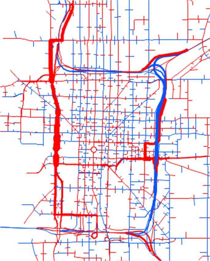
CONTENTS
1   INTRODUCTION.............................................................................................................. 1-1
    1.1 Purpose of the Mobility Management Plan .............................................................................1-1
    1.2 Project Overview .....................................................................................................................1-1
    1.3 Federal Environmental Review Process .................................................................................1-4
    1.4 Existing Roadway Network .....................................................................................................1-4
          1.4.1 Downtown Interstate System ...................................................................................................... 1-4
          1.4.2 Downtown Arterial System.......................................................................................................... 1-5
    1.5 Planned Road Closures and Restrictions ...............................................................................1-5
    1.6 Mobility Management Plan Objectives ....................................................................................1-8
    1.7 Report Organization ................................................................................................................1-8

2   SYSTEM TRAFFIC OPERATIONS DURING CONSTRUCTION ..................................... 2-1
    2.1 Diversion of Through Trips to I-465.........................................................................................2-2
    2.2 Downtown Traffic Operations ..................................................................................................2-6
    2.3 Anticipated Level of Disruption to Traffic Operations ..............................................................2-8

3   TRAFFIC OPERATIONS MANAGEMENT ...................................................................... 3-1
    3.1 Contractor’s Traffic Management Plan (TMP) .........................................................................3-1
    3.2 Traffic Network Changes.........................................................................................................3-1
          3.2.1 Interstates and Interchanges ...................................................................................................... 3-1
          3.2.2 Local Street Network Improvements .......................................................................................... 3-3
    3.3 Traffic Management and Intelligent Transportation Systems (ITS) .........................................3-5
    3.4 Incident Management and Response .....................................................................................3-6

4   TRAVEL DEMAND MANAGEMENT ............................................................................... 4-1
    4.1 Mode Shift and Ridesharing ....................................................................................................4-1
          4.1.1 Transit ......................................................................................................................................... 4-1
          4.1.2 Carpools/Vanpools ..................................................................................................................... 4-4
          4.1.3 Non-Motorized Travel ................................................................................................................. 4-5
    4.2 Work Rescheduling and Work Trip Reduction ........................................................................4-7
          4.2.1 Work Rescheduling..................................................................................................................... 4-7
          4.2.2 Work from Home Programs ........................................................................................................ 4-8
    4.3 Special Event Planning ...........................................................................................................4-9

Mobility Management Plan                                                       i                                                                    11/20/2020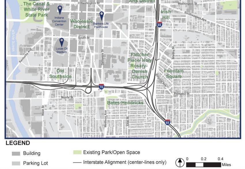
5 COMMUNICATIONS AND PUBLIC OUTREACH ........................................................... 5-1
5.1 North Split Public Involvement Plan ........................................................................................5-1
5.2 Communication Tools .............................................................................................................5-1
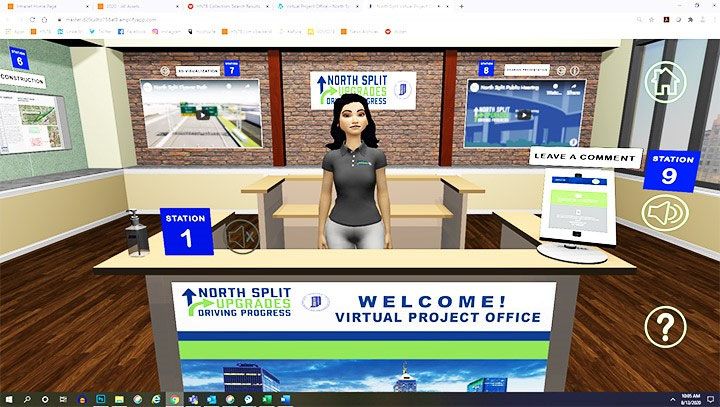
5.2.1 Project Website ........................................................................................................................... 5-2
5.2.2 Virtual Project Office ................................................................................................................... 5-2
5.2.3 Social Media ............................................................................................................................... 5-3
5.2.4 E-Newsletters and SMS Text Messaging ................................................................................... 5-3
5.2.5 Paid Media Communications ...................................................................................................... 5-3
5.3 Advance Closure Notifications ................................................................................................5-4
5.4 Real-Time Traveler Information ..............................................................................................5-5
5.5 Mobility Management Education Program ..............................................................................5-7
5.5.1 Transit and TDM Promotion........................................................................................................ 5-7
5.5.2 Communication Tools ................................................................................................................. 5-7
6 MOBILITY MANAGEMENT PLAN IMPLEMENTATION ................................................. 6-1
6.1 Summary of Mobility Management Plan Components ............................................................6-1
6.2 Mobility Management Plan Toolbox ........................................................................................6-1
Mobility Management Plan ii 11/20/2020
FIGURES
Figure 1-1: Indianapolis Downtown Interstate System...........................................................................1-3
Figure 1-2: Interstate Access during Construction .................................................................................1-6
Figure 2-1: Estimated I-465 Traffic Changes during Construction .........................................................2-3
Figure 2-2: Official North Split Detour Routes........................................................................................2-5
Figure 2-3: Estimated Downtown Traffic Changes during Construction ................................................2-7
Figure 2-4: Detour Signs for I-65 Approaching from the North ..............................................................2-8
Figure 3-1: Washington Street Interchange Adjustments ......................................................................3-2
Figure 3-2: Widened West Street Ramps ..............................................................................................3-2
Figure 4-1: Dedicated BRT Lane ...........................................................................................................4-2
Figure 4-2: Commuter Connect Van ......................................................................................................4-4
Figure 4-3: Emergency Ride Home Brochure ........................................................................................4-5
Figure 4-4: Monon Trail Construction Detour.........................................................................................4-6
Figure 5-1: Virtual Project Office ............................................................................................................5-2
Figure 5-2. INDOT Mobile Smartphone App ..........................................................................................5-6

TABLES
Table 1-1: Maximum Closure Durations ................................................................................................1-7
Table 4-1: IndyGo Routes that will be Impacted by Bridge Construction...............................................4-3
Table 4-2: Improved Bicycle/Pedestrian Widths at Bridges ...................................................................4-7
Table 4-3: Major Local Event Days ........................................................................................................4-9
Table 5-1: Movement Closure Notification Periods................................................................................5-5
Table 6-1: North Split MMP Component Matrix .....................................................................................6-2

Mobility Management Plan                                                iii                                                        11/20/2020
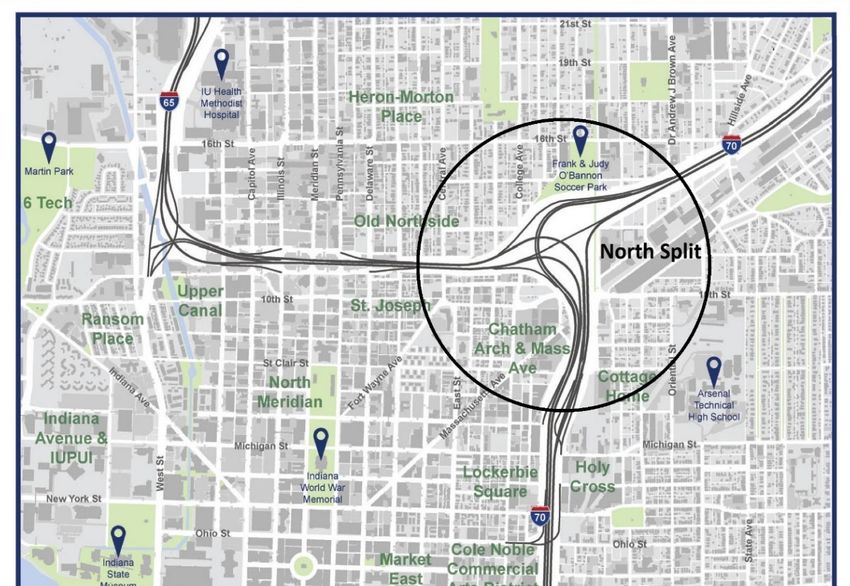
1      INTRODUCTION

1.1    Purpose of the Mobility Management Plan
As described in Chapter 503 “Maintenance of Traffic” of the Indiana Department of Transportation
(INDOT) Indiana Design Manual (IDM), all INDOT projects require a Transportation Management Plan
(TMP) and a Temporary Traffic Control Plan (TTCP). For projects that have significant impacts to the
public, such as the North Split Interchange Rehabilitation Project (“North Split Project”), the TMP
includes a Transportation Operations Plan (TOP) and a Public Information Plan (PIP).
INDOT is using a Design-Build Best-Value procurement to deliver the North Split Project. The Design-
Build Contractor has primary responsibility for development of the TMP and TTCP, with INDOT’s
oversight and approval. The Design-Build Contractor will develop and manage all construction phasing,
traffic operations planning, and incident management activities within the work zone, and will
incorporate other related components into the TMP.
As described in IDM Section 503-4.0, the TOP is to include “strategies for the operations and
management of the work zone and all facilities affected by the work zone…for projects determined to
have significant work zone impacts.” The Mobility Management Plan (MMP) is that part of the TOP
focusing on strategies for mitigating traffic congestion in the network outside the work zone.
IDM Section 503-4.0 notes the strategies can serve transit, rail, air, and pedestrians in addition to
roadway users. The MMP includes these strategies as well as actions to reduce the number of trips
utilizing the transportation network and shift the timing of these trips to periods when the system is less
congested.
This document presents the background and baseline strategies of the North Split MMP. The strategies
are expected to evolve as the project is implemented in order to meet changing needs, conditions, and
opportunities. INDOT will prepare and execute the MMP, as well as the PIP, with support of the North
Split Project Team throughout the life of the project.
One important source of changing conditions that will require monitoring and adjustment of the MMP is
the uncertain impact of the ongoing COVID-19 pandemic on long term travel demand and traffic
congestion. Congestion mitigation needs and strategies discussed in this plan are based on historic
“typical” traffic patterns observed before the COVID-19 outbreak began. In March 2020, there was a
sudden and significant reduction in work commuting and corresponding increase in employees working
from home. While traffic volumes are now trending upward again, it is unknown when volumes on
downtown freeways might approach typical historic levels.

1.2    Project Overview
INDOT is developing a project involving the I-65/I-70 North Junction interchange (North Split) in
Indianapolis, Indiana, in partnership with the Federal Highway Administration (FHWA). I-65 and I-70 are
nationally significant corridors serving the Midwest and United States in four directions. The objective of
this project is to meet the transportation needs at the North Split with a safe, well-functioning facility.
The North Split interchange is the most-heavily traveled interchange in Central Indiana, accommodating
more than 214,000 vehicles per day. Studies have shown that most traffic on downtown Indianapolis
interstates is local. They also have shown I-70 from the east (between I-65 and I-465) has the highest

Mobility Management Plan                           1-1                                          11/20/2020
peak-hour volumes in the state. On both I-65 and I-70, twice as much traffic is headed toward
downtown as away from downtown in the mornings, indicating a heavy commuter pattern.
I-65 and I-70 are unofficially known as the “inner loop” where they pass through downtown Indianapolis
(see Figure 1-1). The inner loop is approximately 4-1/2 miles long and provides 25 entrance and exit
ramps serving all sections of downtown. The downtown interstates were constructed in the late 1960s
and early 1970s, with the last section opening to traffic in October 1976.
Based on the condition of existing infrastructure, INDOT determined the North Split requires repair, and
the construction effort needed for this repair creates an opportunity to improve the safety and
operations of the interchange. The need for repairs in and near the North Split interchange is based on
the deteriorated condition of bridges and pavement. Bridges located in or near the interchange require
rehabilitation or replacement due to their structural condition. The pavement also requires rehabilitation
or replacement.
In addition to its poor physical condition, the interchange configuration is inefficient and poorly suited for
the volumes of traffic it is serving. Reconstructing the infrastructure to correct physical deficiencies
provides an opportunity to improve safety and reduce congestion by realigning ramps and merges in
the interchange area and correcting and eliminating existing weaving problems.

Mobility Management Plan                             1-2                                           11/20/2020
Figure 1-1: Indianapolis Downtown Interstate System

Mobility Management Plan                     1-3      11/20/2020
1.3     Federal Environmental Review Process
The National Environmental Policy Act of 1969 (NEPA) requires Federal agencies to prepare an
environmental analysis for projects that may significantly affect the environment. The North Split Project
study area boundary identified in the NEPA documentation extends south along I-65/I-70 to the
Washington Street interchange, east along I-70 to the bridge over Valley Avenue, and west along I-65
to the bridge over Alabama Street. The study area extends further west along 11th and 12th Streets to
Illinois Street.
FHWA determined an Environmental Assessment (EA) to be the appropriate level of analysis for this
project. The purpose of an EA is to determine if a project will have significant impacts on the
environment. If not, a Finding of No Significant Impact (FONSI) is issued by FHWA, which marks the
end of the NEPA process and documents the decision. If significant impacts are identified during the
EA process, additional studies or an Environmental Impact Statement (EIS) may be required.
An EA describes why the transportation project is needed, the alternatives that were studied, and their
potential impacts. It also provides opportunities for public and agency comments. Environmental
impacts play an important role – alongside other considerations such as performance and cost – in
decisions made about a project. The EA for the North Split Project was made available for the public to
review and a public hearing was held on August 3, 2020. The project sponsor (INDOT) is required to
consider all the comments received during this process before making final decisions about the project.
The EA was approved in July 2020, and FHWA then issued a FONSI for the North Split Project in
September 2020.

1.4     Existing Roadway Network
Access to and through downtown Indianapolis is provided by a system of interstate highways and
arterial streets. These major roadways link with collector and local streets to provide access to
individual properties. From a system perspective, the operations of interstates and arterials are tied
together. The characteristics of both components of the existing roadway network are described below.

1.4.1    Downtown Interstate System
Although the interstate system in downtown Indianapolis is often referred to as the “inner loop,” it is
actually in the shape of a backward C, as shown in Figure 1-1. I-65 forms the north leg, I-70 forms the
south leg, and I-65 and I-70 share the east leg on a common alignment. Connections between I-65 and
I-70 are provided at the “corners” of the inner loop via “system interchanges,” and access to the
downtown street system is provided from the legs via “service interchanges.” The North Split is one of
two system interchanges downtown. The second is the referred to as the South Split.
With the exception of a segment of I-65/I-70 on the east leg of the inner loop, all interstates downtown
are elevated above the local street system. Major streets pass under the north and south legs, allowing
the arterial street system to operate independently of the interstates to serve traffic entering and leaving
downtown on local streets.
A total of 25 entrance and exit ramps are provided downtown at the service interchanges. As a general
rule, there are roughly two exit ramps and two entrance ramps in each direction on each leg, with
variations on the east and south legs. The entrance and exit ramps often connect with high capacity
one-way pair arterials for distribution of traffic downtown. A “collector-distributor” or C-D roadway is

Mobility Management Plan                            1-4                                          11/20/2020
provided on the east leg. This lower speed roadway operates in the southbound direction only, with
closely spaced ramps or intersections with four local roadways.

1.4.2    Downtown Arterial System
The downtown arterial system is a grid network with a diagonal street in each quadrant. The center of
the grid is Monument Circle, serving Meridian Street north-south and Market Street east-west. Higher
capacity one-way pairs are located parallel and on each side of these streets. The Capital
Avenue/Illinois Street and Pennsylvania Street/Delaware Street one-way pairs parallel Meridian Street,
and the Washington Street/Maryland Street and Michigan Street/New York Street one-way pairs
parallel Market Street. Most of these one-way streets connect directly with interstate ramps.
In addition to the one-way pairs, West Street plays a major role in serving traffic needs downtown. West
Street is a six-lane divided arterial north of Maryland Street to the West Street/MLK interchange at I-65.
South of Maryland Street, it splits into the West Street/Missouri Street one-way pair to an interchange
with I-70. In terms of the downtown street grid, West Street serves as the “west leg” of the inner loop.
The six-lane segment north of Maryland Street is the most heavily travelled arterial roadway in the
region, serving about 55,000 vehicles per day.

1.5     Planned Road Closures and Restrictions
The sequence and timeframe of construction is defined in the maintenance of traffic (MOT) plan for the
project. The MOT plan establishes what roadways and/or travel lanes will be open and closed to traffic
at each stage of the work. The Design-Build Contractor is responsible for developing and implementing
the MOT plan for this project. The agreement between INDOT and the Design-Build Contractor
identifies baseline constraints for the MOT plan, such as which major movements may be closed at any
one time, hours of the day that closures are allowed, and the maximum amount of time these
movements may be closed. The Design-Build Contractor is penalized for violating these restrictions.
Interstate access during construction is illustrated in a series of four maps in Figure 1-2. Descriptions of
the information represented in each map are provided below.

Mobility Management Plan                            1-5                                          11/20/2020
Figure 1-2: Interstate Access during Construction

    1. Close I-65/I-70, North Split to Washington St     2. All exits & entrances open outside project area

    3. I-65 to I-70 open each way across interchange         4. One ramp open to and from I-70 at all times

Mobility Management Plan                               1-6                                                    11/20/2020
1. I-65/I-70 Closure. All mainline lanes of I-65 and I-70 between the North Split interchange and
Washington Street will be closed for up to two construction seasons. Ramps to and from the
south on Washington Street will remain open at all times. Through traffic on I-65 will be
detoured to I-70 and I-465 on the west side of Indianapolis. Through traffic on I-70 will be
detoured to I-465 on the south and east sides of Indianapolis.
2. Ramps outside the Project Area. All downtown entrance and exit ramps outside the project area
will be open, except for closures of the Fletcher Avenue entrance ramp to I-65/I-70 (up to 560
days) and the Fletcher Avenue exit ramp from the I-65/I-70 collector (up to 520 days).
3. I-65 to I-70 Link. The I-65 to I-70 link across the north part of the North Split will be open to
traffic in each direction, except for a one-day closure of the I-65 southbound to I-70 eastbound
movement for bridge construction.
4. Ramp Connections to I-70E. The Pine Street entrance ramp to eastbound I-70 will be open at all
times. A westbound I-70 exit ramp will serve either Michigan Street or Ohio Street (or both) at all
times via the collector-distributor road.
In addition to the restrictions noted above for interstates, most local arterials that cross under the
interstates will require closure at some point for bridge reconstruction. In no case, however, will the
contractor be allowed to close two adjacent roadways at the same time.
The maximum allowable closure times for traffic movements within the project limits are specified in
Table 1-1. Shorter closure durations may be possible, depending on the final MOT plan implemented
by the Design-Build Contractor.
Table 1-1: Maximum Closure Durations
Roadway Segment Allowable Closure
I-65 Mainline (NB to WB and EB to SB through interchange) 520 days
I-70 Mainline (NB to EB and WB to SB through interchange) 430 days
I-65 SB to I-70 EB (Bridge) 1 day
12th Street/Pennsylvania Street exit from I-65 NB 120 days
11th Street/Delaware Street entrance to I-65 SB 60 days
Ohio St exit from I-70 collector * 260 days
Michigan St exit from I-70 collector* 260 days
Pine Street entrance to I-65 NB 560 days
Pine Street entrance to I-70 EB Not allowed
Washington Street and Pennsylvania Street under interstate Not allowed
Delaware Street under interstate 45 days
All other street and railroad crossings under interstate within
90 days
project limits (no simultaneous adjacent street closures allowed)
Mobility Management Plan 1-7 11/20/2020*Exits to Ohio Street and Michigan Street are not allowed to be closed at the same time
1.6 Mobility Management Plan Objectives
The goals of the MMP are to minimize traffic disruption due to North Split Project construction and
maintain the social, economic, and cultural vitality of the central downtown area of Indianapolis. This
will be accomplished by a combination of actions designed to increase the efficiency of alternate routes,
reduce peak-hour travel demand, and communicate effectively with users so they make smart choices
about routes of travel, time of travel, and whether they should travel at all.
To meet the MMP goals, the strategies presented in this plan focus on three fundamental objectives:
Optimize traffic operations on the available transportation network;
Reduce overall roadway network demand; and
Provide enhanced motorist information.
These objectives relate to the supply of transportation system capacity, the travel demand placed on
the system, and the information transportation system users need to make smart travel decisions.
1.7 Report Organization
This Mobility Management Plan (MMP) focuses on the development of strategies to meet the goals of
minimizing traffic disruption and maintaining the vitality of the region while the North Split Project is
being constructed. The process begins with a review of anticipated system traffic operations during
construction in Chapter 2. Issues and strategies related to the three mobility management objectives
are described in the next three chapters. Chapter 3 addresses traffic operations management, Chapter
4 addresses transportation demand management, and Chapter 5 describes communications and
public outreach activities. Overall MMP implementation strategies are described in Chapter 6.
Mobility Management Plan 1-8 11/20/20202 SYSTEM TRAFFIC OPERATIONS DURING CONSTRUCTION
During North Split Project construction, downtown access will be available at all interstate ramps
outside the project area. Movements between I-65 and I-70 on the north side of the interchange will be
available in each direction, and ramp connections will be available to and from I-70 east of downtown.
The primary impacts to downtown traffic flow will result from the movements that will not be available
due to the following closures:
Eastbound I-70 will be closed at Washington Street for two construction seasons.
Westbound I-70 will be closed at the North Split interchange for two construction seasons.
Northbound I-65 will be closed at Washington Street for two construction seasons.
Southbound I-65 will be closed at the North Split interchange for two construction seasons.
The Michigan Street and Ohio Street ramps (alternatively) will each be closed up to one full
construction season.
The Pennsylvania Street exit ramp will be closed up to 60 days, and the Delaware Street
entrance ramp will be closed up to 120 days.
Most arterial streets crossings under the interstate in the project area will be closed up to 90
days.
The Monon Trail crossing under the interstate will be closed for the duration of construction.
Drawing from the results of high-level traffic simulation modeling, this section reviews the anticipated
impacts of the above construction restrictions on traffic operations in and near the downtown area.
However, the analysis supporting this review of anticipated project traffic impacts did not consider the
unprecedented global effect that the COVID-19 outbreak of 2020 has had on personal travel. According
to the US Department of Transportation,1 daily trips in Indiana were approximately 23 percent lower in
mid-September 2020 than during the same time period in 2019, while the number of people staying
home each day was approximately 26% higher. Although travel is expected to increase over time, as
COVID-19 impacts ease, it is uncertain how quickly this will occur or whether traffic demand will ever
return to pre-pandemic levels. It is therefore possible that congestion caused by North Split
construction will be less severe than anticipated in this analysis.
The Indianapolis Metropolitan Planning Organization (IMPO) nine-county TransCAD model was used
as the base for traffic modeling efforts. To support the review of traffic impacts on the local roadway
network, a detailed TransModeler traffic simulation model was developed for an approximately 6-mile
by 6-mile subarea roughly bordered by 38th Street to the north, Emerson Avenue to the east, Raymond
Street to the south, and White River to the west. The dynamics of how network components interact in
serving total travel demand can be quite complex, particularly when a mix of interstate highways and
local roads are considered. The nine-county IMPO model was used to review large-scale system
changes related to diversion of interstate traffic away from downtown to I-465 and other regional
facilities, while the more detailed microsimulation model was used to capture construction effects on
traffic continuing to use the downtown system.
1
US Department of Transportation, Bureau of Transportation Statistics, Changes in Mobility by State. Available online at
https://www.bts.gov/content/changes-mobility-state.
Mobility Management Plan 2-1 11/20/2020This traffic review focuses on peak period operations that occur every weekday, generally between 6:00 am and 9:00 am and between 3:00 pm and 6:00 pm. This approach is reasonable since the weekday peak period conditions are frequent, repetitive, and are the conditions for which urban roads are typically designed. To the extent peak period conditions are addressed, operations during other periods of the day and night are typically acceptable. 2.1 Diversion of Through Trips to I-465 Although most of the traffic impacts during North Split construction will occur downtown, traffic levels on I-465 will also be affected. Figure 2-1 shows an estimate of traffic changes on I-465 with I-65 and I-70 closed at the North Split. The greatest impact will be on the segments of I-465 that provide the most logical alternate routes for through traffic on I-70 or I-65. Mobility Management Plan 2-2 11/20/2020
Figure 2-1: Estimated I-465 Traffic Changes during Construction

                                               AM         +200 (1%)
                                               PM         +600 (2%)
                                               Daily     +1,900 (1%)

       AM         +400 (2%)
       PM         +800 (3%)
       Daily     +3,100 (3%)

                                       KEY:
                                       Traffic Increase
                                       Traffic Decrease

                                                                                    AM         +100 (0%)
                                                                                    PM         -200 (-1%)
                                                                                    Daily      -300 (0%)

       AM     +2,800 (8%)
       PM     +3,600 (11%)
       Daily +22,800 (17%)

                                                                                    AM     +1,000 (4%)
                                                                                    PM     +1,200 (4%)
                                                                                    Daily +12,300 (10%)

                           AM     +2,100 (8%)
                           PM     +2,100 (8%)
                           Daily +25,400 (24%)

       Note: AM peak = 6:00 – 9:00 am, PM peak = 3:00 – 6:00 pm, Daily = 24 hours
       Source: Indianapolis Metropolitan Planning Organization 2020 Regional Travel Demand Model

Mobility Management Plan                                2-3                                            11/20/2020
The most apparent impacts of closing I-65 and I-70 downtown are for through trips. Signs will be posted
on all interstate highways approaching Indianapolis to inform motorists of the closure and directing
them to bypass the construction using alternate routes along I-70 and the I-465 beltway for all or part of
their trip through Indianapolis. The degree of likely diversion to I-465 was reviewed in the “System-
Level Analysis of Downtown Interstates2,” completed in 2018. That study found fewer than 10% of
interstate trips downtown during peak periods are through trips, beginning and ending outside I-465.
These estimates do not imply that 90% of peak period traffic is destined to downtown. Many trips pass
through downtown to destinations inside I-465. These are not “through” trips because they do not begin
and end outside I-465. They are not likely to be able to use I-465 as an alternate route and most will
contribute to increases on arterial streets in or near downtown during North Split construction.
The logical diversion route for through trips on I-65 is to use the I-465 beltway around the south and
west sides of Indianapolis instead of traveling through downtown and the North Split interchange. The
logical diversion route for through trips on I-70 is to use the I-465 around the south and east sides of
Indianapolis instead of traveling through downtown. However, the southern segment of I-465 already
experiences congested conditions during daily peak travel periods, which could be exacerbated by
adding diverted through trips from both I-65 and I-70. Because of this, I-65 through trips will continue to
use I-65 south of downtown and will be directed to use I-70 and I-465 west of downtown to connect with
I-65 northwest of downtown. I-70 through trips will be directed to follow I-465 around the south and east
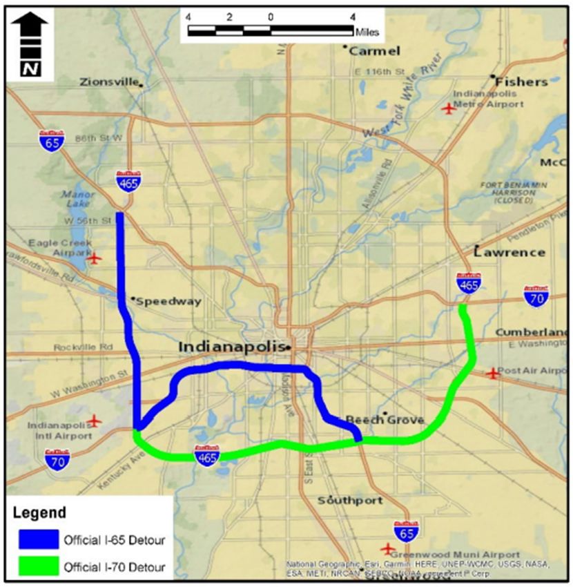
sides of Indianapolis. These official North Split detour routes are shown in Figure 2-2. The impact of
these diverted through trips indicates INDOT should optimize traffic flow on the impacted segments of I-
465 and I-70 through effective use of monitoring and surveillance technology, enhanced incident
response, and deferred maintenance and construction where feasible.
2
System-Level Analysis of Downtown Interstates, INDOT, May 2018.
Mobility Management Plan 2-4 11/20/2020Figure 2-2: Official North Split Detour Routes Mobility Management Plan 2-5 11/20/2020
2.2 Downtown Traffic Operations
Most of the traffic impacts from North Split construction will occur on arterial streets approaching and
passing through the downtown area. Traffic levels will increase on downtown streets for a number of
reasons, including the following:
Many motorists accessing downtown on interstates will have to exit “early” to finish their trips on
local streets. Examples are IU Health employees living on the south side, or Eli Lilly employees
living in Hamilton County or on the north side of Indianapolis.
Motorists beginning a long interstate trip on the opposite side of downtown will have to use
arterial streets to access an interstate entrance ramp, forcing them to drive through or around
downtown.
If an interstate no longer serves a motorist’s destination, they are more likely to divert to an
alternate arterial route before entering the downtown area, resulting in additional neighborhood
traffic.
With fewer entrance and exit ramps available, those that remain open, such as at Washington
Street and at West Street, are likely to be congested. This will cause diversion to parallel
arterials.
Closure of downtown arterials to reconstruct interstate overpasses will force diversion to
alternate routes, increasing the congestion and delay on parallel arterial streets.
The last bullet illustrates the challenge of modeling traffic impacts of North Split construction closures. It
is not a matter of identifying a single closure condition and developing a traffic simulation. In practice, it
will be an ever-changing dynamic depending on which arterial streets are available at any point in time
and which are closed. Recognizing this limitation, it is still useful to get an order of magnitude
perspective of how much the arterial system might be impacted. Figure 2-3 illustrates traffic pattern
changes with closures described
Mobility Management Plan 2-6 11/20/2020Figure 2-3: Estimated Downtown Traffic Changes during Construction
AM PEAK PERIOD PM PEAK PERIOD
KEY: KEY:
Traffic Increase Traffic Increase
Traffic Decrease Traffic Decrease
.
Mobility Management Plan 2-7 10/12/20in Section 1.5. Segments with an increase in traffic are shown in red; segments with a decrease are shown in blue. The width of the lines indicates the level of traffic volume change. Information is shown for the AM and PM peak hours. As indicated in Figure 2-3, the greatest increase in arterial traffic demand due to construction closures will be on West Street during both the morning and evening peak periods. This is not surprising since West Street provides a direct link between I-65 and I-70, parallel with the segment of I-65/I-70 being closed. As a six-lane divided arterial, it also provides the highest capacity of any downtown street. Other downtown streets showing a significant increase in traffic volumes in Figure 2-3 connect to available interstate ramps, including Washington Street, the Pennsylvania/Delaware Street one-way pair on the north side of downtown, and the Capital/Illinois Street one-way pair on the south side of downtown. Outside of downtown, most major streets approaching downtown from the north and east show an increase in traffic volume compared to existing. The most notable increases are on Fall Creek Parkway and Washington Street. Many other downtown streets show smaller increases in traffic volumes in Figure 2-3. These increases will become more pronounced as traffic shifts to parallel routes when interstate overpasses are reconstructed during the North Split Project. Since these patterns will be frequently changing, it will be especially important to implement mobility management actions to optimize the existing system, reduce demand where feasible, and keep motorists informed so they can make the best decisions based on real-time information. 2.3 Anticipated Level of Disruption to Traffic Operations The reconstruction of the North Figure 2-4: Detour Signs for I-65 Approaching from the North Split will cause major disruption to traffic operations in and near the downtown area and will also exacerbate some of the existing regionally challenged traffic operations locations during peak periods. The preceding sections focus on anticipated traffic operations impacts to the interstate (Section 2.1) and the downtown local roadway network (Section 2.2) during North Split reconstruction. The interstate system will be directly affected (see Figure 2-4), but the interstates and local roadway network work together to serve the public’s traffic needs. All system components will be affected by North Split construction. Mobility Management Plan 2-8 10/12/20
As various segments of the North Split are closed during construction, additional traffic demand will be
placed on:
1. The interchanges adjacent to the North Split that will remain open,
2. I-465 which has its own traffic operations challenges during peak periods, and
3. The local roadway network with its existing constraints.
It is important to note the traffic modeling performed to assess conditions during reconstruction of the
North Split does not incorporate any of the potential mitigation measures discussed in Sections 3, 4,
and 5 of this report and also assumes traffic demand at pre-COVID conditions. It is intended to
represent a worst-case scenario, and the goal of this MMP is to identify practical and effective
mitigation measures, as well as the strategy for implementing them, to minimize the area-wide increase
in delay and congestion resulting from the reconstruction of the North Split.
Even with the lower traffic volumes on the downtown interstates during construction, without the
mitigation measures identified in Sections 3, 4, and 5 of this report, traffic modeling predicts that
significant queuing of approximately 5 to 6 miles would occur on all of the I-65 and I-70 approaches to
the North Split each weekday morning, as motorists exit at the adjacent interchanges to the North Split
or work their way through non-closed segments of the North Split. This potential queuing of 5 to 6 miles
would result in extensive delay, with stop and go operation on the following segments:
Northbound I-65: Keystone Avenue to I-465
Southbound I-65: 38th Street
Eastbound I-70: Harding Street to Holt Road
Westbound I-70: Shadeland Avenue to I-465
The interchanges adjacent to the North Split have limited capacity to handle the additional diverted
traffic, such that mainline interstate queuing will build from these interchange locations. Queuing is not
anticipated for the interstates leaving the downtown area. The bottleneck for those interstates will be
the entrance ramps from the local roadway system.
The local roadway network will experience increased traffic volumes during construction, as well as
additional traffic operations challenges at the interchanges adjacent to the North Split. Without
implementation of mitigation measures, traffic modeling predicts significant queuing on the local
roadway network in and near the downtown area. Sitting through multiple traffic signal cycles before
travelling through a signalized intersection is anticipated for many locations, especially those near an
entrance to, or exit from, interchanges adjacent to the North Split.
The mitigation measures discussed in Sections 3, 4, and 5 of this report are critical for minimizing the
unavoidable disruption caused by the North Split construction. Some measures focus on infrastructure
improvements, such as 1) geometric or lane assignment improvements at the critical interchanges
adjacent to the North Split and 2) improved traffic signal performance and efficiency throughout the
local roadway network in and near the downtown area. Other mitigation measures focus on peak
period travel demand reduction and more efficient travel through opportunities such as transit and ride-
share initiatives. Traffic patterns and volumes will be monitored throughout construction to assess the
effectiveness of mitigation measures and whether conditions warrant revising mitigation measures or
adding new mitigation measures. The goal of the MMP is to make the disruption during the
reconstruction of the North Split manageable. It will not be possible to eliminate it completely.
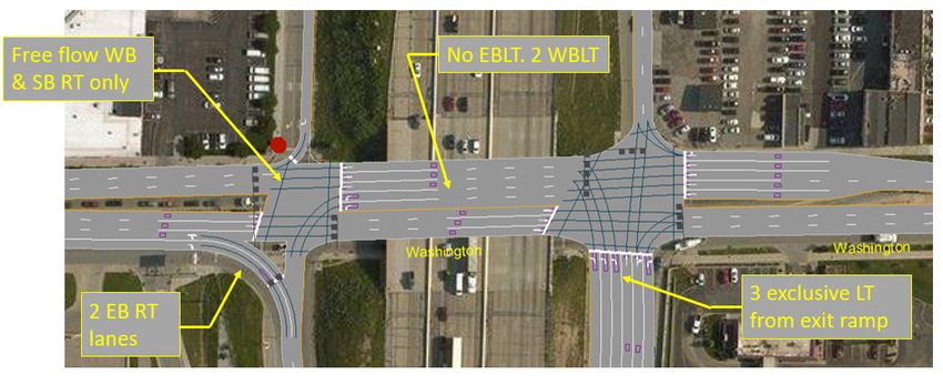
Mobility Management Plan 2-9 10/12/203 TRAFFIC OPERATIONS MANAGEMENT Traffic operations management begins in the construction zone and extends throughout the local street network and the interstate highway system. Some changes have been or are being made to increase capacity at key locations. Other traffic operations management actions are more dynamic, to respond to evolving system conditions as the work is underway. Effective incident management will be important throughout the construction period to ensure the system is functioning at its full potential. All these topics are explored in this section. 3.1 Contractor’s Traffic Management Plan (TMP) As described in Section 1.1, the Design-Build Contractor is required to develop a Traffic Management Plan (TMP) in accordance with the requirements defined in Chapter 503 of the Indiana Design Manual. This plan will support the maintenance of traffic plan to meet construction objectives, provide a safe environment for workers, and minimize adverse traffic impacts in the work zone. Proposed mitigation measures in the TMP will include traffic incident management plans, planned special events, Intelligent Traffic System (ITS) components, maintenance or enhancement of other modes of transportation, emergency service provider access and communication, work zone law enforcement, and related strategies. The TMP will identify the Design-Build Contractor’s proposed methodology for monitoring and measuring mobility during the active work zone phase. Lane restriction information will be transmitted by the INDOT traffic management center to dynamic message signs on approaching interstates to notify motorists of the work well in advance of the closure. Other components of the TMP will include the closure strategy as part of the MOT plan and support of INDOT public involvement and communications activities. Major elements of the project MOT plan are described in Section 1.5 and INDOT’s planned programs for communications and public outreach are described in Section 5. 3.2 Traffic Network Changes A review was conducted of network operations to identify existing and anticipated sources of traffic delay that might be improved prior to initiation of North Split construction. Removing or improving these bottlenecks and restrictions will make the whole system operate more effectively. These opportunities are described below, for the interstate system and for the local street network. 3.2.1 Interstates and Interchanges Adjustments to the configuration of two adjacent interchanges will improve traffic operations during North Split construction. The Washington Street interchange will be the ending point for I-65/I-70 coming from the south. All interstate traffic will enter or exit at this location. Changes will be made as part of the North Split Project to improve the flow of the interchange so it will function more effectively as a terminus. The changes at the Washington street interchange are shown in Figure 3-1. They will provide an additional lane on the approach to Washington Street from the northbound exit ramp, provide an additional turn lane on Washington Street at the southbound entrance ramp, and adjust the approach Mobility Management Plan 3-1 10/12/20
lanes to provide free flow for westbound Washington street traffic after passing under the bridge by
temporarily removing the traffic signal from service.

Figure 3-1: Washington Street Interchange Adjustments

A second key interchange location during North Figure 3-2: Widened West Street Ramps
Split Project construction will be the interchange of
I-65 with West Street/Dr. Martin Luther King Jr.
(MLK) Street. This interchange is outside the North
Split Project area, but it will serve as a key southern
junction point for southbound I-65 and will continue
to serve as an access point for I-70 to and from the
east. The important role of West Street in the overall
traffic operations of the downtown Indianapolis
arterial street network is described in Section 2.2.
Potential improvements to the interchange at I-65
and West Street/MLK Street were analyzed by
INDOT in a separate study.3 Among the changes
recommended in that study were added lanes on
the southbound exit ramp from I-65 and at the
easternmost entrance ramp to the interchange from
11th Street. INDOT expedited these changes since
they could be constructed in existing right-of-way,
would provide immediate benefits to motorists, and
would be supportive of other projects downtown,
including the North Split Project.

3
    Indiana Statewide Interchange Study, INDOT, October 30, 2019

Mobility Management Plan                                    3-2                             10/12/20
These changes to the West Street/MLK Street interchange are scheduled to be completed prior to most
of the construction work on the North Split interchange – in the spring of 2021 or before. As shown in
Figure 3-2, the current project includes the following items of work:
Modify the southbound I-65 exit ramp to West Street to allow traffic to exit from two lanes.
Modify the southbound I-65 entrance ramp from West Street so that vehicles traveling in the
center lane of West Street as they cross 11th Street will be able to enter either northbound I-65
or southbound I-65.
3.2.2 Local Street Network Improvements
INDOT has recently installed cellular telephone modems at over 120 traffic signals that it operates on
state roads and at freeway ramps within Marion County. These modems will allow INDOT to improve
traffic signal synchronization and better monitor signal operations from its traffic management center on
the east side of Indianapolis.
In 2019, INDOT also began working with the Indianapolis Department of Public Works to improve traffic
flow on the local city street system as part of INDOT’s Advanced Maintenance of Traffic (Advanced
MOT) program. The purpose of the Advanced MOT program is to make traffic engineering and spot
improvements on major local arterials throughout the area in support of INDOT’s regional program.
Many of these improvements will enhance traffic operations in and near the downtown area or on local
routes used to access downtown. The planned improvements are described below:
Advanced MOT Signals Project (INDOT Contract T-42659)
Construction of this project commenced in August 2020 and is scheduled to be complete in the spring
of 2021. The project includes the following upgrades at approximately 500 traffic signals within Marion
County:
Repair or replace malfunctioning vehicle detection and pedestrian actuation equipment.
Install GPS time synchronization equipment at approximately 280 signals.
Install cellular modems for time synchronization and monitoring of 208 signals along the
following arterial routes:
o East Washington Street;
o East New York Street;
o East Michigan Street;
o West Washington Street;
o Raymond Street;
o Kentucky Avenue;
o Madison Avenue;
o Bluff Road;
o Harding Street;
o 16th Street / Crawfordsville Road;
o North Meridian Street;
Mobility Management Plan 3-3 10/12/20o Fall Creek Parkway /Binford Boulevard; and
o North Keystone Avenue.
Install traffic monitoring cameras at 17 arterial intersections.
Replace traffic signal controllers and cabinets as needed.
The GPS time synchronization equipment and cellular modems will allow traffic signals to be better
synchronized and monitored. The entire system will operate more efficiently than it does today, with
coordination maintained at all times in the downtown grid and in major corridors leading to downtown.
Traffic signal systems and traffic cameras will be monitored at INDOT’s traffic management center.
Advanced MOT Spot Improvements Project (INDOT Contract T-42856)
This project was let for construction in August 2020, with construction to be completed in the spring of
2021. This project includes the following spot improvements:
Pennsylvania Street at Ohio Street - Restripe the southbound right lane from bus only to mixed
flow right turn lane due to bus route changes.
Raymond Street at Kentucky Avenue - Install left turn signals on Raymond Street.
Raymond Street at Southeastern Avenue - Alter median curb on Southeastern Avenue to
reduce queue blockage of through lanes.
Southport Road at Bluff Road - Provide railroad preemption of existing traffic signal to safely
accommodate increased traffic.
County Line Road at Railroad Road - Install warranted traffic signal with preemption for adjacent
railroad grade crossing.
Washington Street at New Jersey Street - Repair damaged conduit and side street detection.
Washington Street at East Street - Install pedestrian actuation for crossing the east leg of
Washington Street.
Fall Creek Parkway - Restore lane control system between 30th Street and College Avenue to
increase corridor capacity.
I-70 at Harding Street - Reassign northbound through lane as a second left turn lane at both
ramp terminal intersections.
I-65 at Keystone Avenue - Add a second left turn lane to the northbound exit ramp.
Washington Street at Southeastern Avenue - Remove center curb island to allow an added
westbound lane through the intersection and prohibit left turns from Washington Street.
Illinois Street at 12th Street/I-65 entrance – Modify the northbound left turn signal to provide
better operation for vehicles entering I-65.
Many of the spot improvements are located outside the downtown area. However, all the improvements
will benefit overall traffic flow in the region. The Fall Creek Parkway project and the Washington
Street/Southeastern Avenue project will improve traffic flow on two of the most important primary
arterial access routes leading to downtown.
Mobility Management Plan 3-4 10/12/203.3 Traffic Management and Intelligent Transportation Systems (ITS) Roadway conditions on Indiana’s interstate system are continuously monitored by INDOT traffic management centers in Indianapolis and Gary. At these two centers, INDOT assembles information from in-pavement traffic and weather sensors, automated traffic speed data, freeway service patrols, 911 operators, INDOT construction staff, and a series of closed-circuit television cameras to provide a real-time picture of conditions on the interstates. INDOT uses this information to alert emergency responders to incidents, adjust traffic control and construction activities as needed, and inform the public of travel conditions. Section 5.4 provides additional details about real-time travel information content and methods. INDOT currently provides 24/7 staffing of the Indianapolis traffic management center, with additional staffing during weekday morning and evening peak travel periods. More staff will be added as needed to monitor and manage traffic conditions during North Split construction. This could be especially beneficial immediately after new construction traffic patterns are implemented, as drivers adjust to different restrictions and routes. The North Split Design-Build Contractor will provide advance signing to notify travelers of construction zone restrictions and official detour routes. The TMP will identify this signing for each phase of project construction and define how the Design-Build Contractor will work with staff at the Indianapolis traffic management center to also convey this information using INDOT’s dynamic message signs and other traveler information resources. Indiana State Police and INDOT “Hoosier Helpers” regularly patrol Indianapolis area freeways and monitor for crashes, broken down vehicles, or other unusual conditions. During the North Split closure, patrol zones and frequency will be adjusted as necessary to provide additional coverage in areas with increased traffic. For instance, additional monitoring may be necessary along the the segments of of I- 70 and I-465 that experience added traffic diverted from I-65 and I-70. Patrols of key arterials could also be implemented if needed, in coordination with the Indianapolis Metropolitan Police Department. As new construction traffic patterns are implemented, INDOT will deploy additional traffic operations staff to monitor conditions along alternate routes and make traffic signal changes as necessary to improve flow. Traffic management center staff will use existing freeway surveillance cameras and new arterial cameras installed with the Advanced MOT project (see Section 3.2.2) to monitor for traffic congestion and bottlenecks. Field observation of traffic conditions will be conducted along arterial routes where cameras are not available or to confirm potential issues identified from the traffic management center. Where traffic signal changes are required to alleviate congestion on diversion routes, these changes will be implemented quickly by traffic operations staff in the field or at the traffic management center. As with previous major construction projects, INDOT and the City of Indianapolis will partner to monitor local street and address signal operation issues quickly. INDOT, the City of Indianapolis, IndyGo, and other organizations have been working together to minimize and prepare for traffic diversion during the North Split closure. Construction project schedules are being coordinated to help minimize road capacity restrictions on anticipated diversion routes while the closure is in place. The city is considering implementing a construction permit review process to assure that unnecessary street blockages are not approved along key diversion routes. Actions to minimize downtown street blockage due to deliveries are also being discussed. Mobility Management Plan 3-5 10/12/20
3.4      Incident Management and Response
Incident management and response is an important element of the traffic operations component of the
MMP because of the significant impact incidents have on the function of the transportation system. The
Traffic Management Data Dictionary (TMDD), as published by the Institute of Transportation engineers
(ITE) and the American Association of State Highway Transportation Officials (AASHTO), defines an
incident as "an unplanned randomly occurring traffic event that adversely affects normal traffic
operations."4
Traffic incidents have been identified as a major contributor to increased congestion. The National
Traffic Incident Management Coalition (NTIMC) estimates that traffic incidents are the cause of about
one-quarter of the congestion on US roadways, and every minute a freeway lane is blocked due to an
incident results in 4 minutes of travel delay time.5
The Design-Build Contractor for the North Split Project is required to establish and manage a traffic
incident management plan (TIMP) as a component of the TMP. The focus of that plan is the project
work zone, approaches to the work zone, and official detours. The incident management focus of The
MMP focuses on the surrounding transportation network, outside the work zone but still influenced by
north split construction.
In practice, the incident management strategies and execution of the MMP and the TIMP are mostly
seamless. INDOT already operates a robust freeway incident management program from its
Indianapolis traffic management center, in close coordination with the Indiana State Police and local
emergency response agencies. The TIMP developed by the Design-Build Contractor will focus on how
the presence of construction will impact site access, response coordination, and established
procedures for incident management. The emergency responders are mostly the same and conditions
within and outside the work zone are affected by the same closures and construction operations. The
requirements of the Design-Build Contractor with respect to incident management and control are
described below.
The Design-Build Contractor is required to facilitate establishment of policies and procedures that
specifically address the detection, verification, response, management, and clearance of incidents
within or adjacent to the work zone. This will be led by the Design-Build Contractor’s Incident
Management Liaison, who will manage the preparation of the TIMP and attend regular TMP meetings
and present reports on incidents.
Prior to the start of construction work, the Incident Management Liaison will conduct a one- to two-hour,
Incident management training session for the Design-Build Contractor’s key personnel,
superintendents, and lead foremen, with an invitation to INDOT. This training will familiarize the Design-
Build Contractor’s personnel with the Incident management procedures developed by the TIMP.
The Incident Management Liaison will prepare Incident management maps as part of its TIMP
submission to be reviewed by INDOT and distributed to governmental entities identified in the TMP.
The Incident Management Liaison will update maps at a minimum of once per change of phase in MOT
Plan or at the request of INDOT. The maps will show which travel lanes and ramps are open or closed

4
  Traffic Management Data Dictionary (TMDD) and Message Sets for External traffic management center Communications
  (MS/ETMCC) Website. Institute of Transportation Engineers
5
  NTIMC: Benefits of Traffic Incident Management, available online: http://www.transportation.org/sites/ntimc/docs/Benefits11-
  07-06.pdf.

Mobility Management Plan                                     3-6                                                     10/12/20
You can also read