Marine Protected Areas 2020: Building Efective Conservation Networks Marine Protected Areas of the United States
←
→
Page content transcription
If your browser does not render page correctly, please read the page content below
Marine Protected Areas of the United States

    Marine Protected Areas 2020:
    Building Efective Conservation Networks

m a r i n e p r o t e c t e d a r e a s . n o a a . g o v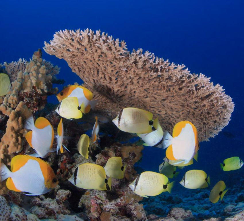
Contributors: Lauren Wenzel, Mimi D'Iorio, Charles Wahle, Gonzalo Cid, Zachary Cannizzo,
Katherine Darr

Designer: Dayna McLaughlin

Cover photo: A NOAA archaeologist surveys the wreck of the USS Schurz off North Carolina
while fish school around divers and the wreck. Photo: Tane Casserley/NOAA
MARINE PROTECTED AREAS 2020:
Building Effective Conservation Networks
This report summarizes U.S. contributions towards six key aspects of
successful marine protected area (MPA) networks. The U.S. has established
nearly 1,000 MPAs (as defined by the International Union for the
Conservation of Nature (IUCN)) to protect important places in our ocean,
estuaries, coastal waters, and Great Lakes. Scientists and managers have
identified the following characteristics for networks of MPAs to achieve
conservation outcomes1,2:
   • Area protected
   • Ecologically representative
   • Ecologically connected
   • Other effective conservation measures (that are not MPAs)
   • Effectively and equitably managed MPAs
   • Integrated into the wider seascape

Most marine protected areas allow multiple uses, such as recreational activities like kayaking. Photo: Sienna
Streamfellow

                                                          1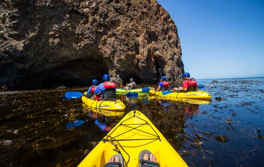
Protecting Coastal and Marine Areas
Based on scientific guidance, nearly every country in the
world, including the U.S., has agreed to a goal of protecting
at least 10% of the globe’s coastal and marine areas by 2020.
As of June 2020, 26% of U.S. waters (including the Great
Lakes) are in some type of MPA, and 3% of U.S. waters are
in the most highly protected category of MPAs (“no take”
MPAs that prohibit extractive uses). Nearly all the highly
protected MPAs in the U.S. are located in two large MPAs in
the remote Pacific Ocean – Papahānaumokuākea Marine
National Monument and Pacific Remote Islands Marine
National Monument. Less than 0.1% of U.S. waters outside
of these sites are in highly protected MPAs.
                                                                        U.S. marine waters, in blue, encompass
                                                                        3.5% of the global ocean. Image: NOAA

MPA (yellow) and no-take MPA (red) coverage throughout U.S. marine waters. MPAs cover 26% of U.S. marine
waters, of which 3% are in no-take marine reserves. Image: NOAA

Highly protected areas have been shown to produce stronger conservation outcomes than areas
where more extractive uses are allowed.3,4 New highly protected areas can be established,
working with stakeholders, to:
    •   Enhance the level of protection within existing MPAs by effectively addressing current
        and emerging threats, and by creating special use zones where needed to protect key
        habitats and resources.
    •   Develop and adaptively manage new sites and networks with high levels of protection
        reflecting local uses, threats, and conservation values.

                                                      2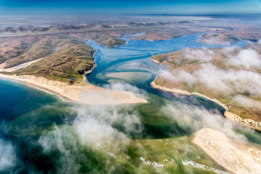
Percentage of U.S. Waters by Region
                                                                          Northeast         Great Lakes
                                                             Southeast       3%                 1%
                                                                4%
                                                    Caribbean
                                                       2%
                                            Gulf of Mexico
                                                  6%                                                                  Alaska
                                                                                                                       30%

                                         West Coast
                                            7%

                                           Pacific Islands
                                                47%

The U.S. encompasses more than 4.8 million square miles (12.4 million square kilometers) of marine waters. This pie
chart depicts the percent of U.S. marine waters in each geographic region. Nearly half of U.S. waters lie in the Pacific
Islands region. Source: NOAA

                                                    Percentage of Waters in MPAs per Region
                                  60.0
  Perercentage of Waters in MPA

                                                         52.1
                                  50.0

                                  40.0

                                  30.0

                                  20.0
                                                                                                                                     11.6
                                  10.0                              5.2                                                    5.1
                                            0.6                                   2.1              2.2       1.9
                                   0.0
                                           Alaska      Pacific   West Coast     Gulf of      Caribbean    Southeast     Northeast Great Lakes
                                                       Islands                  Mexico
                                                                                          Region

Graph shows the percent of regional waters that are in marine protected areas (MPAs). Relative to the area of marine
waters, the Pacific Islands have the highest proportion of MPAs (52%) while Alaska has the lowest (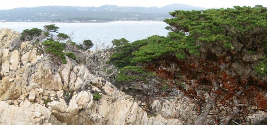
Ecologically Representative Networks
Aldo Leopold, the father of wildlife ecology, said, “To keep every cog and wheel is the first
precaution of intelligent tinkering.” In this spirit, ecologically representative systems of MPAs
conserve characteristic areas in their local eco-regions, and protect marine and coastal areas
that support ecologically important habitats, communities, species, processes, and features. This
integration of ecological representativeness into the design and management of MPA networks
can enhance conservation outcomes, particularly for species and habitats with small ranges. 5
The goal of “representativeness” is embraced by many federal and state MPA programs in the
U.S. Examples include:
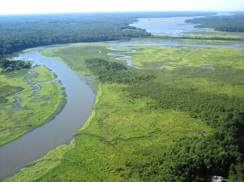
• National Estuarine Research Reserve System, a robust conservation partnership between
NOAA and 29 coastal states.
• California’s statewide MPA network.
• Executive Order 13158 calling for a “scientifically based, comprehensive national system
of MPAs representing diverse U.S. marine ecosystems, and the nation’s natural and
cultural resources.”
Chesapeake Bay National Estuarine Research Reserve is one of the 29 coastal sites that make up the National
Estuarine Research Reserve System. Photo: Chesapeake Bay NERR
4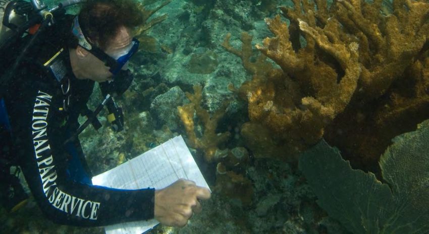
By several measures, the current collection of federal and state MPAs in the U.S. is moderately
representative of the nation’s key eco-regions, ecosystems, and taxa. In 2015 and 2020, NOAA’s
National MPA Center conducted preliminary assessments of the degree of representativeness in
the nation’s portfolio of MPAs. These analyses found that all of the 19 marine ecoregions in the
U.S. contained at least one and often many MPAs. The relative number and sizes of these MPAs
vary widely within and among ecoregions, as do their levels of protection, management
approaches, and likely conservation impacts on those ecosystem features.

Percent of marine ecoregions protected in an MPA. Marine ecoregions are mapped to represent areas with similar
habitats and ecosystems. Ecoregions with the highest percent of waters in MPA protection are the coral reef
ecosystems in the Pacific Islands and South Florida. Image: Commission for Environmental Cooperation and NOAA
MPA Inventory

Additionally, many ecologically significant ecosystem types, habitats, processes, and taxa are
protected by federal and state MPAs. For example, 80% of shallow tropical corals, 83% of
mangroves, 63% of seagrasses, and 54% of deep corals (based on their current extent mapped)
are contained within an MPA in U.S. waters.

Percentages of mapped habitat area that is protected in U.S MPAs. Image: NOAA

                                                             5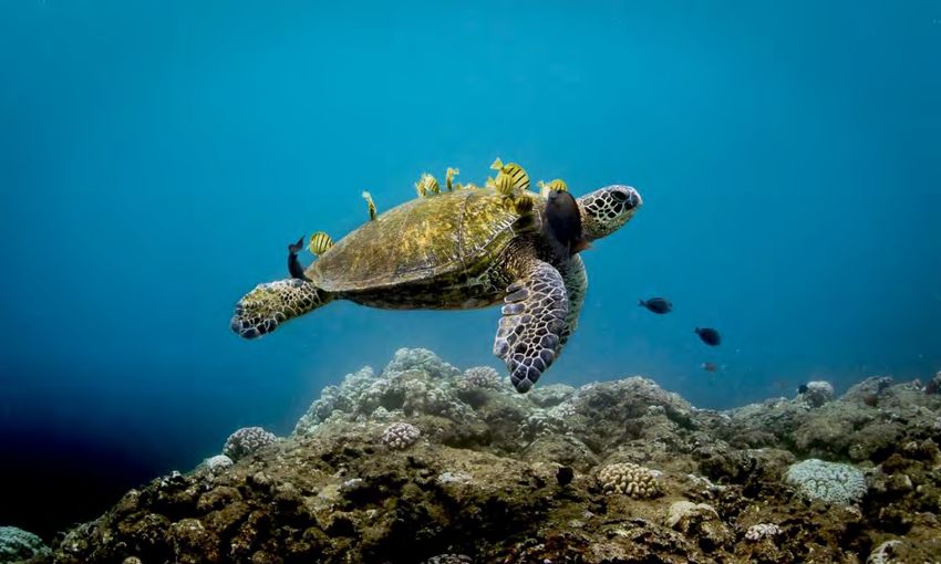
Achieving a more representative network of MPAs in the U.S. will require:
    •    Filling Critical Data Gaps – Creating better access to reliable and comparable data on
         the distribution of ecologically important features throughout the exclusive economic
         zone, including the deep sea and polar regions. Additionally, MPA programs and their
         research and exploration partners must develop high-resolution maps of the distribution
         and abundance of diverse taxa, habitats, and ecologically important processes to identify
         areas of conservation concern, including outside MPAs.
    •    Strengthening Legal Authorities – MPA statutes, policies, and designations should more
         explicitly incorporate and operationalize the concept of representativeness in the
         structure, composition, and management of new and existing networks.
    •    Incorporating Climate Change – Design for new MPA networks, and adjustments to
         existing ones, must plan for expected changes in species composition, habitat types, and
         ecological processes over time as the climate changes.

Migratory species like this sea turtle can travel extraordinary distances and often use MPAs that may be thousands of
miles apart as breeding or feeding areas. MPA networks help managers care for these far flung species during
different life stages. Photo: Matt McIntosh/NOAA

                                                          6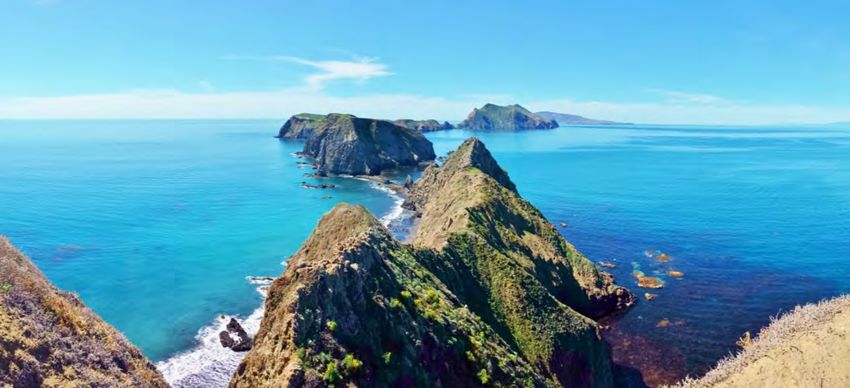
Ecologically Connected Systems of MPAs
Ecological connectivity refers to the functional linkages between spatially distinct populations,
communities, habitats, or ecosystems, including the exchange of organisms, nutrients, or
materials. Connectivity enhances the effectiveness, biodiversity, productivity, stability, and
resilience of MPAs and networks.6
Ecological connectivity is only beginning to be a factor in the design and adaptive management
of MPAs and MPA networks in U.S. waters. To date, the states of California and Hawai‘i have
created the nation’s first MPA networks that take connectivity into account in the location of
sites. In contrast, most other U.S. MPAs were established over several decades by many different
programs, each with distinct conservation goals and management approaches. MPA
establishment processes have historically focused on individual sites of local significance, rather
than on connected networks of ecologically linked sites.
U.S. MPA managers are addressing the connectivity of their sites through such approaches as
working with adjacent watershed managers to curb land-based pollution; partnering with ocean
managers to protect known connections among nearby habitats needed by species at different
life stages; and establishing international sister site partnerships with other MPAs that may
share migratory species or are linked by ocean currents.

                   Case Study: California’s Statewide Network of MPAs

  The state of California’s portfolio of MPAs is the nation’s only example of an intentionally
  designed, ecologically connected, cohesive, regional network of MPAs. This network design
  involved significant stakeholder input and relied on models and studies of ocean circulation,
  larval dispersal, optimal size and spacing distances, and projected impacts on commercial
  and recreational fisheries. This planning approach allowed California to leverage ecological
  connectivity to maximize conservation and economic outcomes throughout the state’s
  waters. It can serve as a model for other U.S. and international MPA programs in the
  establishment of ecologically connected networks.

  Point Lobos State Marine Reserve is a California marine protected area. Photo: NOAA

                                                      7
Improving Connectivity of MPA Networks in the U.S.
More effective and locally focused outreach
and communication tools would help
planners, stakeholders, and decision-makers
understand the importance, value, and
mechanics of ecological connectivity in their
geographical context. The following additional
actions would improve near-term capacity to
improve MPA connectivity:
    •    Developing new authorities, policies,
         governance frameworks, and planning
         tools that explicitly incorporate
         ecological connectivity into the design
         and management of MPA networks.
    •    Developing new insights into how
                                                           Species that move slowly, or not at all, like this sea
         connectivity works across a variety of            cucumber on a coral reef in American Samoa, depend on
         ecosystems, taxa, life stages, and                connectivity through larval dispersal to maintain healthy
         regions, and how those linkages may               populations. Photo: Greg McFall/NOAA
         change with a changing climate.
    •    Integrating areas that are not MPAs but contribute to conservation outcomes (defined as
         “other effective conservation measures” by the IUCN), into MPA networks to provide
         additional opportunities to incorporate ecological connectivity.

There are two primary types of ecological connectivity in MPAs. Habitat connectivity links geographically separated
habitats of the same type (e.g., larval dispersal among coral reefs) while seascape connectivity links habitats of
different types within the same ecosystem (e.g., juvenile fish migrating from mangrove nurseries to nearby
seagrasses and coral reefs). Both are important to the long-term effectiveness of MPA networks. Image: NOAA

                                                          8
Other Effective Conservation Measures for U.S.
Waters
Effective management of ocean areas that are not MPAs also
contributes to MPA goals of ecosystem and biodiversity Other Effective Area-
conservation. An “other effective conservation measure” (OECM) Based Conservation
occurs outside of a protected area, but may nevertheless achieve Measure
long-term biodiversity conservation outcomes. Because of these IUCN defines an other
potential benefits, OECMs (such as military exclusion zones or effective area-based
some fishery closures) can make important contributions to MPA conservation measure
(OECM) as “a
networks.
geographically defined
area other than a
Role of OECMs for Ocean Conservation in the U.S. protected area, which is
In 2008, anticipating the important role of the OECM concept in governed and managed in
spatial planning, the National MPA Center published a report on de ways that achieve positive
and sustained long-term
facto MPAs in U.S. waters – areas that were not designated as outcomes for the in-situ
MPAs, but potentially provide conservation benefits. The report conservation of
found that approximately 3% of U.S. waters were in such areas, biodiversity with
which vary widely in their purpose, size, and level of protection. associated ecosystem
While OECMs are more narrowly defined than de facto MPAs, this functions and services
review provides a useful starting point for U.S. efforts to identify and where applicable,
and report on OECMs and to consider their potential role in cultural, spiritual, socio-
improving MPA effectiveness and protecting ecosystem economic, and other
connectivity. The U.S. has not yet developed a comprehensive locally relevant values.”
inventory of OECMs that contribute to MPA networks.
Case Study: No Motor Zone for Manatee Protection
The Indian River lagoon (including the Banana River)
near NASA’s Kennedy Space Center is home to one of
the largest concentrations of manatees in Florida. These
endangered marine mammals have been monitored
since the 1970s, and in 1990, NASA closed the area to
motor boats to minimize disturbance. The Florida Fish
and Wildlife Commission manages the area and
delineates the boundary of the No Motor Zone with
signs. This 10,600 acre open water area is one of the few
places in Florida free from motor boats and has become
a desirable destination for paddlers and fishermen.
Much of the shoreline of this part of the lagoon is Photo: Keith Ramos/USFWS
within the Security Area of the Kennedy Space Center and Cape Canaveral Air Force
Station, and access to the No Motor Zone is limited. The overall trend in the number of
manatees in these waters has increased over time, and ranges from 200-300 in the
summer to over 1,000 in the spring. Manatees and other marine life in the Indian River
Lagoon system have been negatively impacted by poor water quality, which kills the
seagrasses they feed on and causes harmful algal blooms, and efforts are underway to
address this problem.
9Effectively and Equitably Managed MPAs
Well-managed MPAs are those that achieve the conservation outcomes, goals, and objectives in
their management plans. Most MPAs in the U.S. have management plans with goals and
objectives. However, the diverse range of federal, state, territorial, tribal, and local MPAs and
programs each measure effectiveness differently, making it difficult to derive a regional or
national picture of MPA effectiveness.
For example, even within the federal government, MPA programs use different mechanisms to
measure management effectiveness and adapt their management to environmental, policy, and
socioeconomic changes. NOAA’s National Marine Sanctuary System produces condition reports
to assess the condition and trends of the resources found in each national marine sanctuary.
Condition reports also identify drivers and pressures on target resources, trends for resources
and ecosystem services, and existing management responses to pressures.
Other federal agency-level examples implemented nationally or at the site or ecosystem levels
include the inventory and monitoring programs of the U.S. Fish and Wildlife Service and the
National Park Service, which select indicators to represent the overall health or condition of
protected area resources, including some socioeconomic indicators such as human values.
There are many opportunities for public involvement to help ensure equitable management of
MPAs in the U.S. For example, federal and state legislation (the National Environmental Policy
Act and state counterparts to this law) requires agencies to assess the social and economic
impacts of a proposed action, including different alternatives, during MPA designations and the
development of management plans, and to provide for public comment. This process ensures
that social and economic impacts are considered explicitly before management decisions are
made. Some MPAs have taken the additional step of establishing citizen advisory councils that
meet regularly and advise agencies on aspects of MPA management. Other programs have
worked with local communities to create “friends” groups for specific MPAs that conduct
education, stewardship, and fundraising activities. As the U.S. population becomes more
diverse, there is an increased need to reflect this diversity in the audiences who experience and
benefit from our public lands and waters.
Channel Islands National Marine Sanctuary, Channel Islands National Park, and the state of California cooperate to
monitor marine resources. Photo: Donna Hendricks
10Improving Management Effectiveness in U.S. MPAs
Among the key opportunities for U.S. MPAs in
addressing management effectiveness are:
• Standardizing and routinely applying
management effectiveness assessment tools
among national and state level MPA agencies.
• Synthesizing management effectiveness data to
provide more regional and national scale
pictures of key accomplishments, gaps, and
challenges, and acting on those findings.
• Increasing the integration of social science to
address issues such as human uses and values of
MPAs, and overcoming barriers to gathering this
information.
• Integrating climate change adaptation into
management planning and providing additional
tools that can be quickly implemented to address
climate impacts (e.g., such as through dynamic
management measures or through inter-agency
or international partnerships).
• Ensuring more effective public communication
about how MPA management is conducted and A researcher at San Francisco Bay National
Estuarine Research Reserve gathers weather
its goals are being achieved. and water quality monitoring data to better
understand estuarine systems nationwide.
Photo: Matt Ferner/San Francisco Bay NERR
National Park Service diver studies coral health in Virgin Islands National Park. Photo: NPS
11Integrated MPAs in the Wider Seascape
MPAs are not “islands” operating in isolation from their surroundings. Instead, many are
integral components of a complex and dynamic seascape of physical and ecological processes
and management jurisdictions supporting an expanding suite of ocean uses. For example, many
MPAs contribute to nearby connected ecosystems and to the services they provide (e.g., fishing)
through the dispersal from the site of larvae and spillover of adults of ecologically and/or
economically important species. Conversely, many MPAs, and the valued resources they protect,
are impacted by human activities originating far beyond their boundaries (e.g., energy
development or pollution from adjacent watersheds) or by those that intermittently transit
through the sites (e.g., shipping). As a result, MPAs in the U.S. and worldwide are integrated
into the fabric of ocean management on geographic scales that reach beyond their individual
local physical footprints, management priorities, or authorities.
Case Study: Slower Ships and Safer Whales
The U.S. West Coast hosts 293 federal and state MPAs located in some of the nation’s most
productive and heavily used waters. The confluence of whale feeding habitats and heavy
shipping traffic led NOAA’s Office of National Marine Sanctuaries to collaborate with the
shipping industry and the U.S. Coast Guard to develop voluntary vessel speed reductions to
limit ship strikes on blue, humpback, and fin whales in seasons of peak abundance.
Additionally, slower speeds reduce ocean noise and decrease greenhouse gas emissions.
Managers of Greater Farallones, Cordell Bank, Monterey Bay, and Channel Islands national
marine sanctuaries used outreach to the shipping industry, annual report cards, and public
recognition of successes to generate and celebrate cooperation among participating shipping
companies. A related program, Blue Skies/Blue Whales, provided modest monetary
incentives to companies to reduce vessel speeds, leading to higher levels of cooperation. This
innovative initiative highlights how MPAs can leverage public-private partnerships with key
user groups to enhance the conservation of important natural resources both within and
beyond their boundaries.
Several national marine sanctuaries are working with the shipping industry to voluntarily slow ships in areas with
high whale concentrations to reduce ship strikes. Photo: Elliot Hazen/NOAA, NOAA Fisheries Permit #14245
12Further Integrating U.S. MPAs into Seascape Management
Outside of energy development and other industrial activities, existing U.S. ocean management
regimes provide for limited coordination mechanisms for regions and states to share data and
consider ocean uses. As place-based management tools that routinely engage local communities,
user groups, and stakeholders, MPAs can serve as a trusted, local partner for diverse ocean
interests to find practical and equitable solutions to these complex space use issues. Steps that
would accelerate this trend include:
• Broadening MPAs’ management focus to consider their interaction with and dependence
on resources, habitats, and threats outside their boundaries.
• Proactive and sustained effort to build and sustain meaningful, collaborative
partnerships with the full range of stakeholder interests in the region.
• Using knowledge of ecological connectivity and marine corridors within regions to help
inform broader spatial management plans.
Drakes Bay is part of California’s Tomales-Drake Watershed and Greater Farallones National Marine Sanctuary.
Photo: Brian Cluer/NOAA
13Photo: Matt McIntosh/NOAA
Conclusion
The U.S. has made significant progress in designating and managing MPAs to conserve marine
resources, which in turn help to sustain a healthy ocean and the coastal communities. With 26%
of the country’s marine waters in MPAs, the U.S. exceeds the current United Nations
Sustainable Development Goal target and the Convention on Biological Diversity’s Aichi Target
11 to protect 10%, and is well on its way to meeting the more ambitious target of 30% ocean
protection recommended by scientists and under consideration by the Convention for Biological
Diversity. The following strategies would continue to strengthen U.S. marine conservation
efforts.
Addressing Climate Change – The design of new MPAs and MPA networks, and the
adaptive management of existing ones, requires consideration of the widespread and lasting
impacts of climate change on marine ecosystems and species. This relates directly to the design
and adaptive management of current and new MPAs. Additionally, the U.S. has an opportunity
to mitigate climate change impacts by protecting areas that serve as carbon sinks (e.g.,
mangroves, salt marshes, and seagrasses), and by managing the carbon stored in marine and
coastal habitats, living marine resources, and marine sediment by protecting it from
disturbance.
Ensuring Effective MPAs – Sustained, science-based, adaptive management of MPAs is
increasingly vital to their success. U.S. MPA programs can increase their effectiveness by
sustaining efforts to monitor, evaluate, and adaptively manage our MPAs in a rapidly changing
ocean.
Engaging the Public - Many MPA programs are actively involved in community engagement
through visitor centers, public education, advisory councils, citizen science, social media, and
other efforts. Continuing and expanding on these efforts would continue to build public
understanding of the value of MPA networks and their role in sustaining a healthy ocean.
Addressing Spatial Gaps in MPA Coverage - Most of the MPA coverage in the U.S. is in
the remote Pacific Islands, providing a high level of protection to coral reef ecosystems and
some of the world’s most important areas for seabirds, turtles, and marine mammals. However,
other regions of the U.S. would benefit from expanded MPA coverage to ensure the continuity of
benefits that marine resources provide to coastal communities and economies.
A 2020 Vision
By addressing these outstanding needs, the U.S. can build upon the successful MPA programs in
place, and realize the full potential of MPA networks to sustain a healthy ocean and the essential
benefits it provides.
14Photo: Greg McFall/NOAA 1 Convention for Biological Diversity. 2009. Azores Scientific Criteria and Guidance for Identifying Ecologically or Biologically Significant Areas and Designing Representative Networks of Marine Protected Areas in Open Ocean Waters and Deep Sea Habitats. https://www.cbd.int/marine/doc/azores-brochure-en.pdf. 2 Convention for Biological Diversity Target 11 Technical Rationale. 2012. https://www.cbd.int/sp/targets/rationale/target-11/. 3 Partnership for Interdisciplinary Studies of Coastal Oceans. 2007. The Science of Marine Reserves (2nd Edition, United States Version). 4 Edgar, G., R. Stuart-Smith, T. Willis, et al. 2014. Global conservation outcomes depend on marine protected areas with five key features. Nature 506, 216–220. https://doi.org/10.1038/nature13022. 5 Magris, R.A., M. Andrello, R.L. Pressey, et al. 2018. Biologically representative and well‐connected marine reserves enhance biodiversity persistence in conservation planning. Conservation Letters 11, e12439. 6 Olds, A.D., R.M. Connolly, K.A. Pitt, et al. 2016. Quantifying the conservation value of seascape connectivity: a global synthesis. Global Ecology and Biogeography 25, 3-15.
www.marineprotectedareas.noaa.gov
 Te National Marine Protected Areas Center is located within NOAA’s
Ofce of National Marine Sanctuaries and works with the Department of
the Interior to serve as a resource to all federal, state, territorial and tribal
            programs responsible for the health of the oceans.
You can also read