MMO Marine Planning Update - From the East Inshore and Offshore Plan Areas Russell Gadbury
←
→
Page content transcription
If your browser does not render page correctly, please read the page content below

MMO Marine
Planning Update
From the East Inshore and
   Offshore Plan Areas
                Russell Gadbury
                 Marine Planning
                    Manager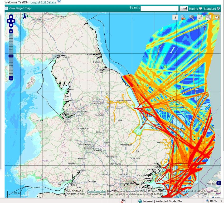
Outline
• Overview: England - level, timetable, plan areas

• Progress and outputs
   – Timetable
   – Stakeholder engagement and co-operation
   – Policy and objectives (national, sub-national)
   – Evidence, analysis, research
   – Sustainability Appraisal

• Update of resources and support for Coastal Partnerships

• Next steps/activities
The requirement for marine planning

• Aim: contribute to and help deliver sustainable
  development
• Marine & Coastal Access Act provides legislative basis for
  a marine planning system
• Marine Policy Statement (MPS) will be the overarching
  policy framework for the UK marine area
• Marine Plans will translate the MPS into detailed policy
  and spatial guidance for each Marine Plan area (MMO)
• A description of the marine planning system for England
  (Defra)
National level
Overall timetable
•   Currently two at a time every 2
    years, i.e. complete by 2021
•   Review spring 2012

National activity
•   Govt, Stakeholders
•   Evidence and Analysis

Other ‘Future’ plan areas
•   Engagement
•   Projects, learning, issues etc
East plan areas
58,700 km2

Two plans but one process

Deliver April 2013
•   Evidence Nov 2011
•   Issues Jan 2012
•   Objectives Mar 2012
•   Options start Mar 2012

Note other timelines, eg MCZs,
  R3 wind
East Inshore and Offshore Plan Areas Key Facts

• 37% of oil and gas production areas.
• 58% SAC and 42% SPA by area.
• 24% of existing wind farms, 70% of those planned and
  89% of Round 3 search areas.
• 22% of ports including the busiest port of Immingham
  on the Humber.
• 68% of aggregate dredging areas and a significant
  proportion of future search areas.


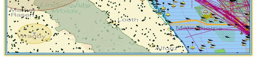
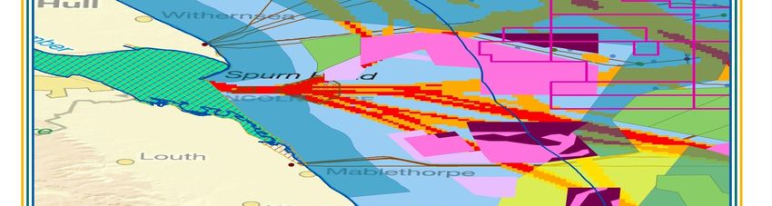
Humber Estuary
• Wildlife habitat is an important feature
• Renewable energy developments important to the area:
  Port development, Green Port Hull, Queen Elizabeth
  Dock
• Humber Enterprise Zone & North Killingholme Marine
  Energy Park, Project Neptune
• Tourism: Diversification, parasailing, bird watching,
  diving

•   Engagement: Hull CC, East Riding Council, NEIFCA,EIFCA, Smart
    Wind, Forewind, NFFO, NUTFA, WCL etc
Stakeholder Engagement
• Statements of Public Participation (SPP)
     informs people of how and when they can become
     involved
     published April 2011
     signed off by Government (Secretary of State, Defra)

• Local stakeholder engagement
     Individual interests and groups
     Work with existing partnerships, links to other
     projects (MCZs,R3)
     Range of meetings, workshops, events + Liaison
     officers
     Contacts, evidence, issues, aspirations etc
Stakeholder engagement – plan areas
“Where we need to be” – policy & objectives
 National (‘top down’)
 • Marine Policy Statement
       Vision ‘clean, healthy, safe, productive and
       biologically diverse oceans and seas’
       Goals, objectives, policies: draw out in a plan area
       context
 • Other, e.g. National Policy Statements

 Sub-national (‘integration’)
 • Terrestrial plans (LDFs)
 • RBMPs, SMPs, AONBs etc
 • Vision, objectives, policies etc
Marine - terrestrial planning links Need • “take all reasonable steps” to ensure compatible with adjacent Planning Act plan • Assess marine relevant policies in LDFs Approach • Worked with Local Authorities to develop • Undertook review of all 26 LDFs • Each LA commenting Results • Understanding across different LA areas • Summary of implications for marine planning and vice-versa
Evidence and analysis
• National: Strategic Scoping Report
   – Not a planning or policy document
   – The ‘big picture’ to set plan area in context
   – Includes analysis of potential future opportunities
• East inshore and East offshore data & information
   – Substantial data collation and presentation
   – Call for evidence from stakeholders and data gap filling
   – Web portal
• Research
   – various
   – Socio-economic study
Marine Planning Portal

Online tool for stakeholders
• View existing data from the
  evidence base
• Comment on MMO data
• Suggest a new dataset
Data being added and
  revised
Further development
• Spring 2012 onward
• View/interrogate plan
  options
                                http://planningportal.marinemanagement.org.uk
Research: socio-economic study • Help to understand the impact of marine planning on the socio-economics of coastal communities • Identify different types of coastal community around England and, in detail, the plan area • National report; EoE report (information for each LA) • Inform both marine AND terrestrial planning
Sustainability Appraisals
• Legislative requirement set out in M&CAA
• Increasingly used in England, particularly terrestrial planning

• Purpose
  - a process to provide independent check of the development of the plan
  - assess impacts of plan options on social, economic and
   environmental objectives
  - incorporates Strategic Environmental Assessment and Habitats
   Regulations Assessment

• Progress
  - started on ‘day 1’ of plan making with contractors appointed
  - Refining approach, evidence gathering and interpretation
  - Advisory Group established
Summary of progress

• Statements of Public Participation published
• Stakeholder engagement: from individual meetings to
  workshops
• Developing co-operation and understanding of
  existing plans, e.g. with Local Authorities
• Substantial on-going evidence and data gathering
• Launch and use of Web Portal
• Strategic Scoping Report published
• Socio-economic research completed
• Sustainability Appraisal process and Advisory Group
  up and running
Next Steps
• On-going: Evidence and data gathering
• ‘Evidence & Emerging Issues Report’ (evidence, policies,
  emerging issues) + SA Scoping report
• Plan Area stakeholder workshops including discussion of
  vision and goals by early December 2011
• Sustainability Appraisal: in parallel with plan production
• Stakeholder consultation (informal) on plan objectives -
  February 2012
• Options workshops provisionally April 2012
• Informal drop in events February 2012
Contact details
Marine planning team:
www.marinemanagement.org.uk/marineplanning
Email: planning@marinemanagement.org.uk
Portal: planningportal.marinemanagement.org.uk
Telephone: 0191 376 2790

Marine Planning Liaison officers:
Flamborough Head to Skegness
Sally Bradley: Tel: 01472 355 112 or 07770 934 656
Email: sally.bradley@marinemanagement.org.uk
The Wash to Weybourne
Jez Sooben: Tel: 01502 573 149 or 07831 174 216
Email: jeremy.sooben@marinemanagement.org.uk
Sheringham to Felixstowe
Stacey Mayer: Tel: 01502 573 149 or 07766 214 855
Email: stacey.mayer@marinemanagement.org.uk
You can also read