NORTH FACE SURVEY - Phase II: 2015 - Nevis Landscape Partnership
←
→
Page content transcription
If your browser does not render page correctly, please read the page content below
NORTH FACE SURVEY

                  Phase II: 2015
                  Report compiled by Lewis Pate
    Environmental Project Officer at Nevis Landscape Partnership
                              Jan 2016

The Nevis Partnership is a Charity registered in Scotland, No SCO33418

                                  1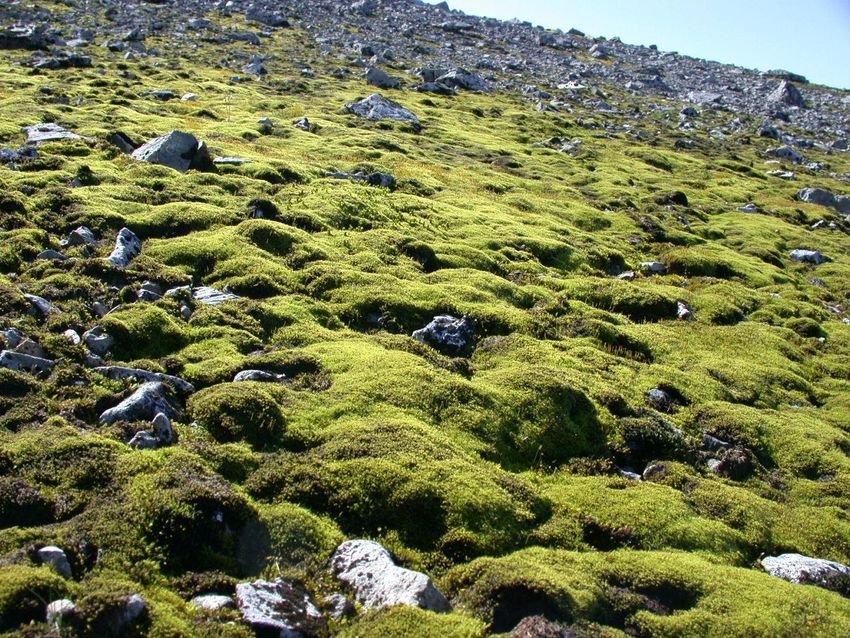
Contents

Acknowedgements……………………………………………………………………………………………………………………………………………………..3

Summary…………………………………………………………………………………………………………………………………………………………………….4

Aims & Objectives……………………………………………………………………………………………………………………………………………………….5

Project Background & Description…………………………………………………………………………………………………………………………6,7,8

Training day……………………………………………………………………………………………………………………………………………………………9,10

2015 Survey………………………………………………………………………………………………………………………………………………….…11,12,13

Areas visited, teams and notable features……………………………………………………………………………..……………………14,15,16,17

Recommendations…………………………………………………………………………………………………………………………………………………….18

Appendix I – Iain Strachan, Botanical Report………………………………………………………………………………………..……..19,20,21,22

Appendix II – MVE, Geological Report….……………………………………………………………………………. 23,24,25,26,27,28,29,30,31

Appendix III – Gordon Rothero, Notable Bryophytes…………………………………………………………………….32,33,34,35,36,37,38

Appendix IV – Gordon Rothero, Nationally Rare & Scarce Bryophytes (2014 Survey)…………………………………………39,40,41

Appendix V – Mike Pescod, Access & Safety Report……………………………………………………………………………………………………42

Appendix VI – Rare & Scarce Vascular Plant Species Not Previously Recorded on Ben Nevis (2014 Survey)………….43,44

Appendix VII – SNH Species ID Cards………………………………………………………………………………………………….………..45,46,47,48

Appendix VIII – North Face Survey Team Contact Details…………………………………………………………………………………………..49

                                                      2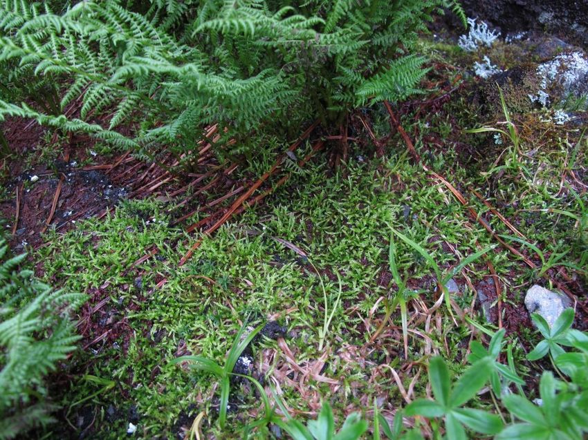
Acknowledgements

The second ecological and geological survey of the north face of Ben Nevis took place between the 10th and 14th of
August 2015. Building on the success from 2014, the Nevis Landscape Partnership in partnership with SNH continued
with a comprehensive and logistically challenging survey of Britain’s highest mountain.

Funding for the project was kindly provided by the Heritage Lottery Fund (HLF) and Scottish Natural Heritage (SNH).

The challenges of the survey would not have been met without the professional input from the following people and
organisations:

Scottish Natural Heritage – Cathy Mayne
Abacus Mountaineering - Mike Pescod and contracted guides
Midland Valley Exploration – Roddy Muir, Jenny Ellis, Hugh Barron
Rio Tinto Alcan - Landowner
John Muir Trust – Ali Austin & Blair Fyffe
Ian Strachan
Gordon Rothero
NLP Trainee Volunteer Ranger Team
Ed Holt
DMM - Dave Gary
Scottish Mountaineering Club

A major objective of the project has been to raise public awareness of our fascinating and fragile mountain
environments and develop working partnerships between professional mountaineers and conservation bodies.

Images are reproduced courtesy of the survey team, NLP staff and volunteers.

Round-leaved Sundew (Drosera rotundifolia)

                                                         3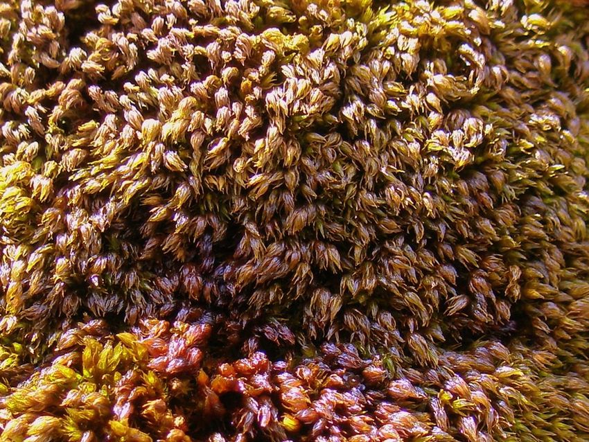
Summary
During August 2015, the Nevis Landscape Partnership, in
collaboration with our working partners, continued to build on
the success of the 2014 survey. We undertook a logistically
challenging and multi-disciplinary survey of Britain’s highest
mountain at 1343mt.
Ben Nevis first attracted botanists and geologists over 200 years
ago, and continues to reveal some of its remaining secrets.
The project team, including geologists, botanists and professional
mountaineers, NLP staff and volunteers, made significant
discoveries, recording new geological features and arctic-alpine
plant species.
Until 2014 many of the 600 metre cliffs, gullies and buttresses remained inaccessible to the scientific community.
Aided by nearly 3,000 meters of rope and low-impact mountaineering techniques the team continued to safely record
new data from previously unexplored areas and revisited challenging areas on the north face of Ben Nevis.
The project is developing a detailed dataset of geological and botanical features which will hopefully provide a guide
for future projects elsewhere, to better understand the habitats that exist on Scotland’s mountains.
Effective partnership working between conservation bodies, professional mountain guides, botanists and geologists
has developed to allow everyone involved to add value to their respective professional knowledge. This will improve
the public’s understanding of our fragile mountain environments with better public engagement and knowledge
sharing.
The NLP and its working partners will continue with one final survey in 2016.

Mike Pescod of Abacus Mountain Guides reviewing survey routes at the CIC hut.

                                                                            4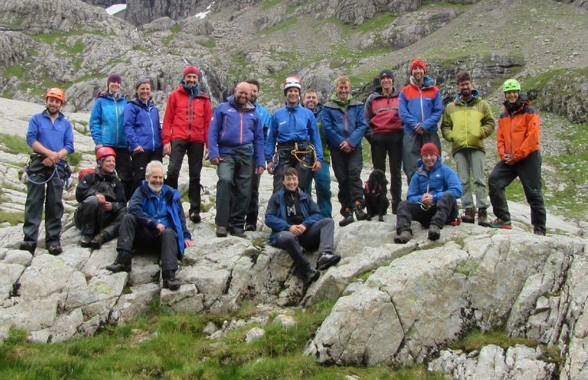
Primary Aims & Objectives

                           Aim                                                       Objective
 Identify the botanical and geological features of           Advise SNH, working partners and the general public of
 previously inaccessible areas of the north face of Ben      the distribution, location and current condition and of
 Nevis SSSi                                                  these features in detail.
 Build relationships between professionals working in        Improve knowledge base for professional climbers,
 conservation and recreation                                 guides, botanists, geologists and recreational users of
                                                             the mountain
 Deliver three technical surveys of 125ha of normally Develop survey skills and working practices as a blueprint
 inaccessible habitat on the north face of Britain’s highest for future surveys on similar terrain elsewhere
 mountain
 Produce a concise professional report with useful and Inform interested parties of the work undertaken and
 accurate information                                        improve “site condition monitoring”, hopefully bringing
                                                             the unfavourable “vascular plant” feature into
                                                             favourable condition
 Gather geological data to build a three dimensional map Develop a detailed understanding of the processes that
 of the Ben Nevis massif                                     formed the mountain and promote this to a wider
                                                             audience via the “Fieldmove” applications software
 Promote an innovative and exciting project to as wide an Raise awareness of the conservation value of Ben Nevis
 audience as possible, raising the profile of Ben Nevis      SSSi and the pressures put upon it by climate change and
                                                             recreational and commercial use

Descending lower section of Ledge Route

                                                          5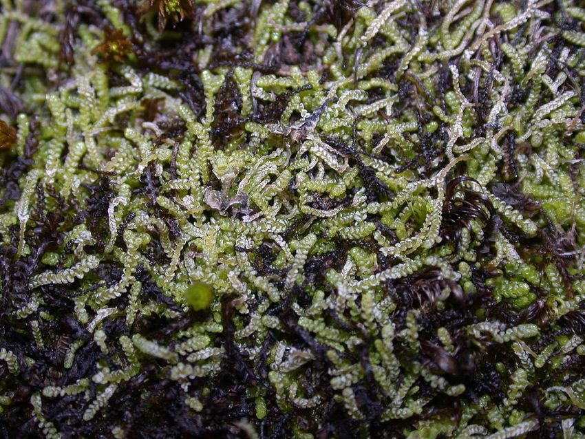
Project Background

The Ben Nevis Site of Special Scientific Interest (SSSI) is an extensive upland site of 9539ha centred on a massif which
stretches for over 12 kilometres from Ben Nevis, eastwards to Stob Coire na Ceannain, and has an altitudinal range
from 30m above sea level in Glen Nevis to 1344m on the summit.
It contains the following listed features:
(Ref: SNH Site Link, http://gateway.snh.gov.uk/sitelink/siteinfo.jsp?pa_code=192)

 Last Visit Date                       Feature Category                        Feature                      Last assessed Condition

 19/07/13                              Coniferous woodland                     Native pinewood              Unfavourable Recovering
 21/09/15                              Other invertebrates                     Fly assemblage               Favourable Maintained
 16/07/15                              Butterflies                             Small mountain       ringlet Favourable Maintained
                                                                               (Erebia epiphron)
 31/08/15                              Bryophytes                              Bryophyte assemblage         Favourable Maintained
 31/05/15                              Birds – assemblage of Breeding bird assemblage                       Favourable Maintained
                                       breeding birds
 30/09/15                              Mosaic                                  Upland assemblage            Favourable Maintained
 18/07/15                              Igneous petrology                       Caledonian igneous           Favourable Maintained
 08/09/15                              Vascular plants                         Vascular plant assemblage    Unfavourable No Change
 13/06/15                              Broad-leaved, mixed and Upland oak woodland                          Favourable maintained
                                       yew woodland

A large cushion of Gouty-moss (Oedipodium griffithianum) with sporophytes on Tower Ridge

                                                                           6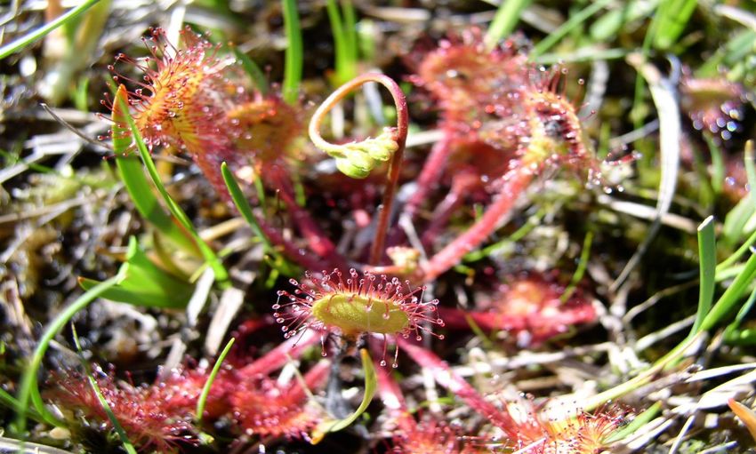
The range in altitude and geology gives rise to a diversity of habitats including native pine and oak woodlands, montane
cliffs, semi-permanent snow beds, upland heaths and grasslands. A
wide variety of vascular and lower plants are present. The altitude
influences the flora and fauna of the site, further influencing the
range of bird and invertebrate species present.

Ben Nevis and the associated peaks of Aonach Mor and Aonach Beag
form a massif that has the highest land in the UK and contains only
three peaks greater than 1200m out with the Cairngorms. The SSSI
supports an assemblage of upland habitats which includes the only
semi-permanent snow beds outside the Cairngorms, and the most
extensive scree snow-beds in the UK.

The mountain provides unique habitats for rare arctic-alpine flora. The importance of this flora is reflected in the Ben
Nevis SSSI feature for vascular plants, currently in “unfavourable” condition. Some of the key locations that are already
known about are at risk from recreational activity but are also potentially further threatened by changing climate.
The geological features of the site are unlikely to fall into unfavourable condition, however the detailed geological
mapping that MVE undertook in 2014/15 has developed our understanding of the processes that have shaped the
mountain.

Image of the Move software interface from MVE, showing the distribution of the geological data collected during the 2015 survey of the North Face. The coloured
discs represent the 3D orientation of geological contacts, joints and faults that were measured using the Fieldmove Clino application. The data have been projected
onto a digital elevation model of the Lochaber area. Contours are taken from the Ordnance Survey 1:25,000 dataset. View looking to the SW with the Halfway
Lochan on the right.

                                                                                7
A significantly greater area of the 125ha (see Map1 page 21) of the north face of Ben Nevis has now been accessed by
botanists and geologists. Due to the sensitivity of the site and the guiding designations covering it (NSA, SSSI & SAC)
no fixed anchors were placed in the rock.
Rather than employing heavy duty industrial access techniques (such as placing bolts in the rock) the survey team
utilised climbing equipment which can be placed without damaging the site. Many of the sites being accessed were
either damp, ‘flush’ areas or along geological contacts. These locations often coincide with large fractures in the rock
and consequently are full of loose, wet rock. Climbers usually avoid such places for obvious reasons.
The team therefore used many of the usual guiding techniques and had to develop some new approaches. The
experience learned from the 2014 survey made for a much more efficient and targeted approach this year.
The team of mountaineers also brought an extensive and detailed knowledge of the mountain to the scientific survey.
Thousands of days guiding clients on the north face of Ben Nevis gave the geologists and botanists insight into the
mountain’s topography as well taking them safely to previously unrecorded areas.
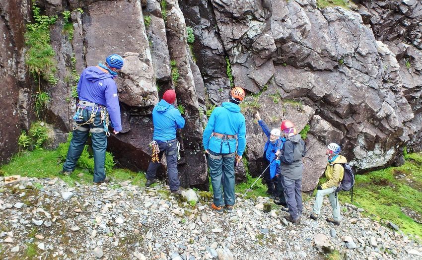
Ian Strachan training guides on species ID Susan Nicol assisting with PPE at the summit
Man and beast working in harmony Rope protectors and belay set-up for surveyors
8
The Training Day
It was decided to reduce the “training week from 2014” to one day for the 2015 survey. This was to deliver the project
within budget and, as many of the same team were involved from 2014, it was considered an appropriate timeframe
to bring existing members up to speed. In addition it allowed NLP to maintain a comparable level of input from 2014
for the main survey week.
The day started at NLP offices at An Drochaid and everyone quickly set off to the CIC hut from the north face car park
to work on practical sessions covering:
survey techniques and data collection – RM & JE from MVE
GPS, checks and calibration with maps and altimeter – MVE
geological processes, rock types, features and structures – MVE
montane habitats and indicator species – IS
identification of arctic-alpine species – IS
safety equipment and access logistics – MP
radios and communications – MP
rope systems and rigging – MP & team
Field Move Clino App - MVE
Training Day Team August 2015
9
Rescue 8 & shunt set-up for surveyors
                                             Fieldmove Clino App. On IPhone 6

Abseil practice on Organ Pipe Wall
                                        10
The Survey (10th – 14 August 2015)
During the survey week many new areas
of the north face were surveyed and
recorded for the first time finding many
new colonies of nationally rare and
scarce plant species: in particular
saxifrages, grasses and mousears, with
additional recording of mosses and
liverworts by Gordon Rothero.
Besides the huge scale of the task and the
challenge of multi-disciplinary surveying
in extremely difficult terrain, the survey
team had to contend with complex
logistical challenges and the need to
physically carry huge amounts of rope,
safety equipment and survey items around the mountain each day. At the end of each day the team had to review
any issues, gather data, and develop plans for the following day.
Every morning was arranged with a 7am meet at
the North Face car park, and an 8:30 briefing at
the CIC hut. Survey teams were finalised, with key
sites identified and access routes determined to
manage safety and communications. Each
location was allocated specific team members
with botanists and geologists allocated as
required. The daily logistics were recorded on a
rota board at the CIC hut for the communications
manager.
Morning Planning Meeting at CIC Hut
Communications and radio checks were continued throughout the day with regular updates on team locations and
most importantly managing the hazard of rock fall onto survey teams or the general public. Ed Holt managed the radio
communications from the CIC hut during the week. Ed facilitated effective communication between team members
and monitored public access to the main climbing routes with the aid of a telescope.
The survey was conducted with four teams of two mountaineers either working independently or with a
geologist/botanist as a rope of three. Those teams working without expert guidance would carry out a sweep survey
of technical terrain, noting indicator species and recording any finds on the field App.
To ensure accuracy of records, digital photos of species were taken (with GPS data recorded and checked) and then
checked with the relevant expert back at the base camp at the end of each day. If an area proved of interest, a geologist
or botanist would then be taken back to the key areas. This made the best use of resources and a maintained a balance
between macro and micro scale surveying
11The 2015 survey had the added input of the NLP’s seven trainee volunteer rangers (TVR’s), who were deployed to
strategic locations where they assisted the survey team in various ways. Belay points were monitored on the summit,
200m bags of rope were moved up and down ledge route and along the summit to specific locations and members of
the public were informed of activity to avoid the danger of rock fall from the survey teams.
Iain Strachan training guides on species ID
Before entering terrain with a hazard of rock fall the teams would communicate with the base camp officer and other
teams to ensure the public were not exposed to any risk. Signage around the area was also used, as were numerous
communications during the preceding weeks to the survey on walkers and climbers forums, blogs and websites.
The project was promoted widely on Twitter and Facebook and articles were placed via the following websites and
publications:
Mountain Weather Information Service
Grough Magazine
Press & Journal
UK Climbing
Mountaineering Council of Scotland
SNH Nature of Scotland
Blair Fyffe JMT
12On the Tuesday Mark Steven from BBC Scotland Out Of Doors spent the day with the team and the project received a
good level of reporting broadcast on Sat 19th Sept and repeated on Sun 20th. Positive feedback was received from
several sources on this programme. It is planned to involve BBC Out Of Doors across additional NLP projects going
forward.
Ian Strachan Summit Interview for BBC Out of Doors
Mara Media had two cameramen on the survey for the Wednesday and filmed for a series “The Highlands”. This is due
for broadcast sometime in 2016 and centres on the connection between people and the landscape of northern
Scotland.
13Mon 10th August
Team Area Visited Notable Species/Features
Recorded (target spp. in bold)
Donald King, Dave Anderson, Ian Slingsby’s Chimney to base of Arctic Mouse-ear, Russet Sedge
Strachan Oservatory Buttress from Coire Leis and Alpine Saw-wort on traverse,
traverse Alpine Lady-fern in Zero Gully
Al Halewood, Dave Buckett, Gordon Bowl above the Shroud from Ledge Alpine Speedwell and Arctic
Rothero Route to Boomer’s Requiem. Mouse-ear above the Shroud,
Starwort Mouse-ear at top of
Also plateau edge Ledge Route to Arch Gully
Castle Ridge
Mike Pescod, Connor Holdsworth, Minus Three Gully from Coire Leis Arctic Mouse-ear, Russet Sedge
Dan Watson (NTS) Traverse and Three-flowered Rush on
traverse
Scott Kirkhope, Will Rowland, Roddy Base Little Brenva Face Starwort Mouse-ear and
Muir Sibbaldia
Jenny Ellis & Blair Fyffe North Trident Buttress base
Cathy Mayne & Cathel Hutchison Base of Carn Dearg Buttress to Castle Large stands Russet Sedge, also
(TVR) Ridge Alpine Lady-fern, Alpine Lady-f
ern
Lewis Pate, Erika Forbes (TVR), Chris Moving rope up Ledge Route to top
Scully (TVR), Allan Audsley (TVR) of Castle Ridge
Harris-Harris Brooker (TVR) Phoebe Signs to shoulder near Lochan Meall
Webster (TVR) an t’Suidhe
Tues 11th August
Team Area Visited Notable Species/Features
Recorded
Mike Pescod, Will Rowland, Ian Plateau above upper Cascades Large pop Highland Saxifrage,
Strachan Cascade also Alpine Meadow-grass,
Starwort Mouse-ear and Arctic
Mouse-ear. New UK altitudinal
records for all four, also for
Mountain Sorrel and Scurvy
Grass
Mike Pescod, Erika Forbes (TVR), Summit
Cathel Hutchison (TVR), Phoebe
Webster (TVR)
14Scott Kirkhope, Dave Anderson, East flank of Tower Ridge from crest of Large stand (100+) Hare’s-foot
Gordon Rothero ridge, descend via Coire Leis Sedge, also Sibbaldia and
Starwort Mouse-ear
Al Halewood, Connor Holdsworth, Broad Gully, west flank Tower Ridge Highland Saxifrage, Alpine Lady-
Dan Watson (NTS) fern, Sibbaldia and Mountain
Speedwell. Alpine Speedwell
and Sibbaldia in Coire Leis.
Dave Bucket, Ali Austin (JMT), Roddy Tower Ridge Alpine Speedwell, Arctic Mouse-
Muir ear, Alpine Meadow-grass and
Sibbaldia.
Donald King, Blair Fyffe, Jenny Ellis Castle Ridge
Harris Brooker (TVR), Allan Audsley Half way lochan/traverse path - safety
(TVR),
Cathy Mayne, Chris Scully (TVR) Coire Leis Alpine Lady-fern, Russet Sedge,
Sibbaldia and Northern Buckler-
fern
Lewis Pate Ledge Route and summit with BBC
Scotland Mark Steven Out of Doors
Wed 12th August
Team Area Visited Notable Species/Features
Recorded
Al Halewood, Dave Anderson, Ian West of Tower Gully, East flank of Sibbaldia, also Alpine Speedwell
Strachan Tower Ridge from summit plateau on Ledge Route
Conner Holdsworth, Erika Forbes Coire Leis lochan and abseil posts path Curved Woodrush (new for Ben
(TVR), Gordon Rothero Nevis), also Alpine Meadow-
grass, Starwort Mouse-ear,
Arctic Mouse-ear, Alpine Lady-
fern & Russet Sedge.
Scott Kirkhope, Will Rowland, Jenny North Trident Buttress & base mud Sibbaldia
Ellis rocks
Donald King, Dan Watson Under the Castle, Moat & Serpent Starwort Mouse-ear, Alpine
Lady-fern, also Juniper and
Mountain Speedwell
Dave Bucket & Roddy Muir First platform WE Buttress Arctic Mouse-ear
Mike Pescod & Blair Fyffe Castle Ridge – rope retrieval
15Cathy Mayne, Ali Austin, Lewis Pate Ledge Route Easy to summit – rock Starwort Mouse-ear, Alpine
& TVR’s site survey on summit Speedwell & Sibbaldia en route
Rope to top of Castle Ridge
Cathel Hutchison (TVR) and Phoebe Traverse path under Castle Ridge –
Webster (TVR) safety
Film Crew from Mara Media Tbc
Thurs 13th August
Team Area Visited Notable Species/Features
Recorded
Scott Kirkhope, Connor Holdsworth No. 3 Gully Buttress from top Large pops of Starwort Mouse-
& Ian Strachan ear and Highland Saxifrage, also
Arctic Mouse-ear
Al Halewood, Blair Fyffe & Gordon South Trident Buttress & No. 4 Gully Starwort Mouse-ear
Rothero
Donald King & Cathy Mayne Long Climb to bottom of Basin – Orion Alpine Lady-fern
Face
Dave Bucket, Dave Anderson & Observatory Ridge – descend Ledge
Roddy Muir Route
Mike Pescod, Ali Austin & Hugh Secondary Tower Ridge from Italian Alpine Lady-fern, Sibbaldia.
Barron (MVE) Climb to Pinnacle Buttress, No. 3 & No. (Drooping and Tufted Saxifrage
4 Gully, descend down Ledge Route and other known scarce spp also
recorded at top of No 4.)
Will Rowland & Jim McIntosh (BSBI) Coire Leis Abseil Posts path and Good stands of Curved
Buttress east of Bob Run Woodrush, Arctic Mouse-ear,
Alpine Speedwell and Sibbaldia,
also Alpine Meadow-grass and
Russet Sedge.
Susan Nicol, Chris Scully (TVR), Harris Coire na Ciste – removing rope
Brooker (TVR)
16Fri 14th August
Team Area Visited Notable Species/Features
Recorded
Mike Pescod, Dave Anderson & Raeburn’s Buttress Compression Starwort & Arctic Mouse-ear,
Cathy Mayne Cracks – returned out of South Castle Alpine Lady-fern, Alpine Saw-
Gully wort, Northern Buckler-fern
Cerastium arcticum, Cerastium
cerastoides
Donald Kind & Roddy Muir Tbc
Allan Audsley (TVR) & Alex Hogarth Descend to top car park from CIC with
(TVR) rope
Dave Bucket, Blair Fyffe & Hugh Ledge Route to west – descend down Starwort Mouse-ear, Sibbaldia
Barron No. 5 Gully Top Bowl
Scot Kirkhope, Gordon Rothero & Slopes above Raeburn’s Buttress Starwort & Arctic Mouse-ear,
Conner Holdsworth Sibbaldia, Highland Saxifrage
Al Halewood, Will Rowland & Ian Indicator Wall RH from summit top no target spp but new UK alt
Strachan, Lewis Pate 70m and descend via Coire Leis record for Stiff Sedge
Susan Nicol & Chris Scully (TVR), Summit
Harris Brooker (TVR) & Cathel
Hutchison (TVR)
17Recommendations for 2016:
Include at least one training day. This should be paid and will include carrying equipment to the CIC Hut, botany
and geology refreshers as well as further coaching for the experts.
Consider an additional “open” training day for NGO land staff from other conservation bodies (NTS/JMT/SNH)
this to be supported by additional paid work with input by the geologists, botanists and guides
Earlier training of TVR’s on rough ground access and site specific knowledge to reduce management and
labour-intensity. MP and NLP to assess ability prior to training day.
Additional independent transport for TVR’s to reduce NLP staff time
Using the same experts and guides as far as is practical.
Maintain the current ratio of surveyors/guides.
Ensure that media teams have their own guides and that they are aware of what they can achieve so as not to
disrupt the survey too much. Further define media parameters prior to any survey involvement to ensure
appropriate & relevant promotion of NLP and working partners.
Use logistical, ecological and geological knowledge of people such as staff from NTS, JMT and NLP – this worked
well on the 2015 survey.
Maintain an experienced and paid communications manager at the CIC hut.
Seek additional sponsored equipment such as waterproof jackets for survey team
18Appendix I
Ben Nevis North Face Survey, year 2, Aug 2015: botanical report
Ian Strachan, 17 Nov 2015
Introduction
The botanical survey in 2015 was again very successful, helped by having the same professional team of climbers
involved as last year. Botanists Ian Strachan and Gordon Rothero were joined for four days (including the training day)
by Dan Watson, NTS Ecologist for Ben Lawers and Glencoe, and for one day by Jim McIntosh, BSBI Scottish Officer.
Both are very experienced mountain botanists and made valuable contributions. Cathy Mayne (SNH), Alison Austin
(JMT) and other team members also contributed botanical skills. The climbers’ familiarity with the North Face was
invaluable, not only for access, but also for identifying potential survey areas which often proved to be of high botanical
interest, such as No 3 Gully buttress, Tower Ridge and the Upper Cascades.
The weather was mixed but did not really hinder survey, and Thursday was a particularly fine day. Late snow-lie limited
access in places, but more of an issue was the very late season, with some species well behind their usual flowering
period, making identification more difficult.
The focus of vascular plant recording was again on Nationally Rare (NR) and Nationally Scarce (NS) species, forming
part of the Ben Nevis SSSI vascular plant assemblage feature (Table 1). Other notable species were also recorded when
seen e.g. Alpine Saw-wort Saussurea alpina and Moss Campion Silene acaulis. We aimed to visit localities not reached
in 2014, notably Tower Ridge, the north side of Carn Dearg Buttress, Coire Leis, Castle Ridge north, Trident Buttress
and several other routes. A mixture of climbing, scrambling and abseiling was used, including short abseils from the
plateau for e.g. Upper Cascades and Indicator Wall (from the summit cairn!). Table X lists the teams and routes covered
each day, together with an indication of key finds (more details below).
On the training day, IS, DW and CM carried out brief ‘refresher’ identification work with the climbers. Laminated ID
cards were available as last year. Most records were made on iPhones using the Midland Valley Fieldmove app, which
had been adapted by the geologists working with the team to record both geological and botanical information. The
botanists also used GPS and notebooks (see next section). Notes were sometimes made of counts or
population/habitat extent, also associated photographs were taken and labelled. Climbing teams surveying without
an expert botanist took photographs to confirm plant identifications.
Data analysis
Finds were recorded in the field in two ways (a) using the Fieldmove app on iPhones, (b) with GPS and notebook. The
latter method was used by IS, DW and CM, although some of their finds were recorded on iPhones instead or as well.
Data from iPhones were downloaded at the end of each day. Notebook records were entered into XL by the recorders
after the survey.
For each survey day, every team that made any plant records has been given a code, from A1 to F4, with a letter for
the day and a number for the team. This was linked to each record for analysis purposes. IPhone data were collated
into a series of spreadsheets for each day/team. The data included a mixture of location records and images
(photographs). The photos were all examined and species identification checked. The botanical site and image records
were combined and sorted by time of day to match photos and locations where possible. The records were imported
19into GIS and the locations converted from lat/long to OS grid reference. The iPhone data was all collated into a single
spreadsheet together with the ‘notebook’ records (which were also imported into GIS) and each record given a unique
number.
Certain difficulties were encountered when ‘cleaning’ the data e.g. photo GRs were usually different from the
apparently corresponding ‘site’ GRs, sometimes very different. Some sites were clearly in the ‘wrong place’, probably
a consequence of the difficulties of using GPS on crags. Judgement had to be applied by examining record details and
locations against maps and air photos in GIS. Decisions made are recorded in the master spreadsheet. Similar problems
were encountered where iPhone and GPS/notebook records coincided. In a few cases the same stands had been
recorded by different teams e.g. in Coire Leis. As far as possible ‘duplicate’ records were identified and omitted from
the final analyses.
Separate layers for each target species were then created in GIS and examined to determine the number of new
‘populations’ in terms of Site Condition Monitoring i.e. stands, or clusters of stands, within a 40m radius. These were
compared with previous records, although this must be provisional in a few cases as the 2014 has still not been fully
collated into GIS.
Findings
Map 1 shows the distribution of all records for target species (i.e. Nationally Rare or Scarce vascular plants) made in
2015. Over 150 target species records were made, most being at new locations. Approximately 68 previously unknown
populations for 10 target species were identified, as detailed in Table 1. A wide range of records were also obtained
for other notable species which will be imported into the BSBI Distributional Database and will contribute to Atlas
2020.
Highlights include:
A large population of Curved Woodrush (Luzula arcuata) in upper Coire Leis, west of the abseil posts.
Previously within the SSSI the only recent records were from Aonach Beag, where there is one very large
population on the plateau and scattered individuals on slopes and gullies. There were old records from the
Carn Mor Dearg side of Coire Leis which could not be refound in 2015. This new find therefore represents the
first record for Ben Nevis itself and the second ‘qualifying’ population (>25 plants) for the SSSI. Curved
Woodrush is classified as ‘Vulnerable’ in the Red Data List.
A large stand of Hare’s-foot Sedge (Carex lachenalii) with at least 100 flowering shoots on the east flank of
Tower Ridge, c. 500m SE of the known (smaller) population in Coire na Ciste. Very small populations were
recorded in 2005 on Aonach Mor and Aonach Beag (the latter could not be found in 2013). This is therefore
the second ‘qualifying’ population (>25 plants) for the SSSI.
Large new populations of Highland Saxifrage on the north side of Carn Dearg (Raeburn’s Buttress) and in Coire
na Ciste (No. 3 Gully Buttress and the Upper Cascades), and of Alpine Speedwell and Arctic Mouse-ear around
upper Coire Leis.
More than 10 new populations for each of Alpine lady-fern, Starwort Mouse-ear and Sibbaldia.
New upper altitudinal limits for Britain & Ireland for several species, including Highland Saxifrage, Alpine
Meadow-grass, Starwort Mouse-ear, Arctic Mouse-ear, Mountain Sorrel and Scurvy Grass (to be confirmed).
20Map 1. Locations of all records for target species made in August 2015 (red squares)
21Table 1. Nationally Rare (bold) and Nationally Scarce vascular plant species recorded from new localities on Ben
Nevis North Face, August 2015. * species not recorded previously from Ben Nevis.
Common 2015 pops
Species name (records) Detailed findings
Athyrium Alpine 15 (20) New pops on N face of Castle Ridge, Raeburn’s Buttress, Tower
distentifolium Ridge (2), Zero Gully, Orion Face, Coire Leis (6). Also several
Lady-fern 12 new known pops re-recorded.
Carex lachenalii Hare’s-foot 1 (1) New population on Tower Ridge E, largest known pop for SSSI
Sedge (>100 spikes) and a second SCM qualifying population.
new
Carex saxatilis Russet 10 (21) New populations on NE Buttress (1) and Coire Leis (5), also known
Sedge pops refound/counted below Carn Dearg Buttress (4).
6 new
Cerastium Starwort 18 (30) New pops on Castle Ridge N Face, Raeburn’s Buttress (2),
cerastoides Mouse-ear Waterfall Gully, Carn Dearg plateau (3), above Trident Buttress,
16 new No3 Gully Buttress, Upper Cascades, Tower Ridge, Little Brenva
Face, Coire Leis (4?). Also several known sites relocated
Cerastium Arctic 11 (15) New pops on Raeburn’s Buttress (2), Carn Dearg N Wall, No 3
nigrescens Gully Buttress (2), Raeburn’s Easy Route, NE Buttress, Upper Coire
Mouse-ear 8 new Leis (large pop). Also two 2014 sites recorded.
Luzula arcuata* Curved 1 (8) Large population in upper Coire Leis, first definite record for Ben
Woodrush* Nevis and second qualifying pop for SSSI.
new
Poa alpina Alpine 5 (8) Small stands found at several new locations – Raeburn’s Easy
Route, Douglas Gap, Upper Coire Leis. Also two 2014 sites.
Meadow- 3 new
grass
Saxifraga Highland 7 (11) Large new pops on Raeburn’s Buttress, No 3 Gully Buttress (2) and
rivularis Saxifrage Upper Cascades, also new pops on Raeburn’s Easy Route and
6 new Tower Ridge W. One 2014 site rerecorded.
Sibbaldia Sibbaldia 18 (23) New pops on Raeburn’s Buttress, Waterfall Gully, Tower Ridge E
procumbens (2), Tower Gully (2), Little Brenva Face (2), upper Coire Leis & rim
11 new (3). Several 2014 pops also rerecorded.
Veronica alpina Alpine 5 (9) 2 large new populations found near S end of Little Brenva Face
Speedwell and in upper Coire Leis, also new sites on Carn Dearg North Wall
4 new and Ledge Route.
Note. Poa flexuosa (Wavy Meadow-grass), Saxifraga cernua (Drooping Saxifrage) and Saxifraga cespitosa (Tufted
Saxifrage) were also recorded, but at known sites only.
22Appendix II
Summary of Geology for Year 2
Midland Valley Team – Roddy Muir (Monday – Friday)
Jenny Ellis (Monday-Wednesday)
Hugh Anderson (Thursday-Friday)
Geological Survey – primary objectives
Use Midland Valley’s Fieldmove Clino application for smartphones to map out the distribution of the
different rock types in the Allt a ’Mhuilinn and on the North Face;
Collect data on the spatial orientation of geological contacts, faults and joints;
Improve our understanding of how the Ben Nevis area has evolved through geological time;
Construct a 3D model of the Ben Nevis area in Midland Valley’s Move software that can be shared with the
wider community for teaching and research.
Training Day – Friday 7th August
During the training day we provided a brief overview of our findings from last year’s survey and reviewed the target
areas for the 2015 survey. We also gave a refresher session on the Fieldmove Clino application and how it should be
used for collecting and recording geological and botanical data.
Midland Valley provided five iPhones for the climbing teams and at the end of each day the data was downloaded and
saved before recharging the phones for the following day. We were very impressed with the quality of the data
gathered by the climbing teams during the survey. All of the climbers have made a significant effort to understand
what features the geologists are looking for, and their valuable feedback helped to identify areas that needed to be
investigated in more detail during the survey week. With assistance from Ali Austin from the John Muir Trust we were
able to cover twice as much ground compared with the previous year, and weather permitting, we will be able to visit
the last remaining priority areas during the 2016 survey.
Over the past year, one of us (RM) has also been mapping the outer contact between the Ben Nevis Igneous Complex
and the Dalradian country rocks. Work will continue on mapping the wider Ben Nevis area over the next 12 months in
order to provide sufficient data to build a realistic 3D model of the whole mountain.
23Monday 10th August
The contact between the Inner Granite and the Volcanic Pile was traced from the base of the NE Buttress, round the
lower slopes of Little Brenva Face and on up to the crest of the CMD Arête. Snow patches at the head of Coire Leis
made access difficult in places, but the climbers were able to assist RM in reaching all of the relevant rock outcrops.
We have now collected structural data from all exposures of the contact between the Inner Granite and the Volcanic
Pile and we can begin to construct the 3D geometry of this surface in Move.
A preliminary examination of the sedimentary rocks within the Volcanic Pile at the base of North Trident Buttress was
also carried out.
Contact between the Inner Granite (pale pink rock on left of both images) and the Volcanic Pile. Little Brenva Face
Tuesday 11th August
Geological contacts and structural data were mapped in detail during ascents of Tower Ridge and Castle Ridge. In the
gully on the east side of the Douglas Boulder a vertical sheet of andesite approx. 10m wide was observed cutting the
breccias of the Coire na Ciste Formation. This sheet might represent a feeder dyke for the Summit Andesites. RM will
return to this area to map out the sheet in more detail before next year’s survey.
Contact between andesite sheet (grey) and the Coire na Ciste Formation breccias – gully on the east side of the
Douglas Boulder. Image on the RHS shows unweathered andesite with feldspar crystals.
Tower Ridge - Previously unrecorded, fine grained sedimentary rocks similar to those cropping out at the base of North
Trident Buttress were also observed high up on Tower Ridge. The other important discovery on Tower Ridge was the
presence of amygdales within the Summit Andesite Formation. Amygdales are gas bubbles (vesicles) in an igneous
rock that have been filled with a secondary mineral – in this case calcite. The amygdales within the andesite show a
24preferred alignment which reflects movement of magma within a lava flow or sill prior to cooling and solidification of
the magma.
Band of fine grained sediments on Tower Ridge – running left to right across the image (orange arrow), just below
the first protection.
Approaching Tower Gap Amygdales in the Summit Andesite (to the left of the Krab)
Castle Ridge – Cloud cover hampered some of the investigations on Castle Ridge, but it was still possible to locate the
base of the Summit Andesites overlying the volcanic breccias. A sheet of igneous material (approx. 5m wide) that may
represent a feeder for the Andesites was also observed. Further investigation of Castle Ridge will be required during
next year’s survey.
25Feeder dyke (yellow) on the approach to Castle Ridge
26Wednesday 12th August
NE Buttress - The orientation of a prominent rhyolite sheet cutting the volcanic breccias on the first platform of NE
Buttress was measured and recorded. Further mapping of the sedimentary rocks forming the lower slopes of Little
Brenva Face has enabled the orientation of the original sedimentary bedding to be determined. Numerous way-up
structures, including small sand volcanoes and water escape structures have been observed and recorded. Previously
unrecorded granite sheet cutting the sedimentary rocks. Further detailed mapping of the different sedimentary units
(fine grained mudstone and coarse conglomerates) making up the Little Brenva Face will be undertaken during next
year’s survey.
Laminated Mudstone – Little Brenva Face
Coarse Conglomerate – Little Brenva Face
Granite Sheet (below red rucsac) cutting sediments – Little Brenva
Face
North Trident Buttress – the vertical and lateral extent of fine grained sediments overlying the coarse breccias of the
Coire na Ciste Formation was investigated and recorded. Further work will be required next year to look at the internal
structure of the sediments which contain numerous examples of water escape structures. Internal slumping of the
sediments has also been observed.
27Fine Grained Sediments(Blue Arrow) – North Trident Buttress. Yellow Arrow = No.5 Gully.
A distinctive andesitic unit with angular fragments of rhyolite crops out in No.5 Gully. A similar unit can be found on
the path 50m upstream from the CIC hut and at the NW margin of the Volcanic Pile beneath Tower Ridge. Detailed
mapping of this unit and the fault rocks in No.5 Gully will be carried out before next year’s survey.
No. 5 Gully and distinctive andesite unit with angular fragments of rhyolite
28Thursday 13th August
Observatory Ridge – consists mainly of volcanic breccia with the contact between the overlying Summit Andesites
occurring close to the top of the ridge. Previously unrecorded sheet of granite cutting the volcanic breccia just above
the halfway point.
Observatory Ridge (centre) flanked by the Northeast Buttress to the left and Tower Ridge to the right
Granite sheet (left) cutting volcanic breccia (Observatory Ridge)
Summit – investigated brown weathering igneous rock cropping out between the head of No.4 and No.5 gully. This
unit forms a distinctive scree field on the summit plateau. Appears to from a separate intrusion fed from below by one
or more feeder dykes – further detailed mapping required.
Friday 14th August
29Top of Ledge Route and No.5 Gully Bowl – measured and recorded joint sets in the Summit Andesite and examined
one of the feeder dykes for the brown weathering igneous rock on the Summit Plateau.
Distinctive brown weathering igneous rock and feeder dyke in No.5 Gully Bowl.
Photogrammetry
In addition to gathering information on the orientation of geological features, we have also been capturing 3D images
of various rock outcrops to help build the 3D model of the Ben Nevis area. Using digital photographs from smartphones
and more advanced cameras, the images are uploaded to a software package that stitches the 2D images together to
create full 3D images in Move. An example of one of the 3D images is shown below and we hope to be able to generate
a similar model for the whole of the North Face.
3D image (left) of a large outcrop of the Inner Granite – created from 2D photographs (right)
30Summary of Geological Data
Image of the Move software interface showing the distribution of the geological data collected during the 2015 survey
of the North Face. The coloured discs represent the 3D orientation of geological contacts, joints and faults that were
measured using the FieldMove Clino application. The data have been projected onto a digital elevation model of the
Lochaber area. Contours are taken from the Ordnance Survey 1:25,000 dataset. View looking to the SW with the
Halfway Lochan on the right.
31Appendix III
BEN NEVIS NORTH FACE SURVEY
The notable bryophytes – Gordon Rothero
The main thrust of this survey has been the search for interesting vascular plants and observations of bryophyte
species and communities have been ‘cherry-picked’ during this work. Fortunately the sites that are of interest for
vascular plants are usually good for bryophytes as well but there are some habitats with few vascular plants that have
interesting bryophytes, especially where the snow lies very late into the summer. This is a short account of the more
important bryophyte communities and species; for a much fuller account of the bryophytes on the Ben Nevis SSSI see
Rothero 2005 and 2013. Nomenclature follows Hill et al, 2008.
Where snow lies late into the summer, so-called snowbed communities are widespread on Ben Nevis and the
nationally scarce, chionophilous mosses like Northern Haircap (Polytrichastrum sexangulare, Starke's Fork-moss
(Kiaeria starkei, Sickle-leaved Fork-moss (Kiaeria falcata), Snow Fork-moss (Kiaeria glaciale), Helmet-moss
(Conostomum tetragonum) and Ludwig's Thread-moss (Pohlia ludwigii) are all locally frequent on the more stable
patches of finer gravels in the gullies and along the cornice line. In the latter habitat Kiaeria falcata can form very
large stands (Photo 1) but mostly these species occur in a bryophyte turf of more common species.
32Photo 1. A very large stand of Kiaeria falcata just above the top of No. 3 Gully.
There are also important snow-bed liverworts in this habitat including good populations of Alpine Ruffwort (Moerckia
blyttii), Snow Threadwort (Pleurocladula albescens) (Photo 2), Speckled Rustwort (Marsupella sphacelata) and
particularly, Alpine Jagged Notchwort (Lophozia opacifolia). Where the gravels are a bit drier, especially up on the
plateau rim there are scattered stands of Snow Rustwort (Marsupella brevissima), Scarce Silverwort (Anthelia
juratzkana), Book Flapwort (Nardia breidleri) and the nationally rare species Compact Rustwort (Marsupella
condensata) and Pointed Frostwort (Gymnomitrion apiculatum. One other very rare species, Boeck's Rustwort
(Marsupella boeckii), was recorded from wet rocks in this habitat on Ben Nevis, (the old name for the species was
Marsupella nevicensis). I have looked hard for this species in the appropriate habitat during this survey but without
success; it has not been seen on the Ben since 1939.
Photo 2 Pleurocladula albescens in the bryophyte turf in Coire na Ciste
Springs and flushes are also important habitats for bryophytes on the north face as they are for flowering plants,
indeed it is the distinctive pale green colour of the larger patches of the moss Mountain Thread-moss (Pohlia
wahlenbergii var. glacialis) that has often indicated likely target areas for our survey. Other prominent species here
are Pohlia ludwigii and and the much more common Fountain Apple-moss (Philonotis fontana) but mixed with it can
be the nationally scarce Spiral Apple-moss (Philonotis seriata). This mix of the common and the rare is the same with
the liverworts in the springs, the common Water Earwort (Scapania undulata) is usually accompanied by the montane
33Marsh Earwort (Scapania uliginosa) and occasionally by the much rarer Floppy Earwort (Scapania paludosa), but they
are quite tricky to separate.
A common moss in the springs and flushes is Claw Brook-moss (Hygrohypnum ochraceum) but in a number of places
this is accompanied by the rare Soft Brook-moss (Hygrohypnum molle). This moss has been known for over 100 years
from the springs at the top of the Red Burn but this survey has produced several new sites; it is now known from No.
5 Gully in at least two places, at the new Hare’s-foot sedge site on the east side of Tower Ridge (Photo 3) and in two
places near the lochan at the head of Coire Leis. In Coire Leis it grows with the rare moss Muehlenbeck's Thread-moss
(Bryum muehlenbeckii) which also occurs in the burn lower down in the coire, and probably elsewhere on the site.
Wet crevices associated with the springs but also on wet crags often have the common Dotted Thyme-moss
(Rhizomnium punctatum) but occasionally there are patches of the larger, montane species Large-leaf Thyme-moss
(Rhizomnium magnifolium).
Photo 3. The habitat for Hygrohypnum molle with Hygrohypnum ochraceum at the Hare’s-foot sedge site on the E
side of Tower Ridge. 2015.
34Photo 4 Andreaea nivalis in Coire Leis
Much of the north face is composed of crags of hard acid rocks and these have a limited bryophyte flora and the same
is true of the areas of scree which are usually too mobile for anything other than the most common species. Prominent
here are species of Fringe-moss(Racomitrium) like Bristly Fringe-moss(Racomitrium heterostichum), Slender Fringe-
moss (Racomitrium sudeticum), Woolly Fringe-moss (Racomitrium lanuginosum) and Green Mountain Fringe-moss
(Racomitrium fasciculare) but there are also occasional stands of the much less common Macoun's Fringe-moss
(Racomitrium macounii subsp. alpinum). The granite mosses, species of Andreaea are also very common; Alpine Rock-
moss (Andreaea alpina) is particularly frequent on both solid rock and on gravel, Changeable Rock-moss (Andreaea
mutabilis) occurs in some of the burns and the nationally rare Snow Rock-moss (Andreaea nivalis) is locally abundant
where there is fairly regular irrigation in areas where the snow lies late (Photo 4). On drier rocks in the areas of latest
snow lie there are some shiny, black patches of the very rare Blytt's Rock-moss (Andreaea blyttii), often encrusted with
lichen.
Other uncommon plants that are quite frequent species on the crags include Arctic Fork-moss (Arctoa fulvella), Alpine
Ditrichum (Ditrichum zonatum), Alpine Rustwort (Marsupella alpina) and, where the rock face is often irrigated, the
rosy-red threads of Stabler's Rustwort (Marsupellea stableri). One other species to mention here is the nationally
scarce moss Gouty-moss (Oedipodium griffithianum) which occurs in sheltered crevices over much of the north face;
it is frequent on Tower Ridge, for instance, sometimes in big cushions that look like patches of little lettuces (Photo 5).
35Photo 5. A large cushion of Oedipodium griffithianum with sporophytes on Tower Ridge
More base-rich rocks are harder to find and are usually associated with more broken ground, as at the top of No. 4
Gully, and are often associated with stands of the more interesting flowering plants. Occasionally there are calcicole
mosses here like Frizzled Crisp-moss (Tortella tortuosa) and Fine Distichium (Distichium capillaceum) but in general
the species are less demanding. Mougeot's Yoke-moss (Amphidium mougeotii) is quite common and its much rarer
sister species Lapland Yoke-moss (Amphidium lapponicum) occurs in a few places, particularly in the broken ground at
the head of Coire Leis with both Curved woodrush (Luzula arcuata) and Arctic mouse-ear (Cerastium nigrescens). At
the top of No 4 gully there is a good stand of Patent Leskea (Pseudoleskea patens) and this species also occurs on the
broken crags in the basin to the west of Ledge Route where it occurs with Mueller's Silk-moss (Isopterygiopsis
muelleriana).
The more stable areas of scree below the north face are also an important habitat for bryophytes. In the lower screes
there is a patchy development of the internationally important liverwort-rich, oceanic-montane heath community.
The common species here are Taylor's Flapwort (Mylia taylori), Western Earwort (Scapania gracilis), Lesser Whipwort
(Bazzania tricrenata), White Earwort (Diplophyllum albicans), Red Bog-moss (Sphagnum capillifolium) and Woolly
fringe-moss (Racomitrium lanuginosum) and the globally rare and disjunct liverwort Donn's Notchwort
(Anastrophyllum donnianum) is locally frequent. The other characteristic species of this community at this altitude,
Cloud Earwort (Scapania nimbosa) and Birds-foot Earwort (Scapania ornithopodioides) are surprisingly uncommon
given their frequency elsewhere on the Ben Nevis SSSI. Though some of these big liverworts are reasonably common
in the north-west of Scotland, most are very rare in Europe and some have their only European sites here.
36Photo 6. Anastrophyllum donnianum amongst broken crags on the west side of Ledge Route
37Photo 7. A large patch of Sciuro-hypnum glaciale with Alpine Lady-fern on the east side of Tower Ridge.
Other rare species are associated with crevices in the scree, usually where there is some build up of litter from the
Alpine Lady fern; the most frequent of these are Snow Feather-moss (Sciuro-hypnum glaciale) and Reflexed Feather-
moss (Sciuro-hypnum reflexum), often occurring with Shaded Wood-moss (Hylocomiastrum umbratum) and Downy
Plait-moss (Hypnum callichroum). Both occur with the fern in Coire Leis and Coire na Ciste and Sciuro-hypnum glaciale
has other stands in broken ground on the side of Tower Ridge, at the top of No. 4 Gully and on the west side of Ledge
Route and certainly elsewhere. Other notable species that occur in the interstices of the scree are Muhlenbeck's
Feather-moss (Herzogiella striatella), Greater Pawwort (Barbilophozia lycopodioides), Obtuse Notchwort (Lophozia
obtusa) and Alpine Earwort (Diplophyllum taxifolium).
References
Hill, M.O., Blackstock, T.H., Long, D.G., & Rothero, G.P. 2008. A checklist and census catalogue of British and Irish
bryophytes. Cardiff: The British Bryological Society.
Hill, M.O. and Preston, C.D. 1998. The geographical relationships of British and Irish bryophytes. Journal of Bryology
20: 127-226.
Hodgetts, N.G. 2011. A revised Red List of bryophytes in Britain. Field Bryology 103: 40-49.
Preston, C.D. 2010. A revised list of nationally rare bryophytes. Field Bryology 100: 32-40.
Preston, C.D. 2006. A revised list of nationally scarce bryophytes. Field Bryology 90: 22-29.
Rothero, G. 2005. Ben Nevis SSSI: site condition dossier for bryophytes. Unpublished report for SNH.
Rothero G. P., 2013. Third cycle Site Condition Monitoring report for bryological interest: Ben Nevis SSSI. Scottish
Natural Heritage Commissioned Report
38You can also read