Science solutions for the Murray-Darling Basin - Managing today's resources for the future - CSIRO ...
←
→
Page content transcription
If your browser does not render page correctly, please read the page content below
Australia’s National
                                              Science Agency

Science solutions for the
Murray-Darling Basin
Managing today’s resources for the future
August 2020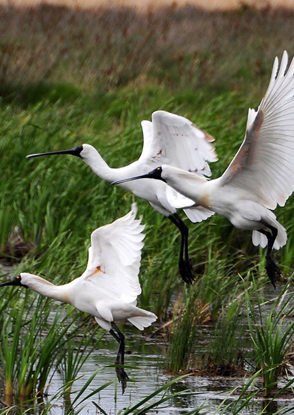
How CSIRO is helping to
protect a national icon
The Murray-Darling Basin is a national icon under stress               To better manage water under this likely future, we need
in a changing climate. Ensuring this Australian food bowl              to know the key climate drivers across the Basin, and how
remains healthy and productive is vital for the communities,           they’re likely to change due to global warming. We also
environment and industries relying on it. The Basin (MDB)              need to understand where and when rains will fall, and
covers 14 per cent of Australia and is home to more than               what evaporation rates and water use can be expected.
two million people. Its agriculture (both dryland and
                                                                       CSIRO has delivered decades of world-leading research in
irrigated) accounts for almost 40 per cent by value of
                                                                       the Basin. Water allocation and use in this important water
Australia’s agricultural production.
                                                                       resource is contentious, with many different water users and
The Basin is in one of the world’s most variable climate               beneficiaries. During average flow years there is tension
regions, where catchment inflows in a wet year can be more             around the various uses of water and through dry years,
than 20 times greater than the inflow in a dry year. It’s a            particularly in an extended drought, water allocation decisions
system facing profound future challenges to adapt to a                 are often contested. The challenges in the Basin also extend to
drier, hotter climate.                                                 the management of other natural assets beyond water.

CSIRO Murray Darling Basin research milestones over time

                                    2006                                                                     2012
                                    The South Eastern                                                        CSIRO assessment of the
                                    Australian Climate Initiative                                            ecological and economic
                                    (SEACI) collaboration                                                    benefits of environmental
                                    begins investigating
                                                                          2009-12                            water in the Murray-Darling
                                    drivers of the climate in                                                Basin (MDB).
                                    south-eastern Australia,              SEACI phase 2 delivers
1986                                                                      answers on climate
                                    including global warming.
Murray-Darling                                                            questions from the
Freshwater Research                                                       south-eastern region
Centre established.                                                       of Australia.

                                                  2007-08                               2011
                                                  Murray-Darling                        CSIRO Science
                                                  Basin Sustainable                     review into
                                                  Yields Project                        the Guide to
                                                  (MDBSY) outlines                      the proposed
                                                  current and future                    Murray-Darling
                                                  water availability                    Basin Plan.          2012
                                                  in the Basin.           2009                               MDBSY findings
                         2001                                             CLLAMMEcology framework            supports the
                         15-year strategy to                              to guide management of the         development of
                         manage salinity in the                           Coorong, Lower Lakes and           the Murray-Darling
                         Basin commences.                                 Murray Mouth is released.          Basin Plan.

2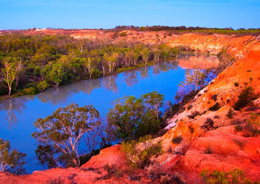
The Basin is a complex social-ecological system facing many
drivers of change and an understanding of this is vital for
informing its long-term management.

Acknowledging this complexity, we collaborate to provide
the best scientifc advice to those who depend on, or benefit
from, the Basin. Our lessons and scientific achievements
from the Basin have been shared with water managers
globally. We continue to provide science to support the
best possible outcomes for communities, industries, and
the Basin as a whole, now and into the future.

   CSIRO conducts research across four important areas
   in the Basin. In the following pages we look at the
   work CSIRO has delivered and what we are doing now
   in these four areas:

   1.   Assessing water availability in the Basin
   2.   Adapting to less water
                                                                     Our research informs management of the complex
   3.   Sustaining the environment
                                                                     social-ecological system that is the Basin. Pictured is a lace
   4.   Ensuring resilient, diverse and healthy communities          monitor (goanna) perched on an upper tree branch on the
                                                                     Chowilla Floodplain, South Australia.

                            2015
                            MDB Salinity
                            Management Strategy
                            is released.
                                                                                                         2020
                                                                                                         Release of
                                                   2017-18                                               CSIRO-led Lower
2014                                               Bioregional Assessment                                Lakes Science
Delivery of the MDB                                Programme assesses impacts                            Review for the
Environment Flows                                  of coal seam gas and coal                             Murray-Darling
Cluster project                                    mining developments,                                  Basin Authority’s
(following CLLAMM                                  including the MDB’s Namoi                             science advisory
Ecology Cluster project).                          and Condamine regions.                                committee ACSEES.

                            2015                                                2019
                            CSIRO and the Bureau of                             CSIRO convenes
                            Meteorology provide an                              the Future Ready
                            assessment on the MDB, as                           Murray-Darling
                                                                                                         2020
2014                        part of the latest Climate                          Basin Forum:             Risk assessment for
                            Change in Australia report.                         Beyond 2030.             Australian Government
The development                                                                                          regarding the release of
and implementation
of the Sustainable
                                                              2018                                       the Carp virus (Cyprinid
                                                                                                         herpesvirus 3) to manage
Diversion Limit (SDL)                                         CSIRO’s SDL work leads to an               Carp numbers across the
Adjustment method                                             amendment of the Murry-                    waterways of the MDB.
by CSIRO.                                                     Darling Basin Plan by the
                                                              Australian Government.

                                                                                                                                      3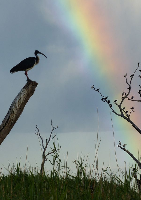
Assessing water
availability in the Basin

Managing water in the Murray-Darling Basin (MDB)
requires an in-depth assessment of the actual water
available in the Basin. To support this, CSIRO has been
undertaking research for 30 years into understanding
patterns of rainfall, evapotranspiration and water use
over time and space, across the whole Basin. This has
further deepened our knowledge to better identify
the key climate drivers across the Basin, as well as
how these are likely to change as a result of climate
variability and change.

What have we done?
CSIRO and the Bureau of Meteorology assessed the
observed climate change in Australia, including in
the Murray-Darling Basin, and its causes, as well as
projected future changes over the 21st century. This
was part of the 2015 Climate Change in Australia (CCIA)
report for Australia’s Natural Resources Management
(NRM) and the earlier South Eastern Australian Climate
Initiative (SEACI). More recently the climate change
impact on Australia and its water resources is featured
in the biennial State of the Climate report.

CSIRO research has characterised the following climate
change-related impacts on the Basin:

• increased air temperature by nearly 1.5 degrees
  relative to the 1910-1950 average. This is around
  30 per cent greater than the global average
  temperature increase                                        Lower Lakes (Image: Kane Aldridge).
• overall reductions in rainfall, particularly in the south
• large reductions in winter rainfall, with possibly
  some increases in summer rainfall
• an increase in extreme rainfall events
• a greater number of hot, and fewer cold days
• an increase in the number and intensity of extreme
  fire days.

4
What are we doing now?

National hydroclimate projections to
prepare for the future
 CSIRO is developing rigorous and credible methods for
projecting hydrological metrics for Australia, including
the Basin, as part of the National Environmental Science
Program (NESP). These methods will underpin the
science and modelling capability required for the next
generation of national climate projections following
the release of the Intergovernmental Panel on Climate
Change (IPCC) Sixth Assessment Report in 2021. They
continue to help us assess and predict water availability    The Barmah-Millewa Forest, Australia’s largest red gum
in the Basin and plan for the future scenarios.              forest in flood.

We are also developing a suite of ‘hydroclimate
storylines’ that will be used to communicate the range       Improved water accounting
of potential futures to the broader community and water      CSIRO, in collaboration with universities and other research
users. These storylines are based on projections of future   agencies, including OzFlux and TERN, has developed
climate such as planning for a a drier future and changes    methods to quantify water loss from the land, plant and
in the total annual flow.                                    water surface to the atmosphere using a combination of
                                                             satellite data and in-situ observations. These eight-day
                                                             measurements of evapotranspiration help us understand
                                                             how much water is being evaporated and therefore how
                                                             much is available for agriculture, towns, industry and
                                                             the environment. Research focusses particularly on the
                                                             floodplains of the southern Basin where understanding the
                                                             magnitude of water losses from River Red Gum and Black
                                                             Box trees via field measurements is important to manage
                                                             floodplain health. We are also looking at how best to
                                                             account for the impact of numerous small farm dams on the
                                                             overall water availability.

                                                             Impacts on climate and water availability
                                                             Through the Victorian Water and Climate Initiative
                                                             (VicWACI), CSIRO is continuing previous work with the
                                                             South Eastern Australian Climate Initiative (SEACI). We
                                                             are working with a consortium including the Bureau of
                                                             Meteorology and the University of Melbourne to study
                                                             current trends in Victorian rainfall, and particular looking
                                                             at: what is known about the drivers, assessing how these
                                                             may change in the future, and how these will affect
                                                             streamflow and water availability. This research involves
                                                             incorporating knowledge of the main drivers of local-scale
                                                             rainfall to re-interpret results from coarse resolution global
                                                             climate models (referred to as downscaling) and then
                                                             enabling us to better represent future rainfall projections
                                                             at a catchment scale. This work will also assess how best to
                                                             use the research to inform adaptation.

Red gums at Katarapko Creek, South Australia.

                                                                                                                              5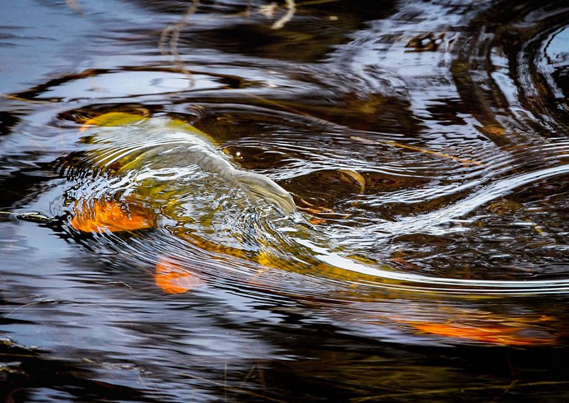
Adapting to less water

Over the past 20 years, the average inflow to the                   What have we done?
Basin was around half of the 20th century average.
Sixteen of the past 20 years have seen below average                The Murray-Darling Basin Sustainable Yields (MDBSY)
winter rainfall. Most climate models also project that              project undertaken in 2007 and 2008 represented the first
rainfall is likely to continue to decrease, particularly            attempt to build a linked model of all the catchments and
in the southern half of the Basin, as global average                major aquifers in the Basin. It showed that under the water
temperatures rise. Longer and more intense droughts                 allocation rules in operation at the time, the impacts of
are also more likely in the future. As a result, we need to         drought were felt much more keenly by the environment
adapt to less water overall. There will be changes in the           than by irrigators. The findings of the MDBSY helped lead
timing and geographical distribution of water availability,         to the development of the Basin Plan (2012) which attempts
and there is much uncertainty about what kinds of                   to ensure an equitable allocation of water in a changing
extremes different localities will be faced with. It is not         climate for all users, including the environment.
simply about making do with less water but adapting to
                                                                    The subsequent Bioregional Assessment Programme
a complex mix of changes and consequences at different
                                                                    assessed the cumulative impacts of coal mines and CSG on
scales in the Basin.
                                                                    existing water users and the environment. This included
                                                                    the Basin regions of Namoi and Condamine, which were
                                                                    assessed between 2017 and 2018.

The Victorian side of Lake Hume, a major dam across the Murray River, at 4% capacity in 2007 (Image: Tim J Keegan via Flickr).

6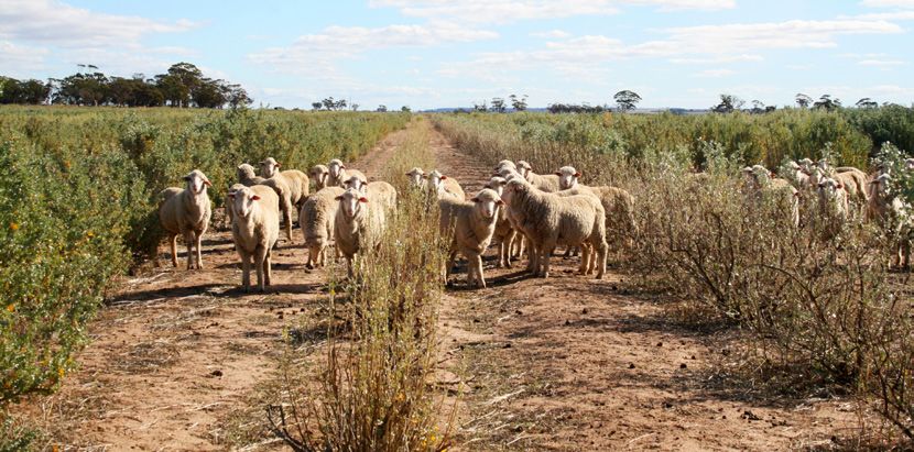
Planting AnamekaTM saltbush can provide extra on-farm forage for sheep in times of drought.

What are we doing now?                                            Drought resilience
                                                                  • CSIRO is working with partners on a focussed drought
                                                                    resilience research effort that aims to reduce the
Improving agriculture
                                                                    impacts of drought on producers, communities and
• We are researching ways to improve crop efficiency                the environment.
  across the Basin through both genetic improvement
                                                                  • A range of activities that bring together existing and
  and farming system approaches. These include irrigated
                                                                    emerging technologies and practices and develop novel
  annual crops such as cotton and soybean as well as
                                                                    ones are planned. These will be complemented by new
  perennial crops such as grapevines, citrus and nut trees.
                                                                    ways of sharing risk through financial and other tools.
  We are also working to improve the efficiency of dryland
  crops such as cereals, oilseeds, legumes and dryland            • In some places the increased frequency of low
  cotton. Research is also being carried out on mixed               rainfall years will challenge even the best producers,
  farming systems and livestock systems.                            consequently, re-designing some systems or changing
                                                                    the type of enterprise conducted also needs to be
• Some of the new approaches being explored are digital
                                                                    explored. We propose developing the analytical tools to
  and data-driven technologies to improve water-use
                                                                    support this.
  efficiency, livestock management and increase the rate of
  genetic improvement of the animals and crops we farm.           • To smooth the variation in supply of irrigation water
                                                                    and to prevent rural towns approaching day zero (the
• Practices being examined include the use of break crops,
                                                                    day they run out of water) we are exploring managed
  controlling summer weeds, early sowing, irrigation
                                                                    aquifer recharge (or water banking). This is the
  timing, wider rows, and optimised application of
                                                                    intentional recharge of water to underground aquifers
  fertilizer. The CSIRO-bred Phalaris cultivar provides
                                                                    for subsequent use or environmental benefit. Research
  high quality forage which is acid tolerant, deep rooted
                                                                    into this includes an assessment of the hydrogeologic
  and water efficient. Similarly, Anameka saltbush
                                                                    and hydrochemical suitability of target aquifers as well
  commercialised in 2014 is a drought-tolerant shrub
                                                                    as understanding the legal framework for extraction of
  adapted to low rainfall environments.
                                                                    water under current licencing conditions.
• We explore how alternative water sources, such as
                                                                  • Droughts and extended periods of low rainfall increase
  treated wastewater and water from unconventional
                                                                    the risk to on farm environmental assets, as well as of
  gas, can be safely used for sustainable irrigated
                                                                    the farm itself. We are seeking to develop practices that
  agriculture/horticulture.
                                                                    are economically productive and reduce soil losses and
                                                                    undesirable changes such as salinisation.

                                                                                                                                7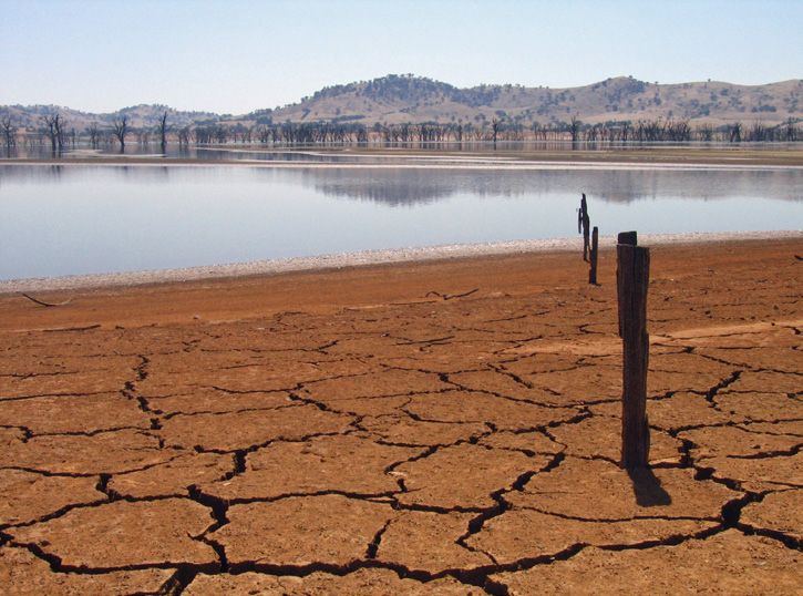
Sustaining the environment

Water extraction from the Basin through human activities      Mapping willow trees
has increased dramatically in recent decades. This increase   We have developed a set of tools to allow water managers
has brought great benefits to the communities that live       to understand where and how many hectares of willow
in the Basin but has caused increased stress on ecological    trees exist and how much water they use. This allows
communities that also rely on this water. These ecological    managers to calculate the total water savings if willows are
impacts affect livelihoods, such as tourism and cultural      removed from individual rivers.
values. Ensuring that the natural environment of the Basin
is not compromised by these human activities is therefore
a key issue.                                                  Managing salinity
                                                              CSIRO made a significant contribution to the establishment
                                                              of the Murray-Darling Basin Salinity Management Strategy
What have we done?
                                                              in 2015 which aims to maintain the cap on salinity
                                                              through the existing Basin Salinity Target and the existing
Human activities and water use                                accountability framework. It also explores opportunities
CSIRO contributed greatly to the Murray-Darling               to responsively manage salt interception schemes so that
Freshwater Research Centre (MDFRC) over more than             operations can be further optimised and costs can be
30 years, particularly determining the requirements to        reduced when river salinity is forecast to be low.
maintain the condition of rivers and wetlands in the Basin.
This research helped develop clear understanding of the
                                                              Restoring ecology
effect of human activities on water quality, particularly
                                                              CSIRO contributed to the development of a suite of
carbon, nutrients, and salinity, and subsequent
                                                              modelling tools to help land and water managers to restore
functioning of rivers and wetlands.
                                                              the ecology of the Coorong and Murray Mouth region as
Sustainable diversion limits (SDLs) determine how much        part of the CLLAMMecology research cluster.
water, on average, can be used in the Basin by towns,
communities, industry and farmers. The Basin Plan
allows SDLs to be increased if environmental, social
and economic outcomes are maintained. This requires
an ‘environmental equivalence test’ to assess whether
environmental outcomes will be maintained if the SDL
is increased. The Ecological Elements Method (EEM)
developed by CSIRO does just that. The EEM method
assesses how three ecological classes: vegetation,
waterbirds and fish are affected by changes to water
availability. The environmental outcomes need to remain
equal to or higher than a defined benchmark scenario
under potential SDL adjustments. This method is now in
use in the southern part of the Basin.

                                                              Aerial view of River Murray, wetlands and floodplains in the
                                                              southern Murray-Darling Basin.

8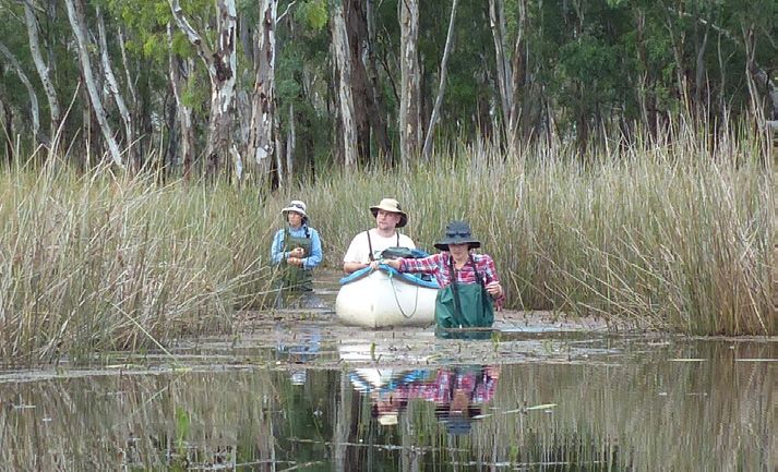
What are we doing now?                                      Assessing environmental flow releases
                                                            To measure the benefits of environmental water
                                                            releases, CSIRO in collaboration with the Commonwealth
System-level understanding of environmental
                                                            Environment Water Holder is carrying out a monitoring,
outcomes of the Basin Plan
                                                            evaluation and research program. This provides the
To understand the broader impacts of management             critical evidence we need to understand how water for the
on ecosystem function, resilience and system-level          environment can best be used to maintain, protect, and
environmental outcomes, CSIRO has undertaken                restore ecosystems and native species across the Basin. This
Basin-scale ecosystem function research. This multi-        multi-disciplinary program of monitoring and research is
disciplinary research will provide an improved Basin-wide   assessing the productivity benefits of environmental flow
understanding of the complex interactions and scales of     releases through a systems-level approach.
change between hydrological and biological connectivity,
productivity, habitat provision and maintenance with
changing hydrological regimes.

Black water flowing over Rice’s Weir on
Broken Creek, near Barmah (2012).

                                                                                                                       9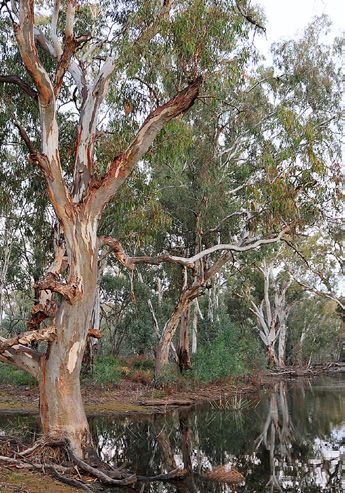
Predicting and monitoring blue-green algal • CSIRO is engaging and collaborating with the Murray
outbreaks and blackwater events Darling Basin Authority (MDBA) to assess change in
environmental indicators in response to various climate
• We are combining remote sensing, hyperspectral
characteristics in the lower Murray region as part of the
and satellite remote sensing with hydrodynamic
Earth Systems and Climate Change Hub (ESCC) under
modelling in order to produce a continuous forecast
the National Environmental Science Programme (NESP).
of algal growth. This approach is being trialled in Lake
The results can contribute to modelling development for
Hume, NSW, and is providing early warning of bloom
ecological change trajectories.
formation across the reservoir.
• Simulation and monitoring tools for blue-green-
Assessing biocontrol of European carp
algae form the basis of on-ground activities for the
AquaWatch Australia Program which will develop a As part of the National Carp Control Plan, an assessment of
comprehensive, national monitoring system that can the feasibility of using the Carp virus (Cyprinid herpesvirus
provide precise, decision-ready information on the 3) as a biological control agent for introduced common carp
quality of water across Australia’s inland waterways, in Australia was delivered to the Australian Government in
reservoirs, and coastal environments and its variations January 2020.
over time. This will enhance existing monitoring
To inform the National Carp Control Plan:
systems already in place across states and territories.
• Blackwater (hypoxic) events occur during flooding • Through modelling the epidemiology of the virus, risks
when organic material is washed off the floodplain and to non-target species such as trout and frogs as well as
into the river systems. It can lead to a sudden decrease broader risks to the environment and people, whose
in the oxygen available to fish and other organisms livelihood may be impacted, can be estimated.
in our rivers and result in fish kills, disruption of • CSIRO is providing a risk assessment related to the
small businesses such as fisheries and increased cost release of the Carp virus to help manage Carp numbers
of water treatment. We are researching the sources across the waterways of the Basin.
and processes leading to hypoxic events in order to • The epidemiological model is linked with a population
develop a scenario modelling tool which will assess dynamic model and based on large scale hydrological
the impacts of flow management options to minimize simulations, remote sensing derived inundation mapping
future blackwater events. and water temperature estimates in catchments of the
Basin to evaluate the most effective release strategy for
Understanding ecological trajectories the virus.
of change
• Understanding how and when recovered
environmental water is best used and achieving Basin
Plan objectives can be assisted by understanding how
environmental conditions change through time, and
predicting future flow conditions.
• CSIRO research aims to develop a modelling
approach which predicts trajectories of ecological
change over space and time, as a result of water
management, climate variability and climate change.
This will allow a comparison of relative outcomes
from different management scenarios into the
future, as well as tracking environmental progress
towards Basin Plan objectives.
An ecologist holds an adult carp collected during fish surveys
in the Macquarie Marshes, NSW.
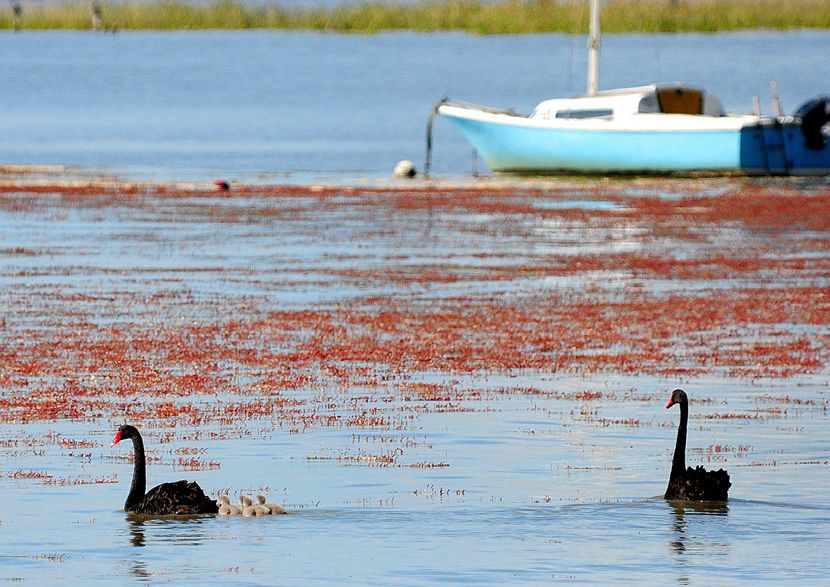
10Swans and signets in the Lower Lakes (Goolwa) after floodwaters renew water during the 2010-2012 floods.
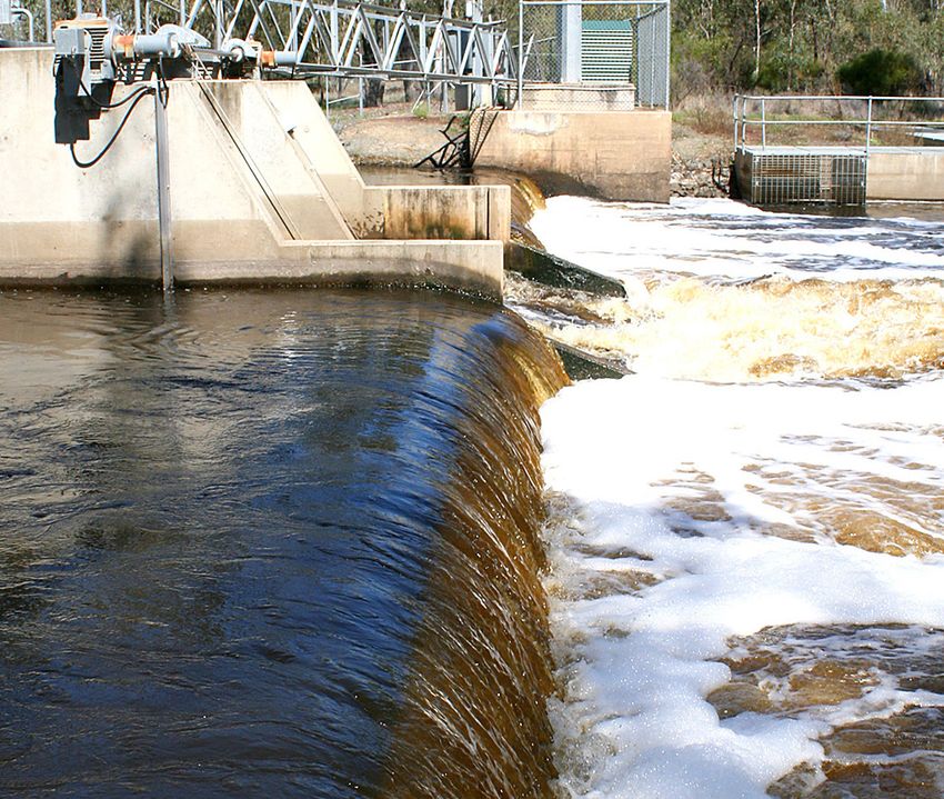
Bushfire and water quality Coorong, Lower Lakes and Murray Mouth
The 2019-20 bushfires across south east Australia An independent expert panel led by CSIRO delivered a
led to a massive release of sediment and ash into review of South Australia’s Lower Lakes, including the
waterways with an implication for aquatic ecosystems. Coorong, in May 2020.
We estimated the potential risk to waterways.
This involved combining data on burn severity so The independent panel reviewed the existing science
agencies could better target hotspot areas in the relating to the management of the Lower Lakes and
landscape with erosion models to simulate sediment Coorong, noting that under climate change, the
loading of waterways. We estimated potential risks of: management of the Coorong, Lower Lakes and Murray
Mouth would become increasingly challenging.
a. increased sediment load and low oxygen on fish kill,
As part of our contribution to the South Australian
b. toxic effects of released metals and other substances Government’s Healthy Coorong Healthy Basin Action
on aquatic life, and Plan we are determining what is required to restore the
c. increased sediment deposition and subsequent ecological character of the South Lagoon of the Coorong.
internal nutrient loading in reservoirs, leading to This project aims to determine how future climate change
toxic blue-green algal blooms. will affect the ecological character of the Coorong,
determine which values are most at risk, and what
management actions could be taken to reduce this risk.
11Ensuring resilient and
healthy communities
What have we done? What are we doing now?
Murray Darling Basin Forum Social research
In March 2019, CSIRO convened the Future Ready All communities are different. Understanding the gender
Murray-Darling Basin Forum: Beyond 2030 in Canberra. distribution, occupation and income of communities allows
The forum considered future constraints and us to better predict which types of policy interventions will
opportunities for the Basin, identified critical gaps in be successful across the diversity of the Murray-Darling
knowledge, and ensured investments would deliver Basin region.
impact. The forum involved more than 100 leaders and
stakeholders from the Murray-Darling Basin. The priority Previous research under the Strategic Foresight for Regional
actions from this forum included developing a science Australia project identified key scenarios likely to affect
prospectus for investment in knowledge, undertaking an Basin communities. Ensuring that these communities are
annual report card, mainstreaming Aboriginal voices, and able to survive droughts and other system shocks is now a
improving partnerships to focus CSIRO research efforts. focus of research. This may be through improved resilience
or through adaptation to short and long-term changes and
may involve widespread modification of agricultural or
Regional communities social systems.
As part of the Physical Environment Analysis Network
(PEAN), we have explored the effects of water
Evaluating the benefits of Indigenous land and
management in regional communities. This project drew
water management
on water data from a range of sources, including the
Bureau of Meterology, Murray-Darling Basin Authority CSIRO is working with Murray Lower Darling Rivers
and Australian Bureau of Statistics as well as the Indigenous Nations, Northern Basin Aboriginal Nations
Multi-Agency Data Integration Project and the Business and the MDBA to evaluate the socio-economic benefits
Longitudinal Analysis Data Environment. of assessing the return on investment from the Federal
Government support for Indigenous programs working on
country in the Basin. The program is generating insights
Incorporating social values that will improve the delivery of government programs
In a collaboration with the MDBA, and in parallel with including the MDBA – ASEI Monitoring Framework,
our eco-hydrological trajectories modelling work Indigenous Rangers program, Indigenous Protected Areas
mentioned earlier, CSIRO reviewed and extended our program and the National Landcare program.
understanding of the multiple ways in which people
benefit from environmental water being delivered
and ecological objectives being met. The review
recommended improving the way these benefits are
shared so that the Basin Plan ecosystem targets can be
evaluated, not only according to biophysical indicators,
but relevant social indicators. Also, the study found that
an improved understanding of the relevant social values
also enables more informed decisions when trade-offs
between different values are necessary.
Growth of aquatic vegetation in response to flooding in a
Murray-Darling Basin weltand.
12Royal spoonbills after 2010 -2012 flood
period in the Coorong.
13Looking to the future
CSIRO researchers have used key outcomes of Basin This will lead to a better understanding of how the people
research to support water resource sharing and of the Basin, its critical agricultural assets, and ecology
integrated management in overseas river basins and may be impacted, allowing time to develop and assess
sub-basins. We aim to improve the livelihoods and adaptation options.
economic well-being of people in large and complex
Future opportunities include exploring:
river basins. This is not only in Australia, but also in
Nepal, Asia, India, South Pacific and Pacific. • the economics of dual water supply source options, such
as using surface water resources when available, and
As we look to the future, we need a better
groundwater resources during particularly dry periods;
understanding of how ecosystems respond to changes
in water availability, increased temperatures, longer dry • different possible futures to inform robust decision-
spells and other hydrological changes predicted under making options; and
climate change. • the value of local and traditional knowledge, values
and social interactions as drivers for decision-making
Further research to better understand climate drivers,
and effective water management in conjunction with
reductions in rainfall and water availability promises
traditional monitoring and enforcement strategies.
benefits for decision makers across government,
industry and agriculture.
A CSIRO Waterbird Research Team entering the Reed Beds Wetland in Barmah-Millewa Forest.
14Straw- necked Ibis pictured at Macquarie Marshes in NSW.
15Carp spawning on Murray Darling flood plain.
As Australia’s national science
agency and innovation catalyst,
CSIRO is solving the greatest
challenges through innovative
science and technology.
CSIRO. Unlocking a better future
for everyone.
Contact us For further information
1300 363 400 David Post Helen Beringen
+61 3 9545 2176 Murray-Darling Basin Lead Communication Manager, Land and Water
csiroenquiries@csiro.au +61 2 6246 5751 +61 7 3833 5945
csiro.au david.post@csiro.au helen.beringen@csiro.au
B&M | 20-00228You can also read