SPAIN NATIONAL REPORT - OF THE MEDITERRANEAN AND BLACK SEAS HYDROGRAPHIC COMMISSION (MBSHC-22) TO THE 22nd MEETING - International Hydrographic ...
←
→
Page content transcription
If your browser does not render page correctly, please read the page content below
SPAIN

     NATIONAL REPORT

       TO THE 22nd MEETING
OF THE MEDITERRANEAN AND BLACK
 SEAS HYDROGRAPHIC COMMISSION
            (MBSHC-22)

         CADIZ, ESPAÑA (SPAIN)
          MAY 2019 – MAY 2021

     Instituto Hidrográfico de la Marina
                Cádiz - España
1.     HYDROGRAPHIC SERVICE
Instituto Hidrográfico de la Marina (España). There haven´t been relevant internal
modifications in the organization of our Hydrographic Service since the last meeting. Our
organization, mission and different kind of services offered can be found at
http://www.armada.defensa.gob.es
(https://armada.defensa.gob.es/ArmadaPortal/page/Portal/ArmadaEspannola/cienciaihm1
/prefLang-es/ )

This report covers the period May 2019 – May 2021.

2. SURVEYS

2.1. Coverage of new surveys

A total of 99% of Spanish Mediterranean coastal waters up to 200 m deep have already
been surveyed. These data were updated considering single beam coastal surveys (
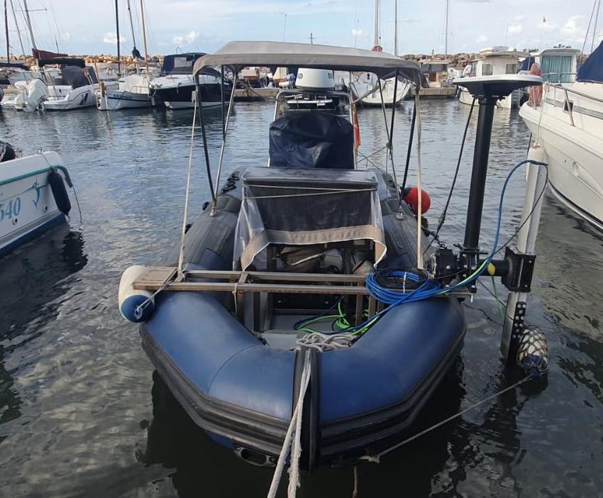
Figure 2. "Malaspina" class oceanic hydrographic vessel, A-32 “Tofiño” in Monaco.

                     Figure 3. "Antares" class coastal hydrographic vessel.

Furthermore, it is important to highlight that this office has continued with the goal of
carrying out hydrographic surveys of Ports and their approaching channels (Special and
Exclusive order surveys). For this purpose, IHM employed transportable hydrographic
launches and small boats fitted with MBES.

                                               3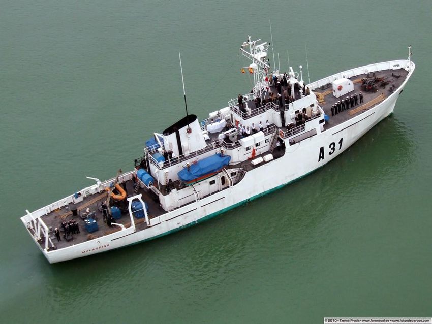
Figure 4. Transportable hydrographic launches.

                Figure 5. Small transportable hydrographic boat.

Figure 6. Very shallow water bathymetry system operated from a small rubber boat

                                       4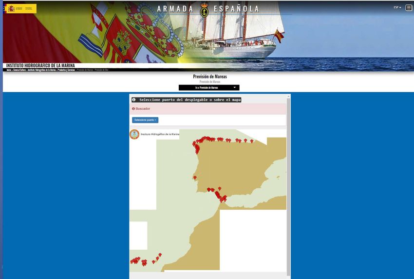
Compiled bathymetric coverage conducted by Spanish navy survey ships from May
2019 to May 2021 is illustrated in the next figure.

Figure 8. Compiled bathymetric coverage conducted by Spanish navy survey ships from May 2019
                                         to May 2021

Survey planning

Surveys have been prepared by taking into account the type and purpose of each
navigational area, in accordance with the IHO S-44 publication. This requirement
directs us to assign specific surveys to the right asset (Hydrographic Vessel,
Transportable launch or Boat) depending on her hydrographic capability, equipment
and endurance.

2.2. New technologies and/or equipment
2.2.1. Cartographic production

The production of charts with CARIS HPD production system is fully established, and
work continues on the migration of cartographic production to the new system. A print
on demand system (POD) is completely established to print charts embedded in CARIS
HPD production system. Nowadays this POD percentage is reaching the 85% of the
total Cartography published by IHM.

2.2.2. Echosounders
New MBES (Kongsberg EM-2040P) and Teledyne RESON T-20P were acquired and
installed on our boats in order to work in shallow waters.

                                             5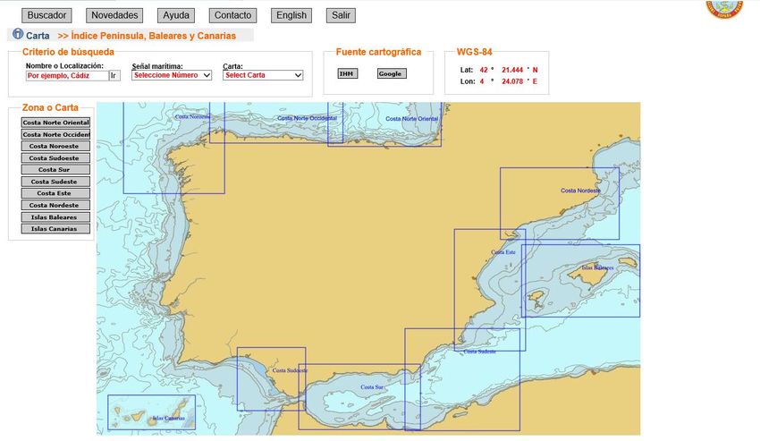
Our Hydrographic Fleet is currently fitted as follows:
Two Hydrographic Vessel, “Tofiño” and “Malaspina” (1000 Gross Tons, GT),
are equipped with two hull-mounted MBES (for shallow and deep waters). Each vessel
has two small hydrographic boats to cover very shallow waters with portable MBES
and PDBS (Phase Differencing Bathymetric Sonars).
One Coastal Hydrographic Vessel “Antares” (400 GT) is fitted with a shallow
water MBES and with one small hydrographic boat operating high resolution shallow-
water portable MBES and PDBS.
Three Transportable hydrographic launches, and a small rubber boat, have either
hull or pole mounted MBES or PDBS in order to conduct Special and Exclusive Order
Surveys.
2.2.2.1 Bottom Mapping Sonars
Seafloor mapping is achieved mostly by using MBES. Over the last two years, new high
resolution portable systems have been purchased and are in use onboard our
hydrographic small boat and launches. These new sensors can provide simultaneous co-
registered high-resolution side scan sonar imagery and bathymetry within IHO special
and exclusive order accuracy standards. In addition, updated processing methods allow
IHM hydrographers to process this data in a swift way so that the ping-to-chart
workflow is executed timely.
2.3. New ships
IHM has proposed to replace the hydrographic fleet with new survey vessels for
modern, sophisticated and low-noisy vessels and boats by means of an operational
requirements document. The submitted proposal consists of one oceanic vessel, two
coastal hydrographic vessels and five survey boats.
3. NEW CHARTS AND UPDATES
3.1 ENC coverage, gaps and overlaps
To date, IHM has produced during this period 49 ENCs within the area of the MBSHC
(out of a total of 317 published for all areas).
Since the last MBSHC meeting, IHM has produced 11 new ENCs, and 38 new ENC
editions. This shows the increasing workload associated with maintaining and updating
the ENC catalog, which slows the production of new ENCs.
While it continues the work to finish Purpose 5 Project, Purpose 6 Project has started
with the most important commercial ports.
Navigational purpose Projected Published
1 - Overview 0 0
6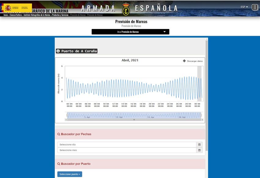
2 - General                    1            1
                 3 - Coastal                    3            3
                 4 - Approach                  11           11
                 5 - Harbour                   32           32
                 6 - Berthing                  30            2
                                  Total        77           49

Figure 9. Navigational purpose 2 and 3 ENC production in the MBSHC May 2019-Apr 2021

                                          7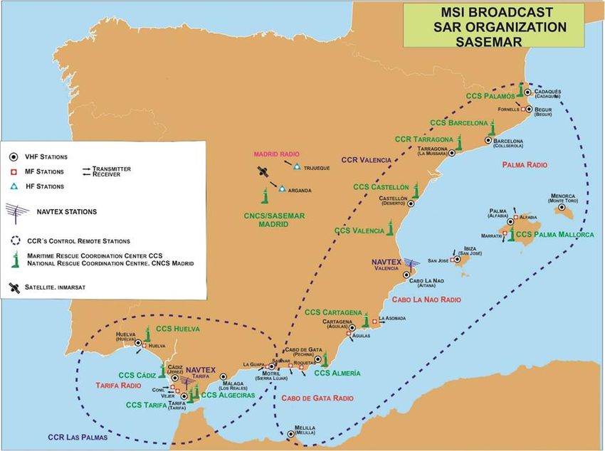
Figure 10. Navigational purpose 4, 5 and 6 ENC production in the MBSHC May 2019-Apr 2021
                                              part 1

Figure 11. Navigational purpose 4 and 5 ENC production in the MBSHC May 2019-Apr 2021 part 2

                                              8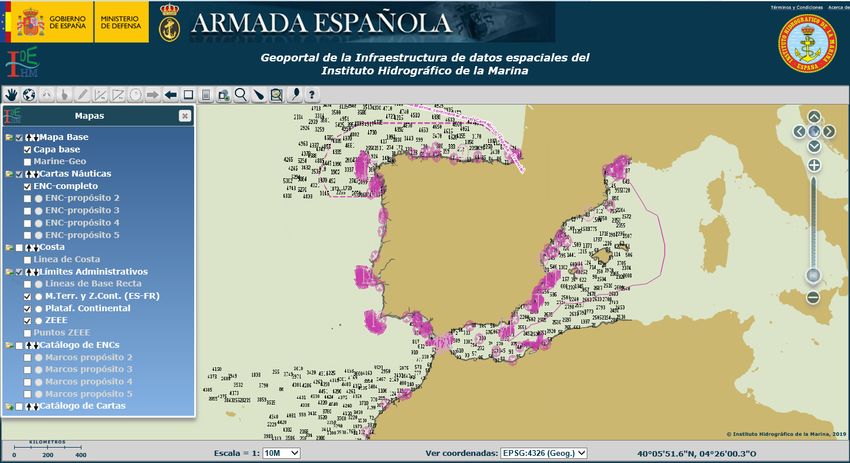
3.2      ENC distribution method.
Spain is a member of the International Center for ENC (www.ic-enc.org/) RENC from
the beginner of the IC-ENC. All Spanish ENCs are distributed by IC-RENC, which
carries out validations and consistency checks before distribution. There is close
collaboration in development with this RENC, especially regarding the optimization of
production and validation processes.

3.3.     RNCs.
NTR.

3.4.     INT Charts.
Nowadays, IHM has produced 59 International charts, 25 within the area of the
MBSHC (out of a total of 339 published for all areas).
Since last MBSHC meeting, IHM has produced 1 new INT Charts, and 5 new editions.
This table shows the increasing workload associated with maintaining and updating the
INT Chart catalog.

Navigational purpose                                           MBSHC ZONE
INT charts made since the last MBSCH Conference                     6
Charts projected for the second semester of 2021 and 2022/23        7
Status of the INT charts production assigned to IHM pending to      7
be published
Leisure Charts published                                            9
Leisure charts pending to be published                              2
                                        Table 1

The next table shows INT charts made since the last MBSCH Conference:

INT No    National No                          Title                       Edition
 3184       489A               Aproches del puerto de Barcelona         VII Mar 2020
 3113        49A         De Barcelona al Cap Cerbère con las islas de     I Mar 2020
                                      Mallorca y Menorca
 3164       464A             Aproches de Cartagena y Escombreras         IX Jun 2020
 3168       4722                       Puerto de Alicante               VI Dic 2020
 3252       4511                    Bahía y puerto de Ceuta             VIII Feb 2021
 3150        105        Estrecho de Gibraltar. De cabo Roche a punta de VI Mar 2021
                          la Chullera y de cabo Espartel a cabo Negro.
                                        Table 2

                                           9
Figure 12. INT charts produced since the last MBSHC Conference

The next table shows INT charts projected for the second semester of 2021, and
2022/23.
  INT No      National No                              Title                            Edition
                 45A1                                                                   TBD[1]
      3101                   Estrecho de Gibraltar y Mar de Alborán
              (1:275 000)
      3104       46A1        Del Cabo de Gata Punta el Caño y de Saídïa a            TBD (2021)[2]
              (1:250 000)    Cap Carbón
      3105       47A1        De Punta El Cañon a Gandia con Ibiza y                      TBD1
              (1:250 000)    Formentera
      3106*        46        De cabo de Gata a cabo de las Huertas y de              TBD (2020)[3]
              (1:350 000)    cabo Milonia a cabo Ivi
      3107      48A1         De la Isla de Tabarca a Peñiscola con Ibiza y               TBD1
             (1:250 000)     Formentera
   3109         48 B1        Islas Baleares                                              TBD1
             (1:275 000)
   3111         48C1         De Las Fuentes a Tossa de Mar                               TBD1
             (1:250 000)
* INT 3106, Coproduction as INT Chart between Algeria and Spain. Exist as National Spanish Chart

[1]
    Delayed to 2020/2021 due to HPD conversion.
[2]
    Depend on Spanish/Algerian Agreement.
[3]
    Depend on Spanish/Algerian Agreement.

                                                  10
Table 3
Figure 13. INT paper Charts projected in the MBSHC from May 2019-Apr 2021
The next table shows status of INT charts production assigned to IHM.
INT National Title Edition Scale
No. No.
303 4-C Mar de Alborán y Mar Balear 97/97 1 000 000
3102 45 Estrecho de Gibraltar y Mar de Alborán 79/08 350 000
3108 47 De Cabo Tiñoso a Cabo Canet con las islas Ibiza, 76/05 350 000
Formentera, Cabrera y Costa sudoeste de
Mallorca
3110 48 De Cabo de la Noa a Barcelona con las Islas 78/04 425 000
Baleares
3112 49 Golfo de León – De Punta del Llobregat a Cabo 79/17 400 000
d’Antibes
3113 49A De Barcelona al Cap Cerbère con las islas de 20/20 275.000
Mallorca y Menorca
3150 105 Estrecho de Gibraltar 98/21 100 000
3152 445 A Côte Sud d’Espagne – Bahía de Algeciras 86/08 25 000
3156 455 A Aproches del Puerto de Málaga 84/06 25 000
3157 4551 Puerto de Málaga 95/06 10 000
3159 459 Golfo de Almería – De la Punta Sabinar al Cabo 59/07 50 000
de Gata
11Plan A – Roquetas de Mar 7 500
3160 4591 Puerto de Almería 93/07 10 000
3164 464 A Aproches de Cartagena y Escombreras 85/20 30 000
3165 4642 Puertos de Cartagena y Escombreras 96/07 10 000
3167 472 A Aproches del Puerto de Alicante 87/09 25 000
3168 4722 Puerto de Alicante 87/20 10 000
3172 481 A Aproches del Puerto de Valencia 87/10 25 000
Plan A: Pobla de Farnals 10 000
Plan B: Port-Saplaya 10 000
3173 4811 Puerto de Valencia 94/10 10 000
3175 482 A Aproches del Puerto de Castellón 95/03 25 000
3176 4821 Puerto de Castellón 91/11 10 000
3179 487 A Aproches del Puerto de Tarragona 89/04 25 000
3180 4871 Puerto de Tarragona 80/05 10 000
3184 489 A Aproches del Puerto de Barcelona 87/20 25 000
3185 4891 Puerto de Barcelona 92/11 12 500
3252 4511 Bahía y Puerto de Ceuta 92/09 10 000
Table 4
Status of the production of international charts assigned to Spain.
Scale Assigned Produced
Small 5.000.000-1.000.000 1 1
Medium 350.0000-100.000 12 6
Large 80.000-10.000 18 18
TOTAL 31 25
Table 5
12Figure 14. Status of the INT charts production assigned to IHM
The boundaries of medium scale INT charts (3102, 3106, 3108, 3110 y 3112) are being
modified to adjust to the boundaries of the corresponding scale of the scheme for INT
charts (1:250.000)
13Figure 15. Status of the INT charts production assigned to IHM
3.5 National paper charts.
National No Title Edition
D49AN De Palamós a Portbou I Jul 2019
4851 Puertos de Sant Carles de la Rápita y Alcanar III Ago 2019
D49AS De Vilanova i la Geltrú a Platja d'Aro I Ene 2020
4865 Puerto de Cambrils y Rada de Salou I Ene 2020
4792 Puerto de La Savina II Mar 2020
489 Del puerto de Barcelona al puerto de Arenys de Mar VI Mar 2020
4632 Rada de Mazarrón III May 2020
4221 Isla de Cabrera y adyacentes III jun 2020
4571 Puertos de Motril y Adra III Jun 2020
4812 Puerto de Sagunto VI Jun 2020
4331 Puerto de Melilla III Jun 2020
4241 Porto Colom, Porto Cristo y Cala Ratjada III Oct 2020
The next table shows national charts made since the last XXI MBSCH Conference:
Table 6
14Figure 15. National Paper Charts produced in the MBSHC May 2019-Apr 2021.
3.6 Other charts.
Leisure Charts
Since the new format for leisure charts was implemented, from May 2019 two booklets
of leisure charts was published, chart D49AS Y D49AN. There is work in progress
regarding three new editions of booklet of leisure charts in the MBS area.
15Figure 16. Leisure charts
National No Title Edition Published
D45 De Barbate a Estepona y de cabo Espartel a cabo Negro I Dic 2014 X
D45A De Estepona a p unta de Torrox I Dic 2013 X
D46 De Marina del Este a San Pedro del Pinatar I Dic 2017 X
D47A De Torre de la Horadada a Dénia I Dic 2017 X
D48 De Oliva a Vinarós I Dic 2017 X
D48N De Les Cases de Alcanar a Segur de Calafell I Abr 2018 X
D48NE De Cala Figuera a Sóller I Jun 2016 X
D49AN De Palamós a Portbou I Jul 2019 X
D49AS De Vilanova i la Geltrú a Platja d'Aro I Ene 2020 X
D48SW Puertos de Mallorca SW TBD TBD
D48E Islas de Ibiza y Formentera TBD TBD
Table 7
4. NEW PUBLICATIONS AND UPDATES.
4.1 New publications.
The Mariners Handbook. 2021 edition.
4.2 Updated publications.
16Publications are updated via Notice to Mariners: Avisos a los Navegantes - Avisos a los
navegantes - Instituto Hidrográfico de la Marina - Armada Española - Ministerio de
Defensa - Gobierno de España
https://armada.defensa.gob.es/ArmadaPortal/page/Portal/ArmadaEspannola/cienciaihm1
/prefLang-es/02ProductosServicios--01avisos booklet which can also be downloaded
free of charge from the IHM section in the Spanish Navy Official Website.
4.2.1 Charts new editions:
- A new edition of «Catálogo de Cartas Náuticas y otras publicaciones»
(Catalogue of Nautical Charts and Publications) was published in the first quarter
2021.
4.2.2 Nautical publications
- IHO S-4 associated publication INT 1 – Symbols, Abbreviations and Terms use
on Charts (Spanish version), 6th edition 2018.
- Regulations for International (INT) Charts and Chart Specifications of the IHO
(Spanish: Edition 4.8.0, October 2018). S-4
- List of lights and fog signals, part I 2021 edition. Atlantic Spain and Portugal
coast and occidental Africa coast from Espartel Cape to Verde Cape (Senegal)
and Azores, Madeira, Canary and Cape Verde islands.
- List of lights and fog signals, part II 2021 edition. Gibraltar Strait, Balearic
Islands and Mediterranean coasts of Spain, Morocco and Algeria.
- Sailing Directions num. 1. From Río Bidasoa to Río Rivadeo.2021 edition.
- Sailing Directions num. 2. From Río Rivadeo to Cabo Finisterre.2020 edition.
- Sailing Directions num. 3. From Cabo Finisterre to Río Miño.2021 edition.
- Sailing Directions num. 4. From Río Miño to Río Guadiana, and Azores
Islands. 2020 edition.
- Sailing Directions num. 5. From Río Guadiana to Cabo Sacratif and the North
and South coasts of Gibraltar Strait. 2020 edition.
- Sailing Directions num. 6. From Cabo Sacratif to Cabo La Nao, North Coast of
Morocco and Coast of Algeria to Cabo Kramis. 2021 edition.
- Sailing Directions num. 7. From Cabo La Nao to France Border. 2020 edition.
- Sailing Directions num. 8. Balearic Islands and North Coast of Algeria from
Cabo Kramis to Tunisia Border. 2021 edition.
- Sailing Directions num. 9. Northeast coast of Africa from Cabo Espartel to
Cabo Verde. Madeira, Selvagens, and Cape Verde islands. 2021 edition.
- Sailing Directions num. 10. Canary Islands. 2020 edition.
- Radiosignals book 2020 y 2021 edition.
- International Regulations for Preventing Collisions at Sea (1972)
- Marine Signaling 2020 edition
- International Signal Code 4ª edition
- Official Annual Tide tables from Spanish Hydrographic Office
174.3. Means of delivery
Charts and other nautical publications produced by the IHM can be purchased
through the net of authorized sales agents. Contact information with these sales
agents is available in the following internet address:
Agencias de Ventas - Instituto Hidrográfico de la Marina - Armada Española -
Ministerio de Defensa - Gobierno de España (IHM sales agents)
https://armada.defensa.gob.es/ArmadaPortal/page/Portal/ArmadaEspannola/ciencia
ihm1/prefLang-es/02ProductosServicios--05Agencias
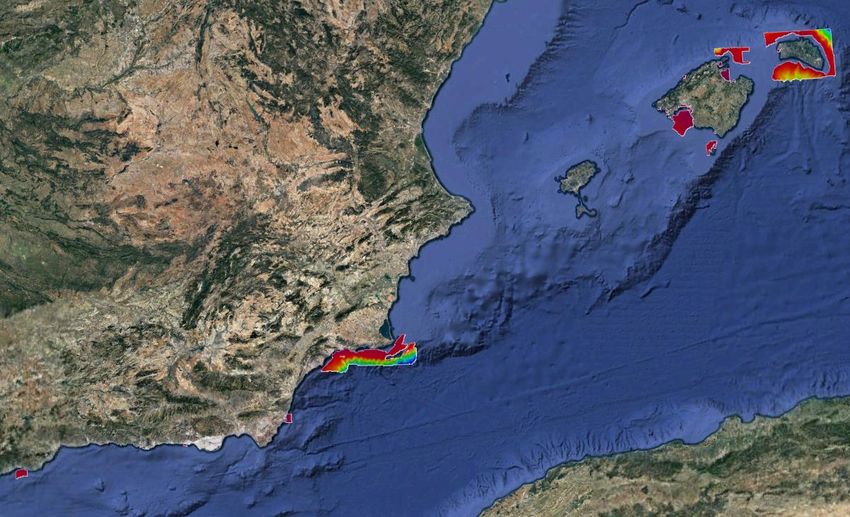
A digital version of the publication List of Lights and Fog Signals is currently
available online, which is an interactive application, in the following internet
address:
Faros y Señales de Niebla
https://armada.defensa.gob.es/ihm/Aplicaciones/LibroFaros/V3/index.html
18Figure 18. Screenshots of the List of Lights and Fog Signals interactive tool
Since 2018, a new online interactive application for the Spanish Tidal Predictions
is available in the following internet address:
Spanish Tidal Predictions
https://armada.defensa.gob.es/ArmadaPortal/page/Portal/ArmadaEspannola/ciencia
ihm1/prefLang-es/02ProductosServicios--045PrevisiondeMareas
19Figure 19. Screenshot of the Spanish Tidal Predictions online application
5. MSI
Spain (IHM) is NAVAREA III (Mediterranean and Black Sea)
Coordinator.
205.1. Existing Infrastructures for MSI dissemination
The current situation of the dissemination of Maritime Safety Information can be
summarized as follows:
5.1.1. Coastal Navigational Warnings in Spanish Coasts
Coordinator: SASEMAR (Spanish National Agency for Maritime Search and
Rescue Operations, Ministry of Public Works) is the national Coordinator for
coastal and local radio navigational warnings. The National Rescue Co- ordination
Centre (CNCS) is located in Madrid.
Control Remote Stations (CCRs): Valencia, Las Palmas.
Valencia CCR: NAVTEX Station: La Nao [ X ] [ M ] (490 Khz, Spanish)
MF Coast Radio Stations (CRSs): La Nao, Palma de Mallorca,
Cabo de Gata.
VHF Coast Radio Stations (CRSs): Cabo de Gata, Melilla,
Cartagena, La Nao, Castellón, Tarragona, Barcelona, Begur,
Cadaqués, Menorca, Palma de Mallorca , Ibiza.
Las Palmas CCR: NAVTEX Station: Tarifa [ G ] [ T ] (490 Khz, Spanish)
MF Coast Radio Stations (CRSs): Tarifa.
VHF Coast Radio Stations (CRSs): Tarifa, Malaga, Motril,
SASEMAR liaises with IHM for broadcasting coastal warnings through NAVTEX
Stations.
NAVAREA III Coordinator. NAVAREA III warnings are broadcast via
SAFETYNET 2 through Burum Land Earth Station and AOR-E Satellite over the
whole region.
IHM liaises with SHOM and SASEMAR exchanging NAVAREA warnings
originated in each region that are relevant for each coordinator.
IHM publishes the Notice to Mariners bulletin weekly which include the
NAVAREA warnings in force.
5.1.2. SAR Organisation
Coordinator: SASEMAR through its National Rescue Coordination Centre
(CNCS) located in Madrid and 10 Maritime Rescue Coordination Centres (CCSs):
Palamós, Barcelona, Tarragona, Castellón, Valencia, Palma de Mallorca,
Cartagena, Almería, Algeciras andTarifa.
21Figure 20. MSI Broadcast and SAR organization
5.2. New infrastructure in accordance with GMDSS Master Plan
NTR.
6. C-55.
6.1. Spain. Cartographic Region F.
6.1.1 Hydrographic Surveying
Survey coverage, where:
A = percentage which is adequately surveyed.
B = percentage which requires re-survey at larger scale or to modern standards.
C = percentage which has never been systematically surveyed.
A B C
Dephts < 200 m 40 60 0
Dephts > 200 m 90 0 10
Table 9
This table has been updated not considering now single beam coastal surveys (A= percentage covered by INT chart series, or paper charts complying with S-4
regulations.
B = percentage covered by raster charts (RNCs) complying with S-61 regulations.
C = percentage covered in accordance with S-57 regulations.
Purpose / Scale A B1 C
Offshore passage / Small 100 0 100
Landfall and Coastal passage/ Medium 100 0 100
Approaches and Ports / Large 100 0 85
Table 10
6.1.3 Maritime Safety Information (MSI)
NAVIGATIONAL INFORMATION (S-53)
SERVICE Yes No Partial Notes
LOCAL
X
WARNINGS
COASTAL
X
WARNINGS
NAVAREA
X
WARNINGS
PORT Agreements with all Port
X
INFORMATION Authorities
Table 11
GMDSS IMPLEMENTATION (IMO Publication 970–GMDSS Manual)
SERVICE Yes No Partial Notes
X
Master Plan
X
Area A1
X
Area A2
X
Area A3
X
NAVTEX
For NAVAREA Warnings
X
SafetyNET only.
Table 12
7. CAPACITY BUILDING
7.1 Offer of and/or demand for Capacity Building
The Spanish Hydrographic School, located within the premises of the IHM, offers
both Hydrography Category A and B courses. These courses are 10-month long and
are taught in Spanish. Minimum academic enrolling requirements should be
fulfilled.
1
Spain does not produce raster charts.
23In 2019 the Specialization Program in Hydrography & Oceanography for Naval
Officers (Category A) was presented and defended to the FIG/IHO/ICA
International Board on Standards of Competence for Hydrographic Surveyors and
Nautical Cartographers (IBSC), getting its recognition.
In 2020 the Specialization Program in Hydrography & Oceanography for Naval
Petty Officers (Category B) was presented and defended to the FIG/IHO/ICA
International Board on Standards of Competence for Hydrographic Surveyors and
Nautical Cartographers (IBSC), getting its recognition.
The virtual portal, as a supporting knowledge center for students including a
repository for teaching documents, regulations, procedures, relevant links and
various learning resources is implemented. Also, the learning platform MOODLE
is used both in online training and to complement classroom courses, as it can be
used as a basic repository of student resources and as a network learning
environment for students to interact, access content and complete tasks, monitoring
their full performance online and in the classroom.
The following is a list of the number of students who have attended these courses in
the last two academic years
Category A course:
Academic year 2020-2021.
- 2 Officers from the Spanish Navy
- 1 Officer from Argentina
- 1 Officer from Tunisia
- 1 Officer from Morocco
Academic year 2019-2020.
- 4 Officers from the Spanish Navy
- 1 Officer from Uruguay
Category B course:
Academic year 2020-2021.
- 3 Petty Officers from the Spanish Navy
Academic year 2019-2020.
- 4 Petty Officers from the Spanish Navy
- 1 Petty Officer from Morocco
Nowadays, all the students who take the aforementioned courses are military
personnel. The attendance of non-Spanish students is offered though a
Collaboration Agreement with regard to military training, signed between the
Spanish Ministry of Defense and other countries Collaboration Program with
24Foreign Countries regarding Military Training. This agreement provides grants for
the attendance to the abovementioned courses. The point of contact for these
matters is generally the Defense Attaché to the corresponding Spanish Embassy
7.2 Training received, needed, offered.
Apart from the training received by Spanish Navy officers and petty officers in
the courses reflected in paragraph 7.1 above, several Spanish officers have
accomplished different Master degrees:
- Master in Subaquatic Archaeological Heritage (University of Cádiz) from
September 2019 to July 2020.
- Geospatial Information Course (Geodesy Department from the Spanish
Army College) from November 2018 to July 2020. Madrid.
- Master in Advanced Hydrography for Professionals (University of
Plymouth) from May 2018 to July 2020.
In terms of needs of capacity building, there is nothing to remark.
7.3 Definition of proposals and requests to the IHO CBSC.
Specialization Course in Hydrography & Oceanography for Naval Officers
(Category A) and Petty Officers (Category B):
As indicated in point 7.1 above, the attendance of non-Spanish students is
offered though a collaboration agreement with regard to military training, signed
between the Spanish Ministry of Defence and other countries, through The
Collaboration Program with Foreign Countries regarding Military Training.
This agreement provides grants for the attendance to the above-mentioned
courses. The point of contact for these matters is the Defence Attaché to the
corresponding Spanish Embassy.
8. OCEANOGRAPHIC ACTIVITIES
8.1 General
During the last years, one of main efforts of the Oceanographic Section in relation with
tides has been aimed on making tide real time tide data available to IHM Hydrographic
Commissions, this improves workflow and reduces times and data confidence while
doing bathymetric works.
For this purpose, a WEB interface is required for remote access to the tide data. This
interface provides access not only to IHM stations, but also to stations that belong to
other organizations that have signed agreements to share tide data. This website is
working and is subject to continuous improvements.
25During the last three years, we have been working on the design of a Hydrographic
Reference Surface (SRH) that allows the bathymetry data to be referenced to an in-situ
Hydrographic Zero.
8.2 GEBCO/IBC’s activities
The IHM, as a partner, has been part of the EMODNET Project from 2013 to June
2016. Therefore, GEBCO grid is currently making use of data from the EMODNET
Project.
8.3 Tide gauge network
Stations available have been deployed by hydrographic commissions together with fixed
stations of IHM and collaborating organizations, so that the bathymetric work can
include near real time tide data.
8.4 New equipment
In 2019, a VALEPORT RADAR marker was acquired, increasing the capacity to
deploy tide stations along the national coastline.
In 2020 and early 2021, acoustic tide gauges and GNSS stations have been acquired,
with the aim of improving the Hydrographic Reference Surface model.
9. SPATIAL DATA INFRAESTRUCTURES
9.1 Relationship with the NSDI and status of MSDI national portal.
Within SDI´s, this IHM is a participant in the GT-IDEE (Working Group on
Infrastructure of Spatial Data of Spain), as well as in the Board of the Spanish
Geographic Information Infraestructure (Consejo Directivo de la Infraestructura de
Información Geográfica de España – CODIIGE), tasked with the integration via internet
of geographic data, metadata, services and information produced in Spain, to help users
locate, identify, select and access such resources via the IDEE geoportal
(http://www.idee.es), which constitutes the NSDI.
Also, the Spanish Central Archive of Cartography (Instituto Geográfico Nacional) has
been provided with digital information produced by the IHM, including the Spanish
coastline at scale 1:50000, straight territorial sea baseline and de Spanish Exclusive
Economic Zone in the North-western Mediterranean. This information is available to
free download in the following internet address:
Centro de Descargas del CNIG (IGN).
http://centrodedescargas.cnig.es/CentroDescargas/index.jsp
26The IHM has developed its own SDI (IDE-IHM), with the purpose to give an answer to
the increasing demand of users to have access to nautical information.
http://ideihm.covam.es/index1.html
Currently, this IDE-IHM is offering the following services:
27Figure 21. Screenshot of the Spanish Maritime SDI (IDE-IHM)
Nautical Chart WMS Services.
These services provide access to some geographical information, which is included in
the Spanish IHM official nautical cartography. The data is selected from different
proposal of navigation Electronical Nautical Chart (ENC) already produced by the
Spanish IHM. The visual representation mimics the standard S52 of IHO, including
information for the type standard, adding depths and obstructions.
WMS/WFS for Spanish Coast line.
These services provide capabilities to display and download the Spanish coastline
included in the official nautical cartography (scale 1:50.000).
CSW Service of Metadata Catalog (Spanish IHM Nautical Chart).
This service provides capabilities of Catalog and searching of metadata files published
in the IDE-IHM as WMS Service, WMS Layers, Electronic Nautical Chart (ENC) and
Paper Nautical Chart (PNC).
WMS/WFS for straight territorial sea baseline.
These services provide capabilities to display and download, the straight territorial sea
baseline (LBR in Spanish language).
WMS/WFS for Maritime boundaries.
These services provide capability to display and download the maritime limits as
national territorial waters, contiguous zone, continental platform and exclusive
economic zone.
WMS/WFS for IHM nautical chart catalogue scheme.
These services provide capabilities to display and download the Spanish IHM nautical
28chart catalogue scheme, both for paper nautical chart and Electronic Nautical Chart
(ENC).
WMS/WFS for military maritime practice areas.
These services provides capabilities to display and download, the scheme with the
assigned areas for military training (amphibious, aerial, surface and submarine).
WMS/WFS for List of Lights and Fog Signals.
This service provides capability to display, downloading and access to the data on
maritime signaling existing in the publications "List of Lights and Maritime Signals,
Parts I and II".
Application Programming Interface (API) for prediction of tidal data.
This service provides access to the Tidal Prediction Tables published by the IHM. This
API is intended to offer users the possibility of importing the data from that IHM
publication, into their web pages, documents, etc, by an automatized licensing process.
The service permits, in an intuitive manner, build the url up, step by step, to get the final
data.
URL: https://ideihm.covam.es/apimareas
9.2 Challenges and Achievements
The IDE-IHM has become an open service to satisfy the information requests from the
public, by means of publishing interoperable services.
10. OTHER ACTIVITIES
10.1 Participation in IHO meetings
IHM has taken part in the Assembly 2020 and Council 2019 and 2020.
IHM takes part in several IHO Hydrographic Commissions:
- Hydrographic Commission on Antarctica (HCA)
- East Atlantic Hydrographic Commission (EAtHC)
- Mediterranean and Black Sea Hydrographic Commission (MBSHC)
- Meso American - Caribbean Sea Hydrographic Commission (MACHC)
And in a wide variety of IHO working groups:
- Hydrographic Services and Standards Committee (HSSC)
- ENC Standards Maintenance Working Group (ENC-WG)
- S-100 Working Group (S-100 WG)
- Nautical Information Provision Working Group (NIPWG)
29- Nautical Cartography Working Group (NCWG)
- Tidal and Water Level Working Group (TWLWG)
- World-Wide Navigational Warning Service Sub-Committee (WWNWS)
- Inter-Regional Coordination Committee (IRCC)
- Marine Spatial Data Infrastructure Working Group (MSDIWG)
- Capacity building subcommittee (CBSC).
- IHO-EU Network Working Group (IENWG)
IHM also takes part in several NATO working groups:
- Geospatial Maritime Working Group (GMWG).
- Defence Maritime Geospatial Exchange Model (DMGEM).
- AML Co-Production Program (NACPP) (Additional Military Layers).
- Military Oceanography Working Group (MILOC).
10.2 Meteorological data collection
The IHM collaborates with the State Meteorological Agency (AEMET) in the collection
of information in the maritime field, its analysis, and in the preparation of products for
use in the Spanish Armed Forces and NATO countries.
10.3 Geospatial studies
IHM participates in the several national projects and EU project GALILEO as
the main researcher of the signals reception tests of the GALILEO GNSS
constellation in high latitudes (Antarctica) compared to the others GNSS system
during 5 years. The latest tests, were performed in 2020, as in 2021 the tests
were cancelled due to the COVID19 pandemic.
10.4 International engagements
Two bilateral agreements with Algeria are in process to be signed:
- Bilateral cooperation agreement between Hydrographic Services IHM
and “Service Hydrographique des Forces Navales” (SHFN) from
Algeria.
- Technical co-production agreement for INT charts 3104 and INT 3106.
One bilateral agreement is in process to be signed with The United Kingdom:
- Bilateral agreement between United Kingdom Hydrographic Office and
IHM.
30You can also read