STATUS OF HIMAWARI-8/9 AND THEIR FOLLOW-ON SATELLITES PROGRAM - Kotaro BESSHO Satellite Program Division Japan Meteorological Agency - NESDIS
←
→
Page content transcription
If your browser does not render page correctly, please read the page content below
Himawari-9

Kotaro BESSHO
Satellite Program Division    Himawari-8

Japan Meteorological Agency

STATUS OF HIMAWARI-8/9 AND
THEIR FOLLOW-ON SATELLITES PROGRAM
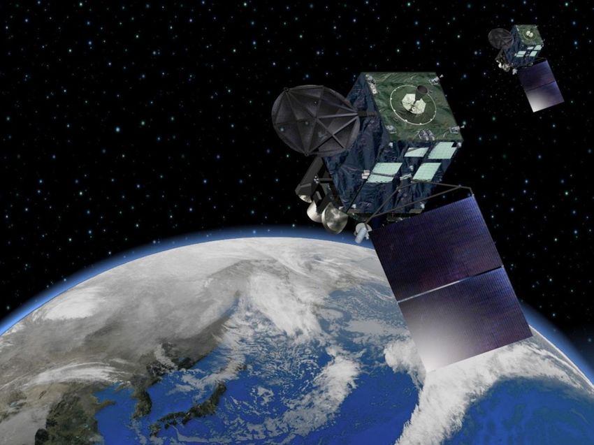
Himawari-8/9
                                                                                                 Spectral                                                               Spatial
             Advanced Himawari Imager (AHI)                               VIS 1 band                           VIS 3 bands                              At sub-satellite point
                         communication antennas
                                                                                                                                                        VIS 1 km                     VIS 0.5/1 km
                                                                                                                                                        IR 4 km                      IR      2 km
                                                                                                                                                   MTSAT-1R/2                       Himawari-8/9

                                                                                                                     R      G      B
                                                                                                                                                                      Temporal
                                                                                                               NIR 3 bands
                                                                                                                                                    Observation Frequency

                                                                          IR 4 bands                          IR      10 bands
           solar panel
                                                                                                                                                                 full-disk
                                                                                                                                                                   obs.
Himawari-8 began operation on 7 July                                           5 bands                          16 bands
2015, replacing the previous MTSAT-2                                     MTSAT-1R/2                           Himawari-8/9                        MTSAT-1R/2                        Himawari-8/9
operational satellite
               2005   2006   2007   2008    2009   2010   2011   2012   2013   2014   2015    2016     2017   2018   2019   2020   2021   2022   2023   2024   2025   2026   2027   2028   2029

MTSAT-1R                     operation                            standby
MTSAT-2                       standby                            operation                   standby

Himawari-8                      a package      manufacture              launch                                operation                                         standby
Himawari-9                      purchase       manufacture                              launch                 standby                                         operation                   standby

                                                                                                                                                                                                     2
Himawari-8/9 for Disaster Risk Reduction
Himawari-8/9
- Earth Monitoring on 24/7
2.5 min interval
- Observational intervals: 10 minutes (Full-disk) scan
2.5 minutes (Japan)
- Additionally, 2.5 minutes typhoon observation
Sea-surface AMVs Rapidly Developing
Cumulus Area product
Improved typhoon monitoring (Sea-surface AMV)
Improved typhoon forecast (AMV & CSR in NWP) Better
Improved detection of severe weather (RGB Imagery) Counter-Disaster
Improved cumulus area identification Operation
SST, ice/snow, fog, volcanic ash, aeolian dust and more
3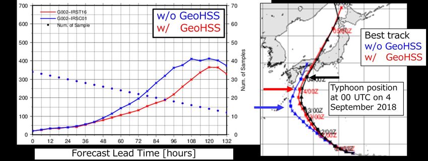
Himawari-8/9 Products

                    Fog                             Cumulonimbus

Typhoon

                                                         Sea Surface Temperature

                          True Color Reproduction

RGB Composite Imagery     Dust and Ash                 Weather Analysis Map
                                                                        4
                                                                              4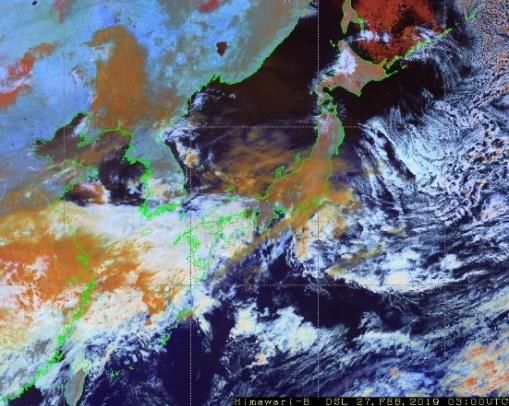
Himawari-8/9 International Cooperation
                             HimawariCast
                             33 Users

                             HimawariCloud
                             24 Users
                                   As of Sept 2019
                                                     JMA, NOAA/NESDIS, CSU/CIRA

       NMHS users of Himawari                    HimawariRequest: Request-based obs. for NHMSs
                           Heavy
                           Rain
                           Potential

                                                                                  Regional and
                                                                                     Global
                                                                                    Disaster
                                                                                   Resiliency
RSMC Nowcast established in Dec. 2018         Capacity Building
                                                                                           5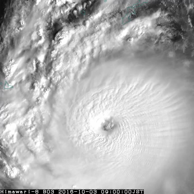
JMA’s 10-Year Strategy toward 2030
2. Promotion of Effective
1. Technical Development
Utilization of Info./Data
Application of Latest Sci & Tech; Build Environment for Better
Advanced satellites, remote Synergy Usage of Met. Info/Data
sensing, big data Larger data flow
Met.
NWP and other prediction tech. Easier access
Services
Collaboration etc. for Better Raise Capacity to Utilize Met.
Improvement of Forecast Society
Nowcast up to 1 hour
Info/Data
12 hr forecast of localized heavy Literacy about disaster, safety,
rain etc.
3 day typhoon forecast etc. Application technology/skill
3. Contribution to Disaster Resiliency
JMA to Contribute to “Disaster Awareness Society” and to Play
the Leading Role in Met. Services
Improved impact-based warnings on the basis of advanced sci & tech
Collaborate with stake-holders to build local decision making capacity
Raise individual disaster awareness and response capacity
6
We need to observe 3D humidity information to improve these forecast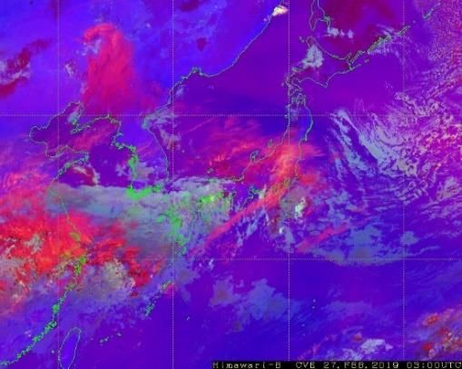
WMO Vision for WIGOS in 2040 for GEO
                                 Application                                Satellite/Instrument
                  Cloud amount/type/top height/temperature,          •   NOAA: GOES-16,17/ABI
VIS/IR            wind, sea/land surface temperature,
                                                                     •   JMA: Himawari-8,9/AHI
                  precipitation, aerosols, snow cover,
Imager w/ rapid                                                      •   KMA: GK-2A/AMI
                  vegetation cover, albedo, atmospheric
repeat cycles     stability, fires, volcanic ash, sand/dust storm,   •   CMA: FY-4A/AGRI
                  convective initiation                              •   EUMETSAT: MTG-I1/FCI (2022)

                  Atmospheric temperature/humidity,                  •   NOAA: N/A
                  wind, rapidly evolving mesoscale features,         •   JMA: N/A
Hyperspectral
                  sea/land surface temperature, cloud                •   KMA: N/A
IR Sounder        amount/top height/temperature,                     •   CMA: FY-4A/GIIRS
                  atmospheric composition                            •   EUMETSAT: MTG-S1/IRS (2023)
                                                                     •   NOAA: GOES-16,17/GLM
                                                                     •   JMA: N/A
Lightning         Lightning, location of intense convection,
                                                                     •   KMA: N/A
Mapper            life cycle of convective systems
                                                                     •   CMA: FY-4A/LMI
                                                                     •   EUMETSAT: MTG-I1/LI (2022)
                                                                     •   NASA: TEMPO (2022)
                                                                     •   JMA: N/A
UV/VNIR           Ozone, trace gases, aerosol, humidity, cloud
                                                                     •   KMA: GK-2B/GEMS (2020)
Sounder           top height
                                                                     •   CMA: N/A
                                                                     •   EUMETSAT: MTG-S1/UVN (2023)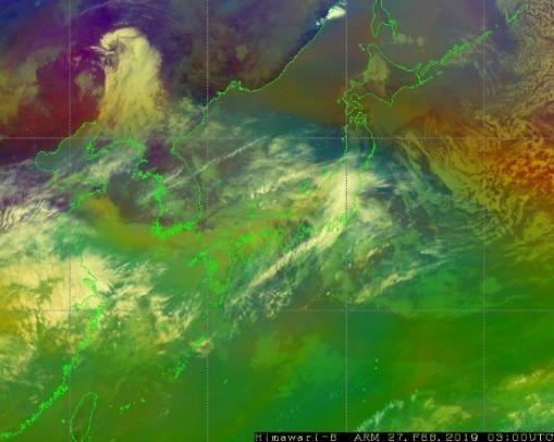
Himawari follow-on program
2008 2009 2010 2011 2012 2013 2014 2015 2016 2017 2018 2019 2020 2021 2022 2023 2024 2025 2026 2027 2028 2029
launch
Himawari-8 manufacture operation standby
Himawari-9 manufacture standby operation standby
launch
Follow-on
satellite manufacture
• Japanese government’ Implementation Plan of the Basic Plan on Space Policy:
“By FY2023 Japan will start manufacturing the Geostationary Meteorological
Satellites that will be the successors to Himawari-8 and -9, aiming to put them
into operation in around FY2029”.
• 2018: JMA started considering the next GEO satellite program
• JMA will pursue seamless GEO satellite system by considering CGMS (Coordination
Group for Meteorological Satellites) baseline and Vision for WIGOS in 2040
E.g., Hyperspectral IR Sounder and Lightning Mapper
• 2019: JMA conducted a worldwide technology trends survey on future
(2030-2040 time frame) satellites/instruments
Site visits and face-to-face interviews for potential suppliers in Japan/US/Europe
• 2018-2019: OSSE/OSE of hyperspectral IR sounder on JMA NWP systems
8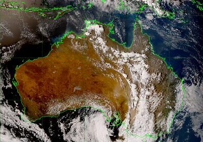
Results of Technology Trends Survey in 2019
• Several potential suppliers of VIS/IR Imager, Hyperspectral IR
Sounder, and Lightning Imager for GEO
• Design lifetime
Sensors > 10 years, satellite bus > 15 years
• Enhancements of VIS/IR Imager observations
Addition of spectral bands (e.g. 16 => 17), increase of spatial resolution
and number of rapid scanning areas, etc.
• Location of Himawari satellite series (~140 E)
Not the best place for UV/VNIR Sounder observation
• Feasibility of mounting multiple sensors on one satellite including
Imager, IR sounder and Lightning Imager, with increased risks
OSSE/OSE of hyperspectral IR sounder
• Assessment of potential impacts of GEO HSIR (GeoHSS) on JMA NWPs by reanalysis-
based OSSE (RA-OSSE)
Two-year (FY 2018-2019) project at JMA
Positive impacts on JMA’s Global/Regional (Meso-scale) NWP systems
Assimilation experiments clearly demonstrate value of GeoHSS for the prediction
of large-scale system such as typhoon and heavy rainfall event
The result was published in peer-reviewed paper (Okamoto et al., 2020, SOLA).
• Candidate instrument: MTG/IRS (700-1210, 1600-2175 cm-1)
Located at 140.7 E (same as Himawari-8)
Hourly full-disk observation
Horizontal resolution: 30 km (limitation from reference)
• Reanalysis-based OSSE (RA-OSSE)
Adopt ERA5 (ECMWF Re-Analysis 5) as reference (truth)
No need to simulate existing observations
Assess impacts for cases that actually occurred
Cases are limited that ERA5 better reproduces than JMAGlobal Data Assimilation Experiment – Results
Zonal mean of RMSE diff. on 3-d forecast (%),
verified against initials of UKMO
• Reduction of RMSEs in all altitudes and latitudinal Temperature
bands, except in northern high latitude
• Reduction of typhoon position error (e.g., 5-d
Pressure (hPa)
forecasts w/ GeoHSS ≈ 4-d forecasts w/o GeoHSS)
by better representation of large-scale field
GeoHSS GeoHSS
Typhoon track forecast for JEBI (1821)Regional Data Assimilation Experiment – Results
Moisture flux diff. (kg m-2 s-1)
• Better fit of analysis and forecast for T and winds to
(w/ GeoHSS − w/o GeoHSS)
RAOB (not shown)
• Better prediction of heavy rainfall due to increased
southwesterly moisture flux
Propagation of analysis improvement in clear-sky
regions through data assimilation cycles
FT=18, at 850 hPa
3-hour accumulated rainfall (mm) at 0000 UTC on 06 July 2018
OBS w/o GeoHSS w/ GeoHSS
FT=21 FT=21Summary
- Himawari-8 has been operational since July 2015. Himawari-9 has
been standby on orbit since March 2017 and is planned to take over
the service in 2022. Both satellites will continue playing the vital roles
in observing the earth until 2029.
- JMA established a 10-year strategy toward 2030 in 2018.
- JMA will pursue a seamless effort in the Earth observations with GEO
satellite system, keeping in mind the WMO Vision for WIGOS in 2040
for GEO.
- JMA started considering the next GEO satellite program in 2018 and
conducted the technology trends survey for follow-on satellites in
2019.
- OSSE/OSE study on GEO hyperspectral IR sounder shows positive
impacts on JMA’s Global/Regional NWP systems.
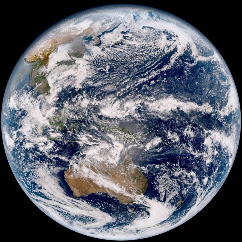
13Thank you!! The first image of Himawari-9
02:40 UTC, 24 Jan. 2017
True Color Reproduction imagery
This imagery was developed on the basis of collaboration between the JMA Meteorological Satellite 14
Center and the NOAA/NESDIS GOES-R Algorithm Working Group imagery team.You can also read