Street Smart Quick Start Guide - March 2021

Page created by Kelly Mason
 
CONTINUE READING
Street Smart Quick Start Guide - March 2021
Street Smart Quick Start Guide
March 2021
Street Smart Quick Start Guide - March 2021
Getting Started in Street Smart is easy!

 1   Open a browser and go to

https://streetsmart.cyclomedia.com/

        (Or just click the link!)

                                           For the best experience, use Chrome, Edge or Firefox
                                                                                         2      .
Street Smart Quick Start Guide - March 2021
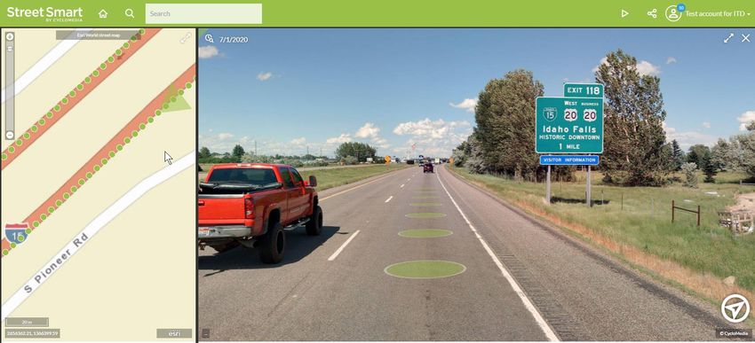
Log In                                               Cyclomedia offers two types of logins: Cyclomedia
                                                     logins and Single sign-on (SSO) logins. In both cases,
                                                     your login is usually your email address. Not sure? Want
                                                     to set up SSO? Ask your Cyclomedia representative.

                                                     2   Enter your email address or SSO login in the
                                                         User name field.
                                                                                            Cyclomedia logins: Don’t
                                                                                            want to enter your
                                                     3   Click the Next button.             information every time? Be
                                                                                            sure to check the Remember
                          SSO Login Screen Example                                          My Login box!
Cyclomedia Login Screen

                                                     4   Enter your password.

                                                           Cyclomedia login users, see page 14 for help creating a
                                                           new password. SSO login users, you probably have a login
                                                           you know well, if not, check with your IT department.

                                                     5   Click the Log in or Sign in button.

                                                                                                                      3
Street Smart Quick Start Guide - March 2021
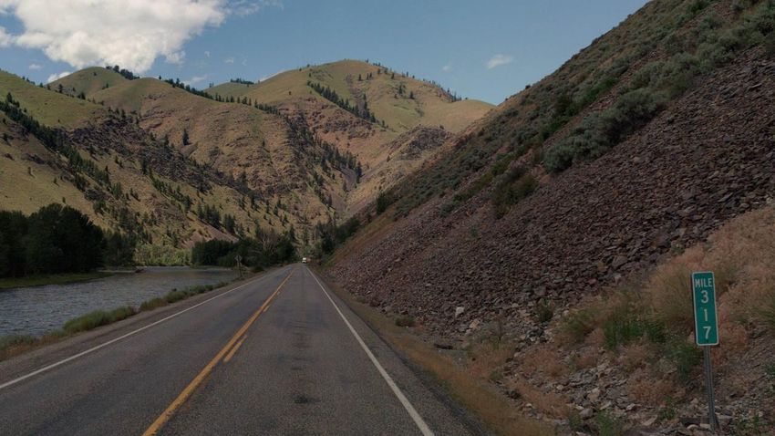
Street Smart Dashboard
    You are almost there! Street Smart will initially open with the Dashboard screen displayed.
6   On your first use, please go to the Settings tab to check a few things.

                                                                    After your first use, select the
                                                                              Go to map
                                                                   button to go directly to the map

                                                                                                       4
Street Smart Quick Start Guide - March 2021
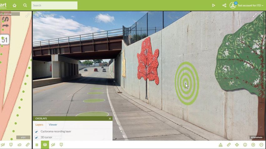
Street Smart Settings
                                                             For the Viewer SRS (Spatial Reference
                                                             System), you should see your local
                                                      7      coordinate system. There is usually no reason
                                                             to change it.

           Setup is complete!

      10   Click the map icon to begin
           using Street Smart.

       Planning frequent searches for addresses in
       one city? Check Use default search area,
       then type in City, State.                     8

                                          After changes, click the Apply button.

                                              Street Smart will refresh after applying this
                                              change. This setting will be remembered
                                                                                              9
                                              next time you open Street Smart.                          5
Street Smart Quick Start Guide - March 2021
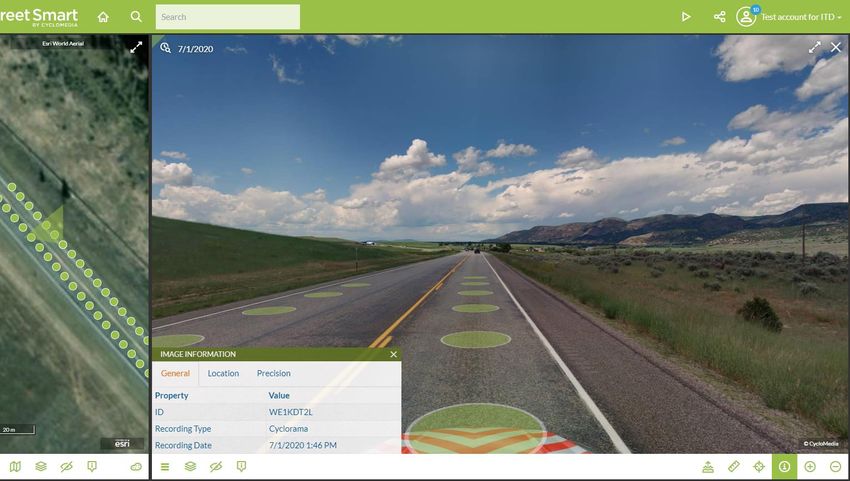
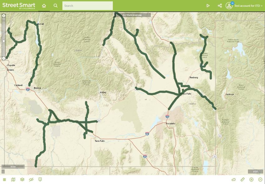
Street Smart Default Map
The map will default to a view of the entire US with coverage areas in green. You can navigate the map to your area of
interest the same way you would any web map interface. To change the default map location, follow these steps.

                        Select the Home icon to return to
               11       the Dashboard, then select the
                        Settings tab.

                                                               Navigate the Start Location
                                                               map to your area of interest,
                                                               then click the Apply button.    12

                                                                   The new default location will not
                                                                   take effect until the next time you
                                                                   open Street Smart or refresh your
    You will see coverage of areas outside of your area.           browser.
 These are locations collected for other customers who
 share similar configuration settings. If you zoom to any of
 these areas, you will not be able to see the imagery, and
 your imagery will only be accessible by your organization.
                                                                                                              6
Street Smart Quick Start Guide - March 2021
Street Smart Map

                                                                              Coverage Area
                            Home Icon                                     • Navigate the map using your
                            Select this icon to return to the Dashboard    mouse scroll wheel, the map
                                                                           zoom slider or hold the shift key
                                                                           and left mouse button to draw
     Map Zoom Slider                                                       a box.
     Zoom in and out from the center of the
     map using this slider. The horizontal line                           • Green areas show locations
     near the top shows the zoom level where                               where imagery is available.
     the overlay changes from coverage area
     to the recording points.                                             • Zoom in to change display
                                                                           from coverage area to 360°
                                                                           recording points (see next
                                                                           slide).

     Base Map Options
     Select this icon to change the base map.

                                                                                                    7
Street Smart Quick Start Guide - March 2021
Street Smart Recording Points
When zoomed to street level, coverage area changes to recording points. Each circle represtents a 360° panoramic
image. Images are taken every 5 meters.

                                                                     Click any blue or green recording point to
                                                                     open the panoramic image.

                                                                  Image
                                                                             Green circles indicate that 3D Images
                                                                    +
                                                                  LiDAR      and measuring tools are available.

                                                                  Image      Blue circles indicate that standard
                                                                   Only      images and measuring are available.*

                                                                *Occasionally with new 3D projects
                                                                blue indicates the 3D surface has
                                                                not been published yet. Check
                                                                                                               8
                                                                back soon!
Street Smart Quick Start Guide - March 2021
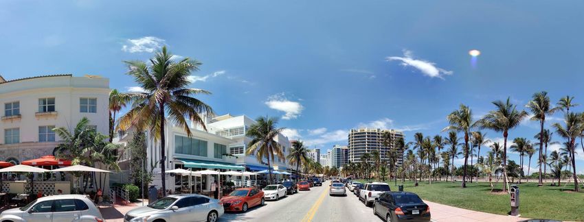
Street Smart Imagery
Each image provides a 360° by 180° view! Click and drag your mouse to change direction or use your mouse wheel to zoom in
and out within the image. For a quick zoom, click and hold the left mouse button.

                                                                                                  • Green areas show
                                                                                                    locations where
                                                                                                    imagery is available
                                                                                                  • Navigate map using
                                                                                                    mouse scroll wheel,
                                                                                                    map zoom slider or
                                                                                                    hold the shift key and
                                                                                                    left mouse button to
                                                                                                    draw a box
                    The viewing cone on the map shows
                    the current location and the
                                                                                                  • Zoom in to change
                    direction being displayed in the                                                display from coverage
                    image.                                                                          area to 360° recording
                                                                                                    points
                              Base Map Options                                             Recording points also overlay the
                              Select this icon to change the base map                      image. Click the circle to navigate
                                                                                           to that location.

                                                                                                                            9
Street Smart Quick Start Guide - March 2021
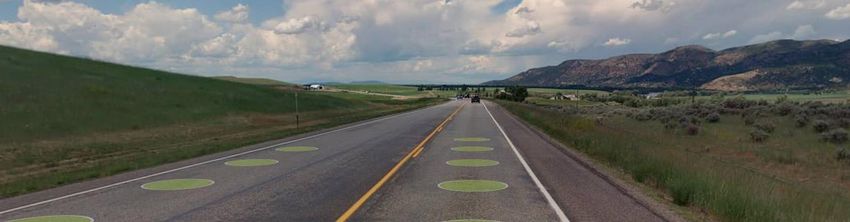
3D Images and Measuring                                         3D Depth Surface
                                                          Along with the capturing the panoramic photographs, the
                                                          Cyclomedia vehicles also use a LiDAR sensor. The
                                                          information collected from this special sensor is used to
                                                          create a 3D model, called a depth surface. This model is
                                                          hiding behind every image and allows you to make
                                                          accurate measurements right within the picture!
                                                          The depth surface and measuring are covered more in
                                                          Cyclomedia’s Street Smart Training.
                                                          Here’s a sneak peak…

                                         Once in Measurement Mode, use this
                                         toggle to switch between the image
                                         and the 3D Depth Surface.

This icon begins Measurement
Mode and displays the 5 options below.

                                                                                                                      10
Image Overlays

                 The 3D cursor is available
                  for green recording points
                 and is shaped like a target.
                 It drapes over the 3D Depth
                 Surface and is helpful for
                 finding edges.

                            Open the Overlays panel to toggle
                            the recording point layer or 3D cursor
                            on and off.
                                                                     11
Image Information

                    Select the info icon to open
                    the Image Information panel.
                    Each image has a unique ID,
                    which can be used in the
                    search bar.

                                                   12
Search Options

• Address
 • 410 W Broadway St, Idaho Falls, ID
• Street or Intersection
 • Air Base Rd, Mountain Home, ID
 • Air Base Rd & Grandview Rd, Mountain
   Home, ID
• Coordinates
 • 2357689.59, 1331993.57
• Image ID
 • WE1KCQ9W

                                          13
We all forget our passwords sometimes. If it happens to you, it only takes a
Password Reset                             minute to have a new password sent right to your email. Want to change it
                                           to something you can remember? We’ve got you covered there too!
For Cyclomedia Logins Only*

    1     To change or reset your password, click the
          Reset password button on Log in screen
           Or, go to:
           https://password.cyclomedia.com/

2       If you’ve forgotten your password, enter your
        user name and select the Send me a new
        password button to have a new password
        generated and sent via email.

        To set a password of your choice, enter your
        user name and select I know my password
        and want to create a new one.

        *SSO login users, please contact your IT department.
                                                                                                                 14
Next step = Street Smart Training – There’s More!

         Perform          Overlay features   Integrations with
      measurements in      on map and        ArcGIS and other
         images              imagery             systems

       Use playlists to    Create reports,      Simulate
      view and share      download images      Drainage &
         locations         and share links      Flooding

                                                                 15
Want more?

            • Contact your Cyclomedia representative to set up a training session for your
              organization.
            • Visit our self-service Street Smart training site at https://training.cyclomedia.com

            • Request our PDF course materials on Street Smart and Street Smart for ArcGIS

              from our service desk.

You can access Cyclomedia’s support page at https://www.cyclomedia.com/us/support/support-users for links to self-service training and our
help portal.

                                                                                                                                   16
You can also read