Sustrans Scotland: walking and cycling outcomes - Sustrans' Scottish Government Grant 2012 - 2015: Second Interim Report
←
→
Page content transcription
If your browser does not render page correctly, please read the page content below
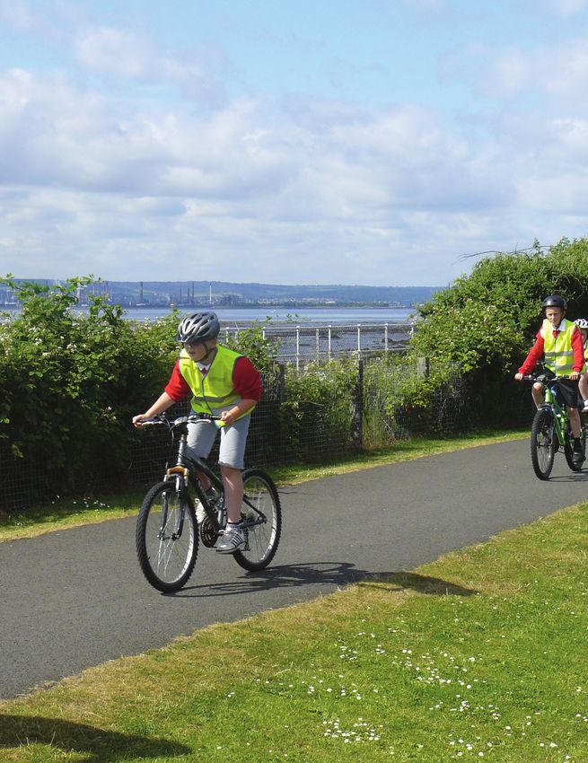
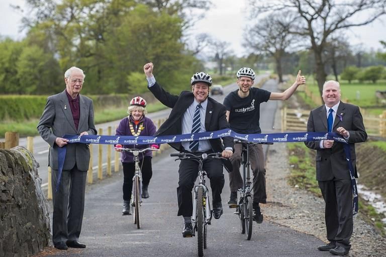
Sustrans Scotland: walking and cycling
outcomes
Sustrans' Scottish Government Grant 2012 – 2015: Second
Interim Report
September 2014

Route Opening, Alva to Tillicoultry, May 2014
© Stuart Nicol Photography 2014.
About Sustrans
Sustrans makes smarter travel choices possible, desirable and inevitable. We’re a leading UK charity
enabling people to travel by foot, bike or public transport for more of the journeys we make every
day. We work with families, communities, policy-makers and partner organisations so that people
are able to choose healthier, cleaner and cheaper journeys, with better places and spaces to move
through and live in.
It’s time we all began making smarter travel choices. Make your move and support Sustrans today.
www.sustrans.org.uk
Sustrans
Rosebery House
9 Haymarket Terrace
Edinburgh
EH12 5EZ

© Sustrans 2014
Registered Charity No. 326550 (England and Wales) SC039263 (Scotland)
VAT Registration No. 416740656

     Sustrans Scotland: walking and cycling outcomes Sustrans' Scottish Government Grant 2012 – 2015: Second Interim Report September
                                                                                                                                 1    2014
Table of contents
1 Introduction and Background ...................................................................................................... 1
2 Overview of Key Outcomes .......................................................................................................... 2
3 KPI 1: Increased levels of walking and cycling ............................................................................. 3
3.1 Overview ............................................................................................................................... 3
3.2 Expansion of NCN ................................................................................................................ 3
3.3 Annual usage estimate (AUE) - NCN .................................................................................... 4
3.4 Annual usage estimates - site specific (NCN, Community Links, Connect2) ......................... 5
3.5 Increases in walking and cycling at West Barns, East Lothian .............................................. 8
3.6 Automatic cycle counters data.............................................................................................. 8
3.7 Make your move Kirkcaldy .................................................................................................. 10
4 KPI 2: Increased levels of ‘purposeful trips’ made by walking and cycling ................................ 11
4.1 Overview ............................................................................................................................. 11
4.2 Breakdown of journey types on the NCN ............................................................................ 12
4.3 Pedestrian and cyclist comparison ..................................................................................... 12
4.4 Number of ‘purposeful trips’ at specific NCN sites and Community Links projects ............ 13
4.5 Travel to school .................................................................................................................. 15
4.5.1 Hands up Scotland ...................................................................................................... 15
4.5.2 I Bike ............................................................................................................................ 16
4.6 Case Study: Increased usage for school trips at Ardblair Trail, Blairgowrie ........................ 18
4.7 Evidence for increased commuting: Edinburgh count data ................................................. 18
4.7.1 Steadfastgate manual count ........................................................................................ 18
4.7.2 North Edinburgh Access counter ................................................................................. 19
5 KPI 3: Increased levels of attainment of recommended physical activity levels through walking
and cycling........................................................................................................................................ 21
5.1 Overview ............................................................................................................................. 21
5.2 Physical activity levels - RUIS ............................................................................................. 21
5.3 The impact of routes on increasing levels of physical activity ............................................. 22
5.4 Breasclete Community - Feedback ..................................................................................... 23
5.5 E-bikes, Cairngorms National Park ..................................................................................... 24
5.6 Kirkcaldy Challenge ............................................................................................................ 25
6 KPI 4: Improved community cohesion and liveability ................................................................. 26
6.1 Overview ............................................................................................................................. 26
6.2 Breasclete Community Path – Feedback Survey ................................................................ 26
6.3 Beneficiary feedback - Kirkcaldy ........................................................................................ 27
6.4 Volunteer support - Kirkcaldy ............................................................................................. 28
6.5 I Bike ................................................................................................................................... 28
6.6 Dumfries Street Design ....................................................................................................... 29
Sustrans Scotland: walking and cycling outcomes Sustrans' Scottish Government Grant 2012 – 2015: Second Interim Report September
2 20147 KPI 5: Reductions in incidence of KSI, and perception of level of risk ....................................... 30
7.1 Overview ............................................................................................................................. 30
7.2 NCN/Community Links ....................................................................................................... 30
7.3 Street Design Sinclairtown .................................................................................................. 31
7.4 City of Edinburgh Council Workplace Travel Survey ........................................................... 32
7.5 I Bike ................................................................................................................................... 33
7.6 Waterloo Street, Glasgow ................................................................................................... 33
7.7 Community Links Breasclete .............................................................................................. 34
7.8 Transport Scotland – Reported Road Casualties ................................................................ 35
8 KPI 6: Economic benefits ........................................................................................................... 36
8.1 Benefit to cost ratio (BCR) of Community Links projects .................................................... 36
8.2 Reductions in greenhouse gas emissions ........................................................................... 36
8.3 Jobs sustained through Community Links projects ............................................................ 37
8.4 Tourism ............................................................................................................................... 38
8.5 Tourism on the NCN and links ............................................................................................ 39
8.6 Estimated benefits of active travel on the NCN ................................................................... 39
9 Next Steps ................................................................................................................................. 40
Appendix One – Methodology........................................................................................................... 41
Appendix Two – Survey Dates .......................................................................................................... 51
Multiple iterations sites .............................................................................................................. 51
Single iteration sites ................................................................................................................... 52
Sustrans Scotland: walking and cycling outcomes Sustrans' Scottish Government Grant 2012 – 2015: Second Interim Report September
3 2014Report Summary
Usage of the National Cycle Network (NCN) in Scotland
increased by 7% between 2012 and 2013
2012 2013
48 Total97 million 51 Total104 million
trips on the NCN trips on the NCN
49 53
17.1 %
of those surveyed
68.9 km £298 million
of traffic-free and the indicitive value of
on the NCN were on-road NCN routes leisure cycling and cycle
commuting were built/upgraded/ tourism on the NCN
redesignated between
December 2012 and
December 2013
The estimated health
The benefits of walking and
potential cycling on the NCN
saving of journeys
on the NCN has
increased from 50.4% of pupils £66 £44
who took part million million
54,586 tonnes 64,121 tonnes in the Hands
in 2012 Up Scotland
in 2013
survey said
they travelled to
school actively
16.3:1
Benefit
to cost ratio
Over half of users for Community
surveyed on the NCN
meet the minimum Links project in
20.8 FTE jobs sustained physical activity guideline West Barns, East
requirements of:
through Community Links Lothian
projects funded in 2013 30 minutes
5 days a week1 Introduction and Background Sustrans Scotland manages funds on behalf of Transport Scotland. The bulk of these funds are distributed as grants to partner organisations to deliver a variety of practical interventions to help grow the numbers of people in Scotland making short trips by walking and cycling and particularly to help realise the vision of the Government’s Cycling Action Plan for Scotland (CAPS), which is 10% of trips by bike by 2020. Sustrans works in partnership with a variety of agencies in Scotland to demonstrate how travel behaviour in Scotland can change by delivering practical interventions to make the built environment more conducive to walking and cycling and engaging with people to present the options available to them to travel actively. This report builds on previous annual reports of usage on the National Cycle Network (NCN) in Scotland, other statistics and reports gathered and published by Sustrans Scotland and Sustrans UK. The work has been completed by Sustrans’ Research & Monitoring Unit (RMU), which is based in Newcastle upon Tyne. Unless stated otherwise, this report has been gathered and written by the RMU. Sustrans Scotland’s work is measured through six Key Performance Indicators (KPIs): 1. Increased levels of walking and cycling 2. Increased levels of purposeful trips made by walking and cycling 3. Increased levels of attainment of recommended physical activity levels through walking and cycling 4. Improved community cohesion and liveability 5. Reductions in the incidence of KSI and perception of level of risk 6. Economic effectiveness and benefits Our funding allows us to work in partnership with a variety of public and statutory agencies and communities to deliver practical projects that help demonstrate how Scotland can work towards a more active population, making more short trips by walking and cycling and helping deliver 10% of trips by bike by 2020. 1 Sustrans Scotland: walking and cycling outcomes Sustrans' Scottish Government Grant 2012 – 2015: Second Interim Report September 2014
2 Overview of Key Outcomes
Following the continuation of funding to Sustrans Scotland from the Sustainable Transport Team in
Transport Scotland, Sustrans’ Research and Monitoring Unit (RMU) has been tasked with monitoring
the progress Sustrans Scotland makes against the key walking and cycling outcomes agreed
between Transport Scotland and Sustrans Scotland:
Increased levels of walking and cycling
Increased levels of purposeful trips made by walking and cycling
Increased levels of attainment of recommended physical activity levels through walking and
cycling
Improved community cohesion and liveability
Reductions in the incidence of KSI and perception of level of risk
This report also expresses the economic effectiveness and the benefits derived from the investment
in walking and cycling through the evidence presented.
Progress against these outcomes is assessed using a range of indicators derived from a variety of
data types. Data are collected from automatic cycle counters, route user intercept surveys (RUIS),
manual counts, the annual Hands up Scotland survey of school children, I Bike Hands up surveys
completed in schools participating in the I Bike programme, CCTV footage, household surveys,
workplace travel surveys, community engagement surveys and beneficiary surveys. More details on
the specific methodologies are in Appendix One.
This report is the second in a series of interim reports covering 2012-2015 with a final report being
produced at the end of the funding period in 2015. The most up to date data available is used in this
report. However because of the timescales for project delivery and monitoring some of this data is
from 2012-2013 and earlier. Sustrans RMU has refined its methodologies since the previous report
and has therefore updated previous data, where applicable, to match the new methodologies. Full
details of the methodologies used in this report are in Appendix One.
2 Sustrans Scotland: walking and cycling outcomes Sustrans' Scottish Government Grant 2012 – 2015: Second Interim Report September 20143 KPI 1: Increased levels of walking and cycling
Annual usage estimates for the National Cycle Network (NCN) in Scotland suggest that overall usage
of the NCN has increased by 7.0% between 2012 and 2013. Further evidence for a general increase
in active travel across Scotland is seen in 53 out of 79 automatic cycle counters and six out of nine
repeat survey locations measuring increased usage.
However, data from the Scottish Household Survey (SHS) Travel Diary1 for 2012 reports levels of
cycling appearing consistent across Scotland for the previous 10 years fluctuating between 0.7%
(2001 & 2007) to 1.3% (2011). Due to questionnaire changes in 2012 additional walking journeys
have been recorded so there is a break in the series and it is not possible to compare previous years.
In 2012 SHS data reports2 26.0% of journeys by main mode were walking and 1.2% by cycling.
Sustrans RMU monitors a variety of infrastructure schemes such as the NCN3 and Community
Links4, to provide data on changes in levels of walking and cycling over time or following a specific
intervention. To demonstrate these changes a variety of monitoring tools were utilised, primarily
RUIS, manual counts and automatic cycle counters. The methodology used to obtain the annual
usage estimate (AUE) for Scotland overall and at specific sites is given in Appendix One.
3.1 Overview
NCN
68.9km of additional open and links to the NCN were built/upgraded/redesignated between
December 2012 and December 2013.
Estimated annual usage on the NCN in Scotland has increased by 7.0% from 2012.
On an individual site basis, 32 of 43 automatic cycle counter sites on the NCN in Scotland
recorded an increase in counts between 2012 and 2013.
An increase in usage was recorded at three of the four locations on the NCN where repeat
iterations of RUIS were performed.
Other schemes
On an individual site basis, 21 of 36 automatic cycle counter sites on other routes in Scotland
recorded an increase in counts between 2012 and 2013.
Increases in walking and cycling were seen at three of five projects where post surveys where
undertaken in 2013.
32.1% increase in estimated usage at Kelvingrove Park, Glasgow following completion of the
Connect2 scheme.
3.2 Expansion of NCN
Continued investment in the NCN in Scotland has led to an additional 68.9km of traffic-free (TF) and
on-road (OR) route being built/upgraded/redesignated since December 2012 (Table 3-1).
1
http://www.transportscotland.gov.uk/sites/default/files/documents/rrd_reports/uploaded_reports/j285661/j285661.pdf - Page 15 ‘[Main
mode] Percentage of journeys made by main mode of travel 1999 – 2012’.
2
http://www.transportscotland.gov.uk/system/files/documents/tsc-basic-pages/SHS-Transport-local-Area-Analysis-2012-Webtables-
November-2013.pdf - Page 16 ‘SHS Travel Diary – Main mode of travel, 2012’.
3
The NCN is a 3,600 km signed, mapped and promoted network of routes throughout Scotland that aim to provide a range of active travel
options from everyday commuting to longer, leisure adventures.
4
Community Links are links of three miles or less that allow people to make every day trips to the places they want to get to under their
own steam. In the 2012-13 year 110 projects were delivered across Scotland making up the largest capital intervention Sustrans Scotland
manages over the financial year. Each Community link is a partnership initiative with grant recipients matching the funding award from
Sustrans on a 50-50 cash basis. Each project is governed by an MoU, which clarifies the technical standards, timescales and qualities of
each project. 10 sites were selected for Pre or Post monitoring with additional reporting to be delivered in 2013-14 report.
3 Sustrans Scotland: walking and cycling outcomes Sustrans' Scottish Government Grant 2012 – 2015: Second Interim Report September 2014Table 3-1 : Scotland open and links NCN in km
Urban TF Urban OR Rural TF Rural OR
Dec-12 446.7 km 299.1 km 723.6 km 2,133.4 km
Dec-13 461.5 km 300.0 km 752.1 km 2,158.1 km
Change +14.8 km +0.9 km +28.5 km +24.7 km
This investment has led to improvements in access with 39.7%5 of the Scottish population now living
within 0.5 miles of the NCN, a 1.3 percentage point increase from 2012. This is compared to a 2.0
percentage point increase across the UK.
3.3 Annual usage estimate (AUE) - NCN
In order to get a more detailed picture of route usage on the NCN in Scotland and the UK as a
whole, annual usage estimates are generated. The estimated annual usage for the NCN in Scotland
reported below was generated using the length and characteristics of the network in Scotland to
estimate cycle kilometres for each group (see Appendix One for details of the methodology and
modifications made to the methodology since the 2012 report). In 2013, 104 million trips were made
on the NCN in Scotland and the estimated breakdown of this usage by cycling and walking trips is
given in Table 3-2.
Table 3-2 : Annual usage estimates (AUE) of pedestrian and cyclist trips on the NCN in
Scotland 2012 – 2013
AUE total (millions) AUE cyclists (millions) AUE pedestrians
(millions)
2012 97 48 49
2013 104 51 53
% change +6.99% +6.12% +7.84%
The estimated annual usage for 2013 suggests substantial growth in usage on the NCN in Scotland
since 20106, illustrated in Chart 3-1.
5
The figures are derived from OS postcode household data and ONS super output area population data (updated 2007).
6
Figures from 2010 – 2012 have been recalculated using the updated AUE methodology as presented in Appendix one.
4 Sustrans Scotland: walking and cycling outcomes Sustrans' Scottish Government Grant 2012 – 2015: Second Interim Report September 2014Chart 3-1 : Annual usage estimate of pedestrian and cyclists on the NCN in Scotland
60,000,000
50,000,000
40,000,000
30,000,000
20,000,000
10,000,000
0
2010 2011 2012 2013
Cycle Pedestrian
Across the UK, 748 million trips were made on the NCN in 2013, up 7% from 2012.
3.4 Annual usage estimates - site specific (NCN, Community Links,
Connect2)
In addition to an overall figure for annual usage in Scotland estimated annual usage at specific sites
can be calculated where a route user intercept survey (RUIS) was carried out. Four RUIS were
undertaken during August (school holiday) and September (term time) in 2013 across the NCN at
sites which have been surveyed previously. The 2013 data together with the data from the previous
survey at each location are summarised in Table 3-3.
A further five pre and post intervention surveys were completed on Community Links and Connect2
projects. The 2013 surveys were commissioned for August/September 2013 and data together with
the data from the previous survey at each location are summarised in Table 3-4.
In total, pre and post usage data has been collected at 10 Community Links schemes since 20117,
eight of which have shown an increase in usage following completion of the scheme.
7
Results from survey at six schemes were reported in First Interim Report in September 2013. Data from all sites will be aggregated for the
Final Report in 2015.
5 Sustrans Scotland: walking and cycling outcomes Sustrans' Scottish Government Grant 2012 – 2015: Second Interim Report September 2014Table 3-3 : Breakdown of annual usage estimates (AUE) reported from repeat RUIS on the NCN
8
Survey site Year AUE AUE AUE Year AUE AUE AUE Scheme Site description Overall
9
cyclists pedestrians overall cyclists pedestrians overall change
Steadfastgate, Large Urban,
Edinburgh 2005 95,090 177,400 288,918 2013 343,470 349,235 766,409 NCN Traffic-free site on
NCN 75
Callander to Rural, Traffic-free
Kilmahog, Stirling
2009 31,493 43,649 76,360 2013 29,077 46,401 77,127 NCN
site on NCN 7
Linlithgow, West Small Urban,
Lothian* 2011 39,980 92,060 148,658 2013 40,688 59,952 113,059 NCN Traffic-free site on
NCN 754
Deeside Way, Medium Urban,
Aberdeen 2009 121,631 154,983 296,983 2013 119,083 150,809 303,500 NCN Traffic-free site on
NCN 195
* A pre-intervention survey was undertaken at Linlithgow, West Lothian as part of the Scottish Short Links programme. Completed in January 2011, the estimated baseline
annual usage (AUE) on the route was 61,430. Upon completion of Phase 1 of the route a post-intervention survey was undertaken where the estimated annual usage
increased to 148,658 trips. In 2013 the site was revisited after further works and an additional survey was completed. The estimated annual usage dropped to 113,059 with a
noted drop in pedestrian usage. Further information is not available as to why this drop occurred and additional monitoring at the survey location would be required to
understand if this change in usage was part of any trend.
8
Year one in all tables represents the last available survey data for that survey location. An example is Steadfastgate where the last survey to be undertaken at this location was 2005.
9
Overall usage includes cyclists, pedestrians and other users which incorporates joggers, wheelchair users, roller skates and pushchairs
6 Sustrans Scotland: walking and cycling outcomes Sustrans' Scottish Government Grant 2012 – 2015: Second Interim Report September 2014Table 3-4 : Breakdown of annual usage estimates (AUE) reported from repeat RUIS on Community Links/Connect2 projects
Survey site Year AUE AUE AUE Year AUE AUE AUE overall Scheme Site Overall
cyclists pedestrians overall cyclists pedestrians description change
Ardblair Trail,
Blairgowrie
2012 6,306 56,537 66,807 2013 15,741 80,376 104,756
Community
Links
Small Urban,
Traffic-free
Dumbarton, West
Dunbartonshire *
2012 5,446 36,623 43,790 2013 2,222 32,266 34,893
Community
Links
Small Urban,
Road adjacent
Roslin, Midlothian* 2012 7,964 30,621 43,630 2013 15,032 11,184 28,782
Community
Links
Rural, Traffic-
free
West Barns, East
Lothian
2012 5,470 34,692 44,573 2013 10,955 45,099 56,530 Community
Links
Small Urban,
Traffic-free site
on NCN 76
Kelvingrove Park,
Glasgow
2009 29,183 344,257 458,656 2013 98,805 483,345 605,893 Connect2 Large Urban,
Traffic-free
*There have been drops in usage at both Dumbarton and Roslin post intervention. Further investigation has failed to provide an adequate reason for this drop and additional
post monitoring is being considered.
7 Sustrans Scotland: walking and cycling outcomes Sustrans' Scottish Government Grant 2012 – 2015: Second Interim Report September 20143.5 Increases in walking and cycling at West Barns, East Lothian
West Barns, East Lothian (Route 76 of the NCN) demonstrates increases in walking and cycling
usage, including a jump in usage by children. The existing narrow path was upgraded to a two metre
wide tarmac surface through Community Links funding. The new path will be incorporated into the
North Sea Cycle route, John Muir Way, and is part of the NCN.
Chart 3-2 : Breakdown of four day 12 hour manual count at West Barns, East Lothian
500
450
400
350
Number of users
300
250
Pre 2012
200 Post 2013
150
100
50
0
Cyclists Pedestrians Other
Activity
The intial bid received by East Lothian Council suggested the route would provide a safer, off road
route for local schools to access facilites. Further investigation of the manual count data suggests
the increase in usage has been driven by children walking and cycling on the route.
Before the intervention one child was recorded cycling and 29 walking. Following completion of the
route 70 children were recorded cycling and 83 walking.
The project has therefore met this key aim of providing access to local schools. In addition there
have also been increases in other user groups who have benefited from the improvements to the
path. Pre development cyclists, pedestrians and joggers were recorded using the route but following
the upgrade wheelchair users, horse riders, parents pushing children in pushchairs and children on
skate boards were also recorded utilising the path. The new tarmac surface on the path appears to
have widened accessibility, providing a safer traffic-free route for members of the community.
3.6 Automatic cycle counters data
Data were gathered from a total of 79 counters in Scotland, both on the NCN and other routes. Of
these, an increase in the counts was recorded between 2012 and 2013 for 53 counter locations (21
showed a decrease in the count and five showed no change).
Two examples with good levels of continuous data have been selected to present in more detail:
North Edinburgh Access Route, West Granton and Eldon Street, Greenock. Both sites show an
increase in levels of cycling trips which are shown in Charts 3-3 and 3-4.
8 Sustrans Scotland: walking and cycling outcomes Sustrans' Scottish Government Grant 2012 – 2015: Second Interim Report September 2014A total of 36 months of data are available from a counter located near to the North Edinburgh Access
Road, West Granton. The counter is on a traffic-free section of path, part of the Roseburn-Craigleith-
Crewe Toll which crosses the Red Bridge and links to Route One of the NCN. Chart 3-3 shows that
the median weekday totals have increased year-on-year with clearly defined peaks in summer 2012
and 2013 after a relatively flat 2011. Data collected by the Met Office supports this change recording
the wettest year in a series since 191010 in 2011.
Chart 3-3 : Median monthly totals of cyclists at North Edinburgh Access Route, West Granton
1,200
Median count of cyclists
1,000
800
600
400
200
0
Median daily total Median weekday total Median weekend day total
A total of 24 months of data are available from a counter located on Eldon Street, Greenock. The
counter is located on a road adjacent section of Route 75 of the NCN which makes up part of route
connecting Leith in Edinburgh with Portavadie. Chart 3-4 shows that median monthly totals for the
summer months have increased between 2012 and 2013.
Chart 3-4 : Median monthly total change 2012 - 2013 at Eldon Street, Greenock
150
100
Median count of cyclists
50
0
July
July
August
October
August
October
November
November
April
April
May
May
September
September
June
June
January
December
December
March
January
February
March
February
-50
-100
2012 2013 difference
Both counters show seasonality with clear increases in cycling through the summer months. This is
supported by anecdotal evidence from surveys in workplaces and communities. Respondents have
indicated that one barrier to cycling either to work or for pleasure is the weather and further evidence
of this is provided by the SHS11 with 19% of respondents stating poor weather as a reason for not
10
http://www.metoffice.gov.uk/climate/uk/summaries/2011/annual
11
http://www.transportscotland.gov.uk/statistics/j281378-06.htm - Changes to mode of travel – 6.11
9 Sustrans Scotland: walking and cycling outcomes Sustrans' Scottish Government Grant 2012 – 2015: Second Interim Report September 2014cycling to work. It could therefore be assumed that the weather would also have an impact on leisure cycling in the winter months. A longer series of counter data would be required to further investigate this theory. 3.7 Make your move Kirkcaldy The Make your move Kirkcaldy project comprises a range of interventions including improving the walking and cycling routes in the town, advertising the benefits of choosing walking and cycling as an alternative to motorised travel, and promoting information such as maps and training opportunities as well as holding events. It aims to increase the share of journeys in Kirkcaldy made by walking and cycling. One method of monitoring walking and cycling levels in Kirkcaldy is through manual counts of route users at eight locations across the town. Manual counts were conducted at the below locations in either 2013 or 2014 as a follow up to baseline counts conducted in 2011. Six of the sites were selected as single manual count locations with an additional two locations selected for a full RUIS including manual count. Five of the eight sites showed an increase in the annual usage estimate over this time with AUEs given in the Tables 3-5 and 3-6. Table 3-5 : AUEs at manual count locations in Kirkcaldy Location 2011 AUE 2013 AUE Dunnikier Way 196,621 207,799 Overton Road 302,057 228,011 Victoria Road 146,036 178,801 Dronachy Road 68,334 81,720 Bennochy Road 669,447 640,974 Esplanade 491,703 290,908 Table 3-6 : AUEs at RUIS locations in Kirkcaldy Location 2011 AUE 2014 AUE Nether Street 84,057 139,837 Templehall Avenue 507,014 734,087 Further analysis of the data has provided no definitive reasons why Overton Road and Bennochy Road showed a decrease in usage. There were closures on the Esplanade which could account for the decrease. 10 Sustrans Scotland: walking and cycling outcomes Sustrans' Scottish Government Grant 2012 – 2015: Second Interim Report September 2014
4 KPI 2: Increased levels of ‘purposeful trips’ made by
walking and cycling
Purposeful trips are defined as “the ordinary, everyday short trips currently made, in the main, by
car” but which could be made on foot or by bike. In the context of this report a ‘purposeful trip’
includes commuting, shopping and travelling to school/education.
In 2012, the SHS12 reported that 16% of all journeys to work were by active modes (13% walking
and 2% cycling). The most common reasons for not cycling to work were that it was too far to cycle
(36%), poor weather'(19%), that there were too many cars (14%), and that respondents did not have
a bike (14%).
Interventions delivered by Sustrans have given local communities, including schoolchildren, the
opportunity to undertake more of the journeys they wish to make everyday by walking and cycling,
with some sites showing notable increases in purposeful journeys.
Data from RUIS on the NCN and other routes, activities in communities and projects delivered in I
Bike schools were used to provide information on the types of purposeful journeys for this report.
Automatic cycle counter and manual count data are used to demonstrate change in usage during
commuting periods at specific sites.
In 2013, 17.1% (sample size 1,173) of those surveyed on the NCN were commuting: 29.5% of
cyclists and 10.9% of pedestrians were commuting. Results from the 2013 Hands up Scotland
survey show that 50.4% of pupils in Scotland said they normally travel to school actively, without
using any form of motorised transport. Although based on low numbers of respondents, repeat
surveys at six out of seven sites show an increase in the number of purposeful trips.
4.1 Overview
NCN
17.1% of all respondents to RUIS carried out on the NCN were commuting.
29.5% of cyclists interviewed as part of the RUIS on the NCN were commuting compared to
10.9% of pedestrians.
Survey responses from a RUIS at Deeside Way, Aberdeen indicated that 53.5% of cyclists
were commuting in 2013 increasing from 43.0% in 2009.
Other schemes
Repeat surveys at three of four Community Links schemes indicate an increase in the number
of purposeful trips made at the sites.
Ardblair Trail, Blairgowrie Community Links project shows an increase in walking and cycling
trips by children during both school term time and school holidays.
12
http://www.transportscotland.gov.uk/statistics/j281378-06.htm
11 Sustrans Scotland: walking and cycling outcomes Sustrans' Scottish Government Grant 2012 – 2015: Second Interim Report September 20144.2 Breakdown of journey types on the NCN
All respondents to the RUIS carried out on the NCN in 2013 indicated that they were travelling on the
NCN for the reasons shown in Table 4-1.
Table 4-1 : Trips by journey type on the NCN in 2013
2013 (%)
Leisure 72.8
Commuting 17.1
Shopping 3.2
Other 3.2
Personal business 2.6
Education 1.0
Total 100.0
4.3 Pedestrian and cyclist comparison
Survey responses indicated that the way in which cyclists and pedestrian use the NCN differs. A
higher proportion of cyclists who responded to the survey were commuting when compared to
pedestrians and this is demonstrated in Chart 4-1.
Chart 4-1 : Cyclist and pedestrian on the NCN responses to question on current journey
purpose
90
80
70
60
% response
50
40 Cycle
30 Walk
20
10
0
Commute Education Shopping Other escort Personal Leisure Other
business
Journey purpose
Cycle n = 404
Walk n = 709
12 Sustrans Scotland: walking and cycling outcomes Sustrans' Scottish Government Grant 2012 – 2015: Second Interim Report September 20144.4 Number of ‘purposeful trips’ at specific NCN sites and Community
Links projects
Repeat surveys were undertaken at seven sites (three NCN and four Community Links) in 2013.
These have been analysed to provide data on the numbers of trips for commuting, shopping or to /
from schools / colleges/ universities (Table 4-2). Six of the seven sites show an increase in the
number of purposeful trips since the previous survey indicating a positive impact of interventions on
increasing purposeful trips by active modes. However, not all journey purposes have increased at
these sites and results should be treated with caution due to low numbers of survey respondents.
13 Sustrans Scotland: walking and cycling outcomes Sustrans' Scottish Government Grant 2012 – 2015: Second Interim Report September 2014Table 4-2 : Estimated annual numbers of purposeful trips13 reported at NCN sites and
Community Links projects
Estimated Estimated Estimated
Changes
annual annual annual
Year made to Scheme
commuter shopper education
the route
total total total
Callander to 2009 0 0 0 Leisure National
Kilmahog, route with Cycle
Stirling 2013 188 167 0 no upgrade Network
Linlithgow, 2012 908 3,027 0 National
Towpath
West Cycle
upgrade
Lothian 2013 4,644 4,054 1,929 Network
Disused
2009 55,763 918 0 railway line
Deeside National
in urban
Way, Cycle
areas used
Aberdeen Network
for multiple
2013 68,861 3,228 3,467
purposes
Upgraded
2012 733 4,523 0 route from
West Barns,
desire line Community
East
allowing Links
Lothian
leisure
2013 787 0 0 usage
2012 0 348 0 New path
Blairgowrie, linking Community
P&K community Links
2013 2,614 0 0* to school
Dumbarton, 2012 4,027 6,183 3,651 Links train
West Community
station to
Dunbartons Links
2013 8,689 4,701 1,435 community
hire
2012 0 854 0 Upgrade
Roslin, Community
from desire
Midlothian Links
line
2013 1,699 0 0
*RUIS are not undertaken with route users under the age of 16 suggesting that although route was built primarily to link the local
community with the school campus it is also being utilised by commuters as a traffic-free route to work. Figures from the manual count
at Blairgowrie have shown an increase in usage among children. This is discussed in more detail in Section 5.9.
13
Estimated annual commuter/shopper/education totals are derived by applying the journey purpose % from survey data to the overall
AUE for each site as shown in Table 3-3 and Table 3-4.
14 Sustrans Scotland: walking and cycling outcomes Sustrans' Scottish Government Grant 2012 – 2015: Second Interim Report September 20144.5 Travel to school
Sustrans carries out the Hands up Scotland survey annually. Starting in 2008 this is the largest
national dataset to look at travel to school across Scotland and collects data from schools
regardless of whether there are any walking or cycling activities currently being delivered. Since
2011, Hands up Scotland data have had Official Statistics status in Scotland.
Sustrans also delivers the I Bike programme of activities in schools in five local authorities – Dumfries
and Galloway, East Dunbartonshire, Edinburgh, Fife and Perth and Kinross which is covered in
Section 4.5.2. In addition, Sustrans runs an annual project to match fund the installation of cycle
parking at schools across Scotland.
4.5.1 Hands up Scotland
Table 4-3 shows the modal share for travel to school by school types in Scotland for 2012 and 2013.
Table 4-3 : Hands up Scotland survey : Travel modes by school type 2012 and 2013
School type Year Walk Cycle Scooter/ Park & Driven Bus Taxi Other Total
Skate Stride
Nursery 2012 42.0% 3.0% 3.0% 4.3% 43.9% 2.8% 0.7% 0.3% 19,411
2013 41.0% 2.8% 3.8% 3.8% 44.6% 2.9% 0.7% 0.3% 19,737
Primary 2012 47.8% 4.1% 2.5% 9.8% 26.5% 7.5% 1.6% 0.2% 282,468
2013 46.0% 5.0% 4.3% 9.6% 25.5% 7.7% 1.7% 0.2% 288,812
Secondary 2012 42.2% 1.1% 0.2% 4.3% 14.1% 35.8% 1.3% 1.0% 166,169
2013 42.0% 0.9% 0.2% 4.1% 13.9% 36.9% 1.2% 0.8% 171,594
15.0
SEN† 2012 1.8% * 0.0% * 3.6% 20.5% 59.0% 1,555
%
2013 1.0% 0.4% * * 3.3% 40.5% 50.3% 4.4% 1,301
Independent 2012 14.9% 0.8% 1.1% 11.0% 42.3% 27.8% 0.2% 2.0% 7,296
2013 15.3% 1.4% 1.2% 8.5% 44.3% 26.4% 0.4% 2.5% 5,690
Overall¥ 2012 45.1% 2.9% 1.6% 7.8% 22.2% 18.2% 1.7% 0.5% 457,488
2013 44.1% 3.5% 2.8% 7.5% 21.4% 18.8% 1.6% 0.4% 467,397
†SEN – Special Education Needs
¥Except nursery
*Suppressed data due to low responses
15 Sustrans Scotland: walking and cycling outcomes Sustrans' Scottish Government Grant 2012 – 2015: Second Interim Report September 2014In 2013, over 467,000 children from 2,017 schools and 540 nurseries took part in the survey from all
32 local authorities in Scotland.
50.4% of pupils surveyed in 2013 said that they normally travel to school in an active way without
any form of motorised transport:
44.1% of pupils said they normally walk to school
3.5% of pupils said they normally travel to school by bicycle
2.8% said that they normally use a scooter or skateboard to travel to school
41.8% of pupils surveyed in 2013 said that they normally travel to school using only a motorised
mode of transport:
21.4% of pupils said that they are normally driven to school
18.8% of pupils said that they normally take the bus to school
1.6% said that they normally travel to school by taxi
In addition to those travelling solely by an active or motorised mode of travel to school, 7.5% of
pupils said that they normally park and stride to school.
Data from the SHS states that:
“Fifty two percent of all journeys to school were made by walking or cycling in 2012. The levels have
remained relatively stable over the last ten years.”14
4.5.2 I Bike
The overarching aim of I Bike is to increase the number of pupils cycling to school. Specific aims of
the project are to counter the decline in cycling levels as pupils move from primary school to
secondary school and to recognise and support the differing needs of male and female pupils
regarding cycling. Additional data on the I Bike project methodology is available in Appendix One.
Chart 4-2 shows the changes in frequency of cycling at I Bike schools between 2012-13.
14
http://www.transportscotland.gov.uk/statistics/j281378-06.htm
16 Sustrans Scotland: walking and cycling outcomes Sustrans' Scottish Government Grant 2012 – 2015: Second Interim Report September 2014Chart 4-2 : Responses to the question ‘How often do you cycle to school?’
How often do you cycle to school?
80.0 74.2
70.0 64.1
60.0
Percentage of pupils (%)
50.0
40.0
30.0
20.0
11.3
7.7 9.5
10.0 7.3
2.9 4.5 3.9 5.1 4.6 4.9
0.0
Every day Three or four Once or twice Once or twice A few times a Never
times a week a week a month year
Pre 2012-2013 Post 2012-2013
n = 5,417 n = 4,846
Chart 4-2 is consistent with responses to last year survey which showed ‘every day’ cycling
increasing from 2.9% to 4.1% and ‘never’ decreasing from 74.8 % to 60.2%, further years data
would be required to suggests any trends in this result.
In addition to this pupil survey results in 2013 have also shown the following positive impacts of I
Bike:
levels of regular walking to school have increased by 6.2 percentage points, from 53.5% to
59.7% after one year of engagement
the percentage of pupils regularly scooting and skating to school have increased by 4.3
percentage points (from 3.5% to 7.8%) after one year of project engagement
these increases in active travel to school correspond with a decrease in car use: the
percentage of pupils being regularly driven to school decreased by 3.9 percentage points,
from 49.3% before I Bike to 45.4% after one year
alongside this, the percentage of pupils ‘never’ being driven to school increased by 2.2
percentage points from 36.6% to 38.8%.
By demonstrating increased levels of cycling to school, pupil survey results, therefore, suggest that I
Bike has had a positive impact on pupils’ physical activity levels. Recent academic research
suggests that increasing active travel to school is associated with an increase in the total amount of
time children spend in moderate to vigorous physical activity each day.15 Research also shows that
children who cycle to school are fitter and have a lower risk of cardiovascular disease than those
who walk or travel passively.16
15
Goodman (2011) Activity compensation and activity synergy in British 8-13 year olds
16
Andersen et al (2011) Cycling to School and Cardiovascular Risk Factors: A Longitudinal Study
17 Sustrans Scotland: walking and cycling outcomes Sustrans' Scottish Government Grant 2012 – 2015: Second Interim Report September 20144.6 Case Study: Increased usage for school trips at Ardblair Trail,
Blairgowrie
The Ardblair Trail, Blairgowrie is a local path in the vicinity of a number of public facilities including
Blairgowrie High School, leisure centre, learning centre and community campus (incorporating two
primary schools and a nursery). Previously a desire line behind a housing estate, the trail was built in
response to a request from the local community for an upgraded route linking local residential areas
with the community campus and other facilities listed above. Additional concerns had been raised
about the safety of children crossing at a central junction and speed of traffic in the area. By
providing a traffic-free path between the campus and residential area and introducing a raised table
crossing, the council aimed to provide:
“..the necessary infrastructure and road safety improvements in order to create safe, welcoming and
inclusive communities.”
In addition there had been safety concerns raised about parents parking outside of the high school
and community campus and the council hoped the improved facilities would encourage parents to
walk with their children or allow them to walk or cycle to school via the improved route.
Manual count data collected at survey location before the installation of the path and following
completion has shown a noted increase in usage amongst children as shown in Table 4-4.
Table 4-4 : Child manual count data from Ardblair Trail, Blairgowrie
Children – non term time Children – term time
Pedestrian Cyclist Pushchair Pedestrian Cyclist Pushchair
Pre 36 29 26 8 10 11
Post 77 18 6 386 67 47
Change +41 -11 -20 +378 +57 +36
4.7 Evidence for increased commuting: Edinburgh count data
There has been continued investment in cycling in Edinburgh, the Edinburgh Active Travel Action
Plan (ATAP) has a target of 15% of commuter trips made by bike by 2020. There is good data
available from various cycle counters across Edinburgh and 12 out of 15 of these show an increase
in annual average daily totals between 2012 and 2013. Compared to Scotland overall Edinburgh has
high levels of cycling with 4.8% of journeys to work by bicycle as the main mode of transport to
work, compared to 1.6% for Scotland overall17. These levels of cycling are reflected in the counter
data. Examples of manual count data from Steadfastgate, and automatic cycle counter data from the
North Edinburgh Access Road counter in West Granton indicate how levels of cycle trips are higher
at peak times suggesting a high level of usage by commuters. Peak time usage has also increased
over time.
4.7.1 Steadfastgate manual count
Analysis of manual count data at Steadfastgate, Edinburgh undertaken in 2005 and repeated in 2013
indicates a change in when people travel on the route. Count data was collected over four 12 hour
periods in 2005 and repeated in 2013 on this route in central Edinburgh recording route users
17
Census 2011 Table QS701SC
18 Sustrans Scotland: walking and cycling outcomes Sustrans' Scottish Government Grant 2012 – 2015: Second Interim Report September 2014travelling SW into the city and NE away from the centre towards Leith. Charts 4-3 and 4-4 show data
collected on the route for the weekday during term time for both 2005 and 2013.
Chart 4-3 : 12 hour pedestrian manual count at Steadfastgate, Edinburgh in 2005 and 2013
travelling towards Edinburgh City Centre on a Weekday in Term Time
40
35
Number of pedestrians
30
25
20
15 2013 SW from NE
10 2005 SW from NE
5
0
11:00
18:30
07:00
07:30
08:00
08:30
09:00
09:30
10:00
10:30
11:30
12:00
12:30
13:00
13:30
14:00
14:30
15:00
15:30
16:00
16:30
17:00
17:30
18:00
Time
Chart 4-4 : 12 hour pedestrian manual count at Steadfastgate, Edinburgh in 2005 and 2013
travelling away from Edinburgh City Centre on a Weekday in Term Time
50
45
Number of pedestrians
40
35
30
25
20 2013 NE from SW
15
2005 NE from SW
10
5
0
11:00
18:30
07:00
07:30
08:00
08:30
09:00
09:30
10:00
10:30
11:30
12:00
12:30
13:00
13:30
14:00
14:30
15:00
15:30
16:00
16:30
17:00
17:30
18:00
Time
The data show the hourly profiles for both directions at Steadfastgate and suggest that usage has
changed from a mixed use path with slight peaks at commuting times to a more defined commuter
route with high peaks in usage in the morning heading south west into Edinburgh city centre and in
the evening heading north east out of Edinburgh city centre.
4.7.2 North Edinburgh Access counter
In addition to clearly defined increases in usage at the North Edinburgh Access counter in West
Granton as presented in Chart 3-3, there has also been a noted increase in the median count
between 2012 and 2013 during recognised commuting periods as shown in Chart 4-5.
19 Sustrans Scotland: walking and cycling outcomes Sustrans' Scottish Government Grant 2012 – 2015: Second Interim Report September 2014Chart 4-5 : Median hourly total change 2012 – 2013 at North Edinburgh Access, West Granton
90
80
Median count of cyclists
70
60
50
40
30
20
10
0
0 1 2 3 4 5 6 7 8 9 10 11 12 13 14 15 16 17 18 19 20 21 22 23
2012 2013
:
Increasing in commuting by bicycle are not only evident in Edinburgh. The Deeside Way is a Bitmac
surface traffic-free route on a disused railway line within Aberdeen city, part of the route which runs
from Aberdeen to Ballater and is used for both recreation and commuting. Data from 2009 and 2013
RUIS have been analysed and show that an increase in the numbers of cyclists commuting with
usage increasing from 41,528 trips in 2009 to 56,176 trips in 2013.
20 Sustrans Scotland: walking and cycling outcomes Sustrans' Scottish Government Grant 2012 – 2015: Second Interim Report September 20145 KPI 3: Increased levels of attainment of
recommended physical activity levels through
walking and cycling
Aggregated data from RUIS responses in 2013 show 53.8% of respondents completed 30 minutes
or more of physical activity on five or more days of the previous week (one way of demonstrating
attainment of Chief Medical Officer’s recommended physical activity levels).
There is evidence that Sustrans interventions are helping to increase levels of physical activity.
Increases in the number of respondents meeting the recommended level of physical activity were
seen at four of six sites with repeat surveys. A majority of respondents at all four Community Links
schemes surveyed said that the routes have helped increase the amount of physical activity they
regularly undertake.
Changes in physical activity can be attributed to a number of factors but evidence at specific
locations on the network suggests that by providing relevant infrastructure, tailored programmes and
guidance it is possible to demonstrate increased levels of physical activity.
5.1 Overview
NCN
When surveyed, 53.8% of respondents on the NCN confirmed that they had completed 30
minutes or more of physical activity on five or more days in the previous week.
Analysis of data from two survey locations on the NCN with baseline and follow-up data
show increases in physical activity.
Other schemes
Analysis of data from four Community Links projects with pre/post data show increases in
physical activity at two schemes.
The majority of survey respondents at four Community Links projects agreed that the route
has helped increase their levels of physical activity.
Breasclete Community Association member feedback on the positive impact of a Community
Links project on levels of physical activity in older residents of the community.
5.2 Physical activity levels - RUIS
Aggregated RUIS data from 2013 suggests over half (53.8%) of route users surveyed on the NCN are
meeting the recommended weekly targets for physically activity (at least 150 minutes (2 hours and
30 minutes) of moderate-intensity aerobic activity such as cycling or fast walking every week or at
least 30 minutes of physical activity on five or more days in the previous week).
Table 5-1 shows the percentage of respondents who had completed 30 minutes or more of physical
activity on five or more days in the past week, as recorded in both pre and post completion surveys
of Community Links schemes and at baseline/follow-up on the NCN.
21 Sustrans Scotland: walking and cycling outcomes Sustrans' Scottish Government Grant 2012 – 2015: Second Interim Report September 2014Table 5-1 : Percentage of respondents completing the recommended level of physical activity
over the previous seven days at survey sites on Community Links projects and on the NCN
5 days of 6 days of 7 days of Percentage
physical physical physical point
activity activity activity change of
(%) (%) (%) respondent
completing
5 or more
days
2012 (Pre) 24.9 6.2 37.3
Blairgowrie, Perth & Kinross
+11.3%
2013 (Post) 17.8 0.0 61.9
Dumbarton, West 2012 (Pre) 14.8 6.3 26
Dunbartonshire -4.6%
2013 (Post) 15.5 4.8 22.2
2012 (Pre) 24.4 2.3 1.8
Roslin, Midlothian
+26.2%
2013 (Post) 4.1 1.7 48.9
2012 (Pre) 16.8 8.4 39.7
West Barns, East Lothian -12.8%*
2013 (Post) 11.5 0.0 40.6
2009 11.2 4.2 23.7
Callander to Kilmahog,
+9.8%
Stirling
2013 15.5 7.3 26.1
2009 9.6 4.9 40.2
Deeside Way, Aberdeen +15.0%
2013 18.2 10.6 40.9
*Increases in usage have been seen at West Barns but this does not necessarily lead to increases in physical activity as additional factors
such as displacement may have influenced the increase and under 16s are not interviewed as part of the RUIS process.
5.3 The impact of routes on increasing levels of physical activity
Community Links schemes are small infrastructure schemes designed to link communities to the
places they regularly visit. Three of the four schemes listed below have been upgraded from loose
track / desire lines with the exception of Dumbarton where existing footways were redetermined to a
more secure shared space. By providing an alternative to driving, the schemes aim to increase levels
of physical activity and Table 5-2 provides an indication of the impact the routes have had.
22 Sustrans Scotland: walking and cycling outcomes Sustrans' Scottish Government Grant 2012 – 2015: Second Interim Report September 2014Table 5-2 : Responses by all users on Community Links projects to the question ‘Has the
presence of this route helped you to increase the amount of physical activity that you regularly
take?’
Yes, by a large Yes, by a small No (%)
amount (%) amount (%)
Blairgowrie, Perth & 52.4 36.3 11.3
Kinross
Dumbarton, West 28.1 42.4 29.5
Dunbartonshire
Roslin, Midlothian 82.2 17.8 0.0
West Barns, East 43.4 25.7 30.9
Lothian
Table 5-2 suggests that the presence of routes developed by Community Links projects have helped
increase levels of physical activity at all locations, 100% of respondents at Roslin agreed that the
route had helped increase their levels of physical activity. Aggregated data from all respondents on
the four Community Links projects show a 20.1 percentage point increase in respondents who
completed 30 minutes or more of physically active for seven days in the previous week. The data
suggests by linking the places people live with the places they want to get to people will make more
trips by sustainable means and become more physically active as a consequence.
5.4 Breasclete Community - Feedback
The Community Links project in Breasclete, on the Isle of Lewis in the Western Isles built a multi-
purpose path to address the needs of the community for a safer, traffic-free path where no path
existed before.
A member of the Breasclete Community Association was interviewed for feedback on the installation
of the path and discussed how the local residents utilise the traffic-free route. The respondent stated
that:
“People walk their dogs, children walk or cycle to school. The paths also allow older people and
disabled people to walk or use a wheelchair in safety away from the traffic, giving them access to
gentle exercise and some social inclusion.”
“Not everybody (in the community) drives so people can walk more between places.”
It was felt that paths built in coastal communities are long “…and you have to drive to them and then
either walk back or be met at the other end. The beauty with these paths is they are on your doorstep
so you don’t have to drive anywhere to enjoy a walk and the scenery. People are more likely to walk if
it’s outside their house than if they have to drive for miles.”
The feedback from the survey and interview indicate how the development of the path has benefitted
the community by allowing people a place to exercise in safety and limit the isolation of those who
do not have a car.
23 Sustrans Scotland: walking and cycling outcomes Sustrans' Scottish Government Grant 2012 – 2015: Second Interim Report September 20145.5 E-bikes, Cairngorms National Park
In 2013 Sustrans led a project funded by the Scottish Government Energy and Climate Change
Directorate to support the development and delivery of a Cairngorms National Park Authority (CNPA)
Cycling Strategy and Action Plan. As part of this initiative, Sustrans also developed a pilot ‘Electric
Bike Network’ (EBN), to stimulate the use of electric bikes by visitors and locals for travel within the
Park. The network was officially launched in July 2013 with 20 E-bikes available to hire from eight
locations around the Park, and ran for four months until the end of October. They proved popular
with users. An E-bike hub stakeholder commented:
“People who have used them have said the whole experience is just great fun….they invariably go
much further than they intended to, and a couple of times people who rented the bikes for half a day
have phoned to ask if they can hang on to them for the rest of the day.”
Follow up surveys with those who had used the E-bikes found that three individuals had purchased
E-bikes following their experience in the CNP and two individuals were using them to replace car
journeys. The journeys that had been replaced were for leisure and visiting friends/family and
amounted to a combined 187km (116 miles) per week (nine hours cycling).
Survey respondents were asked how likely it is that they would use E-bikes and conventional bikes
more often in the future and the results are shown in Chart 5-1.
Chart 5-1 : Likelihood of respondents cycling more in the future
25
23 Ebike
Conventional cycle
20
n = 41
Number of respondents
15
13 13
11
10
5 4 4
3
2 2
0
0
Very likely Likely Unlikely Very unlikely Don't know
How likely to cycle more?
Although this is a relatively small survey sample the responses indicate the positive impact of using
E-bikes on future physical activity levels.
Renting E-bikes was most popular with an older demographic as 75% of those who rented the bike
were aged 45 or over. The E-bikes were also beneficial to individuals who had health issues or were
in older age groups. The extra power provided by the E-bikes enables users to participate in physical
activities, i.e. cycling in the Cairngorms that they may not otherwise have been able to do.
24 Sustrans Scotland: walking and cycling outcomes Sustrans' Scottish Government Grant 2012 – 2015: Second Interim Report September 2014You can also read