THE CANOP CUBESAT MISSION - REMOTE IMAGING OF THE RAIN FOREST AND TESTING AI BASED IDENTIFICATION TOOLS SSC20-V-06 SMALL SATELLITE CONFERENCE ...
←
→
Page content transcription
If your browser does not render page correctly, please read the page content below
The
CaNOP Cubesat Mission
Remote Imaging of the Rain Forest And Testing AI
Based Identification Tools
SSC20-V-06
Small Satellite Conference

  Andrew Santangelo              Dr. Kevin Crosby
    sci_Zone, Inc.               Carthage College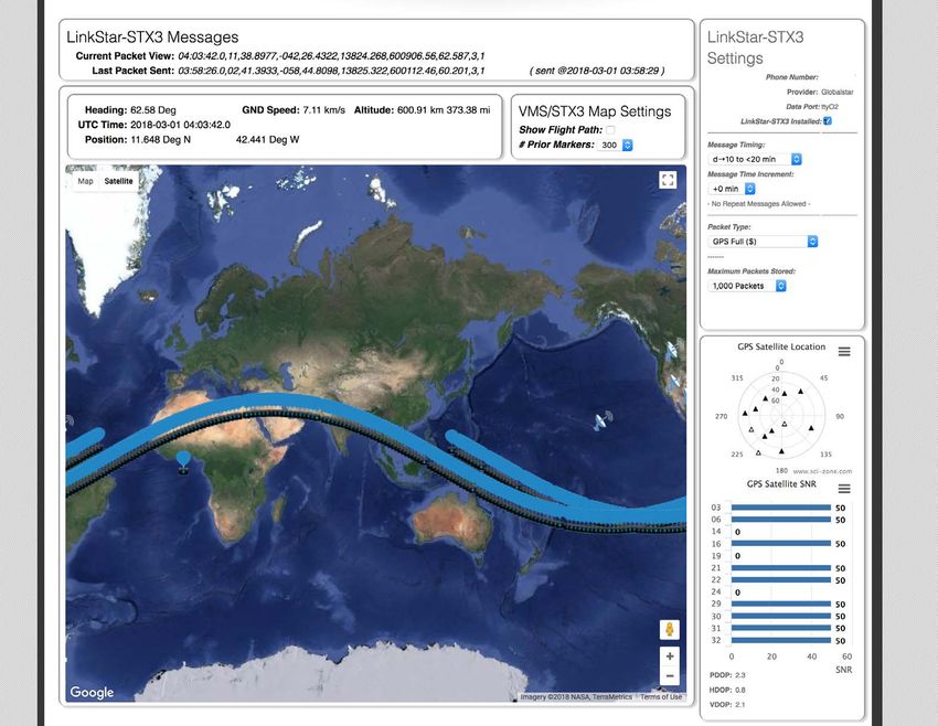
Canopy Near-IR Observing Project

•   CaNOP Mission Overview
•   CaNOP CubeSat
•   Camera System
•   Mission Operations
•   LinkStar System

                                    sci_Zone, Inc.
                                   www.sci-zone.com
CaNOP Mission Overview
Purpose:
•   Test method for Multispectral
    Imaging
•   Image changes in the rain forest
    on Earth
•   Visualize Changes in urban night
    lighting due to the growth of low
    power LED street lights
•   Identification of objects
    approximately the size of a 737
    in flight
                                         sci_Zone, Inc.
                                        www.sci-zone.com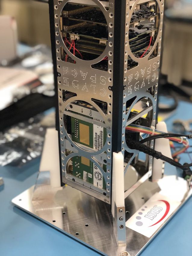
CaNOP Cubesat

                  sci_Zone, Inc.
                www.quick-sat.com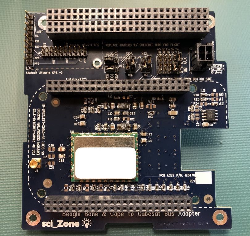
Ver. 1.1 July 5, 2016
Fig. 4.
The image properties obtained from a pushbroom sensor moving Pushbroom
along a scan track are sensor showing the arrangement of 2 Mpx into 8 spectral bands.
characterized byField of View:
the following TheThe
quantities. FOV(º) isofapushbroom
geometry functionimaging
of theis illustrated
sensor dimensions and the focal length of the
Instantaneous Field of View: The IFOV measures the angular image cone of a single pixel
in Fig. 5.
objective lens. Our sensor The hasimage
dimensions of hx =obtained
properties 5.93 mmfrom
in the
a cross-track
pushbroomdirection
sensor and
moving along a scan track are
CaNOP Conceptual Design Documentation
and is given by hyFOV(º)
Field of View: The =11.86 mm (11.86/8
is a function =characterized
of the sensor 1.48 mmand
dimensions per
theband) in following
focal length
by the the
of thealong-track direction. The FOV in each
quantities. The geometry of pushbroom imaging is illustrated
objective lens. Our sensor has dimensionsVer. of hx =1.1
5.93 mmJuly 5, cross-track
in the 2016 direction and
direction
hy =11.86 mm (11.86/8Fig. 4. ismmtherefore
Pushbroom
= 1.48 Fig.
sensor
per showing
band) inarrangement
4.inPushbroom Fig.sensor
thethealong-track 5.
of 2 showing
Mpx into
direction. the
FOVarrangement
The8 spectral
in bands.
each of 2 Mpx into 8 spectral bands.
Multispectral Camera
direction is therefore
#TU9 = @>=/b = 157The µ"QBhQWO . obtained from a pushbroom sensor moving along a scan track are
The image properties obtained from a pushbroom sensor moving along a scan track are
image properties
characterized by the following quantities. The geometry of pushbroom imaging is illustrated CaN
+)
in Fig.CMNOO
5. − PMQRScharacterized
TU9 V) = 2PQW CMNOO − PMQRS
Field
by+)theℎfollowing TU9 The
of View: V The
=FOV(º)
quantities.
Y /2L = 9.68º
) 2PQW isofaℎpushbroom
geometry /2L = imaging
Yfunction9.68º
of theis illustrated
sensor dimensions and the focal length of the
Instantaneous
Dwell Time: The dwell Field ofField
time is a measure ofView:
1FNW]
the The
− PMQRS
of View: time
The TU9 IFOV
each
FOV(º) 2PQW measures
Vis a=1FNW]
in Fig. 5.
pixel
function of −
^objective
theℎ PMQRS
/2L =
is
+)
exposed
sensor TU9 the
lens.
2.43º/aQWB
dimensions Vand
_
^ to
angular
Our
=
the a sensor
2PQW
focal terrain
length of theimage
ℎhas cone
_ /2Ldimensions
+)
= of of
2.43º/aQWB a single
hx = 5.93 pixel
mm in the cross-track direction and
objective lens. Our sensor has dimensions of h = 5.93 mm in the cross-track direction and
and directly
feature and is related is giventoby
the signal-to-noise
Swath Width: The
Swathswath
h =11.86 width
mm
Width: (11.86/8
The
y
Field
L isratio
the
ofmmView:
for
cross-track
= 1.48
swath the
per L
width
The
image
band)
is the
=11.86
hyinFOV(º)
imaging
scale
the on the
along-track
cross-track
mm
is a function (11.86/8
x
process.
ground.
direction.
image
ofThe
theFOV sensor
For
It represents = dimensions
in each1.48 mmand
a pertheband) in the
focal length of thealong-track direction. The FOV in each
objective lens. Our sensor has dimensions of h = 5.93 mm in the cross-track direction and
the width of eachSwath
direction
stripon
scale Width:
ofisthe
image dataThe
therefore
ground. acquiredswath width
direction
in a pass
It represents the over
width
Fig. Lthe
4. istarget
of the
is
each
Pushbroom cross-track
therefore
terrain.
strip
sensor
x
The imaging
showing image
the scale
arrangement of 2on
Mpx the
into 8ground.
spectral It represents
bands.
pushbroom sensor, the dwell time isisrelated
height assumedof to to
be the
image the
the width of each
GSD
orbital
data
h =11.86
altitude
y
acquired and
in
mm
Ha=pass
strip
400 the
(11.86/8
km.
over
ofV The
image
orbital
the
=
= 2PQW data
1.48
target velocity
mm per
terrain.
ℎ /2L acquired
band) V.in theAt
in a pass over
400
along-track direction. The FOV in each
the target terrain. The imaging
msCAM:
+)
direction
CMNOO − PMQRSisTU9
therefore = 9.68º
The imaging#TU9 = @>=/b = 157 µ"QBhQWO .
) Y
height isPMQRS
assumed to be image properties
the orbital obtained
altitude from a pushbroom sensor moving along a scan track are
km, the orbital velocity V= 7.67 km/sec.
0 = 2bPQW TU9/2
Hheight
= 67 is assumed to be the
Sc. 1FNW] − TU9 V = 2PQW orbitalbyaltitude
ℎ
characterized /2L
^ the followingHquantities.
= 2.43º/aQWB +)
= 400The
_ km.geometry of pushbroom imaging is illustrated
+)
= 400 km.
in Fig.CMNOO
5. − PMQRS TU9 V) = 2PQW+) CMNOO − PMQRS
ℎY /2L TU9 V) = 2PQW
= 9.68º ℎY /2L = 9.68º
Ground Sample Swath Width:The
Distance: TheGSD
swathis
width
the Lground
is the cross-track
projectedimage
pixelscale
size:on the ground. It represents
TU9 Vis a=1FNW]2PQW of − ℎ PMQRS +)
Dwell
Pi Time:
= @>=/9The =dwell
63 0time
=is 2bPQW
c/(7.67×10
height is
assumeda measure
(
TU9/2
to be c/O)
the == 67
orbital altitudeof 1FNW]
H =Sc.
8.2
Field the
cOAR.
− PMQRS
km. time each pixel is exposed
of View:
400
The FOV(º) function the
+)
/2L =
sensor TU9 Vand
2.43º/aQWB
the width of each strip of image data acquired in a pass over the target ^terrain. The imaging_
dimensions ^ to= focal
the 2PQW length of theℎ_ /2L = 2.43º/aQWB
a terrain
+f ( +(
@>= = B ×b/L = (5.5e10 c)×(400×10 c) / (35×10 objectivec) = 63
lens. Ourc.sensor has dimensions of h = 5.93 mm in the cross-track direction and
Images at 450, 550, 650, and
& x
Fig. 4
• feature and is related Ground
directly
0 = 2bPQW TU9/2
GroundSample
to=Swath
Sample
the
67 Sc. signal-to-noise
Width: The
Distance:
Distance:
the width of each
swath
h =11.86
TheSwathGSD
The
Swath
direction
strip
scale of
width
mm
Width:
isimage
isGSD
on the Width:
L isratio
(11.86/8
the The
therefore
the
ground
is
data
= 1.48
swath
the
ground.The
y
forperthe
cross-track
mm
width
ground
acquiredswath the
in
It represents a
image
band)
L imaging
projected
width
pass
scale
in the
is the
over
width
along-track
cross-track
L of
thepixel
is each
target
process.
on thedirection.
ground.The
image
size:
the strip
For a
It represents
FOV in each
cross-track image scale on the ground. It represents
terrain. The imaging
A dwell time of 8.2pushbroom
msec suggests a shutter
sensor, theGround time
projected
dwell Sample of
pixel
time 8.2
size:
Distance: ismsec,
The
height related
GSD
is which
to to
is the ground
assumed of image theisorbital
projected
be the
data
within
GSD
pixel altitudethe
size:
acquired and
in
capabilities
Ha=pass
400the km.
over orbital
the target velocity
terrain. V. At 400
the width of each strip ofV image
= 2PQW data ℎ /2L acquired in a pass over the target terrain. The imaging
750 nm at 2048 unmixed pixels The imag
+)
CMNOO − PMQRS TU9 = 9.68º
of the camera unitkm,
under
theconsideration for@>=
the = CaNOP mission.
) Y
The imaging
+f height is assumed
( to be the orbital
+( altitude CaNOP Conceptual Design
orbital velocity V= 7.67B& ×b/Lkm/sec. = (5.5e10 c)×(400×10 c) / (35×10 c) = 63 c.
+f ( +(
@>= = B ×b/L = (5.5e10 c)×(400×10
& c) / (35×10 c) = 63 c. 19
Hheight is assumed to be the orbital altitude H = 400 km. +)
0 = 2bPQW TU9/2 = 67 Sc. 1FNW] − PMQRS TU9 V = 2PQW ℎ /2L = 2.43º/aQWB
^ _
= 400 km. character
Ver. 1.1 July 5,
To estimateper band
Swath Width:The
TheGSD
swathis width
the Lground
is the cross-track
projectedimage
pixelscale
size:on the ground. It represents
the image size in bytes of a strip
CaNOPGround
ConceptualSample Distance:
Design Documentation
in Fig.senso
Fig. 4. Pushbroom 5.
P =of@>=/9
imaging
= data obtained under the==
conditions the width of each strip of image data acquired in a pass over the target terrain. The imaging
0 = 2bPQW TU9/2 67 (
63 c/(7.67×10 c/O) 8.2Sc.
cOAR.
Ver. 1.1 July 5, 2016
Figure 3: msCAM multispectral camera with lens i height is assumed
+f to be the orbital
19
( altitude H = 400
+( km.
@>= = B& ×b/L = (5.5e10 c)×(400×10 c) / (35×10 c) = 63 c.
derived here, weintoconsider
integrated the cubesat a frame rate
structure of 1 exposure per band - that is one exposure in the The image properties obtaine
0 = 2bPQW TU9/2 = 67 Sc.
Ground Sample Distance: The GSD is the ground characterized byField of V
the following
timeThe itimage
takes properties
the obtained from
sensor to a move
push broom a sensor
distance of 250 x GSD = Ground
15.75 km. Sample
The Distance: The
along-track FOV GSD is the ground projected pixel 19 size:
is 19.2º,• which
following Push Broom Sensor
moving along a scan A
provides
quantities.
dwell time of 8.2 msec suggests a shutter
track are
The geometry
imaging is illustrated inof
characterized
a totalof push
by
exposure
the
broom
time
Ground Sample of
projected pixel 8.2Themsec,
size:
Distance:
track of 136 km. The actual ground pixel coverage
the5. camera unit under consideration for@>=the = B CaNOP
which
GSD is the ground
= (5.5e10mission.
is pixel
projected size: Instantaneous
within
/ (35×10 c) = 63 c. and
the capabilitiesField of View: The IFOV measures
in Fig. 5.
objective
is 126 km (for a GSD of 63 m). The cross-track image width is@>= =×b/L
Bkm
& ×b/L =c)×(400×10 c) +f
(5.5e10 c)×(400×10( c) is given
/ (35×10 by
+(
c) = 63 c. Field of View: ThehyFOV(º)
=11.86 is a
+f ( +(
Figure & 19
L = 67 for an area of 9112 objective lens. Our sensor ha
direction
~ 2Mpx arranged in a 1000px x
2Field of View: The FOV(o) is a function of the sensor hy =11.86 mm (11.86/8 Fig. 4. Push
= 1.48
•sensor has dimensions
. Let
km dimensions us assume
and the focal 8 exposures
length
Toofestimateof the across
objective
the lens.
image
the 2 Mpx sensor
size in bytes
in the 16.4 seconds required
CaNOP Conceptual Design Documentation
of a strip of imaging data
Ver. 1.1
for
obtained under the conditions
July 5, 2016 direction is therefore
#TU9 = @>=/b The image= prop1
each Ourband to pass along 126
x = 5.93
hFigure 3:mmkm
in
msCAMtheof the track. camera
cross-
multispectral At 10with
bits/pixel,
lens the data acquired along the 19
characterized by
2000px grid
track direction and hy derived here, x we consider
the cubesat a frame px)rate of 1 exposure per band - that is one exposure in the
=11.86 mm (11.86/8 = 1.48into
integrated mm structure
6 8
imaging
per band)track is (8 exposures)
in the along-track direction. The FOV (10bits/px)
in each x (2x10 = 1.6x10 bits = 20 MB. in Fig.CMNOO
5. −
direction is therefore The image properties obtained from a push broom sensor
time it takes the sensor to move a distance of 250 x GSD = 15.75 km. The along-track FOV 19 1FNW] − PMQ
moving along a scan track Fig. 4.are characterized Dwell Time:
Figure 4: Pushbybroom
Pushbroom The dwell time is a measure
thearrangement
sensor showing the of the tim
of 2 Mpx into 8 spectral bands.
sensor showing the
Field of View: Th
objective lens. O
is 19.2º,
followingwhich provides
quantities. Theimage
The geometrya total
arrangement
properties exposure
of push
obtained of broom
from a2 pushbroom track
Mpx intosensor
8 spectral
movingofalong
136
bands. a scan km.
track areThe actual groundfeature
pixel coverage
and is related directly to the signal-to-nois Swath Width: The swath
hy =11.86
Swath width
mm
Width: (1
imaging is illustrated incharacterized
Figure 5. by the following quantities. The geometry of pushbroom imaging is illustrated
is 126 km (for a GSD in Fig. 5. of 63 m). The cross-track image width is L = 67 km for an area of 9112 Swath
scale on theWig direction
the width of each strip ofisimag
there
2Field of View: The FOV( o
) View:
is a Thefunction ofa function
the sensor pushbroom sensor, the dwell time is
height isrelated
assumed
of
the
to to
be
image the
the
width
o
data
. Let usand
km dimensions assume Field of8 lens.
exposures
FOV(º) is across
of the the 2 Mpx sensor in the 16.4 seconds required for
sensor dimensions and the focal length of the
The imaging
the focal length
objective of sensor
Our the objective lens.
has dimensions of h = 5.93 mm in the cross-track direction and
x km, the orbital velocity V= 7.67 km/sec.
0 = 2bPQW TU9/2
Hheight
= 67is Sca
each band to passdirection
Our sensor has dimensions along
of
h =11.86
y h mm
x = 126 km of the track. At 10 bits/pixel, the data acquired along the
5.93
(11.86/8
is therefore
mm
= 1.48inmmthe cross-
per band) in the along-track direction. The FOV in each = 400 km
track direction and hy =11.86 mm (11.86/8 = 1.48 mm 6 8 Ground Sample Swath Width:The
Distance: Th
imaging
per band)track is (8 exposures)
in the along-track direction. CMNOO
The −FOVxPMQRS(10bits/px)
in each x (2x10 px) = 1.6x10 bits = 20 MB. the width of eac
0 = 2bPQ
direction is therefore
TU9 V = 2PQW
1FNW] − PMQRS TU9 V^ = 2PQW
)
+)
+)
ℎ /2L = 9.68º
Fig. 4. ℎPushbroom
_ /2L = 2.43º/aQWB
Y
sensor showing the arrangement of 2 Mpx into 8 spectral bands.
Pi = @>=/9 = 63 c/(7.67×
height is assume
@>= = B ×b/L = (5.5e10 +f
&
Figure 4: Push broom sensor showing the
0 = 2bPQW TU9
Ground
Swath Width: The swath width L is the cross-track
The image image arrangement
scale on
properties ofIt a2represents
the ground.
obtained from Mpx intosensor
pushbroom 8 spectral bands.
moving along a scan track are
GroundSam S
the width of each strip of image data acquired in a pass over
characterized
height is assumed to be the orbital altitude
in H = 400
Fig. 5. km.
thefollowing
by the target terrain. The imaging
quantities.
A dwell time of 8.2 msec suggests a
The geometry of pushbroom imaging is illustrated
shutter time
projected
Ground pix
Sample
0 = 2bPQW TU9/2 = 67 Sc. of ofthe
Field of View: The FOV(º) is a function of the sensor dimensions and the focal length the camera unit under consideration for the
@>=
@>= = B Ca
=×b/L
B& &
objective
Ground Sample Distance: The GSD is the lens. Ourpixel
ground projected sensor
size:has dimensions of hx = 5.93 mm in the cross-track direction and
hy =11.86 mm (11.86/8 = 1.48 mm per band) in the along-track direction. The FOV in each
@>= = B& ×b/L = (5.5e10+f c)×(400×10 direction
( is therefore
+(
c) / (35×10 c) = 63 c.
To estimate the image size in bytes of a strip of im
CMNOO − PMQRS TU9 V) = 2PQW+)
Figure 3: msCAM multispectral
ℎY /2L = 9.68º
sci_Zone,
camera with lensInc.
derived here, weintoconsider
integrated the cubesat a frame rate of 1 expos
structure
1FNW] − PMQRS TU9 V = 2PQW ℎ /2L = 2.43º/aQWB ^
19
+)
_
www.sci-zone.com
The image properties obtained from a push broom sensor
Figure 5: Push broom imaging geometry. Swath Width: The swath width L is the cross-track image scale on the ground. It time
representsit takes the sensor to move a distance of 250
moving along a scan track are characterized by the
Fig. 5. Pushbroom imaging geometry. the width of each strip of image data acquired in a pass over the target terrain. The imaging
height is assumed to be the orbital altitude H = 400 km. is 19.2º,
followingwhich provides
quantities. a total
The geometry exposure
of push broom track of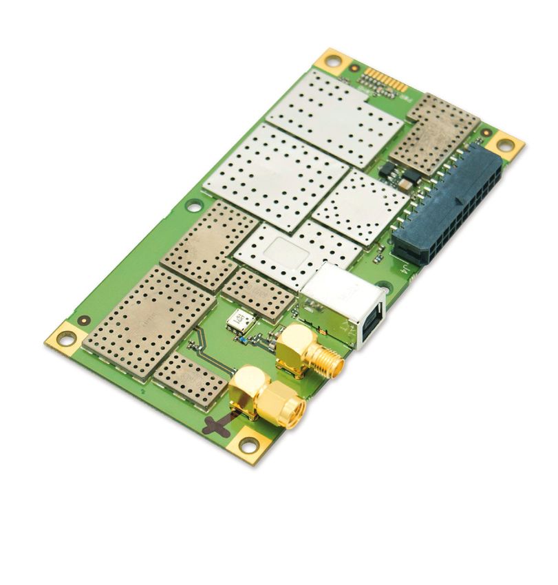
Mission Operations
The primary mission of CaNOP is to return spectrally resolved images
of diverse forest landscapes from a variety of ecological and
climatological niches.
• Launch to ISS by NASA/ELaNA
• Deployed from Nanoracks
Cubesat launch container
• De-tumbling begins 30 minutes
after deployment for one orbit
• Imaging activated when
crossing defined “fences”
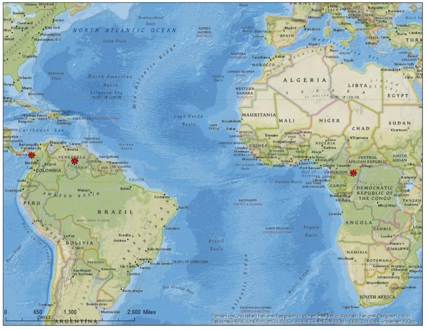
Imaging Targets:
• Los Katíos National Park is located in Colombia, South America
• El Caura in Venezuela, South America
• Sangha Tri-National Forest is an equatorial tropical rainforest situated between the
nations of Central African Republic, Cameroon and Congo-Brazzaville sci_Zone, Inc.
www.sci-zone.com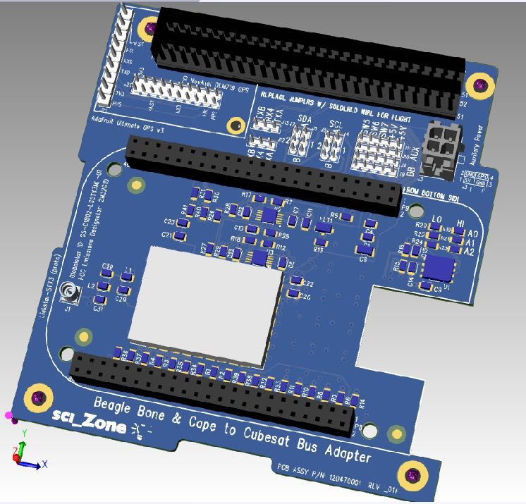
LinkStar Architecture
LinkStar: A Paradigm Shift
sci_Zone, Inc.                                                                               AF192-001                   F192-001-1674

                                  LinkStar-TRK,-STX3

 GSP-1720
 Satellite Data and Voice Module

GSP-1720
                                                     LinkStar-D
                               The GSP-1720 Satellite Data and Voice Module (SDVM)
                               provides full, two-way data and voice capability, allowing for

Satellite Data and Voice Modulethe development of new and creative applications from basic
                               AT Modems to fully-featured fixed telephone services from
                               remote locations.

                                                                                                                                           OEM-719, ADA Fruit
 Features and Advantages:                             The GSP-1720 Satellite Data and Voice Module (SDVM)
                                            SCADA Applications:
                                                                                                                                             UltimateGPS
                                                      provides full, two-way data and voice capability, allowing for

                                                                                                                                                GPS
                                                      the development of new and creative applications from basic
                                                      AT Modems to fully-featured fixed telephone services from

                                             LinkStar-HD                                                                QuickSat
                                            GSP-1720 Includes:
                                                      remote locations.
 Data Services:

                                            Installation Options

Features and Advantages:                                                     SCADA Applications:

                                            Other radios                     GSP-1720 Includes:
                                                                                                                            Industrial
                                                                                                                        BeagleBone Black
                                                                                                                           Flight
Data Services:

                                                                                                                                             MAI-400
                                                                             Installation Options

                                                                                                                         Computer

                                                                                                                                             Sensors
                       LinkStar
                       Architecture                                                                                                         Actuators
                                                                                                                                               sci_Zone, Inc.
                                                                                                                       Other Computers        www.sci-zone.com
                                                                                                                                                                     8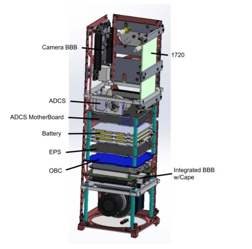
LinkStar-STX3-PC104
Globalstar STX3 Based Module
 • Power
     •   192 mW Tx power
 •   PC104 Based
 •   Full Support for Cubesat Bus
 •   Beagle Bone Black Cape Interface
 •   Duplex Radio, any radio interface
 •   Supports switched/unswitched power
 •   Serial, I2C interface
 •   GPS Interface (NovAtel, Adafruit)
 •   Near Global Coverage!

 sci_Zone, Inc.
www.sci-zone.com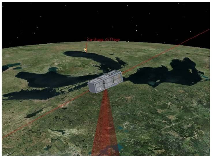
sci_Zone, Inc.
www.sci-zone.com
Satellite Data and Voice

 LinkStar Duplex
 Product Features                                                                     Th
                                                                                      pro
                                                                                      the

• No deployables                                                                      AT
                                                                                      rem
• 3 cm diameter circular patch for duplex
• Rapid acquisition
• Data rates
•   9600 bps maximum
•   SMS Uplink Messaging
•   LinkStar intended to compliment traditional high speed
                                                  Features and radios
                                                               Advantages:

•   LinkStar can serve as a primary radio depending project and
    product data requirements.

                                                                    sci_Zone, Inc.
                                                                   www.sci-zone.com
LinkStar Product Features
• Almost anytime, anywhere vehicle Telemetry, Tracking and Control
• Large, global coverage area
• Common FCC Satellite-to-Satellite License
• No Amateur bands
• No satellite to ground license required
• Globalstar will work with sci_Zone on obtaining FAA and FCC licenses
• Ground station over Internet Protocol (IP)
• Access your vehicle from anywhere!
• Piggy-backs on established 2 billion dollar network
• Low Cost
sci_Zone, Inc.
www.sci-zone.comsci_Zone, Inc. www.sci-zone.com
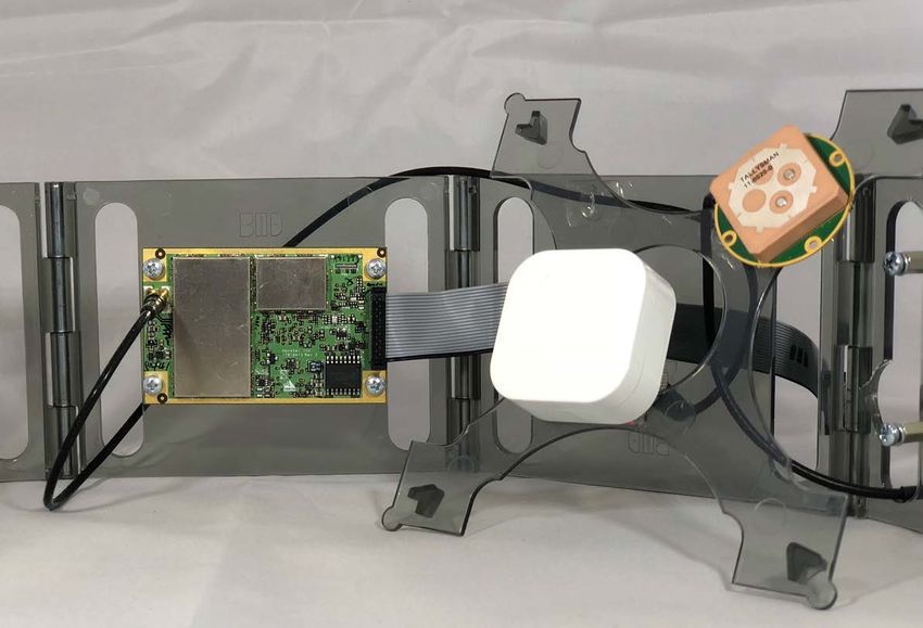
GPS Interface
•   NovAtel OEM 719
    •   COCOM limits removed
    •   Acquisition time in space 4 - 6 minutes (one time took
        18 minutes).
    •   Lock maintained for multiple orbits
    •   Can look below the horizon
    •   Antenna placement critical

•   Adafruit Ultimate GPS
    •   Can work above 59,000 feet

                          LinkStar radios
                         auto sense GPS

                           APIs provided
Interface Message and GPS
information
Radio
messaging
control and
radio information
GPS signal
quality
information
OEM 719 Accepts
SNR > 29 db• Web server - html 5/
javascript, php
QuickSAT/
VMS Architecture
•C
• Python Custom Interfaces
Custom & Addon
Processes
stepSATdb_Flight
vms_db
Custom Commands vms
Core Commands
Communication Tools
APIs created for lsRadio
communication system
interface, database interface
and communicating with the
GPS (Adafruit and NovAtel). Command
Applications Data
Files
sci_Zone, Inc.Inc.
sci_Zone,
www.sci-zone.com
www.sci-zone.comQuickSAT/Autonomy
with LinkStar
QuickSAT/Autonomy can be used to fuse sensor data,
such as data from hyperspectral cameras and other
sensors to sense and perceive events and conditions. The
event/condition is transmitted to the ground - the cubesat
can autonomously act on the event/condition. The event/
condition can be transmitted efficiently and quickly (in as
little as 0.2 seconds depending on the radio system). The
operator can download the large raw data as needed at a
later time.
Autonomy APIs and Functions for Vehicle Health Monitoring,
Perception and Planning
Integrated computer (BeagleBone AI or Xilinx Zynq UltraScale+
MPSoC chip), communications interface, with optional GPS.
IC2, Space Wire, Serial, CAN, USB interfaces, UART
Support for CubeSat bus
0.5 U in size
QuickSAT/VMS environment for seamless control and software
integration
Optional Hypervisor for protection from malicious attacks.
sci_Zone, Inc.
www.sci-zone.com
17Next STEP - Join the Fun!
email: andrew_santangelo@sci-zone.com
web: www.sci-zone.com
sci_Zone, Inc.
www.sci-zone.comYou can also read


