Upper Big Blue natural resources district - Long Range - Upper Big Blue NRD
←
→
Page content transcription
If your browser does not render page correctly, please read the page content below

Long Range
IMPLEMENTATION PLAN   2021-
                        2026

Upper Big Blue
natural resources district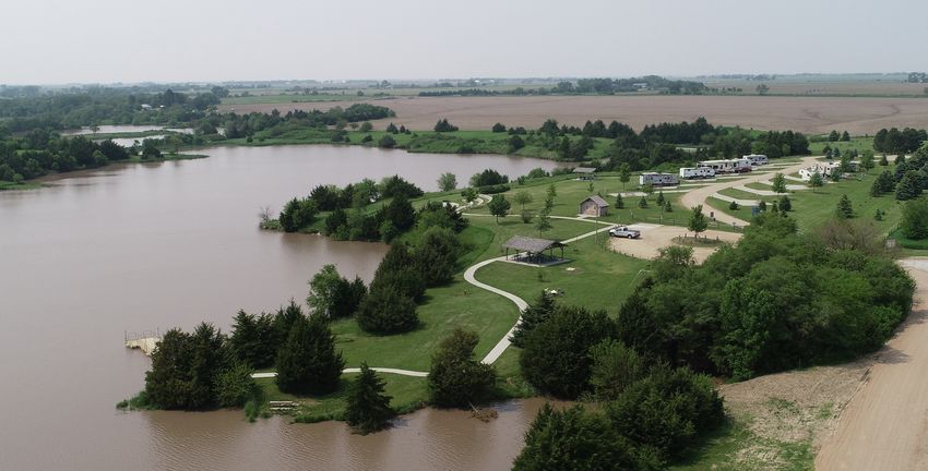
Long
    ProjectRange
           ProposalImplementation Plan

2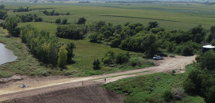
Long
     ProjectRange
            ProposalImplementation Plan

Table of Contents

         Long Range Implementation Plan
         1      History and Purpose
         2      Programs and Activities
         3      District Board
         4      District Staff
         5      Regulations
         6      Soil and Water Resources: Planning & Management
         11     Projects and Programs
         16     Project Priorities
         19     Fiscal Management and Budget Forecasting
         27     Contact Information

3
Long
    ProjectRange
           ProposalImplementation Plan

History & Purpose
        More than 56,000 citizens rely on the Upper Big Blue Natural Resources
        District (NRD) to provide direction and assistance in the wise use,
        conservation and development of soil, water and related natural
        resources. The Upper Big Blue NRD is dedicated to the conservation and
        careful development of natural resources to serve everyone’s needs.

        In 1972, over 150 special purpose districts      the implementation of NRD polices and
        were consolidated into Nebraska’s NRDs.          regulations, and serves as the focal point for
        There are 23 NRDs, formed to correspond          planning and operations for the District.
        with the state’s major river basins. The NRDs
        carry the names of these rivers, hence the       The NRD works closely with state and
        Upper Big Blue NRD, Lower Platte South           federal agencies to coordinate conservation
        NRD, and so on.                                  efforts. A key agency is the Natural
                                                         Resources Conservation Service (NRCS),
        NRDs are organized as political subdivisions     which provides planning, technical aid
        of the state. Local control is provided by a     and inspections for private landowners.
        board of directors, elected by voters within     NRCS field offices are located in Aurora,
        the district. Across the state, NRDs are a       Clay Center, David City, Geneva, Hastings,
        major source of assistance to landowners         Osceola, Seward, Wilber, and York.
        in conservation and natural resources
        management. The NRDs also, by law,               A major source of funding for projects,
        regulate the use of groundwater in the state.    programs and administration comes from
                                                         a tax levy on all taxable property within the
        At the Upper Big Blue NRD, a 17 member           district. Other sources include federal, state,
        board of directors establishes policy.           and private grants.
        These elected directors represent the
        citizens’ interests in conservation. Not         The NRD has the authority to coordinate
        only do directors make decisions about           land and water management projects and
        conservation programs at the district level,     programs with local, state, and federal
        they also bring a wealth of local judgment       conservation organizations and other
        and experience to bear when adapting state       governmental units. These projects may be
        and national programs to local situations.       funded through the sharing of project costs
                                                         by the sponsoring agencies.
        The directors (two from each of eight sub-
        districts and one at-large) are elected by all   This plan document follows the goals and
        of the voters of the NRD. They serve four-       objectives of the 2020 Master Plan, and
        year terms.                                      summarizes the planned district activities
                                                         for the next five years, including projections
        The NRD staff, under the direction of            of financial, staffing and land rights needs of
        the general manager, is responsible for          the district.

1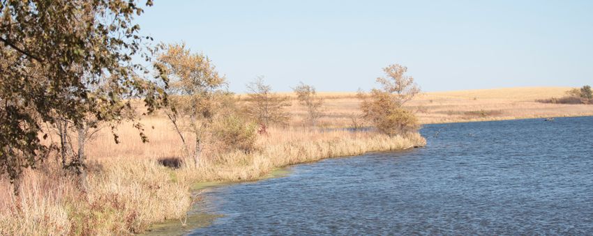
Long
 ProjectRange
        Proposal Implementation Plan

Programs & Activities
      The NRD offers several major natural resources programs, as well as administers rules and
      regulations for groundwater use and protection in these areas:
      •   Water Conservation Dams                    •   Groundwater Quantity
      •   Flood Control                                  » Observation Wells
          » Dams                                         » Crop Water Use Information
          » Levees                                       » Irrigation Scheduling Equipment
          » Flood Plain Buyouts                          » Flow Meter Cost Share
          » Buffer Strips                                » Demonstration Fields (Project
      •   Storm Water Drainage (Urban)                       GROW)
          » Master Drainage Plans                        » Variable Rate Irrigation Cost-Share
          » Storm Water Drainage Systems             •   Groundwater Quality
      •   Hazard Mitigation Planning                     » Monitoring Wells
      •   Land Treatment Cost-Share                      » Well Abandonment Cost-Share
          » Terraces                                     » Municipal Water Quality Assistance
          » Dams                                         » Domestic Well Quality Testing
          » Diversions                               •   Wildlife Habitat
          » Windbreaks                                   » Habitat Improvement
          » Irrigation Efficiency Improvements           » Corners for Wildlife
          » Buffer Strips                                » Wild Nebraska Program
          » Community Native Grass Resources             » Wetlands Grazing Portable Corral
      •   Public Relations                               » Divots in the Pivots (wetland
          » Publications, Social Media, E-mails              conservation cost-share)
          » Public Speaking                          •   Tree Plantings
          » Public Events                                » Seedling Sales
          » Scholarships                                 » Conservation Plantings
          » Educational Capital Projects Fund            » Storm Damage Tree Replacement
      •   Parks and Recreation                           » Community Tree Cost-Share
          » Parks Cost-Share                         •   On-Farm Research
          » NRD Recreation Areas

                                                                       Beaver Creek Flooding, May ‘19

                                                                          Oxbow Trails Recreation Area

                                                                                                  2
Long
    ProjectRange
           ProposalImplementation Plan

District Board
        The Upper Big Blue Natural Resources District is governed by a 17 member Board of
        Directors. Two directors are elected from each of the eight sub-districts, plus one at-large
        member from any sub-district. The board sets policy for the district and works closely with
        the staff through a committee system to carry out the district’s goals. Board meetings are
        conducted on the third Thursday of each month at the district office. Committees meet
        throughout the month. Special meetings are called as needed to consider important
        concerns and issues. The district board of directors sets the direction, policies and budget
        for the natural resources district.

        Board of Directors (As of October 2020)
        •   Jeff Bohaty, Seward, Sub-district 2
        •   Douglas Bruns, Waco, Sub-district 3
        •   Paul Bethune, York, Sub-district 8
        •   Douglas L. Dickinson, Seward, Sub-district 2
        •   Gary E. Eberle, Bradshaw, Sub-district 7
        •   Roger W. Houdersheldt, Shelby, Sub-district 1
        •   Linda L. Luebbe, Beaver Crossing, At-Large Member
        •   John Miller, Aurora, Sub-district 6
        •   Larry K. Moore, Ulysses, Sub-district 1
        •   Micheal D. Nuss, Sutton, Sub-district 5
        •   Bill Kuehner, Jr., Aurora, Sub-district 6
        •   David Robotham, York, Sub-district 8
        •   Bill Stahly, Milford, Sub-district 3
        •   Ronda Rich, York, Sub-district 7
        •   Merlin M. Volkmer, Shickley, Sub-district 5
        •   Paul Weiss, McCool Junction, Sub-district 4
        •   Lynn Yates, Geneva, Sub-district 4

        The management staff oversee the day-to-day functions of the district, including regulation
        enforcement. These functions are carried out by the rest of the employees.
        The management staff are also instrumental in budget and policy development which
        are ultimately approved by the board. The management staff are the project managers
        who conducted oversee planning, design, contracts and construction of district projects.
        Consultants are sometimes hired for specific tasks, such as geotechnical investigations
        or research. Occasionally consultants are hired for project design, but only under close
        supervision by management.

3
Long
ProjectRange
       ProposalImplementation Plan

District Staff
     The district has 27 employee positions, 24 full time, one part-time and two occasional
     workers. Full-time and part-time employees are permanent employees with paid benefits.
     Full-time employees work 40 hour work weeks all year whereas part-time employees
     work a regular schedule of at least 20 hours per week. Occasional workers are temporary
     employees who do not learn benefits. Their hours vary depending on available work.

     NRD STAFF (As of October 2020)
     •   David Eigenberg, General Manager
     •   Rodney Verhoeff, Assistant General Manager
     •   Jack Wergin,.Projects Department Manager
     •   Marie Krausnick, Water Department Manager
     •   Nancy Brisk, Office Manager
     •   Chrystal Houston, Public Relations Manager
     •   Jeff Ball, Lead Engineering Technician
     •   John Bush, Water Resources Technician
     •   Drew ten Bensel, Water Resources Technician
     •   Erinn Wilkins, Water Resources Technician
     •   Jacob Maslonka, Water Resources Technician
     •   Miranda Coffey, Water Data Assistant
     •   Dan Leininger, Water Conservationist
     •   Sylvia Jividen, Geneva Field Office Clerk
     •   Tamra Jones, Osceola Field Office Clerk
     •   Janet Yates, Seward Field Office Clerk
     •   April English, York Field Office Clerk
     •   Rita Hoblyn, Projects Department Secretary
     •   Carleen Light, Water Department Secretary
     •   DeeDee Novotny, Water Dept. Secretary
     •   Patty Connors, Secretary
     •   Mick Northrop, Lead Maintenance Worker
     •   Jay Geiger, Maintenance Worker
     •   Mark Olsen, Maintenance Worker
     •   Tom Johnson,. Maintenance Worker
     •   Andy Larkin, Maintenance Worker
     •   Kyle Yrkoski, District Forester

                                                                                               4
Long
    Project Range
            Proposal Implementation Plan

Regulations
        The long-term management and regulation of groundwater quantity
        and quality is a high priority in this District. That commitment requires a
        staff of 9 and a large part of the annual budget (about one-third of the
        total NRD staff and budget).

            •   Groundwater Quantity (most of the
                NRD)                                    •   Fully Appropriated Upper Platte
                » Well Permits                              Basin Integrated Management Plan
                » Large Water User Studies
                » Well Spacing                          •   Chemigation
                » Transfers
                » Irrigated Acres Certification         •   Erosion and Sediment Control
                » Groundwater Use Reports
                » Flow Meters                           •   Park Regulations
                                                            » General
            •   Groundwater Quality (all of the NRD)        » Anderson Recreation Area
                » Fertilizer Timing Restrictions            » Overland Trails
                » Operator Training                         » Oxbow Trails
                » Soil Sampling                             » Pioneer Trails
                » Irrigation Scheduling                     » Smith Creek
                » Irrigation Water Test for Nitrates
                » Annual Reporting

           *For additional information on the specifics of the programs and regulations of the NRD,
           please view the regularly updated Programs and Rules & Regulations publications.*

                                                                               Oxbow Trails Recreation Area

5
Long
 Project Range
         Proposal Implementation Plan

Soil & Water Resources: Planning & Management

      Online Reporting
      A major goal was accomplished in 2019 as online reporting for water use and Phase II and
      III management area reporting. While paper reporting is still allowed, many producers
      chose online reporting and found it quick and easy. The new tool received praise from
      many producers and streamlined the data management for NRD staff as well. This tool will
      continue with the expectation that it will increasingly replace traditional reporting.

      One District, Two Plans, One Water
      In 2018, the Upper Big Blue NRD joined the Nebraska Department of Natural Resources
      (NeDNR) and the Nebraska Department of Environment and Energy (NDEE)on a joint
      planning effort to address water quality and quantity across the District. The engineering
      firm JEO was contracted to help with this first of its kind project. The conversations
      and work continued in 2019 and a public open house on the topic was held on April 2.
      The resulting Water Quality Management Plan (WQMP) and draft Voluntary Integrated
      Management Plan (VIMP) were the results of this effort.

      The joint planning process began with building partnerships between agencies. Since
      each plan required different but similar requirements, all agencies needed to agree on the
      terminology and planning schedule to be sure all statutory and federal guidelines were met
      in the planning process. Next all concerned explored the characteristics of the watershed to
      identify priority and special priority areas and management actions based on water quality
      resource concerns. They also reviewed the existing district rules and regulations dealing
      with groundwater quantity and identified management actions to address groundwater
      quantity. The WQMP was adopted by the Environmental Protection Agency in March 2020.

      Next steps in the implementation of the WQMP will include:

         •   Developing a localized stakeholder group from within the priority and special
             priority areas.
         •   Using stakeholder feedback to identify barriers in the implementation of the WQMP.
         •   Developing creative ways to encourage the adoption of best management practices
             to improve water quality in the priority and special priority areas.

      Work continues on the VIMP as a regional basin wide groundwater flow model is being
      developed in partnership with the Nebraska Department of Natural Resources and the
      Blue River Basin Natural Resources Districts. The outcome of the regional model will be
      incorporated into the final VIMP.

                                                                                                     6
Long
    ProjectRange
           ProposalImplementation Plan

        Proposed Changes to Rule 5 Regulation

Groundwater
        In 2019, the board spent considerable time discussing the ongoing concern around nitrates
        in the drinking water supply of a majority of the population concentration areas of the
        district. They examined research on the topic and weighed several options for how to
        proceed with this challenging issue.

        In July, the board proposed changes to Rule 5 nitrogen management practices. The
        proposed changes would have impacted fertilizer practices for agriculture producers across
        the district with the aim of reducing the amount of nitrates in the groundwater supply. The
        changes proposed involved the timing and amount of fertilizer application, the addition
        of a nitrification inhibitor when fertilizing in a certain window of time, and additional
        reporting on fertilizer use. Some changes would have impacted all producers, while others
        would have affected only those in areas with high median nitrate levels in the groundwater.

        A public hearing was held on this issue on August 19 and a follow-up meeting was held
        September 10. Testimony was collected from more than 40 individuals during this period of
        public comment. Many producers expressed concern at the added expense this regulation
        would involve for individuals and co-ops. After reviewing the testimony, the board chose
        to send the proposal back to the committee level for further review as a consensus could
        not be reached about the changes needed. The conversation about regulation changes
        continued until August of 2020 when a final decision was made to leave Rule 5 as is with
        the addition of two new active nitrification inhibiting ingredients were added and the
        requirement to provide a copy of a receipt as proof of purchase for nitrification inhibitors in
        Phase III Management Areas.

        On-Farm Research/ Project GROW Demonstrations
        During the 2019 conversation regarding Rule 5 changes, many producers
        in the district expressed a desire to examine strategies for nitrogen
        management locally. Thanks to a partnership with the York County Extension
        Office, volunteer producers were able to try and answer their nitrogen
        management questions on their farms with technical assistance from the
        University Extension and financial support from the NRD.

        York Well Watch Program
         In November 2019 the Upper Big Blue NRD launched the York Well Watch
        program in conjunction with the City of York. The program seeks to inventory
        all private wells in the Wellhead Protection Area—a region that extends from
        the ballfield complex on the east to beyond the airport on the west, and
        north to south encompassing the residential and business sector of York. The
        area also includes a section of land south of Interstate 80 on Highway 81. The
        NRD is collecting data about all domestic, livestock, and irrigation wells in
        this area, both active and abandoned wells, to create an accurate picture of
        the risks wells may pose to the water system.

        Depending on their condition, wells can be a direct conduit for contaminants
        to enter the city’s drinking water. Mapping well locations will help the city
        and NRD to better understand how many wells are still in use and if further
        action is needed to safeguard the water supply. If a number of inactive wells

7
Long
ProjectRange
ProposalImplementation Plan
exist in the Wellhead Protection Area, the city may be eligible for additional grant funding
that could provide tools like ground penetrating radar for research and services such as well
decommissioning. Cooperation with municipalities on non-point source contamination
continues to be a priority. This project is expected to continue through 2020. This project is
supported by a NDEE Source Water Protection grant.
Water Quality Management Plan – Best Management Practices
The Upper Big Blue Natural Resources District is currently finalizing a district-wide Water
Quality Management Plan (WQMP) which will provide a concise summary on water
resource conditions in the district as well as offer direction for a coordinated approach
to address non-point source pollution. The WQMP is based on the U.S. Environmental
Protection Agency’s Nine-Elements of Watershed Planning as well as basin planning
guidance provided by the Nebraska Department of Environment and Energy.
The WQMP documents specific projects intended for implementation over the next five
years. These projects and practices are aimed at improving water quality and removing
targeted water bodies from NDEE’s list of impaired waters.
Over the next five years the district is expecting an increase in the number of land
treatment practices implemented due to the adoption of the district’s Water Quality
Management Plan WQMP. The target areas of the plan (for the first five-year period) include
two impaired segments of Beaver Creek and the drainage basin above Recharge Lake.
Project GROW soybeans and cover crops
8Long
ProjectRange
ProposalImplementation Plan
Goals of the Water Quality Management Plan include:
1. The quality of surface water and groundwater resources in the basin will be
enhanced through a comprehensive and collaborative program that efficiently
and effectively implements actions to restore and protect natural resources from
degradation and impairment.
2. Resource managers, public officials, community leaders, and private citizens will
understand the effects of human activities on water quality and support actions to
restore and protect water resources from impairment by non-point source pollution.
3. Land and water resources will be stable and productive using community-supported
best management practices.
4. The water quality of surface and groundwater resources will meet the conditions
necessary to support domestic, industrial, agricultural, recreational, and ecological
uses.
Project GROW (Growing Rotational crops On Wellfield)
The Upper Big Blue NRD continued to develop Project GROW in York in 2019. Corn and
soybeans were planted in collaboration with local partner Scott Gonnerman on 160 acres.
The emphasis on restoring soil health continued through use of no-till and cover crop
methods of weed and pest control.
The result of the 2019 growing season was continued profitability as well as a low level of
residual nitrogen in the soil. The nitrogen efficiency was .68 pounds per bushel--well below
the district average of 1.1.
As part of the educational outreach of Project GROW, an annual winter soil health workshop
was held in 2018. About 100 people attended the event in each 2018 and 2019.
9Long
ProjectRange
ProposalImplementation Plan
Most of the attendees were farmers or others involved in the agriculture industry. Speakers
have included a diverse group of researchers and practitioners, presenting on subjects from
increasing carbon in soil to more accurate irrigation and fertilization practices, to weather
patterns that will impact the ag economy. The workshop emphasizes the viability of no-
till and cover cropping practices in the district. The district will continue to organize and
sponsor producer educational efforts for the foreseeable future.
Voluntary Integrated Management Plan – Best Management Practices
The Upper Big Blue NRD is currently developing an Integrated Management Plan (IMP)
to collaboratively manage the surface water and ground water supplies in the district
with a goal of developmental sustainability. The vision of the IMP is to achieve a balance
between the water uses and water supplies in the district so that the economic viability,
environmental sustainability, and safe living conditions within the district can be
maintained and enhanced for both the short-term and the long-term.
Specific goals of the draft Integrated Management Plan include:
1. Integrated surface and groundwater resources will be proactively managed using
the best available science and data.
2. The public will better understand and more fully support actions to restore
and protect water supplies while developing broader understand of resource
management.
3. Existing and future water uses and supplies will be protected through community-
supported best management practices.
4. Over the next five years the NRD is expecting an increase in the number of land
treatment practices implemented in an effort to meet the goals of the IMP.
Improved Dam in Milligan
10Long
ProjectRange
ProposalImplementation Plan
Projects & Programs
Smith Creek Dam--Emergency Spillway Rehabilitation
The Smith Creek Dam and Recreation Area was built in 1983. Original land acquisition
allowed the adjacent landowner to continue to farm through the emergency spillway. The
Nebraska Department of Natural Resources’ (NeDNR) Dam Safety Group has identified
the farming of the emergency spillway as a dam safety issue. The District will restore the
emergency spillway channel to the original cross section and seed the channel to grass, as
recommended by the NeDNR.
Smith Creek Recreation Area--Improved Facilities
The district is planning improvements to the Smith Creek Recreation Area facilities.
Planned improvements include the addition of a domestic well, adding outlets to the picnic
shelter, and adding security light with a warning siren.
Oxbow Trail Recreation Area – Improved Facilities
The district is planning improvements to the Oxbow Trail Recreation Area facilities. Planned
improvements include the addition of a domestic well, adding outlets to the picnic shelter,
and adding security light with a warning siren.
Oxbow Trail Recreation Area – Supplemental Well
The district is planning to add a supplemental well to the
Oxbow Trail Recreation Area that will be used during periods
of severe drought as a means of preventing the loss of the
excellent fishery at Oxbow Lake.
Seward Trail
The district provided technical, financial, and construction
assistance to the City of Seward for the construction of a 2.7
mile hiking/biking trail along the east side of Seward which was
completed in 2004. Through an interlocal agreement with the
city, the Upper Big Blue NRD is providing financial assistance
to the city for the extension of the trail which will loop around
perimeter of Seward. This trail project involves construction
of a five-mile, 10-foot wide, concrete trail for bicycle and
pedestrian use in southern, western and northern Seward. The
project would connect to the existing trail at the Plum Creek
Trailhead on South Columbia Avenue, just south of Depot Road.
The trail would proceed west along the south edge of Seward
11Long
ProjectRange
ProposalImplementation Plan
crossing beneath Highway 15, through the Seward County Fairgrounds before passing
beneath the Highway 34 bridge. At this point the trail would head north to Waverly Road.
The trail would then travel along the south side of Waverly Road, cross Highway 15 at-grade
and end at the existing trail located on the southeast corner of the intersection of Karol Kay
Boulevard and Waverly Road, which is the northern end of the existing Plum Creek Trail.
Construction is planned to begin in 2021.
Sutton Trail Pedestrian Bridge
The district is providing financial assistance to the City of Sutton for the replacement of a
pedestrian bridge located on the west side of Saunders Avenue on the city’s trail. This is
a key component of the city, as it connects the south side of Sutton to the north side of
Sutton.
Oxbow Trail Recreation Area – Expansion of Recreation Facilities
The Upper Big Blue NRD continues to investigate opportunities to expand the recreation
facilities at Oxbow Trail Recreation Area. Current recreation facilities include a boat ramp
and dock, vault restrooms, and a picnic shelter. Expansion of the facilities could include
flush restrooms, RV camping pads, an additional picnic shelter, playground equipment, and
a tent camping area.
Bruce Anderson Recreation Area - Expansion of Recreation Facilities
The Bruce Anderson Recreation Area has been a popular destination for RV campers each
summer. Most weekends the RV camping area is full, and the public has asked if the Upper
Big Blue NRD has plans to expand the RV camping area. The NRD has investigated adding
additional RV camping pads in the future.
Pioneer Trails Recreation Area
12Long
ProjectRange
ProposalImplementation Plan
Projects & Programs (continued)
Pioneer Trails Recreation Area – Expansion of Recreation Facilities
In 2015 the Upper Big Blue NRD added recreation facilities to the Pioneer Trails Recreation
Area. Public use of these facilities continues to increase each year. The NRD has discussed
adding additional facilities at Pioneer Trails such as a boat dock, handicap fishing dock, and
additional RV camping pads.
Seward Levee Accreditation
The Upper Big Blue NRD provided financial assistance to the City of Seward for the
evaluation of the Seward Levee. The NRD anticipates additional financial assistance from
Seward for a freeboard risk assessment, modifications to the levee pump station, and for
the final levee certification.
The City of Seward is provided flood risk reduction by a 1.6-mile-long levee system
constructed in 1953 located along the left bank of the Big Blue River along the west and
south edge of Seward. In 2019 the Federal Emergency Management Agency (through
a contract with the Nebraska Department of Natural Resources) updated the floodplain
mapping of Seward County. FEMA requires that the levee system meet criteria specified in
44 CFR 65.10 to continue to be shown as providing the 100-year flood risk reduction. The
levee evaluation was completed in 2019. Follow-up activities to complete the accreditation
of the levee system includes a freeboard risk assessment, modifications to an existing
pump station (which pumps storm runoff from the city side of the levee to the river side of
the levee), and the final levee certification process.
Urban Storm Water Master Planning
The district has completed storm water master drainage planning for Aurora, Milford, and
parts of Seward. Other cities and villages in the district may benefit from these planning
efforts. The proper sizing and location of drainage works throughout a village should be
considered, not just a local fix for a neighborhood problem. The district is also in a position
to consider the impacts and solutions for drainage from or to rural areas.
Urban Storm Water Drainage Projects
After the master planning is complete for a community, some construction cost share
assistance from the district may be necessary to encourage construction of the highest
priority components. It is expected that requests will be made over the next several years.
Joint Public Water Supply Systems
The district is anticipating a growing need for joint water supply projects as nitrates in
groundwater is a problem for cities and villages. Other contaminants also affect drinking
water quality. The cities and villages must, because of federal regulations, supply clean
water for their citizens. Water treatment plants for drinking water quality are expensive. The
City of Seward spent several million dollars on a treatment plant to remove nitrates. The
City of Hastings is looking at $100M expenditure over the next 20 years to remove nitrates
13Long
ProjectRange
ProposalImplementation Plan
from the water furnished to their 25,000 citizens. By looking at these costs and other
information, it is apparent that it will not be cost effective for villages and small cities to
build their own individual treatment plants.
Several years ago, an unsuccessful effort was undertaken by Osceola, Polk, Shelby and
Stromsburg to build a joint public water supply system. The attempt failed because the
smaller villages did not want the system planning, construction and operation to be
influenced by a larger community.
The district is in a position to take the lead in developing joint water supply systems
because it serves all the citizens of the area, not just those in a particular town. The district
can be the lead agency for planning, design, and construction. District funds may be
best used for general concept planning to pay part of the consulting engineers’ costs.
Seed money may be necessary to encourage construction. The long-term operation and
maintenance costs should be paid for with charges to the final customers.
Several options exist for the ownership and operation of joint water supply systems. The
cooperating cities and villages could set up an entity through an inter-local agreement
to own and operate the system. Or the district could, with political and financial support
from the cooperating communities establish a rural water district to supply treated
drinking water. If a rural water district was created, it would have to be part of the district,
not a stand-alone entity. A rural water district could also deliver domestic water to rural
customers. Other options are possible but probably not as workable.
The NRD anticipates new requests for joint water supply systems in the next few years, as
communities continue to search for solutions to nitrate contamination issues.
Trail Projects
A number of trail projects within the Upper Big Blue NRD that have been discussed for
future development. Included in these are:
• Overland Trail Recreation Area – Walking Trail
The Upper Big Blue NRD is currently developing a maintenance road access to the
Overland Trail Dam which will run along the south and east side of the reservoir area.
This maintenance access road may also serve as a walking trail.
• City of York Trail Project
The possible trail project to be constructed by the district would be owned and
operated jointly by the district and the City of York. The joint arrangement is best
because the trail right-of-way would be located both inside and outside of the city
limits. The trail would be an extension of the existing city trail system that ends on
the southwest side of York. The route would extend to the west under the highway 81
bypass at Beaver Creek and then onto the northwest to Recharge Lake.
14Long
ProjectRange
ProposalImplementation Plan
Projects & Programs (continued)
• City of Aurora Trail Project
There have been some initial discussions about expansion of the Aurora City Trail which
would include a new section of trail that would extend from the east edge of Aurora out
to the Pioneer Trails Recreation Area.
• Dark Island Trail
The Upper Big Blue NRD has received requests for financial support of extension of the
Dark Island Trail, which runs from Central City to Marquette. The initial request was for
development of a one-mile section south of Marquette and future plans may include
from Marquette to Aurora.
York Flood Mitigation and Resiliency Plan
The Upper Big Blue NRD has assisted in writing a pre-disaster mitigation grant application
for a flood mitigation and resiliency plan. If selected, the NRD will provide technical
and financial assistance for the development of the plan. Preliminary flood studies and
assessments can be conducted to identify and prioritize design improvements to address
site specific localized flooding issues to reduce and/or alleviate flooding impacts. The City
of York will be developing a Flood Mitigation and Resiliency Plan to holistically evaluate
flood risks and identify possible solutions to reduce the impacts of flooding on public
and private infrastructure. Possible solutions to address flooding concerns will include a
combination of structural (levees, detention, dams, channel improvements, etc.) and non-
structural (elevation, acquisition, etc.) projects. The deliverable will include a list of projects
at a preliminary design level backed by geotechnical evaluation, benefit/cost analysis, and
funding strategy, allowing the project sponsors to proceed directly to final design and
construction.
Warning Sirens at Recreation Areas
The Upper Big Blue NRD has submitted a notice of intent under the Hazard Mitigation
Grant Funding Program for the installation of warning sirens at four of the NRD recreation
areas (Pioneer Trails, Recharge Lake, Smith Creek, and Oxbow Trail). Installation of these
sirens would give advance notice to campers and day use visitors of severe weather.
Storm Shelters at Recreation Areas
The Upper Big Blue NRD has submitted a notice of intent under the Hazard Mitigation
Grant Funding Program for the installation of storm shelters at the two NRD Recreation
areas that have RV camping (Pioneer Trails, Recharge Lake). Installation of these storm
shelters will provide shelter for campers and day use visitors during severe weather.
15Long
ProjectRange
ProposalImplementation Plan
Project Priorities
Project Priority List
16Long
ProjectRange
ProposalImplementation Plan
Project Priority List
17Long
ProjectRange
ProposalImplementation Plan
Project Priority List
1819
Long
GENERAL EXPENSES
Project Range
Expenses FY 2021 FY 2022 FY 20223 FY 2024 FY 2025 FY 2026
Auto & Truck
$47,850 $49,525 $51,258 $53,052 $54,909 $56,831
Expenses
Directors’ Expense
General Expenses
$32,000 $32,000 $32,000 $32,000 $32,000 $32,000
Directors’ Per
$42,840 $44,339 $45,891 $47,497 $49,160 $50,880
Diem
Proposal Implementation Plan
Dues &
$45,085 $46,663 $48,296 $49,987 $51,736 $53,547
Memberships
Expenses --
$53,100 $54,959 $56,882 $58,873 $60,933 $63,066
Personnel
Fees & Licenses $17,680 $18,299 $18,939 $19,602 $20,288 $20,998
Information &
$87,827 $90,901 $94,082 $97,375 $100,784 $104,311
Education
Insurance $80,000 $82,800 $85,698 $88,697 $91,802 $95,015
Legal Notices $1,700 $1,700 $1,700 $1,700 $1,700 $1,700
Fiscal Management & Budget Forecasting
Misc. Expense $1,000 $1,000 $1,000 $1,000 $1,000 $1,000
Office Supplies &
$22,000 $22,770 $23,567 $24,392 $25,246 $26,129
Expenses
Postage $15,000 $15,525 $16,068 $16,631 $17,213 $17,815
Special Projects $294,150 $304,445 $315,101 $326,129 $337,544 $349,358
Professional
$558,207 $577,744 $597,965 $618,894 $640,555 $662,975
ServicesLong
Expenses FY 2021 FY 2022 FY 20223 FY 2024 FY 2025 FY 2026
Project Range
Project Legal
$5,000 $5,175 $5,356 $5,544 $5,738 $5,938
Costs
Project Operation
$37,500 $38,813 $40,171 $41,577 $43,032 $44,538
& Maintenance
Other Operation
$41,250 $42,694 $44,188 $45,735 $47,335 $48,992
& Maintenance
Materials for
Proposal Implementation Plan
$95,000 $98,325 $101,766 $105,328 $109,015 $112,830
Resale
Utilities $35,000 $36,225 $37,493 $38,805 $40,163 $41,569
General Expenses (continued)
Rent Expenses $13,706 $13,706 $13,706 $13,706 $13,706 $13,706
Telephone $25,000 $25,875 $26,781 $27,718 $28,688 $29,692
Salaries $1,562,183 $1,616,859 $1,673,449 $1,732,020 $1,792,641 $1,855,383
Payroll Taxes $119,062 $123,229 $127,542 $132,006 $136,626 $141,408
Employees’
$635,781 $658,033 $681,065 $704,902 $729,573 $755,108
Benefits
Building
$30,000 $31,050 $32,137 $33,262 $34,426 $35,631
Maintenance
Scholarship $6,050 $6,050 $6,050 $6,050 $6,050 $6,050
TOTAL
OPERATING $3,903,971 $4,038,704 $4,178,153 $4,322,482 $4,471,863 $4,626,472
EXPENSES
2021
CAPITAL EXPENSES Long
Capital Expenses FY 2021 FY 2022 FY 20223 FY 2024 FY 2025 FY 2026
ProjectRange
Land - Title &
-- -- -- -- -- --
Easements
Project
Construction $725,500 $750,893 $777,174 $804,375 $832,528 $861,666
Costs
Capital Expenses
Building
$18,000 $5,000 $5,000 $5,000 $5,000 $5,000
Improvements
ProposalImplementation Plan
Land Treatment
$175,000 $181,125 $187,464 $194,026 $200,817 $207,845
Cost Sharing
Intergovern Cost
$192,500 $199,238 $206,211 $213,428 $220,898 $228,630
Sharing
Buffer Strip Cost
$31,183 $32,274 $33,404 $34,573 $35,783 $37,036
Sharing
Water Meter
$15,000 $15,525 $16,068 $16,631 $17,213 $17,815
Repair Cost Share
Financials & Planning
Abandoned Well
$35,000 $36,225 $37,493 $38,805 $40,163 $41,569
Cost Share
Wildlife Habitat $13,665 $14,143 $14,638 $15,151 $15,681 $16,230
Storm
Damage Tree $10,000 $10,350 $10,712 $11,087 $11,475 $11,877
Replacements
Private Dams
$150,000 $155,250 $160,684 $166,308 $172,128 $178,153
Program
Transfer from
$250,000 -- -- -- -- --
Sinking Fund
Total Capital
Improvements
$1,615,848 $1,400,023 $1,448,848 $1,499,383 $1,551,687 $1,605,821
Exempt from Levy
LimitCAPITAL EXPENSES Long
Capital Expenses FY 2021 FY 2022 FY 20223 FY 2024 FY 2025 FY 2026
ProjectRange
Machinery &
$8,000 $8,000 $8,000 $8,000 $8,000 $8,000
Equipment
Autos & Trucks $25,000 $30,000 $30,000 $30,000 $30,000 $30,000
Office Equipment $16,500 $17,078 $17,675 $18,294 $18,934 $19,597
Other Capital
$49,500 $51,233 $53,026 $54,882 $56,802 $58,790
Expenses
Total Capital
ProposalImplementation Plan
Improvements
$99,000 $106,310 $108,701 $111,175 $113,737 $116,387
Capital and Total Expenses
Not Exempt from
Levy Limit
Total Capital
Expenses
$1,714,848 $1,506,333 $1,557,549 $1,610,559 $1,665,423 $1,722,208
(Exempt & Not
Exempt)
TOTAL EXPENSES
FY 2021 FY 2022 FY 20223 FY 2024 FY 2025 FY 2026
General Expenses $3,903,971 $4,038,704 $4,178,153 $4,322,482 $4,471,863 $4,626,472
Capital Expenses $1,714,848 $1,506,333 $1,557,549 $1,610,559 $1,665,423 $1,722,208
Debt Service
-- -- -- -- -- --
Expenses
TOTAL
$5,569,319 $5,545,036.71 $5,735,702.03 $5,933,040.64 $6,137,286.10 $6,348,680.16
EXPENSES
2223
Long
ProjectRange
CASH RESERVE
FY 2021 FY 2022 FY 20223 FY 2024 FY 2025 FY 2026
CASH RESERVE $350,000 $350,000 $350,000 $350,000 $350,000 $350,000
ProposalImplementation Plan
Cash Reserve and Assets
ASSETS
ASSETS FY 2021 FY 2022 FY 20223 FY 2024 FY 2025 FY 2026
Financials & Planning
Cash in Bank
$1,418,000 $500,000 $500,000 $500,000 $500,000 $500,000
Accounts
Receivable -- -- $25,000 $25,875 $26,781 $27,718 $28,688
Federal
Accounts
$43,935 $30,000 $31,050 $32,137 $33,262 $34,426
Receivable
Inventories $62,670 $40,000 $41,400 $42,849 $44,349 $45,901
TOTAL ASSETS $1,524,605 $525,000 $525,875 $526,781 $527,718 $528,688Long
ProjectRange
LIABILITIES Liabilities
LIABILITIES FY 2021 FY 2022 FY 20223 FY 2024 FY 2025 FY 2026
Accounts Payable $329,107 $340,626 $352,548 $364,887 $377,658 $390,876
Accrued Vacation $111,928 $115,845 $119,900 $124,097 $128,440 $132,935
ProposalImplementation Plan
Payroll Taxes
$38,317 $39,658 $41,046 $42,483 $43,970 $45,509
Payable
Insurance Payable $64,107 $66,351 $68,673 $71,077 $73,564 $76,139
Other Pre-paid
$13,768 $14,250 $14,749 $15,265 $15,799 $16,352
Expenses
Retirement
$199 $206 $213 $221 $228 $236
Payable
Sales Tax Payable $200 $207 $214 $222 $230 $238
Annuity Payable $2,322 $2,403 $2,487 $2,574 $2,665 $2,758
FSA Payable $1,092,975 $1,131,229 $1,170,822 $1,211,801 $1,254,214 $1,298,111
Net Cash Balance $3,063,937 $3,171,175 $3,282,166 $3,397,042 $3,515,938 $3,638,996
Investments $33,944 $35,132 $36,362 $37,634 $38,952 $40,315
County Treasurers’
$4,750,804 $4,917,082 $5,089,180 $5,267,301 $5,451,657 $5,642,465
Balances
2425
STATE AND FEDERAL RECEIPTS Long
FY 2021 FY 2022 FY 20223 FY 2024 FY 2025 FY 2026
ProjectRange
State Grants &
$343,345 $355,362 $367,800 $380,673 $393,996 $407,786
Funds
Federal Grants &
$30,000 $31,050 $32,137 $33,262 $34,426 $35,631
Funds
Private Grants $76,165 $30,000 $31,050 $32,137 $33,262 $34,426
Labor on Sale of
$9,200 $9,522 $9,855 $10,200 $10,557 $10,927
Trees
ProposalImplementation Plan
Customer
$98,000 $101,430 $104,980 $108,654 $112,457 $116,393
State and Federal Receipts
Charges
Income from
investments $10,000 $10,350 $10,712 $11,087 $11,475 $11,877
(interest)
Miscellaneous
Financials & Planning
-- -- -- -- -- --
Income
Reimbursement
$132,586 $137,227 $142,029 $147,000 $152,145 $157,471
by other NRDs
Pro-Rate Motor
Vehicle & Carline $5,500 $5,693 $5,892 $6,098 $6,311 $6,532
Tax
Income from
-- -- -- -- -- --
Counties/Cities
Transfer from
-- -- -- -- -- --
other Funds
TOTAL RECEIPTS $704,796 $680,633 $704,455 $729,111 $754,630 $781,042Long
ProjectRange
Property Taxes
PROPERTY TAXES
ProposalImplementation Plan
FY 2021 FY 2022 FY 20223 FY 2024 FY 2025 FY 2026
Property Taxes $3,408,125 $3,527,409 $3,650,869 $3,778,649 $3,910,902 $4,047,783
County Treasurers
$34,081 $35,274 $36,509 $37,786 $39,109 $40,478
Commission
TOTAL
PROPERTY TAX $3,442,206 $3,562,683 $3,687,377 $3,816,436 $3,950,011 $4,088,261
REQUIREMENT
26319 E 25th St, York, NE 68467
www.upperbigblue.org
(402) 362-6601
This Long Range Implementation Plan Document
was adopted by the Board of Directors,
Upper Big Blue Natural Resources District,
on October 15, 2020
in accordance with Nebraska Law
(Section 2-3276)
Our Mission
The Upper Big Blue Natural Resources District shall be a leader
in conserving, protecting, developing, and managing the natural
resources of this District for the health and welfare of the people
of the District. The core of the Upper Big Blue Natural Resources
District focuses on these things:
• Water • Trees and Wildlife Habitat
• Soil • Recreation
• Urban Conservation • Grazing Lands
• Flood Control • EducationYou can also read