VESSEL STRIKES THREATEN NORTH ATLANTIC RIGHT WHALES - Speeding Toward Extinction
←
→
Page content transcription
If your browser does not render page correctly, please read the page content below
Speeding Toward Extinction:
VESSEL STRIKES
THREATEN NORTH
ATLANTIC RIGHT WHALES         1
Speeding Toward Extinction:
    VESSEL STRIKES
    THREATEN NORTH
    ATLANTIC RIGHT WHALES
    JULY 2021                                         DOI: 10.5281/zenodo.5120727

    Authors: Mariah Pfleger, Patrick Mustain, Marla Valentine, Ph.D., Emma Gee, Whitney Webber, and Brianna Fenty
    Designer: Jessica Howard

                                                                           Photo Credit: Sven Hansche/Shutterstock
2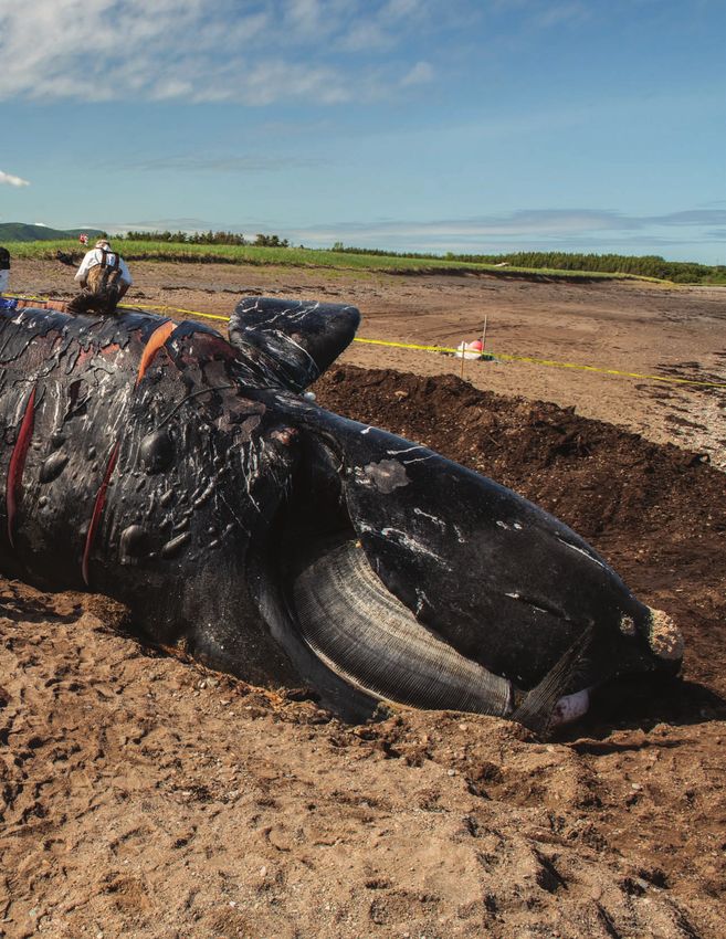
Contents
                           4       In Memoriam
                           7       Executive Summary
                          11       Introduction
                          15       Overview of Vessel Speed Regulations
                          21       Compliance in Seasonal Management Areas
                          31       Cooperation in Dynamic Management Areas
                         36        Summary of Findings
                         39        Discussion
                         43        Conclusion and Recommendations
                         46        Methodology
                         48        References

Cover Photo Credit: Nick Hawkins
                                                                             3
IN MEMORIAM
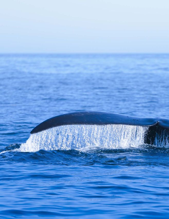
North Atlantic right whales are swimming on the edge of extinction.
They are prone to being hit by vessels because they tend to swim
slowly, near the water’s surface, are dark in color, and lack a dorsal
fin, making them very difficult to spot and susceptible
to vessel strikes.
JANUARY 2020
Derecha, a roughly 27-year-old North
Atlantic right whale, was spotted off the
coast of Georgia on January 8 with her
fourth calf. The newborn had two parallel
gashes on its head and face, consistent
with injuries from the propeller of a vessel.
Experts believed one of the cuts to the
newborn’s mouth would impede its ability
to feed. Scientists and veterinarians from
across the country launched an attempt to
locate the mother-and-calf pair again and
deliver antibiotics to Derecha’s calf, which
was in poor condition. They succeeded in
administering antibiotics on January 15
off the coast of Fernandina Beach, Florida.
Tragically the calf has not been seen again,
Photo Credit: FWC
and is presumed dead.1
4
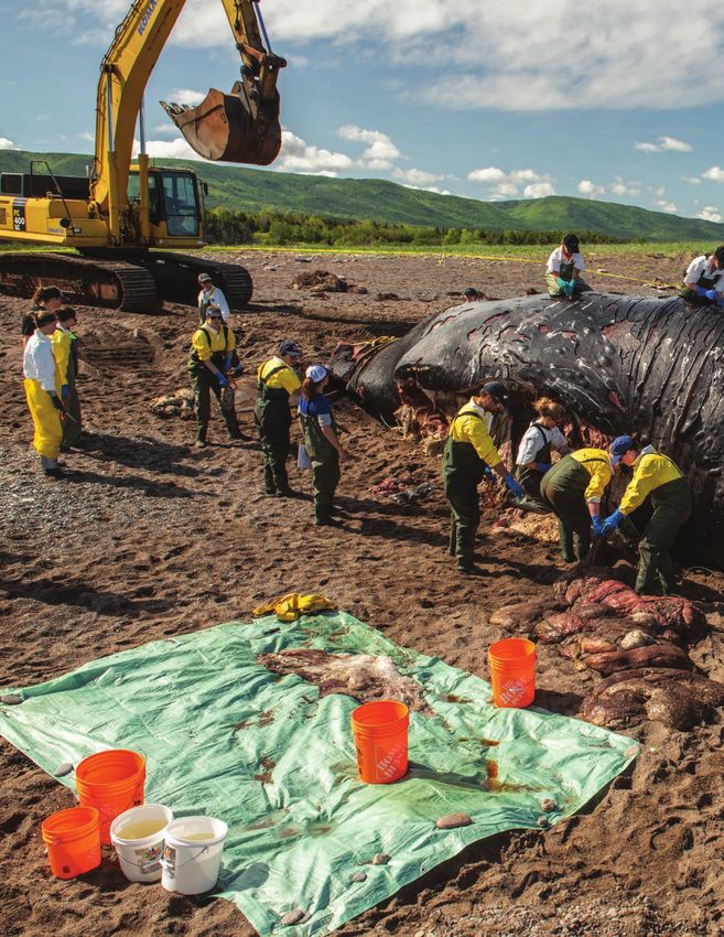
JUNE 2020
On June 25, the National Oceanic and
Atmospheric Administration (NOAA)
received a report about a dead whale
floating off the coast of Elberon, New
Jersey, which turned out to be the first
reported North Atlantic right whale calf
of the 2019/2020 calving season. The calf
was first spotted in December 2019 off
the coast of Georgia with his mom, North
Atlantic right whale #3560. This was
#3560’s first calf, but their time together
did not last long. The calf was struck by
vessels twice within the first few months
of his life. The first strike left him with
lacerations across his head and chest and a
likely rudder injury to his back. The second
vessel collision led to similar lacerations
across the base of his tail, which ended up         Photo Credit: Center for Coastal Studies
being fatal.2

                                               FEBRUARY 2021
                                               On January 17, researchers spotted
                                               19-year-old Infinity with her first known
                                               calf, swimming together off of Amelia
                                               Island, Florida.3 Less than a month later, on
                                               February 13, the calf was reported dead
                                               off the coast of Anastasia State Park in
                                               Florida. Investigators found that a 54-foot
                                               recreational fishing boat had struck the
                                               calf at 21 knots, about 25 miles per hour,
                                               an impact so hard that the boat began to
                                               sink.4 While the boaters’ actions were not
                                               illegal, the strike left the month-old calf
                                               with propeller wounds, broken ribs and
                                               a fractured skull.5 About 50 miles north
                                               of where her calf was struck, Infinity was
                                               found several days later with two cuts to her
                                               left side, suggesting a recent vessel strike,
                                               leaving her vulnerable to infection and
                   Photo Credit: FWC
                                               other complications.6

                                                                                               5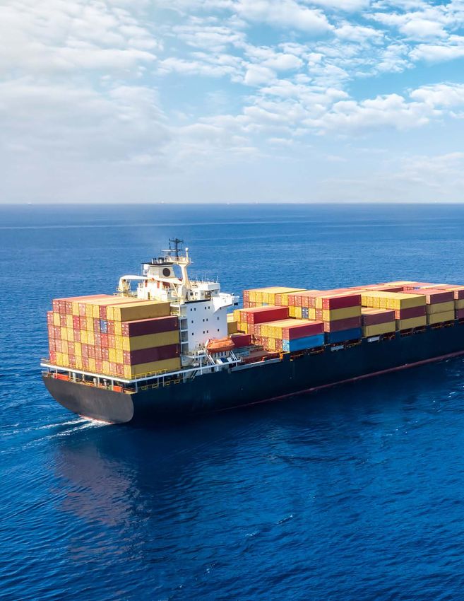
Photo Credit: EcoHealth Alliance

6
Speeding Toward Extinction: Vessel Strikes Threaten North Atlantic Right Whales

                Executive Summary
   The North Atlantic right whale is one of the most endangered whales on the planet. Only around
     360 remain.7 The two greatest threats to this species are vessel strikes and entanglements in
  fishing gear. To reduce the risk from these threats, the United States government must: 1) require
      vessels to avoid areas where North Atlantic right whales are present or if avoidance is not
   possible, slow down to minimize the risk of serious injury or death; and 2) reduce the number of
  vertical lines from fishing gear in the water, particularly in times and places where North Atlantic
                                        right whales are present.
  For this analysis, Oceana examined vessel speeds in areas where U.S. regulations direct them to
         slow down to protect whales and found that most vessels were not slowing down
                                      when they should be.

T
      o address the vessel strike threat to North Atlantic                     Since the implementation of these regulations,
      right whales, the U.S. National Marine Fisheries                         researchers estimated that limiting vessel speeds to
      Service (NMFS) issued regulations in 2008 known                          10 knots reduces a North Atlantic right whale’s risk of
as the Vessel Speed Rule that created two types of right                       death from vessel strikes by between 80% and 90%.9
whale conservation areas:8                                                     Additionally, based on the government’s own assessment,
                                                                               the regulations have had a minimal economic burden on
 1. Seasonal Management Areas (SMAs): Ten distinct                            the shipping industry.10
 areas ranging from Massachusetts to Florida where all
 vessels 65 feet and longer are required to reduce speeds                      Despite these promising findings, North Atlantic right
 to 10 knots (11.5 mph) or less, with certain exemptions                       whales continue to die from vessel strikes. Oceana
 for safety reasons and for federal vessels. SMA locations                     conducted an analysis of vessel compliance with speed
 were chosen because they represented important                                restrictions in both SMAs and DMAs between 2017
 feeding, breeding, calving, and migratory habitats for                        and 2020 using data from Global Fishing Watch (GFW),
 the whales in 2008.                                                           an international nonprofit organization founded by
                                                                               Oceana in partnership with Google and SkyTruth. Oceana
 2. Dynamic Management Areas (DMAs): Voluntary                                analyzed self-reported vessel speed and location data
 slow zones where vessels 65 feet and longer are asked                         from 2017 to 2020 to track vessel speeds and positions
 to avoid the area or slow down to 10 knots or less.                           in North Atlantic right whale conservation areas. For
 DMAs are reactive speed zones that are triggered based                        this analysis, non-compliance in SMAs refers to vessels
 on visual sightings of three or more North Atlantic right                     exceeding the mandatory speed limits, and
 whales within an area and are temporary, lasting 15 days                      non-cooperation in DMAs refers to vessels that fail to
 from the sighting, but are extended if the whales remain                      cooperate with the voluntary speed limits. DMAs were
 in the vicinity. DMAs are rectangular, extend 15 nautical                     broken up into four regions: Gulf of Maine, Southern New
 miles around the core area of the whale detection, and                        England, Mid-Atlantic, and the Southern States.
 were intended to account for the variability of whale
 locations outside of SMAs.

                                                                                                                                      7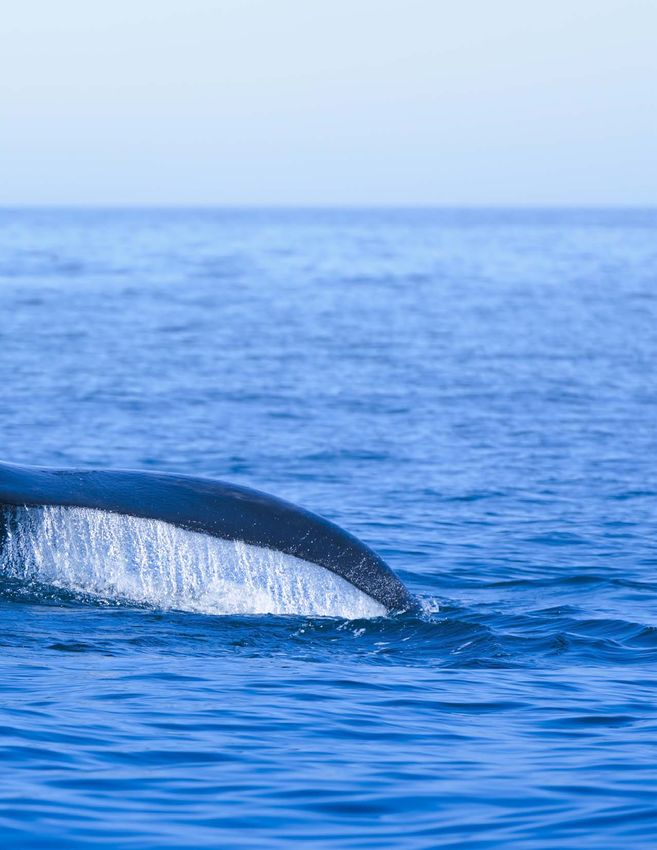
What We Found in Seasonal Management Areas

               BEST CASE                                                      WORST CASE
    The highest level of compliance with mandatory                 Almost 90% of vessels violated the mandatory 10-
    10-knot speed restrictions was only around two-                knot speed limit in the Wilmington, North Carolina,
    thirds of vessels in the Off Race Point SMA , near             to Brunswick, Georgia, SMA.
    Cape Cod, Massachusetts.

                         The SMAs with the worst compliance were:
                         1.   Wilmington, North Carolina, to Brunswick, Georgia (average of 87.5% non-compliance)
                         2.   Ports of New York/New Jersey (average of 79.3% non-compliance)
                         3.   Calving and nursery grounds from Georgia to Florida (average of 72.1% non-compliance)
                         4.   The entrance to the Chesapeake Bay (average of 64.2% non-compliance)
                         5.   The entrance to the Delaware Bay (average of 56.4% non-compliance)

      What We Found in Dynamic Management Areas

                  BEST CASE                                                  WORST CASE
      Only around half of vessels cooperated with                  Almost 85% of vessels did not cooperate with
      voluntary 10-knot speed limits in DMAs.                      voluntary 10-knot speed limits in DMAs.

                          Because of the sheer volume of traffic in the Southern New England DMAs, this region poses
                          the greatest threat despite having a lower percentage of non-cooperation than others.
                          Over 2,600 vessel transits exceeded the speed restrictions over the four-year period.

    >80%                      With more than 80% of the vessels violating the speed limit between Cape May, New
                              Jersey to Florida, the Southern States’ DMAs had the highest rate of non-cooperation.

8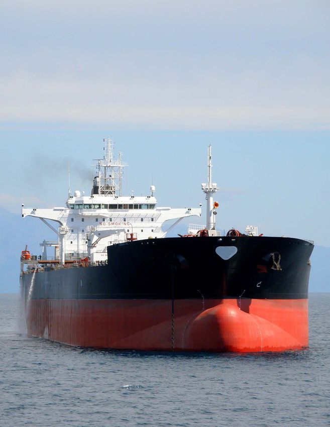
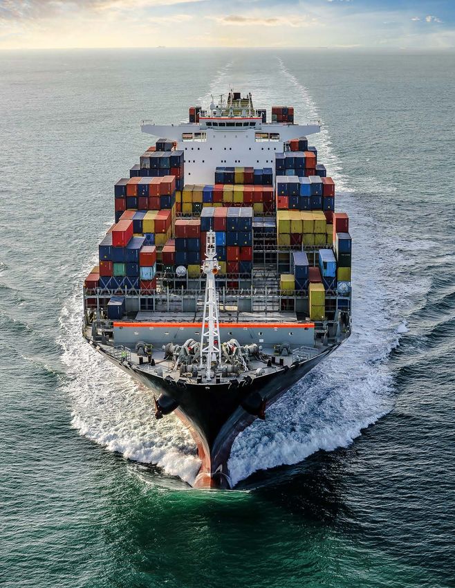
Cargo vessels were the least compliant vessel type in both DMAs and SMAs.
                           Cargo vessels represented about 42% of non-cooperation in DMAs and around
                           50% of non-compliance in SMAs.

                           Two-thirds of the vessels that exceeded the 10-knot speed limits in both DMAs
                           and SMAs operated under foreign flags. The least compliant vessels by flag state
                           in both SMAs and DMAs included vessels flagged to the United States, Panama,
                           Marshall Islands, Liberia, Singapore, and Germany.*

                             Current Regulations Are Not Enough
  The current protections are analogous to imposing speed limits on semi-trucks to protect pedestrians, while
  allowing cars and SUVs to go as fast as they want, leaving pedestrians still vulnerable to these just-as-deadly
  vehicles. We should expand the coverage of the Vessel Speed Rule to all vessels, regardless of size, and
  improve its enforcement.

                                    The federal government must take the following actions
                                    to reduce deadly vessel strikes in order to save North
                                    Atlantic right whales from extinction:

  Expand and establish new                            Make compliance with                                  Expand the Vessel Speed
  SMAs                                                DMAs mandatory or require                             Rule to include vessels
                                                      mandatory compliance in all                           under 65 feet in length
                                                      reactive speed zones that may
                                                      replace DMAs

  Expand AIS requirement to                           Improve compliance and                               Narrow the federal
  include vessels under 65 feet in                    enforcement of the mandatory                         agencies’ exemption from
  length and require continuous                       speed limit                                          the Vessel Speed Rule
  use of AIS

*Panama, Marshall Islands, and Liberia are known “flags of convenience” — when vessels fly flags that do not belong to their country of
ownership in exchange for fewer regulations and more lax enforcement.

                                                                                                                                          9
Photo Credit: Clearwater Marine Aquarium Research Institute

10
Speeding Toward Extinction: Vessel Strikes Threaten North Atlantic Right Whales

                                  Introduction
         North Atlantic right whales are swimming along the razor’s edge of extinction. They
          are one of the most endangered large whales on the planet, with only around 360
          individuals left.7 This species was once abundant, with as many as 9,000 to 21,000
       individuals before commercial whaling.11 But their proximity to shore, slow swimming
           speed, and tendency to float when killed turned out to be a fatal combination for
         the whales and an incredible boon to the whaling industry, which dubbed them the
        “right” whale to kill.12 And kill they did, to the point that fewer than an estimated 100
                            individuals remained in the Atlantic by the 1920s.13

F
     ortunately, the League of Nations banned the                              injuries can lead to slow and painful deaths. Consider
     whaling of this species in 1935,14 and its slow crawl                     Cottontail, an 11-year-old North Atlantic right whale
     to recovery began, rebounding to as many as 483                           who became so badly entangled that he was considered
individuals in 2010.15 While whaling has ended, new                            “swimming while dead.” Unfortunately, he succumbed to
threats posed by humans have emerged:                                          his injuries in early 2021.19 But these mortalities are only
                                                                               the ones that are found. In fact, scientists only observed
 • Vessel strikes that leave them with broken bones,                        36% of all estimated North Atlantic right whale deaths
   blunt force trauma, or lacerations from propellers.16                       between 1990 and 2017.20

 •E
   ntanglements in fishing gear, in which strong ropes
  wrap around their mouths, fins, tails, and bodies,
  digging in and causing infections and cuts to the
  bone. Entanglements can also lead to starvation by                              North Atlantic right
  preventing whales from feeding, as well as exhaustion
  and drowning from pulling heavy fishing gear through                           whales are one of the
  the water.17
                                                                                 most endangered large
These two threats have become such a problem that in
2017, the National Marine Fisheries Service (NMFS)                               whales on the planet,
declared an unusual mortality event (UME) for the
species. Since then, a total of 34 whales in the United                          with only around 360
States and Canada have died, and another 15 whales have
been documented with serious injuries such as propeller
wounds or entanglements in fishing gear.18 These serious
                                                                                   individuals left.
                                                                                                                                          11
BIRTHS vs DEATHS
2020
2019
2018
2017
(Birth years defined by calving season)
12Expanding and Enforcing Protections
It is not just where and when the management areas are put into place — how
they are enforced is important too. Not only do the existing protections need
to be modified to reflect the whales’ current geographic range, they also
need to be better enforced, and exemptions for smaller and federal vessels
need to be narrowed. Otherwise, the regulations will continue to leave these
critically endangered whales vulnerable to vessel strikes. The calf found
in February 2021 was killed by a 54-foot boat that was exempt from the
speed restrictions, which only apply to vessels 65 feet and longer. Federal
vessels, like military or law enforcement vessels, are also exempt but just
as dangerous.4,8
Shifting Range Means Shifting Protections
North Atlantic right whales are altering their range, likely due to shifting
food sources.21 But with every new location and congregation, the whales
are moving into areas where there are no slow zones to protect them. In fact,
the current U.S. slow zones were developed prior to 2008 — over a decade
ago. Since that time, new regions have become increasingly important to the
species but only have temporary, voluntary protections.
Photo Credit: FWC 13Photo Credit: Alex Stemmer/Shutterstock 14
Speeding Toward Extinction: Vessel Strikes Threaten North Atlantic Right Whales

                  Overview of Vessel
                  Speed Regulations
       North Atlantic right whales are found up and down the East Coast of the United States and
       Canada, where vessels, ports, and shipping channels overlap with calving grounds, feeding
     areas, and migration routes. Of the 34 North Atlantic right whale deaths since the beginning of
            the unusual mortality event, and where the cause of death could be determined,
                                   11 were caused by vessel strikes.5,18

H
       owever, vessel strikes were a problem long before                      trade associations, port associations, pilot associations,
       2017. To deal with this, in 2008 NMFS published                        passenger services, private commercial services, whale-
       the Vessel Speed Rule, which set a 10-knot (11.5                       watching and deep-sea fishing charters, shipbuilding
mph) speed restriction for vessels 65 feet (19.8 meters)                      entities, technological entities, and government agencies
and longer in key areas off the East Coast of the United                      — submitted comments in opposition to the proposed
States during certain times of the year.8 The 2008 Vessel                     Vessel Speed Rule.22 Some of these comments claimed
Speed Rule created two distinct types of protective areas:                    there was a lack of scientific evidence to support
                                                                              speed restrictions, suggested the rule would lead to a
 1. Seasonal Management Areas (SMAs): Ten distinct                          substantial economic burden on the shipping industry,
 areas ranging from Massachusetts to Florida where all                        and expressed concerns that slower speeds could result
 vessels 65 feet and longer are required to reduce speeds                     in a loss of vessel maneuverability.23 The agency caved to
 to 10 knots or less, with certain exemptions for safety                      this pressure and weakened the final rule substantially,
 and for federal vessels. SMA locations were chosen                           increasing the risk to whales. To accommodate the
 because they represented important feeding, breeding,                        industry opposition, the final Vessel Speed Rule made
 calving, and migratory habitats for the whales in 2008.                      compliance with DMAs voluntary rather than mandatory,
                                                                              created exemptions to speed limits for maintaining
2. Dynamic Management Areas (DMAs): Voluntary                               navigational safety, reduced the size and boundaries of
 slow zones where vessels 65 feet and longer are asked                        the SMAs in the mid-Atlantic, and set the rule to expire in
 to avoid the area or slow down to 10 knots or less.                          2013 pending an analysis of the effectiveness of
 DMAs are triggered based on visual sightings of three                        the regulations.23
 or more North Atlantic right whales within an area and
 are temporary, lasting 15 days from the sighting, but are                    However, in 2013, NMFS extended these protections
 extended if the whales remain in the vicinity. DMAs are                      indefinitely since its own analysis had revealed that the
 rectangular and extend 15 nautical miles around the                          Vessel Speed Rule reduced the risk of vessel strikes
 core area of the whale detection and were intended to                        within SMAs, and showed that death and injury from
 account for the variability in whale locations outside                       vessel strikes were still primary threats to the recovery of
 of SMAs.                                                                     the species.24

During the rulemaking process that led to the final Vessel
Speed Rule, more than 60 shipping interests — including

                                                                                                                                       15
Note: This map includes many overlapping speed zones due to the fact
that DMAs are created following sightings of North Atlantic right whales,
and this map includes several years of data.
16Mandatory (SMAs) and Voluntary
(DMAs) Speed Zones to Protect North
Atlantic right whales
Seasonal Management Areas (SMAs)
Dynamic Management Areas (DMAs)
17Photo Credit: Monica Zani/ New England Aquarium A separate 2013 analysis estimated that the vessel publish a report evaluating the conservation benefits speed reductions reduced the North Atlantic right and the economic and navigational safety impacts of whale’s risk of death from vessel strikes by between the Vessel Speed Rule.27 However, this report was 80% and 90%.9 Additionally, contrary to the shipping not released until January 2021, after two years of industry’s claims that the rules would pose an economic unexplained delay.10 The 2021 report found that the burden,25 a 2012 economic analysis found the direct speed restrictions are working to protect North Atlantic economic impact of speed restrictions only represented right whales, but that compliance, particularly in DMAs, 0.006% of the value of traded merchandise and 0.2% is inadequate. The report also followed up on the of freight costs for the marine East Coast trade in previous economic analyses and found that the annual 2009. The 10-knot speed limit had minimal impact on direct cost to commercial shipping ranges between the revenues and financial performance of shipping $24.8 million and $29.2 million,28 which represents only vessels.26 The reality was that the costs of speed about 0.005% of the trade value at relevant East restrictions were substantially lower than initially Coast ports.10 projected by NMFS in 2008.23 The 2013 extension of the regulations also included a requirement that, by January 1, 2019, NMFS would 18
NMFS concluded in January 2021 that in order
to best protect the North Atlantic right whale,
the Vessel Speed Rule should be changed in the
following ways:

   Modifying the location,         Enhancing enforcement            Addressing vessel strike risk
timing, and duration of some           and outreach                   from smaller vessels that
    SMAs to make them                                                are currently exempt from
       more effective                                                   the Vessel Speed Rule

            Modifying or terminating               Conducting additional research
              the DMA program                       into vessel strikes and North
                                                       Atlantic right whales10

                         While Oceana’s report uses slightly different methodology for
                         analyzing compliance (see methodology section), Oceana’s findings
                         and policy recommendations are consistent with those of NMFS.
                         The data clearly show the need for mandatory speed restrictions in
                         previously defined DMAs and effective enforcement with penalties
                         that deter violations. Both NMFS and Oceana’s findings underscore
                         the immediate need for the Vessel Speed Rule to be updated and
                         improved to reflect current analyses of the danger of high vessel
                         speeds to North Atlantic right whales.

                                                                                                    19
Cape Cod Bay
Off Race Point
Great South Channel
Block Island Sound
Ports of NY/NJ
Entrance to the Delaware Bay
Entrance to the Chesapeake Bay
Ports of Morehead City and Beaufort
Wilmington, NC, to Brunswick, GA
Calving and Nursery Grounds (GA to FL)
20Speeding Toward Extinction: Vessel Strikes Threaten North Atlantic Right Whales
Compliance in Seasonal
Management Areas
There are 10 SMAs along the East Coast of the United States that require all vessels 65 feet or
longer to slow down to 10 knots or less in order to reduce the risk of death or serious injury to
North Atlantic right whales from vessel strikes.
T
he SMAs are each active for a distinct part of the Oceana analyzed non-compliance (the proportion of
year when North Atlantic right whales are likely to vessels that transited through each SMA that exceeded
be present. From north to south, the SMAs are: the 10-knot mandatory speed limit at any given point)
over three seasons: November 1, 2017, to July 31, 2018;
November 1, 2018, to July 31, 2019; and November 1,
•C
ape Cod Bay (from January 1 to May 15) 2019, to July 31, 2020. We chose to organize SMAs into
seasons rather than calendar years because several SMAs
• Off Race Point (from March 1 to April 30)
span the January 1 calendar year start point, and seasons
•G
reat South Channel (from April 1 to July 31) allow for a continuous analysis of the area’s entire
•B
lock Island Sound (from November 1 to April 30) active period.
•P
orts of New York/New Jersey We defined the percentage of non-compliant vessels as
(from November 1 to April 30) those that exceeded the 10-knot speed limit relative to all
•E
ntrance to the Delaware Bay vessels that transited the area. Oceana found that:
(from November 1 to April 30)
• I n our analysis, 8,714 vessels made a total of 26,608
•E
ntrance to the Chesapeake Bay
vessel transits over these three SMA seasons;
(from November 1 to April 30)
• O
ver all three SMA seasons, non-compliance ranged
•P
orts of Morehead City and Beaufort
from 32.7% to 89.6%;
(from November 1 to April 30)
• O
verall, the North Carolina to Georgia SMA exhibited
•W
ilmington, North Carolina, to Brunswick, Georgia
the worst non-compliance: More than 85% of vessels
(from November 1 to April 30)
violated the speed limit during each individual
•C
alving and nursery grounds (Georgia to Florida) SMA season.
(from November 15 to April 15)29
21Thousands of vessels are speeding. Rates in the southeast are close to 90%.
Vessel Non-Compliance In Mandatory Speed Zones
SMA Nov 2017/July 2018 Nov 2018/July 2019 Nov 2019/July 2020
Cape Cod Bay 46.5% (101) 42.6% (100) 45.1% (92)
Off Race Point 51.0% (80) 32.7% (54) 33.1% (43)
Great South Channel 37.1% (181) 36.5% (161) 39.2% (138)
Block Island Sound 40.2% (227) 37.0% (223) 38.1% (223)
Ports of
New York/New Jersey 79.4% (1,164) 79.3% (1,185) 79.1% (1,091)
Entrance to the
Delaware Bay 60.6% (804) 56.4% (692) 52.3% (553)
Entrance to the
Chesapeake Bay 68.4% (1,207) 62.2% (1,065) 62.0% (981)
Ports of Morehead City and
Beaufort
58.9% (305) 37.8% (195) 38.0% (199)
Wilmington, North Carolina,
to Brunswick, Georgia 89.6% (1,501) 87.3% (1,499) 85.7% (1,448)
Calving and Nursery Grounds
(Georgia to Florida) 72.2% (665) 74.8% (711) 69.2% (650)
Percent of non-compliant vessels in SMAs. Number of non-compliant vessels in SMAs in parenthesis.
22Photo Credit: Shutterstock 23
From New England to Florida,

                                                       SMA Non-Compliance Rates
                    2,000

                    1,800

                    1,600

                    1,400
Number of Vessels

                    1,200

                    1,000

                     800

                     600

                     400

                     200

                       0

                            Cape Cod Bay               Off Race Point        Great South Channel     Block Island Sound         Ports of NY/NJ
thousands of vessels speed every year.
SMA Non-Compliance Rates (Continued)
2,000
1,800
1,600
1,400
1,200
1,000
800
600
400
200
0
Entrance to Entrance to Ports of Morehead City Wilmington, NC to Calving and Nursery
Delaware Bay Chesapeake Bay and Beaufort Brunswick, GA Grounds (GA to FL)
25.1 – 30 knots 30.1 – 35 knots Above 35 knots
Stacked bars represent the total number of vessels traveling through the DMA while it was active. Green indicates vessels that never
exceeded the 10-knot speed limit, while darker orange represents vessels in increasingly higher speed classes.
25In half of the mandatory speed zones, vessels recklessly approached up to
four times the speed limit set to protect endangered whales.
Top Recorded Vessel Speeds in Mandatory 10-Knot Speed Zones (in Knots)
SMA Nov 2017/July 2018 Nov 2018/July 2019 Nov 2019/July 2020
Cape Cod Bay 26.9 28.1 37.6
Off Race Point 23.1 31.3 23.6
Great South Channel 33.9 32.2 36.6
Block Island Sound 19.6 34.1 37.9
Ports of 38.8 35.0 36.3
New York/New Jersey
Entrance to the 34.9 35.3 29.4
Delaware Bay
Entrance to the 40.0 38.4 36.2
Chesapeake Bay
Ports of Morehead City and
39.9 37.6 37.5
Beaufort
Wilmington, North Carolina, to 39.7 39.3 39.3
Brunswick, Georgia
Calving and Nursery Grounds 39.0 39.7 34.3
(Georgia to Florida)
Top speeds reached in each SMA reported in knots. Note: Analysis was limited to vessels traveling 40 knots or less.
26Photo Credit: Leon T./Shutterstock 27
Of the non-compliant vessels, the top five vessel classes were cargo vessels, tankers,
     passenger vessels, tugboats, and non-fishing vessels. Nearly 50% of the speeding vessels each
     SMA season were cargo vessels.

                             Most Common Speeders Are Massive Cargo Vessels

                                       Percent of All Vessels Exceeding 10 Knots

              VESSEL CLASS                   2017/2018                   2018/2019       2019/2020
                    Cargo                       49.8%                      49.4%           47.4%
                   Tanker                       14.0%                       14.5%          15.3%
                 Passenger                      13.3%                       14.0%          14.0%
                     Tug                         7.7%                        7.1%          6.8%
                Non-Fishing                     4.2%                        4.4%           4.8%

     All vessels 65 feet or longer must comply with SMA speed restrictions; however, vessels longer
     than three football fields (1,080 feet) were recorded exceeding mandatory speed limits.

                                        Percent of All Vessels Exceeding 10 Knots

     VESSEL LENGTH IN METERS (FEET)         2017/2018                   2018/2019       2019/2020
            19.8 – 50 (65 – 164)               27.7%                        27.4%          28.1%

          50.1 – 100 (164.1 – 328.1)            4.5%                        4.7%            5.3%

         100.1 – 150 (382.2 – 492.1)           11.0%                       10.2%           10.6%

         150.1 – 200 (492.2 – 656.2)           34.2%                       34.4%           33.1%

         200.1 – 250 (656.3 – 820.2)           15.9%                       16.3%           16.0%

         250.1 – 300 (820.3 – 984.3)            5.2%                        5.8%            5.9%

               300.1 + (984.4)                  1.0%                        0.8%            0.9%

                     NA                         0.6%                        0.4%            0.2%

              Vessels ranged in length from 19.8 meters (65 feet) to over 300 meters (984 feet).
28
Flags of Convenience
All vessels are required to be registered to a country, and that country is responsible
for regulating the activities of the vessels that fly its flag.30 However, vessels do not
have to be flagged to the country in which the owners or operators reside. Some
countries profit off the use of their flag in return for fewer regulations and more lax
enforcement.31 When vessels fly flags that do not belong to their country of ownership,
it is known as a “flag of convenience.” For example, a vessel owned by a U.S. company
can be flagged to Panama to reduce regulations. The International Transport Workers’
Federation has identified flag states that are commonly used as flags of convenience,
including Panama, Marshall Islands, and Liberia.32
Two-thirds of speeding vessels were foreign-flagged, while U.S.-flagged vessels accounted
for the rest. The top five flag states for vessels violating the SMA rules were the United
States, Panama, Marshall Islands, Liberia, and Germany, with Singapore tying with Germany
in the 2018/2019 SMA season.
1/3 of Speeding Vessels were U.S.-Flagged
Percent of Vessels Exceeding 10 Knots
FLAG STATE 2017/2018 2018/2019 2019/2020
United States 34.2% 33.8% 34.4%
Panama 10.8% 10.2% 10.1%
Marshall Islands 8.6% 9.5% 8.1%
Liberia 6.8% 6.5% 7.3%
Germany 6.1% 5.3% 5.0%
Singapore N/A 5.3% N/A
29Gulf of Maine
Southern New England
Mid-Atlantic
Southern States
30Speeding Toward Extinction: Vessel Strikes Threaten North Atlantic Right Whales
Cooperation in Dynamic
Management Areas
DMAs are voluntary slow zones where vessels 65 feet and longer are asked to slow down to
10 knots or less.29 These areas are triggered by visual sightings of three or more North Atlantic
right whales within an area and are temporary — lasting 15 days from the sighting.
D
MAs are intended to account for the whales’
variable range outside of static SMAs.29 NMFS
alerts mariners to DMA activations using radio,
websites, email, and fax distribution lists.33 Additionally,
NMFS allows anyone to sign up for email or text
North Atlantic right
notifications to receive information on North Atlantic
right whale slow zones and DMAs.34
whales are found up
Oceana analyzed non-cooperation (the number of vessels and down the East Coast
that exceeded the suggested 10-knot speed limit) in
each DMA that occurred between 2017 and 2020. In of the United States and
our analysis, 3,776 vessels made a total of 6,264 vessel
transits through DMAs during these years. A total of
75 DMAs were triggered over this period, which were
Canada, where vessels,
grouped by region for ease of analysis. However, because
DMAs are triggered by the presence of whales, not every
ports, and shipping
region had DMAs in certain years. The four regions are: channels overlap
• Gulf of Maine
(Maine through the tip of Cape Cod, Massachusetts)
with calving grounds,
•S
outhern New England
(the tip of Cape Cod, Massachusetts, to Montauk, New York)
feeding areas, and
•M
id-Atlantic
(Montauk, New York, to Cape May, New Jersey)
migration routes.
• Southern States
(Cape May, New Jersey, through Florida)
31Vessel Non-Cooperation in Voluntary Speed Zones
ZONE 2017 2018 2019 2020
Gulf of Maine 53.5% (62) 71.5% (266) 61.2% (93) 65.3% (111)
Southern New England 48.5% (393) 63.9% (480) 72.5% (1,057) 77.2% (692)
Mid-Atlantic 56.3% (112) 55.2% (96) N/A 79.7% (593)
Southern States N/A 83.6% (352) N/A N/A
Percentage of non-cooperating vessels in DMAs. Number of non-cooperating vessels in DMAs in parentheses.
DMA Non-Cooperation
1,600
1,400
1,200
Number of Vessels
1,000
800
600
400
200
0
Gulf of Maine Southern New England Mid-Atlantic Southern StatesOur analysis also revealed the top speeds of vessels transiting through DMAs during this
time. Top speeds ranged from 22 knots (25.3 mph) to 40 knots (46 mph), although our
analysis was limited to vessels transiting at less than or equal to 40 knots.
Top Recorded Vessel Speeds in Voluntary Speed Zones (in Knots)
ZONE 2017 2018 2019 2020
Gulf of Maine 35.6 39.0 36.0 37.3
Southern New England 39.6 39.9 40.0 37.3
Mid-Atlantic 28.7 22.0 N/A 38.5
Southern States N/A 26.1 N/A N/A
Top speeds reached in each DMA region reported in knots. Note: Analysis was limited to vessels traveling 40 knots or less.
The top five vessel types that were most likely to exceed the suggested 10-knot speed limit
over all four years were cargo vessels, tankers, passenger vessels, trawlers, and tugboats.
Most Common Speeders Are Massive Cargo Vessels
VESSEL CLASS PERCENT OF ALL VESSELS EXCEEDING 10 KNOTS
Cargo 41.7%
Tanker 20.0%
Passenger 17.5%
Trawler 4.8%
Tug 4.6%
33Vessels from 19.8 meters (65 feet) to over 300.1 meters (985 feet) exceeded the suggested
10-knot speed limit over all four years.
Percent of Vessels Exceeding 10 Knots
VESSEL LENGTH IN METERS (FEET) % of Vessels Exceeding 10 Knots
19.8 – 50 (65 – 164) 29.8%
50.1 – 100 (164.1 – 328.1) 4.1%
100.1 – 150 (382.2 – 492.1) 6.7%
150.1 – 200 (492.2 – 656.2) 30.1%
200.1 – 250 (656.3 – 820.2) 20.8%
250.1 – 300 (820.3 – 984.3) 7.5%
300.1 + (984.4) 1.1%
Two-thirds of the vessels that exceeded the suggested 10-knot speed limit over all four years
of data were flagged to foreign countries. The remaining third flew U.S. flags. The five flag
states that most often violated the 10-knot speed limit were the United States, Marshall
Islands, Panama, Liberia, and Germany.
FLAG STATE Percent of Vessels Exceeding 10 Knots
United States 33.26%
Marshall Islands 9.45%
Panama 8.89%
Liberia 7.79%
Germany 4.46%
34Photo Credit: Sky Cinema/Shutterstock 35
Speeding Toward Extinction: Vessel Strikes Threaten North Atlantic Right Whales

         Summary of Findings
                                 Seasonal Management Areas

           SMA non-compliance ranged from 32.7% to 89.6% over all three seasons.

                    The SMAs with the worst compliance were:
                    1.   Wilmington, North Carolina, to Brunswick, Georgia (average of 87.5% non-compliance)
                    2.   Ports of New York/New Jersey (average of 79.3% non-compliance)
                    3.   Calving and nursery grounds from Georgia to Florida (average of 72.1% non-compliance)
                    4.   The entrance to the Chesapeake Bay (average of 64.2% non-compliance)
                    5.   The entrance to the Delaware Bay (average of 56.4% non-compliance)

     These five SMA zones all had non-compliance over 50% every season, with the SMA for Wilmington,
     North Carolina, to Brunswick, Georgia, always over 85% non-compliant.

                    Cargo vessels were consistently the least compliant vessel class with percentages between
                    46% and 50%, followed by tankers, passenger vessels, tugboats, and
                    non-fishing vessels.

                    Vessels flagged to the United States constituted around 34% of non-compliant vessels, while
                    the remaining two-thirds were foreign-flagged. Vessels flagged to the United States, Panama,
                    Marshall Islands, Liberia, Singapore, and Germany were the worst offenders.

36
Dynamic Management Areas
DMA non-cooperation ranged from 48.5% to 83.6% over the four-year
period of analysis, meaning that nearly 50% or more of the vessels
traveling through DMAs exceeded the requested speed limit.
More than 80% of the vessels traveling through DMAs in the Southern States region violated the speed
restrictions. However, because of the sheer volume of traffic in the Southern New England DMAs, this region
poses the greatest threat despite having a lower percentage of non-cooperation than others. Over 2,600 vessel
transits exceeded the speed restrictions over the four-year period.
Similar to results in SMAs, cargo vessels were the worst offenders, violating the voluntary
speed zones 41.7% of the time, followed by tankers, passenger vessels, trawlers, and tugboats.
In DMAs, the flag states for vessels with the highest rates of non-cooperation after the United
States were the Marshall Islands, Panama, Liberia, and Germany.
Photo Credit: FWC
37Photo Credit: Allison Henry/NOAA 38
Speeding Toward Extinction: Vessel Strikes Threaten North Atlantic Right Whales

                                      Discussion
      Our analysis clearly shows that speeding vessels continue to threaten the North Atlantic right
      whale. Vessels are not slowing down in the mandatary or voluntary slow zones established to
      protect these whales. Non-compliance/cooperation rates (32.7% to 89.6% in SMAs and 48.5% to
              83.6% in DMAs) are consistently high. But non-compliance/cooperation are not
                                          the only problems...

T
       he current SMAs do not reflect some new locations                      missed deadlines at port, which provides little incentive
       where North Atlantic right whales are regularly                        to abide by voluntary measures. Making slowdown zones
       observed. Additionally, the exemptions for smaller                     mandatory, rather than voluntary, could allow shipping
vessels less than 65 feet, and for federal vessels, like                      companies to build slow zones into their schedules,
Coast Guard and Navy ships, continue to leave these                           removing the incentive for speeding in these areas.
critically endangered whales vulnerable to deadly strikes.
We know that slow speeds help protect whales. To                              During the 2008 rulemaking for the Vessel Speed Rule,
effectively protect this species, the federal government                      NMFS stated that if DMAs were not successful at getting
must expand existing slow zones in time and size, reduce                      vessels to slow down, they would “consider making
loopholes and exemptions to the speed limit, and enhance                      them mandatory, through a subsequent rulemaking.”35
compliance and enforcement across the board.                                  With only around 360 whales left and more than 50%
                                                                              of vessels exceeding the voluntary speed limit, it is time
                                                                              to take that action: NMFS should require that all vessels
Mandating Speed Limits in DMAs                                                slow down to 10 knots or less in areas where North
                                                                              Atlantic right whales are found.
Both Oceana and NMFS found that an alarmingly high
number of vessels violate the voluntary speed restrictions
in DMAs.10 In fact, Oceana’s analysis found only one                          Expanded Protections
DMA in Southern New England in 2017 where more than
50% of the vessels traveled less than 10 knots. This lack                     North Atlantic right whales are altering their range, likely
of compliance is likely due to the voluntary nature of                        due to shifting food sources.21 The government has a
the DMAs compared to the mandatory requirements of                            legal mandate to expand and create new protections for
SMAs. It may also be that vessels underway and headed                         this critically endangered species to reflect where the
toward a DMA when it’s activated may not be notified of                       whales are presently congregating. The current SMAs
the activation, or if they are, may be more incentivized                      were developed by NMFS before the release of the 2008
to ignore it due to strict shipping schedules. The reactive                   Vessel Speed Rule — over a decade ago. Since that time,
nature of DMAs, while necessary, can be an impediment                         new regions have become increasingly important to
to planning voyages. The maritime industry is rigidly                         the species, such as the area south of Nantucket where
scheduled, with companies possibly facing costs for                           around 100 whales — more than a quarter of the existing

                                                                                                                                       39
Photo Credit: Shutterstock
population — gathered in January 2019.36 In 2018 to protect the whales in Cape Cod Bay, the state of
alone, 15 DMAs were established near similar locations Massachusetts imposed seasonal speed limits on all
south of Nantucket.37 Likewise, North Atlantic right vessels, including those smaller than 65 feet.42
whales consistently show up in areas off the coasts of
Massachusetts and Rhode Island. Since 2010, nearly 200 The current protections are analogous to imposing
North Atlantic right whales, including 34 calving females, speed limits for semi-trucks to protect pedestrians, while
were spotted in the area.38 NMFS needs to expand allowing cars and SUVs to go as fast as they want, leaving
SMAs to areas where the whales are regularly observed, pedestrians still vulnerable to these just-as-deadly
especially in areas where DMAs continue to be extended vehicles. Expanding the coverage of the Vessel Speed
due to the presence of whales. Rule to vessels less than 65 feet long will further protect
the roughly 360 whales that remain.
Length Requirements
Federal Exemptions
Current SMA and DMA speed limits only apply to vessels
65 feet and over, even though vessels of all sizes can All federal vessels — regardless of agency, type of
seriously injure or kill right whales.39 This was sadly vessel, or vessel activity — are exempt from the Vessel
demonstrated in February 2021 when a 54-foot vessel Speed Rule, purportedly to prevent some agencies
traveling at 21 knots struck Infinity’s month-old calf, from compromising navigation, human safety, or even
leaving it with propeller cuts, broken ribs, and a fractured national security.43 While an exemption along these
skull — injuries that ultimately proved fatal.4,5 Between lines is certainly warranted, this one is overly broad.
1999 and 2012, experts evaluated 18 cases of injuries For instance, police cars and ambulances are generally
in which vessels struck North Atlantic right whales. Of expected to comply with the speed limit and traffic laws,
those 18 cases, 11 (61%) involved vessels less than 65 unless responding to an emergency. The federal vessel
feet long.40 exemption could easily be narrowed to cover only those
government activities that involve national security or
Precedent for changing length requirements exists. safety concerns. In fact, Canada has already implemented
Canada’s most recent protections for the North Atlantic this kind of narrow exemption for federal vessels and,
right whale included expanding their 10-knot speed zones in 2019, the government fined two Canadian Coast
to include vessels as small as 43 feet long.41 Additionally, Guard vessels for speeding in a mandatory slow zone.41,44
40Additionally, NMFS exempts state law enforcement We can see which vessels are speeding and where, and so
vessels only if they are engaged in law enforcement or can the government. To save this species, NMFS needs to
search-and-rescue duties.45 A 2004 review of the Large not only expand mandatory protections, but also ensure
Whale Ship Strike Database revealed that U.S. Navy and that the ones we already have are well-enforced. There
Coast Guard vessels were responsible for 17.1% and are several ways to improve compliance and enforcement,
6.7% of strikes, respectively, in cases where the type of including:
vessel was known. It should be noted that it is standard
Navy and Coast Guard practice to report vessel strikes, •P
erforming ongoing evaluations of vessel speeds
whereas other types of vessels may be underreporting, using AIS to identify vessels that are not obeying
which may create a bias.46 Nonetheless, requiring these mandatory speed limits;
vessels to slow down when national security and human
•E
nsuring that all relevant navigational charts are up to
safety are not at risk would reduce the threat they pose
date during Port State Control inspections, verifying
to North Atlantic right whales.
that they reflect current SMAs and speed restrictions;
•E
nsuring that the exemptions to the Vessel Speed
Enforcement Rule are not abused, by requiring periodic reporting
of when and why speed overages occur;
Compliance with the Vessel Speed Rule is alarmingly
low in both SMAs and DMAs. The federal government • I nspecting vessel logs, electronic chart displays, and
is responsible for investigating, enforcing, and issuing voyage data recorders as part of regular U.S. Coast
penalties for violations of the Vessel Speed Rule. If a Guard boardings to check for abuse of the exemption;
vessel exceeds a 10-knot speed limit within an SMA •S
eeking sufficiently high penalties on the same
for reasons beyond the scope of navigational safety scale as port penalties for late arrivals, to deter
exemptions, a range of enforcement measures can be multimillion-dollar corporations from ignoring speed
issued, including written warnings, educational letters, limits and passing the fines on to the consumer; and
and/or monetary fines and penalties. Between 2017 and
2019, the government contacted 178 vessels related to • I ncrease funding and support to agencies such as
enforcement of the Vessel Speed Rule — a stark contrast NOAA and the U.S. Coast Guard to ensure they have
to the thousands of vessels found speeding in our analysis the necessary resources to promptly enforce the
over a similar time frame.10 This is a solvable problem. Vessel Speed Rule.
41The North Atlantic right whale’s range extends from the United States into Canada. Here is
how the two countries’ protective measures for the species compare:
HOW PROTECTIONS COMPARE
CONSERVATION MEASURE UNITED STATES CANADA
Mandatory dynamic shipping
NO YES
zones/areas
Mandatory static speed reduction YES for Gulf of St. Lawrence
YES
zones/seasonal management areas NO for Cabot Straight
Year-round or seasonal protections Seasonal Seasonal
Vessel size affected by speed limits 65 feet and longer 43 feet and longer
Only exempt under limited
Federal vessel speed requirements Exempt under all circumstances
circumstances
Speed limits in slow zones 10 knots 10 knots
Speed restrictions not required for
Depth exemptions None vessels inSpeeding Toward Extinction: Vessel Strikes Threaten North Atlantic Right Whales
Conclusion and
Recommendations
Current regulations fall short.
We can see the problem, and we know how to fix it. To protect this species,
Oceana recommends that NMFS and the U.S. Coast Guard update the Vessel Speed
Rule or initiate new rulemaking that would:
1 2 3
Expand and establish Make compliance with DMAs Expand the Vessel Speed Rule
new SMAs mandatory or require mandatory to include vessels under 65
compliance in all reactive speed zones feet in length
4 5 6
Expand AIS requirement to Improve compliance and Narrow the federal agencies’
include vessels under 65 enforcement of the mandatory exemption from the Vessel
feet in length and require speed limit Speed Rule
continuous use of AIS
43Photo Credit: Steve Meese/Shutterstock 44
Acknowledgments
           Oceana would like to thank Master Mariner and Captain Morgan McManus,
Sean Brillant, Ph.D., Kelly A. Kryc, Ph.D., and Peter Corkeron, Ph.D., for their helpful contributions
                         during the development and review of this report.

  We would also like to give sincere thanks to Will Markowski and Ariana Spawn, and the many
Oceana team members who helped with this report, including Paulita Bennett-Martin, Gib Brogan,
 Alicia Cate, Dustin Cranor, Osanna Drake, Kim Elmslie, Claire Griffin, Megan Jordan, Beth Lowell,
                          Katie Matthews, Ph.D., and Jacqueline Savitz.

     Note: All photos of North Atlantic right whales were taken under permits from NOAA or
                          Fisheries and Oceans Canada where required.

                                                                                                         45
Methodology
T
his analysis was conducted using the Global span calendar years. For this report, compliance was
Fishing Watch (GFW) mapping platform, which calculated across seasons to allow for a continuous
provides a powerful tool for ocean governance, analysis of the entire open period of the SMA. SMA
empowering anyone to view or download data and seasons for this report are:
investigate global fishing activity in near real-time
for free. Oceana used the GFW mapping platform to • November 1, 2017, to July 31, 2018;
analyze vessel speeds in North Atlantic right whale • November 1, 2018, to July 31, 2019; and
conservation areas. The GFW database compiles • November 1, 2019, to July 31, 2020.
data from Automatic Identification System (AIS)
transmissions and vessel registries, including the As DMAs are triggered by the presence of whales,
vessel’s unique Maritime Mobile Service Identity compliance was calculated by region rather than
(MMSI), location, speed, class, length, flag state, season. The DMAs were divided into four regions:
timestamp, and date. AIS data is pulled from both
terrestrial and satellite sources. •G ulf of Maine (Maine through the tip of Cape Cod,
Massachusetts);
GFW uses machine learning to classify vessel behavior • Southern New England (The tip of Cape Cod,
and combine databases with identifying information. Massachusetts, to Montauk, New York);
The flag state of a vessel is first determined by what • Mid-Atlantic (Montauk, New York, to Cape May,
is listed in government vessel registries. If this is not New Jersey); and
known, GFW uses the first three digits of the vessel’s • Southern States (Cape May, New Jersey, through
MMSI, which serves as an identifier of the country Florida).
responsible for the vessel.47 If the flag is missing from
the registry and the vessel’s MMSI does not have Oceana calculated the percentage of non-compliant
a valid three-digit country code, the vessel’s flag is vessels in a particular area as the number of MMSIs
designated as “unknown.” Similarly, vessel length with at least one AIS signal exceeding 10 knots divided
is first assigned based on registry information. If a by the total number of MMSIs detected in the area
vessel’s length is not available from a registry, GFW over the relevant time span. The data were filtered
uses machine learning to infer its length based on to only include vessels that recorded at least two AIS
its movement patterns.48 Vessel class is assigned by signals during transit through a speed restriction zone.
GFW’s neural net, which uses behavioral and registry Furthermore, the data were analyzed for erroneously
data to determine the class to which each vessel high speeds, which were also removed. For example,
belongs. If the neural net cannot give any class a if a vessel’s AIS recorded the following consecutive
probability of greater than 50%, the vessel is assigned speeds: 11,12, 11, 11, 38, 12, then the outlier would be
a more general class, such as “fishing” or “non-fishing.” removed from the data as an error. All vessel speeds
The coordinates for the speed restriction zones and greater than 40 knots (46 mph) were filtered out of
the time periods when they were active were obtained the dataset as vessels included in this study were not
from the U.S. National Oceanic and Atmospheric capable of reaching 40 knots, and these speeds were
Administration (NOAA).29 Seasonal management areas likely errors made either by the transponder or by the
46Methodology
receiver. However, the points over 40 knots made up This information is transmitted from a vessel’s AIS
about 0.002% of the total data. device, which is collected via satellites and terrestrial
receivers. Faulty AIS devices, user error, intentional
In its January 2021 report, NMFS conducted its own manipulation, crowded areas, poor satellite reception,
analysis of vessel speed compliance using distance- and transmission flaws are factors that contribute
weighted average speed. Distance-weighted average to noise and errors in AIS data, and sometimes
speed totals the distance a vessel travels and records those inaccuracies can be reflected in the speed and
the speed during each segment of its transit. Each location of a vessel. Vessel operators can accidentally
speed segment is then multiplied by the fraction of or purposefully enter false information into their
the total distance traveled and summed to produce ship’s AIS, thus concealing their identity or location.
an average speed weighted by each segment’s In crowded areas, such as ports, the massive number
contribution.10 of radio transmissions can crowd the bandwidth
of satellite and terrestrial receivers, leading to
This method of reporting compliance is notably inaccuracies as well. For these reasons, Ship Speed
different from the method used here, in which a vessel Watch information must be relied upon solely at your
was determined to be non-compliant if at least one own risk.
position message exceeded 10 knots. For example,
the NOAA report method smooths out short bursts of Our analysis cannot determine which vessels fall
fast speeds, while this report uses a binary system of under exemptions to the Vessel Speed Rule (e.g., for
compliance — a vessel either has or has not exceeded U.S. federal government vessels, foreign-flagged
the 10-knot speed limit. vessels engaging in joint exercises with the U.S. Navy,
and vessels deviating to maintain safe maneuvering
GFW, a provider of open data for use in this report, speed due to inclement wind and current conditions),
is an international nonprofit organization dedicated so some speeding vessels counted in this analysis may
to advancing ocean governance through increased have legal exemptions. See 50 C.F.R. § 224.105(a)
transparency of human activities at sea. The views (providing an exemption for U.S. vessels owned
and opinions expressed in this report are those of the or operated by, or under contract to, the Federal
authors, which are not connected with or sponsored, Government and for foreign sovereign vessels when
endorsed, or granted official status by GFW. By engaging in joint exercises with the U.S. Navy); 50
creating and publicly sharing map visualizations, data, C.F.R. § 224.105(c) (allowing for deviations from the
and analysis tools, GFW aims to enable scientific 10-knot speed limit to maintain safe maneuvering
research and transform the way our ocean is managed. speed and the requirement to enter the deviation into
the vessel’s logbook).
Oceana’s online tool called Ship Speed Watch allows
anyone to track vessel speeds in speed zones designed
to protect North Atlantic right whales along the East
Coast of the U.S. and Canada. Ship Speed Watch
uses vessel information from the GFW database.
47References
1.
NOAA Fisheries (2021) North Atlantic Right Whale Pettis HM, Pace RM and Hamilton PK (2021) North
7.
Calf Injured by Vessel Strike | NOAA Fisheries. In: Atlantic Right Whale Consortium 2020 Annual
NOAA. Available: https://www.fisheries.noaa.gov/ Report Card. Report to the North Atlantic Right
feature-story/north-atlantic-right-whale-calf-injured- Whale Consortium.
vessel-strike. Accessed Mar 15, 2021.
8.
-- 50 C.F.R. §224.105-Speed Restrictions to Protect
2.
NOAA Fisheries (2021) Dead North Atlantic Right North Atlantic Right Whales (“Vessel Speed Rule”);
Whale Sighted off New Jersey | NOAA Fisheries. In: Endangered Fish and Wildlife; Final Rule to
NOAA. Available: https://www.fisheries.noaa.gov/fea- Implement Speed Restrictions to Reduce the Threat
ture-story/dead-north-atlantic-right-whale-sighted- of Ship Collisions with North Atlantic Right Whales,
new-jersey. Accessed Mar 15, 2021. 73 Fed. Reg. 60,173 (Oct. 10, 2008) (“2008 Vessel
Speed Rule”); Endangered Fish and Wildlife; Final
3.
NOAA Fisheries (2021) North Atlantic Right Whale Rule to Remove the Sunset Provision of the Final Rule
Calving Season 2021 | NOAA Fisheries. In: NOAA. Implementing Vessel Speed Restrictions to Reduce
Available: https://www.fisheries.noaa.gov/national/ the Threat of Ship Collisions with North Atlantic Right
endangered-species-conservation/north-atlantic- Whales, 78 Fed. Reg. 73,726 (Dec. 9, 2013)
right-whale-calving-season-2021. Accessed Mar 15, (eliminating the December 9, 2013 expiration date or
2021. “sunset clause” in the 2008 Vessel Speed Rule).
4.
Isom B (2021) FWC documents shed new light 9.
Conn PB and Silber GK (2013) Vessel speed
on boat strike that killed right whale calf. In: WJXT. restrictions reduce risk of collision-related mortality
Available: https://www.news4jax.com/news/lo- for North Atlantic right whales. Ecosphere 4: art43.
cal/2021/03/12/fwc-documents-shed-new-light-on- doi: 10.1890/ES13-00004.1
boat-strike-that-killed-right-whale-calf/. Accessed
Mar 15, 2021. 10.
NOAA Fisheries, Office of Protected Resources
(2021) North Atlantic Right Whale (Eubalaena
5.
Landers M (2021) Endangered right whale calf glacialis) Vessel Speed Rule Assessment.
struck by boat propeller, numbers dip critically low.
In: Savannah Morning News. Available: https://www. Monsarrat S, Pennino MG, Smith TD, et al. (2016) A
11.
savannahnow.com/story/news/2021/02/16/endan- spatially explicit estimate of the prewhaling
gered-right-whale-calf-found-dead-boat-strike-flori- abundance of the endangered North Atlantic right
da/6754912002/. Accessed Mar 15, 2021. whale: Eubalaena glacialis Historical Abundance.
Conservation Biology 30: 783–791. doi: 10.1111/
6.
NOAA Fisheries (2021) North Atlantic Right Whale cobi.12664
Calf Stranded Dead in Florida | NOAA Fisheries. In:
NOAA. Available: https://www.fisheries.noaa.gov/fea- Buck EH (2001) The North Atlantic Right Whale:
12.
ture-story/north-atlantic-right-whale-calf-stranded- Federal Management Issues. Library of Congress:
dead-florida. Accessed Mar 15, 2021. Congressional Research Service. Report No.:
RL30907.
48References
Marine Mammal Commission North Atlantic Right
13. 20.
Pace RM, Williams R, Kraus SD, Knowlton AR and
Whale. In: North Atlantic Right Whales. Pettis HM (2021) Cryptic mortality of North Atlantic
right whales. Conservation Science and Practice 3: e346.
van Drimmelen, B (1991) The international
14.
doi: https://doi.org/10.1111/csp2.346
mismanagement of whaling. Pacific Basin Law Journal,
10(1). 21.
Record N, Pendleton D, Balch W, et al. (2019) Rapid
Climate-Driven Circulation Changes Threaten
Pace RM, Corkeron PJ and Kraus SD (2017) State-
15.
Conservation of Endangered North Atlantic Right
space mark-recapture estimates reveal a recent Whales. Oceanography 32 doi: 10.5670/ocean-
decline in abundance of North Atlantic right whales. og.2019.201
Ecology and Evolution doi: 10.1002/ece3.3406
22.
-- Public comments submitted to Fisheries Service
16.
Sharp S, McLellan W, Rotstein D, et al. (2019) Gross in August 2006 in response to Proposed Rule to
and histopathologic diagnoses from North Atlantic Implement Speed Restrictions to Reduce the Threat of
right whale Eubalaena glacialis mortalities between Ship Collisions with North Atlantic Right Whales, 71 Fed.
2003 and 2018. Diseases of Aquatic Organisms 135: Reg. 36,299 (June 26, 2006) (on file with Oceana).
1–31. doi: 10.3354/dao03376
23.
-- Endangered Fish and Wildlife; Final Rule To
Cassoff R, Moore K, McLellan W, et al. (2011) Le-
17.
Implement Speed Restrictions to Reduce the Threat
thal entanglement in baleen whales. Diseases of of Ship Collisions With North Atlantic Right Whales,
Aquatic Organisms 96: 175–185. doi: 10.3354/ 73 Fed. Reg. 60,173-60,191 (Oct 10, 2008).
dao02385
24.
-- 2013 Ship Strike Rule, 78 Fed. Reg. at 73,726.
18.
NOAA Fisheries (2021) 2017–2021 North Atlantic
Right Whale Unusual Mortality Event | NOAA Fish- 25.
-- Public comments submitted to Fisheries Service
eries. In: NOAA. Available: https://www.fisheries. in August 2006 in response to Proposed Rule to Im-
noaa.gov/national/marine-life-distress/2017-2021- plement Speed Restrictions to Reduce the Threat of Ship
north-atlantic-right-whale-unusual-mortality-event. Collisions with North Atlantic Right Whales, 71 Fed. Reg.
Accessed Mar 4, 2021. 36,299 (June 26, 2006) (on file with Oceana).
Abel D (2021) Sharks spotted circling carcass of
19. 26.
Nathan Associates Inc (2012) Economic Analysis
North Atlantic right whale - The Boston Globe. of North Atlantic Right Whale Ship Strike Reduction
Available: https://www.bostonglobe. Rule. : 49.
com/2021/03/02/metro/sharks-spotted-circling-
carcass-north-atlantic-right-whale/. Accessed Mar 9, 27.
-- 50 C.F.R. § 224.105(d).
2021.
Industrial Economics, Incorporated (2020)
28.
Economic Analysis of the North Atlantic Right Whale
Vessel Speed Restriction Rule.
49You can also read