What is GIS? A technology An information handling strategy The objective: to improve overall decision making
←
→
Page content transcription
If your browser does not render page correctly, please read the page content below
What is GIS?
• A technology
  – hardware & software tools

• An information handling strategy

• The objective: to improve overall decision
  making
                                               1
GIS: a formal definition
“A system for capturing, storing, checking,
 integrating, manipulating, analysing and
 displaying data which are spatially
 referenced to the Earth. This is normally
 considered to involve a spatially referenced
 computer database and appropriate
 applications software”

                                                2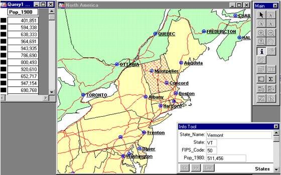
GIS definition

“… a special case of information system where the
  database consists of observation son spatially distributed
  features, activities or events, which are definable in
  space as points, lines or area. A geographic information
  systems manipulates data about these points, lines and
  areas to retrieve data for ad hoc queries and analyses”

Why is GIS unique?

• GIS handles SPATIAL information
  – Information referenced by its location in space

• GIS makes connections between activities
  based on spatial proximity

                                                      4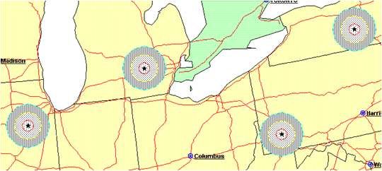
GIS concepts are not new!
• London cholera epidemic 1854

                            Soho

                            + Cholera death
                                 Water pump

                                              5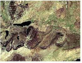
GIS: historical background
This technology has developed from:
  – Digital cartography and CAD
  – Data Base Management Systems

                   ID    X,Y       ID   ATTRIB
      1             1               1
                    2               2
          2         3               3
              3

      CAD System        Data Base Management System

                                                      6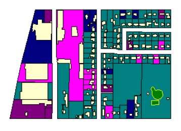
Digital
             Mapping

 Computer
                          Photo-
  Aided
                        grammetry
  Design

                GIS

Databases                Surveying

            Remote
            Sensing

Cross-disciplinary nature of GIS
GIS components
         Spatial
          data

                   GIS
Computer hardware /
                                 ?
                        Specific applications /
   software tools     decision making objectives
                                               8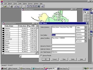
What makes data spatial?
       Grid co-ordinate         Placename

Latitude / Longitude
                                 Postcode

         Description
                          Distance & bearing

                                               9
Characteristics of spatial data
• Location
• Description: Kingston University,PenrhynRoad Centre
• Post Code: KT1 2EE
• Grid Reference: 518106.72 168530.37
• Latitude/Longitude: 0° 21’ 55.38”W, 49° 36’ 17.62”N
10Characteristics of spatial data
Geometry
• The shape of a
building or county
• The course of a river,
the route of a road
• The shape of the
landscape, relief
11Characteristics of spatial data
• Topology
• Connected to
• Within
• Adjacent to
• North of . . .
• Within the Royal Borough of Kingston-upon-Thames
• Opposite the Surrey County Council building
• North of Surbiton station
• Adjacent to Penrhyn Road
12Spatial Data: examples
• Socio-economic data
– Regional health data
– Consumer / lifestyle profiles
– Geodemographics
• Environmental data
– Topographic data
– Thematic data, soils, geology
13Data Modelling - step 1
• Features
– Buildings
– Road centrelines
– Lamp columns
– Gas pipes
– CTV Access covers
– Road surfaces
14Data Modelling - step 2
Point
Line
Polygon
15Data Modelling - step 3
Feature : Building
Object: Polygon
Entity: Tourist
Information
Bureau
16Attributes
Name : Next
Address: 5 Market Place
Town: Kingston
Owner: Ms J Shore
Tel. No: 0181 547 1245
Floor space 1300 sq m
17Spatial data storage
7,10
5,9
10
9,8
• Vector model 4,7
polygon as geometric objects:
1,6 8,6
5 2,5
6,6
points, lines, polygons
line 5,4
point
2,2 4,1
5 10
as image files
composed of grid-cells
• Raster model (pixels)
18Spatial data storage model
• important in determining the potential applications of the system
• model may also affect the type of analysis work that can be
achieved
• hybrid approach to storing graphical and attribute information
• Attribute information often stored within standard relational
database
• Graphical information is stored in a proprietary file system
– optimised tools for data handling
– although non-standard proprietary system will be difficult to
integrate with other systems, it will tend to be very efficient at
handling large graphics files.Vector data model
• advantage of the vector data format: allows precise representation of
points, boundaries, and linear features.
– useful for analysis tasks that require accurate positioning,
– for defining spatial relationship (ie the connectivity and adjacency)
between coverage features (topology), important for such purposes as
network analysis (for example to find an optimal path between two nodes
in a complex transport network)
• main disadvantage of vector data is that the boundaries of the resulting
map polygons are discrete (enclosed by well-defined boundary lines),
whereas in reality the map polygons may represent continuous
gradation or gradual change, as in soil maps.Raster data model
• good for representing indistinct boundaries
– thematic information on soil types, soil moisture, vegetation, ground
temperatures
• as reconnaissance satellites and aerial surveys use raster-based
scanners, the information (ie scanned images) can be directly
incorporated into GIS
• the higher the grid resolution, the larger the data file is going to beModelling the real world
y
1 1 20 50
1 2 24 45
1 3 52 55
2 1 0 45 46
x
40
...
000000020
000001000
020010000
000020000
2 2 2 0 1 ...
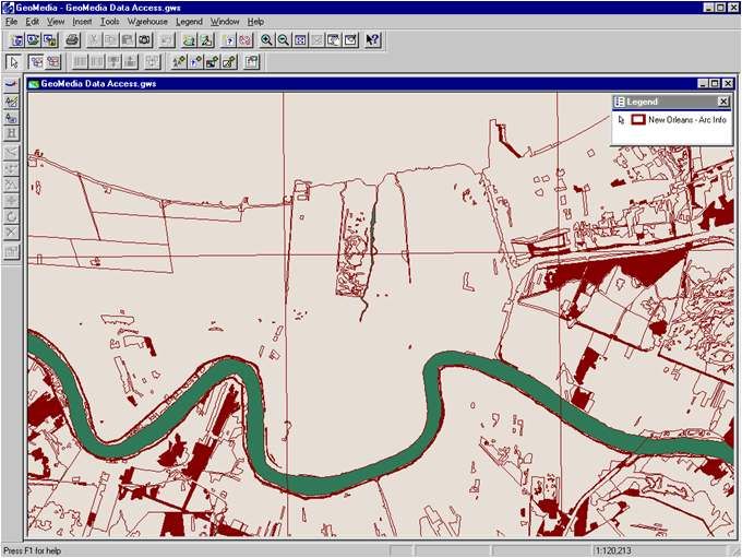
22Vector data
Land use parcels
23Raster data
24Manipulation and analysis
• What would happen if . . .
A chemical leaked into a river?
• Where does . . .
The Green Belt exist in relation to the City?
• Has . . .
Population changed over the last ten years?
• Is there a spatial pattern related to . . .
Car ownership in our area?
25Databases & GIS
Spatial data
• At a simple level a
GIS may just form
the graphical
interface to a
database
• The majority of GIS
applications follow MapInfo
this example Linked database table SQL Query ManagerGeo-relational Data Models • Linked tables based on the relational model, but storing geographical information such as: – Geometry – Topology – Attributes
GIS & Analysis
In the context of GIS, analysis is...
   “Deriving new information from existing data”
It is also the manipulation of data to solve a problem
   e.g. identify all areas within 500m of a lake

Increasing use is made of the analytical capabilities of GIS, BUT
many GIS projects only use the software to store and manage
geographical data

Yet analysis often relies on many simple basic GIS techniques
Simple Query
• The identification of objects and their attributes
  either by location or attribute query.

                                                 MapInfo
Buffering
• Creation of an area of interest around an object
– proximity analysis and environmental impact assessment.
MapInfoCookie Cutting
• Overlay of datasets using one dataset as a sieve or
cookie cutter to select a subset of the other dataset.
MapInfoOverlays
• Layer: A thematic plane of GIS features containing
geographically and logically related data
• Overlaying involves superimposing two or more map layers to produce
a new map layer.
• Example: a new genetically engineered variety of wheat grows well in dry
environments, with long growing seasons and alkaline soils. Given the
availability of data on the length of the growing season, moisture regime and
soil alkalinity, where is the best place to plant the wheat?
– overlaying (superimposing) several maps showing (separately) water-budget,
growing season length, soil pH, sodium content, and so on. The GIS analysis can
establish the locations where all the favorable soil conditions coincide, as the places
where the wheat will grow best.The benefits of GIS include:
• Better information management
• Higher quality analysis
• Ability to carry out “what if?” scenarios
• Improve project efficiency
35GIS Applications
• Facilities management
• Marketing and retailing
• Environmental
• Transport/vehicle routing
• Health
• Insurance
and many more . . .
36You can also read