2021 Population & Housing Census Cartographic Strategy
←
→
Page content transcription
If your browser does not render page correctly, please read the page content below

2021 Population & Housing Census Cartographic Strategy
                                                                 STATISTICS BOTSWANA     1

2021 Population & Housing Census
       Cartographic Strategy

                Private Bag 0024 Gaborone Botswana
  Tel: (+267) 367 1300. Fax: (+267) 395 2201. Toll Free: 0800 600 200
    Email: info@statsbots.org.bw Website: www.statsbots.org.bw
2021 Population & Housing Census
      Cartographic Strategy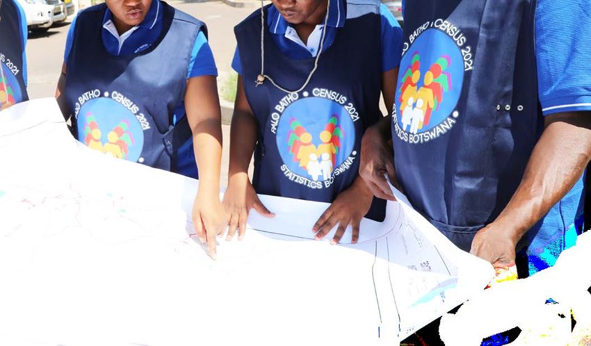
2021 Population & Housing Census Cartographic Strategy
                                                                               STATISTICS BOTSWANA      3

Table of Contents

PREFACE       												                                                                              4.

1.     BACKGROUND											                                                                            5.

2.     INTRODUCTION											                                                                          5.

3.       PRE-ENUMERATION CENSUS CARTOGRAPHY								                                                     6.
 3.1     Justification – The Importance of Census Cartography                                           6.
 3.2     Project Management Structures                                                                  7.
 3.3    Census Cartography Personnel Training and Recruitment                                           7.
 3.4    Quality Assurance and Control                                                                   7.
 3.5     Sustainability and Risk Factors                                                                8.
 3.6     Project Cost                                                                                  11.
 3.7   Roles and Responsibilities                                                                      13.
 3.8     2021 PHC  Cartography Project Schedule                                                        14.

4.       CENSUS CARTOGRAPHY METHODOLOGY								                                                        17.
 4.1     Overview                                                                                      17.
 4.2     Census Geographic Hierarchy in Botswana                                                       17.
 4.3     Use of Imagery Base Maps                                                                      18.
 4.4     Evaluation of the 2011 Population and Housing Census Cartography                              18.
 4.5     Consultancy to Determine the Feasibility to Implement Smart Census                            19.
 4.6     Smart Census Solution                                                                         19.
 4.7     Advantages of Smart Census                                                                    20.
 4.8     Design Criteria for Enumeration Areas                                                         21.
 4.9     Coding Scheme                                                                                 21.
 4.10    Enumeration Maps Production                                                                   22.
 4.11 Field Mapping Time Requirements                                                                  22.

5.     PUBLICITY AND ADVOCACY PLAN									                                                            23.
 5.1   Introduction                                                                                    23.
 5.2   Communication, Publicity and Advocacy Committee                                                 23.
 5.3   The Communication, Publicity and Advocacy Plan                                                  23.

APPENDIX I: Detailed Roles and Responsibilities of Census Cartography Team                             27.
APPENDIX II: Project Process flow                                                                      30.
APPENDIX III: Methodology and Solution                                                                 31.
APPENDIX IV: Workflow for Pre-Enumeration Mapping for the 2021 Census                                  33.
2021 Population & Housing Census Cartographic Strategy
4   STATISTICS BOTSWANA

Preface

Statistics Botswana (SB) embarked on the development of a comprehensive 2021 Population and Housing
Census (PHC) Cartography Project Document that will also serve as source for support and resource mobilization
for all processes of the exercise and the overall processes of the population and housing undertaking.  Statistics
Botswana has partnered with GeoSpace International for automation of the 2021 census cartographic
exercise. The company will provide Technical Assistance, support and the Implementation of Smart Census
Application for the 2021 census cartographic work in Botswana.

This follows the decision by Statistics Botswana to utilize modern geospatial information technologies for the
2021 census pre-enumeration activities as opposed to the traditional method of affixing dwelling numbers
on houses. This time around the system has an in-built Geographic Positioning System (GPS) for collecting
coordinates for every structure in Botswana to support the production of enumeration area maps. The
advantages of using GPS are mainly to improve on the quality of the census population estimates in terms of
accuracy, coverage and timeliness; and production of the geodatabase and the listing of dwellings.

Botswana has a tradition of preparing project documents for the censuses with the inclusion of the
cartographic operations as a major and first component of the census preparatory activities. This time around
the cartographic operations have been separated to ensure that focus is dedicated to the implementation
of Geomedia SmartClient for Census application as a major project. Thus, the Botswana 2021 Population and
Housing Census Cartography Project Document forms Volume I of the overall census Project Document.  This is
the first of its kind in the country’s history of census undertaking since independence. The second and Volume
II of the project would cover the rest of the phases of the 2021 Population and Housing Census undertaking.

The 2021 PHC Cartography Project Document covers the evaluation of the 2011 census processes in terms of
cartographic operations, the expected 2021 National Census Structures, roles and responsibilities of different
cartography committees, the institutional capacity assessment of the organisation to adopt new census
mapping technologies for a successful conduct of the cartographic exercise and to proactively fill the gaps.
The project document also acts as a project implementation guide.

Like in the past censuses, it is hoped that the document will assist in resource mobilization especially from
development partners to participate in this massive project during the current global economic challenges.

Dr. Burton Mguni
Statistician General
August 2018
2021 Population & Housing Census Cartographic Strategy
                                                                                   STATISTICS BOTSWANA           5
1.     Background

The traditional role of cartographic exercise in a census has been to support the production of enumeration
area (EA) maps and thematic maps derived from available census information. However, due to recent
technological developments in geographic information systems (GIS) and other geospatial technologies,
the scope of census cartography has been extended to include Cartographic census data analysis and
dissemination. The cartography section (now Cartography and GIS Unit) within Statistics Botswana (SB) was set
up in 1992 with the aim of fulfilling the above-mentioned purposes. All these roles have been achieved but with
the use of more traditional, labour intensive cartographic methods, especially in delineation of enumeration
areas. However, with the new technological developments for census operations (which includes data
collection, analysis, presentation and dissemination), Statistics Botswana has been moving from traditional
cartographic methods towards geographic information systems as the new technological applications in
census taking surfaced. For instance, in the 2011 Population and Housing Census Statistics Botswana (the then
Central Statistics Office) introduced geographic information systems for census cartography that allowed
automation of cartographic processes.

The automation of cartographic processes reduced the number of cartographic operations such as
compilation of map/data, drafting of maps and final drawing as was applied in the traditional way of census
mapping. There is greater flexibility in handling, processing and producing enumeration maps products.
Furthermore, the implementation of GIS in census, improved analysis and dissemination of census results. The
digital census cartography approach is a continuous and dynamic process.

The base for the 2021 Population and Housing Census Cartography will be the geospatial datasets prepared
during the 2011 census. However, there will be improvements in the 2021 census cartography methodology
compared to 2011, in terms of technology application as well as the details of features annotated on
the census enumeration maps, for example, the introduction of Smart Census application. Therefore, this
document provides the census cartography strategy for the upcoming 2021 population and housing census
of Botswana.

2.       Introduction

Botswana will be conducting the National Population and Housing Census in 2021. It will be the sixth National
population and Housing Census since Independence in 1966. The 2021 Population and Housing census will
introduce modern methods and best practices. Statistics Botswana as a custodian of official statistics and
mandated to collect and disseminate statistical information, has taken a decision to employ Smart Census
for its pre-enumeration activities (census cartography).  One of the great achievements is the creation of a
Dwelling Unit (DU) Frame, which will be an important new addition during the census cartography phase.  This
is the first of its kind in Botswana. The DU-frame will provide Statistics Botswana with detailed dwellings and
land use information on each and every building structure in Botswana. Structures and Points of Interest (POI)
will also be systematically and comprehensively captured in the process. The DU-Frame will greatly improve
the quality of the census enumeration area (EA) maps and related activities beyond the census.

As mentioned, Statistics Botswana made a decision to utilize modern census technologies for the 2021 census
pre-enumeration activities. To this end, the Smart Census solution was adopted for the whole pre-enumeration
census cartographic methodology.

The Smart Census is a total solution that covers the entire life cycle of a population and housing census.
It integrates traditional GIS functionality with a powerful workflow and workforce management tool to
provide a total solution for census strategies: from pre-enumeration activities, to digital enumeration, to post-
enumeration dynamic mapping. It can be used on its own or integrated with a nation or organization’s existing
GIS infrastructure or platforms.  Smart Census also supports statistics offices beyond the census itself, providing
the infrastructure to plan, perform and disseminate data for post-census surveys at any scale necessary.

The Smart Census solution is made up of three modules assigned to the different stages of the census process:

a) Pre-enumeration Phase (census cartography): Smart Census enables the digital creation and maintenance
of enumeration areas, the planning of canvassing activities, within one tool as well as the creation and
maintenance of the Dwelling Unit Frame;

b) Enumeration Phase: Smart Census can integrate with mobile systems such as Computer Assisted Personal
2021 Population & Housing Census Cartographic Strategy
6 STATISTICS BOTSWANA
Interview (CAPI) regardless of the type of software used, for example, CSPro or survey solutions, for fast and
efficient data collection and ensures continuous enumeration, even in remote areas.
c) Post-enumeration and dissemination phase: Smart Census speeds up dissemination processes by utilizing
Hexagon Geospatial Smart M.App technology which presents complex census data based on multiple
demographic, economic and geographic factors. The dissemination module allows census and survey results
to be disseminated through the Internet using dynamic maps combined with an array of graphs and tables
For this project, Statistics Botswana procured the pre-enumeration mapping module of Smart Census. The
primary deliverables of the 2021 pre-enumeration mapping project are:
1. an updated geographic frame for Botswana that will reflect the current administrative boundaries of
the country;
2. an updated Enumeration (EA) and supervision area (SA) map database with accompanying
information to be used during the enumeration phase of the census;
3. a detailed DU-Frame with current image base maps.
4. The secondary deliverables/benefits include:
a. upgraded GIS Office hardware and software;
b. mobile data capture devices (PDA/GPS) that can be used in future surveys;
c. sustainable census mapping capacity in Statistics Botswana;
d. updated national geo-spatial and attribute datasets;
e. Smart Census technology that can be used for Enumeration, subsequent surveys and
dissemination of data.
Statistics Botswana will ensure that census activities are implemented based on international standards and
best practices for census mapping as recommended by the United Nations.
The census cartography is scheduled to commerce in October 2018 first as a pilot exercise of the new
technology. The actual exercise will commence in February 2019.
3. Pre-enumeration Census Cartography
3.1 Justification – The Importance of Census Cartography
The cartographic fieldwork forms the fundamental core activity to the success of any population and housing
census. The primary objective is to delineate enumeration areas (EA) in the country to facilitate the counting
of inhabitants during enumeration period and fundamentally to ascertain that all areas are covered; that
everyone in the country is counted with minimal possibility of under counting as well as the creation of a
master sampling frame for socio-economic and household surveys that are conducted during the inter-
census period. Enumeration Area (EA) must be big enough for one enumerator to handle during the time of
enumeration. The EAs will be delineated and delivered according the National Geo-Frame. The deliverable
will be a set of A3-sized EA and SA (supervision area) maps, hardcopy or digital. A further important deliverable
of pre-enumeration activities is the creation of the geography layer that is used for enumeration planning and
digital enumeration (CAPI) as well as the analysis and dissemination of census results.
The role of maps in the census is twofold: (a) to support enumeration activities and (b) to present aggregate
census results in cartographic form. Advantages of the enumeration maps include: (i) ensuring full and
unduplicated coverage; (ii) estimating resource requirements (travel time and costs); (iii) assigning
geographical codes; and (iv) establishing the numbers of field officers to be hired, vehicles, equipment and
materials to be procured.
During the enumeration exercise, these maps are used to guide the enumerators to find their way within the
enumeration areas. Enumeration area maps also provide a basis for producing thematic maps for spatial
analysis of the census and provide a sound basis for developing a national sampling frame for inter census
household surveys. The spatial census database can be combined with other datasets to generate thematic
indicator maps, which can be included in a Census Atlas depicting several socio-economic indicators2021 Population & Housing Census Cartographic Strategy
STATISTICS BOTSWANA 7
including poverty and literacy levels that enhance understanding of the spatial dimensions of diverse issues in
all sectors of the Botswana economy.
Specifically, census cartography aims to:
a. To delineate enumeration areas and produce maps used to facilitate counting of inhabitants
during the enumeration period;
b. Ascertain that all areas are covered and that everyone in the country is counted with minimal
possibility of under counting;
c. Produce thematic maps for spatial analysis of the census and provide a sound basis for
developing a national sampling frame for the inter-census household surveys;
d. Estimating resource requirements (costs, fieldworkers, vehicles, equipment etc.), for the
Population and Housing Census;
e. Produce a spatial census database for use with other datasets to generate thematic indicator
maps to enhance understanding of the spatial dimensions of diverse issues in all sectors of the
economy.
f. Ensure that EA maps easily guide the enumerators to their assigned EAs during the census
period.
g. Effectively monitor the enumeration process.
3.2 Project Management Structures
The census cartography project is the responsibility of Statistics Botswana and hence it is important to have
a framework which outlines the structures of the project, with clear roles and responsibilities. To this end,
a cartographic committee has been formed to oversee the technical part of the project. Membership is
drawn from various stakeholders such as Department of Surveys and Mapping, Botswana Defence Force,
Department of Environment in the University of Botswana (UB), to mention but a few. This committee will meet
on quarterly basis and shall report to the Executive Committee of Statistics Botswana through the chairperson,
being the Deputy Statistician General – Statistical and Technical Operations
Other structures within Statistics Botswana such as the Project Steering Committee shall be used to monitor
progress and updates on the project on monthly basis.
3.3 Census Cartography Personnel Training and Recruitment
Statistics Botswana has a functional GIS and Cartography unit. The tasks of the office and field staff require
a large number of personnel. Currently there are eight (8) office staff of which two (2) are on contract basis.
Additional 10 supervisors with a degree in GIS shall be recruited. Forty (40) mappers, comprising high school
leavers or any higher discipline shall be recruited for the project and they will be trained accordingly.
The consultancy will train the project team in the use of Smart Census (Configuration and Management),
GeoMedia Professional and GIS and Cartography Project Management to further equip them in performing
office work and support fieldwork operations. Training will be conducted in batches as and when needed.
The methodology development will play a critical role in the scheduling of the training. A detailed census
cartography methodology chapter is included in this project document in order to identify the required
additional GIS and fieldwork staff as well as the infrastructure compliments necessary to complete the census
mapping exercise.
3.4 Quality Assurance and Control
Quality Assurance (QA) and Quality Control (QC) are important to ensure quality and consistency in the outputs
of the project. That is, the quality of geo-datasets including maps that are used in the census undertaking has
a major influence on the quality and reliability of data collected. In particular, special attention should be
given to ensuring production of quality census enumeration area maps.
Provision is being made for quality assurance and control procedures at all steps in the project, from Phase 12021 Population & Housing Census Cartographic Strategy
8 STATISTICS BOTSWANA
through to the final delivery of the enumeration areas for Enumeration. It is however important to emphasize
that the QA and QC must be performed as close to real-time as possible to allow corrections to be made
within memorable time frame.
3.5 Sustainability and Risk Factors
Sustainability of the project will be ensured by a number of factors including national commitment, capacity
building, quality assurance, availability of transport and all other logistical arrangements, connectivity as
well as technological support. National commitment should be reflected through legal actions (Acts and
formation of cartographic committees), human, financial, and other resource allocation. Donor commitment
is reflected mainly through provision of technical support. National capacity development will be central to
the various levels of census planning and implementation including cartography/mapping fieldwork and
other processes of the census phases.
Quality control procedures (well-designed and tested tools and plans, spot checks, internal consistency and
range checks, independent verification and supervision) will be built into the system. However, a number of
challenges and potential risks that need to be taken into account are presented in the risk register below.
TABLE 1 RISKS AND RISK MITIGATION MEASURES
Impact /
Risk Description and Consequence Risk
No Risk Name consequences Root Cause Rating Risk mitigations owner
1. Delays in Delayed formation Unclear roles on Critical Expedite the NCC
formation of of census which office should formation of
census coordination of initiate the census National Census
structures office. project. No clear office and reporting
defined reporting lines
lines
Delayed formation Lack of guidance Critical 1. Address the district NCC
of census district and experience commissioners about
structures will in carrying out the the census project.
delay the census project 2. Inclusion of
commencement of resource in the
cartographic work committee that has
therefore time over- exposure. And
runs for this project. experience in
undertaking census
Denied access to inadequate Critical Manager (SFS) to Manager
households due to publicity due to advise when to (SFS)/
lack of publicity delayed officially implement DCC
implementation of publicity and
the publicity plan advocacy plan of
of the cartographic the project
exercise
2. Delays in Data received from Data for the Catastrophic Sourcing of Manager
getting LAPCAS surveyed plots have satellite imageries SFS
spatial data project has gaps, not been from other
from not complete. submitted from the institutions i.e. DIS &
LAPCAS land boards to Dept. BDF
project of Surveys &
mapping
The key used to quantify the impact/consequence of the risks is as follows:
Catastrophic: Occurrence/s with the potential to lead to suspension of operations or closure of
Statistics Botswana.
Critical: Events which can be endured, but which may have a prolonged negative impact and/or extensive
consequences
Serious: Events which can be managed, but require additional resources and management effort
Significant: Events which can be managed under normal operating conditions
Minor: Consequences can be readily absorbed2021 Population & Housing Census Cartographic Strategy
STATISTICS BOTSWANA 9
TABLE 1 RISKS AND RISK MITIGATION MEASURES Cont.
Risk Description Impact /
and Consequence
No Risk Name consequences Root Cause Rating Risk mitigations Risk owner
3. High staff Most of employees Engaged employees Serious Have a reserve HR
turnover used are go for better pool of staff
temporary staff opportunities or job
security since they are
employed on
temporary basis
4. Insufficient Smart census is a New technology and Serious Continuous Manager
knowledge new technology there is need to get adequate SFS
and skills on and most people grip with the concepts training and
Smart census are not usage of the
knowledgeable system.
about it and this
will delay
cartographic
progress
5. Non Failure to secured Delayed release of Critical 1. Borrow already DSMIS
adherence equipment and funds. available
to the material on time equipment e.g.
procurement BDS
plan 2. Borrow funds
from already
running projects
within SB.
Failure to deliver by Critical BDS gadgets to Manager
service providers on be used in the SFS
time. case that the
specified
gadgets are not
delivered on
time.
Failure to start the pro- Critical Procurement to Ass
curement process on comment Manager-
time. Procure-
ment2021 Population & Housing Census Cartographic Strategy
10 STATISTICS BOTSWANA
TABLE 1 RISKS AND RISK MITIGATION MEASURES Cont.
Risk Description Impact /
Risk and Consequence
No Name consequences Root Cause Rating Risk mitigations Risk owner
6. Low Lack of staff Low staff morale Significant 1. Motivate staff Manager SFS
quality commitment through various ways
data e.g. Communication,
pro- HR.
duced 2. Performance
agreements to
include projects and
ensure rigorous
supervision
1. Lack of Significant 1. Follow disciplinary 1. Manager
discipline. processes and SFS
2. non actions to be taken 2&3
adherence accordingly. Manager HR
to terms and 2. Explain to
conditions of temporary terms and
the contract by conditions of their
temporary staff contracts including
during data absenteeism,
collection undesirable behavior,
etc. and how much
would be dealt with.
3. Staff should be
requested to sign their
contract as well as the
rules leaflet (to be pro-
vided by HR)
Recruitment of lack of Significant 1. Recruit a large of Manager HR
non- database of those who have &
experienced previously used previously Manager SS
data collectors data collectors collected data in (for training)
Statistics Botswana
2. Early recruitment of
staff and ensure
adequate and
in-depth training2021 Population & Housing Census Cartographic Strategy
STATISTICS BOTSWANA 11
TABLE 1 RISKS AND RISK MITIGATION MEASURES Cont.
Risk Description Impact /
Risk and Consequence Risk
No Name consequences Root Cause Rating Risk mitigations owner
7. Technol- Insufficient Insufficient Critical 1. Sign a contract to IT
ogy server storage server use the consultant’s Manager
failure which will result capacity server (in Pretoria) on
in the server temporary
crushing basis, through
Virtual
Private Network.
2. To procure a new
Server by end of
November 2018.
3. Current server at
Statistics Botswana to
be assessed for
specifications to host
pilot data
8. No Loss of data No external Catastrophic To have an external IT
external data backup data backup Manager
data
backup
9. Con- Low internet Low Critical To be addressed by IT
nectivity speed bandwidth, old moving to the new Manager
failure switches and home by 31
cabling December 2018
Interrupted data No or low Critical Approach mobile IT
transmission network service providers Manager
coverage by about network
mobile service coverage
providers
10. Environ- extended Heavy rains, Critical 1. factor Manager
mental number of days floods and any weather conditions SFS/ HR
and without field other natural in the work plan.
climate work being disasters 2. Procure protective
factors, done due to clothing and
rains weather equipment to
conditions enable work during
rainy season
3.6 Project Cost
The estimated budget for the 2021 PHC cartography operations is 44 Million Pula. The cost of the project is
wholly sponsored by the Government of Botswana. The budget is spread over the 3-year period, P21million
for 2018/19, P14 million for 2019/20 and P9 million for 2020/21. Table 2 below displays the budget breakdown.2021 Population & Housing Census Cartographic Strategy
12 STATISTICS BOTSWANA
TABLE 2: 2021 PHC CARTOGRAPHY BUDGET BREAKDOWNS
Item Duration
No. Item Description Unit Cost Quantity (months) Total Cost
A Consultancy
1 Consultancy Services 5,994,670.00 1.00 1.00 5,994,670.00
12% VAT 719,360
Total 6,714,030
B Human Resources
2 · Commuted Allowance for Supervisors, 4,500.00 70.00 22.00 6,930,000.00
mappers and Drivers
3 · Salaries for Supervisors 8,000.00 10.00 22.00 1,760,000.00
4 · Salaries for mappers 5,050.00 40.00 22.00 4,444,000.00
5 · Salaries for Drivers 4,000.00 20.00 22.00 1,760,000.00
6 · Salaries for GIS Specialist 21,000.00 2.00 48.00 2,016,000.00
7 · Salaries for IT Personnel 21,000.00 3.00 48.00 3,024,000.00
8 · Supervisors Airtime 150.00 10.00 22.00 33,000.00
9 · Quality Controllers Airtime 200.00 8.00 22.00 35,200.00
Sub Total 20,002,200.00
12% VAT 2,400,264.00
TOTAL 22,402,464.00
C All Equipment
10 · GIS Workstations 65,000.00 8.00 1.00 520,000.00
11 · Laptops 20,000.00 12.00 1.00 240,000.00
12 · Rugged Computer Tablets 60,000.00 40.00 1.00 2,400,000.00
13 · A3 Colour copier/printer 100,000.00 1.00 1.00 100,000.00
14 · A0 Plotter 118,330.00 1.00 1.00 118,330.00
15 Colour Printers 40,000.00 3.00 1.00 120,000.00
16 external harddrives 4,000.00 8.00 1.00 32,000.00
17 Transport (robust vehicles) 455,400.00 6.00 1.00 2,732,400.00
18 Fieldwork Personnel Attire 84,000.00 1.00 1.00 84,000.00
19 Fuel and other Lubricants 5,004.00 24.00 22.00 2,642,112.00
20 License to access remotely sensed data 1,400,000.00 1.00 2.00 2,800,000.00
21 Printing and Packaging of final EA maps 65,000.00 1.00 1.00 65,000.00
22 Camping Equipment 671,821.00 1.00 1.00 671,821.00
23 Stationary 132,375.00 1.00 1.00 132,375.00
Sub Total 12,658,038.00
12% VAT 1,518,964.56
TOTAL 14,177,002.56
GRAND TOTAL - excl VAT 38,654,908.00
GRAND TOTAL - incl VAT 4,638,589.0
GRAND TOTAL 43,293,497.02021 Population & Housing Census Cartographic Strategy
STATISTICS BOTSWANA 13
3.7 Roles and Responsibilities
a. The Statistician General
The overall responsibility for the Population and Housing Census Cartographic operations lies with the
Statistician General Office. The office is responsible for the role of political leadership in the project and is
required to communicate the census message at the highest level. In order to do so the office will be regularly
briefed of the census cartography project processes, progress and the required resources on regular basis
through executive meetings. The same office will play advocacy role which is crucial to ensure political buy-in
and mobilize the support of the population at large.
b. The National Census Coordinator or Deputy Statistician General – Statistical and
Technical Operations (DSG_STO)
The National Census Coordinator or DSG_STO office is responsible for keeping the SG informed on the methods
and status of the project on regular basis. This can be done through monthly executive project status reports
and meetings. The office is also responsible for major decision making in the areas of resource mobilization
and utilization as required for a successful implementation of the census including the pre-enumeration
cartography project. The office will support the census where high level interventions are required; play an
important role in the coordination and mobilization of support from external stakeholders. This office also
chairs the Census Cartographic Committee.
c. The Director
With the assistance of the Census Cartography Project Manager, the Director is accountable for the overall
coordination and management of the census cartography project operations, administratively and technically
to ensure that the project runs smoothly, time lines are kept and that resources are utilized efficiently. As such,
he/she must be aware of all the census cartography processes and project details to enable him/her to
provide required guidance and make informed decisions on the project. The Director is also responsible for
the overall coordination of project meetings with internal stakeholders as well as the supervision of the Census
Cartography Project Manager.
d. Census Cartography Project Manager
With the assistance of the GIS and Cartography Unit head, the Census Cartography Project Manager is
responsible for and required to supervise the mapping project team. The Census Cartography Manager
must therefore be up to date in all aspects of the project in order to ensure that the project accomplishes the
results required within the timeframe set. The Census Cartography Project Manager is also responsible for the
supervision of GIS and Cartography Unit head.
e. Head, GIS and Cartography Unit
The head of unit is responsible for the operational management of the pre-enumeration mapping exercise.
The head is also responsible for supervision of GIS specialists and hence should be up-to-date with field
operations and their status, report progress to the Census Cartography Project Manager regularly or on
agreed frequency.
f. GIS Specialists and Technicians
Reporting to the head, GIS and Cartography, the GIS Specialists and Technician are responsible for the
management of the GIS office work and staff, the scheduling of work, reporting on the progress and status of
work, requests for technical assistance and (additional) training, resolving issues that could potentially affect
the quality and delivery of the GIS Office work. This team is also responsible for the production of all maps
required for enumeration purposes as well as quality control activities.2021 Population & Housing Census Cartographic Strategy 14 STATISTICS BOTSWANA g. Fieldwork Supervisors Fieldwork Supervisors are responsible for the overall management and supervision of the census EA delineation fieldwork teams. This entails the scheduling of work according to the agreed schedule, reporting on the progress and status of work, requests for assistance and (additional) training, escalation of issues that could potentially threaten the quality and delivery of the fieldwork. He/she will work in close collaboration with head, GIS and Cartography unit to ensure that all the required field maps are produced timely and according to the agreed standards. h. Fieldwork Mappers Fieldwork mappers are responsible for data collection, EA delineation and capturing of data for the creation of Dwelling Unit Frame. i. Database Administrator The Database Administrator will be responsible for maintenance of GIS systems, monitoring the flow of data from field to office and managing the geo-database. He/she will be reporting to the head of unit. A detailed overview of functions for Census Cartography team is displayed as Appendix I. 3.8 2021 PHC Cartography Project Schedule The project schedule below displays census cartography activities and timelines.
2021 Population & Housing Census Cartographic Strategy
                                                                          STATISTICS BOTSWANA     15

TABLE 3: 2021 CARTOGRAPHIC FIELDWORK OPERATIONS MILESTONE CHART
SR    YEAR                            2017/18            2018/19             2019/20        2021
NO.    PLAN OF ACTIVITIES        Q1 Q2 Q3 Q4        Q1   Q2 Q3 Q4 Q1 Q2           Q3 Q4      Apr
1     Project Planning (Needs Assessment)
a     Situational Analysis
b     Map Inventory
c     Formation of 2021 census
      cartographic Committee
d     Project Proposal and
      Budgeting
e     Signing of Contract with
      GeoSpace International
f     Development of PM (budget)
      and release of funds
g     Preparation of the Tender
      Documents and Awarding
h     Development of Project
      Document
2     Procurement of Vehicles, GIS Equipment and Geomedia Professional
a     Fieldwork Vehicles
b     Tender award for procurement
      of cartography equipment
3     System Design, Manual Productions and Geodatabase
a     Document Management
      System Design
b     Geodatabase Development
c     Develop Quality Control
      Management System
d     Mappers Manual Production
4     Geographic Data Collection and Map Updating
a     Data acquisition (collection)
b     Data Cleaning
      (Update EA maps from 2011
      PHC)
c     Produce and print base maps
      for fieldwork operations
5     Development of Data Collection Instruments
a     Pre-Listing Form
b     Site Conditioning Form
c     Daily Workload Form
2021 Population & Housing Census Cartographic Strategy
16 STATISTICS BOTSWANA
TABLE 3: 2021 CARTOGRAPHIC FIELDWORK OPERATIONS MILESTONE CHART
SR YEAR 2017/18 2018/19 2019/20 2021
NO. PLAN OF ACTIVITIES Q1 Q2 Q3 Q4 Q1 Q2 Q3 Q4 Q1 Q2 Q3 Q4 Apr
6 Procurement of Fieldwork Equipment/Supplies
a Camping Equipment, field
attire, airtime, stationary, etc.
b Internet connectivity for data
transfers
c Engagement of Mobile
Phone companies
7 Recruitment of Field Staff
a Recruitment of temporary
GIS /
Cartographic Technicians
b Recruitment and training of
supervisors and mappers
c Recruitment of temporary
drivers (pilot and main exer-
cise)
8 Training
a Geomedia Pro advanced
b Smart Census System
9 Publicity (Stakeholder Relations)
a Develop and implement
Communication plan
b Involvement of Districts
c Publicity Materials
(TV Adverts & Radio Jingles)
10 Cartographic Fieldwork
a Conduct Pilot
b Main Mapping Exercise
commencement
c Quality control (fieldwork
and Office)
d Cartographic Inspection
11 Delineation of Enumeration Areas and Map Production ( Office)
a Production of EA and
Supervision Area maps
b Printing and packaging of EA
maps
c Distribution of district maps to
Districts
d Updated Locality Coding
List /
Geocoding Scheme2021 Population & Housing Census Cartographic Strategy
STATISTICS BOTSWANA 17
4. CENSUS CARTOGRAPHY METHODOLOGY
4.1 Overview
The census cartography provides the basis for most logistical planning for census enumeration operation,
as well as the crucial details of the number of enumeration areas and their estimated size. A number of
innovations were introduced for the 2011 Census, including using GIS and new sources of spatial data to
improve the design of enumeration areas. More improvements will be introduced in the 2021 census
cartography methodology compared to 2011. The biggest innovations for the 2021 census (compared to
2011) are the use of 50cm or less orthophotos as the base map for the entire country (compared to 2,5m
panchromatic OPM in 2011). More importantly, is the introduction of Smart Census solution. Smart Census pre-
enumeration mapping module is a client-server solution specifically designed for census mapping exercise.
Through unique workflows the data capturing and management of the entire project is managed.
The 2021 Census pre-enumeration cartographic mapping will be carried out in four main phases namely:
a. Fieldwork exercise where dots are placed on each dwelling unit (DU) on a hardcopy 2011 EA map;
b. Verification and updating of existing prominent features (PF) data using Smart Client for Census;
c. Prominent features include educational facilities, health facilities, community centres, places of
worship and police stations;
d. Capturing of GPS location as well as attribute information for PFs not already in the database using
Smart Census;
e. Verification and modification of existing enumeration areas boundaries through field updating.
f. Production of enumeration maps.
Since the 2011 census there has been a lot of growth in terms of physical developments across the country
especially in urban and peri-urban areas. This growth has led to villages expanding into nearby land areas
thereby swallowing them up as residential plots were demarcated and allocated in these areas. The outcome
of this growth is that rural EAs that were delineated for the 2011 census in these land areas no longer exist. It
is, therefore important that all these changes are captured before the start of the cartographic fieldwork. This
growth has also affected the enumeration areas boundaries and hence calls for the updating of the EA maps
as well as the realignment of the EA boundaries.
Delineation of EAs will be carried out on base maps on the basis of the estimated number of dwellings and the
recorded population during the listing of households’ exercise. An EA in rural areas normally consists of about
75 – 150 dwellings depending on the ecological zone it is situated; 110-220 dwellings in urban and village
areas, and has definite boundaries. In effect, this is an operational unit for enumeration. The entire country will
completely be covered by a network of EAs.
The EAs will be coded numerically different for identification purposes so as to facilitate reporting of the
census data using a four-digit code. The complete code number for an EA can be increased to eight digits
with the first 4 digits representing the census district and the village code respectively.
4.2 Census Geographic Hierarchy in Botswana
A census geographic hierarchy involves creating a list of all administrative and statistical reporting units in the
country, with the relationships among all types of administrative and reporting unit boundaries defined. Every
country has its own specific administrative hierarchy. The lowest level of administrative unit is an EA. For the
purpose of the census taking Statistics Botswana uses a generic census geographic hierarchy as illustrated by
figure below.2021 Population & Housing Census Cartographic Strategy
18 STATISTICS BOTSWANA
Country
Admin District
Census District
Urban District Rural District
Village/Localities Village/Localities
Enumeration
Geographically Towns and Cities fall within the boundaries of administrative districts but due to their peculiarities
they are designated as independent census districts for census operations. This applies to administrative
districts that have not been subdivided and newly established sub-districts though the determination of district
boundaries is a very serious challenge. It should be noted that, in urban districts, town/cities are villages and
the extensions within them are designated as localities as opposed to the rural districts, where the setup is
fairly straight forward. In rural districts, villages, cattleposts and lands areas are themselves localities.
4.3 Use of Imagery Base Maps
During the 2011 census, a mapping innovation was introduced through the use of digitized enumeration area
maps. These were produced using data collected from various sources, colour aerial photographs (OPM)
and the panchromatic OPM covering the entire country. In some areas satellite imagery was used. The base
maps were updated and verified in the field during the cartographic fieldwork operations to facilitate the
production of comprehensive digitized maps.
4.4 Evaluation of the 2011 Population and Housing Census Cartography
The evaluation of the 2011 PHC cartography exercise revealed the following as problems encountered during
the exercise;
a. Maps were inaccurate in terms of labelling and caused more confusion among the enumerators.
b. EA Identification: problems relating to the identification of EA boundaries during census enumeration.
c. EA size: some enumeration areas were too big to be covered by one enumerator during enumeration.
d. The black and white OPM covering the whole country was outdated and the resolution was not good
enough for large scale mapping.
e. Data gaps: some areas were covered using sketch maps.
f. The manual numbering of dwellings and building structures caused a lot of problems during census
enumeration. This is caused by legibility issues since they were hand written.
g. Unlisted localities and dwellings even in urban areas2021 Population & Housing Census Cartographic Strategy
STATISTICS BOTSWANA 19
h. Combined or Lumped EAs: These occurred due to insufficient map information to separate adjacent
EAs
i. Some images were cloud-blurred and could not be used in rural areas e.g. OMP
The introduction of the new mapping approach, including the Smart Census mapping module, will address
the problems encountered during the 2011 PHC cartographic operations. The following will be done;
a. For pre-enumeration activities for the 2021 census, archived high resolution satellite imagery (25cm
and 50 cm), topographical dataset, cadastral data (LAPCAS), line map data and 1.5m satellite imagery
(AirBus) will be acquired to complement the ESRI image base map and to replace the outdated panchromatic
OMP. The high resolution satellite imagery will be used for densely populated areas (fast growing) such as
urban and peri-urban areas while the topographic data will be used for medium scale mapping in rural areas.
b. The cadastral data will be used for large scale mapping. This will provide an updated layer of all the
land parcels across the country with a systematic numbering of dwellings and building structures, particularly
in villages where there are no plot numbers. The 1.5m satellite image will cover the most remote parts of the
country such as lands area, cattle post, farm etc. in conjunction with the topographic data.
c. The use of satellite imagery will eliminate most, if not all, of the problems encountered during the 2011
while the cadastral data will address the issues relating to the numbering of dwellings and building structures.
This will contribute to the best possible pre-enumeration mapping and will ultimately result in better quality EA
maps for the census.
4.5 Consultancy to Determine the Feasibility to Implement Smart Census
Statistics Botswana benchmarked on the use of new technology for census undertaking. The use of Smart
Census solution was demonstrated to the Organisation’s management. GeoSpace International Company
was invited to make a presentation to Statistics Botswana in May 2017. From the presentation it surfaced
that there are key requirements to be satisfied before Smart Census solution could be implemented. The
requirements are as follows;
a. The need for a comprehensive and complete geo spatial database
b. Procurement of hardware, software infrastructure and addressing connectivity issues
c. Availability of latest and cleaned geo spatial data (imagery, etc.) and
d. Procurement of GeoMedia Professional (cleaning software) and training of staff on such
Following the presentation, the company was contracted to conduct a situational analysis to determine
the feasibility of implementing Smart Census for 2021 Population and Housing Census cartographic work. A
comprehensive report of the consultancy was prepared in June 2017 and was titled ‘Short-term Consultancy
on Pre-Enumeration Census mapping, Statistics Botswana’.
The consultancy revealed that, while the environment is conducive for the implementation of Smart Census,
there are however, data gaps and base maps issues to be resolved and hence a need for development of
a clean geo spatial database; procurement of software and hardware including Geomedia Professional
and staff trained on the same as well as improving internet connectivity. Data availability was viewed as a
prerequisite for Smart Census implementation. Data is normally obtained from Department of Surveys and
Mapping (DSM). On average, the consultancy recommended the adoption of the technology as Statistics
Botswana satisfied most of the requirements.
4.6 Smart Census Solution
Statistics Botswana made a decision to utilize modern census mapping technologies for the 2021 census pre-
enumeration activities. For this reason, Smart Census solution has been adopted for the whole pre-enumeration
census mapping methodology. The Smart Census solution was developed by Hexagon Geospatial in2021 Population & Housing Census Cartographic Strategy
20 STATISTICS BOTSWANA
association with GeoSpace International. It is a total solution that covers the entire life cycle of a Population
and Housing Census and is a client-server software platform that integrates traditional GIS functionality with a
powerful workflow and workforce management tool to provide a total solution for census strategies.
Smart Census provides a solution for each phase of a census: 1) Pre-enumeration mapping; 2) digital
enumeration, and 3) post-enumeration dynamic mapping for the dissemination of census results.
3
2
1
These phases are explicitly elaborated in the introduction. However, only the pre-enumeration census
mapping module is procured for this project. The solution for the project includes the full Pre-enumeration
mapping module covering the configuration, training, implementation and technical support.
The Smart Census is an integrated solution that enables all users (office and field) to work on the same
database and execute the tasks allocated to them within a given Production Unit (PU) at any given moment
in time. Workflows and users are pre-defined and vary by User Type and User Need (see Appendix). The
production units for the project will be the census districts as described above under the census hierarchy
of Botswana.
The Solution has online and offline functionality. This implies that certain users can execute certain tasks
online and other tasks offline. This is important for fieldwork where Internet access is often not guaranteed. It
is important to understand a few concepts first before we get to the hands-on use of the application.
The Smart Census pre-enumeration mapping module and the field component runs on Microsoft Windows
Mobile as well as iOS and Android
4.7 Advantages of Smart Census
The benefits of Smart Census are as follows:
• Cost-effective solution (replaces the need for big numbers of desktop GIS licenses);
• Speed up field mapping process;
• Better control and management of the project;
• Provide data validation and coding processes in the field;
• Improves completeness by filling the entire compulsory variables to be collected;
• Immediate quality control at the moment of data typing;
• Control of data filling by introducing controls to reduce errors. Such controls will include skip
patterns, consistency checks, and message prompts;
• Limit data loss risks since data is loaded onto the system on a regular basis;
• Real time tracking of field data collection by directly transmitting collected data to central system.
This allows monitoring and evaluation of field mapping implementation progress and outputs achieved;
• Can be used as a tool for the planning and management of subsequent phases of the census; and
• It can also be used as a dissemination tool for census data.2021 Population & Housing Census Cartographic Strategy
STATISTICS BOTSWANA 21
4.8 Design Criteria for Enumeration Areas
The principal objective of EAs delineation is to create EAs that are ideal size in terms of number of dwellings,
population and area size. The ideal dwelling’s population size is the number of dwellings that one enumerator
is expected to enumerate during the period of census enumeration. The total dwellings one enumerator is
expected to enumerate will vary by enumeration type settlement as well as by ecological zone type, thus
density of population and type of terrain. The criteria will also vary depending on whether the areas are urban
or rural. The proposed design criterion for EAs is given below in a table.
TABLE 4: DESIGN CRITERIA FOR ENUMERATION AREAS
EA TYPE DWELLINGS PERSONS
Urban 110 - 220 300 - 600
Villages 110 - 220 300 - 600
Localities 75 - 100 100 - 250
The estimates of persons are based on the population recorded at dwelling level during the cartographic
mapping exercise. The rural areas are separated according to the ecological zones since the settlement
patterns and topographic terrain vary significantly between the various zones. Enumeration areas in most
remote areas such as lands and cattle posts are constituted by grouping of localities which are normally far
apart hence small number of dwellings.
Enumeration areas are delineated with identifiable boundaries, which do not overlap. The enumeration areas
should not cut across boundaries of administrative and census districts. An EA will be given a code which will
distinctly identify it when combined with codes of administrative areas in which it is located. The EA map should
indicate clearly its boundaries, include notable landmarks such roads and rivers, as well as building structures
as guides to identify different parts of the EA. Standardized symbols should be used for clear understanding
and the map should be of such a scale that it will be easy to handle and read.
4.9 Coding Scheme
The development of a coding scheme is necessary for assigning a unique code to each enumeration area.
The coding scheme, reflecting the administrative hierarchy, should be flexible enough and well-structured to
incorporate new and future administrative divisions. In order to ensure consistency and clarity of the numeric
identifiers, a hierarchical coding scheme will be followed. In this approach the geographic units will be
numbered at each administrative hierarchy. The proposed geo-coding will be in line with census geographic
frame as given below.
TABLE 5: CARTOGRAPHY CODING SCHEME
Locality Type Locality Code
Cities and Towns 0
Village 1
Lands Area 2 or 7
Cattle Post 3 or 8
Mixture (lands and cattle post) 5
Freehold Farm 4 or 9
Border Post, work camps etc. 62021 Population & Housing Census Cartographic Strategy 22 STATISTICS BOTSWANA 4.10 Enumeration Maps Production An enumeration area map is a map that an enumerator will carry out for fieldwork and act as a guide while an assistant supervisor map is a map that contains 3-4 EA and various landmarks such as roads, rivers and name of localities. The census map production process will be part of Smart Census solution. It will automatically take the census enumeration area boundary files, determine an appropriate scale for printing, add the administrative boundaries information and apply defined rules for cartographic presentation. The standardized symbols for clear understanding of the maps and placement of text will also be automated. The enumeration area maps will clearly indicate its boundaries, including infrastructure establishments as guides to identify different parts of an EA. The automated map production system will store map files in PDF. Further to EA maps to be designed, supervision area and district maps for Supervisors and District Census Officers respectively will also be designed. Overall the process of enumeration maps design, printing and packaging will take approximately 10 months. 4.11 Field Mapping Time Requirements Based on experience from the past census, it is estimated that a team of four mapping assistants provided with two vehicles and equipped with one GPS receiver set (rugged tablet computer) and other necessary materials, will cover at least 2 to 3 EAs per day depending on the terrain and road conditions. Therefore, for this exercise to be fully conducted on time, at a comfortable pace that will ensure accuracy and complete coverage, a period of 18 months is needed and another four (4) months reserved for the finalization of logistical arrangements. In total the exercise of field mapping will be conducted by 50 mapping personnel divided into 10 teams, each comprising of one fieldwork team leader, four (4) mappers and two (2) drivers. The team leader is in charge of the team and he/she is professionally more qualified than the mapping assistants.
2021 Population & Housing Census Cartographic Strategy
                                                                                   STATISTICS BOTSWANA           23

5.       PUBLICITY AND ADVOCACY PLAN

5.1      Introduction

The Communication, Publicity and Advocacy (CPA) plan identifies and presents the key strategic interventions
that will facilitate the participation of all stakeholders in the implementation of the 2021 Population and Housing
Census (2021 PHC) cartography operations. The principal anchors of the CPA include national ownership,
multi-stakeholder engagement and the general public’s right to information.

The CPA plan outlines the key programmes and activities that will raise awareness about the 2021 Population
and Housing Census Cartographic work and its objectives with the view to engage all stakeholders to ensure
that the project is supported, and therefore successful. Further, the plan identifies the resource needs with
regards to time, staff, structures and funds.

5.2      Communication, Publicity and Advocacy Committee

The Publicity and Advocacy Committee (CPAC), will be responsible for informing and preparing the general
public on the activities of the cartographic exercise and the need for multi-stakeholder cooperation. The
committee will be headed by the Manager-Communication, Documentation and Dissemination. Specific
roles of this Committee will be to:

i.           Develop and Implement a communication, publicity and advocacy plan;
ii.          Develop communication, publicity and advocacy materials;
iii.         Develop a plan for disseminating the cartography results;
iv.          Prepare press releases;
v.           Organize workshops, seminars and public meetings for the purpose of informing the relevant authorities
             and the general public;
vi.          Work with District Census Officers (DCOs) to facilitate publicity of the cartography in the districts

5.3      The Communication, Publicity and Advocacy Plan

This Committee will work closely with the Technical Working Group (TWG) to incorporate technical aspects of
the cartographic exercise in various publicity materials.

For the cartographic exercise to succeed, key stakeholders, and the general public should co-operate
and participate willingly. This requires undertaking of sensitization of key stakeholders at local, district and
national level through existing structures, and total community mobilisation through a targeted and intensive
Information, Education and Communication (IEC) programme. The sensitization and mobilisation initiatives
will deliver messaging on the importance of the cartographic exercise to individuals, the community,
and the country. It is expected that through increased awareness and understanding of the data to be
generated through this exercise, and how it will be used to facilitate development planning at various levels
increased cooperation will be achieved. A CPA plan that will guide all work in this area will be developed
and implemented.

a.       Sensitization of Key Stakeholders

Sensitization of key stakeholders will be done for both the pilot and enumeration stages of the census
cartography project through various fora, viz;

i.       Letters and Public address:

•     Letters will be written to the Councils, District Commissioners, House of Chiefs, NGO Council, Council of
      Churches, Embassies, Parliament and the Parliamentary Population Committee, and other key groups to
      inform them of the project and to enlist their support in cartographic operations.
2021 Population & Housing Census Cartographic Strategy
24 STATISTICS BOTSWANA
• SB will make presentations through its CPA committee to Councils, District Authorities, and other groups to
enlist support
ii. Kgotla Meetings:
• Batswana’s traditional system of communal meetings in the Kgotla will be used to sensitize local authorities,
and garner their support
iii. Local Government and Rural Development Meetings:
• Scheduled meetings for the Ministry of Local Government and Rural Development will be utilised to enlist
support as this ministry oversees district structures.
iv. Print Media:
• Production of cartography brochures and posters (in English and Setswana) for distribution to key
stakeholders;
• Newspaper advertorials will be used to deliver notices regarding the cartographic exercise
v. Broadcast Media:
• Radio and Television news items, public announcements and discussions will be used to sensitize key
stakeholders
vi. Cartographic Project Launch:
• A launch will be hosted with key stakeholders including the media fraternity in attendance.
vii. Press Conferences & Media Releases:
• These tactics will be employed at identified times to keep the stakeholders informed through public and
private media.
Note: These activities will be implemented to the extent possible during the pilot stage, and more widely
during full project implementation.
b. Community Mobilization
Community mobilisation is imperative for the success of the CPA. As such, a lot of effort will be placed in this
activity through different channels.
i. Development of 2021 Population and Housing Census theme
• The theme will be executed through the song and jingles, and shall be implemented through various
media to increase recall of project messaging.
ii. Digital Communication
• Email and SMS blasts to the general public multiple times
• SB email signatures will carry the cartographic project advertorial banner
• Social Media (Facebook, Twitter, You Tube) Advertising: Cartoons, Infographics, videos and short stories
will be used to relay messaging
• Website: Regular Updating of the census and media sections in the website with project news. SB will
publish information about the project in BW-Statistics News, an external news publication that is distributed
through the website.You can also read