A conservation vision for the Tapajos basin - 2016 STUDY - image
←
→
Page content transcription
If your browser does not render page correctly, please read the page content below
STUDY
 BR

2016

  A conservation vision for
                              © Zig Koch/WWF Living Amazon Initiative

  the Tapajos basin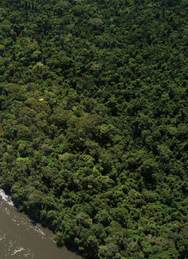
WWF-BRAZIL

General Secretary
Carlos Nomoto

Conservation Supervisor
Mario Barroso

Science Programme Coordinator
Mariana Napolitano e Ferreira

Amazon Programme Coordinator
Marco Lentini

WWF – Living Amazon Initiative

Leader
Sandra Charity

Coordinator of the Responsible Hydropower Development Strategy
Damian Fleming

Communication Coordinator
Denise Oliveira

PUBLICATION

Technical Coordination:                                  Maps:
Mariana Napolitano Ferreira and Paula Hanna Valdujo      Science Programme/WWF-Brazil

Technical Team:                                          Photography:
Mariana Soares, Bernardo Caldas Oliveira, Alessandra     Adriano Gambarini e Zig Koch
Manzur, Mario Barroso, Sidney Rodrigues
                                                         Cover photo:
Collaborators:                                           Salto São Simão, Rio Juruena, states of Mato Grosso
André Nahur, André Dias, Marco Lentini, Frederico        and Amazonas, Brazil. Credit: © Zig Koch/ WWF Living
Machado, Glauco Kimura, Aldem Bourscheit, Jean           Amazon Initiative
François Timmers, Jaime Gesisky
                                                         Graphic Design:
Interviewees:                                            Talita Ferreira
Enrico Bernard, Arnaldo Carneiro, Cláudio Maretti

Writing and Editing:
Maura Campanilli
                                                    Cataloguing

              C755c     A conservation vision for the Tapajos basin. WWF Brazil.
                       Brasilia, 2016.
                       54p.;il; color 29.7 cm.

                       ISBN 978-85-5574-029-9

                       1. Basin of the Tapajos – Mato Grosso, Para and Amazonas
                       2. Hydroelectric Energy - Brazil 3. Impacts 4. Systematic
                          Conservation Planning

                   1. WWF Brazil II. Title
                                                                  CDU 556 (81) (05) =690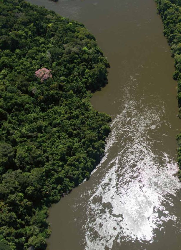
A CONSERVATION VISION FOR
    THE TAPAJOS BASIN

           1st edition

         Brasilia, Brazil
          April, 2016
LIST OF ACRONYMS
ANA                                             HIS-ARA                               PAC
National Water Board                            Hydrological Information System for   Growth Acceleration Plan
                                                Amazon River Assessment
BR                                                                                    Parna
Biological Reserve                              Ibama                                 National Park
                                                Brazilian Institute for the
CAC                                             Environment and Renewable Natural     PCH
Critical Area for Conservation                  Resources                             Small-scale Hydroelectric
                                                                                      Installations
DNPM                                            IBGE
National Mineral Survey Department              Brazilian Geography and Statistics    PDE
                                                Institute                             Decennial Energy Expansion Plan
ECI
Indigenous Component Study                      ICMBio                                PE
                                                Chico Mendes Institute for            State Park
EPE                                             Biodiversity Conservation
Energy Research Company                                                               PA
                                                INPE                                  Protected Area
ERI                                             National Space Research Institute
Ecological Risk Index                                                                 SCP
                                                IT                                    Systematic Conservation Planning
Flona                                           Indigenous Territory
National Forest                                                                       Terfron
                                                MMA                                   Northern Frontier Port Terminal
Funai                                           Ministry of the Environment
National Indian Foundation
                                                MME
HDI                                             Ministry of Mines and Energy
Human Development Index
                                                MW
HE                                              megawatts
Hydroelectric Plant
A conservation vision for the Tapajos basin - Page 4
©Zig Koch/WWF Living Amazon Initiative

CONTENTS
INTRODUCTION ����������������������������������������������������������������������������6

POWER SUPPLY ISSUES IN BRAZIL����������������������������������������������������� 10

A CONSERVATION VISION FOR THE TAPAJOS BASIN���������������������������������� 14

APPLYING SYSTEMATIC CONSERVATION PLANNING TO THE TAPAJOS������������� 36

RECOMMENDATIONS�������������������������������������������������������������������� 50

                                                       A conservation vision for the Tapajos basin - Page 5
INTRODUCTION
This study of the Tapajos Basin brings together a series of
analyses undertaken by WWF and its partner organizations
designed to define conservation scenarios and indicators on the
basis of hydrological, biological and land use information, in the
perspective of the aquatic and terrestrial environments.
© Zig Koch/WWF Living Amazon Initiative
INTRODUCTION
                                                                    The Tapajos River Basin occupies parts of the states of
                                                                    Mato Grosso, Para and Amazonas and a small part of
                                                                    the state of Rondonia. With an area that is almost 6% of
                                                                    Brazilian territory, the basin is of the greatest ecological,
                          scenic, social and cultural importance. Nevertheless it is liable to be severely affected by
                          infrastructure projects that include the construction of seven hydropower plants in the so-called
                          Tapajos Complex alone, among which are two mega-plants – Sao Luiz and Jatoba. Altogether 44
                          plants are on the list of the inventories made for the Teles Pires, Juruena and Tapajos sub-basins1.

                          Integrated planning for a basin like the Tapajos could serve as an example to be replicated
                          in other basins because it helps to define scenarios and indicators regarding the state of
                          conservation of big rivers. Only proper planning can trace the parameters for decision-making
                          regarding the best alternatives capable of conciliating a region’s economic development with the
                          conservation of its terrestrial and aquatic ecosystems.

                          WWF’s engagement in the Tapajos Basin is part of a broader initiative designed to face the
                          threats posed by the expansion of unsustainable hydroelectricity generation in the entire
                          Amazon region where there are already 154 dams installed, 21 currently being built and 277 at
                          the early planning stage. In addition to Brazil, WWF has active programs to foster sustainable
                          hydropower in the Bolivian and Peruvian Amazon regions.

                          This study of the Tapajos Basin brings together a series of analyses undertaken by WWF2 and
                          its partner organizations designed to define conservation scenarios and indicators on the basis
                          of hydrological, biological and land use information, in the perspective of the aquatic and
                          terrestrial environments.

                          Information gathering embraced official data, consultation of the scientific literature and
                          workshops held with experts on Amazonian biodiversity, all directed at identifying targets
                          (habitats and species) in the basin and defining their conservation goals as well as calculating the
                          Ecological Risk Indexes which represent the risk of the regional ecosystems losing their integrity.

                          WWF’s intention is to contribute towards developing the knowledge, methodologies and
                          tools needed to support the construction of a form of hydropower planning that is integrated
                          and sustainable and that includes identifying conservation opportunities and allowing for
                          participation of, and discussion with other sectors and organizations of society.

                          We firmly believe that this Conservation Vision for the Tapajos Basin is a consistent
                          demonstration of how it is possible to adopt a more integrated approach that presents
                          alternatives in the light of the cumulative impacts of multiple infrastructure works.

                          By sharing this experience we will be shouldering our responsibility to diffuse information
                          and approaches and we hope, in that way, to make it possible for a variety of social actors
                          to participate in the decision-making processes that determine the Amazon’s ecological and
                          social future.

                          1          Plano Decennal de Expansão de Energia 2020, pág. 80. http://www.epe.gov.br/
                          PDEE/20120302_1.pdf [Decennial Energy Expansion Plan 2020].
                          2          In 2011 the Ministry of the Environment and WWF-Brazil signed a term of cooperation for
                          the application of the Systematic Conservation Planning methodology to the Tapajos. The work enjoyed
                          the additional collaboration of the Energy Research Company (EPE) attached to the Ministry of Mines
                          and Energy (MME), the Chico Mendes Institute for Biodiversity Conservation (ICMBio), the National
                          Water Board (ANA) and the Brazilian Institute for the Environment and Renewable Natural Resources
                          (Ibama).

A conservation vision for the Tapajos basin - Page 8
© Zig Koch/WWF Living Amazon Initiative

Black-collared Swallow (Pygochelidon melanoleuca), Juruena River, Mato Grosso, Brazil.
POWER SUPPLY ISSUES
IN BRAZIL
A recently published study has revealed that the expected
oscillations in rainfall-drought regimes could lead to a
reduction of around 30% in hydroelectricity generation and
could also jeopardize the long term economic viability of the
Amazonian hydropower projects.
© Zig Koch/WWF Living Amazon Initiative
POWER SUPPLY
                                                                  The Amazon functions as if it were one huge ecological
                                                                  unit but the equilibrium of this system has its limits.
                                                                  The fragmentation resulting from deforestation and the

          ISSUES IN BRAZIL
                                                                  interference in the region’s aquatic ecosystems may well
                                                                  lead to a collapse that will have impacts on humidity,
                                                                  rainfall, arable areas, water supply and hydroelectric
                                                                  power throughout the South American continent. Apart
                                 from climate change, the consequences of such a collapse could affect the entire world, as
                                 a result of the increase in greenhouse gas emissions.

                                 WWF-Brazil recognizes that energy is a crucial issue for Brazil and that generating and
                                 distributing electricity are integral aspects of socioeconomic development strategies.
                                 Nevertheless, the organization argues in favour of an electricity generating matrix that is
                                 safe, efficient and clean and, consequently, it defends the gradual elimination of electricity
                                 generation based on fossil fuels and the restriction of their use to exceptional and
                                 emergency situations only.

                                 In the case of hydroelectricity, there is serious concern regarding the form of the plants
                                 and dams that have been, and continue to be planned and constructed, especially in the
                                 Amazon and in the headwaters of the Pantanal. WWF-Brazil proposes that the planning
                                 processes need to be improved by adopting an integrated vision that takes into account
                                 the multiplicity of vectors and alternatives that exists. It is of fundamental importance
                                 that there should be far greater degrees of transparency and social participation so that
           HISTORICALLY          the biome’s conservation priorities as a whole and the resilience of the Brazilian electricity

  HYDROPOWER PLANTS’             supply system in the light of climate change are duly taken into account. A recently
                                 published study has revealed that the expected oscillations in rainfall-drought regimes
        ENVIRONMENTAL            could lead to a reduction of around 30% in hydroelectricity generation3, and could also

     IMPACTS HAVE BEEN           jeopardize the long term economic viability of the Amazonian hydropower projects.

   ASSESSED PROJECT BY           Historically, hydropower plants’ environmental impacts have been assessed project by

PROJECT WITH LITTLE OR           project with little or no attention paid to indirect or cumulative impacts even though
                                 the hydropower potential inventories have been made in an integrated manner, on
   NO ATTENTION PAID TO          a basin-wide basis, for many years now. It is of fundamental importance that the set

INDIRECT OR CUMULATIVE           of dams now being planned should be assessed as a set, thereby making it feasible to
                                 anticipate, prevent and mitigate the greater impacts on biodiversity and on traditional
               IMPACTS           peoples and to achieve the maintenance of strategic stretches of rivers free from dams.

                                 3        Economia da Mudança do Clima no Brasil: custos e oportunidades (Climate
                                 Change Economics in Brazil: costs and opportunities), a 2009 study conducted by the Climate
                                 Economics of public and private research organisations coordinated by researchers Carolina
                                 Dubeux, Jacques Marcovitch and Sérgio Margulis.

A conservation vision for the Tapajos basin - Page 12
Furthermore, Brazil has wind, sunshine and biomass in abundance. Alternatives
exist that allow for the country to have a diversified energy matrix that is clean
and secure and that would be competitive from the economic and environmental
standpoint. Brazil is possibly the only country where that would be possible to
achieve within a reasonable timeframe and at a reasonable cost. To that end,
however, it needs to alter its focus on subsidizing and stimulating an unsustainable
matrix and focus instead on sustainable technology.
Energy security can be achieved by diversifying generating sources and localities
as a way of compensating for climate change impacts in such a widespread
territory. Measures must also be taken to reduce waste and increase efficiency in
electricity distribution and consumption. Access to electricity is a universal right
that needs to be provided in a secure and sustainable manner for the good of all.
Thus, in addition to investing in sustainable sources for large scale production,
investments are needed in distributed generation to reduce overloads on
the grid and prevent and dilute the impacts of generating accidents on that process.
Distributed generation means generating electricity near to the places
where it will be consumed, regardless of the power level or the source of energy
involved. Within that concept, the consumer may even generate the electricity
he or she consumes by using renewable sources (like solar panels for example)
and any excess can be supplied to the local distribution system.
A conservation vision for the Tapajos basin - Page 13A CONSERVATION VISION FOR THE TAPAJOS BASIN Integrated planning for a river basin like the Tapajos could serve as an example to be replicated in other basins because it helps to define scenarios and indicators regarding the state of conservation of big rivers.
© Adriano Gambarini/WWF Living Amazon Initiative
A CONSERVATION
WWF is arguing in favour of integrated planning for
the river basins of the Amazon region and proposing
a qualified national debate on the conservation
VISION FOR THE
of that vast territory. That means defining which
rivers must be preserved before the accumulation of
innumerable hydropower projects for the region, each
TAPAJOS BASIN
one treated in an isolated manner, generates a socio-
environmental impact that could potentially be of
disastrous proportions.
In that sense, integrated planning for a basin like
the Tapajos could serve as an example to be replicated in other basins because it
helps to define scenarios and indicators regarding the state of conservation of big
rivers. Only such planning can trace the parameters for decision-making as to the
best alternatives capable of conciliating a region’s economic development with the
conservation of its terrestrial and aquatic ecosystems.
To define conservation scenarios and indicators, WWF’-Brazil’s Science Programme
coordinated a series of analyses of the Tapajos Hydrographic Basin on the basis
of hydrological, biological and land use information and in the perspective of the
aquatic and terrestrial media.
That methodology, known as Systematic Conservation Planning (SCP) was used to
define the basin’s conservation priorities based on biodiversity targets and their
environments, such as vegetation types, diversity of bodies of water, and other
attributes that are important to conservation and that could be mapped throughout
the Tapajos basin.
The process of modelling an ecological vision also involves analyses of risks,
vulnerability and conservation opportunities. Terrestrial risks are represented by
the risk of deforestation while the vulnerability of aquatic systems is defined by
the Ecological Risk Index (ERI) calculated on the basis of the impacts generated by
anthropogenic activities. Conservation opportunities refer to Protected Areas and
Indigenous Territories (ITs).
© Zig Koch/WWF Living Amazon Initiative
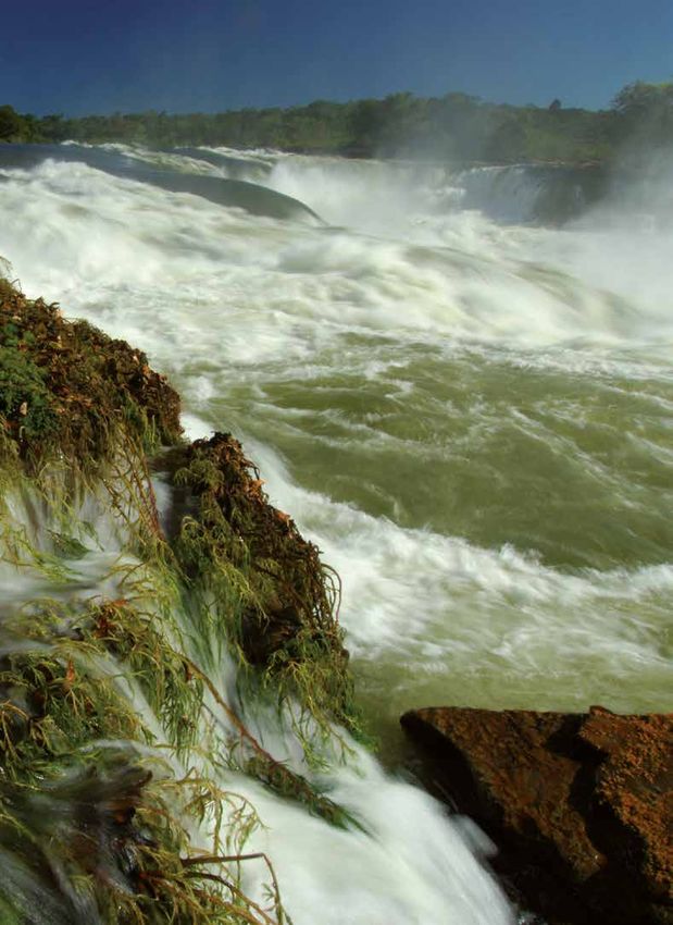
Salto Augusto Falls, Juruena River, Mato Grosso, Brazil
A conservation vision for the Tapajos basin - Page 16THE HIS-ARA APPROACH
Currently there are various tools that can facilitate integrated analyses of the
environment and help to define land use restrictions and guide the utilization
of natural resources. Such tools lead to the identification of priority areas
for biodiversity conservation, ecological-economic zoning, environmental
vulnerability and so on. Studies using such tools have already been undertaken
by governments and other institutions, but in many cases the administrators
or the communities in general have not been capable of making full use of their
potential.
For that reason, in the context of Systematic Conservation Planning, WWF has
developed an approach that makes it possible to obtain an integrated vision of
river basins that takes into account risks and potential social and environmental
impacts.
The approach is based on an information system and analyses that identify
priority areas for conservation and indicate those rivers that need to have
their flows kept free so that the natural ebbs and flows of the system can be
maintained. That is made possible by analytical tools applied to a Hydrological
Information System for Amazon River Assessment (HIS-ARA) which integrates
ecological and hydrological information to create a conservation vision of the
terrestrial and aquatic ecosystems on a regional scale
The HIS-ARA approach takes into account both local and cumulative impacts
in relation to other potential threats and it incorporates data on ecological
systems, aquatic habitat types and existing protected areas, as well as various
kinds of anthropogenic threats and their potential environmental impacts.
WWF-Brazil has previously used Systematic Conservation Planning for the
Serra do Mar, the Cerrado-Pantanal region, the states of Goias and Bahia and
for the Xingu River Basin. For each initiative, new analyses and databases
were incorporated to take into account regional peculiarities and the particular
objectives of the respective study. The innovation, in the case of the Tapajos
Basin, is that the organisation has made use of hydrological information in the
analyses in order to consider both aquatic and terrestrial ecosystems in the search
for conservation solutions.
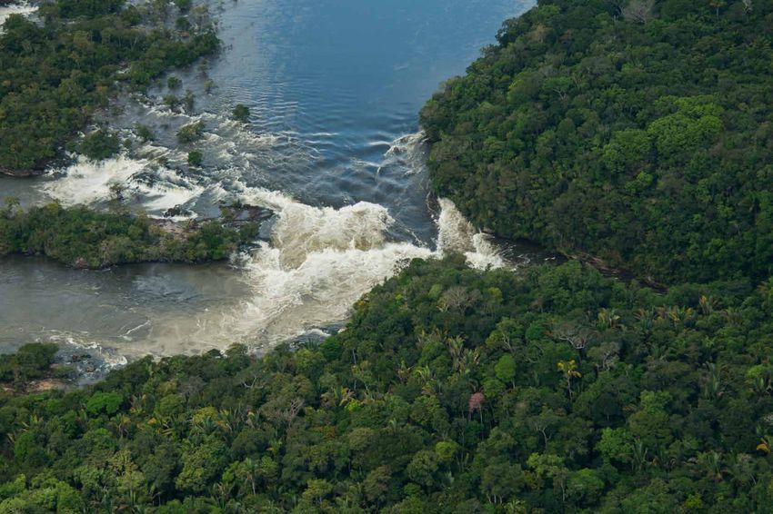
A conservation vision for the Tapajos basin - Page 17THE TAPAJOS RIVER BASIN The Tapajos is a river with transparent waters, a rarity
in the Amazon, and that unique feature makes it one of
the most sought after tourist destinations in the region.
Because they rise in central Brazil and flow out into the main channel of the Amazon
River, the Tapajos and its tributaries flow through regions with different types of
vegetation and correspondingly varied landscapes with a high degree of biodiversity
and a great number of endemic species.
Geographic location of the basin
The Tapajos River Basin embraces an area of 492,000 km2 in the states of Mato
Grosso, Para, Amazonas and small part of Rondonia. It is situated on the borders of
the deforestation front of the Brazilian Amazon but is still very well preserved and
represents a kind of great green wall, tending to discourage the deforestation that is
driven by commodities production in the transition zone with the region of the Cerrado
savannahs. That front is now advancing through the proliferation of small settlements
and landholdings from south to north and from east to west along the routes of the
Cuiaba-Santarem Federal Highway (BR-163 and the Trans-Amazon Highway (BR-
230) respectively. Furthermore, the Tapajos is the only big right bank tributary of the
main Amazon river that has not been blocked by very large scale hydropower dams.
Currently, however, the Tapajos River Basin is being targeted as the great frontier for
hydropower supply and economic development of the Amazon.
The Tapajos’s main tributaries are the Jamanxim, Crepori, Teles Pires and Juruena
Rivers. The headwaters of the Juruena and Teles Pires are in areas of Cerrado savannah
already considerably modified and, as they flow northwards, the savannah is gradually
replaced by Amazon forest vegetation in a transition zone also highly affected by human
activities. Even farther north, towards the main course of the Amazon, the vegetation is
marked by the presence of open ombrophilous forest and dense ombrophilous forest with
interspersed areas of seasonal forests, grasslands and campinarana formations, as well
as alluvial forests close to the courses of the rivers themselves. © Adriano Gambarini/WWF Living Amazon Initiative
Tapajos River, Para, Brazil.
A conservation vision for the Tapajos basin - Page 18Figure 1: Main rivers of the Tapajos Basin and cities with over 20 thousand inhabitants.
A conservation vision for the Tapajos basin - Page 19Vegetation
Figure 2: Vegetation in the Tapajos River Basin. Source: IBGE.
A conservation vision for the Tapajos basin - Page 20According to a survey conducted by the Brazilian Ministry of the Environment based on
satellite images for 2008, 77.7% (382,266 km2) of the basin still has its original vegetation.
A WWF-Brazil survey based on data from the National Space Research Institute -
Inpe, complemented by analyses conducted by the WWF team shows that the most
frequent type of land use in the basin is for pastures, occupying 78,128.03 km2 followed
by agriculture occupying 47,309.31 km2 and that there are a further 1,482.04 km2 of
deforested land without any identifiable form of use.
Protected areas
Almost 40% of the basin is under some form of conservation protection either as protected
areas or as indigenous territories: there are nine strict protection areas (8.1% of the basin
area), 20 sustainable use protected areas, occupying a total of 13.6% of the basin and 30
indigenous reserves occupying 17.9% of the basin. The oldest protected areas in the Tapajos
Basin are the Amazon National Park and the Tapajos National Forest, both created in 1974.
The protected areas, however, have been created in the light of terrestrial attributes and the
region’s freshwater ecosystems are still highly vulnerable to degradation and fragmentation.
Table 1: Protected Areas in the Tapajos Basin
Name Area lying within the basin (km2)
Strict Protection Areas
Ique Ecological Station 1,860
Cristalino State Park 590
Igarapes do Juruena State Park 1,028
Sucunduri State Park 4,723
Amazon National Park 3,379
Jamanxim National Park 8,587
Juruena National Park 13,741
Rio Novo National Park 5,382
Nascentes Serra do Cachimbo Biological Reserve 395
Sustainable Use Protected Areas
Cabeceiras do Rio Cuiaba Environmental Protection Area 1,493
Salto Magessi Environmental Protection Area 78
Tapajos Environmental Protection Area 20,403
Apui State Forest 896
Sucunduri State Forest 621
Altamira National Forest 1,955
Itaituba National Forest I 2,129
Itaituba National Forest II 3,988
Tapajos National Forest 3,122
Amana National Forest 1,592
Crepori National Forest 7,404
Jamanxim National Forest 13,017
Trairao National Forest 2,561
Bararati Sustainable Development Reserve 1,108
Riozinho do Anfrisio Extractive Reserve 147
Tapajos Arapiuns Extractive Reserve 6,744
Cristalino Privately Owned Nature Reserve 25
Cristalino Privately Owned Nature Reserve 16
Cristalino Privately Owned Nature Reserve 5
Cristalino Privately Owned Nature Reserve 18
A conservation vision for the Tapajos basin - Page 21Biodiversity
There is a high degree of biodiversity in the basin but it is still very little known.
However, to give an idea of what it might be, fifteen new bird species were described
for the Amazon region in 2013 alone and one of them, Tolmomyias suncunduri4, comes
from the Tapajos Basin. The basin’s protected areas and natural landscapes are home to
various species under threat of extinction or with very restricted distributions. Indeed,
the Tapajos River Basin is one of eight areas of endemism in the Amazon, especially in
regard to fish and bird species5. Furthermore, the Tapajos River itself is an important
bio-geographic barrier for some bird species, like the Hoffmanns’s woodcreeper
(Dendrocolaptes hoffmannsi), endemic to the Tapajos-Madeira interfluve and the
Tapajos hermit (Phaethornis aethopyga) endemic to the Tapajos-Xingu interfluve.
AREAS OF ENDEMISM
Endemic plant or animal species are those that only exist in a certain
geographic region. Areas of endemism are territories that are home to various
species that can only be found in them.
According to the article “O destino das areas de endemismo na Amazônia”6,
(The destiny of areas of endemism in the Amazon), recent compilations have
shown that the Amazon, the world’s biggest and most diverse tropical forest, is
home to at least 40,000 species of plants, 427 mammal species, 1,294 species of
birds, 378 reptile species, 427 species of amphibians and around 3,000 species
of fish. Considering the variety of heterogeneous plant and animal communities,
it is a veritable archipelago made up of eight distinct areas of endemism
separated by the region’s main rivers. The areas are Tapajos, Xingu and Belem
(restricted to Brazil); Rondonia (most of the area is in Brazil); and Napo, Imeri,
Guyana and Inambari (areas partly lying in other countries).
According to those authors “the areas of endemism in the Amazon have lost
from 2 to 13% of their forests with the exception of Xingu, which has lost
around 27% and Belem, which now has only one third of its area still covered
by forest. Napo, Imeri and Guyana have more than 40% of their territories in
protected areas; Inambari, Rondônia, Tapajos and Xingu, from 20% to 40%;
and Belem, less than 20%. However, protected areas in the Strict Protection
category are only a small portion of those protected areas and account for
0.28% to 11.7% of the extension of areas of endemism in Brazil”.
4 Whitney, Schunck, Rêgo & Silveira, 2013
5 http://www.icmbio.gov.br/portal/images/stories/o-que-fazemos/proj_apoiados/
resumo_projeto_313.pdf.
6 Silva, José Maria C. da; Rylands, Anthony B.; Fonseca, Gustavo A. B. da. 2005.
Megadiversidade, volume 1, number 1.
A conservation vision for the Tapajos basin - Page 22THE TAPAJOS REGION There are 74 municipalities in the Tapajos river basin –
two in the state of Amazonas, 60 in Mato Grosso, 11 in
Para and one in Rondonia. 47 of them have their main city
within the basin’s limits (37 in Mato Grosso and seven in Para). Santarem and Itaituba are
the two main municipalities in the basin.
Located at the mouth of the Tapajos where it joins the Amazon, Santarem is the region’s
biggest municipality. It has around 300 thousand inhabitants and also has the largest
GDP in the Tapajos Basin. In the last ten years it has become an important grain
producing area, especially of soya, due to the expansion of the agricultural frontier. People
SANTAREM IS THE in Para state call the city “the Pearl of Tapajos” because it is where one of Brazil’s most
REGION’S BIGGEST CITY beautiful scenic landscapes is located, the Alter do Chao district, with its paradisiacal
white sand beaches and the emerald green waters of the Tapajos itself.
WITH AROUND 300
THOUSAND INHABITANTS Itaituba is a municipality with 100 thousand inhabitants which, in the 1980s and 90s,
had its economy centred on gold mining. When production from the Serra Pelada began
to decline at the beginning of the 1980s, all eyes turned to the Tapajos region which was
believed to be one of the world’s largest auriferous provinces. For that reason Itaituba
came to be known as “Cidade Pepita” or Nugget City. Nowadays the mining activity is
limited to clandestine artisanal mining that [unfortunately] still uses mercury and cyanide
to extract the gold. The city itself is strategically located on the banks of the Tapajos with
fast, easy access to Federal Highway BR-163 and only 350 km south of Belem.
The region has a low human development index. Itaituba’s score is 0.640 and Santarem’s
is 0.691), which puts them among the lowest of Brazils 5,565 municipalities; 3,291st and
2,161st places in the ranking, respectively. The presence and performance of the State in
more distant localities is also very feeble and there are serious gaps in the provision of
health and education services, among others.
LARGE-SCALE Hydroelectric plants
According to the executive summary of the integrated
VENTURES AND IMPACTS environmental assessment of the Tapajos River Basin (carried
out by the Tapajos Study Group and Ecology Brasil in 2014)7,
IN THE BASIN
within a 20 year timeframe, three hydroelectric plants are
planned to be installed in the Tapajos river itself (Sao Luiz,
Jatoba and Chacorao) and another four in the basin of one
of its main tributaries, the Jamanxim River (Cachoeira do
Cai, Jamanxim, Cachoeira dos Patos and Jardim do Ouro),
forming what is referred to as the Tapajos Complex.
The scenario, however, could possibly become even more intricate because the Energy
Research Company (EPE) has identified 44 sites for possible dam construction in the Tapajos
Basin located in the Juruena, Teles Pires and Jamanxim rivers and their tributaries. 14 of
those projects appear in the Growth Acceleration Plan (PAC 2), namely, Colider and Teles
Pires (at the commercial operation stage), Alto Apiacas (2016), Sinop and Sao Manoel (2018),
Sao Luiz do Tapajos (2021), Jatoba (2023), Castanheira (2024), Salto Augusto Baixo and
Sao Simao Alto (removed from the PDE for 2022-2023), in addition to those for Cachoeira
dos Patos, Chacorao, Jamanxim, Foz do Formiga Baixo and Tucumao which have no date
established as yet for going operational because they are not listed in the PDE for 2024.
7 http://www.grupodeestudostapajos.com.br/site/wp-content/uploads/2014/04/Sumario_AAI.pdf.
A conservation vision for the Tapajos basin - Page 23Figure 3: Hydroelectric plants and reservoirs identified, planned or under construction in the Tapajos River Basin. Location of HE plants listed in the PDE 2023 in red (Sao Luis do Tapajos and Jatoba, in the Tapajos River; Castanheira in the Arinos River; Sao Manuel, Teles Pires, Colider and Sinop in the Teles Pires River); plants listed in the PDE 2022 excluded from the PDE 2023 in orange (Sao Simao and Salto Augusto, in the Juruena River), and all the other plants listed in inventories of the Tapajos, Juruena and Teles Pires Basins in black. A conservation vision for the Tapajos basin - Page 24
Table 2: Inventoried HEs in the Tapajos Basin (Source: EPE)

Number on map    Name of HE Plant       River        Power (MW)                   Reservoir Area (ha)

      1         São Luiz do Tapajós     Tapajós        8,040                            73,242

      2         Cachoeira do Caí       Jamanxim        802                              51,972

      3         Jatobá                  Tapajós        2,338                            64,875

      4         Jamanxim               Jamanxim        881                              8,360

      5         Cachoeira dos Patos    Jamanxim        528                              12,415

      6         Jardim do Ouro         Jamanxim        227                              44,550

      7         Chacorão                Tapajós        3,336                            62,527

      8         São Simão Alto          Juruena        3,509                            28,100

      9         Salto Augusto Baixo     Juruena        1,461                            12,525

      10        Escondido               Juruena        1,248                           110,341

      11        São Manoel             Teles Pires     700                              5,708

      12        Foz do Apiacás          Apiacás        275                              7,904

      13        Teles Pires            Teles Pires     1,819                            14,585

      14        Tucumã                  Juruena        510                              21,997

      15        Travessão dos Índios     Arinos        252                              25,898

      16        Apiaká-Kayabi           do Peixe       206                              3,296

      17        Colider                Teles Pires     300                              12,334

      18        Erikpatsa               Juruena        415                              8,972

      19        Tapires                do Sangue        75                              4,441

      20        Castanheira              Arinos        192                              11,905

      21        Sinop                  Teles Pires     400                              32,963

      22        Fontanilhas             Juruena        225                              56,303

      23        Kabiara                do Sangue       241                              25,424

      24        Enawenê-Nawê            Juruena        150                              8,021

      25        Roncador               do Sangue       134                              23,838

      26        Nambikwara               Juína          73                               866

      27        Foz do Buriti          Papagaio         68                              1,887

      28        Foz do Formiga Baixo     Juína         107                              2,575

      29        Parecis                do Sangue        74                              20,050

      30        Buriti                   Buriti         60                              1,479

      31        Jacaré                   Juína          53                              10,926

      32        Foz do Sacre           Papagaio        117                              2,103

      33        Matrinxã                 Sacre          34                                85

      34        Juruena                 Juruena         46                               186

                                                             A conservation vision for the Tapajos basin - Page 25
Number on map Name of HE Plant River Power (MW) Reservoir Area (ha)
35 Tirecatinga Buriti 37 3,187
36 Salto Utiariti Papagaio 76 191
37 Água Quente Buriti 42 3,315
38 Paiaguá do Sangue 35 2,249
39 Cachoeirão Juruena 64 284
40 Pocilga Juína 34 130
41 Jesuíta Juruena 22 859
42 Barra do Claro Arinos 61 6,776
43 Magessi Teles Pires 53 6,393
44 Salto Apiacás Apiacás 45 75
© Zig Koch/WWF Living Amazon Initiative
Construction of a hydroelectric plant on the Teles Pires River, Mato Grosso and Para, Brazil.
A conservation vision for the Tapajos basin - Page 26Potential and impacts
Considering just the seven plants foreseen in the Executive Summary of the Integrated
Environmental Assessment of the Tapajos Basin, - Sao Luiz, Jatoba and Chacorao
(in the Tapajos) and Cachoeira do Cai, Jamanxim, Cachoeira dos Patos and Jardim
do Ouro (in the Jamanxim), their hydroelectric potential is 14 thousand megawatts,
equivalent to the bi-national Itaipu plant on the Brazil-Paraguay border.
According to Eletronorte data for the year 2008, as cited in a report of the Agencia
Publica8, at least 2.3 thousand people belonging to 32 riverside communities will
be directly affected if the seven projects are effectively implemented. Furthermore,
16 indigenous villages of the Munduruku ethnic group will also have parts of their
territories inundated by the reservoir waters that the dams will form. Social movements
and entities advising those communities consider that the number is underestimated.
Figure 4: Projection of the reservoirs of three of the seven HEs inventoried for the Tapajos Basin. Source: EPE and MME
8 Amazônia Publica. São Paulo, SP. Publica, 2013 (http://www.apublica.org/amazoniapublica/).
A conservation vision for the Tapajos basin - Page 27The Sao Luiz do Tapajos hydroelectric project stands out in government planning as the
largest plant of the complex, with a generating capacity of 8,040 megawatts. According
to the project, it will be Brazil’s fourth largest hydroelectric installation only surpassed
by Itaipu, Belo Monte (in course of construction) and Tucurui, with the last two being in
the Amazon region as well. The dam will be 3,483 metres long and 39 metres high and it
is expected to inundate almost 732 km2 (half the size of the municipality of Sao Paulo).
Pimental, founded 120 years ago and home to 760 inhabitants9, is the largest of the
riverside communities that will be submerged by the reservoir waters.
Again according to the Agencia Publica report, the environmental impacts the plants
will cause may be even more serious than those generated by the Belo Monte dam
whose reservoir will occupy an area of 510 km2. In the Xingu, the stretch of river that
will be dammed up will be 200 km long. In the Tapajos, it will be two and a half times
greater. The Jamanxim with its three plants installed will become just a series of lakes.
Anther source of concern is the relation between the muddy waters of the Amazon and
the clear green waters of the Tapajos which meet, but do not mix, in front of Santarem.
There is concern that the Amazon River waters may invade the waters of the Tapajos
due to the reduced flow of the latter river and that would mean the end of the tourist
attraction of Alter do Chao.
© Zig Koch/WWF Living Amazon Initiative
Aerial view of forest cover, Mato Grosso, Brazil.
9 Report “O pesado custo ambiental de Tapajós” [The heavy environmental cost of Tapajos],
de André Borges, Valor, 25-07-2012.
A conservation vision for the Tapajos basin - Page 28Reduction of protected areas
To enable the construction of the hydroelectric plants, above all Sao Luiz and Jatoba,
protected areas in the basin were reduced by 750 km2 by Provisional Act no 558/2012,
converted into Law no 12.678, on June 25, 2012. That measure reduced the territories
of the Amazon National Park, and the Itaituba (I and II) and Crepori National Forests
and that of the Tapajos Area of Environmental Protection. All the parts of protected
areas liberated for expropriation are courses and floodplains of rivers that may come to
be permanently immersed if the dams are effectively built.
Figure 5: Area liberated for expropriation by Act no 12.678, dated June 25, 2012 in the Amazon National Park, the National Forests
Itaituba I and II and Crepori, and the Tapajos Environmental Protection Area.
A conservation vision for the Tapajos basin - Page 29In 2012, staff of the ICMBio’s Itaituba office, responsible for 12 protected areas in the
Tapajos Basin, launched a public manifesto10, in which they declared that “information
compiled up to the moment indicates the existence of an extremely high level of biodiversity
with a considerable degree of endemism and great representativeness of species under threat
of extinction in the areas affected by that act”.
Making adjustments to protected area perimeters, especially those areas that were
established before the existence of a specialized database or without due consultation of
society, can be an important way to remediate historical injustices, solve local conflicts and
ensure the conservation of areas with high biodiversity value. Nevertheless, transparent
technical analysis and public consultation processes need to be established to assess the real
importance of any intended reduction, reclassification or protection-cancelling affecting
protected areas. In extreme cases, where alterations are absolutely inevitable, a process
should be established to compensate for the areas being lost by expanding existing protected
areas or creating new ones in such a way as to guarantee the representativeness of the
system and the protection of areas with a biodiversity equivalent to those that have been
affected. In the light of Act no 12.678, two protected areas in the Madeira River Basin have
already been expanded by the addition of a total area of 3,473 km2 to compensate for the loss
of 1,404 km2 of protected areas in the Madeira and Tapajos Basins. However, in spite of the
increase in the extension of protected areas, there was no compensation for the floodplain
ecosystems that were lost.
THE #SOSJURUENA CAMPAIGN
Another protected area at risk of having its area reduced to accommodate the
construction of hydropower plants is the Juruena National Park located on the
border between the states of Mato Grosso and Amazonas. It is Brazil’s fourth largest
National Park with an area of almost 2 million hectares, representing 2.5% of the
total area of federal protected areas in the Legal Amazon and 5.3% of the total
area of National Parks in the region. Reducing the area under protection would be
the first step towards the construction of the Sao Simao and Salto Augusto Baixo
hydropower plants. To warn society about that threat, WWF-Brazil launched
the SOS Juruena campaign (wwf.org.br/sosjuruena; #sosjuruena) calling for the
support of society to pressure the Ministry of Mines and Energy not to permit the
construction of those projects and to maintain the Park’s integrity.
If the two plants are eventually constructed, their reservoirs will inundate an area
of 40 thousand hectares in the Juruena National Park, the Igarapes de Juruena and
Sucunduri State Parks and in the indigenous territories Escondido, dos Apiakas
do Pontal and isolated native peoples. In addition to local human populations, the
dams will affect the survival of animal and plant species already under threat of
extinction and of many species that are endemic to the region, putting at risk the
Juruena River rapids and nullifying ecological processes that are vital for species
like migratory fish, for example.
That appeal to society brought in good results: the two plants were removed from
the PDE 2023 list which means they will not become operational at least in the next
ten years. However, to totally eliminate the threat they represent, a commitment
needs to be obtained from the Ministry of Mines and Energy that it will remove
them definitively from its planning.
10 http://www.oeco.org.br/noticias/26290-icmbio-servidores-divulgam-carta-aberta-contra-
recorte-de-ucs/
A conservation vision for the Tapajos basin - Page 30Impacts of the Tapajos Complex
If the Sao Luiz do Tapajos dam (the first power plant of the Tapajos Complex) is eventually
constructed then, according to the Agencia Publica, 112 kilometres of the road that cuts
across the Amazon National Park, the Trans-Amazon highway, will go under water.
Furthermore the physical barrier constituted by the dams would make it impossible for
various fish species to make the annual run to their spawning areas upstream. According to
ICMBio technical staff interviewed for the Agencia Publica report, 90% of the 400 species
registered for the park may fail to survive. A study conducted by Maringa State University
researchers in Parana shows that fish ladders are actually a death trap for tropical fish
species. Their work was published in the news section of Nature magazine in 2008 and it
shows that after fish have gone up the ladder, the adults and the larvae are retained in the
waters above the dam and never get back downstream again to complete the reproductive
cycle11. The dams will also alter the seasonal cycles of high and low water, not only in the
Tapajos and Jamanxim rivers themselves but in the entire hydrographic network associated
to them. In addition, there are 390 registered bird species in the region as well as many
other animal species under threat of extinction such as the jaguar, the giant anteater and
the ocelot.
Together the hydropower plants of the Tapajos Complex would inundate an area of
3,084.85 km2 and generate severe impacts on indigenous communities. The Sao Luiz
plant would affect the communities of Munduruku and Apiaka de Pimentel, Akaybae and
Remedio. The Chacorao plant would inundate 121.1 km2 of the Munduruku Indigenous
THE DAMS WILL ALSO Territory and would also directly affect the indigenous territories of Sai Cinza, Sao
ALTER THE SEASONAL Martinho and Boca do Igarape Pacu, just 2.5 kilometres from the dam.
CYCLES OF HIGH AND LOW A new version of the Indigenous Component Study (Estudo do Componente Indigena -
WATER, NOT ONLY IN THE ECI) included in the Sao Luiz do Tapajos hydropower project identifies 14 negative impacts
on the region’s indigenous inhabitants. Furthermore, the study, coordinated by Eletrobras,
TAPAJOS AND JAMANXIM shows that indigenous communities will be directly affected by the flooding caused by the
RIVERS THEMSELVES dam which means that the project is not viable from the environmental standpoint.12
BUT IN THE ENTIRE Hydropower projects also generate significant indirect impacts on people and the forests
HYDROGRAPHIC NETWORK but they are more difficult to measure than direct impacts stemming from the dam
construction and the reservoirs. The main indirect impacts caused by hydroelectric projects
ASSOCIATED TO THEM are the deforestation associated to opening up access roads, the migration of people going
to work on the project and the installation of the infrastructure needed to accommodate all
the workers.
According to the article Cenários do Desmatamento na Área de Influência do Complexo
Tapajós (Deforestation Scenarios in the Area of Influence of the Tapajos Complex) 13,
produced by the INPA and WWF, the two main drivers of deforestation in the Tapajos region
are the northward expansion of soy crop farming in the state of Mato Grosso and the paving
of the Federal Highway BR-163 which links Cuiaba in Mato Grosso to Santarem in Para and
crosses the Trans-Amazon highway BR-230, as yet unpaved. The impacts of those factors
could be aggravated by land speculation, increased emigration and increased costs for goods
and services resulting from expectations of profiting from the future hydroelectric
power in the region, especially in the light of the precarious land use planning and the lack of
11 http://www.nature.com/news/2008/080117/full/news.2008.445.html
12 O Globo, 29/09/2014, “Técnicos avaliam usina no rio Tapajós como inviável por
impactos para índios”[Technical staff consider power plant on the Tapajos to be unfeasible
because of impacts on indians]evaluate , http://oglobo.globo.com/economia/tecnicos-avaliam-
usina-no-rio-tapajos-como-inviavel-por-impactos-para-indios-14049436#ixzz3ES20JJ2G
13 “Deforestation Scenarios in the Area of Influence of the Tapajós Hydropower Complex”,
published on page 50, in “State of the Amazon: Freshwater Connectivity and Ecosystem Health”,
available on http://d2ouvy59p0dg6k.cloudfront.net/downloads/wwf_livingamazon_state_of_the_
amazon_freshwaterconnectivity__links_web_eng.pdf
A conservation vision for the Tapajos basin - Page 31any controls that might mitigate the main impacts in this region. In 2013, 19% of the Tapajos
Complex’s area of influence had already had its forests cleared and 76% of that deforestation
was in the state of Mato Grosso.
Another consequence of implanting the hydropower plants will be the increase in
population, thereby causing an impact on urban centres. According to the Agencia Publica
report, Itaituba with its current population of 100 thousand would be liable to receive
an additional 43 thousand inhabitants with the advent of the Sao Luiz do Tapajos plant
alone, as foreseen in the Eletronorte inventory. If all the plants planned for the Tapajos
are included, then there would be an estimated increase of 130 thousand people. While the
possibility exists that the Sao Luiz do Tapajos plant could be constructed in the form of a
platform like those used by the Petrobras Company to extract oil from the sea bed offshore
and also already used to construct a gas pipeline in the Amazon, experts doubt whether that
would reduce the impacts on the cities. Apart from the large numbers of employees involved
(around 13 thousand at the height of the construction operations), which would make it
difficult to transport them all by helicopter, they would need a place to stay on land anyway.
Furthermore, hydropower plants are not alone in their potential for generating impacts on the
Tapajos Basin. Taking into account other large scale infrastructure works to be carried out in
Itaituba in the near future, such as the construction of river ports to ship out grain coming in
mainly from Mato Grosso, the population is expected to double over the next five years.
Other projects for the region
Small scale hydroelectric installations
There are various projects for small scale hydroelectric plants (PCHS) in the Tapajos
Basin and they too can have a cumulative impact on the basin. The Electricity Sector Geo-
referenced Information System (Sigel) of the National Electricity Regulatory Board (Aneel)
reveals that currently there are 13 PCHS in operation in the Juruena, Formiga, Cravari,
Sacre and Sangue rivers, all in the Juruena Basin, and in addition, there are at least
another 40 PHCS either planned or already inventoried for that same basin14.
Highways
The Tapajos region is a strategic corridor that enables the reduction of exportation costs
by shipping the soy bean production of Mato Grosso state, Brazil’s biggest producer, via
the Amazon river. To further that end, Brazil intends to conclude the paving of the 1,739
kilometre-long BR-163 federal highway linking the city of Cuiaba to Santarem, at the
mouth of the Tapajos15.
Railways
There is also a new agenda for railways in the region and feasibility studies have already
been authorized for a rail link that would connect Sinop in Mato Grosso to the river port of
Miritituba (Para state), from where cargoes would be shipped in barges to ports further north.
It is estimated that up to 40% of all grain and meal production from the state could eventually
embark via that railway line which has been nicknamed the “Ferrograo” or grain line”16.
14 Revisão dos impactos ambientais gerados na fase de instalação das hidrelétricas: uma
análise da sub-bacia do Alto Juruena- MT, pág. 74. [Review of environmental impacts generated by
the installation stage of hydroelectric plants: an analysis of the Upper Juruena sub-basin]. {http://
periodicoscientificos.ufmt.br/ojs/index.php/biodiversidade/article/viewFile/707/605.
15 http://www.apublica.org/amazoniapublica/tapajos/rio-de-ouro-e-soja/
16 http://www.em.com.br/app/noticia/economia/2014/06/10/internas_economia,538079/
governo-autoriza-estudos-para-novas-ferrovias.shtml
A conservation vision for the Tapajos basin - Page 32Navigation
There is already one port in operation in the region (Santarem) and a port complex
between Miritituba and Barcarena. Another port is being constructed in Miritituba and the
federal government is studying the feasibility of implanting two locks to connect the Teles
Pires and Tapajos rivers as set out in detail below:
The Cargill Company has installed a port at the mouth of the Tapajos in Santarem for
the exportation of grain produced in Mato Grosso; the grain is transported in trucks
to Rondonia where it is loaded onto barges that go down the Madeira River to the
Amazon River and on to the port of Santarem where it is loaded onto ships with a 60
thousand ton cargo capacity. Although 95% of the cargo handled by that port comes
from Mato Grosso, there has been an increase in the number of crop farms, not only in
the municipality of Santarem but in neighbouring Belterra.
Approximately 100 km of the Tapajos between Itaituba and Santarem is navigable and
there the port of Miritituba is being built by the Hidrovias do Brasil S.A Company. It is
expected to go operational some time in 2016. It is a strategic location not only because
of the river connection but also because of the road connection with access to BR-163
and the Trans-Amazon highways.
In April 2014, the Bunge Company inaugurated the Miritituba-Barcarena port complex
in the municipality of Itaituba; an investment of 700 million reals. The complex
consists of two terminals and a shipping company. At one point there is the Estaçao
de Transbordo de Miritituba (Miritituba Transhipment Station) and at the other
there is the Terminal Portuario Fronteira do Norte-Terfron (Northern Frontier Port
Terminal) in the port of Vila do Conde, in Barcarena. The shipping company was
created in a partnership arrangement with the Maggi group. The company has a fleet of
50 barges and two tugs to push them17.
The federal government has begun technical studies to take advantage of the
construction of hydroelectric plants and implant two locks to make the connection
of the Teles Pires and Tapajos Rivers feasible, thereby facilitating direct shipment in
river vessels from the north of Mato Grosso to the Amazon via the Tapajos river and
from there directly to the Atlantic. This latter possibility, however, was not originally
foreseen in the projects for dams that are currently under construction.
Another impact associated to waterways is the presence of speedboats (high speed
launches that function as river taxis) between Santarem and Itaituba. There is no overall
navigation plan for the Tapajos and regulations that might help to avoid the impacts of
the traffic of such launches on local communities and biodiversity are lacking.
17 O Estado de S. Paulo: “Com complexo portuária de R$ 700 mi, Bunge abre nova rota
de exportação” [With its R$700 million port complex, Bunge opens up a new exportation route ],
25/04/2014. http://economia.estadao.com.br/noticias/geral,com-complexo-portuario-de-r-700-mi-
bunge-abre-nova-rota-de-exportacao-imp-,1158345.
A conservation vision for the Tapajos basin - Page 33Mining
Gold is the main mineral being mined in the Tapajos Basin. There are no big mining
companies operating in the region, however, because the gold in this basin is scattered
and there are no single large deposits. Furthermore there is a lack of the roads and
electricity that might otherwise make larger operations feasible. That situation has
favoured smaller-scale artisanal/prospector mining which predominates in the region.
The Para State government has set up a working group to study migration measures
and regulate the small-scale mining activity which is the leading source of employment
and income in Itaituba where the Sao Luiz do Tapajos dam and power plant are planned
to be built. 85% of the state’s gold mining exploration licences are concentrated in the
municipality of Itaituba. There are 466 regularized concessions for the activity. Another
9.3 thousand requests for mining permissions are still awaiting analysis in the National
Mineral Research Department (DNPM) – many of them with little chance of success as
they are superimposed on protected areas18.
Nevertheless, it has been calculated that there more than two thousand artisanal
mining sites along the course of the Tapajos, almost all of them irregular and many
of them operated from pontoons, working material brought up directly from the bed
of the river. With the reduction of the protected areas that took place in 2012, the
number of such pontoons went up from 5 to 35 in the 400 km of river between the
municipalities of Itaituna and Jacareacanga, according to the Agencia Publica.
The expected implantation of new infrastructure such as roads and hydropower
plants has also begun to attract the mining companies. Currently only one medium-
sized Canadian mining company, Eldorado Gold, has any concrete investments in the
Tapajos (the Tocantinzinho Project in Itaituba, scheduled to go operational in 2016).
However, the giant South African Anglo Gold Ashanti Company, one of the biggest gold
mining companies in the world, has also filed requests for exploration permissions for
areas in the west of Para state and is currently undertaking a survey to determine the
potential of a copper ore deposit in the Jamanxim National Forest.
18 A transição entre o ouro e a hidrelétrica [The transition from gold to hydroeectric
plants], Brasil Econômico, 6/8/2014.http://brasileconomico.epaper.grupodia.com.br/contents_
brasileconomico/paper140728344993.pdf; pág. 10.
A conservation vision for the Tapajos basin - Page 34© Zig Koch/WWF Living Amazon Initiative Inferno Rapids, Juruena River, Mato Grosso and Amazonas states, Brazil
APPLYING SYSTEMATIC
CONSERVATION PLANNING TO
THE TAPAJOS
Systematic Conservation Planning is highly valuable in the elaboration of
conservation scenarios that envisage the protection of biodiversity and the
ecosystems and persistence of species, ecological processes and landscapes and
that also envisage conservation opportunities and ways to minimize costs.
ACKNOWLEDGEMENTS
The development of knowledge, approaches, methodologies and tools to support planning and the making of
decisions to be applied in the Amazon has only been possible because of the work of various WWF experts in
the course of the last few years and their work, in turn, was able to count on the contributions of researchers
and on interactions with Brazilian government authorities and technical personnel in the fields of energy and
of the environment as well as the cooperation of companies and various civil society organisations. Therefore
we wish to thank all those professionals for their inestimable contributions to this process which has brought
together their diversified expertise in a dedicated, participative and collaborative effort. They were:
                                                                                                                  © Zig Koch/WWF Living Amazon Initiative

Sidney Rodrigues, Pedro Bara (TNC) and Paulo Petry (TNC) supported different stages of the work.
We also thank Luciane Lourenço, Bianca Mattos, Maurício Pompeu and Fábio Ricarte (MMA);
Hermani de Moraes Vieira, Veronica Gomes, Gustavo Schmidt and Elisangela Almeida (EPE/MME).
Many researchers supplied their data for the study: Marcelo Bassols Raseira (CEPAM/ICMBio), José
Senhorini (CEPTA/ICMBio), Zuleica Castilhos (CETEM), Mauro Lambert (IBGE), Hellen Cano (IBGE),
Vera F. da Silva (INPA), Luiza Magalli Henriques (INPA), Jansen Zuanon (INPA), Efrem Ferreira
(INPA), William Ernest Magnusson (INPA), Vidal Mansano (JBRJ), Sérgio Vaz (MNRJ), José de Souza
Junior (MPEG), André Ravetta (MPEG), Alexandre Aleixo (MPEG), Ronaldo Borges Barthem (MPEG),
Teresa Cristina Avila-Pires (MPEG), Leandro Valle Ferreira (MPEG), Carlos Freitas (UFAM), Célia
Regina Soares (UNEMAT), Flávio Lima (UNICAMP), Alexandre Persequillo (USP), Carlos Ernesto
Candia-Gallardo (USP)and Luis Fábio da Silveira (USP).
APPLYING
The study is based on the need to plan the use and
conservation of biodiversity, of the ecosystems and
of natural resources in an integrated manner and for
SYSTEMATIC
the long term, and to adopt a conservation vision for
the Tapajos River basin as a whole. The Systematic
Conservation Planning approach is a valuable tool
CONSERVATION
to support decision-making that assists in selecting
priority areas for conservation based on the distribution
of biodiversity, of ecosystems and of environmental
PLANNING TO THE
services, while bearing in mind the costs of conservation
and the connectivity of ecosystems along the rivers and
that of flood plains and forests.
TAPAJOS
SCP is highly valuable in the elaboration of conservation
scenarios that envisage the protection of biodiversity
and the ecosystems and persistence of species, ecological
processes and landscapes and that also envisage
conservation opportunities and ways to minimize costs. Currently protected areas are
planned primarily with terrestrial habitats in mind and they fail to foster the connectivity
with aquatic ecosystems, thereby jeopardizing protection for the interface between the
two environments. That goes to underscore the importance of integrated studies that
contemplate the connectivity of environments along the rivers and the maintenance of
natural flow regimes.
Deforestation and the loss of terrestrial and aquatic connectivity resulting from various
conflicting types of land use such as agriculture, livestock raising, mining, urban occupation
and infrastructure works intensify the need to evaluate all the threats together so that it
becomes feasible to foresee the risk of losing aquatic ecosystems’ integrity because of the
expansion of infrastructure, while at the same time bearing in mind those other uses.
ECOLOGICAL RISK INDEX
The Ecological Risk Index (ERI) evaluates the loss of
aquatic ecosystems’ integrity resulting from the various
conflicting types of land use consolidated in each of the
microbasins that make up the study area. The conflicting
uses that have been mapped out are those that threaten ecological integrity because
they modify the structure of the environment, the chemical composition of the water,
the flow regime, biodiversity and energy flows.
The Index combines the extent of different uses in each microbasin (for example,
kilometres of road, cultivated areas) to a weighting coefficient that identifies the
intensity of the impact caused by each type of use and another that indicates the
differences in the sensitivities of each area according to its slope, the size of the rivers,
and the climate type.
To calculate the ERI the occurrence and distribution of new kinds of conflicting use in
the Tapajos Basin as described in Table 3 and Figure 6 were mapped:
A conservation vision for the Tapajos basin - Page 38You can also read